View
Add
Copy
Edit
Delete
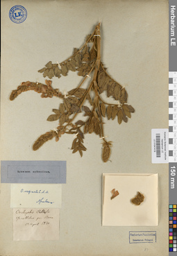
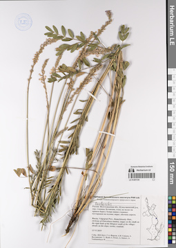
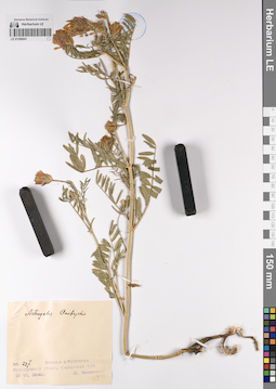
LE 01041419
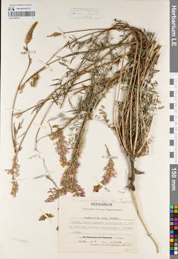
Onobrychis vaginalis C.A. Mey.
Groups of specimens: Образцы сектора КавказаRecord creation: 2020-10-01, Ivan Tatanov, from old scansCitation: Specimen LE 01041419 // Virtual herbarium of Komarov Botanical Institute RAS — http://re.herbariumle.ru/01041419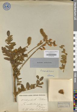
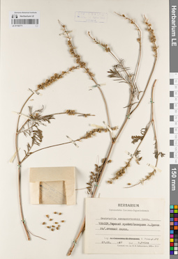
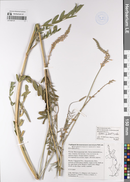
LE 01041420
Onobrychis vaginalis C.A. Mey.
Groups of specimens: Образцы сектора КавказаRecord creation: 2020-10-01, Ivan Tatanov, from old scansCitation: Specimen LE 01041420 // Virtual herbarium of Komarov Botanical Institute RAS — http://re.herbariumle.ru/01041420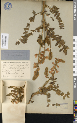
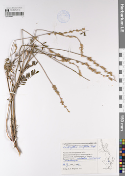
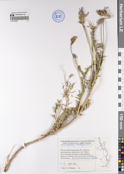
LE 01041421
Onobrychis vaginalis C.A. Mey.
Groups of specimens: Образцы сектора КавказаRecord creation: 2020-10-01, Ivan Tatanov, from old scansCitation: Specimen LE 01041421 // Virtual herbarium of Komarov Botanical Institute RAS — http://re.herbariumle.ru/01041421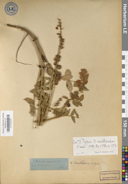
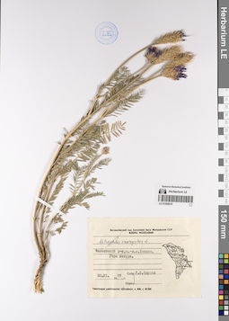
LE 01041422
Onobrychis vassiltschenkoi
Groups of specimens: Образцы сектора КавказаRecord creation: 2020-10-01, Ivan Tatanov, from old scansCitation: Specimen LE 01041422 // Virtual herbarium of Komarov Botanical Institute RAS — http://re.herbariumle.ru/01041422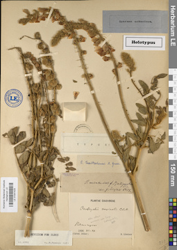
LE 01041423
Onobrychis vassiltschenkoi
Groups of specimens: Образцы сектора КавказаRecord creation: 2020-10-01, Ivan Tatanov, from old scansCitation: Specimen LE 01041423 // Virtual herbarium of Komarov Botanical Institute RAS — http://re.herbariumle.ru/01041423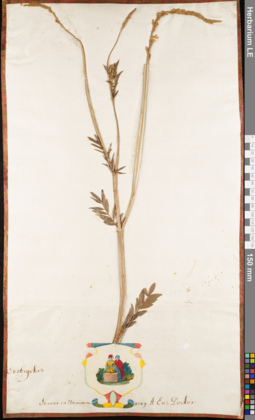
LE 01062833
Groups of specimens: Herbarium of Abraham EnsComment:
Onobrychis 221
Record creation: 2020-08-06, Andrey Sytin, PhotoScan D2Citation: Specimen LE 01062833 // Virtual herbarium of Komarov Botanical Institute RAS — http://re.herbariumle.ru/01062833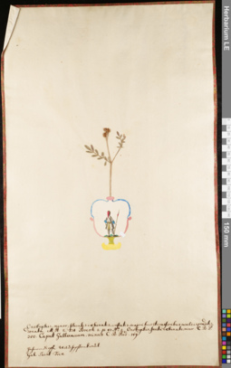
LE 01062871
Groups of specimens: Herbarium of Abraham EnsComment:
Onobrychis 097
Record creation: 2020-08-06, Andrey Sytin, PhotoScan D2Citation: Specimen LE 01062871 // Virtual herbarium of Komarov Botanical Institute RAS — http://re.herbariumle.ru/01062871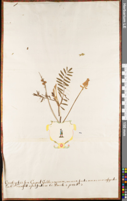
LE 01062872
Groups of specimens: Herbarium of Abraham EnsComment:
Onobrychis 097
Record creation: 2020-08-06, Andrey Sytin, PhotoScan D2Citation: Specimen LE 01062872 // Virtual herbarium of Komarov Botanical Institute RAS — http://re.herbariumle.ru/01062872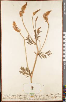
LE 01062876
Groups of specimens: Herbarium of Abraham EnsComment:
Onobrychis 221
Record creation: 2020-08-06, Andrey Sytin, PhotoScan D2Citation: Specimen LE 01062876 // Virtual herbarium of Komarov Botanical Institute RAS — http://re.herbariumle.ru/01062876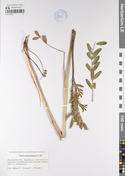
LE 01174507
Onobrychis arenaria (Kit.) DC. det. Efimov, Peter Gennadievich, Chukhina, Irena Georgievna at 12.06.2005
Collectors: Efimov, Peter Gennadievich; Chukhina, Irena Georgievna Collection date: 12.06.2005. Administrative regions: RU - Leningradskaya Oblast' - Luzhskiy Rayon. Топоним: Геостанция РГПУ им. А. И. Герцена "Железо". Groups of specimens: Образцы сектора Восточной Европы; Соглашение Минобрнауки №075-15-2021-1056Original label text:Ленинградская область, Лужский район, 7 км северо-западнее железнодорожной станции Толмачево, 2 км восточнее базы Государственного педагогического университета им. Герцена "Железо", обочина шоссе.
Coordinates (geographic position): 58° 55′ 31.4″ N, 29° 50′ 2.31″ E ±500 mRecord creation: 2023-01-19, Denis Melnikov, PhotoScan D2.Citation: Specimen LE 01174507 // Virtual herbarium of Komarov Botanical Institute RAS — http://re.herbariumle.ru/01174507
LE 01176855
Onobrychis sp. det. Poplavskaya (Poplawska), Henrietta Ippolitovna at 17.07.1932
Field collecting number: 127. Collection date: 17.07.1932. Administrative regions: UA - Republic of Crimea - Gorodskoy okrug Feodosiya. Groups of specimens: Образцы сектора Восточной Европы; Соглашение Минобрнауки №075-15-2021-1056Original label text:Onobrychis
Крым г. Феодосия мыс Ильи степной склон у моря
LE 01176864
Onobrychis sativa Lam. det. Stankov, Sergei Sergeevich at 30.05.1922
Collectors: Stankov, Sergei Sergeevich Collection date: 30.05.1922. Administrative regions: UA - Republic of Crimea - Gorodskoy okrug Yalta. Groups of specimens: Образцы сектора Восточной Европы; Соглашение Минобрнауки №075-15-2021-1056Original label text:Herbarium Horti Botanici Nikitensis.
Никитский Сад.
На поляне.
30.(17).J 1922/2
Leg. Det. S. Stankow.
Coordinates (geographic position): 44° 30′ 44.66″ N, 34° 13′ 59.43″ E ±100 mRecord creation: 2023-01-20, Denis Melnikov, PhotoScan D2.Citation: Specimen LE 01176864 // Virtual herbarium of Komarov Botanical Institute RAS — http://re.herbariumle.ru/01176864. Plantae tauricae.
sativa Lon
Никитский Сад.
На поляне.
30.(17).J 1922/2
Leg. Det. S. Stankow.
LE 01182770
Onobrychis novopokrovskii Vassilcz. det. Menitsky, Yuri Leonardovich
Additional identifications: Onobrychis cyri Grossh. det. Prima V. M. Collectors: Prima V. M. Collection date: 08.05.1976. Groups of specimens: Образцы сектора КавказаOriginal label text:Herbarium Universitatis Czeczeno-Inguschetiensis
Record creation: 2022-07-07, Иван Владимирович ТатановCitation: Specimen LE 01182770 // Virtual herbarium of Komarov Botanical Institute RAS — http://re.herbariumle.ru/01182770Onobrychis cyri Grossh.
ЧИАССР, Терско-Кумская низменность, в 5-ти км севернее станицы Червленная, в песчаной степи.
8.05.1976
Leg. V. Prima
Det. V. Prima
LE 01182771
Onobrychis novopokrovskii Vassilcz. det. Prima V. M.
Collectors: Prima V. M. Collection date: 27.05.1967. Groups of specimens: Образцы сектора КавказаOriginal label text:Herbarium Universitatis Czeczeno-Inguschetiensis
Record creation: 2022-07-07, Иван Владимирович ТатановCitation: Specimen LE 01182771 // Virtual herbarium of Komarov Botanical Institute RAS — http://re.herbariumle.ru/01182771Onobrychis novopokrovskii Vass.
ЧИАССР, Терский хребет / севернее г. Грозного / степной склон.
27.05.1967
Leg. V. Prima
Det. V. Prima
LE 01200562
Onobrychis viciifolia Scop. det. Firsov, Gennadij Afanasievich at 29.07.2000
Collectors: Firsov, Gennadij Afanasievich Collection date: 29.07.2000. Administrative regions: RU - Volgogradskaya Oblast' - Kumylzhenskiy Rayon. Топоним: Нижнехоперский природный парк. Groups of specimens: Образцы сектора Восточной Европы; Соглашение Минобрнауки №075-15-2021-1056; Флора Нижнехоперского природного парка.Original label text:Россия: Волгоградская область, Кумылженский район, окрестности станицы Слащевской, правобережье реки Хопер, Титкин барак, меловое обнажение у станицы.
Coordinates (geographic position): 49° 51′ 30.84″ N, 42° 21′ 7.94″ E ±500 mRecord creation: 2023-01-19, Denis Melnikov, PhotoScan D2.Citation: Specimen LE 01200562 // Virtual herbarium of Komarov Botanical Institute RAS — http://re.herbariumle.ru/01200562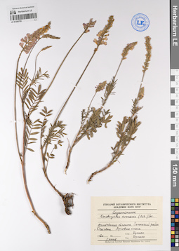
LE 01200785
Onobrychis arenaria (Kit.) DC. det. Bukhalo, M. at 05.06.1970
Collectors: Bukhalo, M. Collection date: 05.06.1970. Administrative regions: RU - Tambovskaya Oblast'. Groups of specimens: Образцы сектора Восточной Европы; Соглашение Минобрнауки №075-15-2021-1056Original label text:Leguminosae
Onobrychis arenaria (Kit.)
Тамбовская обл. Уметский район. с ольховка. Луговая степь
LE 01201134
Onobrychis sp. det. Byalt, Vyacheslav Vyacheslavovich, Firsov, Gennadij Afanasievich, Sintsov, Aleksei Nikolaevich, Volchanskaja, Aleksandra Vladimirovna
Collectors: Byalt, Vyacheslav Vyacheslavovich; Firsov, Gennadij Afanasievich; Sintsov, Aleksei Nikolaevich; Volchanskaja, Aleksandra Vladimirovna Collection date: 13.06.2019. Administrative regions: RU - Volgogradskaya Oblast' - Alekseyevskiy Rayon. Топоним: Нижнехоперский природный парк. Groups of specimens: Образцы сектора Восточной Европы; Соглашение Минобрнауки №075-15-2021-1056; Флора Нижнехоперского природного парка.Original label text:Россия: Волгоградская область, Кумылженский [Алексеевский] район, окрестности станицы Зотовская, степь на мелах на правом берегу Хопра южнее станицы: кустарники на склоне; овраг; обочина дороги.
Coordinates (geographic position): 50° 3′ 57.26″ N, 42° 24′ 30.05″ E ±500 mRecord creation: 2023-01-19, Denis Melnikov, PhotoScan D2.Citation: Specimen LE 01201134 // Virtual herbarium of Komarov Botanical Institute RAS — http://re.herbariumle.ru/01201134Russia: Volgograd Prov., Kumylzhensky Distr., environs of Zotovskaya stanitsa, steppe on chalk on the right bank of the Khopyor south of the village: shrubs on the slope; ravine; roadside.
LE 01201137
Onobrychis sp. det. Byalt, Vyacheslav Vyacheslavovich, Firsov, Gennadij Afanasievich, Sintsov, Aleksei Nikolaevich, Volchanskaja, Aleksandra Vladimirovna at 13.06.2019
Collectors: Byalt, Vyacheslav Vyacheslavovich; Firsov, Gennadij Afanasievich; Sintsov, Aleksei Nikolaevich; Volchanskaja, Aleksandra Vladimirovna Collection date: 13.06.2019. Administrative regions: RU - Volgogradskaya Oblast' - Alekseyevskiy Rayon. Топоним: Нижнехоперский природный парк. Groups of specimens: Образцы сектора Восточной Европы; Соглашение Минобрнауки №075-15-2021-1056; Флора Нижнехоперского природного парка.Original label text:Россия: Волгоградская область, Кумылженский [Алексеевский] район, окрестности станицы Зотовская, степь на мелах на правом берегу Хопра южнее станицы: кустарники на склоне; овраг; обочина дороги.
Coordinates (geographic position): 50° 3′ 57.26″ N, 42° 24′ 30.05″ E ±500 mRecord creation: 2023-01-19, Denis Melnikov, PhotoScan D2.Citation: Specimen LE 01201137 // Virtual herbarium of Komarov Botanical Institute RAS — http://re.herbariumle.ru/01201137Russia: Volgograd Prov., Kumylzhensky Distr., environs of Zotovskaya stanitsa, steppe on chalk on the right bank of the Khopyor south of the village: shrubs on the slope; ravine; roadside.
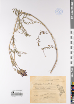
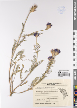
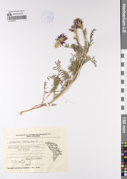
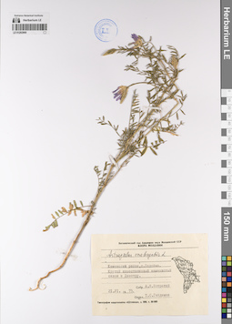
LE 01201603
Astragalus onobrychis L. det. Firsov, Gennadij Afanasievich at 01.06.1999
Collectors: Firsov, Gennadij Afanasievich Collection date: 01.06.1999. Administrative regions: RU - Volgogradskaya Oblast' - Kumylzhenskiy Rayon. Топоним: Нижнехоперский природный парк. Groups of specimens: Образцы сектора Восточной Европы; Соглашение Минобрнауки №075-15-2021-1056; Флора Нижнехоперского природного парка.Original label text:Россия: Волгоградская область, Кумылженский район, окрестности хутора Косо-Ключанский, меловые горы правого берега реки Хопер, степь на мелах, меловые обнажения, Ключанский барак.
Coordinates (geographic position): 49° 49′ 6.1″ N, 42° 26′ 36.84″ E ±500 mRecord creation: 2023-01-19, Denis Melnikov, PhotoScan D2.Citation: Specimen LE 01201603 // Virtual herbarium of Komarov Botanical Institute RAS — http://re.herbariumle.ru/01201603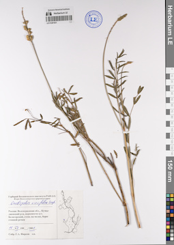
LE 01201631
Onobrychis viciifolia Scop. det. Firsov, Gennadij Afanasievich at 16.07.2001
Collectors: Firsov, Gennadij Afanasievich Collection date: 16.07.2001. Administrative regions: RU - Volgogradskaya Oblast' - Kumylzhenskiy Rayon. Топоним: Нижнехоперский природный парк. Groups of specimens: Образцы сектора Восточной Европы; Соглашение Минобрнауки №075-15-2021-1056; Флора Нижнехоперского природного парка.Original label text:Россия: Волгоградская область, Кумылженский район, окрестности хутора Белогорский, степь на мелах, берег степной речки.
Coordinates (geographic position): 49° 53′ 41.55″ N, 41° 56′ 6.76″ E ±3000 mRecord creation: 2023-01-19, Denis Melnikov, PhotoScan D2.Citation: Specimen LE 01201631 // Virtual herbarium of Komarov Botanical Institute RAS — http://re.herbariumle.ru/01201631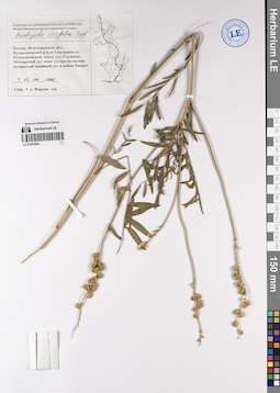
LE 01201654
Onobrychis viciifolia Scop. det. Firsov, Gennadij Afanasievich at 04.08.2000
Collectors: Firsov, Gennadij Afanasievich Collection date: 04.08.2000. Administrative regions: RU - Volgogradskaya Oblast' - Kumylzhenskiy Rayon. Топоним: Нижнехоперский природный парк. Groups of specimens: Образцы сектора Восточной Европы; Соглашение Минобрнауки №075-15-2021-1056; Флора Нижнехоперского природного парка.Original label text:Россия: Волгоградская область, Кумылженский район, около хутора Глушица, Почтарский луг ниже хутора по склону (открытый заливной луг в пойме Хопра).
Coordinates (geographic position): 49° 50′ 24.85″ N, 42° 32′ 23.41″ E ±1000 mRecord creation: 2023-01-19, Denis Melnikov, PhotoScan D2.Citation: Specimen LE 01201654 // Virtual herbarium of Komarov Botanical Institute RAS — http://re.herbariumle.ru/01201654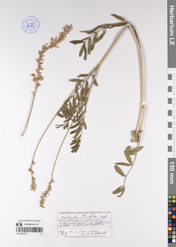
LE 01201779
Onobrychis viciifolia Scop. det. Tzvelev, Nikolai Nikolaievich at 16.07.2001
Collectors: Firsov, Gennadij Afanasievich Collection date: 16.07.2001. Administrative regions: RU - Volgogradskaya Oblast' - Kumylzhenskiy Rayon. Топоним: Нижнехоперский природный парк. Groups of specimens: Образцы сектора Восточной Европы; Соглашение Минобрнауки №075-15-2021-1056Original label text:Россия: Волгоградская область, Кумылженский район, хутор Белогорский, на окраине хутора, у обочины дороги.
Coordinates (geographic position): 49° 54′ 47.98″ N, 41° 55′ 53.43″ E ±2000 mRecord creation: 2023-01-19, Denis Melnikov, PhotoScan D2.Citation: Specimen LE 01201779 // Virtual herbarium of Komarov Botanical Institute RAS — http://re.herbariumle.ru/01201779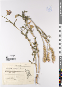
LE 01202009
Astragalus onobrychis L. det. Tschenykh, R. V. at 30.06.1977
Collectors: Tschenykh, R. V. Collection date: 30.06.1977. Administrative regions: MD - Moldova (Republic of). Groups of specimens: Образцы сектора Восточной Европы; Соглашение Минобрнауки №075-15-2021-1056; Флора МолдавииOriginal label text:Ботанический сад Академии наук Молдавской ССР
Coordinates (geographic position): 47° 30′ 28.23″ N, 27° 57′ 18.09″ E ±1000 mRecord creation: 2023-01-19, Denis Melnikov, PhotoScan D2.Citation: Specimen LE 01202009 // Virtual herbarium of Komarov Botanical Institute RAS — http://re.herbariumle.ru/01202009Фалештский район, юго-восточнее села Боканы. Гора Мегура.
LE 01202010
Astragalus onobrychis L. det. Tschenykh, R. V. at 30.06.1977
Collectors: Tschenykh, R. V. Collection date: 30.06.1977. Administrative regions: MD - Moldova (Republic of). Groups of specimens: Образцы сектора Восточной Европы; Соглашение Минобрнауки №075-15-2021-1056Original label text:Ботанический сад Академии наук Молдавской ССР
Coordinates (geographic position): 47° 30′ 28.23″ N, 27° 57′ 18.09″ E ±1000 mRecord creation: 2023-01-19, Denis Melnikov, PhotoScan D2.Citation: Specimen LE 01202010 // Virtual herbarium of Komarov Botanical Institute RAS — http://re.herbariumle.ru/01202010Фалештский район, юго-восточнее села Боканы. Гора Мегура.
LE 01202013
Astragalus onobrychis L. det. Gejdeman, Tatyana Sergeevna at 10.06.1975
Collectors: Nikolaeva, L. P. Collection date: 10.06.1975. Administrative regions: MD - Moldova (Republic of). Groups of specimens: Образцы сектора Восточной Европы; Соглашение Минобрнауки №075-15-2021-1056; Флора МолдавииOriginal label text:Ботанический сад Академии наук Молдавской ССР
Coordinates (geographic position): 45° 44′ 59.31″ N, 28° 22′ 13.05″ E ±2000 mRecord creation: 2023-01-19, Denis Melnikov, PhotoScan D2.Citation: Specimen LE 01202013 // Virtual herbarium of Komarov Botanical Institute RAS — http://re.herbariumle.ru/01202013Вулканетский район. Северо-запад села Гаваноса, урочище Фаламында. Гырнец.
LE 01202014
Astragalus onobrychis L. det. Tschenykh, R. V. at 30.06.1977
Collectors: Tschenykh, R. V. Collection date: 30.06.1977. Administrative regions: MD - Moldova (Republic of). Groups of specimens: Образцы сектора Восточной Европы; Соглашение Минобрнауки №075-15-2021-1056; Флора МолдавииOriginal label text:Ботанический сад Академии наук Молдавской ССР
Coordinates (geographic position): 47° 30′ 28.23″ N, 27° 57′ 18.09″ E ±1000 mRecord creation: 2023-01-19, Denis Melnikov, PhotoScan D2.Citation: Specimen LE 01202014 // Virtual herbarium of Komarov Botanical Institute RAS — http://re.herbariumle.ru/01202014Фалештский район.юго-восточнее села Боканы. Гора Мегура.
LE 01202018
Astragalus onobrychis L. det. Tschenykh, R. V. at 30.06.1977
Collectors: Tschenykh, R. V. Collection date: 30.06.1977. Administrative regions: MD - Moldova (Republic of). Groups of specimens: Образцы сектора Восточной Европы; Соглашение Минобрнауки №075-15-2021-1056; Флора МолдавииOriginal label text:Ботанический сад Академии наук Молдавской ССР
Coordinates (geographic position): 47° 30′ 28.23″ N, 27° 57′ 18.09″ E ±1000 mRecord creation: 2023-01-19, Denis Melnikov, PhotoScan D2.Citation: Specimen LE 01202018 // Virtual herbarium of Komarov Botanical Institute RAS — http://re.herbariumle.ru/01202018Фалештский район.юго-восточнее села Боканы. Гора Мегура.
LE 01202900
Astragalus onobrychis L. det. Gejdeman, Tatyana Sergeevna at 21.06.1975
Collectors: Istratii, A. I. Collection date: 21.06.1975. Administrative regions: MD - Pridnestrovian Moldavian Republic. Groups of specimens: Образцы сектора Восточной Европы; Соглашение Минобрнауки №075-15-2021-1056; Флора МолдавииOriginal label text:Ботанический сад Академии наук Молдавской ССР
Coordinates (geographic position): 47° 59′ 16.93″ N, 28° 46′ 58.34″ E ±1000 mRecord creation: 2023-01-19, Denis Melnikov, PhotoScan D2.Citation: Specimen LE 01202900 // Virtual herbarium of Komarov Botanical Institute RAS — http://re.herbariumle.ru/01202900Каменский район. Село Подойма. Крутой известняковый каменистый склон к Днестру.
LE 01206041
Astragalus onobrychis L. det. Janischewsky, Dmitriy Erastovich at 13.06.1914
Collectors: Janischewsky, Dmitriy Erastovich Field collecting number: 227. Collection date: 13.06.1914. Administrative regions: RU - Orenburgskaya Oblast' - Buzulukskiy Rayon. Groups of specimens: Образцы сектора Восточной Европы; Соглашение Минобрнауки №075-15-2021-1056; Флора Урала и прилегающих территорий (проект)Original label text:Долина реки Бузулук. Бузулукский уезд Самарской губернии. [ныне Оренбургская область]
Coordinates (geographic position): 52° 39′ 40.76″ N, 52° 14′ 47.52″ E ±1000 mRecord creation: 2023-01-19, Denis Melnikov, PhotoScan D2.Citation: Specimen LE 01206041 // Virtual herbarium of Komarov Botanical Institute RAS — http://re.herbariumle.ru/01206041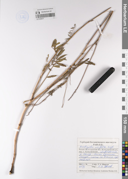
LE 01206377
Onobrychis viciifolia Scop. det. Tzvelev, Nikolai Nikolaievich at 27.07.2000
Collectors: Firsov, Gennadij Afanasievich Collection date: 27.07.2000. Administrative regions: RU - Volgogradskaya Oblast' - Kumylzhenskiy Rayon. Топоним: Нижнехоперский природный парк. Groups of specimens: Образцы сектора Восточной Европы; Соглашение Минобрнауки №075-15-2021-1056Original label text:Россия: Волгоградская область, Кумылженский район, окрестности станицы Кумылженская, правобережье реки Хопер, балка Орлиное гнездо, степь на южных черноземах.
Coordinates (geographic position): 49° 50′ 8.26″ N, 42° 32′ 59.28″ E ±500 mRecord creation: 2023-01-19, Denis Melnikov, PhotoScan D2.Citation: Specimen LE 01206377 // Virtual herbarium of Komarov Botanical Institute RAS — http://re.herbariumle.ru/01206377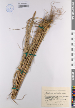
LE 01237703
Koeleria polonica Domin det. Unknown
Collectors: Unknown Collection date: 05.07.1961. Administrative regions: RU - Pskovskaya Oblast' - Pustoshkinskiy Rayon. Groups of specimens: Образцы сектора Восточной Европы; Соглашение Минобрнауки №075-15-2021-1056Original label text:Псковская область Пустошкинский район; в 2 километрах юго-восточнее деревни Алоль сосновый бор ; южный склон кама. вместе с Calamagrostis arundinacea Onobrichis (Onobrychis) arenaria
Record creation: 2023-05-16, Artyom Borodushkin, PhotoScan D2. Part 2.Citation: Specimen LE 01237703 // Virtual herbarium of Komarov Botanical Institute RAS — http://re.herbariumle.ru/01237703