View
Add
Copy
Edit
Delete
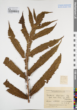
LE 01167342
Tectaria decurrens (C.Presl) Copel. det. V.N.Tu at 30.01.1975
Collectors: Takhtajan, Armen Leonovich. Field collecting number: Takhtajan 8652(1). Collection date: 30.01.1975. Administrative regions: VN - Tinh Ninh Binh. Groups of specimens: L. V. Averyanov specimens; L. V. Averyanov herbarium; Соглашение Минобрнауки №075-15-2021-1056Original label text:FLORA OF VIETNAM
Record creation: 2022-01-18, Galina Savich, PhotoScan D2Citation: Specimen LE 01167342 // Virtual herbarium of Komarov Botanical Institute RAS — http://re.herbariumle.ru/01167342Tectaria decurrens (C.Presl) Copel.
Ninh Bình Prov.
Takhtajan 8652(1), 30.01.1975
Det. V.N.Tu, 30.01.1975
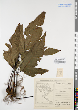
LE 01167341
Tectaria variolosa (Wall.) C.Chr. det. V.N.Tu at 21.01.1987
Collectors: Takhtajan, Armen Leonovich. Field collecting number: Takhtajan 8490. Collection date: 21.01.1975. Administrative regions: VN - Tinh Lao Cai. Groups of specimens: L. V. Averyanov specimens; L. V. Averyanov herbarium; Соглашение Минобрнауки №075-15-2021-1056Original label text:FLORA OF VIETNAM
Record creation: 2022-01-18, Galina Savich, PhotoScan D2Citation: Specimen LE 01167341 // Virtual herbarium of Komarov Botanical Institute RAS — http://re.herbariumle.ru/01167341Tectaria variolosa (Wall.) C.Chr.
Lao Cai Prov.
Takhtajan 8490, 21.01.1975
Det. V.N.Tu at 21.01.1975
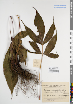
LE 01167340
Tectaria quinquefida (Baker) Ching det. V.N.Tu at 29.01.1975
Collectors: Takhtajan, Armen Leonovich. Field collecting number: Takhtajan 8612. Collection date: 29.01.1975. Administrative regions: VN - Tinh Ninh Binh. Groups of specimens: L. V. Averyanov specimens; L. V. Averyanov herbarium; Соглашение Минобрнауки №075-15-2021-1056Original label text:FLORA OF VIETNAM
Record creation: 2022-01-18, Galina Savich, PhotoScan D2Citation: Specimen LE 01167340 // Virtual herbarium of Komarov Botanical Institute RAS — http://re.herbariumle.ru/01167340Tectaria quinquefida (Baker) Ching
Ninh Bình Prov.
Takhtajan 8612, 29.01.1975
Det. V.N.Tu at 29.01.1975
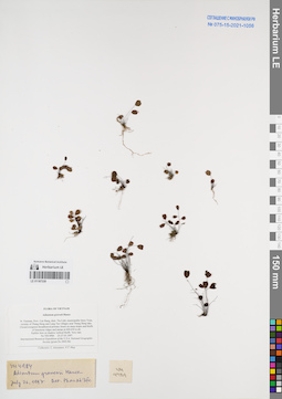
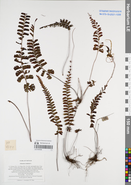
LE 01167339
Adiantum gravesii Hance det. Phan Ke Loc at 21.07.1997
Collectors: Averyanov, Leonid Vladimirovich; Tien Hiep Nguyen Field collecting number: VH4984. Collection date: 27.05.1997. Administrative regions: VN - Tinh Cao Bang. Groups of specimens: L. V. Averyanov specimens; L. V. Averyanov herbarium; Соглашение Минобрнауки №075-15-2021-1056Original label text:FLORA OF VIETNAM
Adiantum gravesii Hance
N. Vietnam, Prov. Cao Bang, distr. Tra Linh, municipalite Quoc Toan, vicinity of Thang Heng and Lung Tao villages near Thang Heng lake. Closed evergreen broadleaved primary forest on steep slopes and bluffs
of limestone ridges and mesas at 600-650 m alt. Epilitic fern on shadow vertical bluffs. Very rare.
Record creation: 2022-01-18, Galina Savich, PhotoScan D2. Processing status: work_status_1Citation: Specimen LE 01167339 // Virtual herbarium of Komarov Botanical Institute RAS — http://re.herbariumle.ru/01167339Adiantum gravesii Hance
N. Vietnam, Prov. Cao Bang, distr. Tra Linh, municipalite Quoc Toan, vicinity of Thang Heng and Lung Tao villages near Thang Heng lake. Closed evergreen broadleaved primary forest on steep slopes and bluffs
of limestone ridges and mesas at 600-650 m alt. Epilitic fern on shadow vertical bluffs. Very rare.
VH 4984 25-27.05.1997
International Botanical Expedition of the U.S.A. National Geographic Society (grant No 5803-96)
Collectors: L. Averyanov, N.T. Hiep
International Botanical Expedition of the U.S.A. National Geographic Society (grant No 5803-96)
Collectors: L. Averyanov, N.T. Hiep
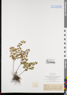
LE 01167338
Adiantum caudatum L. det. Averyanov, Leonid Vladimirovich at 27.05.1997
Collectors: Averyanov, Leonid Vladimirovich; Tien Hiep Nguyen Field collecting number: VH4894. Collection date: 27.05.1997. Administrative regions: VN - Tinh Cao Bang. Groups of specimens: L. V. Averyanov specimens; L. V. Averyanov herbarium; Соглашение Минобрнауки №075-15-2021-1056Original label text:FLORA OF VIETNAM
Adiantaceae
Record creation: 2022-01-18, Galina Savich, PhotoScan D2. Processing status: work_status_1Citation: Specimen LE 01167338 // Virtual herbarium of Komarov Botanical Institute RAS — http://re.herbariumle.ru/01167338Adiantaceae
Adiantum caudatum L.
N. Vietnam, Prov. Cao Bang, distr. Tra Linh, municipalite Quoc Toan, vicinity of Thang Heng and Lung Tao villages near Thang Heng lake. Open dry primary mixed forest with domination of Keteleeria fortunei on
tops of limestone mesas and ridges at 850-1000 m alt. Epilitic fern on vertical limestone bluffs near tops of mesas at 850-1000 m alt. Not common. VH 4894 25-27.05.1997
International Botanical Expedition of the U.S.A. National Geographic Society (grant No 5803-96)
Collectors: L. Averyanov, N.T. Hiep
N. Vietnam, Prov. Cao Bang, distr. Tra Linh, municipalite Quoc Toan, vicinity of Thang Heng and Lung Tao villages near Thang Heng lake. Open dry primary mixed forest with domination of Keteleeria fortunei on
tops of limestone mesas and ridges at 850-1000 m alt. Epilitic fern on vertical limestone bluffs near tops of mesas at 850-1000 m alt. Not common. VH 4894 25-27.05.1997
International Botanical Expedition of the U.S.A. National Geographic Society (grant No 5803-96)
Collectors: L. Averyanov, N.T. Hiep
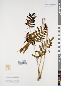
LE 01167337
Adiantum induratum Christ. det. Phan Ke Loc at 20.07.1997
Collectors: Averyanov, Leonid Vladimirovich; N.Q. Binh; Nguyen Van Duy; Phan Ke Loc Field collecting number: VH2623. Collection date: 13.03.1997. Administrative regions: VN - Tinh Lam GJong. Groups of specimens: L. V. Averyanov specimens; L. V. Averyanov herbarium; Соглашение Минобрнауки №075-15-2021-1056Original label text:FLORA OF VIETNAM
Adiantum induratum Christ
S. Vietnam, Prov. Lam Dong, 8.5 km to S from Dalat city (N 11° 54′, E 108° 27′). Dry old open secondary coniferous forest with domination of Pinus kesiya along tops of mt. ridge at 1400 m alt. Terrestrial fern on dry steep slopes. Common. VH 2623 13.03.1997
International Botanical Expedition of the U.S.A. National Geographic Society (grant No 5803-96)
Collectors: L. Averyanov, N.Q. Binh, N.V. Duy, P.K. Loc
Coordinates (geographic position): 11° 54′ N, 108° 27′ E ±1000 mRecord creation: 2022-01-18, Galina Savich, PhotoScan D2. Processing status: work_status_1Citation: Specimen LE 01167337 // Virtual herbarium of Komarov Botanical Institute RAS — http://re.herbariumle.ru/01167337Adiantum induratum Christ
S. Vietnam, Prov. Lam Dong, 8.5 km to S from Dalat city (N 11° 54′, E 108° 27′). Dry old open secondary coniferous forest with domination of Pinus kesiya along tops of mt. ridge at 1400 m alt. Terrestrial fern on dry steep slopes. Common. VH 2623 13.03.1997
International Botanical Expedition of the U.S.A. National Geographic Society (grant No 5803-96)
Collectors: L. Averyanov, N.Q. Binh, N.V. Duy, P.K. Loc
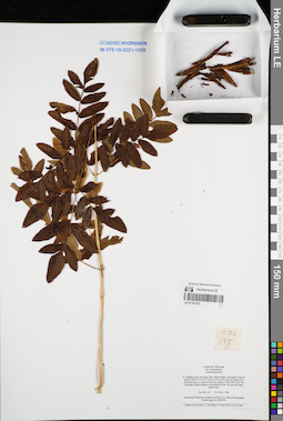
LE 01167336
Osmunda japonica Thunb. det. Averyanov, Leonid Vladimirovich at 18.04.1999
Collectors: Phan Ke Loc; P.H. Hoang; Averyanov, Leonid Vladimirovich Field collecting number: CBL1540. Collection date: 18.04.1999. Administrative regions: VN - Tinh Cao Bang. Groups of specimens: L. V. Averyanov specimens; L. V. Averyanov herbarium; Соглашение Минобрнауки №075-15-2021-1056Original label text:FLORA OF VIETNAM
Osmunda japonica
N. Vietnam, prov. Cao Bang, distr. Bao Lac, municipality Dinh Phung, Man Lung ridge (N 22°47′ E 105°49′). Secondary wet closed broadleaved evergreen forest with bamboo on shale alluvial foothills of limestone
Man Lung ridge at 1400-1500 m elev. Terrestrial fern in open places. Common. CBL 1540 18 April 1999
International Botanical Expedition of the U.S.A. National Geographic
Society (grant No 6300-98)
Collectors: P.K.Loc, P.H.Hoang, Averyanov L.
Coordinates (geographic position): 22° 47′ N, 105° 49′ E ±1000 mRecord creation: 2022-01-18, Galina Savich, PhotoScan D2. Processing status: work_status_1Citation: Specimen LE 01167336 // Virtual herbarium of Komarov Botanical Institute RAS — http://re.herbariumle.ru/01167336Osmunda japonica
N. Vietnam, prov. Cao Bang, distr. Bao Lac, municipality Dinh Phung, Man Lung ridge (N 22°47′ E 105°49′). Secondary wet closed broadleaved evergreen forest with bamboo on shale alluvial foothills of limestone
Man Lung ridge at 1400-1500 m elev. Terrestrial fern in open places. Common. CBL 1540 18 April 1999
International Botanical Expedition of the U.S.A. National Geographic
Society (grant No 6300-98)
Collectors: P.K.Loc, P.H.Hoang, Averyanov L.
LE 01167335
Osmunda japonica Thunb. det. Averyanov, Leonid Vladimirovich at 11.11.1998
Collectors: Averyanov, Leonid Vladimirovich; et al. Field collecting number: CBL145. Collection date: 11.11.1998. Administrative regions: VN - Tinh Cao Bang. Groups of specimens: L. V. Averyanov specimens; L. V. Averyanov herbarium; Соглашение Минобрнауки №075-15-2021-1056Original label text:FLORA OF VIETNAM
Osmundaceae
Osmunda japonica
N. Vietnam, prov. Cao Bang, distr. Nguyen Binh, municipality Nguyen Binh (N 22°37′ E 105°52′), about 41 km to W from Cao Bang town. Elevation from Le A pass to Na Ni mt. peak at 1400-1900 m alt. Old secondary closed evegreen wet mountain forest. On open wet steep slopes. Rare. CBL 145 11-12 Nov. 1998
International Botanical Expedition of the U.S.A. National Geographic
Society (grant No 6300-98)
Collectors: Averyanov L., N.Q.Binh, N.T.Hiep, P.K.Loc, N.X.Tam.
Coordinates (geographic position): 22° 37′ N, 105° 52′ E ±1000 mRecord creation: 2022-01-18, Galina Savich, PhotoScan D2. Processing status: work_status_1Citation: Specimen LE 01167335 // Virtual herbarium of Komarov Botanical Institute RAS — http://re.herbariumle.ru/01167335Osmundaceae
Osmunda japonica
N. Vietnam, prov. Cao Bang, distr. Nguyen Binh, municipality Nguyen Binh (N 22°37′ E 105°52′), about 41 km to W from Cao Bang town. Elevation from Le A pass to Na Ni mt. peak at 1400-1900 m alt. Old secondary closed evegreen wet mountain forest. On open wet steep slopes. Rare. CBL 145 11-12 Nov. 1998
International Botanical Expedition of the U.S.A. National Geographic
Society (grant No 6300-98)
Collectors: Averyanov L., N.Q.Binh, N.T.Hiep, P.K.Loc, N.X.Tam.
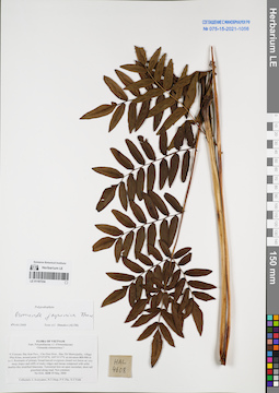
LE 01167334
Osmunda japonica Thunb. det. Averyanov, Leonid Vladimirovich at 19.05.2004
Collectors: Averyanov, Leonid Vladimirovich; Tien Hiep Nguyen; The Van Pham; Vinh Tien Nguyen Field collecting number: HAL4608. Collection date: 19.05.2004. Administrative regions: VN - Tinh Bac Kan. Groups of specimens: L. V. Averyanov specimens; L. V. Averyanov herbarium; Соглашение Минобрнауки №075-15-2021-1056Original label text:FLORA OF VIETNAM
Polypodiaceae s.l. (Osmundaceae)
Osmunda cinnamomea ?
N.Vietnam, Bac Kan Prov., Cho Don Distr., Ban Thi Municipality, village Phia Khao, around point 22°15′35′'N, 105°31′17′'E at elevation 800-900 m a.s.l. Remnants of primary broad-leaved evergreen closed wet forest on very steep slopes and cliffs of rocky ridges and mesae composed with solid marble-like stratified limestone.
Terrestrial fern on open secondary short tall grassland along road.
Not common. HAL 4608 19 May 2004
Collectors: L.Averyanov, N.T.Hiep, P.V.The, N.T.Vinh.
Coordinates (geographic position): 22° 15′ 35″ N, 105° 31′ 17″ E ±1000 mRecord creation: 2022-01-18, Galina Savich, PhotoScan D2. Processing status: work_status_1Citation: Specimen LE 01167334 // Virtual herbarium of Komarov Botanical Institute RAS — http://re.herbariumle.ru/01167334Polypodiaceae s.l. (Osmundaceae)
Osmunda cinnamomea ?
N.Vietnam, Bac Kan Prov., Cho Don Distr., Ban Thi Municipality, village Phia Khao, around point 22°15′35′'N, 105°31′17′'E at elevation 800-900 m a.s.l. Remnants of primary broad-leaved evergreen closed wet forest on very steep slopes and cliffs of rocky ridges and mesae composed with solid marble-like stratified limestone.
Terrestrial fern on open secondary short tall grassland along road.
Not common. HAL 4608 19 May 2004
Collectors: L.Averyanov, N.T.Hiep, P.V.The, N.T.Vinh.
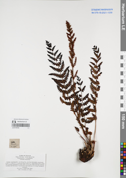
LE 01167333
Osmunda cinnamomea L. det. Averyanov, Leonid Vladimirovich at 17.10.2005
Collectors: Averyanov, Leonid Vladimirovich; Vinh Tien Nguyen Field collecting number: HLF5276. Collection date: 17.10.2005. Administrative regions: VN - Tinh Lam GJong. Groups of specimens: L. V. Averyanov specimens; L. V. Averyanov herbarium; Соглашение Минобрнауки №075-15-2021-1056Original label text:FLORA OF VIETNAM
Plants of Bi Doup – Nui Ba National Park
Polypodiaceae s.l. (Osmundaceae)
Osmunda cinnamomea
Vietnam, Lam Dong Prov., Lac Duong Distr., Da Chais Municipality, around point 12°08′31′N 108°39′01″E, at elevation about 1400 m a.s.l. Open primary grassy swamp with Osmunda cinnamomea in stream valley at lower part of hills with open coniferous woodland with Pinis kesya. Terrestrial fern with fronds up to 0.5 m long. Dominant of community. HLF 5276 17 October 2005. Photo.
Coll. L.Averyanov, N.T.Vinh.
Grant from Henry Luce Foundation.
Coordinates (geographic position): 12° 8′ 31″ N, 108° 39′ 1″ E ±1000 mRecord creation: 2022-01-18, Galina Savich, PhotoScan D2. Processing status: work_status_1Citation: Specimen LE 01167333 // Virtual herbarium of Komarov Botanical Institute RAS — http://re.herbariumle.ru/01167333Plants of Bi Doup – Nui Ba National Park
Polypodiaceae s.l. (Osmundaceae)
Osmunda cinnamomea
Vietnam, Lam Dong Prov., Lac Duong Distr., Da Chais Municipality, around point 12°08′31′N 108°39′01″E, at elevation about 1400 m a.s.l. Open primary grassy swamp with Osmunda cinnamomea in stream valley at lower part of hills with open coniferous woodland with Pinis kesya. Terrestrial fern with fronds up to 0.5 m long. Dominant of community. HLF 5276 17 October 2005. Photo.
Coll. L.Averyanov, N.T.Vinh.
Grant from Henry Luce Foundation.
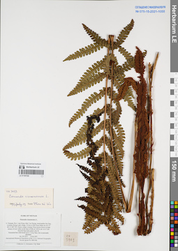
LE 01167332
Osmunda cinnamomea L. det. Phan Ke Loc at 19.07.1997
Collectors: Averyanov, Leonid Vladimirovich; N.Q. Binh Field collecting number: VH3973. Collection date: 14.04.1997. Administrative regions: VN - Tinh Lam GJong. Groups of specimens: L. V. Averyanov specimens; L. V. Averyanov herbarium; Соглашение Минобрнауки №075-15-2021-1056Original label text:FLORA OF VIETNAM
Osmunda cinnamomea L.
S. Vietnam, Prov. Lam Dong, distr. Lac Duong, municipalite Da Chay, vicinities Klong Lanh village, 32 km to NNE from Dalat city (N 12° 08′, E 108° 39′). Grassy-sedges swampy Pinus kesiya forest on high terrace of river valley at the base of hills at 1450 m alt. in 6-7 km from Bi Dup main peak to the W. Terrestrial fern with fronds up to 1 m lg. Rare, but occasionally abundant. VH 3973 14.04.1997
International Botanical Expedition of the U.S.A. National Geographic
Society (grant No 5803-96)
Collectors: L. Averyanov, N.Q. Binh
Coordinates (geographic position): 12° 8′ N, 108° 39′ E ±1000 mRecord creation: 2022-01-18, Galina Savich, PhotoScan D2. Processing status: work_status_1Citation: Specimen LE 01167332 // Virtual herbarium of Komarov Botanical Institute RAS — http://re.herbariumle.ru/01167332Osmunda cinnamomea L.
S. Vietnam, Prov. Lam Dong, distr. Lac Duong, municipalite Da Chay, vicinities Klong Lanh village, 32 km to NNE from Dalat city (N 12° 08′, E 108° 39′). Grassy-sedges swampy Pinus kesiya forest on high terrace of river valley at the base of hills at 1450 m alt. in 6-7 km from Bi Dup main peak to the W. Terrestrial fern with fronds up to 1 m lg. Rare, but occasionally abundant. VH 3973 14.04.1997
International Botanical Expedition of the U.S.A. National Geographic
Society (grant No 5803-96)
Collectors: L. Averyanov, N.Q. Binh
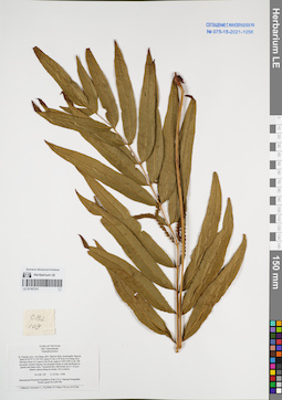
LE 01167331
Osmunda javanica Blume. det. Averyanov, Leonid Vladimirovich at 11.11.1998
Collectors: Averyanov, Leonid Vladimirovich; et al. Field collecting number: CBL109. Collection date: 11.11.1998. Administrative regions: VN - Tinh Cao Bang. Groups of specimens: L. V. Averyanov specimens; L. V. Averyanov herbarium; Соглашение Минобрнауки №075-15-2021-1056Original label text:FLORA OF VIETNAM
Osmundaceae
Osmunda javanica
N. Vietnam, prov. Cao Bang, distr. Nguyen Binh, municipality Nguyen Binh (N 22°37′ E 105°52′), about 41 km to W from Cao Bang town. Elevation from Le A pass to Na Ni mt. peak at 1400-1900 m alt. Oldsecondary closed evegreen wet mountain forest on soils developed on granite and shale rocks. Terrestrial fern with fronds up to 1 m lg in shadow places along mt stream. Not common. CBL 109 11-12 Nov. 1998
International Botanical Expedition of the U.S.A. National Geographic
Society (grant No 6300-98)
Collectors: Averyanov L., N.Q.Binh, N.T.Hiep, P.K.Loc, N.X.Tam.
Coordinates (geographic position): 22° 37′ N, 105° 52′ E ±1000 mRecord creation: 2022-01-18, Galina Savich, PhotoScan D2. Processing status: work_status_1Citation: Specimen LE 01167331 // Virtual herbarium of Komarov Botanical Institute RAS — http://re.herbariumle.ru/01167331Osmundaceae
Osmunda javanica
N. Vietnam, prov. Cao Bang, distr. Nguyen Binh, municipality Nguyen Binh (N 22°37′ E 105°52′), about 41 km to W from Cao Bang town. Elevation from Le A pass to Na Ni mt. peak at 1400-1900 m alt. Oldsecondary closed evegreen wet mountain forest on soils developed on granite and shale rocks. Terrestrial fern with fronds up to 1 m lg in shadow places along mt stream. Not common. CBL 109 11-12 Nov. 1998
International Botanical Expedition of the U.S.A. National Geographic
Society (grant No 6300-98)
Collectors: Averyanov L., N.Q.Binh, N.T.Hiep, P.K.Loc, N.X.Tam.
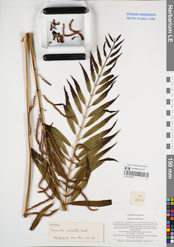
LE 01167330
Osmunda vachellii Hook. det. Phan Ke Loc at 19.07.1997
Collectors: Averyanov, Leonid Vladimirovich; et al. Field collecting number: VH2708. Collection date: 16.03.1997. Administrative regions: VN - Tinh Lam GJong. Groups of specimens: L. V. Averyanov specimens; L. V. Averyanov herbarium; Соглашение Минобрнауки №075-15-2021-1056Original label text:FLORA OF VIETNAM
Osmunda vachelii Hook.
S. Vietnam, Prov. Lam Dong, 31 km to NE from Dalat city, distr. Lac Duong, municipalite Da Chay, vicinities Klong Lanh village (N 12° 08′, E 108° 39′). Closed broadleaved secondary forest rich in primary
elements along small river on NW macroslope of Bi Dup mt system at 1450-1500 m alt. Terrestrial fern on wet open stream rocks. Common. VH 2708 16.03.1997
Coordinates (geographic position): 12° 8′ N, 108° 39′ E ±1000 mRecord creation: 2022-01-18, Galina Savich, PhotoScan D2. Processing status: work_status_1Citation: Specimen LE 01167330 // Virtual herbarium of Komarov Botanical Institute RAS — http://re.herbariumle.ru/01167330Osmunda vachelii Hook.
S. Vietnam, Prov. Lam Dong, 31 km to NE from Dalat city, distr. Lac Duong, municipalite Da Chay, vicinities Klong Lanh village (N 12° 08′, E 108° 39′). Closed broadleaved secondary forest rich in primary
elements along small river on NW macroslope of Bi Dup mt system at 1450-1500 m alt. Terrestrial fern on wet open stream rocks. Common. VH 2708 16.03.1997
International Botanical Expedition of the U.S.A. National Geographic Society (grant No 5803-96)
Collectors: L. Averyanov, N.Q. Binh, N.V. Duy, P.K. Loc
Collectors: L. Averyanov, N.Q. Binh, N.V. Duy, P.K. Loc
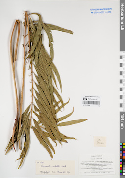
LE 01167329
Osmunda vachellii Hook. det. Phan Ke Loc at 19.07.1997
Collectors: Averyanov, Leonid Vladimirovich; et al. Field collecting number: VH2602. Collection date: 13.03.1997. Administrative regions: VN - Tinh Lam GJong. Groups of specimens: L. V. Averyanov specimens; L. V. Averyanov herbarium; Соглашение Минобрнауки №075-15-2021-1056Original label text:FLORA OF VIETNAM
Osmunda vachelii Hook.
S. Vietnam, Prov. Lam Dong, 8.5 km to S from Dalat city (N 11° 54′, E 108° 27′). Closed mixed secondary forest with Dacrycarpus imbricatus rich in primary elements along stream canyon at 1300-1400 m alt.
Large terrestrial fern along stream. Common. VH 2602 13.03.1997
International Botanical Expedition of the U.S.A. National Geographic Society (grant No 5803-96)
Collectors: L. Averyanov, N.Q. Binh, N.V. Duy, P.K. Loc
Coordinates (geographic position): 11° 54′ N, 108° 27′ E ±1000 mRecord creation: 2022-01-18, Galina Savich, PhotoScan D2. Processing status: work_status_1Citation: Specimen LE 01167329 // Virtual herbarium of Komarov Botanical Institute RAS — http://re.herbariumle.ru/01167329Osmunda vachelii Hook.
S. Vietnam, Prov. Lam Dong, 8.5 km to S from Dalat city (N 11° 54′, E 108° 27′). Closed mixed secondary forest with Dacrycarpus imbricatus rich in primary elements along stream canyon at 1300-1400 m alt.
Large terrestrial fern along stream. Common. VH 2602 13.03.1997
International Botanical Expedition of the U.S.A. National Geographic Society (grant No 5803-96)
Collectors: L. Averyanov, N.Q. Binh, N.V. Duy, P.K. Loc
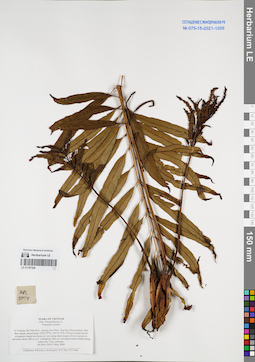
LE 01167328
Osmunda vachellii Hook. det. Averyanov, Leonid Vladimirovich at 02.05.2004
Collectors: Phan Ke Loc; Averyanov, Leonid Vladimirovich; The Van Pham; Vinh Tien Nguyen Field collecting number: HAL5014. Collection date: 02.05.2004. Administrative regions: VN - Tinh Ha Tinh. Groups of specimens: L. V. Averyanov specimens; L. V. Averyanov herbarium; Соглашение Минобрнауки №075-15-2021-1056Original label text:FLORA OF VIETNAM
Polypodiaceae s.l.
Osmunda vachelii
N.Vietnam, Ha Tinh Prov., Huong Son Distr., Son Kim Municipality, Rao Bun stream around point 18°23′39′'N, 105°15′12′'E. Primary broad-leaved evergreen closed wet forest on very steep shale slopes of
river canyon at elevation about 300 m a.s.l. Lithophytic fern on wet shady stream bluffs along water line. Very
common. HAL 5014 2 May 2004
Collectors: P.K.Loc, L.Averyanov, P.V.The, N.T.Vinh.
Coordinates (geographic position): 18° 23′ 39″ N, 105° 15′ 12″ E ±1000 mRecord creation: 2022-01-18, Galina Savich, PhotoScan D2. Processing status: work_status_1Citation: Specimen LE 01167328 // Virtual herbarium of Komarov Botanical Institute RAS — http://re.herbariumle.ru/01167328Polypodiaceae s.l.
Osmunda vachelii
N.Vietnam, Ha Tinh Prov., Huong Son Distr., Son Kim Municipality, Rao Bun stream around point 18°23′39′'N, 105°15′12′'E. Primary broad-leaved evergreen closed wet forest on very steep shale slopes of
river canyon at elevation about 300 m a.s.l. Lithophytic fern on wet shady stream bluffs along water line. Very
common. HAL 5014 2 May 2004
Collectors: P.K.Loc, L.Averyanov, P.V.The, N.T.Vinh.
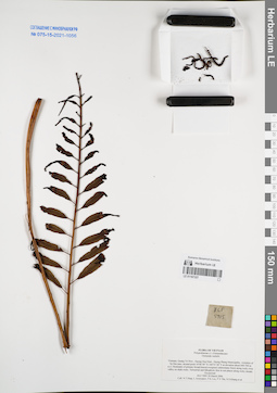
LE 01167327
Osmunda vachellii Hook. det. Averyanov, Leonid Vladimirovich at 30.03.2006
Collectors: Tien Hiep Nguyen; Averyanov, Leonid Vladimirovich; Phan Ke Loc; et al. Field collecting number: HLF5905. Collection date: 30.03.2006. Administrative regions: VN - Tinh Quang Tri. Groups of specimens: L. V. Averyanov specimens; L. V. Averyanov herbarium; Соглашение Минобрнауки №075-15-2021-1056Original label text:FLORA OF VIETNAM
Polypodiaceae s.l. (Osmundaceae)
Osmunda vachelii
Vietnam, Quang Tri Prov., Huong Hoa Distr., Huong Phung Municipality, vicinities of Sa Mui pass, around point 16°46′49″N 106°35′28″E at elevation about 600-700 m a.s.l. Remnants of primary broad-leaved evergreen submontane forest along rocky river valley on shale rocks. Terrestrial and lithophytic fern in wet places along rocky stream. Occasional. HLF 5905 30 March 2006.
Coll. N.T.Hiep, L.Averyanov, P.K.Loc, P.V.The, N.S.Khang, P.H.Duc, L.T.Son, S.Bounphanmy, T.K.Ratana, O.Sonliya, T.Q.Dang, N.V.Hien, H.T.N.Trang, L.T.Chau.
Grant from Henry Luce Foundation.
Coordinates (geographic position): 16° 46′ 49″ N, 106° 35′ 28″ E ±1000 mRecord creation: 2022-01-18, Galina Savich, PhotoScan D2. Processing status: work_status_1Citation: Specimen LE 01167327 // Virtual herbarium of Komarov Botanical Institute RAS — http://re.herbariumle.ru/01167327Polypodiaceae s.l. (Osmundaceae)
Osmunda vachelii
Vietnam, Quang Tri Prov., Huong Hoa Distr., Huong Phung Municipality, vicinities of Sa Mui pass, around point 16°46′49″N 106°35′28″E at elevation about 600-700 m a.s.l. Remnants of primary broad-leaved evergreen submontane forest along rocky river valley on shale rocks. Terrestrial and lithophytic fern in wet places along rocky stream. Occasional. HLF 5905 30 March 2006.
Coll. N.T.Hiep, L.Averyanov, P.K.Loc, P.V.The, N.S.Khang, P.H.Duc, L.T.Son, S.Bounphanmy, T.K.Ratana, O.Sonliya, T.Q.Dang, N.V.Hien, H.T.N.Trang, L.T.Chau.
Grant from Henry Luce Foundation.
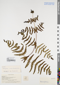
LE 01167326
Histiopteris incisa (Thunb.) J. Sm. det. Phan Ke Loc at 19.07.1997
Collectors: Averyanov, Leonid Vladimirovich; et al. Field collecting number: VH651. Collection date: 10.03.1995. Administrative regions: VN - Kon Tum. Groups of specimens: L. V. Averyanov specimens; L. V. Averyanov herbarium; Соглашение Минобрнауки №075-15-2021-1056Original label text:FLORA OF VIETNAM
Polypodiaceae s.l.
Histiopteris sp.
S. Vietnam, Prov. Kontum. Close evegreen primary forest on N slope of Ngoc Linh mountain system at 1700 m alt. Terrestrial fern with fronds up to 1 m lg. VH 651 10.03.1995
International Botanical Expedition of the U.S.A. National Geographic Society (grant No 5094-93)
Record creation: 2022-01-18, Galina Savich, PhotoScan D2. Processing status: work_status_1Citation: Specimen LE 01167326 // Virtual herbarium of Komarov Botanical Institute RAS — http://re.herbariumle.ru/01167326Polypodiaceae s.l.
Histiopteris sp.
S. Vietnam, Prov. Kontum. Close evegreen primary forest on N slope of Ngoc Linh mountain system at 1700 m alt. Terrestrial fern with fronds up to 1 m lg. VH 651 10.03.1995
International Botanical Expedition of the U.S.A. National Geographic Society (grant No 5094-93)
Participants: L. Averyanov, N.T. Ban, N. Q. Binh, A. Budantzev, L. Budantzev, N.T. Hiep, D.D. Huyen, P.K. Loc, N.X. Tam, G. Yakovlev
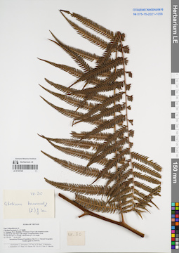
LE 01167325
Cibotium barometz (L.) J. Sm. det. Averyanov, Leonid Vladimirovich at 23.02.1995
Collectors: Averyanov, Leonid Vladimirovich; et al. Field collecting number: VH030. Collection date: 23.02.1995. Administrative regions: VN - Kon Tum. Groups of specimens: L. V. Averyanov specimens; L. V. Averyanov herbarium; Соглашение Минобрнауки №075-15-2021-1056Original label text:FLORA OF VIETNAM
Polypodiaceae s.l.
Cibotium barometz (L.) J. Smith.
S. Vietnam, Prov. Kontum. NW slopes of Ngoc Linh mountain system at 1200 m alt. near Ngoc Linh village. Evergreen primary forest. Woody fern up to 10 m high, with fronds up to 4 m length. VH 030 23.02.1995
International Botanical Expedition of the U.S.A. National Geographic Society (grant No 5094-93)
Participants: L. Averyanov, N.T. Ban, N. Q. Binh, A. Budantzev, L. Budantzev, N.T. Hiep, D.D. Huyen, P.K. Loc, N.X. Tam, G. Yakovlev
Record creation: 2022-01-18, Galina Savich, PhotoScan D2. Processing status: work_status_1Citation: Specimen LE 01167325 // Virtual herbarium of Komarov Botanical Institute RAS — http://re.herbariumle.ru/01167325Polypodiaceae s.l.
Cibotium barometz (L.) J. Smith.
S. Vietnam, Prov. Kontum. NW slopes of Ngoc Linh mountain system at 1200 m alt. near Ngoc Linh village. Evergreen primary forest. Woody fern up to 10 m high, with fronds up to 4 m length. VH 030 23.02.1995
International Botanical Expedition of the U.S.A. National Geographic Society (grant No 5094-93)
Participants: L. Averyanov, N.T. Ban, N. Q. Binh, A. Budantzev, L. Budantzev, N.T. Hiep, D.D. Huyen, P.K. Loc, N.X. Tam, G. Yakovlev
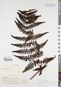
LE 01167324
Histiopteris incisa (Thunb.) J. Sm. det. Shmakov, Aleksandr Ivanovich at 02.01.2008
Collectors: Averyanov, Leonid Vladimirovich; et al. Field collecting number: VH1265. Collection date: 09.04.1995. Administrative regions: VN - Kon Tum. Groups of specimens: L. V. Averyanov specimens; L. V. Averyanov herbarium; Соглашение Минобрнауки №075-15-2021-1056Original label text:FLORA OF VIETNAM
Polypodiaceae s.l.
Histiopteris sp.
S. Vietnam, Prov. Kontum. Evergreen primary forest at 2100-2200 m alt. on NW slope of Ngoc Linh mountain system on elevation to Ngoc Gua peak. Terrestrial fern with fronds up to 3 m lg. in wet places. Not common.
VH 1265 09.04.1995
International Botanical Expedition of the U.S.A. National Geographic Society (grant No 5094-93)
Participants: L. Averyanov, N.T. Ban, N. Q. Binh, A. Budantzev, L. Budantzev, N.T. Hiep, D.D. Huyen, P.K. Loc, N.X. Tam, G. Yakovlev
Record creation: 2022-01-18, Galina Savich, PhotoScan D2. Processing status: work_status_1Citation: Specimen LE 01167324 // Virtual herbarium of Komarov Botanical Institute RAS — http://re.herbariumle.ru/01167324Polypodiaceae s.l.
Histiopteris sp.
S. Vietnam, Prov. Kontum. Evergreen primary forest at 2100-2200 m alt. on NW slope of Ngoc Linh mountain system on elevation to Ngoc Gua peak. Terrestrial fern with fronds up to 3 m lg. in wet places. Not common.
VH 1265 09.04.1995
International Botanical Expedition of the U.S.A. National Geographic Society (grant No 5094-93)
Participants: L. Averyanov, N.T. Ban, N. Q. Binh, A. Budantzev, L. Budantzev, N.T. Hiep, D.D. Huyen, P.K. Loc, N.X. Tam, G. Yakovlev
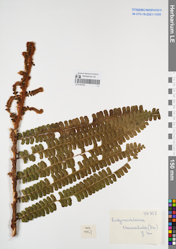
LE 01167323
Didymochlaena truncatula (Sw.) J. Sm. at 28.03.1995
Collectors: Busch Field collecting number: VH957. Collection date: 28.03.1995. Administrative regions: VN - Vietnam. Groups of specimens: L. V. Averyanov specimens; L. V. Averyanov herbarium; Соглашение Минобрнауки №075-15-2021-1056Original label text:FLORA OF VIETNAM
Fam. Polypodiaceae s.l.
Didymochlaena truncatula (Sw.) J. Sm.
S. Vietnam, Prov. Kontum. Evegreen primary forest at 1600 m alt. on W slope of mountain system between Dak Poko and Dak Mek rivers. Terrestrial fern with fronds up to 2 m lg. No VH 957 28.03.1995
International Botanical Expedition of the U.S.A. National Geographic
Society (grant No 5094-93)
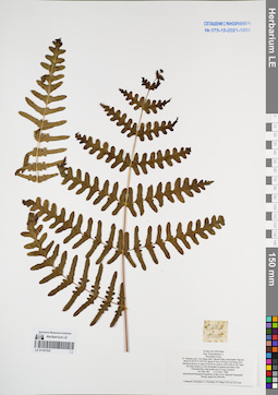
LE 01167322
Histiopteris incisa (Thunb.) J. Sm. det. Averyanov, Leonid Vladimirovich at 11.11.1998
Collectors: Averyanov, Leonid Vladimirovich; et al. Field collecting number: CBL006. Collection date: 11.11.1998. Administrative regions: VN - Tinh Cao Bang. Groups of specimens: L. V. Averyanov specimens; L. V. Averyanov herbarium; Соглашение Минобрнауки №075-15-2021-1056Original label text:FLORA OF VIETNAM
Polypodiaceae s.l.
Hicriopteris incisa
N. Vietnam, prov. Cao Bang, distr. Nguyen Binh, municipality Nguyen Binh (N 22°37′ E 105°52′), about 41 km to W from Cao Bang town. Elevation from Le A pass to Na Ni mt. peak at 1400-1900 m alt. Open wet steep slopes on soils developed on granite and shale rocks. Terrestrial fern with fronds up to 3 m lg. Common.
CBL 006 11-12 Nov. 1998
International Botanical Expedition of the U.S.A. National Geographic Society (grant No 6300-98)
Collectors: Averyanov L., N.Q.Binh, N.T.Hiep, P.K.Loc, N.X.Tam.
Coordinates (geographic position): 22° 37′ N, 105° 52′ E ±1000 mRecord creation: 2022-01-18, Galina Savich, PhotoScan D2. Processing status: work_status_1Citation: Specimen LE 01167322 // Virtual herbarium of Komarov Botanical Institute RAS — http://re.herbariumle.ru/01167322Polypodiaceae s.l.
Hicriopteris incisa
N. Vietnam, prov. Cao Bang, distr. Nguyen Binh, municipality Nguyen Binh (N 22°37′ E 105°52′), about 41 km to W from Cao Bang town. Elevation from Le A pass to Na Ni mt. peak at 1400-1900 m alt. Open wet steep slopes on soils developed on granite and shale rocks. Terrestrial fern with fronds up to 3 m lg. Common.
CBL 006 11-12 Nov. 1998
International Botanical Expedition of the U.S.A. National Geographic Society (grant No 6300-98)
Collectors: Averyanov L., N.Q.Binh, N.T.Hiep, P.K.Loc, N.X.Tam.
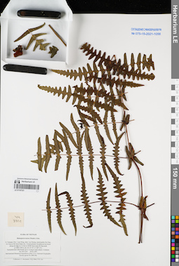
LE 01167321
Histiopteris incisa (Thunb.) J. Sm. det. Averyanov, Leonid Vladimirovich at 29.03.1997
Collectors: Averyanov, Leonid Vladimirovich; N.Q. Binh; Phan Ke Loc Field collecting number: VH3354. Collection date: 29.03.1997. Administrative regions: VN - Tinh Lam GJong. Groups of specimens: L. V. Averyanov specimens; L. V. Averyanov herbarium; Соглашение Минобрнауки №075-15-2021-1056Original label text:FLORA OF VIETNAM
Histiopteris incisa (Thunb.) J.Sm.
S. Vietnam, Prov. Lam Dong, distr. Lac Duong, municipalite Da Chay, 32.5 km to NE from Dalat city. Closed primary broadleaved mt forest along mt ridge in 5-6 km to NNW from main Bi Dup peak at 1800-1900 m alt. (N 12° 07′, E 108° 41′). Terrestrial fern with fronds up to 2 m hg in open places. Common. VH 3354 29.03.1997
International Botanical Expedition of the U.S.A. National Geographic Society (grant No 5803-96)
Collectors: L. Averyanov, N.Q. Binh, P.K. Loc
Coordinates (geographic position): 12° 7′ N, 108° 41′ E ±1000 mRecord creation: 2022-01-18, Galina Savich, PhotoScan D2. Processing status: work_status_1Citation: Specimen LE 01167321 // Virtual herbarium of Komarov Botanical Institute RAS — http://re.herbariumle.ru/01167321Histiopteris incisa (Thunb.) J.Sm.
S. Vietnam, Prov. Lam Dong, distr. Lac Duong, municipalite Da Chay, 32.5 km to NE from Dalat city. Closed primary broadleaved mt forest along mt ridge in 5-6 km to NNW from main Bi Dup peak at 1800-1900 m alt. (N 12° 07′, E 108° 41′). Terrestrial fern with fronds up to 2 m hg in open places. Common. VH 3354 29.03.1997
International Botanical Expedition of the U.S.A. National Geographic Society (grant No 5803-96)
Collectors: L. Averyanov, N.Q. Binh, P.K. Loc
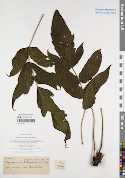
LE 01167320
Stegnogramma griffithii (T.Moore) K.Iwats. det. Phan Ke Loc at 21.07.1997
Collectors: Averyanov, Leonid Vladimirovich; N.Q. Binh; Phan Ke Loc Field collecting number: VH3108. Collection date: 23.03.1997. Administrative regions: VN - Tinh Lam GJong. Groups of specimens: L. V. Averyanov specimens; L. V. Averyanov herbarium; Соглашение Минобрнауки №075-15-2021-1056Original label text:FLORA OF VIETNAM
Stegnogramma griffithii (Moore) K.Iwats.
S. Vietnam, Prov. Lam Dong, 29 km to NE from Dalat city, distr. Lac Duong, municipalite Da Chay. Primary wet closed broadleaved cloud forest along main Bi Dup ridge at 1900-2000 m alt. (N 12° 06′, E 108° 39′).
Terrestrial fern on steep slopes. Common. VH 3108 23.03.1997
International Botanical Expedition of the U.S.A. National Geographic Society (grant No 5803-96)
Collectors: L. Averyanov, N.Q. Binh, P.K. Loc
Coordinates (geographic position): 12° 6′ N, 108° 39′ E ±1000 mRecord creation: 2022-01-18, Galina Savich, PhotoScan D2. Processing status: work_status_1Citation: Specimen LE 01167320 // Virtual herbarium of Komarov Botanical Institute RAS — http://re.herbariumle.ru/01167320Stegnogramma griffithii (Moore) K.Iwats.
S. Vietnam, Prov. Lam Dong, 29 km to NE from Dalat city, distr. Lac Duong, municipalite Da Chay. Primary wet closed broadleaved cloud forest along main Bi Dup ridge at 1900-2000 m alt. (N 12° 06′, E 108° 39′).
Terrestrial fern on steep slopes. Common. VH 3108 23.03.1997
International Botanical Expedition of the U.S.A. National Geographic Society (grant No 5803-96)
Collectors: L. Averyanov, N.Q. Binh, P.K. Loc
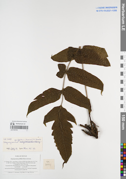
LE 01167319
Stegnogramma griffithii (T.Moore) K.Iwats. det. Phan Ke Loc at 19.07.1997
Collectors: Averyanov, Leonid Vladimirovich; N.Q. Binh; et al. Field collecting number: VH2497. Collection date: 11.03.1997. Administrative regions: VN - Tinh Lam GJong. Groups of specimens: L. V. Averyanov specimens; L. V. Averyanov herbarium; Соглашение Минобрнауки №075-15-2021-1056Original label text:FLORA OF VIETNAM
Stegnogramma griffithii (Moore) K.Iwats.
S. Vietnam, Prov. Lam Dong, 14 km to NNW from Dalat city (N 12° 05′, E 108° 22′). Primary closed mixed forest with Pinus kesiya and P. krempfii at 1740-1760 m alt. Terrestrial fern with fronds up to 0.8 m lg. Common in deep places. VH 2497 11.03.1997
International Botanical Expedition of the U.S.A. National Geographic Society (grant No 5803-96)
Collectors: L. Averyanov, N.Q. Binh, N.V. Duy, P.K. Loc
Coordinates (geographic position): 12° 5′ N, 108° 22′ E ±1000 mRecord creation: 2022-01-18, Galina Savich, PhotoScan D2. Processing status: work_status_1Citation: Specimen LE 01167319 // Virtual herbarium of Komarov Botanical Institute RAS — http://re.herbariumle.ru/01167319Stegnogramma griffithii (Moore) K.Iwats.
S. Vietnam, Prov. Lam Dong, 14 km to NNW from Dalat city (N 12° 05′, E 108° 22′). Primary closed mixed forest with Pinus kesiya and P. krempfii at 1740-1760 m alt. Terrestrial fern with fronds up to 0.8 m lg. Common in deep places. VH 2497 11.03.1997
International Botanical Expedition of the U.S.A. National Geographic Society (grant No 5803-96)
Collectors: L. Averyanov, N.Q. Binh, N.V. Duy, P.K. Loc
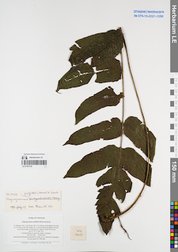
LE 01167318
Stegnogramma griffithii (T.Moore) K.Iwats. det. Phan Ke Loc at 19.07.1997
Collectors: Averyanov, Leonid Vladimirovich; N.Q. Binh; Phan Ke Loc Field collecting number: VH3681. Collection date: 04.04.1997. Administrative regions: VN - Tinh Lam GJong. Groups of specimens: L. V. Averyanov specimens; L. V. Averyanov herbarium; Соглашение Минобрнауки №075-15-2021-1056Original label text:FLORA OF VIETNAM
Stegnogramme griffithii (Moore) K.Iwats.
S. Vietnam, Prov. Lam Dong, distr. Lac Duong, municipalite Da Chay in 33.5 km to NE from Dalat city. Closed primary broadleaved forest on W macroslope of Gia Rinh mt. ridge at 1600-1650 m alt. (N 12° 07′, E 108° 41′).
Terrestrial fern on steep dry slopes. Common. VH 3681 04.04.1997
International Botanical Expedition of the U.S.A. National Geographic Society (grant No 5803-96)
Collectors: L. Averyanov, N.Q. Binh, P.K. Loc
Coordinates (geographic position): 12° 7′ N, 108° 41′ E ±1000 mRecord creation: 2022-01-18, Galina Savich, PhotoScan D2. Processing status: work_status_1Citation: Specimen LE 01167318 // Virtual herbarium of Komarov Botanical Institute RAS — http://re.herbariumle.ru/01167318Stegnogramme griffithii (Moore) K.Iwats.
S. Vietnam, Prov. Lam Dong, distr. Lac Duong, municipalite Da Chay in 33.5 km to NE from Dalat city. Closed primary broadleaved forest on W macroslope of Gia Rinh mt. ridge at 1600-1650 m alt. (N 12° 07′, E 108° 41′).
Terrestrial fern on steep dry slopes. Common. VH 3681 04.04.1997
International Botanical Expedition of the U.S.A. National Geographic Society (grant No 5803-96)
Collectors: L. Averyanov, N.Q. Binh, P.K. Loc
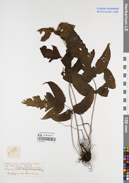
LE 01167317
Stegnogramma griffithii (T.Moore) K.Iwats. det. Phan Ke Loc at 19.07.1996
Collectors: Phan Ke Loc Field collecting number: P-7358. Collection date: 20.04.1997. Administrative regions: VN - Tinh Lao Cai. Groups of specimens: L. V. Averyanov specimens; L. V. Averyanov herbarium; Соглашение Минобрнауки №075-15-2021-1056Original label text:FLORA OF VIETNAM
Record creation: 2022-01-18, Galina Savich, PhotoScan D2Citation: Specimen LE 01167317 // Virtual herbarium of Komarov Botanical Institute RAS — http://re.herbariumle.ru/01167317Stegnogramma griffithii (T.Moore) K.Iwats.
Lao Cai Prov.
P-7358, 20.04.1997
Phan Ke Loc, 19.07.1996
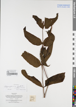
LE 01167316
Stegnogramma griffithii (T.Moore) K.Iwats. det. Shmakov, Aleksandr Ivanovich at 09.01.2008
Collectors: Phan Ke Loc; et al. Field collecting number: CBL2116. Collection date: 03.05.1999. Administrative regions: VN - Tinh Ha Giang. Groups of specimens: L. V. Averyanov specimens; L. V. Averyanov herbarium; Соглашение Минобрнауки №075-15-2021-1056Original label text:FLORA OF VIETNAM
Stenogramme sp.
N. Vietnam, prov. Ha Giang, distr. Yen Minh, municipality Du Gia, E slopes of Phu Tha Ca mountain system at 1500-1600 m elev. (N 23°56′ E 105°13′). Primary evergreen broadleaved very wet mountain forest on
shale very steep slopes. Terrestrial fern in shady place. Not rare. CBL 2116 03 May 1999
International Botanical Expedition of the U.S.A. National Geographic Society (grant No 6300-98)
Collectors: P.K.Loc, P.H.Hoang, Averyanov L.
Coordinates (geographic position): 23° 56′ N, 105° 13′ E ±1000 mRecord creation: 2022-01-18, Galina Savich, PhotoScan D2. Processing status: work_status_1Citation: Specimen LE 01167316 // Virtual herbarium of Komarov Botanical Institute RAS — http://re.herbariumle.ru/01167316Stenogramme sp.
N. Vietnam, prov. Ha Giang, distr. Yen Minh, municipality Du Gia, E slopes of Phu Tha Ca mountain system at 1500-1600 m elev. (N 23°56′ E 105°13′). Primary evergreen broadleaved very wet mountain forest on
shale very steep slopes. Terrestrial fern in shady place. Not rare. CBL 2116 03 May 1999
International Botanical Expedition of the U.S.A. National Geographic Society (grant No 6300-98)
Collectors: P.K.Loc, P.H.Hoang, Averyanov L.
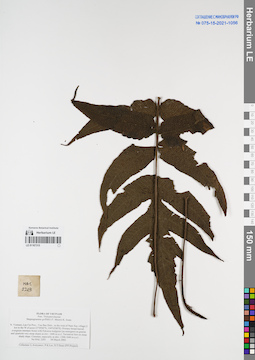
LE 01167315
Stegnogramma griffithii (T.Moore) K.Iwats. det. Averyanov, Leonid Vladimirovich at 09.03.2002
Collectors: Averyanov, Leonid Vladimirovich; Phan Ke Loc; D.T. Doan Field collecting number: HAL2203. Collection date: 09.03.2002. Administrative regions: VN - Tinh Lao Cai. Groups of specimens: L. V. Averyanov specimens; L. V. Averyanov herbarium; Соглашение Минобрнауки №075-15-2021-1056Original label text:FLORA OF VIETNAM
Thelypteridaceae
Stegnogramme griffithii (T. Moore) K. Iwats.
Northern Vietnam, Lao Cai Prov., Van Ban Distr., to the west of Nam Xay village (1 km to the W of point 21°59′00′'N, 104°02′00′'E). Primary broad-leaved evergreen montane forest with Fokienia hodginsii
(as emergent) on granite and quartzite very steep slopes at elev. 1600 m a.s.l. Terrestrial fern on steep shady slope. Common, especially at elev. 1300-1640 m a.s.l. HAL 2203 09 March 2002
Collectors: L.Averyanov, P.K.Loc, D.T.Doan (FFI Project).
Coordinates (geographic position): 21° 59′ N, 104° 2′ E ±1000 mRecord creation: 2022-01-18, Galina Savich, PhotoScan D2. Processing status: work_status_1Citation: Specimen LE 01167315 // Virtual herbarium of Komarov Botanical Institute RAS — http://re.herbariumle.ru/01167315Thelypteridaceae
Stegnogramme griffithii (T. Moore) K. Iwats.
Northern Vietnam, Lao Cai Prov., Van Ban Distr., to the west of Nam Xay village (1 km to the W of point 21°59′00′'N, 104°02′00′'E). Primary broad-leaved evergreen montane forest with Fokienia hodginsii
(as emergent) on granite and quartzite very steep slopes at elev. 1600 m a.s.l. Terrestrial fern on steep shady slope. Common, especially at elev. 1300-1640 m a.s.l. HAL 2203 09 March 2002
Collectors: L.Averyanov, P.K.Loc, D.T.Doan (FFI Project).
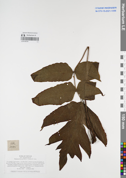
LE 01167314
Stegnogramma griffithii (T.Moore) K.Iwats. det. Averyanov, Leonid Vladimirovich at 20.03.2002
Collectors: Averyanov, Leonid Vladimirovich; Phan Ke Loc; D.T. Doan Field collecting number: HAL2585. Collection date: 20.03.2002. Administrative regions: VN - Tinh Lao Cai. Groups of specimens: L. V. Averyanov specimens; L. V. Averyanov herbarium; Соглашение Минобрнауки №075-15-2021-1056Original label text:FLORA OF VIETNAM
Thelypteridaceae
Stegnogramme griffithii (T. Moore) K. Iwats.
Coordinates (geographic position): 21° 58′ 12″ N, 104° 14′ 2″ E ±1000 mRecord creation: 2022-01-18, Galina Savich, PhotoScan D2. Processing status: work_status_1Citation: Specimen LE 01167314 // Virtual herbarium of Komarov Botanical Institute RAS — http://re.herbariumle.ru/01167314Thelypteridaceae
Stegnogramme griffithii (T. Moore) K. Iwats.
Northern Vietnam, Lao Cai Prov., Van Ban Distr., Khanh Yen Ha municipality, to the SW of Na Nheo village (in the vicinity of point 21°58′12′'N, 104°14′02′'E). Secondary evergreen broad-leaved montane
forest with bamboo on steep granite and quartzite slopes at elev. 1600-1700 m a.s.l. Terrestrial fern on steep slope. Common. HAL 2585 20 March 2002
Collectors: L.Averyanov, P.K.Loc, D.T.Doan (FFI Project).
forest with bamboo on steep granite and quartzite slopes at elev. 1600-1700 m a.s.l. Terrestrial fern on steep slope. Common. HAL 2585 20 March 2002
Collectors: L.Averyanov, P.K.Loc, D.T.Doan (FFI Project).
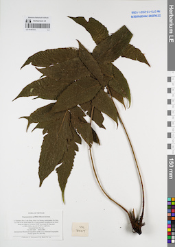
LE 01167313
Stegnogramma griffithii (T.Moore) K.Iwats. det. Averyanov, Leonid Vladimirovich at 29.03.1997
Collectors: Averyanov, Leonid Vladimirovich; N.Q. Binh; Phan Ke Loc Field collecting number: VH3369. Collection date: 29.03.1997. Administrative regions: VN - Tinh Lam GJong. Groups of specimens: L. V. Averyanov specimens; L. V. Averyanov herbarium; Соглашение Минобрнауки №075-15-2021-1056Original label text:FLORA OF VIETNAM
Stegnogramma griffithii (Moore) K.Iwats.
S. Vietnam, Prov. Lam Dong, distr. Lac Duong, municipalite Da Chay, 32.5 km to NE from Dalat city. Closed primary broadleaved mt forest along mt ridge in 5-6 km to NNW from main Bi Dup peak at 1800-1900 m alt. (N 12° 07′, E 108° 41′). Terrestrial fern. Not rare. VH 3369 29.03.1997
International Botanical Expedition of the U.S.A. National Geographic Society (grant No 5803-96)
Collectors: L. Averyanov, N.Q. Binh, P.K. Loc
Coordinates (geographic position): 12° 7′ N, 108° 41′ E ±1000 mRecord creation: 2022-01-18, Galina Savich, PhotoScan D2. Processing status: work_status_1Citation: Specimen LE 01167313 // Virtual herbarium of Komarov Botanical Institute RAS — http://re.herbariumle.ru/01167313Stegnogramma griffithii (Moore) K.Iwats.
S. Vietnam, Prov. Lam Dong, distr. Lac Duong, municipalite Da Chay, 32.5 km to NE from Dalat city. Closed primary broadleaved mt forest along mt ridge in 5-6 km to NNW from main Bi Dup peak at 1800-1900 m alt. (N 12° 07′, E 108° 41′). Terrestrial fern. Not rare. VH 3369 29.03.1997
International Botanical Expedition of the U.S.A. National Geographic Society (grant No 5803-96)
Collectors: L. Averyanov, N.Q. Binh, P.K. Loc
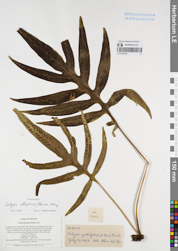
LE 01167312
Colysis elliptica (Thunb.) Ching det. Shmakov, Aleksandr Ivanovich at 02.01.2008
Additional identifications: Colysis pothifolia (D.Don) C.Presl det. Phan Ke Loc at 22.07.1997 Collectors: Averyanov, Leonid Vladimirovich; et al. Field collecting number: VH3644. Collection date: 04.04.1997. Administrative regions: VN - Tinh Ninh Thuan. Groups of specimens: L. V. Averyanov specimens; L. V. Averyanov herbarium; Соглашение Минобрнауки №075-15-2021-1056Original label text:FLORA OF VIETNAM
Colysis pothifolia (D.Don) Presl
S. Vietnam, Prov. Ninh Thuan, distr. Ninh Son, municipalite Phuoc Binh and Prov. Lam Dong, distr. Lac Duong, municipalite Da Chay boundary region in 34 km to NE from Dalat city. Closed primary broadleaved
cloud very wet forest along Gia Rinh mt. ridge at 1800-1900 m alt. (N 12° 07′, E 108° 41′).
Epiphyte. Not common. VH 3644 04.04.1997
International Botanical Expedition of the U.S.A. National Geographic Society (grant No 5803-96)
Collectors: L. Averyanov, N.Q. Binh, P.K. Loc
Coordinates (geographic position): 12° 7′ N, 108° 41′ E ±1000 mRecord creation: 2022-01-18, Galina Savich, PhotoScan D2. Processing status: work_status_1Citation: Specimen LE 01167312 // Virtual herbarium of Komarov Botanical Institute RAS — http://re.herbariumle.ru/01167312Colysis pothifolia (D.Don) Presl
S. Vietnam, Prov. Ninh Thuan, distr. Ninh Son, municipalite Phuoc Binh and Prov. Lam Dong, distr. Lac Duong, municipalite Da Chay boundary region in 34 km to NE from Dalat city. Closed primary broadleaved
cloud very wet forest along Gia Rinh mt. ridge at 1800-1900 m alt. (N 12° 07′, E 108° 41′).
Epiphyte. Not common. VH 3644 04.04.1997
International Botanical Expedition of the U.S.A. National Geographic Society (grant No 5803-96)
Collectors: L. Averyanov, N.Q. Binh, P.K. Loc
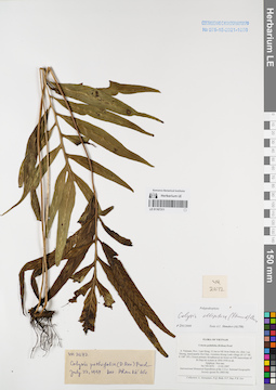
LE 01167311
Colysis elliptica (Thunb.) Ching det. Shmakov, Aleksandr Ivanovich at 02.01.2008
Additional identifications: Colysis pothifolia (D.Don) C.Presl det. Phan Ke Loc at 22.07.1997 Collectors: Averyanov, Leonid Vladimirovich; et al. Field collecting number: VH2672. Collection date: 15.03.1997. Administrative regions: VN - Tinh Lam GJong. Groups of specimens: L. V. Averyanov specimens; L. V. Averyanov herbarium; Соглашение Минобрнауки №075-15-2021-1056Original label text:FLORA OF VIETNAM
Colysis pothifolia (D.Don) Presl
S. Vietnam, Prov. Lam Dong, 31 km to NE from Dalat city, distr. Lac Duong, municipalite Da Chay, vicinities Klong Lanh village (N 12° 08′, E 108° 39′). Closed primary broadleaved mt forest on NW macroslope of
Bi Dup mt system at 1850-1950 m alt. Epiphyte. Not rare. VH 2672 15.03.1997
International Botanical Expedition of the U.S.A. National Geographic Society (grant No 5803-96)
Collectors: L. Averyanov, N.Q. Binh, N.V. Duy, P.K. Loc
Coordinates (geographic position): 12° 8′ N, 108° 39′ E ±1000 mRecord creation: 2022-01-18, Galina Savich, PhotoScan D2. Processing status: work_status_1Citation: Specimen LE 01167311 // Virtual herbarium of Komarov Botanical Institute RAS — http://re.herbariumle.ru/01167311Colysis pothifolia (D.Don) Presl
S. Vietnam, Prov. Lam Dong, 31 km to NE from Dalat city, distr. Lac Duong, municipalite Da Chay, vicinities Klong Lanh village (N 12° 08′, E 108° 39′). Closed primary broadleaved mt forest on NW macroslope of
Bi Dup mt system at 1850-1950 m alt. Epiphyte. Not rare. VH 2672 15.03.1997
International Botanical Expedition of the U.S.A. National Geographic Society (grant No 5803-96)
Collectors: L. Averyanov, N.Q. Binh, N.V. Duy, P.K. Loc
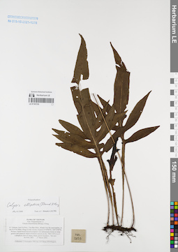
LE 01167310
Colysis elliptica (Thunb.) Ching det. Shmakov, Aleksandr Ivanovich at 02.01.2008
Collectors: Averyanov, Leonid Vladimirovich; Phan Ke Loc; D.T. Doan Field collecting number: HAL2821. Collection date: 27.03.2002. Administrative regions: VN - Tinh Lao Cai. Groups of specimens: L. V. Averyanov specimens; L. V. Averyanov herbarium; Соглашение Минобрнауки №075-15-2021-1056Original label text:FLORA OF VIETNAM
Polypodiaceae s.l.
Colysis dissimilialata (Bonap.) Ching
Northern Vietnam, Lao Cai Prov., Van Ban Distr., Khanh Yen Ha municipality, to the S of Na Nheo village (in the vicinity of point 21°59′04′'N, 104°15′08′'E). Primary closed broad-leaved evergreen wet submontane forest on steep granite and quartzite slopes of stream canyon at elev. 900-1150 m a.s.l. Lithophytic fern on mossy shady granite boulders. Not rare. HAL 2821 27 March 2002
Collectors: L.Averyanov, P.K.Loc, D.T.Doan (FFI Project).
Coordinates (geographic position): 21° 59′ 4″ N, 104° 15′ 8″ E ±1000 mRecord creation: 2022-01-18, Galina Savich, PhotoScan D2. Processing status: work_status_1Citation: Specimen LE 01167310 // Virtual herbarium of Komarov Botanical Institute RAS — http://re.herbariumle.ru/01167310Polypodiaceae s.l.
Colysis dissimilialata (Bonap.) Ching
Northern Vietnam, Lao Cai Prov., Van Ban Distr., Khanh Yen Ha municipality, to the S of Na Nheo village (in the vicinity of point 21°59′04′'N, 104°15′08′'E). Primary closed broad-leaved evergreen wet submontane forest on steep granite and quartzite slopes of stream canyon at elev. 900-1150 m a.s.l. Lithophytic fern on mossy shady granite boulders. Not rare. HAL 2821 27 March 2002
Collectors: L.Averyanov, P.K.Loc, D.T.Doan (FFI Project).
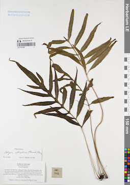
LE 01167309
Colysis elliptica (Thunb.) Ching det. Shmakov, Aleksandr Ivanovich at 02.01.2008
Collectors: Phan Ke Loc; Averyanov, Leonid Vladimirovich; et al. Field collecting number: HAL5012. Collection date: 02.05.2004. Administrative regions: VN - Tinh Ha Tinh. Groups of specimens: L. V. Averyanov specimens; L. V. Averyanov herbarium; Соглашение Минобрнауки №075-15-2021-1056Original label text:FLORA OF VIETNAM
Polypodiaceae s.l.
Colysis longisora ?
N.Vietnam, Ha Tinh Prov., Huong Son Distr., Son Kim Municipality, Rao Bun stream around point 18°23′39′'N, 105°15′12′'E. Primary broad-leaved evergreen closed wet forest on very steep shale slopes of
river canyon at elevation about 300 m a.s.l. Lithophytic fern on wet shady stream bluffs along water line. Common. HAL 5012 2 May 2004
Collectors: P.K.Loc, L.Averyanov, P.V.The, N.T.Vinh.
Coordinates (geographic position): 18° 23′ 39″ N, 105° 15′ 12″ E ±1000 mRecord creation: 2022-01-18, Galina Savich, PhotoScan D2. Processing status: work_status_1Citation: Specimen LE 01167309 // Virtual herbarium of Komarov Botanical Institute RAS — http://re.herbariumle.ru/01167309Polypodiaceae s.l.
Colysis longisora ?
N.Vietnam, Ha Tinh Prov., Huong Son Distr., Son Kim Municipality, Rao Bun stream around point 18°23′39′'N, 105°15′12′'E. Primary broad-leaved evergreen closed wet forest on very steep shale slopes of
river canyon at elevation about 300 m a.s.l. Lithophytic fern on wet shady stream bluffs along water line. Common. HAL 5012 2 May 2004
Collectors: P.K.Loc, L.Averyanov, P.V.The, N.T.Vinh.
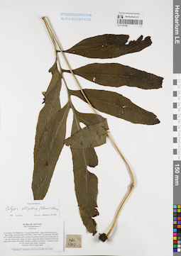
LE 01167308
Colysis elliptica (Thunb.) Ching det. Shmakov, Aleksandr Ivanovich at 02.01.2008
Collectors: Averyanov, Leonid Vladimirovich; Phan Ke Loc; The Van Pham Field collecting number: HAL5702. Collection date: 13.06.2004. Administrative regions: VN - Tinh Cao Bang. Groups of specimens: L. V. Averyanov specimens; L. V. Averyanov herbarium; Соглашение Минобрнауки №075-15-2021-1056Original label text:FLORA OF VIETNAM
Polypodiaceae s.l.
Colysis sp.
N.Vietnam, Cao Bang Prov., Trung Khanh Distr., Ngoc Khe Municipality, Pac Nga village, around point 22°54′59′'N, 106°31′44′'E, at elevation 700-800 m a.s.l. Closed secondary and remnants of primary broad-leaved evergreen forest on very steep rocky slopes of rocky ridges and mesae composed with light gray solid marble-like highly eroded crystalline limestone. Creeping lithophyte on very steep rocky slope. Common.
HAL 5702 13 June 2004
Collectors: L.Averyanov, P.K.Loc, P.V.The, N.T.Vinh.
Coordinates (geographic position): 22° 54′ 59″ N, 106° 31′ 44″ E ±1000 mRecord creation: 2022-01-18, Galina Savich, PhotoScan D2. Processing status: work_status_1Citation: Specimen LE 01167308 // Virtual herbarium of Komarov Botanical Institute RAS — http://re.herbariumle.ru/01167308Polypodiaceae s.l.
Colysis sp.
N.Vietnam, Cao Bang Prov., Trung Khanh Distr., Ngoc Khe Municipality, Pac Nga village, around point 22°54′59′'N, 106°31′44′'E, at elevation 700-800 m a.s.l. Closed secondary and remnants of primary broad-leaved evergreen forest on very steep rocky slopes of rocky ridges and mesae composed with light gray solid marble-like highly eroded crystalline limestone. Creeping lithophyte on very steep rocky slope. Common.
HAL 5702 13 June 2004
Collectors: L.Averyanov, P.K.Loc, P.V.The, N.T.Vinh.
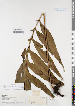
LE 01167307
Colysis elliptica (Thunb.) Ching det. Shmakov, Aleksandr Ivanovich at 02.01.2008
Collectors: Averyanov, Leonid Vladimirovich; et al. Field collecting number: VH277. Collection date: 23.02.1995. Administrative regions: VN - Kon Tum. Groups of specimens: L. V. Averyanov specimens; L. V. Averyanov herbarium; Соглашение Минобрнауки №075-15-2021-1056Original label text:FLORA OF VIETNAM
Polypodiaceae s.l.
Colysis sp.
S. Vietnam, Prov. Kontum. NW slopes of Ngoc Linh mountain system at 1600-1800 m alt. Open secondary forest in shadow place. Epilite with fronds up to 2 m lg. VH 277 23.02.1995
International Botanical Expedition of the U.S.A. National Geographic Society (grant No 5094-93)
Participants: L. Averyanov, N.T. Ban, N. Q. Binh, A. Budantzev, L. Budantzev, N.T. Hiep, D.D. Huyen, P.K. Loc, N.X. Tam, G. Yakovlev
Record creation: 2022-01-18, Galina Savich, PhotoScan D2. Processing status: work_status_1Citation: Specimen LE 01167307 // Virtual herbarium of Komarov Botanical Institute RAS — http://re.herbariumle.ru/01167307Polypodiaceae s.l.
Colysis sp.
S. Vietnam, Prov. Kontum. NW slopes of Ngoc Linh mountain system at 1600-1800 m alt. Open secondary forest in shadow place. Epilite with fronds up to 2 m lg. VH 277 23.02.1995
International Botanical Expedition of the U.S.A. National Geographic Society (grant No 5094-93)
Participants: L. Averyanov, N.T. Ban, N. Q. Binh, A. Budantzev, L. Budantzev, N.T. Hiep, D.D. Huyen, P.K. Loc, N.X. Tam, G. Yakovlev
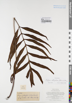
LE 01167306
Colysis elliptica (Thunb.) Ching det. Shmakov, Aleksandr Ivanovich at 02.01.2008
Additional identifications: Colysis pothifolia (D.Don) C.Presl det. Phan Ke Loc at 22.07.1995 Collectors: Averyanov, Leonid Vladimirovich; Tien Hiep Nguyen; Phan Ke Loc Field collecting number: VH4586. Collection date: 15.05.1997. Administrative regions: VN - Tinh Quang Binh. Groups of specimens: L. V. Averyanov specimens; L. V. Averyanov herbarium; Соглашение Минобрнауки №075-15-2021-1056Original label text:FLORA OF VIETNAM
Colysis pothifolia (D.Don) Presl
N. Vietnam, Prov. Quang Binh, distr. Minh Hoa, 72 km to NWW from Dong Hoi, municipalite Thong Hoa, vicinities of Yen Son village, limestone massif Ke Bang (N 17°40′ E 105°57′). Primary evergreen broadleaved forest on steep slopes and bluffs of limestone mesas at 200-250 m alt. Epilitic and epiphytic fern on shadow steep slopes. Not rare. VH 4586 15.05.1997
International Botanical Expedition of the U.S.A. National Geographic Society (grant No 5803-96)
Collectors: L. Averyanov, N.T. Hiep, P.K. Loc
Coordinates (geographic position): 17° 40′ N, 105° 57′ E ±1000 mRecord creation: 2022-01-18, Galina Savich, PhotoScan D2. Processing status: work_status_1Citation: Specimen LE 01167306 // Virtual herbarium of Komarov Botanical Institute RAS — http://re.herbariumle.ru/01167306Colysis pothifolia (D.Don) Presl
N. Vietnam, Prov. Quang Binh, distr. Minh Hoa, 72 km to NWW from Dong Hoi, municipalite Thong Hoa, vicinities of Yen Son village, limestone massif Ke Bang (N 17°40′ E 105°57′). Primary evergreen broadleaved forest on steep slopes and bluffs of limestone mesas at 200-250 m alt. Epilitic and epiphytic fern on shadow steep slopes. Not rare. VH 4586 15.05.1997
International Botanical Expedition of the U.S.A. National Geographic Society (grant No 5803-96)
Collectors: L. Averyanov, N.T. Hiep, P.K. Loc
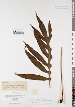
LE 01167305
Colysis pothifolia (D.Don) C.Presl det. Phan Ke Loc at 22.07.1997
Collectors: Averyanov, Leonid Vladimirovich; et al. Field collecting number: VH3654. Collection date: 04.04.1997. Administrative regions: VN - Tinh Ninh Thuan. Groups of specimens: L. V. Averyanov specimens; L. V. Averyanov herbarium; Соглашение Минобрнауки №075-15-2021-1056Original label text:FLORA OF VIETNAM
Colysis pothifolia (D.Don) Presl
S. Vietnam, Prov. Ninh Thuan, distr. Ninh Son, municipalite Phuoc Binh and Prov. Lam Dong, distr. Lac Duong, municipalite Da Chay boundary region in 34 km to NE from Dalat city. Closed primary broadleaved
cloud very wet forest along Gia Rinh mt. ridge at 1800-1900 m alt. (N 12° 07′, E 108° 41′). Epiphyte. Not rare.
VH 3654 04.04.1997
International Botanical Expedition of the U.S.A. National Geographic Society (grant No 5803-96)
Collectors: L. Averyanov, N.Q. Binh, P.K. Loc
Coordinates (geographic position): 12° 7′ N, 108° 41′ E ±1000 mRecord creation: 2022-01-18, Galina Savich, PhotoScan D2. Processing status: work_status_1Citation: Specimen LE 01167305 // Virtual herbarium of Komarov Botanical Institute RAS — http://re.herbariumle.ru/01167305Colysis pothifolia (D.Don) Presl
S. Vietnam, Prov. Ninh Thuan, distr. Ninh Son, municipalite Phuoc Binh and Prov. Lam Dong, distr. Lac Duong, municipalite Da Chay boundary region in 34 km to NE from Dalat city. Closed primary broadleaved
cloud very wet forest along Gia Rinh mt. ridge at 1800-1900 m alt. (N 12° 07′, E 108° 41′). Epiphyte. Not rare.
VH 3654 04.04.1997
International Botanical Expedition of the U.S.A. National Geographic Society (grant No 5803-96)
Collectors: L. Averyanov, N.Q. Binh, P.K. Loc
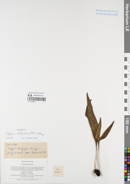
LE 01167304
Colysis longipes Ching. det. Phan Ke Loc at 22.07.1997
Collectors: Averyanov, Leonid Vladimirovich; et al. Field collecting number: VH3638. Collection date: 03.04.1997. Administrative regions: VN - Tinh Ninh Thuan. Groups of specimens: L. V. Averyanov specimens; L. V. Averyanov herbarium; Соглашение Минобрнауки №075-15-2021-1056Original label text:FLORA OF VIETNAM
Colysis longipes Ching
S. Vietnam, Prov. Ninh Thuan, distr. Ninh Son, municipalite Phuoc Binh in 34 km to NE from Dalat city. Closed primary broadleaved forest along mt ridge between Bi Dup and Gia Rinh mt. mt at 1800-1900 m alt.
(N 12° 07′, E 108° 42′). Epiphyte. Not common. VH 3638 03.04.1997
International Botanical Expedition of the U.S.A. National Geographic Society (grant No 5803-96)
Collectors: L. Averyanov, N.Q. Binh, P.K. Loc
Coordinates (geographic position): 12° 7′ N, 108° 42′ E ±1000 mRecord creation: 2022-01-18, Galina Savich, PhotoScan D2. Processing status: work_status_1Citation: Specimen LE 01167304 // Virtual herbarium of Komarov Botanical Institute RAS — http://re.herbariumle.ru/01167304Colysis longipes Ching
S. Vietnam, Prov. Ninh Thuan, distr. Ninh Son, municipalite Phuoc Binh in 34 km to NE from Dalat city. Closed primary broadleaved forest along mt ridge between Bi Dup and Gia Rinh mt. mt at 1800-1900 m alt.
(N 12° 07′, E 108° 42′). Epiphyte. Not common. VH 3638 03.04.1997
International Botanical Expedition of the U.S.A. National Geographic Society (grant No 5803-96)
Collectors: L. Averyanov, N.Q. Binh, P.K. Loc
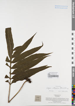
LE 01167303
Colysis elliptica (Thunb.) Ching det. Shmakov, Aleksandr Ivanovich at 02.01.2008
Collectors: Tien Hiep Nguyen; Averyanov, Leonid Vladimirovich; Phan Ke Loc; et al. Field collecting number: HLF5849. Collection date: 29.03.2006. Administrative regions: VN - Tinh Quang Tri. Groups of specimens: L. V. Averyanov specimens; L. V. Averyanov herbarium; Соглашение Минобрнауки №075-15-2021-1056Original label text:FLORA OF VIETNAM
Polypodiaceae s.l.
Colysis pothifolia
Vietnam, Quang Tri Prov., Huong Hoa Distr., Huong Phung Municipality, Sa Mui pass, around point 16°48′36″N 106°34′44″E at elevation about 1300-1400 m a.s.l. Primary broad-leaved evergreen submontane forest on very steep rocky shale southern slopes of Sa Mui Mountain. Creeping lithophytic fern on mossy shady rocks along rocky ridge edge and on slopes. Very common. HLF 5849 29 March 2006.
Coll. N.T.Hiep, L.Averyanov, P.K.Loc, P.V.The, N.S.Khang, P.H.Duc, L.T.Son, S.Bounphanmy, T.K.Ratana, O.Sonliya, T.Q.Dang, N.V.Hien, H.T.N.Trang, L.T.Chau.
Grant from Henry Luce Foundation.
Coordinates (geographic position): 16° 48′ 36″ N, 106° 34′ 44″ E ±1000 mRecord creation: 2022-01-18, Galina Savich, PhotoScan D2. Processing status: work_status_1Citation: Specimen LE 01167303 // Virtual herbarium of Komarov Botanical Institute RAS — http://re.herbariumle.ru/01167303Polypodiaceae s.l.
Colysis pothifolia
Vietnam, Quang Tri Prov., Huong Hoa Distr., Huong Phung Municipality, Sa Mui pass, around point 16°48′36″N 106°34′44″E at elevation about 1300-1400 m a.s.l. Primary broad-leaved evergreen submontane forest on very steep rocky shale southern slopes of Sa Mui Mountain. Creeping lithophytic fern on mossy shady rocks along rocky ridge edge and on slopes. Very common. HLF 5849 29 March 2006.
Coll. N.T.Hiep, L.Averyanov, P.K.Loc, P.V.The, N.S.Khang, P.H.Duc, L.T.Son, S.Bounphanmy, T.K.Ratana, O.Sonliya, T.Q.Dang, N.V.Hien, H.T.N.Trang, L.T.Chau.
Grant from Henry Luce Foundation.
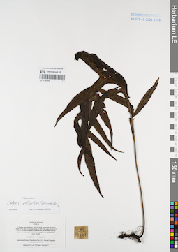
LE 01167302
Colysis elliptica (Thunb.) Ching det. Shmakov, Aleksandr Ivanovich at 02.01.2008
Collectors: Phan Ke Loc; P.H. Hoang; Averyanov, Leonid Vladimirovich Field collecting number: CBL2131. Collection date: 03.05.1999. Administrative regions: VN - Tinh Ha Giang. Groups of specimens: L. V. Averyanov specimens; L. V. Averyanov herbarium; Соглашение Минобрнауки №075-15-2021-1056Original label text:FLORA OF VIETNAM
Colysis sp.
N. Vietnam, prov. Ha Giang, distr. Yen Minh, municipality Du Gia, E slopes of Phu Tha Ca mountain system at 1600-1700 m elev. (N 23°56′ E 105°13′). Primary evergreen broadleaved very wet mountain forest on
shale very steep slopes. Lithophyte creeping fern on shady quartzite rocks. Not rare. CBL 2131 03 May 1999
International Botanical Expedition of the U.S.A. National Geographic Society (grant No 6300-98)
Collectors: P.K.Loc, P.H.Hoang, Averyanov L.
Coordinates (geographic position): 23° 56′ N, 105° 13′ E ±1000 mRecord creation: 2022-01-18, Galina Savich, PhotoScan D2. Processing status: work_status_1Citation: Specimen LE 01167302 // Virtual herbarium of Komarov Botanical Institute RAS — http://re.herbariumle.ru/01167302Colysis sp.
N. Vietnam, prov. Ha Giang, distr. Yen Minh, municipality Du Gia, E slopes of Phu Tha Ca mountain system at 1600-1700 m elev. (N 23°56′ E 105°13′). Primary evergreen broadleaved very wet mountain forest on
shale very steep slopes. Lithophyte creeping fern on shady quartzite rocks. Not rare. CBL 2131 03 May 1999
International Botanical Expedition of the U.S.A. National Geographic Society (grant No 6300-98)
Collectors: P.K.Loc, P.H.Hoang, Averyanov L.
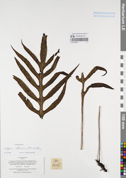
LE 01167301
Colysis elliptica (Thunb.) Ching det. Shmakov, Aleksandr Ivanovich at 02.01.2008
Collectors: Phan Ke Loc; P.H. Hoang; Averyanov, Leonid Vladimirovich Field collecting number: CBL2106. Collection date: 03.05.1999. Administrative regions: VN - Tinh Ha Giang. Groups of specimens: L. V. Averyanov specimens; L. V. Averyanov herbarium; Соглашение Минобрнауки №075-15-2021-1056Original label text:FLORA OF VIETNAM
Colysis sp.
N. Vietnam, prov. Ha Giang, distr. Yen Minh, municipality Du Gia, E slopes of Phu Tha Ca mountain system at 1400-1500 m elev. (N 23°56′ E 105°13′). Primary evergreen broadleaved very wet mountain forest on
shale very steep slopes. Lithophyte fern in shady place. Not rare. CBL 2106 03 May 1999
International Botanical Expedition of the U.S.A. National Geographic Society (grant No 6300-98)
Collectors: P.K.Loc, P.H.Hoang, Averyanov L.
Coordinates (geographic position): 23° 56′ N, 105° 13′ E ±1000 mRecord creation: 2022-01-18, Galina Savich, PhotoScan D2. Processing status: work_status_1Citation: Specimen LE 01167301 // Virtual herbarium of Komarov Botanical Institute RAS — http://re.herbariumle.ru/01167301Colysis sp.
N. Vietnam, prov. Ha Giang, distr. Yen Minh, municipality Du Gia, E slopes of Phu Tha Ca mountain system at 1400-1500 m elev. (N 23°56′ E 105°13′). Primary evergreen broadleaved very wet mountain forest on
shale very steep slopes. Lithophyte fern in shady place. Not rare. CBL 2106 03 May 1999
International Botanical Expedition of the U.S.A. National Geographic Society (grant No 6300-98)
Collectors: P.K.Loc, P.H.Hoang, Averyanov L.
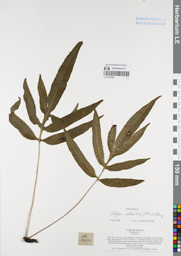
LE 01167300
Colysis elliptica (Thunb.) Ching det. Shmakov, Aleksandr Ivanovich at 02.01.2008
Collectors: Averyanov, Leonid Vladimirovich; et al. Field collecting number: HAL10954. Collection date: 06.04.2007. Administrative regions: VN - Tinh Thua Thien-Hue. Groups of specimens: L. V. Averyanov specimens; L. V. Averyanov herbarium; Соглашение Минобрнауки №075-15-2021-1056Original label text:FLORA OF VIETNAM
Polypodiaceae s.l.
Colysis sp.
Thua Thien – Hue Prov., Nam Dong Distr., Thuong Lo Municipality, along Cha Mang stream, around point 16°07′46″N 107°44′24″E. Remnants of primary evergreen broad-leaved lowland forest on very steep hill slopes and rocky river valley composed with stratified shale and sandstone at elev. about 50-70 m a.s.l.
Terrestrial fern on shady steep river slope. Common. HAL 10954 6 Apr. 2007.
Coll.: L.Averyanov, Phan Ke Loc, A.Averyanova, N.D.Phuong, L.V.Hung.
Coordinates (geographic position): 16° 7′ 46″ N, 107° 44′ 24″ E ±1000 mRecord creation: 2022-01-18, Galina Savich, PhotoScan D2. Processing status: work_status_1Citation: Specimen LE 01167300 // Virtual herbarium of Komarov Botanical Institute RAS — http://re.herbariumle.ru/01167300Polypodiaceae s.l.
Colysis sp.
Thua Thien – Hue Prov., Nam Dong Distr., Thuong Lo Municipality, along Cha Mang stream, around point 16°07′46″N 107°44′24″E. Remnants of primary evergreen broad-leaved lowland forest on very steep hill slopes and rocky river valley composed with stratified shale and sandstone at elev. about 50-70 m a.s.l.
Terrestrial fern on shady steep river slope. Common. HAL 10954 6 Apr. 2007.
Coll.: L.Averyanov, Phan Ke Loc, A.Averyanova, N.D.Phuong, L.V.Hung.
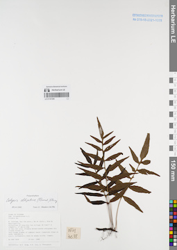
LE 01167299
Colysis elliptica (Thunb.) Ching det. Shmakov, Aleksandr Ivanovich at 02.01.2008
Collectors: Tien Hiep Nguyen; Phan Ke Loc; Averyanov, Leonid Vladimirovich Field collecting number: NTH3638. Collection date: 19.10.1999. Administrative regions: VN - Tinh Bac Kan. Groups of specimens: L. V. Averyanov specimens; L. V. Averyanov herbarium; Соглашение Минобрнауки №075-15-2021-1056Original label text:FLORA OF VIETNAM
Polypodiaceae s.l.
Colysis sp.
N. Vietnam, Bac Can prov., Na Ri distr., Kim Hy municipality, vicinities of Lung Hin Con village (N 22°17′ E 106°03′), 27 km to 55° of Bac Can city. Primary broadleaved evergreen dry closed forest on
very steep slopes of remnant karst limestone ridge at elev. 500-600 m a.s.l. Lithophytic fern on shady cliffs. Common. NTH 3638 19 Oct. 1999
Collectors: N.T. Hiep, P.K. Loc, L. Averyanov.
Coordinates (geographic position): 22° 17′ N, 106° 3′ E ±1000 mRecord creation: 2022-01-18, Galina Savich, PhotoScan D2. Processing status: work_status_1Citation: Specimen LE 01167299 // Virtual herbarium of Komarov Botanical Institute RAS — http://re.herbariumle.ru/01167299Polypodiaceae s.l.
Colysis sp.
N. Vietnam, Bac Can prov., Na Ri distr., Kim Hy municipality, vicinities of Lung Hin Con village (N 22°17′ E 106°03′), 27 km to 55° of Bac Can city. Primary broadleaved evergreen dry closed forest on
very steep slopes of remnant karst limestone ridge at elev. 500-600 m a.s.l. Lithophytic fern on shady cliffs. Common. NTH 3638 19 Oct. 1999
Collectors: N.T. Hiep, P.K. Loc, L. Averyanov.
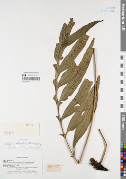
LE 01167298
Colysis elliptica (Thunb.) Ching det. Shmakov, Aleksandr Ivanovich at 02.01.2008
Collectors: Averyanov, Leonid Vladimirovich; et al. Field collecting number: VH045. Collection date: 23.02.1995. Administrative regions: VN - Kon Tum. Groups of specimens: L. V. Averyanov specimens; L. V. Averyanov herbarium; Соглашение Минобрнауки №075-15-2021-1056Original label text:FLORA OF VIETNAM
Polypodiaceae s.l.
Colysis sp.
S. Vietnam, Prov. Kontum. NW slopes of Ngoc Linh mountain system at 1200 m alt. near Ngoc Linh village. Evergreen dense primary forest. Epiphyte with fronds up to 0.7 m length. VH 045 23.02.1995
International Botanical Expedition of the U.S.A. National Geographic Society (grant No 5094-93)
Participants: L. Averyanov, N.T. Ban, N. Q. Binh, A. Budantzev, L. Budantzev, N.T. Hiep, D.D. Huyen, P.K. Loc, N.X. Tam, G. Yakovlev
Record creation: 2022-01-18, Galina Savich, PhotoScan D2. Processing status: work_status_1Citation: Specimen LE 01167298 // Virtual herbarium of Komarov Botanical Institute RAS — http://re.herbariumle.ru/01167298Polypodiaceae s.l.
Colysis sp.
S. Vietnam, Prov. Kontum. NW slopes of Ngoc Linh mountain system at 1200 m alt. near Ngoc Linh village. Evergreen dense primary forest. Epiphyte with fronds up to 0.7 m length. VH 045 23.02.1995
International Botanical Expedition of the U.S.A. National Geographic Society (grant No 5094-93)
Participants: L. Averyanov, N.T. Ban, N. Q. Binh, A. Budantzev, L. Budantzev, N.T. Hiep, D.D. Huyen, P.K. Loc, N.X. Tam, G. Yakovlev
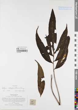
LE 01167297
Colysis elliptica (Thunb.) Ching det. Shmakov, Aleksandr Ivanovich at 02.01.2008
Collectors: Averyanov, Leonid Vladimirovich; et al. Field collecting number: HAL2488. Collection date: 18.03.2002. Administrative regions: VN - Tinh Lao Cai. Groups of specimens: L. V. Averyanov specimens; L. V. Averyanov herbarium; Соглашение Минобрнауки №075-15-2021-1056Original label text:FLORA OF VIETNAM
Polypodiaceae
Colysis longisora Ching (C. elliptica (Thunb.) Ching ?)
Northern Vietnam, Lao Cai Prov., Van Ban Distr., Khanh Yen Ha municipality, to the SW of Na Nheo village (in the vicinity of point21°57′34′'N, 104°13′49′'E). Primary evergreen broad-leaved wet montane forest with Fokienia hodginsii on steep granite and quartzite slopes of SW exposition at elev. 1800-1900 m a.s.l. Lithophytic creeping fern on shady mossy granite boulders. Very common. HAL 2488 18 March 2002
Collectors: L.Averyanov, P.K.Loc, D.T.Doan (FFI Project).
Coordinates (geographic position): 21° 57′ 34″ N, 104° 13′ 49″ E ±1000 mRecord creation: 2022-01-18, Galina Savich, PhotoScan D2. Processing status: work_status_1Citation: Specimen LE 01167297 // Virtual herbarium of Komarov Botanical Institute RAS — http://re.herbariumle.ru/01167297Polypodiaceae
Colysis longisora Ching (C. elliptica (Thunb.) Ching ?)
Northern Vietnam, Lao Cai Prov., Van Ban Distr., Khanh Yen Ha municipality, to the SW of Na Nheo village (in the vicinity of point21°57′34′'N, 104°13′49′'E). Primary evergreen broad-leaved wet montane forest with Fokienia hodginsii on steep granite and quartzite slopes of SW exposition at elev. 1800-1900 m a.s.l. Lithophytic creeping fern on shady mossy granite boulders. Very common. HAL 2488 18 March 2002
Collectors: L.Averyanov, P.K.Loc, D.T.Doan (FFI Project).
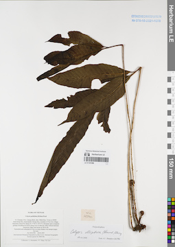
LE 01167296
Colysis elliptica (Thunb.) Ching det. Shmakov, Aleksandr Ivanovich at 02.01.2008
Collectors: Averyanov, Leonid Vladimirovich; Tien Hiep Nguyen; Phan Ke Loc Field collecting number: VH4790. Collection date: 18.05.1997. Administrative regions: VN - Tinh Quang Binh. Groups of specimens: L. V. Averyanov specimens; L. V. Averyanov herbarium; Соглашение Минобрнауки №075-15-2021-1056Original label text:FLORA OF VIETNAM
Colysis pothifolia (D.Don) Presl
N. Vietnam, Prov. Quang Binh, distr. Minh Hoa, 72 km to NWW from Dong Hoi, municipalite Thong Hoa, vicinities of Yen Son village, limestone massif Ke Bang (N 17°40′ E 105°57′). Remnant open evergreen primary broadleaved forest along river in alluvial valley bottom between limestone ridges and mesas at 200 m alt.
Terrestrial and subepiphytic fern on steep shadow wet stream slopes. Not rare.VH 4790 18.05.1997
International Botanical Expedition of the U.S.A. National Geographic
Society (grant No 5803-96)
Collectors: L. Averyanov, N.T. Hiep, P.K. Loc
Coordinates (geographic position): 17° 40′ N, 105° 57′ E ±1000 mRecord creation: 2022-01-18, Galina Savich, PhotoScan D2. Processing status: work_status_1Citation: Specimen LE 01167296 // Virtual herbarium of Komarov Botanical Institute RAS — http://re.herbariumle.ru/01167296Colysis pothifolia (D.Don) Presl
N. Vietnam, Prov. Quang Binh, distr. Minh Hoa, 72 km to NWW from Dong Hoi, municipalite Thong Hoa, vicinities of Yen Son village, limestone massif Ke Bang (N 17°40′ E 105°57′). Remnant open evergreen primary broadleaved forest along river in alluvial valley bottom between limestone ridges and mesas at 200 m alt.
Terrestrial and subepiphytic fern on steep shadow wet stream slopes. Not rare.VH 4790 18.05.1997
International Botanical Expedition of the U.S.A. National Geographic
Society (grant No 5803-96)
Collectors: L. Averyanov, N.T. Hiep, P.K. Loc
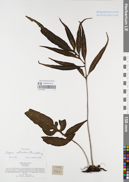
LE 01167295
Colysis elliptica (Thunb.) Ching det. Shmakov, Aleksandr Ivanovich at 02.01.2008
Collectors: Tien Hiep Nguyen; Averyanov, Leonid Vladimirovich; The Van Pham Field collecting number: HAL9334. Collection date: 28.10.2006. Administrative regions: VN - Tinh Son La. Groups of specimens: L. V. Averyanov specimens; L. V. Averyanov herbarium; Соглашение Минобрнауки №075-15-2021-1056Original label text:FLORA OF VIETNAM
Polypodiaceae s.l.
Colysis digitata?
Son La Prov., Moc Chau Distr., Van Ho Municipality, Hua Tat village, around point 20°46′18″N 104°47′29″E.
Broad-leaved evergreen forest with Pinus kwangtungensis and Podocarpus pilgeri on tops of ridge composed with rocky crystalline solid marble-like highly eroded limestone at elev. 1200-1350 m a.s.l. Lithophytic fern on shady cliff. Not rare. HAL 9334 28 Oct. 2006
Coll.: Nguyen Tien Hiep, L.Averyanov, Pham Van The.
Coordinates (geographic position): 20° 46′ 18″ N, 104° 47′ 29″ E ±1000 mRecord creation: 2022-01-18, Galina Savich, PhotoScan D2. Processing status: work_status_1Citation: Specimen LE 01167295 // Virtual herbarium of Komarov Botanical Institute RAS — http://re.herbariumle.ru/01167295Polypodiaceae s.l.
Colysis digitata?
Son La Prov., Moc Chau Distr., Van Ho Municipality, Hua Tat village, around point 20°46′18″N 104°47′29″E.
Broad-leaved evergreen forest with Pinus kwangtungensis and Podocarpus pilgeri on tops of ridge composed with rocky crystalline solid marble-like highly eroded limestone at elev. 1200-1350 m a.s.l. Lithophytic fern on shady cliff. Not rare. HAL 9334 28 Oct. 2006
Coll.: Nguyen Tien Hiep, L.Averyanov, Pham Van The.
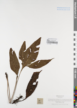
LE 01167294
Colysis digitata Ching det. Averyanov, Leonid Vladimirovich at 08.05.2004
Collectors: Phan Ke Loc; Averyanov, Leonid Vladimirovich; The Van Pham; Vinh Tien Nguyen Field collecting number: HAL5204. Collection date: 08.05.2004. Administrative regions: VN - Tinh Ha Tinh. Groups of specimens: L. V. Averyanov specimens; L. V. Averyanov herbarium; Соглашение Минобрнауки №075-15-2021-1056Original label text:FLORA OF VIETNAM
Polypodiaceae s.l.
Colysis digitata
N.Vietnam, Ha Tinh Prov., Huong Son Distr., Son Hong Municipality, around point 18°34′06′'N, 105°11′40′'E. Primary broad-leaved evergreen forest on steep mt slopes composed with granite along Khe Van stream
at elev 400-450 m a.s.l. Creeping lithophyte. Common. HAL 5204 8 May 2004
Collectors: P.K.Loc, L.Averyanov, P.V.The, N.T.Vinh.
Coordinates (geographic position): 18° 34′ 6″ N, 105° 11′ 40″ E ±1000 mRecord creation: 2022-01-18, Galina Savich, PhotoScan D2. Processing status: work_status_1Citation: Specimen LE 01167294 // Virtual herbarium of Komarov Botanical Institute RAS — http://re.herbariumle.ru/01167294Polypodiaceae s.l.
Colysis digitata
N.Vietnam, Ha Tinh Prov., Huong Son Distr., Son Hong Municipality, around point 18°34′06′'N, 105°11′40′'E. Primary broad-leaved evergreen forest on steep mt slopes composed with granite along Khe Van stream
at elev 400-450 m a.s.l. Creeping lithophyte. Common. HAL 5204 8 May 2004
Collectors: P.K.Loc, L.Averyanov, P.V.The, N.T.Vinh.
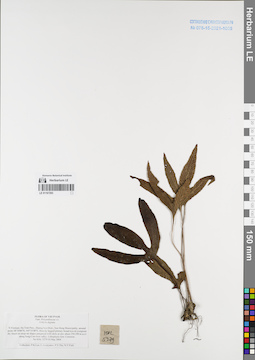
LE 01167293
Colysis digitata Ching det. Averyanov, Leonid Vladimirovich at 10.05.2004
Collectors: Phan Ke Loc; Averyanov, Leonid Vladimirovich; et al. Field collecting number: HAL5279. Collection date: 10.05.2004. Administrative regions: VN - Tinh Ha Tinh. Groups of specimens: L. V. Averyanov specimens; L. V. Averyanov herbarium; Соглашение Минобрнауки №075-15-2021-1056Original label text:FLORA OF VIETNAM
Polypodiaceae s.l.
Colysis digitata
N.Vietnam, Ha Tinh Prov., Huong Son Distr., Son Hong Municipality, around point 18°34′06′'N, 105°11′40′'E. Heavily logged primary broad-leaved evergreen dry forest on steep mt slopes composed with
shale at elev about 250-350 m a.s.l. along Song Con river valley. Lithophytic fern. Common.
HAL 5279 10 May 2004
Collectors: P.K.Loc, L.Averyanov, P.V.The, N.T.Vinh.
Coordinates (geographic position): 18° 34′ 6″ N, 105° 11′ 40″ E ±1000 mRecord creation: 2022-01-18, Galina Savich, PhotoScan D2. Processing status: work_status_1Citation: Specimen LE 01167293 // Virtual herbarium of Komarov Botanical Institute RAS — http://re.herbariumle.ru/01167293Polypodiaceae s.l.
Colysis digitata
N.Vietnam, Ha Tinh Prov., Huong Son Distr., Son Hong Municipality, around point 18°34′06′'N, 105°11′40′'E. Heavily logged primary broad-leaved evergreen dry forest on steep mt slopes composed with
shale at elev about 250-350 m a.s.l. along Song Con river valley. Lithophytic fern. Common.
HAL 5279 10 May 2004
Collectors: P.K.Loc, L.Averyanov, P.V.The, N.T.Vinh.