View
Add
Copy
Edit
Delete
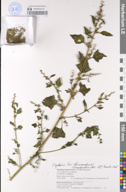
LE 01080030
Oxybasis chenopodioides (L.) S. Fuentes, Uotila & Borsch det. Sukhorukov, Alexander Petrovich at 23.09.2020
Collectors: Sukhorukov, Alexander Petrovich; Stepanova, Nina Jur'evna; Kalmykova Olga Field collecting number: 376. Collection date: 23.09.2020. Administrative regions: RU - Orenburgskaya Oblast' - Yasnenskiy Rayon. Groups of specimens: Образцы сектора Восточной ЕвропыOriginal label text:Оренбургская область. Ясненский район, 11 км южнее пос. Ясный 50.909794. 59.888653 Берег пруда, на песке.
Russia. Orenburg prov. Yasnensky distr. 11 km S of Yasnvi. 50.909794. 59.888653
Edge of a pond, on sand.
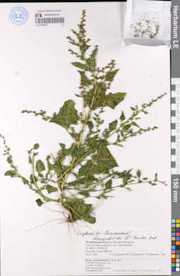
LE 01080034
Oxybasis chenopodioides (L.) S. Fuentes, Uotila & Borsch det. Sukhorukov, Alexander Petrovich at 26.09.2020
Collectors: Sukhorukov, Alexander Petrovich; Stepanova, Nina Jur'evna; Kalmykova Olga Field collecting number: 309. Collection date: 26.09.2020. Administrative regions: RU - Chelyabinskaya Oblast' - Bredinskiy Rayon. Groups of specimens: Образцы сектора Восточной ЕвропыOriginal label text:Челябинская область, Брединский район, 3 км на северо-запад от пос. Павловский. 52.10053, 59.98158 Солонец у реки Байтук.
Russia, Chelyabinsk prov., Bredy distr., 3 km NW of Pavlovsky vill.,
52.10053,59.98158 Salty sols near Baytuk river.