View
Add
Copy
Edit
Delete
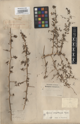
LE 00016816
Specimen originale of Lycium turcomannicum Fisch. et C.A. Mey. ex Ledeb.
Field collecting number: 183. Groups of specimens: Образцы общего сектораComment:[Imported description]
Family: Solanaceae
Taxon: Lycium turcomannicum Fisch. et C.A. Mey. ex Ledeb.
Type specimen category: Original material
Collectors: Herb. Fischer
Record number: 183
Family: Solanaceae
Taxon: Lycium turcomannicum Fisch. et C.A. Mey. ex Ledeb.
Type specimen category: Original material
Collectors: Herb. Fischer
Record number: 183
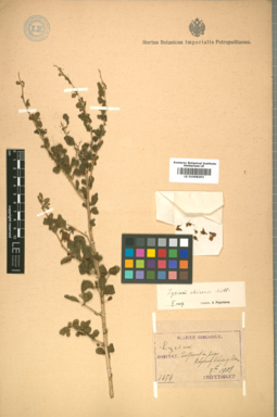
LE 01008293
Lycium chinense Mill.
Field collecting number: 1454. Collection date: 09.1908. Administrative regions: KR - Korea (Republic of). Place of collection: Quelpaert in pago Tchyoung Fehyeng Koan.Groups of specimens: Образцы сектора Центральной и Восточной АзииComment:[Imported description]
Taxon: Lycium chinense Mill.
Type specimen category: General specimen
Collectors: E. Taquet
Record number: 1454
Collection date: 1908.09.
Country: Korea
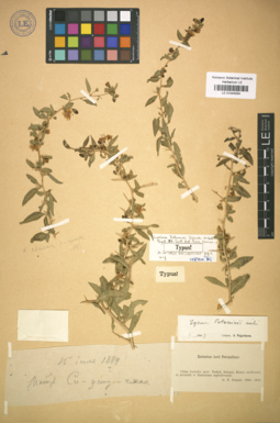
LE 01043054
Holotype of Lycium potaninii Pojark.
Collectors: Potanin, Grigorii Nikolajevic Collection date: 15.07.1884. Administrative regions: CN - China. Place of collection: монастырь Си-усту-чжао.Groups of specimens: Образцы сектора Центральной и Восточной Азии; Типовые образцы сектора Центральной и Восточной АзииComment:[Imported description]
Taxon: Lycium potaninii Pojark.
Type specimen category: holotype
Original paper: 1950, Not. Syst. (Leningrad), 13 : 265, fig. 6 (a – g)
Collectors: G.N. Potanin
Collection date: 15.07.1884
Country: China
State/Province: Inner Mongolia
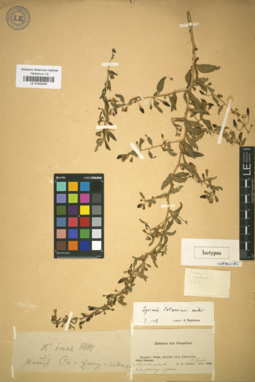
LE 01043055
Isotype of Lycium potaninii Pojark.
Collectors: Potanin, Grigorii Nikolajevic Collection date: 15.07.1884. Administrative regions: CN - China. Place of collection: Mongolia: planities circa Kuku-hoton, монастырь Си-усту-чжао.Groups of specimens: Образцы сектора Центральной и Восточной Азии; Типовые образцы сектора Центральной и Восточной АзииComment:[Imported description]
Taxon: Lycium potaninii Pojark.
Type specimen category: isotype
Original paper: 1950, Not. Syst. (Leningrad), 13 : 265, fig. 6 (a – g)
Collectors: G.N. Potanin
Collection date: 15.07.1884
Country: China
State/Province: Inner Mongolia
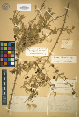
LE 01043056
Isotype of Lycium potaninii Pojark.
Collectors: Potanin, Grigorii Nikolajevic Collection date: 23.09.1884. Administrative regions: CN - China. Place of collection: Ордос, уроч. Баин-тухум.Groups of specimens: Образцы сектора Центральной и Восточной Азии; Типовые образцы сектора Центральной и Восточной АзииComment:[Imported description]
Taxon: Lycium potaninii Pojark.
Type specimen category: isotype
Original paper: 1950, Not. Syst. (Leningrad), 13 : 265, fig. 6 (a – g)
Collectors: G.N. Potanin
Collection date: 23.09.1884
Country: China
State/Province: Inner Mongolia
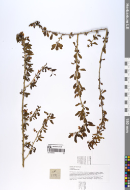
LE 01055404
Lycium chinense Mill. det. Averyanov, Leonid Vladimirovich at 21.10.2018
Collectors: Averyanov, Leonid Vladimirovich; Khang Sinh Nguyen; Maisak, Tatiana Viktorovna; Truong Duc Thieu Field collecting number: VR1191. Collection date: 22.10.2018. Administrative regions: VN - Tinh Ha Giang. Groups of specimens: L. V. Averyanov specimens; L. V. Averyanov herbarium; L. V. Averyanov photosOriginal label text:FLORA OF VIETNAM.
Coordinates (geographic position): 23° 5′ 52.6″ N, 104° 51′ 26.4″ E ±1000 mComment: Solanaceae.
Lycium chinense Mill.
Ha Giang prov., Quan Ba distr., Cao Ma Po commune, Va Thang 1 village, around point 23º05ʹ52.6ʺN 104º51ʹ26.4ʺE, steep alluvial slopes and flattened mountain summits based on limestone at elevation 1400–1480 m a.s.l. Primary evergreen broad-leaved very humid forest. Small shrub 1–1.5 n tall on exposed mossy rock outcrops. Flowers blue-violet. Not common.22 October 2018, L. Averyanov, Nguyen Sinh Khang, T. Maisak, Truong Duc Thieu, VR 1191.
All photos © L. Averyanov & K.S. Nguyen
Record creation: 2019-06-11, Leonid Averyanov, PhotoScan D1Citation: Specimen LE 01055404 // Virtual herbarium of Komarov Botanical Institute RAS — http://re.herbariumle.ru/01055404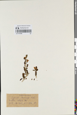
LE 01167609
Lycium chinense Mill. det. Nguyen Thi Nhan at 19.05.1976
Collectors: Nguyen Thi Nhan Field collecting number: Nguyen Thi Nhan 16303. Collection date: 19.05.1976. Administrative regions: VN - Vietnam. Groups of specimens: L. V. Averyanov specimens; L. V. Averyanov herbarium; Соглашение Минобрнауки №075-15-2021-1056Original label text:FLORA OF VIETNAM
Record creation: 2022-03-03, Galina Savich, PhotoScan D2. Processing status: work_status_1Citation: Specimen LE 01167609 // Virtual herbarium of Komarov Botanical Institute RAS — http://re.herbariumle.ru/01167609Solanaceae
Lycium chinense Mill.
Vietnam.
Nguyen Thi Nhan 16303.
19.05.1976.
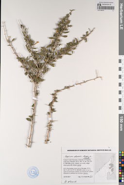
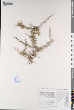
LE 01194121
Lycium shawii Roem. & Schult. det. Byalt, Vyacheslav Vyacheslavovich
Collectors: Byalt, Vyacheslav Vyacheslavovich Field collecting number: 93. Collection date: 10.12.2017. Administrative regions: AE - United Arab Emirates. Place of collection: Фуджейра, вади около Мазафи, в ущелье.Groups of specimens: Образцы общего сектора; Соглашение Минобрнауки №075-15-2021-1056; Бялт В.В.: Флора ФуджейрыOriginal label text: United Arab Emirates. Emirate of Fujaira, wadi near Musafi, 25°21, 991’ N, 56° 10, 375’ E, 500–600 m alt.: in gorge.– ОАЭ, Фуджейра, вади около Мазафи, 25°21, 991’ N, 56° 10, 375’ E, 500–600 м выс. н. ур. м.: в ущелье, 10 XII 2017, V.V. Byalt s.n. / 93
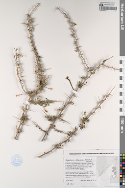
LE 01194123
Lycium shawii Roem. & Schult. det. Byalt, Vyacheslav Vyacheslavovich
Collectors: Byalt, Vyacheslav Vyacheslavovich Field collecting number: 267. Collection date: 14.12.2017. Administrative regions: AE - United Arab Emirates. Place of collection: Фуджейра, пос. Аль Бидия, окрестности г. Фуджейра, около плотины, каменистые склоны выше плотины.Groups of specimens: Образцы общего сектора; Соглашение Минобрнауки №075-15-2021-1056; Бялт В.В.: Флора ФуджейрыOriginal label text: United Arab Emirates. Emirate of Fujaira, environs of Al Fujeira, near dam, 25° 8' 24.34" N, 56°18'39.14"E: stony slope upper dam.– ОАЭ, Фуджейра, посёлок Аль Бидия, окр. г. Фуджейра, около плотины, 25° 8' 24.34" N, 56°18'39.14"E: каменистые склоны выше плотины, 14 XII 2017, fl., V.V. Byalt 267
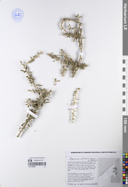
LE 01194124
Lycium shawii Roem. & Schult. det. Byalt, Vyacheslav Vyacheslavovich
Collectors: Byalt, Vyacheslav Vyacheslavovich Field collecting number: s.n. Collection date: 10.12.2017. Administrative regions: AE - United Arab Emirates. Place of collection: Фуджейра, вади около пос. Мазафи, в ущелье.Groups of specimens: Образцы общего сектора; Соглашение Минобрнауки №075-15-2021-1056; Бялт В.В.: Флора ФуджейрыOriginal label text: United Arab Emirates. Emirate of Fujaira, wadi near Musafi, 25°21, 991’ N, 56° 10, 375’ E, 500–600 m alt.: in gorge, fl. blue.– ОАЭ, Фуджейра, вади около Мазафи, 25°21, 991’ N, 56° 10, 375’ E, 500–600 м выс. н. ур. м.: в ущелье, 10 XII 2017, V.V. Byalt s.n.
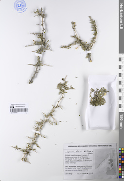
LE 01194859
Lycium shawii Roem. & Schult. det. Byalt, Vyacheslav Vyacheslavovich
Collectors: Byalt, Vyacheslav Vyacheslavovich; Korshunov, Vladimir Mikhailovich Field collecting number: 694. Collection date: 06.04.2018. Administrative regions: AE - United Arab Emirates. Place of collection: Фуджейра, северо-западные окрестности пос. Тавайан, доломитовый хребет: сухой ручей.Groups of specimens: Образцы общего сектора; Соглашение Минобрнауки №075-15-2021-1056; Бялт В.В.: Флора ФуджейрыOriginal label text: United Arab Emirates. Emirate of Fujaira, NW environs of Tawaian, 25°37'21.2"N 56°05'39.7"E, 600–650 m alt., limestone (dolomite) ridge: dry spring valley. – ОАЭ, Фуджейра, NW окрестности пос. Тавайан, 25°37'21.2"N 56°05'39.7"E, 600–650 м н. ур. м., доломитовый хребет: сухой ручей, 6 IV 2018, veg., V.V. Byalt, V. Korshunov 694
LE 01194860
Lycium shawii Roem. & Schult. det. Byalt, Vyacheslav Vyacheslavovich
Collectors: Byalt, Vyacheslav Vyacheslavovich Field collecting number: 467. Collection date: 30.03.2017. Administrative regions: AE - United Arab Emirates. Place of collection: Фуджейра, окрестности г. Манама, на скалах-останцах (среди песков).Groups of specimens: Образцы общего сектора; Соглашение Минобрнауки №075-15-2021-1056; Бялт В.В.: Флора ФуджейрыOriginal label text: United Arab Emirates. Emirate of Fujaira, environs of Al Manama, 25°20,020’ N, 56° 11,847’ E: on destroyed rocky outcrops. – ОАЭ, Фуджейра, окрестности г. Манама, 25°20,020’ N, 56° 11,847’ E: на скалах останцах (среди песков), 30 III 2017, fl., V.V. Byalt 467
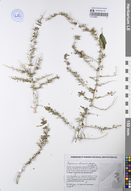
LE 01194862
Lycium shawii Roem. & Schult. det. Byalt, Vyacheslav Vyacheslavovich
Collectors: Byalt, Vyacheslav Vyacheslavovich; Korshunov, Mikhail Vladimirovich Field collecting number: 1418. Collection date: 22.11.2019. Administrative regions: AE - United Arab Emirates. Place of collection: Фуджейра, пос. Авала, во дворе форта Ахвала.Groups of specimens: Образцы общего сектора; Соглашение Минобрнауки №075-15-2021-1056; Бялт В.В.: Флора ФуджейрыOriginal label text: United Arab Emirates. Emirate of Fujaira, vil. Ahwala, 24°54'31.11"N 56°18'11.596"E, ca. 80 m alt.: in the yard of Ahwala Fort. – ОАЭ, Фуджейра, пос. Авала, 24 ° 54'31,11 "N 56 ° 18'11,596" E, ок. 80 м н.ур.м.: во дворе форта Ахвала, 22 XI 2019, fl., V.V. Byalt, M.V. Korshunov 1418
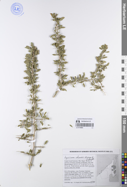
LE 01194863
Lycium shawii Roem. & Schult. det. Byalt, Vyacheslav Vyacheslavovich
Collectors: Byalt, Vyacheslav Vyacheslavovich; Korshunov, Mikhail Vladimirovich Field collecting number: 1530. Collection date: 23.11.2019. Administrative regions: AE - United Arab Emirates. Place of collection: Фуджейра, горы Хаджар. Граница эмиратов Фуджейра и Рас-эль-Хайма, старая дорога Масафи-Дибба, вади: на скалах и в каменистом сухом водотоке.Groups of specimens: Образцы общего сектора; Соглашение Минобрнауки №075-15-2021-1056; Бялт В.В.: Флора ФуджейрыOriginal label text: United Arab Emirates. Mts. Hajar. Border of emirate of Fujaira and Ras al Khaima, old road Masafi-Dibba, 25°21'17.57"N 56°10'47.12"E, ca. 515 m alt.: on rocks and in a stony dry stream.– ОАЭ, Фуджейра, горы Хаджар. Граница эмиратов Фуджейра и Рас-эль-Хайма, старая дорога Масафи-Дибба, 25 ° 21'17.57 "N 56 ° 10'47.12" E, ок. 515 м. Вади: на скалах и в каменистом сухом водотоке, 23 XI 2019, veg., V.V. Byalt, M.V. Korshunov 1530
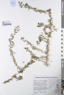
LE 01194864
Lycium shawii Roem. & Schult. det. Byalt, Vyacheslav Vyacheslavovich
Collectors: Byalt, Vyacheslav Vyacheslavovich; Korshunov, Mikhail Vladimirovich Field collecting number: 1629. Collection date: 24.11.2019. Administrative regions: AE - United Arab Emirates. Place of collection: Фуджейра, Аль Тайба в окрестности г. Фуджейра: в южной части фермы шейха Хамада II [точка 342], в питомнике растений в юго-восточной части, у забора.Groups of specimens: Образцы общего сектора; Соглашение Минобрнауки №075-15-2021-1056; Бялт В.В.: Флора ФуджейрыOriginal label text: United Arab Emirates. Emirate of Fujaira, Al Taiba in environs of the city of Al Fujeira, 25°09'29.6"N 56°17'31"E: in irrigated places in S part of farm of the Sheikh Khamad II [point 342]; in plant nurcery, near fence. – ОАЭ, Фуджейра, Аль Тайба в окр. г. Фуджейра, 25°09'29.6"N 56°17'31"E: в S части фермы шейха Хамада II [точка 342], в питомнике растений в ЮВ части, у забора, 24 XI 2019, fl., V.V. Byalt & M.V. Korshunov 1629
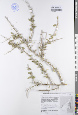
LE 01194876
Lycium shawii Roem. & Schult. det. Byalt, Vyacheslav Vyacheslavovich
Collectors: Byalt, Vyacheslav Vyacheslavovich; Korshunov, Mikhail Vladimirovich Field collecting number: 1274/490. Collection date: 02.04.2018. Administrative regions: AE - United Arab Emirates. Place of collection: эмират Фуджейра, 2,5 км юго-западнее пос. Дахир, культивируется в частном саду.Groups of specimens: Образцы общего сектора; Соглашение Минобрнауки №075-15-2021-1056; Бялт В.В.: Флора ФуджейрыOriginal label text: United Arab Emirates. Emirate of Fujaira, 2,5 km to SW from Dahir, 25°30'28.7"N 56°07'59.8"E, ca. 150 m alt., cultivated in garden.– ОАЭ, эмират Фуджейра, 2,5 км SW от Дахир, 25°30'0.54"N 56° 7'52.40"E, ca. 150 м н. ур. м., культивируется в частном саду, 2 IV 2018, V.V. Byalt, M.V. Korshunov 1274/490
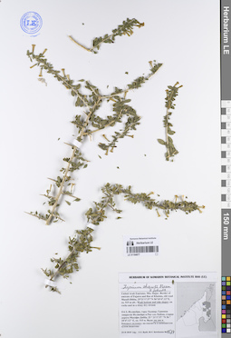
LE 01194877
Lycium shawii Roem. & Schult. det. Byalt, Vyacheslav Vyacheslavovich
Collectors: Byalt, Vyacheslav Vyacheslavovich; Korshunov, Mikhail Vladimirovich Field collecting number: 1534. Collection date: 23.11.2019. Administrative regions: AE - United Arab Emirates. Place of collection: Фуджейра, горы Хаджар, граница эмиратов Фуджейра и Рас-эль-Хайма, старая дорога Масафи-Дибба, вади: дно и боковые склоны.Groups of specimens: Образцы общего сектора; Соглашение Минобрнауки №075-15-2021-1056; Бялт В.В.: Флора ФуджейрыOriginal label text: United Arab Emirates. Mts. Hajar. Border of emirate of Fujaira and Ras al Khaima, old road Masafi-Dibba, 25°21'17.57"N 56°10'47.12"E, ca. 515 m alt.: Wadi bottom and side slopes.– ОАЭ, Фуджейра, горы Хаджар. Граница эмиратов Фуджейра и Рас-эль-Хайма, старая дорога Масафи-Дибба, 25 ° 21'17.57 "N 56 ° 10'47.12" E, ок. 515 м. Вади: на дне и боковых склонах, 23 XI 2019, fl., V.V. Byalt, M.V. Korshunov 1534
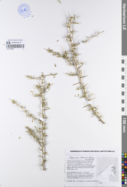
LE 01194959
Lycium shawii Roem. & Schult. det. Byalt, Vyacheslav Vyacheslavovich
Collectors: Byalt, Vyacheslav Vyacheslavovich; Korshunov, Mikhail Vladimirovich Field collecting number: 1273/471. Collection date: 02.04.2018. Administrative regions: AE - United Arab Emirates. Place of collection: Фуджейра, 5 км северо-западнее пос. Аль Хала, верх гряды с садом: сухие скалы и каменисто-щебнистые склоны.Groups of specimens: Образцы общего сектора; Соглашение Минобрнауки №075-15-2021-1056; Бялт В.В.: Флора ФуджейрыOriginal label text: United Arab Emirates. Emirate of Fujaira, 5 km to NW from Al Khala, 25°30'0.54"N 56° 7'52.40"E, ca. 300-350 m alt., the top of the ridge with garden: dry rocks and stony-gravelly slopes. – ОАЭ, Фуджейра, 5 км NW от Аль Хала, 25°30'0.54"N 56° 7'52.40"E, ca. 300-350 м н. ур. м., верх гряды с садом: сухие скалы и каменисто-щебнистые склоны, 2 IV 2018, V.V. Byalt, M.V. Korshunov 1273/471
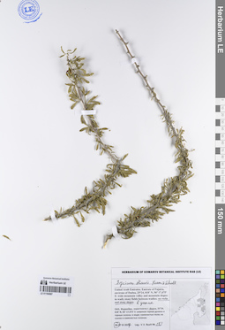
LE 01194967
Lycium shawii Roem. & Schult. det. Byalt, Vyacheslav Vyacheslavovich
Collectors: Byalt, Vyacheslav Vyacheslavovich Field collecting number: 283. Collection date: 26.03.2017. Administrative regions: AE - United Arab Emirates. Place of collection: Фуджейра, окрестности г. Дадна, широкая горная долина и горные склоны: скалы и каменистые склоны в ущелье.Groups of specimens: Образцы общего сектора; Соглашение Минобрнауки №075-15-2021-1056; Бялт В.В.: Флора ФуджейрыOriginal label text: United Arab Emirates. Emirate of Fujaira, environs of Dadna, 25°24, 018’ N, 56° 17,475’ E: wide mountain valley and mountain slopes: on rocks and stony slopes. – ОАЭ, Фуджейра, окрестности г. Дадна, 25°24, 018’ N, 56° 17,475’ E: широкая горная долина и горные склоны: на скалах и каменистых склонах в ущелье. 26-27 III 2017, V.V. Byalt
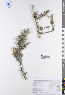
LE 01194968
Lycium shawii Roem. & Schult. det. Byalt, Vyacheslav Vyacheslavovich
Collectors: Byalt, Vyacheslav Vyacheslavovich Field collecting number: 347. Collection date: 30.03.2017. Administrative regions: AE - United Arab Emirates. Place of collection: Фуджейра, окрестности г. Манама, скалы-останцы (среди песков).Groups of specimens: Образцы общего сектора; Соглашение Минобрнауки №075-15-2021-1056; Бялт В.В.: Флора ФуджейрыOriginal label text: United Arab Emirates. Emirate of Fujaira, environs of Al Manama, 25°20,020’ N, 56° 11,847’ E: on destroyed rocky outcrops. – ОАЭ, Фуджейра, окрестности г. Манама, 25°20,020’ N, 56° 11,847’ E: на скалах останцах (среди песков), 30 III 2017, fl., V.V. Byalt 347
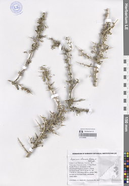
LE 01259698
Lycium shawii Roem. & Schult. det. Byalt, Vyacheslav Vyacheslavovich
Collectors: Byalt, Vyacheslav Vyacheslavovich; Korshunov, Mikhail Vladimirovich Field collecting number: 413. Collection date: 13.03.2020. Administrative regions: AE - United Arab Emirates. Place of collection: Fujairah Emirate, Al Tawyeen (Taween) area, 2.4 km West-South-West to mountain peak, abandoned baghara (winter season dryland farm) [point 708]: in sand on dryland field.Groups of specimens: Образцы общего сектора; Соглашение Минобрнауки №075-15-2021-1056; Бялт В.В.: Флора ФуджейрыOriginal label text: United Arab Emirates, Fujairah Emirate, Al Tawyeen (Taween) area, 2.4 km West-South-West to mountain peak, abandoned baghara (winter season dryland farm). 25°37'42.66"N, 56° 7'19.59"E, elevation 950 m. [point 708]: in sand on dryland field, 13 III 2020, V.V. Byalt, M.V. Korshunov 413