View
Add
Copy
Edit
Delete
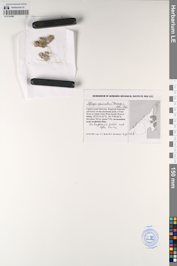
LE 01193585
Ifloga spicata (Forssk.) Sch. Bip. det. Byalt, Vyacheslav Vyacheslavovich
Collectors: Byalt, Vyacheslav Vyacheslavovich; Korshunov, Mikhail Vladimirovich Field collecting number: 1026b. Collection date: 24.03.2020. Administrative regions: AE - United Arab Emirates. Place of collection: Fujairah emirate, cell tower on the mountain peak, 3.5 km West to Ghub, 8 km West-South-West to Dibba [point 719].Groups of specimens: Образцы общего сектора; Соглашение Минобрнауки №075-15-2021-1056; Бялт В.В.: Флора ФуджейрыOriginal label text: United Arab Emirates, Fujairah emirate, cell tower on the mountain peak, 3.5 km West to Ghub, 8 km West-South-West to Dibba. 25°34'14.16"N, 56° 9'58.28"E, elevation 765 m. [point 719]: on bagharah field, wet after rains, 24 III 2020, fr., V.V. Byalt, M.V. Korshunov 1026b
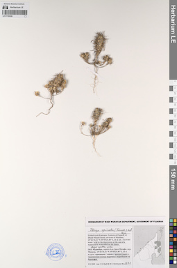
LE 01193636
Ifloga spicata (Forssk.) Sch. Bip. det. Byalt, Vyacheslav Vyacheslavovich
Collectors: Byalt, Vyacheslav Vyacheslavovich; Korshunov, Mikhail Vladimirovich Field collecting number: 1733. Collection date: 03.04.2020. Administrative regions: AE - United Arab Emirates. Place of collection: Фуджейра, дорога Аль Даид-Мазафи, окрестности г. Манама, дикорастущее в понижении в конце водотока с водосбором на барханах.Groups of specimens: Образцы общего сектора; Соглашение Минобрнауки №075-15-2021-1056; Бялт В.В.: Флора ФуджейрыOriginal label text: United Arab Emirates. Emirate of Fujaira, Al Dhaid-Masafi Road, environs of Manama, 25°36'10.31"N 55°58'25.48"E, 26 m alt.: wild in the depression at the end of a watercourse watershed on the dunes. – ОАЭ, Фуджейра, дорога Аль Даид-Мазафи, окр. Манама, 25°36'10.31"N 55°58'25.48"E, 26 м н.ур.м.: дикорастущее в понижениив в конце водотока с водосбором на барханнах, 3 IV 2020, fr., V.V. Byalt & M.V. Korshunov 1733