View
Add
Copy
Edit
Delete
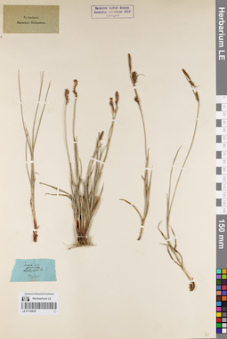
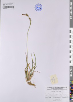
LE 01159630
Carex panicea L. det. Marschall von Bieberstein, Friedrich August
Groups of specimens: Ex herbario Marschall Bieberstein; Соглашение Минобрнауки №075-15-2021-1056Original label text:Carex an panicea
Record creation: 2021-11-24, Ivan Tatanov, PhotoScan D2Citation: Specimen LE 01159630 // Virtual herbarium of Komarov Botanical Institute RAS — http://re.herbariumle.ru/01159630Tauria
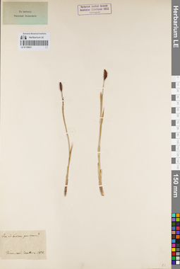
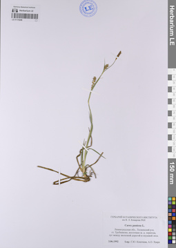
LE 01159631
Carex panicea L. det. Unknown
Administrative regions: UA - Ukraine. Groups of specimens: Ex herbario Marschall Bieberstein; Соглашение Минобрнауки №075-15-2021-1056Original label text:An ad Caricem paniceam?
Coordinates (geographic position): 50° 26′ 35.16″ N, 30° 30′ 59.76″ ERecord creation: 2021-11-24, Ivan Tatanov, PhotoScan D2Citation: Specimen LE 01159631 // Virtual herbarium of Komarov Botanical Institute RAS — http://re.herbariumle.ru/01159631Kiew, com. Werther (?) a. 1821
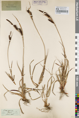
LE 01159632
Carex panicea L. det. Marschall von Bieberstein, Friedrich August
Collectors: Steven, Christian von Collection date: 1816. Groups of specimens: Ex herbario Marschall Bieberstein; Соглашение Минобрнауки №075-15-2021-1056Original label text:Carex panicea
Record creation: 2021-11-24, Ivan Tatanov, PhotoScan D2Citation: Specimen LE 01159632 // Virtual herbarium of Komarov Botanical Institute RAS — http://re.herbariumle.ru/01159632Tauria
Steven 1816
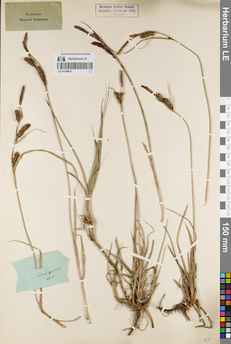
LE 01159633
Carex panicea L. det. Marschall von Bieberstein, Friedrich August
Groups of specimens: Ex herbario Marschall Bieberstein; Соглашение Минобрнауки №075-15-2021-1056Original label text:Carex panicea
Record creation: 2021-11-24, Ivan Tatanov, PhotoScan D2Citation: Specimen LE 01159633 // Virtual herbarium of Komarov Botanical Institute RAS — http://re.herbariumle.ru/01159633...
LE 01172236
Carex panicea L. det. Melnikov, Denis Germanovich at 01.08.2018
Collectors: Melnikov, Denis Germanovich; Kuropatkin Vladislav; Lalenko Il'ya Sergeevich Field collecting number: 130 а. Collection date: 01.08.2018. Administrative regions: RU-Komi - Inta (gorodskoj okrug). Groups of specimens: Образцы сектора Восточной Европы; Соглашение Минобрнауки №075-15-2021-1056; Флора Урала и прилегающих территорий (проект)Original label text:Россия, Республика Коми, городской округ Инта, грунтовая дорога в устье реки Лимбекою, пойменный луг.
Coordinates (geographic position): 65° 28′ 29.88″ N, 60° 28′ 58.8″ E ±50 m 234 m a.s.l.Record creation: 2023-07-26, Artyom Borodushkin, PhotoScan D2.Citation: Specimen LE 01172236 // Virtual herbarium of Komarov Botanical Institute RAS — http://re.herbariumle.ru/01172236GPS N 65˚28.498' E 60˚28.980', h=234 м над уровнем моря.
LE 01174248
Carex panicea L. det. Konechnaya, Galina Yurievna, Haare, Ado Oskarovich at 03.06.1992
Collectors: Konechnaya, Galina Yurievna; Haare, Ado Oskarovich Collection date: 03.06.1992. Administrative regions: RU - Leningradskaya Oblast' - Tosnenskiy Rayon. Groups of specimens: Образцы сектора Восточной Европы; Соглашение Минобрнауки №075-15-2021-1056Original label text:Ленинградская область, Тосненский район, станция Трубниково, восточнее железнодорожного переезда, луг между железной дорогой и лесом.
Coordinates (geographic position): 59° 16′ 9.43″ N, 31° 24′ 29.07″ E ±500 mRecord creation: 2023-07-26, Artyom Borodushkin, PhotoScan D2.Citation: Specimen LE 01174248 // Virtual herbarium of Komarov Botanical Institute RAS — http://re.herbariumle.ru/01174248