View
Add
Copy
Edit
Delete
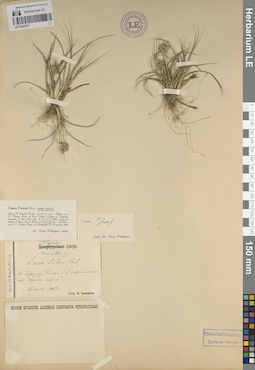
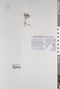
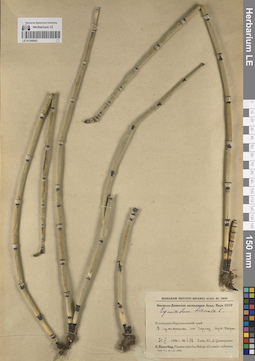
LE 01241677
Groups of specimens: Образцы сектора Восточной Европы; Соглашение Минобрнауки №075-15-2021-1056Record creation: 2023-10-12, Artyom Leostrin, PhotoScan D2.Citation: Specimen LE 01241677 // Virtual herbarium of Komarov Botanical Institute RAS — http://re.herbariumle.ru/01241677
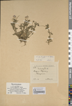
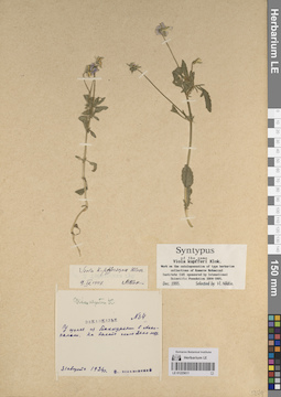
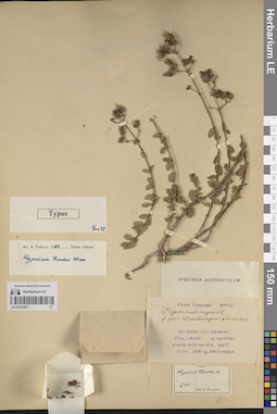
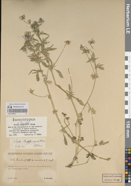
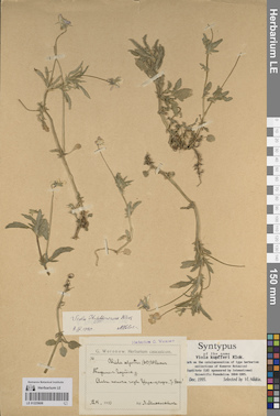
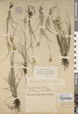
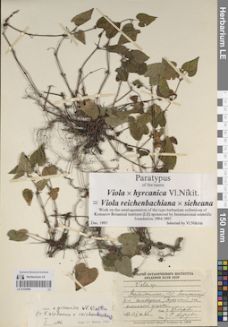
LE 01225612
Groups of specimens: Образцы сектора Кавказа; Типовые образцы сектора Кавказа; Соглашение Минобрнауки №075-15-2021-1056Record creation: 2023-10-13, Elena Portenier, PhotoScan D2.Citation: Specimen LE 01225612 // Virtual herbarium of Komarov Botanical Institute RAS — http://re.herbariumle.ru/01225612
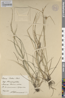
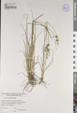
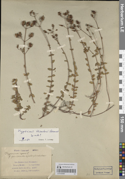
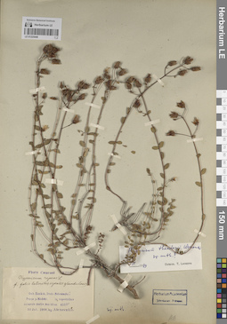
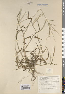
LE 01241590
Groups of specimens: Образцы сектора Восточной Европы; Соглашение Минобрнауки №075-15-2021-1056Record creation: 2023-10-04, Artyom Leostrin, PhotoScan D2.Citation: Specimen LE 01241590 // Virtual herbarium of Komarov Botanical Institute RAS — http://re.herbariumle.ru/01241590
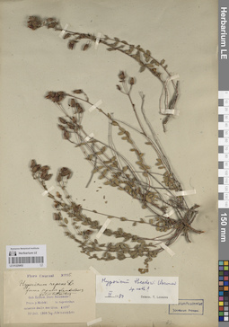
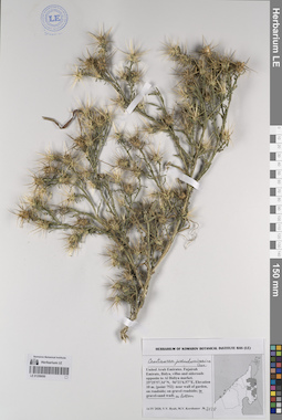
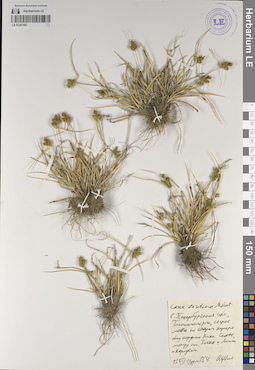
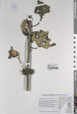
LE 01225452
Groups of specimens: Образцы сектора Кавказа; Типовые образцы сектора Кавказа; Соглашение Минобрнауки №075-15-2021-1056Record creation: 2023-10-11, Elena Portenier, PhotoScan D2.Citation: Specimen LE 01225452 // Virtual herbarium of Komarov Botanical Institute RAS — http://re.herbariumle.ru/01225452
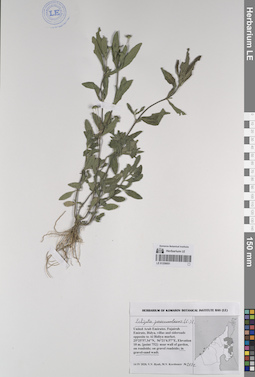
LE 01259051
Eclipta prostrata (L.) L. det. Byalt, Vyacheslav Vyacheslavovich
Additional identifications: Eclipta procumbens Michx. det. Byalt, Vyacheslav Vyacheslavovich Collectors: Byalt, Vyacheslav Vyacheslavovich; Korshunov, Mikhail Vladimirovich Field collecting number: 2122. Collection date: 14.04.2020. Administrative regions: AE - United Arab Emirates. Place of collection: Fujairah Emirate, Bidya, villas and sideroads opposite to Al Bidiya market [point 752]: gravel-sand wadi.Groups of specimens: Образцы общего сектора; Соглашение Минобрнауки №075-15-2021-1056; Бялт В.В.: Флора ФуджейрыOriginal label text: United Arab Emirates, Fujairah Emirate, Bidya, villas and sideroads opposite to Al Bidiya market. 25°25'57.34"N, 56°21'6.57"E, elevation 10 m. [point 752]: in gravel-sand wadi, 14 IV 2020, fl., fr., V.V. Byalt, M.V. Korshunov 2122
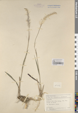
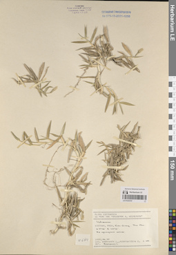
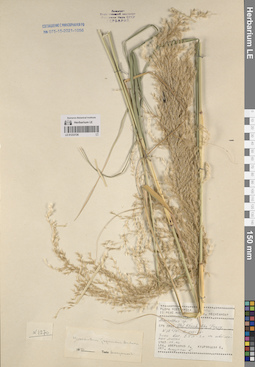
LE 01233728
Imperata sp. det. Averyanov, Leonid Vladimirovich at 25.06.1989
Collectors: Averyanov, Leonid Vladimirovich; Kudryavtzeva, Ekaterina Petrovna Field collecting number: Averyanov642. Collection date: 25.06.1989. Administrative regions: VN - Tinh Kien Giang. Groups of specimens: L. V. Averyanov specimens; L. V. Averyanov herbarium; Соглашение Минобрнауки №075-15-2021-1056; Flora of VietnamRecord creation: 2023-10-06, Galina Savich, PhotoScan D2.Citation: Specimen LE 01233728 // Virtual herbarium of Komarov Botanical Institute RAS — http://re.herbariumle.ru/01233728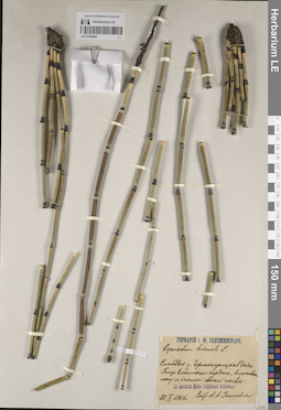
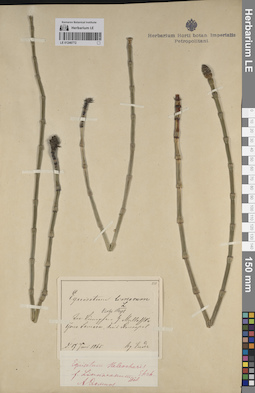
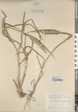
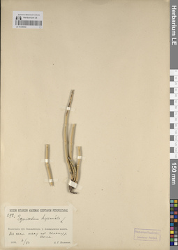
LE 01246847
Groups of specimens: Образцы сектора Восточной Европы; Флора Урала и прилегающих территорий (проект); Соглашение Минобрнауки №075-15-2021-1056Record creation: 2023-10-03, Denis Melnikov, PhotoScan D2.Citation: Specimen LE 01246847 // Virtual herbarium of Komarov Botanical Institute RAS — http://re.herbariumle.ru/01246847
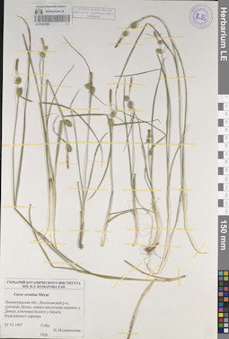
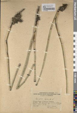
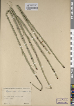
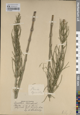
LE 01246773
Equisetum limosum L. f. verticillatum Döll.
Collectors: Korshinsky, Sergei Ivanovitsch Collection date: 03.06.1885. Administrative regions: RU - Tatarstan - Novosheshminskiy Rayon. Groups of specimens: Образцы сектора Восточной Европы; Флора Урала и прилегающих территорий (проект); Соглашение Минобрнауки №075-15-2021-1056Original label text:У Новошешминска. В озерах. Gub. Kasan. Distr. Tschistopol. (Казанская губерния. Чистопольский район.)
Record creation: 2023-10-02, Denis Melnikov, PhotoScan D2.Citation: Specimen LE 01246773 // Virtual herbarium of Komarov Botanical Institute RAS — http://re.herbariumle.ru/01246773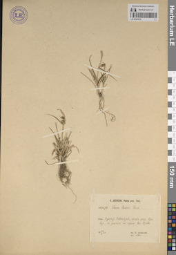
LE 01241676
Groups of specimens: Образцы сектора Восточной Европы; Соглашение Минобрнауки №075-15-2021-1056Record creation: 2023-10-12, Artyom Leostrin, PhotoScan D2.Citation: Specimen LE 01241676 // Virtual herbarium of Komarov Botanical Institute RAS — http://re.herbariumle.ru/01241676
LE 01225611
Groups of specimens: Образцы сектора Кавказа; Типовые образцы сектора Кавказа; Соглашение Минобрнауки №075-15-2021-1056Record creation: 2023-10-13, Elena Portenier, PhotoScan D2.Citation: Specimen LE 01225611 // Virtual herbarium of Komarov Botanical Institute RAS — http://re.herbariumle.ru/01225611
LE 01241589
Groups of specimens: Образцы сектора Восточной Европы; Соглашение Минобрнауки №075-15-2021-1056Record creation: 2023-10-04, Artyom Leostrin, PhotoScan D2.Citation: Specimen LE 01241589 // Virtual herbarium of Komarov Botanical Institute RAS — http://re.herbariumle.ru/01241589
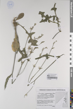
LE 01259050
Centaurea pseudosinaica Czerep. det. Byalt, Vyacheslav Vyacheslavovich
Collectors: Byalt, Vyacheslav Vyacheslavovich; Korshunov, Mikhail Vladimirovich Field collecting number: 2128. Collection date: 14.04.2020. Administrative regions: AE - United Arab Emirates. Place of collection: Fujairah Emirate, Bidya, villas and sideroads opposite to Al Bidiya market [point 752]: in gravel-sand wadi bottom.Groups of specimens: Образцы общего сектора; Соглашение Минобрнауки №075-15-2021-1056; Бялт В.В.: Флора ФуджейрыOriginal label text: United Arab Emirates, Fujairah Emirate, Bidya, villas and sideroads opposite to Al Bidiya market. 25°25'57.34"N, 56°21'6.57"E, elevation 10 m. [point 752]: in gravel-sand wadi bottom, 14 IV 2020, fl., fr., V.V. Byalt, M.V. Korshunov 2128
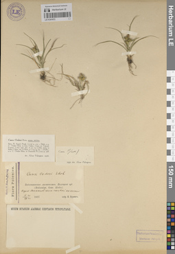
LE 01225451
Groups of specimens: Образцы сектора Кавказа; Типовые образцы сектора Кавказа; Соглашение Минобрнауки №075-15-2021-1056Record creation: 2023-10-11, Elena Portenier, PhotoScan D2.Citation: Specimen LE 01225451 // Virtual herbarium of Komarov Botanical Institute RAS — http://re.herbariumle.ru/01225451
LE 01233727
Ischaemum sp. det. Averyanov, Leonid Vladimirovich at 25.06.1989
Collectors: Averyanov, Leonid Vladimirovich; Kudryavtzeva, Ekaterina Petrovna Field collecting number: Averyanov644. Collection date: 25.06.1989. Administrative regions: VN - Tinh Kien Giang. Groups of specimens: L. V. Averyanov specimens; L. V. Averyanov herbarium; Соглашение Минобрнауки №075-15-2021-1056; Flora of VietnamRecord creation: 2023-10-06, Galina Savich, PhotoScan D2.Citation: Specimen LE 01233727 // Virtual herbarium of Komarov Botanical Institute RAS — http://re.herbariumle.ru/01233727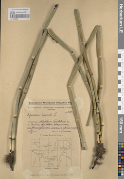
LE 01246846
Groups of specimens: Образцы сектора Восточной Европы; Флора Урала и прилегающих территорий (проект); Соглашение Минобрнауки №075-15-2021-1056Record creation: 2023-10-03, Denis Melnikov, PhotoScan D2.Citation: Specimen LE 01246846 // Virtual herbarium of Komarov Botanical Institute RAS — http://re.herbariumle.ru/01246846
LE 01246772
Equisetum limosum L.
Collectors: illegible Collection date: 17.06.1865. Administrative regions: RU - Russian Federation. Groups of specimens: Образцы сектора Восточной Европы; Флора Урала и прилегающих территорий (проект); Соглашение Минобрнауки №075-15-2021-1056Original label text:(нечитаемый текст) Stavropol (Ставрополь/Ставропольский)
Record creation: 2023-10-02, Denis Melnikov, PhotoScan D2.. Processing status: label contains unreadable dataCitation: Specimen LE 01246772 // Virtual herbarium of Komarov Botanical Institute RAS — http://re.herbariumle.ru/01246772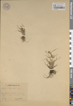
LE 01241675
Groups of specimens: Образцы сектора Восточной Европы; Соглашение Минобрнауки №075-15-2021-1056Record creation: 2023-10-12, Artyom Leostrin, PhotoScan D2.Citation: Specimen LE 01241675 // Virtual herbarium of Komarov Botanical Institute RAS — http://re.herbariumle.ru/01241675
LE 01241588
Groups of specimens: Образцы сектора Восточной Европы; Соглашение Минобрнауки №075-15-2021-1056Record creation: 2023-10-04, Artyom Leostrin, PhotoScan D2.Citation: Specimen LE 01241588 // Virtual herbarium of Komarov Botanical Institute RAS — http://re.herbariumle.ru/01241588
LE 01225610
Groups of specimens: Образцы сектора Кавказа; Типовые образцы сектора Кавказа; Соглашение Минобрнауки №075-15-2021-1056Record creation: 2023-10-13, Elena Portenier, PhotoScan D2.Citation: Specimen LE 01225610 // Virtual herbarium of Komarov Botanical Institute RAS — http://re.herbariumle.ru/01225610
LE 01225450
Groups of specimens: Образцы сектора Кавказа; Типовые образцы сектора Кавказа; Соглашение Минобрнауки №075-15-2021-1056Record creation: 2023-10-11, Elena Portenier, PhotoScan D2.Citation: Specimen LE 01225450 // Virtual herbarium of Komarov Botanical Institute RAS — http://re.herbariumle.ru/01225450
LE 01259049
Atractylis cancellata L. det. Byalt, Vyacheslav Vyacheslavovich
Collectors: Byalt, Vyacheslav Vyacheslavovich; Korshunov, Vladimir Mikhailovich; Melnikov, Denis Germanovich Field collecting number: 126. Collection date: 18.04.2022. Administrative regions: AE - United Arab Emirates. Place of collection: Emirate of Fujaira, environs of Tawaian, high mountains on border with Musandam (Oman) [point 707d]: by side of small baghara field.Groups of specimens: Образцы общего сектора; Соглашение Минобрнауки №075-15-2021-1056; Бялт В.В.: Флора ФуджейрыOriginal label text: United Arab Emirates. Emirate of Fujaira, environs of Tawaian, high mountains on border with Musandam (Oman), 25°38’ N, 56° 07’ E, 1000–1126 m alt. [point 707d]: by side of small baghara field, 18 IV 2022, fr., V.V. Byalt, V.M. Korshunov, D.G. Melnikov 126
LE 01233726
Miscanthus japonicus Andersson det. Averyanov, Leonid Vladimirovich at 1988
Collectors: Averyanov, Leonid Vladimirovich; Kudryavtzeva, Ekaterina Petrovna Field collecting number: Averyanov1270. Collection date: 17.04.1987. Administrative regions: VN - Tinh Khanh Hoa. Groups of specimens: L. V. Averyanov specimens; L. V. Averyanov herbarium; Соглашение Минобрнауки №075-15-2021-1056; Flora of VietnamRecord creation: 2023-10-06, Galina Savich, PhotoScan D2.Citation: Specimen LE 01233726 // Virtual herbarium of Komarov Botanical Institute RAS — http://re.herbariumle.ru/01233726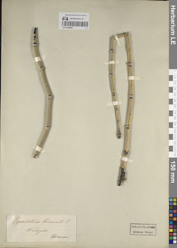
LE 01246845
Groups of specimens: Образцы сектора Восточной Европы; Флора Урала и прилегающих территорий (проект); Соглашение Минобрнауки №075-15-2021-1056Record creation: 2023-10-03, Denis Melnikov, PhotoScan D2.Citation: Specimen LE 01246845 // Virtual herbarium of Komarov Botanical Institute RAS — http://re.herbariumle.ru/01246845
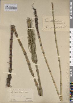
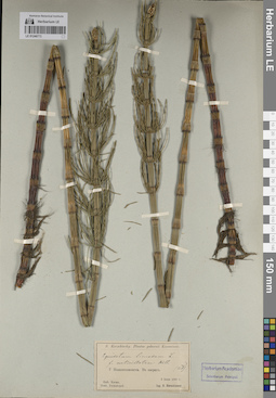
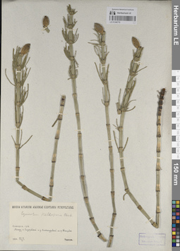
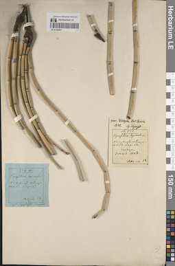
LE 01246771
Equisetum heleocharis Ehrh.
Collectors: Korshinsky, Sergei Ivanovitsch Collection date: 03.06.1885. Administrative regions: RU - Tatarstan - Novosheshminskiy Rayon. Groups of specimens: Образцы сектора Восточной Европы; Флора Урала и прилегающих территорий (проект); Соглашение Минобрнауки №075-15-2021-1056Original label text:У Новошешминска. В озерах. Gub. Kasan. Distr. Tschistopol. (Казанская губерния. Чистопольский район.)
Record creation: 2023-10-02, Denis Melnikov, PhotoScan D2.Citation: Specimen LE 01246771 // Virtual herbarium of Komarov Botanical Institute RAS — http://re.herbariumle.ru/01246771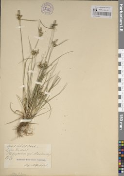
LE 01241674
Groups of specimens: Образцы сектора Восточной Европы; Соглашение Минобрнауки №075-15-2021-1056Record creation: 2023-10-12, Artyom Leostrin, PhotoScan D2.Citation: Specimen LE 01241674 // Virtual herbarium of Komarov Botanical Institute RAS — http://re.herbariumle.ru/01241674
LE 01241587
Groups of specimens: Образцы сектора Восточной Европы; Соглашение Минобрнауки №075-15-2021-1056Record creation: 2023-10-04, Artyom Leostrin, PhotoScan D2.Citation: Specimen LE 01241587 // Virtual herbarium of Komarov Botanical Institute RAS — http://re.herbariumle.ru/01241587
LE 01225609
Groups of specimens: Образцы сектора Кавказа; Типовые образцы сектора Кавказа; Соглашение Минобрнауки №075-15-2021-1056Record creation: 2023-10-13, Elena Portenier, PhotoScan D2.Citation: Specimen LE 01225609 // Virtual herbarium of Komarov Botanical Institute RAS — http://re.herbariumle.ru/01225609

LE 01225449
Groups of specimens: Образцы сектора Кавказа; Типовые образцы сектора Кавказа; Соглашение Минобрнауки №075-15-2021-1056Record creation: 2023-10-11, Elena Portenier, PhotoScan D2.Citation: Specimen LE 01225449 // Virtual herbarium of Komarov Botanical Institute RAS — http://re.herbariumle.ru/01225449
LE 01259048
Filago desertorum Pomel det. Byalt, Vyacheslav Vyacheslavovich
Collectors: Byalt, Vyacheslav Vyacheslavovich Field collecting number: 326. Collection date: 27.03.2017. Administrative regions: AE - United Arab Emirates. Place of collection: Фуджейра, окрестности пос. Тавайан, уступы и трещины скал.Groups of specimens: Образцы общего сектора; Соглашение Минобрнауки №075-15-2021-1056; Бялт В.В.: Флора ФуджейрыOriginal label text: United Arab Emirates. Emirate of Fujaira, environs of Tawaian, 25°38, 989’ N, 56° 07, 296’ E, 1200–1367 m alt.: rocks and rocky ledges. – ОАЭ, Фуджейра, окрестности пос. Тавайан, 25°38, 989’ N, 56° 07, 296’ E, 1200–1367 м н. ур. м.: уступы и трещины скал, 27 III 2017, veg. juv., V.V. Byalt 326
LE 01246844
Groups of specimens: Образцы сектора Восточной Европы; Флора Урала и прилегающих территорий (проект); Соглашение Минобрнауки №075-15-2021-1056Record creation: 2023-10-03, Denis Melnikov, PhotoScan D2.Citation: Specimen LE 01246844 // Virtual herbarium of Komarov Botanical Institute RAS — http://re.herbariumle.ru/01246844
LE 01246770
Equisetum heleocharis Ehrh.
Collectors: Terekhov, Alexander Fedorovich Collection date: 27.05.1920. Administrative regions: RU - Samarskaya Oblast'. Groups of specimens: Образцы сектора Восточной Европы; Флора Урала и прилегающих территорий (проект); Соглашение Минобрнауки №075-15-2021-1056Original label text:Самарская губерния Между селом Сидоровкой и деревней Александровкой, по реке Танцовке.
Record creation: 2023-10-02, Denis Melnikov, PhotoScan D2.Citation: Specimen LE 01246770 // Virtual herbarium of Komarov Botanical Institute RAS — http://re.herbariumle.ru/01246770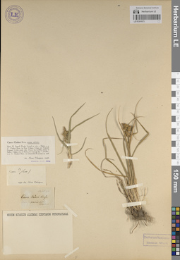
LE 01241673
Groups of specimens: Образцы сектора Восточной Европы; Соглашение Минобрнауки №075-15-2021-1056Record creation: 2023-10-12, Artyom Leostrin, PhotoScan D2.Citation: Specimen LE 01241673 // Virtual herbarium of Komarov Botanical Institute RAS — http://re.herbariumle.ru/01241673
LE 01233725
Echinochloa sp. det. Averyanov, Leonid Vladimirovich at 29.03.1987
Collectors: Averyanov, Leonid Vladimirovich; Kudryavtzeva, Ekaterina Petrovna Field collecting number: Averyanov615. Collection date: 29.03.1987. Administrative regions: VN - Tinh Quang Nam. Groups of specimens: L. V. Averyanov specimens; L. V. Averyanov herbarium; Соглашение Минобрнауки №075-15-2021-1056; Flora of VietnamRecord creation: 2023-10-06, Galina Savich, PhotoScan D2.Citation: Specimen LE 01233725 // Virtual herbarium of Komarov Botanical Institute RAS — http://re.herbariumle.ru/01233725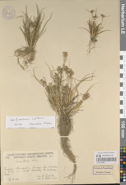
LE 01241586
Groups of specimens: Образцы сектора Восточной Европы; Соглашение Минобрнауки №075-15-2021-1056Record creation: 2023-10-04, Artyom Leostrin, PhotoScan D2.Citation: Specimen LE 01241586 // Virtual herbarium of Komarov Botanical Institute RAS — http://re.herbariumle.ru/01241586
LE 01225608
Groups of specimens: Образцы сектора Кавказа; Типовые образцы сектора Кавказа; Соглашение Минобрнауки №075-15-2021-1056Record creation: 2023-10-13, Elena Portenier, PhotoScan D2.Citation: Specimen LE 01225608 // Virtual herbarium of Komarov Botanical Institute RAS — http://re.herbariumle.ru/01225608
LE 01225448
Groups of specimens: Образцы сектора Кавказа; Типовые образцы сектора Кавказа; Соглашение Минобрнауки №075-15-2021-1056Record creation: 2023-10-11, Elena Portenier, PhotoScan D2.Citation: Specimen LE 01225448 // Virtual herbarium of Komarov Botanical Institute RAS — http://re.herbariumle.ru/01225448
LE 01259047
Helianthus annuus L. det. Byalt, Vyacheslav Vyacheslavovich
Collectors: Byalt, Vyacheslav Vyacheslavovich; Korshunov, Mikhail Vladimirovich Field collecting number: 2144. Collection date: 14.04.2020. Administrative regions: AE - United Arab Emirates. Place of collection: Fujairah Emirate, Al Bidya, villas and sideroads opposite to Al Bidiya market [point 752]: run wild in gravel-sand wadi.Groups of specimens: Образцы общего сектора; Соглашение Минобрнауки №075-15-2021-1056; Бялт В.В.: Флора ФуджейрыOriginal label text: United Arab Emirates, FE, Al Bidya, villas and sideroads opposite to Al Bidiya market. 25°25'57.34"N, 56°21'6.57"E, elevation 10 m. [point 752]: run wild in gravel-sand wadi, 14 IV 2020, fl., V. B., M. K. 2144
LE 01246843
Groups of specimens: Образцы сектора Восточной Европы; Флора Урала и прилегающих территорий (проект); Соглашение Минобрнауки №075-15-2021-1056Record creation: 2023-10-03, Denis Melnikov, PhotoScan D2.Citation: Specimen LE 01246843 // Virtual herbarium of Komarov Botanical Institute RAS — http://re.herbariumle.ru/01246843
LE 01246769
Equisetum heleocharis Ehrh.
Collectors: Litvinov, Dimitri Ivanovich Collection date: 21.07.1927. Administrative regions: RU - Samarskaya Oblast' - Gorodskoy okrug Samara. Groups of specimens: Образцы сектора Восточной Европы; Флора Урала и прилегающих территорий (проект); Соглашение Минобрнауки №075-15-2021-1056Original label text:Окрестности города Самары. Жигули. (нечитаемо). Торфяное болото
Record creation: 2023-10-02, Denis Melnikov, PhotoScan D2.. Processing status: label contains unreadable dataCitation: Specimen LE 01246769 // Virtual herbarium of Komarov Botanical Institute RAS — http://re.herbariumle.ru/01246769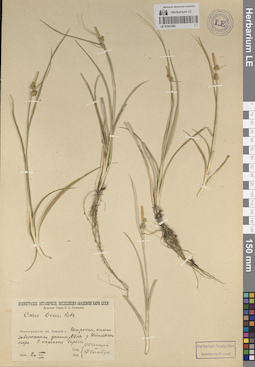
LE 01241585
Groups of specimens: Образцы сектора Восточной Европы; Соглашение Минобрнауки №075-15-2021-1056Record creation: 2023-10-04, Artyom Leostrin, PhotoScan D2.Citation: Specimen LE 01241585 // Virtual herbarium of Komarov Botanical Institute RAS — http://re.herbariumle.ru/01241585
LE 01241672
Groups of specimens: Образцы сектора Восточной Европы; Соглашение Минобрнауки №075-15-2021-1056Record creation: 2023-10-12, Artyom Leostrin, PhotoScan D2.Citation: Specimen LE 01241672 // Virtual herbarium of Komarov Botanical Institute RAS — http://re.herbariumle.ru/01241672
LE 01233724
Digitaria sp. det. Averyanov, Leonid Vladimirovich at 29.03.1987
Collectors: Averyanov, Leonid Vladimirovich; Kudryavtzeva, Ekaterina Petrovna Field collecting number: Averyanov585. Collection date: 29.03.1987. Administrative regions: VN - Tinh Quang Nam. Groups of specimens: L. V. Averyanov specimens; L. V. Averyanov herbarium; Соглашение Минобрнауки №075-15-2021-1056; Flora of VietnamRecord creation: 2023-10-06, Galina Savich, PhotoScan D2.Citation: Specimen LE 01233724 // Virtual herbarium of Komarov Botanical Institute RAS — http://re.herbariumle.ru/01233724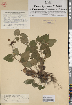
LE 01225607
Groups of specimens: Образцы сектора Кавказа; Типовые образцы сектора Кавказа; Соглашение Минобрнауки №075-15-2021-1056Record creation: 2023-10-13, Elena Portenier, PhotoScan D2.Citation: Specimen LE 01225607 // Virtual herbarium of Komarov Botanical Institute RAS — http://re.herbariumle.ru/01225607
LE 01246842
Groups of specimens: Образцы сектора Восточной Европы; Флора Урала и прилегающих территорий (проект); Соглашение Минобрнауки №075-15-2021-1056Record creation: 2023-10-03, Denis Melnikov, PhotoScan D2.Citation: Specimen LE 01246842 // Virtual herbarium of Komarov Botanical Institute RAS — http://re.herbariumle.ru/01246842
LE 01259046
Launaea nudicaulis (L.) Hook. f. det. Byalt, Vyacheslav Vyacheslavovich
Additional identifications: Launaea massauensis (Fresen.) Sch. Bip. ex Kuntze det. Byalt, Vyacheslav Vyacheslavovich Collectors: Byalt, Vyacheslav Vyacheslavovich; Korshunov, Mikhail Vladimirovich Field collecting number: 1985. Collection date: 04.04.2018. Administrative regions: AE - United Arab Emirates. Place of collection: Фуджейра, пос. Аль Бидия, сорное вдоль забора сада.Groups of specimens: Образцы общего сектора; Соглашение Минобрнауки №075-15-2021-1056; Бялт В.В.: Флора ФуджейрыOriginal label text: United Arab Emirates. Emirate of Fujaira, village Al Bidiyah, 25°26'13" N, 56°20'2"° Е: weed along fence of garden. – ОАЭ, Фуджейра, посёлок Аль Бидия, 25°26'13" N, 56°20'2"° Е: сорняк вдоль забора сада, 3–4 IV 2018, V.V. Byalt, M.V. Korshunov 1985
LE 01246768
Equisetum heleocharis Ehrh.
Collectors: Korshinsky, Sergei Ivanovitsch Administrative regions: RU - Russian Federation. Groups of specimens: Образцы сектора Восточной Европы; Флора Урала и прилегающих территорий (проект); Соглашение Минобрнауки №075-15-2021-1056Original label text:Теньки по берегу реки Волги. (Казанская губерния). Стоячие воды.
Record creation: 2023-10-02, Denis Melnikov, PhotoScan D2.Citation: Specimen LE 01246768 // Virtual herbarium of Komarov Botanical Institute RAS — http://re.herbariumle.ru/01246768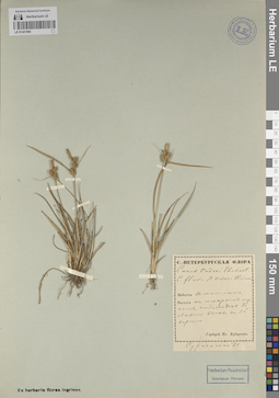
LE 01241584
Groups of specimens: Образцы сектора Восточной Европы; Соглашение Минобрнауки №075-15-2021-1056Record creation: 2023-10-04, Artyom Leostrin, PhotoScan D2.Citation: Specimen LE 01241584 // Virtual herbarium of Komarov Botanical Institute RAS — http://re.herbariumle.ru/01241584
LE 01241671
Groups of specimens: Образцы сектора Восточной Европы; Соглашение Минобрнауки №075-15-2021-1056Record creation: 2023-10-12, Artyom Leostrin, PhotoScan D2.Citation: Specimen LE 01241671 // Virtual herbarium of Komarov Botanical Institute RAS — http://re.herbariumle.ru/01241671
LE 01225606
Groups of specimens: Образцы сектора Кавказа; Типовые образцы сектора Кавказа; Соглашение Минобрнауки №075-15-2021-1056Record creation: 2023-10-13, Elena Portenier, PhotoScan D2.Citation: Specimen LE 01225606 // Virtual herbarium of Komarov Botanical Institute RAS — http://re.herbariumle.ru/01225606
LE 01246841
Groups of specimens: Образцы сектора Восточной Европы; Флора Урала и прилегающих территорий (проект); Соглашение Минобрнауки №075-15-2021-1056Record creation: 2023-10-03, Denis Melnikov, PhotoScan D2.Citation: Specimen LE 01246841 // Virtual herbarium of Komarov Botanical Institute RAS — http://re.herbariumle.ru/01246841