View
Add
Copy
Edit
Delete
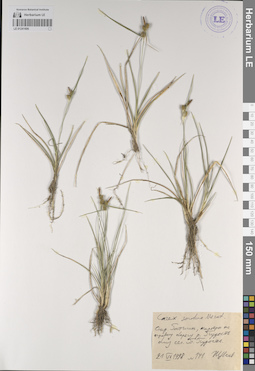
LE 01225631
Groups of specimens: Образцы сектора Кавказа; Типовые образцы сектора Кавказа; Соглашение Минобрнауки №075-15-2021-1056Record creation: 2023-10-13, Elena Portenier, PhotoScan D2.Citation: Specimen LE 01225631 // Virtual herbarium of Komarov Botanical Institute RAS — http://re.herbariumle.ru/01225631
LE 01225690
Groups of specimens: Образцы сектора Кавказа; Типовые образцы сектора Кавказа; Соглашение Минобрнауки №075-15-2021-1056Record creation: 2023-10-11, Elena Portenier, PhotoScan D2.Citation: Specimen LE 01225690 // Virtual herbarium of Komarov Botanical Institute RAS — http://re.herbariumle.ru/01225690
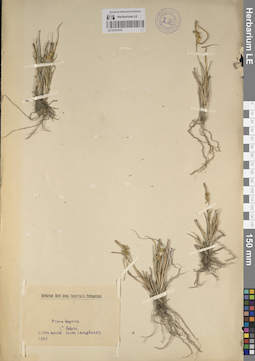
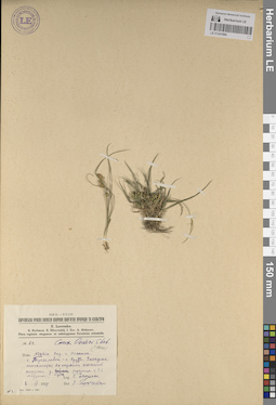
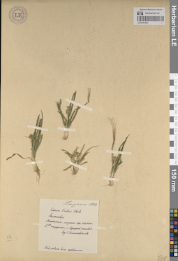
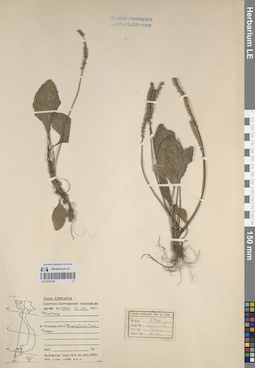
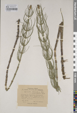
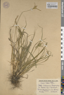
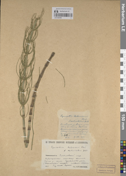
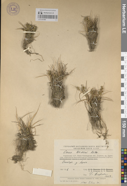
LE 01241610
Groups of specimens: Образцы сектора Восточной Европы; Соглашение Минобрнауки №075-15-2021-1056Record creation: 2023-10-04, Artyom Leostrin, PhotoScan D2.Citation: Specimen LE 01241610 // Virtual herbarium of Komarov Botanical Institute RAS — http://re.herbariumle.ru/01241610
LE 01246867
Groups of specimens: Образцы сектора Восточной Европы; Флора Урала и прилегающих территорий (проект); Соглашение Минобрнауки №075-15-2021-1056Record creation: 2023-10-03, Denis Melnikov, PhotoScan D2.Citation: Specimen LE 01246867 // Virtual herbarium of Komarov Botanical Institute RAS — http://re.herbariumle.ru/01246867
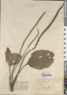
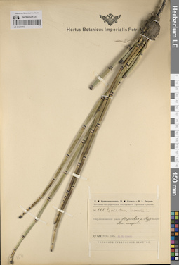
LE 01233745
Pittosporum sp. det. Averyanov, Leonid Vladimirovich at 21.11.2014
Collectors: Averyanov, Leonid Vladimirovich; et al. Field collecting number: CPC7590. Collection date: 21.11.2014. Administrative regions: VN - Tinh Cao Bang. Groups of specimens: L. V. Averyanov specimens; L. V. Averyanov herbarium; Соглашение Минобрнауки №075-15-2021-1056; Flora of VietnamRecord creation: 2023-10-06, Galina Savich, PhotoScan D2.Citation: Specimen LE 01233745 // Virtual herbarium of Komarov Botanical Institute RAS — http://re.herbariumle.ru/01233745
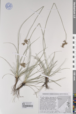
LE 01259067
Cyperus rotundus L. det. Byalt, Vyacheslav Vyacheslavovich
Collectors: Byalt, Vyacheslav Vyacheslavovich; Korshunov, Mikhail Vladimirovich Field collecting number: 2972. Collection date: 15.05.2020. Administrative regions: AE - United Arab Emirates. Place of collection: Fujairah Emirate, Al Bidiya, Al Qalamoon Nursery, 0.3 km East from Eid Prayer Ground Bidyah [point 781]: weed on irrigation under date palm.Groups of specimens: Образцы общего сектора; Соглашение Минобрнауки №075-15-2021-1056; Бялт В.В.: Флора ФуджейрыOriginal label text: United Arab Emirates, Fujairah Emirate, Al Bidiya, Al Qalamoon Nursery, 0.3 km East from Eid Prayer Ground Bidyah, 25°25'24.70"N, 56°20'18.77"E, Elevation 22 m [point 781]: weed on irrigation under date palm, 15 V 2020, fl., V.V. Byalt, M.V. Korshunov 2972
LE 01241695
Groups of specimens: Образцы сектора Восточной Европы; Соглашение Минобрнауки №075-15-2021-1056Record creation: 2023-10-12, Artyom Leostrin, PhotoScan D2.Citation: Specimen LE 01241695 // Virtual herbarium of Komarov Botanical Institute RAS — http://re.herbariumle.ru/01241695
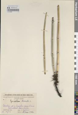
LE 01246793
Equisetum heleocharis Ehrh. det. Busch
Collectors: Busch Collection date: 05.07.1927. Administrative regions: RU - Nizhegorodskaya Oblast'. Groups of specimens: Образцы сектора Восточной Европы; Флора Урала и прилегающих территорий (проект); Соглашение Минобрнауки №075-15-2021-1056Original label text:Против совхоза "Зименки" Нижегородских губернии и уезда Левый берег реки Волги. Зименковские поемные луга. Центральная пойма, болотистая западина.
Record creation: 2023-10-02, Denis Melnikov, PhotoScan D2.Citation: Specimen LE 01246793 // Virtual herbarium of Komarov Botanical Institute RAS — http://re.herbariumle.ru/01246793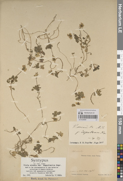
LE 01225630
Groups of specimens: Образцы сектора Кавказа; Типовые образцы сектора Кавказа; Соглашение Минобрнауки №075-15-2021-1056Record creation: 2023-10-13, Elena Portenier, PhotoScan D2.Citation: Specimen LE 01225630 // Virtual herbarium of Komarov Botanical Institute RAS — http://re.herbariumle.ru/01225630
LE 01241609
Groups of specimens: Образцы сектора Восточной Европы; Соглашение Минобрнауки №075-15-2021-1056Record creation: 2023-10-04, Artyom Leostrin, PhotoScan D2.Citation: Specimen LE 01241609 // Virtual herbarium of Komarov Botanical Institute RAS — http://re.herbariumle.ru/01241609
LE 01246866
Groups of specimens: Образцы сектора Восточной Европы; Флора Урала и прилегающих территорий (проект); Соглашение Минобрнауки №075-15-2021-1056Record creation: 2023-10-03, Denis Melnikov, PhotoScan D2.Citation: Specimen LE 01246866 // Virtual herbarium of Komarov Botanical Institute RAS — http://re.herbariumle.ru/01246866
LE 01225689
Groups of specimens: Образцы сектора Кавказа; Типовые образцы сектора Кавказа; Соглашение Минобрнауки №075-15-2021-1056Record creation: 2023-10-11, Elena Portenier, PhotoScan D2.Citation: Specimen LE 01225689 // Virtual herbarium of Komarov Botanical Institute RAS — http://re.herbariumle.ru/01225689
LE 01241694
Groups of specimens: Образцы сектора Восточной Европы; Соглашение Минобрнауки №075-15-2021-1056Record creation: 2023-10-12, Artyom Leostrin, PhotoScan D2.Citation: Specimen LE 01241694 // Virtual herbarium of Komarov Botanical Institute RAS — http://re.herbariumle.ru/01241694
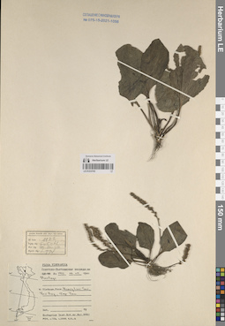
LE 01233744
Plantago sp. at 27.08.1961
Collectors: Unknown Field collecting number: 4058. Collection date: 27.08.1961. Administrative regions: VN - Thanh Pho Ha Noi. Groups of specimens: L. V. Averyanov specimens; L. V. Averyanov herbarium; Соглашение Минобрнауки №075-15-2021-1056; Flora of VietnamRecord creation: 2023-10-06, Galina Savich, PhotoScan D2.Citation: Specimen LE 01233744 // Virtual herbarium of Komarov Botanical Institute RAS — http://re.herbariumle.ru/01233744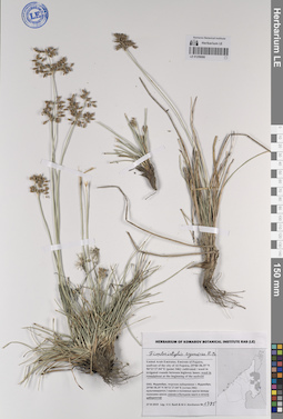
LE 01259066
Fimbristylis cymosa R.Br. det. Byalt, Vyacheslav Vyacheslavovich
Collectors: Byalt, Vyacheslav Vyacheslavovich; Korshunov, Mikhail Vladimirovich Field collecting number: 1785. Collection date: 27.11.2019. Administrative regions: AE - United Arab Emirates. Place of collection: Фуджейра, морская набережная г. Фуджейра [точка 346]: сорное в большом круге в начале набережной.Groups of specimens: Образцы общего сектора; Соглашение Минобрнауки №075-15-2021-1056; Бялт В.В.: Флора ФуджейрыOriginal label text: United Arab Emirates. Emirate of Fujaira, seafront of the city of Al Fujeira, 25°06'38.35"N 56°21'27.04"E [point 346]: weed in roundabout at the beginning of the seefront. – ОАЭ, Фуджейра, морская набережная г. Фуджейра, 25°06'38.35"N 56°21'27.04"E [точка 346]: сорняк в большом круге в начале набережной, 27 XI 2019, fl., fr., V.V. Byalt & M.V. Korshunov 1785
LE 01225629
Groups of specimens: Образцы сектора Кавказа; Типовые образцы сектора Кавказа; Соглашение Минобрнауки №075-15-2021-1056Record creation: 2023-10-13, Elena Portenier, PhotoScan D2.Citation: Specimen LE 01225629 // Virtual herbarium of Komarov Botanical Institute RAS — http://re.herbariumle.ru/01225629
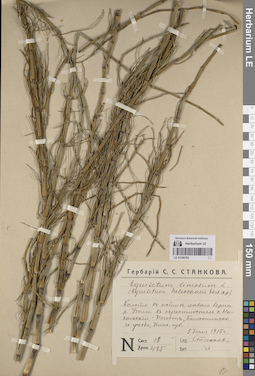
LE 01246792
Equisetum limosum L. det. illegible
Collectors: Stankov, Sergei Sergeevich Field collecting number: 18/485. Collection date: 05.07.1915. Administrative regions: RU - Nizhegorodskaya Oblast' - Balakhninskiy Rayon. Groups of specimens: Образцы сектора Восточной Европы; Флора Урала и прилегающих территорий (проект); Соглашение Минобрнауки №075-15-2021-1056Original label text:Болото в пойме левого берега реки Узолы в окрестностях села Никольский-Погост, Балахнинского уезда, Нижегородской губернии
Record creation: 2023-10-02, Denis Melnikov, PhotoScan D2.Citation: Specimen LE 01246792 // Virtual herbarium of Komarov Botanical Institute RAS — http://re.herbariumle.ru/01246792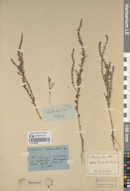
LE 01225688
Groups of specimens: Образцы сектора Кавказа; Типовые образцы сектора Кавказа; Соглашение Минобрнауки №075-15-2021-1056Record creation: 2023-10-11, Elena Portenier, PhotoScan D2.Citation: Specimen LE 01225688 // Virtual herbarium of Komarov Botanical Institute RAS — http://re.herbariumle.ru/01225688

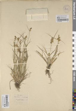
LE 01241608
Groups of specimens: Образцы сектора Восточной Европы; Соглашение Минобрнауки №075-15-2021-1056Record creation: 2023-10-04, Artyom Leostrin, PhotoScan D2.Citation: Specimen LE 01241608 // Virtual herbarium of Komarov Botanical Institute RAS — http://re.herbariumle.ru/01241608
LE 01246865
Groups of specimens: Образцы сектора Восточной Европы; Флора Урала и прилегающих территорий (проект); Соглашение Минобрнауки №075-15-2021-1056Record creation: 2023-10-03, Denis Melnikov, PhotoScan D2.Citation: Specimen LE 01246865 // Virtual herbarium of Komarov Botanical Institute RAS — http://re.herbariumle.ru/01246865
LE 01241607
Groups of specimens: Образцы сектора Восточной Европы; Соглашение Минобрнауки №075-15-2021-1056Record creation: 2023-10-04, Artyom Leostrin, PhotoScan D2.Citation: Specimen LE 01241607 // Virtual herbarium of Komarov Botanical Institute RAS — http://re.herbariumle.ru/01241607
LE 01241693
Groups of specimens: Образцы сектора Восточной Европы; Соглашение Минобрнауки №075-15-2021-1056Record creation: 2023-10-12, Artyom Leostrin, PhotoScan D2.Citation: Specimen LE 01241693 // Virtual herbarium of Komarov Botanical Institute RAS — http://re.herbariumle.ru/01241693
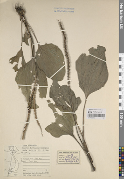
LE 01233743
Plantago sp. at 06.05.1961
Collectors: Unknown Field collecting number: 1922. Collection date: 06.05.1961. Administrative regions: VN - Tinh Yen Bai. Groups of specimens: L. V. Averyanov specimens; L. V. Averyanov herbarium; Соглашение Минобрнауки №075-15-2021-1056Record creation: 2023-10-06, Galina Savich, PhotoScan D2.Citation: Specimen LE 01233743 // Virtual herbarium of Komarov Botanical Institute RAS — http://re.herbariumle.ru/01233743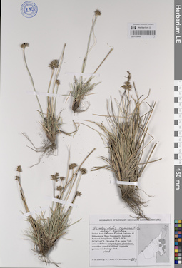
LE 01259065
Fimbristylis cymosa R. Br. ssp. cymosa R. Br. det. Byalt, Vyacheslav Vyacheslavovich
Collectors: Byalt, Vyacheslav Vyacheslavovich; Korshunov, Mikhail Vladimirovich Field collecting number: 689. Collection date: 17.03.2020. Administrative regions: AE - United Arab Emirates. Place of collection: Fujairah Emirate, Al Dibba town, Wam Community. Fujairah National Dairy Farm [point 714]: weed on irrigated grass plantation.Groups of specimens: Образцы общего сектора; Соглашение Минобрнауки №075-15-2021-1056; Бялт В.В.: Флора ФуджейрыOriginal label text: United Arab Emirates, Fujairah Emirate, Al Dibba town, Wam Community. Fujairah National Dairy Farm.
25°36'2.49"N, 56°14'2.64"E, elevation 25 m. [point 714]: weed on irrigated grass plantation, 17 III 2020, fl., fr., V.V. Byalt, M.V. Korshunov 689
LE 01225628
Groups of specimens: Образцы сектора Кавказа; Типовые образцы сектора Кавказа; Соглашение Минобрнауки №075-15-2021-1056Record creation: 2023-10-13, Elena Portenier, PhotoScan D2.Citation: Specimen LE 01225628 // Virtual herbarium of Komarov Botanical Institute RAS — http://re.herbariumle.ru/01225628
LE 01225687
Groups of specimens: Образцы сектора Кавказа; Типовые образцы сектора Кавказа; Соглашение Минобрнауки №075-15-2021-1056Record creation: 2023-10-11, Elena Portenier, PhotoScan D2.Citation: Specimen LE 01225687 // Virtual herbarium of Komarov Botanical Institute RAS — http://re.herbariumle.ru/01225687
LE 01246864
Groups of specimens: Образцы сектора Восточной Европы; Флора Урала и прилегающих территорий (проект); Соглашение Минобрнауки №075-15-2021-1056Record creation: 2023-10-03, Denis Melnikov, PhotoScan D2.Citation: Specimen LE 01246864 // Virtual herbarium of Komarov Botanical Institute RAS — http://re.herbariumle.ru/01246864
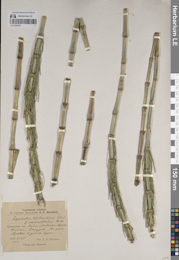
LE 01246791
Equisetum limosum L. f. verticillatum Döll. det. Schennikov, Alexander Petrovich
Collectors: Busch Collection date: 25.06.1916. Administrative regions: RU - Chuvashskaya Respublika - Krasnochetayskiy Rayon. Groups of specimens: Образцы сектора Восточной Европы; Флора Урала и прилегающих территорий (проект); Соглашение Минобрнауки №075-15-2021-1056Original label text:Курмышский уезд. Район Медяно-Красный Чатай, Заурье. На речке Уревке в долине Суры.
Record creation: 2023-10-02, Denis Melnikov, PhotoScan D2.Citation: Specimen LE 01246791 // Virtual herbarium of Komarov Botanical Institute RAS — http://re.herbariumle.ru/01246791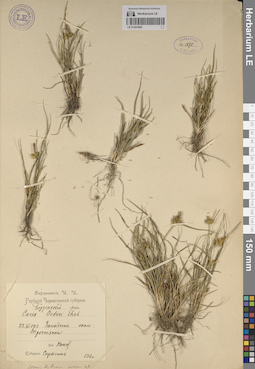
LE 01241692
Groups of specimens: Образцы сектора Восточной Европы; Соглашение Минобрнауки №075-15-2021-1056Record creation: 2023-10-12, Artyom Leostrin, PhotoScan D2.Citation: Specimen LE 01241692 // Virtual herbarium of Komarov Botanical Institute RAS — http://re.herbariumle.ru/01241692
LE 01241606
Groups of specimens: Образцы сектора Восточной Европы; Соглашение Минобрнауки №075-15-2021-1056Record creation: 2023-10-04, Artyom Leostrin, PhotoScan D2.Citation: Specimen LE 01241606 // Virtual herbarium of Komarov Botanical Institute RAS — http://re.herbariumle.ru/01241606
LE 01233742
Plantago sp. at 21.05.1961
Collectors: Unknown Field collecting number: 2349. Collection date: 21.05.1961. Administrative regions: VN - Tinh Lao Cai. Groups of specimens: L. V. Averyanov specimens; L. V. Averyanov herbarium; Соглашение Минобрнауки №075-15-2021-1056; Flora of VietnamRecord creation: 2023-10-06, Galina Savich, PhotoScan D2.Citation: Specimen LE 01233742 // Virtual herbarium of Komarov Botanical Institute RAS — http://re.herbariumle.ru/01233742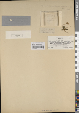
LE 01225627
Groups of specimens: Образцы сектора Кавказа; Типовые образцы сектора Кавказа; Соглашение Минобрнауки №075-15-2021-1056Record creation: 2023-10-13, Elena Portenier, PhotoScan D2.Citation: Specimen LE 01225627 // Virtual herbarium of Komarov Botanical Institute RAS — http://re.herbariumle.ru/01225627
LE 01259064
Fimbristylis cymosa R.Br. subsp. spathacea (Roth.) T. Koyama det. Byalt, Vyacheslav Vyacheslavovich
Collectors: Byalt, Vyacheslav Vyacheslavovich; Korshunov, Mikhail Vladimirovich Field collecting number: 2927. Collection date: 15.05.2020. Administrative regions: AE - United Arab Emirates. Place of collection: Fujairah Emirate, Al Bidiya, Al Qalamoon Nursery, 0.3 km East from Eid Prayer Ground Bidyah [point 781]: weed next to the water tank near the office building, in the wet and shady place behind tank.Groups of specimens: Образцы общего сектора; Соглашение Минобрнауки №075-15-2021-1056; Бялт В.В.: Флора ФуджейрыOriginal label text: United Arab Emirates, Fujairah Emirate, Al Bidiya, Al Qalamoon Nursery, 0.3 km East from Eid Prayer Ground Bidyah, 25°25'24.70"N, 56°20'18.77"E, elevation 22 m [point 781]: weed next to the water tank near the office building, in the wet and shady place behind tank, 15 V 2020, fl., fr., V.V. Byalt, M.V. Korshunov 2927
LE 01225686
Groups of specimens: Образцы сектора Кавказа; Типовые образцы сектора Кавказа; Соглашение Минобрнауки №075-15-2021-1056Record creation: 2023-10-11, Elena Portenier, PhotoScan D2.Citation: Specimen LE 01225686 // Virtual herbarium of Komarov Botanical Institute RAS — http://re.herbariumle.ru/01225686
LE 01246790
Equisetum heleocharis Ehrh. var. verticillatum Dӧll. det. Schennikov, Alexander Petrovich
Collectors: Busch Collection date: 22.07.1914. Administrative regions: RU - Ulyanovsk Oblast - Ulyanovskiy Rayon. Groups of specimens: Образцы сектора Восточной Европы; Флора Урала и прилегающих территорий (проект); Соглашение Минобрнауки №075-15-2021-1056Original label text:Ульяновский уезд, Карамзинская психиатрическая колония пойма реки Волги, прирусловая зона Заросль на иловато-песчаных сырых наносах.
Record creation: 2023-10-02, Denis Melnikov, PhotoScan D2.Citation: Specimen LE 01246790 // Virtual herbarium of Komarov Botanical Institute RAS — http://re.herbariumle.ru/01246790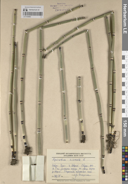
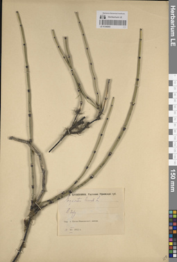
LE 01246863
Groups of specimens: Образцы сектора Восточной Европы; Флора Урала и прилегающих территорий (проект); Соглашение Минобрнауки №075-15-2021-1056Record creation: 2023-10-03, Denis Melnikov, PhotoScan D2.Citation: Specimen LE 01246863 // Virtual herbarium of Komarov Botanical Institute RAS — http://re.herbariumle.ru/01246863
LE 01241605
Groups of specimens: Образцы сектора Восточной Европы; Соглашение Минобрнауки №075-15-2021-1056Record creation: 2023-10-04, Artyom Leostrin, PhotoScan D2.Citation: Specimen LE 01241605 // Virtual herbarium of Komarov Botanical Institute RAS — http://re.herbariumle.ru/01241605
LE 01241691
Groups of specimens: Образцы сектора Восточной Европы; Соглашение Минобрнауки №075-15-2021-1056Record creation: 2023-10-12, Artyom Leostrin, PhotoScan D2.Citation: Specimen LE 01241691 // Virtual herbarium of Komarov Botanical Institute RAS — http://re.herbariumle.ru/01241691
LE 01225626
Groups of specimens: Образцы сектора Кавказа; Типовые образцы сектора Кавказа; Соглашение Минобрнауки №075-15-2021-1056Record creation: 2023-10-13, Elena Portenier, PhotoScan D2.Citation: Specimen LE 01225626 // Virtual herbarium of Komarov Botanical Institute RAS — http://re.herbariumle.ru/01225626
LE 01225680
Groups of specimens: Образцы сектора Кавказа; Типовые образцы сектора Кавказа; Соглашение Минобрнауки №075-15-2021-1056Record creation: 2023-10-11, Elena Portenier, PhotoScan D2.Citation: Specimen LE 01225680 // Virtual herbarium of Komarov Botanical Institute RAS — http://re.herbariumle.ru/01225680
LE 01233741
Plantago sp. at 27.08.1961
Collectors: Unknown Field collecting number: 4058. Collection date: 27.08.1961. Administrative regions: VN - Thanh Pho Ha Noi. Groups of specimens: L. V. Averyanov specimens; L. V. Averyanov herbarium; Соглашение Минобрнауки №075-15-2021-1056; Flora of VietnamRecord creation: 2023-10-06, Galina Savich, PhotoScan D2.Citation: Specimen LE 01233741 // Virtual herbarium of Komarov Botanical Institute RAS — http://re.herbariumle.ru/01233741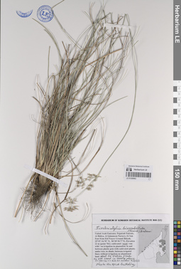
LE 01259063
Fimbristylis bisumbellata (Forssk.) Bubani det. Byalt, Vyacheslav Vyacheslavovich
Collectors: Byalt, Vyacheslav Vyacheslavovich; Korshunov, Mikhail Vladimirovich Field collecting number: 2973. Collection date: 15.05.2020. Administrative regions: AE - United Arab Emirates. Place of collection: Fujairah Emirate, Al Bidiya, Al Qalamoon Nursery, 0.3 km East from Eid Prayer Ground Bidyah [point 781]: weed next to water tanks on wet sand in shady place next to office building.Groups of specimens: Образцы общего сектора; Соглашение Минобрнауки №075-15-2021-1056; Бялт В.В.: Флора ФуджейрыOriginal label text: United Arab Emirates. Fujairah Emirate, Al Bidiya, Al Qalamoon Nursery, 0.3 km East from Eid Prayer Ground Bidyah, 25°25' 24.70" N, 56°20'18.77"E, Elevation 22 m [point 781]: weed next to water tanks on wet sand in shady place next to ofice building, 19 V 2020, V.V. Byalt, M.V. Korshunov 2973
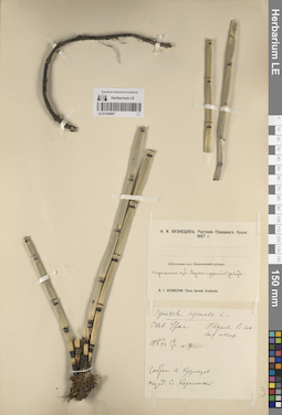
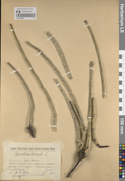
LE 01246789
Equisetum heleocharis Ehrh. var. verticillatum Dӧll. det. Schennikov, Alexander Petrovich
Collectors: Busch Collection date: 09.07.1914. Administrative regions: RU - Ulyanovsk Oblast - Ulyanovskiy Rayon. Groups of specimens: Образцы сектора Восточной Европы; Флора Урала и прилегающих территорий (проект); Соглашение Минобрнауки №075-15-2021-1056Original label text:Ульяновский уезд. Карамзинская психиатрическаая колония. Пойма реки Волги. Прирусловая зона (Ташлинский остров) Иловато-песчаный нанос. Заросль.
Record creation: 2023-10-02, Denis Melnikov, PhotoScan D2.Citation: Specimen LE 01246789 // Virtual herbarium of Komarov Botanical Institute RAS — http://re.herbariumle.ru/01246789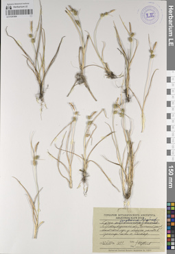
LE 01241604
Groups of specimens: Образцы сектора Восточной Европы; Соглашение Минобрнауки №075-15-2021-1056Record creation: 2023-10-04, Artyom Leostrin, PhotoScan D2.Citation: Specimen LE 01241604 // Virtual herbarium of Komarov Botanical Institute RAS — http://re.herbariumle.ru/01241604
LE 01246862
Groups of specimens: Образцы сектора Восточной Европы; Флора Урала и прилегающих территорий (проект); Соглашение Минобрнауки №075-15-2021-1056Record creation: 2023-10-03, Denis Melnikov, PhotoScan D2.Citation: Specimen LE 01246862 // Virtual herbarium of Komarov Botanical Institute RAS — http://re.herbariumle.ru/01246862
LE 01241690
Groups of specimens: Образцы сектора Восточной Европы; Соглашение Минобрнауки №075-15-2021-1056Record creation: 2023-10-12, Artyom Leostrin, PhotoScan D2.Citation: Specimen LE 01241690 // Virtual herbarium of Komarov Botanical Institute RAS — http://re.herbariumle.ru/01241690
LE 01225625
Groups of specimens: Образцы сектора Кавказа; Типовые образцы сектора Кавказа; Соглашение Минобрнауки №075-15-2021-1056Record creation: 2023-10-13, Elena Portenier, PhotoScan D2.Citation: Specimen LE 01225625 // Virtual herbarium of Komarov Botanical Institute RAS — http://re.herbariumle.ru/01225625
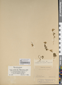
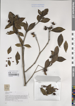
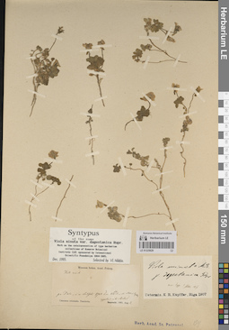
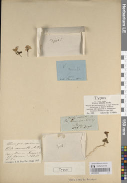
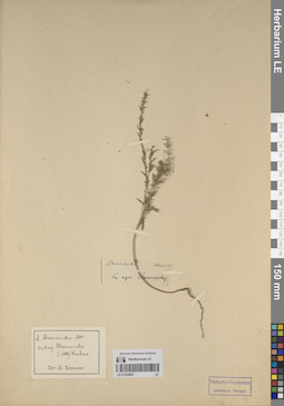
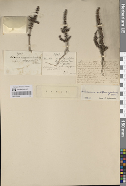
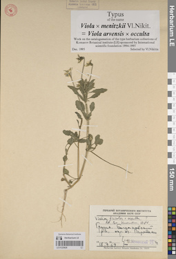
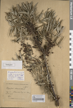
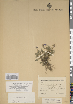
LE 01225679
Lectotype of Elaeagnus angustifolia var. caspica Sosn. det. Tzvelev, Nikolai Nikolaievich at 16.04.2002
Additional identifications: Elaeagnus hortensis Bieb. det. Becker, Alexander K.; Specimen originale of Elaeagnus angustifolia var. caspica Sosn.; Specimen originale of Elaeagnus caspica (Sosn.) Grossh. det. Grossheim, Alexander Alfonsovich at 1947; Specimen originale of Elaeagnus caspica (Sosn.) Grossh. det. Kozlowskaja, Natalija Vitalevna at 03.1953; Lectotype of Elaeagnus caspica (Sosn.) Grossh. det. Tzvelev, Nikolai Nikolaievich at 16.04.2002; Elaeagnus angustifolia L. det. Tatanov, Ivan Vladimirovich at 17.06.2024 Collectors: Becker, Alexander K. Administrative regions: RU - Dagestan - Derbentskiy Rayon. Groups of specimens: Образцы сектора Кавказа; Типовые образцы сектора Кавказа; Соглашение Минобрнауки №075-15-2021-1056Original label text:Elaeagnus hortensis MB.
Coordinates (geographic position): 42° 4′ 10.92″ N, 48° 17′ 41.64″ ERecord creation: 2023-10-11, Elena Portenier, PhotoScan D2.Citation: Specimen LE 01225679 // Virtual herbarium of Komarov Botanical Institute RAS — http://re.herbariumle.ru/01225679[№] 53
Derbent
leg. A. Becker
E. angustifolia L.
var. caspica m.
Det.: D. Sosnowsky
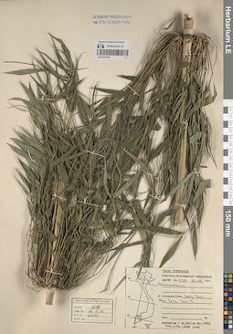
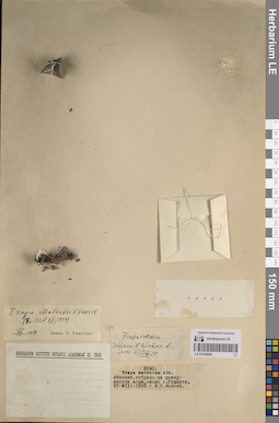
LE 01233740
Dendrocalamus sp. at 28.02.1961
Collectors: Unknown Field collecting number: 1028. Collection date: 28.02.1961. Administrative regions: VN - Tinh Lang Son. Groups of specimens: L. V. Averyanov specimens; L. V. Averyanov herbarium; Соглашение Минобрнауки №075-15-2021-1056; Flora of VietnamRecord creation: 2023-10-06, Galina Savich, PhotoScan D2.Citation: Specimen LE 01233740 // Virtual herbarium of Komarov Botanical Institute RAS — http://re.herbariumle.ru/01233740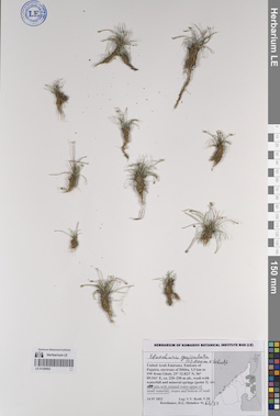
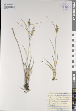
LE 01259062
Eleocharis geniculata (L.) Roem. & Schult. det. Byalt, Vyacheslav Vyacheslavovich
Collectors: Byalt, Vyacheslav Vyacheslavovich; Korshunov, Vladimir Mikhailovich; Melnikov, Denis Germanovich Field collecting number: 63/33. Collection date: 14.04.2022. Administrative regions: AE - United Arab Emirates. Place of collection: Emirate of Fujaira, environs of Dibba, 3,5 km to SW from Ghub, wadi with waterfall and mineral springs [point 3]: in pits with mineral water upper of small waterfall.Groups of specimens: Образцы общего сектора; Соглашение Минобрнауки №075-15-2021-1056; Бялт В.В.: Флора ФуджейрыOriginal label text: United Arab Emirates. Emirate of Fujaira, environs of Dibba, 3,5 km to SW from Ghub, 25° 32.823' N, 56° 09.541' E, ca. 220–250 m alt., wadi with waterfall and mineral springs [point 3]: in pits with mineral water upper of small waterfall, 14 IV 2022, fr., V.V. Byalt, V.M. Korshunov, D.G. Melnikov 63/33