View
Add
Copy
Edit
Delete
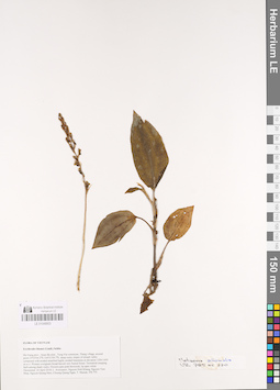
LE 01048853
Erythrodes blumei (Lindl.) Schltr. det. Averyanov, Leonid Vladimirovich at 24.04.2018
Collectors: Averyanov, Leonid Vladimirovich; Khang Sinh Nguyen; Chuong, Quang Ngan; Maisak, Tatiana Viktorovna Field collecting number: VR770. Collection date: 24.04.2018. Administrative regions: VN - Tinh Ha Giang. Groups of specimens: L. V. Averyanov specimens; L. V. Averyanov herbarium; L. V. Averyanov photos; Orchids of Vietnam, Laos and CambodiaOriginal label text:FLORA OF VIETNAM
Coordinates (geographic position): 23° 3′ 4.2″ N, 104° 51′ 9.7″ E ±1000 mComment: Orchidaceae
Erythrodes hirsuta (Griff.) Ormerod
Ha Giang prov., Quan Ba distr., Tung Vai commune, Thang village, around point 23º03ʹ04.2ʺN 104º51ʹ09.7ʺE, steep rocky slopes of stream valley composed with eroded stratified highly eroded limestone at elevation 1200-1450 m a.s.l. Primary evergreen broad-leaved very humid forest. Terrestrial creeping herb among shady rocks. Flowers pale pink-brownish, lip apex white. Occasional. 24 April 2018, L. Averyanov, Nguyen Sinh Khang, Nguyen Tien Hiep, Nguyen Quang Hieu, Chuong Quang Ngan, T. Maisak, VR 770.
All photos © L. Averyanov & K.S. Nguyen
Record creation: 2019-01-13, Leonid Averyanov, PhotoScan D1. Processing status: work_status_1Citation: Specimen LE 01048853 // Virtual herbarium of Komarov Botanical Institute RAS — http://re.herbariumle.ru/01048853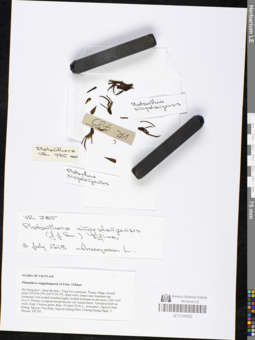
LE 01048852
Platanthera singgalangensis (J.J.Sm.) Efimov det. Averyanov, Leonid Vladimirovich at 03.07.2018
Collectors: Averyanov, Leonid Vladimirovich; Khang Sinh Nguyen; Chuong, Quang Ngan; Maisak, Tatiana Viktorovna Field collecting number: VR785. Collection date: 24.04.2018. Administrative regions: VN - Tinh Ha Giang. Groups of specimens: L. V. Averyanov specimens; L. V. Averyanov herbarium; L. V. Averyanov photos; Orchids of Vietnam, Laos and CambodiaOriginal label text:FLORA OF VIETNAM
Coordinates (geographic position): 23° 3′ 4.2″ N, 104° 51′ 9.7″ E ±1000 mComment: Orchidaceae
Platanthera singgalangensis ( J.J.Sm. ) Efimov
Ha Giang prov., Quan Ba distr., Tung Vai commune, Thang village, around point 23º03ʹ04.2ʺN 104º51ʹ09.7ʺE, steep rocky slopes near mountain top composed with eroded stratified highly eroded limestone at elevation 1200-1450 m a.s.l. Primary evergreen broad-leaved very humid forest. Terrestrial herb on rocky slope. Flowers green. Rare. 24 April 2018, L. Averyanov, Nguyen Sinh Khang, Nguyen Tien Hiep, Nguyen Quang Hieu, Chuong Quang Ngan, T. Maisak, VR 785.
All photos © L. Averyanov & K.S. Nguyen
Record creation: 2019-01-13, Leonid Averyanov, PhotoScan D1. Processing status: work_status_1Citation: Specimen LE 01048852 // Virtual herbarium of Komarov Botanical Institute RAS — http://re.herbariumle.ru/01048852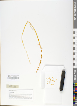
LE 01048851
Isotype of Ophiopogon brevicaulis N.Tanaka & Aver. det. Noriyuki Tanaka at 26.07.2019
Additional identifications: Ophiopogon caulescens Backer det. Averyanov, Leonid Vladimirovich at 14.04.2018 Collectors: Averyanov, Leonid Vladimirovich; Khang Sinh Nguyen; Chuong, Quang Ngan; Maisak, Tatiana Viktorovna Field collecting number: VR136. Collection date: 14.04.2018. Administrative regions: VN - Tinh Ha Giang. Groups of specimens: L. V. Averyanov specimens; L. V. Averyanov herbarium; L. V. Averyanov photosOriginal label text:FLORA OF VIETNAM Convallariaceae Ophiopogon caulescens (Blume) Backer Ha Giang prov., Quan Ba distr., Bat Dai Son Nature Reserve, Can Ty commune, Dau Cau 1 village, around point 23º05ʹ26.3ʺN 105º01ʹ03.0ʺE, 1100-1150 m a.s.l., karstic, highly eroded mountains composed of solid marble-like limestone, primary evergreen broad-leaved humid forest on steep rocky slopes near mountain tops. Terrestrial herb among rocks in shady place. Flowers white with violet tint. Not rare. 14 April 2018, L. Averyanov, Nguyen Sinh Khang, Chuong Quang Ngan, T. Maisak, VR 136.
Comment: All photos © L. Averyanov & K.S. Nguyen
Record creation: 2019-01-13, Leonid Averyanov, PhotoScan D1Citation: Specimen LE 01048851 // Virtual herbarium of Komarov Botanical Institute RAS — http://re.herbariumle.ru/01048851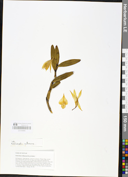
LE 01048850
Dendrobium williamsonii Day & Rchb.f. det. Averyanov, Leonid Vladimirovich at 25.04.2018
Collectors: Averyanov, Leonid Vladimirovich; Khang Sinh Nguyen; Tien Hiep Nguyen; Nguyen Quang Hieu; Chuong, Quang Ngan; Maisak, Tatiana Viktorovna Field collecting number: VR781. Collection date: 24.04.2018. Administrative regions: VN - Tinh Ha Giang. Groups of specimens: L. V. Averyanov specimens; L. V. Averyanov herbarium; L. V. Averyanov photos; Orchids of Vietnam, Laos and CambodiaOriginal label text:FLORA OF VIETNAM
Orchidaceae
Dendrobium williamsonii Day & Rchb.f.
Ha Giang prov., Quan Ba distr., Tung Vai commune, Thang village, around point 23º03ʹ04.2ʺN 104º51ʹ09.7ʺE, steep rocky slopes near mountain top composed with eroded stratified highly eroded limestone at elevation 1200-1450 m a.s.l. Primary evergreen broad-leaved very humid forest. Epiphyte on tall mossy tree. Flowers yellowish, lip with orange center. Not rare.
24 April 2018, L. Averyanov, Nguyen Sinh Khang, Nguyen Tien Hiep, Nguyen Quang Hieu, Chuong Quang Ngan, T. Maisak, VR 781.
All photos © L. Averyanov & K.S. Nguyen
Record creation: 2019-01-13, Leonid Averyanov, PhotoScan D1. Processing status: work_status_1Citation: Specimen LE 01048850 // Virtual herbarium of Komarov Botanical Institute RAS — http://re.herbariumle.ru/01048850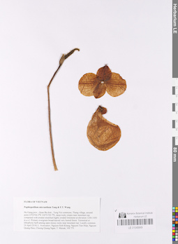
LE 01048849
Paphiopedilum micranthum Tang & F.T.Wang det. Averyanov, Leonid Vladimirovich at 24.04.2018
Collectors: Averyanov, Leonid Vladimirovich; Khang Sinh Nguyen; Tien Hiep Nguyen; Nguyen Quang Hieu; Chuong, Quang Ngan; Maisak, Tatiana Viktorovna Field collecting number: VR773. Collection date: 24.04.2018. Administrative regions: VN - Tinh Ha Giang. Groups of specimens: L. V. Averyanov specimens; L. V. Averyanov herbarium; L. V. Averyanov photos; Orchids of Vietnam, Laos and CambodiaOriginal label text:FLORA OF VIETNAM
Coordinates (geographic position): 23° 3′ 4.2″ N, 104° 51′ 9.7″ E ±1000 mComment: Orchidaceae
Paphiopedilum micranthum Tang & F.T. Wang
Ha Giang prov., Quan Ba distr., Tung Vai commune, Thang village, around point 23º03ʹ04.2ʺN 104º51ʹ09.7ʺE, steep rocky slopes near mountain top composed with eroded stratified highly eroded limestone at elevation 1200-1450 m a.s.l. Primary evergreen broad-leaved very humid forest. Terrestrial or lithophytic herb among open mossy rocks near mountain top. Locally common. 24 April 2018, L. Averyanov, Nguyen Sinh Khang, Nguyen Tien Hiep, Nguyen Quang Hieu, Chuong Quang Ngan, T. Maisak, VR 773.
All photos © L. Averyanov & K.S. Nguyen
Record creation: 2019-01-13, Leonid Averyanov, PhotoScan D1. Processing status: work_status_1Citation: Specimen LE 01048849 // Virtual herbarium of Komarov Botanical Institute RAS — http://re.herbariumle.ru/01048849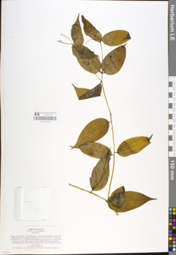
LE 01048848
Disporum calcaratum D. Don det. Noriyuki Tanaka at 26.01.2019
Additional identifications: Disporum sp. det. Averyanov, Leonid Vladimirovich at 17.03.2007 Collectors: Averyanov, Leonid Vladimirovich; Phan Ke Loc; N.V. Trai; Vinh Tien Nguyen; N.D. Phuong; Averyanova, Anna Leonidovna Field collecting number: HLF6624. Collection date: 17.03.2007. Administrative regions: VN - Tinh Nghe An. Groups of specimens: L. V. Averyanov specimens; L. V. Averyanov herbariumOriginal label text:FLORA OF VIETNAM Liliaceae s.l (Convallariaceae) Disporum sp. Vietnam, Nghe An Prov., Tuong Duong Distr., Tam Quang Municipality, Tung Huong village, along Khe Mat stream around point 19°03'07"N 104°36'57"E at elevation about 400-500 m a.s.l. Lowland closed secondary old evergreen forest on steep slopes along rocky stream valley composed with stratified solid shale and sandstone. Terrestrial herb up to 1 m tall along rocky shady stream valley. Fruits black. Locally very common. HLF 6624 17 March 2007. Coll. Averyanov L., P.K.Loc, N.V.Trai, N.T.Vinh, N.D.Phuong, Averyanova A. Grant from Henry Luce Foundation.
Coordinates (geographic position): 19° 3′ 7″ N, 104° 36′ 57″ E ±1000 mRecord creation: 2019-01-13, Leonid Averyanov, PhotoScan D1Citation: Specimen LE 01048848 // Virtual herbarium of Komarov Botanical Institute RAS — http://re.herbariumle.ru/01048848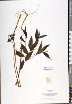
LE 01048846
Disporum cantoniense (Lour.) Merr. det. Noriyuki Tanaka at 26.01.2019
Additional identifications: Disporum sp. det. Averyanov, Leonid Vladimirovich at 28.04.1999 Collectors: Phan Ke Loc; P.H. Hoang; Averyanov, Leonid Vladimirovich Field collecting number: CBL1714. Collection date: 28.04.1999. Administrative regions: VN - Tinh Ha Giang. Groups of specimens: L. V. Averyanov specimens; L. V. Averyanov herbariumOriginal label text:FLORA OF VIETNAM Fam. Liliaceae Disporum sp. N. Vietnam, prov. Ha Giang, distr. Dong Van, municipality Ho Quang Phin, vicinities of Ta Xa village, 14-16 km to SSW of Dong Van town (N 23°16' E 105°22'). Open secondary shrubs among limestone rocks on alluvial limestone ridge foothills at 1300 m alt. Terrestrial herb up to 1.2 m hg. Flowers dirty purple-violet. Not rare. No CBL 1714 28 April 1999 International Botanical Expedition of the U.S.A. National Geographic Society (grant No 6300-98) P.K.Loc, P.H.Hoang, Averyanov L.
Coordinates (geographic position): 23° 16′ N, 105° 22′ E ±1000 mRecord creation: 2019-01-13, Leonid Averyanov, PhotoScan D1Citation: Specimen LE 01048846 // Virtual herbarium of Komarov Botanical Institute RAS — http://re.herbariumle.ru/01048846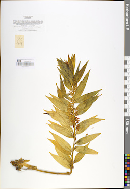
LE 01048845
Polygonatum punctatum Kunth det. Noriyuki Tanaka at 26.01.2019
Additional identifications: Polygonatum sp. det. Averyanov, Leonid Vladimirovich at 15.04.1999 Collectors: Phan Ke Loc; P.H. Hoang; Averyanov, Leonid Vladimirovich Field collecting number: CBL1417. Collection date: 15.04.1999. Administrative regions: VN - Tinh Cao Bang. Groups of specimens: L. V. Averyanov specimens; L. V. Averyanov herbariumOriginal label text:FLORA OF VIETNAM Convallariaceae Polygonatum sp. N. Vietnam, prov. Cao Bang, distr. Bao Lac, municipality Dinh Phung, Nam Linh mt. (N 22°47' E 105°49'). Old secondary broadleaved wet mossy cloud forest along tops of remnant karst limestone Nam Linh ridge at 1550-1600 m alt. Epiphyte. Flowers light yellowish-green. Not common. No CBL 1417 15 April 1999 International Botanical Expedition of the U.S.A. National Geographic Society (grant No 6300-98) Collectors: P.K.Loc, P.H.Hoang, Averyanov L.
Coordinates (geographic position): 22° 47′ N, 105° 49′ E ±1000 mRecord creation: 2019-01-13, Leonid Averyanov, PhotoScan D1Citation: Specimen LE 01048845 // Virtual herbarium of Komarov Botanical Institute RAS — http://re.herbariumle.ru/01048845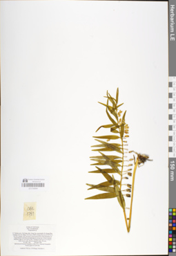
LE 01048844
Polygonatum punctatum Kunth det. Noriyuki Tanaka at 26.01.2019
Additional identifications: Polygonatum sp. det. Averyanov, Leonid Vladimirovich at 28.04.1999 Collectors: Phan Ke Loc; P.H. Hoang; Averyanov, Leonid Vladimirovich Field collecting number: CBL1781. Collection date: 28.04.1999. Administrative regions: VN - Tinh Ha Giang. Groups of specimens: L. V. Averyanov specimens; L. V. Averyanov herbariumOriginal label text:FLORA OF VIETNAM Fam. Convallariaceae Polygonatum sp. N. Vietnam, prov. Ha Giang, distr. Dong Van, municipality Ho Quang Phin, vicinities of Ta Xa village, 14-16 km to SSW of Dong Van town (N 23°16' E 105°22'). Primary very wet mossy cloud mixed forest (with domination of Tsuga chinensis and Pinus kwangtungensis) along tops of karst remnant limestone ridge at 1550-1600 m elev. Lithophyte herb up to 0.4 m hg on shady mossy rocks. Flowers greenish-white. Not rare. No CBL 1781 28 April 1999 International Botanical Expedition of the U.S.A. National Geographic Society (grant No 6300-98) Collectors: P.K.Loc, P.H.Hoang, Averyanov L.
Coordinates (geographic position): 23° 16′ N, 105° 22′ E ±1000 mRecord creation: 2019-01-13, Leonid Averyanov, PhotoScan D1Citation: Specimen LE 01048844 // Virtual herbarium of Komarov Botanical Institute RAS — http://re.herbariumle.ru/01048844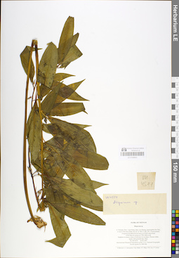
LE 01048843
Polygonatum punctatum Kunth det. Noriyuki Tanaka at 26.01.2019
Additional identifications: Disporum sp. det. Phan Ke Loc at 02.05.1997 Collectors: Averyanov, Leonid Vladimirovich; N.Q. Binh; Tien Hiep Nguyen; Phan Ke Loc; P.Lowry Field collecting number: VH4514. Collection date: 02.05.1997. Administrative regions: VN - Tinh Lam GJong. Groups of specimens: L. V. Averyanov specimens; L. V. Averyanov herbariumOriginal label text:FLORA OF VIETNAM Disporum sp. S. Vietnam, Prov. Lam Dong, distr. Lac Duong, municipalite Da Chay, 31 km to NE from Dalat city (N 12° 08', E 108° 39'). Closed primary evergreen broadleaved mt forest on NNW macroslope of Bi Dup mt system at 1700-1800 m alt. Epiphyte on mossy stems of old trees in wet place. Flowers white, tepals with greenish tips. Rare. No VH 4514 02.05.1997 International Botanical Expedition of the U.S.A. National Geographic Society (grant No 5803-96) Collectors: L. Averyanov, N.Q. Binh, N.T. Hiep, P.K. Loc, P. Lowry
Coordinates (geographic position): 12° 8′ N, 108° 39′ E ±1000 mRecord creation: 2019-01-13, Leonid Averyanov, PhotoScan D1Citation: Specimen LE 01048843 // Virtual herbarium of Komarov Botanical Institute RAS — http://re.herbariumle.ru/01048843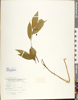
LE 01048842
Disporum hainanense Merr. det. Noriyuki Tanaka at 26.01.2019
Additional identifications: Disporum sp. det. Averyanov, Leonid Vladimirovich at 12.06.1985 Collectors: Averyanov, Leonid Vladimirovich; et al. Field collecting number: LX-VN 2333. Collection date: 12.06.1985. Administrative regions: VN - Tinh Vinh Phuc. Groups of specimens: L. V. Averyanov specimens; L. V. Averyanov herbariumOriginal label text:N. Vietnam, Vinh Phu province, Tam Dao 3 Mountain, at elevation about 1000 m, undershrub to 3 m tall in scrub, 12.06.1985, L. Averyanov et al., LX-VN 2333
Comment: Thisspecies is unique in having small flowers.
Record creation: 2019-01-13, Leonid Averyanov, PhotoScan D1Citation: Specimen LE 01048842 // Virtual herbarium of Komarov Botanical Institute RAS — http://re.herbariumle.ru/01048842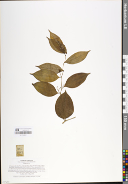
LE 01048841
Disporum pedunculatum H. Li & J.L. Huang det. Noriyuki Tanaka at 26.01.2019
Additional identifications: Disporum sp. det. Averyanov, Leonid Vladimirovich at 19.05.2004 Collectors: Averyanov, Leonid Vladimirovich; Tien Hiep Nguyen; The Van Pham; Vinh Tien Nguyen Field collecting number: HAL4643. Collection date: 19.05.2004. Administrative regions: VN - Tinh Bac Kan. Groups of specimens: L. V. Averyanov specimens; L. V. Averyanov herbariumOriginal label text:FLORA OF VIETNAM Fam. Liliaceae s.l. (Convallariaceae) Disporum sp. N.Vietnam, Bac Kan Prov., Cho Don Distr., Ban Thi Municipality, village Phia Khao, around point 22°15'35"N, 105°31'17"E at elevation 800-900 m a.s.l. Remnants of primary broad-leaved evergreen closed wet forest on very steep slopes and cliffs of rocky ridges and mesae composed with solid marble-like stratified limestone. Terrestrial and lithophytic herb up to 1 m tall. Flowers light yellow-green, anthers yellow. Not rare. No HAL 4643 19 May 2004 Collectors: L.Averyanov, N.T.Hiep, P.V.The, N.T.Vinh.
Coordinates (geographic position): 22° 15′ 35″ N, 105° 31′ 17″ E ±1000 mComment: N. Tanaka note: Characterizedby the pedunculate inflorescences of a few flowers from leaf axils (inflorescencesnot confined to stem apices). This species has been recorded only from China.Flora of China treats D. pedunculatumas a synonym of D. calcaratum, butthese are quite different species. D.pedunculatum was described on the basis of specimens in fruit, and thus itsflowers need to be described.
Record creation: 2019-01-13, Leonid Averyanov, PhotoScan D1Citation: Specimen LE 01048841 // Virtual herbarium of Komarov Botanical Institute RAS — http://re.herbariumle.ru/01048841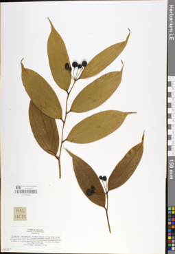
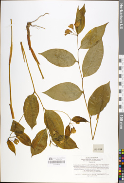
LE 01048840
Disporum trabeculatum Gagnep. det. Noriyuki Tanaka at 26.01.2019
Additional identifications: Disporum sp. det. Averyanov, Leonid Vladimirovich at 29.11.2006 Collectors: Tien Hiep Nguyen; Averyanov, Leonid Vladimirovich; The Van Pham Field collecting number: HAL10200. Collection date: 29.11.2006. Administrative regions: VN - Tinh Lai Chau. Groups of specimens: L. V. Averyanov specimens; L. V. Averyanov herbariumOriginal label text:FLORA OF VIETNAM
Coordinates (geographic position): 22° 23′ 5″ N, 103° 36′ 46″ E ±1000 mRecord creation: 2019-01-13, Leonid Averyanov, PhotoScan D1Citation: Specimen LE 01048840 // Virtual herbarium of Komarov Botanical Institute RAS — http://re.herbariumle.ru/01048840Liliaceae s.l. (Convallariacae)
Disporum sp.
Lai Chau Prov., Tam Duong Distr., Ho Thau Community, Ho Thau village, around point 22°23'05"N 103°36'46"E. Secondary and primary evergreen closed forest on very steep mountain slopes composed with granite and quartzite at elevation from 1500 to 1900 m a.s.l. Terrestrial herb along mossy ridge edge. Fruits black. Not common. HAL 10200 29 Nov. 2006 Coll.: Nguyen Tien Hiep, L.Averyanov, Pham Van The.
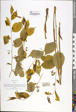
LE 01048839
Disporum trabeculatum Gagnep. det. Noriyuki Tanaka at 26.01.2019
Additional identifications: Disporum sp. det. Averyanov, Leonid Vladimirovich at 29.01.2005 Collectors: Averyanov, Leonid Vladimirovich; Phan Ke Loc; The Van Pham; Averyanova, Anna Leonidovna; Vinh Tien Nguyen; N.Q. Vinh; N.T. Binh Field collecting number: HAL6246. Collection date: 29.01.2005. Administrative regions: VN - Tinh Quang Binh. Groups of specimens: L. V. Averyanov specimens; L. V. Averyanov herbariumOriginal label text:FLORA OF VIETNAM
Coordinates (geographic position): 17° 27′ 51″ N, 106° 22′ 46″ E ±1000 mRecord creation: 2019-01-13, Leonid Averyanov, PhotoScan D1Citation: Specimen LE 01048839 // Virtual herbarium of Komarov Botanical Institute RAS — http://re.herbariumle.ru/01048839Plants of Phong Nha - Ke Bang National Park
Fam. Liliaceae s.l. (Convallariaceae)
Disporum sp.
Vietnam, Quang Binh Prov., Bo Trach Distr., Hung Trach Municipality, Khe Me locality, around point 17°27'51"N, 106°22'46"E at elev. 900-1000 m a.s.l. Slightly logged primary closed broad-leaved evergreen forest on slopes of mountains composed with shale and sandstone. Terrestrial herb up to 0.6 m tall. Flowers white. Very common. No HAL 6246 29 January 2005. Photo. Collectors: L.Averyanov, P.K.Loc, P.V.The, A.Averyanova, N.T.Vinh, N.Q.Vinh, N.T.Binh.
LE 01048838
Disporum pedunculatum H. Li & J.L. Huang det. Noriyuki Tanaka at 26.01.2019
Additional identifications: Disporum sp. det. Averyanov, Leonid Vladimirovich at 05.04.2014 Collectors: Nguyen Quang Hieu; Tien Hiep Nguyen; N.N. Hung; Chuong, Quang Ngan; T.P. Tuan Field collecting number: CPC7269. Collection date: 05.04.2014. Administrative regions: VN - Tinh Ha Giang. Groups of specimens: L. V. Averyanov specimens; L. V. Averyanov herbariumOriginal label text:FLORA OF VIETNAM
Comment: Liliaceae ( sensu lato)
Disporum sp.
Ha Giang Prov., Bac Me District., Phieng Luong commune, Phieng Luong village. Primary evergreen broad- leaf forest on schist or limestone at elevation 1000-1135 m a.s.l. Grows in soil humus , on slope of mountaine at elevation 1135 m a.s.l. around point 220 38° 46.1°°N;1050 18° 0.34°°E, 1153 m, Herb 80 cm in height, flower white, common 05 April 2014, CPC 7269 Coll.: N. Q. Hieu, N.T.Hiep, N.N. Hung, T.Q. Ngan, T.P.Tuan
N. Tanaka note: Characterizedby the pedunculate inflorescences of a few flowers from leaf axils (inflorescencesnot confined to stem apices). This species has been recorded only from China.Flora of China treats D. pedunculatumas a synonym of D. calcaratum, butthese are quite different species. D.pedunculatum was described on the basis of specimens in fruit, and thus itsflowers need to be described.
Record creation: 2019-01-13, Leonid Averyanov, PhotoScan D1Citation: Specimen LE 01048838 // Virtual herbarium of Komarov Botanical Institute RAS — http://re.herbariumle.ru/01048838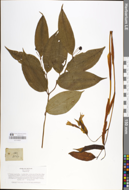
LE 01048837
Disporum trabeculatum Gagnep. det. Noriyuki Tanaka at 26.01.2019
Additional identifications: Disporum sp. det. Averyanov, Leonid Vladimirovich at 08.03.2002 Collectors: Averyanov, Leonid Vladimirovich; Phan Ke Loc; D.T. Doan Field collecting number: HAL2147. Collection date: 08.03.2002. Administrative regions: VN - Tinh Lao Cai. Groups of specimens: L. V. Averyanov specimens; L. V. Averyanov herbariumOriginal label text:FLORA OF VIETNAM Fam. Liliaceae Disporum sp. Northern Vietnam, Lao Cai Prov., Van Ban Distr., to the west of Nam Xay village (around point 21°58'09"N, 104°00'55"E). Primary broad-leaved evergreen montane wet forest on granite and quartzite along stream canyon at elev. 1750-1800 m a.s.l. Terrestrial herb up to 0.5 m hg. Fruits black. Common. No HAL 2147 08 March 2002 Collectors: L.Averyanov, P.K.Loc, D.T.Doan (FFI Project).
Coordinates (geographic position): 21° 58′ 9″ N, 104° 0′ 55″ E ±1000 mComment: Disporum trabeculatum Gagnep.
Record creation: 2019-01-13, Leonid Averyanov, PhotoScan D1Citation: Specimen LE 01048837 // Virtual herbarium of Komarov Botanical Institute RAS — http://re.herbariumle.ru/01048837left plant
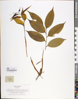
LE 01048836
Disporum sp. det. Noriyuki Tanaka at 26.01.2019
Collectors: Averyanov, Leonid Vladimirovich; Phan Ke Loc; D.T. Doan Field collecting number: HAL2025. Collection date: 05.03.2002. Administrative regions: VN - Tinh Lao Cai. Groups of specimens: L. V. Averyanov specimens; L. V. Averyanov herbarium; L. V. Averyanov photosOriginal label text:FLORA OF VIETNAM Fam. Liliaceae Disporum sp. Northern Vietnam, Lao Cai Prov., Van Ban Distr., to the west of Nam Xay village (21°58'18"N, 104°00'24"E). Primary coniferous (with Fokienia hodginsii) evergreen montane forest at elev. 1700 m a.s.l. Terrestrial herb in shady slope. Flowers: tepals white, tepal tips pink-violet. Common. No HAL 2025 (Photo) 05 March 2002 Collectors: L.Averyanov, P.K.Loc, D.T.Doan (FFI Project).
Coordinates (geographic position): 21° 58′ 18″ N, 104° 0′ 24″ E ±1000 mRecord creation: 2019-01-13, Leonid Averyanov, PhotoScan D1Citation: Specimen LE 01048836 // Virtual herbarium of Komarov Botanical Institute RAS — http://re.herbariumle.ru/01048836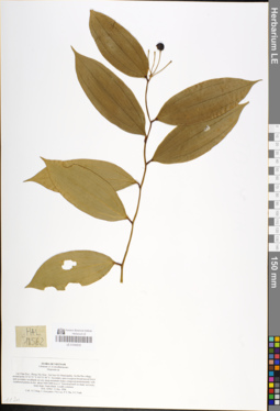
LE 01048835
Disporum sp. det. Noriyuki Tanaka at 26.01.2019
Collectors: Tien Hiep Nguyen; Averyanov, Leonid Vladimirovich; Phan Ke Loc; The Van Pham; Vinh Tien Nguyen Field collecting number: HAL10562. Collection date: 11.12.2006. Administrative regions: VN - Tinh Lai Chau. Groups of specimens: L. V. Averyanov specimens; L. V. Averyanov herbarium; L. V. Averyanov photosOriginal label text:FLORA OF VIETNAM Liliaceae s.l. (Convallariaceae) Disporum sp. Lai Chau Prov., Phong Tho Distr., Sin Suoi Ho Municipality, Sa Ma Pho village, around point 22°32'53"N 103°33'40"E. Secondary open evergreen broad-leaved forest and secondary woodlands on very steep mountain slopes composed predominantly with weathered granite at elev. about 1600-1800 m a.s.l. Terrestrial herb on shady wet rocky steep slope. Fruits black. Locally common. HAL 10562 11 Dec. 2006 Coll.: Nguyen Tien Hiep, L.Averyanov, Phan Ke Loc, Pham Van The, N.T.Vinh.
Coordinates (geographic position): 22° 32′ 53″ N, 103° 33′ 40″ E ±1000 mRecord creation: 2019-01-13, Leonid Averyanov, PhotoScan D1Citation: Specimen LE 01048835 // Virtual herbarium of Komarov Botanical Institute RAS — http://re.herbariumle.ru/01048835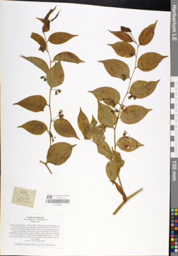
LE 01048834
Disporum pedunculatum H. Li & J.L. Huang det. Noriyuki Tanaka at 26.01.2019
Additional identifications: Disporum sp. det. Averyanov, Leonid Vladimirovich at 06.03.2005 Collectors: Averyanov, Leonid Vladimirovich; Phan Ke Loc; Vinh Tien Nguyen; Averyanova, Anna Leonidovna Field collecting number: HAL6532. Collection date: 06.03.2005. Administrative regions: VN - Tinh Ha Giang. Groups of specimens: L. V. Averyanov specimens; L. V. Averyanov herbariumOriginal label text:FLORA OF VIETNAM
Coordinates (geographic position): 22° 39′ 29″ N, 105° 19′ 35″ E ±1000 mComment: Fam. Liliaceae s.l.
Convallariaceae
Disporum sp.
Vietnam, Ha Giang Prov., Bac Me Distr., Phieng Luong Municipality, about 1.5 km to SW of Phieng Luong Municipality headquarter (22°39'29"N, 105°19'35"E). Heavily logged primary closed evergreen broad-leaved forest along rocky streamlet valley at the base of steep slopes of mountains composed with solid highly eroded crystalline and partially shale limestone at elev. about 900 m a.s.l. Terrestrial and lithophytic herb up to 1.5 m tall. Flowers white with green median nerve on tepals, anthers yellow, fruits black. Not common. No HAL 6532 6 March 2005 Collectors: L.Averyanov, P.K.Loc, N.T.Vinh, A.Averyanova.
N. Tanaka note: Characterizedby the pedunculate inflorescences of a few flowers from leaf axils (inflorescencesnot confined to stem apices). This species has been recorded only from China.Flora of China treats D. pedunculatumas a synonym of D. calcaratum, butthese are quite different species. D.pedunculatum was described on the basis of specimens in fruit, and thus itsflowers need to be described.
Record creation: 2019-01-13, Leonid Averyanov, PhotoScan D1Citation: Specimen LE 01048834 // Virtual herbarium of Komarov Botanical Institute RAS — http://re.herbariumle.ru/01048834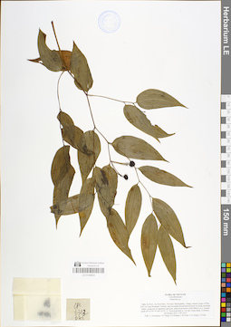
LE 01048833
Disporum cantoniense (Lour.) Merr. det. Noriyuki Tanaka at 26.01.2019
Additional identifications: Disporum sp. det. Averyanov, Leonid Vladimirovich at 26.11.2013 Collectors: Averyanov, Leonid Vladimirovich; Tien Hiep Nguyen; Khang Sinh Nguyen; L.M. Tuan; N.A.Trang; L.H.Dan Field collecting number: CPC6313. Collection date: 26.11.2013. Administrative regions: VN - Tinh Nghe An. Groups of specimens: L. V. Averyanov specimens; L. V. Averyanov herbariumOriginal label text:FLORA OF VIETNAM
Coordinates (geographic position): 19° 12′ 54″ N, 104° 12′ 1″ E ±1000 mRecord creation: 2019-01-13, Leonid Averyanov, PhotoScan D1Citation: Specimen LE 01048833 // Virtual herbarium of Komarov Botanical Institute RAS — http://re.herbariumle.ru/01048833Convallariaceae
Disporum sp.
Nghe An Prov., Ky Son Distr., Na Ngoi Municipality, eastern slopes of Phu Xai Lai Leng Mountain. Primary and secondary broad-leaved forest on steep mountain slopes composed of sandstone and gray shale at elevation 1300-2000 m a.s.l. around point 19°12'54"N 104°12'01"E. Terrestrial herb to 1 m tall. Fruits black. Common. 26 October 2013 CPC 6313 Coll.: L.Averyanov, N.T.Hiep, N.S.Khang, L.M.Tuan, N.A.Trang, L.H.Dan
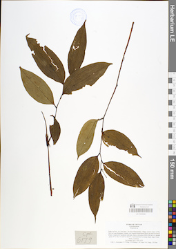
LE 01048832
Disporum trabeculatum Gagnep. det. Noriyuki Tanaka at 26.01.2019
Additional identifications: Disporum sp. det. Averyanov, Leonid Vladimirovich at 24.10.2013 Collectors: Averyanov, Leonid Vladimirovich; Tien Hiep Nguyen; Khang Sinh Nguyen; L.M. Tuan; N.A.Trang; L.H.Dan Field collecting number: CPC6179. Collection date: 24.10.2013. Administrative regions: VN - Tinh Nghe An. Groups of specimens: L. V. Averyanov specimens; L. V. Averyanov herbariumOriginal label text:FLORA OF VIETNAM
Coordinates (geographic position): 19° 11′ 58.2″ N, 104° 11′ 38.6″ E ±1000 mRecord creation: 2019-01-13, Leonid Averyanov, PhotoScan D1Citation: Specimen LE 01048832 // Virtual herbarium of Komarov Botanical Institute RAS — http://re.herbariumle.ru/01048832Convallariaceae
Disporum sp.
Nghe An Prov., Ky Son Distr., Na Ngoi Municipality, eastern slopes of Phu Xai Lai Leng Mountain. Primary very humid broad-leaved forest on steep mountain slopes composed of sandstone and gray shale at elevation 2000-2300 m a.s.l. around point 19°11°58.2°°N 104°11°38.6°°E. Terrestrial herb on steep shady slope. Fruits black. Common. 24 October 2013 CPC 6179 Coll.: L.Averyanov, N.T.Hiep, N.S.Khang, L.M.Tuan, N.A.Trang, L.H.Dan
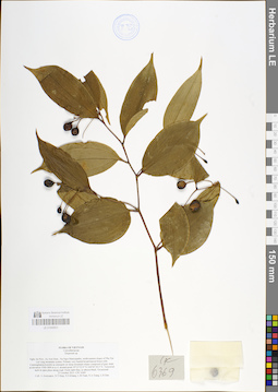
LE 01048831
Disporum trabeculatum Gagnep. det. Noriyuki Tanaka at 26.01.2019
Additional identifications: Disporum sp. det. Averyanov, Leonid Vladimirovich at 27.10.2013 Collectors: Averyanov, Leonid Vladimirovich; Tien Hiep Nguyen; Khang Sinh Nguyen; L.M. Tuan; N.A.Trang; L.H.Dan Field collecting number: CPC6369. Collection date: 27.10.2013. Administrative regions: VN - Tinh Nghe An. Groups of specimens: L. V. Averyanov specimens; L. V. Averyanov herbariumOriginal label text:FLORA OF VIETNAM
Coordinates (geographic position): 19° 13′ 52.9″ N, 104° 5′ 30.5″ E ±1000 mRecord creation: 2019-01-13, Leonid Averyanov, PhotoScan D1Citation: Specimen LE 01048831 // Virtual herbarium of Komarov Botanical Institute RAS — http://re.herbariumle.ru/01048831Convallariaceae
Disporum sp.
Nghe An Prov., Ky Son Distr., Na Ngoi Municipality, north-eastern slopes of Phu Xai Lai Leng mountain system. Primary very humid broad-leaved forest with Cunninghamia konishii as emergent on steep mountain slopes composed of gray shale at elevation 1500-1800 m a.s.l. around point 19°13°52.9°°N 104°05°30.5°°E. Terrestrial herb in open place along road. Fruits dark blue, to almost black. Occasional. 27 October 2013 CPC 6369 Coll.: L.Averyanov, N.T.Hiep, N.S.Khang, L.M.Tuan, N.A.Trang, L.H.Dan
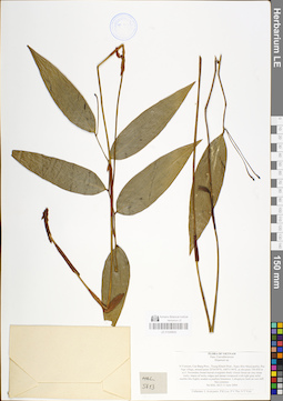
LE 01048830
Disporum sinovietnamicum R.C.Hu & Y.Feng Huang det. Noriyuki Tanaka at 14.05.2023
Additional identifications: Disporum sp. det. Averyanov, Leonid Vladimirovich at 11.06.2004; Disporum cantoniense (Lour.) Merr. det. Noriyuki Tanaka at 26.01.2019 Collectors: Averyanov, Leonid Vladimirovich; Phan Ke Loc; The Van Pham; Vinh Tien Nguyen Field collecting number: HAL5613. Collection date: 11.06.2004. Administrative regions: VN - Tinh Cao Bang. Groups of specimens: L. V. Averyanov specimens; L. V. Averyanov herbarium; Flora of VietnamOriginal label text:FLORA OF VIETNAM
Coordinates (geographic position): 22° 54′ 59″ N, 106° 31′ 44″ E ±1000 mRecord creation: 2019-01-13, Leonid Averyanov, PhotoScan D1. Processing status: work_status_1Citation: Specimen LE 01048830 // Virtual herbarium of Komarov Botanical Institute RAS — http://re.herbariumle.ru/01048830Convallariaceae
Disporum sp.
N.Vietnam, Cao Bang Prov., Trung Khanh Distr., Ngoc Khe Municipality, Pac Nga village, around point 22°54'59"N, 106°31'44"E, at elevation 750-850 m a.s.l. Secondary broad-leaved evergreen shady closed forest on very steep rocky slopes of rocky ridges and mesae composed with light gray solid marble-like highly eroded crystalline limestone. Lithophytic herb on wet cliff. Not common. No HAL 5613 11 June 2004 Collectors: L.Averyanov, P.K.Loc, P.V.The, N.T.Vinh.
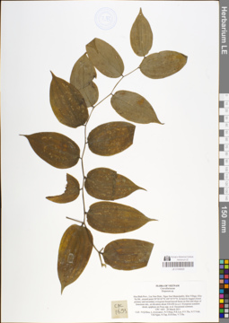
LE 01048829
Disporum cantoniense (Lour.) Merr. det. Noriyuki Tanaka at 26.01.2019
Additional identifications: Disporum sp. det. Averyanov, Leonid Vladimirovich at 29.03.2011 Collectors: Averyanov, Leonid Vladimirovich; Tien Hiep Nguyen; Phan Ke Loc; The Van Pham; Vinh Tien Nguyen; T.B. Ngan; N.Tap; D.D.Dao; V.T. Ha Field collecting number: CPC1693. Collection date: 29.03.2011. Administrative regions: VN - Tinh Hoa Binh. Groups of specimens: L. V. Averyanov specimens; L. V. Averyanov herbariumOriginal label text:FLORA OF VIETNAM
Coordinates (geographic position): 20° 26′ 43″ N, 105° 19′ 57″ E ±1000 mRecord creation: 2019-01-13, Leonid Averyanov, PhotoScan D1Citation: Specimen LE 01048829 // Virtual herbarium of Komarov Botanical Institute RAS — http://re.herbariumle.ru/01048829Convallariaceae
Disporum sp.
Hoa Binh Prov., Lac Son Distr., Ngoc Son Municipality, Khu Village, Khu Na Mt., around point 20°26'43"N 105°19'57"E. In heavily logged closed primary and secondary evergreen broad-leaved forest on foot and slope of limestone mts., at elevation about 530-650 m a.s.l. Evergreen scandent shrub, epiphyte on Ficus spp. et al. Occasional common. CPC 1693 29 March 2011 Coll.: N.Q.Hieu, L.Averyanov, N.T.Hiep, P.K.Loc, P.V.The, N.T.Vinh, T.B.Ngan, N.Tap, D.D.Dao, V.T.Ha.
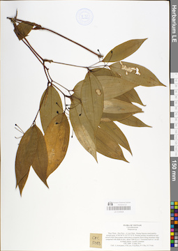
LE 01048828
Disporum cantoniense (Lour.) Merr. det. Noriyuki Tanaka at 26.01.2019
Additional identifications: Disporum sp. det. Averyanov, Leonid Vladimirovich at 12.05.2011 Collectors: Averyanov, Leonid Vladimirovich; et al. Field collecting number: CPC3088. Collection date: 12.05.2011. Administrative regions: VN - Tinh Thua Thien-Hue. Groups of specimens: L. V. Averyanov specimens; L. V. Averyanov herbariumOriginal label text:FLORA OF VIETNAM Convallariaceae Disporum sp. Thua Thien - Hue Prov., A Luoi Distr., Huong Nguyen municipality, around point 16°06'04"N 107°27'55"E. Pristine primary broadleaved and mixed (with Dacrycarpus imbricatus) evergreen forest along mountain ridge composed with shale at elev. about 1000 m a.s.l. Terrestrial herb to 1 m tall in shady places. Locally common. CPC 3088 12 May 2011 Coll.: L.Averyanov, P.K.Loc, N.Q.Hieu, P.V.The, N.T.Vinh.
Coordinates (geographic position): 16° 6′ 4″ N, 107° 27′ 55″ E ±1000 mRecord creation: 2019-01-13, Leonid Averyanov, PhotoScan D1Citation: Specimen LE 01048828 // Virtual herbarium of Komarov Botanical Institute RAS — http://re.herbariumle.ru/01048828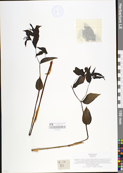
LE 01048827
Disporum cantoniense (Lour.) Merr. det. Noriyuki Tanaka at 26.01.2019
Additional identifications: Disporum sp. det. Averyanov, Leonid Vladimirovich at 24.03.2013 Collectors: Averyanov, Leonid Vladimirovich; Khang Sinh Nguyen; S. Lorphengsy Field collecting number: LA-VN806. Collection date: 24.03.2013. Administrative regions: LA - Vientiane Province. Groups of specimens: L. V. Averyanov specimens; L. V. Averyanov herbarium; L. V. Averyanov photosOriginal label text:FLORA OF LAOS
Coordinates (geographic position): 19° 18′ 45.5″ N, 102° 22′ 31.4″ E ±1000 mRecord creation: 2019-01-13, Leonid Averyanov, PhotoScan D1Citation: Specimen LE 01048827 // Virtual herbarium of Komarov Botanical Institute RAS — http://re.herbariumle.ru/01048827Convallariaceae
Disporum sp.
Vientiane Prov., Kasi Distr., Namken village, Phachao Mt., around point 19°18°45.5°N 102°22°31.4°E. Primary broad-leaved evergreen forest on very steep rocky slopes of remnant mountain composed with highly eroded solid crystalline limestone at elevations 1500-1750 m. Terrestrial and lithophytic erect herb on exposed mossy rocks near top of mountain. Common. LA-VN 806 24 March 2013 Coll.: L.Averyanov, N.S.Khang, S.Lorphengsy
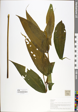
LE 01048826
Disporopsis longifolia Craib det. Noriyuki Tanaka at 26.01.2019
Additional identifications: Disporum sp. det. Averyanov, Leonid Vladimirovich at 28.03.2017 Collectors: Averyanov, Leonid Vladimirovich; Tien Hiep Nguyen; Khang Sinh Nguyen; Chuong, Quang Ngan; Maisak, Tatiana Viktorovna; Khamla Inkhavilay Field collecting number: LA-VN1836. Collection date: 28.03.2017. Administrative regions: LA - Lao People's Democratic Republic. Groups of specimens: L. V. Averyanov specimens; L. V. Averyanov herbariumOriginal label text:FLORA OF LAOS
Coordinates (geographic position): 19° 6′ 10.9″ N, 102° 10′ 46.1″ E ±1000 mRecord creation: 2019-01-13, Leonid Averyanov, PhotoScan D1Citation: Specimen LE 01048826 // Virtual herbarium of Komarov Botanical Institute RAS — http://re.herbariumle.ru/01048826Convallariaceae
Disporum sp.
Vientiane prov., Kasi distr., Si Sang Vone village, around point 19°06'10.9''N 102°10'46.1''E. Secondary and primary evergreen dry forest on very steep rocky mountain slopes composed by solid marble like highly eroded limestone at elev. 600-750 m a.s.l. Terrestrial and lithophytic herb to 1 m tall on steep shady rocky slope near mountain top. Not common. LA-VN 1836 28 March 2017 Coll.: L.Averyanov, N.T.Hiep, N.S.Khang, C.Q.Ngan, T.Maisak, Khamla Inkhavilay, Hongthong Southyvohanh, Pinmany Sisavath, Chanthala Cheuaysamphanh.
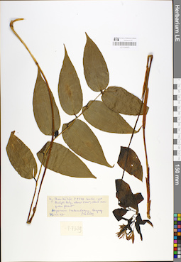
LE 01048825
Disporum cantoniense (Lour.) Merr. var. nov. det. Noriyuki Tanaka at 26.01.2019
Additional identifications: Disporum trabeculatum Gagnep. det. Phan Ke Loc at 29.07.1997 Collectors: Phan Ke Loc Field collecting number: P-7329. Collection date: 29.07.1997. Administrative regions: VN - Tinh Lao Cai. Groups of specimens: L. V. Averyanov specimens; L. V. Averyanov herbariumOriginal label text:N. Vietnam, Lao Cai province, Phan Xi Pang Mountain, about 2200 m, cloud evergreen forest, 29.07.1997, Phan Ke Loc, P-7329
Record creation: 2019-01-13, Leonid Averyanov, PhotoScan D1Citation: Specimen LE 01048825 // Virtual herbarium of Komarov Botanical Institute RAS — http://re.herbariumle.ru/01048825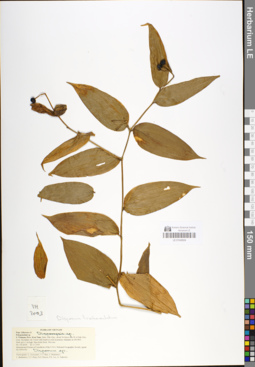
LE 01048824
Disporum calcaratum D. Don det. Noriyuki Tanaka at 26.01.2019
Additional identifications: Disporum trabeculatum Gagnep. det. Averyanov, Leonid Vladimirovich at 26.11.1995 Collectors: Averyanov, Leonid Vladimirovich; N.T. Ban; Budantzev, Andrey Lvovitch; Budantzev, L.; Tien Hiep Nguyen; Duong Duc Huyen; Phan Ke Loc; Yakovleva, G. Field collecting number: VH2003. Collection date: 26.11.1995. Administrative regions: VN - Kon Tum. Groups of specimens: L. V. Averyanov specimens; L. V. Averyanov herbariumOriginal label text:FLORA OF VIETNAM Fam. Liliaceae s.l. Polygonatum sp. S. Vietnam, Prov. Kon Tum, Distr. Dak Gley, about 3-4 km to the W of Dak Gley town. Secondary dry forest with bamboos rich in primary elements at 650-800. Herb up to 1 m high. Ripe fruits flack. Not rare. No VH 2003 26.11.1995 International Botanical Expedition of the U.S.A. National Geographic Society (grant No 5094-93) Participants: L. Averyanov, N.T. Ban, A. Budantzev, L. Budantzev, N.T. Hiep, D.D. Huyen, P.K. Loc, G. Yakovlev
Record creation: 2019-01-13, Leonid Averyanov, PhotoScan D1Citation: Specimen LE 01048824 // Virtual herbarium of Komarov Botanical Institute RAS — http://re.herbariumle.ru/01048824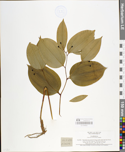
LE 01048823
Disporum trabeculatum Gagnep. det. Noriyuki Tanaka at 26.01.2019
Collectors: N.Tap; N.V. Trai Field collecting number: HLF6051. Collection date: 25.03.2006. Administrative regions: VN - Tinh Quang Tri. Groups of specimens: L. V. Averyanov specimens; L. V. Averyanov herbariumOriginal label text:Convallariaceae Disporum trabeculatum Gagnep. Dja diem: Tinh Quang Tri, huyen Da Krong. xa Hue Nghi. Ban Кар (Trai I). 16°29’ B, 107^00’ D, do cao: 350-450 m C o cao l m. So hieu mlu: HLF 6051 Ngay thu mau: 25/3/2006 Nhirng ngiroi lay mau: N. Tap, Аг. V. Trai Mau vat duac thu thap vai sir tai tra cua Henry Luce Foundation
Record creation: 2019-01-13, Leonid Averyanov, PhotoScan D1Citation: Specimen LE 01048823 // Virtual herbarium of Komarov Botanical Institute RAS — http://re.herbariumle.ru/01048823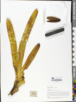
LE 01048786
Acampe rigida (Sm.) P.F.Hunt det. Averyanov, Leonid Vladimirovich at 11.05.2018
Collectors: Averyanov, Leonid Vladimirovich; Khang Sinh Nguyen; Maisak, Tatiana Viktorovna; et al. Field collecting number: AL973. Collection date: 11.05.2018. Administrative regions: LA - Khammouan. Groups of specimens: L. V. Averyanov specimens; L. V. Averyanov herbarium; L. V. Averyanov photos; Orchids of Vietnam, Laos and CambodiaOriginal label text:FLORA OF LAOS Hin Nam No Nature Protected Area Orchidaceae Acampe rigida (Buch.-Ham. ex Sm.) P.F. Hunt Laos, Khammoune prov., Boualapha distr., Nong Seng village, Chanh Daeng mountain, around point 17°31'11.1"N, 105°46'41.4"E. Primary dry evergreen and semideciduous broad-leaved forest on very steep rocky slope near karstic hill top composed with solid, marble-like highly eroded limestone at 400-600 m a.s.l. Lithophytic undershrub to 1 m tall on shady cliff near mountain top. Common. 11 May 2018, L. Averyanov, Khang Sinh Nguyen, T. Maisak, Littideth Xaiyavongsa, Siphanom Keovankham, AL 973.
Coordinates (geographic position): 17° 31′ 11.1″ N, 105° 46′ 41.4″ E ±1000 mRecord creation: 2019-01-13, Leonid Averyanov, PhotoScan D1Citation: Specimen LE 01048786 // Virtual herbarium of Komarov Botanical Institute RAS — http://re.herbariumle.ru/01048786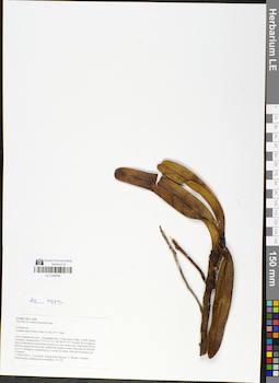
LE 01048785
Acampe rigida (Sm.) P.F.Hunt det. Averyanov, Leonid Vladimirovich at 11.05.2018
Collectors: Averyanov, Leonid Vladimirovich; Khang Sinh Nguyen; Maisak, Tatiana Viktorovna; et al. Field collecting number: AL973. Collection date: 11.05.2018. Administrative regions: LA - Khammouan. Groups of specimens: L. V. Averyanov specimens; L. V. Averyanov herbarium; L. V. Averyanov photos; Orchids of Vietnam, Laos and CambodiaOriginal label text:FLORA OF LAOS Hin Nam No Nature Protected Area Orchidaceae Acampe rigida (Buch.-Ham. ex Sm.) P.F. Hunt Laos, Khammoune prov., Boualapha distr., Nong Seng village, Chanh Daeng mountain, around point 17°31'11.1"N, 105°46'41.4"E. Primary dry evergreen and semideciduous broad-leaved forest on very steep rocky slope near karstic hill top composed with solid, marble-like highly eroded limestone at 400-600 m a.s.l. Lithophytic undershrub to 1 m tall on shady cliff near mountain top. Common. 11 May 2018, L. Averyanov, Khang Sinh Nguyen, T. Maisak, Littideth Xaiyavongsa, Siphanom Keovankham, AL 973.
Coordinates (geographic position): 17° 31′ 11.1″ N, 105° 46′ 41.4″ E ±1000 mRecord creation: 2019-01-13, Leonid Averyanov, PhotoScan D1Citation: Specimen LE 01048785 // Virtual herbarium of Komarov Botanical Institute RAS — http://re.herbariumle.ru/01048785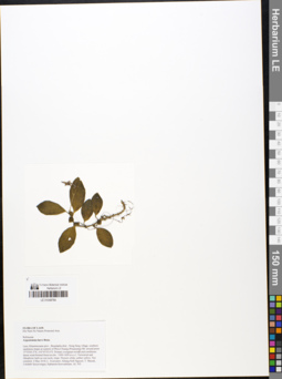
LE 01048784
Argostemma laeve Benn. det. Averyanov, Leonid Vladimirovich at 04.05.2018
Collectors: Averyanov, Leonid Vladimirovich; Khang Sinh Nguyen; Maisak, Tatiana Viktorovna; et al. Field collecting number: AL593. Collection date: 04.05.2018. Administrative regions: LA - Khammouan. Groups of specimens: L. V. Averyanov specimens; L. V. Averyanov herbarium; L. V. Averyanov photosOriginal label text:FLORA OF LAOS Hin Nam No Nature Protected Area Rubiaceae Argostemma laeve Benn. Laos, Khammouane prov., Boualapha distr., Nong Seng village, southern sandstone slopes at summit of Phou Chuang (Poujeuang) Mt. around point 17°35'00.3"N, 105°47'35.6"E. Primary evergreen mixed and coniferous dense wind-formed forest at elev. 1000-1400 m a.s.l. Terrestrial and lithophytic herb on wet rocky slope. Flowers white, anther yellow. Not common. 4 May 2018, L. Averyanov, Khang Sinh Nguyen, T. Maisak, Littideth Xaiyavongsa, Siphanom Keovankham, AL 593.
Coordinates (geographic position): 17° 35′ 0.3″ N, 105° 47′ 35.6″ E ±1000 mRecord creation: 2019-01-13, Leonid Averyanov, PhotoScan D1Citation: Specimen LE 01048784 // Virtual herbarium of Komarov Botanical Institute RAS — http://re.herbariumle.ru/01048784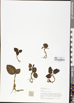
LE 01048783
Anoectochilus roxburghii (Wall.) Lindl. det. Averyanov, Leonid Vladimirovich at 04.05.2018
Collectors: Averyanov, Leonid Vladimirovich; Khang Sinh Nguyen; Maisak, Tatiana Viktorovna Field collecting number: AL596. Collection date: 04.05.2018. Administrative regions: LA - Khammouan. Groups of specimens: L. V. Averyanov specimens; L. V. Averyanov herbarium; L. V. Averyanov photos; Orchids of Vietnam, Laos and CambodiaOriginal label text:FLORA OF LAOS Hin Nam No Nature Protected Area Orchidaceae Anoectochilus roxburghii (Wall.) Lindl. Laos, Khammouane prov., Boualapha distr., Nong Seng village, southern sandstone slopes at summit of Phou Chuang (Poujeuang) Mt. around point 17°35'00.3"N, 105°47'35.6"E. Primary evergreen mixed and coniferous dense wind-formed forest at elev. 1000-1400 m a.s.l. Creeping terrestrial herb in shady mossy place. Leaves dark velvety olive with pink or whitish nerves. Occasional. 4 May 2018, L. Averyanov, Khang Sinh Nguyen, T. Maisak, Littideth Xaiyavongsa, Siphanom Keovankham, AL 596.
Coordinates (geographic position): 17° 35′ 0.3″ N, 105° 47′ 35.6″ E ±1000 mRecord creation: 2019-01-13, Leonid Averyanov, PhotoScan D1Citation: Specimen LE 01048783 // Virtual herbarium of Komarov Botanical Institute RAS — http://re.herbariumle.ru/01048783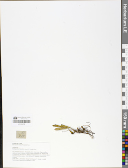
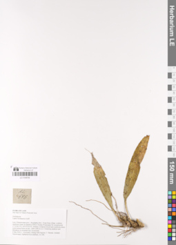
LE 01048782
Bulbophyllum lepidum (Blume) J.J.Sm. det. Averyanov, Leonid Vladimirovich at 15.03.2022
Additional identifications: Bulbophyllum flabellum-veneris (J.Koenig) Aver. det. Averyanov, Leonid Vladimirovich at 04.05.2018 Collectors: Averyanov, Leonid Vladimirovich; Khang Sinh Nguyen; Maisak, Tatiana Viktorovna; et al. Field collecting number: AL665. Collection date: 04.05.2018. Administrative regions: LA - Khammouan. Groups of specimens: L. V. Averyanov specimens; L. V. Averyanov herbarium; L. V. Averyanov photos; Orchids of Vietnam, Laos and CambodiaOriginal label text:FLORA OF LAOS
Hin Nam No Nature Protected Area
Orchidaceae
Bulbophyllum flabellum-veneris (J. Koenig) Aver.
Laos, Khammouane prov., Boualapha distr., Nong Seng village, southern sandstone slopes at summit of Phou Chuang (Poujeuang) Mt. around point 17°35'00.3"N, 105°47'35.6"E. Primary evergreen mixed and coniferous dense wind-formed forest at elev. 1000-1400 m a.s.l. Epiphyte on mossy tree. Common. 4 May 2018, L. Averyanov, Khang Sinh Nguyen, T. Maisak, Littideth Xaiyavongsa, Siphanom Keovankham, AL 665.
LE 01048746
Liparis bootanensis Griff. det. Averyanov, Leonid Vladimirovich at 04.05.2018
Collectors: Averyanov, Leonid Vladimirovich; Khang Sinh Nguyen; Maisak, Tatiana Viktorovna; et al. Field collecting number: AL646. Collection date: 04.05.2018. Administrative regions: LA - Khammouan. Groups of specimens: L. V. Averyanov specimens; L. V. Averyanov herbarium; L. V. Averyanov photos; Orchids of Vietnam, Laos and CambodiaOriginal label text:FLORA OF LAOS
Hin Nam No Nature Protected Area
Orchidaceae Liparis bootanensis Griff.
Laos, Khammouane prov., Boualapha distr., Nong Seng village, southern sandstone slopes at summit of Phou Chuang (Poujeuang) Mt. around point 17°35'00.3"N, 105°47'35.6"E. Primary evergreen mixed and coniferous dense wind-formed forest at elev. 1000-1400 m a.s.l. Clustering epiphyte and lithophyte on mountain top. Occasional.
4 May 2018, L. Averyanov, Khang Sinh Nguyen, T. Maisak, Littideth Xaiyavongsa, Siphanom Keovankham, AL 646.
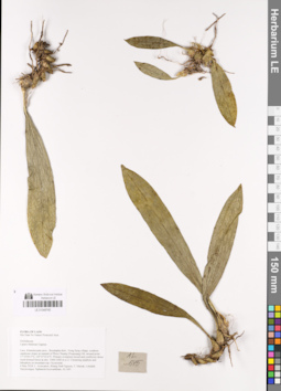
LE 01048745
Liparis balansae Gagnep. det. Averyanov, Leonid Vladimirovich at 04.05.2018
Collectors: Averyanov, Leonid Vladimirovich; Khang Sinh Nguyen; Maisak, Tatiana Viktorovna; et al. Field collecting number: AL645. Collection date: 04.05.2018. Administrative regions: LA - Khammouan. Groups of specimens: L. V. Averyanov specimens; L. V. Averyanov herbarium; L. V. Averyanov photos; Orchids of Vietnam, Laos and CambodiaOriginal label text:FLORA OF LAOS
Coordinates (geographic position): 17° 35′ 0.3″ N, 105° 47′ 35.6″ E ±1000 mRecord creation: 2019-01-13, Leonid Averyanov, PhotoScan D1. Processing status: work_status_1Citation: Specimen LE 01048745 // Virtual herbarium of Komarov Botanical Institute RAS — http://re.herbariumle.ru/01048745Hin Nam No Nature Protected Area
Orchidaceae
Liparis balansae Gagnep.
Laos, Khammouane prov., Boualapha distr., Nong Seng village, southern sandstone slopes at summit of Phou Chuang (Poujeuang) Mt. around point 17°35'00.3"N, 105°47'35.6"E. Primary evergreen mixed and coniferous dense wind-formed forest at elev. 1000-1400 m a.s.l. Clustering epiphyte and lithophyte on mountain top. Occasional. 4 May 2018, L. Averyanov, Khang Sinh Nguyen, T. Maisak, Littideth Xaiyavongsa, Siphanom Keovankham, AL 645.
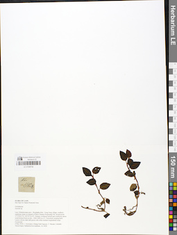
LE 01048744
Goodyera rhombodoides Aver. ⟮prelim. ID⟯ det. Averyanov, Leonid Vladimirovich at 10.03.2022
Additional identifications: Zeuxine sp. det. Averyanov, Leonid Vladimirovich at 04.05.2018 Collectors: Averyanov, Leonid Vladimirovich; Khang Sinh Nguyen; Maisak, Tatiana Viktorovna; et al. Field collecting number: AL642b. Collection date: 04.05.2018. Administrative regions: LA - Khammouan. Groups of specimens: L. V. Averyanov specimens; L. V. Averyanov herbarium; L. V. Averyanov photos; Orchids of Vietnam, Laos and CambodiaOriginal label text:FLORA OF LAOS
Coordinates (geographic position): 17° 35′ 0.3″ N, 105° 47′ 35.6″ E ±1000 mComment: Hin Nam No Nature Protected Area
Orchidaceae
Zeuxine sp.
Laos, Khammouane prov., Boualapha distr., Nong Seng village, southern sandstone slopes at summit of Phou Chuang (Poujeuang) Mt. around point 17°35'00.3"N, 105°47'35.6"E. Primary evergreen mixed and coniferous dense wind-formed forest at elev. 1000-1400 m a.s.l. Terrestrial creeping herb. Leaves velvety dark dull green with white median longitudinal stripe. Occasional. 4 May 2018, L. Averyanov, Khang Sinh Nguyen, T. Maisak, Littideth Xaiyavongsa, Siphanom Keovankham, AL 642b
All photos © - L. Averyanov
Record creation: 2019-01-13, Leonid Averyanov, PhotoScan D1. Processing status: work_status_1Citation: Specimen LE 01048744 // Virtual herbarium of Komarov Botanical Institute RAS — http://re.herbariumle.ru/01048744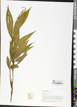
LE 01048743
Tropidia curculigoides Lindl. det. Averyanov, Leonid Vladimirovich at 08.05.2018
Collectors: Averyanov, Leonid Vladimirovich; Khang Sinh Nguyen; Maisak, Tatiana Viktorovna; et al. Field collecting number: AL778. Collection date: 08.05.2018. Administrative regions: LA - Khammouan. Groups of specimens: L. V. Averyanov specimens; L. V. Averyanov herbarium; L. V. Averyanov photos; Orchids of Vietnam, Laos and CambodiaOriginal label text:FLORA OF LAOS
Comment: Hin Nam No Nature Protected Area
Orchidaceae
Tropidia curculigoides Lindl.
Laos, Khammoune prov., Boualapha distr., Vang Maner village, Palai mountain area, around point 17°30'13.6"N, 105°49'23.9"E, 520 m a.s.l. Primary dry evergreen and semideciduous broad-leaved forest on very steep rocky slope near karstic hill top composed with solid, marble-like highly eroded limestone at 300-500 m a.s.l. Terrestrial herb in shady place. Occasional. 8 May 2018, L. Averyanov, Khang Sinh Nguyen, T. Maisak, Littideth Xaiyavongsa, Siphanom Keovankham, AL 778.
All photos © - L. Averyanov
Record creation: 2019-01-13, Leonid Averyanov, PhotoScan D1. Processing status: work_status_1Citation: Specimen LE 01048743 // Virtual herbarium of Komarov Botanical Institute RAS — http://re.herbariumle.ru/01048743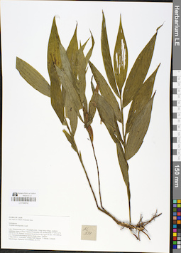
LE 01048742
Tropidia curculigoides Lindl. det. Averyanov, Leonid Vladimirovich at 03.05.2018
Collectors: Averyanov, Leonid Vladimirovich; Khang Sinh Nguyen; Maisak, Tatiana Viktorovna; et al. Field collecting number: AL511. Collection date: 03.05.2018. Administrative regions: LA - Khammouan. Groups of specimens: L. V. Averyanov specimens; L. V. Averyanov photos; L. V. Averyanov herbarium; Orchids of Vietnam, Laos and CambodiaOriginal label text:FLORA OF LAOS
Coordinates (geographic position): 17° 34′ 13.3″ N, 105° 47′ 57.5″ E ±1000 mRecord creation: 2019-01-13, Leonid Averyanov, PhotoScan D1. Processing status: work_status_1Citation: Specimen LE 01048742 // Virtual herbarium of Komarov Botanical Institute RAS — http://re.herbariumle.ru/01048742Hin Nam No Nature Protected Area
Orchidaceae
Tropidia curculigoides Lindl.
Laos, Khammouane prov., Boualapha distr., Nong Seng village, southern sandstone slopes of Phou Chuang (Poujeuang) Mt. around point 17°34'13.3"N 105°47'57.5"E. Primary evergreen broad-leaved dry forest at elev. 700-1000 m a.s.l. Terrestrial rhizomatous herb in shady place. Not rare. 3 May 2018, L. Averyanov, Khang Sinh Nguyen, T. Maisak, Littideth Xaiyavongsa, Siphanom Keovankham, AL 511.
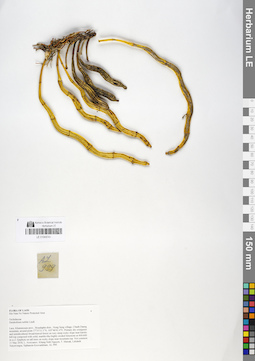
LE 01048741
Dendrobium nobile Lindl. det. Averyanov, Leonid Vladimirovich at 11.05.2018
Collectors: Averyanov, Leonid Vladimirovich; Khang Sinh Nguyen; Maisak, Tatiana Viktorovna; et al. Field collecting number: AL999. Collection date: 11.05.2018. Administrative regions: LA - Khammouan. Groups of specimens: L. V. Averyanov specimens; L. V. Averyanov herbarium; L. V. Averyanov photos; Orchids of Vietnam, Laos and CambodiaOriginal label text:FLORA OF LAOS
Coordinates (geographic position): 17° 31′ 11.1″ N, 105° 46′ 41.4″ E ±1000 mRecord creation: 2019-01-13, Leonid Averyanov, PhotoScan D1. Processing status: work_status_1Citation: Specimen LE 01048741 // Virtual herbarium of Komarov Botanical Institute RAS — http://re.herbariumle.ru/01048741Hin Nam No Nature Protected Area
Orchidaceae
Dendrobium nobile Lindl.
Laos, Khammoune prov., Boualapha distr., Nong Seng village, Chanh Daeng mountain, around point 17°31'11.1"N, 105°46'41.4"E. Primary dry evergreen and semideciduous broad-leaved forest on very steep rocky slope near karstic hill top composed with solid, marble-like highly eroded limestone at 400-600 m a.s.l. Epiphyte on tall trees on rocky slope near mountain top. Not common. 11 May 2018, L. Averyanov, Khang Sinh Nguyen, T. Maisak, Littideth Xaiyavongsa, Siphanom Keovankham, AL 999.
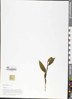
LE 01048740
Tropidia curculigoides Lindl. det. Averyanov, Leonid Vladimirovich at 08.05.2018
Collectors: Averyanov, Leonid Vladimirovich; Khang Sinh Nguyen; Maisak, Tatiana Viktorovna; et al. Field collecting number: AL808. Collection date: 08.05.2018. Administrative regions: LA - Khammouan. Groups of specimens: L. V. Averyanov specimens; L. V. Averyanov herbarium; L. V. Averyanov photos; Orchids of Vietnam, Laos and CambodiaOriginal label text:FLORA OF LAOS
Comment: Hin Nam No Nature Protected Area
Orchidaceae
Tropidia curculigoides Lindl.
Laos, Khammoune prov., Boualapha distr., Vang Maner village, Palai mountain area, around point 17°30'13.6"N, 105°49'23.9"E, 520 m a.s.l. Primary dry evergreen and semideciduous broad-leaved forest on very steep rocky slope near karstic hill top composed with solid, marble-like highly eroded limestone at 300-500 m a.s.l. Terrestrial herb on shady rocky slope. Not common. 8 May 2018, L. Averyanov, Khang Sinh Nguyen, T. Maisak, Littideth Xaiyavongsa, Siphanom Keovankham, AL 808.
All photos © - L. Averyanov
Record creation: 2019-01-13, Leonid Averyanov, PhotoScan D1. Processing status: work_status_1Citation: Specimen LE 01048740 // Virtual herbarium of Komarov Botanical Institute RAS — http://re.herbariumle.ru/01048740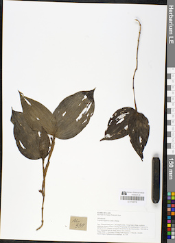
LE 01048738
Tropidia angulosa (Lindl.) Blume det. Averyanov, Leonid Vladimirovich at 03.05.2018
Collectors: Averyanov, Leonid Vladimirovich; Khang Sinh Nguyen; Maisak, Tatiana Viktorovna; et al. Field collecting number: AL539. Collection date: 03.05.2018. Administrative regions: LA - Khammouan. Groups of specimens: L. V. Averyanov specimens; L. V. Averyanov herbarium; L. V. Averyanov photos; Orchids of Vietnam, Laos and CambodiaOriginal label text:FLORA OF LAOS
Coordinates (geographic position): 17° 34′ 13.3″ N, 105° 47′ 57.5″ E ±1000 mComment: Hin Nam No Nature Protected Area
Orchidaceae
Tropidia angulosa (Lindl.) Blume
Laos, Khammouane prov., Boualapha distr., Nong Seng village, southern sandstone slopes of Phou Chuang (Poujeuang) Mt. around point 17°34'13.3"N 105°47'57.5"E. Primary evergreen broad-leaved dry forest at elev. 700-1000 m a.s.l. Terrestrial herb in shady places. Not common. 3 May 2018, L. Averyanov, Khang Sinh Nguyen, T. Maisak, Littideth Xaiyavongsa, Siphanom Keovankham, AL 539.
All photos © - L. Averyanov
Record creation: 2019-01-13, Leonid Averyanov, PhotoScan D1. Processing status: work_status_1Citation: Specimen LE 01048738 // Virtual herbarium of Komarov Botanical Institute RAS — http://re.herbariumle.ru/01048738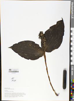
LE 01048735
Tropidia angulosa (Lindl.) Blume det. Averyanov, Leonid Vladimirovich at 06.05.2018
Collectors: Averyanov, Leonid Vladimirovich; Khang Sinh Nguyen; Maisak, Tatiana Viktorovna; et al. Field collecting number: AL738. Collection date: 06.05.2018. Administrative regions: LA - Khammouan. Groups of specimens: L. V. Averyanov specimens; L. V. Averyanov herbarium; L. V. Averyanov photos; Orchids of Vietnam, Laos and CambodiaOriginal label text:FLORA OF LAOS
Coordinates (geographic position): 17° 33′ 14.4″ N, 105° 47′ 50.4″ E ±1000 mComment: Hin Nam No Nature Protected Area
Orchidaceae
Tropidia angulosa (Lindl.) Blume
Laos, Khammouane prov., Boualapha distr., Nong Seng village, southern sandstone slopes of Phou Chuang (Poujeuang) Mt. around point 17°33'14.4"N, 105°47'50.4"E. Primary semideciduous and evergreen broad-leaved dry forest at elev. 300-400 m a.s.l. Terrestrial herb in shady place. Common. 6 May 2018, L. Averyanov, Khang Sinh Nguyen, T. Maisak, Littideth Xaiyavongsa, Siphanom Keovankham, AL 738.
All photos © - L. Averyanov
Record creation: 2019-01-13, Leonid Averyanov, PhotoScan D1. Processing status: work_status_1Citation: Specimen LE 01048735 // Virtual herbarium of Komarov Botanical Institute RAS — http://re.herbariumle.ru/01048735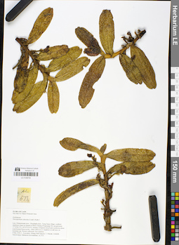
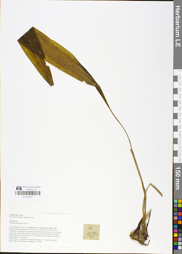
LE 01048734
Thrixspermum calceolus (Lindl.) Rchb.f. det. Averyanov, Leonid Vladimirovich at 04.05.2018
Collectors: Averyanov, Leonid Vladimirovich; Khang Sinh Nguyen; Maisak, Tatiana Viktorovna; et al. Field collecting number: AL673. Collection date: 04.05.2018. Administrative regions: LA - Khammouan. Groups of specimens: L. V. Averyanov specimens; L. V. Averyanov herbarium; L. V. Averyanov photos; Orchids of Vietnam, Laos and CambodiaOriginal label text:FLORA OF LAOS
Coordinates (geographic position): 17° 35′ 0.3″ N, 105° 47′ 35.6″ E ±1000 mRecord creation: 2019-01-13, Leonid Averyanov, PhotoScan D1. Processing status: work_status_1Citation: Specimen LE 01048734 // Virtual herbarium of Komarov Botanical Institute RAS — http://re.herbariumle.ru/01048734Hin Nam No Nature Protected Area
Orchidaceae
Thrixspermum calceolus (Lindl.) Rchb.f.
Laos, Khammouane prov., Boualapha distr., Nong Seng village, southern sandstone slopes at summit of Phou Chuang (Poujeuang) Mt. around point 17°35'00.3"N, 105°47'35.6"E. Primary evergreen mixed and coniferous dense wind-formed forest at elev. 1000-1400 m a.s.l. Epiphyte on tall trees on mountain top. Flowers yellowish. Not common. 4 May 2018, L. Averyanov, Khang Sinh Nguyen, T. Maisak, Littideth Xaiyavongsa, Siphanom Keovankham, AL 673.
LE 01048733
Tainia penangiana Hook.f. det. Averyanov, Leonid Vladimirovich at 08.05.2018
Collectors: Averyanov, Leonid Vladimirovich; Khang Sinh Nguyen; Maisak, Tatiana Viktorovna; et al. Field collecting number: AL788. Collection date: 08.05.2018. Administrative regions: LA - Khammouan. Groups of specimens: L. V. Averyanov specimens; L. V. Averyanov herbarium; L. V. Averyanov photos; Orchids of Vietnam, Laos and CambodiaOriginal label text:FLORA OF LAOS
Comment: Hin Nam No Nature Protected Area
Orchidaceae
Tainia penangiana Hook.f.
Laos, Khammoune prov., Boualapha distr., Vang Maner village, Palai mountain area, around point 17°30'13.6"N, 105°49'23.9"E, 520 m a.s.l. Primary dry evergreen and semideciduous broad-leaved forest on very steep rocky slope near karstic hill top composed with solid, marble-like highly eroded limestone at 300-500 m a.s.l. Terrestrial herb on shady rocky slope with bamboo. Not common. 8 May 2018, L. Averyanov, Khang Sinh Nguyen, T. Maisak, Littideth Xaiyavongsa, Siphanom Keovankham, AL 788.
All photos © - L. Averyanov
Record creation: 2019-01-13, Leonid Averyanov, PhotoScan D1. Processing status: work_status_1Citation: Specimen LE 01048733 // Virtual herbarium of Komarov Botanical Institute RAS — http://re.herbariumle.ru/01048733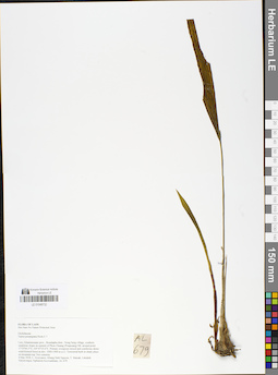
LE 01048732
Tainia penangiana Hook.f. det. Averyanov, Leonid Vladimirovich at 04.05.2018
Collectors: Averyanov, Leonid Vladimirovich; Khang Sinh Nguyen; Maisak, Tatiana Viktorovna; et al. Field collecting number: AL679. Collection date: 04.05.2018. Administrative regions: LA - Khammouan. Groups of specimens: L. V. Averyanov specimens; L. V. Averyanov herbarium; L. V. Averyanov photos; Orchids of Vietnam, Laos and CambodiaOriginal label text:FLORA OF LAOS
Coordinates (geographic position): 17° 35′ 0.3″ N, 105° 47′ 35.6″ E ±1000 mComment: Hin Nam No Nature Protected Area
Orchidaceae
Tainia penangiana Hook.f. ?
Laos, Khammouane prov., Boualapha distr., Nong Seng village, southern sandstone slopes at summit of Phou Chuang (Poujeuang) Mt. around point 17°35'00.3"N, 105°47'35.6"E. Primary evergreen mixed and coniferous dense wind-formed forest at elev. 1000-1400 m a.s.l. Terrestrial herb in shady place on mountain top. Not common. 4 May 2018, L. Averyanov, Khang Sinh Nguyen, T. Maisak, Littideth Xaiyavongsa, Siphanom Keovankham, AL 679.
All photos © - L. Averyanov
Record creation: 2019-01-13, Leonid Averyanov, PhotoScan D1. Processing status: work_status_1Citation: Specimen LE 01048732 // Virtual herbarium of Komarov Botanical Institute RAS — http://re.herbariumle.ru/01048732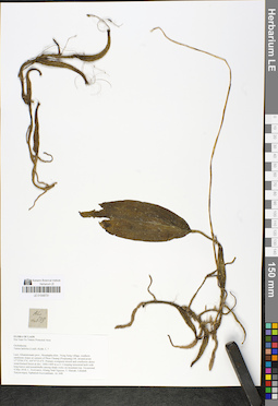
LE 01048731
Tainia latifolia (Lindl.) Rchb.f. det. Averyanov, Leonid Vladimirovich at 04.05.2018
Collectors: Averyanov, Leonid Vladimirovich; Khang Sinh Nguyen; Maisak, Tatiana Viktorovna; et al. Field collecting number: AL648. Collection date: 04.05.2018. Administrative regions: LA - Khammouan. Groups of specimens: L. V. Averyanov specimens; L. V. Averyanov herbarium; L. V. Averyanov photos; Orchids of Vietnam, Laos and CambodiaOriginal label text:FLORA OF LAOS
Coordinates (geographic position): 17° 35′ 0.3″ N, 105° 47′ 35.6″ E ±1000 mComment: Hin Nam No Nature Protected Area
Orchidaceae
Tainia latifolia (Lindl.) Rchb. f., ?
Laos, Khammouane prov., Boualapha distr., Nong Seng village, southern sandstone slopes at summit of Phou Chuang (Poujeuang) Mt. around point 17°35'00.3"N, 105°47'35.6"E. Primary evergreen mixed and coniferous dense wind-formed forest at elev. 1000-1400 m a.s.l. Creeping terrestrial herb with long leaves and pseudobulbs among shady rocks on mountain top. Occasional. 4 May 2018, L. Averyanov, Khang Sinh Nguyen, T. Maisak, Littideth Xaiyavongsa, Siphanom Keovankham, AL 648.
All photos © - L. Averyanov
Record creation: 2019-01-13, Leonid Averyanov, PhotoScan D1. Processing status: work_status_1Citation: Specimen LE 01048731 // Virtual herbarium of Komarov Botanical Institute RAS — http://re.herbariumle.ru/01048731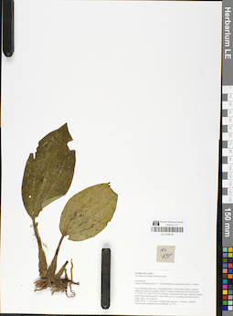
LE 01048730
Tainia macrantha Hook.f. ⟮prelim. ID⟯ det. Averyanov, Leonid Vladimirovich at 19.03.2025
Additional identifications: Tainia cordifolia Hook.f. det. Averyanov, Leonid Vladimirovich at 04.05.2018; Mischobulbum cordifolium (Hook.f.) Schltr. det. Averyanov, Leonid Vladimirovich at 04.05.2018 Collectors: Averyanov, Leonid Vladimirovich; Khang Sinh Nguyen; Maisak, Tatiana Viktorovna; et al. Field collecting number: AL651. Collection date: 04.05.2018. Administrative regions: LA - Khammouan. Groups of specimens: L. V. Averyanov specimens; L. V. Averyanov herbarium; L. V. Averyanov photos; Orchids of Vietnam, Laos and CambodiaOriginal label text:FLORA OF LAOS
Coordinates (geographic position): 17° 35′ 0.3″ N, 105° 47′ 35.6″ E ±1000 mComment: Hin Nam No Nature Protected Area
Orchidaceae
Tainia cordifolia Hook.f. ( = Mischobulbum cordifolium (Hook.f.) Schltr.)
Laos, Khammouane prov., Boualapha distr., Nong Seng village, southern sandstone slopes at summit of Phou Chuang (Poujeuang) Mt. around point 17°35'00.3"N, 105°47'35.6"E. Primary evergreen mixed and coniferous dense wind-formed forest at elev. 1000-1400 m a.s.l. Creeping terrestrial herb in shady place. Not common. 4 May 2018, L. Averyanov, Khang Sinh Nguyen, T. Maisak, Littideth Xaiyavongsa, Siphanom Keovankham, AL 651.
All photos © - L. Averyanov
Record creation: 2019-01-13, Leonid Averyanov, PhotoScan D1. Processing status: work_status_1Citation: Specimen LE 01048730 // Virtual herbarium of Komarov Botanical Institute RAS — http://re.herbariumle.ru/01048730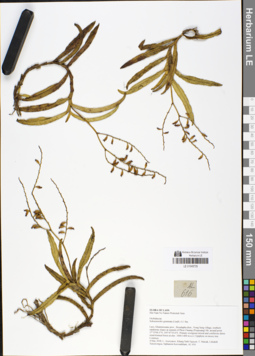
LE 01048729
Schoenorchis gemmata (Lindl.) J.J.Sm. det. Averyanov, Leonid Vladimirovich at 04.05.2018
Collectors: Averyanov, Leonid Vladimirovich; Khang Sinh Nguyen; Maisak, Tatiana Viktorovna; et al. Field collecting number: AL616. Collection date: 04.05.2018. Administrative regions: LA - Khammouan. Groups of specimens: L. V. Averyanov specimens; L. V. Averyanov herbarium; L. V. Averyanov photos; Orchids of Vietnam, Laos and CambodiaOriginal label text:FLORA OF LAOS
Coordinates (geographic position): 17° 35′ 0.3″ N, 105° 47′ 35.6″ E ±1000 mRecord creation: 2019-01-13, Leonid Averyanov, PhotoScan D1. Processing status: work_status_1Citation: Specimen LE 01048729 // Virtual herbarium of Komarov Botanical Institute RAS — http://re.herbariumle.ru/01048729Hin Nam No Nature Protected Area
Orchidaceae
Schoenorchis gemmata (Lindl.) J.J. Sm.
Laos, Khammouane prov., Boualapha distr., Nong Seng village, southern sandstone slopes at summit of Phou Chuang (Poujeuang) Mt. around point 17°35'00.3"N, 105°47'35.6"E. Primary evergreen mixed and coniferous dense wind-formed forest at elev. 1000-1400 m a.s.l. Epiphyte on mossy tree. Common. 4 May 2018, L. Averyanov, Khang Sinh Nguyen, T. Maisak, Littideth Xaiyavongsa, Siphanom Keovankham, AL 616.