View
Add
Copy
Edit
Delete
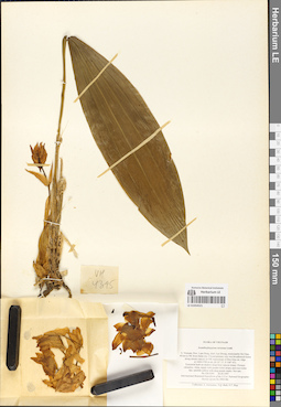
LE 01054521
Acanthophippium striatum Lindl. det. Averyanov, Leonid Vladimirovich at 26.04.1997
Collectors: Averyanov, Leonid Vladimirovich; et al. Field collecting number: VH4395. Collection date: 26.04.1997. Administrative regions: VN - Tinh Lam GJong. Groups of specimens: L. V. Averyanov specimens; L. V. Averyanov herbarium; Orchids of Vietnam, Laos and CambodiaOriginal label text:FLORA OF VIETNAM
Coordinates (geographic position): 12° 11′ N, 108° 43′ E ±1000 mRecord creation: 2019-05-23, Leonid Averyanov, PhotoScan D1. Processing status: work_status_1Citation: Specimen LE 01054521 // Virtual herbarium of Komarov Botanical Institute RAS — http://re.herbariumle.ru/01054521Orchidaceae
Acanthephippium striatum Lindl.
S. Vietnam, Prov. Lam Dong, distr. Lac Duong, municipalite Da Chay,. 40 km to NE from Dalat city. Closed primary very wet broadleaved forest. along stream canyon on SW macroslope of Hon Giao mt. ridge. at 1600-1700 m alt. (N 12° 11', E 108° 43'). Terrestrial herb on shadow steep river canyon slopes. Flowers. odourless, white, tepals with purple-violet stripes and rose-violet. tips, epichile yellow with deep purple marks. Not rare. No VH 4395 26.04.1997.
International Botanical Expedition of the U.S.A. National Geographic. Society (grant No 5803-96).
Collectors: L. Averyanov, N.Q. Binh, N.T. Hiep
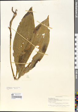
LE 01054520
Acanthophippium striatum Lindl. det. Averyanov, Leonid Vladimirovich at 24.03.1995
Collectors: Averyanov, Leonid Vladimirovich; et al. Field collecting number: VH903. Collection date: 24.03.1995. Administrative regions: VN - Tinh Quang Nam. Groups of specimens: L. V. Averyanov specimens; L. V. Averyanov herbarium; Orchids of Vietnam, Laos and CambodiaOriginal label text:FLORA OF VIETNAM
Record creation: 2019-05-23, Leonid Averyanov, PhotoScan D1. Processing status: work_status_1Citation: Specimen LE 01054520 // Virtual herbarium of Komarov Botanical Institute RAS — http://re.herbariumle.ru/01054520Orchidaceae Juss.
Acanthephippium striatum ?.
S. Vietnam, Prov. Quangnam-Danang. Evegreen close primary forest. on SE slope of Ngoc Linh mountain system at 1700 m alt. Terrestrial herb. Not common. No VH 903 24.03.1995. International Botanical Expedition of the U.S.A. National Geographic. Society (grant No 5094-93). Participants: L. Averyanov, N.T. Ban, A. Budantzev, L. Budantzev,. N.T. Hiep, D.D. Huyen, P.K. Loc, G. Yakovlev
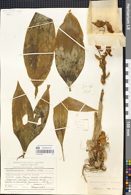
LE 01054519
Acanthophippium striatum Lindl. det. Averyanov, Leonid Vladimirovich at 16.04.1984
Collectors: Averyanov, Leonid Vladimirovich; et al. Field collecting number: LX-VN 1664. Collection date: 16.04.1984. Administrative regions: VN - Tinh Lam GJong. Groups of specimens: L. V. Averyanov specimens; L. V. Averyanov herbarium; Orchids of Vietnam, Laos and CambodiaOriginal label text:FLORA VIETNAMICA
Soviet – Vietnamese Expedition
LX-VN 1664
Orchidaceae
Acanthephippium striatum Lindl.
Vietnam. Prov. Lam Dong, Dalat, Langbiang. 16.04.1984. L. Averyanov et al.
Det.: L. Averyanov 1985
Soviet – Vietnamese Expedition
LX-VN 1664
Orchidaceae
Acanthephippium striatum Lindl.
Vietnam. Prov. Lam Dong, Dalat, Langbiang. 16.04.1984. L. Averyanov et al.
Det.: L. Averyanov 1985
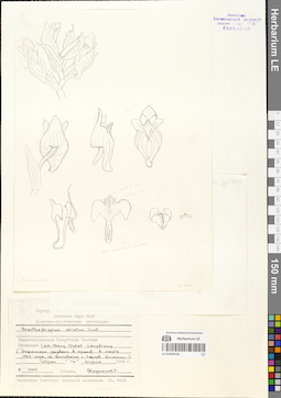
LE 01054518
Acanthophippium striatum Lindl. det. Averyanov, Leonid Vladimirovich at 03.1985
Collectors: Averyanov, Leonid Vladimirovich Field collecting number: LX-VN 1664. Collection date: 03.1985. Administrative regions: VN - Tinh Lam GJong. Groups of specimens: L. V. Averyanov specimens; L. V. Averyanov drawings; Orchids of Vietnam, Laos and CambodiaOriginal label text:Russian - Vietnamese expedition.
Record creation: 2019-05-23, Leonid Averyanov, PhotoScan D1. Processing status: work_status_1Citation: Specimen LE 01054518 // Virtual herbarium of Komarov Botanical Institute RAS — http://re.herbariumle.ru/01054518Orchidaceae
Acanthephippium striatum Lindl.
Vietnam, prov. Lam Dong, Langbian Mt., 16 April 1984, LX-VN 1664, Averyanov et al.
FLowered in garden in March 1985, flowers light yellowish with dark purple nerves. L. Averyanov
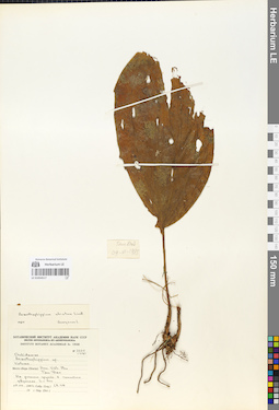
LE 01054517
Acanthophippium striatum Lindl. det. Averyanov, Leonid Vladimirovich at 1985
Collectors: Averyanov, Leonid Vladimirovich; et al. Field collecting number: Averyanov 2325. Collection date: 09.06.1985. Administrative regions: VN - Tinh Vinh Phuc. Groups of specimens: L. V. Averyanov specimens; L. V. Averyanov herbarium; Orchids of Vietnam, Laos and CambodiaOriginal label text:FLORA OF VIETNAM
Record creation: 2019-05-23, Leonid Averyanov, PhotoScan D1. Processing status: work_status_1Citation: Specimen LE 01054517 // Virtual herbarium of Komarov Botanical Institute RAS — http://re.herbariumle.ru/01054517Orchidaceae
Acanthephippium striatum Lindl.
Vinh Phu Province , Tam Dao.
Averyanov L. 2325
09.06.1985
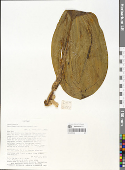
LE 01054516
Acanthophippium striatum Lindl. det. Averyanov, Leonid Vladimirovich at 2001
Collectors: D.K. Harder; Tien Hiep Nguyen; Averyanov, Leonid Vladimirovich; Nguyen Quang Hieu Field collecting number: DKH6988. Collection date: 27.02.2001. Administrative regions: VN - Tinh Lao Cai. Groups of specimens: L. V. Averyanov specimens; L. V. Averyanov herbarium; Orchids of Vietnam, Laos and CambodiaOriginal label text:FLORA OF VIETNAM
Record creation: 2019-05-23, Leonid Averyanov, PhotoScan D1. Processing status: work_status_1Citation: Specimen LE 01054516 // Virtual herbarium of Komarov Botanical Institute RAS — http://re.herbariumle.ru/01054516Orchidaceae
Acanthephippium striatum Lindl.
Lao Cai Province , Van Ban District.
D.K. Harder , N.T. Hiep et al. DKH 6988.
27.02.2001
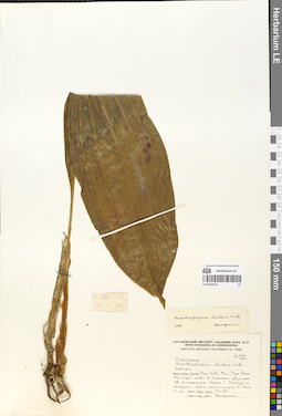
LE 01054515
Acanthophippium striatum Lindl. det. Averyanov, Leonid Vladimirovich at 1985
Collectors: Averyanov, Leonid Vladimirovich; et al. Field collecting number: LX-VN 2355. Collection date: 12.06.1985. Administrative regions: VN - Tinh Vinh Phuc. Groups of specimens: L. V. Averyanov specimens; L. V. Averyanov herbarium; Orchids of Vietnam, Laos and CambodiaOriginal label text:FLORA VIETNAMICA
Soviet – Vietnamese Expedition
LX-VN 2355
Orchidaceae
Acanthephippium striatum Lindl.
Vietnam. Prov. Vinh Phuc, Tam Dao.12.06.1985. L. Averyanov et al.
Det.: L. Averyanov 1985
Soviet – Vietnamese Expedition
LX-VN 2355
Orchidaceae
Acanthephippium striatum Lindl.
Vietnam. Prov. Vinh Phuc, Tam Dao.12.06.1985. L. Averyanov et al.
Det.: L. Averyanov 1985
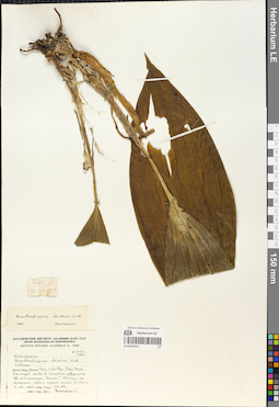
LE 01054514
Acanthophippium striatum Lindl. det. Averyanov, Leonid Vladimirovich at 1985
Collectors: Averyanov, Leonid Vladimirovich; et al. Field collecting number: LX-VN 2355. Collection date: 12.06.1985. Administrative regions: VN - Tinh Vinh Phuc. Groups of specimens: L. V. Averyanov specimens; L. V. Averyanov herbarium; Orchids of Vietnam, Laos and CambodiaOriginal label text:FLORA VIETNAMICA
Soviet – Vietnamese Expedition
LX-VN 2355
Soviet – Vietnamese Expedition
LX-VN 2355
Orchidaceae
Acanthephippium striatum Lindl.
Vietnam. Prov. Vinh Phuc, Tam Dao.12.06.1985. L. Averyanov et al.
Det.: L. Averyanov 1985
Acanthephippium striatum Lindl.
Vietnam. Prov. Vinh Phuc, Tam Dao.12.06.1985. L. Averyanov et al.
Det.: L. Averyanov 1985
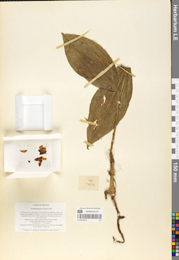
LE 01054513
Acanthophippium striatum Lindl. det. Averyanov, Leonid Vladimirovich at 17.03.1997
Collectors: Averyanov, Leonid Vladimirovich; et al. Field collecting number: VH2774. Collection date: 17.03.1997. Administrative regions: VN - Tinh Lam GJong. Groups of specimens: L. V. Averyanov specimens; L. V. Averyanov herbarium; Orchids of Vietnam, Laos and CambodiaOriginal label text:FLORA OF VIETNAM
Coordinates (geographic position): 12° 8′ N, 108° 39′ E ±1000 mRecord creation: 2019-05-23, Leonid Averyanov, PhotoScan D1. Processing status: work_status_1Citation: Specimen LE 01054513 // Virtual herbarium of Komarov Botanical Institute RAS — http://re.herbariumle.ru/01054513Orchidaceae
Acanthephippium striatum Lindl.
S. Vietnam, Prov. Lam Dong, 31 km to NE from Dalat city, distr. Lac. Duong, municipalite Da Chay (N 12° 08', E 108° 39'). Closed primary. broadleaved mt forest on NW macroslope of Bi Dup mt system at. 1550-1700 m alt. Herb up to 0.6 m hg in shadow places. Flowers white,. tepals with purple stripes. Common. No VH 2774 17.03.1997. International Botanical Expedition of the U.S.A. National Geographic. Society (grant No 5803-96). Collectors: L. Averyanov, N.Q. Binh, N.V. Duy, P.K. Loc
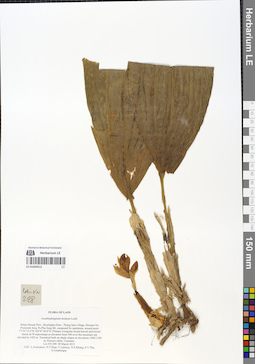
LE 01054512
Acanthophippium striatum Lindl. det. Averyanov, Leonid Vladimirovich at 09.03.2013
Collectors: Averyanov, Leonid Vladimirovich; et al. Field collecting number: LA-VN298. Collection date: 09.03.2013. Administrative regions: LA - Khammouan. Groups of specimens: L. V. Averyanov specimens; L. V. Averyanov herbarium; Orchids of Vietnam, Laos and CambodiaOriginal label text:FLORA OF LAOS
Coordinates (geographic position): 17° 35′ 13.2″ N, 105° 47′ 49.8″ E ±1000 mRecord creation: 2019-05-23, Leonid Averyanov, PhotoScan D1. Processing status: work_status_1Citation: Specimen LE 01054512 // Virtual herbarium of Komarov Botanical Institute RAS — http://re.herbariumle.ru/01054512Orchidaceae
Acanthephippium striatum Lindl.
Kham Mouan Prov., Bounlapha Distr., Thong Sam village, Hinnam No Protected Area, Pu Pha Song Mt. composed by sandstone, around point 17°35'13.2"N 105°47'49.8"E. Primary evergreen broad-leaved and mixed forest on W macroslope at elevation from 500 m to the mountain top elevated to 1425 m. Terrestrial herb on shady slopes at elevations 1000-1300 m. Flowers white. Common. LA-VN 298 09 March 2013. Coll.: L.Averyanov, N.T.Hiep, V.Lamxay, N.S.Khang, P.V.The, S.Lorphengsy
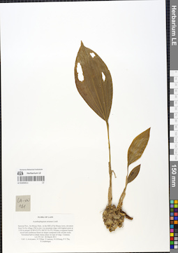
LE 01054511
Acanthophippium striatum Lindl. det. Averyanov, Leonid Vladimirovich at 04.05.2013
Collectors: Averyanov, Leonid Vladimirovich; et al. Field collecting number: LA-VN161. Collection date: 04.03.2013. Administrative regions: LA - Salavan. Groups of specimens: L. V. Averyanov specimens; L. V. Averyanov herbarium; Orchids of Vietnam, Laos and CambodiaOriginal label text:FLORA OF LAOS
Coordinates (geographic position): 16° 8′ 47″ N, 106° 52′ 35.4″ E ±1000 mRecord creation: 2019-05-23, Leonid Averyanov, PhotoScan D1. Processing status: work_status_1Citation: Specimen LE 01054511 // Virtual herbarium of Komarov Botanical Institute RAS — http://re.herbariumle.ru/01054511Orchidaceae
Acanthephippium striatum Lindl.
Saravan Prov., Sa Mouay Distr., to the SEE of Sa Mouay town, elevation from Ta Oy village (700 m elev.) to mountain ridge with highest point at 1350 m around 16°08'47.0"N 106°52'35.4"E. Primary evergreen humid mixed and coniferous forest on slopes composed with silicate rocks. Terrestrial herb in shady mossy place on tops of ridge. Common. LA-VN 161 04 March 2013. Coll.: L.Averyanov, N.T.Hiep, V.Lamxay, N.S.Khang, P.V.The, S.Lorphengsy
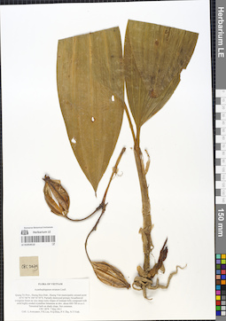
LE 01054510
Acanthophippium striatum Lindl. det. Averyanov, Leonid Vladimirovich at 07.05.2011
Collectors: Averyanov, Leonid Vladimirovich; et al. Field collecting number: CPC2879. Collection date: 07.05.2011. Administrative regions: VN - Tinh Quang Tri. Groups of specimens: L. V. Averyanov specimens; L. V. Averyanov herbarium; Orchids of Vietnam, Laos and CambodiaOriginal label text:FLORA OF VIETNAM
Coordinates (geographic position): 16° 51′ 6″ N, 106° 34′ 38″ E ±1000 mRecord creation: 2019-05-23, Leonid Averyanov, PhotoScan D1. Processing status: work_status_1Citation: Specimen LE 01054510 // Virtual herbarium of Komarov Botanical Institute RAS — http://re.herbariumle.ru/01054510Orchidaceae
Acanthephippium striatum Lindl.
Quang Tri Prov., Huong Hoa Distr., Huong Viet municipality around point 16°51'06"N 106°34'38"E. Partially destroyed primary broadleaved evergreen forest on very steep rocky slopes of remnant hills composed with solid highly eroded crystalline limestone at elev. about 600-700 m a.s.l. Terrestrial herb on shady slope. Not common. CPC 2879 7 May 2011. Coll.: L.Averyanov, P.K.Loc, N.Q.Hieu, P.V.The, N.T.Vinh.
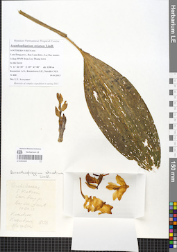
LE 01054509
Acanthophippium striatum Lindl. det. Averyanov, Leonid Vladimirovich at 10.04.2013
Collectors: Nuraliev, M. S.; et al. Field collecting number: Nuraliev 808. Collection date: 10.04.2013. Administrative regions: VN - Tinh Lam GJong. Groups of specimens: L. V. Averyanov specimens; L. V. Averyanov herbarium; Orchids of Vietnam, Laos and CambodiaOriginal label text:Russian-Vietnamese Tropical Centre
Acanthephippium striatum Lindl.
SOUTHERN VIETNAM
Lam Dong prov., Bao Lam distr., Loc Bac munic.
14 km WNW from Loc Thang town
In the forest
N 11° 44' 50'' E 107° 43' 00'' elev. 1200 m
Nuraliev M.S., Kuznetsov A.N., Kuznetsova S.P.
№ 808 10.04.2013
Det. L.V. Averyanov
Materials of multidisciplinary expedition in spring 2013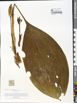
LE 01054508
Acanthophippium striatum Lindl. det. Averyanov, Leonid Vladimirovich at 09.04.2014
Collectors: Nguyen Quang Hieu; et al. Field collecting number: CPC7324. Collection date: 09.04.2014. Administrative regions: VN - Tinh Ha Giang. Groups of specimens: L. V. Averyanov specimens; L. V. Averyanov herbarium; Orchids of Vietnam, Laos and CambodiaOriginal label text:FLORA OF VIETNAM
Record creation: 2019-05-23, Leonid Averyanov, PhotoScan D1. Processing status: work_status_1Citation: Specimen LE 01054508 // Virtual herbarium of Komarov Botanical Institute RAS — http://re.herbariumle.ru/01054508Orchidaceae
Calanthe sp.
Ha Giang Prov., Bac Me District., Phieng Luong commune, Phieng Luong village , Suoi Do stream. Primary evergreen broad- leaf forest on schist at elevation 1000-1140 m a.s.l. Grows in soil humus , on slope and top of mountaine at elevation 1135 m a.s.l. around point 22°37'32.6"N;105°18'23.9"E, 1135 m m a.s.l. Terrestrial herb, flower bud with fruit green. 09 April 2014, CPC 7324. Coll.: N. Q. Hieu, N.T.Hiep, N.N. Hung, T.Q. Ngan, T.P.Tuan, G.M. Pao.
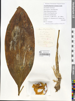
LE 01054507
Acanthophippium striatum Lindl. det. Averyanov, Leonid Vladimirovich at 10.04.2015
Collectors: Nuraliev, M. S.; et al. Field collecting number: Nuraliev 1324. Collection date: 10.04.2015. Administrative regions: VN - Gia Lai. Groups of specimens: L. V. Averyanov specimens; L. V. Averyanov herbarium; Orchids of Vietnam, Laos and CambodiaOriginal label text:Russian-Vietnamese Tropical Centre
Acanthephippium striatum Lindl.
SOUTHERN VIETNAM
Kon Tum prov., Kon Plong distr.
Thach Nham protected forest
16 km N from Mang Den town
In the forest, mountain slope
N 14° 44' 52'' E 108° 18' 10'' elev. 1280 m
Kuznetsov A.N., Kuznetsova S.P., Nuraliev M.S.
№ 1324 10.04.2015
Det. L.V. Averyanov
Materials of multidisciplinary expedition in spring 2015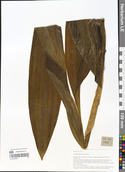
LE 01054506
Acanthophippium striatum Lindl. det. Averyanov, Leonid Vladimirovich at 28.03.2017
Collectors: Averyanov, Leonid Vladimirovich; et al. Field collecting number: LA-VN1817. Collection date: 28.03.2017. Administrative regions: LA - Vientiane Province. Groups of specimens: L. V. Averyanov specimens; L. V. Averyanov herbarium; Orchids of Vietnam, Laos and CambodiaOriginal label text:FLORA OF LAOS
Coordinates (geographic position): 19° 6′ 10.9″ N, 102° 10′ 46.1″ E ±1000 mRecord creation: 2019-05-23, Leonid Averyanov, PhotoScan D1. Processing status: work_status_1Citation: Specimen LE 01054506 // Virtual herbarium of Komarov Botanical Institute RAS — http://re.herbariumle.ru/01054506Orchidaceae
Acanthephippium striatum Lindl.
Vientiane prov., Kasi distr., Si Sang Vone village, around point 19°06'10.9"N 102°10'46.1"E. Secondary and primary evergreen dry forest on very steep rocky mountain slopes composed by solid marble like highly eroded limestone at elev. 600-750 m a.s.l. Terrestrial herb on shady steep rocky slope. Flower buds white with pink-purple nerves. Occasional. LA-VN 1817 28 March 2017. Coll.: L.Averyanov, N.T.Hiep, N.S.Khang, C.Q.Ngan, T.Maisak, Khamla Inkhavilay, Hongthong Southyvohanh, Pinmany Sisavath, Chanthala Cheuaysamphanh.
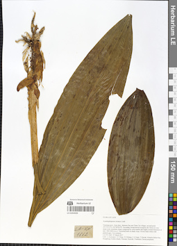
LE 01054505
Acanthophippium striatum Lindl. det. Averyanov, Leonid Vladimirovich at 25.03.2017
Collectors: Averyanov, Leonid Vladimirovich; et al. Field collecting number: LA-VN1662. Collection date: 25.03.2017. Administrative regions: LA - Vientiane Province. Groups of specimens: L. V. Averyanov specimens; L. V. Averyanov herbarium; Orchids of Vietnam, Laos and CambodiaOriginal label text:FLORA OF LAOS
Orchidaceae
Acanthephippium striatum Lindl.
Vientiane prov., Kasi distr., between San and Tham Tai villages, around point 19°17′47.9′'N 102°08′58.9′'E. Secondary broad-leaved evergreen dry forest on very steep rocky mountain slopes composed by solid marble like highly eroded limestone at elev. 900-1000 m a.s.l. Terrestrial herb on shady slope. Flower buds white with pinkish apex. Not common.
LA-VN 1662 25 March 2017
Coll.: L.Averyanov, N.T.Hiep, N.S.Khang, C.Q.Ngan, T.Maisak, Khamla Inkhavilay, Hongthong Southyvohanh, Pinmany Sisavath, Chanthala Cheuaysamphanh.
Coordinates (geographic position): 19° 17′ 47.9″ N, 102° 8′ 58.9″ E ±1000 mRecord creation: 2019-05-23, Leonid Averyanov, PhotoScan D1. Processing status: work_status_1Citation: Specimen LE 01054505 // Virtual herbarium of Komarov Botanical Institute RAS — http://re.herbariumle.ru/01054505Orchidaceae
Acanthephippium striatum Lindl.
Vientiane prov., Kasi distr., between San and Tham Tai villages, around point 19°17′47.9′'N 102°08′58.9′'E. Secondary broad-leaved evergreen dry forest on very steep rocky mountain slopes composed by solid marble like highly eroded limestone at elev. 900-1000 m a.s.l. Terrestrial herb on shady slope. Flower buds white with pinkish apex. Not common.
LA-VN 1662 25 March 2017
Coll.: L.Averyanov, N.T.Hiep, N.S.Khang, C.Q.Ngan, T.Maisak, Khamla Inkhavilay, Hongthong Southyvohanh, Pinmany Sisavath, Chanthala Cheuaysamphanh.
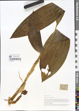
LE 01054504
Acanthophippium striatum Lindl. det. Averyanov, Leonid Vladimirovich at 25.03.2017
Collectors: Averyanov, Leonid Vladimirovich; et al. Field collecting number: LA-VN1662. Collection date: 25.03.2017. Administrative regions: LA - Vientiane Province. Groups of specimens: L. V. Averyanov specimens; L. V. Averyanov herbarium; Orchids of Vietnam, Laos and CambodiaOriginal label text:FLORA OF LAOS
Orchidaceae
Acanthephippium striatum Lindl.
Vientiane prov., Kasi distr., between San and Tham Tai villages, around point 19°17′47.9′'N 102°08′58.9′'E. Secondary broad-leaved evergreen dry forest on very steep rocky mountain slopes composed by solid marble like highly eroded limestone at elev. 900-1000 m a.s.l. Terrestrial herb on shady slope. Flower buds white with pinkish apex. Not common.
LA-VN 1662 25 March 2017
Coll.: L.Averyanov, N.T.Hiep, N.S.Khang, C.Q.Ngan, T.Maisak, Khamla Inkhavilay, Hongthong Southyvohanh, Pinmany Sisavath, Chanthala Cheuaysamphanh.
Coordinates (geographic position): 19° 17′ 47.9″ N, 102° 8′ 58.9″ E ±1000 mRecord creation: 2019-05-23, Leonid Averyanov, PhotoScan D1. Processing status: work_status_1Citation: Specimen LE 01054504 // Virtual herbarium of Komarov Botanical Institute RAS — http://re.herbariumle.ru/01054504Orchidaceae
Acanthephippium striatum Lindl.
Vientiane prov., Kasi distr., between San and Tham Tai villages, around point 19°17′47.9′'N 102°08′58.9′'E. Secondary broad-leaved evergreen dry forest on very steep rocky mountain slopes composed by solid marble like highly eroded limestone at elev. 900-1000 m a.s.l. Terrestrial herb on shady slope. Flower buds white with pinkish apex. Not common.
LA-VN 1662 25 March 2017
Coll.: L.Averyanov, N.T.Hiep, N.S.Khang, C.Q.Ngan, T.Maisak, Khamla Inkhavilay, Hongthong Southyvohanh, Pinmany Sisavath, Chanthala Cheuaysamphanh.
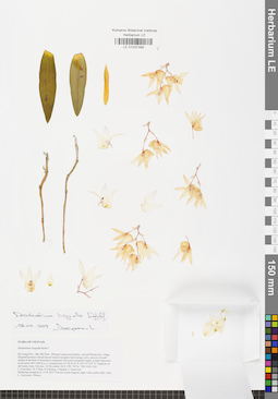
LE 01037399
Dendrobium linguella Rchb.f. det. Averyanov, Leonid Vladimirovich at 13.05.2019
Collectors: Averyanov, Leonid Vladimirovich; et al. Field collecting number: CPC7473c TM 1168. Collection date: 13.05.2019. Administrative regions: VN - Tinh Ha Giang. Groups of specimens: L. V. Averyanov specimens; L. V. Averyanov herbarium; Orchids of Vietnam, Laos and CambodiaOriginal label text:FLORA OF VIETNAM
Orchidaceae
Dendrobium linguella Rchb.f.
Ha Giang Prov., Bac Me Distr., Phieng Luong municipality, around Phieng Day village. Degraded primary broad-leaved humid evergreen forest along rocky canyon of small stream at the base of mountains composed with solid crystalline highly eroded limestone at elevation 900-1000 m a.s.l. around point 22°38′43.8″N 105°19′19.8″E. Epiphyte on old mossy trees. Not rare. 16 November 2014 CPC 7473c / TM 1168. Coll.: L.Averyanov, N.T.Hiep, N.S.Khang, T.Maisak, L.Osinovetz
Record creation: 2019-05-23, Leonid Averyanov, PhotoScan D1. Processing status: work_status_1Citation: Specimen LE 01037399 // Virtual herbarium of Komarov Botanical Institute RAS — http://re.herbariumle.ru/01037399Orchidaceae
Dendrobium linguella Rchb.f.
Ha Giang Prov., Bac Me Distr., Phieng Luong municipality, around Phieng Day village. Degraded primary broad-leaved humid evergreen forest along rocky canyon of small stream at the base of mountains composed with solid crystalline highly eroded limestone at elevation 900-1000 m a.s.l. around point 22°38′43.8″N 105°19′19.8″E. Epiphyte on old mossy trees. Not rare. 16 November 2014 CPC 7473c / TM 1168. Coll.: L.Averyanov, N.T.Hiep, N.S.Khang, T.Maisak, L.Osinovetz
Herbarium prepared in 13.05.2019. Flowers sweet fragrant, light violet, antler dark violet L. Averyanov. Photos.
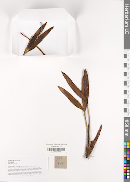
LE 01037398
Eria stricta Lindl. det. Averyanov, Leonid Vladimirovich at 17.10.2018
Collectors: Averyanov, Leonid Vladimirovich; et al. Field collecting number: VR874. Collection date: 17.10.2018. Administrative regions: VN - Tinh Ha Giang. Groups of specimens: L. V. Averyanov specimens; L. V. Averyanov herbarium; L. V. Averyanov photos; Orchids of Vietnam, Laos and CambodiaOriginal label text:FLORA OF VIETNAM
Coordinates (geographic position): 23° 4′ 38.6″ N, 104° 56′ 6.8″ E ±1000 mComment: Orchidaceae
Eria stricta Lindl.
Ha Giang prov., Quan Ba distr., Tung Vai commune, Thung Pang village, around point 23º04ʹ38.6ʺN 104º56ʹ06.8ʺE, steep rocky slopes near hill top composed with stratified highly eroded limestone at elevation 1000–1100 m a.s.l. Remnants of primary evergreen broad-leaved very humid forest. Lithophytic clustering herb on mossy rocks. Flower buds white. Common.
17 October 2018, L. Averyanov, Nguyen Sinh Khang, T. Maisak, Truong Duc Thieu, VR 874.
All photos © L. Averyanov & K.S. Nguyen
Record creation: 2019-05-23, Leonid Averyanov, PhotoScan D1. Processing status: work_status_1Citation: Specimen LE 01037398 // Virtual herbarium of Komarov Botanical Institute RAS — http://re.herbariumle.ru/01037398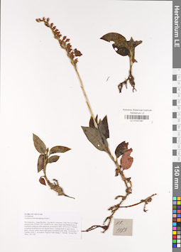
LE 01037397
Goodyera schlechtendaliana Rchb.f. det. Averyanov, Leonid Vladimirovich at 21.10.2018
Collectors: Averyanov, Leonid Vladimirovich; Khang Sinh Nguyen; Maisak, Tatiana Viktorovna; Truong Duc Thieu Field collecting number: VR1183. Collection date: 21.10.2018. Administrative regions: VN - Tinh Ha Giang. Groups of specimens: L. V. Averyanov specimens; L. V. Averyanov herbarium; L. V. Averyanov photos; Orchids of Vietnam, Laos and CambodiaOriginal label text:FLORA OF VIETNAM
Coordinates (geographic position): 23° 4′ 47.2″ N, 104° 48′ 55.6″ E ±1000 mComment: Orchidaceae
Goodyera schlechtendaliana Rchb.f.
Ha Giang prov., Quan Ba distr., Cao Ma Po commune, Chin Chu Lin village, around point 23º04ʹ47.2ʺN 104º48ʹ55.6ʺE, steep slopes and flattened top of mountain composed with sandstone at elevation 1800–1950 m a.s.l. Primary evergreen broad-leaved very humid forest. Creeping herb in open mossy place. Flowers white, leaves dark green tessellated with white. Occasional. 21 October 2018, L. Averyanov, Nguyen Sinh Khang, T. Maisak, Truong Duc Thieu, VR 1183.
All photos © L. Averyanov & K.S. Nguyen
Record creation: 2019-05-23, Leonid Averyanov, PhotoScan D1. Processing status: work_status_1Citation: Specimen LE 01037397 // Virtual herbarium of Komarov Botanical Institute RAS — http://re.herbariumle.ru/01037397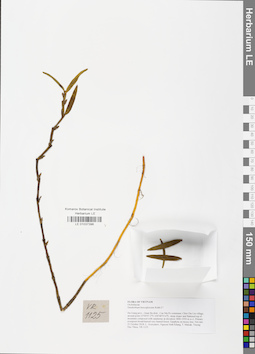
LE 01037396
Dendrobium hercoglossum Rchb.f. ⟮prelim. ID⟯ det. Averyanov, Leonid Vladimirovich at 21.10.2018
Collectors: Averyanov, Leonid Vladimirovich; Khang Sinh Nguyen; Maisak, Tatiana Viktorovna; Truong Duc Thieu Field collecting number: VR1125. Collection date: 21.10.2018. Administrative regions: VN - Tinh Ha Giang. Groups of specimens: L. V. Averyanov specimens; L. V. Averyanov herbarium; L. V. Averyanov photos; Orchids of Vietnam, Laos and CambodiaOriginal label text:FLORA OF VIETNAM
Coordinates (geographic position): 23° 4′ 47.2″ N, 104° 48′ 55.6″ E ±1000 mComment: Orchidaceae
Dendrobium hercoglossum Rchb.f.?
Ha Giang prov., Quan Ba distr., Cao Ma Po commune, Chin Chu Lin village, around point 23º04ʹ47.2ʺN 104º48ʹ55.6ʺE, steep slopes and flattened top of mountain composed with sandstone at elevation 1800–1950 m a.s.l. Primary evergreen broad-leaved very humid forest. Epiphyte on mossy tree. Not rare. 21 October 2018, L. Averyanov, Nguyen Sinh Khang, T. Maisak, Truong Duc Thieu, VR 1125.
All photos © L. Averyanov & K.S. Nguyen
Record creation: 2019-05-23, Leonid Averyanov, PhotoScan D1. Processing status: work_status_1Citation: Specimen LE 01037396 // Virtual herbarium of Komarov Botanical Institute RAS — http://re.herbariumle.ru/01037396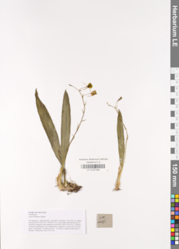
LE 01037395
Liparis balansae Gagnep. det. Averyanov, Leonid Vladimirovich at 21.10.2018
Collectors: Averyanov, Leonid Vladimirovich; Khang Sinh Nguyen; Maisak, Tatiana Viktorovna; Truong Duc Thieu Field collecting number: VR1120. Collection date: 21.10.2018. Administrative regions: VN - Tinh Ha Giang. Groups of specimens: L. V. Averyanov specimens; L. V. Averyanov herbarium; L. V. Averyanov photos; Orchids of Vietnam, Laos and CambodiaOriginal label text:FLORA OF VIETNAM
Coordinates (geographic position): 23° 4′ 47.2″ N, 104° 48′ 55.6″ E ±1000 mComment: Orchidaceae
Liparis balansae Gagnep.
Ha Giang prov., Quan Ba distr., Cao Ma Po commune, Chin Chu Lin village, around point 23º04ʹ47.2ʺN 104º48ʹ55.6ʺE, steep slopes and flattened top of mountain composed with sandstone at elevation 1800–1950 m a.s.l. Primary evergreen broad-leaved very humid forest. Epiphyte on mossy tree. Flowers green. Occasional.
21 October 2018, L. Averyanov, Nguyen Sinh Khang, T. Maisak, Truong Duc Thieu, VR 1120.
All photos © L. Averyanov & K.S. Nguyen
Record creation: 2019-05-23, Leonid Averyanov, PhotoScan D1. Processing status: work_status_1Citation: Specimen LE 01037395 // Virtual herbarium of Komarov Botanical Institute RAS — http://re.herbariumle.ru/01037395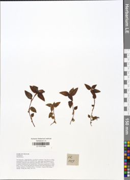
LE 01037394
Goodyera rhombodoides Aver. ⟮prelim. ID⟯ det. Averyanov, Leonid Vladimirovich at 03.01.2022
Additional identifications: Rhomboda sp. det. Averyanov, Leonid Vladimirovich at 21.10.2018 Collectors: Averyanov, Leonid Vladimirovich; Khang Sinh Nguyen; Maisak, Tatiana Viktorovna; Truong Duc Thieu Field collecting number: VR1119. Collection date: 21.10.2018. Administrative regions: VN - Tinh Ha Giang. Groups of specimens: L. V. Averyanov specimens; L. V. Averyanov herbarium; L. V. Averyanov photos; Orchids of Vietnam, Laos and CambodiaOriginal label text:FLORA OF VIETNAM
Coordinates (geographic position): 23° 4′ 47.2″ N, 104° 48′ 55.6″ E ±1000 mComment: Orchidaceae
Rhomboda sp.
Ha Giang prov., Quan Ba distr., Cao Ma Po commune, Chin Chu Lin village, around point 23º04ʹ47.2ʺN 104º48ʹ55.6ʺE, steep slopes and flattened top of mountain composed with sandstone at elevation 1800–1950 m a.s.l. Primary evergreen broad-leaved very humid forest. Terrestrial creeping herb in shady place. Leaves velvety dark dull olive-greenish with white longitudinal stripe. Locally common. 21 October 2018, L. Averyanov, Nguyen Sinh Khang, T. Maisak, Truong Duc Thieu, VR 1119.
All photos © L. Averyanov & K.S. Nguyen
Record creation: 2019-05-23, Leonid Averyanov, PhotoScan D1. Processing status: work_status_1Citation: Specimen LE 01037394 // Virtual herbarium of Komarov Botanical Institute RAS — http://re.herbariumle.ru/01037394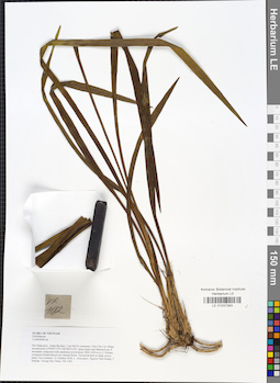
LE 01037393
Cymbidium ensifolium (L.) Sw. det. Averyanov, Leonid Vladimirovich at 07.09.2019
Additional identifications: Cymbidium sp. det. Averyanov, Leonid Vladimirovich at 21.10.2018 Collectors: Averyanov, Leonid Vladimirovich; Khang Sinh Nguyen; Maisak, Tatiana Viktorovna; Truong Duc Thieu Field collecting number: VR1182. Collection date: 21.10.2018. Administrative regions: VN - Tinh Ha Giang. Groups of specimens: L. V. Averyanov specimens; L. V. Averyanov herbarium; L. V. Averyanov photos; Orchids of Vietnam, Laos and CambodiaOriginal label text:FLORA OF VIETNAM
Coordinates (geographic position): 23° 4′ 47.2″ N, 104° 48′ 55.6″ E ±1000 mComment: Orchidaceae
Cymbidium sp.
Ha Giang prov., Quan Ba distr., Cao Ma Po commune, Chin Chu Lin village, around point 23º04ʹ47.2ʺN 104º48ʹ55.6ʺE, steep slopes and flattened top of mountain composed with sandstone at elevation 1800–1950 m a.s.l. Primary evergreen broad-leaved very humid forest. Terrestrial herb in shady mossy place. Not common. 21 October 2018, L. Averyanov, Nguyen Sinh Khang, T. Maisak, Truong Duc Thieu, VR 1182.
All photos © L. Averyanov & K.S. Nguyen
Record creation: 2019-05-23, Leonid Averyanov, PhotoScan D1. Processing status: work_status_1Citation: Specimen LE 01037393 // Virtual herbarium of Komarov Botanical Institute RAS — http://re.herbariumle.ru/01037393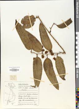
LE 01037392
Smilax sp. det. Pan Li at 29.08.2019
Additional identifications: Smilax sp. det. Averyanov, Leonid Vladimirovich at 04.01.1989 Collectors: Averyanov, Leonid Vladimirovich; et al. Field collecting number: LX-VN 4070. Collection date: 04.01.1989. Administrative regions: VN - Gia Lai; VN - Kon Tum. Groups of specimens: L. V. Averyanov specimens; L. V. Averyanov herbariumOriginal label text:FLORA VIETNAMICA Soviet - Vietnamese expedition LX-VN 4070 04.01.1989. Vietnam. Prov. Gialai - Kontum, Kbang, Tram Lap. Liana 3-4 m long in humid forest. Flowers greenish.
Record creation: 2019-05-23, Leonid Averyanov, PhotoScan D1Citation: Specimen LE 01037392 // Virtual herbarium of Komarov Botanical Institute RAS — http://re.herbariumle.ru/01037392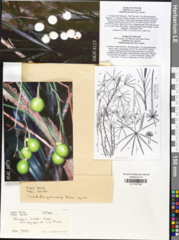
LE 01037390
Isotype of Rhapis vidalii Aver., T.H. Nguyen & P.K. Loc det. Averyanov, Leonid Vladimirovich at 12.12.2002
Additional identifications: Vidaliella podocarpa Aver., H.T.Nguyen et L.K.Phan det. Averyanov, Leonid Vladimirovich at 12.12.2002 Collectors: D.K. Harder; Tien Hiep Nguyen; Averyanov, Leonid Vladimirovich; et al. Field collecting number: DKH8123. Collection date: 12.12.2002. Administrative regions: VN - Tinh Hoa Binh. Groups of specimens: L. V. Averyanov specimens; L. V. Averyanov herbarium; L. V. Averyanov photos; L. V. Averyanov drawingsOriginal label text:ARECACEAE Rhapis Hoa Binh Mai Chau District, Van Mai Municipality, Hwy. 7, 15 km post; on trail to the east between two mountains with Farjon Mountain on left, from village of Van Mai along road at 85 m to locality listed at 420 m. Collection in primary mostly undisturbed lowland, moist broadleaved evergreen forest in shale at very low altitude to karstic limestone with deep fissures. Collections between 20.35.26 N, 105.02.00 E at 300m to 12 Dec 2002 D.K. Harder, N.T. Hiep, P.K. Loc, L.V. Averyanov & B. Hall 8123 Supported by National Geographic Society MISSOURI BOTANICAL GARDEN HERBARIUM (MO) Page 2 20.34.39 N, 105.02.23 E at approx. 400m. elevation. 20°35'26"N 105°02'00"E 300 - 400 m 20°34'39"N 105°02'23"E Locally abundant; among limestone; single stem, non-clinging to 1.5 m; fleshy fruit white sympodial growth. 12 Dec 2002 D.K. Harder, N.T. Hiep, P.K. Loc, L.V. Averyanov & B. Hall 8123 Supported by National Geographic Society MISSOURI BOTANICAL GARDEN HERBARIUM (MO)
Coordinates (geographic position): 20° 35′ 26″ N, 105° 2′ E ±1000 mRecord creation: 2019-05-23, Leonid Averyanov, PhotoScan D1Citation: Specimen LE 01037390 // Virtual herbarium of Komarov Botanical Institute RAS — http://re.herbariumle.ru/01037390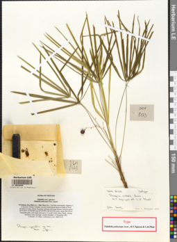
LE 00010444
Isotype of Rhapis vidalii Aver., T.H. Nguyen & P.K. Loc det. Averyanov, Leonid Vladimirovich at 12.12.2002
Additional identifications: Isotype of Vidaliella podocarpa Aver., H.T.Nguyen et L.K.Phan det. Averyanov, Leonid Vladimirovich at 12.12.2002; Isotype of Rhapis cyperifolia Aver. det. Averyanov, Leonid Vladimirovich at 12.12.2002 Collectors: D.K. Harder; Tien Hiep Nguyen; Averyanov, Leonid Vladimirovich; et al. Field collecting number: DKH8123. Collection date: 12.12.2002. Administrative regions: VN - Tinh Hoa Binh. Place of collection: Flora of Vietnam, N. Vietnam, Hoa Binh prov., Mai Chau distr., Van Mai municipality, Highway 7, 15 km post. Primary lowland, very dry broad-leaved forest on shale lower elevation to rocky, karstic limestone outcrops with deep fissures, between points 20° 35' 26'' N 105° 02' 00'' E and 20° 34' 39'' N 105° 02' 23'' E.Groups of specimens: L. V. Averyanov specimens; L. V. Averyanov herbariumOriginal label text:ARECACEAE
Rhapis
Hoa Binh Mai Chau District, Van Mai Municipality, Hwy. 7, 15 km post; on trail to the east between two mountains with Farjon Mountain on left, from village of Van Mai along road at 85 m to locality listed at 420 m. Collection in primary mostly undisturbed lowland, moist broadleaved evergreen forest in shale at very low altitude to karstic limestone with deep fissures. Collections between 20.35.26 N, 105.02.00 E at 300m to 12 Dec 2002 D.K. Harder, N.T. Hiep, P.K. Loc, L.V. Averyanov & B. Hall 8123
Supported by National Geographic Society MISSOURI BOTANICAL GARDEN HERBARIUM (MO) Page 2 20.34.39 N, 105.02.23 E at approx. 400m. elevation. 20°35'26"N 105°02'00"E 300 - 400 m 20°34'39"N 105°02'23"E Locally abundant; among limestone; single stem, non-clinging to 1.5 m; fleshy fruit white sympodial growth. 12 Dec 2002 D.K. Harder, N.T. Hiep, P.K. Loc, L.V. Averyanov & B. Hall 8123 Supported by National Geographic Society MISSOURI BOTANICAL GARDEN HERBARIUM (MO)
[Imported description]
Family: Arecaceae
Taxon: Rhapis vidalii Aver., T.H. Nguyên et P.K. Lôc
Type specimen category: Isotype
Collectors: D. Harder, N.T. Hiep, L. Averyanov et al.
Record number: DKH 8123
Collection date: 12.12.2002
Country: Viet Nam
Locality: Flora of Vietnam, N. Vietnam, Hoa Binh prov., Mai Chau distr., Van Mai municipality, Highway 7, 15 km post. Primary lowland, very dry broad-leaved forest on shale lower elevation to rocky, karstic limestone outcrops with deep fissures, between points 20° 35' 26'' N 105° 02' 00'' E and 20° 34' 39'' N 105° 02' 23'' E
Altitude: 300-350 m
Family: Arecaceae
Taxon: Rhapis vidalii Aver., T.H. Nguyên et P.K. Lôc
Type specimen category: Isotype
Collectors: D. Harder, N.T. Hiep, L. Averyanov et al.
Record number: DKH 8123
Collection date: 12.12.2002
Country: Viet Nam
Locality: Flora of Vietnam, N. Vietnam, Hoa Binh prov., Mai Chau distr., Van Mai municipality, Highway 7, 15 km post. Primary lowland, very dry broad-leaved forest on shale lower elevation to rocky, karstic limestone outcrops with deep fissures, between points 20° 35' 26'' N 105° 02' 00'' E and 20° 34' 39'' N 105° 02' 23'' E
Altitude: 300-350 m
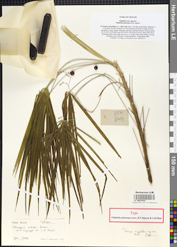
LE 00010443
Isotype of Rhapis vidalii Aver., T.H. Nguyen & P.K. Loc det. Averyanov, Leonid Vladimirovich at 12.12.2002
Additional identifications: Isotype of Vidaliella podocarpa Aver., H.T.Nguyen et L.K.Phan det. Averyanov, Leonid Vladimirovich at 12.12.2002; Isotype of Rhapis cyperifolia Aver. det. Averyanov, Leonid Vladimirovich at 12.12.2002 Collectors: D.K. Harder; Tien Hiep Nguyen; Averyanov, Leonid Vladimirovich; et al. Field collecting number: DKH8123. Collection date: 12.12.2002. Administrative regions: VN - Tinh Hoa Binh. Place of collection: Flora of Vietnam, N. Vietnam, Hoa Binh prov., Mai Chau distr., Van Mai municipality, Highway 7, 15 km post. Primary lowland, very dry broad-leaved forest on shale lower elevation to rocky, karstic limestone outcrops with deep fissures, between points 20° 35' 26'' N 105° 02' 00'' E and 20° 34' 39'' N 105° 02' 23'' E.Groups of specimens: L. V. Averyanov specimens; L. V. Averyanov herbariumOriginal label text:ARECACEAE Rhapis Hoa Binh Mai Chau District, Van Mai Municipality, Hwy. 7, 15 km post; on trail to the east between two mountains with Farjon Mountain on left, from village of Van Mai along road at 85 m to locality listed at 420 m. Collection in primary mostly undisturbed lowland, moist broadleaved evergreen forest in shale at very low altitude to karstic limestone with deep fissures. Collections between 20.35.26 N, 105.02.00 E at 300m to 12 Dec 2002 D.K. Harder, N.T. Hiep, P.K. Loc, L.V. Averyanov & B. Hall 8123 Supported by National Geographic Society MISSOURI BOTANICAL GARDEN HERBARIUM (MO) Page 2 20.34.39 N, 105.02.23 E at approx. 400m. elevation. 20°35'26"N 105°02'00"E 300 - 400 m 20°34'39"N 105°02'23"E Locally abundant; among limestone; single stem, non-clinging to 1.5 m; fleshy fruit white sympodial growth. 12 Dec 2002 D.K. Harder, N.T. Hiep, P.K. Loc, L.V. Averyanov & B. Hall 8123 Supported by National Geographic Society MISSOURI BOTANICAL GARDEN HERBARIUM (MO)
Coordinates (geographic position): 20° 35′ 26″ N, 105° 2′ E ±1000 mComment: [Imported description]
Family: Arecaceae
Taxon: Rhapis vidalii Aver., T.H. Nguyên et P.K. Lôc
Type specimen category: Isotype
Collectors: D. Harder, N.T. Hiep, L. Averyanov et al.
Record number: DKH 8123
Collection date: 12.12.2002
Country: Viet Nam
Locality: Flora of Vietnam, N. Vietnam, Hoa Binh prov., Mai Chau distr., Van Mai municipality, Highway 7, 15 km post. Primary lowland, very dry broad-leaved forest on shale lower elevation to rocky, karstic limestone outcrops with deep fissures, between points 20° 35' 26'' N 105° 02' 00'' E and 20° 34' 39'' N 105° 02' 23'' E
Altitude: 300-350 m
Family: Arecaceae
Taxon: Rhapis vidalii Aver., T.H. Nguyên et P.K. Lôc
Type specimen category: Isotype
Collectors: D. Harder, N.T. Hiep, L. Averyanov et al.
Record number: DKH 8123
Collection date: 12.12.2002
Country: Viet Nam
Locality: Flora of Vietnam, N. Vietnam, Hoa Binh prov., Mai Chau distr., Van Mai municipality, Highway 7, 15 km post. Primary lowland, very dry broad-leaved forest on shale lower elevation to rocky, karstic limestone outcrops with deep fissures, between points 20° 35' 26'' N 105° 02' 00'' E and 20° 34' 39'' N 105° 02' 23'' E
Altitude: 300-350 m
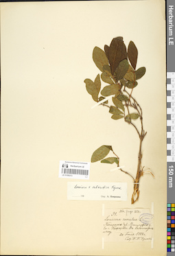
LE 01056313
Additional identifications: Lonicera caerulea L. det. Orlov, P. P. at 20.07.1884; Lonicera × subarctica Pojark. det. Pojarkova, Antonina Ivanovna at 1960 Collectors: Orlov, P. P. Field collecting number: 91. Collection date: 20.07.1884. Groups of specimens: Образцы сектора Восточной Европы; Herbarium TrautvetterOriginal label text:
Костромская губерния, Ветлужский уезд, близ села Кажарова, болотистом лесу.
Comment: Misit Zinger, 1884.
Record creation: 2019-05-19, Alexey Byalt, PhotoScan D1Citation: Specimen LE 01056313 // Virtual herbarium of Komarov Botanical Institute RAS — http://re.herbariumle.ru/01056313
LE 01056312
Additional identifications: Lonicera caerulea L. det. Vasilkova E.I., Smirnov, V.I. at 1925; Lonicera × subarctica Pojark. det. Pojarkova, Antonina Ivanovna at 1960 Collectors: Vasilkova E.I.; Smirnov, V.I. Field collecting number: 221. Collection date: 13.09.1925. Administrative regions: RU - Yaroslavskaya Oblast' - Poshekhonskiy Rayon. Expedition: Гео-Ботаническая экспедиция в Рыбинский округ (1924 -1925)Groups of specimens: Образцы сектора Восточной ЕвропыOriginal label text:
Ярославская губерния, Пошехонский уезд, елово-березовый лес у деревни Пигалоево [Пигалоево].
Record creation: 2019-05-19, Alexey Byalt, PhotoScan D1Citation: Specimen LE 01056312 // Virtual herbarium of Komarov Botanical Institute RAS — http://re.herbariumle.ru/01056312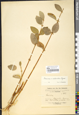
LE 01056311
Lonicera × subarctica Pojark. det. Pojarkova, Antonina Ivanovna at 1960
Collectors: Fedtschenko, Boris Alexeevich; Bobrov, Evgeniy Grigorievich; Jarmolenko, Alexander Viktorovich Field collecting number: 487. Collection date: 16.09.1924. Administrative regions: RU - Yaroslavskaya Oblast' - Bol'shesel'skiy Rayon. Expedition: Исследование болот Ярославской губернии под руководством профессора Б.А. Федченко в 1924 году (1924 -1924)Groups of specimens: Образцы сектора Восточной ЕвропыOriginal label text:Ярославская губерния, Ярославский уезд, Варегово болото. Ass. Betuletum pinosum.
Coordinates (geographic position): 57° 43′ 21″ N, 39° 13′ 43″ ERecord creation: 2019-05-19, Alexey Byalt, PhotoScan D1Citation: Specimen LE 01056311 // Virtual herbarium of Komarov Botanical Institute RAS — http://re.herbariumle.ru/01056311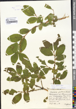
LE 01056310
Additional identifications: Lonicera pallasii Ledeb. det. Tzvelev, Nikolai Nikolaievich; Lonicera × subarctica Pojark. det. Sennikov, Alexander Nikolaevitsch at 08.2005 Collectors: Tzvelev, Nikolai Nikolaievich Field collecting number: 44. Collection date: 11.08.1986. Administrative regions: RU - Novgorodskaya Oblast'. Subregion: Khvoyninsky District. Place of collection: в 5 км ниже с. Мимцы и в 6-7 км от границы с Вологодской областью.Groups of specimens: Образцы сектора Восточной ЕвропыLife form: ShrubOriginal label text:
Lonicera pallasii Ledeb. Новгородская обл., Хвойнинский р-н, левобережье р. Песь в 5 км ниже сел. Мимцы и в 6-7 км от границы с Вологодской обл., смешанный лес. 11 VIII 1986. № 44. Н. Цвелев.
Habitat / plant community in location of collecting: смешанный лесRecord creation: 2019-05-19, Alexey Byalt, PhotoScan D1Citation: Specimen LE 01056310 // Virtual herbarium of Komarov Botanical Institute RAS — http://re.herbariumle.ru/01056310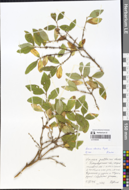
LE 01056309
Additional identifications: Lonicera pallasii Ledeb. det. Tzvelev, Nikolai Nikolaievich; Lonicera × subarctica Pojark. det. Sennikov, Alexander Nikolaevitsch at 08.2005 Collectors: Tzvelev, Nikolai Nikolaievich Field collecting number: 1026. Collection date: 07.09.1996. Administrative regions: RU - Leningradskaya Oblast' - Podporozhskiy Rayon. Subregion: Podporozhsky District. Place of collection: в 11-12 км к юго-зап. от пос. Вознесенье у дороги на Шуст-ручей.Groups of specimens: Образцы сектора Восточной ЕвропыLife form: ShrubOriginal label text:
Lonicera pallasii Ledeb. С. Петербургская обл., старый липовый лес с елью и сосной в 11-12 км к юго-зап. от пос. Вознесенье у дороги на Шуст-ручей. Сыроватый участок. 7 IX 1996. № 1026. Н. Цвелев.
Habitat / plant community in location of collecting: старый липовый лес с елью и соснойRecord creation: 2019-05-19, Alexey Byalt, PhotoScan D1Citation: Specimen LE 01056309 // Virtual herbarium of Komarov Botanical Institute RAS — http://re.herbariumle.ru/01056309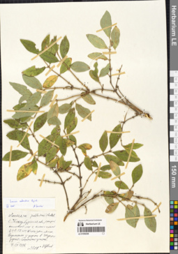
LE 01056308
Additional identifications: Lonicera pallasii Ledeb. det. Tzvelev, Nikolai Nikolaievich at 1996; Lonicera × subarctica Pojark. det. Sennikov, Alexander Nikolaevitsch at 08.2005 Collectors: Tzvelev, Nikolai Nikolaievich Field collecting number: 1028. Collection date: 07.09.1996. Administrative regions: RU - Leningradskaya Oblast' - Podporozhskiy Rayon. Groups of specimens: Образцы сектора Восточной ЕвропыOriginal label text:
Санкт-Петербургская область, старый осиновый лес с елью и сосной в 11-12 км к юго-западу от пос. Вознесенье у дороги в Шустручей [?]. Сыроватый участок.
Record creation: 2019-05-19, Alexey Byalt, PhotoScan D1. Processing status: label contains unreadable dataCitation: Specimen LE 01056308 // Virtual herbarium of Komarov Botanical Institute RAS — http://re.herbariumle.ru/01056308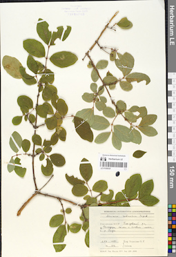
LE 01056307
Lonicera × subarctica Pojark. det. Baranova, Olga Germanovna at 1987
Collectors: Baranova, Olga Germanovna Field collecting number: 109. Collection date: 02.07.1987. Administrative regions: RUUdmurtskaya Respublika - Glazovskiy Rayon. Groups of specimens: Образцы сектора Восточной ЕвропыOriginal label text:Удмуртская АССР, Глазовский район, д. Солодырь, склон с еловым лесом к р. Пызеп.
Record creation: 2019-05-19, Alexey Byalt, PhotoScan D1Citation: Specimen LE 01056307 // Virtual herbarium of Komarov Botanical Institute RAS — http://re.herbariumle.ru/01056307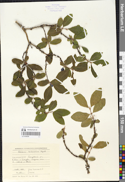
LE 01056306
Lonicera × subarctica Pojark. det. Baranova, Olga Germanovna at 1987
Collectors: Baranova, Olga Germanovna Field collecting number: 121. Collection date: 04.08.1987. Administrative regions: RUUdmurtskaya Respublika - Glazovskiy Rayon. Groups of specimens: Образцы сектора Восточной ЕвропыOriginal label text:Удмуртская АССР, Глазовский район, в 5 км от г. Глазова, опушка леса в пойме р. Убыть.
Record creation: 2019-05-19, Alexey Byalt, PhotoScan D1Citation: Specimen LE 01056306 // Virtual herbarium of Komarov Botanical Institute RAS — http://re.herbariumle.ru/01056306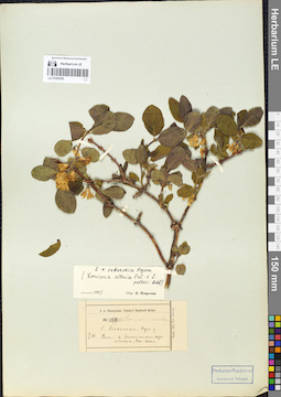
LE 01056305
Additional identifications: Lonicera caerulea L. det. Teplouchow, Fedor (Theodor) Alexandrowitsch at 1883; Lonicera × subarctica Pojark. det. Pojarkova, Antonina Ivanovna at 1957 Collectors: Teplouchow, Fedor (Theodor) Alexandrowitsch Field collecting number: 159. Collection date: 14.05.1883. Administrative regions: RU - Perm Krai - Il'inskiy Rayon. Groups of specimens: Образцы сектора Восточной ЕвропыOriginal label text:
Пермская губерния, село Ильинское Пермского уезда. Дико: в болотистом перелеске, довольно часто.
Coordinates (geographic position): 58° 34′ 10″ N, 55° 41′ 39″ ERecord creation: 2019-05-19, Alexey Byalt, PhotoScan D1Citation: Specimen LE 01056305 // Virtual herbarium of Komarov Botanical Institute RAS — http://re.herbariumle.ru/01056305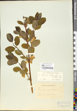
LE 01056304
Additional identifications: Lonicera caerulea L. det. Teplouchow, Fedor (Theodor) Alexandrowitsch; Lonicera × subarctica Pojark. det. Pojarkova, Antonina Ivanovna at 1957 Collectors: Teplouchow, Fedor (Theodor) Alexandrowitsch Administrative regions: RU - Perm Krai - Il'inskiy Rayon. Groups of specimens: Образцы сектора Восточной ЕвропыOriginal label text:
с. Ильинское Пермской губернии.
Coordinates (geographic position): 58° 34′ 10″ N, 55° 41′ 39″ ERecord creation: 2019-05-19, Alexey Byalt, PhotoScan D1. Processing status: (re)scanning NeededCitation: Specimen LE 01056304 // Virtual herbarium of Komarov Botanical Institute RAS — http://re.herbariumle.ru/01056304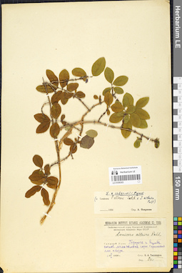
LE 01056303
Additional identifications: Lonicera altaica Pall. det. Tikhomirov, Boris Anatolievich at 1939; Lonicera × subarctica Pojark. det. Pojarkova, Antonina Ivanovna at 1956 Collectors: Tikhomirov, Boris Anatolievich Collection date: 06.07.1939. Administrative regions: RU - Sverdlovskaya Oblast'. Place of collection: дорога к горе Кумба, лес на склоне горы.Expedition: Геоботанический отряд Уральской Комплексной экспедиции Академии Наук СССР (1939 -1940)Groups of specimens: Образцы сектора Восточной ЕвропыOriginal label text:
Средний Урал. По дороге к Кумбе. Сосновый лес на склоне горы с примесью ели и кедра.
Landscape in location of collection: склон горыHabitat / plant community in location of collecting: сосновый лес с примесью ели и кедраRecord creation: 2019-05-19, Alexey Byalt, PhotoScan D1Citation: Specimen LE 01056303 // Virtual herbarium of Komarov Botanical Institute RAS — http://re.herbariumle.ru/01056303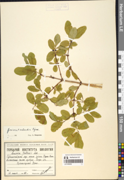
LE 01056302
Additional identifications: Lonicera pallasii Ledeb. det. Storozheva, Mariya Mihajlovna at 1968; Lonicera × subarctica Pojark. det. Pojarkova, Antonina Ivanovna at 1960 Collectors: Storozheva, Mariya Mihajlovna Collection date: 18.07.1968. Groups of specimens: Образцы сектора Восточной ЕвропыOriginal label text:
Приполярный Урал. Субальпийский луг около речки Перна-Вож. Восточный склон хребта Педы-Из.
Record creation: 2019-05-19, Alexey Byalt, PhotoScan D1Citation: Specimen LE 01056302 // Virtual herbarium of Komarov Botanical Institute RAS — http://re.herbariumle.ru/01056302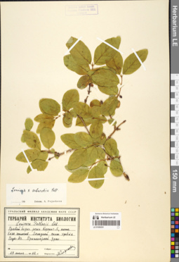
LE 01056301
Additional identifications: Lonicera pallasii Ledeb. det. Storozheva, Mariya Mihajlovna at 1968; Lonicera × subarctica Pojark. det. Pojarkova, Antonina Ivanovna at 1960 Collectors: Storozheva, Mariya Mihajlovna Collection date: 29.07.1968. Groups of specimens: Образцы сектора Восточной ЕвропыOriginal label text:
Приполярный Урал, правый берег речки Керсынг-Я, ниже базы геологов. Западный склон хребта Педы-Из.
Record creation: 2019-05-19, Alexey Byalt, PhotoScan D1Citation: Specimen LE 01056301 // Virtual herbarium of Komarov Botanical Institute RAS — http://re.herbariumle.ru/01056301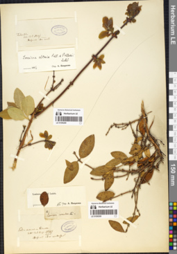
LE 01056300
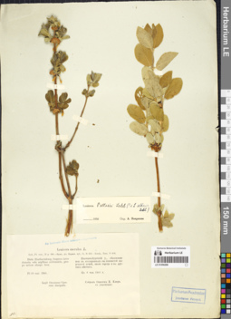
Additional identifications: Lonicera caerulea L. det. Trautvetter, Rudolf Ernst von at 1847; Lonicera pallasii Ledeb. det. Pojarkova, Antonina Ivanovna Collection date: 20.08.1847. Groups of specimens: Образцы сектора Восточной Европы; Herbarium TrautvetterOriginal label text:
...... Hofman iter Uralens
Comment: Пересканировать, убрать листик с этикетки
Record creation: 2019-05-19, Alexey Byalt, PhotoScan D1. Processing status: label contains unreadable data; special marks (look in the comment); data is not fully entered; (re)scanning NeededCitation: Specimen LE 01056300 // Virtual herbarium of Komarov Botanical Institute RAS — http://re.herbariumle.ru/01056300Создать запись для № 01056299
LE 01056298
Additional identifications: Lonicera caerulea L. det. Kler, Onisim Egorovich at 1901; Lonicera pallasii Ledeb. det. Pojarkova, Antonina Ivanovna at 1956 Collectors: Kler, Onisim Egorovich Collection date: 19.05.1901. Administrative regions: RU - Sverdlovskaya Oblast' - Municipalnoe obrazovanie «gorod Ekaterinburg». Groups of specimens: Образцы сектора Восточной ЕвропыOriginal label text:
Distr. Ekatherinburg, frequens inter dumeta solo argilloso subhumido, prope urbem aliaque loca. Екатеринбургский у., обыкновенная въ кустарникахъ на глинистой сыроватой почве, около города и въ другихъ местахъ. [№ 13]
Record creation: 2019-05-19, Alexey Byalt, PhotoScan D1Citation: Specimen LE 01056298 // Virtual herbarium of Komarov Botanical Institute RAS — http://re.herbariumle.ru/01056298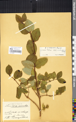
LE 01056297
Additional identifications: Lonicera caerulea L. det. Pohle, Christian Nikolai Richard at 1906; Lonicera × subarctica Pojark. det. Pojarkova, Antonina Ivanovna at 1956 Collectors: Pohle, Christian Nikolai Richard Collection date: 14.08.1906. Administrative regions: RU - Arkhangel'skaya Oblast' - Vel'skiy Rayon. Groups of specimens: Образцы сектора Восточной ЕвропыOriginal label text:
Prov. Wolga, distr. Welsk. еловый лес на свежей почве. р. Вель.
Comment: Обрезать верхнюю часть скана
Record creation: 2019-05-19, Alexey Byalt, PhotoScan D1. Processing status: special marks (look in the comment)Citation: Specimen LE 01056297 // Virtual herbarium of Komarov Botanical Institute RAS — http://re.herbariumle.ru/01056297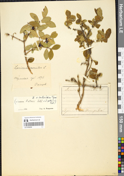
LE 01056296
Additional identifications: Lonicera caerulea L. at 1896; Lonicera × subarctica Pojark. det. Pojarkova, Antonina Ivanovna at 1956 Collection date: 1896. Administrative regions: RU - Perm Krai. Groups of specimens: Образцы сектора Восточной ЕвропыOriginal label text:
Пермская губерния
Record creation: 2019-05-19, Alexey Byalt, PhotoScan D1. Processing status: data is not fully entered; label contains unreadable dataCitation: Specimen LE 01056296 // Virtual herbarium of Komarov Botanical Institute RAS — http://re.herbariumle.ru/01056296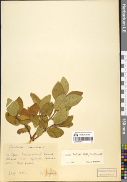
LE 01056295
Additional identifications: Lonicera caerulea L. det. Igoschina, Kapitolina Nikolaevna at 1925; Lonicera pallasii Ledeb. det. Pojarkova, Antonina Ivanovna at 1956 Collectors: Igoschina, Kapitolina Nikolaevna Collection date: 26.07.1925. Administrative regions: RU - Sverdlovskaya Oblast' - Gorod Karpinsk. Groups of specimens: Образцы сектора Восточной ЕвропыOriginal label text:
Средний Урал. Конжаковский Камень, северный склон перевала. Субальпийский пояс, среди россыпей.
Record creation: 2019-05-19, Alexey Byalt, PhotoScan D1Citation: Specimen LE 01056295 // Virtual herbarium of Komarov Botanical Institute RAS — http://re.herbariumle.ru/01056295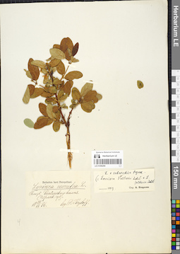
LE 01056294
Additional identifications: Lonicera caerulea L. det. Krylov, Porphyriy Nikitich at 1876; Lonicera × subarctica Pojark. det. Pojarkova, Antonina Ivanovna at 1957 Collectors: Krylov, Porphyriy Nikitich Collection date: 28.06.1876. Administrative regions: RU - Sverdlovskaya Oblast' - Gorod Karpinsk. Groups of specimens: Образцы сектора Восточной ЕвропыOriginal label text:
Близ Косвинского Камня. Пермская губерния.
Record creation: 2019-05-19, Alexey Byalt, PhotoScan D1Citation: Specimen LE 01056294 // Virtual herbarium of Komarov Botanical Institute RAS — http://re.herbariumle.ru/01056294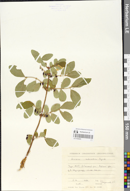
LE 01056293
Lonicera × subarctica Pojark. det. Baranova, Olga Germanovna at 1986
Collectors: Baranova, Olga Germanovna Field collecting number: 25. Collection date: 05.06.1986. Administrative regions: RUUdmurtskaya Respublika - Debesskiy Rayon. Original label text:Удмуртская АССР, Бебесский район, в 1,5 км западнее дер. В. Шудзялуд, склон холма.
Record creation: 2019-05-19, Alexey Byalt, PhotoScan D1Citation: Specimen LE 01056293 // Virtual herbarium of Komarov Botanical Institute RAS — http://re.herbariumle.ru/01056293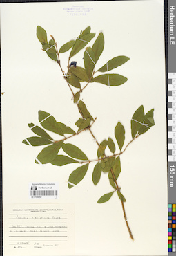
LE 01056292
Lonicera × subarctica Pojark. det. Baranova, Olga Germanovna at 1985
Collectors: Baranova, Olga Germanovna Field collecting number: 275. Collection date: 22.07.1985. Administrative regions: RUUdmurtskaya Respublika - Yarskiy Rayon. Groups of specimens: Образцы сектора Восточной ЕвропыOriginal label text:Удмуртская АССР, Ярский район, в 1,5 км западнее д. Сосновка, берег лесного озера.
Record creation: 2019-05-19, Alexey Byalt, PhotoScan D1Citation: Specimen LE 01056292 // Virtual herbarium of Komarov Botanical Institute RAS — http://re.herbariumle.ru/01056292