View
Add
Copy
Edit
Delete
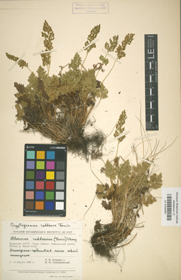
LE 01043881
Cryptogramma raddeana Fomin
Collectors: Egorova, Tatiana Vladimirovna; Siplivinsky, Vladimir Nikolaevich Collection date: 01.08.1967. Administrative regions: RU - Respublika Buryatiya - Severo-Baykal'skiy Rayon. Original label text:Бурятская АССР, озеро Байкал, Байкальский хребет, истоки р. Малая Коса. Мелкоземно-щебнистая осыпь южной экспозиции.
Coordinates (geographic position): 54° 44′ 25.54″ N, 108° 43′ 6.41″ ERecord creation: 2019-06-10, Marina Yarichina, from old scansCitation: Specimen LE 01043881 // Virtual herbarium of Komarov Botanical Institute RAS — http://re.herbariumle.ru/01043881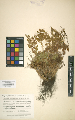
LE 01043880
Cryptogramma raddeana Fomin
Collectors: Egorova, Tatiana Vladimirovna; Siplivinsky, Vladimir Nikolaevich Collection date: 13.08.1967. Administrative regions: RU - Respublika Buryatiya - Severo-Baykal'skiy Rayon. Original label text:Бурятская АССР, озеро Байкал, Байкальский хребет, истоки р. Мужинай. Нагромождение каменных глыб - курумники.
Coordinates (geographic position): 54° 54′ 45.42″ N, 108° 44′ 47.99″ E ±1000 mRecord creation: 2019-06-10, Marina Yarichina, from old scansCitation: Specimen LE 01043880 // Virtual herbarium of Komarov Botanical Institute RAS — http://re.herbariumle.ru/01043880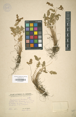
LE 01043879
Cryptogramma raddeana Fomin det. Tjulina (Tyulina), Lyudmila Nikolaevna
Collectors: Tjulina (Tyulina), Lyudmila Nikolaevna Field collecting number: 750. Collection date: 26.08.1943. Administrative regions: RU - Respublika Buryatiya - Severo-Baykal'skiy Rayon. Original label text:Бурят-Монгольская АССР, Баргузинский район.
Record creation: 2019-06-10, Marina Yarichina, from old scansCitation: Specimen LE 01043879 // Virtual herbarium of Komarov Botanical Institute RAS — http://re.herbariumle.ru/01043879Верховья речки Шумилиха (близ села Сосновка). На россыпях над озером, альпийский-субальпийский пояс. На подъеме.
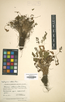
LE 01043878
Cryptogramma raddeana Fomin
Collectors: Siplivinsky, Vladimir Nikolaevich; Egorova, Tatiana Vladimirovna Collection date: 10.07.1967. Administrative regions: RU - Respublika Buryatiya - Severo-Baykal'skiy Rayon. Original label text:Бурятская АССР, озеро Байкал, Байкальский хребет, истоки р. Куркула. Каменистое русло пересохшей реки.
Record creation: 2019-06-10, Marina Yarichina, from old scansCitation: Specimen LE 01043878 // Virtual herbarium of Komarov Botanical Institute RAS — http://re.herbariumle.ru/01043878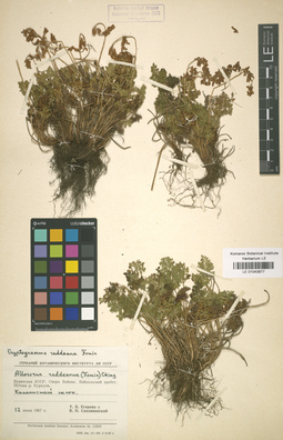
LE 01043877
Cryptogramma raddeana Fomin
Collectors: Egorova, Tatiana Vladimirovna; Siplivinsky, Vladimir Nikolaevich Collection date: 12.07.1967. Administrative regions: RU - Respublika Buryatiya - Severo-Baykal'skiy Rayon. Original label text:Бурятская АССР, озеро Байкал, Байкальский хребет, истоки р. Куркула. Каменистый слон.
Record creation: 2019-06-10, Marina Yarichina, from old scansCitation: Specimen LE 01043877 // Virtual herbarium of Komarov Botanical Institute RAS — http://re.herbariumle.ru/01043877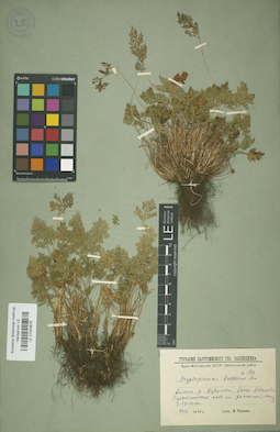
LE 01043876
Cryptogramma raddeana Fomin det. Tjulina (Tyulina), Lyudmila Nikolaevna
Collectors: Tjulina (Tyulina), Lyudmila Nikolaevna Field collecting number: 500. Collection date: 20.07.1940. Administrative regions: RU - Respublika Buryatiya - Severo-Baykal'skiy Rayon. Original label text:Бурят-Монгольская АССР. Баргузинский район.
Record creation: 2019-06-10, Marina Yarichina, from old scansCitation: Specimen LE 01043876 // Virtual herbarium of Komarov Botanical Institute RAS — http://re.herbariumle.ru/01043876Долина р. Кудалкан, выше водопада. Субальпийский пояс, на россыпи между глыбами.
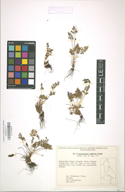
LE 01043875
Cryptogramma raddeana Fomin det. Kharkevich, Sigismund Semenovich
Collectors: Kharkevich, Sigismund Semenovich; Butsch, Tamara Georgievna; Vyshin, Igor Borisovich Field collecting number: 28. Collection date: 22.07.1983. Administrative regions: RU - Khabarovskiy Kray - Nanayskiy Rayon. Groups of specimens: Plantae vasculares Orientis Extremi Rossici (VLA). Flora ExsiccataOriginal label text:Khabarovsky territory, Nanayskiy distr., mountain Tardoky-Yany (2077 m), basin of river Anyuy, subgoltzovy belt, circus, boulder field, among blocks, abundant.
Coordinates (geographic position): 48° 53′ 52.42″ N, 138° 3′ 12.04″ E ±1000 m, 2077 m a.s.l.Record creation: 2019-06-10, Marina Yarichina, from old scansCitation: Specimen LE 01043875 // Virtual herbarium of Komarov Botanical Institute RAS — http://re.herbariumle.ru/01043875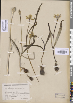
LE 01043836
Tulipa uniflora (L.) Besser & Backer
Collectors: Maltzev, Nicolai Ivanovich Collection date: 02.05.1907. Groups of specimens: Образцы сектора Сибири и Дальнего Востока РоссииCoordinates (geographic position): 54° 24′ 24.2″ N, 103° 17′ 54.87″ E ±1000 mComment:Растение в цветах.
Record creation: 2019-06-10, Marina Yarichina, from old scansCitation: Specimen LE 01043836 // Virtual herbarium of Komarov Botanical Institute RAS — http://re.herbariumle.ru/01043836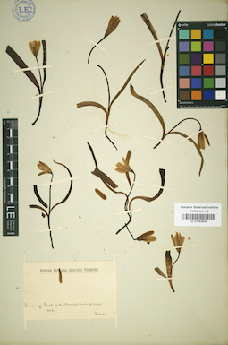
LE 01043835
Tulipa uniflora (L.) Besser & Backer
Collectors: Turczaninow, Nicolai Stepanowisch Administrative regions: RU - Irkutskaya Oblast'. Groups of specimens: Образцы сектора Сибири и Дальнего Востока РоссииRecord creation: 2019-06-10, Marina Yarichina, from old scansCitation: Specimen LE 01043835 // Virtual herbarium of Komarov Botanical Institute RAS — http://re.herbariumle.ru/01043835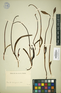
LE 01043834
Tulipa uniflora (L.) Besser & Backer
Collectors: Turczaninow, Nicolai Stepanowisch Administrative regions: RU - Irkutskaya Oblast'. Groups of specimens: Образцы сектора Сибири и Дальнего Востока РоссииRecord creation: 2019-06-10, Marina Yarichina, from old scansCitation: Specimen LE 01043834 // Virtual herbarium of Komarov Botanical Institute RAS — http://re.herbariumle.ru/01043834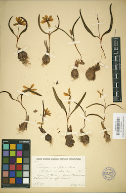
LE 01043833
Tulipa uniflora (L.) Besser & Backer det. Borodin, Ivan Parfenevich
Collectors: Shul'gin, Prokopiy Ivanovich Administrative regions: RU - Irkutskaya Oblast' - Ziminskiy Rayon. Groups of specimens: Образцы сектора Сибири и Дальнего Востока РоссииRecord creation: 2019-06-10, Marina Yarichina, from old scansCitation: Specimen LE 01043833 // Virtual herbarium of Komarov Botanical Institute RAS — http://re.herbariumle.ru/01043833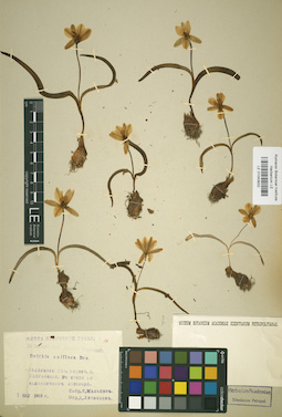
LE 01043832
Tulipa uniflora (L.) Besser & Backer
Collectors: Maltzev, Nicolai Ivanovich Administrative regions: RU - Irkutskaya Oblast' - Balaganskiy Rayon. Groups of specimens: Образцы сектора Сибири и Дальнего Востока РоссииRecord creation: 2019-06-10, Marina Yarichina, from old scansCitation: Specimen LE 01043832 // Virtual herbarium of Komarov Botanical Institute RAS — http://re.herbariumle.ru/01043832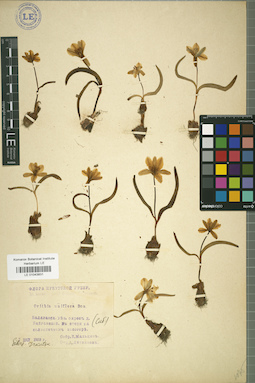
LE 01043831
Tulipa uniflora (L.) Besser & Backer
Collectors: Maltzev, Nicolai Ivanovich Administrative regions: RU - Irkutskaya Oblast' - Balaganskiy Rayon. Groups of specimens: Образцы сектора Сибири и Дальнего Востока РоссииRecord creation: 2019-06-10, Marina Yarichina, from old scansCitation: Specimen LE 01043831 // Virtual herbarium of Komarov Botanical Institute RAS — http://re.herbariumle.ru/01043831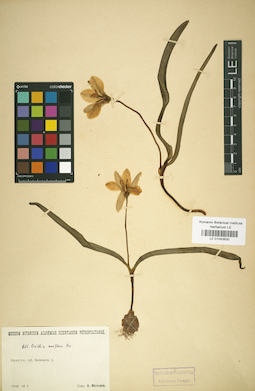
LE 01043830
Tulipa uniflora (L.) Besser & Backer
Collectors: Maltzev, Nicolai Ivanovich Administrative regions: RU - Irkutskaya Oblast' - Balaganskiy Rayon. Groups of specimens: Образцы сектора Сибири и Дальнего Востока РоссииRecord creation: 2019-06-10, Marina Yarichina, from old scansCitation: Specimen LE 01043830 // Virtual herbarium of Komarov Botanical Institute RAS — http://re.herbariumle.ru/01043830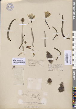
LE 01043829
Tulipa uniflora (L.) Besser & Backer det. Glehn, Peter von.
Collectors: Czekanowski, Alexander Piotr Field collecting number: 1. Collection date: 23.04.1867. Administrative regions: RU - Irkutskaya Oblast' - Bratskiy Rayon. Place of collection: д. Пьянова (берег Братского водохранилища).Groups of specimens: Образцы сектора Сибири и Дальнего Востока РоссииOriginal label text:Am den zeimlich steilen Sundidehange des Angara Thales in W Niederung des Dorfes Pianowa, ... № 3 Alyssum № 8й Pulsatilla № 4 - ...
Coordinates (geographic position): 56° 4′ 22.2″ N, 101° 41′ 58.86″ E ±200 mComment: Inter Irkutzk et Jenisseisk, ad fl. Angara (Tunguska super.) prope pagum Padun.
Пьянова была затоплена при постройке Братского водохранилища. Располагалась между Братским и Падунским острогом (нынешний Братск).
Record creation: 2019-06-10, Marina Yarichina, from old scansCitation: Specimen LE 01043829 // Virtual herbarium of Komarov Botanical Institute RAS — http://re.herbariumle.ru/01043829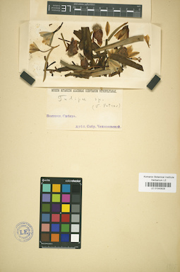
LE 01043828
Tulipa uniflora (L.) Besser & Backer
Collectors: Czekanowski, Alexander Piotr Collection date: 04.1867. Administrative regions: RU - Irkutskaya Oblast' - Bratsk Urban Okrug. Топоним: Падун (Братск). Groups of specimens: Образцы сектора Сибири и Дальнего Востока РоссииOriginal label text:Восточная Сибирь
Coordinates (geographic position): 56° 18′ 9.96″ N, 101° 48′ 10.89″ E ±2000 mRecord creation: 2019-06-10, Marina Yarichina, from old scansCitation: Specimen LE 01043828 // Virtual herbarium of Komarov Botanical Institute RAS — http://re.herbariumle.ru/01043828Inter Irkutzk et Jenisseisk, ad fl. Angara (Tunguska super.) prope pagum Padun
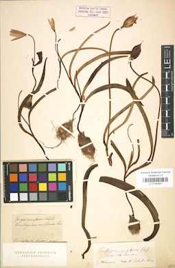
LE 01043827
Tulipa uniflora (L.) Besser & Backer
Collectors: Turczaninow, Nicolai Stepanowisch Administrative regions: RU - Irkutskaya Oblast'. Groups of specimens: Образцы сектора Сибири и Дальнего Востока РоссииRecord creation: 2019-06-10, Marina Yarichina, from old scansCitation: Specimen LE 01043827 // Virtual herbarium of Komarov Botanical Institute RAS — http://re.herbariumle.ru/01043827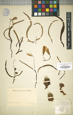
LE 01043826
Tulipa uniflora (L.) Besser & Backer
Collectors: Schukin, Semen Semenovich Administrative regions: RU - Irkutskaya Oblast'. Groups of specimens: Образцы сектора Сибири и Дальнего Востока РоссииRecord creation: 2019-06-10, Marina Yarichina, from old scansCitation: Specimen LE 01043826 // Virtual herbarium of Komarov Botanical Institute RAS — http://re.herbariumle.ru/01043826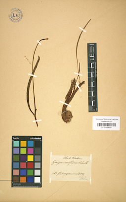
LE 01043825
Tulipa uniflora (L.) Besser & Backer
Collectors: Turczaninow, Nicolai Stepanowisch Administrative regions: RU - Irkutskaya Oblast'. Groups of specimens: Образцы сектора Сибири и Дальнего Востока РоссииRecord creation: 2019-06-10, Marina Yarichina, from old scansCitation: Specimen LE 01043825 // Virtual herbarium of Komarov Botanical Institute RAS — http://re.herbariumle.ru/01043825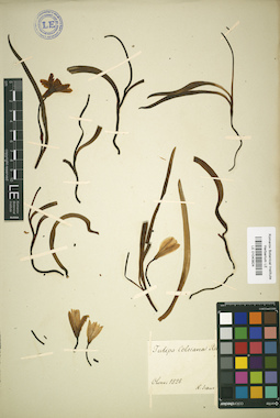
LE 01043824
Tulipa uniflora (L.) Besser & Backer
Collectors: Schukin, Semen Semenovich Administrative regions: RU - Irkutskaya Oblast'. Groups of specimens: Образцы сектора Сибири и Дальнего Востока РоссииRecord creation: 2019-06-10, Marina Yarichina, from old scansCitation: Specimen LE 01043824 // Virtual herbarium of Komarov Botanical Institute RAS — http://re.herbariumle.ru/01043824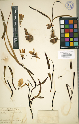
LE 01043823
Tulipa uniflora (L.) Besser & Backer
Collectors: Turczaninow, Nicolai Stepanowisch Administrative regions: RU - Irkutskaya Oblast'. Groups of specimens: Образцы сектора Сибири и Дальнего Востока РоссииRecord creation: 2019-06-10, Marina Yarichina, from old scansCitation: Specimen LE 01043823 // Virtual herbarium of Komarov Botanical Institute RAS — http://re.herbariumle.ru/01043823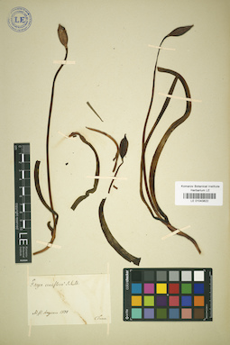
LE 01043822
Tulipa uniflora (L.) Besser & Backer
Collectors: Turczaninow, Nicolai Stepanowisch Administrative regions: RU - Irkutskaya Oblast'. Groups of specimens: Образцы сектора Сибири и Дальнего Востока РоссииRecord creation: 2019-06-10, Marina Yarichina, from old scansCitation: Specimen LE 01043822 // Virtual herbarium of Komarov Botanical Institute RAS — http://re.herbariumle.ru/01043822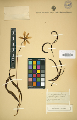
LE 01043821
Tulipa uniflora (L.) Besser & Backer
Collectors: Turczaninow, Nicolai Stepanowisch Administrative regions: RU - Irkutskaya Oblast'. Groups of specimens: Образцы сектора Сибири и Дальнего Востока РоссииRecord creation: 2019-06-10, Marina Yarichina, from old scansCitation: Specimen LE 01043821 // Virtual herbarium of Komarov Botanical Institute RAS — http://re.herbariumle.ru/01043821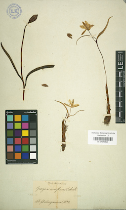
LE 01043820
Tulipa uniflora (L.) Besser & Backer
Collectors: Turczaninow, Nicolai Stepanowisch Administrative regions: RU - Irkutskaya Oblast'. Groups of specimens: Образцы сектора Сибири и Дальнего Востока РоссииRecord creation: 2019-06-10, Marina Yarichina, from old scansCitation: Specimen LE 01043820 // Virtual herbarium of Komarov Botanical Institute RAS — http://re.herbariumle.ru/01043820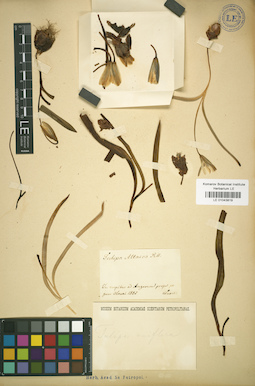
LE 01043819
Tulipa uniflora (L.) Besser & Backer
Additional identifications: Tulipa altaica Pall. ex Spreng. det. Turczaninow, Nicolai Stepanowisch Collectors: Turczaninow, Nicolai Stepanowisch Administrative regions: RU - Irkutskaya Oblast'. Groups of specimens: Образцы сектора Сибири и Дальнего Востока РоссииRecord creation: 2019-06-10, Marina Yarichina, from old scansCitation: Specimen LE 01043819 // Virtual herbarium of Komarov Botanical Institute RAS — http://re.herbariumle.ru/01043819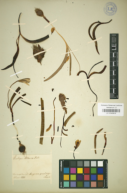
LE 01043818
Tulipa uniflora (L.) Besser & Backer
Additional identifications: Tulipa altaica Pall. ex Spreng. det. Turczaninow, Nicolai Stepanowisch Collectors: Turczaninow, Nicolai Stepanowisch Administrative regions: RU - Irkutskaya Oblast'. Groups of specimens: Образцы сектора Сибири и Дальнего Востока РоссииRecord creation: 2019-06-10, Marina Yarichina, from old scansCitation: Specimen LE 01043818 // Virtual herbarium of Komarov Botanical Institute RAS — http://re.herbariumle.ru/01043818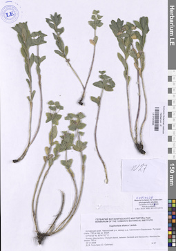
LE 01043595
Euphorbia altaica C.A. Mey. ex Ledeb. det. Geltman, Dmitri Victorovich
Collectors: Geltman, Dmitri Victorovich Field collecting number: 27. Collection date: 26.06.2008. Administrative regions: RU - Altayskiy Kray - Charyshskiy Rayon. Groups of specimens: Образцы сектора Сибири и Дальнего Востока России; Ваучерные образцыOriginal label text:Алтайский край, Чарышский р-н, между дд. Сентелек и Березовка. Луговая степь. 780 м над ур. моря.
Coordinates (geographic position): 51° 15′ 3″ N, 83° 41′ 52″ E, 780 m a.s.l.Record creation: 2019-06-10, Marina Yarichina, from old scansCitation: Specimen LE 01043595 // Virtual herbarium of Komarov Botanical Institute RAS — http://re.herbariumle.ru/01043595Russia, Altay terr., Charysh distr., between Sentelek and Beryozovka. Meadow-like steppe.
51°15'03" N, 83°41'52" E
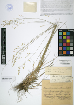
LE 01043567
Additional identifications: Holotype of Poa amurica Prob. det. Probatova, Nina Sergeyevna at 09.1996; Poa ussuriensis Roshev. det. Probatova, Nina Sergeyevna at 1976 Collectors: Klychkova T. V.; Nesterova S. Collection date: 06.07.1976. Administrative regions: RU - Amurskaya Oblast'. Groups of specimens: Типовые образцы сектора Сибири и Дальнего Востока РоссииOriginal label text:
Амурская обл., Селемджинский р-н, пос. Селемджинск, правый берег р. Селемджи в 2 км по течению.
Coordinates (geographic position): 52° 33′ 30.43″ N, 131° 6′ 1.77″ ERecord creation: 2019-06-10, Marina Yarichina, from old scansCitation: Specimen LE 01043567 // Virtual herbarium of Komarov Botanical Institute RAS — http://re.herbariumle.ru/01043567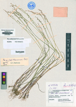
LE 01043566
Isotype of Poa archarensis Prob. det. Probatova, Nina Sergeyevna at 08.2018
Collectors: Aistova, Elena Vasiljevna Collection date: 29.06.2004. Administrative regions: RU - Amurskaya Oblast' - Arkharinskiy Rayon. Groups of specimens: Типовые образцы сектора Сибири и Дальнего Востока РоссииOriginal label text:Амурская область, Архаринский р-н, ст. Кундур, обочина дороги.
Coordinates (geographic position): 49° 6′ 28″ N, 130° 45′ 18.33″ E ±1000 mRecord creation: 2019-06-10, Marina Yarichina, from old scansCitation: Specimen LE 01043566 // Virtual herbarium of Komarov Botanical Institute RAS — http://re.herbariumle.ru/01043566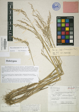
LE 01043565
Holotype of Poa archarensis Prob. det. Probatova, Nina Sergeyevna at 08.2018
Additional identifications: Poa pseudoattenuata Probatova det. Enushchenko, Ilya Valerevich at 07.12.2007 Collectors: Aistova, Elena Vasiljevna Collection date: 29.06.2004. Administrative regions: RU - Amurskaya Oblast' - Arkharinskiy Rayon. Groups of specimens: Типовые образцы сектора Сибири и Дальнего Востока РоссииOriginal label text:Амурская область, Архаринский р-н, ст. Кундур, обочина дороги
Coordinates (geographic position): 49° 6′ 28″ N, 130° 45′ 18.33″ E ±1000 mRecord creation: 2019-06-10, Marina Yarichina, from old scansCitation: Specimen LE 01043565 // Virtual herbarium of Komarov Botanical Institute RAS — http://re.herbariumle.ru/01043565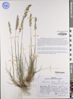
LE 01043564
Holotype of Koeleria dersu Prob. et Prokopenko det. Probatova, Nina Sergeyevna at 2018
Collectors: Prokopenko, Sergey Valerevich Collection date: 19.06.2018. Administrative regions: RU - Primorskiy Kray. Subregion: Кавалеровский район. Groups of specimens: Типовые образцы сектора Сибири и Дальнего Востока РоссииOriginal label text:Приморский край, Кавалеровский район, окр. пос. Кавалерово, памятник природы "Скала Дерсу Узала", у вершины утеса с юго-западной стороны, среди известняковой щебёнки; нередко.
Coordinates (geographic position): 44° 14′ 51.3″ N, 135° 3′ 38.77″ ERecord creation: 2019-06-10, Marina Yarichina, from old scansCitation: Specimen LE 01043564 // Virtual herbarium of Komarov Botanical Institute RAS — http://re.herbariumle.ru/01043564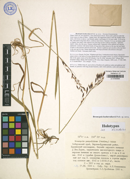
LE 01043563
Holotype of Bromopsis kozhevnikovii Prob. det. Probatova, Nina Sergeyevna at 2018
Additional identifications: Bromopsis pumpelliana (Scribn.) Holub det. Probatova, Nina Sergeyevna at 1990 Collectors: Kozhevnikov, Andrey Evgenievich Collection date: 17.08.1989. Administrative regions: RU - Khabarovskiy Kray. Groups of specimens: Типовые образцы сектора Сибири и Дальнего Востока РоссииOriginal label text:Хабаровский край, Верхне-Буреинский район, Буреинский заповедник, бассейн верхнего течения р. Лев. Бурея, окрестности высокогорного озера в верхнем течении левого её притока в 3 км к З от выс. 2041 м (хребет Дуссе-Алинь), сырой разнотравный луг под З скалистым склоном в горном цирке под склоном выс. 2041 м (=2002.8 м), часто. Н = 1600 м над ур. моря.
Coordinates (geographic position): 52° 4′ 0″ N, 134° 53′ 0″ ERecord creation: 2019-06-10, Marina Yarichina, from old scansCitation: Specimen LE 01043563 // Virtual herbarium of Komarov Botanical Institute RAS — http://re.herbariumle.ru/01043563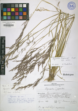
LE 01043562
Holotype of Agrostis lapenkoi Prob. det. Probatova, Nina Sergeyevna at 08.2018
Collectors: Lapenko V. T. Field collecting number: 280. Collection date: 18.06.2012. Administrative regions: RU - Primorskiy Kray. Subregion: Лесозаводский район. Groups of specimens: Типовые образцы сектора Сибири и Дальнего Востока РоссииOriginal label text:Приморский край, Лесозаводский р-н, восточная окраина г. Лесозаводска, вдоль лесной дороги близ ЛЭП-110.
Coordinates (geographic position): 45° 29′ 51.45″ N, 133° 27′ 0.55″ ERecord creation: 2019-06-10, Marina Yarichina, from old scansCitation: Specimen LE 01043562 // Virtual herbarium of Komarov Botanical Institute RAS — http://re.herbariumle.ru/01043562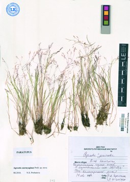
LE 01043561
Paratype of Agrostis czernjaginae Prob. det. Probatova, Nina Sergeyevna at 08.2018
Collectors: Chernyagina, O. A.; Shtreker L. Collection date: 14.08.2014. Administrative regions: RU - Kamtchatski Kray - Ust'-Bol'sheretskiy Rayon. Groups of specimens: Типовые образцы сектора Сибири и Дальнего Востока РоссииOriginal label text:Полуостров Камчатка, Усть-Большеречкий р-н, Большебанные горячие ключи, в корнеобитаемом слое 38,5-37,2°.
Record creation: 2019-06-10, Marina Yarichina, from old scansCitation: Specimen LE 01043561 // Virtual herbarium of Komarov Botanical Institute RAS — http://re.herbariumle.ru/01043561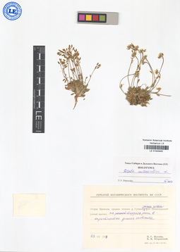
LE 01043442
Holotype of Draba metaarctica V. Petrovsky det. Petrovsky, Vladislav Vladimirovich at 03.2018
Collectors: Zhukova, P. G.; Petrovsky, Vladislav Vladimirovich Collection date: 23.07.1979. Administrative regions: RU - Chukotskiy Avtonomnyy Okrug. Subregion: Иультинский район. Groups of specimens: Типовые образцы сектора Сибири и Дальнего Востока РоссииOriginal label text:Остров Врангеля, среднее течение р. Гусиной, ниже устья р. Ленинградский (левый приток), на террасе реки в окрестностях домика охотника.
Coordinates (geographic position): 71° 8′ 57.04″ N, 179° 9′ 32.28″ ERecord creation: 2019-06-10, Marina Yarichina, from old scansCitation: Specimen LE 01043442 // Virtual herbarium of Komarov Botanical Institute RAS — http://re.herbariumle.ru/01043442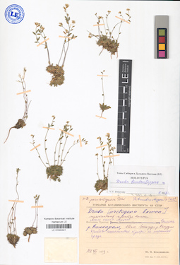
LE 01043441
Additional identifications: Draba arctogena (Ekman) Ekman det. Kozhevnikov, Yury Pavlovich at 1973; Holotype of Draba tundrostepposa V. Petrovsky det. Petrovsky, Vladislav Vladimirovich at 03.2017 Collectors: Kozhevnikov, Yury Pavlovich Collection date: 24.07.1973. Administrative regions: RU - Chukotskiy Avtonomnyy Okrug. Subregion: Иультинский район. Place of collection: Ванкаремская низменность.Groups of specimens: Типовые образцы сектора Сибири и Дальнего Востока РоссииOriginal label text:
Восточная Чукотка, долина р. Ванкарем, 10 км выше устья р. Рекууль, дриадово-лишайниковая тундра на моренной гряде.
Coordinates (geographic position): 67° 37′ 0.07″ N, 176° 50′ 8.83″ WRecord creation: 2019-06-10, Marina Yarichina, from old scansCitation: Specimen LE 01043441 // Virtual herbarium of Komarov Botanical Institute RAS — http://re.herbariumle.ru/01043441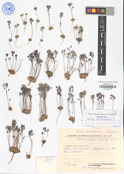
LE 01043439
Holotype of Draba tolmatchevii Petrovsky det. Petrovsky, Vladislav Vladimirovich at 03.2017
Collectors: Petrovsky, Vladislav Vladimirovich; Polozova, Tamara Georgievna Collection date: 09.08.1979. Administrative regions: RU - Chukotskiy Avtonomnyy Okrug. Place of collection: окрестности пос. Звёздный.Groups of specimens: Типовые образцы сектора Сибири и Дальнего Востока РоссииOriginal label text:о. Врангеля, бухта Сомнительная, край приморской террасы к западу от поселка.
Coordinates (geographic position): 70° 53′ 43.05″ N, 179° 29′ 30.25″ WRecord creation: 2019-06-10, Marina Yarichina, from old scansCitation: Specimen LE 01043439 // Virtual herbarium of Komarov Botanical Institute RAS — http://re.herbariumle.ru/01043439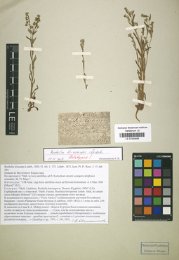
LE 01043406
Additional identifications: Rochelia leiocarpa Ledeb. det. Meyer, Carl Anton von at 1826; Lectotype of Rochelia leiocarpa Ledeb. det. Ovchinnikova Svetlana Vasilievna at 24.12.2018 Collectors: Meyer, Carl Anton von Field collecting number: 358. Collection date: 06.05.1826. Administrative regions: KZ - East Kazakhstan. Expedition: Экспедиция на Алтай и в Восточный Казахстан (1826 -1826)Groups of specimens: Типовые образцы сектора Сибири и Дальнего Востока РоссииOriginal label text:
Altai. Legi locis sterilibus siccis ad fluvium Kurtschum.
Record creation: 2019-06-10, Marina Yarichina, from old scansCitation: Specimen LE 01043406 // Virtual herbarium of Komarov Botanical Institute RAS — http://re.herbariumle.ru/01043406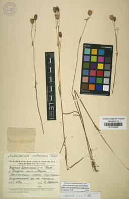
LE 01042965
Gastrolychnis violascens Tolm.
Additional identifications: Melandrium violascens (Tolm.) A.P. Khokhr. det. Lukitscheva, A.N. at 12.08.1957 Collectors: Lukitscheva, A.N. Collection date: 12.08.1957. Administrative regions: RU - Respublika Sakha (Yakutiya) - Olenyoksky District. Groups of specimens: Образцы сектора Сибири и Дальнего Востока России; Ваучерные образцы; Соглашение Минобрнауки №075-15-2021-1056Original label text:Якутия, Оленекский район, бассейн р. Далдын, приток р. Марха. Лиственнично-мохово-бруснично-багульниковый лес на террасе.
Record creation: 2019-06-10, Marina Yarichina, from old scansCitation: Specimen LE 01042965 // Virtual herbarium of Komarov Botanical Institute RAS — http://re.herbariumle.ru/01042965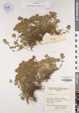
LE 01042905
Holotype of Thymus kamelinii Vasjukov det. Vasjukov, Vladimir Mikhailovich at 28.03.2018
Collectors: Kamelin, Rudolph Vladimirovich; Shmakov, Aleksandr Ivanovich Field collecting number: АЮК 1985. Collection date: 20.07.1998. Administrative regions: RU - Respublika Altay. Groups of specimens: Типовые образцы сектора Сибири и Дальнего Востока РоссииOriginal label text:Республика Алтай, Кош-Агачский район, плоскогорье Укок, среднее течение р. Калгуты, левый и правый берег
Coordinates (geographic position): 49° 17′ 43.14″ N, 88° 2′ 18.28″ ERecord creation: 2019-06-10, Marina Yarichina, from old scansCitation: Specimen LE 01042905 // Virtual herbarium of Komarov Botanical Institute RAS — http://re.herbariumle.ru/01042905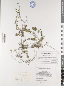
LE 01042373
Holotype of Thymus malyschevii Vasjukov, Krivenko et Kazanovsky det. Vasjukov, Vladimir Mikhailovich at 2018
Collectors: Krivenko, Denis Alexandrovich Field collecting number: 48821. Collection date: 29.07.2015. Administrative regions: RU - Irkutskaya Oblast' - Nizhneudinskiy Rayon. Groups of specimens: Типовые образцы сектора Сибири и Дальнего Востока РоссииOriginal label text:Россия, Иркутская область, Нижнеудинский район, предгорья Восточного Саяна, в 62 км от г. Нижнеудинск вверх по течению р. Уда, правый берег, в 15 км от п. Порог, Пещерский утес. Замшелый скальник.
Record creation: 2019-06-10, Marina Yarichina, from old scansCitation: Specimen LE 01042373 // Virtual herbarium of Komarov Botanical Institute RAS — http://re.herbariumle.ru/0104237354°28’32.65˝ с.ш. 98°58’58.76˝ в.д.
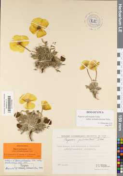
LE 01042299
Holotype of Papaver pulvinatum ssp. tschuktschorum Tolm. det. Petrovsky, Vladislav Vladimirovich, Sokolova, Irina Viktorovna, Mikhajlova, Marina Аntonovna at 2018
Additional identifications: Papaver pulvinatum Tolm. det. Petrovsky, Vladislav Vladimirovich; Lectotype of Papaver pulvinatum ssp. tschuktschorum Tolm. det. Petrovsky, Vladislav Vladimirovich at 2007 Collectors: Petrovsky, Vladislav Vladimirovich Collection date: 20.07.1964. Administrative regions: RU - Chukotskiy Avtonomnyy Okrug. Subregion: городской округ Эгвекинот. Groups of specimens: Типовые образцы сектора Сибири и Дальнего Востока РоссииOriginal label text:Остров Врангеля, бухта Сомнительная, р. Сомнительная. Прибрежная терраса.
Coordinates (geographic position): 70° 56′ 8.27″ N, 179° 37′ 34.23″ W ±1000 mRecord creation: 2019-06-10, Marina Yarichina, from old scansCitation: Specimen LE 01042299 // Virtual herbarium of Komarov Botanical Institute RAS — http://re.herbariumle.ru/01042299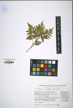
LE 01042278
Sorbaria sorbifolia (L.) A. Braun det. Byalt, Vyacheslav Vyacheslavovich
Collectors: Byalt, Vyacheslav Vyacheslavovich Collection date: 11.08.2016. Administrative regions: RU - Yamalo-Nenetskiy Avtonomnyy Okrug - Priural'skiy Rayon. Groups of specimens: Образцы сектора Сибири и Дальнего Востока РоссииOriginal label text:Россия: Ямало-Ненецкий автономный округ, Приуральский р-н, Салехард (66°32' N, 66° 36' E), берег реки Шайтанки у моста, посадки и самосев.
Coordinates (geographic position): 66° 32′ 0″ N, 66° 36′ 0″ ERecord creation: 2019-06-10, Marina Yarichina, from old scansCitation: Specimen LE 01042278 // Virtual herbarium of Komarov Botanical Institute RAS — http://re.herbariumle.ru/01042278Yamal: Yamal Nenetsky autonomus okrug, Ptiuralsky distr., N part t. Salekhard (66°32' N, 66° 36' E): bank of Rv. Shaitanka near bridge.
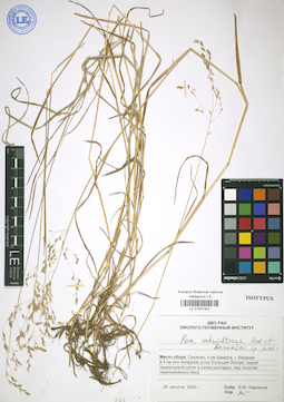
LE 01041302
Isotype of Poa schmidtiana Prob. et Barkalov det. Probatova, Nina Sergeyevna
Collectors: Barkalov, Vyacheslav Yuryevich Collection date: 29.08.2009. Administrative regions: RU - Sakhalinskaya Oblast' - Okhinskiy Rayon. Groups of specimens: Типовые образцы сектора Сибири и Дальнего Востока РоссииOriginal label text:Сахалин, п-ов Шмидта, г. Входная в 4 км юго-западнее устья р. Большие Лонгри, сырой приручьевой склон в узком распадке, под пологом темнохвойного леса
Coordinates (geographic position): 54° 2′ 41.4″ N, 142° 54′ 23.67″ E ±1000 mRecord creation: 2019-06-10, Marina Yarichina, from old scansCitation: Specimen LE 01041302 // Virtual herbarium of Komarov Botanical Institute RAS — http://re.herbariumle.ru/01041302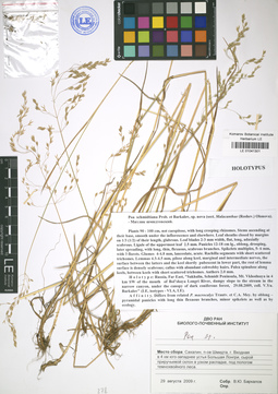
LE 01041301
Holotype of Poa schmidtiana Prob. et Barkalov det. Probatova, Nina Sergeyevna at 2017
Collectors: Barkalov, Vyacheslav Yuryevich Collection date: 29.08.2009. Administrative regions: RU - Sakhalinskaya Oblast'; RU - Sakhalinskaya Oblast' - Okhinskiy Rayon. Groups of specimens: Типовые образцы сектора Сибири и Дальнего Востока РоссииOriginal label text:Сахалин, п-ов Шмидта, г. Входная в 4 км юго-западнее устья Большие Лонгри, сырой приручьевой склон в узком распадке, под пологом темнохвойного леса.
Coordinates (geographic position): 54° 2′ 41.37″ N, 142° 54′ 23.63″ ERecord creation: 2019-06-10, Marina Yarichina, from old scansCitation: Specimen LE 01041301 // Virtual herbarium of Komarov Botanical Institute RAS — http://re.herbariumle.ru/01041301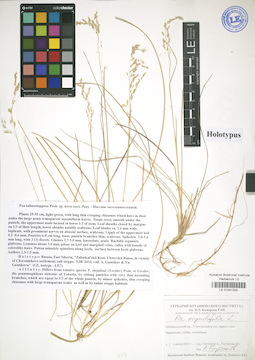
LE 01041300
Additional identifications: Holotype of Poa salinostepposa Prob. det. Probatova, Nina Sergeyevna at 2017; Poa angustifolia L. det. Gnutikov, Alexander Alexandrovich at 2010 Collectors: Gnutikova, Yu.; Gnutikov, Alexander Alexandrovich Collection date: 05.07.2010. Administrative regions: RU - Zabaykal'skiy Kray; RU - Zabaykal'skiy Kray - Uletovskiy Rayon. Groups of specimens: Типовые образцы сектора Сибири и Дальнего Востока РоссииOriginal label text:
Забайкальский кр., Улётовский р-н, окрестности пос. Черемхово, степь, солончаки.
Coordinates (geographic position): 51° 27′ 38.72″ N, 112° 42′ 10.63″ ERecord creation: 2019-06-10, Marina Yarichina, from old scansCitation: Specimen LE 01041300 // Virtual herbarium of Komarov Botanical Institute RAS — http://re.herbariumle.ru/01041300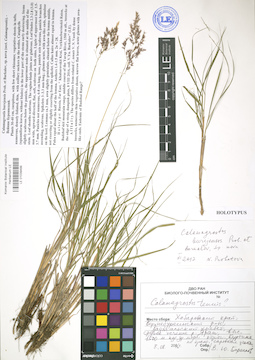
LE 01039499
Additional identifications: Holotype of Calamagrostis burejensis Prob. et Barkalov det. Probatova, Nina Sergeyevna at 09.2017; Calamagrostis tenuis V.N. Vassil. det. Barkalov, Vyacheslav Yuryevich at 2016 Collectors: Barkalov, Vyacheslav Yuryevich Collection date: 08.08.2016. Administrative regions: RU - Khabarovskiy Kray. Groups of specimens: Типовые образцы сектора Сибири и Дальнего Востока РоссииOriginal label text:
Хабаровский край, Верхнебуреинский район, Баджальский хребет, среднее течение р. Ярап, выс. 1500 м над ур. м.; отрог, куртина по краю, сыроватые участки.
Coordinates (geographic position): 50° 25′ 48.19″ N, 132° 41′ 7.76″ E, 1500 m a.s.l.Record creation: 2019-06-10, Marina Yarichina, from old scansCitation: Specimen LE 01039499 // Virtual herbarium of Komarov Botanical Institute RAS — http://re.herbariumle.ru/01039499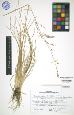
LE 01039407
Isotype of Deschampsia turczaninowii var. pseudovivipara Prob. et Enustsch. det. Probatova, Nina Sergeyevna at 2017
Collectors: Enushchenko, Ilya Valerevich Collection date: 26.09.2016. Administrative regions: RU - Respublika Buryatiya - Severo-Baykal'skiy Rayon. Groups of specimens: Типовые образцы сектора Сибири и Дальнего Востока РоссииOriginal label text:Республика Бурятия, Северо-Байкальский р-н, мыс Котельниковский, по берегу Байкала
Coordinates (geographic position): 55° 2′ 19.47″ N, 109° 6′ 28.44″ E ±1000 mRecord creation: 2019-06-10, Marina Yarichina, from old scansCitation: Specimen LE 01039407 // Virtual herbarium of Komarov Botanical Institute RAS — http://re.herbariumle.ru/01039407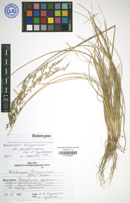
LE 01039406
Holotype of Deschampsia turczaninowii var. pseudovivipara Prob. et Enustsch. det. Probatova, Nina Sergeyevna at 2017
Collectors: Enushchenko, Ilya Valerevich Collection date: 26.09.2016. Administrative regions: RU - Respublika Buryatiya - Severo-Baykal'skiy Rayon. Groups of specimens: Типовые образцы сектора Сибири и Дальнего Востока РоссииOriginal label text:Республика Бурятия, Северо-Байкальский р-н, мыс Котельниковский, по берегу Байкала
Coordinates (geographic position): 55° 2′ 19.47″ N, 109° 6′ 28.44″ E ±1000 mRecord creation: 2019-06-10, Marina Yarichina, from old scansCitation: Specimen LE 01039406 // Virtual herbarium of Komarov Botanical Institute RAS — http://re.herbariumle.ru/01039406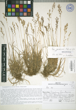
LE 01039405
Holotype of Poa janaensis Prob. det. Probatova, Nina Sergeyevna at 23.06.2017
Collectors: Lapshina E.; Muldiyarov E. Collection date: 07.07.1993. Administrative regions: RU - Respublika Sakha (Yakutiya); RU - Respublika Sakha (Yakutiya) - Ust'-Yanskiy Rayon. Groups of specimens: Типовые образцы сектора Сибири и Дальнего Востока РоссииOriginal label text:Республика Саха (Якутия), Усть-Янский р-н, окр. пос. Депутатский, на слабо задернованных склонах старых горных отвалов.
Coordinates (geographic position): 69° 21′ 8.29″ N, 139° 55′ 58.42″ ERecord creation: 2019-06-10, Marina Yarichina, from old scansCitation: Specimen LE 01039405 // Virtual herbarium of Komarov Botanical Institute RAS — http://re.herbariumle.ru/01039405