View
Add
Copy
Edit
Delete
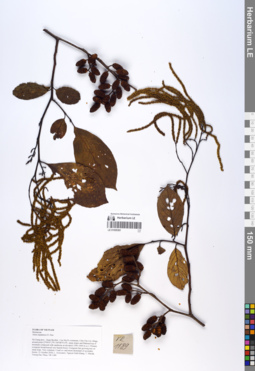
LE 01055361
Alnus nepalensis D.Don det. Averyanov, Leonid Vladimirovich at 21.10.2018
Collectors: Averyanov, Leonid Vladimirovich; Khang Sinh Nguyen; Maisak, Tatiana Viktorovna; Truong Duc Thieu Field collecting number: VR1189. Collection date: 21.10.2018. Administrative regions: VN - Tinh Ha Giang. Groups of specimens: L. V. Averyanov specimens; L. V. Averyanov herbarium; L. V. Averyanov photosOriginal label text:FLORA OF VIETNAM
Coordinates (geographic position): 23° 4′ 47.2″ N, 104° 48′ 55.6″ E ±1000 mComment: Betulaceae
Alnus nepalensis D. Don
Ha Giang prov., Quan Ba distr., Cao Ma Po commune, Chin Chu Lin village, around point 23º04ʹ47.2ʺN 104º48ʹ55.6ʺE, steep slopes and flattened top of mountain composed with sandstone at elevation 1500–1600 m a.s.l. Primary evergreen broad-leaved very humid forest. Evergreen fast growing tree on steep slope. Very common. Usual co- and mono-dominant of secondary forests. 21 October 2018, L. Averyanov, Nguyen Sinh Khang, T. Maisak, Truong Duc Thieu, VR 1189.
All photos © L. Averyanov & K.S. Nguyen
Record creation: 2019-06-11, Leonid Averyanov, PhotoScan D1Citation: Specimen LE 01055361 // Virtual herbarium of Komarov Botanical Institute RAS — http://re.herbariumle.ru/01055361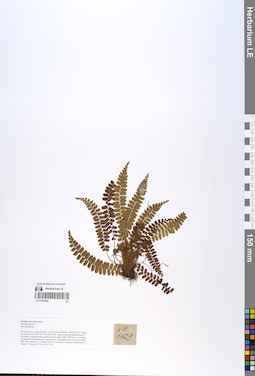
LE 01055360
Polystichum fugongense Ching & W.M.Chu det. Averyanov, Leonid Vladimirovich at 15.09.2019
Additional identifications: Polystichum sp. det. Averyanov, Leonid Vladimirovich at 21.10.2018; Polystichum acutidens Christ det. X.C.Zhang at 05.07.2019 Collectors: Averyanov, Leonid Vladimirovich; Khang Sinh Nguyen; Maisak, Tatiana Viktorovna; Truong Duc Thieu Field collecting number: VR1129. Collection date: 21.10.2018. Administrative regions: VN - Tinh Ha Giang. Groups of specimens: L. V. Averyanov specimens; L. V. Averyanov photos; L. V. Averyanov herbariumOriginal label text:FLORA OF VIETNAM.
Coordinates (geographic position): 23° 4′ 47.2″ N, 104° 48′ 55.6″ E ±1000 mComment: Polypodiaceae s.l.
Polystichum sp.
Ha Giang prov., Quan Ba distr., Cao Ma Po commune, Chin Chu Lin village, around point 23º04ʹ47.2ʺN 104º48ʹ55.6ʺE, steep slopes and flattened top of mountain composed with sandstone at elevation 1800–1950 m a.s.l. Primary evergreen broad-leaved very humid forest. Lithophytic fern on mossy shady cliff. Not common. 21 October 2018, L. Averyanov, Nguyen Sinh Khang, T. Maisak, Truong Duc Thieu, VR 1129.
This species is very close to Polystichum minutissimum Li Bing Zhang & H.He (= Polystichum hagiangense Li Bing Zhang & N.T.Lu & Liang Zhang).
All photos © L. Averyanov & K.S. Nguyen
Record creation: 2019-06-11, Leonid Averyanov, PhotoScan D1Citation: Specimen LE 01055360 // Virtual herbarium of Komarov Botanical Institute RAS — http://re.herbariumle.ru/01055360All photos © L. Averyanov & K.S. Nguyen
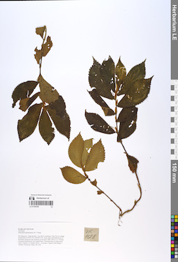
LE 01055359
Elatostema nanchuanense W.T.Wang det. Fu Longfei at 21.10.2018
Collectors: Averyanov, Leonid Vladimirovich; Khang Sinh Nguyen; Maisak, Tatiana Viktorovna; Truong Duc Thieu Field collecting number: VR1128. Collection date: 21.10.2018. Administrative regions: VN - Tinh Ha Giang. Groups of specimens: L. V. Averyanov specimens; L. V. Averyanov herbarium; L. V. Averyanov photosOriginal label text:FLORA OF VIETNAM Urticaceae Elatostema nanchuanense W.T. Wang Ha Giang prov., Quan Ba distr., Cao Ma Po commune, Chin Chu Lin village, around point 23º04ʹ47.2ʺN 104º48ʹ55.6ʺE, steep slopes and flattened top of mountain composed with sandstone at elevation 1800–1950 m a.s.l. Primary evergreen broad-leaved very humid forest. Terrestrial herb on steep mossy slope. Common. 21 October 2018, L. Averyanov, Nguyen Sinh Khang, T. Maisak, Truong Duc Thieu, VR 1128.
Coordinates (geographic position): 23° 4′ 47.2″ N, 104° 48′ 55.6″ E ±1000 mComment: All photos © L. Averyanov & K.S. Nguyen
Record creation: 2019-06-11, Leonid Averyanov, PhotoScan D1Citation: Specimen LE 01055359 // Virtual herbarium of Komarov Botanical Institute RAS — http://re.herbariumle.ru/01055359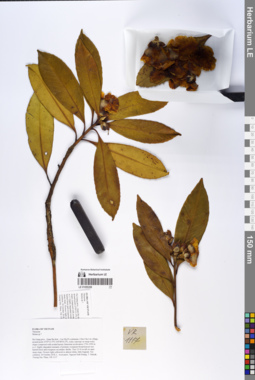
LE 01055358
Polyspora speciosa (Kochs) B.M.Barthol. & T.L.Ming det. Averyanov, Leonid Vladimirovich at 07.12.2019
Additional identifications: Schima sp. det. Averyanov, Leonid Vladimirovich at 20.10.2018 Collectors: Averyanov, Leonid Vladimirovich; Khang Sinh Nguyen; Maisak, Tatiana Viktorovna; Truong Duc Thieu Field collecting number: VR1117. Collection date: 20.10.2018. Administrative regions: VN - Tinh Ha Giang. Groups of specimens: L. V. Averyanov specimens; L. V. Averyanov photos; L. V. Averyanov herbariumOriginal label text:FLORA OF VIETNAM.
Coordinates (geographic position): 23° 5′ 13.5″ N, 104° 48′ 30.2″ E ±1000 mComment: Theaceae.
Shima sp.?.
Ha Giang prov., Quan Ba distr., Cao Ma Po commune, Chin Chu Lin village, around point 23º05ʹ13.5ʺN 104º48ʹ30.2ʺE, rocky outcrops on steep rocky slopes composed with eroded karstic limestone at elevation 1750–1950 m a.s.l. Highly degraded remnants of primary evergreen broad-leaved very humid forest and evergreen secondary shrubs. Tree 12-16 m tall on open steep slope. Flowers light yellowish to almost white, little fragrant. Not common.20 October 2018, L. Averyanov, Nguyen Sinh Khang, T. Maisak, Truong Duc Thieu, VR 1117.
All photos © L. Averyanov & K.S. Nguyen
Record creation: 2019-06-11, Leonid Averyanov, PhotoScan D1Citation: Specimen LE 01055358 // Virtual herbarium of Komarov Botanical Institute RAS — http://re.herbariumle.ru/01055358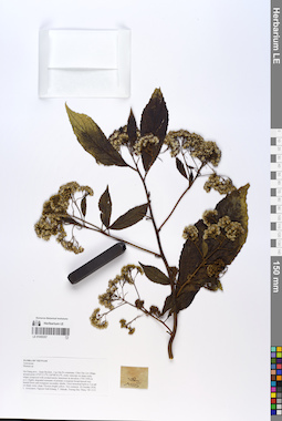
LE 01055357
Blumea densiflora DC. ⟮prelim. ID⟯ det. Sennikov, Alexander Nikolaevitsch at 12.09.2019
Additional identifications: Blumea sp. det. Averyanov, Leonid Vladimirovich at 20.10.2018 Collectors: Averyanov, Leonid Vladimirovich; Khang Sinh Nguyen; Maisak, Tatiana Viktorovna; Truong Duc Thieu Field collecting number: VR1115. Collection date: 20.10.2018. Administrative regions: VN - Tinh Ha Giang. Groups of specimens: L. V. Averyanov specimens; L. V. Averyanov photos; L. V. Averyanov herbariumOriginal label text:FLORA OF VIETNAM.
Coordinates (geographic position): 23° 5′ 13.5″ N, 104° 48′ 30.2″ E ±1000 mComment: Asteraceae.
Blumea sp.
Ha Giang prov., Quan Ba distr., Cao Ma Po commune, Chin Chu Lin village, around point 23º05ʹ13.5ʺN 104º48ʹ30.2ʺE, rocky outcrops on steep rocky slopes composed with eroded karstic limestone at elevation 1750–1950 m a.s.l. Highly degraded remnants of primary evergreen broad-leaved very humid forest and evergreen secondary shrubs. Erect terrestrial herb to 2 m tall on shady rocky slope. Flowers bright yellow. Not common.20 October 2018, L. Averyanov, Nguyen Sinh Khang, T. Maisak, Truong Duc Thieu, VR 1115.
All photos © L. Averyanov & K.S. Nguyen
Record creation: 2019-06-11, Leonid Averyanov, PhotoScan D1Citation: Specimen LE 01055357 // Virtual herbarium of Komarov Botanical Institute RAS — http://re.herbariumle.ru/01055357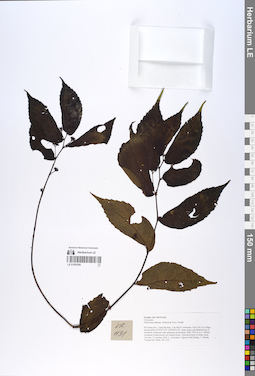
LE 01055356
Elatostema radicans (Siebold & Zucc.) Wedd. & H.Schroet. det. Fu Longfei at 21.10.2018
Collectors: Averyanov, Leonid Vladimirovich; Khang Sinh Nguyen; Maisak, Tatiana Viktorovna; Truong Duc Thieu Field collecting number: VR1131. Collection date: 21.10.2018. Administrative regions: VN - Tinh Ha Giang. Groups of specimens: L. V. Averyanov specimens; L. V. Averyanov herbarium; L. V. Averyanov photosOriginal label text:FLORA OF VIETNAM Urticaceae Elatostema radicans (Siebold & Zucc.) Wedd. Ha Giang prov., Quan Ba distr., Cao Ma Po commune, Chin Chu Lin village, around point 23º04ʹ47.2ʺN 104º48ʹ55.6ʺE, steep slopes and flattened top of mountain composed with sandstone at elevation 1800–1950 m a.s.l. Primary evergreen broad-leaved very humid forest. Terrestrial herb on shady slope. Not rare. 21 October 2018, L. Averyanov, Nguyen Sinh Khang, T. Maisak, Truong Duc Thieu, VR 1131.
Coordinates (geographic position): 23° 4′ 47.2″ N, 104° 48′ 55.6″ E ±1000 mComment: All photos © L. Averyanov & K.S. Nguyen
Record creation: 2019-06-11, Leonid Averyanov, PhotoScan D1Citation: Specimen LE 01055356 // Virtual herbarium of Komarov Botanical Institute RAS — http://re.herbariumle.ru/01055356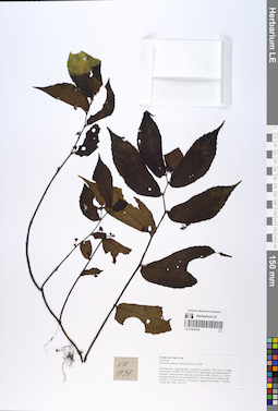
LE 01055355
Elatostema radicans (Siebold & Zucc.) Wedd. & H.Schroet. det. Fu Longfei at 21.10.2018
Collectors: Averyanov, Leonid Vladimirovich; Khang Sinh Nguyen; Maisak, Tatiana Viktorovna; Truong Duc Thieu Field collecting number: VR1131. Collection date: 21.10.2018. Administrative regions: VN - Tinh Ha Giang. Groups of specimens: L. V. Averyanov specimens; L. V. Averyanov herbarium; L. V. Averyanov photosOriginal label text:FLORA OF VIETNAM
Coordinates (geographic position): 23° 4′ 47.2″ N, 104° 48′ 55.6″ E ±1000 mComment: Urticaceae
Elatostema radicans (Siebold & Zucc.) Wedd.
Ha Giang prov., Quan Ba distr., Cao Ma Po commune, Chin Chu Lin village, around point 23º04ʹ47.2ʺN 104º48ʹ55.6ʺE, steep slopes and flattened top of mountain composed with sandstone at elevation 1800–1950 m a.s.l. Primary evergreen broad-leaved very humid forest. Terrestrial herb on shady slope. Not rare. 21 October 2018, L. Averyanov, Nguyen Sinh Khang, T. Maisak, Truong Duc Thieu, VR 1131.
All photos © L. Averyanov & K.S. Nguyen
Record creation: 2019-06-11, Leonid Averyanov, PhotoScan D1Citation: Specimen LE 01055355 // Virtual herbarium of Komarov Botanical Institute RAS — http://re.herbariumle.ru/01055355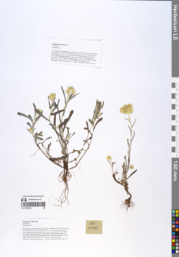
LE 01055354
Pseudognaphalium affine (D.Don) Anderb. det. Sennikov, Alexander Nikolaevitsch at 12.09.2019
Additional identifications: Gnaphalium sp. det. Averyanov, Leonid Vladimirovich at 20.10.2018 Collectors: Averyanov, Leonid Vladimirovich; Khang Sinh Nguyen; Maisak, Tatiana Viktorovna; Truong Duc Thieu Field collecting number: VR1110. Collection date: 20.10.2018. Administrative regions: VN - Tinh Ha Giang. Groups of specimens: L. V. Averyanov specimens; L. V. Averyanov photos; L. V. Averyanov herbariumOriginal label text:FLORA OF VIETNAM.
Coordinates (geographic position): 23° 5′ 13.5″ N, 104° 48′ 30.2″ E ±1000 mComment: Asteraceae.
Gnaphalium sp.
Ha Giang prov., Quan Ba distr., Cao Ma Po commune, Chin Chu Lin village, around point 23º05ʹ13.5ʺN 104º48ʹ30.2ʺE, rocky outcrops on steep rocky slopes composed with eroded karstic limestone at elevation 1750–1950 m a.s.l. Highly degraded remnants of primary evergreen broad-leaved very humid forest and evergreen secondary shrubs. Erect terrestrial herb on open grassy slope. Flowers yellow. Very common.20 October 2018, L. Averyanov, Nguyen Sinh Khang, T. Maisak, Truong Duc Thieu, VR 1110.
All photos © L. Averyanov & K.S. Nguyen
Record creation: 2019-06-11, Leonid Averyanov, PhotoScan D1Citation: Specimen LE 01055354 // Virtual herbarium of Komarov Botanical Institute RAS — http://re.herbariumle.ru/01055354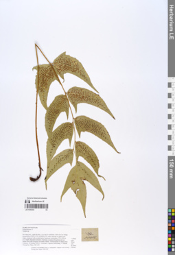
LE 01055353
Cyrtomium caryotideum C.Presl det. X.C.Zhang at 05.07.2019
Additional identifications: Tectaria sp. det. Averyanov, Leonid Vladimirovich at 20.10.2018 Collectors: Averyanov, Leonid Vladimirovich; Khang Sinh Nguyen; Maisak, Tatiana Viktorovna; Truong Duc Thieu Field collecting number: VR1105. Collection date: 20.10.2018. Administrative regions: VN - Tinh Ha Giang. Groups of specimens: L. V. Averyanov specimens; L. V. Averyanov photos; L. V. Averyanov herbariumOriginal label text:FLORA OF VIETNAM.
Coordinates (geographic position): 23° 5′ 13.5″ N, 104° 48′ 30.2″ E ±1000 mComment: Polypodiaceae s.l.
Tectaria sp.
Ha Giang prov., Quan Ba distr., Cao Ma Po commune, Chin Chu Lin village, around point 23º05ʹ13.5ʺN 104º48ʹ30.2ʺE, rocky outcrops on steep rocky slopes composed with eroded karstic limestone at elevation 1750–1950 m a.s.l. Highly degraded remnants of primary evergreen broad-leaved very humid forest and evergreen secondary shrubs. Terrestrial fern in shady place. Common.20 October 2018, L. Averyanov, Nguyen Sinh Khang, T. Maisak, Truong Duc Thieu, VR 1105.
All photos © L. Averyanov & K.S. Nguyen
Record creation: 2019-06-11, Leonid Averyanov, PhotoScan D1Citation: Specimen LE 01055353 // Virtual herbarium of Komarov Botanical Institute RAS — http://re.herbariumle.ru/01055353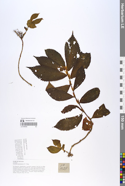
LE 01055352
Elatostema nanchuanense W.T.Wang det. Fu Longfei at 21.10.2018
Collectors: Averyanov, Leonid Vladimirovich; Khang Sinh Nguyen; Maisak, Tatiana Viktorovna; Truong Duc Thieu Field collecting number: VR1128. Collection date: 21.10.2018. Administrative regions: VN - Tinh Ha Giang. Groups of specimens: L. V. Averyanov specimens; L. V. Averyanov herbarium; L. V. Averyanov photosOriginal label text:FLORA OF VIETNAM
Coordinates (geographic position): 23° 4′ 47.2″ N, 104° 48′ 55.6″ E ±1000 mComment: Urticaceae
Elatostema nanchuanense W.T. Wang
Ha Giang prov., Quan Ba distr., Cao Ma Po commune, Chin Chu Lin village, around point 23º04ʹ47.2ʺN 104º48ʹ55.6ʺE, steep slopes and flattened top of mountain composed with sandstone at elevation 1800–1950 m a.s.l. Primary evergreen broad-leaved very humid forest. Terrestrial herb on steep mossy slope. Common. 21 October 2018, L. Averyanov, Nguyen Sinh Khang, T. Maisak, Truong Duc Thieu, VR 1128.
All photos © L. Averyanov & K.S. Nguyen
Record creation: 2019-06-11, Leonid Averyanov, PhotoScan D1Citation: Specimen LE 01055352 // Virtual herbarium of Komarov Botanical Institute RAS — http://re.herbariumle.ru/01055352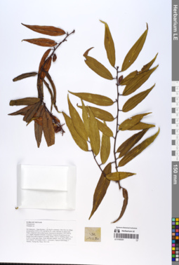
LE 01055351
Elaeagnus delavayi Lecomte ⟮prelim. ID⟯ det. Averyanov, Leonid Vladimirovich at 13.09.2019
Additional identifications: Elaeagnus sp. det. Averyanov, Leonid Vladimirovich at 20.10.2018 Collectors: Averyanov, Leonid Vladimirovich; Khang Sinh Nguyen; Maisak, Tatiana Viktorovna; Truong Duc Thieu Field collecting number: VR1118. Collection date: 20.10.2018. Administrative regions: VN - Tinh Ha Giang. Groups of specimens: L. V. Averyanov specimens; L. V. Averyanov photos; L. V. Averyanov herbariumOriginal label text:FLORA OF VIETNAM.
Coordinates (geographic position): 23° 5′ 13.5″ N, 104° 48′ 30.2″ E ±1000 mComment: Elaeagnaceae.
Elaeagnus sp.
Ha Giang prov., Quan Ba distr., Cao Ma Po commune, Chin Chu Lin village, around point 23º05ʹ13.5ʺN 104º48ʹ30.2ʺE, rocky outcrops on steep rocky slopes composed with eroded karstic limestone at elevation 1750–1950 m a.s.l. Highly degraded remnants of primary evergreen broad-leaved very humid forest and evergreen secondary shrubs. Erect or climbing shrub 1.5–2 m tall on steep open slope. Fruits dull pale reddish, sweet, juicy, delicious. Not common.20 October 2018, L. Averyanov, Nguyen Sinh Khang, T. Maisak, Truong Duc Thieu, VR 1118.
All photos © L. Averyanov & K.S. Nguyen
Record creation: 2019-06-11, Leonid Averyanov, PhotoScan D1Citation: Specimen LE 01055351 // Virtual herbarium of Komarov Botanical Institute RAS — http://re.herbariumle.ru/01055351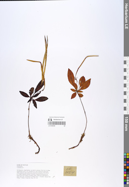
LE 01055350
Lysionotus sp. det. Averyanov, Leonid Vladimirovich at 20.10.2018
Collectors: Averyanov, Leonid Vladimirovich; Khang Sinh Nguyen; Maisak, Tatiana Viktorovna; Truong Duc Thieu Field collecting number: VR1104. Collection date: 20.10.2018. Administrative regions: VN - Tinh Ha Giang. Groups of specimens: L. V. Averyanov specimens; L. V. Averyanov herbarium; L. V. Averyanov photosOriginal label text:FLORA OF VIETNAM.
Coordinates (geographic position): 23° 5′ 13.5″ N, 104° 48′ 30.2″ E ±1000 mComment: Gesneriaceae.
Lysionotus sp. 2.
Ha Giang prov., Quan Ba distr., Cao Ma Po commune, Chin Chu Lin village, around point 23º05ʹ13.5ʺN 104º48ʹ30.2ʺE, rocky outcrops on steep rocky slopes composed with eroded karstic limestone at elevation 1750–1950 m a.s.l. Highly degraded remnants of primary evergreen broad-leaved very humid forest and evergreen secondary shrubs. Small erect undershrub on mossy open rocks. Occasional.20 October 2018, L. Averyanov, Nguyen Sinh Khang, T. Maisak, Truong Duc Thieu, VR 1104.
All photos © L. Averyanov & K.S. Nguyen
Record creation: 2019-06-11, Leonid Averyanov, PhotoScan D1Citation: Specimen LE 01055350 // Virtual herbarium of Komarov Botanical Institute RAS — http://re.herbariumle.ru/01055350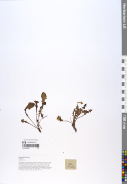
LE 01055349
Taraxacum officinale F.H.Wigg. ⟮s. l.⟯ det. Sennikov, Alexander Nikolaevitsch at 12.09.2019
Collectors: Averyanov, Leonid Vladimirovich; Khang Sinh Nguyen; Maisak, Tatiana Viktorovna; Truong Duc Thieu Field collecting number: VR1102. Collection date: 20.10.2018. Administrative regions: VN - Tinh Ha Giang. Groups of specimens: L. V. Averyanov specimens; L. V. Averyanov herbarium; L. V. Averyanov photosOriginal label text:FLORA OF VIETNAM.
Coordinates (geographic position): 23° 5′ 13.5″ N, 104° 48′ 30.2″ E ±1000 mComment: Asteraceae.
Taraxacum sp.
Ha Giang prov., Quan Ba distr., Cao Ma Po commune, Chin Chu Lin village, around point 23º05ʹ13.5ʺN 104º48ʹ30.2ʺE, rocky outcrops on steep rocky slopes composed with eroded karstic limestone at elevation 1750–1950 m a.s.l. Highly degraded remnants of primary evergreen broad-leaved very humid forest and evergreen secondary shrubs. Terrestrial herb on open grassy slope. Flowers yellow. Common.20 October 2018, L. Averyanov, Nguyen Sinh Khang, T. Maisak, Truong Duc Thieu, VR 1102.
All photos © L. Averyanov & K.S. Nguyen
Record creation: 2019-06-11, Leonid Averyanov, PhotoScan D1Citation: Specimen LE 01055349 // Virtual herbarium of Komarov Botanical Institute RAS — http://re.herbariumle.ru/01055349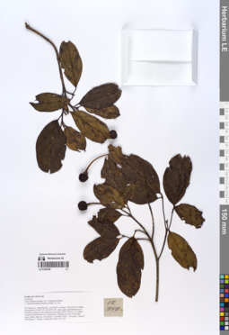
LE 01055348
Cornus hongkongensis Hemsl. det. Averyanov, Leonid Vladimirovich at 13.09.2019
Additional identifications: Cornus elliptica (Pojark.) Q.Y.Xiang & Boufford det. Averyanov, Leonid Vladimirovich, Nguyen Van Khang at 21.10.2018; Dendrobenthamia elliptica (Pojark.) H.Yu det. Averyanov, Leonid Vladimirovich, Nguyen Van Khang at 21.10.2018 Collectors: Averyanov, Leonid Vladimirovich; Khang Sinh Nguyen; Maisak, Tatiana Viktorovna; Truong Duc Thieu Field collecting number: VR1147. Collection date: 21.10.2018. Administrative regions: VN - Tinh Ha Giang. Groups of specimens: L. V. Averyanov specimens; L. V. Averyanov photos; L. V. Averyanov herbariumOriginal label text:FLORA OF VIETNAM Cornaceae Cornus elliptica (Pojark.) Q.Y. Xiang & Boufford ( = Dendrobenthamia elliptica (Pojark.) H. Yu) Ha Giang prov., Quan Ba distr., Cao Ma Po commune, Chin Chu Lin village, around point 23º04ʹ47.2ʺN 104º48ʹ55.6ʺE, steep slopes and flattened top of mountain composed with sandstone at elevation 1800–1950 m a.s.l. Primary evergreen broad-leaved very humid forest. Medium size tree. Fruits dark green, edible, delicious. Occasional. 21 October 2018, L. Averyanov, Nguyen Sinh Khang, T. Maisak, Truong Duc Thieu, VR 1147.
Coordinates (geographic position): 23° 4′ 47.2″ N, 104° 48′ 55.6″ E ±1000 mComment: All photos © L. Averyanov & K.S. Nguyen
Record creation: 2019-06-11, Leonid Averyanov, PhotoScan D1Citation: Specimen LE 01055348 // Virtual herbarium of Komarov Botanical Institute RAS — http://re.herbariumle.ru/01055348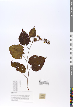
LE 01055347
Rubus viscidus Focke det. Tien Hiep Nguyen at 05.12.2019
Additional identifications: Rubus sp. det. Averyanov, Leonid Vladimirovich at 20.10.2018 Collectors: Averyanov, Leonid Vladimirovich; Khang Sinh Nguyen; Maisak, Tatiana Viktorovna; Truong Duc Thieu Field collecting number: VR1101. Collection date: 20.10.2018. Administrative regions: VN - Tinh Ha Giang. Groups of specimens: L. V. Averyanov specimens; L. V. Averyanov photos; L. V. Averyanov herbariumOriginal label text:FLORA OF VIETNAM.
Coordinates (geographic position): 23° 5′ 13.5″ N, 104° 48′ 30.2″ E ±1000 mComment: Rosaceae.
Rubus sp.
Ha Giang prov., Quan Ba distr., Cao Ma Po commune, Chin Chu Lin village, around point 23º05ʹ13.5ʺN 104º48ʹ30.2ʺE, rocky outcrops on steep rocky slopes composed with eroded karstic limestone at elevation 1750–1950 m a.s.l. Highly degraded remnants of primary evergreen broad-leaved very humid forest and evergreen secondary shrubs. Scandent shrub to 1.5 tall among open secondary shrubs on steep rocky slope. Fruits yellow, edible. Common.20 October 2018, L. Averyanov, Nguyen Sinh Khang, T. Maisak, Truong Duc Thieu, VR 1101.
All photos © L. Averyanov & K.S. Nguyen
Record creation: 2019-06-11, Leonid Averyanov, PhotoScan D1Citation: Specimen LE 01055347 // Virtual herbarium of Komarov Botanical Institute RAS — http://re.herbariumle.ru/01055347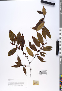
LE 01055346
Iteadaphne caudata (Nees) H.W.Li det. Averyanov, Leonid Vladimirovich at 20.09.2019
Additional identifications: Litsea sp. det. Averyanov, Leonid Vladimirovich at 21.10.2018 Collectors: Averyanov, Leonid Vladimirovich; Khang Sinh Nguyen; Maisak, Tatiana Viktorovna; Truong Duc Thieu Field collecting number: VR1114. Collection date: 21.10.2018. Administrative regions: VN - Tinh Ha Giang. Groups of specimens: L. V. Averyanov specimens; L. V. Averyanov photos; L. V. Averyanov herbariumOriginal label text:FLORA OF VIETNAM Lauraceae Litsea sp.? Ha Giang prov., Quan Ba distr., Cao Ma Po commune, Chin Chu Lin village, around point 23º05ʹ13.5ʺN 104º48ʹ30.2ʺE, rocky outcrops on steep rocky slopes composed with eroded karstic limestone at elevation 1750–1950 m a.s.l. Highly degraded remnants of primary evergreen broad-leaved very humid forest and evergreen secondary shrubs. Tree 6–8 m tall. Flowers yellowish. Not common. 20 October 2018, L. Averyanov, Nguyen Sinh Khang, T. Maisak, Truong Duc Thieu, VR 1114.
Coordinates (geographic position): 23° 5′ 13.5″ N, 104° 48′ 30.2″ E ±1000 mComment: All photos © L. Averyanov & K.S. Nguyen
Record creation: 2019-06-11, Leonid Averyanov, PhotoScan D1Citation: Specimen LE 01055346 // Virtual herbarium of Komarov Botanical Institute RAS — http://re.herbariumle.ru/01055346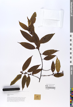
LE 01055345
Iteadaphne caudata (Nees) H.W.Li det. Averyanov, Leonid Vladimirovich at 20.09.2019
Additional identifications: Litsea sp. det. Averyanov, Leonid Vladimirovich at 21.10.2018 Collectors: Averyanov, Leonid Vladimirovich; Khang Sinh Nguyen; Maisak, Tatiana Viktorovna; Truong Duc Thieu Field collecting number: VR1114. Collection date: 21.10.2018. Administrative regions: VN - Tinh Ha Giang. Groups of specimens: L. V. Averyanov specimens; L. V. Averyanov photos; L. V. Averyanov herbariumOriginal label text:FLORA OF VIETNAM
Coordinates (geographic position): 23° 5′ 13.5″ N, 104° 48′ 30.2″ E ±1000 mComment: Lauraceae
Litsea sp.?
Ha Giang prov., Quan Ba distr., Cao Ma Po commune, Chin Chu Lin village, around point 23º05ʹ13.5ʺN 104º48ʹ30.2ʺE, rocky outcrops on steep rocky slopes composed with eroded karstic limestone at elevation 1750–1950 m a.s.l. Highly degraded remnants of primary evergreen broad-leaved very humid forest and evergreen secondary shrubs. Tree 6–8 m tall. Flowers yellowish. Not common. 20 October 2018, L. Averyanov, Nguyen Sinh Khang, T. Maisak, Truong Duc Thieu, VR 1114.
All photos © L. Averyanov & K.S. Nguyen
Record creation: 2019-06-11, Leonid Averyanov, PhotoScan D1Citation: Specimen LE 01055345 // Virtual herbarium of Komarov Botanical Institute RAS — http://re.herbariumle.ru/01055345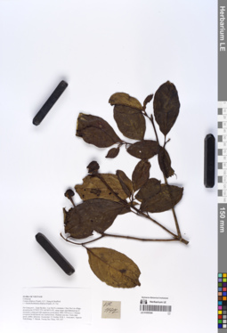
LE 01055344
Cornus hongkongensis Hemsl. det. Averyanov, Leonid Vladimirovich at 13.09.2019
Additional identifications: Cornus elliptica (Pojark.) Q.Y.Xiang & Boufford det. Averyanov, Leonid Vladimirovich, Nguyen Van Khang at 21.10.2018 Collectors: Averyanov, Leonid Vladimirovich; Khang Sinh Nguyen; Maisak, Tatiana Viktorovna; Truong Duc Thieu Field collecting number: VR1147. Collection date: 21.10.2018. Administrative regions: VN - Tinh Ha Giang. Groups of specimens: L. V. Averyanov specimens; L. V. Averyanov photos; L. V. Averyanov herbariumOriginal label text:FLORA OF VIETNAM
Coordinates (geographic position): 23° 4′ 47.2″ N, 104° 48′ 55.6″ E ±1000 mComment: Cornaceae
Cornus elliptica (Pojark.) Q.Y. Xiang & Boufford
( = Dendrobenthamia elliptica (Pojark.) H. Yu)
Ha Giang prov., Quan Ba distr., Cao Ma Po commune, Chin Chu Lin village, around point 23º04ʹ47.2ʺN 104º48ʹ55.6ʺE, steep slopes and flattened top of mountain composed with sandstone at elevation 1800–1950 m a.s.l. Primary evergreen broad-leaved very humid forest. Medium size tree. Fruits dark green, edible, delicious. Occasional. 21 October 2018, L. Averyanov, Nguyen Sinh Khang, T. Maisak, Truong Duc Thieu, VR 1147.
All photos © L. Averyanov & K.S. Nguyen
Record creation: 2019-06-11, Leonid Averyanov, PhotoScan D1Citation: Specimen LE 01055344 // Virtual herbarium of Komarov Botanical Institute RAS — http://re.herbariumle.ru/01055344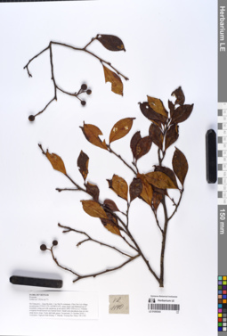
LE 01055343
Sorbus ligustrifolia (A.Chev.) J.E.Vidal det. Tien Hiep Nguyen at 05.12.2019
Additional identifications: Sorbus sp. det. Averyanov, Leonid Vladimirovich at 21.10.2018; Pyrus sp. det. Averyanov, Leonid Vladimirovich at 21.10.2018 Collectors: Averyanov, Leonid Vladimirovich; Khang Sinh Nguyen; Maisak, Tatiana Viktorovna; Truong Duc Thieu Field collecting number: VR1140. Collection date: 21.10.2018. Administrative regions: VN - Tinh Ha Giang. Groups of specimens: L. V. Averyanov specimens; L. V. Averyanov photos; L. V. Averyanov herbariumOriginal label text:FLORA OF VIETNAM Rosaceae Sorbus sp.? (Pyrus sp.??) Ha Giang prov., Quan Ba distr., Cao Ma Po commune, Chin Chu Lin village, around point 23º04ʹ47.2ʺN 104º48ʹ55.6ʺE, steep slopes and flattened top of mountain composed with sandstone at elevation 1800–1950 m a.s.l. Primary evergreen broad-leaved very humid forest. Small semi-deciduous tree on very steep mossy slope. Fruits dull dark green. Occasional. 21 October 2018, L. Averyanov, Nguyen Sinh Khang, T. Maisak, Truong Duc Thieu, VR 1140.
Coordinates (geographic position): 23° 4′ 47.2″ N, 104° 48′ 55.6″ E ±1000 mComment: All photos © L. Averyanov & K.S. Nguyen
Record creation: 2019-06-11, Leonid Averyanov, PhotoScan D1Citation: Specimen LE 01055343 // Virtual herbarium of Komarov Botanical Institute RAS — http://re.herbariumle.ru/01055343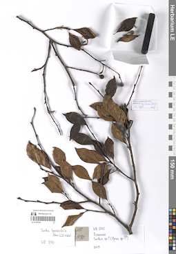
LE 01055342
Sorbus ligustrifolia (A.Chev.) J.E.Vidal det. Tien Hiep Nguyen at 05.12.2019
Additional identifications: Sorbus sp. det. Averyanov, Leonid Vladimirovich at 21.10.2018; Pyrus sp. det. Averyanov, Leonid Vladimirovich at 21.10.2018 Collectors: Averyanov, Leonid Vladimirovich; Khang Sinh Nguyen; Maisak, Tatiana Viktorovna; Truong Duc Thieu Field collecting number: VR1140. Collection date: 21.10.2018. Administrative regions: VN - Tinh Ha Giang. Groups of specimens: L. V. Averyanov specimens; L. V. Averyanov photos; L. V. Averyanov herbariumOriginal label text:FLORA OF VIETNAM Rosaceae Sorbus sp.? (Pyrus sp.??) Ha Giang prov., Quan Ba distr., Cao Ma Po commune, Chin Chu Lin village, around point 23º04ʹ47.2ʺN 104º48ʹ55.6ʺE, steep slopes and flattened top of mountain composed with sandstone at elevation 1800–1950 m a.s.l. Primary evergreen broad-leaved very humid forest. Small semi-deciduous tree on very steep mossy slope. Fruits dull dark green. Occasional. 21 October 2018, L. Averyanov, Nguyen Sinh Khang, T. Maisak, Truong Duc Thieu, VR 1140.
Coordinates (geographic position): 23° 4′ 47.2″ N, 104° 48′ 55.6″ E ±1000 mComment: All photos © L. Averyanov & K.S. Nguyen
Record creation: 2019-06-11, Leonid Averyanov, PhotoScan D1Citation: Specimen LE 01055342 // Virtual herbarium of Komarov Botanical Institute RAS — http://re.herbariumle.ru/01055342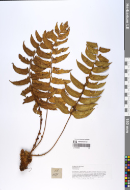
LE 01055341
Polystichum hookerianum (C.Presl) C.Chr. det. Averyanov, Leonid Vladimirovich at 09.07.2019
Additional identifications: Polystichum sp. det. Averyanov, Leonid Vladimirovich at 21.10.2018 Collectors: Averyanov, Leonid Vladimirovich; Khang Sinh Nguyen; Maisak, Tatiana Viktorovna; Truong Duc Thieu Field collecting number: VR1139. Collection date: 21.10.2018. Administrative regions: VN - Tinh Ha Giang. Groups of specimens: L. V. Averyanov specimens; L. V. Averyanov photos; L. V. Averyanov herbariumOriginal label text:FLORA OF VIETNAM Polypodiaceae s.l. Dryopteridaceae Polystichum hookerianum (C.Presl) C.Chr. Ha Giang prov., Quan Ba distr., Cao Ma Po commune, Chin Chu Lin village, around point 23º04ʹ47.2ʺN 104º48ʹ55.6ʺE, steep slopes and flattened top of mountain composed with sandstone at elevation 1800–1950 m a.s.l. Primary evergreen broad-leaved very humid forest. Terrestrial fern on very steep mossy slope. Common. 21 October 2018, L. Averyanov, Nguyen Sinh Khang, T. Maisak, Truong Duc Thieu, VR 1139.
Coordinates (geographic position): 23° 4′ 47.2″ N, 104° 48′ 55.6″ E ±1000 mComment: All photos © L. Averyanov & K.S. Nguyen
Record creation: 2019-06-11, Leonid Averyanov, PhotoScan D1Citation: Specimen LE 01055341 // Virtual herbarium of Komarov Botanical Institute RAS — http://re.herbariumle.ru/01055341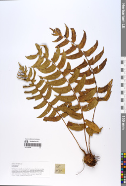
LE 01055340
Polystichum hookerianum (C.Presl) C.Chr. det. Averyanov, Leonid Vladimirovich at 09.07.2019
Additional identifications: Polystichum sp. det. Averyanov, Leonid Vladimirovich at 21.10.2018 Collectors: Averyanov, Leonid Vladimirovich; Khang Sinh Nguyen; Maisak, Tatiana Viktorovna; Truong Duc Thieu Field collecting number: VR1139. Collection date: 21.10.2018. Administrative regions: VN - Tinh Ha Giang. Groups of specimens: L. V. Averyanov specimens; L. V. Averyanov photos; L. V. Averyanov herbariumOriginal label text:FLORA OF VIETNAM
Coordinates (geographic position): 23° 4′ 47.2″ N, 104° 48′ 55.6″ E ±1000 mComment: Polypodiaceae s.l.
Dryopteridaceae
Polystichum hookerianum (C.Presl) C.Chr.
Ha Giang prov., Quan Ba distr., Cao Ma Po commune, Chin Chu Lin village, around point 23º04ʹ47.2ʺN 104º48ʹ55.6ʺE, steep slopes and flattened top of mountain composed with sandstone at elevation 1800–1950 m a.s.l. Primary evergreen broad-leaved very humid forest. Terrestrial fern on very steep mossy slope. Common. 21 October 2018, L. Averyanov, Nguyen Sinh Khang, T. Maisak, Truong Duc Thieu, VR 1139.
All photos © L. Averyanov & K.S. Nguyen
Record creation: 2019-06-11, Leonid Averyanov, PhotoScan D1Citation: Specimen LE 01055340 // Virtual herbarium of Komarov Botanical Institute RAS — http://re.herbariumle.ru/01055340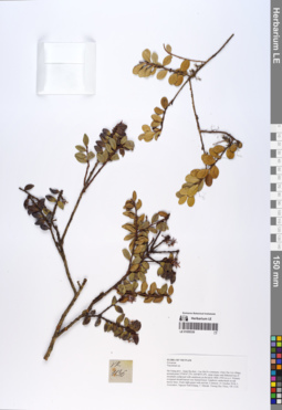
LE 01055339
Vaccinium papillatum P.F.Stevens det. Averyanov, Leonid Vladimirovich at 10.12.2019
Additional identifications: Vaccinium sp. det. Averyanov, Leonid Vladimirovich at 21.10.2018 Collectors: Averyanov, Leonid Vladimirovich; Khang Sinh Nguyen; Maisak, Tatiana Viktorovna; Truong Duc Thieu Field collecting number: VR1136. Collection date: 21.10.2018. Administrative regions: VN - Tinh Ha Giang. Groups of specimens: L. V. Averyanov specimens; L. V. Averyanov photos; L. V. Averyanov herbariumOriginal label text:FLORA OF VIETNAM
Coordinates (geographic position): 23° 4′ 47.2″ N, 104° 48′ 55.6″ E ±1000 mComment: Ericaceae
Vaccinium sp.
Ha Giang prov., Quan Ba distr., Cao Ma Po commune, Chin Chu Lin village, around point 23º04ʹ47.2ʺN 104º48ʹ55.6ʺE, steep slopes and flattened top of mountain composed with sandstone at elevation 1800–1950 m a.s.l. Primary evergreen broad-leaved very humid forest. Epiphytic undershrub on tall mossy trees. Fruits light green with red tint. Common. 21 October 2018, L. Averyanov, Nguyen Sinh Khang, T. Maisak, Truong Duc Thieu, VR 1136.
All photos © L. Averyanov & K.S. Nguyen
Record creation: 2019-06-11, Leonid Averyanov, PhotoScan D1Citation: Specimen LE 01055339 // Virtual herbarium of Komarov Botanical Institute RAS — http://re.herbariumle.ru/01055339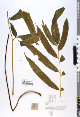
LE 01055338
Coniogramme intermedia Hieron. det. X.C.Zhang at 02.07.2019
Additional identifications: Diplazium sp. det. Averyanov, Leonid Vladimirovich at 21.10.2018 Collectors: Averyanov, Leonid Vladimirovich; Khang Sinh Nguyen; Maisak, Tatiana Viktorovna; Truong Duc Thieu Field collecting number: VR1127. Collection date: 21.10.2018. Administrative regions: VN - Tinh Ha Giang. Groups of specimens: L. V. Averyanov specimens; L. V. Averyanov photos; L. V. Averyanov herbariumOriginal label text:FLORA OF VIETNAM
Coordinates (geographic position): 23° 4′ 47.2″ N, 104° 48′ 55.6″ E ±1000 mComment: Polypodiaceae s.l.
Diplazium sp.
Ha Giang prov., Quan Ba distr., Cao Ma Po commune, Chin Chu Lin village, around point 23º04ʹ47.2ʺN 104º48ʹ55.6ʺE, steep slopes and flattened top of mountain composed with sandstone at elevation 1800–1950 m a.s.l. Primary evergreen broad-leaved very humid forest. Terrestrial fern on steep mossy slope. Not rare. 21 October 2018, L. Averyanov, Nguyen Sinh Khang, T. Maisak, Truong Duc Thieu, VR 1127.
All photos © L. Averyanov & K.S. Nguyen
Record creation: 2019-06-11, Leonid Averyanov, PhotoScan D1Citation: Specimen LE 01055338 // Virtual herbarium of Komarov Botanical Institute RAS — http://re.herbariumle.ru/01055338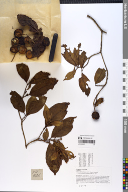
LE 01055337
Cornus hongkongensis Hemsl. det. Averyanov, Leonid Vladimirovich at 13.09.2019
Additional identifications: Cornus elliptica (Pojark.) Q.Y.Xiang & Boufford det. Nguyen Van Khang at 21.10.2018 Collectors: Averyanov, Leonid Vladimirovich; Khang Sinh Nguyen; Maisak, Tatiana Viktorovna; Truong Duc Thieu Field collecting number: VR1126. Collection date: 21.10.2018. Administrative regions: VN - Tinh Ha Giang. Groups of specimens: L. V. Averyanov specimens; L. V. Averyanov photos; L. V. Averyanov herbariumOriginal label text:FLORA OF VIETNAM
Coordinates (geographic position): 23° 4′ 47.2″ N, 104° 48′ 55.6″ E ±1000 mComment: Cornaceae
Cornus elliptica (Pojark.) Q.Y. Xiang & Boufford
( = Dendrobenthamia elliptica (Pojark.) H. Yu)
Ha Giang prov., Quan Ba distr., Cao Ma Po commune, Chin Chu Lin village, around point 23º04ʹ47.2ʺN 104º48ʹ55.6ʺE, steep slopes and flattened top of mountain composed with sandstone at elevation 1800–1950 m a.s.l. Primary evergreen broad-leaved very humid forest. Large tree. Fruits globular to 4 cm in diameter, light yellow-greenish, fleshy, edible (?). Not rare. 21 October 2018, L. Averyanov, Nguyen Sinh Khang, T. Maisak, Truong Duc Thieu, VR 1126.
All photos © L. Averyanov & K.S. Nguyen
Record creation: 2019-06-11, Leonid Averyanov, PhotoScan D1Citation: Specimen LE 01055337 // Virtual herbarium of Komarov Botanical Institute RAS — http://re.herbariumle.ru/01055337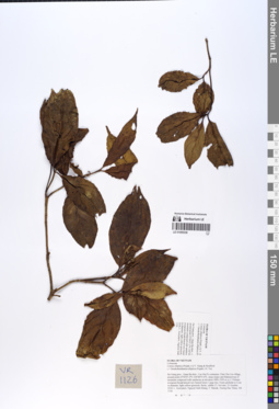
LE 01055336
Cornus hongkongensis Hemsl. det. Averyanov, Leonid Vladimirovich at 13.09.2019
Additional identifications: Cornus elliptica (Pojark.) Q.Y.Xiang & Boufford det. Nguyen Van Khang at 21.10.2018 Collectors: Averyanov, Leonid Vladimirovich; Khang Sinh Nguyen; Maisak, Tatiana Viktorovna; Truong Duc Thieu Field collecting number: VR1126. Collection date: 21.10.2018. Administrative regions: VN - Tinh Ha Giang. Groups of specimens: L. V. Averyanov specimens; L. V. Averyanov photos; L. V. Averyanov herbariumOriginal label text:FLORA OF VIETNAM
Coordinates (geographic position): 23° 4′ 47.2″ N, 104° 48′ 55.6″ E ±1000 mComment: Cornaceae
Cornus elliptica (Pojark.) Q.Y. Xiang & Boufford
( = Dendrobenthamia elliptica (Pojark.) H. Yu)
Ha Giang prov., Quan Ba distr., Cao Ma Po commune, Chin Chu Lin village, around point 23º04ʹ47.2ʺN 104º48ʹ55.6ʺE, steep slopes and flattened top of mountain composed with sandstone at elevation 1800–1950 m a.s.l. Primary evergreen broad-leaved very humid forest. Large tree. Fruits globular to 4 cm in diameter, light yellow-greenish, fleshy, edible (?). Not rare. 21 October 2018, L. Averyanov, Nguyen Sinh Khang, T. Maisak, Truong Duc Thieu, VR 1126.
All photos © L. Averyanov & K.S. Nguyen
Record creation: 2019-06-11, Leonid Averyanov, PhotoScan D1Citation: Specimen LE 01055336 // Virtual herbarium of Komarov Botanical Institute RAS — http://re.herbariumle.ru/01055336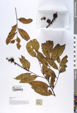
LE 01055335
Castanopsis ferox Spach ⟮prelim. ID⟯ det. Averyanov, Leonid Vladimirovich at 19.09.2019
Additional identifications: Lithocarpus sp. det. Averyanov, Leonid Vladimirovich at 21.10.2018 Collectors: Averyanov, Leonid Vladimirovich; et al. Field collecting number: VR1122. Collection date: 21.10.2018. Administrative regions: VN - Tinh Ha Giang. Groups of specimens: L. V. Averyanov specimens; L. V. Averyanov photos; L. V. Averyanov herbariumOriginal label text:FLORA OF VIETNAM
Coordinates (geographic position): 23° 4′ 47.2″ N, 104° 48′ 55.6″ E ±1000 mComment: Fagaceae
Lithocarpus sp.
Ha Giang prov., Quan Ba distr., Cao Ma Po commune, Chin Chu Lin village, around point 23º04ʹ47.2ʺN 104º48ʹ55.6ʺE, steep slopes and flattened top of mountain composed with sandstone at elevation 1800–1950 m a.s.l. Primary evergreen broad-leaved very humid forest. Large tree. Common, co-dominant of the forest. 21 October 2018, L. Averyanov, Nguyen Sinh Khang, T. Maisak, Truong Duc Thieu, VR 1122.
All photos © L. Averyanov & K.S. Nguyen
Record creation: 2019-06-11, Leonid Averyanov, PhotoScan D1. Processing status: work_status_1Citation: Specimen LE 01055335 // Virtual herbarium of Komarov Botanical Institute RAS — http://re.herbariumle.ru/01055335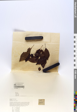
LE 01055334
Docynia indica (Colebr.) Decne. det. Averyanov, Leonid Vladimirovich, Nguyen Van Khang at 21.10.2018
Collectors: Averyanov, Leonid Vladimirovich; Khang Sinh Nguyen; Maisak, Tatiana Viktorovna; Truong Duc Thieu Field collecting number: VR1121. Collection date: 21.10.2018. Administrative regions: VN - Tinh Ha Giang. Groups of specimens: L. V. Averyanov specimens; L. V. Averyanov herbarium; L. V. Averyanov photosOriginal label text:FLORA OF VIETNAM.
Coordinates (geographic position): 23° 4′ 47.2″ N, 104° 48′ 55.6″ E ±1000 mComment: Rosaceae.
Docynia indica (Wall.) Decne.?.
Ha Giang prov., Quan Ba distr., Cao Ma Po commune, Chin Chu Lin village, around point 23º04ʹ47.2ʺN 104º48ʹ55.6ʺE, steep slopes and flattened top of mountain composed with sandstone at elevation 1800–1950 m a.s.l. Primary evergreen broad-leaved very humid forest. Small tree in open place. Fruits dull light greenish, edible. Occasional. 21 October 2018, L. Averyanov, Nguyen Sinh Khang, T. Maisak, Truong Duc Thieu, VR 1121.
All photos © L. Averyanov & K.S. Nguyen
Record creation: 2019-06-11, Leonid Averyanov, PhotoScan D1Citation: Specimen LE 01055334 // Virtual herbarium of Komarov Botanical Institute RAS — http://re.herbariumle.ru/01055334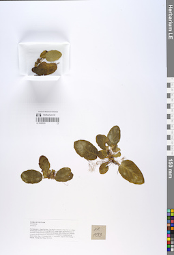
LE 01055333
Holotype of Primula urceolata Aver. det. C.M. Hu, Averyanov, Leonid Vladimirovich at 28.09.2019
Additional identifications: Primula sp. det. Averyanov, Leonid Vladimirovich, Nguyen Van Khang at 21.10.2018 Collectors: Averyanov, Leonid Vladimirovich; Khang Sinh Nguyen; Maisak, Tatiana Viktorovna; Truong Duc Thieu Field collecting number: VR1133. Collection date: 21.10.2018. Administrative regions: VN - Tinh Ha Giang. Groups of specimens: L. V. Averyanov specimens; L. V. Averyanov herbarium; L. V. Averyanov photosOriginal label text:FLORA OF VIETNAM
Coordinates (geographic position): 23° 4′ 47.2″ N, 104° 48′ 55.6″ E ±1000 mComment: Primulaceae
Primula sp.
Ha Giang prov., Quan Ba distr., Cao Ma Po commune, Chin Chu Lin village, around point 23º04ʹ47.2ʺN 104º48ʹ55.6ʺE, steep slopes and flattened top of mountain composed with sandstone at elevation 1800–1950 m a.s.l. Primary evergreen broad-leaved very humid forest. Lithophytic rosulate herb on mossy rocks. Rare. 21 October 2018, L. Averyanov, Nguyen Sinh Khang, T. Maisak, Truong Duc Thieu, VR 1133.
All photos © L. Averyanov & K.S. Nguyen
Record creation: 2019-06-11, Leonid Averyanov, PhotoScan D1Citation: Specimen LE 01055333 // Virtual herbarium of Komarov Botanical Institute RAS — http://re.herbariumle.ru/01055333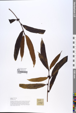
LE 01055332
Ficus macilenta King det. Tien Hiep Nguyen at 20.10.2018
Collectors: Averyanov, Leonid Vladimirovich; Khang Sinh Nguyen; Maisak, Tatiana Viktorovna; Truong Duc Thieu Field collecting number: VR1106. Collection date: 20.10.2018. Administrative regions: VN - Tinh Ha Giang. Groups of specimens: L. V. Averyanov specimens; L. V. Averyanov herbarium; L. V. Averyanov photosOriginal label text:FLORA OF VIETNAM Moraceae Ficus macilenta King Ha Giang prov., Quan Ba distr., Cao Ma Po commune, Chin Chu Lin village, around point 23º05ʹ13.5ʺN 104º48ʹ30.2ʺE, rocky outcrops on steep rocky slopes composed with eroded karstic limestone at elevation 1750–1950 m a.s.l. Highly degraded remnants of primary evergreen broad-leaved very humid forest and evergreen secondary shrubs. Small tree or shrub on mossy rocks. Occasional. 20 October 2018, L. Averyanov, Nguyen Sinh Khang, T. Maisak, Truong Duc Thieu, VR 1106.
Coordinates (geographic position): 23° 5′ 13.5″ N, 104° 48′ 30.2″ E ±1000 mComment: All photos © L. Averyanov & K.S. Nguyen
Record creation: 2019-06-11, Leonid Averyanov, PhotoScan D1Citation: Specimen LE 01055332 // Virtual herbarium of Komarov Botanical Institute RAS — http://re.herbariumle.ru/01055332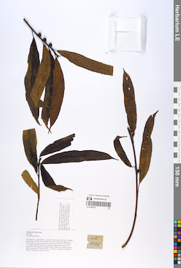
LE 01055331
Ficus macilenta King det. Tien Hiep Nguyen at 20.10.2018
Collectors: Averyanov, Leonid Vladimirovich; Khang Sinh Nguyen; Maisak, Tatiana Viktorovna; Truong Duc Thieu Field collecting number: VR1106. Collection date: 20.10.2018. Administrative regions: VN - Tinh Ha Giang. Groups of specimens: L. V. Averyanov specimens; L. V. Averyanov herbarium; L. V. Averyanov photosOriginal label text:FLORA OF VIETNAM
Coordinates (geographic position): 23° 5′ 13.5″ N, 104° 48′ 30.2″ E ±1000 mComment: Moraceae
Ficus macilenta King
Ha Giang prov., Quan Ba distr., Cao Ma Po commune, Chin Chu Lin village, around point 23º05ʹ13.5ʺN 104º48ʹ30.2ʺE, rocky outcrops on steep rocky slopes composed with eroded karstic limestone at elevation 1750–1950 m a.s.l. Highly degraded remnants of primary evergreen broad-leaved very humid forest and evergreen secondary shrubs. Small tree or shrub on mossy rocks. Occasional. 20 October 2018, L. Averyanov, Nguyen Sinh Khang, T. Maisak, Truong Duc Thieu, VR 1106.
All photos © L. Averyanov & K.S. Nguyen
Record creation: 2019-06-11, Leonid Averyanov, PhotoScan D1Citation: Specimen LE 01055331 // Virtual herbarium of Komarov Botanical Institute RAS — http://re.herbariumle.ru/01055331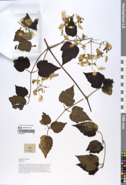
LE 01055330
Clematis leschenaultiana DC. det. Averyanov, Leonid Vladimirovich at 10.12.2019
Additional identifications: Clematis sp. det. Averyanov, Leonid Vladimirovich at 20.10.2018 Collectors: Averyanov, Leonid Vladimirovich; et al. Field collecting number: VR1111. Collection date: 20.10.2018. Administrative regions: VN - Tinh Ha Giang. Groups of specimens: L. V. Averyanov specimens; L. V. Averyanov herbarium; L. V. Averyanov photosOriginal label text:FLORA OF VIETNAM
Coordinates (geographic position): 23° 5′ 13.5″ N, 104° 48′ 30.2″ E ±1000 mComment: Ranunculaceae
Clematis sp.
Ha Giang prov., Quan Ba distr., Cao Ma Po commune, Chin Chu Lin village, around point 23º05ʹ13.5ʺN 104º48ʹ30.2ʺE, rocky outcrops on steep rocky slopes composed with eroded karstic limestone at elevation 1750–1950 m a.s.l. Highly degraded remnants of primary evergreen broad-leaved very humid forest and evergreen secondary shrubs. Herbaceous vine 4–6 m long among open shrubs on open rocky slope. Flowers pale light yellowish. Common.20 October 2018, L. Averyanov, Nguyen Sinh Khang, T. Maisak, Truong Duc Thieu, VR 1111.
All photos © L. Averyanov & K.S. Nguyen
Record creation: 2019-06-11, Leonid Averyanov, PhotoScan D1Citation: Specimen LE 01055330 // Virtual herbarium of Komarov Botanical Institute RAS — http://re.herbariumle.ru/01055330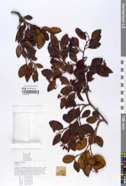
LE 01055329
Cotoneaster glaucophyllus Franch. det. Tien Hiep Nguyen at 05.12.2019
Additional identifications: Cotoneaster sp. det. Averyanov, Leonid Vladimirovich at 20.10.2018 Collectors: Averyanov, Leonid Vladimirovich; Khang Sinh Nguyen; Maisak, Tatiana Viktorovna; Truong Duc Thieu Field collecting number: VR1116. Collection date: 20.10.2018. Administrative regions: VN - Tinh Ha Giang. Groups of specimens: L. V. Averyanov specimens; L. V. Averyanov herbarium; L. V. Averyanov photosOriginal label text:FLORA OF VIETNAM
Coordinates (geographic position): 23° 5′ 13.5″ N, 104° 48′ 30.2″ E ±1000 mComment: Rosaceae
Cotoneaster sp.?
Ha Giang prov., Quan Ba distr., Cao Ma Po commune, Chin Chu Lin village, around point 23º05ʹ13.5ʺN 104º48ʹ30.2ʺE, rocky outcrops on steep rocky slopes composed with eroded karstic limestone at elevation 1750–1950 m a.s.l. Highly degraded remnants of primary evergreen broad-leaved very humid forest and evergreen secondary shrubs. Treelet 5–6 m talon steep rocky slope. Fruits bright red. Not common.20 October 2018, L. Averyanov, Nguyen Sinh Khang, T. Maisak, Truong Duc Thieu, VR 1116.
All photos © L. Averyanov & K.S. Nguyen
Record creation: 2019-06-11, Leonid Averyanov, PhotoScan D1Citation: Specimen LE 01055329 // Virtual herbarium of Komarov Botanical Institute RAS — http://re.herbariumle.ru/01055329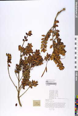
LE 01055328
Aeschynanthus buxifolius Hemsl. det. Averyanov, Leonid Vladimirovich at 20.10.2018
Collectors: Averyanov, Leonid Vladimirovich; Khang Sinh Nguyen; Maisak, Tatiana Viktorovna; Truong Duc Thieu Field collecting number: VR1109. Collection date: 20.10.2018. Administrative regions: VN - Tinh Ha Giang. Groups of specimens: L. V. Averyanov specimens; L. V. Averyanov herbarium; L. V. Averyanov photosOriginal label text:FLORA OF VIETNAM
Coordinates (geographic position): 23° 5′ 13.5″ N, 104° 48′ 30.2″ E ±1000 mComment: Gesneriaceae
Aeschynanthus buxifolius Hemsl.
Ha Giang prov., Quan Ba distr., Cao Ma Po commune, Chin Chu Lin village, around point 23º05ʹ13.5ʺN 104º48ʹ30.2ʺE, rocky outcrops on steep rocky slopes composed with eroded karstic limestone at elevation 1750–1950 m a.s.l. Highly degraded remnants of primary evergreen broad-leaved very humid forest and evergreen secondary shrubs. Erect undershrub with shoots to 0.5 m long on open mossy rocks. Not common. 20 October 2018, L. Averyanov, Nguyen Sinh Khang, T. Maisak, Truong Duc Thieu, VR 1109.
All photos © L. Averyanov & K.S. Nguyen
Record creation: 2019-06-11, Leonid Averyanov, PhotoScan D1Citation: Specimen LE 01055328 // Virtual herbarium of Komarov Botanical Institute RAS — http://re.herbariumle.ru/01055328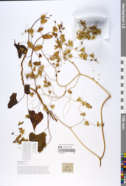
LE 01055327
Porana paniculata Roxb. ⟮prelim. ID⟯ det. Averyanov, Leonid Vladimirovich at 20.10.2018
Collectors: Averyanov, Leonid Vladimirovich; Khang Sinh Nguyen; Maisak, Tatiana Viktorovna; Truong Duc Thieu Field collecting number: VR1108. Collection date: 20.10.2018. Administrative regions: VN - Tinh Ha Giang. Groups of specimens: L. V. Averyanov specimens; L. V. Averyanov herbarium; L. V. Averyanov photosOriginal label text:FLORA OF VIETNAM
Coordinates (geographic position): 23° 5′ 13.5″ N, 104° 48′ 30.2″ E ±1000 mComment: Convolvulaceae
Porana paniculata Roxb.?
Ha Giang prov., Quan Ba distr., Cao Ma Po commune, Chin Chu Lin village, around point 23º05ʹ13.5ʺN 104º48ʹ30.2ʺE, rocky outcrops on steep rocky slopes composed with eroded karstic limestone at elevation 1750–1950 m a.s.l. Highly degraded remnants of primary evergreen broad-leaved very humid forest and evergreen secondary shrubs. Herbaceous vine 3–4 m long among open secondary shrubs on rocky slope. Occasional. 20 October 2018, L. Averyanov, Nguyen Sinh Khang, T. Maisak, Truong Duc Thieu, VR 1108.
All photos © L. Averyanov & K.S. Nguyen
Record creation: 2019-06-11, Leonid Averyanov, PhotoScan D1Citation: Specimen LE 01055327 // Virtual herbarium of Komarov Botanical Institute RAS — http://re.herbariumle.ru/01055327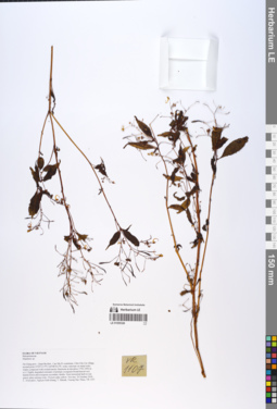
LE 01055326
Impatiens racemosa DC. det. Sheng Xiang Yu, Khang Sinh Nguyen at 11.10.2019
Additional identifications: Impatiens sp. det. Averyanov, Leonid Vladimirovich at 20.10.2018 Collectors: Averyanov, Leonid Vladimirovich; Khang Sinh Nguyen; Maisak, Tatiana Viktorovna; Truong Duc Thieu Field collecting number: VR1107. Collection date: 20.10.2018. Administrative regions: VN - Tinh Ha Giang. Groups of specimens: L. V. Averyanov specimens; L. V. Averyanov herbarium; L. V. Averyanov photosOriginal label text:FLORA OF VIETNAM
Coordinates (geographic position): 23° 5′ 13.5″ N, 104° 48′ 30.2″ E ±1000 mComment: Balsaminaceae
Impatiens sp.
Ha Giang prov., Quan Ba distr., Cao Ma Po commune, Chin Chu Lin village, around point 23º05ʹ13.5ʺN 104º48ʹ30.2ʺE, rocky outcrops on steep rocky slopes composed with eroded karstic limestone at elevation 1750–1950 m a.s.l. Highly degraded remnants of primary evergreen broad-leaved very humid forest and evergreen secondary shrubs. Erect terrestrial herb in wet grassy place among rocks. Flowers pale yellow. Not rare. 20 October 2018, L. Averyanov, Nguyen Sinh Khang, T. Maisak, Truong Duc Thieu, VR 1107.
All photos © L. Averyanov & K.S. Nguyen
Record creation: 2019-06-11, Leonid Averyanov, PhotoScan D1Citation: Specimen LE 01055326 // Virtual herbarium of Komarov Botanical Institute RAS — http://re.herbariumle.ru/01055326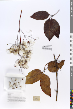
LE 01055325
Clematis loureiroana DC. det. Averyanov, Leonid Vladimirovich at 10.12.2019
Additional identifications: Clematis sp. det. Averyanov, Leonid Vladimirovich at 20.10.2018 Collectors: Averyanov, Leonid Vladimirovich; Khang Sinh Nguyen; Maisak, Tatiana Viktorovna; Truong Duc Thieu Field collecting number: VR1100. Collection date: 20.10.2018. Administrative regions: VN - Tinh Ha Giang. Groups of specimens: L. V. Averyanov specimens; L. V. Averyanov herbarium; L. V. Averyanov photosOriginal label text:FLORA OF VIETNAM
Coordinates (geographic position): 23° 5′ 13.5″ N, 104° 48′ 30.2″ E ±1000 mComment: Ranunculaceae
Clematis sp.
Ha Giang prov., Quan Ba distr., Cao Ma Po commune, Chin Chu Lin village, around point 23º05ʹ13.5ʺN 104º48ʹ30.2ʺE, rocky outcrops on steep rocky slopes composed with eroded karstic limestone at elevation 1750–1950 m a.s.l. Highly degraded remnants of primary evergreen broad-leaved very humid forest and evergreen secondary shrubs. Herbaceous vine 4–6 m long with rigid coriaceous leaves among open secondary shrubs on steep rocky slope. Common. 20 October 2018, L. Averyanov, Nguyen Sinh Khang, T. Maisak, Truong Duc Thieu, VR 1100.
All photos © L. Averyanov & K.S. Nguyen
Record creation: 2019-06-11, Leonid Averyanov, PhotoScan D1Citation: Specimen LE 01055325 // Virtual herbarium of Komarov Botanical Institute RAS — http://re.herbariumle.ru/01055325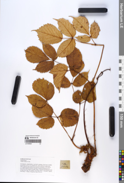
LE 01055324
Astilbe rivularis D.Don det. Averyanov, Leonid Vladimirovich at 20.10.2018
Collectors: Averyanov, Leonid Vladimirovich; Khang Sinh Nguyen; Maisak, Tatiana Viktorovna; Truong Duc Thieu Field collecting number: VR1113. Collection date: 20.10.2018. Administrative regions: VN - Tinh Ha Giang. Groups of specimens: L. V. Averyanov specimens; L. V. Averyanov herbarium; L. V. Averyanov photosOriginal label text:FLORA OF VIETNAM
Coordinates (geographic position): 23° 5′ 13.5″ N, 104° 48′ 30.2″ E ±1000 mComment: Ranunculaceae
Astilbe rivularis D. Don
Ha Giang prov., Quan Ba distr., Cao Ma Po commune, Chin Chu Lin village, around point 23º05ʹ13.5ʺN 104º48ʹ30.2ʺE, rocky outcrops on steep rocky slopes composed with eroded karstic limestone at elevation 1750–1950 m a.s.l. Highly degraded remnants of primary evergreen broad-leaved very humid forest and evergreen secondary shrubs. Terrestrial and lithophytic herb on steep rocky slope. Not common. 20 October 2018, L. Averyanov, Nguyen Sinh Khang, T. Maisak, Truong Duc Thieu, VR 1113.
All photos © L. Averyanov & K.S. Nguyen
Record creation: 2019-06-11, Leonid Averyanov, PhotoScan D1Citation: Specimen LE 01055324 // Virtual herbarium of Komarov Botanical Institute RAS — http://re.herbariumle.ru/01055324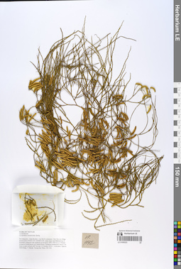
LE 01055323
Lycopodium casuarinoides Spring det. Averyanov, Leonid Vladimirovich at 21.10.2018
Collectors: Averyanov, Leonid Vladimirovich; et al. Field collecting number: VR1142. Collection date: 21.10.2018. Administrative regions: VN - Tinh Ha Giang. Groups of specimens: L. V. Averyanov specimens; L. V. Averyanov herbarium; L. V. Averyanov photosOriginal label text:FLORA OF VIETNAM
Coordinates (geographic position): 23° 4′ 47.2″ N, 104° 48′ 55.6″ E ±1000 mComment: Lycopodiaceae
Lycopodium casuarinoides Spring.
Ha Giang prov., Quan Ba distr., Cao Ma Po commune, Chin Chu Lin village, around point 23º04ʹ47.2ʺN 104º48ʹ55.6ʺE, steep slopes and flattened top of mountain composed with sandstone at elevation 1800–1950 m a.s.l. Primary evergreen broad-leaved very humid forest. Pendulous herbaceous vine to 3 m long on open vertical cliff. Not rare. 21 October 2018, L. Averyanov, Nguyen Sinh Khang, T. Maisak, Truong Duc Thieu, VR 1142.
All photos © L. Averyanov & K.S. Nguyen
Record creation: 2019-06-11, Leonid Averyanov, PhotoScan D1Citation: Specimen LE 01055323 // Virtual herbarium of Komarov Botanical Institute RAS — http://re.herbariumle.ru/01055323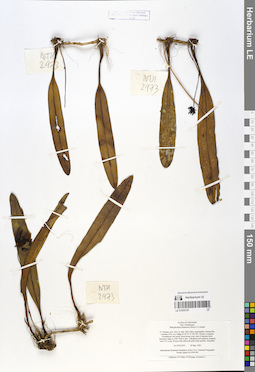
LE 01055197
Bulbophyllum andersonii (Hook. f.) J.J. Sm. det. Averyanov, Leonid Vladimirovich at 29.05.1999
Collectors: Tien Hiep Nguyen; et al. Field collecting number: NTH2973. Collection date: 29.05.1999. Administrative regions: VN - Tinh Son La. Groups of specimens: L. V. Averyanov specimens; L. V. Averyanov herbarium; Orchids of Vietnam, Laos and CambodiaOriginal label text:FLORA OF VIETNAM
Orchidaceae
Bulbophyllum andersonii (Hook.f.) J.J.Smith
N. Vietnam, prov. Son La, distr. Moc Chau, municipality Chieng Hac,
vicinities of Co Liu village (N 20°51′ E 104°38′). Primary evergreen
broadleaved wet mossy forest along rocky tops of remnant karst
limestone ridge at 1200-1240 m elev. Lithophyte and epiphyte creeping
vine 0.5-1 m lg. Flowers dull yellowish pink-violet spotted. Abundant.
NTH 2973 29 May 1999
International Botanical Expedition of the U.S.A. National Geographic
Society (grant No 6300-98)]
Collectors: N.T.Hiep, P.H.Hoang, Averyanov L.
Coordinates (geographic position): 20° 51′ N, 104° 38′ E ±1000 mRecord creation: 2019-06-11, Leonid Averyanov, PhotoScan D1. Processing status: work_status_1Citation: Specimen LE 01055197 // Virtual herbarium of Komarov Botanical Institute RAS — http://re.herbariumle.ru/01055197Orchidaceae
Bulbophyllum andersonii (Hook.f.) J.J.Smith
N. Vietnam, prov. Son La, distr. Moc Chau, municipality Chieng Hac,
vicinities of Co Liu village (N 20°51′ E 104°38′). Primary evergreen
broadleaved wet mossy forest along rocky tops of remnant karst
limestone ridge at 1200-1240 m elev. Lithophyte and epiphyte creeping
vine 0.5-1 m lg. Flowers dull yellowish pink-violet spotted. Abundant.
NTH 2973 29 May 1999
International Botanical Expedition of the U.S.A. National Geographic
Society (grant No 6300-98)]
Collectors: N.T.Hiep, P.H.Hoang, Averyanov L.
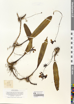
LE 01055196
Bulbophyllum andersonii (Hook. f.) J.J. Sm. det. Averyanov, Leonid Vladimirovich at 05.10.1999
Collectors: Tien Hiep Nguyen; Averyanov, Leonid Vladimirovich; et al. Field collecting number: NTH3278. Collection date: 05.10.1999. Administrative regions: VN - Tinh Ha Giang. Groups of specimens: L. V. Averyanov specimens; L. V. Averyanov herbarium; Orchids of Vietnam, Laos and CambodiaOriginal label text:FLORA OF VIETNAM
Fam. Orchidaceae
Bulbophyllum andersonii (Hook.f.) J.J.Smith.
N. Vietnam, Ha Giang prov., Meo Vac distr., Shung Cha municipality,. vicinities of Lo Loi Phin village (N 23°11' E 105°17'). Secondary. mossy shrubs and grasslands on open slopes. Creeping lithophyte vine. on mossy open limestone rocks at elev. 1200 m a.s.l. Flowers dirty. yellow with reddish marks, not smelled. Abundant. No NTH 3278 05 Oct. 1999. Collectors: N.T. Hiep, N.Q. Binh, L. Averyanov, P. Cribb.
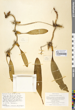
LE 01055195
Bulbophyllum andersonii (Hook. f.) J.J. Sm. det. Averyanov, Leonid Vladimirovich at 27.03.1997
Collectors: Averyanov, Leonid Vladimirovich; et al. Field collecting number: VH3286. Collection date: 27.03.1997. Administrative regions: VN - Tinh Lam GJong. Groups of specimens: L. V. Averyanov specimens; L. V. Averyanov herbarium; Orchids of Vietnam, Laos and CambodiaOriginal label text:FLORA OF VIETNAM
Bulbophyllum andersonii (Hook.f.) J.J.Smith
S. Vietnam, Prov. Lam Dong, distr. Lac Duong, municipalite Da Chay,. vicinities Klong Lanh village, 31 km to NE from Dalat city. Old closed. evergreen broadleaved secondary forest rich in primary elements along. mt river on NW macroslope of Bi Dup mt system at 1450 m alt. (N 12° 08', E 108° 39'). Epiphyte on old tree. Not common. No VH 3286 27.03.1997. International Botanical Expedition of the U.S.A. National Geographic. Society (grant No 5803-96). Collectors: L. Averyanov, N.Q. Binh, P.K. Loc
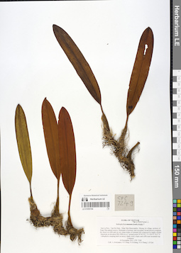
LE 01055194
Bulbophyllum andersonii (Hook.f.) J.J. Sm. det. Averyanov, Leonid Vladimirovich at 16.11.2013
Collectors: Averyanov, Leonid Vladimirovich; Tien Hiep Nguyen; Khang Sinh Nguyen; N.D. Thang; L.D. Qui Field collecting number: CPC7249. Collection date: 16.11.2013. Administrative regions: VN - Tinh Son La. Groups of specimens: L. V. Averyanov specimens; L. V. Averyanov herbarium; Orchids of Vietnam, Laos and CambodiaOriginal label text:FLORA OF VIETNAM
Orchidaceae
Bulbophyllum macraei (Lindl.) Rchb.f.?
Son La Prov., Van Ho Distr., Xuan Nha Municipality, Muong An village, territory of Xuan Nha natural reserve. Remnants of primary and secondary broad-leaved evergreen dry forest on cliffs and on very steep slopes of remnant hill composed by highly eroded limestone at elevation 900-1000 m a.s.l. around point 20°44'50.1"N 104°47'54.5"E. Lithophytic creeping herb on mossy shady rocky slopes and cliffs near mountain top. Common. 16 November 2013 CPC 7249. Coll.: L.Averyanov, N.T.Hiep, N.S.Khang, N.D.Thang, L.D.Qui
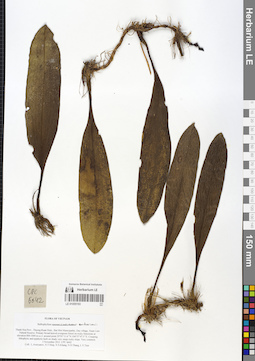
LE 01055193
Bulbophyllum andersonii (Hook.f.) J.J. Sm. det. Averyanov, Leonid Vladimirovich at 03.11.2013
Collectors: Averyanov, Leonid Vladimirovich; Tien Hiep Nguyen; Khang Sinh Nguyen; N.D. Thang; L.V. Tien Field collecting number: CPC6642. Collection date: 03.11.2013. Administrative regions: VN - Tinh Thanh Hoa. Groups of specimens: L. V. Averyanov specimens; L. V. Averyanov herbarium; Orchids of Vietnam, Laos and CambodiaOriginal label text:FLORA OF VIETNAM
Orchidaceae
Bulbophyllum macraei (Lindl.) Rchb.f.?
Thanh Hoa Prov., Thuong Xuan Distr., Bat Mot Municipality, Duc village, Xuan Lien Natural Reserve. Primary broad-leaved evergreen forest on rocky limestone at elevation 800-1000 m a.s.l. around point 20°01'11.6"N 104°57'47.5"E. Creeping lithophytic and epiphytic herb on shady very steep rocky slope. Very common. 3 November 2013 CPC 6642. Coll.: L.Averyanov, N.T.Hiep, N.S.Khang, N.D.Thang, L.V.Tien
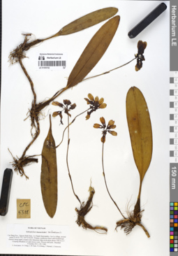
LE 01055192
Bulbophyllum andersonii (Hook.f.) J.J. Sm. det. Averyanov, Leonid Vladimirovich at 04.10.2013
Collectors: Averyanov, Leonid Vladimirovich; Tien Hiep Nguyen; L.M. Tuan; Khang Sinh Nguyen; Maisak, Tatiana Viktorovna; Osinovetz, L. Field collecting number: CPC5388. Collection date: 04.10.2013. Administrative regions: VN - Tinh Cao Bang. Groups of specimens: L. V. Averyanov specimens; L. V. Averyanov herbarium; Orchids of Vietnam, Laos and CambodiaOriginal label text:FLORA OF VIETNAM
Orchidaceae
Bulbophyllum macraei Rchb.f.
Cao Bang Prov., Nguyen Binh Distr., Ca Thanh Municipality, Cao Lu village, around point 22°42'47.7"N, 105°51'50.8"E. Primary coniferous forest with Pseudotsuga sinensis along highly eroded rocky limestone ridge at elevation about 1300 m a.s.l. Creeping lithophyte on open mossy rocks. Flowers dull pink. Abundant. 4 October 2013 CPC 5388. L.Averyanov, N.T.Hiep, L.M.Tuan, N.S.Khang, T.Maisak, L.Osinovets. Photos
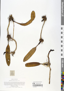
LE 01055191
Bulbophyllum andersonii (Hook. f.) J.J. Sm. det. Averyanov, Leonid Vladimirovich at 13.11.2013
Collectors: Averyanov, Leonid Vladimirovich; et al. Field collecting number: CPC7080. Collection date: 13.11.2013. Administrative regions: VN - Tinh Son La. Groups of specimens: L. V. Averyanov specimens; L. V. Averyanov herbarium; Orchids of Vietnam, Laos and CambodiaOriginal label text:FLORA OF VIETNAM
Orchidaceae
Bulbophyllum andersonii (Hook.f.) J.J.Sm.
Son La Prov., Van Ho Distr., Xuan Nha Municipality, Muong An village, territory of Xuan Nha natural reserve.
Primary broad-leaved evergreen humid forest on very steep slopes and cliffs of remnant mountain composed by solid highly eroded crystalline limestone at elevation 800-1000 m a.s.l. around point 20°45′06.5″N 104°46′37.8″E.
Creeping epiphyte and lithophyte on on very steep mossy shady rocky slope near mountain top. Very common.
13 November 2013 CPC 7080
Coll.: L.Averyanov, N.T.Hiep, N.S.Khang, N.D.Thang, L.D.Qui
Fl. under cultivation at 20 July 2014. Flowers odorless, tepals dull yellowish finely marked with purple, lip white with numerous small purple marks, column white with purple spots, operculum light yellowish with large purple spot at front. Photos. L.Averyanov.
Coordinates (geographic position): 20° 45′ 6.5″ N, 104° 46′ 37.8″ E ±1000 mRecord creation: 2019-06-11, Leonid Averyanov, PhotoScan D1. Processing status: work_status_1Citation: Specimen LE 01055191 // Virtual herbarium of Komarov Botanical Institute RAS — http://re.herbariumle.ru/01055191Orchidaceae
Bulbophyllum andersonii (Hook.f.) J.J.Sm.
Son La Prov., Van Ho Distr., Xuan Nha Municipality, Muong An village, territory of Xuan Nha natural reserve.
Primary broad-leaved evergreen humid forest on very steep slopes and cliffs of remnant mountain composed by solid highly eroded crystalline limestone at elevation 800-1000 m a.s.l. around point 20°45′06.5″N 104°46′37.8″E.
Creeping epiphyte and lithophyte on on very steep mossy shady rocky slope near mountain top. Very common.
13 November 2013 CPC 7080
Coll.: L.Averyanov, N.T.Hiep, N.S.Khang, N.D.Thang, L.D.Qui
Fl. under cultivation at 20 July 2014. Flowers odorless, tepals dull yellowish finely marked with purple, lip white with numerous small purple marks, column white with purple spots, operculum light yellowish with large purple spot at front. Photos. L.Averyanov.
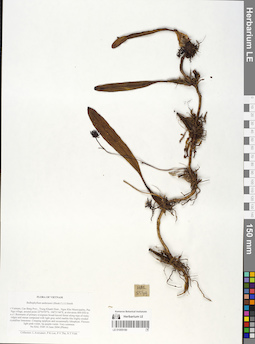
LE 01055190
Bulbophyllum andersonii (Hook. f.) J.J. Sm. det. Averyanov, Leonid Vladimirovich at 10.06.2004
Collectors: Averyanov, Leonid Vladimirovich; et al. Field collecting number: HAL5549. Collection date: 10.06.2004. Administrative regions: VN - Tinh Cao Bang. Groups of specimens: L. V. Averyanov specimens; L. V. Averyanov herbarium; Orchids of Vietnam, Laos and CambodiaOriginal label text:FLORA OF VIETNAM
Orchidaceae
Bulbophyllum andersonii (Hook.f.) J.J.Smith
N.Vietnam, Cao Bang Prov., Trung Khanh Distr., Ngoc Khe Municipality, Pac Nga village, around point 22°54′59′'N, 106°31′44′'E, at elevation 800-850 m a.s.l.
Remnants of primary evergreen broad-leaved forest along tops of rocky ridges and mesae composed with light gray solid marble-like highly eroded crystalline limestone.
Creeping epiphyte and occasionally lithophyte. Flowers light pink-violet, lip purple-violet. Very common.
HAL 5549 10 June 2004 (Photo)
Collectors: L.Averyanov, P.K.Loc, P.V.The, N.T.Vinh.
Coordinates (geographic position): 22° 54′ 59″ N, 106° 31′ 44″ E ±1000 mRecord creation: 2019-06-11, Leonid Averyanov, PhotoScan D1. Processing status: work_status_1Citation: Specimen LE 01055190 // Virtual herbarium of Komarov Botanical Institute RAS — http://re.herbariumle.ru/01055190Orchidaceae
Bulbophyllum andersonii (Hook.f.) J.J.Smith
N.Vietnam, Cao Bang Prov., Trung Khanh Distr., Ngoc Khe Municipality, Pac Nga village, around point 22°54′59′'N, 106°31′44′'E, at elevation 800-850 m a.s.l.
Remnants of primary evergreen broad-leaved forest along tops of rocky ridges and mesae composed with light gray solid marble-like highly eroded crystalline limestone.
Creeping epiphyte and occasionally lithophyte. Flowers light pink-violet, lip purple-violet. Very common.
HAL 5549 10 June 2004 (Photo)
Collectors: L.Averyanov, P.K.Loc, P.V.The, N.T.Vinh.
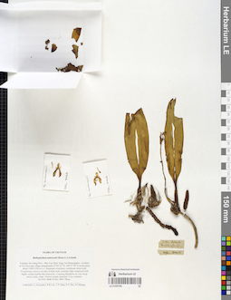
LE 01055189
Bulbophyllum andersonii (Hook. f.) J.J. Sm. det. Averyanov, Leonid Vladimirovich at 10.12.2005
Collectors: Averyanov, Leonid Vladimirovich; et al. Field collecting number: HAL8468. Collection date: 10.12.2005. Administrative regions: VN - Tinh Ha Giang. Groups of specimens: L. V. Averyanov specimens; L. V. Averyanov herbarium; Orchids of Vietnam, Laos and CambodiaOriginal label text:FLORA OF VIETNAM
Orchidaceae
Bulbophyllum andersonii (Hook.f.) J.J.Smith
Vietnam, Ha Giang Prov., Meo Vac Distr, Sung Tra Municipality, vicinities of Ta Cha Lang village around point 23°10′12″N, 105°17′39″E at elevation about 1100-1150 m a.s.l.
Remnants of primary coniferous forest with Pseudotsuga sinensis on tops of high rocky remnant ridge composed with highly eroded marble-like limestone.
Creeping lithophyte on very steep mossy rocky slope. Flowers purple speckled. Very common.
HAL 8468 10 Dec 2005. Photo.
Collectors: L.Averyanov, P.K.Loc, T.V.Thao, P.V.The, N.S.Khang.
Coordinates (geographic position): 23° 10′ 12″ N, 105° 17′ 39″ E ±1000 mRecord creation: 2019-06-11, Leonid Averyanov, PhotoScan D1. Processing status: work_status_1Citation: Specimen LE 01055189 // Virtual herbarium of Komarov Botanical Institute RAS — http://re.herbariumle.ru/01055189Orchidaceae
Bulbophyllum andersonii (Hook.f.) J.J.Smith
Vietnam, Ha Giang Prov., Meo Vac Distr, Sung Tra Municipality, vicinities of Ta Cha Lang village around point 23°10′12″N, 105°17′39″E at elevation about 1100-1150 m a.s.l.
Remnants of primary coniferous forest with Pseudotsuga sinensis on tops of high rocky remnant ridge composed with highly eroded marble-like limestone.
Creeping lithophyte on very steep mossy rocky slope. Flowers purple speckled. Very common.
HAL 8468 10 Dec 2005. Photo.
Collectors: L.Averyanov, P.K.Loc, T.V.Thao, P.V.The, N.S.Khang.
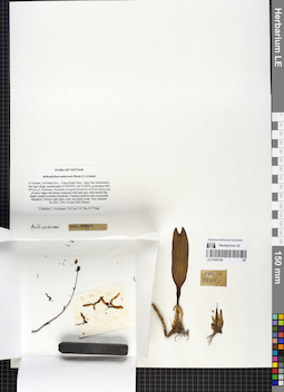
LE 01055188
Bulbophyllum andersonii (Hook. f.) J.J. Sm. det. Averyanov, Leonid Vladimirovich at 10.06.2004
Collectors: Averyanov, Leonid Vladimirovich; et al. Field collecting number: HAL5549. Collection date: 10.06.2004. Administrative regions: VN - Tinh Cao Bang. Groups of specimens: L. V. Averyanov specimens; L. V. Averyanov herbarium; Orchids of Vietnam, Laos and CambodiaOriginal label text:FLORA OF VIETNAM
Orchidaceae
Bulbophyllum andersonii (Hook.f.) J.J.Smith
N.Vietnam, Cao Bang Prov., Trung Khanh Distr., Ngoc Khe Municipality, Pac Nga village, around point 22°54′59′'N, 106°31′44′'E, at elevation 800-850 m a.s.l.
Remnants of primary evergreen broad-leaved forest along tops of rocky ridges and mesae composed with light gray solid marble-like highly eroded crystalline limestone.Creeping epiphyte and occasionally lithophyte. Flowers light pink-violet, lip purple-violet. Very common.
HAL 5549 10 June 2004 (Photo)
Collectors: L.Averyanov, P.K.Loc, P.V.The, N.T.Vinh.
Coordinates (geographic position): 22° 54′ 59″ N, 106° 31′ 44″ E ±1000 mRecord creation: 2019-06-11, Leonid Averyanov, PhotoScan D1. Processing status: work_status_1Citation: Specimen LE 01055188 // Virtual herbarium of Komarov Botanical Institute RAS — http://re.herbariumle.ru/01055188Orchidaceae
Bulbophyllum andersonii (Hook.f.) J.J.Smith
N.Vietnam, Cao Bang Prov., Trung Khanh Distr., Ngoc Khe Municipality, Pac Nga village, around point 22°54′59′'N, 106°31′44′'E, at elevation 800-850 m a.s.l.
Remnants of primary evergreen broad-leaved forest along tops of rocky ridges and mesae composed with light gray solid marble-like highly eroded crystalline limestone.Creeping epiphyte and occasionally lithophyte. Flowers light pink-violet, lip purple-violet. Very common.
HAL 5549 10 June 2004 (Photo)
Collectors: L.Averyanov, P.K.Loc, P.V.The, N.T.Vinh.
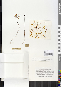
LE 01055187
Bulbophyllum andersonii (Hook. f.) J.J. Sm. det. Averyanov, Leonid Vladimirovich at 08.2004
Collectors: Averyanov, Leonid Vladimirovich; et al. Field collecting number: HAL5549. Collection date: 10.06.2004. Administrative regions: VN - Tinh Cao Bang. Groups of specimens: L. V. Averyanov specimens; L. V. Averyanov herbarium; Orchids of Vietnam, Laos and CambodiaOriginal label text:FLORA OF VIETNAM
Orchidaceae
Bulbophyllum andersonii (Hook.f.) J.J.Smith
N.Vietnam, Cao Bang Prov., Trung Khanh Distr., Ngoc Khe Municipality, Pac Nga village, around point 22°54′59′'N, 106°31′44′'E, at elevation 800-850 m a.s.l.
Remnants of primary evergreen broad-leaved forest along tops of rocky ridges and mesae composed with light gray solid marble-like highly eroded crystalline limestone.
Creeping epiphyte and occasionally lithophyte. Flowers light pink-violet, lip purple-violet. Very common.
HAL 5549 10 June 2004 (Photo)
Collectors: L.Averyanov, P.K.Loc, P.V.The, N.T.Vinh.
Coordinates (geographic position): 22° 54′ 59″ N, 106° 31′ 44″ E ±1000 mRecord creation: 2019-06-11, Leonid Averyanov, PhotoScan D1. Processing status: work_status_1Citation: Specimen LE 01055187 // Virtual herbarium of Komarov Botanical Institute RAS — http://re.herbariumle.ru/01055187Orchidaceae
Bulbophyllum andersonii (Hook.f.) J.J.Smith
N.Vietnam, Cao Bang Prov., Trung Khanh Distr., Ngoc Khe Municipality, Pac Nga village, around point 22°54′59′'N, 106°31′44′'E, at elevation 800-850 m a.s.l.
Remnants of primary evergreen broad-leaved forest along tops of rocky ridges and mesae composed with light gray solid marble-like highly eroded crystalline limestone.
Creeping epiphyte and occasionally lithophyte. Flowers light pink-violet, lip purple-violet. Very common.
HAL 5549 10 June 2004 (Photo)
Collectors: L.Averyanov, P.K.Loc, P.V.The, N.T.Vinh.