View
Add
Copy
Edit
Delete
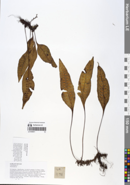
LE 01055411
Neolepisorus ovatus (C.Presl) Ching det. X.C.Zhang at 05.07.2019
Additional identifications: Microsorum sp. det. Averyanov, Leonid Vladimirovich at 22.10.2018 Collectors: Averyanov, Leonid Vladimirovich; Khang Sinh Nguyen; Maisak, Tatiana Viktorovna; Truong Duc Thieu Field collecting number: VR1198. Collection date: 22.10.2018. Administrative regions: VN - Tinh Ha Giang. Groups of specimens: L. V. Averyanov specimens; L. V. Averyanov herbarium; L. V. Averyanov photosOriginal label text:FLORA OF VIETNAM.
Coordinates (geographic position): 23° 5′ 52.6″ N, 104° 51′ 26.4″ E ±1000 mComment: Polypodiaceae s.l.
Microsorum sp.
Ha Giang prov., Quan Ba distr., Cao Ma Po commune, Va Thang 1 village, around point 23º05ʹ52.6ʺN 104º51ʹ26.4ʺE, steep alluvial slopes and flattened mountain summits based on limestone at elevation 1400–1480 m a.s.l. Primary evergreen broad-leaved very humid forest. Lithophytic creeping fern on exposed mossy rocks. Leaves dark – light green tessellated. Very common.22 October 2018, L. Averyanov, Nguyen Sinh Khang, T. Maisak, Truong Duc Thieu, VR 1198.
All photos © L. Averyanov & K.S. Nguyen
Record creation: 2019-06-11, Leonid Averyanov, PhotoScan D1Citation: Specimen LE 01055411 // Virtual herbarium of Komarov Botanical Institute RAS — http://re.herbariumle.ru/01055411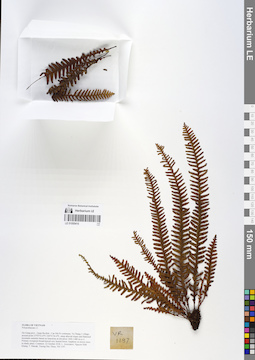
LE 01055410
Prosaptia barathrophylla (Baker) M.G.Price det. Averyanov, Leonid Vladimirovich at 15.02.2020
Additional identifications: Prosaptia khasyana (Hook.) C.Chr. & Tard. det. Averyanov, Leonid Vladimirovich at 05.07.2019 Collectors: Averyanov, Leonid Vladimirovich; Khang Sinh Nguyen; Maisak, Tatiana Viktorovna; Truong Duc Thieu Field collecting number: VR1197. Collection date: 22.10.2018. Administrative regions: VN - Tinh Ha Giang. Groups of specimens: L. V. Averyanov specimens; L. V. Averyanov herbarium; L. V. Averyanov photosOriginal label text:FLORA OF VIETNAM.
Coordinates (geographic position): 23° 5′ 52.6″ N, 104° 51′ 26.4″ E ±1000 mComment: Polypodiaceae s.l.
Ha Giang prov., Quan Ba distr., Cao Ma Po commune, Va Thang 1 village, around point 23º05ʹ52.6ʺN 104º51ʹ26.4ʺE, steep alluvial slopes and flattened mountain summits based on limestone at elevation 1400–1480 m a.s.l. Primary evergreen broad-leaved very humid forest. Epiphyte on mossy trees in shady place. Common.22 October 2018, L. Averyanov, Nguyen Sinh Khang, T. Maisak, Truong Duc Thieu, VR 1197.
All photos © L. Averyanov & K.S. Nguyen
Record creation: 2019-06-11, Leonid Averyanov, PhotoScan D1Citation: Specimen LE 01055410 // Virtual herbarium of Komarov Botanical Institute RAS — http://re.herbariumle.ru/01055410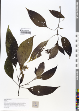
LE 01055409
Ophiorrhiza sp. det. Averyanov, Leonid Vladimirovich at 22.10.2018
Collectors: Averyanov, Leonid Vladimirovich; Khang Sinh Nguyen; Maisak, Tatiana Viktorovna; Truong Duc Thieu Field collecting number: VR1196. Collection date: 22.10.2018. Administrative regions: VN - Tinh Ha Giang. Groups of specimens: L. V. Averyanov specimens; L. V. Averyanov herbarium; L. V. Averyanov photosOriginal label text:FLORA OF VIETNAM Rubiaceae Ophiorrhiza sp. Ha Giang prov., Quan Ba distr., Cao Ma Po commune, Va Thang 1 village, around point 23º05ʹ52.6ʺN 104º51ʹ26.4ʺE, steep alluvial slopes and flattened mountain summits based on limestone at elevation 1400–1480 m a.s.l. Primary evergreen broad-leaved very humid forest. Erect terrestrial herb to 1 m tall in shady place. Flowers white with pink tint. Very common. 22 October 2018, L. Averyanov, Nguyen Sinh Khang, T. Maisak, Truong Duc Thieu, VR 1196.
Coordinates (geographic position): 23° 5′ 52.6″ N, 104° 51′ 26.4″ E ±1000 mComment: All photos © L. Averyanov & K.S. Nguyen
Record creation: 2019-06-11, Leonid Averyanov, PhotoScan D1Citation: Specimen LE 01055409 // Virtual herbarium of Komarov Botanical Institute RAS — http://re.herbariumle.ru/01055409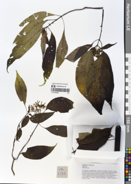
LE 01055408
Ophiorrhiza sp. det. Averyanov, Leonid Vladimirovich at 22.10.2018
Collectors: Averyanov, Leonid Vladimirovich; Khang Sinh Nguyen; Maisak, Tatiana Viktorovna; Truong Duc Thieu Field collecting number: VR1196. Collection date: 22.10.2018. Administrative regions: VN - Tinh Ha Giang. Groups of specimens: L. V. Averyanov specimens; L. V. Averyanov herbarium; L. V. Averyanov photosOriginal label text:FLORA OF VIETNAM
Coordinates (geographic position): 23° 5′ 52.6″ N, 104° 51′ 26.4″ E ±1000 mComment: Rubiaceae
Ophiorrhiza sp.
Ha Giang prov., Quan Ba distr., Cao Ma Po commune, Va Thang 1 village, around point 23º05ʹ52.6ʺN 104º51ʹ26.4ʺE, steep alluvial slopes and flattened mountain summits based on limestone at elevation 1400–1480 m a.s.l. Primary evergreen broad-leaved very humid forest. Erect terrestrial herb to 1 m tall in shady place. Flowers white with pink tint. Very common. 22 October 2018, L. Averyanov, Nguyen Sinh Khang, T. Maisak, Truong Duc Thieu, VR 1196.
All photos © L. Averyanov & K.S. Nguyen
Record creation: 2019-06-11, Leonid Averyanov, PhotoScan D1Citation: Specimen LE 01055408 // Virtual herbarium of Komarov Botanical Institute RAS — http://re.herbariumle.ru/01055408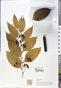
LE 01055407
Smilax cocculoides Diels det. Pan Li at 29.08.2019
Additional identifications: Smilax sp. det. Averyanov, Leonid Vladimirovich at 21.10.2018 Collectors: Averyanov, Leonid Vladimirovich; Khang Sinh Nguyen; Maisak, Tatiana Viktorovna; Truong Duc Thieu Field collecting number: VR1195. Collection date: 22.10.2018. Administrative regions: VN - Tinh Ha Giang. Groups of specimens: L. V. Averyanov specimens; L. V. Averyanov herbarium; L. V. Averyanov photosOriginal label text:FLORA OF VIETNAM.
Coordinates (geographic position): 23° 5′ 52.6″ N, 104° 51′ 26.4″ E ±1000 mComment: Smilacaceae.
Smilax sp.
Ha Giang prov., Quan Ba distr., Cao Ma Po commune, Va Thang 1 village, around point 23º05ʹ52.6ʺN 104º51ʹ26.4ʺE, steep alluvial slopes and flattened mountain summits based on limestone at elevation 1400–1480 m a.s.l. Primary evergreen broad-leaved very humid forest. Terrestrial scandent shrub 1.5 m tall. Fruits bright red. Common.22 October 2018, L. Averyanov, Nguyen Sinh Khang, T. Maisak, Truong Duc Thieu, VR 1195.
All photos © L. Averyanov & K.S. Nguyen
Record creation: 2019-06-11, Leonid Averyanov, PhotoScan D1Citation: Specimen LE 01055407 // Virtual herbarium of Komarov Botanical Institute RAS — http://re.herbariumle.ru/01055407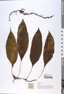
LE 01055406
Microsorum reticulatum L.Shi det. X.C.Zhang at 02.07.2019
Additional identifications: Microsorum sp. det. Averyanov, Leonid Vladimirovich at 22.10.2018 Collectors: Averyanov, Leonid Vladimirovich; Khang Sinh Nguyen; Maisak, Tatiana Viktorovna; Truong Duc Thieu Field collecting number: VR1194. Collection date: 22.10.2018. Administrative regions: VN - Tinh Ha Giang. Groups of specimens: L. V. Averyanov specimens; L. V. Averyanov herbarium; L. V. Averyanov photosOriginal label text:FLORA OF VIETNAM
Coordinates (geographic position): 23° 5′ 52.6″ N, 104° 51′ 26.4″ E ±1000 mComment: Polypodiaceae s.l.
Microsorum sp.
Ha Giang prov., Quan Ba distr., Cao Ma Po commune, Va Thang 1 village, around point 23º05ʹ52.6ʺN 104º51ʹ26.4ʺE, steep alluvial slopes and flattened mountain summits based on limestone at elevation 1400–1480 m a.s.l. Primary evergreen broad-leaved very humid forest. Creeping lithophytic fern on exposed mossy rocks. Common. 22 October 2018, L. Averyanov, Nguyen Sinh Khang, T. Maisak, Truong Duc Thieu, VR 1194.
All photos © L. Averyanov & K.S. Nguyen
Record creation: 2019-06-11, Leonid Averyanov, PhotoScan D1Citation: Specimen LE 01055406 // Virtual herbarium of Komarov Botanical Institute RAS — http://re.herbariumle.ru/01055406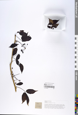
LE 01055405
Eleutherococcus trifoliatus (L.) S.Y.Hu det. Averyanov, Leonid Vladimirovich at 21.10.2018
Collectors: Averyanov, Leonid Vladimirovich; Khang Sinh Nguyen; Maisak, Tatiana Viktorovna; Truong Duc Thieu Field collecting number: VR1193. Collection date: 22.10.2018. Administrative regions: VN - Tinh Ha Giang. Groups of specimens: L. V. Averyanov specimens; L. V. Averyanov herbarium; L. V. Averyanov photosOriginal label text:FLORA OF VIETNAM.
Coordinates (geographic position): 23° 5′ 52.6″ N, 104° 51′ 26.4″ E ±1000 mComment: Araliaceae.
Eleutherococcus trifoliatus (L.) S.Y. Hu.
Ha Giang prov., Quan Ba distr., Cao Ma Po commune, Va Thang 1 village, around point 23º05ʹ52.6ʺN 104º51ʹ26.4ʺE, steep alluvial slopes and flattened mountain summits based on limestone at elevation 1400–1480 m a.s.l. Primary evergreen broad-leaved very humid forest. Scandent shrub to 3 m tall on exposed mossy rocks. Fruits black. Not common.22 October 2018, L. Averyanov, Nguyen Sinh Khang, T. Maisak, Truong Duc Thieu, VR 1193.
All photos © L. Averyanov & K.S. Nguyen
Record creation: 2019-06-11, Leonid Averyanov, PhotoScan D1Citation: Specimen LE 01055405 // Virtual herbarium of Komarov Botanical Institute RAS — http://re.herbariumle.ru/01055405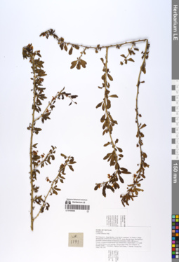
LE 01055404
Lycium chinense Mill. det. Averyanov, Leonid Vladimirovich at 21.10.2018
Collectors: Averyanov, Leonid Vladimirovich; Khang Sinh Nguyen; Maisak, Tatiana Viktorovna; Truong Duc Thieu Field collecting number: VR1191. Collection date: 22.10.2018. Administrative regions: VN - Tinh Ha Giang. Groups of specimens: L. V. Averyanov specimens; L. V. Averyanov herbarium; L. V. Averyanov photosOriginal label text:FLORA OF VIETNAM.
Coordinates (geographic position): 23° 5′ 52.6″ N, 104° 51′ 26.4″ E ±1000 mComment: Solanaceae.
Lycium chinense Mill.
Ha Giang prov., Quan Ba distr., Cao Ma Po commune, Va Thang 1 village, around point 23º05ʹ52.6ʺN 104º51ʹ26.4ʺE, steep alluvial slopes and flattened mountain summits based on limestone at elevation 1400–1480 m a.s.l. Primary evergreen broad-leaved very humid forest. Small shrub 1–1.5 n tall on exposed mossy rock outcrops. Flowers blue-violet. Not common.22 October 2018, L. Averyanov, Nguyen Sinh Khang, T. Maisak, Truong Duc Thieu, VR 1191.
All photos © L. Averyanov & K.S. Nguyen
Record creation: 2019-06-11, Leonid Averyanov, PhotoScan D1Citation: Specimen LE 01055404 // Virtual herbarium of Komarov Botanical Institute RAS — http://re.herbariumle.ru/01055404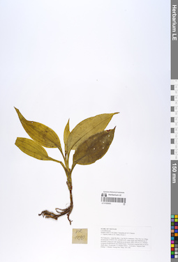
LE 01055403
Rohdea wattii (C.B.Clarke) Yamashita & M.N.Tamura det. Averyanov, Leonid Vladimirovich at 21.10.2018
Additional identifications: Tupistra wattii Hook.f. det. Averyanov, Leonid Vladimirovich at 21.10.2018 Collectors: Averyanov, Leonid Vladimirovich; Khang Sinh Nguyen; Maisak, Tatiana Viktorovna; Truong Duc Thieu Field collecting number: VR1190. Collection date: 21.10.2018. Administrative regions: VN - Tinh Ha Giang. Groups of specimens: L. V. Averyanov specimens; L. V. Averyanov herbarium; L. V. Averyanov photosOriginal label text:FLORA OF VIETNAM.
Coordinates (geographic position): 23° 4′ 47.2″ N, 104° 48′ 55.6″ E ±1000 mComment: Convallariaceae.
Rohdea wattii (C.B.Clarke) Yamashita &M.N.Tamura.
(= Tupistra wattii (C.B.Clarke) Hook.f.).
Ha Giang prov., Quan Ba distr., Cao Ma Po commune, Chin Chu Lin village, around point 23º04ʹ47.2ʺN 104º48ʹ55.6ʺE, steep slopes and flattened top of mountain composed with sandstone at elevation 1800–1950 m a.s.l. Primary evergreen broad-leaved very humid forest. Terrestrial creeping herb in mossy shady place. Occasional. 21 October 2018, L. Averyanov, Nguyen Sinh Khang, T. Maisak, Truong Duc Thieu, VR 1190.
All photos © L. Averyanov & K.S. Nguyen
Record creation: 2019-06-11, Leonid Averyanov, PhotoScan D1Citation: Specimen LE 01055403 // Virtual herbarium of Komarov Botanical Institute RAS — http://re.herbariumle.ru/01055403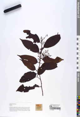
LE 01055402
Prunus wallichii Steud. det. Tien Hiep Nguyen at 05.12.2019
Additional identifications: Prunus sp. det. Averyanov, Leonid Vladimirovich at 21.10.2018 Collectors: Averyanov, Leonid Vladimirovich; Khang Sinh Nguyen; Maisak, Tatiana Viktorovna; Truong Duc Thieu Field collecting number: VR1188. Collection date: 21.10.2018. Administrative regions: VN - Tinh Ha Giang. Groups of specimens: L. V. Averyanov specimens; L. V. Averyanov herbarium; L. V. Averyanov photosOriginal label text:FLORA OF VIETNAM.
Coordinates (geographic position): 23° 4′ 47.2″ N, 104° 48′ 55.6″ E ±1000 mComment: Rosaceae?.
Prunus sp.?.
Ha Giang prov., Quan Ba distr., Cao Ma Po commune, Chin Chu Lin village, around point 23º04ʹ47.2ʺN 104º48ʹ55.6ʺE, steep slopes and flattened top of mountain composed with sandstone at elevation 1800–1950 m a.s.l. Primary evergreen broad-leaved very humid forest. Small tree or shrub on open slope. Occasional. 21 October 2018, L. Averyanov, Nguyen Sinh Khang, T. Maisak, Truong Duc Thieu, VR 1188.
All photos © L. Averyanov & K.S. Nguyen
Record creation: 2019-06-11, Leonid Averyanov, PhotoScan D1Citation: Specimen LE 01055402 // Virtual herbarium of Komarov Botanical Institute RAS — http://re.herbariumle.ru/01055402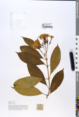
LE 01055401
Luculia yunnanensis S.Y.Hu det. Averyanov, Leonid Vladimirovich at 21.10.2018
Collectors: Averyanov, Leonid Vladimirovich; Khang Sinh Nguyen; Maisak, Tatiana Viktorovna; Truong Duc Thieu Field collecting number: VR1187. Collection date: 21.10.2018. Administrative regions: VN - Tinh Ha Giang. Groups of specimens: L. V. Averyanov specimens; L. V. Averyanov herbarium; L. V. Averyanov photosOriginal label text:FLORA OF VIETNAM.
Coordinates (geographic position): 23° 4′ 47.2″ N, 104° 48′ 55.6″ E ±1000 mComment: Rubiaceae.
Luculia yunnanensis S.Y.Hu?.
Ha Giang prov., Quan Ba distr., Cao Ma Po commune, Chin Chu Lin village, around point 23º04ʹ47.2ʺN 104º48ʹ55.6ʺE, steep slopes and flattened top of mountain composed with sandstone at elevation 1800–1950 m a.s.l. Primary evergreen broad-leaved very humid forest. Shrub 1.5–2.5 m tall on open mossy slope. Flowers white with purple tint at tepal apex. Common.Usual co-dominant of secondary shrubs. 21 October 2018, L. Averyanov, Nguyen Sinh Khang, T. Maisak, Truong Duc Thieu, VR 1187.
All photos © L. Averyanov & K.S. Nguyen
Record creation: 2019-06-11, Leonid Averyanov, PhotoScan D1Citation: Specimen LE 01055401 // Virtual herbarium of Komarov Botanical Institute RAS — http://re.herbariumle.ru/01055401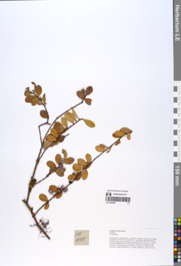
LE 01055400
Vaccinium conchophyllum Rehder ⟮prelim. ID⟯ det. Averyanov, Leonid Vladimirovich at 15.09.2019
Additional identifications: Vaccinium sp. det. Averyanov, Leonid Vladimirovich at 21.10.2018 Collectors: Averyanov, Leonid Vladimirovich; Khang Sinh Nguyen; Maisak, Tatiana Viktorovna; Truong Duc Thieu Field collecting number: VR1135. Collection date: 21.10.2018. Administrative regions: VN - Tinh Ha Giang. Groups of specimens: L. V. Averyanov specimens; L. V. Averyanov herbarium; L. V. Averyanov photosOriginal label text:FLORA OF VIETNAM Ericaceae Vaccinium sp. Ha Giang prov., Quan Ba distr., Cao Ma Po commune, Chin Chu Lin village, around point 23º04ʹ47.2ʺN 104º48ʹ55.6ʺE, steep slopes and flattened top of mountain composed with sandstone at elevation 1800–1950 m a.s.l. Primary evergreen broad-leaved very humid forest. Epiphytic undershrub on tall mossy trees. Fruits light green with red tint. Common. 21 October 2018, L. Averyanov, Nguyen Sinh Khang, T. Maisak, Truong Duc Thieu, VR 1135.
Coordinates (geographic position): 23° 4′ 47.2″ N, 104° 48′ 55.6″ E ±1000 mComment: All photos © L. Averyanov & K.S. Nguyen
Record creation: 2019-06-11, Leonid Averyanov, PhotoScan D1Citation: Specimen LE 01055400 // Virtual herbarium of Komarov Botanical Institute RAS — http://re.herbariumle.ru/01055400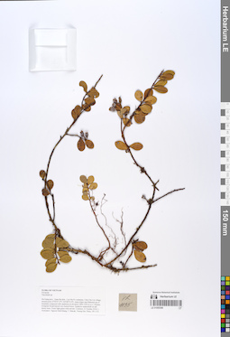
LE 01055399
Vaccinium conchophyllum Rehder ⟮prelim. ID⟯ det. Averyanov, Leonid Vladimirovich at 15.09.2019
Additional identifications: Vaccinium sp. det. Averyanov, Leonid Vladimirovich at 21.10.2018 Collectors: Averyanov, Leonid Vladimirovich; Khang Sinh Nguyen; Maisak, Tatiana Viktorovna; Truong Duc Thieu Field collecting number: VR1135. Collection date: 21.10.2018. Administrative regions: VN - Tinh Ha Giang. Groups of specimens: L. V. Averyanov specimens; L. V. Averyanov herbarium; L. V. Averyanov photosOriginal label text:FLORA OF VIETNAM
Coordinates (geographic position): 23° 4′ 47.2″ N, 104° 48′ 55.6″ E ±1000 mComment: Ericaceae
Vaccinium sp.
Ha Giang prov., Quan Ba distr., Cao Ma Po commune, Chin Chu Lin village, around point 23º04ʹ47.2ʺN 104º48ʹ55.6ʺE, steep slopes and flattened top of mountain composed with sandstone at elevation 1800–1950 m a.s.l. Primary evergreen broad-leaved very humid forest. Epiphytic undershrub on tall mossy trees. Fruits light green with red tint. Common. 21 October 2018, L. Averyanov, Nguyen Sinh Khang, T. Maisak, Truong Duc Thieu, VR 1135.
All photos © L. Averyanov & K.S. Nguyen
Record creation: 2019-06-11, Leonid Averyanov, PhotoScan D1Citation: Specimen LE 01055399 // Virtual herbarium of Komarov Botanical Institute RAS — http://re.herbariumle.ru/01055399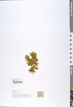
LE 01055398
Huperzia serrata (Thunb.) Trevis. det. Averyanov, Leonid Vladimirovich at 21.10.2018
Collectors: Averyanov, Leonid Vladimirovich; Khang Sinh Nguyen; Maisak, Tatiana Viktorovna; Truong Duc Thieu Field collecting number: VR1134. Collection date: 21.10.2018. Administrative regions: VN - Tinh Ha Giang. Groups of specimens: L. V. Averyanov specimens; L. V. Averyanov herbarium; L. V. Averyanov photosOriginal label text:FLORA OF VIETNAM. Lycopodiaceae. Huperzia serrata (Thunb.)Trevis. Ha Giang prov., Quan Ba distr., Cao Ma Po commune, Chin Chu Lin village, around point 23º04ʹ47.2ʺN 104º48ʹ55.6ʺE, steep slopes and flattened top of mountain composed with sandstone at elevation 1800–1950 m a.s.l. Primary evergreen broad-leaved very humid forest. Terrestrial herb on mossy steep slope. Not common. 21 October 2018, L. Averyanov, Nguyen Sinh Khang, T. Maisak, Truong Duc Thieu, VR 1134.
Coordinates (geographic position): 23° 4′ 47.2″ N, 104° 48′ 55.6″ E ±1000 mComment: All photos © L. Averyanov & K.S. Nguyen
Record creation: 2019-06-11, Leonid Averyanov, PhotoScan D1Citation: Specimen LE 01055398 // Virtual herbarium of Komarov Botanical Institute RAS — http://re.herbariumle.ru/01055398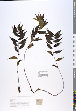
LE 01055397
Elatostema sp. det. Averyanov, Leonid Vladimirovich at 21.10.2018
Collectors: Averyanov, Leonid Vladimirovich; Khang Sinh Nguyen; Maisak, Tatiana Viktorovna; Truong Duc Thieu Field collecting number: VR1132. Collection date: 21.10.2018. Administrative regions: VN - Tinh Ha Giang. Groups of specimens: L. V. Averyanov specimens; L. V. Averyanov herbarium; L. V. Averyanov photosOriginal label text:FLORA OF VIETNAM.
Coordinates (geographic position): 23° 4′ 47.2″ N, 104° 48′ 55.6″ E ±1000 mComment: Urticaceae.
Elatostema sp.
Ha Giang prov., Quan Ba distr., Cao Ma Po commune, Chin Chu Lin village, around point 23º04ʹ47.2ʺN 104º48ʹ55.6ʺE, steep slopes and flattened top of mountain composed with sandstone at elevation 1800–1950 m a.s.l. Primary evergreen broad-leaved very humid forest. Terrestrial herb on shady slope. Not rare. 21 October 2018, L. Averyanov, Nguyen Sinh Khang, T. Maisak, Truong Duc Thieu, VR 1132.
All photos © L. Averyanov & K.S. Nguyen
Record creation: 2019-06-11, Leonid Averyanov, PhotoScan D1Citation: Specimen LE 01055397 // Virtual herbarium of Komarov Botanical Institute RAS — http://re.herbariumle.ru/01055397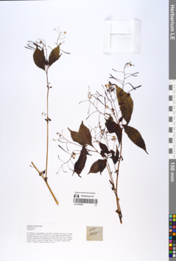
LE 01055396
Impatiens racemosa DC. det. Sheng Xiang Yu, Khang Sinh Nguyen at 14.10.2019
Additional identifications: Impatiens sp. det. Averyanov, Leonid Vladimirovich at 21.10.2018 Collectors: Averyanov, Leonid Vladimirovich; Khang Sinh Nguyen; Maisak, Tatiana Viktorovna; Truong Duc Thieu Field collecting number: VR1155. Collection date: 21.10.2018. Administrative regions: VN - Tinh Ha Giang. Groups of specimens: L. V. Averyanov specimens; L. V. Averyanov herbarium; L. V. Averyanov photosOriginal label text:FLORA OF VIETNAM.
Coordinates (geographic position): 23° 4′ 47.2″ N, 104° 48′ 55.6″ E ±1000 mComment: Balsaminaceae.
Impatiens sp.
Ha Giang prov., Quan Ba distr., Cao Ma Po commune, Chin Chu Lin village, around point 23º04ʹ47.2ʺN 104º48ʹ55.6ʺE, steep slopes and flattened top of mountain composed with sandstone at elevation 1800–1950 m a.s.l. Primary evergreen broad-leaved very humid forest. Terrestrial herb in open wet place. Flowers yellow. Not rare. 21 October 2018, L. Averyanov, Nguyen Sinh Khang, T. Maisak, Truong Duc Thieu, VR 1155.
All photos © L. Averyanov & K.S. Nguyen
Record creation: 2019-06-11, Leonid Averyanov, PhotoScan D1Citation: Specimen LE 01055396 // Virtual herbarium of Komarov Botanical Institute RAS — http://re.herbariumle.ru/01055396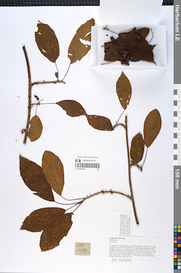
LE 01055395
Actinidia henryi Dunn det. Averyanov, Leonid Vladimirovich at 09.09.2019
Additional identifications: Actinidia sp. det. Averyanov, Leonid Vladimirovich at 21.10.2018 Collectors: Averyanov, Leonid Vladimirovich; Khang Sinh Nguyen; Maisak, Tatiana Viktorovna; Truong Duc Thieu Field collecting number: VR1154. Collection date: 21.10.2018. Administrative regions: VN - Tinh Ha Giang. Groups of specimens: L. V. Averyanov specimens; L. V. Averyanov herbarium; L. V. Averyanov photosOriginal label text:FLORA OF VIETNAM.
Coordinates (geographic position): 23° 4′ 47.2″ N, 104° 48′ 55.6″ E ±1000 mComment: Actinidiaceae.
Actinidia sp.
Ha Giang prov., Quan Ba distr., Cao Ma Po commune, Chin Chu Lin village, around point 23º04ʹ47.2ʺN 104º48ʹ55.6ʺE, steep slopes and flattened top of mountain composed with sandstone at elevation 1800–1950 m a.s.l. Primary evergreen broad-leaved very humid forest. Woody vine to 8 m long onopen steep slope. Fruits shortly cylindrical dull olive-green with small brown warts. Occasional. 21 October 2018, L. Averyanov, Nguyen Sinh Khang, T. Maisak, Truong Duc Thieu, VR 1154.
All photos © L. Averyanov & K.S. Nguyen
Record creation: 2019-06-11, Leonid Averyanov, PhotoScan D1Citation: Specimen LE 01055395 // Virtual herbarium of Komarov Botanical Institute RAS — http://re.herbariumle.ru/01055395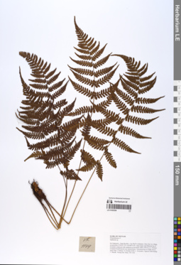
LE 01055394
Athyrium christensenii Tard. det. X.C.Zhang at 05.07.2019
Additional identifications: Diplazium sp. det. Averyanov, Leonid Vladimirovich at 21.10.2018 Collectors: Averyanov, Leonid Vladimirovich; Khang Sinh Nguyen; Maisak, Tatiana Viktorovna; Truong Duc Thieu Field collecting number: VR1144. Collection date: 21.10.2018. Administrative regions: VN - Tinh Ha Giang. Groups of specimens: L. V. Averyanov specimens; L. V. Averyanov herbarium; L. V. Averyanov photosOriginal label text:FLORA OF VIETNAM
Coordinates (geographic position): 23° 4′ 47.2″ N, 104° 48′ 55.6″ E ±1000 mComment: Polypodiaceae s.l.
Athyriaceae
Athyrium christensenii Tard.
Ha Giang prov., Quan Ba distr., Cao Ma Po commune, Chin Chu Lin village, around point 23º04ʹ47.2ʺN 104º48ʹ55.6ʺE, steep slopes and flattened top of mountain composed with sandstone at elevation 1800–1950 m a.s.l. Primary evergreen broad-leaved very humid forest. Terrestrial fern on shady mossy steep slope. Common. 21 October 2018, L. Averyanov, Nguyen Sinh Khang, T. Maisak, Truong Duc Thieu, VR 1144.
All photos © L. Averyanov & K.S. Nguyen
Record creation: 2019-06-11, Leonid Averyanov, PhotoScan D1Citation: Specimen LE 01055394 // Virtual herbarium of Komarov Botanical Institute RAS — http://re.herbariumle.ru/01055394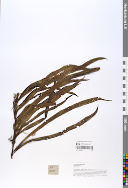
LE 01055393
Lepidomicrosorium subhemionitideum (Christ) P.S.Wang det. Averyanov, Leonid Vladimirovich at 07.09.2019
Additional identifications: Lepidomicrosorium sp. det. X.C.Zhang at 05.07.2019 Collectors: Averyanov, Leonid Vladimirovich; Khang Sinh Nguyen; Maisak, Tatiana Viktorovna; Truong Duc Thieu Field collecting number: VR1137. Collection date: 21.10.2018. Administrative regions: VN - Tinh Ha Giang. Groups of specimens: L. V. Averyanov specimens; L. V. Averyanov herbarium; L. V. Averyanov photosOriginal label text:FLORA OF VIETNAM.
Coordinates (geographic position): 23° 4′ 47.2″ N, 104° 48′ 55.6″ E ±1000 mComment: Polypodiaceae s.l.
Lepisorus sp.?.
Ha Giang prov., Quan Ba distr., Cao Ma Po commune, Chin Chu Lin village, around point 23º04ʹ47.2ʺN 104º48ʹ55.6ʺE, steep slopes and flattened top of mountain composed with sandstone at elevation 1800–1950 m a.s.l. Primary evergreen broad-leaved very humid forest. Creeping epiphytic vine to 2 m long in shady place. Common. 21 October 2018, L. Averyanov, Nguyen Sinh Khang, T. Maisak, Truong Duc Thieu, VR 1137.
All photos © L. Averyanov & K.S. Nguyen
Record creation: 2019-06-11, Leonid Averyanov, PhotoScan D1Citation: Specimen LE 01055393 // Virtual herbarium of Komarov Botanical Institute RAS — http://re.herbariumle.ru/01055393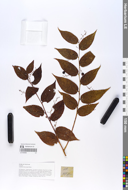
LE 01055392
Gaultheria leucocarpa Blume det. Averyanov, Leonid Vladimirovich at 21.10.2018
Collectors: Averyanov, Leonid Vladimirovich; Khang Sinh Nguyen; Maisak, Tatiana Viktorovna; Truong Duc Thieu Field collecting number: VR1157. Collection date: 21.10.2018. Administrative regions: VN - Tinh Ha Giang. Groups of specimens: L. V. Averyanov specimens; L. V. Averyanov herbarium; L. V. Averyanov photosOriginal label text:FLORA OF VIETNAM Ericaceae Gaultheria leucocarpa Blume Ha Giang prov., Quan Ba distr., Cao Ma Po commune, Chin Chu Lin village, around point 23º04ʹ47.2ʺN 104º48ʹ55.6ʺE, steep slopes and flattened top of mountain composed with sandstone at elevation 1800–1950 m a.s.l. Primary evergreen broad-leaved very humid forest. Shrub 2–2.5 m tall on open steep slope. Ripe fruits black, juicy. Occasional. 21 October 2018, L. Averyanov, Nguyen Sinh Khang, T. Maisak, Truong Duc Thieu, VR 1157.
Coordinates (geographic position): 23° 4′ 47.2″ N, 104° 48′ 55.6″ E ±1000 mComment: All photos © L. Averyanov & K.S. Nguyen
Record creation: 2019-06-11, Leonid Averyanov, PhotoScan D1Citation: Specimen LE 01055392 // Virtual herbarium of Komarov Botanical Institute RAS — http://re.herbariumle.ru/01055392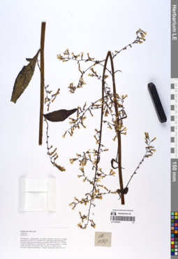
LE 01055391
Paraprenanthes diversifolia (Vaniot) N.Kilian det. Sennikov, Alexander Nikolaevitsch at 12.09.2019
Additional identifications: Lactuca sp. det. Averyanov, Leonid Vladimirovich at 21.10.2018 Collectors: Averyanov, Leonid Vladimirovich; Khang Sinh Nguyen; Maisak, Tatiana Viktorovna; Truong Duc Thieu Field collecting number: VR1156. Collection date: 21.10.2018. Administrative regions: VN - Tinh Ha Giang. Groups of specimens: L. V. Averyanov specimens; L. V. Averyanov herbarium; L. V. Averyanov photosOriginal label text:FLORA OF VIETNAM.
Coordinates (geographic position): 23° 4′ 47.2″ N, 104° 48′ 55.6″ E ±1000 mComment: Asteraceae.
Lactuca sp.?.
Ha Giang prov., Quan Ba distr., Cao Ma Po commune, Chin Chu Lin village, around point 23º04ʹ47.2ʺN 104º48ʹ55.6ʺE, steep slopes and flattened top of mountain composed with sandstone at elevation 1800–1950 m a.s.l. Primary evergreen broad-leaved very humid forest. Erect terrestrial herb to 1.5 m tall in open wet place. Flowers blue-violet. Not rare. 21 October 2018, L. Averyanov, Nguyen Sinh Khang, T. Maisak, Truong Duc Thieu, VR 1156.
All photos © L. Averyanov & K.S. Nguyen
Record creation: 2019-06-11, Leonid Averyanov, PhotoScan D1Citation: Specimen LE 01055391 // Virtual herbarium of Komarov Botanical Institute RAS — http://re.herbariumle.ru/01055391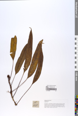
LE 01055390
Microsorum superficiale (Blume) Ching det. X.C.Zhang at 05.07.2019
Additional identifications: Lepisorus sp. det. Averyanov, Leonid Vladimirovich at 21.10.2018 Collectors: Averyanov, Leonid Vladimirovich; Khang Sinh Nguyen; Maisak, Tatiana Viktorovna; Truong Duc Thieu Field collecting number: VR1149. Collection date: 21.10.2018. Administrative regions: VN - Tinh Ha Giang. Groups of specimens: L. V. Averyanov specimens; L. V. Averyanov herbarium; L. V. Averyanov photosOriginal label text:FLORA OF VIETNAM
Coordinates (geographic position): 23° 4′ 47.2″ N, 104° 48′ 55.6″ E ±1000 mComment: Polypodiaceae s.str.
Microsorum superficiale (Blume) Ching
Ha Giang prov., Quan Ba distr., Cao Ma Po commune, Chin Chu Lin village, around point 23º04ʹ47.2ʺN 104º48ʹ55.6ʺE, steep slopes and flattened top of mountain composed with sandstone at elevation 1800–1950 m a.s.l. Primary evergreen broad-leaved very humid forest. Creeping epiphytic vine to 3 m long in shady place. Common. 21 October 2018, L. Averyanov, Nguyen Sinh Khang, T. Maisak, Truong Duc Thieu, VR 1149.
All photos © L. Averyanov & K.S. Nguyen
Record creation: 2019-06-11, Leonid Averyanov, PhotoScan D1Citation: Specimen LE 01055390 // Virtual herbarium of Komarov Botanical Institute RAS — http://re.herbariumle.ru/01055390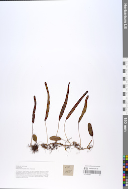
LE 01055389
Selliguea rhynchophylla (Hook.) Fraser-Jenk. det. Averyanov, Leonid Vladimirovich at 21.10.2018
Collectors: Averyanov, Leonid Vladimirovich; Khang Sinh Nguyen; Maisak, Tatiana Viktorovna; Truong Duc Thieu Field collecting number: VR1138. Collection date: 21.10.2018. Administrative regions: VN - Tinh Ha Giang. Groups of specimens: L. V. Averyanov specimens; L. V. Averyanov herbarium; L. V. Averyanov photosOriginal label text:FLORA OF VIETNAM.
Coordinates (geographic position): 23° 4′ 47.2″ N, 104° 48′ 55.6″ E ±1000 mComment: Polypodiaceae.
Selliguea rhynchophylla (Hook.)Fraser-Jenk.
Ha Giang prov., Quan Ba distr., Cao Ma Po commune, Chin Chu Lin village, around point 23º04ʹ47.2ʺN 104º48ʹ55.6ʺE, steep slopes and flattened top of mountain composed with sandstone at elevation 1800–1950 m a.s.l. Primary evergreen broad-leaved very humid forest. Creeping epiphyte on mossy tree. Common. 21 October 2018, L. Averyanov, Nguyen Sinh Khang, T. Maisak, Truong Duc Thieu, VR 1138.
All photos © L. Averyanov & K.S. Nguyen
Record creation: 2019-06-11, Leonid Averyanov, PhotoScan D1Citation: Specimen LE 01055389 // Virtual herbarium of Komarov Botanical Institute RAS — http://re.herbariumle.ru/01055389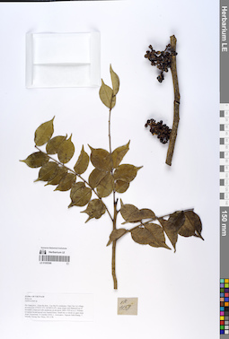
LE 01055388
Zanthoxylum scandens Blume det. Averyanov, Leonid Vladimirovich at 10.12.2019
Additional identifications: Zanthoxylum sp. det. Averyanov, Leonid Vladimirovich at 21.10.2018 Collectors: Averyanov, Leonid Vladimirovich; Khang Sinh Nguyen; Maisak, Tatiana Viktorovna; Truong Duc Thieu Field collecting number: VR1158. Collection date: 21.10.2018. Administrative regions: VN - Tinh Ha Giang. Groups of specimens: L. V. Averyanov specimens; L. V. Averyanov herbarium; L. V. Averyanov photosOriginal label text:FLORA OF VIETNAM.
Coordinates (geographic position): 23° 4′ 47.2″ N, 104° 48′ 55.6″ E ±1000 mComment: Rutaceae.
Zanthoxylum sp.
Ha Giang prov., Quan Ba distr., Cao Ma Po commune, Chin Chu Lin village, around point 23º04ʹ47.2ʺN 104º48ʹ55.6ʺE, steep slopes and flattened top of mountain composed with sandstone at elevation 1800–1950 m a.s.l. Primary evergreen broad-leaved very humid forest. Small tree or shrub on open steep slope. Occasional. 21 October 2018, L. Averyanov, Nguyen Sinh Khang, T. Maisak, Truong Duc Thieu, VR 1158.
All photos © L. Averyanov & K.S. Nguyen
Record creation: 2019-06-11, Leonid Averyanov, PhotoScan D1Citation: Specimen LE 01055388 // Virtual herbarium of Komarov Botanical Institute RAS — http://re.herbariumle.ru/01055388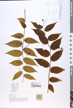
LE 01055387
Gaultheria leucocarpa Blume det. Averyanov, Leonid Vladimirovich at 21.10.2018
Collectors: Averyanov, Leonid Vladimirovich; Khang Sinh Nguyen; Maisak, Tatiana Viktorovna; Truong Duc Thieu Field collecting number: VR1157. Collection date: 21.10.2018. Administrative regions: VN - Tinh Ha Giang. Groups of specimens: L. V. Averyanov specimens; L. V. Averyanov herbarium; L. V. Averyanov photosOriginal label text:FLORA OF VIETNAM
Coordinates (geographic position): 23° 4′ 47.2″ N, 104° 48′ 55.6″ E ±1000 mComment: Ericaceae
Gaultheria leucocarpa Blume
Ha Giang prov., Quan Ba distr., Cao Ma Po commune, Chin Chu Lin village, around point 23º04ʹ47.2ʺN 104º48ʹ55.6ʺE, steep slopes and flattened top of mountain composed with sandstone at elevation 1800–1950 m a.s.l. Primary evergreen broad-leaved very humid forest. Shrub 2–2.5 m tall on open steep slope. Ripe fruits black, juicy. Occasional. 21 October 2018, L. Averyanov, Nguyen Sinh Khang, T. Maisak, Truong Duc Thieu, VR 1157.
All photos © L. Averyanov & K.S. Nguyen
Record creation: 2019-06-11, Leonid Averyanov, PhotoScan D1Citation: Specimen LE 01055387 // Virtual herbarium of Komarov Botanical Institute RAS — http://re.herbariumle.ru/01055387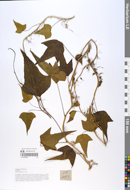
LE 01055386
Hedera nepalensis K.Koch det. Averyanov, Leonid Vladimirovich at 21.10.2018
Collectors: Averyanov, Leonid Vladimirovich; Khang Sinh Nguyen; Maisak, Tatiana Viktorovna; Truong Duc Thieu Field collecting number: VR1151. Collection date: 21.10.2018. Administrative regions: VN - Tinh Ha Giang. Groups of specimens: L. V. Averyanov specimens; L. V. Averyanov herbarium; L. V. Averyanov photosOriginal label text:FLORA OF VIETNAM.
Coordinates (geographic position): 23° 4′ 47.2″ N, 104° 48′ 55.6″ E ±1000 mComment: Araliaceae.
Hedera nepalensis K. Koch.
Ha Giang prov., Quan Ba distr., Cao Ma Po commune, Chin Chu Lin village, around point 23º04ʹ47.2ʺN 104º48ʹ55.6ʺE, steep slopes and flattened top of mountain composed with sandstone at elevation 1800–1950 m a.s.l. Primary evergreen broad-leaved very humid forest. Creeping epiphytic and lithophytic vine to 6 m long on steep slope. Occasional. 21 October 2018, L. Averyanov, Nguyen Sinh Khang, T. Maisak, Truong Duc Thieu, VR 1151.
All photos © L. Averyanov & K.S. Nguyen
Record creation: 2019-06-11, Leonid Averyanov, PhotoScan D1Citation: Specimen LE 01055386 // Virtual herbarium of Komarov Botanical Institute RAS — http://re.herbariumle.ru/01055386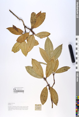
LE 01055385
Rhododendron sp. det. Averyanov, Leonid Vladimirovich at 21.10.2018
Collectors: Averyanov, Leonid Vladimirovich; Khang Sinh Nguyen; Maisak, Tatiana Viktorovna; Truong Duc Thieu Field collecting number: VR1141. Collection date: 21.10.2018. Administrative regions: VN - Tinh Ha Giang. Groups of specimens: L. V. Averyanov specimens; L. V. Averyanov herbarium; L. V. Averyanov photosOriginal label text:FLORA OF VIETNAM.
Coordinates (geographic position): 23° 4′ 47.2″ N, 104° 48′ 55.6″ E ±1000 mComment: Ericaceae?.
Rhododendron sp.?.
Ha Giang prov., Quan Ba distr., Cao Ma Po commune, Chin Chu Lin village, around point 23º04ʹ47.2ʺN 104º48ʹ55.6ʺE, steep slopes and flattened top of mountain composed with sandstone at elevation 1800–1950 m a.s.l. Primary evergreen broad-leaved very humid forest. Treelet or shrub. Occasional. 21 October 2018, L. Averyanov, Nguyen Sinh Khang, T. Maisak, Truong Duc Thieu, VR 1141.
All photos © L. Averyanov & K.S. Nguyen
Record creation: 2019-06-11, Leonid Averyanov, PhotoScan D1Citation: Specimen LE 01055385 // Virtual herbarium of Komarov Botanical Institute RAS — http://re.herbariumle.ru/01055385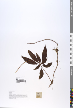
LE 01055384
Lysionotus sp. det. Averyanov, Leonid Vladimirovich at 21.10.2018
Collectors: Averyanov, Leonid Vladimirovich; Khang Sinh Nguyen; Maisak, Tatiana Viktorovna; Truong Duc Thieu Field collecting number: VR1160. Collection date: 21.10.2018. Administrative regions: VN - Tinh Ha Giang. Groups of specimens: L. V. Averyanov specimens; L. V. Averyanov herbarium; L. V. Averyanov photosOriginal label text:FLORA OF VIETNAM.
Coordinates (geographic position): 23° 4′ 47.2″ N, 104° 48′ 55.6″ E ±1000 mComment: Gesneriaceae.
Lysionotus sp.
Ha Giang prov., Quan Ba distr., Cao Ma Po commune, Chin Chu Lin village, around point 23º04ʹ47.2ʺN 104º48ʹ55.6ʺE, steep slopes and flattened top of mountain composed with sandstone at elevation 1800–1950 m a.s.l. Primary evergreen broad-leaved very humid forest. Creeping epiphyte on mossy tree. Occasional. 21 October 2018, L. Averyanov, Nguyen Sinh Khang, T. Maisak, Truong Duc Thieu, VR 1160.
All photos © L. Averyanov & K.S. Nguyen
Record creation: 2019-06-11, Leonid Averyanov, PhotoScan D1Citation: Specimen LE 01055384 // Virtual herbarium of Komarov Botanical Institute RAS — http://re.herbariumle.ru/01055384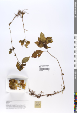
LE 01055383
Impatiens napoensis Y.L.Chen det. Sheng Xiang Yu, Khang Sinh Nguyen at 11.10.2019
Additional identifications: Impatiens sp. det. Averyanov, Leonid Vladimirovich at 21.10.2018 Collectors: Averyanov, Leonid Vladimirovich; Khang Sinh Nguyen; Maisak, Tatiana Viktorovna; Truong Duc Thieu Field collecting number: VR1159. Collection date: 21.10.2018. Administrative regions: VN - Tinh Ha Giang. Groups of specimens: L. V. Averyanov specimens; L. V. Averyanov herbarium; L. V. Averyanov photosOriginal label text:FLORA OF VIETNAM.
Coordinates (geographic position): 23° 4′ 47.2″ N, 104° 48′ 55.6″ E ±1000 mComment: Balsaminaceae.
Impatiens sp.
Ha Giang prov., Quan Ba distr., Cao Ma Po commune, Chin Chu Lin village, around point 23º04ʹ47.2ʺN 104º48ʹ55.6ʺE, steep slopes and flattened top of mountain composed with sandstone at elevation 1800–1950 m a.s.l. Primary evergreen broad-leaved very humid forest. Erect terrestrial herb to 0.5 m tall in open wet place. Flowers purple. Occasional. 21 October 2018, L. Averyanov, Nguyen Sinh Khang, T. Maisak, Truong Duc Thieu, VR 1159.
All photos © L. Averyanov & K.S. Nguyen
Record creation: 2019-06-11, Leonid Averyanov, PhotoScan D1Citation: Specimen LE 01055383 // Virtual herbarium of Komarov Botanical Institute RAS — http://re.herbariumle.ru/01055383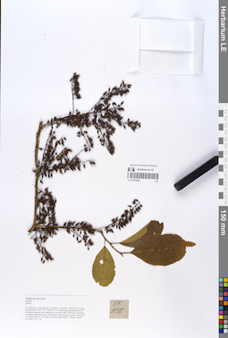
LE 01055382
Itea chinensis Hook. & Arn. det. Averyanov, Leonid Vladimirovich at 20.09.2019
Additional identifications: Itea sp. det. Averyanov, Leonid Vladimirovich at 21.10.2018 Collectors: Averyanov, Leonid Vladimirovich; Khang Sinh Nguyen; Maisak, Tatiana Viktorovna; Truong Duc Thieu Field collecting number: VR1150. Collection date: 21.10.2018. Administrative regions: VN - Tinh Ha Giang. Groups of specimens: L. V. Averyanov specimens; L. V. Averyanov herbarium; L. V. Averyanov photosOriginal label text:FLORA OF VIETNAM.
Coordinates (geographic position): 23° 4′ 47.2″ N, 104° 48′ 55.6″ E ±1000 mComment: Iteaceae.
Itea sp.
Ha Giang prov., Quan Ba distr., Cao Ma Po commune, Chin Chu Lin village, around point 23º04ʹ47.2ʺN 104º48ʹ55.6ʺE, steep slopes and flattened top of mountain composed with sandstone at elevation 1800–1950 m a.s.l. Primary evergreen broad-leaved very humid forest. Small treelet or shrub. Occasional. 21 October 2018, L. Averyanov, Nguyen Sinh Khang, T. Maisak, Truong Duc Thieu, VR 1150.
All photos © L. Averyanov & K.S. Nguyen
Record creation: 2019-06-11, Leonid Averyanov, PhotoScan D1Citation: Specimen LE 01055382 // Virtual herbarium of Komarov Botanical Institute RAS — http://re.herbariumle.ru/01055382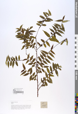
LE 01055381
Eurya subcordata P.T.Li det. Averyanov, Leonid Vladimirovich at 07.12.2019
Additional identifications: Eurya sp. det. Averyanov, Leonid Vladimirovich at 21.10.2018 Collectors: Averyanov, Leonid Vladimirovich; Khang Sinh Nguyen; Maisak, Tatiana Viktorovna; Truong Duc Thieu Field collecting number: VR1143. Collection date: 21.10.2018. Administrative regions: VN - Tinh Ha Giang. Groups of specimens: L. V. Averyanov specimens; L. V. Averyanov herbarium; L. V. Averyanov photosOriginal label text:FLORA OF VIETNAM Theaceae Eurya sp. Ha Giang prov., Quan Ba distr., Cao Ma Po commune, Chin Chu Lin village, around point 23º04ʹ47.2ʺN 104º48ʹ55.6ʺE, steep slopes and flattened top of mountain composed with sandstone at elevation 1800–1950 m a.s.l. Primary evergreen broad-leaved very humid forest. Shrub 2–3 m tall on open slope. Fruits dull dark green. Not rare. 21 October 2018, L. Averyanov, Nguyen Sinh Khang, T. Maisak, Truong Duc Thieu, VR 1143.
Coordinates (geographic position): 23° 4′ 47.2″ N, 104° 48′ 55.6″ E ±1000 mComment: All photos © L. Averyanov & K.S. Nguyen
Record creation: 2019-06-11, Leonid Averyanov, PhotoScan D1Citation: Specimen LE 01055381 // Virtual herbarium of Komarov Botanical Institute RAS — http://re.herbariumle.ru/01055381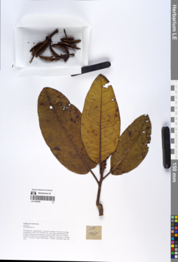
LE 01055380
Rhododendron sp. det. Averyanov, Leonid Vladimirovich at 21.10.2018
Collectors: Averyanov, Leonid Vladimirovich; Khang Sinh Nguyen; Maisak, Tatiana Viktorovna; Truong Duc Thieu Field collecting number: VR1161. Collection date: 21.10.2018. Administrative regions: VN - Tinh Ha Giang. Groups of specimens: L. V. Averyanov specimens; L. V. Averyanov herbarium; L. V. Averyanov photosOriginal label text:FLORA OF VIETNAM.
Coordinates (geographic position): 23° 4′ 47.2″ N, 104° 48′ 55.6″ E ±1000 mComment: Ericaceae.
Rhododendron sp.
Ha Giang prov., Quan Ba distr., Cao Ma Po commune, Chin Chu Lin village, around point 23º04ʹ47.2ʺN 104º48ʹ55.6ʺE, steep slopes and flattened top of mountain composed with sandstone at elevation 1800–1950 m a.s.l. Primary evergreen broad-leaved very humid forest. Small tree. Occasional. 21 October 2018, L. Averyanov, Nguyen Sinh Khang, T. Maisak, Truong Duc Thieu, VR 1161.
All photos © L. Averyanov & K.S. Nguyen
Record creation: 2019-06-11, Leonid Averyanov, PhotoScan D1Citation: Specimen LE 01055380 // Virtual herbarium of Komarov Botanical Institute RAS — http://re.herbariumle.ru/01055380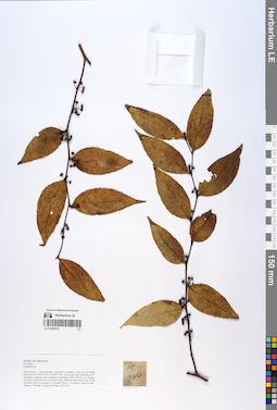
LE 01055379
Gaultheria dumicola W.W.Sm. det. Averyanov, Leonid Vladimirovich at 15.09.2019
Additional identifications: Gaultheria sp. det. Averyanov, Leonid Vladimirovich at 21.10.2018 Collectors: Averyanov, Leonid Vladimirovich; Khang Sinh Nguyen; Maisak, Tatiana Viktorovna; Truong Duc Thieu Field collecting number: VR1163. Collection date: 21.10.2018. Administrative regions: VN - Tinh Ha Giang. Groups of specimens: L. V. Averyanov specimens; L. V. Averyanov herbarium; L. V. Averyanov photosOriginal label text:FLORA OF VIETNAM.
Coordinates (geographic position): 23° 4′ 47.2″ N, 104° 48′ 55.6″ E ±1000 mComment: Ericaceae.
Gaultheria sp.
Ha Giang prov., Quan Ba distr., Cao Ma Po commune, Chin Chu Lin village, around point 23º04ʹ47.2ʺN 104º48ʹ55.6ʺE, steep slopes and flattened top of mountain composed with sandstone at elevation 1800–1950 m a.s.l. Primary evergreen broad-leaved very humid forest. Shrub on open steep slope. Fruits red, later black. Occasional. 21 October 2018, L. Averyanov, Nguyen Sinh Khang, T. Maisak, Truong Duc Thieu, VR 1163.
All photos © L. Averyanov & K.S. Nguyen
Record creation: 2019-06-11, Leonid Averyanov, PhotoScan D1Citation: Specimen LE 01055379 // Virtual herbarium of Komarov Botanical Institute RAS — http://re.herbariumle.ru/01055379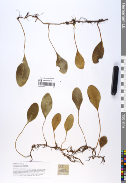
LE 01055378
Elaphoglossum sinii C.Chr. det. Averyanov, Leonid Vladimirovich at 21.10.2018
Collectors: Averyanov, Leonid Vladimirovich; Khang Sinh Nguyen; Maisak, Tatiana Viktorovna; Truong Duc Thieu Field collecting number: VR1152. Collection date: 21.10.2018. Administrative regions: VN - Tinh Ha Giang. Groups of specimens: L. V. Averyanov specimens; L. V. Averyanov herbarium; L. V. Averyanov photosOriginal label text:FLORA OF VIETNAM.
Coordinates (geographic position): 23° 4′ 47.2″ N, 104° 48′ 55.6″ E ±1000 mComment: Polypodiaceae s.l.
Dryopteridaceae.
Elaphoglossum sinii C. Christensen.
Ha Giang prov., Quan Ba distr., Cao Ma Po commune, Chin Chu Lin village, around point 23º04ʹ47.2ʺN 104º48ʹ55.6ʺE, steep slopes and flattened top of mountain composed with sandstone at elevation 1800–1950 m a.s.l. Primary evergreen broad-leaved very humid forest. Creeping epiphyte on mossy tree. Leaves glossy dark green. Occasional. 21 October 2018, L. Averyanov, Nguyen Sinh Khang, T. Maisak, Truong Duc Thieu, VR 1152.
All photos © L. Averyanov & K.S. Nguyen
Record creation: 2019-06-11, Leonid Averyanov, PhotoScan D1Citation: Specimen LE 01055378 // Virtual herbarium of Komarov Botanical Institute RAS — http://re.herbariumle.ru/01055378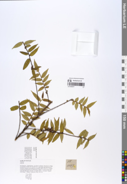
LE 01055377
Eurya subcordata P.T.Li det. Averyanov, Leonid Vladimirovich at 07.12.2019
Additional identifications: Eurya sp. det. Averyanov, Leonid Vladimirovich at 21.10.2018 Collectors: Averyanov, Leonid Vladimirovich; Khang Sinh Nguyen; Maisak, Tatiana Viktorovna; Truong Duc Thieu Field collecting number: VR1143. Collection date: 21.10.2018. Administrative regions: VN - Tinh Ha Giang. Groups of specimens: L. V. Averyanov specimens; L. V. Averyanov herbarium; L. V. Averyanov photosOriginal label text:FLORA OF VIETNAM
Coordinates (geographic position): 23° 4′ 47.2″ N, 104° 48′ 55.6″ E ±1000 mComment: Theaceae
Eurya sp.
Ha Giang prov., Quan Ba distr., Cao Ma Po commune, Chin Chu Lin village, around point 23º04ʹ47.2ʺN 104º48ʹ55.6ʺE, steep slopes and flattened top of mountain composed with sandstone at elevation 1800–1950 m a.s.l. Primary evergreen broad-leaved very humid forest. Shrub 2–3 m tall on open slope. Fruits dull dark green. Not rare. 21 October 2018, L. Averyanov, Nguyen Sinh Khang, T. Maisak, Truong Duc Thieu, VR 1143.
All photos © L. Averyanov & K.S. Nguyen
Record creation: 2019-06-11, Leonid Averyanov, PhotoScan D1Citation: Specimen LE 01055377 // Virtual herbarium of Komarov Botanical Institute RAS — http://re.herbariumle.ru/01055377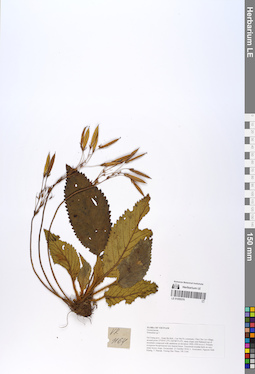
LE 01055376
Oreocharis aurea Dunn ⟮prelim. ID⟯ det. Khang Sinh Nguyen at 07.01.2020
Additional identifications: Primulina sp. det. Averyanov, Leonid Vladimirovich at 21.10.2018; Chirita sp. det. Averyanov, Leonid Vladimirovich at 10.12.2019 Collectors: Averyanov, Leonid Vladimirovich; Khang Sinh Nguyen; Maisak, Tatiana Viktorovna; Truong Duc Thieu Field collecting number: VR1164. Collection date: 21.10.2018. Administrative regions: VN - Tinh Ha Giang. Groups of specimens: L. V. Averyanov specimens; L. V. Averyanov herbarium; L. V. Averyanov photosOriginal label text:FLORA OF VIETNAM.
Coordinates (geographic position): 23° 4′ 47.2″ N, 104° 48′ 55.6″ E ±1000 mComment: Gesneriaceae.
Primulina sp.?.
Ha Giang prov., Quan Ba distr., Cao Ma Po commune, Chin Chu Lin village, around point 23º04ʹ47.2ʺN 104º48ʹ55.6ʺE, steep slopes and flattened top of mountain composed with sandstone at elevation 1800–1950 m a.s.l. Primary evergreen broad-leaved very humid forest. Terrestrial rosulate herb on very steep mossy slope. Occasional. 21 October 2018, L. Averyanov, Nguyen Sinh Khang, T. Maisak, Truong Duc Thieu, VR 1164.
All photos © L. Averyanov & K.S. Nguyen
Record creation: 2019-06-11, Leonid Averyanov, PhotoScan D1Citation: Specimen LE 01055376 // Virtual herbarium of Komarov Botanical Institute RAS — http://re.herbariumle.ru/01055376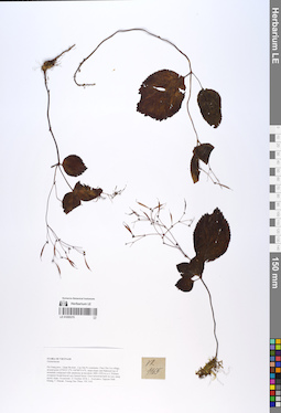
LE 01055375
Didymocarpus sp. det. Averyanov, Leonid Vladimirovich at 12.12.2019
Additional identifications: Gesneriaceae sp. det. Averyanov, Leonid Vladimirovich at 21.10.2018 Collectors: Averyanov, Leonid Vladimirovich; Khang Sinh Nguyen; Maisak, Tatiana Viktorovna; Truong Duc Thieu Field collecting number: VR1165. Collection date: 21.10.2018. Administrative regions: VN - Tinh Ha Giang. Groups of specimens: L. V. Averyanov specimens; L. V. Averyanov herbarium; L. V. Averyanov photosOriginal label text:FLORA OF VIETNAM.
Coordinates (geographic position): 23° 4′ 47.2″ N, 104° 48′ 55.6″ E ±1000 mComment: Gesneriaceae.
Ha Giang prov., Quan Ba distr., Cao Ma Po commune, Chin Chu Lin village, around point 23º04ʹ47.2ʺN 104º48ʹ55.6ʺE, steep slopes and flattened top of mountain composed with sandstone at elevation 1800–1950 m a.s.l. Primary evergreen broad-leaved very humid forest. Erect terrestrial herb on very steep mossy slope. Occasional. 21 October 2018, L. Averyanov, Nguyen Sinh Khang, T. Maisak, Truong Duc Thieu, VR 1165.
All photos © L. Averyanov & K.S. Nguyen
Record creation: 2019-06-11, Leonid Averyanov, PhotoScan D1Citation: Specimen LE 01055375 // Virtual herbarium of Komarov Botanical Institute RAS — http://re.herbariumle.ru/01055375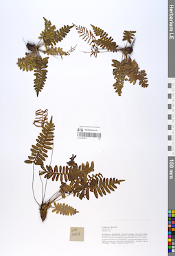
LE 01055374
Plagiogyria yunnanensis Ching det. Averyanov, Leonid Vladimirovich at 28.12.2020
Additional identifications: Plagiogyria sp. det. Averyanov, Leonid Vladimirovich at 21.10.2018; Plagiogyria adnata (Blume) Bedd. det. X.C.Zhang at 05.07.2019 Collectors: Averyanov, Leonid Vladimirovich; Khang Sinh Nguyen; Maisak, Tatiana Viktorovna; Truong Duc Thieu Field collecting number: VR1153. Collection date: 21.10.2018. Administrative regions: VN - Tinh Ha Giang. Groups of specimens: L. V. Averyanov specimens; L. V. Averyanov herbarium; L. V. Averyanov photosOriginal label text:FLORA OF VIETNAM.
Coordinates (geographic position): 23° 4′ 47.2″ N, 104° 48′ 55.6″ E ±1000 mComment: Polypodiaceae s.l.
Plagiogyria sp.
Ha Giang prov., Quan Ba distr., Cao Ma Po commune, Chin Chu Lin village, around point 23º04ʹ47.2ʺN 104º48ʹ55.6ʺE, steep slopes and flattened top of mountain composed with sandstone at elevation 1800–1950 m a.s.l. Primary evergreen broad-leaved very humid forest. Terrestrial and lithophytic fern on shady very steep slope. Occasional. 21 October 2018, L. Averyanov, Nguyen Sinh Khang, T. Maisak, Truong Duc Thieu, VR 1153.
All photos © L. Averyanov & K.S. Nguyen
Record creation: 2019-06-11, Leonid Averyanov, PhotoScan D1Citation: Specimen LE 01055374 // Virtual herbarium of Komarov Botanical Institute RAS — http://re.herbariumle.ru/01055374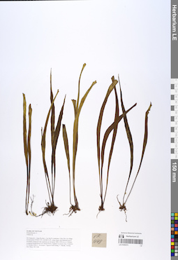
LE 01055373
Haplopteris amboinensis (Fée) X.C.Zhang det. Averyanov, Leonid Vladimirovich at 07.09.2019
Additional identifications: Vittaria sp. det. Averyanov, Leonid Vladimirovich at 21.10.2018; Vittaria amboinensis Fée det. X.C.Zhang at 05.07.2019 Collectors: Averyanov, Leonid Vladimirovich; Khang Sinh Nguyen; Maisak, Tatiana Viktorovna; Truong Duc Thieu Field collecting number: VR1148. Collection date: 21.10.2018. Administrative regions: VN - Tinh Ha Giang. Groups of specimens: L. V. Averyanov specimens; L. V. Averyanov herbarium; L. V. Averyanov photosOriginal label text:FLORA OF VIETNAM.
Coordinates (geographic position): 23° 4′ 47.2″ N, 104° 48′ 55.6″ E ±1000 mComment: Polypodiaceae s.l.
Vittaria sp.
Ha Giang prov., Quan Ba distr., Cao Ma Po commune, Chin Chu Lin village, around point 23º04ʹ47.2ʺN 104º48ʹ55.6ʺE, steep slopes and flattened top of mountain composed with sandstone at elevation 1800–1950 m a.s.l. Primary evergreen broad-leaved very humid forest. Epiphyte on mossy tree. Common. 21 October 2018, L. Averyanov, Nguyen Sinh Khang, T. Maisak, Truong Duc Thieu, VR 1148.
All photos © L. Averyanov & K.S. Nguyen
Record creation: 2019-06-11, Leonid Averyanov, PhotoScan D1Citation: Specimen LE 01055373 // Virtual herbarium of Komarov Botanical Institute RAS — http://re.herbariumle.ru/01055373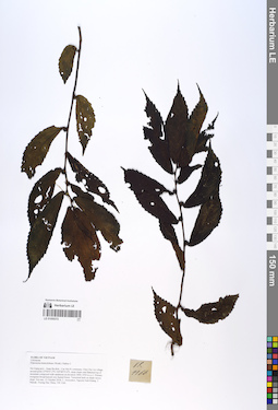
LE 01055372
Elatostema heterolobum (Wedd.) Hallier f. det. Fu Longfei at 21.10.2018
Collectors: Averyanov, Leonid Vladimirovich; Khang Sinh Nguyen; Maisak, Tatiana Viktorovna; Truong Duc Thieu Field collecting number: VR1166. Collection date: 21.10.2018. Administrative regions: VN - Tinh Ha Giang. Groups of specimens: L. V. Averyanov specimens; L. V. Averyanov herbarium; L. V. Averyanov photosOriginal label text:FLORA OF VIETNAM.
Coordinates (geographic position): 23° 4′ 47.2″ N, 104° 48′ 55.6″ E ±1000 mComment: Urticaceae.
Elatostema heterolobum (Wedd.)Hallier f.
Ha Giang prov., Quan Ba distr., Cao Ma Po commune, Chin Chu Lin village, around point 23º04ʹ47.2ʺN 104º48ʹ55.6ʺE, steep slopes and flattened top of mountain composed with sandstone at elevation 1800–1950 m a.s.l. Primary evergreen broad-leaved very humid forest. Terrestrial herb on shady mossy slope. Not rare. 21 October 2018, L. Averyanov, Nguyen Sinh Khang, T. Maisak, Truong Duc Thieu, VR 1166.
All photos © L. Averyanov & K.S. Nguyen
Record creation: 2019-06-11, Leonid Averyanov, PhotoScan D1Citation: Specimen LE 01055372 // Virtual herbarium of Komarov Botanical Institute RAS — http://re.herbariumle.ru/01055372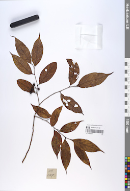
LE 01055371
Lindera kwangtungensis (Liou) C.K.Allen det. Averyanov, Leonid Vladimirovich at 20.09.2019
Additional identifications: Lauraceae sp. det. Averyanov, Leonid Vladimirovich at 21.10.2018 Collectors: Averyanov, Leonid Vladimirovich; Khang Sinh Nguyen; Maisak, Tatiana Viktorovna; Truong Duc Thieu Field collecting number: VR1167. Collection date: 21.10.2018. Administrative regions: VN - Tinh Ha Giang. Groups of specimens: L. V. Averyanov specimens; L. V. Averyanov herbarium; L. V. Averyanov photosOriginal label text:FLORA OF VIETNAM Lauraceae Ha Giang prov., Quan Ba distr., Cao Ma Po commune, Chin Chu Lin village, around point 23º04ʹ47.2ʺN 104º48ʹ55.6ʺE, steep slopes and flattened top of mountain composed with sandstone at elevation 1800–1950 m a.s.l. Primary evergreen broad-leaved very humid forest. Medium size tree. Fruits glossy green, later glossy black, juicy. Occasional. 21 October 2018, L. Averyanov, Nguyen Sinh Khang, T. Maisak, Truong Duc Thieu, VR 1167.
Coordinates (geographic position): 23° 4′ 47.2″ N, 104° 48′ 55.6″ E ±1000 mComment: All photos © L. Averyanov & K.S. Nguyen
Record creation: 2019-06-11, Leonid Averyanov, PhotoScan D1Citation: Specimen LE 01055371 // Virtual herbarium of Komarov Botanical Institute RAS — http://re.herbariumle.ru/01055371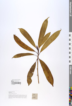
LE 01055370
Magnolia yunnanensis (Hu) Noot. det. Tien Hiep Nguyen at 21.10.2018
Collectors: Averyanov, Leonid Vladimirovich; Khang Sinh Nguyen; Maisak, Tatiana Viktorovna; Truong Duc Thieu Field collecting number: VR1170. Collection date: 21.10.2018. Administrative regions: VN - Tinh Ha Giang. Groups of specimens: L. V. Averyanov specimens; L. V. Averyanov herbarium; L. V. Averyanov photosOriginal label text:FLORA OF VIETNAM.
Coordinates (geographic position): 23° 4′ 47.2″ N, 104° 48′ 55.6″ E ±1000 mComment: Magnoliaceae.
Magnoliayunnanensis (Hu) Noot.
Ha Giang prov., Quan Ba distr., Cao Ma Po commune, Chin Chu Lin village, around point 23º04ʹ47.2ʺN 104º48ʹ55.6ʺE, steep slopes and flattened top of mountain composed with sandstone at elevation 1800–1950 m a.s.l. Primary evergreen broad-leaved very humid forest. Medium size tree. Occasional. 21 October 2018, L. Averyanov, Nguyen Sinh Khang, T. Maisak, Truong Duc Thieu, VR 1170.
All photos © L. Averyanov & K.S. Nguyen
Record creation: 2019-06-11, Leonid Averyanov, PhotoScan D1Citation: Specimen LE 01055370 // Virtual herbarium of Komarov Botanical Institute RAS — http://re.herbariumle.ru/01055370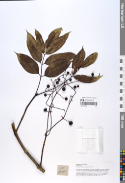
LE 01055369
Turpinia cochinchinensis (Lour.) Merr. det. Averyanov, Leonid Vladimirovich at 21.10.2018
Collectors: Averyanov, Leonid Vladimirovich; Khang Sinh Nguyen; Maisak, Tatiana Viktorovna; Truong Duc Thieu Field collecting number: VR1175. Collection date: 21.10.2018. Administrative regions: VN - Tinh Ha Giang. Groups of specimens: L. V. Averyanov specimens; L. V. Averyanov herbarium; L. V. Averyanov photosOriginal label text:FLORA OF VIETNAM.
Coordinates (geographic position): 23° 4′ 47.2″ N, 104° 48′ 55.6″ E ±1000 mComment: Staphyleaceae.
Turpinia cochinchinensis (Lour.)Merr.
Ha Giang prov., Quan Ba distr., Cao Ma Po commune, Chin Chu Lin village, around point 23º04ʹ47.2ʺN 104º48ʹ55.6ʺE, steep slopes and flattened top of mountain composed with sandstone at elevation 1800–1950 m a.s.l. Primary evergreen broad-leaved very humid forest. Tree 6-8 m tall. Fruits dark dull green, later almost black. Occasional. 21 October 2018, L. Averyanov, Nguyen Sinh Khang, T. Maisak, Truong Duc Thieu, VR 1175.
All photos © L. Averyanov & K.S. Nguyen
Record creation: 2019-06-11, Leonid Averyanov, PhotoScan D1Citation: Specimen LE 01055369 // Virtual herbarium of Komarov Botanical Institute RAS — http://re.herbariumle.ru/01055369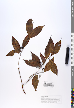
LE 01055368
Lindera kwangtungensis (Liou) C.K.Allen det. Averyanov, Leonid Vladimirovich at 20.09.2019
Additional identifications: Lauraceae sp. det. Averyanov, Leonid Vladimirovich at 21.10.2018 Collectors: Averyanov, Leonid Vladimirovich; Khang Sinh Nguyen; Maisak, Tatiana Viktorovna; Truong Duc Thieu Field collecting number: VR1167. Collection date: 21.10.2018. Administrative regions: VN - Tinh Ha Giang. Groups of specimens: L. V. Averyanov specimens; L. V. Averyanov herbarium; L. V. Averyanov photosOriginal label text:FLORA OF VIETNAM
Coordinates (geographic position): 23° 4′ 47.2″ N, 104° 48′ 55.6″ E ±1000 mComment: Lauraceae
Ha Giang prov., Quan Ba distr., Cao Ma Po commune, Chin Chu Lin village, around point 23º04ʹ47.2ʺN 104º48ʹ55.6ʺE, steep slopes and flattened top of mountain composed with sandstone at elevation 1800–1950 m a.s.l. Primary evergreen broad-leaved very humid forest. Medium size tree. Fruits glossy green, later glossy black, juicy. Occasional. 21 October 2018, L. Averyanov, Nguyen Sinh Khang, T. Maisak, Truong Duc Thieu, VR 1167.
All photos © L. Averyanov & K.S. Nguyen
Record creation: 2019-06-11, Leonid Averyanov, PhotoScan D1Citation: Specimen LE 01055368 // Virtual herbarium of Komarov Botanical Institute RAS — http://re.herbariumle.ru/01055368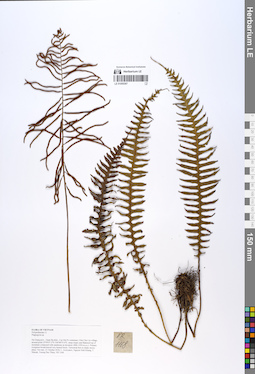
LE 01055367
Plagiogyria stenoptera (Hance) Diels det. X.C.Zhang at 05.07.2019
Additional identifications: Plagiogyria sp. det. Averyanov, Leonid Vladimirovich at 21.10.2018 Collectors: Averyanov, Leonid Vladimirovich; Khang Sinh Nguyen; Maisak, Tatiana Viktorovna; Truong Duc Thieu Field collecting number: VR1168. Collection date: 21.10.2018. Administrative regions: VN - Tinh Ha Giang. Groups of specimens: L. V. Averyanov specimens; L. V. Averyanov photos; L. V. Averyanov herbariumOriginal label text:FLORA OF VIETNAM Polypodiaceae s.l. Plagiogyriaceae Plagiogyria stenoptera (Hance) Diels Ha Giang prov., Quan Ba distr., Cao Ma Po commune, Chin Chu Lin village, around point 23º04ʹ47.2ʺN 104º48ʹ55.6ʺE, steep slopes and flattened top of mountain composed with sandstone at elevation 1800–1950 m a.s.l. Primary evergreen broad-leaved very humid forest. Terrestrial fern in shady mossy place. Not rare. 21 October 2018, L. Averyanov, Nguyen Sinh Khang, T. Maisak, Truong Duc Thieu, VR 1168.
Coordinates (geographic position): 23° 4′ 47.2″ N, 104° 48′ 55.6″ E ±1000 mComment: All photos © L. Averyanov & K.S. Nguyen
Record creation: 2019-06-11, Leonid Averyanov, PhotoScan D1Citation: Specimen LE 01055367 // Virtual herbarium of Komarov Botanical Institute RAS — http://re.herbariumle.ru/01055367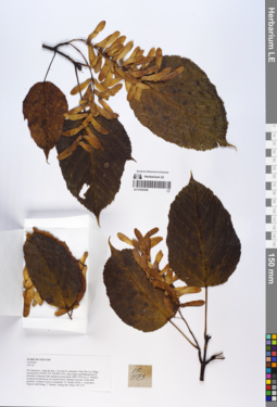
LE 01055366
Acer davidii Franch. det. Averyanov, Leonid Vladimirovich at 09.09.2019
Additional identifications: Acer sp. det. Averyanov, Leonid Vladimirovich at 21.10.2018 Collectors: Averyanov, Leonid Vladimirovich; Khang Sinh Nguyen; Maisak, Tatiana Viktorovna; Truong Duc Thieu Field collecting number: VR1173. Collection date: 21.10.2018. Administrative regions: VN - Tinh Ha Giang. Groups of specimens: L. V. Averyanov specimens; L. V. Averyanov photos; L. V. Averyanov herbariumOriginal label text:FLORA OF VIETNAM.
Coordinates (geographic position): 23° 4′ 47.2″ N, 104° 48′ 55.6″ E ±1000 mComment: Aceraceae.
Acer sp.
Ha Giang prov., Quan Ba distr., Cao Ma Po commune, Chin Chu Lin village, around point 23º04ʹ47.2ʺN 104º48ʹ55.6ʺE, steep slopes and flattened top of mountain composed with sandstone at elevation 1800–1950 m a.s.l. Primary evergreen broad-leaved very humid forest. Medium size tree. Fruits dull greenish. Common, forest co-dominant. 21 October 2018, L. Averyanov, Nguyen Sinh Khang, T. Maisak, Truong Duc Thieu, VR 1173.
All photos © L. Averyanov & K.S. Nguyen
Record creation: 2019-06-11, Leonid Averyanov, PhotoScan D1Citation: Specimen LE 01055366 // Virtual herbarium of Komarov Botanical Institute RAS — http://re.herbariumle.ru/01055366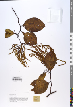
LE 01055365
Alnus nepalensis D.Don det. Averyanov, Leonid Vladimirovich at 21.10.2018
Collectors: Averyanov, Leonid Vladimirovich; Khang Sinh Nguyen; Maisak, Tatiana Viktorovna; Truong Duc Thieu Field collecting number: VR1189. Collection date: 21.10.2018. Administrative regions: VN - Tinh Ha Giang. Groups of specimens: L. V. Averyanov specimens; L. V. Averyanov herbarium; L. V. Averyanov photosOriginal label text:FLORA OF VIETNAM Betulaceae Alnus nepalensis D. Don Ha Giang prov., Quan Ba distr., Cao Ma Po commune, Chin Chu Lin village, around point 23º04ʹ47.2ʺN 104º48ʹ55.6ʺE, steep slopes and flattened top of mountain composed with sandstone at elevation 1500–1600 m a.s.l. Primary evergreen broad-leaved very humid forest. Evergreen fast growing tree on steep slope. Very common. Usual co- and mono-dominant of secondary forests. 21 October 2018, L. Averyanov, Nguyen Sinh Khang, T. Maisak, Truong Duc Thieu, VR 1189.
Coordinates (geographic position): 23° 4′ 47.2″ N, 104° 48′ 55.6″ E ±1000 mComment: All photos © L. Averyanov & K.S. Nguyen
Record creation: 2019-06-11, Leonid Averyanov, PhotoScan D1Citation: Specimen LE 01055365 // Virtual herbarium of Komarov Botanical Institute RAS — http://re.herbariumle.ru/01055365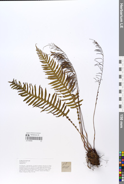
LE 01055364
Plagiogyria stenoptera (Hance) Diels det. X.C.Zhang at 05.07.2019
Additional identifications: Plagiogyria sp. det. Averyanov, Leonid Vladimirovich at 21.10.2018 Collectors: Averyanov, Leonid Vladimirovich; Khang Sinh Nguyen; Maisak, Tatiana Viktorovna; Truong Duc Thieu Field collecting number: VR1168. Collection date: 21.10.2018. Administrative regions: VN - Tinh Ha Giang. Groups of specimens: L. V. Averyanov specimens; L. V. Averyanov herbarium; L. V. Averyanov photosOriginal label text:FLORA OF VIETNAM
Coordinates (geographic position): 23° 4′ 47.2″ N, 104° 48′ 55.6″ E ±1000 mComment: Polypodiaceae s.l.
Plagiogyriaceae
Plagiogyria stenoptera (Hance) Diels
Ha Giang prov., Quan Ba distr., Cao Ma Po commune, Chin Chu Lin village, around point 23º04ʹ47.2ʺN 104º48ʹ55.6ʺE, steep slopes and flattened top of mountain composed with sandstone at elevation 1800–1950 m a.s.l. Primary evergreen broad-leaved very humid forest. Terrestrial fern in shady mossy place. Not rare. 21 October 2018, L. Averyanov, Nguyen Sinh Khang, T. Maisak, Truong Duc Thieu, VR 1168.
All photos © L. Averyanov & K.S. Nguyen
Record creation: 2019-06-11, Leonid Averyanov, PhotoScan D1Citation: Specimen LE 01055364 // Virtual herbarium of Komarov Botanical Institute RAS — http://re.herbariumle.ru/01055364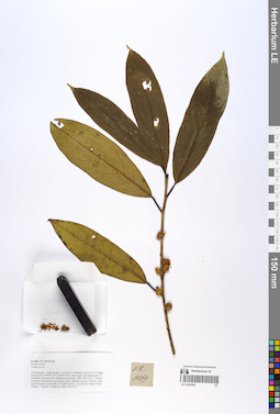
LE 01055363
Symplocos glauca Koidz. det. Averyanov, Leonid Vladimirovich at 07.12.2019
Additional identifications: Symplocos sp. det. Averyanov, Leonid Vladimirovich at 21.10.2018 Collectors: Averyanov, Leonid Vladimirovich; Khang Sinh Nguyen; Maisak, Tatiana Viktorovna; Truong Duc Thieu Field collecting number: VR1171. Collection date: 21.10.2018. Administrative regions: VN - Tinh Ha Giang. Groups of specimens: L. V. Averyanov specimens; L. V. Averyanov photos; L. V. Averyanov herbariumOriginal label text:FLORA OF VIETNAM.
Coordinates (geographic position): 23° 4′ 47.2″ N, 104° 48′ 55.6″ E ±1000 mComment: Symplocaceae?.
Symplocos sp.?.
Ha Giang prov., Quan Ba distr., Cao Ma Po commune, Chin Chu Lin village, around point 23º04ʹ47.2ʺN 104º48ʹ55.6ʺE, steep slopes and flattened top of mountain composed with sandstone at elevation 1800–1950 m a.s.l. Primary evergreen broad-leaved very humid forest. Medium size tree. Flowers white, honey-fragrant. Occasional. 21 October 2018, L. Averyanov, Nguyen Sinh Khang, T. Maisak, Truong Duc Thieu, VR 1171.
All photos © L. Averyanov & K.S. Nguyen
Record creation: 2019-06-11, Leonid Averyanov, PhotoScan D1Citation: Specimen LE 01055363 // Virtual herbarium of Komarov Botanical Institute RAS — http://re.herbariumle.ru/01055363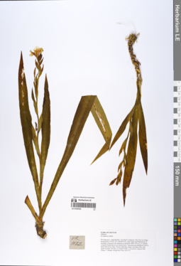
LE 01055362
Iris japonica Thunb. det. Averyanov, Leonid Vladimirovich at 21.10.2018
Collectors: Averyanov, Leonid Vladimirovich; Khang Sinh Nguyen; Maisak, Tatiana Viktorovna; Truong Duc Thieu Field collecting number: VR1172. Collection date: 21.10.2018. Administrative regions: VN - Tinh Ha Giang. Groups of specimens: L. V. Averyanov specimens; L. V. Averyanov herbarium; L. V. Averyanov photosOriginal label text:FLORA OF VIETNAM.
Coordinates (geographic position): 23° 4′ 47.2″ N, 104° 48′ 55.6″ E ±1000 mComment: Iridaceae.
Iris japonica Thunb.
Ha Giang prov., Quan Ba distr., Cao Ma Po commune, Chin Chu Lin village, around point 23º04ʹ47.2ʺN 104º48ʹ55.6ʺE, steep slopes and flattened top of mountain composed with sandstone at elevation 1800–1950 m a.s.l. Primary evergreen broad-leaved very humid forest. Terrestrial and lithophytic herb on open steep mossy slope. Flowers light blue, tepals with light yellow spot inside at center. Not rare. 21 October 2018, L. Averyanov, Nguyen Sinh Khang, T. Maisak, Truong Duc Thieu, VR 1172.
All photos © L. Averyanov & K.S. Nguyen
Record creation: 2019-06-11, Leonid Averyanov, PhotoScan D1Citation: Specimen LE 01055362 // Virtual herbarium of Komarov Botanical Institute RAS — http://re.herbariumle.ru/01055362