View
Add
Copy
Edit
Delete
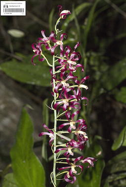
LE 01061366
Tainia viridifusca (Hook.) Hook.f. det. Averyanov, Leonid Vladimirovich at 2018
Collectors: Quang Diep Dinh Field collecting number: Quang Diep Dinh s.n.. Collection date: 2018. Administrative regions: VN - Gia Lai. Groups of specimens: L. V. Averyanov specimens; L. V. Averyanov photos; Orchids of Vietnam, Laos and CambodiaOriginal label text:FLORA OF VIETNAM
Comment: Orchidaceae
Tainia viridifusca (Hook.) Benth. & Hook. f.
Southern Vietnam, Gia Lai Province, K Bang district, Kon Chu Rang Nature Reserve. 2018, Dinh Quang Diep, s.n.
All photos © Dinh Quang Diep
Record creation: 2019-09-07, Аверьянов Леонид Владимирович. Processing status: work_status_1Citation: Specimen LE 01061366 // Virtual herbarium of Komarov Botanical Institute RAS — http://re.herbariumle.ru/01061366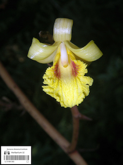
LE 01061365
Cyrtosia faberi (Rolfe) Aver. det. Nuraliev, M. S. at 13.06.2019
Additional identifications: Cyrtosia faberi (Rolfe) Aver. det. Averyanov, Leonid Vladimirovich at 06.09.2019 Collectors: Vislobokov, N. A.; Nuraliev, M. S. Field collecting number: 19085. Collection date: 13.06.2019. Administrative regions: VN - Tinh Lao Cai. Groups of specimens: L. V. Averyanov specimens; L. V. Averyanov photos; Orchids of Vietnam, Laos and CambodiaOriginal label text:Russian – Vietnamese Tropical Centre
Comment: Orchidaceae
Cyrtosia faberi (Rolfe) Aver.
N. VIETNAM, Lao Cai Province, Bat Xat District, Bat Xat Nature Reserve, 4 km SSE of Y Ty village. Disturbed forest, alt. 1834 m, 22°37.467'N 103°37.698'E, 13.06.2019, Vislobokov N.A., 19085. Det. L.V. Averyanov
All photos © Maxim S. Nuraliev
Record creation: 2019-09-06, Аверьянов Леонид Владимирович. Processing status: work_status_1Citation: Specimen LE 01061365 // Virtual herbarium of Komarov Botanical Institute RAS — http://re.herbariumle.ru/01061365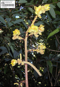
LE 01061364
Cyrtosia lindleyana Hook.f. & Thomson det. Averyanov, Leonid Vladimirovich at 06.09.2019
Additional identifications: Cyrtosia lindleyana Hook.f. & Thomson det. Nuraliev, M. S. at 05.06.2019 Collectors: Vislobokov, N. A.; Nuraliev, M. S. Field collecting number: 19040. Collection date: 05.06.2019. Administrative regions: VN - Tinh Lao Cai. Groups of specimens: L. V. Averyanov specimens; L. V. Averyanov photos; Orchids of Vietnam, Laos and CambodiaOriginal label text:Russian – Vietnamese Tropical Centre
Comment: Orchidaceae
Cyrtosia lindleyana Hook.f. & Thomson
N. VIETNAM, Lao Cai Province, Bat Xat District, Bat Xat Nature Reserve, 4 km SSE of Y Ty village. Disturbed forest, alt. 1834 m, 22°37.467'N 103°37.698'E. 05.06.2019, Vislobokov N.A., 19040. Det. L.V. Averyanov
All photographs © Maxim S. Nuraliev
Record creation: 2019-09-06, Аверьянов Леонид Владимирович. Processing status: work_status_1Citation: Specimen LE 01061364 // Virtual herbarium of Komarov Botanical Institute RAS — http://re.herbariumle.ru/01061364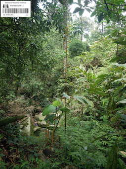
LE 01061363
Cyrtosia lindleyana Hook.f. & Thomson det. Averyanov, Leonid Vladimirovich at 06.09.2019
Collectors: Nuraliev, M. S. Field collecting number: 2681a. Collection date: 09.06.2019. Administrative regions: VN - Tinh Lao Cai. Groups of specimens: L. V. Averyanov specimens; L. V. Averyanov photos; Orchids of Vietnam, Laos and CambodiaOriginal label text:Russian-Vietnamese Tropical Centre
Coordinates (geographic position): 22° 37′ 14″ N, 103° 37′ 21″ E ±1000 mComment: Orchidaceae
Cyrtosia lindleyana Hook.f. & Thomson
N. VIETNAM, Lao Cai Prov., Bat Xat Distr., Bat Xat Nature Reserve, 4 km SSE of Y Ty village. Disturbed forest, stream bank, epiphytic, 22°37'14''N 103°37'21''E, elev. 1900 m. 09.06.2019, Nuraliev M.S., 2681a. All photographs © Maxim S. Nuraliev Det. L.V. Averyanov
All photographs © Maxim S. Nuraliev
Record creation: 2019-09-06, Аверьянов Леонид Владимирович. Processing status: work_status_1Citation: Specimen LE 01061363 // Virtual herbarium of Komarov Botanical Institute RAS — http://re.herbariumle.ru/01061363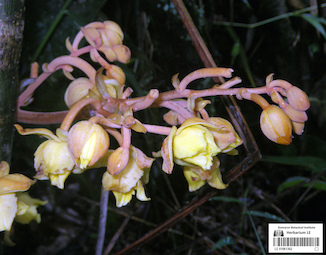
LE 01061362
Cyrtosia falconeri (Hook.f.) Aver. det. Averyanov, Leonid Vladimirovich at 06.09.2019
Collectors: Nuraliev, M. S. Field collecting number: Nuraliev 2679a. Collection date: 09.06.2019. Administrative regions: VN - Tinh Lao Cai. Groups of specimens: L. V. Averyanov specimens; L. V. Averyanov photos; Orchids of Vietnam, Laos and CambodiaOriginal label text:Russian-Vietnamese Tropical Centre
Coordinates (geographic position): 22° 37′ 17″ N, 103° 37′ 21″ E ±1000 mComment: Orchidaceae
Cyrtosia falconeri (Hook.f.) Aver.
N. VIETNAM, Lao Cai Prov., Bat Xat Distr., Bat Xat Nature Reserve, 4 km SSE of Y Ty village. Disturbed forest, near stream, 22°37'17''N 103°37'21''E, elev. 1880 m. 09.06.2019, Nuraliev M.S., 2679a. All photographs © Maxim S. Nuraliev Det. L.V. Averyanov
All photos © Maxim S. Nuraliev
Record creation: 2019-09-06, Аверьянов Леонид Владимирович. Processing status: work_status_1Citation: Specimen LE 01061362 // Virtual herbarium of Komarov Botanical Institute RAS — http://re.herbariumle.ru/01061362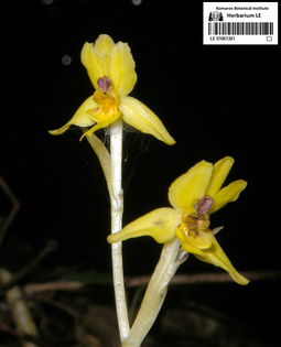
LE 01061361
Vietorchis furcata Aver. & Nuraliev det. Averyanov, Leonid Vladimirovich, Nuraliev, M. S. at 19.05.2019
Collectors: Nuraliev, M. S. Field collecting number: Nuraliev 2572. Collection date: 19.05.2019. Administrative regions: VN - Tinh GJak Lak. Groups of specimens: L. V. Averyanov specimens; L. V. Averyanov photos; Orchids of Vietnam, Laos and CambodiaOriginal label text:VLORA OF VIETNAM
Russian-Vietnamese Tropical Centre Orchidaceae
Vietorchis furcata Aver. & Nuraliev
S. VIETNAM, Dak Lak Prov., Lak Distr., Bong Krang Municip., Chu Yang Sin National Park, 12 km S of Krong Kmar village, in the forest, near stream, 12°23'40''N 108°20'55''E, elev. 1100 m. 19.05.2019, Nuraliev M.S. 2572.
All photos © Maxim S. Nuraliev
Record creation: 2019-09-05, Аверьянов Леонид Владимирович. Processing status: work_status_1Citation: Specimen LE 01061361 // Virtual herbarium of Komarov Botanical Institute RAS — http://re.herbariumle.ru/01061361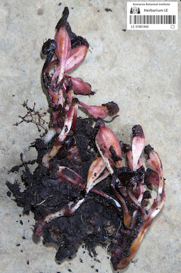
LE 01061440
Yoania prainii King & Pantl. det. Averyanov, Leonid Vladimirovich at 05.09.2019
Collectors: Nuraliev, M. S. Field collecting number: Nuraliev 2647a. Collection date: 06.06.2019. Administrative regions: VN - Tinh Lao Cai. Groups of specimens: L. V. Averyanov specimens; L. V. Averyanov photos; Orchids of Vietnam, Laos and CambodiaOriginal label text:Russian-Vietnamese Tropical Centre
Coordinates (geographic position): 22° 37′ 33″ N, 103° 37′ 46″ E ±1000 mComment: Orchidaceae
Yoania prainii King & Pantl.
N. VIETNAM, Lao Cai Prov., Bat Xat Distr., Bat Xat Nature Reserve, 4 km SSE of Y Ty village. Disturbed forest, near road. 22°37'33''N 103°37'46''E, elev. 1830 m. 06.06.2019, Nuraliev M.S., 2647a.
Det. L.V. Averyanov at 05.09.2019.
All photos © Maxim S. Nuraliev
Record creation: 2019-09-05, Аверьянов Леонид Владимирович. Processing status: work_status_1Citation: Specimen LE 01061440 // Virtual herbarium of Komarov Botanical Institute RAS — http://re.herbariumle.ru/01061440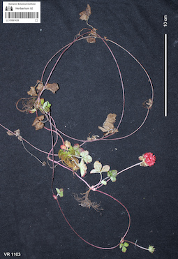
LE 01061439
Duchesnea indica (Andrews) Teschem det. Averyanov, Leonid Vladimirovich at 20.10.2018
Collectors: Averyanov, Leonid Vladimirovich; Khang Sinh Nguyen; Maisak, Tatiana Viktorovna; Truong Duc Thieu Field collecting number: VR1103. Collection date: 20.10.2018. Administrative regions: VN - Tinh Ha Giang. Groups of specimens: L. V. Averyanov specimens; L. V. Averyanov photosOriginal label text:FLORA OF VIETNAM
Coordinates (geographic position): 23° 5′ 13.5″ N, 104° 48′ 30.2″ E ±1000 mComment: Rosaceae
Duchesnea indica (Andrews) Teschem
Ha Giang prov., Quan Ba distr., Cao Ma Po commune, Chin Chu Lin village, around point 23º05ʹ13.5ʺN 104º48ʹ30.2ʺE, rocky outcrops on steep rocky slopes composed with eroded karstic limestone at elevation 1750–1950 m a.s.l. Highly degraded remnants of primary evergreen broad-leaved very humid forest and evergreen secondary shrubs. Creeping terrestrial herb on open grassy slope. Flowers yellow, fruit bright red. Common. 20 October 2018, L. Averyanov, Nguyen Sinh Khang, T. Maisak, Truong Duc Thieu, VR 1103.
All photos © L. Averyanov & K.S. Nguyen
Record creation: 2019-09-02, Аверьянов Леонид ВладимировичCitation: Specimen LE 01061439 // Virtual herbarium of Komarov Botanical Institute RAS — http://re.herbariumle.ru/01061439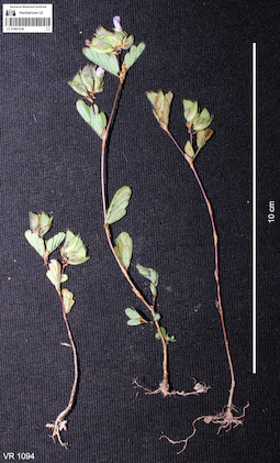
LE 01061438
Smithia conferta Sm. det. Sawai Mattapha at 20.10.2018
Collectors: Averyanov, Leonid Vladimirovich; Khang Sinh Nguyen; Maisak, Tatiana Viktorovna; Truong Duc Thieu Field collecting number: VR1093. Collection date: 20.10.2018. Administrative regions: VN - Tinh Ha Giang. Groups of specimens: L. V. Averyanov specimens; L. V. Averyanov photosOriginal label text:FLORA OF VIETNAM
Coordinates (geographic position): 23° 5′ 13.5″ N, 104° 48′ 30.2″ E ±1000 mComment: Fabaceae
Smithia conferta Sm.
Ha Giang prov., Quan Ba distr., Cao Ma Po commune, Chin Chu Lin village, around point 23º05ʹ13.5ʺN 104º48ʹ30.2ʺE, rocky outcrops on steep rocky slopes composed with eroded karstic limestone at elevation 1750–1950 m a.s.l. Highly degraded remnants of primary evergreen broad-leaved very humid forest and evergreen secondary shrubs. Terrestrial herb on open grassy slope. Flowers light blue. Occasional. 20 October 2018, L. Averyanov, Nguyen Sinh Khang, T. Maisak, Truong Duc Thieu, VR 1093.
All photos © L. Averyanov & K.S. Nguyen
Record creation: 2019-09-02, Аверьянов Леонид ВладимировичCitation: Specimen LE 01061438 // Virtual herbarium of Komarov Botanical Institute RAS — http://re.herbariumle.ru/01061438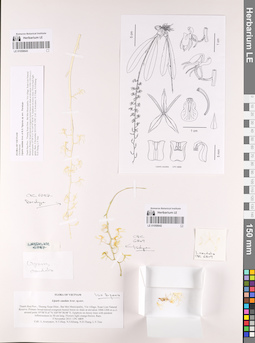
LE 01058643
Paratype of Liparis caudata Aver. & K.S.Nguyen det. Averyanov, Leonid Vladimirovich at 05.11.2019
Collectors: Averyanov, Leonid Vladimirovich; Tien Hiep Nguyen; Khang Sinh Nguyen; N.D. Thang; L.V. Tien Field collecting number: CPC6787. Collection date: 05.11.2013. Administrative regions: VN - Tinh Thanh Hoa. Groups of specimens: L. V. Averyanov specimens; L. V. Averyanov herbarium; L. V. Averyanov drawings; Orchids of Vietnam, Laos and CambodiaOriginal label text:FLORA OF VIETNAM
Record creation: 2019-08-29, Аверьянов Леонид Владимирович. Processing status: work_status_1Citation: Specimen LE 01058643 // Virtual herbarium of Komarov Botanical Institute RAS — http://re.herbariumle.ru/01058643Orchidaceae
Liparis caudata Aver. et K.S. Nguyen, sp. nov. Paratype
Thanh Hoa Prov., Thuong Xuan Distr., Bat Mot Municipality, Vin village, Xuan Lien Natural Reserve. Primary broad-leaved evergreen humid forest on shale at elevation 1000-1200 m a.s.l. around point 19°58’51.6’’N 104°59’38.08’’E. Epiphyte on mossy trees. Flower buds light green. Rare. 5 November 2013 CPC 6787 Coll.: L.Averyanov, N.T.Hiep, N.S.Khang, N.D.Thang, L.V.Tien
LE 01058677
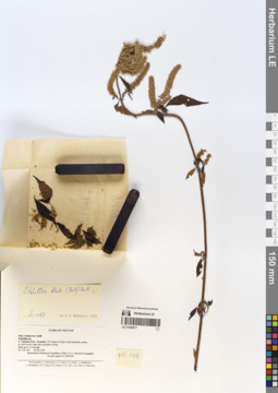
Elsholtzia blanda Benth. det. Budantsev, Andrey Lvovich at 01.1997
Additional identifications: Elsholtzia blanda Benth. det. Chen Yaping, Xiang Chunlei at 2019 Collectors: Averyanov, Leonid Vladimirovich; et al. Field collecting number: VH148. Collection date: 23.02.1995. Administrative regions: VN - Kon Tum. Groups of specimens: L. V. Averyanov specimens; L. V. Averyanov herbariumOriginal label text:FLORA OF VIETNAM
Lamiaceae Lindl.
Esholtzia
South Vietnam, Prov. Kontum. NW slopes of Ngoc Linh mountain system at 1600 m elevation. Open dry secondary forest.
Herb up to 1.2 m high.
VH 148 23 February 1995
International Botanical Expedition sponsored by the National Geographic Society (Grant 5094-93).
Participants: L. Averyanov, N.T. Ban, N. Q. Binh, A. Budantzev, L. Budantzev, N.T. Hiep, D.D. Huyen, P.K. Loc, N.X. Tam, G. Yakovlev.
Lamiaceae Lindl.
Esholtzia
South Vietnam, Prov. Kontum. NW slopes of Ngoc Linh mountain system at 1600 m elevation. Open dry secondary forest.
Herb up to 1.2 m high.
VH 148 23 February 1995
International Botanical Expedition sponsored by the National Geographic Society (Grant 5094-93).
Participants: L. Averyanov, N.T. Ban, N. Q. Binh, A. Budantzev, L. Budantzev, N.T. Hiep, D.D. Huyen, P.K. Loc, N.X. Tam, G. Yakovlev.
LE 01058673
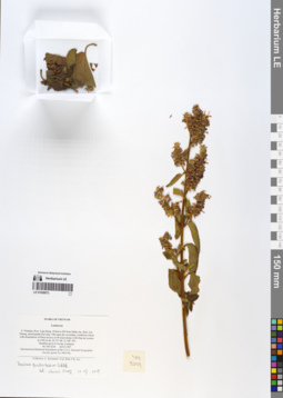
Teucrium quadratulum Sm. det. Xiang Chunlei at 10.07.2019
Collectors: Averyanov, Leonid Vladimirovich; et al. Field collecting number: VH3254. Collection date: 26.03.1997. Administrative regions: VN - Tinh Lam GJong. Groups of specimens: L. V. Averyanov specimens; L. V. Averyanov herbariumOriginal label text:FLORA OF VIETNAM
Lamiaceae
S. Vietnam, Prov. Lam Dong, 30 km to NE from Dalat city, distr. Lac
Duong, municipalite Da Chay. Old open dry secondary coniferous forest
with domination of Pinus kesiya on W macroslope of Bi Dup mt system at 1500 m alt. (N 12° 08′, E 108° 39′).
Shrublet up to 0.4 m hg. Common.
VH 3254 26.03.1997
International Botanical Expedition of the U.S.A. National Geographic
Society (grant No 5803-96)
Collectors: L. Averyanov, N.Q. Binh, P.K. Loc
Lamiaceae
S. Vietnam, Prov. Lam Dong, 30 km to NE from Dalat city, distr. Lac
Duong, municipalite Da Chay. Old open dry secondary coniferous forest
with domination of Pinus kesiya on W macroslope of Bi Dup mt system at 1500 m alt. (N 12° 08′, E 108° 39′).
Shrublet up to 0.4 m hg. Common.
VH 3254 26.03.1997
International Botanical Expedition of the U.S.A. National Geographic
Society (grant No 5803-96)
Collectors: L. Averyanov, N.Q. Binh, P.K. Loc
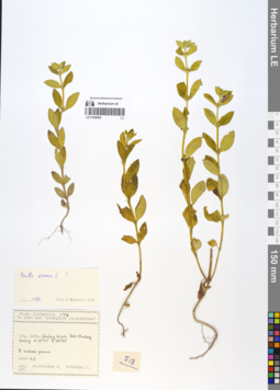
LE 01058669
Mentha arvensis L. det. Budantsev, Andrey Lvovich at 1997
Collectors: Averyanov, Leonid Vladimirovich; Kudryavtzeva, Ekaterina Petrovna Field collecting number: Averyanov 718. Collection date: 12.10.1990. Administrative regions: VN - Tinh Quang Ninh. Groups of specimens: L. V. Averyanov specimens; L. V. Averyanov herbariumOriginal label text:FLORA VIETNAMICA
No 718
7 Expedition of Scientific Vessel "Professor Gagarinsky"
Mentha arvensis L.
Vietnam Prov. Quang Ninh. Dao Phuong Hoang.
N20°47 E107°24'
1990.12.10
Leg. Kudryavtzeva E., Ogureeva G.
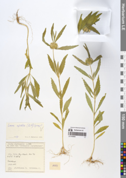
LE 01058665
Leucas cephalotes Spreng. det. Chen Yaping, Xiang Chunlei at 2019
Additional identifications: Leucas cephalotes Spreng. det. Budantsev, Andrey Lvovich at 1997 Collectors: Kudryavtzeva, Ekaterina Petrovna; Ogureeva, G. Field collecting number: Kudryavtzeva 1154. Collection date: 24.10.1990. Administrative regions: VN - Tinh Khanh Hoa. Groups of specimens: L. V. Averyanov specimens; L. V. Averyanov herbariumOriginal label text:FLORA VIETNAMICA
No 1154
7 Expedition of Scientific Vessel "Professor Gagarinsky"
Leucas cephalotes ( Roth) Spreng.
Vietnam Prov. Phu Khanh. Hon Tre Island
N12°14' E109°31'
1990.24.X
Leg. Kudryavtzeva E., Ogureeva G.
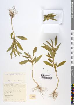
LE 01058661
Leucas cephalotes Spreng. det. Chen Yaping, Xiang Chunlei at 2019
Additional identifications: Leucas cephalotes Spreng. det. Budantsev, Andrey Lvovich at 1997 Collectors: Averyanov, Leonid Vladimirovich; Kudryavtzeva, Ekaterina Petrovna Field collecting number: Averyanov 159. Collection date: 29.09.1990. Administrative regions: VN - Tinh Khanh Hoa. Groups of specimens: L. V. Averyanov specimens; L. V. Averyanov herbariumOriginal label text:FLORA VIETNAMICA
No 159
7 Expedition of Scientific Vessel "Professor Gagarinsky"
Leucas cephalotes (Roth) Sprengel.
Vietnam Prov. Phu Khanh. Hon Tre Island
N12°14' E109°31'
1990.29.IX
Leg. Kudryavtzeva E., Ogureeva G.
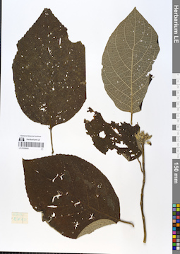
LE 01058660
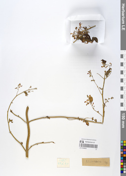
Gomphostemma leptodon Dunn det. Chen Yaping at 27.12.2022
Additional identifications: Lamiaceae sp. Collectors: Takhtajan, Armen Leonovich. Field collecting number: Takhtajan 0509. Collection date: 23.10.1960. Administrative regions: VN - Vietnam. Groups of specimens: L. V. Averyanov specimens; L. V. Averyanov herbarium; Flora of VietnamOriginal label text:FLORA VIETNAMICA
Record creation: 2019-08-29, Leonid Averyanov, PhotoScan D1Citation: Specimen LE 01058660 // Virtual herbarium of Komarov Botanical Institute RAS — http://re.herbariumle.ru/01058660Takhtajan 0509
23.10.1960
Lamiaceae sp.
LE 01058659
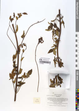
Microtoena sp. det. Busch
Collectors: Takhtajan, Armen Leonovich. Field collecting number: Takhtajan 485. Collection date: 22.10.1960. Administrative regions: VN - Tinh Lao Cai. Groups of specimens: L. V. Averyanov specimens; L. V. Averyanov herbariumOriginal label text:FLORA OF VIETNAM
Microtoena sp.
N. Vietnam, Sapa
22 10 1960
A.Takhnajan 0485
LE 01058658
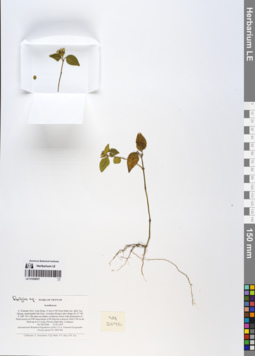
Elsholtzia blanda Benth. det. Chen Yaping, Xiang Chunlei
Collectors: Averyanov, Leonid Vladimirovich; et al. Field collecting number: VH2719. Collection date: 16.03.1997. Administrative regions: VN - Tinh Lam GJong. Groups of specimens: L. V. Averyanov specimens; L. V. Averyanov herbariumOriginal label text:FLORA OF VIETNAM
Lamiaceae
Lamiaceae
S. Vietnam, Prov. Lam Dong, 31 km to NE from Dalat city, distr. Lac
Duong, municipalite Da Chay, vicinities Klong Lanh village (N 12° 08′,
E 108° 39′). Secondary shrub communitys on open dry slopes on NW
macroslope of Bi Dup mt system at 1450-1500 m alt.
Herb up to 3 m hg. Very common.
VH 2719 16.03.1997
International Botanical Expedition of the U.S.A. National Geographic
Society (grant No 5803-96)
Collectors: L. Averyanov, N.Q. Binh, N.V. Duy, P.K. Loc
Duong, municipalite Da Chay, vicinities Klong Lanh village (N 12° 08′,
E 108° 39′). Secondary shrub communitys on open dry slopes on NW
macroslope of Bi Dup mt system at 1450-1500 m alt.
Herb up to 3 m hg. Very common.
VH 2719 16.03.1997
International Botanical Expedition of the U.S.A. National Geographic
Society (grant No 5803-96)
Collectors: L. Averyanov, N.Q. Binh, N.V. Duy, P.K. Loc
LE 01058657
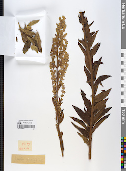
Rungia sp. det. Averyanov, Leonid Vladimirovich
Collectors: Averyanov, Leonid Vladimirovich; N.Q. Binh; Nguyen Van Duy; Phan Ke Loc Field collecting number: VH2696. Collection date: 15.03.1997. Administrative regions: VN - Tinh Lam GJong. Groups of specimens: L. V. Averyanov specimens; L. V. Averyanov herbariumOriginal label text:FLORA OF VIETNAM
Acanthaceae
S. Vietnam, Prov. Lam Dong, 31 km to NE from Dalat city, distr. Lac
Duong, municipalite Da Chay, vicinities Klong Lanh village (N 12° 08′,
E 108° 39′). Old open secondary coniferous forest with domination of
Pinus kesiya on NW macroslope of Bi Dup mt system at 1600-1700 m alt.
Herb up to 0.3 m hg. Flowers light blue. Common.
VH 2696 15.03.1997
International Botanical Expedition of the U.S.A. National Geographic
Society (grant No 5803-96)
Collectors: L. Averyanov, N.Q. Binh, N.V. Duy, P.K. Loc
Acanthaceae
S. Vietnam, Prov. Lam Dong, 31 km to NE from Dalat city, distr. Lac
Duong, municipalite Da Chay, vicinities Klong Lanh village (N 12° 08′,
E 108° 39′). Old open secondary coniferous forest with domination of
Pinus kesiya on NW macroslope of Bi Dup mt system at 1600-1700 m alt.
Herb up to 0.3 m hg. Flowers light blue. Common.
VH 2696 15.03.1997
International Botanical Expedition of the U.S.A. National Geographic
Society (grant No 5803-96)
Collectors: L. Averyanov, N.Q. Binh, N.V. Duy, P.K. Loc
LE 01058656
Isodon ternifolius (D.Don) Kudô det. Busch
Collectors: Busch Field collecting number: 369. Collection date: 20.10.1960. Administrative regions: VN - Vietnam. Groups of specimens: L. V. Averyanov specimens; L. V. Averyanov herbariumOriginal label text:FLORA VIETNAMICA
Record creation: 2019-08-29, Leonid Averyanov, PhotoScan D1Citation: Specimen LE 01058656 // Virtual herbarium of Komarov Botanical Institute RAS — http://re.herbariumle.ru/01058656Lamiaceae
Isodon ternifolius (D.Don) Kudô
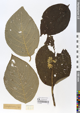
LE 01058655
Gomphostemma sp.
Collectors: Takhtajan, Armen Leonovich. Field collecting number: Takhtajan 0509. Collection date: 27.10.1960. Administrative regions: VN - Tinh Lao Cai. Groups of specimens: L. V. Averyanov specimens; L. V. Averyanov herbariumOriginal label text:FLORA OF VIETNAM
Gomphostemma sp.
N. Vietnam, Sapa
22 10 1960
A.Takhnajan 0509
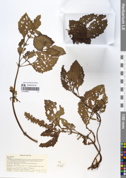
LE 01058654
Ajuga macrosperma Wall. det. Xiang Chunlei at 10.07.2019
Collectors: Averyanov, Leonid Vladimirovich; et al. Field collecting number: VH1936. Collection date: 23.11.1995. Administrative regions: VN - Kon Tum. Groups of specimens: L. V. Averyanov specimens; L. V. Averyanov herbariumOriginal label text:FLORA OF VIETNAM
Lamiaceae
Ajuga sp. ?
S. Vietnam, Prov. Kon Tum, Distr. Dak Gley, about 15-18 km to NW of Dak Gley town, near Mang Khen (Dak Che) village. Primary evergreen mountain very wet forest in deep stream canyon at 1000 m alt.
Prostrate herb rooting at nodes. In open wet place. Flowers blue. Rare.
VH 1936 23.11.1995
International Botanical Expedition of the U.S.A. National Geographic Society (grant No 5094-93)
Participants: L. Averyanov, N.T. Ban, A. Budantzev, L. Budantzev, N.T. Hiep, D.D. Huyen, P.K. Loc, G. Yakovlev
Lamiaceae
Ajuga sp. ?
S. Vietnam, Prov. Kon Tum, Distr. Dak Gley, about 15-18 km to NW of Dak Gley town, near Mang Khen (Dak Che) village. Primary evergreen mountain very wet forest in deep stream canyon at 1000 m alt.
Prostrate herb rooting at nodes. In open wet place. Flowers blue. Rare.
VH 1936 23.11.1995
International Botanical Expedition of the U.S.A. National Geographic Society (grant No 5094-93)
Participants: L. Averyanov, N.T. Ban, A. Budantzev, L. Budantzev, N.T. Hiep, D.D. Huyen, P.K. Loc, G. Yakovlev
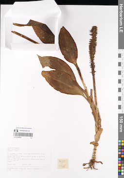
LE 01058653
Goodyera fumata Thwaites det. Averyanov, Leonid Vladimirovich at 04.10.1999
Collectors: Tien Hiep Nguyen; N.Q. Binh; Averyanov, Leonid Vladimirovich; P. Cribb Field collecting number: NTH3276. Collection date: 04.10.1999. Administrative regions: VN - Tinh Ha Giang. Groups of specimens: L. V. Averyanov specimens; L. V. Averyanov herbarium; Orchids of Vietnam, Laos and CambodiaOriginal label text:FLORA OF VIETNAM
Fam. Orchidaceae
Goodyera fumata Thwaites
N. Vietnam, Ha Giang, along road between Quan Ba and Yen Minh towns. Swampy open place among secondary shrubs on alluvial shale slope along road at elev. about 600 m a.s.l. Terrestrial forb up to 0.8 m hg. Not common. No NTH 3276
04 Oct. 1999 Collectors: N.T. Hiep, N.Q. Binh, L. Averyanov, P. Cribb.
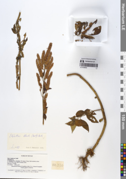
LE 01058652
Elsholtzia blanda Benth. det. Budantzev, Andrey Lvovitch at 1997
Collectors: Averyanov, Leonid Vladimirovich; et al. Field collecting number: VH230. Collection date: 23.02.1995. Administrative regions: VN - Kon Tum. Groups of specimens: L. V. Averyanov specimens; L. V. Averyanov herbariumOriginal label text:FLORA OF VIETNAM
Lamiaceae Lindl.
Elsholtzia sp.
S. Vietnam, Prov. Kontum. NW slopes of Ngoc Linh mountain system
at 1700-1800 m alt. Open secondary forest.
Herb up to 1 m high.
VH 230 23.02.1995
International Botanical Expedition of the U.S.A. National Geographic
Society (grant No 5094-93)
Participants: L. Averyanov, N.T. Ban, N. Q. Binh, A. Budantzev, L. Budantzev, N.T. Hiep, D.D. Huyen, P.K. Loc, N.X. Tam, G. Yakovlev
Lamiaceae Lindl.
Elsholtzia sp.
S. Vietnam, Prov. Kontum. NW slopes of Ngoc Linh mountain system
at 1700-1800 m alt. Open secondary forest.
Herb up to 1 m high.
VH 230 23.02.1995
International Botanical Expedition of the U.S.A. National Geographic
Society (grant No 5094-93)
Participants: L. Averyanov, N.T. Ban, N. Q. Binh, A. Budantzev, L. Budantzev, N.T. Hiep, D.D. Huyen, P.K. Loc, N.X. Tam, G. Yakovlev
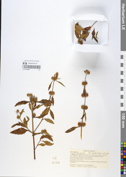
LE 01058651
Hyptis brevipes Poit. ⟮prelim. ID⟯ det. Chen Yaping, Xiang Chunlei at 10.07.2019
Collectors: Averyanov, Leonid Vladimirovich; et al. Field collecting number: VH2056. Collection date: 28.11.1995. Administrative regions: VN - Gia Lai. Groups of specimens: L. V. Averyanov specimens; L. V. Averyanov herbariumOriginal label text:FLORA OF VIETNAM
Lamiaceae
?
S. Vietnam, Prov. Kon Tum, Distr. Dak Gley, about 6-8 km to the N of Dak Gley town. Secondary evergreen dry forest rich in primary elements with bamboo (Oxytenanthera sp.) domination at 700-750 m alt.
Herb 0.5-1 m high in wet places along streams. Rare.
VH 2056 28.11.1995
International Botanical Expedition of the U.S.A. National Geographic Society (grant No 5094-93)
Participants: L. Averyanov, N.T. Ban, A. Budantzev, L. Budantzev, N.T. Hiep, D.D. Huyen, P.K. Loc, G. Yakovlev
Lamiaceae
?
S. Vietnam, Prov. Kon Tum, Distr. Dak Gley, about 6-8 km to the N of Dak Gley town. Secondary evergreen dry forest rich in primary elements with bamboo (Oxytenanthera sp.) domination at 700-750 m alt.
Herb 0.5-1 m high in wet places along streams. Rare.
VH 2056 28.11.1995
International Botanical Expedition of the U.S.A. National Geographic Society (grant No 5094-93)
Participants: L. Averyanov, N.T. Ban, A. Budantzev, L. Budantzev, N.T. Hiep, D.D. Huyen, P.K. Loc, G. Yakovlev
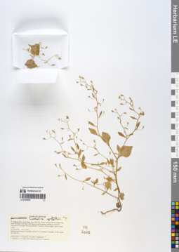
LE 01058650
Lobelia griffithii Hook.f. & Thomson ⟮prelim. ID⟯ det. Averyanov, Leonid Vladimirovich at 26.11.1995
Collectors: Averyanov, Leonid Vladimirovich; et al. Field collecting number: VH2028. Collection date: 26.11.1995. Administrative regions: VN - Kon Tum. Groups of specimens: L. V. Averyanov specimens; L. V. Averyanov herbariumOriginal label text:FLORA OF VIETNAM
Scrophulariaceae
?
S. Vietnam, Prov. Kon Tum, Distr. Dak Gley, about 3-4 km to the W of Dak Gley town. Secondary dry forest with bamboos rich in primary elements at 650-800.
Herb up to 0.4 m high. Not rare in shadow wet places. Flowers light violet or nearly violet.
VH 2028 26.11.1995
International Botanical Expedition of the U.S.A. National Geographic Society (grant No 5094-93)
Participants: L. Averyanov, N.T. Ban, A. Budantzev, L. Budantzev, N.T. Hiep, D.D. Huyen, P.K. Loc, G. Yakovlev
Scrophulariaceae
?
S. Vietnam, Prov. Kon Tum, Distr. Dak Gley, about 3-4 km to the W of Dak Gley town. Secondary dry forest with bamboos rich in primary elements at 650-800.
Herb up to 0.4 m high. Not rare in shadow wet places. Flowers light violet or nearly violet.
VH 2028 26.11.1995
International Botanical Expedition of the U.S.A. National Geographic Society (grant No 5094-93)
Participants: L. Averyanov, N.T. Ban, A. Budantzev, L. Budantzev, N.T. Hiep, D.D. Huyen, P.K. Loc, G. Yakovlev
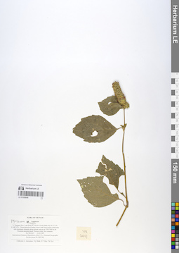
LE 01058649
Pogostemon cablin Benth. det. Chen Yaping, Xiang Chunlei
Collectors: Averyanov, Leonid Vladimirovich; et al. Field collecting number: VH2617. Collection date: 13.03.1997. Administrative regions: VN - Tinh Lam GJong. Groups of specimens: L. V. Averyanov specimens; L. V. Averyanov herbariumOriginal label text:FLORA OF VIETNAM
Lamiaceae
S. Vietnam, Prov. Lam Dong, 8.5 km to S from Dalat city (N 11° 54′,
E 108° 27′). Closed mixed secondary forest with Dacrycarpus imbricatus
rich in primary elements along stream canyon at 1300-1400 m alt.
Prostrate terrestrial herb. Flowers violet. Not common.
VH 2617 13.03.1997
International Botanical Expedition of the U.S.A. National Geographic
Society (grant No 5803-96)
Collectors: L. Averyanov, N.Q. Binh, N.V. Duy, P.K. Loc
Lamiaceae
S. Vietnam, Prov. Lam Dong, 8.5 km to S from Dalat city (N 11° 54′,
E 108° 27′). Closed mixed secondary forest with Dacrycarpus imbricatus
rich in primary elements along stream canyon at 1300-1400 m alt.
Prostrate terrestrial herb. Flowers violet. Not common.
VH 2617 13.03.1997
International Botanical Expedition of the U.S.A. National Geographic
Society (grant No 5803-96)
Collectors: L. Averyanov, N.Q. Binh, N.V. Duy, P.K. Loc
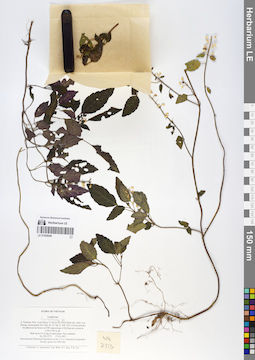
LE 01058648
Scutellaria sp. det. Averyanov, Leonid Vladimirovich at 17.03.1997
Collectors: Averyanov, Leonid Vladimirovich; N.Q. Binh; Nguyen Van Duy; Phan Ke Loc Field collecting number: VH2773. Collection date: 17.03.1997. Administrative regions: VN - Tinh Lam GJong. Groups of specimens: L. V. Averyanov specimens; L. V. Averyanov herbariumOriginal label text:FLORA OF VIETNAM
Lamiaceae S. Vietnam, Prov. Lam Dong, 31 km to NE from Dalat city, distr. Lac
Duong, municipalite Da Chay (N 12° 08′, E 108° 39′). Closed primary
broadleaved mt forest on NW macroslope of Bi Dup mt system at
1550-1700 m alt.
Herb up to 0.5 m hg in open place. Not common.
VH 2773 17.03.1997
International Botanical Expedition of the U.S.A. National Geographic
Society (grant No 5803-96)
Collectors: L. Averyanov, N.Q. Binh, N.V. Duy, P.K. Loc
Lamiaceae S. Vietnam, Prov. Lam Dong, 31 km to NE from Dalat city, distr. Lac
Duong, municipalite Da Chay (N 12° 08′, E 108° 39′). Closed primary
broadleaved mt forest on NW macroslope of Bi Dup mt system at
1550-1700 m alt.
Herb up to 0.5 m hg in open place. Not common.
VH 2773 17.03.1997
International Botanical Expedition of the U.S.A. National Geographic
Society (grant No 5803-96)
Collectors: L. Averyanov, N.Q. Binh, N.V. Duy, P.K. Loc
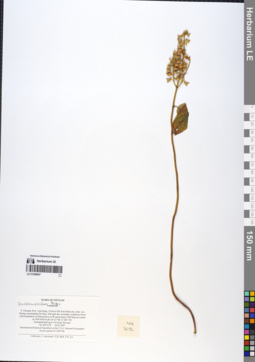
LE 01058647
Teucrium viscidum Blume det. Averyanov, Leonid Vladimirovich at 24.03.1997
Collectors: Averyanov, Leonid Vladimirovich; N.Q. Binh; Phan Ke Loc Field collecting number: VH3178. Collection date: 24.03.1997. Administrative regions: VN - Tinh Lam GJong. Groups of specimens: L. V. Averyanov specimens; L. V. Averyanov herbariumOriginal label text:FLORA OF VIETNAM
Lamiaceae
S. Vietnam, Prov. Lam Dong, 30 km to NE from Dalat city, distr. Lac
Duong, municipalite Da Chay. Old open dry secondary coniferous forest
with domination of Pinus kesiya on W macroslope of Bi Dup mt system at 1500-1600 m alt. (N 12° 08′, E 108° 39′).
Terrestrial herb up to 0.4 m hg. Not rare.
VH 3178 24.03.1997
International Botanical Expedition of the U.S.A. National Geographic
Society (grant No 5803-96)
Collectors: L. Averyanov, N.Q. Binh, P.K. Loc
Lamiaceae
S. Vietnam, Prov. Lam Dong, 30 km to NE from Dalat city, distr. Lac
Duong, municipalite Da Chay. Old open dry secondary coniferous forest
with domination of Pinus kesiya on W macroslope of Bi Dup mt system at 1500-1600 m alt. (N 12° 08′, E 108° 39′).
Terrestrial herb up to 0.4 m hg. Not rare.
VH 3178 24.03.1997
International Botanical Expedition of the U.S.A. National Geographic
Society (grant No 5803-96)
Collectors: L. Averyanov, N.Q. Binh, P.K. Loc
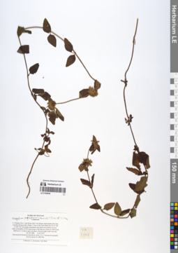
LE 01058646
Clinopodium polycephalum (Vaniot) C.Y.Wu & S.J.Hsuan det. Chen Yaping, Xiang Chunlei at 2019
Collectors: Averyanov, Leonid Vladimirovich; N.Q. Binh Field collecting number: VH3886. Collection date: 12.04.1997. Administrative regions: VN - Tinh Lam GJong. Groups of specimens: L. V. Averyanov specimens; L. V. Averyanov herbariumOriginal label text:FLORA OF VIETNAM
Lamiaceae
S. Vietnam, Prov. Lam Dong, distr. Lac Duong, municipalite Da Chay,
vicinities Klong Lanh village, 31 km to NE from Dalat city (N 12° 08′,
E 108° 39′). Secondary grasslands and shrub associations on river
valley at foothills of NW macroslope of Bi Dup mt system at 1450 m alt.
Herb up to 1 m hg in open wet place. Flowers light violet. Not rare.
VH 3886 12.04.1997
International Botanical Expedition of the U.S.A. National Geographic
Society (grant No 5803-96)
Collectors: L. Averyanov, N.Q. Binh
Lamiaceae
S. Vietnam, Prov. Lam Dong, distr. Lac Duong, municipalite Da Chay,
vicinities Klong Lanh village, 31 km to NE from Dalat city (N 12° 08′,
E 108° 39′). Secondary grasslands and shrub associations on river
valley at foothills of NW macroslope of Bi Dup mt system at 1450 m alt.
Herb up to 1 m hg in open wet place. Flowers light violet. Not rare.
VH 3886 12.04.1997
International Botanical Expedition of the U.S.A. National Geographic
Society (grant No 5803-96)
Collectors: L. Averyanov, N.Q. Binh
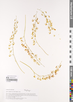
LE 01058645
Epitype of Liparis caudata Aver. & K.S.Nguyen det. Averyanov, Leonid Vladimirovich at 10.11.2017
Collectors: Averyanov, Leonid Vladimirovich Field collecting number: CPC6809.2. Collection date: 10.11.2017. Administrative regions: VN - Tinh Thanh Hoa. Groups of specimens: L. V. Averyanov specimens; L. V. Averyanov herbarium; Orchids of Vietnam, Laos and CambodiaOriginal label text:FLORA OF VIETNAM
Orchidaceae
Liparis caudata Aver. et K.S. Nguyen, sp. nov. Type
Thanh Hoa Prov., Thuong Xuan Distr., Bat Mot Municipality, Vin village, Xuan Lien Natural Reserve. Primary broad-leaved evergreen humid forest on shale at elevation 1000-1200 m a.s.l. around point 19°58’51.6’’N 104°59’38.08’’E. Epiphyte on mossy trees with pendent inflorescences to 30 cm long. Flowers light orange-brown. Rare. 5 November 2013 CPC 6809 Coll.: L.Averyanov, N.T.Hiep, N.S.Khang, N.D.Thang, L.V.Tien
Fl. in hort. 10 November 2017. Photos L. Averyanov.
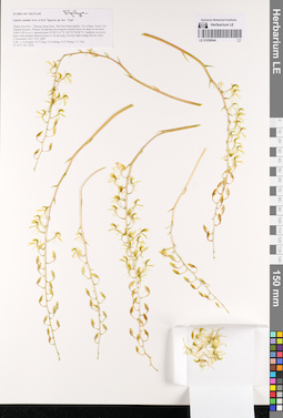
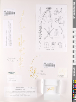
LE 01058644
Epitype of Liparis caudata Aver. & K.S.Nguyen det. Averyanov, Leonid Vladimirovich at 21.10.2016
Collectors: Averyanov, Leonid Vladimirovich Field collecting number: CPC6809. Collection date: 21.10.2016. Administrative regions: VN - Tinh Thanh Hoa. Groups of specimens: L. V. Averyanov specimens; L. V. Averyanov herbarium; Orchids of Vietnam, Laos and CambodiaOriginal label text:FLORA OF VIETNAM
Orchidaceae
Liparis caudata Aver. et K.S. Nguyen, sp. nov. Type
Thanh Hoa Prov., Thuong Xuan Distr., Bat Mot Municipality, Vin village, Xuan Lien Natural Reserve. Primary broad-leaved evergreen humid forest on shale at elevation 1000-1200 m a.s.l. around point 19°58’51.6’’N 104°59’38.08’’E. Epiphyte on mossy trees with pendent inflorescences to 30 cm long. Flowers light orange-brown. Rare. 5 November 2013 CPC 6809 Coll.: L.Averyanov, N.T.Hiep, N.S.Khang, N.D.Thang, L.V.Tien
Fl. in 21 Oct. 2016
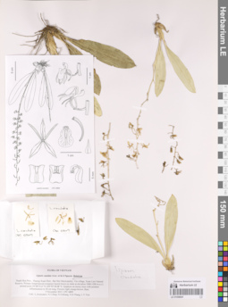
LE 01058642
Isotype of Liparis caudata Aver. & K.S.Nguyen det. Averyanov, Leonid Vladimirovich at 05.11.2013
Collectors: Averyanov, Leonid Vladimirovich; Tien Hiep Nguyen; Khang Sinh Nguyen; N.D. Thang; L.V. Tien Field collecting number: CPC6809. Collection date: 05.11.2013. Administrative regions: VN - Tinh Thanh Hoa. Groups of specimens: L. V. Averyanov specimens; L. V. Averyanov herbarium; L. V. Averyanov photos; L. V. Averyanov drawings; Orchids of Vietnam, Laos and CambodiaOriginal label text:FLORA OF VIETNAM
Record creation: 2019-08-29, Leonid Averyanov, PhotoScan D1. Processing status: work_status_1Citation: Specimen LE 01058642 // Virtual herbarium of Komarov Botanical Institute RAS — http://re.herbariumle.ru/01058642Orchidaceae
Liparis caudata Aver. et K.S. Nguyen, sp. nov. Type
Thanh Hoa Prov., Thuong Xuan Distr., Bat Mot Municipality, Vin village, Xuan Lien Natural Reserve. Primary broad-leaved evergreen humid forest on shale at elevation 1000-1200 m a.s.l. around point 19°58’51.6’’N 104°59’38.08’’E. Epiphyte on mossy trees with pendent inflorescences to 30 cm long. Flowers light orange-brown. Rare. 5 November 2013 CPC 6809 Coll.: L.Averyanov, N.T.Hiep, N.S.Khang, N.D.Thang, L.V.Tien
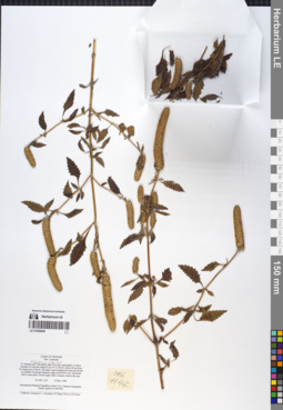
LE 01058641
Holotype of Liparis caudata Aver. & K.S.Nguyen det. Averyanov, Leonid Vladimirovich at 05.11.2013
Collectors: Averyanov, Leonid Vladimirovich; Tien Hiep Nguyen; Khang Sinh Nguyen; N.D. Thang; L.V. Tien Field collecting number: CPC6809. Collection date: 05.11.2013. Administrative regions: VN - Tinh Thanh Hoa. Groups of specimens: L. V. Averyanov specimens; L. V. Averyanov herbarium; L. V. Averyanov photos; L. V. Averyanov drawings; Orchids of Vietnam, Laos and CambodiaOriginal label text:FLORA OF VIETNAM
Record creation: 2019-08-29, Leonid Averyanov, PhotoScan D1. Processing status: work_status_1Citation: Specimen LE 01058641 // Virtual herbarium of Komarov Botanical Institute RAS — http://re.herbariumle.ru/01058641Orchidaceae
Liparis caudata Aver. et K.S. Nguyen, sp. nov. Type
Thanh Hoa Prov., Thuong Xuan Distr., Bat Mot Municipality, Vin village, Xuan Lien Natural Reserve. Primary broad-leaved evergreen humid forest on shale at elevation 1000-1200 m a.s.l. around point 19°58’51.6’’N 104°59’38.08’’E. Epiphyte on mossy trees with pendent inflorescences to 30 cm long. Flowers light orange-brown. Rare. 5 November 2013 CPC 6809 Coll.: L.Averyanov, N.T.Hiep, N.S.Khang, N.D.Thang, L.V.Tien
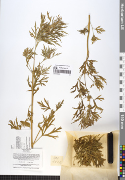
LE 01058640
Elsholtzia cypriani (Pavol.) C.Y. Wu & S. Chow det. Averyanov, Leonid Vladimirovich at 12.12.1998
Collectors: Averyanov, Leonid Vladimirovich; N.Q. Binh; Tien Hiep Nguyen; Phan Ke Loc; Nguyen Xuan Tam Field collecting number: CBL1147. Collection date: 12.12.1998. Administrative regions: VN - Tinh Cao Bang. Groups of specimens: L. V. Averyanov specimens; L. V. Averyanov herbariumOriginal label text:FLORA OF VIETNAM
Lamiaceae
N. Vietnam, prov. Cao Bang, distr. Tra Linh, municipality Co Muoi,
vicinities of Lung Dat village (N 22°51′ E 106°14′), about 22 km from
Cao Bang town to the N. Secondary open broadleaved forest and shrubs
on foothills of remnant limestone ridge at 600-650 m alt. Terrestrial
herb in open place. Flowers light violet. Common weed in the area.
CBL 1147 12 Dec. 1998
International Botanical Expedition of the U.S.A. National Geographic
Society (grant No 6300-98)
Collectors: Averyanov L., N.Q.Binh, N.T.Hiep, P.K.Loc, N.X.Tam.
Lamiaceae
N. Vietnam, prov. Cao Bang, distr. Tra Linh, municipality Co Muoi,
vicinities of Lung Dat village (N 22°51′ E 106°14′), about 22 km from
Cao Bang town to the N. Secondary open broadleaved forest and shrubs
on foothills of remnant limestone ridge at 600-650 m alt. Terrestrial
herb in open place. Flowers light violet. Common weed in the area.
CBL 1147 12 Dec. 1998
International Botanical Expedition of the U.S.A. National Geographic
Society (grant No 6300-98)
Collectors: Averyanov L., N.Q.Binh, N.T.Hiep, P.K.Loc, N.X.Tam.
LE 01058639
Leonurus sibiricus L. det. Averyanov, Leonid Vladimirovich at 13.12.1998
Collectors: Averyanov, Leonid Vladimirovich; N.Q. Binh; Tien Hiep Nguyen; Phan Ke Loc; Nguyen Xuan Tam Field collecting number: CBL1172. Collection date: 13.12.1998. Administrative regions: VN - Tinh Cao Bang. Groups of specimens: L. V. Averyanov specimens; L. V. Averyanov herbariumOriginal label text:FLORA OF VIETNAM
Lamiaceae
Leonurus sibiricus
N. Vietnam, prov. Cao Bang, distr. Tra Linh, municipality Luu Ngoc,
vicinities of Lung Mu village (N 22°47′ E 106°18′), about 14 km from
Cao Bang town to the N. Secondary shrubs and grasslands on alluvial
valley between remnant limestone ridges and mesas at 600-650 m alt.
Terrestrial herb up to 1 m hg in open wet place between limestone
rocks. Flowers light violet. Not common.
CBL 1172 13 Dec. 1998
International Botanical Expedition of the U.S.A. National Geographic
Society (grant No 6300-98)
Collectors: Averyanov L., N.Q.Binh, N.T.Hiep, P.K.Loc, N.X.Tam.
Lamiaceae
Leonurus sibiricus
N. Vietnam, prov. Cao Bang, distr. Tra Linh, municipality Luu Ngoc,
vicinities of Lung Mu village (N 22°47′ E 106°18′), about 14 km from
Cao Bang town to the N. Secondary shrubs and grasslands on alluvial
valley between remnant limestone ridges and mesas at 600-650 m alt.
Terrestrial herb up to 1 m hg in open wet place between limestone
rocks. Flowers light violet. Not common.
CBL 1172 13 Dec. 1998
International Botanical Expedition of the U.S.A. National Geographic
Society (grant No 6300-98)
Collectors: Averyanov L., N.Q.Binh, N.T.Hiep, P.K.Loc, N.X.Tam.
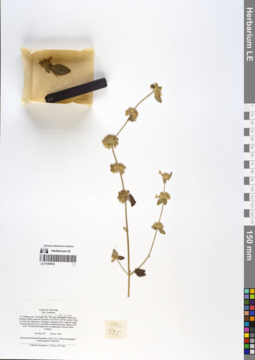
LE 01058638
Leucas mollissima Wall. det. Averyanov, Leonid Vladimirovich at 24.11.1998
Collectors: Averyanov, Leonid Vladimirovich; Phan Ke Loc; Nguyen Xuan Tam Field collecting number: CBL595. Collection date: 24.11.1998. Administrative regions: VN - Tinh Cao Bang. Groups of specimens: L. V. Averyanov specimens; L. V. Averyanov herbariumOriginal label text:FLORA OF VIETNAM
Lamiaceae
N. Vietnam, prov. Cao Bang, distr. Ha Lang, municipality Dong Loan,
vicinities of Ban Lung and Lung Phuc (N 22°46′ E 106°44′), about 50 km
to E from Cao Bang town. Secondary evergreen forest on alluvial walley
among limestone rocks on foothills of remnant limestone ridges at 400
m alt. Terrestrial and epilite herb on steep slopes. Flowers white.
Common.
CBL 595 24 Nov. 1998
International Botanical Expedition of the U.S.A. National Geographic
Society (grant No 6300-98)
Collectors: Averyanov L., P.K.Loc, N.X.Tam.
Lamiaceae
N. Vietnam, prov. Cao Bang, distr. Ha Lang, municipality Dong Loan,
vicinities of Ban Lung and Lung Phuc (N 22°46′ E 106°44′), about 50 km
to E from Cao Bang town. Secondary evergreen forest on alluvial walley
among limestone rocks on foothills of remnant limestone ridges at 400
m alt. Terrestrial and epilite herb on steep slopes. Flowers white.
Common.
CBL 595 24 Nov. 1998
International Botanical Expedition of the U.S.A. National Geographic
Society (grant No 6300-98)
Collectors: Averyanov L., P.K.Loc, N.X.Tam.
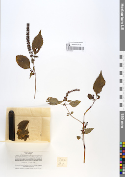
LE 01058637
Pogostemon sp. det. Averyanov, Leonid Vladimirovich at 12.11.1998
Collectors: Averyanov, Leonid Vladimirovich; N.Q. Binh; Tien Hiep Nguyen; Phan Ke Loc; Nguyen Xuan Tam Field collecting number: CBL193. Collection date: 12.11.1998. Administrative regions: VN - Tinh Cao Bang. Groups of specimens: L. V. Averyanov specimens; L. V. Averyanov herbariumOriginal label text:FLORA OF VIETNAM
Lamiaceae
N. Vietnam, prov. Cao Bang, distr. Nguyen Binh, municipality Nguyen
Binh (N 22°37′ E 105°52′), about 41 km to W from Cao Bang town.
Elevation from Le A pass to Na Ni mt. peak at 1400-1900 m alt. Old
secondary closed evegreen wet mountain forest on soils developed on
granite and shale rocks. Herb up to 50 cm hg in open place. Not rare.
CBL 193 11-12 Nov. 1998
International Botanical Expedition of the U.S.A. National Geographic
Society (grant No 6300-98)
Collectors: Averyanov L., N.Q.Binh, N.T.Hiep, P.K.Loc, N.X.Tam.
Lamiaceae
N. Vietnam, prov. Cao Bang, distr. Nguyen Binh, municipality Nguyen
Binh (N 22°37′ E 105°52′), about 41 km to W from Cao Bang town.
Elevation from Le A pass to Na Ni mt. peak at 1400-1900 m alt. Old
secondary closed evegreen wet mountain forest on soils developed on
granite and shale rocks. Herb up to 50 cm hg in open place. Not rare.
CBL 193 11-12 Nov. 1998
International Botanical Expedition of the U.S.A. National Geographic
Society (grant No 6300-98)
Collectors: Averyanov L., N.Q.Binh, N.T.Hiep, P.K.Loc, N.X.Tam.
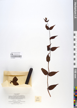
LE 01058636
Scutellaria caudifolia Y.Z.Sun det. Averyanov, Leonid Vladimirovich at 03.05.1999
Collectors: Phan Ke Loc; P.H. Hoang; Averyanov, Leonid Vladimirovich Field collecting number: CBL2141. Collection date: 03.05.1999. Administrative regions: VN - Tinh Ha Giang. Groups of specimens: L. V. Averyanov specimens; L. V. Averyanov herbariumOriginal label text:FLORA OF VIETNAM
Lamiaceae ?
N. Vietnam, prov. Ha Giang, distr. Yen Minh, municipality Du Gia, E
slopes of Phu Tha Ca mountain system at 1700 m elev. (N 23°56′ E
105°13′). Primary evergreen broadleaved very wet mountain forest on
quartzite very steep slopes. Lithophyte herb with pendant shoots up to
1 m lg on open wet mossy quartzite cliffs. Not rare.
CBL 2141 03 May 1999
International Botanical Expedition of the U.S.A. National Geographic
Society (grant No 6300-98)
Collectors: P.K.Loc, P.H.Hoang, Averyanov L.
Lamiaceae ?
N. Vietnam, prov. Ha Giang, distr. Yen Minh, municipality Du Gia, E
slopes of Phu Tha Ca mountain system at 1700 m elev. (N 23°56′ E
105°13′). Primary evergreen broadleaved very wet mountain forest on
quartzite very steep slopes. Lithophyte herb with pendant shoots up to
1 m lg on open wet mossy quartzite cliffs. Not rare.
CBL 2141 03 May 1999
International Botanical Expedition of the U.S.A. National Geographic
Society (grant No 6300-98)
Collectors: P.K.Loc, P.H.Hoang, Averyanov L.
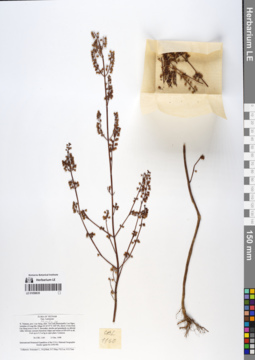
LE 01058635
Mosla sp. det. Averyanov, Leonid Vladimirovich at 13.12.1998
Collectors: Averyanov, Leonid Vladimirovich; N.Q. Binh; Tien Hiep Nguyen; Phan Ke Loc; Nguyen Xuan Tam Field collecting number: CBL1160. Collection date: 13.12.1998. Administrative regions: VN - Tinh Cao Bang. Groups of specimens: L. V. Averyanov specimens; L. V. Averyanov herbariumOriginal label text:FLORA OF VIETNAM
Lamiaceae
N. Vietnam, prov. Cao Bang, distr. Tra Linh, municipality Luu Ngoc,
vicinities of Lung Mu village (N 22°47′ E 106°18′), about 14 km from
Cao Bang town to the N. Secondary shrubs and grasslands on alluvial
valley between remnant limestone ridges and mesas at 600-650 m alt.
Herb up to 0.5 m hg in open place. Common.
CBL 1160 13 Dec. 1998
International Botanical Expedition of the U.S.A. National Geographic
Society (grant No 6300-98)
Collectors: Averyanov L., N.Q.Binh, N.T.Hiep, P.K.Loc, N.X.Tam.
Lamiaceae
N. Vietnam, prov. Cao Bang, distr. Tra Linh, municipality Luu Ngoc,
vicinities of Lung Mu village (N 22°47′ E 106°18′), about 14 km from
Cao Bang town to the N. Secondary shrubs and grasslands on alluvial
valley between remnant limestone ridges and mesas at 600-650 m alt.
Herb up to 0.5 m hg in open place. Common.
CBL 1160 13 Dec. 1998
International Botanical Expedition of the U.S.A. National Geographic
Society (grant No 6300-98)
Collectors: Averyanov L., N.Q.Binh, N.T.Hiep, P.K.Loc, N.X.Tam.
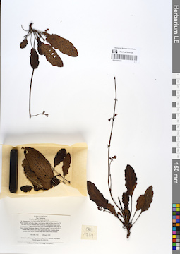
LE 01058634
Salvia sonchifolia C.Y.Wu det. Averyanov, Leonid Vladimirovich at 28.04.1999
Collectors: Phan Ke Loc; P.H. Hoang; Averyanov, Leonid Vladimirovich Field collecting number: CBL1764. Collection date: 28.04.1999. Administrative regions: VN - Tinh Ha Giang. Groups of specimens: L. V. Averyanov specimens; L. V. Averyanov herbariumOriginal label text:FLORA OF VIETNAM
Lamiaceae
N. Vietnam, prov. Ha Giang, distr. Dong Van, municipality Ho Quang
Phin, vicinities of Ta Xa village, 14-16 km to SSW of Dong Van town (N
23°16′ E 105°22′). Primary very wet mossy cloud mixed forest (with
domination of Tsuga chinensis and Pinus kwangtungensis) along tops of
karst remnant limestone ridge at 1550-1600 m elev. Lithophyte herb on
vertical cliffs. Leaves above deep green with white venation, deep
purple-violet below. Flowers deep blue-violet. Very common.
CBL 1764 28 April 1999
International Botanical Expedition of the U.S.A. National Geographic
Society (grant No 6300-98)
Collectors: P.K.Loc, P.H.Hoang, Averyanov L.
Lamiaceae
N. Vietnam, prov. Ha Giang, distr. Dong Van, municipality Ho Quang
Phin, vicinities of Ta Xa village, 14-16 km to SSW of Dong Van town (N
23°16′ E 105°22′). Primary very wet mossy cloud mixed forest (with
domination of Tsuga chinensis and Pinus kwangtungensis) along tops of
karst remnant limestone ridge at 1550-1600 m elev. Lithophyte herb on
vertical cliffs. Leaves above deep green with white venation, deep
purple-violet below. Flowers deep blue-violet. Very common.
CBL 1764 28 April 1999
International Botanical Expedition of the U.S.A. National Geographic
Society (grant No 6300-98)
Collectors: P.K.Loc, P.H.Hoang, Averyanov L.
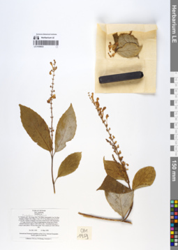
LE 01058633
Scutellaria sichourensis C.Y.Wu & H.W.Li det. Averyanov, Leonid Vladimirovich at 01.05.1999
Collectors: Phan Ke Loc; P.H. Hoang; Averyanov, Leonid Vladimirovich Field collecting number: CBL1959. Collection date: 01.05.1999. Administrative regions: VN - Tinh Ha Giang. Groups of specimens: L. V. Averyanov specimens; L. V. Averyanov herbariumOriginal label text:FLORA OF VIETNAM
Lamiaceae
Scutellaria sp. ?
N. Vietnam, prov. Ha Giang, distr. Yen Minh, municipality Lao Va Chai,
vicinities of Ngan Chai village, 6 km to W of Yen Minh town (N 23°07′
E 105°08′). Primary evergreen wet mossy mixed forest (with domination
of Tsuga chinensis and Pinus kwangtungensis) along tops of karst
remnant limestone ridge at 1500-1600 m elev. Terrestrial herb up to 1
m hg in open places. Flowers blue-violet. Very common at 1450-1500 m
elev.
CBL 1959 01 May 1999
International Botanical Expedition of the U.S.A. National Geographic
Society (grant No 6300-98)
Collectors: P.K.Loc, P.H.Hoang, Averyanov L.
Lamiaceae
Scutellaria sp. ?
N. Vietnam, prov. Ha Giang, distr. Yen Minh, municipality Lao Va Chai,
vicinities of Ngan Chai village, 6 km to W of Yen Minh town (N 23°07′
E 105°08′). Primary evergreen wet mossy mixed forest (with domination
of Tsuga chinensis and Pinus kwangtungensis) along tops of karst
remnant limestone ridge at 1500-1600 m elev. Terrestrial herb up to 1
m hg in open places. Flowers blue-violet. Very common at 1450-1500 m
elev.
CBL 1959 01 May 1999
International Botanical Expedition of the U.S.A. National Geographic
Society (grant No 6300-98)
Collectors: P.K.Loc, P.H.Hoang, Averyanov L.
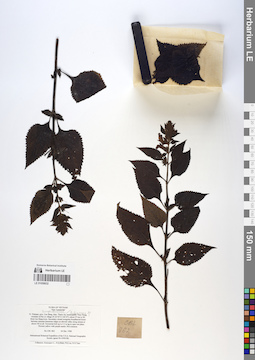
LE 01058632
Adenosma sp. det. Averyanov, Leonid Vladimirovich at 04.12.1998
Collectors: Averyanov, Leonid Vladimirovich; N.Q. Binh; Phan Ke Loc; Nguyen Xuan Tam Field collecting number: CBL862. Collection date: 04.12.1998. Administrative regions: VN - Tinh Cao Bang. Groups of specimens: L. V. Averyanov specimens; L. V. Averyanov herbariumOriginal label text:FLORA OF VIETNAM
Lamiaceae
N. Vietnam, prov. Cao Bang, distr. Thach An, municipality Thuy Hung,
vicinities of Na Lit village (N 22°30′ E 106°27′), about 27 km to SE
from Cao Bang town. Secondary closed evergreen broadleaved forest
between remnant limestone ridges on alluvial valley along stream at
about 100 m alt. Terrestrial herb up to 0.5 m hg in open wet place.
Flowers yellow with purple marks. Not common.
CBL 862 04 Dec. 1998
International Botanical Expedition of the U.S.A. National Geographic
Society (grant No 6300-98)
Collectors: Averyanov L., N.Q.Binh, P.K.Loc, N.X.Tam.
Lamiaceae
N. Vietnam, prov. Cao Bang, distr. Thach An, municipality Thuy Hung,
vicinities of Na Lit village (N 22°30′ E 106°27′), about 27 km to SE
from Cao Bang town. Secondary closed evergreen broadleaved forest
between remnant limestone ridges on alluvial valley along stream at
about 100 m alt. Terrestrial herb up to 0.5 m hg in open wet place.
Flowers yellow with purple marks. Not common.
CBL 862 04 Dec. 1998
International Botanical Expedition of the U.S.A. National Geographic
Society (grant No 6300-98)
Collectors: Averyanov L., N.Q.Binh, P.K.Loc, N.X.Tam.
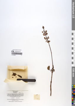
LE 01058631
Coleus sp. det. Averyanov, Leonid Vladimirovich at 04.12.1998
Additional identifications: Plectranthus sp. det. Averyanov, Leonid Vladimirovich at 04.12.1998 Collectors: Averyanov, Leonid Vladimirovich; N.Q. Binh; Phan Ke Loc; Nguyen Xuan Tam Field collecting number: CBL906. Collection date: 04.12.1998. Administrative regions: VN - Tinh Cao Bang. Groups of specimens: L. V. Averyanov specimens; L. V. Averyanov herbariumOriginal label text:FLORA OF VIETNAM
Lamiaceae
Plectranthus sp. ?
N. Vietnam, prov. Cao Bang, distr. Thach An, municipality Thuy Hung,
vicinities of Na Lit village (N 22°30′ E 106°27′), about 27 km to SE
from Cao Bang town. Secondary senideciduous open forest and shrubs
along tops of remnant limestone ridge at 500-550 m alt. Epilite herb
up to 0.6 m hg on open rocks. Very common.
CBL 906 04 Dec. 1998
International Botanical Expedition of the U.S.A. National Geographic
Society (grant No 6300-98)
Collectors: Averyanov L., N.Q.Binh, P.K.Loc, N.X.Tam.
Lamiaceae
Plectranthus sp. ?
N. Vietnam, prov. Cao Bang, distr. Thach An, municipality Thuy Hung,
vicinities of Na Lit village (N 22°30′ E 106°27′), about 27 km to SE
from Cao Bang town. Secondary senideciduous open forest and shrubs
along tops of remnant limestone ridge at 500-550 m alt. Epilite herb
up to 0.6 m hg on open rocks. Very common.
CBL 906 04 Dec. 1998
International Botanical Expedition of the U.S.A. National Geographic
Society (grant No 6300-98)
Collectors: Averyanov L., N.Q.Binh, P.K.Loc, N.X.Tam.
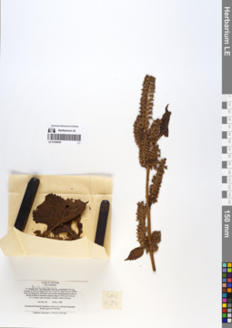
LE 01058630
Perilla frutescens (L.) Britton det. Averyanov, Leonid Vladimirovich at 18.11.1998
Collectors: Averyanov, Leonid Vladimirovich; Phan Ke Loc; Nguyen Xuan Tam Field collecting number: CBL433. Collection date: 18.11.1998. Administrative regions: VN - Tinh Cao Bang. Groups of specimens: L. V. Averyanov specimens; L. V. Averyanov herbariumOriginal label text:FLORA OF VIETNAM
Lamiaceae
N. Vietnam, prov. Cao Bang, distr. Bao Lac, municipality Yen Lac,
vicinities of Yen Lac village (N 22°44′ E 105°50′), about 44 km to NWW
from Cao Bang town. Secondary open shrubs among limestone rocks on
alluvial foothills of limestone remnant ridge at 1100 m alt. Herb up
to 1.2 m hg in open wet place. Common weed in the area.
CBL 433 18 Nov. 1998
International Botanical Expedition of the U.S.A. National Geographic
Society (grant No 6300-98)
Collectors: Averyanov L., P.K.Loc, N.X.Tam.
Lamiaceae
N. Vietnam, prov. Cao Bang, distr. Bao Lac, municipality Yen Lac,
vicinities of Yen Lac village (N 22°44′ E 105°50′), about 44 km to NWW
from Cao Bang town. Secondary open shrubs among limestone rocks on
alluvial foothills of limestone remnant ridge at 1100 m alt. Herb up
to 1.2 m hg in open wet place. Common weed in the area.
CBL 433 18 Nov. 1998
International Botanical Expedition of the U.S.A. National Geographic
Society (grant No 6300-98)
Collectors: Averyanov L., P.K.Loc, N.X.Tam.
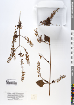
LE 01058629
Isodon coetsa (D.Don) Kudo det. Averyanov, Leonid Vladimirovich at 12.11.1998
Collectors: Averyanov, Leonid Vladimirovich; N.Q. Binh; Tien Hiep Nguyen; Phan Ke Loc; Nguyen Xuan Tam Field collecting number: CBL043. Collection date: 12.11.1998. Administrative regions: VN - Tinh Cao Bang. Groups of specimens: L. V. Averyanov specimens; L. V. Averyanov herbariumOriginal label text:FLORA OF VIETNAM
Lamiaceae
N. Vietnam, prov. Cao Bang, distr. Nguyen Binh, municipality Nguyen
Binh (N 22°37′ E 105°52′), about 41 km to W from Cao Bang town.
Elevation from Le A pass to Na Ni mt. peak at 1400-1900 m alt. Old
secondary closed evegreen wet mountain forest on soils developed on
granite and shale rocks. Herb up to 1 m hg in wet open place. Common.
CBL 043 11-12 Nov. 1998
International Botanical Expedition of the U.S.A. National Geographic
Society (grant No 6300-98)
Collectors: Averyanov L., N.Q.Binh, N.T.Hiep, P.K.Loc, N.X.Tam.
Lamiaceae
N. Vietnam, prov. Cao Bang, distr. Nguyen Binh, municipality Nguyen
Binh (N 22°37′ E 105°52′), about 41 km to W from Cao Bang town.
Elevation from Le A pass to Na Ni mt. peak at 1400-1900 m alt. Old
secondary closed evegreen wet mountain forest on soils developed on
granite and shale rocks. Herb up to 1 m hg in wet open place. Common.
CBL 043 11-12 Nov. 1998
International Botanical Expedition of the U.S.A. National Geographic
Society (grant No 6300-98)
Collectors: Averyanov L., N.Q.Binh, N.T.Hiep, P.K.Loc, N.X.Tam.
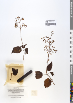
LE 01058628
Coleus sp. det. Averyanov, Leonid Vladimirovich at 25.11.1998
Collectors: Averyanov, Leonid Vladimirovich; Phan Ke Loc; Nguyen Xuan Tam Field collecting number: CBL652. Collection date: 25.11.1998. Administrative regions: VN - Tinh Cao Bang. Groups of specimens: L. V. Averyanov specimens; L. V. Averyanov herbariumOriginal label text:FLORA OF VIETNAM
Lamiaceae
N. Vietnam, prov. Cao Bang, distr. Ha Lang, municipality Dong Loan,
vicinities of Ban Lung and Lung Phuc (N 22°46′ E 106°44′), about 50 km
to E from Cao Bang town. Open primary evergreen broadleaved closed
forest on steep slopes and cliffs of limestone ridge at 500-600 m alt.
Herb or shrublet up to 1.5 m hg on open wet rocks. Flowers blue-violet
with whitish tepal tips. Not common.
CBL 652 25 Nov. 1998
International Botanical Expedition of the U.S.A. National Geographic
Society (grant No 6300-98)
Collectors: Averyanov L., P.K.Loc, N.X.Tam.
Lamiaceae
N. Vietnam, prov. Cao Bang, distr. Ha Lang, municipality Dong Loan,
vicinities of Ban Lung and Lung Phuc (N 22°46′ E 106°44′), about 50 km
to E from Cao Bang town. Open primary evergreen broadleaved closed
forest on steep slopes and cliffs of limestone ridge at 500-600 m alt.
Herb or shrublet up to 1.5 m hg on open wet rocks. Flowers blue-violet
with whitish tepal tips. Not common.
CBL 652 25 Nov. 1998
International Botanical Expedition of the U.S.A. National Geographic
Society (grant No 6300-98)
Collectors: Averyanov L., P.K.Loc, N.X.Tam.
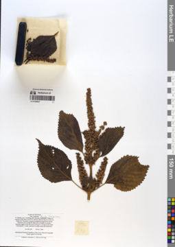
LE 01058627
Perilla frutescens (L.) Britton det. Averyanov, Leonid Vladimirovich at 26.11.1998
Collectors: Averyanov, Leonid Vladimirovich; Phan Ke Loc; Nguyen Xuan Tam Field collecting number: CBL696. Collection date: 26.11.1998. Administrative regions: VN - Tinh Cao Bang. Groups of specimens: L. V. Averyanov specimens; L. V. Averyanov herbariumOriginal label text:FLORA OF VIETNAM
Lamiaceae
N. Vietnam, prov. Cao Bang, distr. Ha Lang, municipality Thang Loi,
vicinities of Ban Hao (N 22°43′ E 106°40′), about 43 km to E from Cao
Bang town. Secondary evergreen broadleaved closed forest among
limestone rocks on alluvial valley and on foothills of remnant
limestone ridges at 300-400 m alt. Herb up to 1.5 m hg in open place
(naturalized?). Locally cultivated for edible seeds (like Sesamum).
CBL 696 26 Nov. 1998
International Botanical Expedition of the U.S.A. National Geographic
Society (grant No 6300-98)
Collectors: Averyanov L., P.K.Loc, N.X.Tam.
Lamiaceae
N. Vietnam, prov. Cao Bang, distr. Ha Lang, municipality Thang Loi,
vicinities of Ban Hao (N 22°43′ E 106°40′), about 43 km to E from Cao
Bang town. Secondary evergreen broadleaved closed forest among
limestone rocks on alluvial valley and on foothills of remnant
limestone ridges at 300-400 m alt. Herb up to 1.5 m hg in open place
(naturalized?). Locally cultivated for edible seeds (like Sesamum).
CBL 696 26 Nov. 1998
International Botanical Expedition of the U.S.A. National Geographic
Society (grant No 6300-98)
Collectors: Averyanov L., P.K.Loc, N.X.Tam.
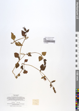
LE 01058626
Elsholtzia kachinensis Prain det. Averyanov, Leonid Vladimirovich at 18.11.1998
Collectors: Averyanov, Leonid Vladimirovich; Phan Ke Loc; Nguyen Xuan Tam Field collecting number: CBL430. Collection date: 18.11.1998. Administrative regions: VN - Tinh Cao Bang. Groups of specimens: L. V. Averyanov specimens; L. V. Averyanov herbariumOriginal label text:FLORA OF VIETNAM
Lamiaceae
N. Vietnam, prov. Cao Bang, distr. Bao Lac, municipality Yen Lac,
vicinities of Yen Lac village (N 22°44′ E 105°50′), about 44 km to NWW
from Cao Bang town. Secondary open shrubs among limestone rocks on
alluvial foothills of limestone remnant ridge at 1100 m alt.
Prostrate herb in open wet places. Flowers violet. Common weed in the
area.
CBL 430 18 Nov. 1998
International Botanical Expedition of the U.S.A. National Geographic
Society (grant No 6300-98)
Collectors: Averyanov L., P.K.Loc, N.X.Tam.
Lamiaceae
N. Vietnam, prov. Cao Bang, distr. Bao Lac, municipality Yen Lac,
vicinities of Yen Lac village (N 22°44′ E 105°50′), about 44 km to NWW
from Cao Bang town. Secondary open shrubs among limestone rocks on
alluvial foothills of limestone remnant ridge at 1100 m alt.
Prostrate herb in open wet places. Flowers violet. Common weed in the
area.
CBL 430 18 Nov. 1998
International Botanical Expedition of the U.S.A. National Geographic
Society (grant No 6300-98)
Collectors: Averyanov L., P.K.Loc, N.X.Tam.
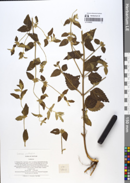
LE 01058625
Leucas mollissima Wall. det. Averyanov, Leonid Vladimirovich at 13.04.1997
Collectors: Averyanov, Leonid Vladimirovich; N.Q. Binh Field collecting number: VH3908. Collection date: 13.04.1997. Administrative regions: VN - Tinh Lam GJong. Groups of specimens: L. V. Averyanov specimens; L. V. Averyanov herbariumOriginal label text:FLORA OF VIETNAM
Lamiaceae
S. Vietnam, Prov. Lam Dong, distr. Lac Duong, municipalite Da Chay,
vicinities Klong Lanh village, 31 km to NE from Dalat city (N 12° 08′,
E 108° 39′). Secondary grasslands and shrub associations on river
valley at foothills of W macroslope of Bi Dup mt system at 1450-1500 m alt.
Herb up to 0.5 m hg in open wet place. Flowers white. Common. Common weed.
VH 3908 13.04.1997
International Botanical Expedition of the U.S.A. National Geographic
Society (grant No 5803-96)
Collectors: L. Averyanov, N.Q. Binh
Lamiaceae
S. Vietnam, Prov. Lam Dong, distr. Lac Duong, municipalite Da Chay,
vicinities Klong Lanh village, 31 km to NE from Dalat city (N 12° 08′,
E 108° 39′). Secondary grasslands and shrub associations on river
valley at foothills of W macroslope of Bi Dup mt system at 1450-1500 m alt.
Herb up to 0.5 m hg in open wet place. Flowers white. Common. Common weed.
VH 3908 13.04.1997
International Botanical Expedition of the U.S.A. National Geographic
Society (grant No 5803-96)
Collectors: L. Averyanov, N.Q. Binh