View
Add
Copy
Edit
Delete
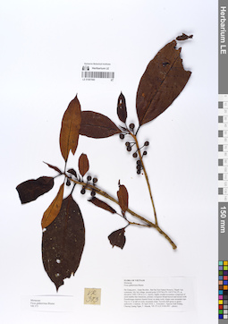
LE 01067060
Ficus glaberrima Blume det. Tien Hiep Nguyen at 10.12.2019
Collectors: Averyanov, Leonid Vladimirovich; Khang Sinh Nguyen; Maisak, Tatiana Viktorovna; Chuong, Quang Ngan Field collecting number: VR373. Collection date: 18.04.2018. Administrative regions: VN - Tinh Ha Giang. Groups of specimens: L. V. Averyanov specimens; L. V. Averyanov herbariumOriginal label text:FLORA OF VIETNAM Moraceae Ficus glaberrima Blume Ha Giang prov., Quan Ba distr., Bat Dai Son Nature Reserve, Thanh Van commune, Mo Sai village, around point 23º07ʹ46.4ʺN 104º57ʹ56.2ʺE, at elevation 1000-1190 m a.s.l., karstic, highly eroded mountains composed of solid marble-like limestone, primary evergreen broad-leaved and mixed (with Pseudotsuga sinensis) humid forest on steep rocky slopes near mountain tops. Tree to 15 m tall on rocky mountain slope. Syconia dull green to green-yellowish. Common. 18 April 2018, L. Averyanov, Nguyen Sinh Khang, Chuong Quang Ngan, T. Maisak, VR 373 (HN, LE01061491 – photo).
Coordinates (geographic position): 23° 7′ 46.4″ N, 104° 57′ 56.2″ E ±1000 mComment: All photos © L. Averyanov & K.S. Nguyen
Record creation: 2020-01-05, Leonid Averyanov, PhotoScan D1Citation: Specimen LE 01067060 // Virtual herbarium of Komarov Botanical Institute RAS — http://re.herbariumle.ru/01067060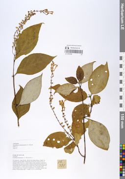
LE 01067059
Scutellaria sichourensis C.Y.Wu & H.W.Li det. Averyanov, Leonid Vladimirovich at 10.12.2019
Collectors: Averyanov, Leonid Vladimirovich; Khang Sinh Nguyen; Maisak, Tatiana Viktorovna; Chuong, Quang Ngan Field collecting number: VR371. Collection date: 18.04.2018. Administrative regions: VN - Tinh Ha Giang. Groups of specimens: L. V. Averyanov specimens; L. V. Averyanov herbariumOriginal label text:FLORA OF VIETNAM Lamiaceae Scutellaria sichourensis C.Y. Wu & H.W. Li Ha Giang prov., Quan Ba distr., Bat Dai Son Nature Reserve, Thanh Van commune, Mo Sai village, around point 23º07ʹ46.4ʺN 104º57ʹ56.2ʺE, at elevation 1000-1190 m a.s.l., karstic, highly eroded mountains composed of solid marble-like limestone, primary evergreen broad-leaved and mixed (with Pseudotsuga sinensis) humid forest on steep rocky slopes near mountain tops. Terrestrial herb to 1 m tall in open wet place on rocky mountain slope. Flowers purple-violet. Common. 18 April 2018, L. Averyanov, Nguyen Sinh Khang, Chuong Quang Ngan, T. Maisak, VR 371 (HN, LE01061489).
Coordinates (geographic position): 23° 7′ 46.4″ N, 104° 57′ 56.2″ E ±1000 mComment: All photos © L. Averyanov & K.S. Nguyen
Record creation: 2020-01-05, Leonid Averyanov, PhotoScan D1Citation: Specimen LE 01067059 // Virtual herbarium of Komarov Botanical Institute RAS — http://re.herbariumle.ru/01067059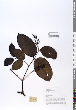
LE 01067058
Gnetum latifolium Blume det. Averyanov, Leonid Vladimirovich at 10.12.2019
Collectors: Averyanov, Leonid Vladimirovich; Khang Sinh Nguyen; Maisak, Tatiana Viktorovna; Chuong, Quang Ngan Field collecting number: VR368. Collection date: 18.04.2018. Administrative regions: VN - Tinh Ha Giang. Groups of specimens: L. V. Averyanov specimens; L. V. Averyanov herbariumOriginal label text:FLORA OF VIETNAM Gnetaceae Gnetum latifolium Blume Ha Giang prov., Quan Ba distr., Bat Dai Son Nature Reserve, Thanh Van commune, Mo Sai village, around point 23º07ʹ46.4ʺN 104º57ʹ56.2ʺE, at elevation 1000-1190 m a.s.l., karstic, highly eroded mountains composed of solid marble-like limestone, primary evergreen broad-leaved and mixed (with Pseudotsuga sinensis) humid forest on steep rocky slopes near mountain tops. Woody vine to 20 m long on rocky mountain slope. Not common. 18 April 2018, L. Averyanov, Nguyen Sinh Khang, Chuong Quang Ngan, T. Maisak, VR 368 (HN, LE01061486 – photo).
Coordinates (geographic position): 23° 7′ 46.4″ N, 104° 57′ 56.2″ E ±1000 mComment: All photos © L. Averyanov & K.S. Nguyen
Record creation: 2020-01-05, Leonid Averyanov, PhotoScan D1Citation: Specimen LE 01067058 // Virtual herbarium of Komarov Botanical Institute RAS — http://re.herbariumle.ru/01067058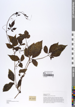
LE 01067057
Gynostemma pentaphyllum (Thunb.) Makino det. Averyanov, Leonid Vladimirovich at 10.12.2019
Collectors: Averyanov, Leonid Vladimirovich; Khang Sinh Nguyen; Maisak, Tatiana Viktorovna; Chuong, Quang Ngan Field collecting number: VR363. Collection date: 18.04.2018. Administrative regions: VN - Tinh Ha Giang. Groups of specimens: L. V. Averyanov specimens; L. V. Averyanov herbariumOriginal label text:FLORA OF VIETNAM Cucurbitaceae Gynostemma pentaphyllum (Thunb.) Makino Ha Giang prov., Quan Ba distr., Bat Dai Son Nature Reserve, Thanh Van commune, Mo Sai village, around point 23º07ʹ46.4ʺN 104º57ʹ56.2ʺE, at elevation 1000-1190 m a.s.l., karstic, highly eroded mountains composed of solid marble-like limestone, primary evergreen broad-leaved and mixed (with Pseudotsuga sinensis) humid forest on steep rocky slopes near mountain tops. Herbaceous vine 2-3 m long in open wet place of rocky mountain slope. Common. 18 April 2018, L. Averyanov, Nguyen Sinh Khang, Chuong Quang Ngan, T. Maisak, VR 363 (HN, LE01061481).
Coordinates (geographic position): 23° 7′ 46.4″ N, 104° 57′ 56.2″ E ±1000 mComment: All photos © L. Averyanov & K.S. Nguyen
Record creation: 2020-01-05, Leonid Averyanov, PhotoScan D1Citation: Specimen LE 01067057 // Virtual herbarium of Komarov Botanical Institute RAS — http://re.herbariumle.ru/01067057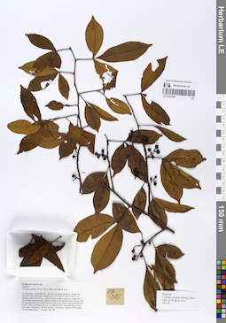
LE 01067056
Luvunga scandens (Roxb.) Wight det. Averyanov, Leonid Vladimirovich at 10.12.2019
Collectors: Averyanov, Leonid Vladimirovich; Khang Sinh Nguyen; Maisak, Tatiana Viktorovna; Chuong, Quang Ngan Field collecting number: VR376. Collection date: 18.04.2018. Administrative regions: VN - Tinh Ha Giang. Groups of specimens: L. V. Averyanov specimens; L. V. Averyanov herbariumOriginal label text:FLORA OF VIETNAM Rutaceae Luvunga scandens (Roxb.) Buch.-Ham. ex Wight & Arn.? Ha Giang prov., Quan Ba distr., Bat Dai Son Nature Reserve, Thanh Van commune, Mo Sai village, around point 23º07ʹ46.4ʺN 104º57ʹ56.2ʺE, at elevation 1000-1190 m a.s.l., karstic, highly eroded mountains composed of solid marble-like limestone, primary evergreen broad-leaved and mixed (with Pseudotsuga sinensis) humid forest on steep rocky slopes near mountain tops. Woody vine or ascendent shrub to 3 m tall on rocky mountain slope. Fruits dark green. Occasional. 18 April 2018, L. Averyanov, Nguyen Sinh Khang, Chuong Quang Ngan, T. Maisak, VR 376 (HN, LE01061494 – photo).
Coordinates (geographic position): 23° 7′ 46.4″ N, 104° 57′ 56.2″ E ±1000 mComment: All photos © L. Averyanov & K.S. Nguyen
Record creation: 2020-01-05, Leonid Averyanov, PhotoScan D1Citation: Specimen LE 01067056 // Virtual herbarium of Komarov Botanical Institute RAS — http://re.herbariumle.ru/01067056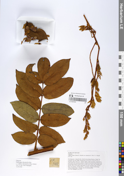
LE 01067055
Callerya dasyphylla (Miq.) Schot det. Sawai Mattapha at 12.05.2018
Additional identifications: Padbruggea dasyphylla Miq. det. Sawai Mattapha at 12.05.2018 Collectors: Averyanov, Leonid Vladimirovich; Khang Sinh Nguyen; Maisak, Tatiana Viktorovna; Chuong, Quang Ngan Field collecting number: VR372. Collection date: 18.04.2018. Administrative regions: VN - Tinh Ha Giang. Groups of specimens: L. V. Averyanov specimens; L. V. Averyanov herbariumOriginal label text:FLORA OF VIETNAM Fabaceae Padbruggea dasyphylla Miq. ( = Callerya dasyphylla (Miq.) Schot) Ha Giang prov., Quan Ba distr., Bat Dai Son Nature Reserve, Thanh Van commune, Mo Sai village, around point 23º07ʹ46.4ʺN 104º57ʹ56.2ʺE, at elevation 1000-1190 m a.s.l., karstic, highly eroded mountains composed of solid marble-like limestone, primary evergreen broad-leaved and mixed (with Pseudotsuga sinensis) humid forest on steep rocky slopes near mountain tops. Woody vine to 20 m long in open place on rocky mountain slope. Flowers blue. Not common. 18 April 2018, L. Averyanov, Nguyen Sinh Khang, Chuong Quang Ngan, T. Maisak, VR 372 (HN, LE01061490). Det. Sawi Mattapha 12.05.2018
Coordinates (geographic position): 23° 7′ 46.4″ N, 104° 57′ 56.2″ E ±1000 mComment: All photos © L. Averyanov & K.S. Nguyen
Record creation: 2020-01-05, Leonid Averyanov, PhotoScan D1Citation: Specimen LE 01067055 // Virtual herbarium of Komarov Botanical Institute RAS — http://re.herbariumle.ru/01067055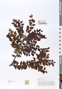
LE 01067054
Vaccinium retusum C.B.Clarke det. Averyanov, Leonid Vladimirovich at 10.12.2019
Collectors: Averyanov, Leonid Vladimirovich; Khang Sinh Nguyen; Maisak, Tatiana Viktorovna; Chuong, Quang Ngan Field collecting number: VR370. Collection date: 18.04.2018. Administrative regions: VN - Tinh Ha Giang. Groups of specimens: L. V. Averyanov specimens; L. V. Averyanov herbariumOriginal label text:FLORA OF VIETNAM Ericaceae Vaccinium retusum Hook.f. ex C.B.Clarke Ha Giang prov., Quan Ba distr., Bat Dai Son Nature Reserve, Thanh Van commune, Mo Sai village, around point 23º07ʹ46.4ʺN 104º57ʹ56.2ʺE, at elevation 1000-1190 m a.s.l., karstic, highly eroded mountains composed of solid marble-like limestone, primary evergreen broad-leaved and mixed (with Pseudotsuga sinensis) humid forest on steep rocky slopes near mountain tops. Shrub or treelet 2-3 m tall on mossy rocky mountain top. Locally common. 18 April 2018, L. Averyanov, Nguyen Sinh Khang, Chuong Quang Ngan, T. Maisak, VR 370 (HN, LE01061488).
Coordinates (geographic position): 23° 7′ 46.4″ N, 104° 57′ 56.2″ E ±1000 mComment: All photos © L. Averyanov & K.S. Nguyen
Record creation: 2020-01-05, Leonid Averyanov, PhotoScan D1Citation: Specimen LE 01067054 // Virtual herbarium of Komarov Botanical Institute RAS — http://re.herbariumle.ru/01067054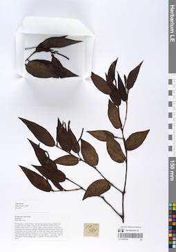
LE 01067053
Piper bonii C.DC. det. Averyanov, Leonid Vladimirovich at 10.12.2019
Collectors: Averyanov, Leonid Vladimirovich; Khang Sinh Nguyen; Maisak, Tatiana Viktorovna; Chuong, Quang Ngan Field collecting number: VR364. Collection date: 18.04.2018. Administrative regions: VN - Tinh Ha Giang. Groups of specimens: L. V. Averyanov specimens; L. V. Averyanov herbariumOriginal label text:FLORA OF VIETNAM Piperaceae Piper bonii C.DC. Ha Giang prov., Quan Ba distr., Bat Dai Son Nature Reserve, Thanh Van commune, Mo Sai village, around point 23º07ʹ46.4ʺN 104º57ʹ56.2ʺE, at elevation 1000-1190 m a.s.l., karstic, highly eroded mountains composed of solid marble-like limestone, primary evergreen broad-leaved and mixed (with Pseudotsuga sinensis) humid forest on steep rocky slopes near mountain tops. Lithophytic and epiphytic herbaceous vine on vertical cliff of rocky mountain slope. Inflorescences white. Common. 18 April 2018, L. Averyanov, Nguyen Sinh Khang, Chuong Quang Ngan, T. Maisak, VR 364 (HN, LE01061482 – photo).
Coordinates (geographic position): 23° 7′ 46.4″ N, 104° 57′ 56.2″ E ±1000 mComment: All photos © L. Averyanov & K.S. Nguyen
Record creation: 2020-01-05, Leonid Averyanov, PhotoScan D1Citation: Specimen LE 01067053 // Virtual herbarium of Komarov Botanical Institute RAS — http://re.herbariumle.ru/01067053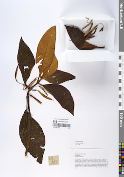
LE 01067052
Lysionotus sp. det. Averyanov, Leonid Vladimirovich at 10.12.2019
Collectors: Averyanov, Leonid Vladimirovich; Khang Sinh Nguyen; Maisak, Tatiana Viktorovna; Chuong, Quang Ngan Field collecting number: VR374. Collection date: 18.04.2018. Administrative regions: VN - Tinh Ha Giang. Groups of specimens: L. V. Averyanov specimens; L. V. Averyanov herbariumOriginal label text:FLORA OF VIETNAM Gesneriaceae Lysionotus sp. 3 Ha Giang prov., Quan Ba distr., Bat Dai Son Nature Reserve, Thanh Van commune, Mo Sai village, around point 23º07ʹ46.4ʺN 104º57ʹ56.2ʺE, at elevation 1000-1190 m a.s.l., karstic, highly eroded mountains composed of solid marble-like limestone, primary evergreen broad-leaved and mixed (with Pseudotsuga sinensis) humid forest on steep rocky slopes near mountain tops. Terrestrial herb to 1 m tall on rocky mountain slope. Occasional. 18 April 2018, L. Averyanov, Nguyen Sinh Khang, Chuong Quang Ngan, T. Maisak, VR 374 (HN, LE01061492). Photo
Coordinates (geographic position): 23° 7′ 46.4″ N, 104° 57′ 56.2″ E ±1000 mComment: All photos © L. Averyanov & K.S. Nguyen
Record creation: 2020-01-05, Leonid Averyanov, PhotoScan D1Citation: Specimen LE 01067052 // Virtual herbarium of Komarov Botanical Institute RAS — http://re.herbariumle.ru/01067052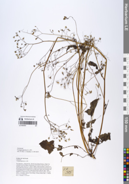
LE 01067051
Youngia japonica (L.) DC. det. Sennikov, Alexander Nikolaevitsch at 12.09.2019
Collectors: Averyanov, Leonid Vladimirovich; Khang Sinh Nguyen; Maisak, Tatiana Viktorovna; Chuong, Quang Ngan Field collecting number: VR375. Collection date: 18.04.2018. Administrative regions: VN - Tinh Ha Giang. Groups of specimens: L. V. Averyanov specimens; L. V. Averyanov herbariumOriginal label text:FLORA OF VIETNAM Asteraceae Youngia japonica (L.) DC. Ha Giang prov., Quan Ba distr., Bat Dai Son Nature Reserve, Thanh Van commune, Mo Sai village, around point 23º07ʹ46.4ʺN 104º57ʹ56.2ʺE, at elevation 1000-1190 m a.s.l., karstic, highly eroded mountains composed of solid marble-like limestone, primary evergreen broad-leaved and mixed (with Pseudotsuga sinensis) humid forest on steep rocky slopes near mountain tops. Terrestrial herb to 0.5 m tall in agricultural field in alluvial valley. Often lithophytic on open mossy rocks. Common weed. Flowers yellow. 18 April 2018, L. Averyanov, Nguyen Sinh Khang, Chuong Quang Ngan, T. Maisak, VR 375 (HN, LE01061493). Det. A. Sennikov 12 09 2019
Coordinates (geographic position): 23° 7′ 46.4″ N, 104° 57′ 56.2″ E ±1000 mComment: All photos © L. Averyanov & K.S. Nguyen
Record creation: 2020-01-05, Leonid Averyanov, PhotoScan D1Citation: Specimen LE 01067051 // Virtual herbarium of Komarov Botanical Institute RAS — http://re.herbariumle.ru/01067051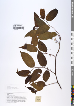
LE 01067050
Broussonetia kazinoki Siebold det. Tien Hiep Nguyen at 27.09.2019
Collectors: Averyanov, Leonid Vladimirovich; Khang Sinh Nguyen; Maisak, Tatiana Viktorovna; Chuong, Quang Ngan Field collecting number: VR369. Collection date: 18.04.2018. Administrative regions: VN - Tinh Ha Giang. Groups of specimens: L. V. Averyanov specimens; L. V. Averyanov herbariumOriginal label text:FLORA OF VIETNAM Moraceae Broussonetia kazinoki Siebold Ha Giang prov., Quan Ba distr., Bat Dai Son Nature Reserve, Thanh Van commune, Mo Sai village, around point 23º07ʹ46.4ʺN 104º57ʹ56.2ʺE, at elevation 1000-1190 m a.s.l., karstic, highly eroded mountains composed of solid marble-like limestone, primary evergreen broad-leaved and mixed (with Pseudotsuga sinensis) humid forest on steep rocky slopes near mountain tops. Shrub or treelet on rocky mountain slope. Fruits greenish. Not common. 18 April 2018, L. Averyanov, Nguyen Sinh Khang, Chuong Quang Ngan, T. Maisak, VR 369 (HN, LE01061487 – photo). Det. Tien Hiep Nguyen at 27.09.2019
Coordinates (geographic position): 23° 7′ 46.4″ N, 104° 57′ 56.2″ E ±1000 mComment: All photos © L. Averyanov & K.S. Nguyen
Record creation: 2020-01-05, Leonid Averyanov, PhotoScan D1Citation: Specimen LE 01067050 // Virtual herbarium of Komarov Botanical Institute RAS — http://re.herbariumle.ru/01067050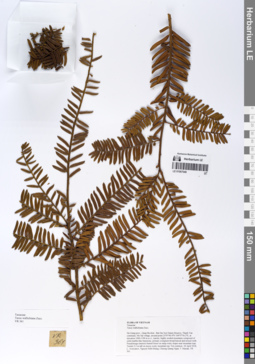
LE 01067049
Taxus wallichiana Zucc. det. Averyanov, Leonid Vladimirovich at 18.04.2018
Collectors: Averyanov, Leonid Vladimirovich; Khang Sinh Nguyen; Maisak, Tatiana Viktorovna; Chuong, Quang Ngan Field collecting number: VR361. Collection date: 18.04.2018. Administrative regions: VN - Tinh Ha Giang. Groups of specimens: L. V. Averyanov specimens; L. V. Averyanov herbariumOriginal label text:FLORA OF VIETNAM Taxaceae Taxus wallichiana Zucc. Ha Giang prov., Quan Ba distr., Bat Dai Son Nature Reserve, Thanh Van commune, Mo Sai village, around point 23º07ʹ46.4ʺN 104º57ʹ56.2ʺE, at elevation 1000-1190 m a.s.l., karstic, highly eroded mountains composed of solid marble-like limestone, primary evergreen broad-leaved and mixed (with Pseudotsuga sinensis) humid forest on steep rocky slopes near mountain tops. Treelet 2-3 m tall on mossy rocky mountain top. Not common. 18 April 2018, L. Averyanov, Nguyen Sinh Khang, Chuong Quang Ngan, T. Maisak, VR 361 (HN, LE01058200 – photo).
Coordinates (geographic position): 23° 7′ 46.4″ N, 104° 57′ 56.2″ E ±1000 mComment: All photos © L. Averyanov & K.S. Nguyen
Record creation: 2020-01-05, Leonid Averyanov, PhotoScan D1Citation: Specimen LE 01067049 // Virtual herbarium of Komarov Botanical Institute RAS — http://re.herbariumle.ru/01067049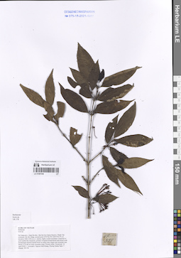
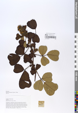
LE 01067048
Ixora henryi H.Lév. det. Averyanov, Leonid Vladimirovich at 08.12.2020
Additional identifications: Ixora sp. det. Averyanov, Leonid Vladimirovich at 18.04.2018 Collectors: Averyanov, Leonid Vladimirovich; Khang Sinh Nguyen; Maisak, Tatiana Viktorovna; Chuong, Quang Ngan Field collecting number: VR378. Collection date: 18.04.2018. Administrative regions: VN - Tinh Ha Giang. Groups of specimens: L. V. Averyanov specimens; L. V. Averyanov herbarium; Flora of VietnamOriginal label text:FLORA OF VIETNAM
Coordinates (geographic position): 23° 7′ 46.4″ N, 104° 57′ 56.2″ E ±1000 mRecord creation: 2020-01-05, Leonid Averyanov, PhotoScan D1. Processing status: work_status_1Citation: Specimen LE 01067048 // Virtual herbarium of Komarov Botanical Institute RAS — http://re.herbariumle.ru/01067048Rubiaceae
Ixora sp.
Ha Giang prov., Quan Ba distr., Bat Dai Son Nature Reserve, Thanh Van commune, Mo Sai village, around point 23º07ʹ46.4ʺN 104º57ʹ56.2ʺE, at elevation 1000-1190 m a.s.l., karstic, highly eroded mountains composed of solid marble-like limestone, primary evergreen broad-leaved and mixed (with Pseudotsuga sinensis) humid forest on steep rocky slopes near mountain tops. Shrub 2-3 m tall on rocky mountain slope. Flowers white. Occasional. 18 April 2018, L. Averyanov, Nguyen Sinh Khang, Chuong Quang Ngan, T. Maisak, VR 378 (HN, LE01061496 – photo).
LE 01067047
Rubus obcordatus (Franch.) Thuan det. Averyanov, Leonid Vladimirovich at 10.12.2019
Collectors: Averyanov, Leonid Vladimirovich; Khang Sinh Nguyen; Maisak, Tatiana Viktorovna; Chuong, Quang Ngan Field collecting number: VR379. Collection date: 18.04.2018. Administrative regions: VN - Tinh Ha Giang. Groups of specimens: L. V. Averyanov specimens; L. V. Averyanov herbariumOriginal label text:FLORA OF VIETNAM Rosaceae Rubus obcordatus (Franch.) Thuan Ha Giang prov., Quan Ba distr., Bat Dai Son Nature Reserve, Thanh Van commune, Mo Sai village, around point 23º07ʹ46.4ʺN 104º57ʹ56.2ʺE, at elevation 1000-1190 m a.s.l., karstic, highly eroded mountains composed of solid marble-like limestone, primary evergreen broad-leaved and mixed (with Pseudotsuga sinensis) humid forest on steep rocky slopes near mountain tops. Scandent shrub 2-3 m tall on open rocky mountain slope. Flowers white, fruits yellow, edible. Very common. 18 April 2018, L. Averyanov, Nguyen Sinh Khang, Chuong Quang Ngan, T. Maisak, VR 379 (HN, LE01061497 – photo).
Coordinates (geographic position): 23° 7′ 46.4″ N, 104° 57′ 56.2″ E ±1000 mComment: All photos © L. Averyanov & K.S. Nguyen
Record creation: 2020-01-05, Leonid Averyanov, PhotoScan D1Citation: Specimen LE 01067047 // Virtual herbarium of Komarov Botanical Institute RAS — http://re.herbariumle.ru/01067047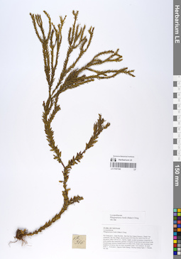
LE 01067046
Phlegmariurus fordii (Baker) Ching det. Averyanov, Leonid Vladimirovich at 10.12.2019
Collectors: Averyanov, Leonid Vladimirovich; Khang Sinh Nguyen; Maisak, Tatiana Viktorovna; Chuong, Quang Ngan Field collecting number: VR366. Collection date: 18.04.2018. Administrative regions: VN - Tinh Ha Giang. Groups of specimens: L. V. Averyanov specimens; L. V. Averyanov herbariumOriginal label text:FLORA OF VIETNAM Lycopodiaceae Phlegmariurus fordii (Baker) Ching Ha Giang prov., Quan Ba distr., Bat Dai Son Nature Reserve, Thanh Van commune, Mo Sai village, around point 23º07ʹ46.4ʺN 104º57ʹ56.2ʺE, at elevation 1000-1190 m a.s.l., karstic, highly eroded mountains composed of solid marble-like limestone, primary evergreen broad-leaved and mixed (with Pseudotsuga sinensis) humid forest on steep rocky slopes near mountain tops. Epiphyte on mossy tree on rocky mountain slope. Not common. 18 April 2018, L. Averyanov, Nguyen Sinh Khang, Chuong Quang Ngan, T. Maisak, VR 366 (HN, LE01061484 – photo).
Coordinates (geographic position): 23° 7′ 46.4″ N, 104° 57′ 56.2″ E ±1000 mComment: All photos © L. Averyanov & K.S. Nguyen
Record creation: 2020-01-05, Leonid Averyanov, PhotoScan D1Citation: Specimen LE 01067046 // Virtual herbarium of Komarov Botanical Institute RAS — http://re.herbariumle.ru/01067046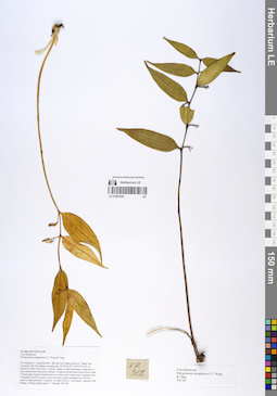
LE 01067045
Polygonatum mengtzense F.T.Wang & Tang det. Averyanov, Leonid Vladimirovich, Noriyuki Tanaka at 10.12.2019
Collectors: Averyanov, Leonid Vladimirovich; Khang Sinh Nguyen; Maisak, Tatiana Viktorovna; Chuong, Quang Ngan Field collecting number: VR362. Collection date: 18.04.2018. Administrative regions: VN - Tinh Ha Giang. Groups of specimens: L. V. Averyanov specimens; L. V. Averyanov herbariumOriginal label text:FLORA OF VIETNAM Convallariaceae Polygonatum mengtzense F.T. Wang & Tang Ha Giang prov., Quan Ba distr., Bat Dai Son Nature Reserve, Thanh Van commune, Mo Sai village, around point 23º07ʹ46.4ʺN 104º57ʹ56.2ʺE, at elevation 1000-1190 m a.s.l., karstic, highly eroded mountains composed of solid marble-like limestone, primary evergreen broad-leaved and mixed (with Pseudotsuga sinensis) humid forest on steep rocky slopes near mountain tops. Lithophytic herb on mossy rocks on mossy rocky mountain top. Flowers white to light greenish. Common. 18 April 2018, L. Averyanov, Nguyen Sinh Khang, Chuong Quang Ngan, T. Maisak, VR 362 (HN).
Coordinates (geographic position): 23° 7′ 46.4″ N, 104° 57′ 56.2″ E ±1000 mComment: All photos © L. Averyanov & K.S. Nguyen
Record creation: 2020-01-05, Leonid Averyanov, PhotoScan D1Citation: Specimen LE 01067045 // Virtual herbarium of Komarov Botanical Institute RAS — http://re.herbariumle.ru/01067045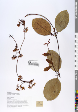
LE 01067044
Toxocarpus villosus (Blume) Blume det. M. Rodda at 11.10.2019
Collectors: Averyanov, Leonid Vladimirovich; Khang Sinh Nguyen; Maisak, Tatiana Viktorovna; Chuong, Quang Ngan Field collecting number: VR380. Collection date: 18.04.2018. Administrative regions: VN - Tinh Ha Giang. Groups of specimens: L. V. Averyanov specimens; L. V. Averyanov herbariumOriginal label text:FLORA OF VIETNAM Apocynaceae Toxocarpus villosus (Blume) Blume Ha Giang prov., Quan Ba distr., Bat Dai Son Nature Reserve, Thanh Van commune, Mo Sai village, around point 23º07ʹ46.4ʺN 104º57ʹ56.2ʺE, at elevation 1000-1190 m a.s.l., karstic, highly eroded mountains composed of solid marble-like limestone, primary evergreen broad-leaved and mixed (with Pseudotsuga sinensis) humid forest on steep rocky slopes near mountain tops. Herbaceous to semi-woody vine 6-8 m long on open rocky mountain slope. Flowers light yellowish. Not common. 18 April 2018, L. Averyanov, Nguyen Sinh Khang, Chuong Quang Ngan, T. Maisak, VR 380 (HN, LE01061498). Det.: M. Rodda 11.10.2019.
Coordinates (geographic position): 23° 7′ 46.4″ N, 104° 57′ 56.2″ E ±1000 mComment: All photos © L. Averyanov & K.S. Nguyen
Record creation: 2020-01-05, Leonid Averyanov, PhotoScan D1Citation: Specimen LE 01067044 // Virtual herbarium of Komarov Botanical Institute RAS — http://re.herbariumle.ru/01067044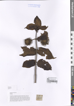
LE 01067043
Uncaria macrophylla Wall. det. Averyanov, Leonid Vladimirovich at 08.12.2020
Additional identifications: Uncaria sp. det. Averyanov, Leonid Vladimirovich at 18.04.2018 Collectors: Averyanov, Leonid Vladimirovich; Khang Sinh Nguyen; Maisak, Tatiana Viktorovna; Chuong, Quang Ngan Field collecting number: VR377. Collection date: 18.04.2018. Administrative regions: VN - Tinh Ha Giang. Groups of specimens: L. V. Averyanov specimens; L. V. Averyanov herbarium; Flora of VietnamOriginal label text:FLORA OF VIETNAM
Coordinates (geographic position): 23° 7′ 46.4″ N, 104° 57′ 56.2″ E ±1000 mRecord creation: 2020-01-05, Leonid Averyanov, PhotoScan D1. Processing status: work_status_1Citation: Specimen LE 01067043 // Virtual herbarium of Komarov Botanical Institute RAS — http://re.herbariumle.ru/01067043Rubiaceae
Uncaria sp.
Ha Giang prov., Quan Ba distr., Bat Dai Son Nature Reserve, Thanh Van commune, Mo Sai village, around point 23º07ʹ46.4ʺN 104º57ʹ56.2ʺE, at elevation 1000-1190 m a.s.l., karstic, highly eroded mountains composed of solid marble-like limestone, primary evergreen broad-leaved and mixed (with Pseudotsuga sinensis) humid forest on steep rocky slopes near mountain tops. Woody vine or ascendent shrub to 3 m tall on rocky mountain slope. Flowers white to yellowish. Occasional. 18 April 2018, L. Averyanov, Nguyen Sinh Khang, Chuong Quang Ngan, T. Maisak, VR 377 (HN, LE01061495 – photo).
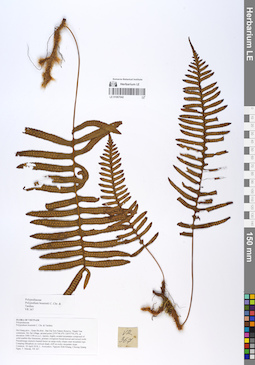
LE 01067042
Polypodium bourretti C. Chr. & Tardieu det. Averyanov, Leonid Vladimirovich at 10.12.2019
Collectors: Averyanov, Leonid Vladimirovich; Khang Sinh Nguyen; Maisak, Tatiana Viktorovna; Chuong, Quang Ngan Field collecting number: VR367. Collection date: 18.04.2018. Administrative regions: VN - Tinh Ha Giang. Groups of specimens: L. V. Averyanov specimens; L. V. Averyanov herbariumOriginal label text:FLORA OF VIETNAM Polypodiaceae Polypodium bourretti C. Chr. & Tardieu Ha Giang prov., Quan Ba distr., Bat Dai Son Nature Reserve, Thanh Van commune, Mo Sai village, around point 23º07ʹ46.4ʺN 104º57ʹ56.2ʺE, at elevation 1000-1190 m a.s.l., karstic, highly eroded mountains composed of solid marble-like limestone, primary evergreen broad-leaved and mixed (with Pseudotsuga sinensis) humid forest on steep rocky slopes near mountain tops. Creeping lithophyte on vertical shady cliff on rocky mountain slope. Common. 18 April 2018, L. Averyanov, Nguyen Sinh Khang, Chuong Quang Ngan, T. Maisak, VR 367 (HN, LE01061485 – photo).
Coordinates (geographic position): 23° 7′ 46.4″ N, 104° 57′ 56.2″ E ±1000 mComment: All photos © L. Averyanov & K.S. Nguyen
Record creation: 2020-01-05, Leonid Averyanov, PhotoScan D1Citation: Specimen LE 01067042 // Virtual herbarium of Komarov Botanical Institute RAS — http://re.herbariumle.ru/01067042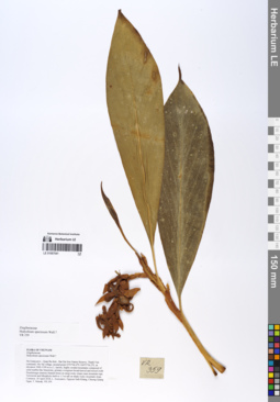
LE 01067041
Hedychium speciosum Wall. det. Averyanov, Leonid Vladimirovich at 10.12.2019
Collectors: Averyanov, Leonid Vladimirovich; Khang Sinh Nguyen; Maisak, Tatiana Viktorovna; Chuong, Quang Ngan Field collecting number: VR359. Collection date: 18.04.2018. Administrative regions: VN - Tinh Ha Giang. Groups of specimens: L. V. Averyanov specimens; L. V. Averyanov herbariumOriginal label text:FLORA OF VIETNAM Zingiberaceae Hedychium speciosum Wall.? Ha Giang prov., Quan Ba distr., Bat Dai Son Nature Reserve, Thanh Van commune, Mo Sai village, around point 23º07ʹ46.4ʺN 104º57ʹ56.2ʺE, at elevation 1000-1190 m a.s.l., karstic, highly eroded mountains composed of solid marble-like limestone, primary evergreen broad-leaved and mixed (with Pseudotsuga sinensis) humid forest on steep rocky slopes near mountain tops. Terrestrial and lithophytic herb to 1.5 m tall on shady rocky mountain slope. Common. 18 April 2018, L. Averyanov, Nguyen Sinh Khang, Chuong Quang Ngan, T. Maisak, VR 359 (HN).
Coordinates (geographic position): 23° 7′ 46.4″ N, 104° 57′ 56.2″ E ±1000 mComment: All photos © L. Averyanov & K.S. Nguyen
Record creation: 2020-01-05, Leonid Averyanov, PhotoScan D1Citation: Specimen LE 01067041 // Virtual herbarium of Komarov Botanical Institute RAS — http://re.herbariumle.ru/01067041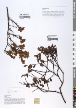
LE 01067040
Vaccinium papillatum P.F.Stevens det. Averyanov, Leonid Vladimirovich at 10.12.2019
Additional identifications: Vaccinium sp. det. Averyanov, Leonid Vladimirovich at 10.12.2019 Collectors: Averyanov, Leonid Vladimirovich; Khang Sinh Nguyen; Maisak, Tatiana Viktorovna; Chuong, Quang Ngan Field collecting number: VR347. Collection date: 18.04.2018. Administrative regions: VN - Tinh Ha Giang. Groups of specimens: L. V. Averyanov specimens; L. V. Averyanov herbariumOriginal label text:FLORA OF VIETNAM Ericaceae Vaccinium papillatum P.F. Stevens Ha Giang prov., Quan Ba distr., Bat Dai Son Nature Reserve, Thanh Van commune, Mo Sai village, around point 23º07ʹ46.4ʺN 104º57ʹ56.2ʺE, at elevation 1000-1190 m a.s.l., karstic, highly eroded mountains composed of solid marble-like limestone, primary evergreen broad-leaved and mixed (with Pseudotsuga sinensis) humid forest on steep rocky slopes near mountain tops. Lithophytic (and occasionally epiphytic) shrub to 2 m tall on mossy rocky mountain top. Flowers pink. Common. 18 April 2018, L. Averyanov, Nguyen Sinh Khang, Chuong Quang Ngan, T. Maisak, VR 347 (HN, LE 01067096, LE01058185 – photo).
Coordinates (geographic position): 23° 7′ 46.4″ N, 104° 57′ 56.2″ E ±1000 mComment: All photos © L. Averyanov & K.S. Nguyen
Record creation: 2020-01-05, Leonid Averyanov, PhotoScan D1Citation: Specimen LE 01067040 // Virtual herbarium of Komarov Botanical Institute RAS — http://re.herbariumle.ru/01067040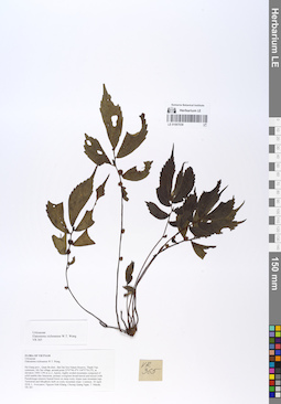
LE 01067038
Elatostema xichouense W.T.Wang det. Fu Longfei at 10.12.2019
Collectors: Averyanov, Leonid Vladimirovich; Khang Sinh Nguyen; Maisak, Tatiana Viktorovna; Chuong, Quang Ngan Field collecting number: VR365. Collection date: 18.04.2018. Administrative regions: VN - Tinh Ha Giang. Groups of specimens: L. V. Averyanov specimens; L. V. Averyanov herbariumOriginal label text:FLORA OF VIETNAM Urticaceae Elatostema xichouense W.T. Wang Ha Giang prov., Quan Ba distr., Bat Dai Son Nature Reserve, Thanh Van commune, Mo Sai village, around point 23º07ʹ46.4ʺN 104º57ʹ56.2ʺE, at elevation 1000-1190 m a.s.l., karstic, highly eroded mountains composed of solid marble-like limestone, primary evergreen broad-leaved and mixed (with Pseudotsuga sinensis) humid forest on steep rocky slopes near mountain tops. Terrestrial and lithophytic herb on rocky mountain slope. Common. 18 April 2018, L. Averyanov, Nguyen Sinh Khang, Chuong Quang Ngan, T. Maisak, VR 365 (HN, LE01061483 – photo).
Coordinates (geographic position): 23° 7′ 46.4″ N, 104° 57′ 56.2″ E ±1000 mComment: All photos © L. Averyanov & K.S. Nguyen
Record creation: 2020-01-05, Leonid Averyanov, PhotoScan D1Citation: Specimen LE 01067038 // Virtual herbarium of Komarov Botanical Institute RAS — http://re.herbariumle.ru/01067038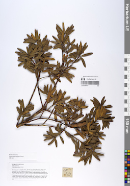
LE 01067037
Podocarpus pilgeri Foxw. det. Averyanov, Leonid Vladimirovich at 18.04.2018
Collectors: Averyanov, Leonid Vladimirovich; Khang Sinh Nguyen; Maisak, Tatiana Viktorovna; Chuong, Quang Ngan Field collecting number: VR360. Collection date: 18.04.2018. Administrative regions: VN - Tinh Ha Giang. Groups of specimens: L. V. Averyanov specimens; L. V. Averyanov herbariumOriginal label text:FLORA OF VIETNAM Podocarpaceae Podocarpus pilgeri Foxw. Ha Giang prov., Quan Ba distr., Bat Dai Son Nature Reserve, Thanh Van commune, Mo Sai village, around point 23º07ʹ46.4ʺN 104º57ʹ56.2ʺE, at elevation 1000-1190 m a.s.l., karstic, highly eroded mountains composed of solid marble-like limestone, primary evergreen broad-leaved and mixed (with Pseudotsuga sinensis) humid forest on steep rocky slopes near mountain tops. Treelet 3-4 m tall on mossy rocky mountain top. Occasional. 18 April 2018, L. Averyanov, Nguyen Sinh Khang, Chuong Quang Ngan, T. Maisak, VR 360 (HN, LE01058199 – photo).
Coordinates (geographic position): 23° 7′ 46.4″ N, 104° 57′ 56.2″ E ±1000 mComment: All photos © L. Averyanov & K.S. Nguyen
Record creation: 2020-01-05, Leonid Averyanov, PhotoScan D1Citation: Specimen LE 01067037 // Virtual herbarium of Komarov Botanical Institute RAS — http://re.herbariumle.ru/01067037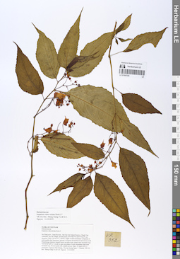
LE 01067036
Impatiens rubrostriata Hook.f. det. Sheng Xiang Yu, Khang Sinh Nguyen at 14.10.2019
Collectors: Averyanov, Leonid Vladimirovich; Khang Sinh Nguyen; Maisak, Tatiana Viktorovna; Chuong, Quang Ngan Field collecting number: VR352. Collection date: 18.04.2018. Administrative regions: VN - Tinh Ha Giang. Groups of specimens: L. V. Averyanov specimens; L. V. Averyanov herbariumOriginal label text:FLORA OF VIETNAM
Coordinates (geographic position): 23° 7′ 46.4″ N, 104° 57′ 56.2″ E ±1000 mComment: Balsaminaceae
Impatiens rubro-striata Hook.f.
Ha Giang prov., Quan Ba distr., Bat Dai Son Nature Reserve, Thanh Van commune, Mo Sai village, around point 23º07ʹ46.4ʺN 104º57ʹ56.2ʺE, at elevation 1000-1190 m a.s.l., karstic, highly eroded mountains composed of solid marble-like limestone, primary evergreen broad-leaved and mixed (with Pseudotsuga sinensis) humid forest on steep rocky slopes near mountain tops. Terrestrial herb to 1 m tall in open wet place of rocky mountain slope near mountain top. Flowers pink with reddish nerves. Rare. 18 April 2018, L. Averyanov, Nguyen Sinh Khang, Chuong Quang Ngan, T. Maisak, VR 352 (HN, LE01058191). Det.: Sheng Xiang Yu & K.S. Nguyen 14.10.2019
All photos © L. Averyanov & K.S. Nguyen
Record creation: 2020-01-05, Leonid Averyanov, PhotoScan D1Citation: Specimen LE 01067036 // Virtual herbarium of Komarov Botanical Institute RAS — http://re.herbariumle.ru/01067036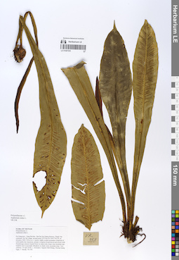
LE 01067035
Asplenium nidus L. det. Averyanov, Leonid Vladimirovich at 10.12.2019
Collectors: Averyanov, Leonid Vladimirovich; Khang Sinh Nguyen; Maisak, Tatiana Viktorovna; Chuong, Quang Ngan Field collecting number: VR358. Collection date: 18.04.2018. Administrative regions: VN - Tinh Ha Giang. Groups of specimens: L. V. Averyanov specimens; L. V. Averyanov photos; L. V. Averyanov herbariumOriginal label text:FLORA OF VIETNAM Polypodiaceae s.l. Asplenium nidus L. Ha Giang prov., Quan Ba distr., Bat Dai Son Nature Reserve, Thanh Van commune, Mo Sai village, around point 23º07ʹ46.4ʺN 104º57ʹ56.2ʺE, at elevation 1000-1190 m a.s.l., karstic, highly eroded mountains composed of solid marble-like limestone, primary evergreen broad-leaved and mixed (with Pseudotsuga sinensis) humid forest on steep rocky slopes near mountain tops. Epiphyte and occasionally lithophyte on shady rocky mountain slope. Very common. 18 April 2018, L. Averyanov, Nguyen Sinh Khang, Chuong Quang Ngan, T. Maisak, VR 358 (HN, LE01058198).
Coordinates (geographic position): 23° 7′ 46.4″ N, 104° 57′ 56.2″ E ±1000 mComment: All photos © L. Averyanov & K.S. Nguyen
Record creation: 2020-01-05, Leonid Averyanov, PhotoScan D1Citation: Specimen LE 01067035 // Virtual herbarium of Komarov Botanical Institute RAS — http://re.herbariumle.ru/01067035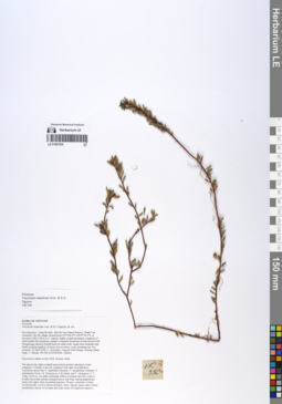
LE 01067034
Paratype of Vaccinium empetrum Aver. & K.S.Nguyen det. Averyanov, Leonid Vladimirovich at 10.12.2019
Collectors: Averyanov, Leonid Vladimirovich; Khang Sinh Nguyen; Maisak, Tatiana Viktorovna; Chuong, Quang Ngan Field collecting number: VR356. Collection date: 18.04.2018. Administrative regions: VN - Tinh Ha Giang. Groups of specimens: L. V. Averyanov specimens; L. V. Averyanov herbariumOriginal label text:FLORA OF VIETNAM Ericaceae Vaccinium empetrum Aver. & K.S. Nguyen, sp. nov.** Ha Giang prov., Quan Ba distr., Bat Dai Son Nature Reserve, Thanh Van commune, Mo Sai village, around point 23º07ʹ46.4ʺN 104º57ʹ56.2ʺE, at elevation 1000-1190 m a.s.l., karstic, highly eroded mountains composed of solid marble-like limestone, primary evergreen broad-leaved and mixed (with Pseudotsuga sinensis) humid forest on steep rocky slopes near mountain tops. Small creeping epiphyte of mossy tree on mossy rocky mountain top. Not common. 18 April 2018, L. Averyanov, Nguyen Sinh Khang, Chuong Quang Ngan, T. Maisak, VR 356 (HN, LE01058196 – photo). Flowered in culture in July 2018. Flowers white.
Coordinates (geographic position): 23° 7′ 46.4″ N, 104° 57′ 56.2″ E ±1000 mComment: All photos © L. Averyanov & K.S. Nguyen
Record creation: 2020-01-05, Leonid Averyanov, PhotoScan D1Citation: Specimen LE 01067034 // Virtual herbarium of Komarov Botanical Institute RAS — http://re.herbariumle.ru/01067034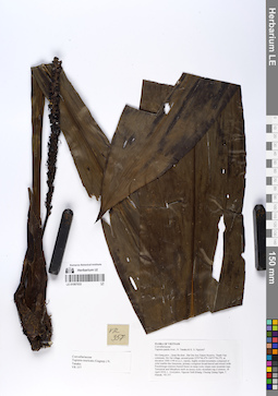
LE 01067033
Tupistra muricata (Gagnep.) N.Tanaka det. Averyanov, Leonid Vladimirovich at 10.12.2019
Collectors: Averyanov, Leonid Vladimirovich; Khang Sinh Nguyen; Maisak, Tatiana Viktorovna; Chuong, Quang Ngan Field collecting number: VR357. Collection date: 18.04.2018. Administrative regions: VN - Tinh Ha Giang. Groups of specimens: L. V. Averyanov specimens; L. V. Averyanov herbariumOriginal label text:FLORA OF VIETNAM Convallariaceae Tupistra muricata (Gagnep.) N. Tanaka Ha Giang prov., Quan Ba distr., Bat Dai Son Nature Reserve, Thanh Van commune, Mo Sai village, around point 23º07ʹ46.4ʺN 104º57ʹ56.2ʺE, at elevation 1000-1190 m a.s.l., karstic, highly eroded mountains composed of solid marble-like limestone, primary evergreen broad-leaved and mixed (with Pseudotsuga sinensis) humid forest on steep rocky slopes near mountain tops. Terrestrial and lithophytic herb on mossy rocky mountain top. Common. 18 April 2018, L. Averyanov, Nguyen Sinh Khang, Chuong Quang Ngan, T. Maisak, VR 357 (HN, LE01058197).
Coordinates (geographic position): 23° 7′ 46.4″ N, 104° 57′ 56.2″ E ±1000 mComment: All photos © L. Averyanov & K.S. Nguyen
Record creation: 2020-01-05, Leonid Averyanov, PhotoScan D1Citation: Specimen LE 01067033 // Virtual herbarium of Komarov Botanical Institute RAS — http://re.herbariumle.ru/01067033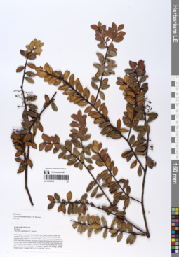
LE 01067032
Vaccinium papillatum P.F.Stevens det. Averyanov, Leonid Vladimirovich at 10.12.2019
Collectors: Averyanov, Leonid Vladimirovich; Khang Sinh Nguyen; Maisak, Tatiana Viktorovna; Chuong, Quang Ngan Field collecting number: VR351. Collection date: 18.04.2018. Administrative regions: VN - Tinh Ha Giang. Groups of specimens: L. V. Averyanov specimens; L. V. Averyanov herbariumOriginal label text:FLORA OF VIETNAM Ericaceae Vaccinium papillatum P.F. Stevens Ha Giang prov., Quan Ba distr., Bat Dai Son Nature Reserve, Thanh Van commune, Mo Sai village, around point 23º07ʹ46.4ʺN 104º57ʹ56.2ʺE, at elevation 1000-1190 m a.s.l., karstic, highly eroded mountains composed of solid marble-like limestone, primary evergreen broad-leaved and mixed (with Pseudotsuga sinensis) humid forest on steep rocky slopes near mountain tops. Climbing lithophytic shrub to 2 m tall on mossy rocky mountain top. Flowers pink. Common. 18 April 2018, L. Averyanov, Nguyen Sinh Khang, Chuong Quang Ngan, T. Maisak, VR 351 (HN, LE01058190 – photo).
Coordinates (geographic position): 23° 7′ 46.4″ N, 104° 57′ 56.2″ E ±1000 mComment: All photos © L. Averyanov & K.S. Nguyen
Record creation: 2020-01-05, Leonid Averyanov, PhotoScan D1Citation: Specimen LE 01067032 // Virtual herbarium of Komarov Botanical Institute RAS — http://re.herbariumle.ru/01067032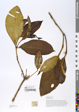
LE 01067031
Medinilla petelotii Merr. det. Averyanov, Leonid Vladimirovich at 10.12.2019
Collectors: Averyanov, Leonid Vladimirovich; Khang Sinh Nguyen; Maisak, Tatiana Viktorovna; Chuong, Quang Ngan Field collecting number: VR353. Collection date: 18.04.2018. Administrative regions: VN - Tinh Ha Giang. Groups of specimens: L. V. Averyanov specimens; L. V. Averyanov herbariumOriginal label text:FLORA OF VIETNAM Melastomataceae Medinilla petelotii Merr. Ha Giang prov., Quan Ba distr., Bat Dai Son Nature Reserve, Thanh Van commune, Mo Sai village, around point 23º07ʹ46.4ʺN 104º57ʹ56.2ʺE, at elevation 1000-1190 m a.s.l., karstic, highly eroded mountains composed of solid marble-like limestone, primary evergreen broad-leaved and mixed (with Pseudotsuga sinensis) humid forest on steep rocky slopes near mountain tops. Shrub to 2 m tall in open wet place of rocky mountain slope near mountain top. Fruits green with dirty purple tint. Occasional. 18 April 2018, L. Averyanov, Nguyen Sinh Khang, Chuong Quang Ngan, T. Maisak, VR 353 (HN, LE01058192 – photo).
Coordinates (geographic position): 23° 7′ 46.4″ N, 104° 57′ 56.2″ E ±1000 mComment: All photos © L. Averyanov & K.S. Nguyen
Record creation: 2020-01-05, Leonid Averyanov, PhotoScan D1Citation: Specimen LE 01067031 // Virtual herbarium of Komarov Botanical Institute RAS — http://re.herbariumle.ru/01067031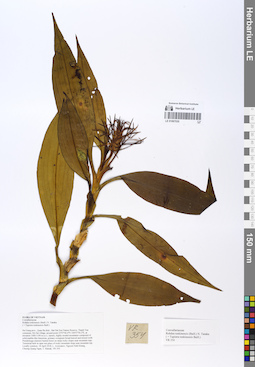
LE 01067030
Rohdea tonkinensis (Baill.) N.Tanaka det. Averyanov, Leonid Vladimirovich at 10.12.2019
Additional identifications: Tupistra tonkinensis Baill. det. Averyanov, Leonid Vladimirovich at 10.12.2019 Collectors: Averyanov, Leonid Vladimirovich; Khang Sinh Nguyen; Maisak, Tatiana Viktorovna; Chuong, Quang Ngan Field collecting number: VR354. Collection date: 18.04.2018. Administrative regions: VN - Tinh Ha Giang. Groups of specimens: L. V. Averyanov specimens; L. V. Averyanov herbariumOriginal label text:FLORA OF VIETNAM Convallariaceae Rohdea tonkinensis (Baill.) N. Tanaka ( = Tupistra tonkinensis Baill.) Ha Giang prov., Quan Ba distr., Bat Dai Son Nature Reserve, Thanh Van commune, Mo Sai village, around point 23º07ʹ46.4ʺN 104º57ʹ56.2ʺE, at elevation 1000-1190 m a.s.l., karstic, highly eroded mountains composed of solid marble-like limestone, primary evergreen broad-leaved and mixed (with Pseudotsuga sinensis) humid forest on steep rocky slopes near mountain tops. Terrestrial herb in open wet place of rocky mountain slope near mountain top. Locally common. 18 April 2018, L. Averyanov, Nguyen Sinh Khang, Chuong Quang Ngan, T. Maisak, VR 354 (HN, LE01058193).
Coordinates (geographic position): 23° 7′ 46.4″ N, 104° 57′ 56.2″ E ±1000 mComment: All photos © L. Averyanov & K.S. Nguyen
Record creation: 2020-01-05, Leonid Averyanov, PhotoScan D1Citation: Specimen LE 01067030 // Virtual herbarium of Komarov Botanical Institute RAS — http://re.herbariumle.ru/01067030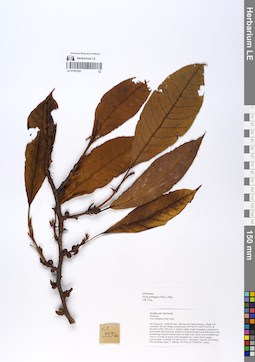
LE 01067029
Ficus pubigera (Miq.) Brandis det. Tien Hiep Nguyen at 10.12.2019
Collectors: Averyanov, Leonid Vladimirovich; Khang Sinh Nguyen; Maisak, Tatiana Viktorovna; Chuong, Quang Ngan Field collecting number: VR355a. Collection date: 18.04.2018. Administrative regions: VN - Tinh Ha Giang. Groups of specimens: L. V. Averyanov specimens; L. V. Averyanov herbariumOriginal label text:FLORA OF VIETNAM Moraceae Ficus pubigera (Miq.) Miq. Ha Giang prov., Quan Ba distr., Bat Dai Son Nature Reserve, Thanh Van commune, Mo Sai village, around point 23º07ʹ46.4ʺN 104º57ʹ56.2ʺE, at elevation 1000-1190 m a.s.l., karstic, highly eroded mountains composed of solid marble-like limestone, primary evergreen broad-leaved and mixed (with Pseudotsuga sinensis) humid forest on steep rocky slopes near mountain tops. Tree to 10 m tall on mossy rocky mountain top. Leaves brown purple, syconia green. Common. 18 April 2018, L. Averyanov, Nguyen Sinh Khang, Chuong Quang Ngan, T. Maisak, VR 355a (HN, LE01058194 – photo).
Coordinates (geographic position): 23° 7′ 46.4″ N, 104° 57′ 56.2″ E ±1000 mComment: All photos © L. Averyanov & K.S. Nguyen
Record creation: 2020-01-05, Leonid Averyanov, PhotoScan D1Citation: Specimen LE 01067029 // Virtual herbarium of Komarov Botanical Institute RAS — http://re.herbariumle.ru/01067029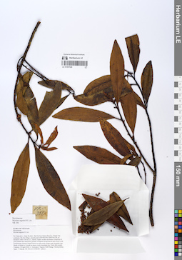
LE 01067028
Myrsine seguinii H.Lév. det. Averyanov, Leonid Vladimirovich at 10.12.2019
Collectors: Averyanov, Leonid Vladimirovich; Khang Sinh Nguyen; Maisak, Tatiana Viktorovna; Chuong, Quang Ngan Field collecting number: VR350. Collection date: 18.04.2018. Administrative regions: VN - Tinh Ha Giang. Groups of specimens: L. V. Averyanov specimens; L. V. Averyanov herbariumOriginal label text:FLORA OF VIETNAM Myrsinaceae Myrsine seguinii H. Lév. Ha Giang prov., Quan Ba distr., Bat Dai Son Nature Reserve, Thanh Van commune, Mo Sai village, around point 23º07ʹ46.4ʺN 104º57ʹ56.2ʺE, at elevation 1000-1190 m a.s.l., karstic, highly eroded mountains composed of solid marble-like limestone, primary evergreen broad-leaved and mixed (with Pseudotsuga sinensis) humid forest on steep rocky slopes near mountain tops. Shrub or treelet to 3 m tall on mossy rocky mountain top. Fruits dirty purple. Common. 18 April 2018, L. Averyanov, Nguyen Sinh Khang, Chuong Quang Ngan, T. Maisak, VR 350 (HN, LE01058189 – photo).
Coordinates (geographic position): 23° 7′ 46.4″ N, 104° 57′ 56.2″ E ±1000 mComment: All photos © L. Averyanov & K.S. Nguyen
Record creation: 2020-01-05, Leonid Averyanov, PhotoScan D1Citation: Specimen LE 01067028 // Virtual herbarium of Komarov Botanical Institute RAS — http://re.herbariumle.ru/01067028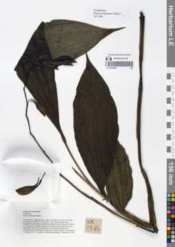
LE 01066826
Phaius mishmensis (Lindl. & Paxton) Rchb.f. det. Averyanov, Leonid Vladimirovich at 11.10.2019
Collectors: Averyanov, Leonid Vladimirovich; Khang Sinh Nguyen; Maisak, Tatiana Viktorovna Field collecting number: VR1586. Collection date: 11.10.2019. Administrative regions: VN - Tinh Ha Giang. Groups of specimens: L. V. Averyanov specimens; L. V. Averyanov herbarium; Orchids of Vietnam, Laos and CambodiaOriginal label text:FLORA OF VIETNAM
Coordinates (geographic position): 23° 5′ 44.38″ N, 105° 1′ 17.11″ E ±1000 mRecord creation: 2020-01-05, Leonid Averyanov, PhotoScan D1. Processing status: work_status_1Citation: Specimen LE 01066826 // Virtual herbarium of Komarov Botanical Institute RAS — http://re.herbariumle.ru/01066826Orchidaceae
Phaius mishmensis Rchb.f.,
Ha Giang Prov., Quan Ba Distr., Can Ty Commune, Sin Suoi Ho Village, around point 23.09566ºN 105.02142ºE. Very steep mountain slopes composed of solid highly eroded karstic limestone at elevation 800–1000 m a.s.l. Remnants of primary evergreen broad-leaved and coniferous (with Calocedrus rupestris and Xanthocyparis vietnamensis) humid forest. Terrestrial herb in shady place among rocks. Flowers pinkish. Not common. 11 October 2019, L. Averyanov, Nguyen Sinh Khang, T. Maisak, VR 1586.
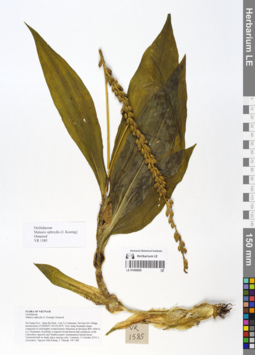
LE 01066825
Malaxis ophrydis (J.Koenig) Ormerod det. Averyanov, Leonid Vladimirovich at 11.10.2019
Collectors: Averyanov, Leonid Vladimirovich; Khang Sinh Nguyen; Maisak, Tatiana Viktorovna Field collecting number: VR1585. Collection date: 11.10.2019. Administrative regions: VN - Tinh Ha Giang. Groups of specimens: L. V. Averyanov specimens; L. V. Averyanov herbarium; Orchids of Vietnam, Laos and CambodiaOriginal label text:FLORA OF VIETNAM
Orchidaceae
Malaxis ophrydis (J. Koenig) Ormerod
Ha Giang Prov., Quan Ba Distr., Can Ty Commune, Sin Suoi Ho Village, around point 23.09566ºN 105.02142ºE. Very steep mountain slopes composed of solid highly eroded karstic limestone at elevation 800–1000 m a.s.l. Remnants of primary evergreen broad-leaved and coniferous (with Calocedrus rupestris and Xanthocyparis vietnamensis) humid forest. Terrestrial herb in shady place among rocks. Common.
11 October 2019, L. Averyanov, Nguyen Sinh Khang, T. Maisak, VR 1585.
All photos © L. Averyanov & K.S. Nguyen
Record creation: 2020-01-05, Leonid Averyanov, PhotoScan D1. Processing status: work_status_1Citation: Specimen LE 01066825 // Virtual herbarium of Komarov Botanical Institute RAS — http://re.herbariumle.ru/01066825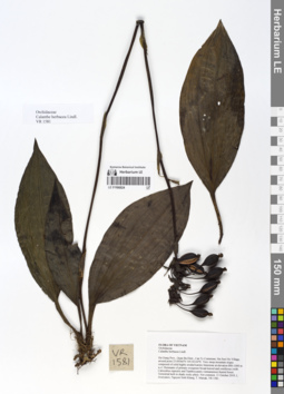
LE 01066824
Calanthe herbacea Lindl. det. Averyanov, Leonid Vladimirovich at 11.10.2019
Collectors: Averyanov, Leonid Vladimirovich; Khang Sinh Nguyen; Maisak, Tatiana Viktorovna Field collecting number: VR1581. Collection date: 11.10.2019. Administrative regions: VN - Tinh Ha Giang. Groups of specimens: L. V. Averyanov specimens; L. V. Averyanov herbarium; Orchids of Vietnam, Laos and CambodiaOriginal label text:FLORA OF VIETNAM
Orchidaceae
Calanthe herbacea Lindl.
Ha Giang Prov., Quan Ba Distr., Can Ty Commune, Sin Suoi Ho Village, around point 23.09566ºN 105.02142ºE. Very steep mountain slopes composed of solid highly eroded karstic limestone at elevation 800–1000 m a.s.l. Remnants of primary evergreen broad-leaved and coniferous (with Calocedrus rupestris and Xanthocyparis vietnamensis) humid forest. Terrestrial herb in shady rocky place. Not common. 11 October 2019, L. Averyanov, Nguyen Sinh Khang, T. Maisak, VR 1581.
All photos © L. Averyanov & K.S. Nguyen
Record creation: 2020-01-05, Leonid Averyanov, PhotoScan D1. Processing status: work_status_1Citation: Specimen LE 01066824 // Virtual herbarium of Komarov Botanical Institute RAS — http://re.herbariumle.ru/01066824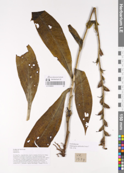
LE 01066823
Habenaria calcicola Aver. ⟮prelim. ID⟯ det. Averyanov, Leonid Vladimirovich at 11.10.2019
Collectors: Averyanov, Leonid Vladimirovich; Khang Sinh Nguyen; Maisak, Tatiana Viktorovna Field collecting number: VR1574. Collection date: 11.10.2019. Administrative regions: VN - Tinh Ha Giang. Groups of specimens: L. V. Averyanov specimens; L. V. Averyanov herbarium; Orchids of Vietnam, Laos and CambodiaOriginal label text:FLORA OF VIETNAM
Coordinates (geographic position): 23° 5′ 44.38″ N, 105° 1′ 17.11″ E ±1000 mRecord creation: 2020-01-05, Leonid Averyanov, PhotoScan D1. Processing status: work_status_1Citation: Specimen LE 01066823 // Virtual herbarium of Komarov Botanical Institute RAS — http://re.herbariumle.ru/01066823Orchidaceae
Habenaria calcicola Aver.?
Ha Giang Prov., Quan Ba Distr., Can Ty Commune, Sin Suoi Ho Village, around point 23.09566ºN 105.02142ºE. Very steep mountain slopes composed of solid highly eroded karstic limestone at elevation 800–1000 m a.s.l. Remnants of primary evergreen broad-leaved and coniferous (with Calocedrus rupestris and Xanthocyparis vietnamensis) humid forest. Terrestrial tuberiferous herb in shady place among rocks. Common.
11 October 2019, L. Averyanov, Nguyen Sinh Khang, T. Maisak, VR 1574.
LE 01066822
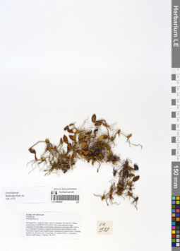
Bulbophyllum sp. det. Averyanov, Leonid Vladimirovich at 11.10.2019
Collectors: Averyanov, Leonid Vladimirovich; Khang Sinh Nguyen; Maisak, Tatiana Viktorovna Field collecting number: VR1572. Collection date: 11.10.2019. Administrative regions: VN - Tinh Ha Giang. Groups of specimens: L. V. Averyanov specimens; L. V. Averyanov herbarium; Orchids of Vietnam, Laos and CambodiaOriginal label text:FLORA OF VIETNAM
Coordinates (geographic position): 23° 5′ 44.38″ N, 105° 1′ 17.11″ E ±1000 mComment: Orchidaceae
Bulbophyllum sp.
Ha Giang Prov., Quan Ba Distr., Can Ty Commune, Sin Suoi Ho Village, around point 23.09566ºN 105.02142ºE. Very steep mountain slopes composed of solid highly eroded karstic limestone at elevation 800–1000 m a.s.l. Remnants of primary evergreen broad-leaved and coniferous (with Calocedrus rupestris and Xanthocyparis vietnamensis) humid forest. Creeping epiphyte on old mossy tree. Occasional. 11 October 2019, L. Averyanov, Nguyen Sinh Khang, T. Maisak, VR 1572.
All photos © L. Averyanov & K.S. Nguyen
Record creation: 2020-01-05, Leonid Averyanov, PhotoScan D1. Processing status: work_status_1Citation: Specimen LE 01066822 // Virtual herbarium of Komarov Botanical Institute RAS — http://re.herbariumle.ru/01066822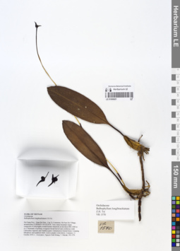
LE 01066821
Bulbophyllum longibrachiatum Z.H.Tsi det. Averyanov, Leonid Vladimirovich at 11.10.2019
Collectors: Averyanov, Leonid Vladimirovich; Khang Sinh Nguyen; Maisak, Tatiana Viktorovna Field collecting number: VR1570. Collection date: 11.10.2019. Administrative regions: VN - Tinh Ha Giang. Groups of specimens: L. V. Averyanov specimens; L. V. Averyanov herbarium; Orchids of Vietnam, Laos and CambodiaOriginal label text:FLORA OF VIETNAM
Orchidaceae
Bulbophyllum longibrachiatum Z.H. Tsi
Ha Giang Prov., Quan Ba Distr., Can Ty Commune, Sin Suoi Ho Village, around point 23.09566ºN 105.02142ºE. Very steep mountain slopes composed of solid highly eroded karstic limestone at elevation 800–1000 m a.s.l. Remnants of primary evergreen broad-leaved and coniferous (with Calocedrus rupestris and Xanthocyparis vietnamensis) humid forest. Creeping lithophytic and epiphytic herb. Leaves purple-violet below. Common. 11 October 2019, L. Averyanov, Nguyen Sinh Khang, T. Maisak, VR 1570.
All photos © L. Averyanov & K.S. Nguyen
Record creation: 2020-01-05, Leonid Averyanov, PhotoScan D1. Processing status: work_status_1Citation: Specimen LE 01066821 // Virtual herbarium of Komarov Botanical Institute RAS — http://re.herbariumle.ru/01066821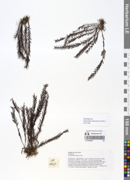
LE 01066820
Podochilus khasianus Hook.f. det. Averyanov, Leonid Vladimirovich at 11.10.2019
Collectors: Averyanov, Leonid Vladimirovich; Khang Sinh Nguyen; Maisak, Tatiana Viktorovna Field collecting number: VR1568. Collection date: 11.10.2019. Administrative regions: VN - Tinh Ha Giang. Groups of specimens: L. V. Averyanov specimens; L. V. Averyanov herbarium; Orchids of Vietnam, Laos and CambodiaOriginal label text:FLORA OF VIETNAM
Coordinates (geographic position): 23° 5′ 44.38″ N, 105° 1′ 17.11″ E ±1000 mRecord creation: 2020-01-05, Leonid Averyanov, PhotoScan D1. Processing status: work_status_1Citation: Specimen LE 01066820 // Virtual herbarium of Komarov Botanical Institute RAS — http://re.herbariumle.ru/01066820Orchidaceae
Podochilus khasianus Hook.f.,
Ha Giang Prov., Quan Ba Distr., Can Ty Commune, Sin Suoi Ho Village, around point 23.09566ºN 105.02142ºE. Very steep mountain slopes composed of solid highly eroded karstic limestone at elevation 800–1000 m a.s.l. Remnants of primary evergreen broad-leaved and coniferous (with Calocedrus rupestris and Xanthocyparis vietnamensis) humid forest. Lithophytic clustering herb on shady mossy rocks. Not rare. 11 October 2019, L. Averyanov, Nguyen Sinh Khang, T. Maisak, VR 1568.
LE 01066819
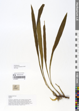
Liparis bootanensis Griff. det. Averyanov, Leonid Vladimirovich at 10.12.2019
Collectors: Averyanov, Leonid Vladimirovich; Khang Sinh Nguyen; Maisak, Tatiana Viktorovna Field collecting number: VR1566. Collection date: 11.10.2019. Administrative regions: VN - Tinh Ha Giang. Groups of specimens: L. V. Averyanov specimens; L. V. Averyanov herbarium; Orchids of Vietnam, Laos and CambodiaOriginal label text:FLORA OF VIETNAM
Orchidaceae
Liparis bootanensis Griff.
Ha Giang Prov., Quan Ba Distr., Can Ty Commune, Sin Suoi Ho Village, around point 23.09566ºN 105.02142ºE. Very steep mountain slopes composed of solid highly eroded karstic limestone at elevation 800–1000 m a.s.l. Remnants of primary evergreen broad-leaved and coniferous (with Calocedrus rupestris and Xanthocyparis vietnamensis) humid forest. Creeping lithophytic herb on shady mossy rocks. Common.
11 October 2019, L. Averyanov, Nguyen Sinh Khang, T. Maisak, VR 1566.
All photos © L. Averyanov & K.S. Nguyen
Record creation: 2020-01-05, Leonid Averyanov, PhotoScan D1. Processing status: work_status_1Citation: Specimen LE 01066819 // Virtual herbarium of Komarov Botanical Institute RAS — http://re.herbariumle.ru/01066819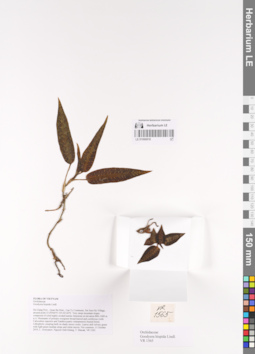
LE 01066818
Goodyera hispida Lindl. det. Averyanov, Leonid Vladimirovich at 11.10.2019
Collectors: Averyanov, Leonid Vladimirovich; Khang Sinh Nguyen; Maisak, Tatiana Viktorovna Field collecting number: VR1565. Collection date: 11.10.2019. Administrative regions: VN - Tinh Ha Giang. Groups of specimens: L. V. Averyanov specimens; L. V. Averyanov herbarium; Orchids of Vietnam, Laos and CambodiaOriginal label text:FLORA OF VIETNAM
Orchidaceae
Goodyera hispida Lindl.
Ha Giang Prov., Quan Ba Distr., Can Ty Commune, Sin Suoi Ho Village, around point 23.09566ºN 105.02142ºE. Very steep mountain slopes composed of solid highly eroded karstic limestone at elevation 800–1000 m a.s.l. Remnants of primary evergreen broad-leaved and coniferous (with Calocedrus rupestris and Xanthocyparis vietnamensis) humid forest. Lithophytic creeping herb on shady mossy rocks. Leaves dull velvety green with light green median stripe and white nerves. Not common.
11 October 2019, L. Averyanov, Nguyen Sinh Khang, T. Maisak, VR 1565.
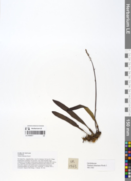
LE 01066817
Thelasis khasiana Hook.f. det. Averyanov, Leonid Vladimirovich at 11.10.2019
Collectors: Averyanov, Leonid Vladimirovich; Khang Sinh Nguyen; Maisak, Tatiana Viktorovna Field collecting number: VR1563. Collection date: 11.10.2019. Administrative regions: VN - Tinh Ha Giang. Groups of specimens: L. V. Averyanov specimens; L. V. Averyanov herbarium; Orchids of Vietnam, Laos and CambodiaOriginal label text:FLORA OF VIETNAM
Coordinates (geographic position): 23° 5′ 44.38″ N, 105° 1′ 17.11″ E ±1000 mRecord creation: 2020-01-05, Leonid Averyanov, PhotoScan D1. Processing status: work_status_1Citation: Specimen LE 01066817 // Virtual herbarium of Komarov Botanical Institute RAS — http://re.herbariumle.ru/01066817Orchidaceae
Thelasis khasiana Hook.f.
Ha Giang Prov., Quan Ba Distr., Can Ty Commune, Sin Suoi Ho Village, around point 23.09566ºN 105.02142ºE. Very steep mountain slopes composed of solid highly eroded karstic limestone at elevation 800–1000 m a.s.l. Remnants of primary evergreen broad-leaved and coniferous (with Calocedrus rupestris and Xanthocyparis vietnamensis) humid forest. Clustering epiphyte on old mossy tree. Occasional. 11 October 2019, L. Averyanov, Nguyen Sinh Khang, T. Maisak, VR 1563.
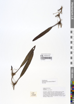
LE 01066816
Bulbophyllum macraei (Lindl.) Rchb.f. det. Averyanov, Leonid Vladimirovich at 11.10.2019
Collectors: Averyanov, Leonid Vladimirovich; Khang Sinh Nguyen; Maisak, Tatiana Viktorovna Field collecting number: VR1562. Collection date: 11.10.2019. Administrative regions: VN - Tinh Ha Giang. Groups of specimens: L. V. Averyanov specimens; L. V. Averyanov herbarium; Orchids of Vietnam, Laos and CambodiaOriginal label text:FLORA OF VIETNAM
Orchidaceae
Bulbophyllum macraei Rchb.f.?
Ha Giang Prov., Quan Ba Distr., Can Ty Commune, Sin Suoi Ho Village, around point 23.09566ºN 105.02142ºE. Very steep mountain slopes composed of solid highly eroded karstic limestone at elevation 800–1000 m a.s.l. Remnants of primary evergreen broad-leaved and coniferous (with Calocedrus rupestris and Xanthocyparis vietnamensis) humid forest. Creeping epiphyte and lithophyte. Common. 11 October 2019, L. Averyanov, Nguyen Sinh Khang, T. Maisak, VR 1562.
All photos © L. Averyanov & K.S. Nguyen
Record creation: 2020-01-05, Leonid Averyanov, PhotoScan D1. Processing status: work_status_1Citation: Specimen LE 01066816 // Virtual herbarium of Komarov Botanical Institute RAS — http://re.herbariumle.ru/01066816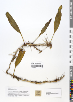
LE 01066815
Bulbophyllum apodum Hook.f. det. Averyanov, Leonid Vladimirovich at 11.10.2019
Collectors: Averyanov, Leonid Vladimirovich; Khang Sinh Nguyen; Maisak, Tatiana Viktorovna Field collecting number: VR1561. Collection date: 11.10.2019. Administrative regions: VN - Tinh Ha Giang. Groups of specimens: L. V. Averyanov specimens; L. V. Averyanov herbarium; Orchids of Vietnam, Laos and CambodiaOriginal label text:FLORA OF VIETNAM
Orchidaceae
Bulbophyllum apodum Hook.f.
Ha Giang Prov., Quan Ba Distr., Can Ty Commune, Sin Suoi Ho Village, around point 23.09566ºN 105.02142ºE. Very steep mountain slopes composed of solid highly eroded karstic limestone at elevation 800–1000 m a.s.l. Remnants of primary evergreen broad-leaved and coniferous (with Calocedrus rupestris and Xanthocyparis vietnamensis) humid forest. Creeping epiphyte and lithophyte. Common. 11 October 2019, L. Averyanov, Nguyen Sinh Khang, T. Maisak, VR 1561.
All photos © L. Averyanov & K.S. Nguyen
Record creation: 2020-01-05, Leonid Averyanov, PhotoScan D1. Processing status: work_status_1Citation: Specimen LE 01066815 // Virtual herbarium of Komarov Botanical Institute RAS — http://re.herbariumle.ru/01066815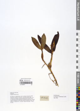
LE 01066814
Coelogyne fimbriata Lindl. det. Averyanov, Leonid Vladimirovich at 11.10.2019
Collectors: Averyanov, Leonid Vladimirovich; Khang Sinh Nguyen; Maisak, Tatiana Viktorovna Field collecting number: VR1560. Collection date: 11.10.2019. Administrative regions: VN - Tinh Ha Giang. Groups of specimens: L. V. Averyanov specimens; L. V. Averyanov herbarium; Orchids of Vietnam, Laos and CambodiaOriginal label text:FLORA OF VIETNAM
Orchidaceae
Coelogyne fimbriata Lindl.
Ha Giang Prov., Quan Ba Distr., Can Ty Commune, Sin Suoi Ho Village, around point 23.09566ºN 105.02142ºE. Very steep mountain slopes composed of solid highly eroded karstic limestone at elevation 800–1000 m a.s.l. Remnants of primary evergreen broad-leaved and coniferous (with Calocedrus rupestris and Xanthocyparis vietnamensis) humid forest. Creeping epiphyte and lithophyte. Flowers dull yellowish, lip with brown center. Very common.
11 October 2019, L. Averyanov, Nguyen Sinh Khang, T. Maisak, VR 1560.
All photos © L. Averyanov & K.S. Nguyen
Record creation: 2020-01-05, Leonid Averyanov, PhotoScan D1. Processing status: work_status_1Citation: Specimen LE 01066814 // Virtual herbarium of Komarov Botanical Institute RAS — http://re.herbariumle.ru/01066814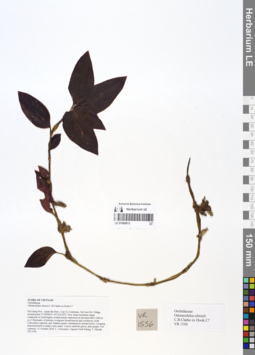
LE 01066813
Odontochilus elwesii Hook.f. det. Averyanov, Leonid Vladimirovich at 11.10.2019
Collectors: Averyanov, Leonid Vladimirovich; Khang Sinh Nguyen; Maisak, Tatiana Viktorovna Field collecting number: VR1556. Collection date: 11.10.2019. Administrative regions: VN - Tinh Ha Giang. Groups of specimens: L. V. Averyanov specimens; L. V. Averyanov herbarium; Orchids of Vietnam, Laos and CambodiaOriginal label text:FLORA OF VIETNAM
Coordinates (geographic position): 23° 5′ 44.38″ N, 105° 1′ 17.11″ E ±1000 mComment: Orchidaceae
Odontochilus elwesii C.B.Clarke ex Hook.f.?
Ha Giang Prov., Quan Ba Distr., Can Ty Commune, Sin Suoi Ho Village, around point 23.09566ºN 105.02142ºE. Very steep mountain slopes composed of solid highly eroded karstic limestone at elevation 800–1000 m a.s.l. Remnants of primary evergreen broad-leaved and coniferous (with Calocedrus rupestris and Xanthocyparis vietnamensis) humid forest. Creeping terrestrial herb in shady rocky place. Leaves uniform glossy dark purple. Not common. 11 October 2019, L. Averyanov, Nguyen Sinh Khang, T. Maisak, VR 1556.
All photos © L. Averyanov & K.S. Nguyen
Record creation: 2020-01-05, Leonid Averyanov, PhotoScan D1. Processing status: work_status_1Citation: Specimen LE 01066813 // Virtual herbarium of Komarov Botanical Institute RAS — http://re.herbariumle.ru/01066813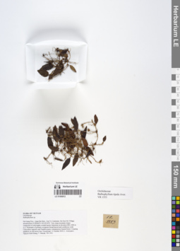
LE 01066812
Bulbophyllum tipula Aver. det. Averyanov, Leonid Vladimirovich at 10.12.2019
Collectors: Averyanov, Leonid Vladimirovich; Khang Sinh Nguyen; Maisak, Tatiana Viktorovna Field collecting number: VR1553. Collection date: 11.10.2019. Administrative regions: VN - Tinh Ha Giang. Groups of specimens: L. V. Averyanov specimens; L. V. Averyanov herbarium; Orchids of Vietnam, Laos and CambodiaOriginal label text:FLORA OF VIETNAM
Orchidaceae
Bulbophyllum tipula Aver.
Ha Giang Prov., Quan Ba Distr., Can Ty Commune, Sin Suoi Ho Village, around point 23.09566ºN 105.02142ºE. Very steep mountain slopes composed of solid highly eroded karstic limestone at elevation 800–1000 m a.s.l. Remnants of primary evergreen broad-leaved and coniferous (with Calocedrus rupestris and Xanthocyparis vietnamensis) humid forest. Creeping epiphyte on old mossy tree. Occasional.
11 October 2019, L. Averyanov, Nguyen Sinh Khang, T. Maisak, VR 1553.
All photos © L. Averyanov & K.S. Nguyen
Record creation: 2020-01-05, Leonid Averyanov, PhotoScan D1. Processing status: work_status_1Citation: Specimen LE 01066812 // Virtual herbarium of Komarov Botanical Institute RAS — http://re.herbariumle.ru/01066812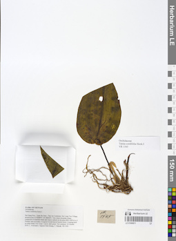
LE 01066811
Tainia cordifolia Hook.f. det. Averyanov, Leonid Vladimirovich at 10.10.2019
Collectors: Averyanov, Leonid Vladimirovich; Khang Sinh Nguyen; Maisak, Tatiana Viktorovna Field collecting number: VR1545. Collection date: 10.10.2019. Administrative regions: VN - Tinh Ha Giang. Groups of specimens: L. V. Averyanov specimens; L. V. Averyanov herbarium; Orchids of Vietnam, Laos and CambodiaOriginal label text:FLORA OF VIETNAM
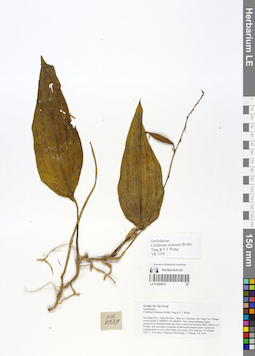
Coordinates (geographic position): 22° 58′ 11.57″ N, 105° 5′ 11.26″ E ±1000 mRecord creation: 2020-01-05, Leonid Averyanov, PhotoScan D1. Processing status: work_status_1Citation: Specimen LE 01066811 // Virtual herbarium of Komarov Botanical Institute RAS — http://re.herbariumle.ru/01066811Orchidaceae
Tainia cordifolia Hook.f.
Ha Giang Prov., Quan Ba Distr., Thai An Commune, Seo Lung Two Village, around point 22.96988ºN 105.08646ºE. Very steep mountain slopes composed of stratified shale and clayey subsoil at elevation 800–1000 m a.s.l. Primary and secondary evergreen broad-leaved humid forest. Creeping herb on steep shady river slope. Leaves dark green. Not common. 10 October 2019, L. Averyanov, Nguyen Sinh Khang, T. Maisak, VR 1545.
LE 01066810
Collabium chinense (Rolfe) Tang & F.T. Wang det. Averyanov, Leonid Vladimirovich at 10.10.2019
Collectors: Averyanov, Leonid Vladimirovich; Khang Sinh Nguyen; Maisak, Tatiana Viktorovna Field collecting number: VR1539. Collection date: 10.10.2019. Administrative regions: VN - Tinh Ha Giang. Groups of specimens: L. V. Averyanov specimens; L. V. Averyanov herbarium; Orchids of Vietnam, Laos and CambodiaOriginal label text:FLORA OF VIETNAM
Orchidaceae
Collabium chinense (Rolfe) Tang & F.T.Wang
Ha Giang Prov., Quan Ba Distr., Thai An Commune, Seo Lung Two Village, around point 22.96988ºN 105.08646ºE. Very steep mountain slopes composed of stratified shale and clayey subsoil at elevation 800–1000 m a.s.l. Primary and secondary evergreen broad-leaved humid forest. Terrestrial creeping herb on very steep shady river slope. Not common.
10 October 2019, L. Averyanov, Nguyen Sinh Khang, T. Maisak, VR 1539.
All photos © L. Averyanov & K.S. Nguyen
Record creation: 2020-01-05, Leonid Averyanov, PhotoScan D1. Processing status: work_status_1Citation: Specimen LE 01066810 // Virtual herbarium of Komarov Botanical Institute RAS — http://re.herbariumle.ru/01066810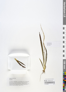
LE 01066809
Oberonia acaulis Griff. det. Averyanov, Leonid Vladimirovich at 10.12.2019
Collectors: Averyanov, Leonid Vladimirovich; Khang Sinh Nguyen; Maisak, Tatiana Viktorovna Field collecting number: VR1476. Collection date: 09.10.2019. Administrative regions: VN - Tinh Ha Giang. Groups of specimens: L. V. Averyanov specimens; L. V. Averyanov herbarium; Orchids of Vietnam, Laos and CambodiaOriginal label text:FLORA OF VIETNAM
Coordinates (geographic position): 23° 2′ 6.47″ N, 104° 52′ 12.58″ E ±1000 mComment: Orchidaceae
Oberonia acaulis Griff.
Ha Giang Prov., Quan Ba Distr., Ta Van Commune, Can Ho Village, around point 23.03513ºN 104.87016ºE, steep rocky mountain slopes composed of eroded limestone at elevation 1100–1250 m a.s.l. near mountain top. Secondary evergreen broad-leaved humid forest. Epiphyte on old mossy tree in shady place. Flowers orange-brown. Not common. 9 October 2019, L. Averyanov, Nguyen Sinh Khang, T. Maisak, VR 1476.
All photos © L. Averyanov & K.S. Nguyen
Record creation: 2020-01-05, Leonid Averyanov, PhotoScan D1. Processing status: work_status_1Citation: Specimen LE 01066809 // Virtual herbarium of Komarov Botanical Institute RAS — http://re.herbariumle.ru/01066809