View
Add
Copy
Edit
Delete
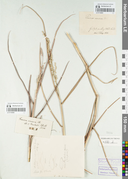
LE 01154561
Groups of specimens: Гербарий Карла Бернхарда Триниуса; Соглашение Минобрнауки №075-15-2021-1056Record creation: 2021-12-02, Marina Yarichina, PhotoScan D2Citation: Specimen LE 01154561 // Virtual herbarium of Komarov Botanical Institute RAS — http://re.herbariumle.ru/01154561
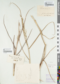
LE 01154560
Groups of specimens: Гербарий Карла Бернхарда Триниуса; Соглашение Минобрнауки №075-15-2021-1056Record creation: 2021-12-02, Marina Yarichina, PhotoScan D2Citation: Specimen LE 01154560 // Virtual herbarium of Komarov Botanical Institute RAS — http://re.herbariumle.ru/01154560
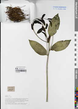
LE 01077678
Melientha suavis Pierre det. Averyanov, Leonid Vladimirovich at 04.04.2017
Collectors: Averyanov, Leonid Vladimirovich; Tien Hiep Nguyen; Khang Sinh Nguyen; et al. Field collecting number: LA-VN2069. Collection date: 04.04.2017. Administrative regions: LA - Luang Prabang Province. Groups of specimens: L. V. Averyanov specimens; L. V. Averyanov herbarium; Соглашение Минобрнауки №075-15-2021-1056Original label text:FLORA OF LAOS
Opiliaceae
Melientha suavis Pierre
Luang Prabang prov., Pon Xay distr., Houay Man village, Phou Tham Keo Mountain, around point 19°57′44.2′'N 102°25′45.8′'E.
Degraded primary evergreen and semideciduous forest on very steep rocky mountain slopes composed by solid marble like highly eroded limestone at elev. 500-650 m a.s.l.
Caulifloric tree to 20 m tall and 25 cm DBH on steep rocky mountain slope. Flowers greenish. Not rare.
LA-VN 2069 4 April 2017 Photos
Coll.: L.Averyanov, N.T.Hiep, N.S.Khang, C.Q.Ngan, T.Maisak, Vichith Lamxay, Koudkeo Phommachanh, Phizar Sayalath, Keooudone Souvannakhoummane.
Coordinates (geographic position): 19° 57′ 44.2″ N, 102° 25′ 45.8″ E ±1000 mRecord creation: 2021-12-02, Tatiana Maisak, PhotoScan D2Citation: Specimen LE 01077678 // Virtual herbarium of Komarov Botanical Institute RAS — http://re.herbariumle.ru/01077678Opiliaceae
Melientha suavis Pierre
Luang Prabang prov., Pon Xay distr., Houay Man village, Phou Tham Keo Mountain, around point 19°57′44.2′'N 102°25′45.8′'E.
Degraded primary evergreen and semideciduous forest on very steep rocky mountain slopes composed by solid marble like highly eroded limestone at elev. 500-650 m a.s.l.
Caulifloric tree to 20 m tall and 25 cm DBH on steep rocky mountain slope. Flowers greenish. Not rare.
LA-VN 2069 4 April 2017 Photos
Coll.: L.Averyanov, N.T.Hiep, N.S.Khang, C.Q.Ngan, T.Maisak, Vichith Lamxay, Koudkeo Phommachanh, Phizar Sayalath, Keooudone Souvannakhoummane.
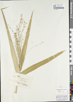
LE 01154559
Groups of specimens: Гербарий Карла Бернхарда Триниуса; Соглашение Минобрнауки №075-15-2021-1056Record creation: 2021-12-02, Marina Yarichina, PhotoScan D2Citation: Specimen LE 01154559 // Virtual herbarium of Komarov Botanical Institute RAS — http://re.herbariumle.ru/01154559
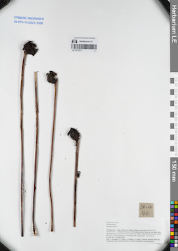
LE 01077677
Aeginetia indica L. det. Averyanov, Leonid Vladimirovich at 23.03.2017
Collectors: Averyanov, Leonid Vladimirovich; Tien Hiep Nguyen; Khang Sinh Nguyen; et al. Field collecting number: LA-VN1612. Collection date: 23.03.2017. Administrative regions: LA - Vientiane Province. Groups of specimens: L. V. Averyanov specimens; L. V. Averyanov herbarium; Соглашение Минобрнауки №075-15-2021-1056Original label text:FLORA OF LAOS
Orobanchaceae
Aeginetia indica L.
Vientiane prov., Vang Vieng distr., Patang village, around point 19°04′15.6′'N 102°24′33.2′'E.
Secondary broad-leaved semi-deciduous dry forest on very steep rocky mountain slopes composed by solid marble like highly eroded limestone at elev. about 670 m a.s.l.
Achlorophyllous mycotrophic herb in open place. Not common.
LA-VN 1612 23 March 2017
Coll.: L.Averyanov, N.T.Hiep, N.S.Khang, C.Q.Ngan, T.Maisak, Khamla Inkhavilay, Hongthong Southyvohanh, Pinmany Sisavath, Chanthala Cheuaysamphanh.
Coordinates (geographic position): 19° 4′ 15.6″ N, 102° 24′ 33.2″ E ±1000 mRecord creation: 2021-12-02, Tatiana Maisak, PhotoScan D2Citation: Specimen LE 01077677 // Virtual herbarium of Komarov Botanical Institute RAS — http://re.herbariumle.ru/01077677Orobanchaceae
Aeginetia indica L.
Vientiane prov., Vang Vieng distr., Patang village, around point 19°04′15.6′'N 102°24′33.2′'E.
Secondary broad-leaved semi-deciduous dry forest on very steep rocky mountain slopes composed by solid marble like highly eroded limestone at elev. about 670 m a.s.l.
Achlorophyllous mycotrophic herb in open place. Not common.
LA-VN 1612 23 March 2017
Coll.: L.Averyanov, N.T.Hiep, N.S.Khang, C.Q.Ngan, T.Maisak, Khamla Inkhavilay, Hongthong Southyvohanh, Pinmany Sisavath, Chanthala Cheuaysamphanh.
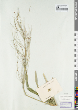
LE 01154558
Groups of specimens: Гербарий Карла Бернхарда Триниуса; Соглашение Минобрнауки №075-15-2021-1056Record creation: 2021-12-02, Marina Yarichina, PhotoScan D2Citation: Specimen LE 01154558 // Virtual herbarium of Komarov Botanical Institute RAS — http://re.herbariumle.ru/01154558
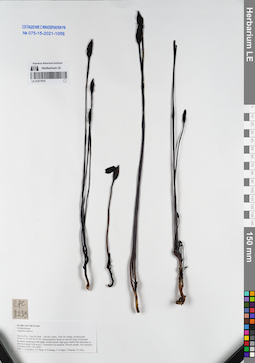
LE 01077676
Aeginetia indica L. det. Averyanov, Leonid Vladimirovich at 02.10.2016
Collectors: Averyanov, Leonid Vladimirovich; Tien Hiep Nguyen; Khang Sinh Nguyen; et al. Field collecting number: CPC8239. Collection date: 02.10.2016. Administrative regions: VN - Tinh Son La. Groups of specimens: L. V. Averyanov specimens; L. V. Averyanov herbarium; Соглашение Минобрнауки №075-15-2021-1056Original label text:FLORA OF VIETNAM
Orobanchaceae
Aeginetia indica L.
Son La Prov., Van Ho Distr., Van Ho comm., Hua Tat village, around point 20°46′21.7N 104°47′47.5E.
Dense bamboo forest on alluvial slope of remnant mountain composed with highly eroded karstic light gray marble-like limestone at elevation about 1100 m a.s.l.
Terrestrial root parasite. Flowers purple. Not common.
2 October 2016 CPC 8239
Coll.: L.Averyanov, N.T.Hiep, N.S.Khang, C.Q.Ngan, T.V.Maisak, N.T.Son.
Coordinates (geographic position): 20° 46′ 21.7″ N, 104° 47′ 47.5″ E ±1000 mRecord creation: 2021-12-02, Tatiana Maisak, PhotoScan D2Citation: Specimen LE 01077676 // Virtual herbarium of Komarov Botanical Institute RAS — http://re.herbariumle.ru/01077676Orobanchaceae
Aeginetia indica L.
Son La Prov., Van Ho Distr., Van Ho comm., Hua Tat village, around point 20°46′21.7N 104°47′47.5E.
Dense bamboo forest on alluvial slope of remnant mountain composed with highly eroded karstic light gray marble-like limestone at elevation about 1100 m a.s.l.
Terrestrial root parasite. Flowers purple. Not common.
2 October 2016 CPC 8239
Coll.: L.Averyanov, N.T.Hiep, N.S.Khang, C.Q.Ngan, T.V.Maisak, N.T.Son.
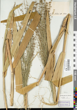
LE 01154557
Groups of specimens: Гербарий Карла Бернхарда Триниуса; Соглашение Минобрнауки №075-15-2021-1056Record creation: 2021-12-02, Marina Yarichina, PhotoScan D2Citation: Specimen LE 01154557 // Virtual herbarium of Komarov Botanical Institute RAS — http://re.herbariumle.ru/01154557
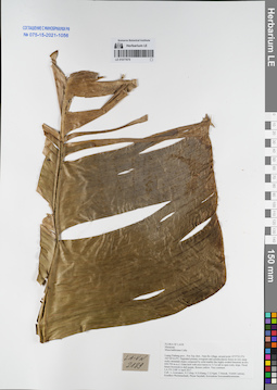
LE 01077675
Musa balbisiana Colla det. Averyanov, Leonid Vladimirovich at 06.04.2017
Collectors: Averyanov, Leonid Vladimirovich; Tien Hiep Nguyen; Khang Sinh Nguyen; et al. Field collecting number: LA-VN2189. Collection date: 06.04.2017. Administrative regions: LA - Luang Prabang Province. Groups of specimens: L. V. Averyanov specimens; L. V. Averyanov herbarium; Соглашение Минобрнауки №075-15-2021-1056Original label text:FLORA OF LAOS
Musaceae
Musa balbisiana Colla.
Luang Prabang prov., Pon Xay distr., Nam Bo village, around point 19°57′23.5′'N 102°26′16.4′'E.
Degraded primary evergreen and semideciduous forest on very steep rocky mountain slopes composed by solid marble like highly eroded limestone at elev. 650-750 m a.s.l.
Giant herb with erect leaves to 5.5 m tall in open rocky slope. Floral bracts brownish to dull purple, flowers yellow. Very common.
LA-VN 2189 6 April 2017
Coll.: L.Averyanov, N.T.Hiep, N.S.Khang, C.Q.Ngan, T.Maisak, Vichith Lamxay, Koudkeo Phommachanh, Phizar Sayalath, Keooudone Souvannakhoummane.
Coordinates (geographic position): 19° 57′ 23.5″ N, 102° 26′ 16.4″ E ±1000 mRecord creation: 2021-12-02, Tatiana Maisak, PhotoScan D2Citation: Specimen LE 01077675 // Virtual herbarium of Komarov Botanical Institute RAS — http://re.herbariumle.ru/01077675Musaceae
Musa balbisiana Colla.
Luang Prabang prov., Pon Xay distr., Nam Bo village, around point 19°57′23.5′'N 102°26′16.4′'E.
Degraded primary evergreen and semideciduous forest on very steep rocky mountain slopes composed by solid marble like highly eroded limestone at elev. 650-750 m a.s.l.
Giant herb with erect leaves to 5.5 m tall in open rocky slope. Floral bracts brownish to dull purple, flowers yellow. Very common.
LA-VN 2189 6 April 2017
Coll.: L.Averyanov, N.T.Hiep, N.S.Khang, C.Q.Ngan, T.Maisak, Vichith Lamxay, Koudkeo Phommachanh, Phizar Sayalath, Keooudone Souvannakhoummane.
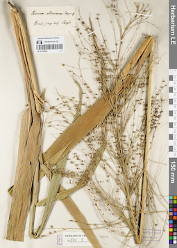
LE 01154556
Groups of specimens: Гербарий Карла Бернхарда Триниуса; Соглашение Минобрнауки №075-15-2021-1056Record creation: 2021-12-02, Marina Yarichina, PhotoScan D2Citation: Specimen LE 01154556 // Virtual herbarium of Komarov Botanical Institute RAS — http://re.herbariumle.ru/01154556
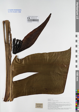
LE 01077674
Musa nanensis Swangpol & Traiperm det. Averyanov, Leonid Vladimirovich at 25.03.2017
Collectors: Averyanov, Leonid Vladimirovich; Tien Hiep Nguyen; Khang Sinh Nguyen; et al. Field collecting number: LA-VN1624. Collection date: 25.03.2017. Administrative regions: LA - Vientiane Province. Groups of specimens: L. V. Averyanov specimens; L. V. Averyanov herbarium; Соглашение Минобрнауки №075-15-2021-1056Original label text:FLORA OF LAOS
Musaceae
Musa nanensis Swangpol & Traiperm
Vientiane prov., Kasi distr., between San and Tham Tai villages, around point 19°17′47.9′'N 102°08′58.9′'E.
Secondary broad-leaved evergreen dry forest on very steep rocky mountain slopes composed by solid marble like highly eroded limestone at elev. 900-1000 m a.s.l.
Giant herb with leaves to 4.5 m long on steep humid stream slope. Inflorescence bracts bright red, flowers and ovaries yellowish. Not rare.
LA-VN 1624 25 March 2017 Photos.
Coll.: L.Averyanov, N.T.Hiep, N.S.Khang, C.Q.Ngan, T.Maisak, Khamla Inkhavilay, Hongthong Southyvohanh, Pinmany Sisavath, Chanthala Cheuaysamphanh.
Coordinates (geographic position): 19° 17′ 47.9″ N, 102° 8′ 58.9″ E ±1000 mRecord creation: 2021-12-02, Tatiana Maisak, PhotoScan D2Citation: Specimen LE 01077674 // Virtual herbarium of Komarov Botanical Institute RAS — http://re.herbariumle.ru/01077674Musaceae
Musa nanensis Swangpol & Traiperm
Vientiane prov., Kasi distr., between San and Tham Tai villages, around point 19°17′47.9′'N 102°08′58.9′'E.
Secondary broad-leaved evergreen dry forest on very steep rocky mountain slopes composed by solid marble like highly eroded limestone at elev. 900-1000 m a.s.l.
Giant herb with leaves to 4.5 m long on steep humid stream slope. Inflorescence bracts bright red, flowers and ovaries yellowish. Not rare.
LA-VN 1624 25 March 2017 Photos.
Coll.: L.Averyanov, N.T.Hiep, N.S.Khang, C.Q.Ngan, T.Maisak, Khamla Inkhavilay, Hongthong Southyvohanh, Pinmany Sisavath, Chanthala Cheuaysamphanh.
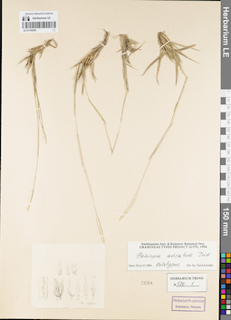
LE 01154555
Groups of specimens: Гербарий Карла Бернхарда Триниуса; Соглашение Минобрнауки №075-15-2021-1056Record creation: 2021-12-02, Marina Yarichina, PhotoScan D2Citation: Specimen LE 01154555 // Virtual herbarium of Komarov Botanical Institute RAS — http://re.herbariumle.ru/01154555
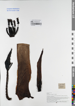
LE 01077673
Musa nanensis Swangpol & Traiperm det. Averyanov, Leonid Vladimirovich at 25.03.2017
Collectors: Averyanov, Leonid Vladimirovich; Tien Hiep Nguyen; Khang Sinh Nguyen; et al. Field collecting number: LA-VN1624. Collection date: 25.03.2017. Administrative regions: LA - Vientiane Province. Groups of specimens: L. V. Averyanov specimens; L. V. Averyanov herbarium; Соглашение Минобрнауки №075-15-2021-1056Original label text:FLORA OF LAOS
Musaceae
Musa nanensis Swangpol & Traiperm
Vientiane prov., Kasi distr., between San and Tham Tai villages, around point 19°17′47.9′'N 102°08′58.9′'E.
Secondary broad-leaved evergreen dry forest on very steep rocky mountain slopes composed by solid marble like highly eroded limestone at elev. 900-1000 m a.s.l.
Giant herb with leaves to 4.5 m long on steep humid stream slope. Inflorescence bracts bright red, flowers and ovaries yellowish. Not rare.
LA-VN 1624 25 March 2017 Photos.
Coll.: L.Averyanov, N.T.Hiep, N.S.Khang, C.Q.Ngan, T.Maisak, Khamla Inkhavilay, Hongthong Southyvohanh, Pinmany Sisavath, Chanthala Cheuaysamphanh.
Coordinates (geographic position): 19° 17′ 47.9″ N, 102° 8′ 58.9″ E ±1000 mRecord creation: 2021-12-02, Tatiana Maisak, PhotoScan D2Citation: Specimen LE 01077673 // Virtual herbarium of Komarov Botanical Institute RAS — http://re.herbariumle.ru/01077673Musaceae
Musa nanensis Swangpol & Traiperm
Vientiane prov., Kasi distr., between San and Tham Tai villages, around point 19°17′47.9′'N 102°08′58.9′'E.
Secondary broad-leaved evergreen dry forest on very steep rocky mountain slopes composed by solid marble like highly eroded limestone at elev. 900-1000 m a.s.l.
Giant herb with leaves to 4.5 m long on steep humid stream slope. Inflorescence bracts bright red, flowers and ovaries yellowish. Not rare.
LA-VN 1624 25 March 2017 Photos.
Coll.: L.Averyanov, N.T.Hiep, N.S.Khang, C.Q.Ngan, T.Maisak, Khamla Inkhavilay, Hongthong Southyvohanh, Pinmany Sisavath, Chanthala Cheuaysamphanh.
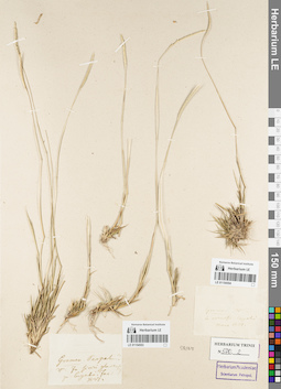
LE 01154554
Groups of specimens: Гербарий Карла Бернхарда Триниуса; Соглашение Минобрнауки №075-15-2021-1056Record creation: 2021-12-02, Marina Yarichina, PhotoScan D2Citation: Specimen LE 01154554 // Virtual herbarium of Komarov Botanical Institute RAS — http://re.herbariumle.ru/01154554
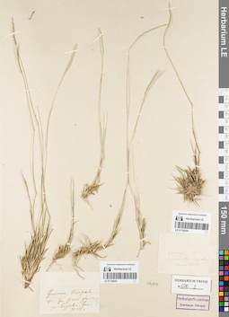
LE 01154553
Groups of specimens: Гербарий Карла Бернхарда Триниуса; Соглашение Минобрнауки №075-15-2021-1056Record creation: 2021-12-02, Marina Yarichina, PhotoScan D2Citation: Specimen LE 01154553 // Virtual herbarium of Komarov Botanical Institute RAS — http://re.herbariumle.ru/01154553
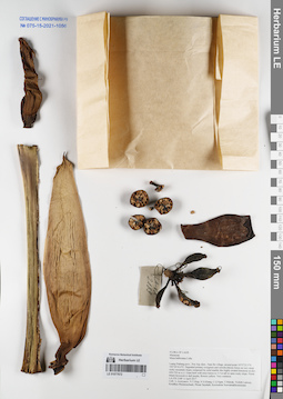
LE 01077672
Musa balbisiana Colla det. Averyanov, Leonid Vladimirovich at 06.04.2017
Collectors: Averyanov, Leonid Vladimirovich; Tien Hiep Nguyen; Khang Sinh Nguyen; et al. Field collecting number: LA-VN2189. Collection date: 06.04.2017. Administrative regions: LA - Luang Prabang Province. Groups of specimens: L. V. Averyanov specimens; L. V. Averyanov herbarium; Соглашение Минобрнауки №075-15-2021-1056Original label text:FLORA OF LAOS
Musaceae
Musa balbisiana Colla.
Luang Prabang prov., Pon Xay distr., Nam Bo village, around point 19°57′23.5′'N 102°26′16.4′'E.
Degraded primary evergreen and semideciduous forest on very steep rocky mountain slopes composed by solid marble like highly eroded limestone at elev. 650-750 m a.s.l.
Giant herb with erect leaves to 5.5 m tall in open rocky slope. Floral bracts brownish to dull purple, flowers yellow. Very common.
LA-VN 2189 6 April 2017
Coll.: L.Averyanov, N.T.Hiep, N.S.Khang, C.Q.Ngan, T.Maisak, Vichith Lamxay, Koudkeo Phommachanh, Phizar Sayalath, Keooudone Souvannakhoummane.
Coordinates (geographic position): 19° 57′ 23.5″ N, 102° 26′ 16.4″ E ±1000 mRecord creation: 2021-12-02, Tatiana Maisak, PhotoScan D2Citation: Specimen LE 01077672 // Virtual herbarium of Komarov Botanical Institute RAS — http://re.herbariumle.ru/01077672Musaceae
Musa balbisiana Colla.
Luang Prabang prov., Pon Xay distr., Nam Bo village, around point 19°57′23.5′'N 102°26′16.4′'E.
Degraded primary evergreen and semideciduous forest on very steep rocky mountain slopes composed by solid marble like highly eroded limestone at elev. 650-750 m a.s.l.
Giant herb with erect leaves to 5.5 m tall in open rocky slope. Floral bracts brownish to dull purple, flowers yellow. Very common.
LA-VN 2189 6 April 2017
Coll.: L.Averyanov, N.T.Hiep, N.S.Khang, C.Q.Ngan, T.Maisak, Vichith Lamxay, Koudkeo Phommachanh, Phizar Sayalath, Keooudone Souvannakhoummane.
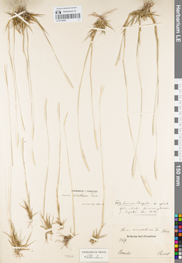
LE 01154552
Groups of specimens: Гербарий Карла Бернхарда Триниуса; Соглашение Минобрнауки №075-15-2021-1056Record creation: 2021-12-02, Marina Yarichina, PhotoScan D2Citation: Specimen LE 01154552 // Virtual herbarium of Komarov Botanical Institute RAS — http://re.herbariumle.ru/01154552
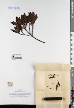
LE 01077671
Rapanea neriifolia (Siebold & Zucc.) det. Tien Hiep Nguyen at 15.08.2011
Collectors: Tien Hiep Nguyen; Nguyen Quang Hieu; N.V. Tap; et al. Field collecting number: CPC4249. Collection date: 15.08.2011. Administrative regions: VN - Tinh Quang Binh. Groups of specimens: L. V. Averyanov specimens; L. V. Averyanov herbarium; Соглашение Минобрнауки №075-15-2021-1056Original label text:FLORA OF VIETNAM
Myrsinaceae
Rapanea neriifolia (Sieb. & Zucc.) Mez
Quang Binh Prov., Minh Hoa Distr., Hoa Son municipality, B’Lam Lang limestone mt., around point 17°42′13.7”N 105°47′33.9”E.
Primary selectedly logged closed evergreen broad-leaved forest on top ridge of mountain at elevation about 700 m a.s.l.
Small shrub, up to 3 m tall. Common.
CPC 4249 15 August 2011
Coll.: N.T.Hiep, N.Q.Hieu, N.V.Tap, N.S.Khang, N.Q.Vinh & L.T.Kien.
Coordinates (geographic position): 17° 42′ 13.7″ N, 105° 47′ 33.9″ E ±1000 mRecord creation: 2021-12-02, Tatiana Maisak, PhotoScan D2Citation: Specimen LE 01077671 // Virtual herbarium of Komarov Botanical Institute RAS — http://re.herbariumle.ru/01077671Myrsinaceae
Rapanea neriifolia (Sieb. & Zucc.) Mez
Quang Binh Prov., Minh Hoa Distr., Hoa Son municipality, B’Lam Lang limestone mt., around point 17°42′13.7”N 105°47′33.9”E.
Primary selectedly logged closed evergreen broad-leaved forest on top ridge of mountain at elevation about 700 m a.s.l.
Small shrub, up to 3 m tall. Common.
CPC 4249 15 August 2011
Coll.: N.T.Hiep, N.Q.Hieu, N.V.Tap, N.S.Khang, N.Q.Vinh & L.T.Kien.
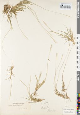
LE 01154551
Groups of specimens: Гербарий Карла Бернхарда Триниуса; Соглашение Минобрнауки №075-15-2021-1056Record creation: 2021-12-02, Marina Yarichina, PhotoScan D2Citation: Specimen LE 01154551 // Virtual herbarium of Komarov Botanical Institute RAS — http://re.herbariumle.ru/01154551
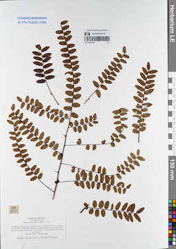
LE 01077670
Embelia polypodioides Hemsl. et Mez det. Averyanov, Leonid Vladimirovich at 05.03.2002
Collectors: Averyanov, Leonid Vladimirovich; Phan Ke Loc; et al. Field collecting number: HAL2055. Collection date: 05.03.2002. Administrative regions: VN - Tinh Lao Cai. Groups of specimens: L. V. Averyanov specimens; L. V. Averyanov herbarium; Соглашение Минобрнауки №075-15-2021-1056Original label text:FLORA OF VIETNAM
Myrsinaceae
Embelia polypodioides Hemsl. et Mez
Northern Vietnam, Lao Cai Prov., Van Ban Distr., to the west of Nam
Xay village (21°58′18′'N, 104°00′24′'E). Primary coniferous (with
Fokienia hodginsii) evergreen montane forest at elev. 1700 m a.s.l.
Climbing shrublet about 0.5 m lg. Common.
HAL 2055 05 March 2002
Collectors: L.Averyanov, P.K.Loc, D.T.Doan (FFI Project).
Coordinates (geographic position): 21° 58′ 18″ N, 104° 0′ 24″ E ±1000 mRecord creation: 2021-12-02, Tatiana Maisak, PhotoScan D2Citation: Specimen LE 01077670 // Virtual herbarium of Komarov Botanical Institute RAS — http://re.herbariumle.ru/01077670Myrsinaceae
Embelia polypodioides Hemsl. et Mez
Northern Vietnam, Lao Cai Prov., Van Ban Distr., to the west of Nam
Xay village (21°58′18′'N, 104°00′24′'E). Primary coniferous (with
Fokienia hodginsii) evergreen montane forest at elev. 1700 m a.s.l.
Climbing shrublet about 0.5 m lg. Common.
HAL 2055 05 March 2002
Collectors: L.Averyanov, P.K.Loc, D.T.Doan (FFI Project).
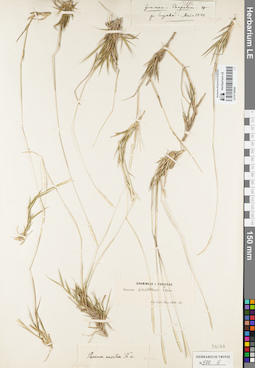
LE 01154550
Groups of specimens: Гербарий Карла Бернхарда Триниуса; Соглашение Минобрнауки №075-15-2021-1056Record creation: 2021-12-02, Marina Yarichina, PhotoScan D2Citation: Specimen LE 01154550 // Virtual herbarium of Komarov Botanical Institute RAS — http://re.herbariumle.ru/01154550
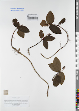
LE 01077669
Ardisia maclurei Merr. det. Averyanov, Leonid Vladimirovich at 28.07.2011
Collectors: Tien Hiep Nguyen; Averyanov, Leonid Vladimirovich; Khang Sinh Nguyen; N.Q. Vinh Field collecting number: CPC3881. Collection date: 28.07.2011. Administrative regions: VN - Tinh Quang Binh. Groups of specimens: L. V. Averyanov specimens; L. V. Averyanov herbarium; Соглашение Минобрнауки №075-15-2021-1056Original label text:FLORA OF VIETNAM
Myrsinaceae
Ardisia maclurei Merr.
Quang Binh Prov., Minh Hoa Distr., Thuong Hoa municipality, environs of Mo O O O village, around point 17°39′21.1”N 105°54′41.7”E.
Closed broad-leaved evergreen primary forest on steep rocky slope of middle part of remnant mountain composed with highly eroded solid crystalline limestone at elevation 400-450 m a.s.l. (mt summit at about 570 m).
Prostrate creeping terrestrial herb in shady places. Leaves dark green. Fruits light green. Occasional.
CPC 3881 28 July 2011
Coll.: N.T.Hiep, L.Averyanov, N.S.Khang, N.Q.Vinh.
Coordinates (geographic position): 17° 39′ 21.1″ N, 105° 54′ 41.7″ E ±1000 mRecord creation: 2021-12-02, Tatiana Maisak, PhotoScan D2Citation: Specimen LE 01077669 // Virtual herbarium of Komarov Botanical Institute RAS — http://re.herbariumle.ru/01077669Myrsinaceae
Ardisia maclurei Merr.
Quang Binh Prov., Minh Hoa Distr., Thuong Hoa municipality, environs of Mo O O O village, around point 17°39′21.1”N 105°54′41.7”E.
Closed broad-leaved evergreen primary forest on steep rocky slope of middle part of remnant mountain composed with highly eroded solid crystalline limestone at elevation 400-450 m a.s.l. (mt summit at about 570 m).
Prostrate creeping terrestrial herb in shady places. Leaves dark green. Fruits light green. Occasional.
CPC 3881 28 July 2011
Coll.: N.T.Hiep, L.Averyanov, N.S.Khang, N.Q.Vinh.
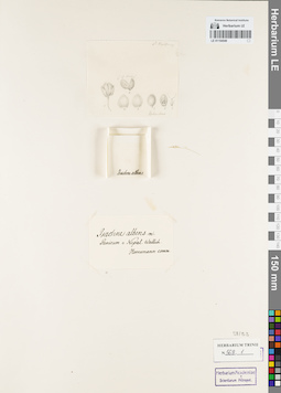
LE 01154549
Groups of specimens: Гербарий Карла Бернхарда Триниуса; Соглашение Минобрнауки №075-15-2021-1056Record creation: 2021-12-02, Marina Yarichina, PhotoScan D2Citation: Specimen LE 01154549 // Virtual herbarium of Komarov Botanical Institute RAS — http://re.herbariumle.ru/01154549
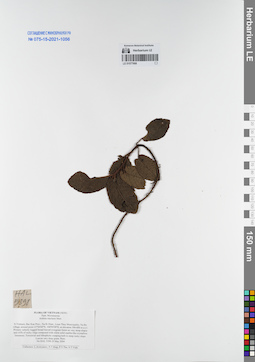
LE 01077668
Ardisia maclurei Merr. det. Averyanov, Leonid Vladimirovich at 29.05.2004
Collectors: Averyanov, Leonid Vladimirovich; Tien Hiep Nguyen; The Van Pham; et al. Field collecting number: HAL5398. Collection date: 29.05.2004. Administrative regions: VN - Tinh Bac Kan. Groups of specimens: L. V. Averyanov specimens; L. V. Averyanov herbarium; Соглашение Минобрнауки №075-15-2021-1056Original label text:FLORA OF VIETNAM (NEW)
Myrsinaceae
Ardisia maclurei Merr.
N.Vietnam, Bac Kan Prov., Na Ri Distr., Liem Thuy Municipality, Na Bo
village, around point 21°56′44′'N, 106°05′09′'E, at elevation 300-600
m a.s.l.
Primary selectly logged broad-leaved evergreen forest on very steep
slopes and cliffs of rocky ridge composed with white solid marble-like
crystalline limestone.
Terrestrial and lithophytic creeping herb in steep rocky slope. Leaves
very deep green. Rare.
HAL 5398 29 May 2004
Coordinates (geographic position): 21° 56′ 44″ N, 106° 5′ 9″ E ±1000 mRecord creation: 2021-12-02, Tatiana Maisak, PhotoScan D2Citation: Specimen LE 01077668 // Virtual herbarium of Komarov Botanical Institute RAS — http://re.herbariumle.ru/01077668Myrsinaceae
Ardisia maclurei Merr.
N.Vietnam, Bac Kan Prov., Na Ri Distr., Liem Thuy Municipality, Na Bo
village, around point 21°56′44′'N, 106°05′09′'E, at elevation 300-600
m a.s.l.
Primary selectly logged broad-leaved evergreen forest on very steep
slopes and cliffs of rocky ridge composed with white solid marble-like
crystalline limestone.
Terrestrial and lithophytic creeping herb in steep rocky slope. Leaves
very deep green. Rare.
HAL 5398 29 May 2004
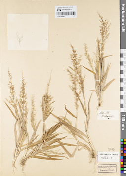
LE 01154548
Groups of specimens: Гербарий Карла Бернхарда Триниуса; Соглашение Минобрнауки №075-15-2021-1056Record creation: 2021-12-02, Marina Yarichina, PhotoScan D2Citation: Specimen LE 01154548 // Virtual herbarium of Komarov Botanical Institute RAS — http://re.herbariumle.ru/01154548
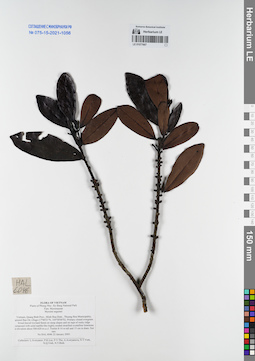
LE 01077667
Myrsine seguinii H.Lév. det. Averyanov, Leonid Vladimirovich at 22.01.2005
Collectors: Averyanov, Leonid Vladimirovich; Phan Ke Loc; The Van Pham; et al. Field collecting number: HAL6046. Collection date: 22.01.2005. Administrative regions: VN - Tinh Quang Binh. Groups of specimens: L. V. Averyanov specimens; L. V. Averyanov herbarium; Соглашение Минобрнауки №075-15-2021-1056Original label text:FLORA OF VIETNAM
Plants of Phong Nha - Ke Bang National Park
Myrsinaceae
Myrsine seguinei
Vietnam, Quang Binh Prov., Minh Hoa Distr., Thuong Hoa Municipality, around Ban On village (17°40′21′'N, 105°58′00′'E).
Primary closed evergreen broad-leaved lowland forest on steep slopes and on tops of rocky ridge composed with solid marble-like highly eroded stratified crystalline limestone at elevation about 500-620 m a.s.l.
Treelet 8-10 m tall and 15 cm in diam. Not rare.
HAL 6046 22 January 2005.
Collectors: L.Averyanov, P.K.Loc, P.V.The, A.Averyanova, N.T.Vinh, N.Q.Vinh, N.T.Binh.
Coordinates (geographic position): 17° 40′ 21″ N, 105° 58′ E ±1000 mRecord creation: 2021-12-02, Tatiana Maisak, PhotoScan D2Citation: Specimen LE 01077667 // Virtual herbarium of Komarov Botanical Institute RAS — http://re.herbariumle.ru/01077667Plants of Phong Nha - Ke Bang National Park
Myrsinaceae
Myrsine seguinei
Vietnam, Quang Binh Prov., Minh Hoa Distr., Thuong Hoa Municipality, around Ban On village (17°40′21′'N, 105°58′00′'E).
Primary closed evergreen broad-leaved lowland forest on steep slopes and on tops of rocky ridge composed with solid marble-like highly eroded stratified crystalline limestone at elevation about 500-620 m a.s.l.
Treelet 8-10 m tall and 15 cm in diam. Not rare.
HAL 6046 22 January 2005.
Collectors: L.Averyanov, P.K.Loc, P.V.The, A.Averyanova, N.T.Vinh, N.Q.Vinh, N.T.Binh.
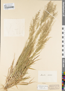
LE 01154547
Groups of specimens: Гербарий Карла Бернхарда Триниуса; Соглашение Минобрнауки №075-15-2021-1056Record creation: 2021-12-02, Marina Yarichina, PhotoScan D2Citation: Specimen LE 01154547 // Virtual herbarium of Komarov Botanical Institute RAS — http://re.herbariumle.ru/01154547
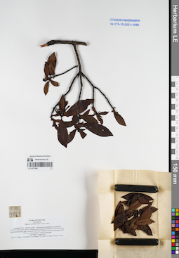
LE 01077666
Rapanea neriifolia (Siebold & Zucc.) det. Averyanov, Leonid Vladimirovich at 06.08.2011
Collectors: Tien Hiep Nguyen; Averyanov, Leonid Vladimirovich; Khang Sinh Nguyen; et al. Field collecting number: CPC4089. Collection date: 06.08.2011. Administrative regions: VN - Tinh Quang Binh. Groups of specimens: L. V. Averyanov specimens; L. V. Averyanov herbarium; Соглашение Минобрнауки №075-15-2021-1056Original label text:FLORA OF VIETNAM
Myrsinaceae
Rapanea neriifolia (Sieb. & Zucc.) Mez
Quang Binh Prov., Minh Hoa Distr., Thuong Hoa municipality, around point 17°41′14.3”N 105°53′28.9”E.
Primary short evergreen broad-leaved mossy forest on tops and along ridge edge composed with solid crystalline limestone at elevation 700-750 m a.s.l.
Shrub about 3 m tall. Occasional.
CPC 4089 6 August 2011
Coll.: N.T.Hiep, L.Averyanov, N.S.Khang, N.Q.Vinh, N.V.Tap, P.V.The, L.T.Kien.
Coordinates (geographic position): 17° 41′ 14.3″ N, 105° 53′ 28.9″ E ±1000 mRecord creation: 2021-12-02, Tatiana Maisak, PhotoScan D2Citation: Specimen LE 01077666 // Virtual herbarium of Komarov Botanical Institute RAS — http://re.herbariumle.ru/01077666Myrsinaceae
Rapanea neriifolia (Sieb. & Zucc.) Mez
Quang Binh Prov., Minh Hoa Distr., Thuong Hoa municipality, around point 17°41′14.3”N 105°53′28.9”E.
Primary short evergreen broad-leaved mossy forest on tops and along ridge edge composed with solid crystalline limestone at elevation 700-750 m a.s.l.
Shrub about 3 m tall. Occasional.
CPC 4089 6 August 2011
Coll.: N.T.Hiep, L.Averyanov, N.S.Khang, N.Q.Vinh, N.V.Tap, P.V.The, L.T.Kien.
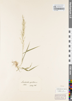
LE 01154546
Groups of specimens: Гербарий Карла Бернхарда Триниуса; Соглашение Минобрнауки №075-15-2021-1056Record creation: 2021-12-02, Marina Yarichina, PhotoScan D2Citation: Specimen LE 01154546 // Virtual herbarium of Komarov Botanical Institute RAS — http://re.herbariumle.ru/01154546
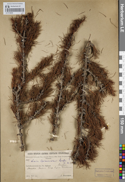
LE 01146205
Groups of specimens: Образцы сектора Сибири и Дальнего Востока России; Соглашение Минобрнауки №075-15-2021-1056Record creation: 2021-12-02, Larisa Orlova, PhotoScan D2Citation: Specimen LE 01146205 // Virtual herbarium of Komarov Botanical Institute RAS — http://re.herbariumle.ru/01146205
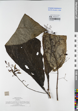
LE 01077665
Ardisia gigantifolia Stapf det. N.Tap at 19.03.2006
Collectors: N.Tap; Phan Ke Loc; et al. Field collecting number: HLF6008. Collection date: 19.03.2006. Administrative regions: VN - Tinh Quang Tri. Groups of specimens: L. V. Averyanov specimens; L. V. Averyanov herbarium; Соглашение Минобрнауки №075-15-2021-1056Original label text:FLORA OF VIETNAM
Plants of the Da Krong Municipality
Myrsinaceae
Ardisia gigantifolia
Vietnam, Quang Tri Prov., Da Krong Distr., Trieu Nguyen Municipality, Na Nam vill., forest quarter 822, ca. 16°39′59″ N, 106057′55″ E, 346 m a.s.l.
On edges of secondary closed evergreen broad-leaved forest on shaly mts. Undershrub, up to 1.5 m. Ripe fruits red. Rare.
HLF 6008 19 March 2006. Photo.
Coll. Nguyen Tap, Phan Ke Loc, Tran Thang Chien.
Grant from Henry Luce Foundation.
Record creation: 2021-12-02, Tatiana Maisak, PhotoScan D2Citation: Specimen LE 01077665 // Virtual herbarium of Komarov Botanical Institute RAS — http://re.herbariumle.ru/01077665Plants of the Da Krong Municipality
Myrsinaceae
Ardisia gigantifolia
Vietnam, Quang Tri Prov., Da Krong Distr., Trieu Nguyen Municipality, Na Nam vill., forest quarter 822, ca. 16°39′59″ N, 106057′55″ E, 346 m a.s.l.
On edges of secondary closed evergreen broad-leaved forest on shaly mts. Undershrub, up to 1.5 m. Ripe fruits red. Rare.
HLF 6008 19 March 2006. Photo.
Coll. Nguyen Tap, Phan Ke Loc, Tran Thang Chien.
Grant from Henry Luce Foundation.
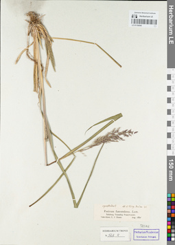
LE 01154545
Groups of specimens: Гербарий Карла Бернхарда Триниуса; Соглашение Минобрнауки №075-15-2021-1056Record creation: 2021-12-02, Marina Yarichina, PhotoScan D2Citation: Specimen LE 01154545 // Virtual herbarium of Komarov Botanical Institute RAS — http://re.herbariumle.ru/01154545
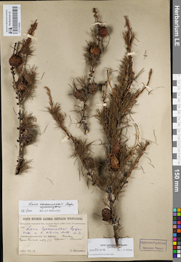
LE 01146204
Groups of specimens: Образцы сектора Сибири и Дальнего Востока России; Соглашение Минобрнауки №075-15-2021-1056Record creation: 2021-12-02, Larisa Orlova, PhotoScan D2Citation: Specimen LE 01146204 // Virtual herbarium of Komarov Botanical Institute RAS — http://re.herbariumle.ru/01146204
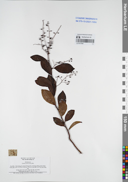
LE 01077664
Embelia subcoriacea Mez det. N.Tap at 30.03.2006
Collectors: N.Tap; N.V. Trai Field collecting number: HLF6358. Collection date: 30.03.2006. Administrative regions: VN - Tinh Quang Tri. Groups of specimens: L. V. Averyanov specimens; L. V. Averyanov herbarium; Соглашение Минобрнауки №075-15-2021-1056Original label text:FLORA OF VIETNAM
Record creation: 2021-12-02, Tatiana Maisak, PhotoScan D2Citation: Specimen LE 01077664 // Virtual herbarium of Komarov Botanical Institute RAS — http://re.herbariumle.ru/01077664Myrsinaceae
Embelia subcoriacea Mez
Tinh Quang Tri Prov.
HLF 6358, 30.03.2006
N. Tap, N.V. Trai.
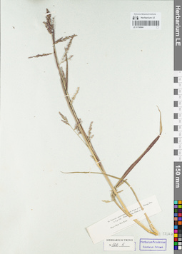
LE 01154544
Groups of specimens: Гербарий Карла Бернхарда Триниуса; Соглашение Минобрнауки №075-15-2021-1056Record creation: 2021-12-02, Marina Yarichina, PhotoScan D2Citation: Specimen LE 01154544 // Virtual herbarium of Komarov Botanical Institute RAS — http://re.herbariumle.ru/01154544
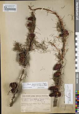
LE 01146203
Groups of specimens: Образцы сектора Сибири и Дальнего Востока России; Соглашение Минобрнауки №075-15-2021-1056Record creation: 2021-12-02, Larisa Orlova, PhotoScan D2Citation: Specimen LE 01146203 // Virtual herbarium of Komarov Botanical Institute RAS — http://re.herbariumle.ru/01146203
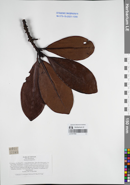
LE 01077663
Myrsine kwangsiensis (E.Walker) Pipoly & C.Chen det. Averyanov, Leonid Vladimirovich at 10.06.2004
Collectors: Averyanov, Leonid Vladimirovich; Phan Ke Loc; The Van Pham; N.T.Vinh Field collecting number: HAL5547. Collection date: 10.06.2004. Administrative regions: VN - Tinh Cao Bang. Groups of specimens: L. V. Averyanov specimens; L. V. Averyanov herbarium; Соглашение Минобрнауки №075-15-2021-1056Original label text:FLORA OF VIETNAM
Myrsinaceae
Mersine kwangsiensis
N.Vietnam, Cao Bang Prov., Trung Khanh Distr., Ngoc Khe Municipality, Pac Nga village, around point 22°54′59′'N, 106°31′44′'E, at elevation 800-850 m a.s.l.
Remnants of primary evergreen broad-leaved forest along tops of rocky ridges and mesae composed with light gray solid marble-like highly eroded crystalline limestone.
Tree 8-12 m tall. Very common. Co-dominant of 2 forest stratum.
HAL 5547 10 June 2004
Collectors: L.Averyanov, P.K.Loc, P.V.The, N.T.Vinh.
Myrsinaceae
Mersine kwangsiensis
N.Vietnam, Cao Bang Prov., Trung Khanh Distr., Ngoc Khe Municipality, Pac Nga village, around point 22°54′59′'N, 106°31′44′'E, at elevation 800-850 m a.s.l.
Remnants of primary evergreen broad-leaved forest along tops of rocky ridges and mesae composed with light gray solid marble-like highly eroded crystalline limestone.
Tree 8-12 m tall. Very common. Co-dominant of 2 forest stratum.
HAL 5547 10 June 2004
Collectors: L.Averyanov, P.K.Loc, P.V.The, N.T.Vinh.
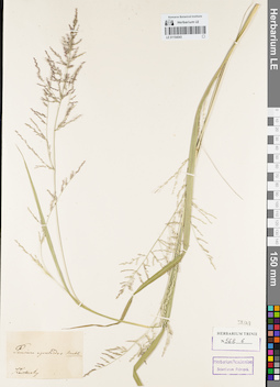
LE 01154543
Groups of specimens: Гербарий Карла Бернхарда Триниуса; Соглашение Минобрнауки №075-15-2021-1056Record creation: 2021-12-02, Marina Yarichina, PhotoScan D2Citation: Specimen LE 01154543 // Virtual herbarium of Komarov Botanical Institute RAS — http://re.herbariumle.ru/01154543
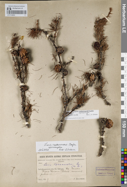
LE 01146202
Groups of specimens: Образцы сектора Сибири и Дальнего Востока России; Соглашение Минобрнауки №075-15-2021-1056Record creation: 2021-12-02, Larisa Orlova, PhotoScan D2Citation: Specimen LE 01146202 // Virtual herbarium of Komarov Botanical Institute RAS — http://re.herbariumle.ru/01146202
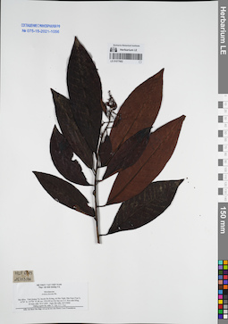
LE 01077662
Ardisia florida Pit. det. N.Tap at 26.03.2006
Collectors: N.Tap; N.V. Trai Field collecting number: HLF6083. Collection date: 26.03.2006. Administrative regions: VN - Tinh Quang Tri. Groups of specimens: L. V. Averyanov specimens; L. V. Averyanov herbarium; Соглашение Минобрнауки №075-15-2021-1056Original label text:FLORA OF VIETNAM
Record creation: 2021-12-02, Tatiana Maisak, PhotoScan D2Citation: Specimen LE 01077662 // Virtual herbarium of Komarov Botanical Institute RAS — http://re.herbariumle.ru/01077662Myrsinaceae
Ardisia florida Pit.
Tinh Quang Tri Prov.
HLF 6083, 26.03.2006
N. Tap, N.V. Trai.
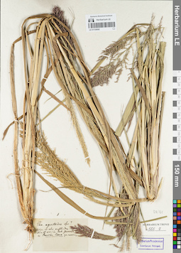
LE 01154542
Groups of specimens: Гербарий Карла Бернхарда Триниуса; Соглашение Минобрнауки №075-15-2021-1056Record creation: 2021-12-02, Marina Yarichina, PhotoScan D2Citation: Specimen LE 01154542 // Virtual herbarium of Komarov Botanical Institute RAS — http://re.herbariumle.ru/01154542
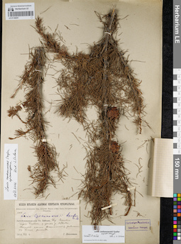
LE 01146201
Groups of specimens: Образцы сектора Сибири и Дальнего Востока России; Соглашение Минобрнауки №075-15-2021-1056Record creation: 2021-12-02, Larisa Orlova, PhotoScan D2Citation: Specimen LE 01146201 // Virtual herbarium of Komarov Botanical Institute RAS — http://re.herbariumle.ru/01146201
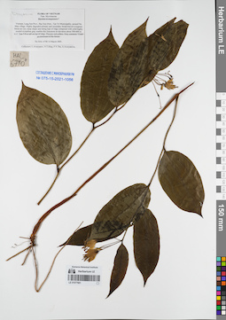
LE 01077661
Disporum sp. det. Averyanov, Leonid Vladimirovich at 14.03.2005
Collectors: Averyanov, Leonid Vladimirovich; Tien Hiep Nguyen; The Van Pham; et al. Field collecting number: HLF6740. Collection date: 14.03.2005. Administrative regions: VN - Tinh Lang Son. Groups of specimens: L. V. Averyanov specimens; L. V. Averyanov herbarium; Соглашение Минобрнауки №075-15-2021-1056Original label text:FLORA OF VIETNAM
Myrsinaceae
Myrsine kwangsiensis ?
Vietnam, Lang Son Prov., Bac Son Distr., Tan Tri Municipality, around Na Mau village.
Highly degraded primary and secondary broad-leaved evergreen forest on very steep slopes and along tops of ridge composed with solid highly eroded crystalline gray marble-like limestone at elevation about 500-600 m a.s.l.
Tree 5-8 m tall on top of ridge. Flowers red-yellow. Very common. Usual co-dominant of the forest.
HAL 6740 14 March 2005.
Collectors: L.Averyanov, N.T.Hiep, P.V.The, A.Averyanova.
Record creation: 2021-12-02, Tatiana Maisak, PhotoScan D2Citation: Specimen LE 01077661 // Virtual herbarium of Komarov Botanical Institute RAS — http://re.herbariumle.ru/01077661Myrsinaceae
Myrsine kwangsiensis ?
Vietnam, Lang Son Prov., Bac Son Distr., Tan Tri Municipality, around Na Mau village.
Highly degraded primary and secondary broad-leaved evergreen forest on very steep slopes and along tops of ridge composed with solid highly eroded crystalline gray marble-like limestone at elevation about 500-600 m a.s.l.
Tree 5-8 m tall on top of ridge. Flowers red-yellow. Very common. Usual co-dominant of the forest.
HAL 6740 14 March 2005.
Collectors: L.Averyanov, N.T.Hiep, P.V.The, A.Averyanova.
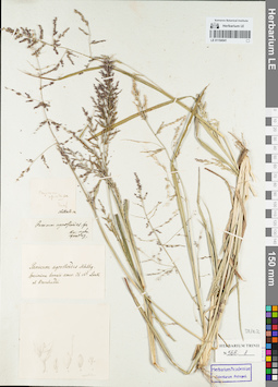
LE 01154541
Groups of specimens: Гербарий Карла Бернхарда Триниуса; Соглашение Минобрнауки №075-15-2021-1056Record creation: 2021-12-02, Marina Yarichina, PhotoScan D2Citation: Specimen LE 01154541 // Virtual herbarium of Komarov Botanical Institute RAS — http://re.herbariumle.ru/01154541
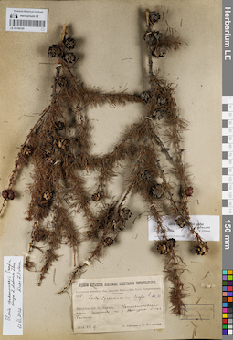
LE 01146165
Groups of specimens: Образцы сектора Сибири и Дальнего Востока России; Соглашение Минобрнауки №075-15-2021-1056Record creation: 2021-12-02, Larisa Orlova, PhotoScan D2Citation: Specimen LE 01146165 // Virtual herbarium of Komarov Botanical Institute RAS — http://re.herbariumle.ru/01146165
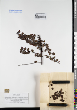
LE 01077660
Embelia polypodioides Hemsl. et Mez ⟮prelim. ID⟯ det. Averyanov, Leonid Vladimirovich at 09.12.2005
Collectors: Averyanov, Leonid Vladimirovich; Phan Ke Loc; et al. Field collecting number: HAL8452. Collection date: 09.12.2005. Administrative regions: VN - Tinh Ha Giang. Groups of specimens: L. V. Averyanov specimens; L. V. Averyanov herbarium; Соглашение Минобрнауки №075-15-2021-1056Original label text:FLORA OF VIETNAM
Myrsinaceae
Embelia polypodioides?
Vietnam, Ha Giang Prov., Yen Minh Distr, Lao Va Chai Municipality, vicinities of Chi Sang village around point 23°05′55″N, 105°04′10″E at elevation about 1500 m a.s.l.
Primary mossy coniferous forest with Tsuga sinensis and Pinus kwamgtungensis on tops of high rocky ridge composed with highly eroded marble-like limestone.
Climbing shrub with shoots up to 3 m long. Not rare.
HAL 8452 9 Dec 2005.
Coordinates (geographic position): 23° 5′ 55″ N, 105° 4′ 10″ E ±1000 mRecord creation: 2021-12-02, Tatiana Maisak, PhotoScan D2Citation: Specimen LE 01077660 // Virtual herbarium of Komarov Botanical Institute RAS — http://re.herbariumle.ru/01077660Myrsinaceae
Embelia polypodioides?
Vietnam, Ha Giang Prov., Yen Minh Distr, Lao Va Chai Municipality, vicinities of Chi Sang village around point 23°05′55″N, 105°04′10″E at elevation about 1500 m a.s.l.
Primary mossy coniferous forest with Tsuga sinensis and Pinus kwamgtungensis on tops of high rocky ridge composed with highly eroded marble-like limestone.
Climbing shrub with shoots up to 3 m long. Not rare.
HAL 8452 9 Dec 2005.
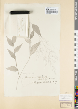
LE 01154540
Groups of specimens: Гербарий Карла Бернхарда Триниуса; Соглашение Минобрнауки №075-15-2021-1056Record creation: 2021-12-02, Marina Yarichina, PhotoScan D2Citation: Specimen LE 01154540 // Virtual herbarium of Komarov Botanical Institute RAS — http://re.herbariumle.ru/01154540
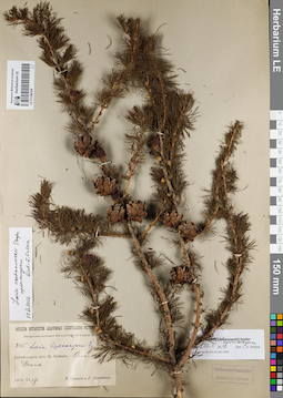
LE 01146164
Groups of specimens: Образцы сектора Сибири и Дальнего Востока России; Соглашение Минобрнауки №075-15-2021-1056Record creation: 2021-12-02, Larisa Orlova, PhotoScan D2Citation: Specimen LE 01146164 // Virtual herbarium of Komarov Botanical Institute RAS — http://re.herbariumle.ru/01146164
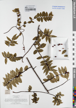
LE 01077659
Embelia polypodioides Hemsl. et Mez ⟮prelim. ID⟯ det. Averyanov, Leonid Vladimirovich at 03.12.2006
Collectors: Tien Hiep Nguyen; Averyanov, Leonid Vladimirovich; The Van Pham Field collecting number: HAL10314. Collection date: 03.12.2006. Administrative regions: VN - Tinh Lai Chau. Groups of specimens: L. V. Averyanov specimens; L. V. Averyanov herbarium; Соглашение Минобрнауки №075-15-2021-1056Original label text:FLORA OF VIETNAM
Myrsinaceae
Embelia polypodioides?
Lai Chau Prov., Tam Duong Distr., Ho Thau Community, Ho Thau village, around point 22°23′49″N 103°36′39″E.
Primary closed evergreen broad-leaved forest on steep mountain slopes and along ridges composed with granite and shale at elev. about 1900-2350 m a.s.l.
Woody vine 2-3 m long on very steep rocky slope. Fruits red. Not rare.
HAL 10314 3 Dec. 2006 Photo.
Coll.: Nguyen Tien Hiep, L.Averyanov, Pham Van The.
Coordinates (geographic position): 22° 23′ 49″ N, 103° 36′ 39″ E ±1000 mRecord creation: 2021-12-02, Tatiana Maisak, PhotoScan D2Citation: Specimen LE 01077659 // Virtual herbarium of Komarov Botanical Institute RAS — http://re.herbariumle.ru/01077659Myrsinaceae
Embelia polypodioides?
Lai Chau Prov., Tam Duong Distr., Ho Thau Community, Ho Thau village, around point 22°23′49″N 103°36′39″E.
Primary closed evergreen broad-leaved forest on steep mountain slopes and along ridges composed with granite and shale at elev. about 1900-2350 m a.s.l.
Woody vine 2-3 m long on very steep rocky slope. Fruits red. Not rare.
HAL 10314 3 Dec. 2006 Photo.
Coll.: Nguyen Tien Hiep, L.Averyanov, Pham Van The.
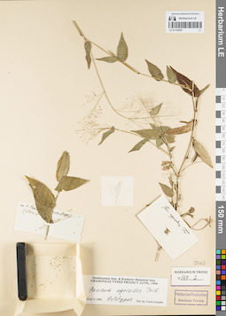
LE 01154539
Groups of specimens: Гербарий Карла Бернхарда Триниуса; Соглашение Минобрнауки №075-15-2021-1056Record creation: 2021-12-02, Marina Yarichina, PhotoScan D2Citation: Specimen LE 01154539 // Virtual herbarium of Komarov Botanical Institute RAS — http://re.herbariumle.ru/01154539