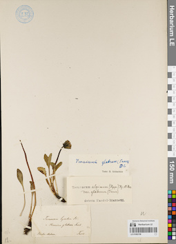
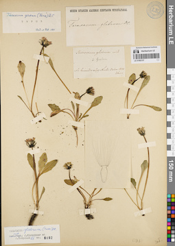
View
Add
Copy
Edit
Delete
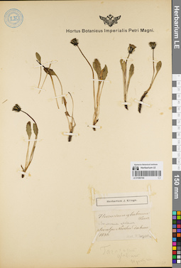
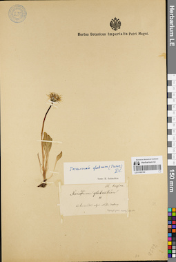
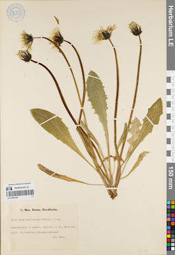
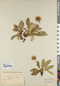
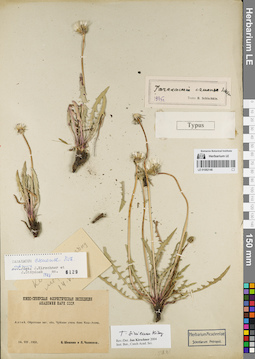
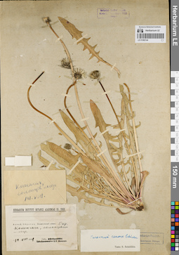
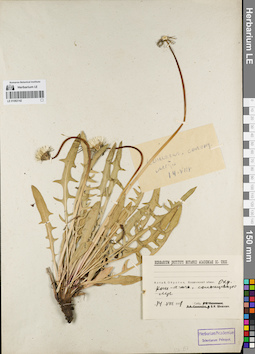
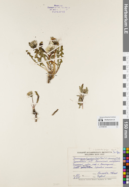
LE 01082164
Groups of specimens: Образцы сектора Сибири и Дальнего Востока России; Типовые образцы сектора Сибири и Дальнего Востока России; Соглашение Минобрнауки №075-15-2021-1056Record creation: 2022-01-26, Marina Yarichina, PhotoScan D2Citation: Specimen LE 01082164 // Virtual herbarium of Komarov Botanical Institute RAS — http://re.herbariumle.ru/01082164
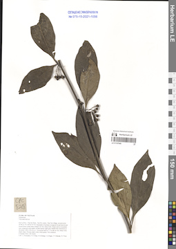
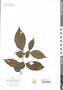
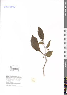
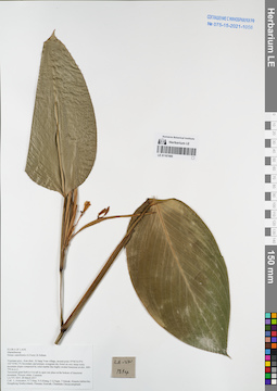
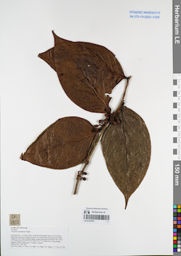
LE 01167640
Tubocapsicum sp. det. Averyanov, Leonid Vladimirovich at 02.10.2016
Collectors: Averyanov, Leonid Vladimirovich; et al. Field collecting number: CPC8218. Collection date: 02.10.2016. Administrative regions: VN - Tinh Son La. Groups of specimens: L. V. Averyanov specimens; L. V. Averyanov herbarium; Соглашение Минобрнауки №075-15-2021-1056Original label text:FLORA OF VIETNAM
Solanaceae
Tubocapsicum sp.
Son La Prov., Van Ho Distr., Van Ho comm., Hua Tat village, around point 20°46′21.7N 104°47′47.5E.
Remnants of primary evergreen broad-leaved and mixed forest (with Pinus wangii) on very steep rocky slopes and on mountain tops composed with highly eroded karstic light gray marble-like limestone at elevation 1300-1350 m a.s.l.
Terrestrial herb to 1.5 m tall on very steep rocky shady slope. Flowers dark violet, fruits green. Not common.
2 October 2016 CPC 8218
Coll.: L.Averyanov, N.T.Hiep, N.S.Khang, C.Q.Ngan, T.V.Maisak, N.T.Son.
Coordinates (geographic position): 20° 46′ 21.7″ N, 104° 47′ 47.5″ E ±1000 mRecord creation: 2022-01-26, Galina Savich, PhotoScan D2. Processing status: work_status_1Citation: Specimen LE 01167640 // Virtual herbarium of Komarov Botanical Institute RAS — http://re.herbariumle.ru/01167640Solanaceae
Tubocapsicum sp.
Son La Prov., Van Ho Distr., Van Ho comm., Hua Tat village, around point 20°46′21.7N 104°47′47.5E.
Remnants of primary evergreen broad-leaved and mixed forest (with Pinus wangii) on very steep rocky slopes and on mountain tops composed with highly eroded karstic light gray marble-like limestone at elevation 1300-1350 m a.s.l.
Terrestrial herb to 1.5 m tall on very steep rocky shady slope. Flowers dark violet, fruits green. Not common.
2 October 2016 CPC 8218
Coll.: L.Averyanov, N.T.Hiep, N.S.Khang, C.Q.Ngan, T.V.Maisak, N.T.Son.
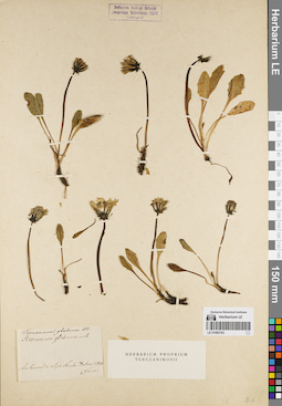
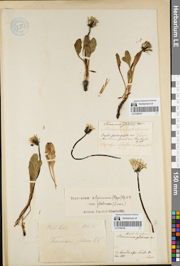
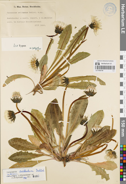
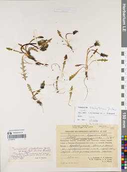
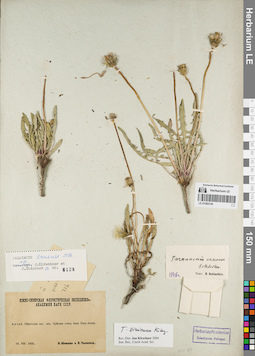
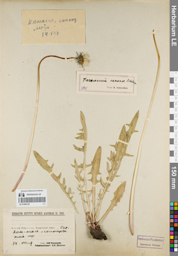
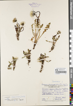
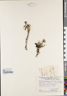
LE 01082163
Groups of specimens: Образцы сектора Сибири и Дальнего Востока России; Типовые образцы сектора Сибири и Дальнего Востока России; Соглашение Минобрнауки №075-15-2021-1056Record creation: 2022-01-26, Marina Yarichina, PhotoScan D2Citation: Specimen LE 01082163 // Virtual herbarium of Komarov Botanical Institute RAS — http://re.herbariumle.ru/01082163
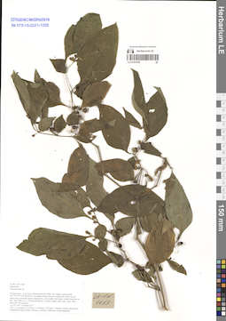
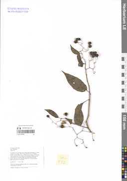
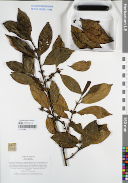
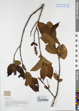
LE 01167639
Tubocapsicum sp. det. Averyanov, Leonid Vladimirovich at 25.03.2017
Collectors: Averyanov, Leonid Vladimirovich; et al. Field collecting number: LA-VN1653. Collection date: 25.03.2017. Administrative regions: LA - Vientiane Province. Groups of specimens: L. V. Averyanov specimens; L. V. Averyanov herbarium; Соглашение Минобрнауки №075-15-2021-1056Original label text:FLORA OF LAOS
Solanaceae
Tubocapsicum sp.
Vientiane prov., Kasi distr., between San and Tham Tai villages, around point 19°17′47.9′'N 102°08′58.9′'E.
Secondary broad-leaved evergreen dry forest on very steep rocky mountain slopes composed by solid marble like highly eroded limestone at elev. 900-1000 m a.s.l.
Terrestrial herb to 1 m tall in rather open rocky slope. Ripe fruits red. Not common.
LA-VN 1653 25 March 2017
Coll.: L.Averyanov, N.T.Hiep, N.S.Khang, C.Q.Ngan, T.Maisak, Khamla Inkhavilay, Hongthong Southyvohanh, Pinmany Sisavath, Chanthala Cheuaysamphanh.
Coordinates (geographic position): 19° 17′ 47.9″ N, 102° 8′ 58.9″ E ±1000 mRecord creation: 2022-01-26, Galina Savich, PhotoScan D2. Processing status: work_status_1Citation: Specimen LE 01167639 // Virtual herbarium of Komarov Botanical Institute RAS — http://re.herbariumle.ru/01167639Solanaceae
Tubocapsicum sp.
Vientiane prov., Kasi distr., between San and Tham Tai villages, around point 19°17′47.9′'N 102°08′58.9′'E.
Secondary broad-leaved evergreen dry forest on very steep rocky mountain slopes composed by solid marble like highly eroded limestone at elev. 900-1000 m a.s.l.
Terrestrial herb to 1 m tall in rather open rocky slope. Ripe fruits red. Not common.
LA-VN 1653 25 March 2017
Coll.: L.Averyanov, N.T.Hiep, N.S.Khang, C.Q.Ngan, T.Maisak, Khamla Inkhavilay, Hongthong Southyvohanh, Pinmany Sisavath, Chanthala Cheuaysamphanh.
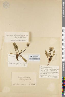
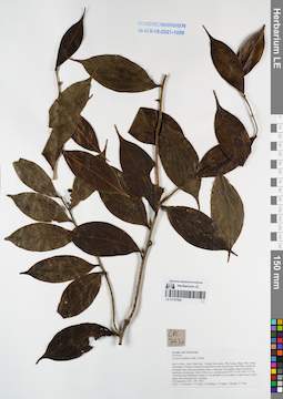
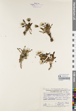
LE 01082162
Groups of specimens: Образцы сектора Сибири и Дальнего Востока России; Типовые образцы сектора Сибири и Дальнего Востока России; Соглашение Минобрнауки №075-15-2021-1056Record creation: 2022-01-26, Marina Yarichina, PhotoScan D2Citation: Specimen LE 01082162 // Virtual herbarium of Komarov Botanical Institute RAS — http://re.herbariumle.ru/01082162

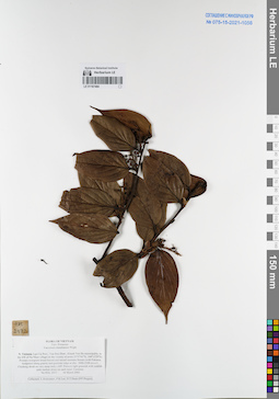
LE 01167638
Capsicum sp. det. Averyanov, Leonid Vladimirovich at 20.10.1990
Collectors: Kudryavtzeva, Ekaterina Petrovna; Ogureeva G. Field collecting number: Kudryavtzeva 1118. Collection date: 20.10.1990. Administrative regions: VN - Tinh Quang Ninh. Groups of specimens: L. V. Averyanov specimens; L. V. Averyanov herbarium; Соглашение Минобрнауки №075-15-2021-1056Original label text:FLORA OF VIETNAM
Record creation: 2022-01-26, Galina Savich, PhotoScan D2. Processing status: work_status_1Citation: Specimen LE 01167638 // Virtual herbarium of Komarov Botanical Institute RAS — http://re.herbariumle.ru/011676387 РЕЙС НИС " ПРОФЕССОР ГАГАРИНСКИЙ"
Solanaceae
Capsicum sp.
Quang Ninh Prov. Kudryavtzeva 1118 , 20.10.1990. Leg. Kudryavtzeva E., Ogureeva G.
Det. Averyanov L.

LE 01082161
Groups of specimens: Образцы сектора Сибири и Дальнего Востока России; Типовые образцы сектора Сибири и Дальнего Востока России; Соглашение Минобрнауки №075-15-2021-1056Record creation: 2022-01-26, Marina Yarichina, PhotoScan D2Citation: Specimen LE 01082161 // Virtual herbarium of Komarov Botanical Institute RAS — http://re.herbariumle.ru/01082161
LE 01082160
Groups of specimens: Образцы сектора Сибири и Дальнего Востока России; Типовые образцы сектора Сибири и Дальнего Востока России; Соглашение Минобрнауки №075-15-2021-1056Record creation: 2022-01-26, Marina Yarichina, PhotoScan D2Citation: Specimen LE 01082160 // Virtual herbarium of Komarov Botanical Institute RAS — http://re.herbariumle.ru/01082160
LE 01167637
Solanum sp. det. D.K. Harder at 12.02.2001
Collectors: D.K. Harder; et al. Field collecting number: DKH6208. Collection date: 12.02.2001. Administrative regions: VN - Tinh Ha Giang. Groups of specimens: L. V. Averyanov specimens; L. V. Averyanov herbarium; Соглашение Минобрнауки №075-15-2021-1056Original label text:FLORA OF VIETNAM
Solanaceae
Solanum sp.
Ha Giang Prov. DKH 6208, 12.02.2001. D.K. Harder et.al.
LE 01082159
Groups of specimens: Образцы сектора Сибири и Дальнего Востока России; Типовые образцы сектора Сибири и Дальнего Востока России; Соглашение Минобрнауки №075-15-2021-1056Record creation: 2022-01-26, Marina Yarichina, PhotoScan D2Citation: Specimen LE 01082159 // Virtual herbarium of Komarov Botanical Institute RAS — http://re.herbariumle.ru/01082159
LE 01167636
Solanum sp. det. Averyanov, Leonid Vladimirovich at 21.05.1999
Collectors: Tien Hiep Nguyen; et al. Field collecting number: NTH2664. Collection date: 21.05.1999. Administrative regions: VN - Tinh Lao Cai. Groups of specimens: L. V. Averyanov specimens; L. V. Averyanov herbarium; Соглашение Минобрнауки №075-15-2021-1056Original label text:FLORA OF VIETNAM
Solanaceae
Solanum sp.
N. Vietnam, prov. Lao Cai, distr. Than Uyen, municipality Ho Mit (N 22°06′ E 103°52′). Elevation to Mang Han San quartzite peak by SW slope from Ban Thao village (SSW macroslope of Hoang Lien Son ridge). Secondary open forest on steep rocky slope at 1300-1400 m elev. Shrub 2-3 m hg in open wet place. Not common.
Coordinates (geographic position): 22° 6′ N, 103° 52′ E ±1000 mRecord creation: 2022-01-26, Galina Savich, PhotoScan D2. Processing status: work_status_1Citation: Specimen LE 01167636 // Virtual herbarium of Komarov Botanical Institute RAS — http://re.herbariumle.ru/01167636Solanaceae
Solanum sp.
N. Vietnam, prov. Lao Cai, distr. Than Uyen, municipality Ho Mit (N 22°06′ E 103°52′). Elevation to Mang Han San quartzite peak by SW slope from Ban Thao village (SSW macroslope of Hoang Lien Son ridge). Secondary open forest on steep rocky slope at 1300-1400 m elev. Shrub 2-3 m hg in open wet place. Not common.
NTH 2664 21-22 May 1999
International Botanical Expedition of the U.S.A. National Geographic Society (grant No 6300-98)
Collectors: N.T.Hiep, P.H.Hoang, Averyanov L.
International Botanical Expedition of the U.S.A. National Geographic Society (grant No 6300-98)
Collectors: N.T.Hiep, P.H.Hoang, Averyanov L.
LE 01082158
Groups of specimens: Образцы сектора Сибири и Дальнего Востока России; Типовые образцы сектора Сибири и Дальнего Востока России; Соглашение Минобрнауки №075-15-2021-1056Record creation: 2022-01-26, Marina Yarichina, PhotoScan D2Citation: Specimen LE 01082158 // Virtual herbarium of Komarov Botanical Institute RAS — http://re.herbariumle.ru/01082158
LE 01167635
Solanum sp. det. Averyanov, Leonid Vladimirovich at 21.11.1998
Collectors: Averyanov, Leonid Vladimirovich; et al. Field collecting number: CBL552. Collection date: 21.11.1998. Administrative regions: VN - Tinh Cao Bang. Groups of specimens: L. V. Averyanov specimens; L. V. Averyanov herbarium; Соглашение Минобрнауки №075-15-2021-1056Original label text:FLORA OF VIETNAM
Solanaceae
Solanum sp.
N. Vietnam, prov. Cao Bang, distr. Nguyen Binh, municipality Ca Thanh, vicinities Ca Lu village, about 7-8 km to SE from Yen Lac village (N 22°44′ E 105°50′), about 38 km to NWW from Cao Bang town. Old open mixed semideciduous and coniferous (with Pseudotsuga brevifolia) primary forest along tops of limestone ridge and on steep slopes near ridge tops at 1350-1450 m alt. Climbing shrublet up to 2 m lg in wet open place. Ripe fruits red. Not common.
CBL 552 21 Nov. 1998
International Botanical Expedition of the U.S.A. National Geographic Society (grant No 6300-98)
Collectors: Averyanov L., P.K.Loc, N.X.Tam.
Coordinates (geographic position): 22° 44′ N, 105° 50′ E ±1000 mRecord creation: 2022-01-26, Galina Savich, PhotoScan D2. Processing status: work_status_1Citation: Specimen LE 01167635 // Virtual herbarium of Komarov Botanical Institute RAS — http://re.herbariumle.ru/01167635Solanaceae
Solanum sp.
N. Vietnam, prov. Cao Bang, distr. Nguyen Binh, municipality Ca Thanh, vicinities Ca Lu village, about 7-8 km to SE from Yen Lac village (N 22°44′ E 105°50′), about 38 km to NWW from Cao Bang town. Old open mixed semideciduous and coniferous (with Pseudotsuga brevifolia) primary forest along tops of limestone ridge and on steep slopes near ridge tops at 1350-1450 m alt. Climbing shrublet up to 2 m lg in wet open place. Ripe fruits red. Not common.
CBL 552 21 Nov. 1998
International Botanical Expedition of the U.S.A. National Geographic Society (grant No 6300-98)
Collectors: Averyanov L., P.K.Loc, N.X.Tam.
LE 01082157
Groups of specimens: Образцы сектора Сибири и Дальнего Востока России; Типовые образцы сектора Сибири и Дальнего Востока России; Соглашение Минобрнауки №075-15-2021-1056Record creation: 2022-01-26, Marina Yarichina, PhotoScan D2Citation: Specimen LE 01082157 // Virtual herbarium of Komarov Botanical Institute RAS — http://re.herbariumle.ru/01082157
LE 01167634
Solanum sp. det. Averyanov, Leonid Vladimirovich at 21.11.1998
Collectors: Averyanov, Leonid Vladimirovich; et al. Field collecting number: CBL547. Collection date: 21.11.1998. Administrative regions: VN - Tinh Cao Bang. Groups of specimens: L. V. Averyanov specimens; L. V. Averyanov herbarium; Соглашение Минобрнауки №075-15-2021-1056Original label text:FLORA OF VIETNAM
Solanaceae
Solanum sp.
N. Vietnam, prov. Cao Bang, distr. Nguyen Binh, municipality Ca Thanh, vicinities Ca Lu village, about 7-8 km to SE from Yen Lac village (N 22°44′ E 105°50′), about 38 km to NWW from Cao Bang town. Old open mixed semideciduous and coniferous (with Pseudotsuga brevifolia) primary forest along tops of limestone ridge and on steep slopes near ridge tops at 1350-1450 m alt. Shrublet up to 1.5 m hg in open place. Ripe fruits red. Not common.
CBL 547 21 Nov. 1998
International Botanical Expedition of the U.S.A. National Geographic Society (grant No 6300-98)
Collectors: Averyanov L., P.K.Loc, N.X.Tam.
Coordinates (geographic position): 22° 44′ N, 105° 50′ E ±1000 mRecord creation: 2022-01-26, Galina Savich, PhotoScan D2. Processing status: work_status_1Citation: Specimen LE 01167634 // Virtual herbarium of Komarov Botanical Institute RAS — http://re.herbariumle.ru/01167634Solanaceae
Solanum sp.
N. Vietnam, prov. Cao Bang, distr. Nguyen Binh, municipality Ca Thanh, vicinities Ca Lu village, about 7-8 km to SE from Yen Lac village (N 22°44′ E 105°50′), about 38 km to NWW from Cao Bang town. Old open mixed semideciduous and coniferous (with Pseudotsuga brevifolia) primary forest along tops of limestone ridge and on steep slopes near ridge tops at 1350-1450 m alt. Shrublet up to 1.5 m hg in open place. Ripe fruits red. Not common.
CBL 547 21 Nov. 1998
International Botanical Expedition of the U.S.A. National Geographic Society (grant No 6300-98)
Collectors: Averyanov L., P.K.Loc, N.X.Tam.
LE 01082156
Groups of specimens: Образцы сектора Сибири и Дальнего Востока России; Типовые образцы сектора Сибири и Дальнего Востока России; Соглашение Минобрнауки №075-15-2021-1056Record creation: 2022-01-26, Marina Yarichina, PhotoScan D2Citation: Specimen LE 01082156 // Virtual herbarium of Komarov Botanical Institute RAS — http://re.herbariumle.ru/01082156
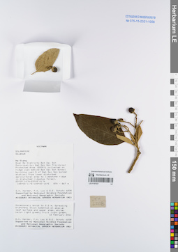
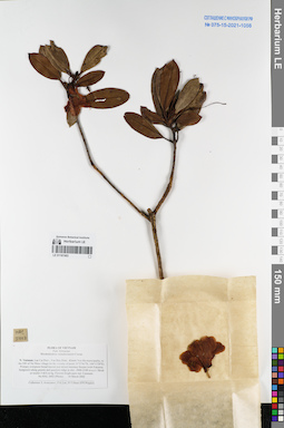
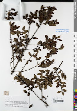
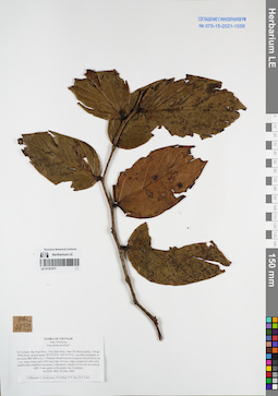
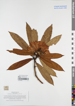
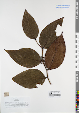
LE 01167488
Garcinia fagraeoides A.Chev. det. Averyanov, Leonid Vladimirovich at 10.06.2004
Collectors: Averyanov, Leonid Vladimirovich; et al. Field collecting number: HAL5533. Collection date: 10.06.2004. Administrative regions: VN - Tinh Cao Bang. Groups of specimens: L. V. Averyanov specimens; L. V. Averyanov herbarium; Соглашение Минобрнауки №075-15-2021-1056Original label text:FLORA OF VIETNAM
Clusiaceae
Garcinia fagreoides
N.Vietnam, Cao Bang Prov., Trung Khanh Distr., Ngoc Khe Municipality, Pac Nga village, around point 22°54′59′'N, 106°31′44′'E, at elevation 700-750 m a.s.l. Secondary wet closed evergreen forest on steep rocky slopes of rocky ridges and mesae composed with light gray solid marble-like highly eroded crystalline limestone.
Tree up to 20 m tall. Young leaves dirty violet. Common. HAL 5533 10 June 2004
Collectors: L.Averyanov, P.K.Loc, P.V.The, N.T.Vinh.
Coordinates (geographic position): 22° 54′ 59″ N, 106° 31′ 44″ E ±1000 mRecord creation: 2022-01-26, Galina Savich, PhotoScan D2. Processing status: work_status_1Citation: Specimen LE 01167488 // Virtual herbarium of Komarov Botanical Institute RAS — http://re.herbariumle.ru/01167488Clusiaceae
Garcinia fagreoides
N.Vietnam, Cao Bang Prov., Trung Khanh Distr., Ngoc Khe Municipality, Pac Nga village, around point 22°54′59′'N, 106°31′44′'E, at elevation 700-750 m a.s.l. Secondary wet closed evergreen forest on steep rocky slopes of rocky ridges and mesae composed with light gray solid marble-like highly eroded crystalline limestone.
Tree up to 20 m tall. Young leaves dirty violet. Common. HAL 5533 10 June 2004
Collectors: L.Averyanov, P.K.Loc, P.V.The, N.T.Vinh.
LE 01082155
Groups of specimens: Образцы сектора Сибири и Дальнего Востока России; Типовые образцы сектора Сибири и Дальнего Востока России; Соглашение Минобрнауки №075-15-2021-1056Record creation: 2022-01-26, Marina Yarichina, PhotoScan D2Citation: Specimen LE 01082155 // Virtual herbarium of Komarov Botanical Institute RAS — http://re.herbariumle.ru/01082155
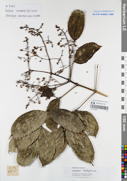
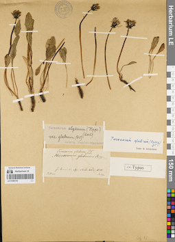
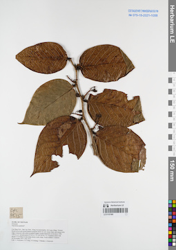
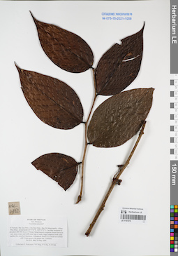
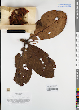
LE 01167487
Turpinia montana Kurz det. Nguyen Huu Cuong at 29.03.2018
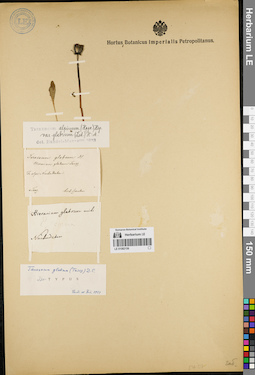
Collectors: Takhtajan, Armen Leonovich. Field collecting number: Takhtajan 8574. Collection date: 29.01.1975. Administrative regions: VN - Vietnam. Groups of specimens: L. V. Averyanov specimens; L. V. Averyanov herbarium; Соглашение Минобрнауки №075-15-2021-1056Original label text:FLORA OF VIETNAM
Record creation: 2022-01-26, Galina Savich, PhotoScan D2Citation: Specimen LE 01167487 // Virtual herbarium of Komarov Botanical Institute RAS — http://re.herbariumle.ru/01167487Turpinia montana Kurz.
Vietnam, Cuc Phuong National Park.
Takhtajan 8574, 29.01.1975
Det. Nguyen Huu Cuong
29.03.2018
LE 01082154
Groups of specimens: Образцы сектора Сибири и Дальнего Востока России; Типовые образцы сектора Сибири и Дальнего Востока России; Соглашение Минобрнауки №075-15-2021-1056Record creation: 2022-01-26, Marina Yarichina, PhotoScan D2Citation: Specimen LE 01082154 // Virtual herbarium of Komarov Botanical Institute RAS — http://re.herbariumle.ru/01082154
LE 01167486
Angiopteris evecta (G.Forst.) Hoffm. det. Averyanov, Leonid Vladimirovich at 02.04.2017
Collectors: Averyanov, Leonid Vladimirovich; et al. Field collecting number: LA-VN1996. Collection date: 02.04.2017. Administrative regions: LA - Luang Prabang Province. Groups of specimens: L. V. Averyanov specimens; L. V. Averyanov herbarium; Соглашение Минобрнауки №075-15-2021-1056Original label text:FLORA OF LAOS
Marattiaceae
Angiopteris evecta (G.Forst.) Hoffm.
Luang Prabang prov., Ngoy distr., Don Khun village, near waterfall, around point 20°31′36.9′'N 102°35′15.8′'E.
Remnants of primary evergreen forest on very steep rocky mountain slopes composed by solid marble like highly eroded limestone at elev. 450-550 m a.s.l. along mountain stream.
Terrestrial fern in shady place along stream. Occasional.
LA-VN 1996 2 April 2017
Coll.: L.Averyanov, N.T.Hiep, N.S.Khang, C.Q.Ngan, T.Maisak, Vichith Lamxay, Koudkeo Phommachanh, Phizar Sayalath, Keooudone Souvannakhoummane.
Coordinates (geographic position): 20° 31′ 36.9″ N, 102° 35′ 15.8″ E ±1000 mRecord creation: 2022-01-26, Galina Savich, PhotoScan D2. Processing status: work_status_1Citation: Specimen LE 01167486 // Virtual herbarium of Komarov Botanical Institute RAS — http://re.herbariumle.ru/01167486Marattiaceae
Angiopteris evecta (G.Forst.) Hoffm.
Luang Prabang prov., Ngoy distr., Don Khun village, near waterfall, around point 20°31′36.9′'N 102°35′15.8′'E.
Remnants of primary evergreen forest on very steep rocky mountain slopes composed by solid marble like highly eroded limestone at elev. 450-550 m a.s.l. along mountain stream.
Terrestrial fern in shady place along stream. Occasional.
LA-VN 1996 2 April 2017
Coll.: L.Averyanov, N.T.Hiep, N.S.Khang, C.Q.Ngan, T.Maisak, Vichith Lamxay, Koudkeo Phommachanh, Phizar Sayalath, Keooudone Souvannakhoummane.
LE 01082153
Groups of specimens: Образцы сектора Сибири и Дальнего Востока России; Типовые образцы сектора Сибири и Дальнего Востока России; Соглашение Минобрнауки №075-15-2021-1056Record creation: 2022-01-26, Marina Yarichina, PhotoScan D2Citation: Specimen LE 01082153 // Virtual herbarium of Komarov Botanical Institute RAS — http://re.herbariumle.ru/01082153
LE 01167485
Donax canniformis (G. Forst.) K. Schum. det. Averyanov, Leonid Vladimirovich at 28.03.2017
Collectors: Averyanov, Leonid Vladimirovich; et al. Field collecting number: LA-VN1814. Collection date: 28.03.2017. Administrative regions: LA - Vientiane Province. Groups of specimens: L. V. Averyanov specimens; L. V. Averyanov herbarium; Соглашение Минобрнауки №075-15-2021-1056Original label text:FLORA OF LAOS
Maranthaceae
Donax canniformis (G.Forst.) K.Schum.
Vientiane prov., Kasi distr., Si Sang Vone village, around point 19°06′10.9′'N 102°10′46.1′'E.
Secondary and primary evergreen dry forest on very steep rocky mountain slopes composed by solid marble like highly eroded limestone at elev. 600-750 m a.s.l. Terrestrial giant herb to 4 m tall in open wet place at the bottom of limestone mountain. Flowers white. Common. LA-VN 1814 28 March 2017
Coll.: L.Averyanov, N.T.Hiep, N.S.Khang, C.Q.Ngan, T.Maisak, Khamla Inkhavilay, Hongthong Southyvohanh, Pinmany Sisavath, Chanthala Cheuaysamphanh.
Coordinates (geographic position): 19° 6′ 10.9″ N, 102° 10′ 46.1″ E ±1000 mRecord creation: 2022-01-26, Galina Savich, PhotoScan D2. Processing status: work_status_1Citation: Specimen LE 01167485 // Virtual herbarium of Komarov Botanical Institute RAS — http://re.herbariumle.ru/01167485Maranthaceae
Donax canniformis (G.Forst.) K.Schum.
Vientiane prov., Kasi distr., Si Sang Vone village, around point 19°06′10.9′'N 102°10′46.1′'E.
Secondary and primary evergreen dry forest on very steep rocky mountain slopes composed by solid marble like highly eroded limestone at elev. 600-750 m a.s.l. Terrestrial giant herb to 4 m tall in open wet place at the bottom of limestone mountain. Flowers white. Common. LA-VN 1814 28 March 2017
Coll.: L.Averyanov, N.T.Hiep, N.S.Khang, C.Q.Ngan, T.Maisak, Khamla Inkhavilay, Hongthong Southyvohanh, Pinmany Sisavath, Chanthala Cheuaysamphanh.
LE 01082152
Groups of specimens: Образцы сектора Сибири и Дальнего Востока России; Типовые образцы сектора Сибири и Дальнего Востока России; Соглашение Минобрнауки №075-15-2021-1056Record creation: 2022-01-26, Marina Yarichina, PhotoScan D2Citation: Specimen LE 01082152 // Virtual herbarium of Komarov Botanical Institute RAS — http://re.herbariumle.ru/01082152
LE 01167484
Vaccinium dunalianum Wight det. Averyanov, Leonid Vladimirovich at 16.03.2002
Collectors: Averyanov, Leonid Vladimirovich; Phan Ke Loc; D.T. Doan Field collecting number: HAL2432. Collection date: 16.03.2002. Administrative regions: VN - Tinh Lao Cai. Groups of specimens: L. V. Averyanov specimens; L. V. Averyanov herbarium; Соглашение Минобрнауки №075-15-2021-1056Original label text:FLORA OF VIETNAM
Ericaceae
Vaccinium dunalianum Wight
Northern Vietnam, Lao Cai Prov., Van Ban Distr., Khanh Yen Ha municipality, to the SW of Na Nheo village (in the vicinity of point 21°57′41′'N, 104°13′29′'E). Primary evergreen broad-leaved and mixed montane forests (with Fokienia hodginsii) along granite and quartzite ridge at elev. 2000-2100 m a.s.l. Climbing shrub on very steep rocky cliff. Flowers light greenish with reddish-pink median stripe on each tepal. Common. HAL 2432 16 March 2002
Collectors: L.Averyanov, P.K.Loc, D.T.Doan (FFI Project).
Coordinates (geographic position): 21° 57′ 41″ N, 104° 13′ 29″ E ±1000 mRecord creation: 2022-01-26, Galina Savich, PhotoScan D2. Processing status: work_status_1Citation: Specimen LE 01167484 // Virtual herbarium of Komarov Botanical Institute RAS — http://re.herbariumle.ru/01167484Ericaceae
Vaccinium dunalianum Wight
Northern Vietnam, Lao Cai Prov., Van Ban Distr., Khanh Yen Ha municipality, to the SW of Na Nheo village (in the vicinity of point 21°57′41′'N, 104°13′29′'E). Primary evergreen broad-leaved and mixed montane forests (with Fokienia hodginsii) along granite and quartzite ridge at elev. 2000-2100 m a.s.l. Climbing shrub on very steep rocky cliff. Flowers light greenish with reddish-pink median stripe on each tepal. Common. HAL 2432 16 March 2002
Collectors: L.Averyanov, P.K.Loc, D.T.Doan (FFI Project).
LE 01082151
Groups of specimens: Образцы сектора Сибири и Дальнего Востока России; Типовые образцы сектора Сибири и Дальнего Востока России; Соглашение Минобрнауки №075-15-2021-1056Record creation: 2022-01-26, Marina Yarichina, PhotoScan D2Citation: Specimen LE 01082151 // Virtual herbarium of Komarov Botanical Institute RAS — http://re.herbariumle.ru/01082151
LE 01082150
Groups of specimens: Образцы сектора Сибири и Дальнего Востока России; Типовые образцы сектора Сибири и Дальнего Востока России; Соглашение Минобрнауки №075-15-2021-1056Record creation: 2022-01-26, Marina Yarichina, PhotoScan D2Citation: Specimen LE 01082150 // Virtual herbarium of Komarov Botanical Institute RAS — http://re.herbariumle.ru/01082150
LE 01167483
Rhododendron ramsdenianum Cowan. det. Averyanov, Leonid Vladimirovich at 16.03.2002
Collectors: Averyanov, Leonid Vladimirovich; Phan Ke Loc; D.T. Doan Field collecting number: HAL2402. Collection date: 16.03.2002. Administrative regions: VN - Tinh Lao Cai. Groups of specimens: L. V. Averyanov specimens; L. V. Averyanov herbarium; Соглашение Минобрнауки №075-15-2021-1056Original label text:FLORA OF VIETNAM
Ericaceae
Rhododendron ramsdenianum Cowan
Northern Vietnam, Lao Cai Prov., Van Ban Distr., Khanh Yen Ha municipality, to the SW of Na Nheo village (in the vicinity of point 21°57′41′'N, 104°13′29′'E). Primary evergreen broad-leaved and mixed montane forests (with Fokienia hodginsii) along granite and quartzite ridge at elev. 2000-2100 m a.s.l. Shrub or treelet 3-4(5) m hg.
Flowers bright pure red. Common. HAL 2402 (Photo) 16 March 2002
Collectors: L.Averyanov, P.K.Loc, D.T.Doan (FFI Project).
Coordinates (geographic position): 21° 57′ 41″ N, 104° 13′ 29″ E ±1000 mRecord creation: 2022-01-26, Galina Savich, PhotoScan D2. Processing status: work_status_1Citation: Specimen LE 01167483 // Virtual herbarium of Komarov Botanical Institute RAS — http://re.herbariumle.ru/01167483Ericaceae
Rhododendron ramsdenianum Cowan
Northern Vietnam, Lao Cai Prov., Van Ban Distr., Khanh Yen Ha municipality, to the SW of Na Nheo village (in the vicinity of point 21°57′41′'N, 104°13′29′'E). Primary evergreen broad-leaved and mixed montane forests (with Fokienia hodginsii) along granite and quartzite ridge at elev. 2000-2100 m a.s.l. Shrub or treelet 3-4(5) m hg.
Flowers bright pure red. Common. HAL 2402 (Photo) 16 March 2002
Collectors: L.Averyanov, P.K.Loc, D.T.Doan (FFI Project).
LE 01082149
Groups of specimens: Образцы сектора Сибири и Дальнего Востока России; Типовые образцы сектора Сибири и Дальнего Востока России; Соглашение Минобрнауки №075-15-2021-1056Record creation: 2022-01-26, Marina Yarichina, PhotoScan D2Citation: Specimen LE 01082149 // Virtual herbarium of Komarov Botanical Institute RAS — http://re.herbariumle.ru/01082149
LE 01167482
Lyonia ovalifolia (Wall.) Druce det. Averyanov, Leonid Vladimirovich at 22.09.2016
Collectors: Averyanov, Leonid Vladimirovich; et al. Field collecting number: CPC7930. Collection date: 22.09.2016. Administrative regions: VN - Tinh Son La. Groups of specimens: L. V. Averyanov specimens; L. V. Averyanov herbarium; Соглашение Минобрнауки №075-15-2021-1056Original label text:FLORA OF VIETNAM
Ericaceae
Lyonia ovalifolia (Wall.) Drude
Son La Prov., Moc Chau Distr., Chieng Son comm., Pha Luong village, Pha Luong Mountains.
Primary evergreen broad-leaved and mixed forest with Pinus cernua on mountain tops and steep summit slopes composed with highly eroded red-brown sandstone at elevation 1400-1500 m a.s.l. around point 20°41′33.2N 104°37′37.0E. Terrestrial and lithophytic treelet 5-7 m tall and 10 cm in diam. in open mossy rocky place near mountain top. Common. 22 September 2016 CPC 7930.
Coll.: L.Averyanov, N.T.Hiep, N.S.Khang, C.Q.Ngan, T.V.Maisak, N.T.Son.
Coordinates (geographic position): 20° 41′ 33.2″ N, 104° 37′ 37″ E ±1000 mRecord creation: 2022-01-26, Galina Savich, PhotoScan D2. Processing status: work_status_1Citation: Specimen LE 01167482 // Virtual herbarium of Komarov Botanical Institute RAS — http://re.herbariumle.ru/01167482Ericaceae
Lyonia ovalifolia (Wall.) Drude
Son La Prov., Moc Chau Distr., Chieng Son comm., Pha Luong village, Pha Luong Mountains.
Primary evergreen broad-leaved and mixed forest with Pinus cernua on mountain tops and steep summit slopes composed with highly eroded red-brown sandstone at elevation 1400-1500 m a.s.l. around point 20°41′33.2N 104°37′37.0E. Terrestrial and lithophytic treelet 5-7 m tall and 10 cm in diam. in open mossy rocky place near mountain top. Common. 22 September 2016 CPC 7930.
Coll.: L.Averyanov, N.T.Hiep, N.S.Khang, C.Q.Ngan, T.V.Maisak, N.T.Son.
LE 01082148
Groups of specimens: Образцы сектора Сибири и Дальнего Востока России; Типовые образцы сектора Сибири и Дальнего Востока России; Соглашение Минобрнауки №075-15-2021-1056Record creation: 2022-01-26, Marina Yarichina, PhotoScan D2Citation: Specimen LE 01082148 // Virtual herbarium of Komarov Botanical Institute RAS — http://re.herbariumle.ru/01082148
LE 01167481
Vaccinium triflorum Rehder det. Averyanov, Leonid Vladimirovich at 24.11.2014
Collectors: Averyanov, Leonid Vladimirovich; Tien Hiep Nguyen; et al. Field collecting number: CPC7644. Collection date: 24.11.2014. Administrative regions: VN - Tinh Cao Bang. Groups of specimens: L. V. Averyanov specimens; L. V. Averyanov herbarium; Соглашение Минобрнауки №075-15-2021-1056Original label text:FLORA OF VIETNAM
Ericaceae
Vaccinium triflorum Rehder
Cao Bang Prov., Bao Lac Distr., Dinh Phung municipality, Ban O village.
Primary mixed and coniferous evergreen humid forest with (Pinus sp., Pseudotsuga sinensis, Podocarpus neriifolius) on very steep slopes and on mountain tops composed by solid highly eroded limestone at elevation 1200-1300 m a.s.l. around point 22°45′24.8″N 105°46′47.9″E.
Shrub 2 m tall on mountain top. Common. 24 November 2014 CPC 7644
Coll.: L.Averyanov, N.T.Hiep, N.S.Khang, T.Maisak, L.Osinovetz
Coordinates (geographic position): 22° 45′ 24.8″ N, 105° 46′ 47.9″ E ±1000 mRecord creation: 2022-01-26, Galina Savich, PhotoScan D2. Processing status: work_status_1Citation: Specimen LE 01167481 // Virtual herbarium of Komarov Botanical Institute RAS — http://re.herbariumle.ru/01167481Ericaceae
Vaccinium triflorum Rehder
Cao Bang Prov., Bao Lac Distr., Dinh Phung municipality, Ban O village.
Primary mixed and coniferous evergreen humid forest with (Pinus sp., Pseudotsuga sinensis, Podocarpus neriifolius) on very steep slopes and on mountain tops composed by solid highly eroded limestone at elevation 1200-1300 m a.s.l. around point 22°45′24.8″N 105°46′47.9″E.
Shrub 2 m tall on mountain top. Common. 24 November 2014 CPC 7644
Coll.: L.Averyanov, N.T.Hiep, N.S.Khang, T.Maisak, L.Osinovetz
LE 01082147
Groups of specimens: Образцы сектора Сибири и Дальнего Востока России; Типовые образцы сектора Сибири и Дальнего Востока России; Соглашение Минобрнауки №075-15-2021-1056Record creation: 2022-01-26, Marina Yarichina, PhotoScan D2Citation: Specimen LE 01082147 // Virtual herbarium of Komarov Botanical Institute RAS — http://re.herbariumle.ru/01082147
LE 01167480
Vaccinium pseudobullatum W.P.Fang & Z.H.Pan det. Tong Yihua at 30.04.2025
Additional identifications: Vaccinium petelotii Merr. ⟮prelim. ID⟯ det. Averyanov, Leonid Vladimirovich at 20.11.2014 Collectors: Averyanov, Leonid Vladimirovich; et al. Field collecting number: CPC7515. Collection date: 20.11.2014. Administrative regions: VN - Tinh Cao Bang. Groups of specimens: L. V. Averyanov specimens; L. V. Averyanov herbarium; Соглашение Минобрнауки №075-15-2021-1056Original label text:FLORA OF VIETNAM
Ericaceae
Vaccinium petelotii?
Cao Bang Prov., Bao Lac Distr., Hong An municipality, Mi Lung village.
Primary broad-leaved and mixed humid evergreen forest on very steep slopes and along rocky ridge composed with solid crystalline highly eroded limestone at elevation 1500-1550 m a.s.l. around point 22°50′01.3″N 105°50′05.7″E. Scandent shrub with shoots 2-3 m long on very steep mossy rocky slope. Fruits reddish. Common. 20 November 2014 CPC 7515
Coll.: L.Averyanov, N.T.Hiep, N.S.Khang, T.Maisak, L.Osinovetz
Coordinates (geographic position): 22° 50′ 1.3″ N, 105° 50′ 5.7″ E ±1000 mRecord creation: 2022-01-26, Galina Savich, PhotoScan D2. Processing status: work_status_1Citation: Specimen LE 01167480 // Virtual herbarium of Komarov Botanical Institute RAS — http://re.herbariumle.ru/01167480Ericaceae
Vaccinium petelotii?
Cao Bang Prov., Bao Lac Distr., Hong An municipality, Mi Lung village.
Primary broad-leaved and mixed humid evergreen forest on very steep slopes and along rocky ridge composed with solid crystalline highly eroded limestone at elevation 1500-1550 m a.s.l. around point 22°50′01.3″N 105°50′05.7″E. Scandent shrub with shoots 2-3 m long on very steep mossy rocky slope. Fruits reddish. Common. 20 November 2014 CPC 7515
Coll.: L.Averyanov, N.T.Hiep, N.S.Khang, T.Maisak, L.Osinovetz
LE 01082146
Groups of specimens: Образцы сектора Сибири и Дальнего Востока России; Типовые образцы сектора Сибири и Дальнего Востока России; Соглашение Минобрнауки №075-15-2021-1056Record creation: 2022-01-26, Marina Yarichina, PhotoScan D2Citation: Specimen LE 01082146 // Virtual herbarium of Komarov Botanical Institute RAS — http://re.herbariumle.ru/01082146
LE 01167479
Vaccinium dunalianum Wight det. Tien Hiep Nguyen at 10.05.2015
Collectors: Nguyen Quang Hieu; Tien Hiep Nguyen; et al. Field collecting number: CPC7851. Collection date: 10.05.2015. Administrative regions: VN - Tinh Ha Giang. Groups of specimens: L. V. Averyanov specimens; L. V. Averyanov herbarium; Соглашение Минобрнауки №075-15-2021-1056Original label text:FLORA OF VIETNAM
Ericaceae
Vaccinium dunalianum Wight
Ha Giang Prov., Vi Xuyen Distr., Tung Ba municipality, Khau Ca NR.
Primary broad-leaved humid evergreen forest on very steep slopes and along rocky ridge composed with solid crystalline highly eroded limestone at elevation 700-1150 m a.s.l. around point 22°50′43.9″N 105°07′18.5″E. ( Khau Ca forest station to travel b,a,c to Minh Son to Lung village to Khau Ca Foretbstation)
Epiphytic Shrub climbering 4-5 m high. Common.10 May 2015 CPC 7851
Coordinates (geographic position): 22° 50′ 43.9″ N, 105° 7′ 18.5″ E ±1000 mRecord creation: 2022-01-26, Galina Savich, PhotoScan D2. Processing status: work_status_1Citation: Specimen LE 01167479 // Virtual herbarium of Komarov Botanical Institute RAS — http://re.herbariumle.ru/01167479Ericaceae
Vaccinium dunalianum Wight
Ha Giang Prov., Vi Xuyen Distr., Tung Ba municipality, Khau Ca NR.
Primary broad-leaved humid evergreen forest on very steep slopes and along rocky ridge composed with solid crystalline highly eroded limestone at elevation 700-1150 m a.s.l. around point 22°50′43.9″N 105°07′18.5″E. ( Khau Ca forest station to travel b,a,c to Minh Son to Lung village to Khau Ca Foretbstation)
Epiphytic Shrub climbering 4-5 m high. Common.10 May 2015 CPC 7851
Coll.: N.Q. Hieu, N.T.Hiep, T.B. Ngan, C.Q. Ngan, D.K. Harder, C. P. Tuy, G.C.Pao
LE 01082145
Groups of specimens: Образцы сектора Сибири и Дальнего Востока России; Типовые образцы сектора Сибири и Дальнего Востока России; Соглашение Минобрнауки №075-15-2021-1056Record creation: 2022-01-26, Marina Yarichina, PhotoScan D2Citation: Specimen LE 01082145 // Virtual herbarium of Komarov Botanical Institute RAS — http://re.herbariumle.ru/01082145
LE 01167478
Lyonia ovalifolia (Wall.) Druce ⟮prelim. ID⟯ det. Averyanov, Leonid Vladimirovich at 08.04.2015
Collectors: Tien Hiep Nguyen; Averyanov, Leonid Vladimirovich; et al. Field collecting number: LA-VN1217. Collection date: 08.04.2015. Administrative regions: LA - Houaphan. Groups of specimens: L. V. Averyanov specimens; L. V. Averyanov herbarium; Соглашение Минобрнауки №075-15-2021-1056Original label text:FLORA OF LAOS
Ericaceae
Lyonia ovalifolia (Wall.) Drude?
Houphan Prov., Viengxay Distr., Khang Pa Pong village, around point 20°19′41.4′'N 104°25′10.6′'E.
Primary and secondary broad-leaved evergreen dry forest on very steep rocky slopes of highly eroded mountains composed by solid marble-like limestone at elev. 1000-1100 m a.s.l.
Shrub 2-3 m tall on rather open rocky slope and on mountain top. Flowers white. Very common.
LA-VN 1217 8 April 2015
Coll.: N.T.Hiep, L.Averyanov, N.S.Khang, N.Q.Hieu, T.Maisak, Somneuk Bouthamounty.
Coordinates (geographic position): 20° 19′ 41.4″ N, 104° 25′ 10.6″ E ±1000 mRecord creation: 2022-01-26, Galina Savich, PhotoScan D2. Processing status: work_status_1Citation: Specimen LE 01167478 // Virtual herbarium of Komarov Botanical Institute RAS — http://re.herbariumle.ru/01167478Ericaceae
Lyonia ovalifolia (Wall.) Drude?
Houphan Prov., Viengxay Distr., Khang Pa Pong village, around point 20°19′41.4′'N 104°25′10.6′'E.
Primary and secondary broad-leaved evergreen dry forest on very steep rocky slopes of highly eroded mountains composed by solid marble-like limestone at elev. 1000-1100 m a.s.l.
Shrub 2-3 m tall on rather open rocky slope and on mountain top. Flowers white. Very common.
LA-VN 1217 8 April 2015
Coll.: N.T.Hiep, L.Averyanov, N.S.Khang, N.Q.Hieu, T.Maisak, Somneuk Bouthamounty.
LE 01082144
Groups of specimens: Образцы сектора Сибири и Дальнего Востока России; Типовые образцы сектора Сибири и Дальнего Востока России; Соглашение Минобрнауки №075-15-2021-1056Record creation: 2022-01-26, Marina Yarichina, PhotoScan D2Citation: Specimen LE 01082144 // Virtual herbarium of Komarov Botanical Institute RAS — http://re.herbariumle.ru/01082144
LE 01167477
Vaccinium pseudobullatum W.P.Fang & Z.H.Pan det. Tong Yihua at 30.04.2025
Additional identifications: Vaccinium petelotii Merr. ⟮prelim. ID⟯ det. Averyanov, Leonid Vladimirovich at 24.05.2004 Collectors: Averyanov, Leonid Vladimirovich; et al. Field collecting number: HAL4862. Collection date: 24.05.2004. Administrative regions: VN - Tinh Bac Kan. Groups of specimens: L. V. Averyanov specimens; L. V. Averyanov herbarium; Соглашение Минобрнауки №075-15-2021-1056Original label text:FLORA OF VIETNAM
Ericaceae
Vaccinium petelotii?
N.Vietnam, Bac Kan Prov., Cho Don Distr., Ban Thi Municipality,village Phia Khao, around point 22°17′31′'N, 105°31′51′'E, Cau Muc mountain at elevation 800-900 m a.s.l. Primary broad-leaved evergreen closed forest on very steep slopes and cliffs near tops of rocky ridge composed with solid marble-like stratified limestone.
Lithophytic shrub 2-2.5 m tall on vertical cliff. Fruits green with purple tint. Common. HAL 4862 24 May 2004
Collectors: L.Averyanov, N.T.Hiep, P.V.The, N.T.Vinh.
Coordinates (geographic position): 22° 17′ 31″ N, 105° 31′ 51″ E ±1000 mRecord creation: 2022-01-26, Galina Savich, PhotoScan D2. Processing status: work_status_1Citation: Specimen LE 01167477 // Virtual herbarium of Komarov Botanical Institute RAS — http://re.herbariumle.ru/01167477Ericaceae
Vaccinium petelotii?
N.Vietnam, Bac Kan Prov., Cho Don Distr., Ban Thi Municipality,village Phia Khao, around point 22°17′31′'N, 105°31′51′'E, Cau Muc mountain at elevation 800-900 m a.s.l. Primary broad-leaved evergreen closed forest on very steep slopes and cliffs near tops of rocky ridge composed with solid marble-like stratified limestone.
Lithophytic shrub 2-2.5 m tall on vertical cliff. Fruits green with purple tint. Common. HAL 4862 24 May 2004
Collectors: L.Averyanov, N.T.Hiep, P.V.The, N.T.Vinh.
LE 01082143
Groups of specimens: Образцы сектора Сибири и Дальнего Востока России; Типовые образцы сектора Сибири и Дальнего Востока России; Соглашение Минобрнауки №075-15-2021-1056Record creation: 2022-01-26, Marina Yarichina, PhotoScan D2Citation: Specimen LE 01082143 // Virtual herbarium of Komarov Botanical Institute RAS — http://re.herbariumle.ru/01082143
LE 01167476
Vaccinium pseudobullatum W.P.Fang & Z.H.Pan det. Tong Yihua at 30.04.2025
Additional identifications: Vaccinium petelotii Merr. ⟮prelim. ID⟯ det. Averyanov, Leonid Vladimirovich at 24.05.2004 Collectors: Averyanov, Leonid Vladimirovich; et al. Field collecting number: HAL4862. Collection date: 24.05.2004. Administrative regions: VN - Tinh Bac Kan. Groups of specimens: L. V. Averyanov specimens; L. V. Averyanov herbarium; Соглашение Минобрнауки №075-15-2021-1056Original label text:FLORA OF VIETNAM
Ericaceae
Vaccinium petelotii?
N.Vietnam, Bac Kan Prov., Cho Don Distr., Ban Thi Municipality, village Phia Khao, around point 22°17′31′'N, 105°31′51′'E, Cau Muc mountain at elevation 800-900 m a.s.l. Primary broad-leaved evergreen closed forest on very steep slopes and cliffs near tops of rocky ridge composed with solid marble-like stratified limestone.
Lithophytic shrub 2-2.5 m tall on vertical cliff. Fruits green with purple tint. Common. HAL 4862 24 May 2004
Collectors: L.Averyanov, N.T.Hiep, P.V.The, N.T.Vinh.
Coordinates (geographic position): 22° 17′ 31″ N, 105° 31′ 51″ E ±1000 mRecord creation: 2022-01-26, Galina Savich, PhotoScan D2. Processing status: work_status_1Citation: Specimen LE 01167476 // Virtual herbarium of Komarov Botanical Institute RAS — http://re.herbariumle.ru/01167476Ericaceae
Vaccinium petelotii?
N.Vietnam, Bac Kan Prov., Cho Don Distr., Ban Thi Municipality, village Phia Khao, around point 22°17′31′'N, 105°31′51′'E, Cau Muc mountain at elevation 800-900 m a.s.l. Primary broad-leaved evergreen closed forest on very steep slopes and cliffs near tops of rocky ridge composed with solid marble-like stratified limestone.
Lithophytic shrub 2-2.5 m tall on vertical cliff. Fruits green with purple tint. Common. HAL 4862 24 May 2004
Collectors: L.Averyanov, N.T.Hiep, P.V.The, N.T.Vinh.
LE 01082142
Groups of specimens: Образцы сектора Сибири и Дальнего Востока России; Типовые образцы сектора Сибири и Дальнего Востока России; Соглашение Минобрнауки №075-15-2021-1056Record creation: 2022-01-26, Marina Yarichina, PhotoScan D2Citation: Specimen LE 01082142 // Virtual herbarium of Komarov Botanical Institute RAS — http://re.herbariumle.ru/01082142
LE 01167475
Rhododendron cyanocarpum Franch. & W.W.Sm. det. Averyanov, Leonid Vladimirovich at 05.03.2002
Collectors: Averyanov, Leonid Vladimirovich; Phan Ke Loc; D.T. Doan Field collecting number: HAL2032. Collection date: 05.03.2002. Administrative regions: VN - Tinh Lao Cai. Groups of specimens: L. V. Averyanov specimens; L. V. Averyanov herbarium; Соглашение Минобрнауки №075-15-2021-1056Original label text:FLORA OF VIETNAM
Ericaceae
Rhododendron cyanocarpum (Franch.) W.W. Sm.
Northern Vietnam, Lao Cai Prov., Van Ban Distr., to the west of Nam Xay village (21°58′18′'N, 104°00′24′'E). Primary coniferous (with Fokienia hodginsii) evergreen montane forest at elev. 1700 m a.s.l.
Treelet about 5 m hg. Flowers light purple-violet with deep violet spot inside tube at the base. Not common.
HAL 2032 (Photo) 05 March 2002
Collectors: L.Averyanov, P.K.Loc, D.T.Doan (FFI Project).
Coordinates (geographic position): 21° 58′ 18″ N, 104° 0′ 24″ E ±1000 mRecord creation: 2022-01-26, Galina Savich, PhotoScan D2. Processing status: work_status_1Citation: Specimen LE 01167475 // Virtual herbarium of Komarov Botanical Institute RAS — http://re.herbariumle.ru/01167475Ericaceae
Rhododendron cyanocarpum (Franch.) W.W. Sm.
Northern Vietnam, Lao Cai Prov., Van Ban Distr., to the west of Nam Xay village (21°58′18′'N, 104°00′24′'E). Primary coniferous (with Fokienia hodginsii) evergreen montane forest at elev. 1700 m a.s.l.
Treelet about 5 m hg. Flowers light purple-violet with deep violet spot inside tube at the base. Not common.
HAL 2032 (Photo) 05 March 2002
Collectors: L.Averyanov, P.K.Loc, D.T.Doan (FFI Project).
LE 01082141
Groups of specimens: Образцы сектора Сибири и Дальнего Востока России; Типовые образцы сектора Сибири и Дальнего Востока России; Соглашение Минобрнауки №075-15-2021-1056Record creation: 2022-01-26, Marina Yarichina, PhotoScan D2Citation: Specimen LE 01082141 // Virtual herbarium of Komarov Botanical Institute RAS — http://re.herbariumle.ru/01082141
LE 01167474
Rhododendron basilicum Balf.f. & W.W.Sm. det. Averyanov, Leonid Vladimirovich at 20.03.2002
Collectors: Averyanov, Leonid Vladimirovich; Phan Ke Loc; D.T. Doan Field collecting number: HAL2578. Collection date: 20.03.2002. Administrative regions: VN - Tinh Lao Cai. Groups of specimens: L. V. Averyanov specimens; L. V. Averyanov herbarium; Соглашение Минобрнауки №075-15-2021-1056Original label text:FLORA OF VIETNAM
Ericaceae
Rhododendron basilicum Balf. et W.W. Sm.
Northern Vietnam, Lao Cai Prov., Van Ban Distr., Khanh Yen Ha municipality, to the SW of Na Nheo village (in the vicinity of point 21°57′15′'N, 104°12′39′'E). Primary broad-leaved evergreen montane forest along tops of granite/quartzite ridge at elev. 2650 m a.s.l. Tree 7-10 m hg (up to 12-14 m). Flowers white, with yellow-green tint
(when young), with large purple spot inside tube at the base. Very common. Most usual co-dominant of first forest stratum. HAL 2578 (Photo) 20 March 2002
Collectors: L.Averyanov, P.K.Loc, D.T.Doan (FFI Project).
Coordinates (geographic position): 21° 57′ 15″ N, 104° 12′ 39″ E ±1000 mRecord creation: 2022-01-26, Galina Savich, PhotoScan D2. Processing status: work_status_1Citation: Specimen LE 01167474 // Virtual herbarium of Komarov Botanical Institute RAS — http://re.herbariumle.ru/01167474Ericaceae
Rhododendron basilicum Balf. et W.W. Sm.
Northern Vietnam, Lao Cai Prov., Van Ban Distr., Khanh Yen Ha municipality, to the SW of Na Nheo village (in the vicinity of point 21°57′15′'N, 104°12′39′'E). Primary broad-leaved evergreen montane forest along tops of granite/quartzite ridge at elev. 2650 m a.s.l. Tree 7-10 m hg (up to 12-14 m). Flowers white, with yellow-green tint
(when young), with large purple spot inside tube at the base. Very common. Most usual co-dominant of first forest stratum. HAL 2578 (Photo) 20 March 2002
Collectors: L.Averyanov, P.K.Loc, D.T.Doan (FFI Project).
LE 01082140
Groups of specimens: Образцы сектора Сибири и Дальнего Востока России; Типовые образцы сектора Сибири и Дальнего Востока России; Соглашение Минобрнауки №075-15-2021-1056Record creation: 2022-01-26, Marina Yarichina, PhotoScan D2Citation: Specimen LE 01082140 // Virtual herbarium of Komarov Botanical Institute RAS — http://re.herbariumle.ru/01082140
LE 01167473
Vaccinium pseudobullatum W.P.Fang & Z.H.Pan det. Tong Yihua at 30.04.2025
Additional identifications: Vaccinium petelotii Merr. det. Nguyen Quang Hieu at 07.04.2014 Collectors: Nguyen Quang Hieu; et al. Field collecting number: CPC7301. Collection date: 07.04.2014. Administrative regions: VN - Tinh Ha Giang. Groups of specimens: L. V. Averyanov specimens; L. V. Averyanov herbarium; Соглашение Минобрнауки №075-15-2021-1056Original label text:FLORA OF VIETNAM
Ericaceae
Vaccinium petelotii
Ha Giang Prov., Bac Me District., Phieng Luong commune, Phieng Luong village direct to phieng Phoc, Khuoi Phin, Sinh Long, Tuyen Quang Province, Primary evergreen broad- leaf forest on limestone at elevation 1000-1183 m a.s.l. Grows in soil limestone humus , on slope and top of mountaine at elevation 1183 m a.s.l. around point 220 37′ 48.3″N;1050 19′ 32.4″E, 1183 m a.s.l. Climbering- shrub, fruit red 07 April 2014, CPC 7301
Coll.: N. Q. Hieu, N.T.Hiep, N.N. Hung, T.Q. Ngan, T.P.Tuan, G.M. Pao
Record creation: 2022-01-26, Galina Savich, PhotoScan D2. Processing status: work_status_1Citation: Specimen LE 01167473 // Virtual herbarium of Komarov Botanical Institute RAS — http://re.herbariumle.ru/01167473Ericaceae
Vaccinium petelotii
Ha Giang Prov., Bac Me District., Phieng Luong commune, Phieng Luong village direct to phieng Phoc, Khuoi Phin, Sinh Long, Tuyen Quang Province, Primary evergreen broad- leaf forest on limestone at elevation 1000-1183 m a.s.l. Grows in soil limestone humus , on slope and top of mountaine at elevation 1183 m a.s.l. around point 220 37′ 48.3″N;1050 19′ 32.4″E, 1183 m a.s.l. Climbering- shrub, fruit red 07 April 2014, CPC 7301
Coll.: N. Q. Hieu, N.T.Hiep, N.N. Hung, T.Q. Ngan, T.P.Tuan, G.M. Pao
LE 01082139
Groups of specimens: Образцы сектора Сибири и Дальнего Востока России; Типовые образцы сектора Сибири и Дальнего Востока России; Соглашение Минобрнауки №075-15-2021-1056Record creation: 2022-01-26, Marina Yarichina, PhotoScan D2Citation: Specimen LE 01082139 // Virtual herbarium of Komarov Botanical Institute RAS — http://re.herbariumle.ru/01082139
LE 01082138
Groups of specimens: Образцы сектора Сибири и Дальнего Востока России; Типовые образцы сектора Сибири и Дальнего Востока России; Соглашение Минобрнауки №075-15-2021-1056Record creation: 2022-01-26, Marina Yarichina, PhotoScan D2Citation: Specimen LE 01082138 // Virtual herbarium of Komarov Botanical Institute RAS — http://re.herbariumle.ru/01082138