View
Add
Copy
Edit
Delete
LE 01197925
Bellevalia saviczii Woronow
Administrative regions: TM - Turkmenistan. Place of collection: долина реки Кушки.Groups of specimens: Образцы сектора Средней Азии; Типовые образцы сектора Средней Азии; Соглашение Минобрнауки №075-15-2021-1056Record creation: 2023-05-16, Mariya Sheludyakova, PhotoScan D2.Citation: Specimen LE 01197925 // Virtual herbarium of Komarov Botanical Institute RAS — http://re.herbariumle.ru/01197925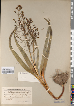
LE 01197924
Bellevalia saviczii Woronow
Administrative regions: TM - Turkmenistan. Groups of specimens: Образцы сектора Средней Азии; Типовые образцы сектора Средней Азии; Соглашение Минобрнауки №075-15-2021-1056Record creation: 2023-05-16, Mariya Sheludyakova, PhotoScan D2.Citation: Specimen LE 01197924 // Virtual herbarium of Komarov Botanical Institute RAS — http://re.herbariumle.ru/01197924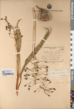
LE 01197923
Bellevalia saviczii Woronow
Administrative regions: TM - Turkmenistan. Groups of specimens: Образцы сектора Средней Азии; Типовые образцы сектора Средней Азии; Соглашение Минобрнауки №075-15-2021-1056Record creation: 2023-05-16, Mariya Sheludyakova, PhotoScan D2.Citation: Specimen LE 01197923 // Virtual herbarium of Komarov Botanical Institute RAS — http://re.herbariumle.ru/01197923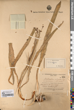
LE 01197922
Bellevalia saviczii Woronow
Administrative regions: TM - Turkmenistan. Groups of specimens: Образцы сектора Средней Азии; Типовые образцы сектора Средней Азии; Соглашение Минобрнауки №075-15-2021-1056Record creation: 2023-05-16, Mariya Sheludyakova, PhotoScan D2.Citation: Specimen LE 01197922 // Virtual herbarium of Komarov Botanical Institute RAS — http://re.herbariumle.ru/01197922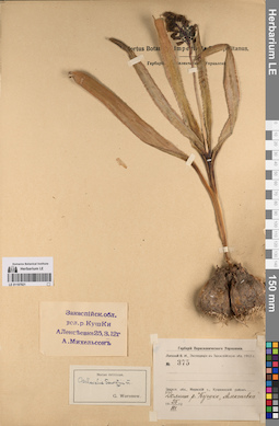
LE 01197921
Bellevalia saviczii Woronow
Administrative regions: TM - Turkmenistan. Place of collection: долина реки Кушки.Groups of specimens: Образцы сектора Средней Азии; Типовые образцы сектора Средней Азии; Соглашение Минобрнауки №075-15-2021-1056Record creation: 2023-05-16, Mariya Sheludyakova, PhotoScan D2.Citation: Specimen LE 01197921 // Virtual herbarium of Komarov Botanical Institute RAS — http://re.herbariumle.ru/01197921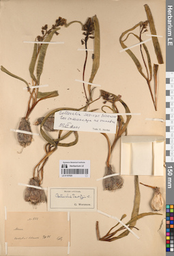
LE 01197920
Bellevalia saviczii Woronow
Groups of specimens: Образцы сектора Средней Азии; Типовые образцы сектора Средней Азии; Соглашение Минобрнауки №075-15-2021-1056Record creation: 2023-05-16, Mariya Sheludyakova, PhotoScan D2.Citation: Specimen LE 01197920 // Virtual herbarium of Komarov Botanical Institute RAS — http://re.herbariumle.ru/01197920
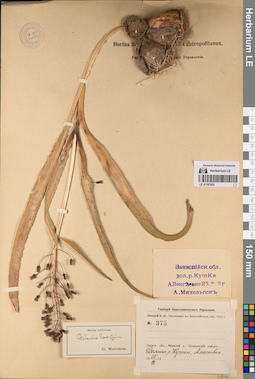
LE 01197919
Lectotype of Bellevalia saviczii Woronow det. Mordak, Elena Vladimirovna
Groups of specimens: Образцы сектора Средней Азии; Типовые образцы сектора Средней Азии; Соглашение Минобрнауки №075-15-2021-1056Record creation: 2023-05-16, Mariya Sheludyakova, PhotoScan D2.Citation: Specimen LE 01197919 // Virtual herbarium of Komarov Botanical Institute RAS — http://re.herbariumle.ru/01197919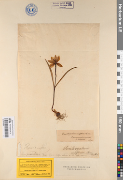
LE 01197918
Ornithogalum uniflorum L.
Additional identifications: Tulipa uniflora (L.) Besser & Backer Groups of specimens: Образцы сектора Средней Азии; Типовые образцы сектора Средней Азии; Соглашение Минобрнауки №075-15-2021-1056Record creation: 2023-05-16, Mariya Sheludyakova, PhotoScan D2.Citation: Specimen LE 01197918 // Virtual herbarium of Komarov Botanical Institute RAS — http://re.herbariumle.ru/01197918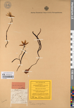
LE 01197917
Ornithogalum oxypetalum Ledeb.
Additional identifications: Tulipa heteropetala Ledeb. Groups of specimens: Образцы сектора Средней Азии; Типовые образцы сектора Средней Азии; Соглашение Минобрнауки №075-15-2021-1056Record creation: 2023-05-16, Mariya Sheludyakova, PhotoScan D2.Citation: Specimen LE 01197917 // Virtual herbarium of Komarov Botanical Institute RAS — http://re.herbariumle.ru/01197917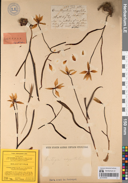
LE 01197916
Ornithogalum oxypetalum Ledeb.
Additional identifications: Tulipa heteropetala Ledeb. Groups of specimens: Образцы сектора Средней Азии; Типовые образцы сектора Средней Азии; Соглашение Минобрнауки №075-15-2021-1056Record creation: 2023-05-16, Mariya Sheludyakova, PhotoScan D2.Citation: Specimen LE 01197916 // Virtual herbarium of Komarov Botanical Institute RAS — http://re.herbariumle.ru/01197916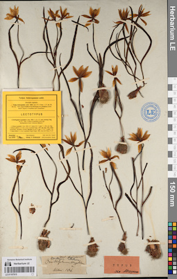
LE 01197915
Ornithogalum oxypetalum Ledeb.
Additional identifications: Tulipa heteropetala Ledeb. Groups of specimens: Образцы сектора Средней Азии; Типовые образцы сектора Средней Азии; Соглашение Минобрнауки №075-15-2021-1056Record creation: 2023-05-16, Mariya Sheludyakova, PhotoScan D2.Citation: Specimen LE 01197915 // Virtual herbarium of Komarov Botanical Institute RAS — http://re.herbariumle.ru/01197915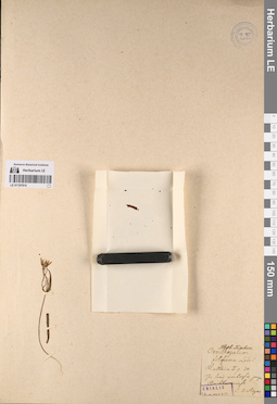
LE 01197914
Ornithogalum filiforme Ledeb.
Groups of specimens: Образцы сектора Средней Азии; Типовые образцы сектора Средней Азии; Соглашение Минобрнауки №075-15-2021-1056Record creation: 2023-05-16, Mariya Sheludyakova, PhotoScan D2.Citation: Specimen LE 01197914 // Virtual herbarium of Komarov Botanical Institute RAS — http://re.herbariumle.ru/01197914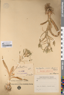
LE 01197913
Ornithogalum arianum Lipsky ex Vved.
Administrative regions: TM - Turkmenistan. Groups of specimens: Образцы сектора Средней Азии; Типовые образцы сектора Средней Азии; Соглашение Минобрнауки №075-15-2021-1056Record creation: 2023-05-16, Mariya Sheludyakova, PhotoScan D2.Citation: Specimen LE 01197913 // Virtual herbarium of Komarov Botanical Institute RAS — http://re.herbariumle.ru/01197913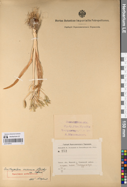
LE 01197912
Ornithogalum arianum Lipsky ex Vved.
Administrative regions: TM - Turkmenistan. Groups of specimens: Образцы сектора Средней Азии; Типовые образцы сектора Средней Азии; Соглашение Минобрнауки №075-15-2021-1056Record creation: 2023-05-16, Mariya Sheludyakova, PhotoScan D2.Citation: Specimen LE 01197912 // Virtual herbarium of Komarov Botanical Institute RAS — http://re.herbariumle.ru/01197912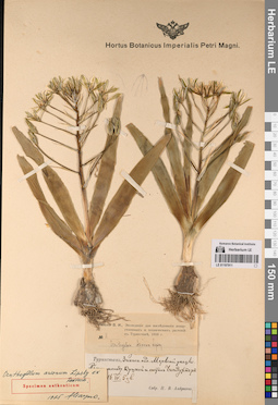
LE 01197911
Ornithogalum arianum Lipsky ex Vved.
Administrative regions: TM - Turkmenistan. Groups of specimens: Образцы сектора Средней Азии; Типовые образцы сектора Средней Азии; Соглашение Минобрнауки №075-15-2021-1056Record creation: 2023-05-16, Mariya Sheludyakova, PhotoScan D2.Citation: Specimen LE 01197911 // Virtual herbarium of Komarov Botanical Institute RAS — http://re.herbariumle.ru/01197911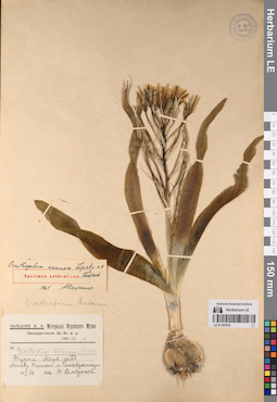
LE 01197910
Ornithogalum arianum Lipsky ex Vved.
Administrative regions: TM - Turkmenistan. Groups of specimens: Образцы сектора Средней Азии; Типовые образцы сектора Средней Азии; Соглашение Минобрнауки №075-15-2021-1056Record creation: 2023-05-16, Mariya Sheludyakova, PhotoScan D2.Citation: Specimen LE 01197910 // Virtual herbarium of Komarov Botanical Institute RAS — http://re.herbariumle.ru/01197910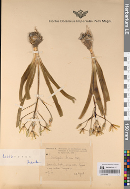
LE 01197909
Ornithogalum arianum Lipsky ex Vved.
Administrative regions: TM - Turkmenistan. Place of collection: Закаспийская область.Groups of specimens: Образцы сектора Средней Азии; Типовые образцы сектора Средней Азии; Соглашение Минобрнауки №075-15-2021-1056Record creation: 2023-05-16, Mariya Sheludyakova, PhotoScan D2.Citation: Specimen LE 01197909 // Virtual herbarium of Komarov Botanical Institute RAS — http://re.herbariumle.ru/01197909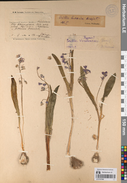
LE 01197908
Scilla vvedenskyi Pazij
Groups of specimens: Образцы сектора Средней Азии; Типовые образцы сектора Средней Азии; Соглашение Минобрнауки №075-15-2021-1056Record creation: 2023-05-16, Mariya Sheludyakova, PhotoScan D2.Citation: Specimen LE 01197908 // Virtual herbarium of Komarov Botanical Institute RAS — http://re.herbariumle.ru/01197908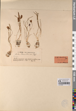
LE 01197907
Scilla raewskiana Regel
Administrative regions: UZ - Uzbekistan. Place of collection: Бухара.Groups of specimens: Образцы сектора Средней Азии; Типовые образцы сектора Средней Азии; Соглашение Минобрнауки №075-15-2021-1056Record creation: 2023-05-16, Mariya Sheludyakova, PhotoScan D2.Citation: Specimen LE 01197907 // Virtual herbarium of Komarov Botanical Institute RAS — http://re.herbariumle.ru/01197907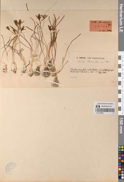
LE 01197906
Scilla raewskiana Regel
Administrative regions: UZ - Uzbekistan. Place of collection: Бухара.Groups of specimens: Образцы сектора Средней Азии; Типовые образцы сектора Средней Азии; Соглашение Минобрнауки №075-15-2021-1056Record creation: 2023-05-16, Mariya Sheludyakova, PhotoScan D2.Citation: Specimen LE 01197906 // Virtual herbarium of Komarov Botanical Institute RAS — http://re.herbariumle.ru/01197906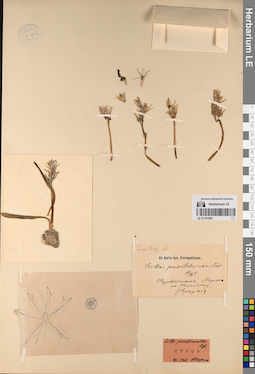
LE 01197905
Scilla puschkinioides Regel
Administrative regions: UZ - Uzbekistan. Groups of specimens: Образцы сектора Средней Азии; Типовые образцы сектора Средней Азии; Соглашение Минобрнауки №075-15-2021-1056Record creation: 2023-05-16, Mariya Sheludyakova, PhotoScan D2.Citation: Specimen LE 01197905 // Virtual herbarium of Komarov Botanical Institute RAS — http://re.herbariumle.ru/01197905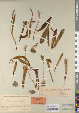
LE 01197904
Scilla bucharica Des.-Shost. ex B. Fedtsch.
Administrative regions: UZ - Uzbekistan. Groups of specimens: Образцы сектора Средней Азии; Типовые образцы сектора Средней Азии; Соглашение Минобрнауки №075-15-2021-1056Record creation: 2023-05-16, Mariya Sheludyakova, PhotoScan D2.Citation: Specimen LE 01197904 // Virtual herbarium of Komarov Botanical Institute RAS — http://re.herbariumle.ru/01197904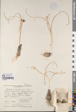
LE 01197903
Dipcadi turkestanicum Vved.
Administrative regions: UZ - Uzbekistan. Place of collection: Сурхандарьинская область.Groups of specimens: Образцы сектора Средней Азии; Типовые образцы сектора Средней Азии; Соглашение Минобрнауки №075-15-2021-1056Record creation: 2023-05-16, Mariya Sheludyakova, PhotoScan D2.Citation: Specimen LE 01197903 // Virtual herbarium of Komarov Botanical Institute RAS — http://re.herbariumle.ru/01197903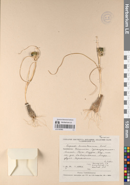
LE 01197902
Dipcadi turkestanicum Vved.
Administrative regions: UZ - Uzbekistan. Place of collection: Сурхандарьинская область.Groups of specimens: Образцы сектора Средней Азии; Типовые образцы сектора Средней Азии; Соглашение Минобрнауки №075-15-2021-1056Record creation: 2023-05-16, Mariya Sheludyakova, PhotoScan D2.Citation: Specimen LE 01197902 // Virtual herbarium of Komarov Botanical Institute RAS — http://re.herbariumle.ru/01197902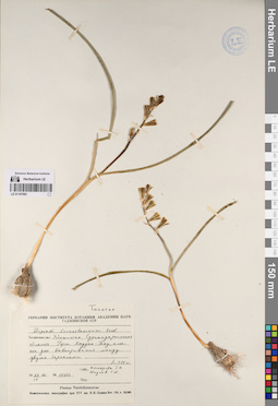
LE 01197901
Dipcadi turkestanicum Vved.
Administrative regions: UZ - Uzbekistan. Place of collection: Сурхандарьинская область.Groups of specimens: Образцы сектора Средней Азии; Типовые образцы сектора Средней Азии; Соглашение Минобрнауки №075-15-2021-1056Record creation: 2023-05-16, Mariya Sheludyakova, PhotoScan D2.Citation: Specimen LE 01197901 // Virtual herbarium of Komarov Botanical Institute RAS — http://re.herbariumle.ru/01197901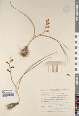
LE 01197900
Dipcadi turkestanicum Vved.
Administrative regions: UZ - Uzbekistan. Place of collection: Сурхандарьинская область.Groups of specimens: Образцы сектора Средней Азии; Типовые образцы сектора Средней Азии; Соглашение Минобрнауки №075-15-2021-1056Record creation: 2023-05-16, Mariya Sheludyakova, PhotoScan D2.Citation: Specimen LE 01197900 // Virtual herbarium of Komarov Botanical Institute RAS — http://re.herbariumle.ru/01197900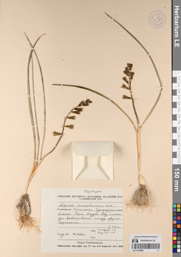
LE 01197899
Dipcadi turkestanicum Vved.
Administrative regions: UZ - Uzbekistan. Place of collection: Сурхандарьинская область.Groups of specimens: Образцы сектора Средней Азии; Типовые образцы сектора Средней Азии; Соглашение Минобрнауки №075-15-2021-1056Record creation: 2023-05-16, Mariya Sheludyakova, PhotoScan D2.Citation: Specimen LE 01197899 // Virtual herbarium of Komarov Botanical Institute RAS — http://re.herbariumle.ru/01197899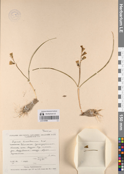
LE 01197898
Dipcadi turkestanicum Vved.
Administrative regions: UZ - Uzbekistan. Place of collection: Сурхандарьинская область.Groups of specimens: Образцы сектора Средней Азии; Типовые образцы сектора Средней Азии; Соглашение Минобрнауки №075-15-2021-1056Record creation: 2023-05-16, Mariya Sheludyakova, PhotoScan D2.Citation: Specimen LE 01197898 // Virtual herbarium of Komarov Botanical Institute RAS — http://re.herbariumle.ru/01197898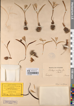
LE 01197897
Orithyia uniflora (L.) D. Don B (var.) intermedia Regel
Administrative regions: KZ - Kazakhstan. Place of collection: хребет Тарбагатай.Groups of specimens: Образцы сектора Средней Азии; Типовые образцы сектора Средней Азии; Соглашение Минобрнауки №075-15-2021-1056Record creation: 2023-05-16, Mariya Sheludyakova, PhotoScan D2.Citation: Specimen LE 01197897 // Virtual herbarium of Komarov Botanical Institute RAS — http://re.herbariumle.ru/01197897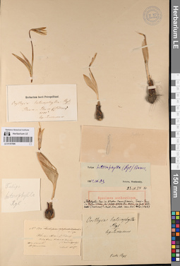
LE 01197896
Orithyia heterophylla Regel
Groups of specimens: Образцы сектора Средней Азии; Типовые образцы сектора Средней Азии; Соглашение Минобрнауки №075-15-2021-1056Record creation: 2023-05-16, Mariya Sheludyakova, PhotoScan D2.Citation: Specimen LE 01197896 // Virtual herbarium of Komarov Botanical Institute RAS — http://re.herbariumle.ru/01197896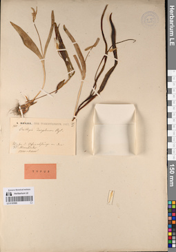
LE 01197895
Orithyia dasystemon Regel
Administrative regions: KZ - Kazakhstan. Groups of specimens: Образцы сектора Средней Азии; Типовые образцы сектора Средней Азии; Соглашение Минобрнауки №075-15-2021-1056Record creation: 2023-05-16, Mariya Sheludyakova, PhotoScan D2.Citation: Specimen LE 01197895 // Virtual herbarium of Komarov Botanical Institute RAS — http://re.herbariumle.ru/01197895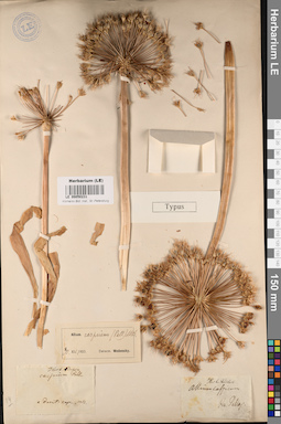
LE 00050231
Crinum caspium Pall.
Groups of specimens: Образцы сектора Средней Азии; Типовые образцы сектора Средней Азии; Соглашение Минобрнауки №075-15-2021-1056Record creation: 2023-05-16, Mariya Sheludyakova, PhotoScan D2.Citation: Specimen LE 00050231 // Virtual herbarium of Komarov Botanical Institute RAS — http://re.herbariumle.ru/00050231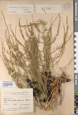
LE 00050230
Type of Asparagus vvedenskyi Botsch.
Administrative regions: KZ - Kazakhstan. Place of collection: горы Алымтау.Groups of specimens: Образцы сектора Средней Азии; Типовые образцы сектора Средней Азии; Соглашение Минобрнауки №075-15-2021-1056Record creation: 2023-05-16, Mariya Sheludyakova, PhotoScan D2.Citation: Specimen LE 00050230 // Virtual herbarium of Komarov Botanical Institute RAS — http://re.herbariumle.ru/00050230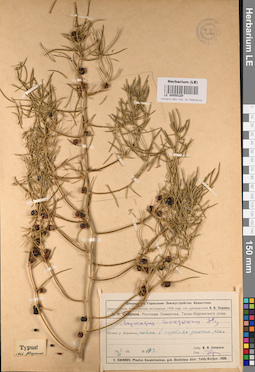
LE 00050229
Asparagus soongoricus Iljin
Administrative regions: KZ - Kazakhstan. Place of collection: низовья реки Каратала.Groups of specimens: Образцы сектора Средней Азии; Типовые образцы сектора Средней Азии; Соглашение Минобрнауки №075-15-2021-1056Record creation: 2023-05-16, Mariya Sheludyakova, PhotoScan D2.Citation: Specimen LE 00050229 // Virtual herbarium of Komarov Botanical Institute RAS — http://re.herbariumle.ru/00050229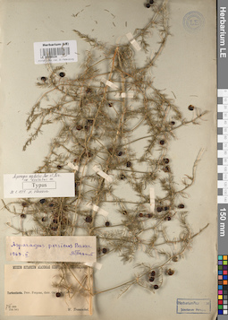
LE 00050228
Type of Asparagus neglectus var. dentatus Vlassova
Administrative regions: UZ - Uzbekistan. Place of collection: Фергана, окрестности.Groups of specimens: Образцы сектора Средней Азии; Типовые образцы сектора Средней Азии; Соглашение Минобрнауки №075-15-2021-1056Record creation: 2023-05-16, Mariya Sheludyakova, PhotoScan D2.Citation: Specimen LE 00050228 // Virtual herbarium of Komarov Botanical Institute RAS — http://re.herbariumle.ru/00050228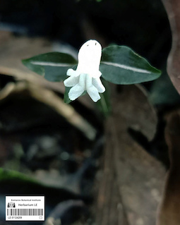
LE 01124209
Epitype of Myrmechis brachyscapa Aver., Vuong & Ormerod det. Averyanov, Leonid Vladimirovich at 25.05.2023
Additional identifications: Myrmechis sp. ⟨probably new species⟩ det. Averyanov, Leonid Vladimirovich at 16.05.2023 Collectors: Truong Ba Vuong Field collecting number: Truong Ba Vuong s.n.. Collection date: 14.05.2023. Administrative regions: VN - Tinh Ha Giang. Groups of specimens: L. V. Averyanov specimens; L. V. Averyanov photos; Orchids of Vietnam, Laos and CambodiaOriginal label text:FLORA OF VIETNAM
Orchidaceae
Myrmechis brachyscapa Aver., Vuong & Ormerod
Ha Giang Province, Vi Xuyen District, Minh Tan Commune, terrestrial orchid, elevation about 1000 m a.s.l.
14 May 2023, Truong Ba Vuong, Vang Di Thao, s.n.
All photos © - Truong Ba Vuong, Vang Di Thao
LE 01237476
Poa sp. det. Busch
Collectors: Busch Collection date: 20.07.1952. Administrative regions: RU - Udmurtskaya Respublika. Groups of specimens: Образцы сектора Восточной Европы; Соглашение Минобрнауки №075-15-2021-1056Original label text:Местонахождение агробиостанция Института Местообитание вдоль дороги
Record creation: 2023-05-15, Artyom Borodushkin, PhotoScan D2.Citation: Specimen LE 01237476 // Virtual herbarium of Komarov Botanical Institute RAS — http://re.herbariumle.ru/01237476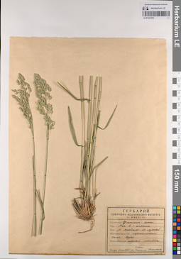
LE 01237475
Poa pratensis L. det. illegible
Collectors: illegible Collection date: 17.06.1956. Administrative regions: RUUdmurtskaya Respublika - Igrinskiy Rayon. Groups of specimens: Образцы сектора Восточной Европы; Соглашение Минобрнауки №075-15-2021-1056Original label text:Местонахождение окрестности села Зуры Местообитание лесная поляна
Record creation: 2023-05-15, Artyom Borodushkin, PhotoScan D2.. Processing status: label contains unreadable dataCitation: Specimen LE 01237475 // Virtual herbarium of Komarov Botanical Institute RAS — http://re.herbariumle.ru/01237475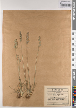
LE 01237474
Poa angustifolia L. det. Busch
Collectors: Busch Collection date: 16.06.1954. Administrative regions: RU - Udmurtskaya Respublika - Karakulinskiy Rayon. Groups of specimens: Образцы сектора Восточной Европы; Соглашение Минобрнауки №075-15-2021-1056Original label text:Местонахождение село Каракулино левый берег реки Камы Местообитание луг
Record creation: 2023-05-15, Artyom Borodushkin, PhotoScan D2.Citation: Specimen LE 01237474 // Virtual herbarium of Komarov Botanical Institute RAS — http://re.herbariumle.ru/01237474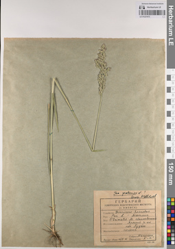
LE 01237473
Poa trivialis L. det. Busch
Collectors: Busch Collection date: 16.06.1961. Administrative regions: RUUdmurtskaya Respublika - Yarskiy Rayon. Groups of specimens: Образцы сектора Восточной Европы; Соглашение Минобрнауки №075-15-2021-1056Original label text:Местонахождение Ярский район поселок Пудем Местообитание поляна
Record creation: 2023-05-15, Artyom Borodushkin, PhotoScan D2.Citation: Specimen LE 01237473 // Virtual herbarium of Komarov Botanical Institute RAS — http://re.herbariumle.ru/01237473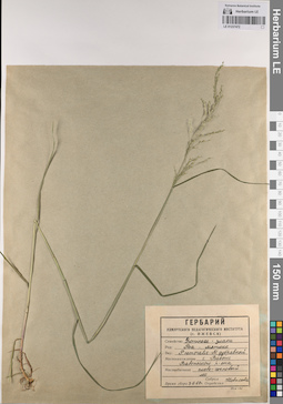
LE 01237472
Poa nemoralis L. det. Busch
Collectors: Busch Collection date: 03.06.1962. Administrative regions: RUUdmurtskaya Respublika - Vavozhskiy Rayon. Groups of specimens: Образцы сектора Восточной Европы; Соглашение Минобрнауки №075-15-2021-1056Original label text:Местонахождение село Вавож Вавожского района Местообитание елово-сосновый лес
Record creation: 2023-05-15, Artyom Borodushkin, PhotoScan D2.Citation: Specimen LE 01237472 // Virtual herbarium of Komarov Botanical Institute RAS — http://re.herbariumle.ru/01237472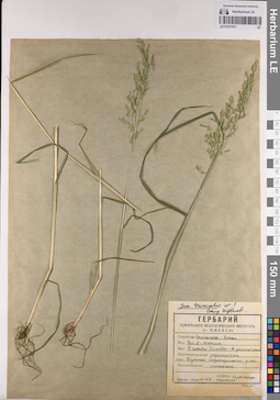
LE 01237471
Poa remota Forselles
Collectors: Busch Collection date: 06.1963. Administrative regions: RU - Udmurtskaya Respublika - Sarapul'skiy Rayon. Groups of specimens: Образцы сектора Восточной Европы; Соглашение Минобрнауки №075-15-2021-1056Original label text:Местонахождение окрестности поселка Бутыш Сарапульского района Местообитание ольшаник
Record creation: 2023-05-15, Artyom Borodushkin, PhotoScan D2.Citation: Specimen LE 01237471 // Virtual herbarium of Komarov Botanical Institute RAS — http://re.herbariumle.ru/01237471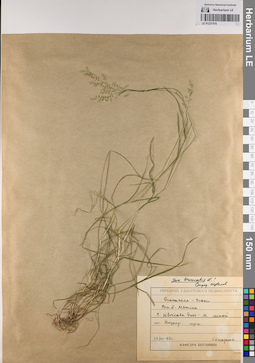
LE 01237470
Poa sylvicola Guss.
Collectors: Busch Collection date: 13.06.1957. Administrative regions: RUUdmurtskaya Respublika - Kiznerskiy Rayon. Groups of specimens: Образцы сектора Восточной Европы; Соглашение Минобрнауки №075-15-2021-1056Original label text:поселок Кизнер, луга
Record creation: 2023-05-15, Artyom Borodushkin, PhotoScan D2.Citation: Specimen LE 01237470 // Virtual herbarium of Komarov Botanical Institute RAS — http://re.herbariumle.ru/01237470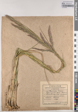
LE 01237469
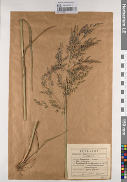
Calamagrostis arundinacea (L.) Roth det. Busch
Collectors: Busch Collection date: 13.06.1957. Administrative regions: RUUdmurtskaya Respublika - Kiznerskiy Rayon. Groups of specimens: Образцы сектора Восточной Европы; Соглашение Минобрнауки №075-15-2021-1056Original label text:Местонахождение Окрестности поселка Кизнер Местообитание Луг
Record creation: 2023-05-15, Artyom Borodushkin, PhotoScan D2.Citation: Specimen LE 01237469 // Virtual herbarium of Komarov Botanical Institute RAS — http://re.herbariumle.ru/01237469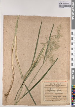
LE 01237468
Calamagrostis lanceolata Roth det. Busch
Collectors: Busch Collection date: 27.06.1957. Administrative regions: RUUdmurtskaya Respublika - Kiznerskiy Rayon. Groups of specimens: Образцы сектора Восточной Европы; Соглашение Минобрнауки №075-15-2021-1056Original label text:Местонахождение Окрестности посёлка Кизнер Местообитание болотистые места берёзового леса
Record creation: 2023-05-15, Artyom Borodushkin, PhotoScan D2.. Processing status: data is not fully enteredCitation: Specimen LE 01237468 // Virtual herbarium of Komarov Botanical Institute RAS — http://re.herbariumle.ru/01237468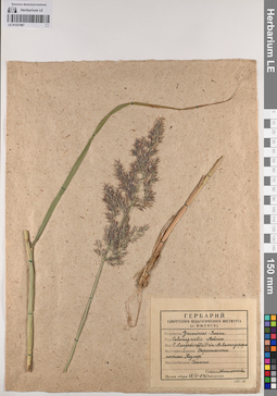
LE 01237467
Calamagrostis langsdorffii (Link) Trin.
Collectors: Busch Collection date: 18.06.1957. Administrative regions: RUUdmurtskaya Respublika - Kiznerskiy Rayon. Groups of specimens: Образцы сектора Восточной Европы; Соглашение Минобрнауки №075-15-2021-1056Original label text:Местонахождение Окрестности посёлка Кизнер Местообитание Болото
Record creation: 2023-05-15, Artyom Borodushkin, PhotoScan D2.Citation: Specimen LE 01237467 // Virtual herbarium of Komarov Botanical Institute RAS — http://re.herbariumle.ru/01237467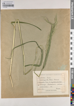
LE 01237466
Calamagrostis obtusata Trin.
Collectors: Busch Collection date: 19.07.1959. Administrative regions: RUUdmurtskaya Respublika - Votkinskiy Rayon. Groups of specimens: Образцы сектора Восточной Европы; Соглашение Минобрнауки №075-15-2021-1056Original label text:деревня Большие Хивари Воткинского района смешанный лес
Record creation: 2023-05-15, Artyom Borodushkin, PhotoScan D2.Citation: Specimen LE 01237466 // Virtual herbarium of Komarov Botanical Institute RAS — http://re.herbariumle.ru/01237466
LE 01237465
Festuca sp.
Collectors: illegible Collection date: 10.07.1977. Administrative regions: RU - Bashkortostan. Groups of specimens: Образцы сектора Восточной Европы; Соглашение Минобрнауки №075-15-2021-1056Original label text:UdSSR - Baschkirische ASSR (Советский Союз - Башкирская АССР, далее нечитаемый текст на немецком)
Record creation: 2023-05-15, Artyom Borodushkin, PhotoScan D2.Citation: Specimen LE 01237465 // Virtual herbarium of Komarov Botanical Institute RAS — http://re.herbariumle.ru/01237465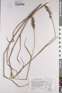
LE 01237464
Phalaroides arundinacea (L.) Rauschert
Collectors: Byalt, Vyacheslav Vyacheslavovich Collection date: 10.07.1997. Administrative regions: RU - Murmanskaya Oblast'. Groups of specimens: Образцы сектора Восточной Европы; Соглашение Минобрнауки №075-15-2021-1056Original label text:Мурманская область, Мончегорский район, 34 километра южнее Мончегорска (1224 километр шоссе Мурманск-Санкт-Петербург). Обочина дороги. Сырая канава.
Record creation: 2023-05-15, Artyom Borodushkin, PhotoScan D2.Citation: Specimen LE 01237464 // Virtual herbarium of Komarov Botanical Institute RAS — http://re.herbariumle.ru/01237464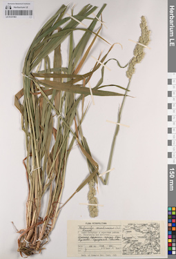
LE 01237463
Phalaroides arundinacea (L.) Rauschert det. Byalt, Vyacheslav Vyacheslavovich
Collectors: Byalt, Vyacheslav Vyacheslavovich Collection date: 22.06.1999. Administrative regions: RU - Sankt-Peterburg - Moskovskiy Rayon. Groups of specimens: Образцы сектора Восточной Европы; Соглашение Минобрнауки №075-15-2021-1056Original label text:Город Санкт-Петербург и окрестные районы. (Saint Petersburg and environs) Южная окраина города. Окрестности Пулково. Городская свалка.
Record creation: 2023-05-15, Artyom Borodushkin, PhotoScan D2.Citation: Specimen LE 01237463 // Virtual herbarium of Komarov Botanical Institute RAS — http://re.herbariumle.ru/01237463