View
Add
Copy
Edit
Delete
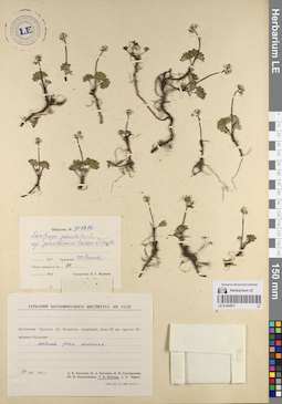
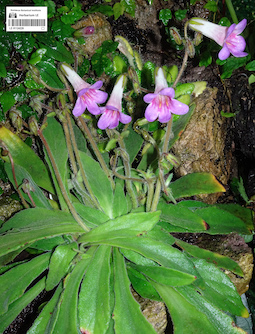
LE 01244011
Saxifraga porsildiana (Calder & Savile) Jurtzev & V.V. Petrov
Groups of specimens: Образцы сектора Сибири и Дальнего Востока России; Соглашение Минобрнауки №075-15-2021-1056Record creation: 2023-06-07, Mariya Sheludyakova, PhotoScan D2. Part1Citation: Specimen LE 01244011 // Virtual herbarium of Komarov Botanical Institute RAS — http://re.herbariumle.ru/01244011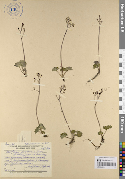
LE 01244010
Saxifraga porsildiana (Calder & Savile) Jurtzev & V.V. Petrov
Groups of specimens: Образцы сектора Сибири и Дальнего Востока России; Соглашение Минобрнауки №075-15-2021-1056Record creation: 2023-06-07, Mariya Sheludyakova, PhotoScan D2. Part1Citation: Specimen LE 01244010 // Virtual herbarium of Komarov Botanical Institute RAS — http://re.herbariumle.ru/01244010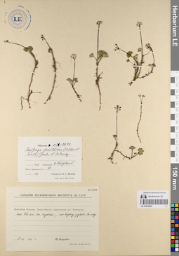
LE 01244009
Saxifraga porsildiana (Calder & Savile) Jurtzev & V.V. Petrov
Groups of specimens: Образцы сектора Сибири и Дальнего Востока России; Соглашение Минобрнауки №075-15-2021-1056Record creation: 2023-06-07, Mariya Sheludyakova, PhotoScan D2. Part1Citation: Specimen LE 01244009 // Virtual herbarium of Komarov Botanical Institute RAS — http://re.herbariumle.ru/01244009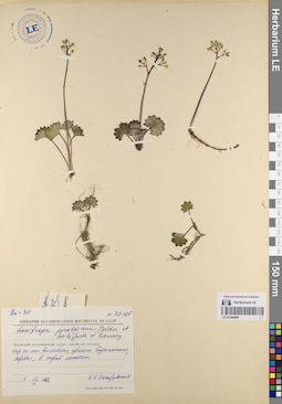
LE 01244008
Saxifraga porsildiana (Calder & Savile) Jurtzev & V.V. Petrov
Groups of specimens: Образцы сектора Сибири и Дальнего Востока России; Соглашение Минобрнауки №075-15-2021-1056Record creation: 2023-06-07, Mariya Sheludyakova, PhotoScan D2. Part1Citation: Specimen LE 01244008 // Virtual herbarium of Komarov Botanical Institute RAS — http://re.herbariumle.ru/01244008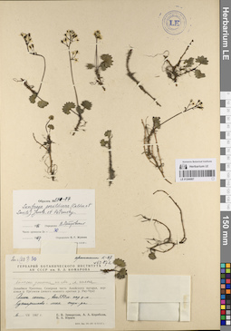
LE 01244007
Saxifraga porsildiana (Calder & Savile) Jurtzev & V.V. Petrov
Groups of specimens: Образцы сектора Сибири и Дальнего Востока России; Соглашение Минобрнауки №075-15-2021-1056Record creation: 2023-06-07, Mariya Sheludyakova, PhotoScan D2. Part1Citation: Specimen LE 01244007 // Virtual herbarium of Komarov Botanical Institute RAS — http://re.herbariumle.ru/01244007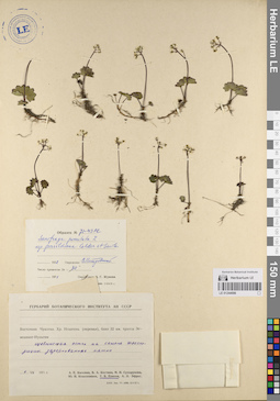
LE 01244006
Saxifraga porsildiana (Calder & Savile) Jurtzev & V.V. Petrov
Groups of specimens: Образцы сектора Сибири и Дальнего Востока России; Соглашение Минобрнауки №075-15-2021-1056Record creation: 2023-06-07, Mariya Sheludyakova, PhotoScan D2. Part1Citation: Specimen LE 01244006 // Virtual herbarium of Komarov Botanical Institute RAS — http://re.herbariumle.ru/01244006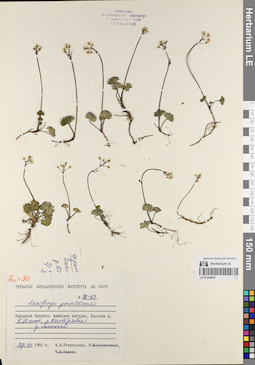
LE 01244005
Saxifraga porsildiana (Calder & Savile) Jurtzev & V.V. Petrov
Groups of specimens: Образцы сектора Сибири и Дальнего Востока России; Соглашение Минобрнауки №075-15-2021-1056Record creation: 2023-06-07, Mariya Sheludyakova, PhotoScan D2. Part1Citation: Specimen LE 01244005 // Virtual herbarium of Komarov Botanical Institute RAS — http://re.herbariumle.ru/01244005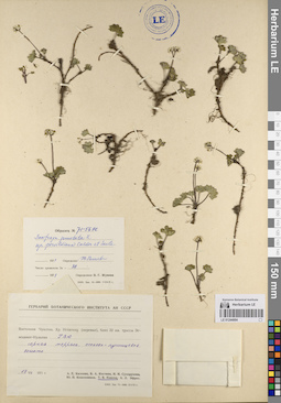
LE 01244004
Saxifraga porsildiana (Calder & Savile) Jurtzev & V.V. Petrov
Groups of specimens: Образцы сектора Сибири и Дальнего Востока России; Соглашение Минобрнауки №075-15-2021-1056Record creation: 2023-06-07, Mariya Sheludyakova, PhotoScan D2. Part1Citation: Specimen LE 01244004 // Virtual herbarium of Komarov Botanical Institute RAS — http://re.herbariumle.ru/01244004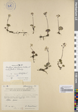
LE 01244003
Saxifraga porsildiana (Calder & Savile) Jurtzev & V.V. Petrov
Groups of specimens: Образцы сектора Сибири и Дальнего Востока России; Соглашение Минобрнауки №075-15-2021-1056Record creation: 2023-06-07, Mariya Sheludyakova, PhotoScan D2. Part1Citation: Specimen LE 01244003 // Virtual herbarium of Komarov Botanical Institute RAS — http://re.herbariumle.ru/01244003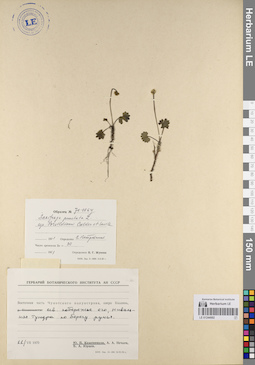
LE 01244002
Saxifraga porsildiana (Calder & Savile) Jurtzev & V.V. Petrov
Groups of specimens: Образцы сектора Сибири и Дальнего Востока России; Соглашение Минобрнауки №075-15-2021-1056Record creation: 2023-06-07, Mariya Sheludyakova, PhotoScan D2. Part1Citation: Specimen LE 01244002 // Virtual herbarium of Komarov Botanical Institute RAS — http://re.herbariumle.ru/01244002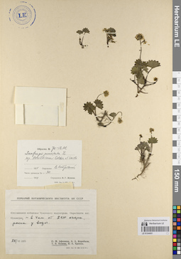
LE 01244001
Saxifraga porsildiana (Calder & Savile) Jurtzev & V.V. Petrov
Groups of specimens: Образцы сектора Сибири и Дальнего Востока России; Соглашение Минобрнауки №075-15-2021-1056Record creation: 2023-06-07, Mariya Sheludyakova, PhotoScan D2. Part1Citation: Specimen LE 01244001 // Virtual herbarium of Komarov Botanical Institute RAS — http://re.herbariumle.ru/01244001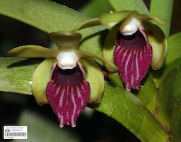
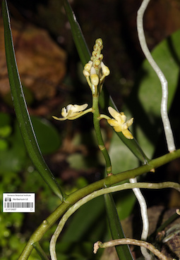
LE 01124224
Vanda alpina (Lindl.) Lindl. det. Averyanov, Leonid Vladimirovich at 06.06.2023
Collectors: Averyanov, Leonid Vladimirovich Field collecting number: AL1324. Collection date: 06.06.2023. Administrative regions: VN - Tinh Lai Chau. Groups of specimens: L. V. Averyanov specimens; L. V. Averyanov photos; Orchids of Vietnam, Laos and CambodiaOriginal label text:FLORA OF VIETNAM
Orchidaceae
Vanda alpina Lindl.
Lai Chau Province, Sin Ho District, collected by local people. Epiphyte, sepals and petals greenish, lip greenish with purple-brown stripes.
04 June 2022, Nguyen Sinh Khang, L. Averyanov, T. Maisak, AL 1324.
Fl. in cult. on 06 June 2023, L. Averyanov, AL 1324.
All photos © - L. Averyanov
LE 01124228
Primulina crassifolia (Aver. & K.S.Nguyen) T.P.Anh, F.Wen & Mich.Möller det. Khang Sinh Nguyen at 07.06.2023
Additional identifications: Primulina sp. det. Averyanov, Leonid Vladimirovich at 06.06.2023 Collectors: Averyanov, Leonid Vladimirovich Field collecting number: VR900.10. Collection date: 06.06.2023. Administrative regions: VN - Tinh Ha Giang. Groups of specimens: L. V. Averyanov specimens; L. V. Averyanov photos; Flora of VietnamOriginal label text:FLORA OF VIETNAM
Gesneriaceae
Primulina crassifolia (Aver. & K.S.Nguyen) T.P.Anh, F.Wen & Mich.Möller
Ha Giang prov., Quan Ba distr., Tung Vai commune, Thung Pang village, around point 23º04ʹ38.6ʺN 104º56ʹ06.8ʺE, steep rocky slopes near hill top composed with stratified highly eroded limestone at elevation 1000–1100 m a.s.l. Remnants of primary evergreen broad-leaved mossy very humid forest. Lithophytic rosulate herb. 17 October 2018, L. Averyanov, Nguyen Sinh Khang, T. Maisak, Truong Duc Thieu, VR 900.9.
Fl. in cult. 06 June 2023. Flowers purple blue. L. Averyanov, T. Maisak, VR 900.10.
All photos © - L. Averyanov
LE 01124227
Micropera pallida (Roxb.) Lindl. det. Averyanov, Leonid Vladimirovich at 06.06.2023
Collectors: Averyanov, Leonid Vladimirovich Field collecting number: AL199. Collection date: 06.06.2023. Administrative regions: LA - Vientiane Province. Groups of specimens: L. V. Averyanov specimens; L. V. Averyanov photos; Orchids of Vietnam, Laos and CambodiaOriginal label text:FLORA OF LAOS
Orchidaceae
Micropera pallida (Roxb.) Lindl.
Laos, Vientiane prov., Vang Vieng district, close vicinities of Vang Vien town, Phu Ngeum Mt., secondary degraded evergreen forest on steep rocky slopes and cliffs composed with karstic highly eroded marble-like limestone at elevation at 350-500 m a.s.l. Creeping and climbing epiphyte on mossy gnarled trees on mountain top. Occasional.
13 December 2015, L.Averyanov, T.Maisak, M.Nuraliev, N.Vislobokov, AL 199.
Fl. in cult. on 06 06 2023, L. Averyanov, AL 199. Flowers entirely light yellowish.
All photos © - L. Averyanov
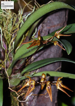
LE 01124226
Luisia zollingeri Rchb.f. det. Averyanov, Leonid Vladimirovich at 06.06.2023
Collectors: Averyanov, Leonid Vladimirovich Field collecting number: AL1774. Collection date: 06.06.2023. Administrative regions: VN - Tinh GJak Lak. Groups of specimens: L. V. Averyanov specimens; L. V. Averyanov photos; Orchids of Vietnam, Laos and CambodiaOriginal label text:FLORA OF VIETNAM
Orchidaceae
Luisia zollingeri Rchb.f.
Dak Lak Province, Lak District, Krong No Municipality, around point 12.1408 N 108.1325 E. Dry evergreen broad-leaved secondary forest on hill slopes composed with granite at elevation 800–900 m a.s.l. Epiphyte on small tree in dray secondary scrub on exposed granite cliffs along stream canyon. Occasional.
24 November 2022, L. Averyanov, Nguyen Van Canh, T. Maisak, Truong Ba Vuong, et al., AL 1774.
Fl. in cult. on 06 06 2023, L. Averyanov AL 1774.
All photos © - L. Averyanov
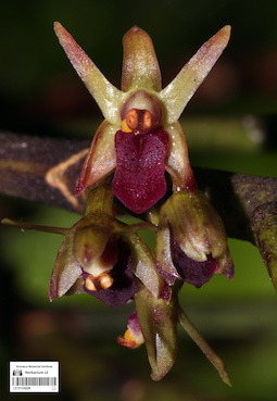
LE 01124225
Bulbophyllum helenae (Kuntze) J.J.Sm. det. Averyanov, Leonid Vladimirovich at 06.06.2023
Collectors: Averyanov, Leonid Vladimirovich Field collecting number: CPC8056e. Collection date: 06.06.2023. Administrative regions: VN - Tinh Son La. Groups of specimens: L. V. Averyanov specimens; L. V. Averyanov photos; Orchids of Vietnam, Laos and CambodiaOriginal label text:FLORA OF VIETNAM
Orchidaceae
Bulbophyllum helenae (Kuntze) J.J. Smith
Son La Prov., Moc Chau Distr., Chieng Son comm., about 1 km to NE from Chieng Son Village, around point 20°46’02.0N 104°37’03.1E. Remnants of primary broad-leaved evergreen forest on tops of hills composed with karstic highly eroded yellow-white limestone at elevation 1150-1250 m a.s.l. Clustering lithophyte on exposed mossy rocks. Not common.
27 September 2016 CPC 8056e
Coll.: L.Averyanov, N.T.Hiep, N.S.Khang, C.Q.Ngan, T.V.Maisak, N.T.Son.
Fl. in cult. on 06 June 2023, L. Averyanov CPC 8056e.
All photos © - L. Averyanov
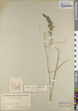
LE 01238674
Calamagrostis obtusata Trin. det. Litvinov, Dimitri Ivanovich
Collectors: Zhuravskij, Andrej Vladimirovich; Rudnev, Dmitry Dmitryevich; Kondakov, L. L. Collection date: 07.1909. Administrative regions: RU - Russian Federation. Groups of specimens: Образцы сектора Восточной Европы; Соглашение Минобрнауки №075-15-2021-1056Original label text:Архангельская губерния Печорский уезд По реке Косье.
Record creation: 2023-06-05, Artyom Borodushkin, PhotoScan D2.Citation: Specimen LE 01238674 // Virtual herbarium of Komarov Botanical Institute RAS — http://re.herbariumle.ru/01238674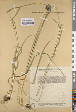
LE 01238673
Calamagrostis obtusata Trin.
Collectors: Andreev, V.D. Collection date: 06.07.1909. Administrative regions: RU - Komi - Kortkerosskiy Rayon. Groups of specimens: Образцы сектора Восточной Европы; Соглашение Минобрнауки №075-15-2021-1056Original label text:Вологодская губерния Усть-Сысольский уезд По сырому берегу реки близ села Мордина. - Prov. Wologda, districtum Ust-Sysolsk. In humidis prope Mordino.
Record creation: 2023-06-05, Artyom Borodushkin, PhotoScan D2.Citation: Specimen LE 01238673 // Virtual herbarium of Komarov Botanical Institute RAS — http://re.herbariumle.ru/01238673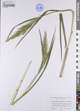
LE 01238672
Echinochloa crus-galli (L.) P. Beauv.
Collectors: Konechnaya, Galina Yurievna Collection date: 13.07.2021. Administrative regions: RU - Leningradskaya Oblast' - Vyborgskiy Rayon. Groups of specimens: Образцы сектора Восточной Европы; Соглашение Минобрнауки №075-15-2021-1056Original label text:Ленинградская область, Выборгский район, окрестности железнодорожной платформы 63 километр, у дороги, идущей у края верхового болота.
Record creation: 2023-06-05, Artyom Borodushkin, PhotoScan D2.Citation: Specimen LE 01238672 // Virtual herbarium of Komarov Botanical Institute RAS — http://re.herbariumle.ru/01238672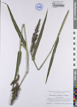
LE 01238671
Echinochloa crus-galli (L.) P. Beauv.
Collectors: Konechnaya, Galina Yurievna; Leostrin, Аrtyom Viktorovich Collection date: 10.09.2021. Administrative regions: RU - Sankt-Peterburg - Primorskiy Rayon. Groups of specimens: Образцы сектора Восточной Европы; Соглашение Минобрнауки №075-15-2021-1056Original label text:Город Санкт-Петербург, Приморский район, окрестности железнодорожной станции Ольгино, берег Финского залива, среди зарослей лежащего Calystegia inflata, 59.99125°N; 30.10146°E.
Coordinates (geographic position): 59° 59′ 28.5″ N, 30° 6′ 5.26″ ERecord creation: 2023-06-05, Artyom Borodushkin, PhotoScan D2.Citation: Specimen LE 01238671 // Virtual herbarium of Komarov Botanical Institute RAS — http://re.herbariumle.ru/01238671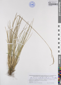
LE 01238670
Festuca sabulosa (Andersson) H. Lindb. det. Konechnaya, Galina Yurievna
Collectors: Geltman, Dmitri Victorovich; Konechnaya, Galina Yurievna Collection date: 01.09.2006. Administrative regions: RU - Sankt-Peterburg - Kurortnyy Rayon. Groups of specimens: Образцы сектора Восточной Европы; Соглашение Минобрнауки №075-15-2021-1056Original label text:Россия, Санкт-Петербург, Курортный район, вблизи железнодорожной платформы Разлив, песчаные дюны берега озера Сестрорецкий разлив. 60°04'27" N, 29°58'34.5" E
Coordinates (geographic position): 60° 4′ 27″ N, 29° 58′ 34.5″ ERecord creation: 2023-06-05, Artyom Borodushkin, PhotoScan D2.Citation: Specimen LE 01238670 // Virtual herbarium of Komarov Botanical Institute RAS — http://re.herbariumle.ru/01238670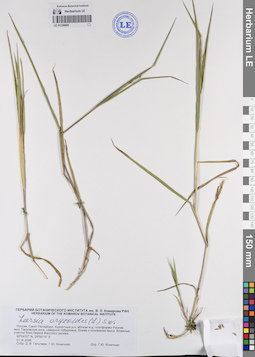
LE 01238669
Leersia oryzoides (L.) Sw. det. Konechnaya, Galina Yurievna
Collectors: Geltman, Dmitri Victorovich; Konechnaya, Galina Yurievna Collection date: 01.09.2006. Administrative regions: RU - Sankt-Peterburg - Kurortnyy Rayon. Groups of specimens: Образцы сектора Восточной Европы; Соглашение Минобрнауки №075-15-2021-1056Original label text:Россия, Санкт-Петербург, Курортный район, вблизи железнодорожной платформы Разлив, мыс Тарховская коса, северное побережье, ближе к основанию мыса. Влажные участки близ берега Финского залива. 60°04'07" N, 29°56'15" E
Coordinates (geographic position): 60° 4′ 7″ N, 29° 56′ 15″ ERecord creation: 2023-06-05, Artyom Borodushkin, PhotoScan D2.Citation: Specimen LE 01238669 // Virtual herbarium of Komarov Botanical Institute RAS — http://re.herbariumle.ru/01238669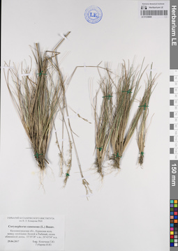
LE 01238668
Corynephorus canescens (L.) P. Beauv.
Collectors: Konechnaya, Galina Yurievna; Gubareva, Irina Yurievna Collection date: 29.04.2017. Administrative regions: RU - Kaliningradskaya Oblast' - Zelenogradskiy Rayon. Groups of specimens: Образцы сектора Восточной Европы; Соглашение Минобрнауки №075-15-2021-1056Original label text:Калининградская область, Куршская коса, между посёлками Лесной и Рыбачий, склон облесенной дюны, 55°05'28" северной широты; 20°43'54" восточной долготы.
Coordinates (geographic position): 55° 5′ 28″ N, 20° 43′ 54″ ERecord creation: 2023-06-05, Artyom Borodushkin, PhotoScan D2.Citation: Specimen LE 01238668 // Virtual herbarium of Komarov Botanical Institute RAS — http://re.herbariumle.ru/01238668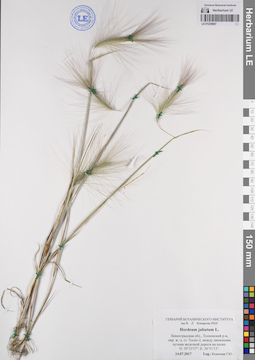
LE 01238667
Hordeum jubatum L.
Collectors: Konechnaya, Galina Yurievna Collection date: 14.07.2017. Administrative regions: RU - Leningradskaya Oblast' - Tosnenskiy Rayon. Groups of specimens: Образцы сектора Восточной Европы; Соглашение Минобрнауки №075-15-2021-1056Original label text:Ленинградская область, Тосненский район, окрестности железнодорожной станции Тосно-2, между запасными путями железной дороги на песке. N: 59°33'37": E: 30°51'13":
Coordinates (geographic position): 59° 33′ 37″ N, 30° 51′ 13″ ERecord creation: 2023-06-05, Artyom Borodushkin, PhotoScan D2.Citation: Specimen LE 01238667 // Virtual herbarium of Komarov Botanical Institute RAS — http://re.herbariumle.ru/01238667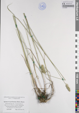
LE 01238666
Agropyron pectinatum (M. Bieb.) P. Beauv.
Collectors: Konechnaya, Galina Yurievna Collection date: 14.07.2017. Administrative regions: RU - Leningradskaya Oblast' - Tosnenskiy Rayon. Groups of specimens: Образцы сектора Восточной Европы; Соглашение Минобрнауки №075-15-2021-1056Original label text:Ленинградская область, Тосненский район, окрестности железнодорожной станции Тосно-2, между запасными путями железной дороги, на песке. N: 59°33'37.0": E: 30°51'13.4":
Coordinates (geographic position): 59° 33′ 37″ N, 30° 51′ 13.4″ ERecord creation: 2023-06-05, Artyom Borodushkin, PhotoScan D2.Citation: Specimen LE 01238666 // Virtual herbarium of Komarov Botanical Institute RAS — http://re.herbariumle.ru/01238666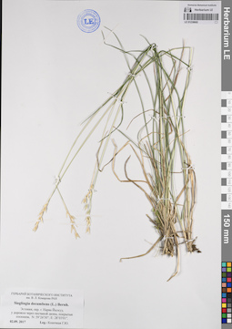
LE 01238665
Sieglingia decumbens (L.) Bernh.
Collectors: Konechnaya, Galina Yurievna Collection date: 02.09.2017. Administrative regions: EE - Ida-Virumaa. Groups of specimens: Образцы сектора Восточной Европы; Соглашение Минобрнауки №075-15-2021-1056Original label text:Эстония, окраина города Нарва Йыэсуу, у дорожки через песчаной дюны, покрытые сосняком. N: 59°26'30"; E:28°03'01".
Coordinates (geographic position): 59° 26′ 30″ N, 28° 3′ 1″ ERecord creation: 2023-06-05, Artyom Borodushkin, PhotoScan D2.Citation: Specimen LE 01238665 // Virtual herbarium of Komarov Botanical Institute RAS — http://re.herbariumle.ru/01238665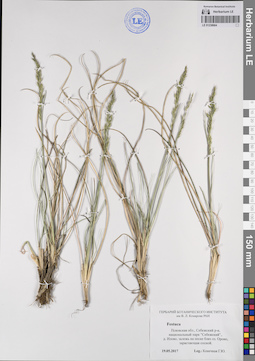
LE 01238664
Festuca sp.
Collectors: Konechnaya, Galina Yurievna Collection date: 19.05.2017. Administrative regions: RU - Pskovskaya Oblast' - Sebezhskiy Rayon. Groups of specimens: Образцы сектора Восточной Европы; Соглашение Минобрнауки №075-15-2021-1056Original label text:Псковская область, Себежский район, национальный парк "Себежский", деревня Илово, залежь на песке близ озера Ороно, зарастающая сосной
Record creation: 2023-06-05, Artyom Borodushkin, PhotoScan D2.Citation: Specimen LE 01238664 // Virtual herbarium of Komarov Botanical Institute RAS — http://re.herbariumle.ru/01238664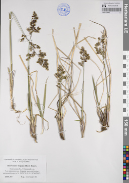
LE 01238663
Hierochloe repens (Host) P. Beauv.
Collectors: Konechnaya, Galina Yurievna Collection date: 20.05.2017. Administrative regions: RU - Pskovskaya Oblast' - Sebezhskiy Rayon. Groups of specimens: Образцы сектора Восточной Европы; Соглашение Минобрнауки №075-15-2021-1056Original label text:Псковская область, Себежский район, 7 километров западнее поселка Идрица, высокий холм у железной дороги, N: 56°20'38,9"; 28°46'20,8".
Coordinates (geographic position): 56° 20′ 38.9″ N, 28° 46′ 20.8″ ERecord creation: 2023-06-05, Artyom Borodushkin, PhotoScan D2.Citation: Specimen LE 01238663 // Virtual herbarium of Komarov Botanical Institute RAS — http://re.herbariumle.ru/01238663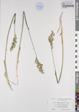
LE 01238662
Hierochloe arctica C. Presl
Collectors: Konechnaya, Galina Yurievna Collection date: 03.06.2017. Administrative regions: EE - Ida-Virumaa. Groups of specimens: Образцы сектора Восточной Европы; Соглашение Минобрнауки №075-15-2021-1056Original label text:Эстония, окраина города Нарва Йыэсуу опушка леса у садоводства. N: 59°26'10"; E:28°04'04".
Coordinates (geographic position): 59° 26′ 10″ N, 28° 4′ 4″ ERecord creation: 2023-06-05, Artyom Borodushkin, PhotoScan D2.Citation: Specimen LE 01238662 // Virtual herbarium of Komarov Botanical Institute RAS — http://re.herbariumle.ru/01238662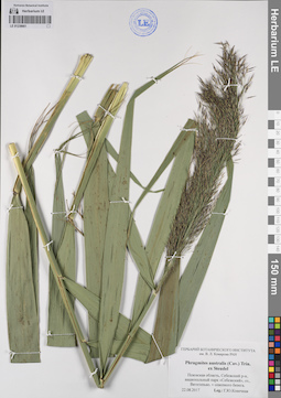
LE 01238661
Phragmites australis (Cav.) Trin. ex Steud.
Collectors: Konechnaya, Galina Yurievna Collection date: 22.08.2017. Administrative regions: RU - Pskovskaya Oblast' - Sebezhskiy Rayon. Groups of specimens: Образцы сектора Восточной Европы; Соглашение Минобрнауки №075-15-2021-1056Original label text:Псковская область, Себежский район, национальный парк "Себежский", озеро, Вятитерьво, у северного берега.
Record creation: 2023-06-05, Artyom Borodushkin, PhotoScan D2.Citation: Specimen LE 01238661 // Virtual herbarium of Komarov Botanical Institute RAS — http://re.herbariumle.ru/01238661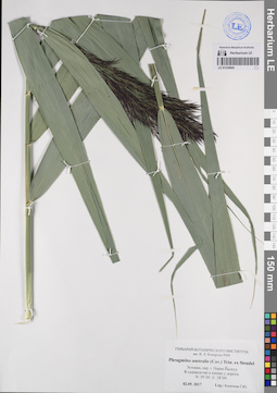
LE 01238660
Phragmites australis (Cav.) Trin. ex Steud.
Collectors: Konechnaya, Galina Yurievna Collection date: 02.09.2017. Administrative regions: EE - Ida-Virumaa. Groups of specimens: Образцы сектора Восточной Европы; Соглашение Минобрнауки №075-15-2021-1056Original label text:Эстония, окраина города Нарва Йыэсуу В садоводстве в канаве у дороги. N: 59°26'; E:28°04'.
Coordinates (geographic position): 59° 26′ 0″ N, 28° 4′ 0″ ERecord creation: 2023-06-05, Artyom Borodushkin, PhotoScan D2.Citation: Specimen LE 01238660 // Virtual herbarium of Komarov Botanical Institute RAS — http://re.herbariumle.ru/01238660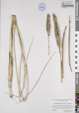
LE 01238659
Ammophila arenaria (L.) Link
Collectors: Konechnaya, Galina Yurievna; Gubareva, Irina Yurievna Collection date: 29.04.2017. Administrative regions: RU - Kaliningradskaya Oblast' - Zelenogradskiy Rayon. Groups of specimens: Образцы сектора Восточной Европы; Соглашение Минобрнауки №075-15-2021-1056Original label text:Калининградская область, Куршская коса, между посёлками Лесной и Рыбачий, открытые дюны близ берега Куршского залива.
Record creation: 2023-06-05, Artyom Borodushkin, PhotoScan D2.Citation: Specimen LE 01238659 // Virtual herbarium of Komarov Botanical Institute RAS — http://re.herbariumle.ru/01238659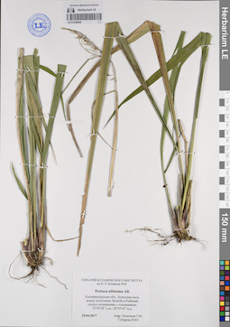
LE 01238658
Festuca altissima All.
Collectors: Konechnaya, Galina Yurievna; Gubareva, Irina Yurievna Collection date: 29.04.2017. Administrative regions: RU - Kaliningradskaya Oblast' - Zelenogradskiy Rayon. Groups of specimens: Образцы сектора Восточной Европы; Соглашение Минобрнауки №075-15-2021-1056Original label text:Калининградская область, Куршская коса, между посёлками Лесной и Рыбачий, склон к понижению с ольшаником, 55°05'28" северной широты; 20°43'43" восточной долготы.
Coordinates (geographic position): 55° 5′ 28″ N, 20° 43′ 43″ ERecord creation: 2023-06-05, Artyom Borodushkin, PhotoScan D2.Citation: Specimen LE 01238658 // Virtual herbarium of Komarov Botanical Institute RAS — http://re.herbariumle.ru/01238658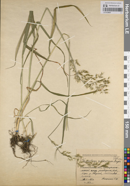
LE 01238657
Trisetum sibiricum Rupr.
Collectors: Konechnaya, Galina Yurievna Field collecting number: 162. Collection date: 21.06.1973. Administrative regions: RU - Tverskaya Oblast' - Nelidovskiy Rayon. Groups of specimens: Образцы сектора Восточной Европы; Соглашение Минобрнауки №075-15-2021-1056Original label text:Калининская область, Центрально-лесной государственный заповедник, 36 квартал, берег реки Жукопа, липняковый ельник.
Record creation: 2023-06-05, Artyom Borodushkin, PhotoScan D2.Citation: Specimen LE 01238657 // Virtual herbarium of Komarov Botanical Institute RAS — http://re.herbariumle.ru/01238657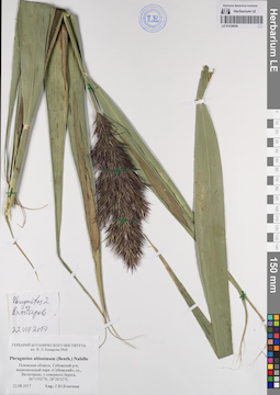
LE 01238656
Phragmites altissimus (Benth.) Mabille
Collectors: Konechnaya, Galina Yurievna Collection date: 22.08.2017. Administrative regions: RU - Pskovskaya Oblast' - Sebezhskiy Rayon. Groups of specimens: Образцы сектора Восточной Европы; Соглашение Минобрнауки №075-15-2021-1056Original label text:Псковская область, Себежский район, национальный парк "Себежский", озеро, Вятитерьво, у северного берега, 56°15'02"N; 28°26'32"E.
Coordinates (geographic position): 56° 15′ 2″ N, 28° 26′ 32″ ERecord creation: 2023-06-05, Artyom Borodushkin, PhotoScan D2.Citation: Specimen LE 01238656 // Virtual herbarium of Komarov Botanical Institute RAS — http://re.herbariumle.ru/01238656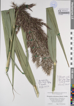
LE 01238655
Phragmites altissimus (Benth.) Mabille
Collectors: Konechnaya, Galina Yurievna Collection date: 21.08.2017. Administrative regions: RU - Pskovskaya Oblast' - Sebezhskiy Rayon. Groups of specimens: Образцы сектора Восточной Европы; Соглашение Минобрнауки №075-15-2021-1056Original label text:Псковская область, Себежский район, восточная окраина поселка Идрица, в канаве у железной дороги, 56°19'34"N; 28°54'44"E.
Coordinates (geographic position): 56° 19′ 34″ N, 28° 54′ 44″ ERecord creation: 2023-06-05, Artyom Borodushkin, PhotoScan D2.Citation: Specimen LE 01238655 // Virtual herbarium of Komarov Botanical Institute RAS — http://re.herbariumle.ru/01238655
LE 01238654
Digitaria ischaemum (Schreb.) H.L. Muhl.
Collectors: Konechnaya, Galina Yurievna Collection date: 21.08.2017. Administrative regions: RU - Pskovskaya Oblast' - Sebezhskiy Rayon. Groups of specimens: Образцы сектора Восточной Европы; Соглашение Минобрнауки №075-15-2021-1056Original label text:Псковская область, Себежский район, западная окраина поселка Идрица, кладбище у железной дороги, на песке, 56°19'57,7"N; 28°51'58,6"E.
Coordinates (geographic position): 56° 19′ 57.7″ N, 28° 51′ 58.6″ ERecord creation: 2023-06-05, Artyom Borodushkin, PhotoScan D2.Citation: Specimen LE 01238654 // Virtual herbarium of Komarov Botanical Institute RAS — http://re.herbariumle.ru/01238654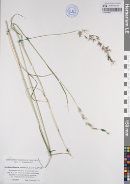
LE 01238653
Arrhenatherum elatius (L.) J. Presl & C. Presl
Collectors: Konechnaya, Galina Yurievna Collection date: 14.07.2017. Administrative regions: RU - Leningradskaya Oblast' - Tosnenskiy Rayon. Groups of specimens: Образцы сектора Восточной Европы; Соглашение Минобрнауки №075-15-2021-1056Original label text:Россия, Ленинградская область, Тосненский район, окрестности железнодорожной станции Тосно-2, между запасными путями железной дороги, на песке. N: 56°35'26"; E: 32°15'23";
Coordinates (geographic position): 59° 33′ 37″ N, 30° 51′ 13.4″ ERecord creation: 2023-06-05, Artyom Borodushkin, PhotoScan D2.Citation: Specimen LE 01238653 // Virtual herbarium of Komarov Botanical Institute RAS — http://re.herbariumle.ru/01238653
LE 01238652
Scolochloa festucacea (Willd.) Link det. Konechnaya, Galina Yurievna
Collectors: Grabovskaja-Borodina, Alisa Evgenievna; Efimov, Peter Gennadievich; Konechnaya, Galina Yurievna; Raenko, Larisa Mikhailovna Collection date: 03.07.2004. Administrative regions: RU - Pskovskaya Oblast' - Sebezhskiy Rayon. Groups of specimens: Образцы сектора Восточной Европы; Соглашение Минобрнауки №075-15-2021-1056Original label text:Россия, Псковская область, Себежский район (N: 56°7'37"; E: 28°50'53"). Деревня Булавчино, берег реки Утуга, высокотравье.
Coordinates (geographic position): 56° 7′ 37″ N, 28° 50′ 53″ ERecord creation: 2023-06-05, Artyom Borodushkin, PhotoScan D2.Citation: Specimen LE 01238652 // Virtual herbarium of Komarov Botanical Institute RAS — http://re.herbariumle.ru/01238652
LE 01238651
Scolochloa festucacea (Willd.) Link det. Efimov, Peter Gennadievich
Collectors: Efimov, Peter Gennadievich; Konechnaya, Galina Yurievna Collection date: 15.07.2002. Administrative regions: RU - Pskovskaya Oblast' - Nevel'skiy Rayon. Groups of specimens: Образцы сектора Восточной Европы; Соглашение Минобрнауки №075-15-2021-1056Original label text:Россия, Псковская область, Невельский район, от поселка Усть-Долыссы 10 километров на юго-запад, деревня Видусово, прибрежные заросли в озере Ловец.
Record creation: 2023-06-05, Artyom Borodushkin, PhotoScan D2.Citation: Specimen LE 01238651 // Virtual herbarium of Komarov Botanical Institute RAS — http://re.herbariumle.ru/01238651
LE 01238650
Scolochloa festucacea (Willd.) Link
Collectors: Andreeva, E. A. Collection date: 11.07.2001. Administrative regions: RU - Pskovskaya Oblast' - Sebezhskiy Rayon. Groups of specimens: Образцы сектора Восточной Европы; Соглашение Минобрнауки №075-15-2021-1056Original label text:Россия, Псковская область, Себежский район, Национальный парк "Себежский", от города Себеж 18 километров на юго-восток, южная часть озера Осыно, у воды.
Record creation: 2023-06-05, Artyom Borodushkin, PhotoScan D2.Citation: Specimen LE 01238650 // Virtual herbarium of Komarov Botanical Institute RAS — http://re.herbariumle.ru/01238650
LE 01238649
Scolochloa festucacea (Willd.) Link det. Efimov, Peter Gennadievich
Collectors: Illarionova, Irina Dmitrievna; Konechnaya, Galina Yurievna Collection date: 25.07.2003. Administrative regions: RU - Tverskaya Oblast' - Zapadnodvinskiy Rayon. Groups of specimens: Образцы сектора Восточной Европы; Соглашение Минобрнауки №075-15-2021-1056Original label text:Россия, Тверская область, Западнодвинский район, от поселка Старая Торопа 7 километров на северо-запад, (N: 56°20'1"; E: 31°37'23") у деревни Задемьянье, у шоссе Москва-Рига, в канаве близ болота.
Coordinates (geographic position): 56° 20′ 1″ N, 31° 37′ 23″ ERecord creation: 2023-06-05, Artyom Borodushkin, PhotoScan D2.Citation: Specimen LE 01238649 // Virtual herbarium of Komarov Botanical Institute RAS — http://re.herbariumle.ru/01238649
LE 01238648
Scolochloa festucacea (Willd.) Link det. Efimov, Peter Gennadievich
Collectors: Illarionova, Irina Dmitrievna; Konechnaya, Galina Yurievna Collection date: 26.07.2003. Administrative regions: RU - Tverskaya Oblast' - Toropetskiy Rayon. Groups of specimens: Образцы сектора Восточной Европы; Соглашение Минобрнауки №075-15-2021-1056Original label text:Россия, Тверская область, от города Торопец 9 километров на юго-восток, (N: 56°28'30"; E: 31°45'48") берег озера.
Coordinates (geographic position): 56° 28′ 30″ N, 31° 45′ 48″ ERecord creation: 2023-06-05, Artyom Borodushkin, PhotoScan D2.Citation: Specimen LE 01238648 // Virtual herbarium of Komarov Botanical Institute RAS — http://re.herbariumle.ru/01238648
LE 01238647
Scolochloa festucacea (Willd.) Link
Collectors: Konechnaya, Galina Yurievna Collection date: 09.06.1999. Administrative regions: RU - Pskovskaya Oblast' - Nevel'skiy Rayon. Groups of specimens: Образцы сектора Восточной Европы; Соглашение Минобрнауки №075-15-2021-1056Original label text:Россия, Псковская область, Невельский район, от города Невель 35 километров на юго-восток, северный берег озера Сенница, в воде у берега.
Record creation: 2023-06-05, Artyom Borodushkin, PhotoScan D2.Citation: Specimen LE 01238647 // Virtual herbarium of Komarov Botanical Institute RAS — http://re.herbariumle.ru/01238647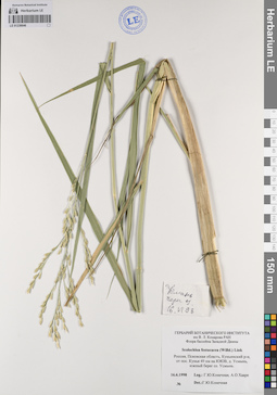
LE 01238646
Scolochloa festucacea (Willd.) Link det. Konechnaya, Galina Yurievna
Collectors: Konechnaya, Galina Yurievna; Haare, Ado Oskarovich Collection date: 16.06.1998. Administrative regions: RU - Pskovskaya Oblast' - Kun'inskiy Rayon. Groups of specimens: Образцы сектора Восточной Европы; Соглашение Минобрнауки №075-15-2021-1056Original label text:Россия, Псковская область, Куньинский район, от поселка Кунья 49 километров на юго-юго-восток, деревня Усмынь, южный берег озера Усмынь.
Record creation: 2023-06-05, Artyom Borodushkin, PhotoScan D2.Citation: Specimen LE 01238646 // Virtual herbarium of Komarov Botanical Institute RAS — http://re.herbariumle.ru/01238646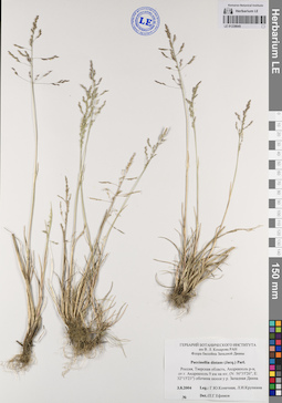
LE 01238645
Puccinellia distans (Jacq.) Parl. det. Efimov, Peter Gennadievich
Collectors: Konechnaya, Galina Yurievna; Krupkina, Lyudmila Ivanovna Collection date: 03.08.2004. Administrative regions: RU - Tverskaya Oblast' - Andreapol'skiy Rayon. Groups of specimens: Образцы сектора Восточной Европы; Соглашение Минобрнауки №075-15-2021-1056Original label text:Россия, Тверская область, Андреаполь (Андреапольский) район, от города Андреаполь 9 километров на юг, (N: 56°35'26"; E: 32°15'23") обочина шоссе у реки Западная Двина.
Coordinates (geographic position): 56° 35′ 26″ N, 32° 15′ 23″ ERecord creation: 2023-06-05, Artyom Borodushkin, PhotoScan D2.Citation: Specimen LE 01238645 // Virtual herbarium of Komarov Botanical Institute RAS — http://re.herbariumle.ru/01238645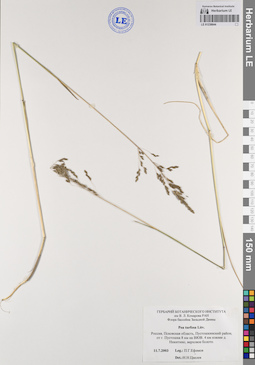
LE 01238644
Poa turfosa Litv. det. Tzvelev, Nikolai Nikolaievich
Collectors: Efimov, Peter Gennadievich Collection date: 11.07.2003. Administrative regions: RU - Pskovskaya Oblast' - Pustoshkinskiy Rayon. Groups of specimens: Образцы сектора Восточной Европы; Соглашение Минобрнауки №075-15-2021-1056Original label text:Россия, Псковская область, Пустошкинский район, от города Пустошка 8 километров на восток-юго-восток. 4 километра южнее деревни Никитин, верховое болото.
Record creation: 2023-06-05, Artyom Borodushkin, PhotoScan D2.Citation: Specimen LE 01238644 // Virtual herbarium of Komarov Botanical Institute RAS — http://re.herbariumle.ru/01238644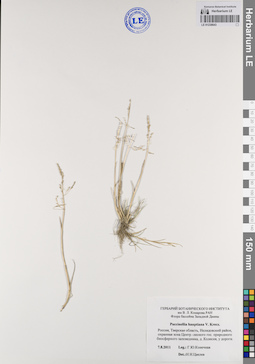
LE 01238643
Puccinellia hauptiana V.I. Krecz. det. Tzvelev, Nikolai Nikolaievich
Collectors: Konechnaya, Galina Yurievna Collection date: 07.08.2011. Administrative regions: RU - Tverskaya Oblast' - Nelidovskiy Rayon. Groups of specimens: Образцы сектора Восточной Европы; Соглашение Минобрнауки №075-15-2021-1056Original label text:Россия, Тверская область, Нелидовский район, охранная зона Центрально-лесного государственного природного биосферного заповедника, деревня Колесня, у дороги.
Record creation: 2023-06-05, Artyom Borodushkin, PhotoScan D2.Citation: Specimen LE 01238643 // Virtual herbarium of Komarov Botanical Institute RAS — http://re.herbariumle.ru/01238643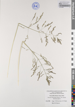
LE 01238642
Puccinellia distans (Jacq.) Parl. det. Tzvelev, Nikolai Nikolaievich
Collectors: Konechnaya, Galina Yurievna; Haare, Ado Oskarovich Collection date: 15.06.1998. Administrative regions: RU - Pskovskaya Oblast' - Kun'inskiy Rayon. Groups of specimens: Образцы сектора Восточной Европы; Соглашение Минобрнауки №075-15-2021-1056Original label text:Россия, Псковская область, поселок Кунья, обочина дороги.
Record creation: 2023-06-05, Artyom Borodushkin, PhotoScan D2.Citation: Specimen LE 01238642 // Virtual herbarium of Komarov Botanical Institute RAS — http://re.herbariumle.ru/01238642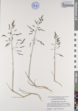
LE 01238641
Puccinellia distans (Jacq.) Parl.
Collectors: Konechnaya, Galina Yurievna Collection date: 28.06.2001. Administrative regions: RU - Pskovskaya Oblast' - Sebezhskiy Rayon. Groups of specimens: Образцы сектора Восточной Европы; Соглашение Минобрнауки №075-15-2021-1056Original label text:Россия, Псковская область, Себежский район, Национальный парк "Себежский", от города Себеж 8 километров на восток. Мальковский карьер, на разрытом песке.
Record creation: 2023-06-05, Artyom Borodushkin, PhotoScan D2.Citation: Specimen LE 01238641 // Virtual herbarium of Komarov Botanical Institute RAS — http://re.herbariumle.ru/01238641