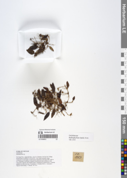
LE 01066812
Drag and drop files for uploading
 LE 01066812
LE 01066812
Bulbophyllum tipula Aver. det. Averyanov, Leonid Vladimirovich at 10.12.2019
Collectors: Averyanov, Leonid Vladimirovich; Khang Sinh Nguyen; Maisak, Tatiana Viktorovna Field collecting number: VR1553. Collection date: 11.10.2019. Administrative regions: VN - Tinh Ha Giang. Groups of specimens: L. V. Averyanov specimens; L. V. Averyanov herbarium; Orchids of Vietnam, Laos and CambodiaOriginal label text:FLORA OF VIETNAM
Orchidaceae
Bulbophyllum tipula Aver.
Ha Giang Prov., Quan Ba Distr., Can Ty Commune, Sin Suoi Ho Village, around point 23.09566ºN 105.02142ºE. Very steep mountain slopes composed of solid highly eroded karstic limestone at elevation 800–1000 m a.s.l. Remnants of primary evergreen broad-leaved and coniferous (with Calocedrus rupestris and Xanthocyparis vietnamensis) humid forest. Creeping epiphyte on old mossy tree. Occasional.
11 October 2019, L. Averyanov, Nguyen Sinh Khang, T. Maisak, VR 1553.
All photos © L. Averyanov & K.S. Nguyen
Record creation: 2020-01-05, Leonid Averyanov, PhotoScan D1. Processing status: work_status_1Citation: Specimen LE 01066812 // Virtual herbarium of Komarov Botanical Institute RAS — http://re.herbariumle.ru/01066812Дмитрий Сластунов, 27.05.2023 22:16