View
Add
Copy
Edit
Delete
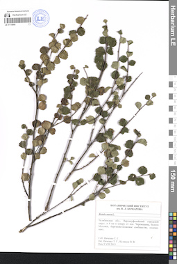
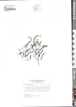
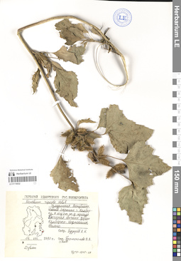
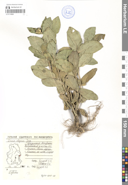
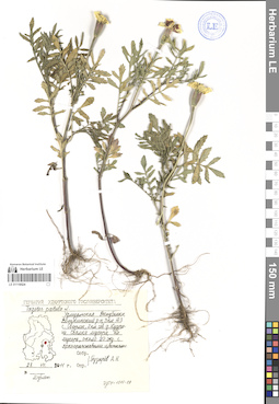
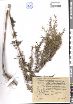
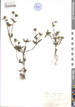
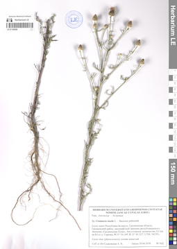
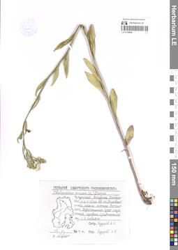
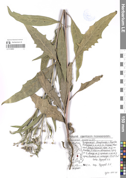
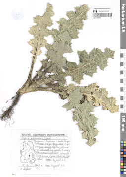
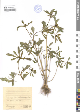
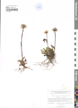
LE 01118909
Groups of specimens: Образцы сектора Восточной ЕвропыRecord creation: Ilya Sadovnikov, PhotoScan D2Citation: Specimen LE 01118909 // Virtual herbarium of Komarov Botanical Institute RAS — http://re.herbariumle.ru/01118909
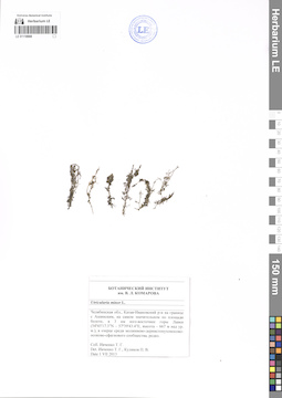
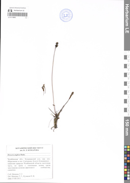
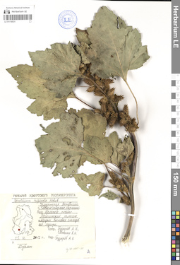
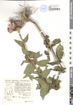
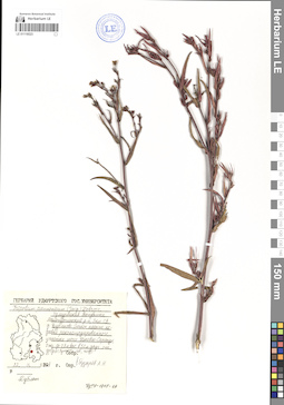
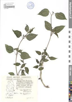
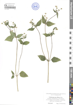
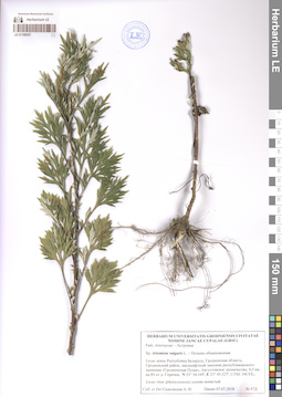
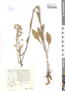
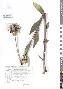
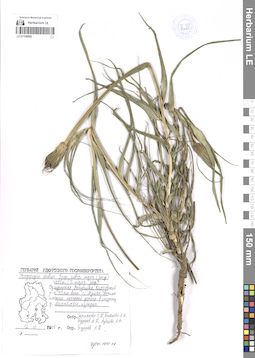
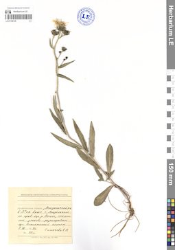
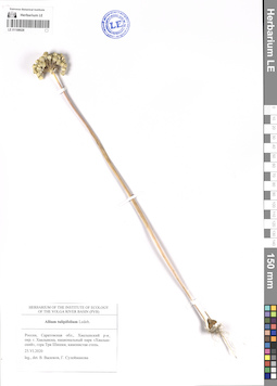
LE 01118908
Groups of specimens: Образцы сектора Восточной ЕвропыRecord creation: Ilya Sadovnikov, PhotoScan D2Citation: Specimen LE 01118908 // Virtual herbarium of Komarov Botanical Institute RAS — http://re.herbariumle.ru/01118908
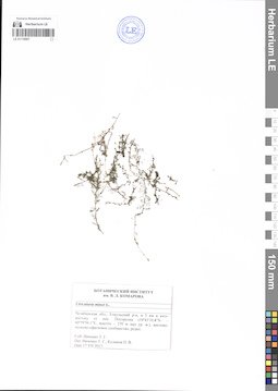
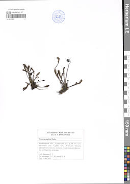
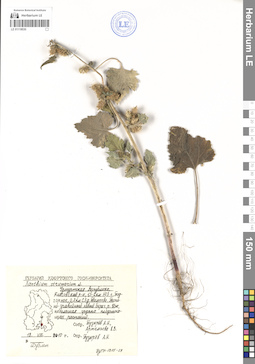
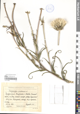
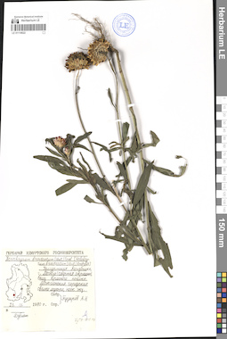
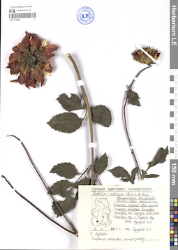
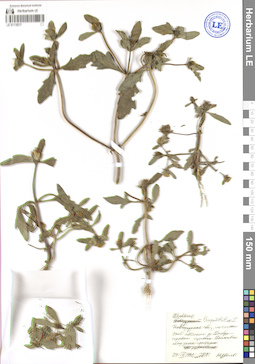
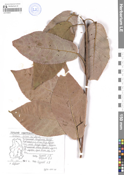
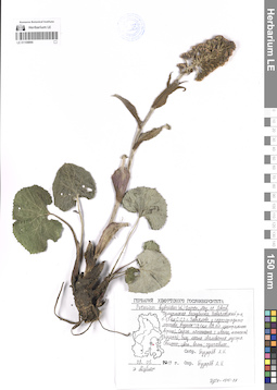
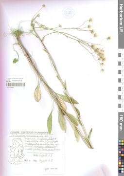
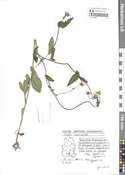
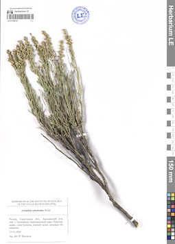
LE 01118907
Groups of specimens: Образцы сектора Восточной ЕвропыRecord creation: Ilya Sadovnikov, PhotoScan D2Citation: Specimen LE 01118907 // Virtual herbarium of Komarov Botanical Institute RAS — http://re.herbariumle.ru/01118907
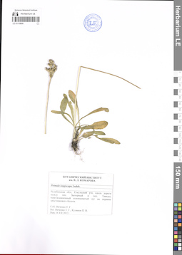
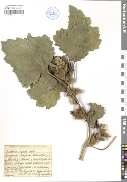
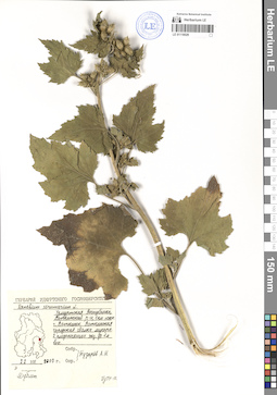
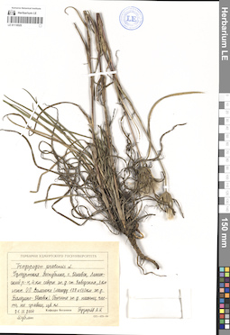
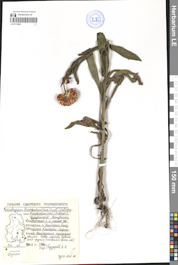
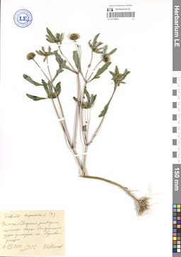
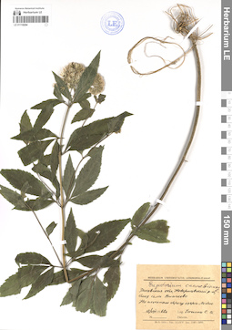
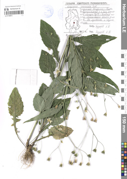
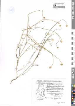
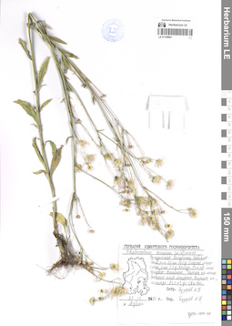
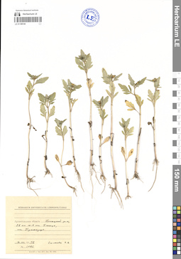
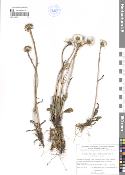
LE 01118906
Groups of specimens: Образцы сектора Восточной ЕвропыRecord creation: Ilya Sadovnikov, PhotoScan D2Citation: Specimen LE 01118906 // Virtual herbarium of Komarov Botanical Institute RAS — http://re.herbariumle.ru/01118906
LE 01118905
Groups of specimens: Образцы сектора Восточной ЕвропыRecord creation: Ilya Sadovnikov, PhotoScan D2Citation: Specimen LE 01118905 // Virtual herbarium of Komarov Botanical Institute RAS — http://re.herbariumle.ru/01118905
LE 01118902
Groups of specimens: Образцы сектора Восточной ЕвропыRecord creation: Ilya Sadovnikov, PhotoScan D2Citation: Specimen LE 01118902 // Virtual herbarium of Komarov Botanical Institute RAS — http://re.herbariumle.ru/01118902
LE 01118901
Groups of specimens: Образцы сектора Восточной ЕвропыRecord creation: Ilya Sadovnikov, PhotoScan D2Citation: Specimen LE 01118901 // Virtual herbarium of Komarov Botanical Institute RAS — http://re.herbariumle.ru/01118901
LE 01118533
Groups of specimens: Образцы сектора Восточной ЕвропыRecord creation: Ilya Sadovnikov, PhotoScan D2Citation: Specimen LE 01118533 // Virtual herbarium of Komarov Botanical Institute RAS — http://re.herbariumle.ru/01118533
LE 01118532
Groups of specimens: Образцы сектора Восточной ЕвропыRecord creation: Ilya Sadovnikov, PhotoScan D2Citation: Specimen LE 01118532 // Virtual herbarium of Komarov Botanical Institute RAS — http://re.herbariumle.ru/01118532
LE 01118531
Groups of specimens: Образцы сектора Восточной ЕвропыRecord creation: Ilya Sadovnikov, PhotoScan D2Citation: Specimen LE 01118531 // Virtual herbarium of Komarov Botanical Institute RAS — http://re.herbariumle.ru/01118531
LE 01118530
Groups of specimens: Образцы сектора Восточной ЕвропыRecord creation: Ilya Sadovnikov, PhotoScan D2Citation: Specimen LE 01118530 // Virtual herbarium of Komarov Botanical Institute RAS — http://re.herbariumle.ru/01118530
LE 01118529
Groups of specimens: Образцы сектора Восточной ЕвропыRecord creation: Ilya Sadovnikov, PhotoScan D2Citation: Specimen LE 01118529 // Virtual herbarium of Komarov Botanical Institute RAS — http://re.herbariumle.ru/01118529
LE 01118528
Groups of specimens: Образцы сектора Восточной ЕвропыRecord creation: Ilya Sadovnikov, PhotoScan D2Citation: Specimen LE 01118528 // Virtual herbarium of Komarov Botanical Institute RAS — http://re.herbariumle.ru/01118528
LE 01118527
Groups of specimens: Образцы сектора Восточной ЕвропыRecord creation: Ilya Sadovnikov, PhotoScan D2Citation: Specimen LE 01118527 // Virtual herbarium of Komarov Botanical Institute RAS — http://re.herbariumle.ru/01118527
LE 01118526
Groups of specimens: Образцы сектора Восточной ЕвропыRecord creation: Ilya Sadovnikov, PhotoScan D2Citation: Specimen LE 01118526 // Virtual herbarium of Komarov Botanical Institute RAS — http://re.herbariumle.ru/01118526
LE 01118525
Groups of specimens: Образцы сектора Восточной ЕвропыRecord creation: Ilya Sadovnikov, PhotoScan D2Citation: Specimen LE 01118525 // Virtual herbarium of Komarov Botanical Institute RAS — http://re.herbariumle.ru/01118525
LE 01118524
Groups of specimens: Образцы сектора Восточной ЕвропыRecord creation: Ilya Sadovnikov, PhotoScan D2Citation: Specimen LE 01118524 // Virtual herbarium of Komarov Botanical Institute RAS — http://re.herbariumle.ru/01118524
LE 01118523
Groups of specimens: Образцы сектора Восточной ЕвропыRecord creation: Ilya Sadovnikov, PhotoScan D2Citation: Specimen LE 01118523 // Virtual herbarium of Komarov Botanical Institute RAS — http://re.herbariumle.ru/01118523
LE 01118522
Groups of specimens: Образцы сектора Восточной ЕвропыRecord creation: Ilya Sadovnikov, PhotoScan D2Citation: Specimen LE 01118522 // Virtual herbarium of Komarov Botanical Institute RAS — http://re.herbariumle.ru/01118522
LE 01118521
Groups of specimens: Образцы сектора Восточной ЕвропыRecord creation: Ilya Sadovnikov, PhotoScan D2Citation: Specimen LE 01118521 // Virtual herbarium of Komarov Botanical Institute RAS — http://re.herbariumle.ru/01118521
LE 01118395
Groups of specimens: Образцы сектора Восточной ЕвропыRecord creation: Ilya Sadovnikov, PhotoScan D2Citation: Specimen LE 01118395 // Virtual herbarium of Komarov Botanical Institute RAS — http://re.herbariumle.ru/01118395
LE 01118289
Groups of specimens: Образцы сектора Восточной ЕвропыRecord creation: Ilya Sadovnikov, PhotoScan D2Citation: Specimen LE 01118289 // Virtual herbarium of Komarov Botanical Institute RAS — http://re.herbariumle.ru/01118289
LE 01118288
Groups of specimens: Образцы сектора Восточной ЕвропыRecord creation: Ilya Sadovnikov, PhotoScan D2Citation: Specimen LE 01118288 // Virtual herbarium of Komarov Botanical Institute RAS — http://re.herbariumle.ru/01118288
LE 01118222
Groups of specimens: Образцы сектора Восточной ЕвропыRecord creation: Ilya Sadovnikov, PhotoScan D2Citation: Specimen LE 01118222 // Virtual herbarium of Komarov Botanical Institute RAS — http://re.herbariumle.ru/01118222
LE 01118221
Groups of specimens: Образцы сектора Восточной ЕвропыRecord creation: Ilya Sadovnikov, PhotoScan D2Citation: Specimen LE 01118221 // Virtual herbarium of Komarov Botanical Institute RAS — http://re.herbariumle.ru/01118221
LE 01118219
Groups of specimens: Образцы сектора Восточной ЕвропыRecord creation: Ilya Sadovnikov, PhotoScan D2Citation: Specimen LE 01118219 // Virtual herbarium of Komarov Botanical Institute RAS — http://re.herbariumle.ru/01118219
LE 01118217
Groups of specimens: Образцы сектора Восточной ЕвропыRecord creation: Ilya Sadovnikov, PhotoScan D2Citation: Specimen LE 01118217 // Virtual herbarium of Komarov Botanical Institute RAS — http://re.herbariumle.ru/01118217
LE 01118204
Groups of specimens: Образцы сектора Восточной ЕвропыRecord creation: Ilya Sadovnikov, PhotoScan D2Citation: Specimen LE 01118204 // Virtual herbarium of Komarov Botanical Institute RAS — http://re.herbariumle.ru/01118204
LE 01109558
Groups of specimens: Образцы сектора Восточной ЕвропыRecord creation: Ilya Sadovnikov, PhotoScan D2Citation: Specimen LE 01109558 // Virtual herbarium of Komarov Botanical Institute RAS — http://re.herbariumle.ru/01109558
LE 01109557
Groups of specimens: Образцы сектора Восточной ЕвропыRecord creation: Ilya Sadovnikov, PhotoScan D2Citation: Specimen LE 01109557 // Virtual herbarium of Komarov Botanical Institute RAS — http://re.herbariumle.ru/01109557
LE 01109161
Groups of specimens: Образцы сектора Восточной ЕвропыRecord creation: Ilya Sadovnikov, PhotoScan D2Citation: Specimen LE 01109161 // Virtual herbarium of Komarov Botanical Institute RAS — http://re.herbariumle.ru/01109161
LE 01108872
Groups of specimens: Образцы сектора Восточной ЕвропыRecord creation: Ilya Sadovnikov, PhotoScan D2Citation: Specimen LE 01108872 // Virtual herbarium of Komarov Botanical Institute RAS — http://re.herbariumle.ru/01108872
LE 01108868
Groups of specimens: Образцы сектора Восточной ЕвропыRecord creation: Ilya Sadovnikov, PhotoScan D2Citation: Specimen LE 01108868 // Virtual herbarium of Komarov Botanical Institute RAS — http://re.herbariumle.ru/01108868
LE 01108867
Groups of specimens: Образцы сектора Восточной ЕвропыRecord creation: Ilya Sadovnikov, PhotoScan D2Citation: Specimen LE 01108867 // Virtual herbarium of Komarov Botanical Institute RAS — http://re.herbariumle.ru/01108867
LE 01108866
Groups of specimens: Образцы сектора Восточной ЕвропыRecord creation: Ilya Sadovnikov, PhotoScan D2Citation: Specimen LE 01108866 // Virtual herbarium of Komarov Botanical Institute RAS — http://re.herbariumle.ru/01108866
LE 01108865
Groups of specimens: Образцы сектора Восточной ЕвропыRecord creation: Ilya Sadovnikov, PhotoScan D2Citation: Specimen LE 01108865 // Virtual herbarium of Komarov Botanical Institute RAS — http://re.herbariumle.ru/01108865
LE 01108864
Groups of specimens: Образцы сектора Восточной ЕвропыRecord creation: Ilya Sadovnikov, PhotoScan D2Citation: Specimen LE 01108864 // Virtual herbarium of Komarov Botanical Institute RAS — http://re.herbariumle.ru/01108864
LE 01108863
Groups of specimens: Образцы сектора Восточной ЕвропыRecord creation: Ilya Sadovnikov, PhotoScan D2Citation: Specimen LE 01108863 // Virtual herbarium of Komarov Botanical Institute RAS — http://re.herbariumle.ru/01108863
LE 01108862
Groups of specimens: Образцы сектора Восточной ЕвропыRecord creation: Ilya Sadovnikov, PhotoScan D2Citation: Specimen LE 01108862 // Virtual herbarium of Komarov Botanical Institute RAS — http://re.herbariumle.ru/01108862
LE 01108861
Groups of specimens: Образцы сектора Восточной ЕвропыRecord creation: Ilya Sadovnikov, PhotoScan D2Citation: Specimen LE 01108861 // Virtual herbarium of Komarov Botanical Institute RAS — http://re.herbariumle.ru/01108861
LE 01108860
Groups of specimens: Образцы сектора Восточной ЕвропыRecord creation: Ilya Sadovnikov, PhotoScan D2Citation: Specimen LE 01108860 // Virtual herbarium of Komarov Botanical Institute RAS — http://re.herbariumle.ru/01108860
LE 01108859
Groups of specimens: Образцы сектора Восточной ЕвропыRecord creation: Ilya Sadovnikov, PhotoScan D2Citation: Specimen LE 01108859 // Virtual herbarium of Komarov Botanical Institute RAS — http://re.herbariumle.ru/01108859
LE 01108858
Groups of specimens: Образцы сектора Восточной ЕвропыRecord creation: Ilya Sadovnikov, PhotoScan D2Citation: Specimen LE 01108858 // Virtual herbarium of Komarov Botanical Institute RAS — http://re.herbariumle.ru/01108858
LE 01108144
Groups of specimens: Образцы сектора Восточной ЕвропыRecord creation: Ilya Sadovnikov, PhotoScan D2Citation: Specimen LE 01108144 // Virtual herbarium of Komarov Botanical Institute RAS — http://re.herbariumle.ru/01108144
LE 01108143
Groups of specimens: Образцы сектора Восточной ЕвропыRecord creation: Ilya Sadovnikov, PhotoScan D2Citation: Specimen LE 01108143 // Virtual herbarium of Komarov Botanical Institute RAS — http://re.herbariumle.ru/01108143
LE 01108135
Groups of specimens: Образцы сектора Восточной ЕвропыRecord creation: Ilya Sadovnikov, PhotoScan D2Citation: Specimen LE 01108135 // Virtual herbarium of Komarov Botanical Institute RAS — http://re.herbariumle.ru/01108135
LE 01108121
Groups of specimens: Образцы сектора Восточной ЕвропыRecord creation: Ilya Sadovnikov, PhotoScan D2Citation: Specimen LE 01108121 // Virtual herbarium of Komarov Botanical Institute RAS — http://re.herbariumle.ru/01108121
LE 01108078
Groups of specimens: Образцы сектора Восточной ЕвропыRecord creation: Ilya Sadovnikov, PhotoScan D2Citation: Specimen LE 01108078 // Virtual herbarium of Komarov Botanical Institute RAS — http://re.herbariumle.ru/01108078
LE 01108074
Groups of specimens: Образцы сектора Восточной ЕвропыRecord creation: Ilya Sadovnikov, PhotoScan D2Citation: Specimen LE 01108074 // Virtual herbarium of Komarov Botanical Institute RAS — http://re.herbariumle.ru/01108074
LE 01108028
Groups of specimens: Образцы сектора Восточной ЕвропыRecord creation: Ilya Sadovnikov, PhotoScan D2Citation: Specimen LE 01108028 // Virtual herbarium of Komarov Botanical Institute RAS — http://re.herbariumle.ru/01108028