View
Add
Copy
Edit
Delete
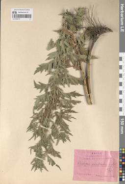
LE 01288179
Lycopus exaltatus L. f. det. Oppermann, Pavel at 13.04.1931
Collectors: Oppermann, Pavel Field collecting number: s.n. Collection date: 09.07.1930. Administrative regions: MD - Raionul Causeni. Subregion: Приднестровье. Топоним: Чебруч (Чобручи). Place of collection: с. Чобручи (Чебруч), "плавни" под огород и с садами.Groups of specimens: Образцы сектора Восточной Европы; Соглашение Минобрнауки №075-15-2021-1056Original label text:А.М. С.С.Р. Слободзея*Чебруч. "Плавни" под огород, и садами. Lycopus exaltatus L. fil. 13/IV 31. 9 Июля 1930 г. Павел Опперманн.
Landscape in location of collection: "плавни" под огород и с садамиCoordinates (geographic position): 46° 40′ 14.1″ N, 29° 45′ 30.69″ E ±4000 mRecord creation: 2024-05-27, Denis Melnikov, PhotoScan D2.Citation: Specimen LE 01288179 // Virtual herbarium of Komarov Botanical Institute RAS — http://re.herbariumle.ru/01288179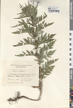
LE 01288178
Lycopus exaltatus L. f. det. Shabanova T.
Collectors: Vyatkina Field collecting number: s.n. Collection date: 14.07.1959. Administrative regions: MD - Raionul Ungheni. Place of collection: с. Бахмут, опушка Реденского леса.Groups of specimens: Образцы сектора Восточной Европы; Соглашение Минобрнауки №075-15-2021-1056; Кишиневский государственный университет; Флора МолдавииOriginal label text:Кишиневский государственный университет. Флора Молдавии. Lycopus exaltatus L. с. Бахмут Каларашского р-на. Опушка Реденского леса. 14 VII 1959 г. Собр. Вяткина. Опред. Шабанова
Habitat / plant community in location of collecting: опушка лесаCoordinates (geographic position): 47° 20′ 1.08″ N, 28° 6′ 47.78″ E ±4000 mRecord creation: 2024-05-27, Denis Melnikov, PhotoScan D2.Citation: Specimen LE 01288178 // Virtual herbarium of Komarov Botanical Institute RAS — http://re.herbariumle.ru/01288178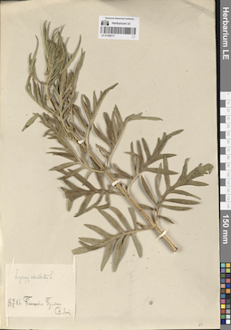
LE 01288177
Lycopus exaltatus L. f. det. Lin.,V.
Collectors: Lin.,V. Field collecting number: s.n. Collection date: 23.06.1886. Administrative regions: MD - Anenii Noi. Топоним: Бульбока (с. Бульбоака). Place of collection: с. Бульбоака (Бульбока).Groups of specimens: Образцы сектора Восточной Европы; Соглашение Минобрнауки №075-15-2021-1056Original label text:Lycopus exaltatus L. 23/VI 1886. Бессарабия. Бульбока. В. Лин.
Coordinates (geographic position): 46° 53′ 27.38″ N, 29° 18′ 12.77″ E ±1000 mRecord creation: 2024-05-27, Denis Melnikov, PhotoScan D2.Citation: Specimen LE 01288177 // Virtual herbarium of Komarov Botanical Institute RAS — http://re.herbariumle.ru/01288177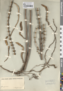
LE 01288176
Collectors: Korshinsky, Sergei Ivanovitsch Administrative regions: RU - Astrakhanskaya Oblast' - Gorod Astrakhan'. Groups of specimens: Образцы сектора Восточной Европы; Соглашение Минобрнауки №075-15-2021-1056; Herbarium Academiae Scientiarium Petropol. УДАЛИТЬ; Museum Botanicum Academiae Scientiarum PetropolitanaeOriginal label text:
Астрахань.
Landscape in location of collection: степи, заболоченная дельтаRecord creation: 2024-05-27, Denis Melnikov, PhotoScan D2.Citation: Specimen LE 01288176 // Virtual herbarium of Komarov Botanical Institute RAS — http://re.herbariumle.ru/01288176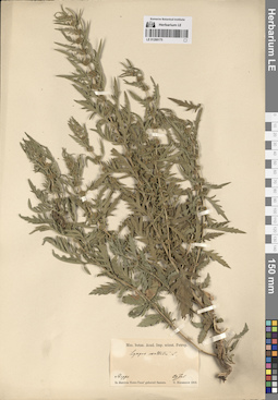
LE 01288175
Lycopus exaltatus L. f. det. Borszczow, G.
Collectors: Borszczow, G. Field collecting number: s.n. Collection date: 29.07.1859. Administrative regions: RUSaratovskaya Oblast' - Novouzenskiy Rayon. Place of collection: Новоузенский уезд Саратовской губернии.Groups of specimens: Образцы сектора Восточной Европы; Соглашение Минобрнауки №075-15-2021-1056; Mus. botan. Acad. Imp. scient. Petrop.Original label text:Mus. botan. Acad. Imp. scient. Petrop. Lycopus exaltatus L. Steppe. In districtu Nowo-Usen' gubernii Samara. G. Borszczow. 29 Jul 1859.
Coordinates (geographic position): 50° 27′ 44.92″ N, 48° 8′ 7.37″ E ±180000 mRecord creation: 2024-05-27, Denis Melnikov, PhotoScan D2.Citation: Specimen LE 01288175 // Virtual herbarium of Komarov Botanical Institute RAS — http://re.herbariumle.ru/01288175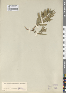
LE 01288174
Lycopus europaeus L. ⟮ID by scan⟯ det. Byalt, Аleksej Vyacheslavovich at 17.06.2024
Collectors: Puparev, K. Field collecting number: s.n. Collection date: 21.07.1849. Administrative regions: KZ - West Kazakhstan. Place of collection: Букеевская внутренняя орда, степь.Groups of specimens: Образцы сектора Восточной Европы; Соглашение Минобрнауки №075-15-2021-1056; Гербарий К. Пупарева; Museum Botanicum Academiae Scientiarum PetropolitanaeOriginal label text:Museum Botanicum Academiae Scientiarum Petropolitanae. Астрахан. губ. Букеевская орда. Степь. Герб. К. Пупырева. 1849.VII.21
Habitat / plant community in location of collecting: степьCoordinates (geographic position): 48° 31′ 24.62″ N, 49° 10′ 21.75″ E ±100000 mRecord creation: 2024-05-27, Denis Melnikov, PhotoScan D2.Citation: Specimen LE 01288174 // Virtual herbarium of Komarov Botanical Institute RAS — http://re.herbariumle.ru/01288174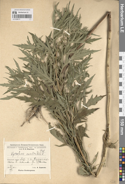
LE 01288173
Lycopus × intermedius Hausskn. ⟮ID by scan⟯ det. Melnikov, Denis Germanovich at 12.08.2024
Additional identifications: Lycopus exaltatus L. f. det. Borissova, Antonina Georgievna at 1928 Collectors: Borissova, Antonina Georgievna Field collecting number: 961. Collection date: 21.07.1928. Administrative regions: RU - Orenburgskaya Oblast' - Tashlinskiy Rayon. Place of collection: луг у пос. Кинделя (Кинделинский, Кинелинский?) в пойме р. Урал.Expedition: Экспедиция в Оренбургский округ Оренбургского Почвенно-Ботанического Бюро (1928)Groups of specimens: Образцы сектора Восточной Европы; Соглашение Минобрнауки №075-15-2021-1056Original label text:Оренбургское Почвенно-Ботаническое Бюро. Экспедиция в Оренбургский округ под руководством проф. Б.А. Федченко. № 961. Lycopus exaltatus L. Илекский район. Луг у п. Кинделинского в пойме р. Урала. 21 VII 1928 г. Собр. А. Борисова. Plantae Orenburgenses.
Landscape in location of collection: луг в пойме рекиHabitat / plant community in location of collecting: пойменный лугCoordinates (geographic position): 51° 29′ 59.46″ N, 53° 1′ 19.09″ E ±10000 mRecord creation: 2024-05-27, Denis Melnikov, PhotoScan D2.Citation: Specimen LE 01288173 // Virtual herbarium of Komarov Botanical Institute RAS — http://re.herbariumle.ru/01288173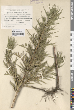
LE 01288172
Lycopus exaltatus L. f. det. Tzvelev, Nikolai Nikolaievich at 1965
Collectors: Kolesnikova, Tatiana; Tzvelev, Nikolai Nikolaievich Field collecting number: 85. Collection date: 24.07.1965. Administrative regions: RU - Astrakhanskaya Oblast' - Kamyzyakskiy Rayon. Place of collection: Дельта р. Волга, урочище Дамчинский участок Астраханского заповедника, солончаковый луг у края тростниковых зарослей близ кордона Дамчик.Groups of specimens: Образцы сектора Восточной Европы; Соглашение Минобрнауки №075-15-2021-1056; Гербарий Ботанического Института Академии наук СССР; Herbarium Instituti Botanici Academiae Scientiarum URSS. Leningrad.Original label text:Гербарий Ботанического Института Академии наук СССР. Lycopus exaltatus L. fil. Астраханская обл. Дельта Волги. Дамчинский участок Астрах. заповедника. Солончаковый луг у края тростниковых зарослей близ кордона Дамчик. 1965 VII 24 № 85. Собр. Н. Цвелев и Т. Колесникова. Опр. Н. Цвелев. Herbarium Instituti Botanici Academiae Sc. URSS
Habitat / plant community in location of collecting: солончаковый луг у края тростниковых зарослейCoordinates (geographic position): 45° 47′ 23.53″ N, 47° 53′ 20.79″ E ±1000 mRecord creation: 2024-05-27, Denis Melnikov, PhotoScan D2.Citation: Specimen LE 01288172 // Virtual herbarium of Komarov Botanical Institute RAS — http://re.herbariumle.ru/01288172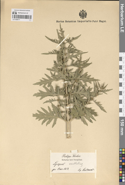
LE 01288171
Lycopus exaltatus L. f. det. Busch
Additional identifications: Lycopus sp. det. Antonow Collectors: Antonow Field collecting number: s.n. Collection date: 1852. Administrative regions: RU - Orenburgskaya Oblast' - Gayskiy Rayon. Place of collection: возле г. Орск.Groups of specimens: Образцы сектора Восточной Европы; Соглашение Минобрнауки №075-15-2021-1056; Reliqu. Fischer; Herbarium horti Petropolitani; Hortus Botanicus Imperialis Petri Magni.Original label text:Reliqu. Fischer. Herbarium horti Petropolitani. Lycopus exaltatus. pr. Orsk 1852 leg. Antonow
Coordinates (geographic position): 51° 13′ 45.48″ N, 58° 28′ 28.83″ E ±30000 mRecord creation: 2024-05-27, Denis Melnikov, PhotoScan D2.Citation: Specimen LE 01288171 // Virtual herbarium of Komarov Botanical Institute RAS — http://re.herbariumle.ru/01288171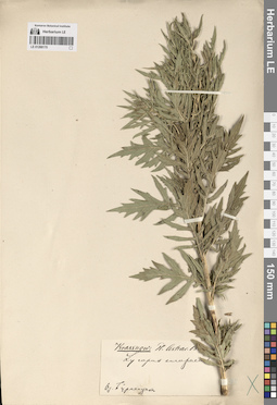
LE 01288170
Lycopus europaeus L. det. Krasnov (Krassnov), Andrej Nikovaevich
Collectors: Krasnov (Krassnov), Andrej Nikovaevich Field collecting number: s.n. Collection date: 1885. Administrative regions: RU - Kalmykiya - Maloderbetovskiy Rayon. Топоним: оз. Бурманцак (оз. Барманцак). Place of collection: оз. Барманцак.Expedition: Krassnow: Pl. Astrac. (1885)Groups of specimens: Образцы сектора Восточной Европы; Соглашение Минобрнауки №075-15-2021-1056Original label text:Krassnow: Pl. Astrac. 188[5]. Lycopus europaeus L. Оз. Бурманцак.
Landscape in location of collection: берег соленого озераCoordinates (geographic position): 48° 3′ 6.16″ N, 44° 39′ 5.59″ E ±7000 mRecord creation: 2024-05-27, Denis Melnikov, PhotoScan D2.Citation: Specimen LE 01288170 // Virtual herbarium of Komarov Botanical Institute RAS — http://re.herbariumle.ru/01288170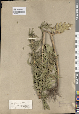
LE 01288169
Lycopus exaltatus L. f. det. Becker, Alexander K. at 1871
Collectors: Becker, Alexander K. Field collecting number: 133. Collection date: 1870. Administrative regions: RU - Astrakhanskaya Oblast' - Gorod Astrakhan'. Place of collection: низовья р. Волга, г. Астрахань.Groups of specimens: Образцы сектора Восточной Европы; Соглашение Минобрнауки №075-15-2021-1056; Herbarium Academiae Scientiarum Petropol.; Herb. A. BeckerOriginal label text:133. Lycopus exaltatus. Ad Wolgam inferior. Astrachan. Becker 1870 Acc. 1871
Landscape in location of collection: берег рекиCoordinates (geographic position): 46° 20′ 53.61″ N, 48° 1′ 15.17″ E ±13000 mRecord creation: 2024-05-27, Denis Melnikov, PhotoScan D2.Citation: Specimen LE 01288169 // Virtual herbarium of Komarov Botanical Institute RAS — http://re.herbariumle.ru/01288169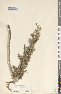
LE 01288168
Lycopus exaltatus L. f. det. Trautvetter, Rudolf Ernst von
Collectors: Becker, Alexander K. Field collecting number: 133. Collection date: 1871. Administrative regions: RU - Astrakhanskaya Oblast' - Gorod Astrakhan'. Топоним: Astrachan (г. Астрахань). Place of collection: г. Астрахань.Groups of specimens: Образцы сектора Восточной Европы; Соглашение Минобрнауки №075-15-2021-1056; Herb. A. BeckerOriginal label text:Lycopus exaltatus L. (Trautv.) 133. Astrachan. A. Becker 71.
Coordinates (geographic position): 46° 20′ 53.61″ N, 48° 1′ 15.17″ E ±13000 mRecord creation: 2024-05-27, Denis Melnikov, PhotoScan D2.Citation: Specimen LE 01288168 // Virtual herbarium of Komarov Botanical Institute RAS — http://re.herbariumle.ru/01288168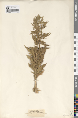
LE 01288167
Lycopus sp. det. Becker, Alexander K.
Collectors: Becker, Alexander K. Administrative regions: RU - Volgogradskaya Oblast' - Gorodskoj okrug gorod Volgograd. Subregion: город Волгоград, Красноармейский район. Топоним: Сарепта, Волгоград (музей-заповедник Старая Сарепта). Groups of specimens: Образцы сектора Восточной Европы; Соглашение Минобрнауки №075-15-2021-1056; Herb. A. Becker; Reliq. LedebourOriginal label text:Sarepta
Landscape in location of collection: степиRecord creation: 2024-05-27, Denis Melnikov, PhotoScan D2.Citation: Specimen LE 01288167 // Virtual herbarium of Komarov Botanical Institute RAS — http://re.herbariumle.ru/01288167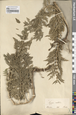
LE 01288166
Lycopus exaltatus L. f. det. Becker, Alexander K.
Collectors: Becker, Alexander K. Field collecting number: s.n. Collection date: 1866. Administrative regions: RU - Astrakhanskaya Oblast' - Gorod Astrakhan'. Place of collection: г. Астрахань.Groups of specimens: Образцы сектора Восточной Европы; Соглашение Минобрнауки №075-15-2021-1056; Herb. A. BeckerOriginal label text:Lycopus exaltatus. Astrachan. 1866. Becker.
Coordinates (geographic position): 46° 20′ 53.61″ N, 48° 1′ 15.17″ E ±13000 mRecord creation: 2024-05-27, Denis Melnikov, PhotoScan D2.Citation: Specimen LE 01288166 // Virtual herbarium of Komarov Botanical Institute RAS — http://re.herbariumle.ru/01288166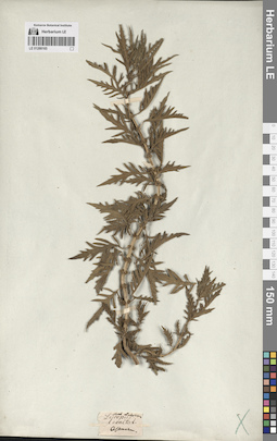
LE 01288165
Lycopus exaltatus L. f. det. Busch
Collectors: Busch Administrative regions: RU - Astrakhanskaya Oblast' - Gorod Astrakhan'. Groups of specimens: Образцы сектора Восточной Европы; Соглашение Минобрнауки №075-15-2021-1056; Herb. LedebourOriginal label text:Astrachan.
Landscape in location of collection: степи, заболоченная дельтаRecord creation: 2024-05-27, Denis Melnikov, PhotoScan D2.Citation: Specimen LE 01288165 // Virtual herbarium of Komarov Botanical Institute RAS — http://re.herbariumle.ru/01288165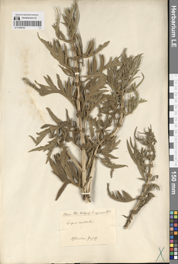
LE 01288164
Lycopus exaltatus L. f. det. Claus, Karl Ernst
Collectors: Claus, Karl Ernst Field collecting number: s.n. Collection date: 1852. Administrative regions: RU - Astrakhanskaya Oblast' - Gorod Astrakhan'. Place of collection: г. Астрахань, Юрьев (Gurjeff) [вероятно, фамилия владельца дома или улица].Expedition: Claus. Iter Wolgensi Caspicum. 1852 ()Groups of specimens: Образцы сектора Восточной Европы; Соглашение Минобрнауки №075-15-2021-1056; Hb. C. ClausOriginal label text:Claus. Iter Wolgensi-Caspicum. 1852. Lycopus exaltatus. Astrachan. Gurgeff.
Coordinates (geographic position): 46° 20′ 51.41″ N, 48° 1′ 48.64″ E ±13000 mRecord creation: 2024-05-27, Denis Melnikov, PhotoScan D2.Citation: Specimen LE 01288164 // Virtual herbarium of Komarov Botanical Institute RAS — http://re.herbariumle.ru/01288164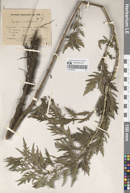
LE 01288163
Lycopus exaltatus L. f. det. Pojarkova, Tatjana Phedorovna at 1926
Collectors: Pojarkova, Tatjana Phedorovna Field collecting number: 241. Collection date: 22.08.1926. Administrative regions: KZ - West Kazakhstan - Kaztalovka Audany. Place of collection: лощина у хут. Еремина.Expedition: Т. Пояркова. Растения Уральской губ. 1926 г. (1926)Groups of specimens: Образцы сектора Восточной Европы; Соглашение Минобрнауки №075-15-2021-1056Original label text:Растения Уральской губ. 1926 г. № 241. Lycopus exaltatus L. Букеевский у. Сламихинский район. в лощине у х. Еремина. Влажно. 22 VIII 1926 г. Собр. Т. Пояркова
Landscape in location of collection: лощинаRecord creation: 2024-05-27, Denis Melnikov, PhotoScan D2.Citation: Specimen LE 01288163 // Virtual herbarium of Komarov Botanical Institute RAS — http://re.herbariumle.ru/01288163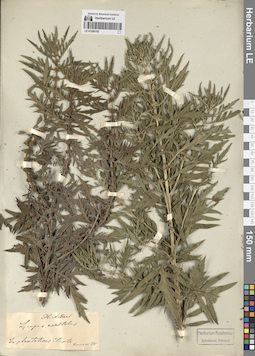
LE 01288162
Lycopus exaltatus L. f. det. Krasnov (Krassnov), Andrej Nikovaevich
Collectors: Krasnov (Krassnov), Andrej Nikovaevich Field collecting number: s.n. Collection date: 1885. Administrative regions: RU - Kalmykiya - Elista Urban Okrug. Place of collection: г. Элиста, в посадках.Expedition: Krassnow: Pl. Astrac. (1885)Groups of specimens: Образцы сектора Восточной Европы; Соглашение Минобрнауки №075-15-2021-1056Original label text:Pl. Astrach. Lycopus exaltatus. In plantations Elista. Krassnov 1885
Habitat / plant community in location of collecting: городские насажденияCoordinates (geographic position): 46° 18′ 27.87″ N, 44° 16′ 11.13″ E ±10000 mRecord creation: 2024-05-27, Denis Melnikov, PhotoScan D2.Citation: Specimen LE 01288162 // Virtual herbarium of Komarov Botanical Institute RAS — http://re.herbariumle.ru/01288162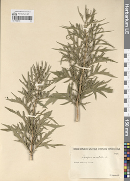
LE 01288161
Lycopus exaltatus L. f. det. Korshinsky, Sergei Ivanovitsch
Collectors: Korshinsky, Sergei Ivanovitsch Administrative regions: RU - Astrakhanskaya Oblast'. Groups of specimens: Образцы сектора Восточной Европы; Соглашение Минобрнауки №075-15-2021-1056; Museum Botanicum Academiae Scientiarum Petropolitanae; Флора дельты реки ВолгиLandscape in location of collection: степи, заболоченная дельтаRecord creation: 2024-05-27, Denis Melnikov, PhotoScan D2.Citation: Specimen LE 01288161 // Virtual herbarium of Komarov Botanical Institute RAS — http://re.herbariumle.ru/01288161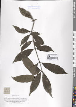
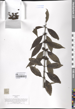
LE 01276156
Lasianthus sp. det. Averyanov, Leonid Vladimirovich at 12.11.2013
Collectors: Averyanov, Leonid Vladimirovich; Tien Hiep Nguyen; et al. Field collecting number: CPC6976. Collection date: 12.11.2013. Administrative regions: VN - Tinh Son La. Groups of specimens: L. V. Averyanov specimens; L. V. Averyanov herbarium; Соглашение Минобрнауки №075-15-2021-1056; Flora of VietnamOriginal label text:FLORA OF VIETNAM
Rubiaceae
Lasianthus sp.
Son La Prov., Van Ho Distr., Chieng Xuan Municipality, Co Hong village, territory of Xuan Nha natural reserve, Pha Luong Mountain. Remnants of primary and secondary broad-leaved evergreen forest on very steep mountain slopes composed by brown sandstone at elevation 700-1000 m a.s.l. around point 20°42’14.2’’N 104°43’53.9’’E. Shrub 2-3 m tall on shady humid slope. Flowers white. Not common.
12 November 2013 CPC 6976
Coll.: L.Averyanov, N.T.Hiep, N.S.Khang, N.D.Thang, L.D.Qui
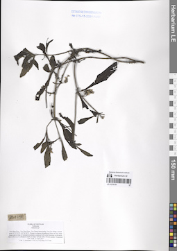
LE 01276155
Lasianthus sp. det. Averyanov, Leonid Vladimirovich at 12.11.2013
Collectors: Averyanov, Leonid Vladimirovich; Tien Hiep Nguyen; et al. Field collecting number: CPC6968. Collection date: 12.11.2013. Administrative regions: VN - Tinh Son La. Groups of specimens: L. V. Averyanov specimens; L. V. Averyanov herbarium; Соглашение Минобрнауки №075-15-2021-1056; Flora of VietnamOriginal label text:FLORA OF VIETNAM
Rubiaceae
Lasianthus sp.
Son La Prov., Van Ho Distr., Chieng Xuan Municipality, Co Hong village, territory of Xuan Nha natural reserve, Pha Luong Mountain. Remnants of primary and secondary broad-leaved evergreen forest on very steep mountain slopes composed by brown sandstone at elevation 700-1000 m a.s.l. around point 20°42’14.2’’N 104°43’53.9’’E. Shrub 2-3 m tall on shady humid slope. Fruits blue. Not common.
12 November 2013 CPC 6968
Coll.: L.Averyanov, N.T.Hiep, N.S.Khang, N.D.Thang, L.D.Qui
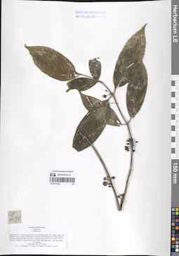
LE 01276154
Hedyotis sp. ⟮prelim. ID⟯ det. Averyanov, Leonid Vladimirovich at 12.04.2011
Collectors: Averyanov, Leonid Vladimirovich; Phan Ke Loc; et al. Field collecting number: CPC2248. Collection date: 12.04.2011. Administrative regions: VN - Tinh Dien Bien. Groups of specimens: L. V. Averyanov specimens; L. V. Averyanov herbarium; Соглашение Минобрнауки №075-15-2021-1056; Flora of VietnamOriginal label text:FLORA OF VIETNAM
Rubiaceae
Hedyotis sp.?
Dien Bien Prov., Tua Chua Distr., Tua Thang Municipality, De Chu village, around point 21°53’22”N 103°24’56”E.
Primary evergreen broadleaved forest on very steep slopes and on tops of remnant mountains composed with solid limestone at elevation 900-1150 m a.s.l. Lithophytic herb on shady vertical cliffs. Flowers purple. Occasional.
CPC 2248 12 April 2011
Coll.: L.Averyanov, P.K.Loc, N.Q.Hieu, N.T.Vinh.
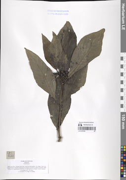
LE 01276153
Lasianthus sp. det. Averyanov, Leonid Vladimirovich at 04.11.2013
Collectors: Averyanov, Leonid Vladimirovich; Tien Hiep Nguyen; et al. Field collecting number: CPC6696. Collection date: 04.11.2013. Administrative regions: VN - Tinh Thanh Hoa. Groups of specimens: L. V. Averyanov specimens; L. V. Averyanov herbarium; Соглашение Минобрнауки №075-15-2021-1056; Flora of VietnamOriginal label text:FLORA OF VIETNAM
Rubiaceae
Lasianthus sp.
Thanh Hoa Prov., Thuong Xuan Distr., Bat Mot Municipality, Duc village, Xuan Lien Natural Reserve. Primary broad-leaved evergreen forest along narrow ridge composed by shale at elevation 1000-1150 m a.s.l. around point 20°01’40.1’’N 104°57’54.9’’E. Shrub or Treelet to 3 m tall on very steep rather open ridge slope. Fruits dull orange. Not common.
4 November 2013 CPC 6696
Coll.: L.Averyanov, N.T.Hiep, N.S.Khang, N.D.Thang, L.V.Tien
LE 01276152
Psychotria sp. det. Averyanov, Leonid Vladimirovich at 02.11.2013
Collectors: Averyanov, Leonid Vladimirovich; Tien Hiep Nguyen; Khang Sinh Nguyen Field collecting number: CPC6621. Collection date: 02.11.2013. Administrative regions: VN - Tinh Thanh Hoa. Groups of specimens: L. V. Averyanov specimens; L. V. Averyanov herbarium; Соглашение Минобрнауки №075-15-2021-1056; Flora of VietnamOriginal label text:FLORA OF VIETNAM
Rubiaceae
Psychotria sp.
Thanh Hoa Prov., Thuong Xuan Distr., Bat Mot Municipality, Vin village, Xuan Lien Natural Reserve. Primary broad-leaved evergreen wet forest on shale at elevation 1000-1200 m a.s.l. around point 19°58’18.2’’N 104°59’24.0’’E. Shrub 1 m tall. Common.
2 November 2013 CPC 6621
L.Averyanov, N.T.Hiep, N.S.Khang
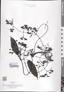
LE 01276151
Paederia sp. det. Averyanov, Leonid Vladimirovich at 02.11.2013
Collectors: Averyanov, Leonid Vladimirovich; Tien Hiep Nguyen; Khang Sinh Nguyen Field collecting number: CPC6629. Collection date: 02.11.2013. Administrative regions: VN - Tinh Thanh Hoa. Groups of specimens: L. V. Averyanov specimens; L. V. Averyanov herbarium; Соглашение Минобрнауки №075-15-2021-1056; Flora of VietnamOriginal label text:FLORA OF VIETNAM
Rubiaceae
Paederia sp.
Thanh Hoa Prov., Thuong Xuan Distr., Bat Mot Municipality, Vin village, Xuan Lien Natural Reserve. Primary broad-leaved evergreen wet forest on shale at elevation 1000-1200 m a.s.l. around point 19°58’18.2’’N 104°59’24.0’’E.
Herbaceous vine 2-4 m long in open secondary forest. Fruits green. Common.
2 November 2013 CPC 6629
L.Averyanov, N.T.Hiep, N.S.Khang
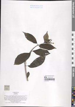
LE 01276150
Mussaenda sp. det. Tien Hiep Nguyen at 14.03.2013
Collectors: Tien Hiep Nguyen; Averyanov, Leonid Vladimirovich; Khang Sinh Nguyen; et al. Field collecting number: LA-VN391. Collection date: 14.03.2013. Administrative regions: LA - Vientiane Province. Groups of specimens: L. V. Averyanov specimens; L. V. Averyanov herbarium; Соглашение Минобрнауки №075-15-2021-1056; Flora of LaosOriginal label text:FLORA OF LAOS
Rubiaceae
Mussaenda sp.
Vientiane Prov., Vang Vieng Distr., Nathong village, about 5 km to the W of Vang Vieng town, Tham Kang Mt., around point 18°55’51.4”N 102°23’50.6”E. Dry broad-leaved primary and secondary evergreen forest on very steep rocky slopes and on vertical cliffs of remnant highly eroded rocky limestone mountains composed by solid crystalline limestone at elevation 300-500 m. Woody vine 2-3 m long. Floral bracts green, flowers yellow-orange, tube light greenish. Common.
LA-VN 391 14 March 2013
Coll.: N.T.Hiep, L.Averyanov, N.S.Khang, P.V.The, S.Lorphengsy
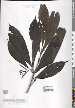
LE 01276149
Randia sp. ⟮prelim. ID⟯ det. Averyanov, Leonid Vladimirovich at 29.03.2011
Collectors: Averyanov, Leonid Vladimirovich; Tien Hiep Nguyen; et al. Field collecting number: CPC1800. Collection date: 29.03.2011. Administrative regions: VN - Tinh Son La. Groups of specimens: L. V. Averyanov specimens; L. V. Averyanov herbarium; Соглашение Минобрнауки №075-15-2021-1056; Flora of VietnamOriginal label text:FLORA OF VIETNAM
Rubiaceae
Randia sp.?
Son La Prov., Thuan Chau Distr., Co Ma Municipality, Copia natural reserve, around point 21°21’02”N 103°35’45”E.
Remnants of primary wet broadleaved evergreen forest on shale at elevation about 1500 m a.s.l. Tree about 5 m tall on steep shady slope. Flowers light yellowish. Not common.
CPC 1800 29 March 2011
Coll.: L.Averyanov, N.T.Hiep, T.B.Ngan.
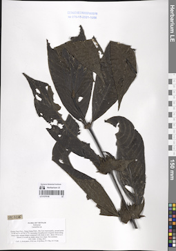
LE 01276148
Lasianthus sp. det. Averyanov, Leonid Vladimirovich at 14.05.2011
Collectors: Averyanov, Leonid Vladimirovich; Phan Ke Loc; et al. Field collecting number: CPC3226. Collection date: 14.05.2011. Administrative regions: VN - Tinh Quang Nam. Groups of specimens: L. V. Averyanov specimens; L. V. Averyanov herbarium; Соглашение Минобрнауки №075-15-2021-1056; Flora of VietnamOriginal label text:FLORA OF VIETNAM
Rubiaceae
Lasianthus sp.
Quang Nam Prov., Dong Giang Distr., Ma Cooi municipality, around point 15°48’40”N 107°42’27”E. Secondary broadleaved evergreen forest along steep rocky stream slopes composed with shale at elev. about 350 m a.s.l. Shrub 2-3 m tall on shady steep river slope. Not common.
CPC 3226 14 May 2011
Coll.: L.Averyanov, P.K.Loc, N.Q.Hieu, P.V.The, N.T.Vinh.
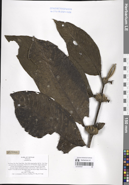
LE 01276147
Lasianthus sp. det. Averyanov, Leonid Vladimirovich at 15.05.2011
Collectors: Averyanov, Leonid Vladimirovich; Phan Ke Loc; et al. Field collecting number: CPC3242. Collection date: 15.05.2011. Administrative regions: VN - Thanh Pho GJa Nang. Groups of specimens: L. V. Averyanov specimens; L. V. Averyanov herbarium; Соглашение Минобрнауки №075-15-2021-1056; Flora of VietnamOriginal label text:FLORA OF VIETNAM
Rubiaceae
Lasianthus sp.
Da Nang City, Hoa Vang Distr., Hoa Ninh municipality, Ba Na – Nui Chua protected area, around point 15°59’52”N 107°59’04”E. Highly destroyed primary and secondary broadleaved evergreen forest on very steep mountain slopes with granite mother rocks at elev. 1200-1500 m a.s.l. Treelet 3-4 m tall on very step shady slope near top of ridge. Flowers white. Occasional.
CPC 3242 15 May 2011
Coll.: L.Averyanov, P.K.Loc, N.Q.Hieu, P.V.The, N.T.Vinh.
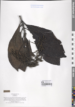
LE 01276146
Wendlandia Bartl. ⟮prelim. ID⟯ det. Averyanov, Leonid Vladimirovich at 19.05.2011
Collectors: Averyanov, Leonid Vladimirovich; Phan Ke Loc; et al. Field collecting number: CPC3461. Collection date: 19.05.2011. Administrative regions: VN - Tinh Quang Nam. Groups of specimens: L. V. Averyanov specimens; L. V. Averyanov herbarium; Соглашение Минобрнауки №075-15-2021-1056; Flora of VietnamOriginal label text:FLORA OF VIETNAM
Rubiaceae
Wendlandia sp.?
Quang Nam Prov., Dai Loc Distr., Dai Hong municipality, environs of Dai Hong town around point 15°49’19”N 107°56’58”E.
Secondary open broadleaved evergreen forest on very steep rocky slopes composed with eroded sandstone at elev. 100-200 m a.s.l. Treelet to 3 m tall in rather open rocky places among shrubs. Common.
CPC 3461 19 May 2011
Coll.: L.Averyanov, P.K.Loc, N.Q.Hieu, P.V.The, N.T.Vinh.
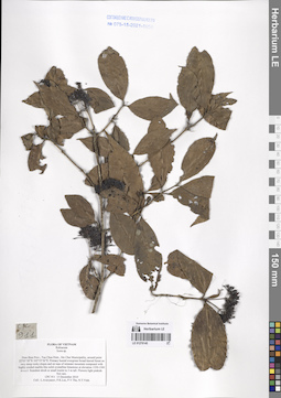
LE 01276145
Ixora sp. det. Averyanov, Leonid Vladimirovich at 13.12.2010
Collectors: Averyanov, Leonid Vladimirovich; Phan Ke Loc; et al. Field collecting number: CPC911. Collection date: 13.12.2010. Administrative regions: VN - Tinh Dien Bien. Groups of specimens: L. V. Averyanov specimens; L. V. Averyanov herbarium; Соглашение Минобрнауки №075-15-2021-1056; Flora of VietnamOriginal label text:FLORA OF VIETNAM
Rubiaceae
Ixora sp.
Dien Bien Prov.
Averyanov L., Phan Ke Loc et al.
CPC 911, 13.12.2010
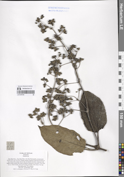
LE 01276144
Paederia sp. det. Averyanov, Leonid Vladimirovich at 14.12.2010
Collectors: Averyanov, Leonid Vladimirovich; Phan Ke Loc; et al. Field collecting number: CPC970. Collection date: 14.12.2010. Administrative regions: VN - Tinh Dien Bien. Groups of specimens: L. V. Averyanov specimens; L. V. Averyanov herbarium; Соглашение Минобрнауки №075-15-2021-1056; Flora of VietnamOriginal label text:FLORA OF VIETNAM
Rubiaceae
Paederia sp.
Dien Bien Prov.
Averyanov L., Phan Ke Loc et al.
CPC 970, 14.12.2010
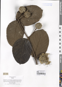
LE 01276143
Uncaria sp. det. Averyanov, Leonid Vladimirovich at 14.05.2011
Collectors: Averyanov, Leonid Vladimirovich; Phan Ke Loc; et al. Field collecting number: CPC3229. Collection date: 14.05.2011. Administrative regions: VN - Tinh Quang Nam. Groups of specimens: L. V. Averyanov specimens; L. V. Averyanov herbarium; Соглашение Минобрнауки №075-15-2021-1056; Flora of VietnamOriginal label text:FLORA OF VIETNAM
Rubiaceae
Uncaria p.
Quang Nam Prov., Nam Giang Distr., near Thanh My town, around point 15°49’08”N 107°44’17”E. Secondary broadleaved evergreen forest along steep rocky stream slopes composed with shale at elev. about 150 m a.s.l. Scandent shrub with shoot to 5 m long on open, very steep river slope. Flowers white. Common.
CPC 3229 14 May 2011
Coll.: L.Averyanov, P.K.Loc, N.Q.Hieu, P.V.The, N.T.Vinh.
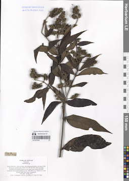
LE 01276142
Wendlandia Bartl. det. Averyanov, Leonid Vladimirovich at 19.05.2011
Collectors: Averyanov, Leonid Vladimirovich; Phan Ke Loc; et al. Field collecting number: CPC3403. Collection date: 19.05.2011. Administrative regions: VN - Tinh Quang Nam. Groups of specimens: L. V. Averyanov specimens; L. V. Averyanov herbarium; Соглашение Минобрнауки №075-15-2021-1056; Flora of VietnamOriginal label text:FLORA OF VIETNAM
Rubiaceae
Wendlandia sp.
Quang Nam Prov., Dai Loc Distr., Dai Hong municipality, environs of Dai Hong town around point 15°49’19”N 107°56’58”E.
Rich secondary broadleaved evergreen forest on very steep rocky slopes and cliffs composed with eroded sandstone at elev. 400-500 m a.s.l. Shrub to 2 m tall on very steep rocky slope. Occasional.
CPC 3403 19 May 2011
Coll.: L.Averyanov, P.K.Loc, N.Q.Hieu, P.V.The, N.T.Vinh.
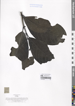
LE 01276141
Psychotria sp. ⟮prelim. ID⟯ det. Averyanov, Leonid Vladimirovich at 08.11.2013
Collectors: Averyanov, Leonid Vladimirovich; Tien Hiep Nguyen; et al. Field collecting number: CPC6941. Collection date: 08.11.2013. Administrative regions: VN - Tinh Thanh Hoa. Groups of specimens: L. V. Averyanov specimens; L. V. Averyanov herbarium; Соглашение Минобрнауки №075-15-2021-1056; Flora of VietnamOriginal label text:FLORA OF VIETNAM
Rubiaceae
Psychotria sp.?
Thanh Hoa Prov., Thuong Xuan Distr., Van Xuan Municipality, Hang Cao village, Xuan Lien Natural Reserve. Secondary humid broad-leaved evergreen forest on low hills composed by sandstone elevation 100-200 m a.s.l. around point 19°51’43.9’’N 105°13’21.3’’E. Shrub 3-4 m tall in shady place. Fruits green. Common.
8 November 2013 CPC 6941
Coll.: L.Averyanov, N.T.Hiep, N.S.Khang, N.D.Thang, L.D.Qui
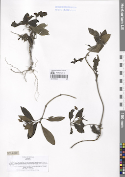
LE 01276140
Hedyotis sp. ⟮prelim. ID⟯ det. Averyanov, Leonid Vladimirovich at 11.04.2011
Collectors: Averyanov, Leonid Vladimirovich; Phan Ke Loc; et al. Field collecting number: CPC2228. Collection date: 11.04.2011. Administrative regions: VN - Tinh Dien Bien. Groups of specimens: L. V. Averyanov specimens; L. V. Averyanov herbarium; Соглашение Минобрнауки №075-15-2021-1056; Flora of VietnamOriginal label text:FLORA OF VIETNAM
Rubiaceae
Hedyotis sp.?
Dien Bien Prov., Tua Chua Distr., Xa Nhe Municipality, around point 21°52’35”N 103°24’21”E. Highly degraded primary evergreen broadleaved dry forest on very steep slopes and on tops of remnant mountains composed with solid limestone at elevation 850-1050 m a.s.l. Lithophytic herb in crevices of vertical shady high cliff. Flowers purple. Not common.
CPC 2228 11 April 2011
Coll.: L.Averyanov, P.K.Loc, N.Q.Hieu, N.T.Vinh.
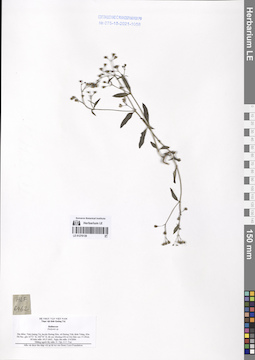
LE 01276139
Hedyotis sp. det. N. Tap at 02.04.2006
Collectors: N. Tap; N. V. Trai Field collecting number: HLF6462. Collection date: 02.04.2006. Administrative regions: VN - Tinh Quang Tri. Groups of specimens: L. V. Averyanov specimens; L. V. Averyanov herbarium; Соглашение Минобрнауки №075-15-2021-1056; Flora of VietnamOriginal label text:FLORA OF VIETNAM
Rubiaceae
Hedyotis sp.
Tinh Quang Tri Prov.
N. Tap, N. V. Trai
HLF 6462, 02.04.2006
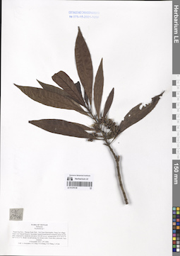
LE 01276138
Psychotria sp. ⟮prelim. ID⟯ det. Averyanov, Leonid Vladimirovich at 08.11.2013
Collectors: Averyanov, Leonid Vladimirovich; Tien Hiep Nguyen; et al. Field collecting number: CPC6946. Collection date: 08.11.2013. Administrative regions: VN - Tinh Thanh Hoa. Groups of specimens: L. V. Averyanov specimens; L. V. Averyanov herbarium; Соглашение Минобрнауки №075-15-2021-1056; Flora of VietnamOriginal label text:FLORA OF VIETNAM
Rubiaceae
Psychotria sp.?
Thanh Hoa Prov., Thuong Xuan Distr., Van Xuan Municipality, Hang Cao village, Xuan Lien Natural Reserve. Secondary humid broad-leaved evergreen forest on low hills composed by sandstone elevation 100-200 m a.s.l. around point 19°51’43.9’’N 105°13’21.3’’E. Shrub 2 m tall among wet stream rocks. Fruits dirty yellowish. Very common.
8 November 2013 CPC 6946
Coll.: L.Averyanov, N.T.Hiep, N.S.Khang, N.D.Thang, L.D.Qui
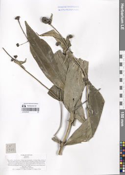
LE 01276137
Hedyotis sp. det. Averyanov, Leonid Vladimirovich at 12.11.2013
Collectors: Averyanov, Leonid Vladimirovich; Tien Hiep Nguyen; et al. Field collecting number: CPC6972. Collection date: 12.11.2013. Administrative regions: VN - Tinh Son La. Groups of specimens: L. V. Averyanov specimens; L. V. Averyanov herbarium; Соглашение Минобрнауки №075-15-2021-1056; Flora of VietnamOriginal label text:FLORA OF VIETNAM
Rubiaceae
Hedyotis sp.
Son La Prov., Van Ho Distr., Chieng Xuan Municipality, Co Hong village, territory of Xuan Nha natural reserve, Pha Luong Mountain. Remnants of primary and secondary broad-leaved evergreen forest on very steep mountain slopes composed by brown sandstone at elevation 700-1000 m a.s.l. around point 20°42’14.2’’N 104°43’53.9’’E. Terrestrial and lithophytic herb on very steep rather open mossy slopes along narrow ridge edge. Common.
12 November 2013 CPC 6972
Coll.: L.Averyanov, N.T.Hiep, N.S.Khang, N.D.Thang, L.D.Qui
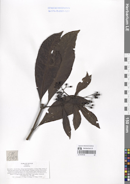
LE 01276136
Psychotria sp. det. Averyanov, Leonid Vladimirovich at 12.11.2013
Collectors: Averyanov, Leonid Vladimirovich; Tien Hiep Nguyen; et al. Field collecting number: CPC6966. Collection date: 12.11.2013. Administrative regions: VN - Tinh Son La. Groups of specimens: L. V. Averyanov specimens; L. V. Averyanov herbarium; Соглашение Минобрнауки №075-15-2021-1056; Flora of VietnamOriginal label text:FLORA OF VIETNAM
Rubiaceae
Psychotria sp.
Son La Prov., Van Ho Distr., Chieng Xuan Municipality, Co Hong village, territory of Xuan Nha natural reserve, Pha Luong Mountain. Remnants of primary and secondary broad-leaved evergreen forest on very steep mountain slopes composed by brown sandstone at elevation 700-1000 m a.s.l. around point 20°42’14.2’’N 104°43’53.9’’E. Shrub 2-2.5 m tall on rather open mossy slope. Fruits reddish. Occasional.
12 November 2013 CPC 6966
Coll.: L.Averyanov, N.T.Hiep, N.S.Khang, N.D.Thang, L.D.Qui
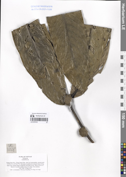
LE 01276135
Lasianthus sp. det. Averyanov, Leonid Vladimirovich at 14.05.2011
Collectors: Averyanov, Leonid Vladimirovich; Phan Ke Loc; et al. Field collecting number: CPC3228. Collection date: 14.05.2011. Administrative regions: VN - Tinh Quang Nam. Groups of specimens: L. V. Averyanov specimens; L. V. Averyanov herbarium; Соглашение Минобрнауки №075-15-2021-1056; Flora of VietnamOriginal label text:FLORA OF VIETNAM
Rubiaceae
Lasianthus sp.
Quang Nam Prov., Dong Giang Distr., Ma Cooi municipality, around point 15°48’40”N 107°42’27”E. Secondary broadleaved evergreen forest along steep rocky stream slopes composed with shale at elev. about 350 m a.s.l. Shrub 2-3 m tall on shady steep river slope. Not common.
CPC 3228 14 May 2011
Coll.: L.Averyanov, P.K.Loc, N.Q.Hieu, P.V.The, N.T.Vinh.
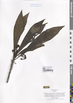
LE 01276134
Ophiorrhiza sp. det. Averyanov, Leonid Vladimirovich at 19.05.2011
Collectors: Averyanov, Leonid Vladimirovich; Phan Ke Loc; et al. Field collecting number: CPC3425. Collection date: 19.05.2011. Administrative regions: VN - Tinh Quang Nam. Groups of specimens: L. V. Averyanov specimens; L. V. Averyanov herbarium; Соглашение Минобрнауки №075-15-2021-1056; Flora of VietnamOriginal label text:FLORA OF VIETNAM
Rubiaceae
Ophiorrhiza sp.
Quang Nam Prov., Dai Loc Distr., Dai Hong municipality, environs of Dai Hong town around point 15°49’19”N 107°56’58”E.
Rich secondary broadleaved evergreen forest on very steep rocky slopes and cliffs composed with eroded sandstone at elev. 400-500 m a.s.l. Terrestrial herb among large shady mossy boulders on very steep humid rocky slope. Flowers white. Common.
CPC 3425 19 May 2011
Coll.: L.Averyanov, P.K.Loc, N.Q.Hieu, P.V.The, N.T.Vinh.
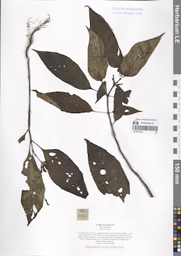
LE 01276133
Ophiorrhiza sp. det. Phan Ke Loc at 08.05.2004
Collectors: Phan Ke Loc; Averyanov, Leonid Vladimirovich; et al. Field collecting number: HAL5194. Collection date: 08.05.2004. Administrative regions: VN - Tinh Ha Tinh. Groups of specimens: L. V. Averyanov specimens; L. V. Averyanov herbarium; Соглашение Минобрнауки №075-15-2021-1056; Flora of VietnamOriginal label text:FLORA OF VIETNAM
Fam. Rubiaceae
Ophiorrhiza sp.
N.Vietnam, Ha Tinh Prov., Huong Son Distr., Son Hong Municipality, around point 18є34'06''N, 105є11'40''E. Primary broad-leaved evergreen forest on steep mt slopes composed with granite along Khe Van stream at elev 400-450 m a.s.l.
Terrestrial herb up to 1 m tall on wet steep rocky stream slope. Flowers white. Common.
No HAL 5194 8 May 2004
_______________________________________________
Collectors: P.K.Loc, L.Averyanov, P.V.The, N.T.Vinh.
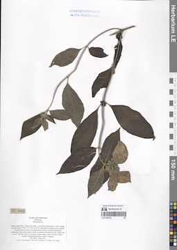
LE 01276132
Mussaenda sp. det. Averyanov, Leonid Vladimirovich at 02.05.2011
Collectors: Averyanov, Leonid Vladimirovich; Phan Ke Loc; et al. Field collecting number: CPC2698. Collection date: 02.05.2011. Administrative regions: VN - Tinh Quang Binh. Groups of specimens: L. V. Averyanov specimens; L. V. Averyanov herbarium; Соглашение Минобрнауки №075-15-2021-1056; Flora of VietnamOriginal label text:FLORA OF VIETNAM
Rubiaceae
Mussaenda sp.
Quang Binh Prov., Tuyen Hoa Distr., Lam Hoa municipality, Chuoi village, around point 17°56’51”N 105°49’18”E.
Secondary broadleaved evergreen closed forest in humid wet depression between remnant mountains composed with rocky highly eroded crystalline limestone at elev. about 100 m a.s.l. Woody vine to 5 m long on open mossy rocks. Flowers yellow-orange, inflorescence bracts white. Common.
CPC 2698 2 May 2011
Coll.: L.Averyanov, P.K.Loc, N.Q.Hieu, P.V.The, N.T.Vinh.
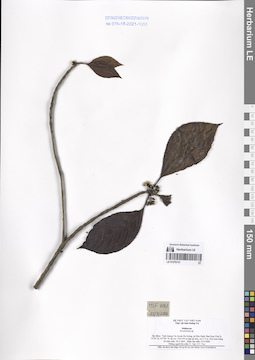
LE 01276131
Brachytome Hook.f. det. N. Tap at 25.03.2006
Collectors: N. Tap; N. V. Trai Field collecting number: HLF6063. Collection date: 25.03.2006. Administrative regions: VN - Tinh Quang Tri. Groups of specimens: L. V. Averyanov specimens; L. V. Averyanov herbarium; Соглашение Минобрнауки №075-15-2021-1056; Flora of VietnamOriginal label text:FLORA OF LAOS
Rubiaceae
Brachytome Hook.f.
Tinh Quang Tri Prov.
N. Tap, N. V. Trai
HLF 6063, 25.03.2006
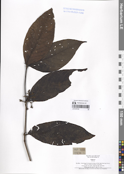
LE 01276130
Aidia sp. det. N. Tap at 25.03.2006
Collectors: N. Tap; N. V. Trai Field collecting number: HLF6069. Collection date: 25.03.2006. Administrative regions: VN - Tinh Quang Tri. Groups of specimens: L. V. Averyanov specimens; L. V. Averyanov herbarium; Соглашение Минобрнауки №075-15-2021-1056; Flora of VietnamOriginal label text:FLORA OF LAOS
Rubiaceae
Aidia sp.
Tinh Quang Tri Prov.
N. Tap, N. V. Trai.
HLF 6069, 25.03.2006
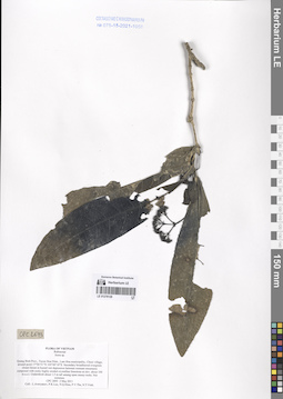
LE 01276129
Ixora sp. det. Averyanov, Leonid Vladimirovich at 02.05.2011
Collectors: Averyanov, Leonid Vladimirovich; Phan Ke Loc; et al. Field collecting number: CPC2693. Collection date: 02.05.2011. Administrative regions: VN - Tinh Quang Binh. Groups of specimens: L. V. Averyanov specimens; L. V. Averyanov herbarium; Соглашение Минобрнауки №075-15-2021-1056; Flora of VietnamOriginal label text:FLORA OF VIETNAM
Rubiaceae
Ixora sp.
Quang Binh Prov., Tuyen Hoa Distr., Lam Hoa municipality, Chuoi village, around point 17°56’51”N 105°49’18”E.
Secondary broadleaved evergreen closed forest in humid wet depression between remnant mountains composed with rocky highly eroded crystalline limestone at elev. about 100 m a.s.l. Undershrub about 1.5 m tall among open mossy rocks. Not common.
CPC 2693 2 May 2011
Coll.: L.Averyanov, P.K.Loc, N.Q.Hieu, P.V.The, N.T.Vinh.
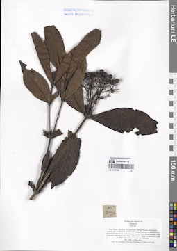
LE 01276128
Ixora sp. det. Averyanov, Leonid Vladimirovich at 12.05.2011
Collectors: Averyanov, Leonid Vladimirovich; Phan Ke Loc; et al. Field collecting number: CPC3096. Collection date: 12.05.2011. Administrative regions: VN - Tinh Thua Thien-Hue. Groups of specimens: L. V. Averyanov specimens; L. V. Averyanov herbarium; Соглашение Минобрнауки №075-15-2021-1056; Flora of VietnamOriginal label text:FLORA OF VIETNAM
Rubiaceae
Ixora sp.
Thua Thien - Hue Prov., A Luoi Distr., Huong Nguyen municipality, around point 16°06’04”N 107°27’55”E.Pristine primary broadleaved and mixed (with Dacrycarpus imbricatus) evergreen forest along mountain ridge composed with shale at elev. about 1000 m a.s.l. Treelet or shrub to 4 m tall in rather open places. Flowers red. Common.
CPC 3096 12 May 2011
Coll.: L.Averyanov, P.K.Loc, N.Q.Hieu, P.V.The, N.T.Vinh.
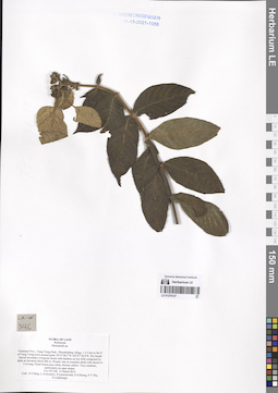
LE 01276127
Mussaenda sp. det. Tien Hiep Nguyen at 13.03.2013
Collectors: Tien Hiep Nguyen; Averyanov, Leonid Vladimirovich; et al. Field collecting number: LA-VN346. Collection date: 13.03.2013. Administrative regions: LA - Vientiane Province. Groups of specimens: L. V. Averyanov specimens; L. V. Averyanov herbarium; Соглашение Минобрнауки №075-15-2021-1056; Flora of LaosOriginal label text:FLORA OF LAOS
Rubiaceae
Mussaenda sp.
Vientiane Prov., Vang Vieng Distr., Phoudindeng village, 1-2 5 km to the E of Vang Vieng town around point 18°57’48.7”N 102°27’34.0”E. Dry broad-leaved secondary evergreen forest with bamboo on low hills composed by shale at elevation about 400 m. Woody vine or scandent shrub with shoots to 5 m long. Floral bracts pure white, flowers yellow. Very common, particularly on open slopes.
LA-VN 346 13 March 2013
Coll.: N.T.Hiep, L.Averyanov, S.Lanorsavanh, N.S.Khang, P.V.The, S.Lorphengsy
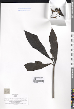
LE 01276126
Morinda sp. det. Averyanov, Leonid Vladimirovich at 13.03.2013
Collectors: Tien Hiep Nguyen; Averyanov, Leonid Vladimirovich; et al. Field collecting number: LA-VN335. Collection date: 13.03.2013. Administrative regions: LA - Vientiane Province. Groups of specimens: L. V. Averyanov specimens; L. V. Averyanov herbarium; Соглашение Минобрнауки №075-15-2021-1056; Flora of LaosOriginal label text:FLORA OF LAOS
Rubiaceae
Morinda sp.
Vientiane Prov., Vang Vieng Distr., Phoudindeng village, 1-2 5 km to the E of Vang Vieng town around point 18°57’48.7”N 102°27’34.0”E. Dry broad-leaved secondary evergreen forest with bamboo on low hills composed by shale at elevation about 400 m. Shrub to 2 m tall in rather open slope among secondary scrub. Flowers white. Not rare.
LA-VN 335 13 March 2013
Coll.: N.T.Hiep, L.Averyanov, S.Lanorsavanh, N.S.Khang, P.V.The, S.Lorphengsy