View
Add
Copy
Edit
Delete
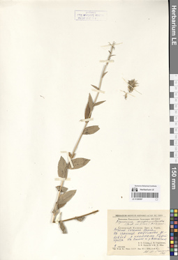
LE 01290597
Asyneuma campanuloides (M. Bieb. ex Sims) Bornm. det. Oganesjan (Oganesian), M. E. at 1988
Collectors: Sochava, Viktor Borisovich; Gavrilevich, A. V.; Lipatova, V. V.; Shik, M. M. Collection date: 09.08.1945. Administrative regions: RU - Karachayevo-Cherkesiya. Expedition: Кавказская комплексная экспедиция АН СССР (1945 -1946)Groups of specimens: Образцы сектора Кавказа; Соглашение Минобрнауки №075-15-2021-1056Original label text:Северный Кавказ. Басс. р. Урупа. Верхнее течение Урупа. На границе отдельных деревьев с полянами Куцего хребта. На склоне к р. Власенчиха.
Coordinates (geographic position): 43° 50′ 17.19″ N, 41° 8′ 10.76″ EComment: 9.VIII.1945
В. Б. Сочава, А. В. Гаврилевич, В. В. Липатова, М. М. Шик.
North Caucasus. Basin of the Urup River. Upper reaches of the Urup river. The Kutsyi ridge. On the slope to the Vlasenchikha river.
Record creation: 2024-08-04, Daria Yudova, PhotoScan D2.Citation: Specimen LE 01290597 // Virtual herbarium of Komarov Botanical Institute RAS — http://re.herbariumle.ru/0129059709.08.1945
Coll. V. B. Sochava, A. V. Gavrilevich, V. V. Lipatova, M. M. Shik
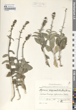
LE 01290596
Asyneuma campanuloides (M. Bieb. ex Sims) Bornm.
Collectors: Adzinba, Z. I. Collection date: 22.08.1987. Administrative regions: GE - Georgia. Groups of specimens: Образцы сектора Кавказа; Соглашение Минобрнауки №075-15-2021-1056Original label text:Гребень Охачкуе, известняки, 2000 м.
Coordinates (geographic position): 42° 46′ 52.04″ N, 41° 57′ 49.75″ E 2000 m a.s.l.Comment: 22.VIII.1987
Адзинба З. И.
Georgia, the Okhachkuye ridge, limestones, 2000 m.
22.08.1987Coll. Z. I. Adzinba
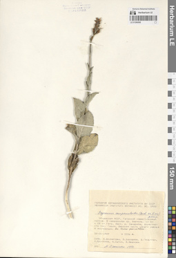
LE 01290595
Asyneuma campanuloides (M. Bieb. ex Sims) Bornm. det. Oganesjan (Oganesian), M. E. at 1990
Collectors: Dolmatova, Anna Petrovna; Dorofeyev, Vladimir Ivanovich; Geltman, Dmitri Victorovich; Krupkina, Lyudmila Ivanovna; Sytin, Andrej Kirillovich; Shvanova, Valeriya Vladimirovna Field collecting number: 3336а. Collection date: 28.06.1989. Administrative regions: GE - Abkhazia. Groups of specimens: Образцы сектора Кавказа; Соглашение Минобрнауки №075-15-2021-1056Original label text:Абхазская АССР, Гагрский известняковый массив. Ю макросклон хр. Берчиль. 12 км к СВ от Гагр, басс. р. Сандрипш, окрестности пос. Гюзля. Верхняя часть узкого ущелья Ю экспозиции. Вн. темно-фиолетовый.
Coordinates (geographic position): 43° 24′ 13.46″ N, 40° 19′ 20.11″ EComment: № 3336а
28.06.1989
Собр. А. Долматова, В. Дорофеев, Д. Гельтман, Л. Крупкина, А. Сытин, В. Шванова.
Abkhazia, Gagra limestone massif. South macroslope of the ridge Bеrchil. 12 km NE from Gagra, Sandripsh river basin, vicinity of the Gyuzlya village.
№ 3336а
28.06.1989
Coll. A. Dolmatova, V. Dorofeev, D. Geltman, L. Krupkina, A. Sytin, V. Shvanova
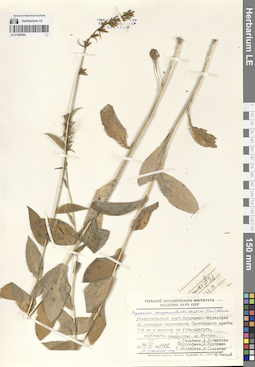
LE 01290594
Asyneuma campanuloides (M. Bieb. ex Sims) Bornm. det. Oganesjan (Oganesian), M. E. at 1990
Collectors: Geltman, Dmitri Victorovich; Dolmatova, Anna Petrovna; Dorofeyev, Vladimir Ivanovich; Krupkina, Lyudmila Ivanovna; Medvedeva, Galina Nikolaevna; Sokolova, Irina Viktorovna Field collecting number: 1122. Collection date: 17.06.1988. Administrative regions: RU - Karachayevo-Cherkesiya. Groups of specimens: Образцы сектора Кавказа; Соглашение Минобрнауки №075-15-2021-1056Original label text:Ставропольский край, Карачаево-Черкесская АО, западная оконечность Пастбищного хребта 7-8 км к востоку от Усть-Джегуты, карбонаты, криволесье из Quercus.
Coordinates (geographic position): 44° 2′ 17.67″ N, 42° 3′ 2.43″ EComment: № 1122
17.VI.1988
Д. Гельтман, А. Долматова, В. Дорофеев, Л. Крупкина, Г. Медведева, И. Соколова, Ю. Росков
Karachayevo-Cherkesiya, western end of the Pastbishchny ridge 7-8 km east from Ust-Dzheguta, carbonates, crooked oak forest.
Record creation: 2024-08-04, Daria Yudova, PhotoScan D2.Citation: Specimen LE 01290594 // Virtual herbarium of Komarov Botanical Institute RAS — http://re.herbariumle.ru/01290594№ 1122
17.06.1988
Coll. D. Geltman, A. Dolmatova, V. Dorofeev, L. Krupkina, G. Medvedeva, I. Sokolova, Yu. Roskov
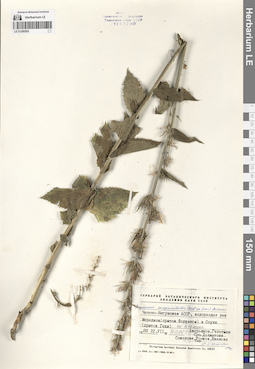
LE 01290593
Asyneuma campanuloides (M. Bieb. ex Sims) Bornm. det. Oganesjan (Oganesian), M. E. at 1990
Collectors: Averyanov, Leonid Vladimirovich; Geltman, Dmitri Victorovich; Dolmatova, Anna Petrovna; Roskov, Yuriy Rafaelevich; Shvanova, Valeriya Vladimirovna Field collecting number: 3386. Collection date: 22.07.1988. Administrative regions: RU - Chechenskaya Respublika. Groups of specimens: Образцы сектора Кавказа; Соглашение Минобрнауки №075-15-2021-1056Original label text:Чечено-Ингушская АССР, водораздел рек Мередиси (приток Фортанги) и Осухи (приток Гехи), на сланцах.
Coordinates (geographic position): 42° 53′ 38.47″ N, 45° 14′ 28.91″ EComment: № 3386
22.VII.1988
Аверьянов, Гельтман, Долматова, Росков, Шванова
Chechen-Ingush ASSR, watershed of the rivers Meredisi [=Meredzhi] (tributary of Fortanga) and Osukhi (tributary of Gekhi), on shale.
№ 3386
22.07.1988
Coll. Averyanov, Geltman, Dolmatova, Roskov, Shvanova
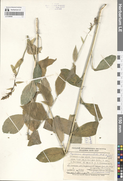
LE 01290592
Asyneuma campanuloides (M. Bieb. ex Sims) Bornm. det. Oganesjan (Oganesian), M. E. at 1990
Collectors: Dolmatova, Anna Petrovna; Geltman, Dmitri Victorovich; Krupkina, Lyudmila Ivanovna; Sytin, Andrej Kirillovich; Shvanova, Valeriya Vladimirovna Field collecting number: 3503. Collection date: 06.07.1989. Administrative regions: RU - Karachayevo-Cherkesiya. Groups of specimens: Образцы сектора Кавказа; Соглашение Минобрнауки №075-15-2021-1056Original label text:Ставропольский край, Преградненский р-н, правый борт ущ. р. Большая Лаба, в окр. п. Загедан (40 км Ю от п. Курджиново). Влажный смешанный лес (широколиств. породы: бук, вяз, клен). Лесной пояс, h= 1200 м над у.м.
Coordinates (geographic position): 43° 38′ 42.93″ N, 40° 52′ 29.69″ E 1200 m a.s.l.Comment: № 3503
6.VII.1989
Долматова, Гельтман, Крупкина, Сытин, Шванова
Stavropol Krai, Pregradnensky District, right side of the Bolshaya Laba River gorge, in the vicinity of the Zagedan village (40 km south from the Kurdzhinovo village). Wet mixed forest (broad-leaved species: beech, elm, maple). Forest belt, h= 1200 m above sea level.
№ 3503
6.07.1989
Coll. Dolmatova, Geltman, Krupkina, Sytin, Shvanova
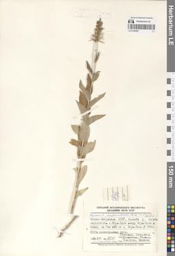
LE 01290591
Asyneuma campanuloides (M. Bieb. ex Sims) Bornm. det. Oganesjan (Oganesian), M. E. at 1990
Collectors: Geltman, Dmitri Victorovich; Averyanov, Leonid Vladimirovich; Dolmatova, Anna Petrovna; Roskov, Yuriy Rafaelevich; Sokolova, Irina Viktorovna; Shvanova, Valeriya Vladimirovna Field collecting number: 2341. Collection date: 09.07.1988. Administrative regions: RU - Chechenskaya Respublika. Groups of specimens: Образцы сектора Кавказа; Соглашение Минобрнауки №075-15-2021-1056Original label text:Чечено-Ингушская АССР, бассейн реки Аргунь, окрестности с. Итум-Кале, между Итум-Кале и Кенхи, ок. 7 км к ЮВ от с. Итум-Кале, h=1900-2000 м, разнотравные луга.
Coordinates (geographic position): 42° 42′ 28.93″ N, 45° 38′ 21.35″ E 1900 m a.s.l.Comment: №2341
9.VII.1988
Гельтман, Аверьянов, Долматова, Росков, Соколова, Шванова
Chechen-Ingush ASSR, Argun river basin, vicinity of the village Itum-Kale, between Itum-Kale and Kenkhi, approx. 7 km southeast from the village Itum-Kale, h=1900-2000 m, mixed-grass meadows.
Record creation: 2024-08-04, Daria Yudova, PhotoScan D2.Citation: Specimen LE 01290591 // Virtual herbarium of Komarov Botanical Institute RAS — http://re.herbariumle.ru/01290591№2341
9.07.1988
Coll. Geltman, Averyanov, Dolmatova, Roskov, Sokolova, Shvanova

LE 01290590
Asyneuma campanuloides (M. Bieb. ex Sims) Bornm. det. Oganesjan (Oganesian), M. E. at 1990
Collectors: Dolmatova, Anna Petrovna; Geltman, Dmitri Victorovich; Krupkina, Lyudmila Ivanovna; Sytin, Andrej Kirillovich; Shvanova, Valeriya Vladimirovna Field collecting number: 3857. Collection date: 09.07.1989. Administrative regions: RU - Karachayevo-Cherkesiya. Groups of specimens: Образцы сектора Кавказа; Соглашение Минобрнауки №075-15-2021-1056Original label text:Карачаево-Черкесская АО, 7 км к востоку от г. Черкесск, между с. Маркопи и с. Нижняя Мара, опушка леса (Carpinus, Corylus, Fagus, Alnus, Populus, Quercus).
Coordinates (geographic position): 43° 46′ 23.81″ N, 42° 0′ 40.57″ EComment: 9.VII.1989
№ 3857
Долматова, Гельтман, Крупкина, Сытин, Шванова
Karachayevo-Cherkesiya, 7 km east of the city of Cherkessk, between the village of Markopi and the village of Nizhnyaya Mara, edge of the forest (Carpinus, Corylus, Fagus, Alnus, Populus, Quercus).
Record creation: 2024-08-04, Daria Yudova, PhotoScan D2.Citation: Specimen LE 01290590 // Virtual herbarium of Komarov Botanical Institute RAS — http://re.herbariumle.ru/012905909.07.1989
№ 3857
Coll. Dolmatova, Geltman, Krupkina, Sytin, Shvanova
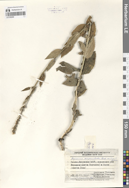
LE 01290589
Asyneuma campanuloides (M. Bieb. ex Sims) Bornm. det. Oganesjan (Oganesian), M. E. at 1990
Collectors: Averyanov, Leonid Vladimirovich; Geltman, Dmitri Victorovich; Dolmatova, Anna Petrovna; Sokolova, Irina Viktorovna; Roskov, Yuriy Rafaelevich; Shvanova, Valeriya Vladimirovna Field collecting number: 3208. Collection date: 22.07.1988. Administrative regions: RU - Chechenskaya Respublika. Groups of specimens: Образцы сектора Кавказа; Соглашение Минобрнауки №075-15-2021-1056Original label text:Чечено-Ингушская АССР, водораздел рек Мередиси (приток Фортанги) и Осухи (приток Гехи), на сланцах.
Coordinates (geographic position): 42° 53′ 38.47″ N, 45° 14′ 28.91″ EComment: № 3208
22.VII.1988
Аверьянов, Гельтман, Долматова, Соколова, Росков, Шванова
Chechen-Ingush ASSR, watershed of the rivers Meredisi [=Meredzhi] (tributary of Fortanga) and Osukhi (tributary of Gekhi), on shale.
№ 3386
22.07.1988
Coll. Averyanov, Geltman, Dolmatova, Sokolova, Roskov, Shvanova
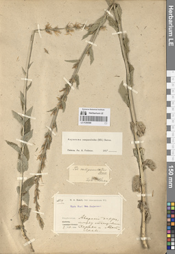
LE 01290588
Asyneuma campanuloides (M. Bieb. ex Sims) Bornm. det. Fedorov, Andrey Aleksandrovich at 1954
Collectors: Busch, Nicolai Adolfowitsch (Nikolaj Adolfovich) удалить Field collecting number: 519. Collection date: 02.08.1904. Administrative regions: RU - Dagestan. Groups of specimens: Образцы сектора Кавказа; Соглашение Минобрнауки №075-15-2021-1056Original label text:№ 519
Coordinates (geographic position): 42° 37′ 16.12″ N, 46° 33′ 15.44″ EComment: Daghestan. Аварский округ, между станциями Харахи и Матласы.
2.VIII.1904
N. A. Busch
№ 519
Record creation: 2024-08-04, Daria Yudova, PhotoScan D2.Citation: Specimen LE 01290588 // Virtual herbarium of Komarov Botanical Institute RAS — http://re.herbariumle.ru/01290588Daghestan. Avarsky district, between Kharakhi and Matlasy [= Matlas] stations.
2.08.1904
Coll. N. A. Busch
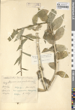
LE 01290587
Asyneuma campanuloides (M. Bieb. ex Sims) Bornm. det. Oganesjan (Oganesian), M. E. at 1988
Collectors: Busch Collection date: 10.07.1968. Administrative regions: RU - Dagestan. Groups of specimens: Образцы сектора Кавказа; Соглашение Минобрнауки №075-15-2021-1056Original label text:Дагестан, село Гапшима, [...ваца]. В лесу.
Coordinates (geographic position): 42° 12′ 36.51″ N, 47° 20′ 1.55″ EComment: 10.VII.68
Dagestan, the Gapshima village. In the forest.
Record creation: 2024-08-04, Daria Yudova, PhotoScan D2.Citation: Specimen LE 01290587 // Virtual herbarium of Komarov Botanical Institute RAS — http://re.herbariumle.ru/0129058710.07.1968
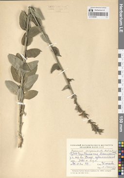
LE 01290586
Asyneuma campanuloides (M. Bieb. ex Sims) Bornm. det. Oganesjan (Oganesian), M. E. at 1988
Collectors: Klochkova, Z. Field collecting number: 417. Collection date: 10.07.1977. Administrative regions: GE - Georgia. Groups of specimens: Образцы сектора Кавказа; Соглашение Минобрнауки №075-15-2021-1056Original label text:ГрССР, Верх. Сванетия, Местинский р-н, окр. сел. Халде, субальпийский луг, 2400 м н.у.м.
Coordinates (geographic position): 42° 57′ 8.51″ N, 42° 56′ 25.22″ E 2400 m a.s.l.Comment: № 417
10.07.1977
З. Клочкова
Georgia, Upper Svaneti, Mesta district, vicinity of the Khalde village, subalpine meadow, 2400 m a.s.l.
Record creation: 2024-08-04, Daria Yudova, PhotoScan D2.Citation: Specimen LE 01290586 // Virtual herbarium of Komarov Botanical Institute RAS — http://re.herbariumle.ru/01290586№ 417
10.07.1977
Z. Klochkova
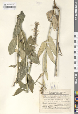
LE 01290585
Asyneuma campanuloides (M. Bieb. ex Sims) Bornm. det. Oganesjan (Oganesian), M. E. at 1990
Collectors: Dolmatova, Anna Petrovna; Geltman, Dmitri Victorovich; Krupkina, Lyudmila Ivanovna; Sytin, Andrej Kirillovich; Shvanova, Valeriya Vladimirovna Field collecting number: 3593. Collection date: 06.07.1989. Administrative regions: RU - Karachayevo-Cherkesiya. Groups of specimens: Образцы сектора Кавказа; Соглашение Минобрнауки №075-15-2021-1056Original label text:Ставропольский край, Преградненский р-н, правый борт ущ. р. Большая Лаба, в окр. п. Загедан (40 км к Ю от п. Курджиново). Буково-пихтовый лес. Лесной пояс, h= 1200 м н.у.м.
Coordinates (geographic position): 43° 38′ 42.93″ N, 40° 52′ 29.69″ E 1200 m a.s.l.Comment: № 3593
6.VII.1989
Долматова, Гельтман, Крупкина, Сытин, Шванова
Stavropol Krai, Pregradnensky District, right side of the Bolshaya Laba River gorge, in the vicinity of the Zagedan village (40 km south from the Kurdzhinovo village). Beech-fir forest. Forest belt, h= 1200 m above sea level.
№ 3503
6.07.1989
Coll. Dolmatova, Geltman, Krupkina, Sytin, Shvanova
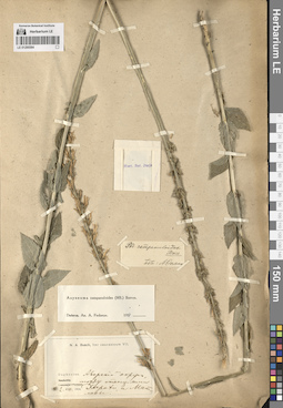
LE 01290584
Asyneuma campanuloides (M. Bieb. ex Sims) Bornm. det. Fedorov, Andrey Aleksandrovich at 1954
Collectors: Busch, Nikolai Adolfovich (Nikolaj Adolfowitsch) Collection date: 02.08.1904. Administrative regions: RU - Dagestan. Groups of specimens: Образцы сектора Кавказа; Соглашение Минобрнауки №075-15-2021-1056Original label text:Daghestan. Аварский округ, между станциями Харахи и Матласы.
N. A. Busch2.08.1904
Daghestan. Avarsky district, between Kharakhi and Matlasy [= Matlas] stations.
Record creation: 2024-08-04, Daria Yudova, PhotoScan D2.Citation: Specimen LE 01290584 // Virtual herbarium of Komarov Botanical Institute RAS — http://re.herbariumle.ru/012905842.08.1904
Coll. N. A. Busch
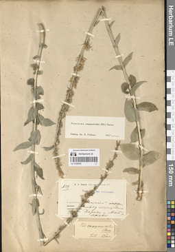
LE 01290583
Asyneuma campanuloides (M. Bieb. ex Sims) Bornm. det. Fedorov, Andrey Aleksandrovich at 1954
Collectors: Busch, Nikolai Adolfovich (Nikolaj Adolfowitsch) Field collecting number: 519. Collection date: 02.08.1904. Administrative regions: RU - Dagestan. Groups of specimens: Образцы сектора Кавказа; Соглашение Минобрнауки №075-15-2021-1056Original label text:Daghestan. Аварский округ, между станциями Харахи и Матласы.
N. A. Busch2.VIII.1904
Daghestan. Avarsky district, between Kharakhi and Matlasy [= Matlas] stations.
Record creation: 2024-08-04, Daria Yudova, PhotoScan D2.Citation: Specimen LE 01290583 // Virtual herbarium of Komarov Botanical Institute RAS — http://re.herbariumle.ru/012905832.08.1904
Coll. N. A. Busch
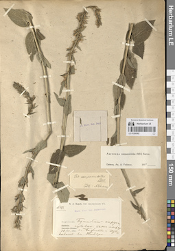
LE 01290582
Asyneuma campanuloides (M. Bieb. ex Sims) Bornm. det. Fedorov, Andrey Aleksandrovich at 1954
Collectors: Busch, Nikolai Adolfovich (Nikolaj Adolfowitsch) Field collecting number: 486. Collection date: 12.07.1904. Administrative regions: RU - Dagestan. Groups of specimens: Образцы сектора Кавказа; Соглашение Минобрнауки №075-15-2021-1056Original label text:№ 486.
Coordinates (geographic position): 42° 9′ 41.92″ N, 46° 2′ 20.84″ EComment: Daghestan. Гунибский округ, субальпийский пояс между с. Бежита и перевалом в Кидеро.
12.VII.1904
N. A. Busch
Dagestan. Gunibsky district, subalpine zone between the Bezhita [= Bezhta] village and the pass to Kidero.
Record creation: 2024-08-04, Daria Yudova, PhotoScan D2.Citation: Specimen LE 01290582 // Virtual herbarium of Komarov Botanical Institute RAS — http://re.herbariumle.ru/0129058212.07.1904
Coll. N. A. Busch
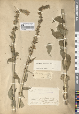
LE 01290581
Asyneuma campanuloides (M. Bieb. ex Sims) Bornm. det. Fedorov, Andrey Aleksandrovich at 1954
Collectors: Busch, Nikolai Adolfovich (Nikolaj Adolfowitsch) Field collecting number: 486. Collection date: 12.07.1904. Administrative regions: RU - Dagestan. Groups of specimens: Образцы сектора Кавказа; Соглашение Минобрнауки №075-15-2021-1056Original label text:№ 486.
Coordinates (geographic position): 42° 9′ 41.92″ N, 46° 2′ 20.84″ EComment: Daghestan. Гунибский округ, субальпийский пояс между с. Бежита и перевалом в Кидеро.
12.VII.1904
N. A. Busch
№ 486.
Dagestan. Gunibsky district, subalpine zone between the Bezhita [= Bezhta] village and the pass to Kidero.12.07.1904
Coll. N. A. Busch
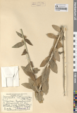
LE 01290580
Asyneuma campanuloides (M. Bieb. ex Sims) Bornm.
Collectors: Popova, Tamara Nikitichna Collection date: 08.08.1972. Administrative regions: RU - Dagestan. Groups of specimens: Образцы сектора Кавказа; Соглашение Минобрнауки №075-15-2021-1056Original label text:Дагестан, Цумадинский р-н, Богосский хр., окр. метеостанции Сулак высокогорный, верховья р. Кила.
Coordinates (geographic position): 42° 21′ 38.48″ N, 46° 15′ 3.74″ EComment: 8.VIII.1972
Т. Попова
Dagestan, Tsumadinsky district, the Bogossky ridge, vicinity of the weather station Sulak vysokogorny, upper reaches of the river Kila [= Tindinskaya].
Record creation: 2024-08-04, Daria Yudova, PhotoScan D2.Citation: Specimen LE 01290580 // Virtual herbarium of Komarov Botanical Institute RAS — http://re.herbariumle.ru/012905808.08.1972
Coll. T. Popova
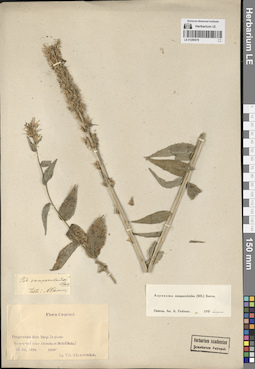
LE 01290579
Asyneuma campanuloides (M. Bieb. ex Sims) Bornm. det. Fedorov, Andrey Aleksandrovich at 1954
Collectors: Alexeenko, Fyodor Nikitich Collection date: 14.07.1898. Administrative regions: RU - Dagestan. Groups of specimens: Образцы сектора Кавказа; Соглашение Минобрнауки №075-15-2021-1056Original label text:Dagestan, distr. Dargi. In pineto Gamra-duz inter Akuscha et Muhi (Meha). 4800'.
Coordinates (geographic position): 42° 17′ 34.85″ N, 47° 22′ 32.51″ ERecord creation: 2024-08-04, Daria Yudova, PhotoScan D2.Citation: Specimen LE 01290579 // Virtual herbarium of Komarov Botanical Institute RAS — http://re.herbariumle.ru/0129057914 Jul. 1898
Leg. Th. Alexeenko.
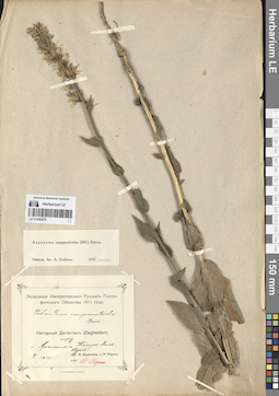
LE 01290578
Asyneuma campanuloides (M. Bieb. ex Sims) Bornm. det. Fedorov, Andrey Aleksandrovich at 1954
Collectors: Kusnezow, Nicolai Ivanovitch; Popow, P. Collection date: 09.07.1911. Administrative regions: RU - Dagestan. Groups of specimens: Образцы сектора Кавказа; Соглашение Минобрнауки №075-15-2021-1056Original label text:Нагорный Дагестан (Daghestan).
Coordinates (geographic position): 42° 41′ 5.72″ N, 47° 2′ 8.35″ EComment: Между с. Араканы и Темир-Ханъ-Шурой.
9.VII.1911
N. Kusnezow, P. Popow
Dagestan. Between the villages of Arakani and Temir-Khan-Shura [= Buynaksk].
09.07.1911Coll. N. Kusnezow, P. Popow
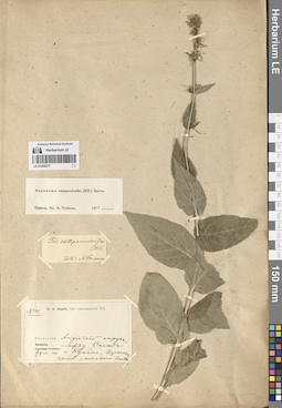
LE 01290577
Asyneuma campanuloides (M. Bieb. ex Sims) Bornm. det. Fedorov, Andrey Aleksandrovich at 1954
Collectors: Busch, Nikolai Adolfovich (Nikolaj Adolfowitsch) Field collecting number: 501. Collection date: 21.07.1904. Administrative regions: RU - Dagestan. Groups of specimens: Образцы сектора Кавказа; Соглашение Минобрнауки №075-15-2021-1056Original label text:№ 501.
Coordinates (geographic position): 42° 24′ 32.34″ N, 45° 55′ 58.95″ EComment: Daghestan. Андийский округ, между Сагада и Куайни, верхняя часть соснового пояса.
21.VII.1904
N. A. Busch
№501
Record creation: 2024-08-04, Daria Yudova, PhotoScan D2.Citation: Specimen LE 01290577 // Virtual herbarium of Komarov Botanical Institute RAS — http://re.herbariumle.ru/01290577Dagestan. Andean district, between Sagada and Kuaini [= Khvaini], upper part of the pine belt.
21.07.1904
Coll. N. A. Busch
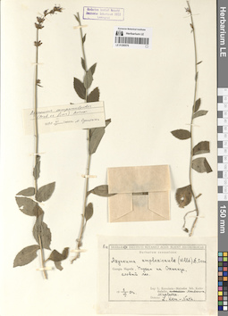
LE 01290576
Asyneuma campanuloides (M. Bieb. ex Sims) Bornm. det. Oganesjan (Oganesian), M. E. at 06.1990
Collectors: Kemularia-Nathadze, Liubov Manucharovna; Kuthatheladze, Shushana Ilinishna; Mandenova, Ida Panovna; Mikeladze Collection date: 05.08.1954. Administrative regions: GE - Georgia. Groups of specimens: Образцы сектора Кавказа; Соглашение Минобрнауки №075-15-2021-1056Original label text:Georgia. Megrelia. Подъем на Охачкуе, еловый лес.
Coordinates (geographic position): 42° 46′ 52.04″ N, 41° 57′ 49.75″ EComment: 5.VIII.1954
L. Kemularia-Nathadze, Sch. Kuthatheladze, Mandenova, Mikeladze
Georgia. Megrelia. The Okhachkue mount.
Record creation: 2024-08-04, Daria Yudova, PhotoScan D2.Citation: Specimen LE 01290576 // Virtual herbarium of Komarov Botanical Institute RAS — http://re.herbariumle.ru/012905765.08.1954
L. Kemularia-Nathadze, Sch. Kuthatheladze, Mandenova, Mikeladze
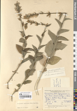
LE 01290575
Asyneuma campanuloides (M. Bieb. ex Sims) Bornm. det. Oganesjan (Oganesian), M. E. at 06.1990
Additional identifications: Asyneuma amplexicaule (Willd.) Hand.-Mazz. det. Fedorov, Andrey Aleksandrovich at 1963 Collectors: Czerepanov, Sergei Kirillovich; Tzvelev, Nikolai Nikolaievich Field collecting number: 1938. Collection date: 26.06.1960. Administrative regions: RU - Dagestan. Groups of specimens: Образцы сектора Кавказа; Соглашение Минобрнауки №075-15-2021-1056Original label text:Дагестанская АССР, Рутульский р-н, у сел. Хпюк (Хлют) между с.с. Ахты и Рутулом, правый бер. р. Самур; луговой склон.
Coordinates (geographic position): 41° 30′ 3.45″ N, 47° 31′ 25.91″ EComment: № 1938
26.VI.1960
C. К. Черепанов, Н. Н. Цвелев
цв. синие
Dagestan, Rutulsky district, near the village Khlut, between the villages of Akhty and Rutul, the right bank of the Samur River; meadow slope
Record creation: 2024-08-04, Daria Yudova, PhotoScan D2.Citation: Specimen LE 01290575 // Virtual herbarium of Komarov Botanical Institute RAS — http://re.herbariumle.ru/01290575№ 1938
26.06.1960
Coll. S. K. Czerepanov, N. N. Tzvelev
Blue flowers
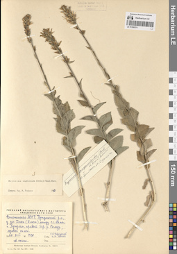
LE 01290574
Asyneuma campanuloides (M. Bieb. ex Sims) Bornm. det. Oganesjan (Oganesian), M. E. at 06.1990
Additional identifications: Asyneuma amplexicaule (Willd.) Hand.-Mazz. det. Fedorov, Andrey Aleksandrovich at 1963 Collectors: Czerepanov, Sergei Kirillovich; Tzvelev, Nikolai Nikolaievich Field collecting number: 1938. Collection date: 26.06.1960. Administrative regions: RU - Dagestan. Groups of specimens: Образцы сектора Кавказа; Соглашение Минобрнауки №075-15-2021-1056Original label text:Дагестанская АССР, Рутульский р-н, у сел. Хпюк (Хлют) между с.с. Ахты и Рутулом, правый бер. р. Самур; луговой склон.
Coordinates (geographic position): 41° 30′ 3.45″ N, 47° 31′ 25.91″ EComment: № 1938
26.VI.1960
C. К. Черепанов, Н. Н. Цвелев
цв. синие
Dagestan, Rutulsky district, near the village Khlut, between the villages of Akhty and Rutul, the right bank of the Samur River; meadow slope
Record creation: 2024-08-04, Daria Yudova, PhotoScan D2.Citation: Specimen LE 01290574 // Virtual herbarium of Komarov Botanical Institute RAS — http://re.herbariumle.ru/01290574№ 1938
26.06.1960
Coll. S. K. Czerepanov, N. N. Tzvelev
Blue flowers
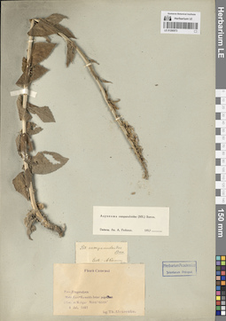
LE 01290573
Asyneuma campanuloides (M. Bieb. ex Sims) Bornm. det. Fedorov, Andrey Aleksandrovich at 1954
Collectors: Alexeenko, Fyodor Nikitich Collection date: 08.07.1897. Administrative regions: RU - Dagestan. Groups of specimens: Образцы сектора Кавказа; Соглашение Минобрнауки №075-15-2021-1056Original label text:Prov. Dagestan.
Coordinates (geographic position): 42° 11′ 59.82″ N, 47° 2′ 39.81″ EComment: Distr. Kasi-Kumukh. Inter pag. Chut (Chot) et Mukgar. 5500'-6500'.
8 Jul. 1897
leg. Th. Alexeenko
Dagestan. Distr. Kasi-Kumukh [=Laksky district]. Between the villages of Chut (Chot) [=Khuty] and Mukgar[=Mukar]. 5500'-6500'.
08.07.1897Coll. F. Alexeenko
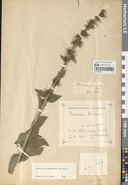
LE 01290572
Asyneuma campanuloides (M. Bieb. ex Sims) Bornm. det. Fedorov, Andrey Aleksandrovich at 1954
Collectors: Hryniewiecki, B. B. Collection date: 12.07.1901. Administrative regions: RU - Krasnodarskiy Kray. Groups of specimens: Образцы сектора Кавказа; Соглашение Минобрнауки №075-15-2021-1056Original label text:Caucasus. Circassia.
Coordinates (geographic position): 43° 43′ 26.53″ N, 40° 26′ 25.07″ EComment: In prato subalpino ad jugum Pseaschcho.
12-25.VII.1901
B. Hryniewieckj
Krasnodarskiy Kray, the Pseaschcho ridge.
12-25.VII.1901
Coll. B. Hryniewieckj
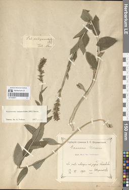
LE 01290571
Asyneuma campanuloides (M. Bieb. ex Sims) Bornm. det. Fedorov, Andrey Aleksandrovich at 1954
Collectors: Hryniewiecki, B. B. Collection date: 12.07.1901. Administrative regions: RU - Krasnodarskiy Kray. Groups of specimens: Образцы сектора Кавказа; Соглашение Минобрнауки №075-15-2021-1056Original label text:Caucasus. Circassia.
Coordinates (geographic position): 43° 43′ 26.53″ N, 40° 26′ 25.07″ EComment: In prato subalpino ad jugum Pseaschcho.
12-25.VII.1901
B. Hryniewieckj
Krasnodarskiy Kray, the Pseaschcho ridge.
12-25.VII.1901
Coll. B. Hryniewieckj
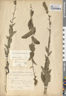
LE 01290570
Asyneuma campanuloides (M. Bieb. ex Sims) Bornm. det. Fedorov, Andrey Aleksandrovich at 1954
Collection date: 23.07.1900. Groups of specimens: Образцы сектора Кавказа; Соглашение Минобрнауки №075-15-2021-1056Original label text:Caucasus. Osetia.
Coordinates (geographic position): 42° 23′ 13.37″ N, 43° 49′ 10.53″ EComment: Южные склоны Белурта [= Билюрта, Билрута, Билурта]. Горийский уезд. Тифлисская губерния.
23.VII.1900
Гораинг
Caucasus. South Osetia.
Record creation: 2024-08-04, Daria Yudova, PhotoScan D2.Citation: Specimen LE 01290570 // Virtual herbarium of Komarov Botanical Institute RAS — http://re.herbariumle.ru/01290570Southern slopes of Belurta [= Bilyurta, Belruta, Bilurta]. Gori district. Tiflis province.
23.07.1900
Coll. Goraing
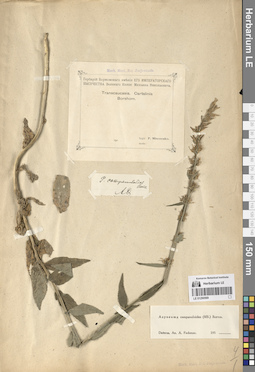
LE 01290569
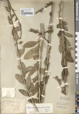
Asyneuma campanuloides (M. Bieb. ex Sims) Bornm. det. Fedorov, Andrey Aleksandrovich
Collectors: Misczenko, Pavel Ivanovich [Mischtschenko] Administrative regions: GE - Georgia. Groups of specimens: Образцы сектора Кавказа; Соглашение Минобрнауки №075-15-2021-1056Original label text:Transcaucasia. Cartalinia. Borshom [= Borjomi].
Coordinates (geographic position): 41° 50′ 43.72″ N, 43° 23′ 16.48″ ERecord creation: 2024-08-04, Daria Yudova, PhotoScan D2.Citation: Specimen LE 01290569 // Virtual herbarium of Komarov Botanical Institute RAS — http://re.herbariumle.ru/01290569leg. P. Misczenko
LE 01290568
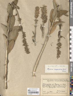
Asyneuma campanuloides (M. Bieb. ex Sims) Bornm. det. Fedorov, Andrey Aleksandrovich at 1956
Field collecting number: 223. Administrative regions: GE - Georgia. Groups of specimens: Образцы сектора Кавказа; Соглашение Минобрнауки №075-15-2021-1056Original label text:№ 223
Coordinates (geographic position): 42° 43′ 20.59″ N, 43° 10′ 9.34″ EComment: Чутхаро
7200'
Июль
№ 223
Record creation: 2024-08-04, Daria Yudova, PhotoScan D2.Citation: Specimen LE 01290568 // Virtual herbarium of Komarov Botanical Institute RAS — http://re.herbariumle.ru/01290568Georgia. The Chutkharo mount.
7200'
July
LE 01290567
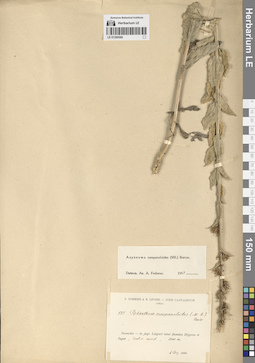
Asyneuma campanuloides (M. Bieb. ex Sims) Bornm. det. Fedorov, Andrey Aleksandrovich at 1954
Collectors: Kharkevich, Sigismund Semenovich Collection date: 14.07.1949. Administrative regions: RU - Respublika Adygeya. Groups of specimens: Образцы сектора Кавказа; Соглашение Минобрнауки №075-15-2021-1056Original label text:Краснодарский край, Тульский район, Кавказский заповедник, пасовище Абаго, на субальпийских [...] метеостанции.
Coordinates (geographic position): 44° 30′ 51.84″ N, 40° 15′ 33.12″ EComment: 14.VII.1949
С. Харкевич
Krasnodar region, Tula district, Caucasian reserve, Abago pasture, at the subalpine [...] weather stations.
Record creation: 2024-08-04, Daria Yudova, PhotoScan D2.Citation: Specimen LE 01290567 // Virtual herbarium of Komarov Botanical Institute RAS — http://re.herbariumle.ru/0129056714.07.1949
Coll. S. Kharkevich
LE 01290566
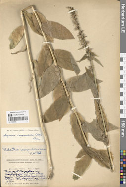
Asyneuma campanuloides (M. Bieb. ex Sims) Bornm. det. Fedorov, Andrey Aleksandrovich at 1954
Collectors: Sommier, Carlo Pietro Stefano(Stephen); Levier, Emile (Emilio) Field collecting number: 888. Collection date: 04.08.1890. Administrative regions: GE - Georgia. Expedition: Iter Caucasicum (Sommier S. et Levier E.) (1890)Groups of specimens: Образцы сектора Кавказа; Соглашение Минобрнауки №075-15-2021-1056Original label text:Svanetia - in jugo Latpari inter flumina Hippum et Ingur, decliv. merid., 2000 m.
Coordinates (geographic position): 42° 52′ 53.71″ N, 42° 56′ 47.37″ E 2000 m a.s.l.Comment: 4 aug. 1890
Sommier S. et Levier E.
Georgia, the Latpari pass. 2000 m.
Record creation: 2024-08-04, Daria Yudova, PhotoScan D2.Citation: Specimen LE 01290566 // Virtual herbarium of Komarov Botanical Institute RAS — http://re.herbariumle.ru/0129056604.08.1890
Coll. Sommier S. et Levier E.
LE 01290565
Asyneuma campanuloides (M. Bieb. ex Sims) Bornm. det. Fedorov, Andrey Aleksandrovich at 1956
Collectors: Grubov, Valery Ivanovich; Ivanina, Lyudmila Ivanovna Collection date: 16.08.1945. Administrative regions: RU - Karachayevo-Cherkesiya. Expedition: Кавказская комплексная экспедиция АН СССР (1945 -1946)Groups of specimens: Образцы сектора Кавказа; Соглашение Минобрнауки №075-15-2021-1056Original label text:Северный Кавказ. Басс. р. Урупа. Предгорья Передового хребта. Водораздельный кряж между Урупом и Черемуховой против устья М. Урупа. Разнотравный луг. 1800 м.
Coordinates (geographic position): 43° 46′ 44.44″ N, 41° 6′ 10.16″ E 1800 m a.s.l.Comment: 16.VIII.1945
В. И. Грубов, Л. И. Иванина
North Caucasus. Basin of the Urup River. Foothills of the Front Range. The watershed ridge between Urup and Cheremukhovaya opposite the mouth of the Maly Urup. Forb meadow. 1800 m.
16.08.1945Coll. V. I. Grubov, L. I. Ivanina
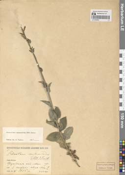
LE 01290564
Asyneuma campanuloides (M. Bieb. ex Sims) Bornm. det. Fedorov, Andrey Aleksandrovich at 1954
Collectors: Busch, Elizaveta Aleksandrovna; Busch, Nikolai Adolfovich (Nikolaj Adolfowitsch) Field collecting number: 15. Collection date: 15.07.1928. Subregion: South Ossetia, Dzau District.. Expedition: Юго-Осетинская экспедиция АН СССР ()Groups of specimens: Образцы сектора Кавказа; Соглашение Минобрнауки №075-15-2021-1056Original label text:Эрцойская котловина, луг на S стороне озера. [Асс.] 2. 1615 м.
Coordinates (geographic position): 42° 28′ 5.78″ N, 43° 45′ 15.96″ E 1615 m a.s.l.Comment: 15.VII.1928
Е. и Н. Буш
Ertso-Tsona depression, meadow on the S side of the lake.
15.07.1928E. and N. Busch
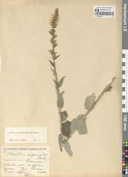
LE 01290563
Asyneuma campanuloides (M. Bieb. ex Sims) Bornm. det. Fedorov, Andrey Aleksandrovich at 1954
Collectors: Busch, Elizaveta Aleksandrovna; Busch, Nikolai Adolfovich (Nikolaj Adolfowitsch) Field collecting number: 43. Collection date: 05.08.1929. Expedition: Юго-Осетинская экспедиция АН СССР ()Groups of specimens: Образцы сектора Кавказа; Соглашение Минобрнауки №075-15-2021-1056Original label text:Кадласенское ущелье. Сенокосный субальпийский луг на правом гребне. Урочище Лалете - карст. 2600 м.
Coordinates (geographic position): 42° 33′ 27.51″ N, 44° 18′ 21.85″ E 2600 m a.s.l.Comment: 5.VIII.1929
Е. и Н. Буш
South Osetia. The Kadlasan gorge.
Record creation: 2024-08-04, Daria Yudova, PhotoScan D2.Citation: Specimen LE 01290563 // Virtual herbarium of Komarov Botanical Institute RAS — http://re.herbariumle.ru/012905635.08.1929
Coll. E. Busch, N. Busch
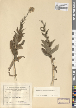
LE 01290562
Asyneuma campanuloides (M. Bieb. ex Sims) Bornm. det. Fedorov, Andrey Aleksandrovich at 1954
Collectors: Kolakovsky, Alfred Alekseevich ( Kolakowsky ) Collection date: 15.07.1927. Groups of specimens: Образцы сектора Кавказа; Соглашение Минобрнауки №075-15-2021-1056Original label text:Transcaucasia, Azerbajdzhan, prov. et distr. Gandzha, in monte Sarjal.
Comment: 15.VII.1927
leg. A. Kolakowsky
возможно, окрестности Аджикенда
Record creation: 2024-08-04, Daria Yudova, PhotoScan D2.Citation: Specimen LE 01290562 // Virtual herbarium of Komarov Botanical Institute RAS — http://re.herbariumle.ru/01290562possibly the vicinity of the Ajikend village
40.509569894982945, 46.328494254475
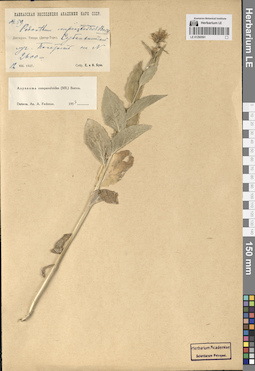
LE 01290561
Asyneuma campanuloides (M. Bieb. ex Sims) Bornm. det. Fedorov, Andrey Aleksandrovich at 1954
Collectors: Busch, Elizaveta Aleksandrovna; Busch, Nikolai Adolfovich (Nikolaj Adolfowitsch) Field collecting number: 59. Collection date: 12.08.1927. Administrative regions: RU - North Ossetia. Groups of specimens: Образцы сектора Кавказа; Соглашение Минобрнауки №075-15-2021-1056Original label text:Дигория. Таторс (Дигор-Торс). Субальпийский луг. [Покатость] на N. 2600 м.
Coordinates (geographic position): 43° 2′ 27.75″ N, 43° 39′ 32.71″ E 2600 m a.s.l.Comment: 12.VIII.1927
Собр. Е. и Н. Буш.
Digoria. Tators (Digor-Tors).
12.08.1927Coll. E. Busch, N. Busch
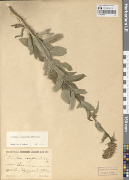
LE 01290560
Asyneuma campanuloides (M. Bieb. ex Sims) Bornm. det. Fedorov, Andrey Aleksandrovich at 1954
Collectors: Busch, Elizaveta Aleksandrovna; Busch, Nikolai Adolfovich (Nikolaj Adolfowitsch) Collection date: 18.07.1928. Administrative regions: RU - Kabardino-Balkarskaya Respublika. Expedition: Юго-Осетинская экспедиция АН СССР ()Groups of specimens: Образцы сектора Кавказа; Соглашение Минобрнауки №075-15-2021-1056Original label text:Гора Фэтэн [= Фытын?]. Сенокосный луг на гребне (вершине). 1990 м.
Coordinates (geographic position): 43° 5′ 15.91″ N, 43° 30′ 17″ E 1990 m a.s.l.Comment: 18.VII.1928
Е. и Н. Буш.
The Feten mount. Hay meadow on the ridge. 1990 m.
18.07.1928
Coll. E. Busch, N. Busch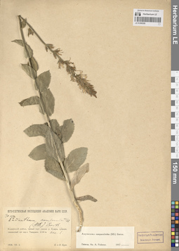
LE 01290559
Asyneuma campanuloides (M. Bieb. ex Sims) Bornm. det. Fedorov, Andrey Aleksandrovich at 1954
Collectors: Busch, Elizaveta Aleksandrovna; Busch, Nikolai Adolfovich (Nikolaj Adolfowitsch) Field collecting number: 30. Collection date: 02.08.1928. Subregion: South Ossetia. Expedition: Юго-Осетинская экспедиция АН СССР ()Groups of specimens: Образцы сектора Кавказа; Соглашение Минобрнауки №075-15-2021-1056Original label text:Кударский район, правый борт ущелья реки Кудары, субальп. сенокосный луг над с. Тамаджин. 2100 м. Асс. 1.
Coordinates (geographic position): 42° 32′ 42.19″ N, 43° 46′ 26.97″ E 2100 m a.s.l.Comment: 1928.VIII.2
Е. и Н. Буш
South Ossetia, Kudara district, right side of the Kudara river gorge, subalpine meadow above the Tamadjin village. 2100 m.
Record creation: 2024-08-04, Daria Yudova, PhotoScan D2.Citation: Specimen LE 01290559 // Virtual herbarium of Komarov Botanical Institute RAS — http://re.herbariumle.ru/012905592.08.1928
Coll. E. Busch, N. Busch
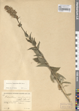
LE 01290558
Asyneuma campanuloides (M. Bieb. ex Sims) Bornm. det. Fedorov, Andrey Aleksandrovich at 1954
Collectors: Busch, Elizaveta Aleksandrovna; Busch, Nikolai Adolfovich (Nikolaj Adolfowitsch) Field collecting number: 27. Collection date: 31.07.1928. Subregion: South Ossetia. Expedition: Юго-Осетинская экспедиция АН СССР ()Groups of specimens: Образцы сектора Кавказа; Соглашение Минобрнауки №075-15-2021-1056Original label text:Кударский район. Субальпийские сенокосные луга на вершине горы Морах. 2400 м.
Coordinates (geographic position): 2400 m a.s.l.Comment: 1928.VII.31
Е. и Н. Буш
South Ossetia. Kudarsky district. Subalpine meadows on the top of the Morakh Mount. 2400 m.
31.07.1928Coll. E. Busch, N. Busch
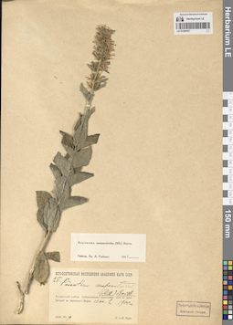
LE 01290557
Asyneuma campanuloides (M. Bieb. ex Sims) Bornm. det. Fedorov, Andrey Aleksandrovich at 1954
Collectors: Busch, Elizaveta Aleksandrovna; Busch, Nikolai Adolfovich (Nikolaj Adolfowitsch) Field collecting number: 25. Collection date: 29.07.1928. Subregion: South Ossetia. Expedition: Юго-Осетинская экспедиция АН СССР ()Groups of specimens: Образцы сектора Кавказа; Соглашение Минобрнауки №075-15-2021-1056Original label text:Кударский район. Субальпийские сенокосные луга от урочища Сегауат до вершины горы Морах. Асс. 2. 1900 м.
Coordinates (geographic position): 42° 31′ 39.95″ N, 43° 46′ 44.23″ E 1900 m a.s.l.Comment: 1928.VII.29
Е. и Н. Буш
South Ossetia. Kudarsky district. Subalpine meadows from the Segauat tract to the top of the Morakh Mount. 1900 m.
29.07.1928Coll. E. Busch, N. Busch
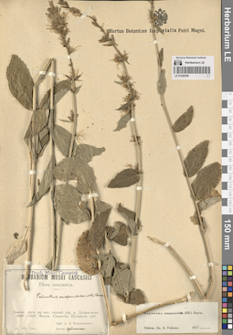
LE 01290556
Asyneuma campanuloides (M. Bieb. ex Sims) Bornm. det. Fedorov, Andrey Aleksandrovich at 1954
Collectors: Schelkownikow, Alexandr Bebutovicz Collection date: 23.07.1911. Administrative regions: GE - Georgia. Groups of specimens: Образцы сектора Кавказа; Соглашение Минобрнауки №075-15-2021-1056Original label text:Хвойные леса на западном склоне ущелья реки Долра-чала. 6000' - 7000'. Верхняя Сванетия. Кутаисская губерния.
Coordinates (geographic position): 43° 6′ 21.59″ N, 42° 35′ 44.58″ EComment: 23.VII.1911
leg. A. B. Schelkovnikov.
Georgia. Coniferous forests on the western slope of the Dolra-chala river gorge. 6000' - 7000'. Upper Svaneti. Kutaisi province.
23.07.1911
Coll. A. B. Schelkovnikov.
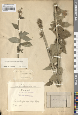
LE 01290555
Asyneuma campanuloides (M. Bieb. ex Sims) Bornm. det. Fedorov, Andrey Aleksandrovich at 1954
Collectors: Hryniewiecki, B. B. Collection date: 11.07.1903. Administrative regions: AM - Armenia. Groups of specimens: Образцы сектора Кавказа; Соглашение Минобрнауки №075-15-2021-1056Original label text:Karabach.
Coordinates (geographic position): 39° 31′ 44″ N, 46° 20′ 33.37″ EComment: In prato alpino prope Staryje Gerjusy
11-24.VII.1903
B. Hryniewiecki
Armenia, near the Starye Gerusy
Record creation: 2024-08-04, Daria Yudova, PhotoScan D2.Citation: Specimen LE 01290555 // Virtual herbarium of Komarov Botanical Institute RAS — http://re.herbariumle.ru/0129055511-24.VII.1903
Coll. B. Hryniewiecki
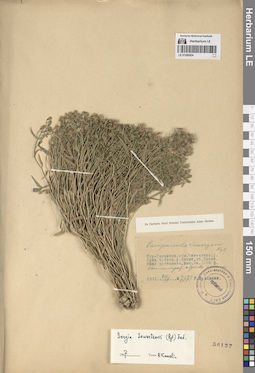
LE 01290424
Sergia sewerzowii (Regel) Fed. det. Kamelin, Rudolph Vladimirovich at 1967
Collectors: Abolin, Robert Ivanovich Field collecting number: 7673. Collection date: 20.06.1921. Administrative regions: KZ - Kazakhstan. Groups of specimens: Образцы сектора Средней АзииOriginal label text:Сыр-Дарьинская область, Чимкентский уезд. Средняя часть бассейна реки Машат, станция Машат. Зона пустынная, высота около 2300 футов. Конгломератные обрывы долины.
Coordinates (geographic position): 42° 29′ 28.64″ N, 69° 57′ 52.58″ EComment: 20.VI.1921
№ 7673
Р. И. Аболин
Kazakhstan, Syr-Darya region, Chimkent district. The middle part of the Mashat river basin, Mashat station. The area is deserted, with an altitude of about 2,300 feet. Conglomerate cliffs of the valley.
Record creation: 2024-08-04, Daria Yudova, PhotoScan D2.Citation: Specimen LE 01290424 // Virtual herbarium of Komarov Botanical Institute RAS — http://re.herbariumle.ru/01290424№ 7673
20.06.1921
Coll. R. I. Abolin
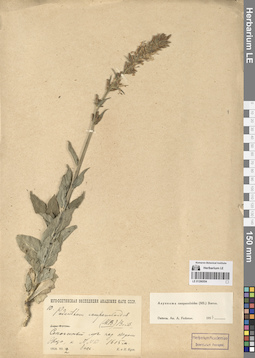
LE 01290554
Asyneuma campanuloides (M. Bieb. ex Sims) Bornm. det. Fedorov, Andrey Aleksandrovich at 1954
Collectors: Busch, Elizaveta Aleksandrovna; Busch, Nikolai Adolfovich (Nikolaj Adolfowitsch) Field collecting number: 10. Collection date: 12.07.1928. Subregion: South Ossetia, Dzau District. Expedition: Юго-Осетинская экспедиция АН СССР ()Groups of specimens: Образцы сектора Кавказа; Соглашение Минобрнауки №075-15-2021-1056Original label text:Сенокосный луг над озером Эрцо, к NNW. 1615 м. 1 асс.
Coordinates (geographic position): 42° 28′ 24.22″ N, 43° 45′ 19.41″ E 1615 m a.s.l.Comment: 1928.VII.12
Е. и Н. Буш
South Ossetia, Ertso Lake. 1615 m.
Record creation: 2024-08-04, Daria Yudova, PhotoScan D2.Citation: Specimen LE 01290554 // Virtual herbarium of Komarov Botanical Institute RAS — http://re.herbariumle.ru/0129055412.07.1928
Coll. E. Busch, N. Busch
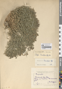
LE 01290423
Sergia sewerzowii (Regel) Fed. det. Fedorov, Andrey Aleksandrovich at 1954
Collectors: Roldugin, I.I. Collection date: 09.06.1951. Administrative regions: KZ - Kazakhstan. Groups of specimens: Образцы сектора Средней АзииOriginal label text:Таласский Ала-Тау. Вблизи поселка Сеславино. На каменистом утесе.
Coordinates (geographic position): 42° 26′ 6.69″ N, 70° 11′ 35.98″ EComment: 9.VI.1951
И. И. Ролдугин
Kazakhstan, Talas Ala-Tau. Near the village of Seslavino. On a rocky cliff.
Record creation: 2024-08-04, Daria Yudova, PhotoScan D2.Citation: Specimen LE 01290423 // Virtual herbarium of Komarov Botanical Institute RAS — http://re.herbariumle.ru/012904239.06.1951
Coll. I. I. Roldugin
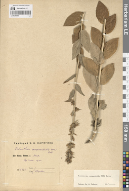
LE 01290553
Asyneuma campanuloides (M. Bieb. ex Sims) Bornm. det. Fedorov, Andrey Aleksandrovich at 1954
Collectors: Karjagin (Karyagin), Ivan Ivanovich Collection date: 25.06.1927. Administrative regions: AZ - Azerbaijan. Groups of specimens: Образцы сектора Кавказа; Соглашение Минобрнауки №075-15-2021-1056Original label text:Вост. Кавказ. Кубинск. у. Аных. Субальпийские луга.
1927.VI.25
И. КарягинAzerbaijan. The Anykh village. Subalpine meadows.
Record creation: 2024-08-04, Daria Yudova, PhotoScan D2.Citation: Specimen LE 01290553 // Virtual herbarium of Komarov Botanical Institute RAS — http://re.herbariumle.ru/0129055325.06.1927
Coll. I. Karjagin
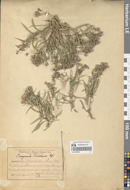
LE 01290422
Sergia sewerzowii (Regel) Fed.
Collectors: Linczevski, Igor Alexandrovich Field collecting number: 493. Collection date: 25.07.1933. Administrative regions: KZ - Kazakhstan. Groups of specimens: Образцы сектора Средней АзииOriginal label text:КазАССР. Хр. Таласский Ала-Тау. Каньон реки Ак-су близ кардона Мансура, южные камен. склоны и скалы.
Coordinates (geographic position): 42° 18′ 34.39″ N, 70° 46′ 40.56″ EComment: № 493
25.VII.1933
И. А. Линчевский
Kazakhstan, Talas Ala-Tau Ridge. Canyon of the Ak-Su River near the Mansur cordon, southern slopes and rocks.
Record creation: 2024-08-04, Daria Yudova, PhotoScan D2.Citation: Specimen LE 01290422 // Virtual herbarium of Komarov Botanical Institute RAS — http://re.herbariumle.ru/01290422№ 493
25.07.1933
Coll. I. A. Linczevski
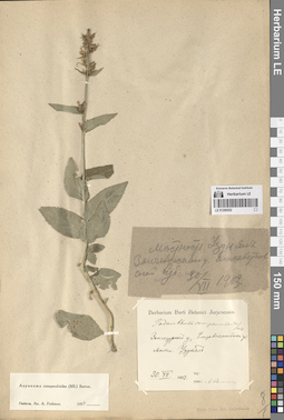
LE 01290552
Asyneuma campanuloides (M. Bieb. ex Sims) Bornm. det. Fedorov, Andrey Aleksandrovich at 1954
Collection date: 30.07.1903. Groups of specimens: Образцы сектора Кавказа; Соглашение Минобрнауки №075-15-2021-1056Original label text:Зангезурский у., Елизаветпольской губ. Местность Узун ял.
Comment: 30.VII.1903
Zangezursky district, Elizavetpol province. Uzun yal area.
Record creation: 2024-08-04, Daria Yudova, PhotoScan D2.Citation: Specimen LE 01290552 // Virtual herbarium of Komarov Botanical Institute RAS — http://re.herbariumle.ru/0129055230.07.1903
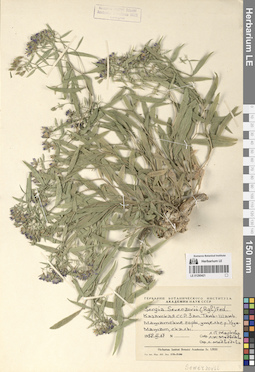
LE 01290421
Sergia sewerzowii (Regel) Fed. det. Medvedeva, L. I. удалить
Collectors: Markova, Lydia Pavlovna; Medvedeva, L. I. удалить Collection date: 17.06.1958. Administrative regions: KZ - Kazakhstan. Groups of specimens: Образцы сектора Средней АзииOriginal label text:Казахская ССР. Западный Тянь-Шань, Машатские горы, ущелье реки Узун-Машат, скалы.
Coordinates (geographic position): 42° 21′ 52.41″ N, 70° 11′ 38.64″ EComment: 17.VI.1958
Л. П. Маркова, Л. И. Медведева
Kazakhstan, Western Tien Shan, Mashat Mountains, Uzun-Mashat River gorge, rocks.
Record creation: 2024-08-04, Daria Yudova, PhotoScan D2.Citation: Specimen LE 01290421 // Virtual herbarium of Komarov Botanical Institute RAS — http://re.herbariumle.ru/0129042117.06.1958
Coll. L. P. Markova, L. I. Medvedeva