View
Add
Copy
Edit
Delete
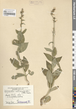
LE 01290649
Asyneuma campanuloides (M. Bieb. ex Sims) Bornm. det. Menitsky, Yuri Leonardovich
Collectors: Menitsky, Yuri Leonardovich Collection date: 08.07.1969. Administrative regions: AM - Armenia. Groups of specimens: Образцы сектора Кавказа; Соглашение Минобрнауки №075-15-2021-1056Original label text:Арм. ССР, окр. г. Кировакана.
Coordinates (geographic position): 40° 49′ 19.47″ N, 44° 29′ 30″ EComment: 8.VII.69
Ю. Меницкий
Armenia, vicinity of Kirovakan.
Record creation: 2024-08-04, Daria Yudova, PhotoScan D2.Citation: Specimen LE 01290649 // Virtual herbarium of Komarov Botanical Institute RAS — http://re.herbariumle.ru/012906498.07.1969
Yu. Menitsky
Kirovakan = Vanadzor
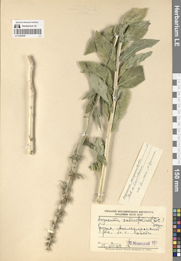
LE 01290648
Asyneuma campanuloides (M. Bieb. ex Sims) Bornm. det. Oganesjan (Oganesian), M. E. at 06.1990
Collectors: Menitsky, Yuri Leonardovich Collection date: 13.07.1969. Administrative regions: GE - Georgia. Groups of specimens: Образцы сектора Кавказа; Соглашение Минобрнауки №075-15-2021-1056Original label text:Грузия, Ахалкалякский р-н, бл. с. Хавети.
Coordinates (geographic position): 41° 16′ 46.99″ N, 43° 14′ 18.15″ EComment: 13.VII.69
Ю. Меницкий
Georgia, Akhalkalaki municipality, near the village of Khaveti.
Record creation: 2024-08-04, Daria Yudova, PhotoScan D2.Citation: Specimen LE 01290648 // Virtual herbarium of Komarov Botanical Institute RAS — http://re.herbariumle.ru/0129064813.07.1969
Yu. Menitsky
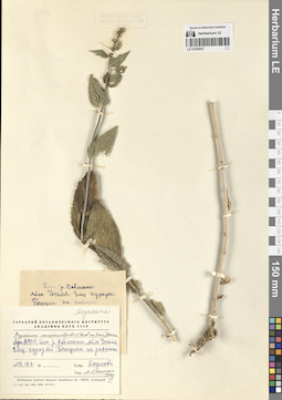
LE 01290647
Asyneuma campanuloides (M. Bieb. ex Sims) Bornm. det. Oganesjan (Oganesian), M. E. at 06.1990
Collectors: Naumova, Sofiya Nickolaevna Collection date: 19.07.1949. Groups of specimens: Образцы сектора Кавказа; Соглашение Минобрнауки №075-15-2021-1056Original label text:Адж. АССР, басс. р. Коблиани, яйла Чечиля, близ курорта Бешуми на равнине.
Coordinates (geographic position): 41° 37′ 25.05″ N, 42° 33′ 33.28″ EComment: 1949.19.7
Наумова
Autonomous Republic of Adjara, Kvabliani river basin, near the Beshumi resort, on the plain.
Record creation: 2024-08-04, Daria Yudova, PhotoScan D2.Citation: Specimen LE 01290647 // Virtual herbarium of Komarov Botanical Institute RAS — http://re.herbariumle.ru/0129064719.07.1949
Naumova
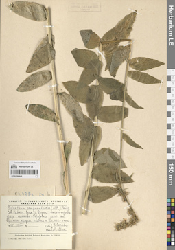
LE 01290646
Asyneuma campanuloides (M. Bieb. ex Sims) Bornm.
Collectors: Sochava, Viktor Borisovich; Shik, M. M. Collection date: 15.08.1945. Administrative regions: RU - Karachayevo-Cherkesiya. Groups of specimens: Образцы сектора Кавказа; Соглашение Минобрнауки №075-15-2021-1056Original label text:Сев. Кавказ, басс. р. Урупа; высокотравье среди кленово-березового леса на верхнем пределе гребня к Чимек-скале.
Coordinates (geographic position): 43° 42′ 44.57″ N, 41° 6′ 49.45″ EComment: 1945 15.VIII
В. Сочава
М. Шик
The North Caucasus, the Urup river basin; tallgrass among the maple-birch forest at the upper limit of the ridge to the mount Chilik.
Record creation: 2024-08-04, Daria Yudova, PhotoScan D2.Citation: Specimen LE 01290646 // Virtual herbarium of Komarov Botanical Institute RAS — http://re.herbariumle.ru/0129064615.08.1945
V. Sochava
M. Shik
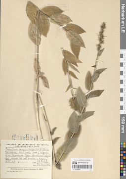
LE 01290645
Asyneuma campanuloides (M. Bieb. ex Sims) Bornm.
Collectors: Sochava, Viktor Borisovich; Lipatova, V. V. Collection date: 02.09.1945. Administrative regions: RU - Karachayevo-Cherkesiya. Groups of specimens: Образцы сектора Кавказа; Соглашение Минобрнауки №075-15-2021-1056Original label text:Сев. Кавказ, верх. часть басс. р. Кяфара, прит. Зеленчука. Сухой овсянично-щучковый сосняк на юж. склоне к Кяфару. 1800 м.
Coordinates (geographic position): 43° 56′ 37.29″ N, 41° 30′ 9.97″ EComment: 1945 2.IX
В. Сочава
В. Липатова
The North Caucasus, the upper part of the Kyafar river basin (tributary of the Zelenchuk). The dry pine forest on the southern slope towards to the Kyafar. 1800 m a.s.l.
Record creation: 2024-08-04, Daria Yudova, PhotoScan D2.Citation: Specimen LE 01290645 // Virtual herbarium of Komarov Botanical Institute RAS — http://re.herbariumle.ru/012906452.IX.1945
V. Sochava
V. Lipatova
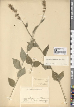
LE 01290644
Asyneuma campanuloides (M. Bieb. ex Sims) Bornm. det. Fedorov, Andrey Aleksandrovich at 1954
Collectors: Busch, Nikolai Adolfovich (Nikolaj Adolfowitsch) Collection date: 12.07.1903. Administrative regions: GE - Georgia. Groups of specimens: Образцы сектора Кавказа; Соглашение Минобрнауки №075-15-2021-1056Original label text:Chewsuria. Между с. Шатиль и уроч. Анатори (могильник).
Coordinates (geographic position): 42° 40′ 6.76″ N, 45° 10′ 19.79″ EComment: 12.VII.1903
Khevsureti. Between the Shatili village and the Anatori village (burial ground).
Record creation: 2024-08-04, Daria Yudova, PhotoScan D2.Citation: Specimen LE 01290644 // Virtual herbarium of Komarov Botanical Institute RAS — http://re.herbariumle.ru/0129064412.07.1903

LE 01290643
Asyneuma campanuloides (M. Bieb. ex Sims) Bornm. det. Fedorov, Andrey Aleksandrovich at 1954
Collectors: Busch, Nikolai Adolfovich (Nikolaj Adolfowitsch) Collection date: 12.07.1903. Administrative regions: GE - Georgia. Groups of specimens: Образцы сектора Кавказа; Соглашение Минобрнауки №075-15-2021-1056Original label text:Chewsuria. Между с. Шатиль и уроч. Анатори (могильник).
Coordinates (geographic position): 42° 40′ 6.76″ N, 45° 10′ 19.79″ EComment: 12.VII.1903
Khevsureti. Between the Shatili village and the Anatori village (burial ground).
Record creation: 2024-08-04, Daria Yudova, PhotoScan D2.Citation: Specimen LE 01290643 // Virtual herbarium of Komarov Botanical Institute RAS — http://re.herbariumle.ru/0129064312.07.1903
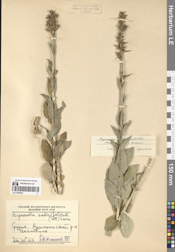
LE 01290642
Asyneuma campanuloides (M. Bieb. ex Sims) Bornm. det. Oganesjan (Oganesian), M. E. at 1990
Collectors: Menitsky, Yuri Leonardovich Collection date: 24.07.1969. Administrative regions: GE - Georgia. Groups of specimens: Образцы сектора Кавказа; Соглашение Минобрнауки №075-15-2021-1056Original label text:Грузия, Ахалцихский р-н. Цхалтбила.
Coordinates (geographic position): 41° 35′ 0.91″ N, 42° 52′ 5.01″ EComment: 24.VII.69
Ю. Меницкий
Georgia, Akhaltsikhe Municipality. Tskaltbila.
Record creation: 2024-08-04, Daria Yudova, PhotoScan D2.Citation: Specimen LE 01290642 // Virtual herbarium of Komarov Botanical Institute RAS — http://re.herbariumle.ru/0129064224.07.1969.
Yu. Menitsky
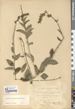
LE 01290641
Asyneuma campanuloides (M. Bieb. ex Sims) Bornm. det. Fedorov, Andrey Aleksandrovich at 1954
Collectors: Albov, Nikolai Michailovich Field collecting number: 450. Collection date: 14.09.1893. Administrative regions: RU - Respublika Adygeya. Groups of specimens: Образцы сектора Кавказа; Соглашение Минобрнауки №075-15-2021-1056Original label text:Mt. Fichte [... alpius]
Coordinates (geographic position): 43° 56′ 29.83″ N, 39° 54′ 6.84″ ERecord creation: 2024-08-04, Daria Yudova, PhotoScan D2.Citation: Specimen LE 01290641 // Virtual herbarium of Komarov Botanical Institute RAS — http://re.herbariumle.ru/0129064114 Septembre
№ 450
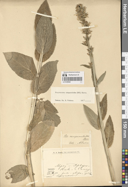
LE 01290640
Asyneuma campanuloides (M. Bieb. ex Sims) Bornm. det. Fedorov, Andrey Aleksandrovich at 1954
Collectors: Busch, Nikolai Adolfovich (Nikolaj Adolfowitsch) Collection date: 23.07.1903. Administrative regions: GE - Georgia. Groups of specimens: Образцы сектора Кавказа; Соглашение Минобрнауки №075-15-2021-1056Original label text:Tuschetia.
Coordinates (geographic position): 42° 22′ 16.24″ N, 45° 27′ 32″ EComment: Между с. Джварбосели и г. Самкурис-цвери, субальпийский березняк.
23.VII.1903.
Tusheti. Between the Jvarboseli village and mount Samkuristsveri, subalpine birch forest.
Record creation: 2024-08-04, Daria Yudova, PhotoScan D2.Citation: Specimen LE 01290640 // Virtual herbarium of Komarov Botanical Institute RAS — http://re.herbariumle.ru/0129064023.VII.1903
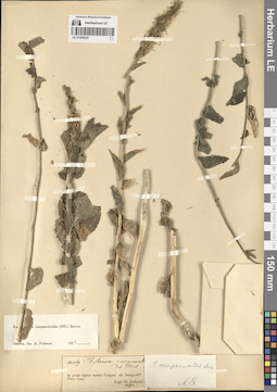
LE 01290639
Asyneuma campanuloides (M. Bieb. ex Sims) Bornm. det. Fedorov, Andrey Aleksandrovich at 1954
Collectors: Kolenati, Friedrich, August (Anton) Rudolf Field collecting number: 2169. Collection date: 06.08.1844. Administrative regions: RU - Respublika Adygeya. Groups of specimens: Образцы сектора Кавказа; Соглашение Минобрнауки №075-15-2021-1056Original label text:№ 2169
Coordinates (geographic position): 44° 11′ 34.38″ N, 40° 12′ 19″ ERecord creation: 2024-08-04, Daria Yudova, PhotoScan D2.Citation: Specimen LE 01290639 // Virtual herbarium of Komarov Botanical Institute RAS — http://re.herbariumle.ru/01290639In pratis alpinis montis Gutgora. alt. hexap. 1077.
Flora Cauc.
Legit Dr. Kolenati.
6.8.1844
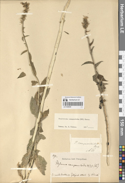
LE 01290638
Asyneuma campanuloides (M. Bieb. ex Sims) Bornm. det. Fedorov, Andrey Aleksandrovich at 1954
Collectors: Kolenati, Friedrich, August (Anton) Rudolf Field collecting number: 692. Collection date: 06.1843. Administrative regions: RU - Stavropol'skiy Kray. Groups of specimens: Образцы сектора Кавказа; Соглашение Минобрнауки №075-15-2021-1056Original label text:692.
Coordinates (geographic position): 44° 4′ 39.12″ N, 43° 0′ 53.95″ ERecord creation: 2024-08-04, Daria Yudova, PhotoScan D2.Citation: Specimen LE 01290638 // Virtual herbarium of Komarov Botanical Institute RAS — http://re.herbariumle.ru/01290638In monti Beschtau pr. Pjatigorsk. 1843.VI. Leg. Kolenati.
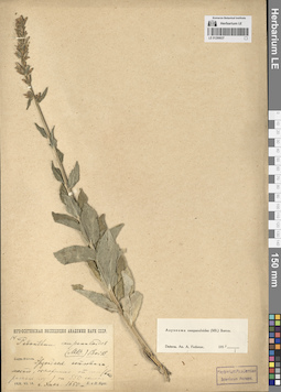
LE 01290637
Asyneuma campanuloides (M. Bieb. ex Sims) Bornm. det. Fedorov, Andrey Aleksandrovich at 1954
Collectors: Busch, Elizaveta Aleksandrovna; Busch, Nikolai Adolfovich (Nikolaj Adolfowitsch) Field collecting number: 14. Collection date: 18.07.1928. Administrative regions: GE - Georgia. Subregion: South Ossetia, Dzau District.. Expedition: Юго-Осетинская экспедиция АН СССР ()Groups of specimens: Образцы сектора Кавказа; Соглашение Минобрнауки №075-15-2021-1056Original label text:14.
Coordinates (geographic position): 42° 28′ 5.88″ N, 43° 45′ 7.56″ EComment: Эрцойская котловина, место, обнаженное от леса (вторичный луг) на SSW склоне.
г. Хаха. 1650 м.
1928.VII.18
Е. и Н. Буш.
Ertso-Tsona depression, secondary prairie, on the SSW slope.
Record creation: 2024-08-04, Daria Yudova, PhotoScan D2.Citation: Specimen LE 01290637 // Virtual herbarium of Komarov Botanical Institute RAS — http://re.herbariumle.ru/01290637Mount Khakha. 1650 m.
1928.VII.18
E. and N. Busch
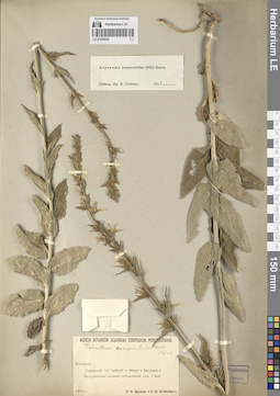
LE 01290636
Asyneuma campanuloides (M. Bieb. ex Sims) Bornm. det. Fedorov, Andrey Aleksandrovich at 1954
Collectors: Krylov, Porphyriy Nikitich; Steinberg, Elisabeth Ivanovna Collection date: 01.07.1916. Administrative regions: GE - Georgia. Groups of specimens: Образцы сектора Кавказа; Соглашение Минобрнауки №075-15-2021-1056Original label text:Кавказ.
Coordinates (geographic position): 41° 48′ 10.88″ N, 43° 23′ 30.59″ EComment: Тифлисская губ. Горийский у. Между с. Бакуриани и Имеретинскими холмами, субальпийские луга. 1 июля.
1916 г.
П.Н. Крылов и Е. И. Штейнберг.
Caucasus. Georgia. Between the Bakuriani village and Imeretian hills, subalpine prairies.
Record creation: 2024-08-04, Daria Yudova, PhotoScan D2.Citation: Specimen LE 01290636 // Virtual herbarium of Komarov Botanical Institute RAS — http://re.herbariumle.ru/012906361.07.1916.
P. N. Krylov and E. I. Steinberg.
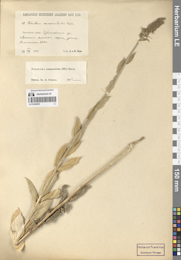
LE 01290635
Asyneuma campanuloides (M. Bieb. ex Sims) Bornm. det. Fedorov, Andrey Aleksandrovich at 1954
Collectors: Busch, Elizaveta Aleksandrovna; Busch, Nikolai Adolfovich (Nikolaj Adolfowitsch) Field collecting number: 48. Collection date: 24.08.1925. Administrative regions: RU - Kabardino-Balkarskaya Respublika. Groups of specimens: Образцы сектора Кавказа; Соглашение Минобрнауки №075-15-2021-1056Original label text:Балкария, Сукан. Субальпийский луг, забросанный камнями, морены, урочище Айлангентам. 2250 м.
Coordinates (geographic position): 42° 58′ 31.38″ N, 43° 26′ 44.55″ EComment: 24.VIII.1925
Собрали Е. и Н. Буш
Balkaria, Sukan. Subalpine prairie with stones, moraines, Ailangentam. 2250 m a.s.l.
Record creation: 2024-08-04, Daria Yudova, PhotoScan D2.Citation: Specimen LE 01290635 // Virtual herbarium of Komarov Botanical Institute RAS — http://re.herbariumle.ru/0129063524.08.1925
E. and N. Busch
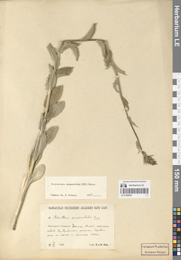
LE 01290634
Asyneuma campanuloides (M. Bieb. ex Sims) Bornm. det. Fedorov, Andrey Aleksandrovich at 1954
Collectors: Busch, Elizaveta Aleksandrovna; Busch, Nikolai Adolfovich (Nikolaj Adolfowitsch) Field collecting number: 11. Collection date: 29.06.1925. Administrative regions: RU - Kabardino-Balkarskaya Respublika. Groups of specimens: Образцы сектора Кавказа; Соглашение Минобрнауки №075-15-2021-1056Original label text:Балкария, Рцывашки. Урочище Мамай-кюннюм, левый берег Рцывашки, остатки берегового леса на скалах и россыпях. 2020 м.
Coordinates (geographic position): 43° 6′ 8.33″ N, 43° 25′ 55.28″ E 2020 m a.s.l.Comment: 29.VI.1925
Собр. Е. и Н. Буш.
Kabardino-Balkaria, Rtsyvashki. Mamai-kyunnyum, left bank of Rtsyvashki, remains of coastal forest on rocks and placers. 2020 m.
Record creation: 2024-08-04, Daria Yudova, PhotoScan D2.Citation: Specimen LE 01290634 // Virtual herbarium of Komarov Botanical Institute RAS — http://re.herbariumle.ru/0129063429.06.1925
Coll. E. Busch, N. Busch
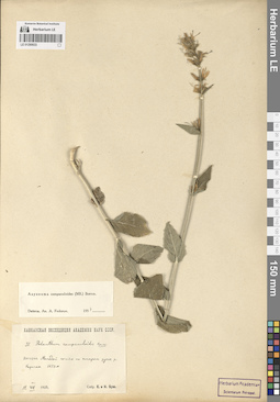
LE 01290633
Asyneuma campanuloides (M. Bieb. ex Sims) Bornm. det. Fedorov, Andrey Aleksandrovich at 1954
Collectors: Busch, Elizaveta Aleksandrovna; Busch, Nikolai Adolfovich (Nikolaj Adolfowitsch) Field collecting number: 37. Collection date: 11.08.1925. Administrative regions: RU - North Ossetia. Groups of specimens: Образцы сектора Кавказа; Соглашение Минобрнауки №075-15-2021-1056Original label text:Дигория. Молодой сосняк на старом русле р. Карагом. 1650 м.
Coordinates (geographic position): 42° 51′ 6.62″ N, 43° 42′ 9.27″ EComment: 11.VIII.1925
Собр. Е. и Н. Буш.
Digoria. Young pine forest on the old riverbed of the Karagom [= Karaugom] River. 1650 m.
11.08.1925
Coll. E. Busch, N. Busch
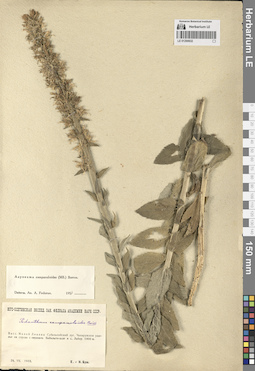
LE 01290632
Asyneuma campanuloides (M. Bieb. ex Sims) Bornm. det. Fedorov, Andrey Aleksandrovich at 1954
Collectors: Busch, Elizaveta Aleksandrovna; Busch, Nikolai Adolfovich (Nikolaj Adolfowitsch) Collection date: 26.07.1933. Subregion: South Ossetia, Tskhinvali District. Expedition: Юго-Осетинская экспедиция Закавказского филиала АН СССР (1933)Groups of specimens: Образцы сектора Кавказа; Соглашение Минобрнауки №075-15-2021-1056Original label text:Басс. Малой Лиахвы. Субальпийский луг. Чапарухское ущелье на спуске с перевала Бибильти-вцэг к с. Льбир. 1900 м.
Coordinates (geographic position): 42° 23′ 6.24″ N, 44° 13′ 17.45″ EComment: 26.VII.1933
Е. и Н. Буш
Malaya Liakhva basin. Subalpine meadow. Chaparukhskoe gorge on the descent from the Bibilti-vtseg pass to the village of L'bir. 1900 m.
Record creation: 2024-08-04, Daria Yudova, PhotoScan D2.Citation: Specimen LE 01290632 // Virtual herbarium of Komarov Botanical Institute RAS — http://re.herbariumle.ru/0129063226.07.1933
Coll. E. Busch, N. Busch
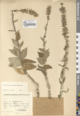
LE 01290631
Asyneuma campanuloides (M. Bieb. ex Sims) Bornm. det. Fedorov, Andrey Aleksandrovich at 1954
Collectors: Vassiljev, Igor V.; Vasiljeva, N. N. Collection date: 14.07.1952. Administrative regions: AM - Armenia. Groups of specimens: Образцы сектора Кавказа; Соглашение Минобрнауки №075-15-2021-1056Original label text:Армянская ССР. Кироваканский р-н. Ущелье на северном склоне горы Сергех близ Кировакана. Смешанный лес. 1550 м.
Coordinates (geographic position): 40° 46′ 55.56″ N, 44° 30′ 26.81″ E 1550 m a.s.l.Comment: 14.VII.1952
Иг. В. Васильев
Н. Н. Васильева
Armenia. Kirovakan district. A gorge on the northern slope of the Sergekh Mount near Kirovakan [= the Vanadzor city]. Mixed forest. 1550 m.
Record creation: 2024-08-04, Daria Yudova, PhotoScan D2.Citation: Specimen LE 01290631 // Virtual herbarium of Komarov Botanical Institute RAS — http://re.herbariumle.ru/0129063114.07.1952
Coll. Ig. V. Vassiljev, N. N. Vassiljeva.
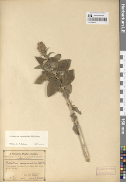
LE 01290629
Asyneuma campanuloides (M. Bieb. ex Sims) Bornm. det. Fedorov, Andrey Aleksandrovich at 1954
Collectors: Doluchanov, Armen Georgievich; G. Tzaturov Collection date: 07.07.1930. Administrative regions: AZ - Azerbaijan. Expedition: Обследование лекарственных и эфирных растений ССР Азербайджана по заданию АзГНИИ (1930)Groups of specimens: Образцы сектора Кавказа; Соглашение Минобрнауки №075-15-2021-1056Original label text:Transcaucasia, Azerbajdzhan, pr. Baku, distr. Kuba, p. p. Susaj.
Coordinates (geographic position): 41° 18′ 43.41″ N, 48° 17′ 37.52″ ERecord creation: 2024-08-04, Daria Yudova, PhotoScan D2.Citation: Specimen LE 01290629 // Virtual herbarium of Komarov Botanical Institute RAS — http://re.herbariumle.ru/012906297.VII.1930
Leg. A. Doluchanov, G. Tzaturov
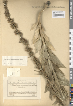
LE 01290628
Asyneuma campanuloides (M. Bieb. ex Sims) Bornm. det. Fedorov, Andrey Aleksandrovich at 1954
Collectors: Bordzilowski, Eugen Iwanowitsch Collection date: 04.07.1907. Administrative regions: GE - Georgia. Groups of specimens: Образцы сектора Кавказа; Соглашение Минобрнауки №075-15-2021-1056Original label text:Transcaucasia. Armenia Rossica.
Coordinates (geographic position): 41° 25′ 14.09″ N, 43° 34′ 13.63″ ERecord creation: 2024-08-04, Daria Yudova, PhotoScan D2.Citation: Specimen LE 01290628 // Virtual herbarium of Komarov Botanical Institute RAS — http://re.herbariumle.ru/01290628Distr. Akhalkalaki. In prato in decliviis angustiarum Busavetensium (in via ex Akhalkalaki versus pagum Busavet).
4.VII.1907
E. B.
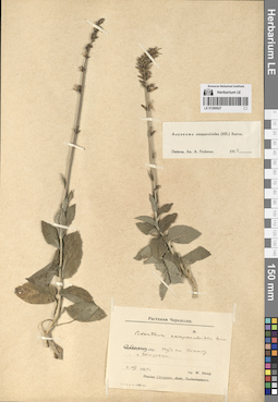
LE 01290627
Asyneuma campanuloides (M. Bieb. ex Sims) Bornm. det. Fedorov, Andrey Aleksandrovich at 1954
Collectors: Steup, W. Collection date: 02.08.1924. Administrative regions: GE - Abkhazia. Groups of specimens: Образцы сектора Кавказа; Соглашение Минобрнауки №075-15-2021-1056; G. Woronow et W. Steup. Растения ЧеркессииOriginal label text:Абхазия. Путь на Уламбу. Г. Шишели
Coordinates (geographic position): 43° 12′ 20.68″ N, 41° 22′ 32.97″ EComment: 2.VIII.1924
leg. W. Steup
Abkhazia. The path to the Ulamba Mount. The Shisheli Mount.
02.08.1924Coll. W. Steup
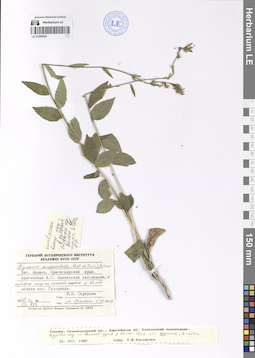
LE 01290626
Asyneuma campanuloides (M. Bieb. ex Sims) Bornm. det. Oganesjan (Oganesian), M. E. at 05.04.2017
Collectors: Seferova, I. V. Collection date: 23.07.1987. Administrative regions: RU - Respublika Adygeya. Groups of specimens: Образцы сектора Кавказа; Соглашение Минобрнауки №075-15-2021-1056Original label text:Зап. Кавказ. Краснодарский край. Адыгейская А. О. Кавказский заповедник, в дубовом лесу на высокой террасе р. Белой вблизи пос. Гузерипль.
Coordinates (geographic position): 43° 59′ 24.35″ N, 40° 7′ 32.27″ EComment: 23.VII.1987
И.В. Сеферова
Western Caucasus. Adygeya. Caucasian Nature Reserve, in an oak forest on a high terrace of the river Belaya near the village Guzeripl.
Record creation: 2024-08-04, Daria Yudova, PhotoScan D2.Citation: Specimen LE 01290626 // Virtual herbarium of Komarov Botanical Institute RAS — http://re.herbariumle.ru/0129062623.07.1987
I.V.Seferova
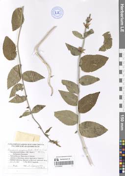
LE 01290625
Asyneuma campanuloides (M. Bieb. ex Sims) Bornm. det. Oganesjan (Oganesian), M. E. at 05.04.2017
Collectors: Gladkova, Valentina Nikolaevna Field collecting number: 20. Collection date: 21.09.1965. Administrative regions: RU - Kabardino-Balkarskaya Respublika. Groups of specimens: Образцы сектора Кавказа; Соглашение Минобрнауки №075-15-2021-1056Original label text:Центральный Кавказ
Coordinates (geographic position): 43° 13′ 27.07″ N, 42° 39′ 14.02″ EComment: Кабардино-Балкария
Приэльбрусье. Верховья р. Баксан, ущелье р. Шхельда, левого притока р. Адыл-су (правый приток р. Баксан), у верхней границы леса.
№20
21.IX.1965
Собр. В.Н. Гладкова
Centaral Caucasus.
Record creation: 2024-08-04, Daria Yudova, PhotoScan D2.Citation: Specimen LE 01290625 // Virtual herbarium of Komarov Botanical Institute RAS — http://re.herbariumle.ru/01290625Kabardino-Balkaria.
Elbrus region. Upper reaches of the river Baksan, river gorge Shkhelda, the left tributary of the river. Adyl-su (right tributary of the Baksan river), at the upper border of the forest.
№20
21.09.1965
V. N. Gladkova
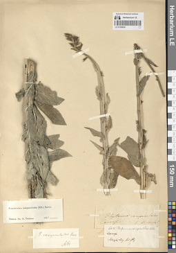
LE 01290624
Asyneuma campanuloides (M. Bieb. ex Sims) Bornm. det. Fedorov, Andrey Aleksandrovich at 1954
Collectors: Wilhelms Groups of specimens: Образцы сектора Кавказа; Соглашение Минобрнауки №075-15-2021-1056Original label text:Caucasus. Wilhelms
Record creation: 2024-08-04, Daria Yudova, PhotoScan D2.Citation: Specimen LE 01290624 // Virtual herbarium of Komarov Botanical Institute RAS — http://re.herbariumle.ru/01290624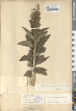
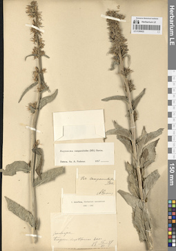
LE 01290623
Asyneuma campanuloides (M. Bieb. ex Sims) Bornm. det. Fedorov, Andrey Aleksandrovich at 1954
Collectors: Radde, Gustav Ferdinand Richard Johannes von Field collecting number: 602. Administrative regions: GE - Georgia. Groups of specimens: Образцы сектора Кавказа; Соглашение Минобрнауки №075-15-2021-1056Original label text:602. Leg. G. Radde
Coordinates (geographic position): 41° 41′ 47.33″ N, 44° 21′ 50″ ERecord creation: 2024-08-04, Daria Yudova, PhotoScan D2.Citation: Specimen LE 01290623 // Virtual herbarium of Komarov Botanical Institute RAS — http://re.herbariumle.ru/01290623Gubern. Tiflis, prope Manglis.
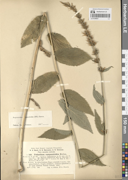
LE 01290622
Asyneuma campanuloides (M. Bieb. ex Sims) Bornm. det. Fedorov, Andrey Aleksandrovich at 1954
Collectors: Akinfiew, Ivan Yakovlevich Collection date: 15.07.1887. Administrative regions: GE - Georgia. Groups of specimens: Образцы сектора Кавказа; Соглашение Минобрнауки №075-15-2021-1056Original label text:Закавказье.
Coordinates (geographic position): 41° 45′ 50.47″ N, 43° 30′ 56.9″ EComment: Бакуриани близ Боржома. 6200
15.VII.1887
I. Akinfiew
Transcaucasia.
Record creation: 2024-08-04, Daria Yudova, PhotoScan D2.Citation: Specimen LE 01290622 // Virtual herbarium of Komarov Botanical Institute RAS — http://re.herbariumle.ru/01290622Bakuriani near Borjomi. 6200
15.07.1887
I. Akinfiew
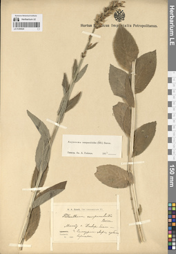
LE 01290621
Asyneuma campanuloides (M. Bieb. ex Sims) Bornm. det. Fedorov, Andrey Aleksandrovich at 1954
Collectors: Busch, Elizaveta Aleksandrovna Collection date: 24.06.1908. Administrative regions: RU - Karachayevo-Cherkesiya. Groups of specimens: Образцы сектора Кавказа; Соглашение Минобрнауки №075-15-2021-1056Original label text:Prov. Kuban. In sylva frondosa (Fagus orientalis Lipsky, Carpinus betulus L., Corylus avellana L., Lonicera xylosteum L.) ad ripam sinistram fluminis Teberda. 4200'.
Coordinates (geographic position): 43° 29′ 1.77″ N, 41° 46′ 0.46″ ERecord creation: 2024-08-04, Daria Yudova, PhotoScan D2.Citation: Specimen LE 01290621 // Virtual herbarium of Komarov Botanical Institute RAS — http://re.herbariumle.ru/0129062124.VI (7.VII). 1908.
Leg. et determ. Elis. Busch
LE 01290620
Asyneuma campanuloides (M. Bieb. ex Sims) Bornm. det. Fedorov, Andrey Aleksandrovich at 1954
Collectors: Busch, Nikolai Adolfovich (Nikolaj Adolfowitsch) Collection date: 06.1903. Administrative regions: GE - Georgia. Groups of specimens: Образцы сектора Кавказа; Соглашение Минобрнауки №075-15-2021-1056Original label text:Tuschetia.
Coordinates (geographic position): 42° 22′ 16.24″ N, 45° 27′ 32″ EComment: Между с. Джварбосели и г. Самкурис-цвери, субальпийский березняк.
VI.1903.
Tusheti. Between the Jvarboseli village and mount Samkuristsveri, subalpine birch forest.
Record creation: 2024-08-04, Daria Yudova, PhotoScan D2.Citation: Specimen LE 01290620 // Virtual herbarium of Komarov Botanical Institute RAS — http://re.herbariumle.ru/01290620VI.1903
N. A. Busch
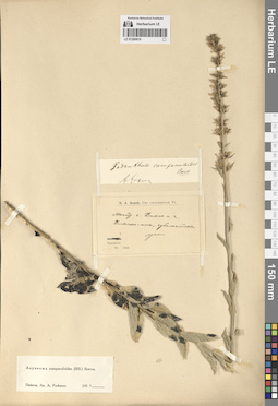
LE 01290619
Asyneuma campanuloides (M. Bieb. ex Sims) Bornm. det. Fedorov, Andrey Aleksandrovich at 1954
Collectors: Busch, Nikolai Adolfovich (Nikolaj Adolfowitsch) Collection date: 06.1903. Administrative regions: GE - Georgia. Groups of specimens: Образцы сектора Кавказа; Соглашение Минобрнауки №075-15-2021-1056Original label text:Tuschetia. Между с. Дикло и г. Диклос-мта, субальпийские луга.
Coordinates (geographic position): 42° 26′ 55.96″ N, 45° 44′ 10.12″ EComment: VI.1903
Tuschetia. Between the Diklo village and mount Diklosmta.
Record creation: 2024-08-04, Daria Yudova, PhotoScan D2.Citation: Specimen LE 01290619 // Virtual herbarium of Komarov Botanical Institute RAS — http://re.herbariumle.ru/0129061906.1903
N. A. Busch
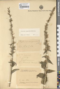
LE 01290618
Asyneuma campanuloides (M. Bieb. ex Sims) Bornm. det. Fedorov, Andrey Aleksandrovich at 1954
Collectors: Chociatowski, I. F. Collection date: 03.07.1897. Administrative regions: AM - Armenia. Groups of specimens: Образцы сектора Кавказа; Соглашение Минобрнауки №075-15-2021-1056Original label text:3 го июля
Coordinates (geographic position): 40° 35′ 3.49″ N, 44° 41′ 53.55″ EComment: в лесу
Бабакиши [= совр. Буякан]
1897 или 1896 г.
И. Ф. Хоцятовский
In the forest.
Record creation: 2024-08-04, Daria Yudova, PhotoScan D2.Citation: Specimen LE 01290618 // Virtual herbarium of Komarov Botanical Institute RAS — http://re.herbariumle.ru/01290618The Babakishi village [= modern the Buyakan village].
03.07.1897 or 1896
Coll. I. F. Chociatowski
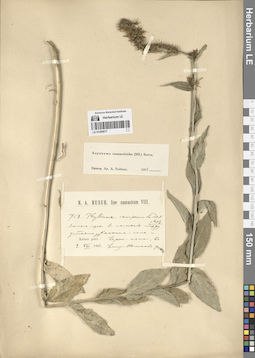
LE 01290617
Asyneuma campanuloides (M. Bieb. ex Sims) Bornm. det. Fedorov, Andrey Aleksandrovich at 1954
Collectors: Busch, Nicolai Adolfowitsch (Nikolaj Adolfovich) удалить Collection date: 02.08.1907. Administrative regions: RU - Karachayevo-Cherkesiya. Groups of specimens: Образцы сектора Кавказа; Соглашение Минобрнауки №075-15-2021-1056Original label text:Kuban prov. Лесные луга в сосняке между устьями рек Кичкине-кола и Черю-кола, в Уллу-Камском ущелье.
Coordinates (geographic position): 43° 21′ 2.62″ N, 42° 11′ 46.67″ EComment: 2.VIII.1907
N. A. Busch
Forest meadows in a pine forest between the mouths of the Kichkinekol and Cheryukol rivers, in the Ullukam Gorge.
2.08.1907
N. A. Busch
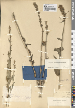
LE 01290616
Asyneuma campanuloides (M. Bieb. ex Sims) Bornm. det. Fedorov, Andrey Aleksandrovich at 1954
Collectors: Akinfiew, Ivan Yakovlevich Collection date: 07.07.1888. Groups of specimens: Образцы сектора Кавказа; Соглашение Минобрнауки №075-15-2021-1056Original label text:Закавказье. Бакуриани, 5600 ф., близ Боржома
Comment: 7 июля 1888
Transcaucasia. Bakuriani, 5600 f., near Borjomi
7.07.1888
Coll. I. Akinfiew
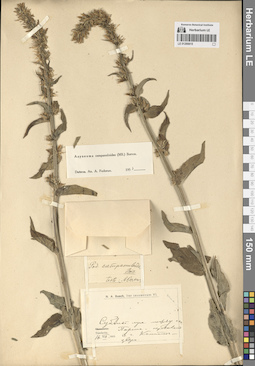
LE 01290615
Asyneuma campanuloides (M. Bieb. ex Sims) Bornm. det. Fedorov, Andrey Aleksandrovich at 1954
Collectors: Busch, Nicolai Adolfowitsch (Nikolaj Adolfovich) удалить Collection date: 16.07.1903. Administrative regions: GE - Georgia. Groups of specimens: Образцы сектора Кавказа; Соглашение Минобрнауки №075-15-2021-1056Original label text:Tuschetia. Субальпийские луга между сел. Парсма и перевалом к г. Комито[...]-цвери.
Coordinates (geographic position): 42° 30′ 41.51″ N, 45° 33′ 32.68″ EComment: 16.VII.1903
N. A. Busch
Tuschetia. Subalpine meadows between the Parsma village and the pass to the Komito[...]-tsveri Mount.
16.07.1903Coll. N. A. Busch
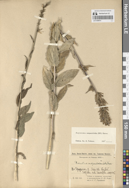
LE 01290614
Asyneuma campanuloides (M. Bieb. ex Sims) Bornm. det. Fedorov, Andrey Aleksandrovich at 1954
Collectors: Roshevitz, Roman Julievich; Gorshkova, Sofia Gennadievna Collection date: 01.08.1923. Administrative regions: GE - Georgia. Groups of specimens: Образцы сектора Кавказа; Соглашение Минобрнауки №075-15-2021-1056Original label text:В.-грузин. д. Окр. ст. Казбек. Подъем на Гельгетск. ледник.
Coordinates (geographic position): 42° 39′ 59.15″ N, 44° 34′ 0.45″ EComment: 1.VIII.1923
Собран и определен курсантами и руководителями Р. Ю. Рожевиц и С. Г. Горшковой.
Georgian military road. The vicinity of the Kazbek station. Climbing to the Gelgeti glacier.
1.08.1923
Collected and determined by cadets and leaders R. Yu. Roshevitz and S. G. Gorshkova.
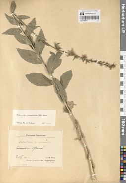
LE 01290613
Asyneuma campanuloides (M. Bieb. ex Sims) Bornm. det. Fedorov, Andrey Aleksandrovich at 1954
Collectors: Steup, W. Administrative regions: RU - Respublika Adygeya - Maykopskiy Rayon. Groups of specimens: Образцы сектора Кавказа; Соглашение Минобрнауки №075-15-2021-1056; G. Woronow et W. Steup. Растения ЧеркессииOriginal label text:Майкопский окр.: Жолоб [Maykop region: Zholob (the Zholobnaya river)]
Coordinates (geographic position): 44° 1′ 34.11″ N, 40° 5′ 49.16″ ERecord creation: 2024-08-04, Daria Yudova, PhotoScan D2.Citation: Specimen LE 01290613 // Virtual herbarium of Komarov Botanical Institute RAS — http://re.herbariumle.ru/012906138.VIII.192-
leg. W. Steup
Plantae Circassiae, distr. Maicop
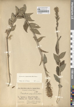
LE 01290612
Asyneuma campanuloides (M. Bieb. ex Sims) Bornm. det. Fedorov, Andrey Aleksandrovich at 1954
Collectors: Roshevitz, Roman Julievich; Gorshkova, Sofia Gennadievna Field collecting number: 136. Collection date: 01.08.1923. Administrative regions: GE - Georgia. Groups of specimens: Образцы сектора Кавказа; Соглашение Минобрнауки №075-15-2021-1056Original label text:В.-грузин. д. Окр. ст. Казбек. Подъем на Гельгет. ледник.
Coordinates (geographic position): 42° 39′ 59.15″ N, 44° 34′ 0.45″ EComment: 1.VIII.1923
Собран и определен курсантами и руководителями Р. Ю. Рожевиц и С. Г. Горшковой.
Georgian military road. The vicinity of the Kazbek station. Climbing to the Gelgeti glacier.
1.08.1923
Collected and determined by cadets and leaders R. Yu. Roshevitz and S. G. Gorshkova.
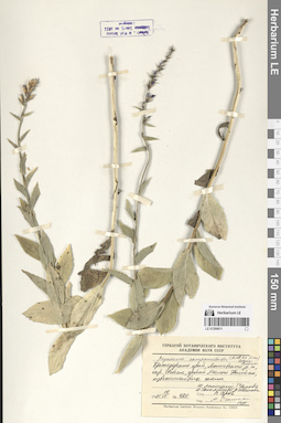
LE 01290611
Asyneuma campanuloides (M. Bieb. ex Sims) Bornm. det. Oganesjan (Oganesian), M. E. at 1988
Collectors: Menitsky, Yuri Leonardovich; Popova, Tamara Nikitichna; Tikhmeneva, Irina Borisovna; Shvanova, Valeriya Vladimirovna; Serov, Vladimir Petrovich Field collecting number: 420. Collection date: 19.07.1981. Administrative regions: RU - Krasnodarskiy Kray. Groups of specimens: Образцы сектора Кавказа; Соглашение Минобрнауки №075-15-2021-1056Original label text:Краснодарский край, Мостовский район, окр. Псебая, хребет Малый Бамбак, известняковые скалы.
Coordinates (geographic position): 43° 58′ 24.76″ N, 40° 38′ 7.04″ EComment: 1981 19.VII
№ 420
Ю. Меницкий, Т. Попова, И. Тихменева, В. Шванова, В. Серов.
Krasnodar region, Mostovsky district, vicinity of Psebay, the Maly Bambak ridge, limestone rocks.
№ 42019.07.1981
Coll. Yu. Menitsky, T. Popova, I. Tikhmeneva, V. Shvanova, V. Serov
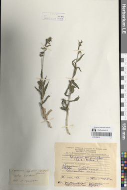
LE 01290610
Additional identifications: Asyneuma campanuloides (M. Bieb. ex Sims) Bornm.; Asyneuma rigidum (Willd.) Grossh. det. Oganesjan (Oganesian), M. E. at 1988 Collection date: 15.08.1973. Administrative regions: AZ - Azerbaijan. Groups of specimens: Образцы сектора Кавказа; Соглашение Минобрнауки №075-15-2021-1056Original label text:
Transcaucasia, Aserbajdshan. Кусарский р-н. Шахдаг. Сухой склон. Каменистые места.
Coordinates (geographic position): 41° 17′ 24.94″ N, 48° 0′ 52.71″ EComment: 15.VIII.1973
[...]
Transcaucasia, Azerbaijan. Kusar district. Shahdag. Dry slope. Rocky places.
Record creation: 2024-08-04, Daria Yudova, PhotoScan D2.Citation: Specimen LE 01290610 // Virtual herbarium of Komarov Botanical Institute RAS — http://re.herbariumle.ru/0129061015.08.1973
[...]
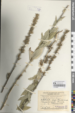
LE 01290609
Asyneuma campanuloides (M. Bieb. ex Sims) Bornm. det. Oganesjan (Oganesian), M. E. at 1988
Collectors: Menitsky, Yuri Leonardovich Collection date: 05.08.1974. Administrative regions: RU - Kabardino-Balkarskaya Respublika. Groups of specimens: Образцы сектора Кавказа; Соглашение Минобрнауки №075-15-2021-1056Original label text:КБАССР, окр. Нальчика. Черные горы выше с. Каменка.
Coordinates (geographic position): 43° 32′ 47.91″ N, 43° 29′ 2.23″ EComment: 5.08.1974
Ю. Меницкий
Kabardino-Balkarian Republic, vicinity of the city of Nalchik. Black Mountains above the village of Kamenka.
05.08.1974Coll. Yu. Menitsky
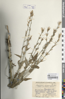
LE 01290608
Asyneuma campanuloides (M. Bieb. ex Sims) Bornm. det. Oganesjan (Oganesian), M. E. at 1988
Collectors: Menitsky, Yuri Leonardovich Collection date: 20.07.1985. Administrative regions: GE - Georgia. Groups of specimens: Образцы сектора Кавказа; Соглашение Минобрнауки №075-15-2021-1056Original label text:Грузинская ССР. Душетский р-н, верх. р. Аргун, окр. с. Шатили, Муцос-Чала.
Coordinates (geographic position): 42° 39′ 22.74″ N, 45° 9′ 33.52″ EComment: 20.VII.1985
Ю. Меницкий
Georgia, Dusheti district, upper reaches of the Argun River, vicinity of the village of Shatili, Mutsos-Chala.
Record creation: 2024-08-04, Daria Yudova, PhotoScan D2.Citation: Specimen LE 01290608 // Virtual herbarium of Komarov Botanical Institute RAS — http://re.herbariumle.ru/0129060820.07.1985
Сoll. Yu. Menitsky
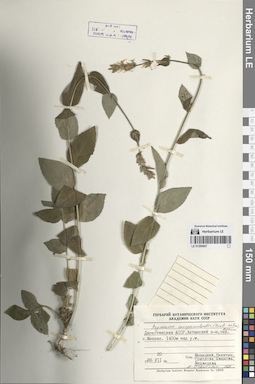
LE 01290607
Asyneuma campanuloides (M. Bieb. ex Sims) Bornm. det. Oganesjan (Oganesian), M. E. at 1988
Collectors: Menitsky, Yuri Leonardovich; Nikitin, Vladimir Vladimirovich; Sokolova, Irina Viktorovna; Shvanova, Valeriya Vladimirovna; Medvedeva, Nina Anatolyevna Collection date: 20.07.1986. Administrative regions: RU - Dagestan. Groups of specimens: Образцы сектора Кавказа; Соглашение Минобрнауки №075-15-2021-1056Original label text:Дагестанская АССР, Ахтынский район, окрестности села Микрах. 1400 м над у.м.
Coordinates (geographic position): 41° 22′ 26.19″ N, 47° 53′ 9.79″ E ±1500 m 1400 m a.s.l.Comment: Dagestan, Akhtynsky district, vicinity of the Mikrakh village. 1400 m above sea level.
Record creation: 2024-08-04, Daria Yudova, PhotoScan D2.Citation: Specimen LE 01290607 // Virtual herbarium of Komarov Botanical Institute RAS — http://re.herbariumle.ru/0129060720.07.1986
Coll. Menitsky, Nikitin, Sokolova, Shvanova, Medvedeva
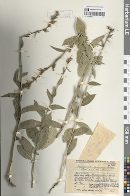
LE 01290605
Asyneuma campanuloides (M. Bieb. ex Sims) Bornm. det. Oganesjan (Oganesian), M. E. at 1988
Collectors: Menitsky, Yuri Leonardovich; Popova, Tamara Nikitichna; Tikhmeneva, Irina Borisovna; Serov, Vladimir Petrovich; Shvanova, Valeriya Vladimirovna Field collecting number: 420. Collection date: 19.07.1981. Administrative regions: RU - Krasnodarskiy Kray. Groups of specimens: Образцы сектора Кавказа; Соглашение Минобрнауки №075-15-2021-1056Original label text:Западный Кавказ, Краснодарский край, Мостовский район, хр. Малый Бамбак, известняковые скалы.
Coordinates (geographic position): 43° 57′ 2.75″ N, 40° 37′ 37.02″ EComment: 19.VII.1981
Ю. Меницкий, Т. Попова, И. Тихменева, В. Серов, В. Шванова.
Western Caucasus, Krasnodar region, Mostovsky district, the Malyi Bambak ridge, limestone rocks.
19.07.1981Coll. Yu. Menitsky, T. Popova, I. Tikhmeneva, V. Serov, V. Shvanova.
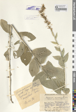
LE 01290604
Asyneuma campanuloides (M. Bieb. ex Sims) Bornm. det. Oganesjan (Oganesian), M. E. at 1988
Collectors: Menitsky, Yuri Leonardovich; Popova, Tamara Nikitichna Collection date: 23.07.1976. Administrative regions: RU - Dagestan. Groups of specimens: Образцы сектора Кавказа; Соглашение Минобрнауки №075-15-2021-1056Original label text:Дагестанская ССР. Ботлихский район, правый борт Анд. Койсу, против с. Муни, сосновый лес.
Coordinates (geographic position): 42° 40′ 16.05″ N, 46° 18′ 32.4″ EComment: 23.VII.1976
Ю. Меницкий, Т. Попова
Dagestan,
Botlikhsky district, the right side of the Andisky Koisu River, opposite the village Muni, pine forest.23.07.1976
Coll. Yu. Menitsky, T. Popova
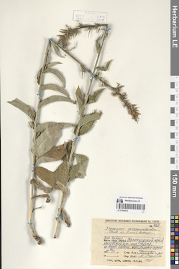
LE 01290603
Asyneuma campanuloides (M. Bieb. ex Sims) Bornm. det. Oganesjan (Oganesian), M. E. at 1988
Collectors: Menitsky, Yuri Leonardovich; Popova, Tamara Nikitichna Field collecting number: 420. Collection date: 19.07.1981. Administrative regions: RU - Krasnodarskiy Kray. Groups of specimens: Образцы сектора Кавказа; Соглашение Минобрнауки №075-15-2021-1056Original label text:Западный Кавказ, Краснодарский край, Мостовский район, хр. Малый Бамбак, известняковые скалы.
Coordinates (geographic position): 43° 57′ 2.75″ N, 40° 37′ 37.02″ EComment: 19.VII.1981
Ю. Меницкий, Т. Попова и др.
Western Caucasus, Krasnodar region, Mostovsky district, the Malyi Bambak ridge, limestone rocks.
19.07.1981Coll. Yu. Menitsky, T. Popova et al.
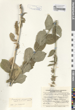
LE 01290602
Asyneuma campanuloides (M. Bieb. ex Sims) Bornm. det. Oganesjan (Oganesian), M. E. at 1988
Collectors: Konechnaya, Galina Yurievna Collection date: 19.07.1984. Administrative regions: AM - Armenia. Groups of specimens: Образцы сектора Кавказа; Соглашение Минобрнауки №075-15-2021-1056Original label text:Армянская ССР, Разданский район, окр. Такярлу [= село Артаваз], северный лесной склон ущелья р. Мармарик.
Coordinates (geographic position): 40° 36′ 37.04″ N, 44° 34′ 53.02″ EComment: 19.VII.1984
Конечная Г. Ю.
Armenia, Hrazdan district, vicinity of Takyarlu [= the Artavaz village], northern forest slope of the Marmarik River gorge.
19.07.1984Coll. G. Yu. Konechnaya
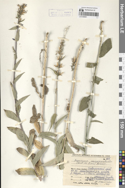
LE 01290601
Asyneuma campanuloides (M. Bieb. ex Sims) Bornm. det. Oganesjan (Oganesian), M. E. at 1988
Collectors: Menitsky, Yuri Leonardovich; Popova, Tamara Nikitichna; Serov, Vladimir Petrovich; Tikhmeneva, Irina Borisovna; Shvanova, Valeriya Vladimirovna Field collecting number: 423. Administrative regions: RU - Karachayevo-Cherkesiya. Groups of specimens: Образцы сектора Кавказа; Соглашение Минобрнауки №075-15-2021-1056Original label text:Ставропольский край, КЧ АО, Зеленчукский р-н, долина р. Маруха, h=1700 м, сосновый лес.
Coordinates (geographic position): 43° 47′ 46.38″ N, 41° 39′ 52.01″ E 1700 m a.s.l.Comment: Ю. Меницкий, Т. Попова, В. Серов, И. Тихменева, В. Шванова.
Karachayevo-Cherkesiya, Zelenchuksky district, valley of the Marukha River, h=1700 m, pine forest.
Yu. Menitsky, T. Popova, V. Serov, I. Tikhmeneva, V. Shvanova.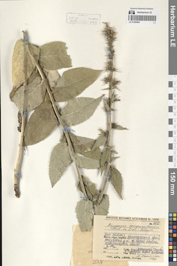
LE 01290600
Asyneuma campanuloides (M. Bieb. ex Sims) Bornm. det. Oganesjan (Oganesian), M. E. at 1988
Collectors: Menitsky, Yuri Leonardovich; Popova, Tamara Nikitichna; Tikhmeneva, Irina Borisovna; Serov, Vladimir Petrovich; Shvanova, Valeriya Vladimirovna Field collecting number: 420. Collection date: 19.07.1981. Administrative regions: RU - Krasnodarskiy Kray. Groups of specimens: Образцы сектора Кавказа; Соглашение Минобрнауки №075-15-2021-1056Original label text:Западный Кавказ, Краснодарский край, Мостовский район, хр. Малый Бамбак, известняковые скалы.
Coordinates (geographic position): 43° 57′ 2.75″ N, 40° 37′ 37.02″ EComment: 19.VII.1981
Ю. Меницкий, Т. Попова, И. Тихменева, В. Серов, В. Шванова.
Western Caucasus, Krasnodar region, Mostovsky district, the Malyi Bambak ridge, limestone rocks.
19.07.1981Coll. Yu. Menitsky, T. Popova, I. Tikhmeneva, V. Serov, V. Shvanova.
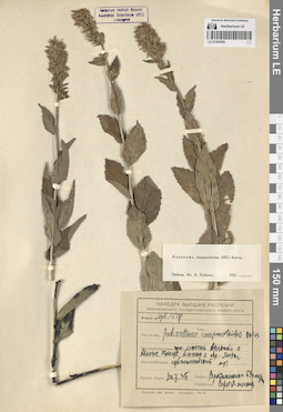
LE 01290599
Asyneuma campanuloides (M. Bieb. ex Sims) Bornm.
Collection date: 30.07.1936. Administrative regions: GE - Abkhazia. Groups of specimens: Образцы сектора Кавказа; Соглашение Минобрнауки №075-15-2021-1056Original label text:Горн. массив Арабика в Абхазск. [...] Альпах в окр. Гагры. Субальпийский луг.
Coordinates (geographic position): 43° 24′ 58.37″ N, 40° 21′ 26.21″ EComment: 30.7.36
[...]
The Arabica mountain range in Abkhazia. The vicinity of Gagra. Subalpine meadow.
30.07.1936Coll. [...]
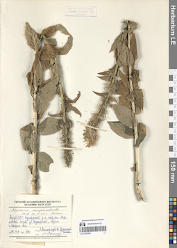
LE 01290598
Asyneuma campanuloides (M. Bieb. ex Sims) Bornm. det. Oganesjan (Oganesian), M. E. at 1990
Collectors: Vinogradov, Oleg Ivanovich; Menitsky, Yuri Leonardovich; Popova, Tamara Nikitichna Field collecting number: 880. Collection date: 14.07.1978. Administrative regions: AZ - Azerbaijan. Groups of specimens: Образцы сектора Кавказа; Соглашение Минобрнауки №075-15-2021-1056Original label text:Азерб. ССР, Кусарский р-н, окр. сел. Лаза, левый борт р. Кусарчай, подъем г. Кызыл-кая.
Coordinates (geographic position): 41° 25′ 1.12″ N, 48° 1′ 47.2″ EComment: № 880
14.VII.1978
О. Виноградов, Ю. Меницкий, Т. Попова
Azerbaijan, Kusarsky district, vicinity of the Laza village, left side of the Kusarchay river, the Kyzyl-kaya mountain.
№ 880
14.07.1978
Coll. O. Vinogradov, Yu. Menitsky, T. Popova.