View
Add
Copy
Edit
Delete
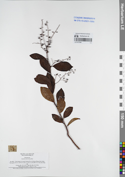
LE 01077664
Embelia subcoriacea Mez det. N.Tap at 30.03.2006
Collectors: N.Tap; N.V. Trai Field collecting number: HLF6358. Collection date: 30.03.2006. Administrative regions: VN - Tinh Quang Tri. Groups of specimens: L. V. Averyanov specimens; L. V. Averyanov herbarium; Соглашение Минобрнауки №075-15-2021-1056Original label text:FLORA OF VIETNAM
Record creation: 2021-12-02, Tatiana Maisak, PhotoScan D2Citation: Specimen LE 01077664 // Virtual herbarium of Komarov Botanical Institute RAS — http://re.herbariumle.ru/01077664Myrsinaceae
Embelia subcoriacea Mez
Tinh Quang Tri Prov.
HLF 6358, 30.03.2006
N. Tap, N.V. Trai.
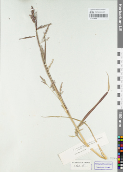
LE 01154544
Groups of specimens: Гербарий Карла Бернхарда Триниуса; Соглашение Минобрнауки №075-15-2021-1056Record creation: 2021-12-02, Marina Yarichina, PhotoScan D2Citation: Specimen LE 01154544 // Virtual herbarium of Komarov Botanical Institute RAS — http://re.herbariumle.ru/01154544
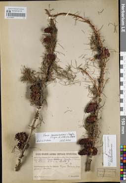
LE 01146203
Groups of specimens: Образцы сектора Сибири и Дальнего Востока России; Соглашение Минобрнауки №075-15-2021-1056Record creation: 2021-12-02, Larisa Orlova, PhotoScan D2Citation: Specimen LE 01146203 // Virtual herbarium of Komarov Botanical Institute RAS — http://re.herbariumle.ru/01146203
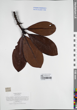
LE 01077663
Myrsine kwangsiensis (E.Walker) Pipoly & C.Chen det. Averyanov, Leonid Vladimirovich at 10.06.2004
Collectors: Averyanov, Leonid Vladimirovich; Phan Ke Loc; The Van Pham; N.T.Vinh Field collecting number: HAL5547. Collection date: 10.06.2004. Administrative regions: VN - Tinh Cao Bang. Groups of specimens: L. V. Averyanov specimens; L. V. Averyanov herbarium; Соглашение Минобрнауки №075-15-2021-1056Original label text:FLORA OF VIETNAM
Myrsinaceae
Mersine kwangsiensis
N.Vietnam, Cao Bang Prov., Trung Khanh Distr., Ngoc Khe Municipality, Pac Nga village, around point 22°54′59′'N, 106°31′44′'E, at elevation 800-850 m a.s.l.
Remnants of primary evergreen broad-leaved forest along tops of rocky ridges and mesae composed with light gray solid marble-like highly eroded crystalline limestone.
Tree 8-12 m tall. Very common. Co-dominant of 2 forest stratum.
HAL 5547 10 June 2004
Collectors: L.Averyanov, P.K.Loc, P.V.The, N.T.Vinh.
Myrsinaceae
Mersine kwangsiensis
N.Vietnam, Cao Bang Prov., Trung Khanh Distr., Ngoc Khe Municipality, Pac Nga village, around point 22°54′59′'N, 106°31′44′'E, at elevation 800-850 m a.s.l.
Remnants of primary evergreen broad-leaved forest along tops of rocky ridges and mesae composed with light gray solid marble-like highly eroded crystalline limestone.
Tree 8-12 m tall. Very common. Co-dominant of 2 forest stratum.
HAL 5547 10 June 2004
Collectors: L.Averyanov, P.K.Loc, P.V.The, N.T.Vinh.
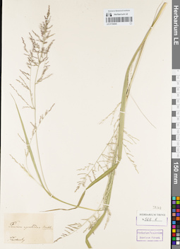
LE 01154543
Groups of specimens: Гербарий Карла Бернхарда Триниуса; Соглашение Минобрнауки №075-15-2021-1056Record creation: 2021-12-02, Marina Yarichina, PhotoScan D2Citation: Specimen LE 01154543 // Virtual herbarium of Komarov Botanical Institute RAS — http://re.herbariumle.ru/01154543
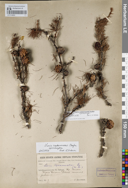
LE 01146202
Groups of specimens: Образцы сектора Сибири и Дальнего Востока России; Соглашение Минобрнауки №075-15-2021-1056Record creation: 2021-12-02, Larisa Orlova, PhotoScan D2Citation: Specimen LE 01146202 // Virtual herbarium of Komarov Botanical Institute RAS — http://re.herbariumle.ru/01146202
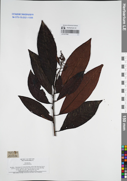
LE 01077662
Ardisia florida Pit. det. N.Tap at 26.03.2006
Collectors: N.Tap; N.V. Trai Field collecting number: HLF6083. Collection date: 26.03.2006. Administrative regions: VN - Tinh Quang Tri. Groups of specimens: L. V. Averyanov specimens; L. V. Averyanov herbarium; Соглашение Минобрнауки №075-15-2021-1056Original label text:FLORA OF VIETNAM
Record creation: 2021-12-02, Tatiana Maisak, PhotoScan D2Citation: Specimen LE 01077662 // Virtual herbarium of Komarov Botanical Institute RAS — http://re.herbariumle.ru/01077662Myrsinaceae
Ardisia florida Pit.
Tinh Quang Tri Prov.
HLF 6083, 26.03.2006
N. Tap, N.V. Trai.
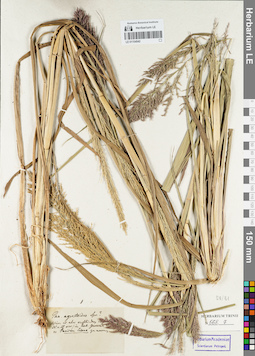
LE 01154542
Groups of specimens: Гербарий Карла Бернхарда Триниуса; Соглашение Минобрнауки №075-15-2021-1056Record creation: 2021-12-02, Marina Yarichina, PhotoScan D2Citation: Specimen LE 01154542 // Virtual herbarium of Komarov Botanical Institute RAS — http://re.herbariumle.ru/01154542
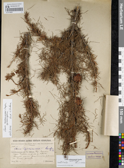
LE 01146201
Groups of specimens: Образцы сектора Сибири и Дальнего Востока России; Соглашение Минобрнауки №075-15-2021-1056Record creation: 2021-12-02, Larisa Orlova, PhotoScan D2Citation: Specimen LE 01146201 // Virtual herbarium of Komarov Botanical Institute RAS — http://re.herbariumle.ru/01146201
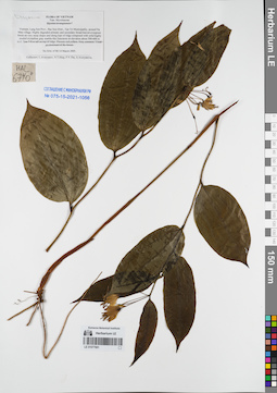
LE 01077661
Disporum sp. det. Averyanov, Leonid Vladimirovich at 14.03.2005
Collectors: Averyanov, Leonid Vladimirovich; Tien Hiep Nguyen; The Van Pham; et al. Field collecting number: HLF6740. Collection date: 14.03.2005. Administrative regions: VN - Tinh Lang Son. Groups of specimens: L. V. Averyanov specimens; L. V. Averyanov herbarium; Соглашение Минобрнауки №075-15-2021-1056Original label text:FLORA OF VIETNAM
Myrsinaceae
Myrsine kwangsiensis ?
Vietnam, Lang Son Prov., Bac Son Distr., Tan Tri Municipality, around Na Mau village.
Highly degraded primary and secondary broad-leaved evergreen forest on very steep slopes and along tops of ridge composed with solid highly eroded crystalline gray marble-like limestone at elevation about 500-600 m a.s.l.
Tree 5-8 m tall on top of ridge. Flowers red-yellow. Very common. Usual co-dominant of the forest.
HAL 6740 14 March 2005.
Collectors: L.Averyanov, N.T.Hiep, P.V.The, A.Averyanova.
Record creation: 2021-12-02, Tatiana Maisak, PhotoScan D2Citation: Specimen LE 01077661 // Virtual herbarium of Komarov Botanical Institute RAS — http://re.herbariumle.ru/01077661Myrsinaceae
Myrsine kwangsiensis ?
Vietnam, Lang Son Prov., Bac Son Distr., Tan Tri Municipality, around Na Mau village.
Highly degraded primary and secondary broad-leaved evergreen forest on very steep slopes and along tops of ridge composed with solid highly eroded crystalline gray marble-like limestone at elevation about 500-600 m a.s.l.
Tree 5-8 m tall on top of ridge. Flowers red-yellow. Very common. Usual co-dominant of the forest.
HAL 6740 14 March 2005.
Collectors: L.Averyanov, N.T.Hiep, P.V.The, A.Averyanova.
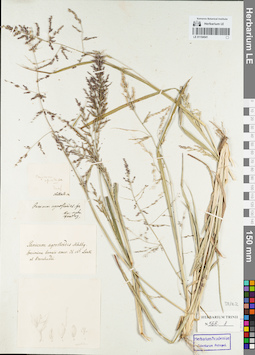
LE 01154541
Groups of specimens: Гербарий Карла Бернхарда Триниуса; Соглашение Минобрнауки №075-15-2021-1056Record creation: 2021-12-02, Marina Yarichina, PhotoScan D2Citation: Specimen LE 01154541 // Virtual herbarium of Komarov Botanical Institute RAS — http://re.herbariumle.ru/01154541
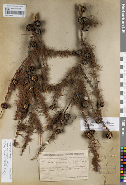
LE 01146165
Groups of specimens: Образцы сектора Сибири и Дальнего Востока России; Соглашение Минобрнауки №075-15-2021-1056Record creation: 2021-12-02, Larisa Orlova, PhotoScan D2Citation: Specimen LE 01146165 // Virtual herbarium of Komarov Botanical Institute RAS — http://re.herbariumle.ru/01146165
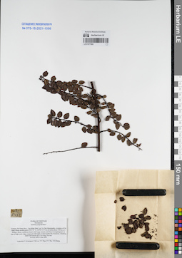
LE 01077660
Embelia polypodioides Hemsl. et Mez ⟮prelim. ID⟯ det. Averyanov, Leonid Vladimirovich at 09.12.2005
Collectors: Averyanov, Leonid Vladimirovich; Phan Ke Loc; et al. Field collecting number: HAL8452. Collection date: 09.12.2005. Administrative regions: VN - Tinh Ha Giang. Groups of specimens: L. V. Averyanov specimens; L. V. Averyanov herbarium; Соглашение Минобрнауки №075-15-2021-1056Original label text:FLORA OF VIETNAM
Myrsinaceae
Embelia polypodioides?
Vietnam, Ha Giang Prov., Yen Minh Distr, Lao Va Chai Municipality, vicinities of Chi Sang village around point 23°05′55″N, 105°04′10″E at elevation about 1500 m a.s.l.
Primary mossy coniferous forest with Tsuga sinensis and Pinus kwamgtungensis on tops of high rocky ridge composed with highly eroded marble-like limestone.
Climbing shrub with shoots up to 3 m long. Not rare.
HAL 8452 9 Dec 2005.
Coordinates (geographic position): 23° 5′ 55″ N, 105° 4′ 10″ E ±1000 mRecord creation: 2021-12-02, Tatiana Maisak, PhotoScan D2Citation: Specimen LE 01077660 // Virtual herbarium of Komarov Botanical Institute RAS — http://re.herbariumle.ru/01077660Myrsinaceae
Embelia polypodioides?
Vietnam, Ha Giang Prov., Yen Minh Distr, Lao Va Chai Municipality, vicinities of Chi Sang village around point 23°05′55″N, 105°04′10″E at elevation about 1500 m a.s.l.
Primary mossy coniferous forest with Tsuga sinensis and Pinus kwamgtungensis on tops of high rocky ridge composed with highly eroded marble-like limestone.
Climbing shrub with shoots up to 3 m long. Not rare.
HAL 8452 9 Dec 2005.
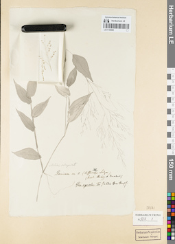
LE 01154540
Groups of specimens: Гербарий Карла Бернхарда Триниуса; Соглашение Минобрнауки №075-15-2021-1056Record creation: 2021-12-02, Marina Yarichina, PhotoScan D2Citation: Specimen LE 01154540 // Virtual herbarium of Komarov Botanical Institute RAS — http://re.herbariumle.ru/01154540
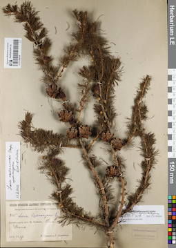
LE 01146164
Groups of specimens: Образцы сектора Сибири и Дальнего Востока России; Соглашение Минобрнауки №075-15-2021-1056Record creation: 2021-12-02, Larisa Orlova, PhotoScan D2Citation: Specimen LE 01146164 // Virtual herbarium of Komarov Botanical Institute RAS — http://re.herbariumle.ru/01146164
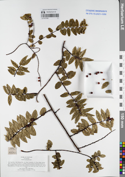
LE 01077659
Embelia polypodioides Hemsl. et Mez ⟮prelim. ID⟯ det. Averyanov, Leonid Vladimirovich at 03.12.2006
Collectors: Tien Hiep Nguyen; Averyanov, Leonid Vladimirovich; The Van Pham Field collecting number: HAL10314. Collection date: 03.12.2006. Administrative regions: VN - Tinh Lai Chau. Groups of specimens: L. V. Averyanov specimens; L. V. Averyanov herbarium; Соглашение Минобрнауки №075-15-2021-1056Original label text:FLORA OF VIETNAM
Myrsinaceae
Embelia polypodioides?
Lai Chau Prov., Tam Duong Distr., Ho Thau Community, Ho Thau village, around point 22°23′49″N 103°36′39″E.
Primary closed evergreen broad-leaved forest on steep mountain slopes and along ridges composed with granite and shale at elev. about 1900-2350 m a.s.l.
Woody vine 2-3 m long on very steep rocky slope. Fruits red. Not rare.
HAL 10314 3 Dec. 2006 Photo.
Coll.: Nguyen Tien Hiep, L.Averyanov, Pham Van The.
Coordinates (geographic position): 22° 23′ 49″ N, 103° 36′ 39″ E ±1000 mRecord creation: 2021-12-02, Tatiana Maisak, PhotoScan D2Citation: Specimen LE 01077659 // Virtual herbarium of Komarov Botanical Institute RAS — http://re.herbariumle.ru/01077659Myrsinaceae
Embelia polypodioides?
Lai Chau Prov., Tam Duong Distr., Ho Thau Community, Ho Thau village, around point 22°23′49″N 103°36′39″E.
Primary closed evergreen broad-leaved forest on steep mountain slopes and along ridges composed with granite and shale at elev. about 1900-2350 m a.s.l.
Woody vine 2-3 m long on very steep rocky slope. Fruits red. Not rare.
HAL 10314 3 Dec. 2006 Photo.
Coll.: Nguyen Tien Hiep, L.Averyanov, Pham Van The.
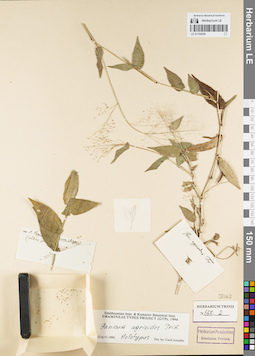
LE 01154539
Groups of specimens: Гербарий Карла Бернхарда Триниуса; Соглашение Минобрнауки №075-15-2021-1056Record creation: 2021-12-02, Marina Yarichina, PhotoScan D2Citation: Specimen LE 01154539 // Virtual herbarium of Komarov Botanical Institute RAS — http://re.herbariumle.ru/01154539
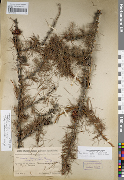
LE 01146163
Groups of specimens: Образцы сектора Сибири и Дальнего Востока России; Соглашение Минобрнауки №075-15-2021-1056Record creation: 2021-12-02, Larisa Orlova, PhotoScan D2Citation: Specimen LE 01146163 // Virtual herbarium of Komarov Botanical Institute RAS — http://re.herbariumle.ru/01146163
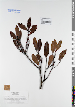
LE 01077658
Myrsine kwangsiensis (E.Walker) Pipoly & C.Chen ⟮prelim. ID⟯ det. Averyanov, Leonid Vladimirovich at 14.03.2005
Collectors: Averyanov, Leonid Vladimirovich; Tien Hiep Nguyen; et al. Field collecting number: HLF6740. Collection date: 14.03.2005. Administrative regions: VN - Tinh Lang Son. Groups of specimens: L. V. Averyanov specimens; L. V. Averyanov herbarium; Соглашение Минобрнауки №075-15-2021-1056Original label text:FLORA OF VIETNAM
Myrsinaceae
Myrsine kwangsiensis ?
Vietnam, Lang Son Prov., Bac Son Distr., Tan Tri Municipality, around Na Mau village.
Highly degraded primary and secondary broad-leaved evergreen forest on very steep slopes and along tops of ridge composed with solid highly eroded crystalline gray marble-like limestone at elevation about 500-600 m a.s.l.
Tree 5-8 m tall on top of ridge. Flowers red-yellow. Very common. Usual co-dominant of the forest.
HAL 6740 14 March 2005.
Collectors: L.Averyanov, N.T.Hiep, P.V.The, A.Averyanova.
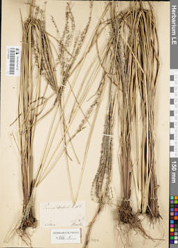
LE 01154538
Groups of specimens: Гербарий Карла Бернхарда Триниуса; Соглашение Минобрнауки №075-15-2021-1056Record creation: 2021-12-02, Marina Yarichina, PhotoScan D2Citation: Specimen LE 01154538 // Virtual herbarium of Komarov Botanical Institute RAS — http://re.herbariumle.ru/01154538
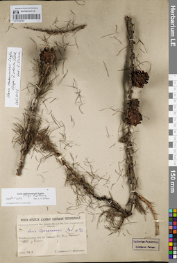
LE 01146162
Groups of specimens: Образцы сектора Сибири и Дальнего Востока России; Соглашение Минобрнауки №075-15-2021-1056Record creation: 2021-12-02, Larisa Orlova, PhotoScan D2Citation: Specimen LE 01146162 // Virtual herbarium of Komarov Botanical Institute RAS — http://re.herbariumle.ru/01146162
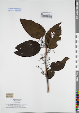
LE 01077657
Maesa balansae Mez det. N.Tap at 26.03.2006
Collectors: N.Tap; N.V. Trai Field collecting number: HLF6092. Collection date: 26.03.2006. Administrative regions: VN - Tinh Quang Tri. Groups of specimens: L. V. Averyanov specimens; L. V. Averyanov herbarium; Соглашение Минобрнауки №075-15-2021-1056Original label text:FLORA OF VIETNAM
Record creation: 2021-12-02, Tatiana Maisak, PhotoScan D2Citation: Specimen LE 01077657 // Virtual herbarium of Komarov Botanical Institute RAS — http://re.herbariumle.ru/01077657Myrsinaceae
Maesa balansae Mez
Tinh Quang Tri Prov.
HLF 6092, 26.03.2006.
N.Tap, N.V. Trai
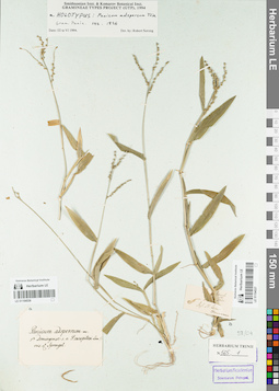
LE 01154536
Groups of specimens: Гербарий Карла Бернхарда Триниуса; Соглашение Минобрнауки №075-15-2021-1056Record creation: 2021-12-02, Marina Yarichina, PhotoScan D2Citation: Specimen LE 01154536 // Virtual herbarium of Komarov Botanical Institute RAS — http://re.herbariumle.ru/01154536
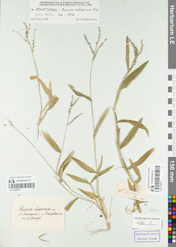
LE 01154537
Groups of specimens: Гербарий Карла Бернхарда Триниуса; Соглашение Минобрнауки №075-15-2021-1056Record creation: 2021-12-02, Marina Yarichina, PhotoScan D2Citation: Specimen LE 01154537 // Virtual herbarium of Komarov Botanical Institute RAS — http://re.herbariumle.ru/01154537
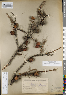
LE 01146161
Groups of specimens: Образцы сектора Сибири и Дальнего Востока России; Соглашение Минобрнауки №075-15-2021-1056Record creation: 2021-12-02, Larisa Orlova, PhotoScan D2Citation: Specimen LE 01146161 // Virtual herbarium of Komarov Botanical Institute RAS — http://re.herbariumle.ru/01146161
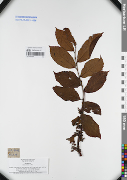
LE 01077656
Maesia sinensis det. N.Tap at 20.03.2006
Collectors: N.Tap; N.V. Trai Field collecting number: HLF6043. Collection date: 20.03.2006. Administrative regions: VN - Tinh Quang Tri. Groups of specimens: L. V. Averyanov specimens; L. V. Averyanov herbarium; Соглашение Минобрнауки №075-15-2021-1056Original label text:FLORA OF VIETNAM
Record creation: 2021-12-02, Tatiana Maisak, PhotoScan D2Citation: Specimen LE 01077656 // Virtual herbarium of Komarov Botanical Institute RAS — http://re.herbariumle.ru/01077656Myrsinaceae
Maesia sinensis A. DC.
Tinh Quang Tri Prov.
HLF 6043 , 20.03.2006
N.Tap, N.V. Trai.
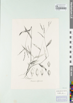
LE 01154535
Groups of specimens: Гербарий Карла Бернхарда Триниуса; Соглашение Минобрнауки №075-15-2021-1056Record creation: 2021-12-02, Marina Yarichina, PhotoScan D2Citation: Specimen LE 01154535 // Virtual herbarium of Komarov Botanical Institute RAS — http://re.herbariumle.ru/01154535
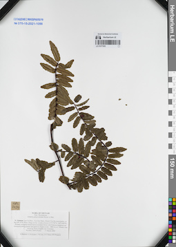
LE 01077655
Embelia polypodioides Hemsl. et Mez det. Averyanov, Leonid Vladimirovich at 17.03.2002
Collectors: Averyanov, Leonid Vladimirovich; Phan Ke Loc; D.T. Doan Field collecting number: HAL2439. Collection date: 17.03.2002. Administrative regions: VN - Tinh Lao Cai. Groups of specimens: L. V. Averyanov specimens; L. V. Averyanov herbarium; Соглашение Минобрнауки №075-15-2021-1056Original label text:FLORA OF VIETNAM
Myrsinaceae
Embelia polypodioides Hemsl. et Mez
Northern Vietnam, Lao Cai Prov., Van Ban Distr., Khanh Yen Ha
municipality, to the SW of Na Nheo village (in the vicinity of point
21°57′59′'N, 104°14′06′'E). Primary evergreen broad-leaved montane
forest with Fokienia hodginsii (as emergent) along granite and
quartzite slopes at elev. 1800 m a.s.l. Woody vine 4-6 m lg. Fruits
brightly red. Common.
HAL 2439 (Photo) 17 March 2002
Collectors: L.Averyanov, P.K.Loc, D.T.Doan (FFI Project).
Coordinates (geographic position): 21° 57′ 59″ N, 104° 14′ 6″ E ±1000 mRecord creation: 2021-12-02, Tatiana Maisak, PhotoScan D2Citation: Specimen LE 01077655 // Virtual herbarium of Komarov Botanical Institute RAS — http://re.herbariumle.ru/01077655Myrsinaceae
Embelia polypodioides Hemsl. et Mez
Northern Vietnam, Lao Cai Prov., Van Ban Distr., Khanh Yen Ha
municipality, to the SW of Na Nheo village (in the vicinity of point
21°57′59′'N, 104°14′06′'E). Primary evergreen broad-leaved montane
forest with Fokienia hodginsii (as emergent) along granite and
quartzite slopes at elev. 1800 m a.s.l. Woody vine 4-6 m lg. Fruits
brightly red. Common.
HAL 2439 (Photo) 17 March 2002
Collectors: L.Averyanov, P.K.Loc, D.T.Doan (FFI Project).
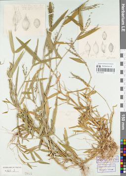
LE 01154534
Groups of specimens: Гербарий Карла Бернхарда Триниуса; Соглашение Минобрнауки №075-15-2021-1056Record creation: 2021-12-02, Marina Yarichina, PhotoScan D2Citation: Specimen LE 01154534 // Virtual herbarium of Komarov Botanical Institute RAS — http://re.herbariumle.ru/01154534
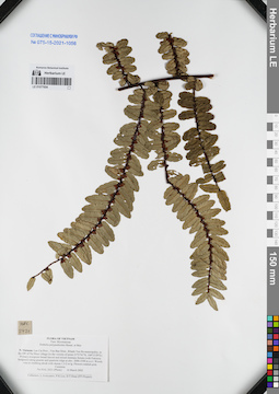
LE 01077654
Embelia polypodioides Hemsl. et Mez det. Averyanov, Leonid Vladimirovich at 16.03.2002
Collectors: Averyanov, Leonid Vladimirovich; Phan Ke Loc; Doan Trung Quoc Field collecting number: HAL2421. Collection date: 16.03.2002. Administrative regions: VN - Tinh Lao Cai. Groups of specimens: L. V. Averyanov specimens; L. V. Averyanov herbarium; Соглашение Минобрнауки №075-15-2021-1056Original label text:FLORA OF VIETNAM
Myrsinaceae
Embelia polypodioides Hemsl. et Mez
Northern Vietnam, Lao Cai Prov., Van Ban Distr., Khanh Yen Ha
municipality, to the SW of Na Nheo village (in the vicinity of point
21°57′41′'N, 104°13′29′'E). Primary evergreen broad-leaved and mixed
montane forests (with Fokienia hodginsii) along granite and quartzite
ridge at elev. 2000-2100 m a.s.l. Woody vine or climbing shrub with
shoots 1.5-2 m lg. Flowers reddish-pink. Common.
HAL 2421 (Photo) 16 March 2002
Collectors: L.Averyanov, P.K.Loc, D.T.Doan (FFI Project).
Coordinates (geographic position): 21° 57′ 41″ N, 104° 13′ 29″ E ±1000 mRecord creation: 2021-12-02, Tatiana Maisak, PhotoScan D2Citation: Specimen LE 01077654 // Virtual herbarium of Komarov Botanical Institute RAS — http://re.herbariumle.ru/01077654Myrsinaceae
Embelia polypodioides Hemsl. et Mez
Northern Vietnam, Lao Cai Prov., Van Ban Distr., Khanh Yen Ha
municipality, to the SW of Na Nheo village (in the vicinity of point
21°57′41′'N, 104°13′29′'E). Primary evergreen broad-leaved and mixed
montane forests (with Fokienia hodginsii) along granite and quartzite
ridge at elev. 2000-2100 m a.s.l. Woody vine or climbing shrub with
shoots 1.5-2 m lg. Flowers reddish-pink. Common.
HAL 2421 (Photo) 16 March 2002
Collectors: L.Averyanov, P.K.Loc, D.T.Doan (FFI Project).
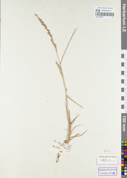
LE 01154533
Groups of specimens: Гербарий Карла Бернхарда Триниуса; Соглашение Минобрнауки №075-15-2021-1056Record creation: 2021-12-02, Marina Yarichina, PhotoScan D2Citation: Specimen LE 01154533 // Virtual herbarium of Komarov Botanical Institute RAS — http://re.herbariumle.ru/01154533
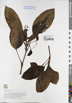
LE 01077653
Spatholirion puluongense Aver. det. Averyanov, Leonid Vladimirovich at 22.09.2016
Collectors: Averyanov, Leonid Vladimirovich; Tien Hiep Nguyen; Khang Sinh Nguyen; et al. Field collecting number: CPC7918. Collection date: 22.09.2016. Administrative regions: VN - Tinh Son La. Groups of specimens: L. V. Averyanov specimens; L. V. Averyanov herbarium; Соглашение Минобрнауки №075-15-2021-1056; Flora of VietnamOriginal label text:FLORA OF VIETNAM
Commelinaceae
Spatholirion puluongense Aver.
Son La Prov., Moc Chau Distr., Chieng Son comm., Pha Luong village, Pha Luong Mountains.
Primary and secondary evergreen broad-leaved forest on very steep slopes and cliffs of highly eroded red-brown sandstone at elevation 1000-1050 m a.s.l. around point 20°42′02.1N 104°37′23.1E.
Terrestrial herb to 0.5 m tall in shady humid places. Leaves dark green, often with white or light pinkish stripes. Flowers purple-violet. Locally abundant, co-dominant od forest herbaceous stratum.
22 September 2016 CPC 7918. Photos.
Coll.: L.Averyanov, N.T.Hiep, N.S.Khang, C.Q.Ngan, T.V.Maisak, N.T.Son.
Coordinates (geographic position): 20° 42′ 2.1″ N, 104° 37′ 23.1″ E ±1000 mRecord creation: 2021-12-02, Tatiana Maisak, PhotoScan D2Citation: Specimen LE 01077653 // Virtual herbarium of Komarov Botanical Institute RAS — http://re.herbariumle.ru/01077653Commelinaceae
Spatholirion puluongense Aver.
Son La Prov., Moc Chau Distr., Chieng Son comm., Pha Luong village, Pha Luong Mountains.
Primary and secondary evergreen broad-leaved forest on very steep slopes and cliffs of highly eroded red-brown sandstone at elevation 1000-1050 m a.s.l. around point 20°42′02.1N 104°37′23.1E.
Terrestrial herb to 0.5 m tall in shady humid places. Leaves dark green, often with white or light pinkish stripes. Flowers purple-violet. Locally abundant, co-dominant od forest herbaceous stratum.
22 September 2016 CPC 7918. Photos.
Coll.: L.Averyanov, N.T.Hiep, N.S.Khang, C.Q.Ngan, T.V.Maisak, N.T.Son.
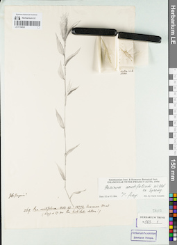
LE 01154532
Groups of specimens: Гербарий Карла Бернхарда Триниуса; Соглашение Минобрнауки №075-15-2021-1056Record creation: 2021-12-02, Marina Yarichina, PhotoScan D2Citation: Specimen LE 01154532 // Virtual herbarium of Komarov Botanical Institute RAS — http://re.herbariumle.ru/01154532
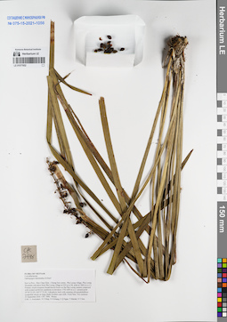
LE 01077652
Ophiopogon intermedius D.Don ⟮prelim. ID⟯ det. Averyanov, Leonid Vladimirovich at 23.09.2016
Collectors: Averyanov, Leonid Vladimirovich; Tien Hiep Nguyen; Khang Sinh Nguyen; et al. Field collecting number: CPC7996. Collection date: 23.09.2016. Administrative regions: VN - Tinh Son La. Groups of specimens: L. V. Averyanov specimens; L. V. Averyanov herbarium; Соглашение Минобрнауки №075-15-2021-1056Original label text:FLORA OF VIETNAM
Convallariaceae
Ophiopogon intermedius D.Don?
Son La Prov., Moc Chau Distr., Chieng Son comm., Pha Luong village, Pha Luong Mountain (elevation from Pha Luong village at 930 m to Mt. peak at 1860 m a.s.l.).
Primary cloud evergreen broad-leaved forest on flat Pha Luong summit composed with eroded red-brown sandstone at elevation 1750-1850 m a.s.l. around point 20°40′23.0N 104°37′52.0E.
Lithophytic herb with creeping old pseudobulbous sympodial shoots on large shady boulders and cliffs. Fruits blue. Not common.
23 September 2016 CPC 7996. Photos.
Coordinates (geographic position): 20° 40′ 23″ N, 104° 37′ 52″ E ±1000 mRecord creation: 2021-12-02, Tatiana Maisak, PhotoScan D2Citation: Specimen LE 01077652 // Virtual herbarium of Komarov Botanical Institute RAS — http://re.herbariumle.ru/01077652Convallariaceae
Ophiopogon intermedius D.Don?
Son La Prov., Moc Chau Distr., Chieng Son comm., Pha Luong village, Pha Luong Mountain (elevation from Pha Luong village at 930 m to Mt. peak at 1860 m a.s.l.).
Primary cloud evergreen broad-leaved forest on flat Pha Luong summit composed with eroded red-brown sandstone at elevation 1750-1850 m a.s.l. around point 20°40′23.0N 104°37′52.0E.
Lithophytic herb with creeping old pseudobulbous sympodial shoots on large shady boulders and cliffs. Fruits blue. Not common.
23 September 2016 CPC 7996. Photos.
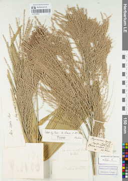
LE 01154531
Groups of specimens: Гербарий Карла Бернхарда Триниуса; Соглашение Минобрнауки №075-15-2021-1056Record creation: 2021-12-02, Marina Yarichina, PhotoScan D2Citation: Specimen LE 01154531 // Virtual herbarium of Komarov Botanical Institute RAS — http://re.herbariumle.ru/01154531
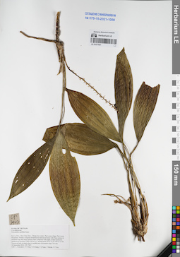
LE 01077651
Peliosanthes griffithii Baker det. Averyanov, Leonid Vladimirovich at 22.09.2016
Collectors: Averyanov, Leonid Vladimirovich; Tien Hiep Nguyen; Khang Sinh Nguyen; et al. Field collecting number: CPC7947. Collection date: 22.09.2016. Administrative regions: VN - Tinh Son La. Groups of specimens: L. V. Averyanov specimens; L. V. Averyanov herbarium; Соглашение Минобрнауки №075-15-2021-1056Original label text:FLORA OF VIETNAM
Convallariaceae
Peliosanthes griffithii Baker
Son La Prov., Moc Chau Distr., Chieng Son comm., Pha Luong village, Pha Luong Mountains.
Primary evergreen broad-leaved and mixed forest with Pinus cernua on mountain tops and steep summit slopes composed with highly eroded red-brown sandstone at elevation 1400-1500 m a.s.l. around point 20°41′33.2N 104°37′37.0E.
Terrestrial herb in shady place in middle part of mountain slope. Not rare.
22 September 2016 CPC 7947.
Coll.: L.Averyanov, N.T.Hiep, N.S.Khang, C.Q.Ngan, T.V.Maisak, N.T.Son.
Coordinates (geographic position): 20° 41′ 33.2″ N, 104° 37′ 37″ E ±1000 mRecord creation: 2021-12-02, Tatiana Maisak, PhotoScan D2Citation: Specimen LE 01077651 // Virtual herbarium of Komarov Botanical Institute RAS — http://re.herbariumle.ru/01077651Convallariaceae
Peliosanthes griffithii Baker
Son La Prov., Moc Chau Distr., Chieng Son comm., Pha Luong village, Pha Luong Mountains.
Primary evergreen broad-leaved and mixed forest with Pinus cernua on mountain tops and steep summit slopes composed with highly eroded red-brown sandstone at elevation 1400-1500 m a.s.l. around point 20°41′33.2N 104°37′37.0E.
Terrestrial herb in shady place in middle part of mountain slope. Not rare.
22 September 2016 CPC 7947.
Coll.: L.Averyanov, N.T.Hiep, N.S.Khang, C.Q.Ngan, T.V.Maisak, N.T.Son.
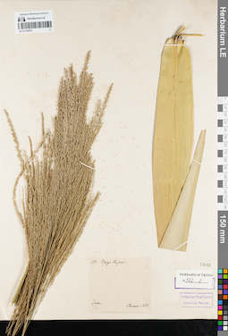
LE 01154530
Groups of specimens: Гербарий Карла Бернхарда Триниуса; Соглашение Минобрнауки №075-15-2021-1056Record creation: 2021-12-02, Marina Yarichina, PhotoScan D2Citation: Specimen LE 01154530 // Virtual herbarium of Komarov Botanical Institute RAS — http://re.herbariumle.ru/01154530
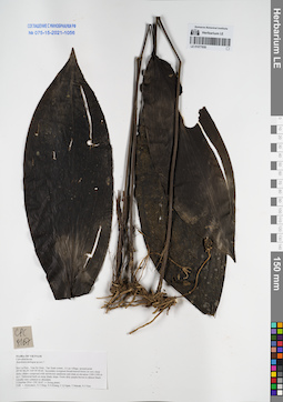
LE 01077650
Aspidistra angustata Aver., K.S.Nguyen & Tillich det. Averyanov, Leonid Vladimirovich at 05.07.2023
Additional identifications: Aspidistra ambigua det. Averyanov, Leonid Vladimirovich at 01.10.2016 Collectors: Averyanov, Leonid Vladimirovich; Tien Hiep Nguyen; Khang Sinh Nguyen; et al. Field collecting number: CPC8167. Collection date: 01.10.2016. Administrative regions: VN - Tinh Son La. Groups of specimens: L. V. Averyanov specimens; L. V. Averyanov herbarium; Соглашение Минобрнауки №075-15-2021-1056Original label text:FLORA OF VIETNAM
Coordinates (geographic position): 20° 40′ 46.2″ N, 104° 39′ 49.6″ E ±1000 mRecord creation: 2021-12-02, Tatiana Maisak, PhotoScan D2. Processing status: work_status_1Citation: Specimen LE 01077650 // Virtual herbarium of Komarov Botanical Institute RAS — http://re.herbariumle.ru/01077650Convallariaceae
Aspidistra ambigua sp.nov.?
Son La Prov., Van Ho Distr., Tan Xuan comm., A Lay village, around point 20°40′46.2N 104°39′49.6E.
Secondary evergreen broad-leaved forest on very steep rocky slopes composed with red-brown sandstone and shale at elevation 1300-1500 m a.s.l.
Terrestrial herb on steep shady slope. Fruits dirty purple-brown to almost black. Locally very common to abundant.
1 October 2016 CPC 8167 (+ living plant)
Coll.: L.Averyanov, N.T.Hiep, N.S.Khang, C.Q.Ngan, T.V.Maisak, N.T.Son.
Herbarium prepared in 25.06.2020, flowers odorless, tube white, perianth lobes pale yellowish green to light green, reddish-brown at the base stile white at basal half, reddish-brown at apical half. Anthers and stigma pale light yellow, L. Averyanov, CPC 8167.1, garden number 16530. Living plant:
Aspidistra sp.
1 October 2016 CPC 8167/1 (+ living plant)
Aspidistra ambigua sp.nov.?
Son La Prov., Van Ho Distr., Tan Xuan comm., A Lay village, around point 20°40′46.2N 104°39′49.6E.
Secondary evergreen broad-leaved forest on very steep rocky slopes composed with red-brown sandstone and shale at elevation 1300-1500 m a.s.l.
Terrestrial herb on steep shady slope. Fruits dirty purple-brown to almost black. Locally very common to abundant.
1 October 2016 CPC 8167 (+ living plant)
Coll.: L.Averyanov, N.T.Hiep, N.S.Khang, C.Q.Ngan, T.V.Maisak, N.T.Son.
Herbarium prepared in 25.06.2020, flowers odorless, tube white, perianth lobes pale yellowish green to light green, reddish-brown at the base stile white at basal half, reddish-brown at apical half. Anthers and stigma pale light yellow, L. Averyanov, CPC 8167.1, garden number 16530. Living plant:
Aspidistra sp.
1 October 2016 CPC 8167/1 (+ living plant)
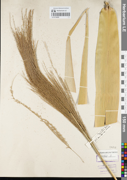
LE 01154529
Groups of specimens: Гербарий Карла Бернхарда Триниуса; Соглашение Минобрнауки №075-15-2021-1056Record creation: 2021-12-02, Marina Yarichina, PhotoScan D2Citation: Specimen LE 01154529 // Virtual herbarium of Komarov Botanical Institute RAS — http://re.herbariumle.ru/01154529
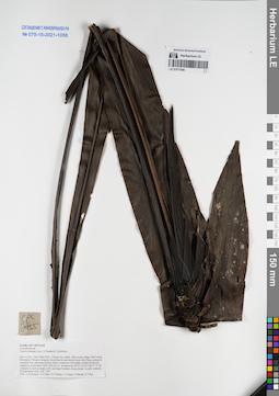
LE 01077649
Tupistra khangii Aver., N.Tanaka & Vislobokov det. Averyanov, Leonid Vladimirovich at 22.09.2016
Collectors: Averyanov, Leonid Vladimirovich; Tien Hiep Nguyen; Khang Sinh Nguyen; et al. Field collecting number: CPC7955. Collection date: 22.09.2016. Administrative regions: VN - Tinh Son La. Groups of specimens: L. V. Averyanov specimens; L. V. Averyanov herbarium; Соглашение Минобрнауки №075-15-2021-1056Original label text:FLORA OF VIETNAM
Convallariaceae
Tupistra khangii Aver., N.Tanaka & Vislobokov
Son La Prov., Moc Chau Distr., Chieng Son comm., Pha Luong village, Pha Luong Mountains.
Primary evergreen broad-leaved and mixed forest with Pinus cernua on mountain tops and steep summit slopes composed with highly eroded red-brown sandstone at elevation 1400-1500 m a.s.l. around point 20°41′33.2N 104°37′37.0E.
Lithophytic herb on shady cliffs and large boulders along stream. Locally common.
22 September 2016 CPC 7955.
Coll.: L.Averyanov, N.T.Hiep, N.S.Khang, C.Q.Ngan, T.V.Maisak, N.T.Son.
Coordinates (geographic position): 20° 41′ 33.2″ N, 104° 37′ 37″ E ±1000 mRecord creation: 2021-12-02, Tatiana Maisak, PhotoScan D2Citation: Specimen LE 01077649 // Virtual herbarium of Komarov Botanical Institute RAS — http://re.herbariumle.ru/01077649Convallariaceae
Tupistra khangii Aver., N.Tanaka & Vislobokov
Son La Prov., Moc Chau Distr., Chieng Son comm., Pha Luong village, Pha Luong Mountains.
Primary evergreen broad-leaved and mixed forest with Pinus cernua on mountain tops and steep summit slopes composed with highly eroded red-brown sandstone at elevation 1400-1500 m a.s.l. around point 20°41′33.2N 104°37′37.0E.
Lithophytic herb on shady cliffs and large boulders along stream. Locally common.
22 September 2016 CPC 7955.
Coll.: L.Averyanov, N.T.Hiep, N.S.Khang, C.Q.Ngan, T.V.Maisak, N.T.Son.
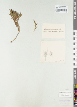
LE 01154528
Groups of specimens: Гербарий Карла Бернхарда Триниуса; Соглашение Минобрнауки №075-15-2021-1056Record creation: 2021-12-02, Marina Yarichina, PhotoScan D2Citation: Specimen LE 01154528 // Virtual herbarium of Komarov Botanical Institute RAS — http://re.herbariumle.ru/01154528
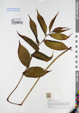
LE 01077648
Polygonatum kingianum Collett & Hemsl. det. Nguyen Quang Hieu at 09.05.2015
Collectors: Nguyen Quang Hieu; Tien Hiep Nguyen; et al. Field collecting number: CPC7827. Collection date: 09.05.2015. Administrative regions: VN - Tinh Ha Giang. Groups of specimens: L. V. Averyanov specimens; L. V. Averyanov herbarium; Соглашение Минобрнауки №075-15-2021-1056Original label text:FLORA OF VIETNAM
Convallariaceae
Polygonatum kingianum Collett & Hemsl.
Ha Giang Prov., Vi Xuyen Distr., Tung Ba municipality, Khau Ca NR.
Primary broad-leaved humid evergreen forest on very steep slopes and along rocky ridge composed with solid crystalline highly eroded limestone at elevation 700-1150 m a.s.l. around point 22°50′43.9″N 105°07′18.5″E.
Terestrial herb 60 cm high, common.
09 May 2015 CPC 7827 Coll.: N.Q. Hieu, N.T.Hiep, T.B. Ngan, C.Q. Ngan, D.K. Harder, C. P. Tuy, G.C.Pao
Coordinates (geographic position): 22° 50′ 43.9″ N, 105° 7′ 18.5″ E ±1000 mRecord creation: 2021-12-02, Tatiana Maisak, PhotoScan D2Citation: Specimen LE 01077648 // Virtual herbarium of Komarov Botanical Institute RAS — http://re.herbariumle.ru/01077648Convallariaceae
Polygonatum kingianum Collett & Hemsl.
Ha Giang Prov., Vi Xuyen Distr., Tung Ba municipality, Khau Ca NR.
Primary broad-leaved humid evergreen forest on very steep slopes and along rocky ridge composed with solid crystalline highly eroded limestone at elevation 700-1150 m a.s.l. around point 22°50′43.9″N 105°07′18.5″E.
Terestrial herb 60 cm high, common.
09 May 2015 CPC 7827 Coll.: N.Q. Hieu, N.T.Hiep, T.B. Ngan, C.Q. Ngan, D.K. Harder, C. P. Tuy, G.C.Pao
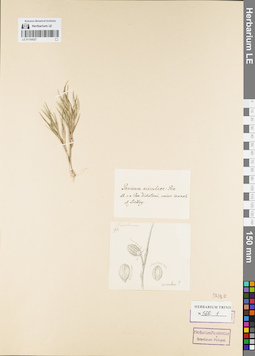
LE 01154527
Groups of specimens: Гербарий Карла Бернхарда Триниуса; Соглашение Минобрнауки №075-15-2021-1056Record creation: 2021-12-02, Marina Yarichina, PhotoScan D2Citation: Specimen LE 01154527 // Virtual herbarium of Komarov Botanical Institute RAS — http://re.herbariumle.ru/01154527
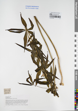
LE 01077647
Polygonatum kingianum Collett & Hemsl. det. Averyanov, Leonid Vladimirovich at 04.04.2015
Collectors: Tien Hiep Nguyen; Averyanov, Leonid Vladimirovich; Khang Sinh Nguyen; et al. Field collecting number: LA-VN1056. Collection date: 04.04.2015. Administrative regions: LA - Xiangkhouang. Groups of specimens: L. V. Averyanov specimens; L. V. Averyanov herbarium; Соглашение Минобрнауки №075-15-2021-1056Original label text:FLORA OF LAOS
Convallariaceae
Polygonatum kingianum Collett & Hemsl.
Xiangkhouang Prov., Kham Distr., Huad village, Phou tat Vinh mt., around point 19°32′31.6′N 103°39′40.4′E.
Primary and secondary broad-leaved evergreen and semideciduous dry forest on very steep rocky slopes of limestone highly eroded mountains composed by solid marble like limestone at elev. 1200-1400 m a.s.l.
Terrestrial herb to 2 m tall on steep rocky slope. Flowers red. Occasional.
LA-VN 1056 4 April 2015
Coll.: N.T.Hiep, L.Averyanov, N.S.Khang, N.Q.Hieu, T.Maisak, Pheng Phengsintham.
Coordinates (geographic position): 19° 32′ 31.6″ N, 103° 39′ 40.4″ E ±1000 mRecord creation: 2021-12-02, Tatiana Maisak, PhotoScan D2Citation: Specimen LE 01077647 // Virtual herbarium of Komarov Botanical Institute RAS — http://re.herbariumle.ru/01077647Convallariaceae
Polygonatum kingianum Collett & Hemsl.
Xiangkhouang Prov., Kham Distr., Huad village, Phou tat Vinh mt., around point 19°32′31.6′N 103°39′40.4′E.
Primary and secondary broad-leaved evergreen and semideciduous dry forest on very steep rocky slopes of limestone highly eroded mountains composed by solid marble like limestone at elev. 1200-1400 m a.s.l.
Terrestrial herb to 2 m tall on steep rocky slope. Flowers red. Occasional.
LA-VN 1056 4 April 2015
Coll.: N.T.Hiep, L.Averyanov, N.S.Khang, N.Q.Hieu, T.Maisak, Pheng Phengsintham.
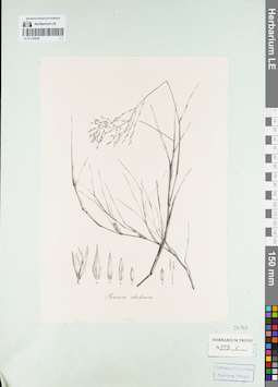
LE 01154526
Groups of specimens: Гербарий Карла Бернхарда Триниуса; Соглашение Минобрнауки №075-15-2021-1056Record creation: 2021-12-02, Marina Yarichina, PhotoScan D2Citation: Specimen LE 01154526 // Virtual herbarium of Komarov Botanical Institute RAS — http://re.herbariumle.ru/01154526
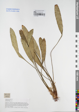
LE 01077646
Ophiopogon regnieri Bois det. Averyanov, Leonid Vladimirovich at 12.04.2015
Collectors: Tien Hiep Nguyen; Averyanov, Leonid Vladimirovich; Khang Sinh Nguyen; et al. Field collecting number: LA-VN1405. Collection date: 12.04.2015. Administrative regions: LA - Houaphan. Groups of specimens: L. V. Averyanov specimens; L. V. Averyanov herbarium; Соглашение Минобрнауки №075-15-2021-1056Original label text:FLORA OF LAOS NEW
Convallariaceae
Ophiopogon regnieri Bois
Houphan Prov., Hem Distr., Nacoc village, Puphadeng mountain, around point 20°09′52.6′'N 103°10′19.4′'E.
Primary and secondary broad-leaved evergreen open dry forest on very steep rocky mountain slopes composed by solid marble like highly eroded limestone at elev. 1000-1200 m a.s.l.
Terrestrial herb on shady steep rocky slope. Leaves yellow spotted with many transversally elliptic spots. Common.
LA-VN 1405 12 April 2015
Coll.: N.T.Hiep, L.Averyanov, N.S.Khang, N.Q.Hieu, T.Maisak, Pheng Phengsintham.
Coordinates (geographic position): 20° 9′ 52.6″ N, 103° 10′ 19.4″ E ±1000 mRecord creation: 2021-12-02, Tatiana Maisak, PhotoScan D2Citation: Specimen LE 01077646 // Virtual herbarium of Komarov Botanical Institute RAS — http://re.herbariumle.ru/01077646Convallariaceae
Ophiopogon regnieri Bois
Houphan Prov., Hem Distr., Nacoc village, Puphadeng mountain, around point 20°09′52.6′'N 103°10′19.4′'E.
Primary and secondary broad-leaved evergreen open dry forest on very steep rocky mountain slopes composed by solid marble like highly eroded limestone at elev. 1000-1200 m a.s.l.
Terrestrial herb on shady steep rocky slope. Leaves yellow spotted with many transversally elliptic spots. Common.
LA-VN 1405 12 April 2015
Coll.: N.T.Hiep, L.Averyanov, N.S.Khang, N.Q.Hieu, T.Maisak, Pheng Phengsintham.
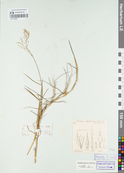
LE 01154525
Groups of specimens: Гербарий Карла Бернхарда Триниуса; Соглашение Минобрнауки №075-15-2021-1056Record creation: 2021-12-02, Marina Yarichina, PhotoScan D2Citation: Specimen LE 01154525 // Virtual herbarium of Komarov Botanical Institute RAS — http://re.herbariumle.ru/01154525
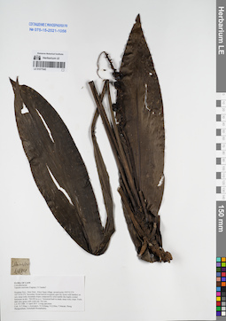
LE 01077645
Tupistra muricata (Gagnep.) N.Tanaka ⟮prelim. ID⟯ det. Averyanov, Leonid Vladimirovich at 15.04.2015
Collectors: Tien Hiep Nguyen; Averyanov, Leonid Vladimirovich; Khang Sinh Nguyen; et al. Field collecting number: LA-VN1484. Collection date: 15.04.2015. Administrative regions: LA - Houaphan. Groups of specimens: L. V. Averyanov specimens; L. V. Averyanov herbarium; Соглашение Минобрнауки №075-15-2021-1056Original label text:FLORA OF LAOS
Convallariaceae
Tupistra muricata (Gagnep.) N.Tanaka
Houphan Prov., Hem Distr., Khon Ngua village, around point 19°55′53.2′'N 103°16′24.2′'E.
Secondary broad-leaved evergreen open dry forest with bamboo on very steep rocky mountain slopes composed by solid marble like highly eroded limestone at elev. 700-950 m a.s.l.
Terrestrial herb in shady steep rocky slope. Fruits dark dirty green with violet tint. Not rare.
LA-VN 1484 15 April 2015 Living specimen
Coll.: N.T.Hiep, L.Averyanov, N.S.Khang, N.Q.Hieu, T.Maisak, Pheng Phengsintham, Somchanh Bounphanmy.
Coordinates (geographic position): 19° 55′ 53.2″ N, 103° 16′ 24.2″ E ±1000 mRecord creation: 2021-12-02, Tatiana Maisak, PhotoScan D2Citation: Specimen LE 01077645 // Virtual herbarium of Komarov Botanical Institute RAS — http://re.herbariumle.ru/01077645Convallariaceae
Tupistra muricata (Gagnep.) N.Tanaka
Houphan Prov., Hem Distr., Khon Ngua village, around point 19°55′53.2′'N 103°16′24.2′'E.
Secondary broad-leaved evergreen open dry forest with bamboo on very steep rocky mountain slopes composed by solid marble like highly eroded limestone at elev. 700-950 m a.s.l.
Terrestrial herb in shady steep rocky slope. Fruits dark dirty green with violet tint. Not rare.
LA-VN 1484 15 April 2015 Living specimen
Coll.: N.T.Hiep, L.Averyanov, N.S.Khang, N.Q.Hieu, T.Maisak, Pheng Phengsintham, Somchanh Bounphanmy.
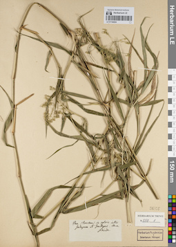
LE 01154524
Groups of specimens: Гербарий Карла Бернхарда Триниуса; Соглашение Минобрнауки №075-15-2021-1056Record creation: 2021-12-02, Marina Yarichina, PhotoScan D2Citation: Specimen LE 01154524 // Virtual herbarium of Komarov Botanical Institute RAS — http://re.herbariumle.ru/01154524
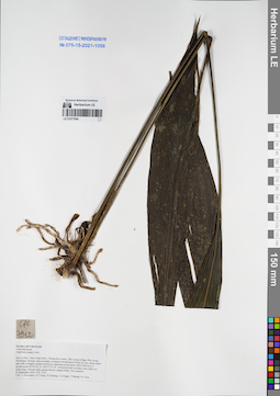
LE 01077644
Aspidistra nutans Aver. & Tillich det. Averyanov, Leonid Vladimirovich at 22.09.2016
Collectors: Averyanov, Leonid Vladimirovich; Tien Hiep Nguyen; Khang Sinh Nguyen; et al. Field collecting number: CPC7912. Collection date: 22.09.2016. Administrative regions: VN - Tinh Son La. Groups of specimens: L. V. Averyanov specimens; L. V. Averyanov herbarium; Соглашение Минобрнауки №075-15-2021-1056Original label text:FLORA OF VIETNAM
Convallariaceae
Aspidistra nutans Aver.
Son La Prov., Moc Chau Distr., Chieng Son comm., Pha Luong village, Pha Luong Mountains.
Primary and secondary evergreen broad-leaved forest on very steep slopes and cliffs of highly eroded red-brown sandstone at elevation 1000-1050 m a.s.l. around point 20°42′02.1N 104°37′23.1E.
Terrestrial herb in shady rocky place on steep slope. Flowers dirty purple-brown, stigma white. Not common.
22 September 2016 CPC 7912.
Coll.: L.Averyanov, N.T.Hiep, N.S.Khang, C.Q.Ngan, T.V.Maisak, N.T.Son.
Coordinates (geographic position): 20° 42′ 2.1″ N, 104° 37′ 23.1″ E ±1000 mRecord creation: 2021-12-02, Tatiana Maisak, PhotoScan D2Citation: Specimen LE 01077644 // Virtual herbarium of Komarov Botanical Institute RAS — http://re.herbariumle.ru/01077644Convallariaceae
Aspidistra nutans Aver.
Son La Prov., Moc Chau Distr., Chieng Son comm., Pha Luong village, Pha Luong Mountains.
Primary and secondary evergreen broad-leaved forest on very steep slopes and cliffs of highly eroded red-brown sandstone at elevation 1000-1050 m a.s.l. around point 20°42′02.1N 104°37′23.1E.
Terrestrial herb in shady rocky place on steep slope. Flowers dirty purple-brown, stigma white. Not common.
22 September 2016 CPC 7912.
Coll.: L.Averyanov, N.T.Hiep, N.S.Khang, C.Q.Ngan, T.V.Maisak, N.T.Son.