View
Add
Copy
Edit
Delete
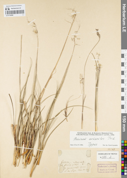
LE 01154596
Groups of specimens: Гербарий Карла Бернхарда Триниуса; Соглашение Минобрнауки №075-15-2021-1056Record creation: 2021-12-02, Marina Yarichina, PhotoScan D2Citation: Specimen LE 01154596 // Virtual herbarium of Komarov Botanical Institute RAS — http://re.herbariumle.ru/01154596
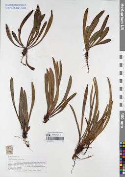
LE 01077710
Haplopteris heterophylla C.W.Chen, Y.H.Chang & Yea C.Liu det. Cheng-Wei Chen at 05.12.2025
Additional identifications: Vittaria hainanensis C.Chr. ex Ching det. Averyanov, Leonid Vladimirovich at 22.09.2016 Collectors: Averyanov, Leonid Vladimirovich; Tien Hiep Nguyen; Khang Sinh Nguyen; et al. Field collecting number: CPC7919. Collection date: 22.09.2016. Administrative regions: VN - Tinh Son La. Groups of specimens: L. V. Averyanov specimens; L. V. Averyanov herbarium; Flora of VietnamOriginal label text:FLORA OF VIETNAM
Coordinates (geographic position): 20° 42′ 2.1″ N, 104° 37′ 23.1″ E ±1000 mRecord creation: 2021-12-02, Tatiana Maisak, PhotoScan D2Citation: Specimen LE 01077710 // Virtual herbarium of Komarov Botanical Institute RAS — http://re.herbariumle.ru/01077710Polypodiaceae s.l.
Vittaria hainanensis C. Chr. ex Ching
Son La Prov., Moc Chau Distr., Chieng Son comm., Pha Luong village, Pha Luong Mountains.
Primary and secondary evergreen broad-leaved forest on very steep slopes and cliffs of highly eroded red-brown sandstone at elevation 1000-1050 m a.s.l. around point 20°42′02.1N 104°37′23.1E.
Lithophytic fern on shady mossy wet cliff and large boulders. Occasional.
22 September 2016 CPC 7919.
Coll.: L.Averyanov, N.T.Hiep, N.S.Khang, C.Q.Ngan, T.V.Maisak, N.T.Son.
Vittaria hainanensis C. Chr. ex Ching
Son La Prov., Moc Chau Distr., Chieng Son comm., Pha Luong village, Pha Luong Mountains.
Primary and secondary evergreen broad-leaved forest on very steep slopes and cliffs of highly eroded red-brown sandstone at elevation 1000-1050 m a.s.l. around point 20°42′02.1N 104°37′23.1E.
Lithophytic fern on shady mossy wet cliff and large boulders. Occasional.
22 September 2016 CPC 7919.
Coll.: L.Averyanov, N.T.Hiep, N.S.Khang, C.Q.Ngan, T.V.Maisak, N.T.Son.
LE 01154595
Groups of specimens: Гербарий Карла Бернхарда Триниуса; Соглашение Минобрнауки №075-15-2021-1056Record creation: 2021-12-02, Marina Yarichina, PhotoScan D2Citation: Specimen LE 01154595 // Virtual herbarium of Komarov Botanical Institute RAS — http://re.herbariumle.ru/01154595
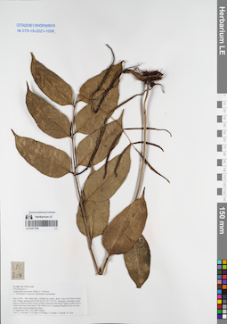
LE 01077709
Aglamorpha acuminata (Willd.) C.V.Morton det. Averyanov, Leonid Vladimirovich at 27.09.2016
Collectors: Averyanov, Leonid Vladimirovich; Tien Hiep Nguyen; Khang Sinh Nguyen; et al. Field collecting number: CPC8096. Collection date: 27.09.2016. Administrative regions: VN - Tinh Son La. Groups of specimens: L. V. Averyanov specimens; L. V. Averyanov herbarium; Соглашение Минобрнауки №075-15-2021-1056Original label text:FLORA OF VIETNAM
Polypodiaceae s.l.
Aglamorpha acuminata (Willd.) C.V.Morton
( = Photinopteris speciosa, Photinopteris acuminata)
Son La Prov., Moc Chau Distr., Chieng Son comm., about 1 km to NE from Chieng Son Village, around point 20°46′02.0N 104°37′03.1E.
Remnants of primary broad-leaved evergreen forest on tops of hills composed with karstic highly eroded yellow-white limestone at elevation 1150-1250 m a.s.l.
Creeping lithophytic fern on steep rocky slope near mountain top. Rare.
27 September 2016 CPC 8096 Photos
Coll.: L.Averyanov, N.T.Hiep, N.S.Khang, C.Q.Ngan, T.V.Maisak, N.T.Son.
Coordinates (geographic position): 20° 46′ 2″ N, 104° 37′ 3.1″ E ±1000 mRecord creation: 2021-12-02, Tatiana Maisak, PhotoScan D2Citation: Specimen LE 01077709 // Virtual herbarium of Komarov Botanical Institute RAS — http://re.herbariumle.ru/01077709Polypodiaceae s.l.
Aglamorpha acuminata (Willd.) C.V.Morton
( = Photinopteris speciosa, Photinopteris acuminata)
Son La Prov., Moc Chau Distr., Chieng Son comm., about 1 km to NE from Chieng Son Village, around point 20°46′02.0N 104°37′03.1E.
Remnants of primary broad-leaved evergreen forest on tops of hills composed with karstic highly eroded yellow-white limestone at elevation 1150-1250 m a.s.l.
Creeping lithophytic fern on steep rocky slope near mountain top. Rare.
27 September 2016 CPC 8096 Photos
Coll.: L.Averyanov, N.T.Hiep, N.S.Khang, C.Q.Ngan, T.V.Maisak, N.T.Son.
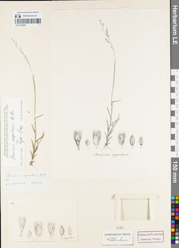
LE 01154594
Groups of specimens: Гербарий Карла Бернхарда Триниуса; Соглашение Минобрнауки №075-15-2021-1056Record creation: 2021-12-02, Marina Yarichina, PhotoScan D2Citation: Specimen LE 01154594 // Virtual herbarium of Komarov Botanical Institute RAS — http://re.herbariumle.ru/01154594
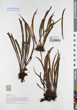
LE 01077708
Vittaria hainanensis C.Chr. ex Ching det. Averyanov, Leonid Vladimirovich at 23.09.2016
Collectors: Averyanov, Leonid Vladimirovich; Tien Hiep Nguyen; Khang Sinh Nguyen; et al. Field collecting number: CPC8002. Collection date: 23.09.2016. Administrative regions: VN - Tinh Son La. Groups of specimens: L. V. Averyanov specimens; L. V. Averyanov herbarium; Соглашение Минобрнауки №075-15-2021-1056Original label text:FLORA OF VIETNAM
Polypodiaceae s.l.
Vittaria hainanensis C. Chr. ex Ching
Son La Prov., Moc Chau Distr., Chieng Son comm., Pha Luong village, Pha Luong Mountain (elevation from Pha Luong village at 930 m to Mt. peak at 1860 m a.s.l.).
Primary cloud evergreen broad-leaved forest on flat Pha Luong summit composed with eroded red-brown sandstone at elevation 1750-1850 m a.s.l. around point 20°40′23.0N 104°37′52.0E.
Lithophytic fern on shady mossy cliffs and boulders near mountain top. Common.
23 September 2016 CPC 8002.
Coll.: L.Averyanov, N.T.Hiep, N.S.Khang, C.Q.Ngan, T.V.Maisak, N.T.Son.
Coordinates (geographic position): 20° 40′ 23″ N, 104° 37′ 52″ E ±1000 mRecord creation: 2021-12-02, Tatiana Maisak, PhotoScan D2Citation: Specimen LE 01077708 // Virtual herbarium of Komarov Botanical Institute RAS — http://re.herbariumle.ru/01077708Polypodiaceae s.l.
Vittaria hainanensis C. Chr. ex Ching
Son La Prov., Moc Chau Distr., Chieng Son comm., Pha Luong village, Pha Luong Mountain (elevation from Pha Luong village at 930 m to Mt. peak at 1860 m a.s.l.).
Primary cloud evergreen broad-leaved forest on flat Pha Luong summit composed with eroded red-brown sandstone at elevation 1750-1850 m a.s.l. around point 20°40′23.0N 104°37′52.0E.
Lithophytic fern on shady mossy cliffs and boulders near mountain top. Common.
23 September 2016 CPC 8002.
Coll.: L.Averyanov, N.T.Hiep, N.S.Khang, C.Q.Ngan, T.V.Maisak, N.T.Son.
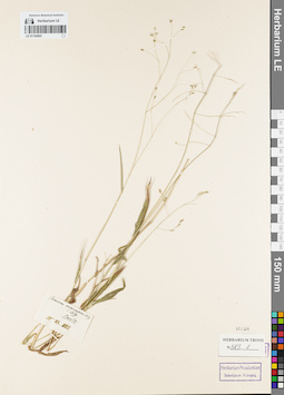
LE 01154593
Groups of specimens: Гербарий Карла Бернхарда Триниуса; Соглашение Минобрнауки №075-15-2021-1056Record creation: 2021-12-02, Marina Yarichina, PhotoScan D2Citation: Specimen LE 01154593 // Virtual herbarium of Komarov Botanical Institute RAS — http://re.herbariumle.ru/01154593
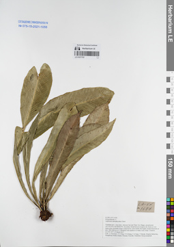
LE 01077707
Asplenium antrophyoides Christ det. Averyanov, Leonid Vladimirovich at 25.03.2017
Collectors: Averyanov, Leonid Vladimirovich; Tien Hiep Nguyen; Khang Sinh Nguyen; et al. Field collecting number: LA-VN1677. Collection date: 25.03.2017. Administrative regions: LA - Vientiane Province. Groups of specimens: L. V. Averyanov specimens; L. V. Averyanov herbarium; Соглашение Минобрнауки №075-15-2021-1056Original label text:FLORA OF LAOS
Polypodiaceae s.l.
Asplenium antrophyoides Christ
Vientiane prov., Kasi distr., between San and Tham Tai villages, around point 19°17′47.9′'N 102°08′58.9′'E.
Secondary broad-leaved evergreen dry forest on very steep rocky mountain slopes composed by solid marble like highly eroded limestone at elev. 900-1000 m a.s.l.
Lithophyte and epiphyte on shady rocky slope. Common.
LA-VN 1677 25 March 2017
Coll.: L.Averyanov, N.T.Hiep, N.S.Khang, C.Q.Ngan, T.Maisak, Khamla Inkhavilay, Hongthong Southyvohanh, Pinmany Sisavath, Chanthala Cheuaysamphanh.
Coordinates (geographic position): 19° 17′ 47.9″ N, 102° 8′ 58.9″ E ±1000 mRecord creation: 2021-12-02, Tatiana Maisak, PhotoScan D2Citation: Specimen LE 01077707 // Virtual herbarium of Komarov Botanical Institute RAS — http://re.herbariumle.ru/01077707Polypodiaceae s.l.
Asplenium antrophyoides Christ
Vientiane prov., Kasi distr., between San and Tham Tai villages, around point 19°17′47.9′'N 102°08′58.9′'E.
Secondary broad-leaved evergreen dry forest on very steep rocky mountain slopes composed by solid marble like highly eroded limestone at elev. 900-1000 m a.s.l.
Lithophyte and epiphyte on shady rocky slope. Common.
LA-VN 1677 25 March 2017
Coll.: L.Averyanov, N.T.Hiep, N.S.Khang, C.Q.Ngan, T.Maisak, Khamla Inkhavilay, Hongthong Southyvohanh, Pinmany Sisavath, Chanthala Cheuaysamphanh.
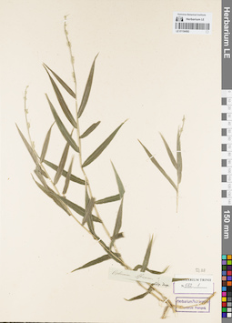
LE 01154592
Groups of specimens: Гербарий Карла Бернхарда Триниуса; Соглашение Минобрнауки №075-15-2021-1056Record creation: 2021-12-02, Marina Yarichina, PhotoScan D2Citation: Specimen LE 01154592 // Virtual herbarium of Komarov Botanical Institute RAS — http://re.herbariumle.ru/01154592
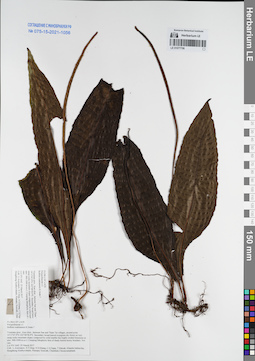
LE 01077706
Bolbitis tonkinensis K.Iwats. ⟮prelim. ID⟯ det. Averyanov, Leonid Vladimirovich at 25.03.2017
Collectors: Averyanov, Leonid Vladimirovich; Tien Hiep Nguyen; Khang Sinh Nguyen; et al. Field collecting number: LA-VN1642. Collection date: 25.03.2017. Administrative regions: LA - Vientiane Province. Groups of specimens: L. V. Averyanov specimens; L. V. Averyanov herbarium; Соглашение Минобрнауки №075-15-2021-1056Original label text:FLORA OF LAOS
Polypodiaceae s.l.
Bolbitis tonkinensis K.Iwats.?
Vientiane prov., Kasi distr., between San and Tham Tai villages, around point 19°17′47.9′'N 102°08′58.9′'E.
Secondary broad-leaved evergreen dry forest on very steep rocky mountain slopes composed by solid marble like highly eroded limestone at elev. 900-1000 m a.s.l.
Creeping lithophytic fern of shady humid mossy boulders. Not rare.
LA-VN 1642 25 March 2017
Coll.: L.Averyanov, N.T.Hiep, N.S.Khang, C.Q.Ngan, T.Maisak, Khamla Inkhavilay, Hongthong Southyvohanh, Pinmany Sisavath, Chanthala Cheuaysamphanh.
Coordinates (geographic position): 19° 17′ 47.9″ N, 102° 8′ 58.9″ E ±1000 mRecord creation: 2021-12-02, Tatiana Maisak, PhotoScan D2Citation: Specimen LE 01077706 // Virtual herbarium of Komarov Botanical Institute RAS — http://re.herbariumle.ru/01077706Polypodiaceae s.l.
Bolbitis tonkinensis K.Iwats.?
Vientiane prov., Kasi distr., between San and Tham Tai villages, around point 19°17′47.9′'N 102°08′58.9′'E.
Secondary broad-leaved evergreen dry forest on very steep rocky mountain slopes composed by solid marble like highly eroded limestone at elev. 900-1000 m a.s.l.
Creeping lithophytic fern of shady humid mossy boulders. Not rare.
LA-VN 1642 25 March 2017
Coll.: L.Averyanov, N.T.Hiep, N.S.Khang, C.Q.Ngan, T.Maisak, Khamla Inkhavilay, Hongthong Southyvohanh, Pinmany Sisavath, Chanthala Cheuaysamphanh.
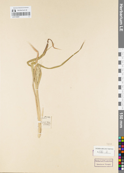
LE 01154591
Groups of specimens: Гербарий Карла Бернхарда Триниуса; Соглашение Минобрнауки №075-15-2021-1056Record creation: 2021-12-02, Marina Yarichina, PhotoScan D2Citation: Specimen LE 01154591 // Virtual herbarium of Komarov Botanical Institute RAS — http://re.herbariumle.ru/01154591
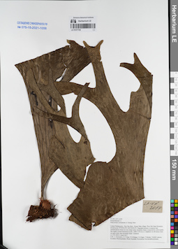
LE 01077705
Platycerium coronarium (J. Koenig ex O. F. Müll.) Desv. det. Averyanov, Leonid Vladimirovich at 04.04.2017
Collectors: Averyanov, Leonid Vladimirovich; Tien Hiep Nguyen; Khang Sinh Nguyen; et al. Field collecting number: LA-VN2054. Collection date: 04.04.2017. Administrative regions: LA - Luang Prabang Province. Groups of specimens: L. V. Averyanov specimens; L. V. Averyanov herbarium; Соглашение Минобрнауки №075-15-2021-1056Original label text:FLORA OF LAOS
Polypodiaceae s.l.
Platycerium coronarium (J. Kцnig) Desv.
Luang Prabang prov., Pon Xay distr., Houay Man village, Phou Pak Sang Mountain, around point 19°59′03.8′'N 102°25′09.0′'E.
Degraded primary evergreen and semideciduous forest on very steep rocky mountain slopes composed by solid marble like highly eroded limestone at elev. 1000-1150 m a.s.l. Epiphyte on old mossy trees on open rocky step mountain slope. Common.
LA-VN 2054 4 April 2017
Coll.: L.Averyanov, N.T.Hiep, N.S.Khang, C.Q.Ngan, T.Maisak, Vichith Lamxay, Koudkeo Phommachanh, Phizar Sayalath, Keooudone Souvannakhoummane.
Coordinates (geographic position): 19° 59′ 3.8″ N, 102° 25′ 9″ E ±1000 mRecord creation: 2021-12-02, Tatiana Maisak, PhotoScan D2Citation: Specimen LE 01077705 // Virtual herbarium of Komarov Botanical Institute RAS — http://re.herbariumle.ru/01077705Polypodiaceae s.l.
Platycerium coronarium (J. Kцnig) Desv.
Luang Prabang prov., Pon Xay distr., Houay Man village, Phou Pak Sang Mountain, around point 19°59′03.8′'N 102°25′09.0′'E.
Degraded primary evergreen and semideciduous forest on very steep rocky mountain slopes composed by solid marble like highly eroded limestone at elev. 1000-1150 m a.s.l. Epiphyte on old mossy trees on open rocky step mountain slope. Common.
LA-VN 2054 4 April 2017
Coll.: L.Averyanov, N.T.Hiep, N.S.Khang, C.Q.Ngan, T.Maisak, Vichith Lamxay, Koudkeo Phommachanh, Phizar Sayalath, Keooudone Souvannakhoummane.
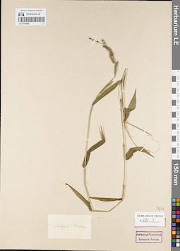
LE 01154590
Groups of specimens: Гербарий Карла Бернхарда Триниуса; Соглашение Минобрнауки №075-15-2021-1056Record creation: 2021-12-02, Marina Yarichina, PhotoScan D2Citation: Specimen LE 01154590 // Virtual herbarium of Komarov Botanical Institute RAS — http://re.herbariumle.ru/01154590
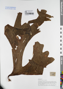
LE 01077704
Platycerium coronarium (J. Koenig ex O. F. Müll.) Desv. det. Averyanov, Leonid Vladimirovich at 02.04.2017
Collectors: Averyanov, Leonid Vladimirovich; Tien Hiep Nguyen; Khang Sinh Nguyen; et al. Field collecting number: LA-VN1995. Collection date: 02.04.2017. Administrative regions: LA - Luang Prabang Province. Groups of specimens: L. V. Averyanov specimens; L. V. Averyanov herbarium; Соглашение Минобрнауки №075-15-2021-1056Original label text:FLORA OF LAOS
Coordinates (geographic position): 20° 31′ 36.9″ N, 102° 35′ 15.8″ E ±1000 mRecord creation: 2021-12-02, Tatiana Maisak, PhotoScan D2Citation: Specimen LE 01077704 // Virtual herbarium of Komarov Botanical Institute RAS — http://re.herbariumle.ru/01077704Polypodiaceae s.l.
Platycerium coronarium (J. Kцnig) Desv.
Luang Prabang prov., Ngoy distr., Don Khun village, near waterfall, around point 20°31′36.9′'N 102°35′15.8′'E.
Remnants of primary evergreen forest on very steep rocky mountain slopes composed by solid marble like highly eroded limestone at elev. 450-550 m a.s.l. along mountain stream.
Epiphyte on tall trees. Very common.
LA-VN 1995 2 April 2017
Coll.: L.Averyanov, N.T.Hiep, N.S.Khang, C.Q.Ngan, T.Maisak, Vichith Lamxay, Koudkeo Phommachanh, Phizar Sayalath, Keooudone Souvannakhoummane.
Platycerium coronarium (J. Kцnig) Desv.
Luang Prabang prov., Ngoy distr., Don Khun village, near waterfall, around point 20°31′36.9′'N 102°35′15.8′'E.
Remnants of primary evergreen forest on very steep rocky mountain slopes composed by solid marble like highly eroded limestone at elev. 450-550 m a.s.l. along mountain stream.
Epiphyte on tall trees. Very common.
LA-VN 1995 2 April 2017
Coll.: L.Averyanov, N.T.Hiep, N.S.Khang, C.Q.Ngan, T.Maisak, Vichith Lamxay, Koudkeo Phommachanh, Phizar Sayalath, Keooudone Souvannakhoummane.
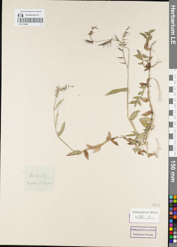
LE 01154589
Groups of specimens: Гербарий Карла Бернхарда Триниуса; Соглашение Минобрнауки №075-15-2021-1056Record creation: 2021-12-02, Marina Yarichina, PhotoScan D2Citation: Specimen LE 01154589 // Virtual herbarium of Komarov Botanical Institute RAS — http://re.herbariumle.ru/01154589
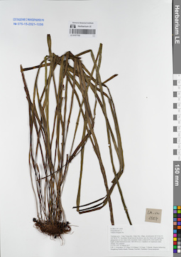
LE 01077703
Vittaria elongata Sw. det. Averyanov, Leonid Vladimirovich at 23.03.2017
Collectors: Averyanov, Leonid Vladimirovich; Tien Hiep Nguyen; Khang Sinh Nguyen; et al. Field collecting number: LA-VN1557. Collection date: 23.03.2017. Administrative regions: LA - Vientiane Province. Groups of specimens: L. V. Averyanov specimens; L. V. Averyanov herbarium; Соглашение Минобрнауки №075-15-2021-1056Original label text:FLORA OF LAOS
Polypodiaceae s.l.
Vittaria elongata Sw.
Vientiane prov., Vang Vieng distr., Khan Mac village, around point 18°51′26.4′'N 102°28′36.7′'E.
Secondary broad-leaved deciduous open dry forest with Euphorbia antiquorum on very steep rocky mountain slopes composed by solid marble like highly eroded limestone at elev. 400-500 m a.s.l.
Epiphyte on Asplenium nidus clumps. Not common.
LA-VN 1557 23 March 2017
Coll.: L.Averyanov, N.T.Hiep, N.S.Khang, C.Q.Ngan, T.Maisak, Khamla Inkhavilay, Hongthong Southyvohanh, Pinmany Sisavath, Chanthala Cheuaysamphanh.
Coordinates (geographic position): 18° 51′ 26.4″ N, 102° 28′ 36.7″ E ±1000 mRecord creation: 2021-12-02, Tatiana Maisak, PhotoScan D2Citation: Specimen LE 01077703 // Virtual herbarium of Komarov Botanical Institute RAS — http://re.herbariumle.ru/01077703Polypodiaceae s.l.
Vittaria elongata Sw.
Vientiane prov., Vang Vieng distr., Khan Mac village, around point 18°51′26.4′'N 102°28′36.7′'E.
Secondary broad-leaved deciduous open dry forest with Euphorbia antiquorum on very steep rocky mountain slopes composed by solid marble like highly eroded limestone at elev. 400-500 m a.s.l.
Epiphyte on Asplenium nidus clumps. Not common.
LA-VN 1557 23 March 2017
Coll.: L.Averyanov, N.T.Hiep, N.S.Khang, C.Q.Ngan, T.Maisak, Khamla Inkhavilay, Hongthong Southyvohanh, Pinmany Sisavath, Chanthala Cheuaysamphanh.
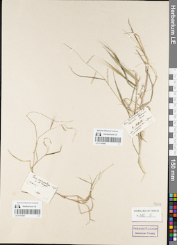
LE 01154588
Groups of specimens: Гербарий Карла Бернхарда Триниуса; Соглашение Минобрнауки №075-15-2021-1056Record creation: 2021-12-02, Marina Yarichina, PhotoScan D2Citation: Specimen LE 01154588 // Virtual herbarium of Komarov Botanical Institute RAS — http://re.herbariumle.ru/01154588
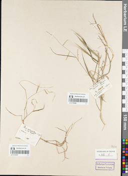
LE 01154587
Groups of specimens: Гербарий Карла Бернхарда Триниуса; Соглашение Минобрнауки №075-15-2021-1056Record creation: 2021-12-02, Marina Yarichina, PhotoScan D2Citation: Specimen LE 01154587 // Virtual herbarium of Komarov Botanical Institute RAS — http://re.herbariumle.ru/01154587
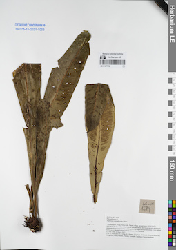
LE 01077702
Asplenium antrophyoides Christ det. Averyanov, Leonid Vladimirovich at 23.03.2017
Collectors: Averyanov, Leonid Vladimirovich; Tien Hiep Nguyen; Khang Sinh Nguyen; et al. Field collecting number: LA-VN1594. Collection date: 23.03.2017. Administrative regions: LA - Vientiane Province. Groups of specimens: L. V. Averyanov specimens; L. V. Averyanov herbarium; Соглашение Минобрнауки №075-15-2021-1056Original label text:FLORA OF LAOS
Polypodiaceae s.l.
Asplenium antrophyoides Christ
Vientiane prov., Vang Vieng distr., Patang village, around point 19°04′15.6′'N 102°24′33.2′'E.
Secondary broad-leaved semi-deciduous dry forest on very steep rocky mountain slopes composed by solid marble like highly eroded limestone at elev. about 670 m a.s.l.
Lithophytic fern in shady places. Very common.
LA-VN 1594 23 March 2017
Coll.: L.Averyanov, N.T.Hiep, N.S.Khang, C.Q.Ngan, T.Maisak, Khamla Inkhavilay, Hongthong Southyvohanh, Pinmany Sisavath, Chanthala Cheuaysamphanh.
Coordinates (geographic position): 19° 4′ 15.6″ N, 102° 24′ 33.2″ E ±1000 mRecord creation: 2021-12-02, Tatiana Maisak, PhotoScan D2Citation: Specimen LE 01077702 // Virtual herbarium of Komarov Botanical Institute RAS — http://re.herbariumle.ru/01077702Polypodiaceae s.l.
Asplenium antrophyoides Christ
Vientiane prov., Vang Vieng distr., Patang village, around point 19°04′15.6′'N 102°24′33.2′'E.
Secondary broad-leaved semi-deciduous dry forest on very steep rocky mountain slopes composed by solid marble like highly eroded limestone at elev. about 670 m a.s.l.
Lithophytic fern in shady places. Very common.
LA-VN 1594 23 March 2017
Coll.: L.Averyanov, N.T.Hiep, N.S.Khang, C.Q.Ngan, T.Maisak, Khamla Inkhavilay, Hongthong Southyvohanh, Pinmany Sisavath, Chanthala Cheuaysamphanh.
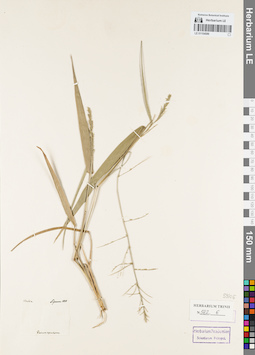
LE 01154586
Groups of specimens: Гербарий Карла Бернхарда Триниуса; Соглашение Минобрнауки №075-15-2021-1056Record creation: 2021-12-02, Marina Yarichina, PhotoScan D2Citation: Specimen LE 01154586 // Virtual herbarium of Komarov Botanical Institute RAS — http://re.herbariumle.ru/01154586
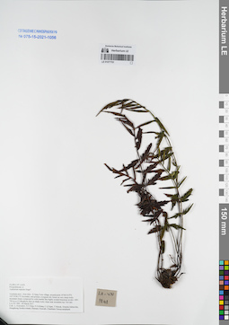
LE 01077701
Asplenium rupestre Hope ⟮prelim. ID⟯ det. Averyanov, Leonid Vladimirovich at 28.03.2017
Collectors: Averyanov, Leonid Vladimirovich; Tien Hiep Nguyen; Khang Sinh Nguyen; et al. Field collecting number: LA-VN1944. Collection date: 28.03.2017. Administrative regions: LA - Vientiane Province. Groups of specimens: L. V. Averyanov specimens; L. V. Averyanov herbarium; Соглашение Минобрнауки №075-15-2021-1056Original label text:FLORA OF LAOS
Polypodiaceae s.l.
Asplenium rupestre Hope?
Vientiane prov., Kasi distr., Si Sang Vone village, around point 19°06′10.9′'N 102°10′46.1′'E.
Secondary and primary evergreen dry forest on very steep rocky mountain slopes composed by solid marble like highly eroded limestone at elev. 600-750 m a.s.l.
Lithophytic fern on shady rocky slope near mountain top. Not rare.
LA-VN 1841 28 March 2017
Coll.: L.Averyanov, N.T.Hiep, N.S.Khang, C.Q.Ngan, T.Maisak, Khamla Inkhavilay, Hongthong Southyvohanh, Pinmany Sisavath, Chanthala Cheuaysamphanh.
Coordinates (geographic position): 19° 6′ 10.9″ N, 102° 10′ 46.1″ E ±1000 mRecord creation: 2021-12-02, Tatiana Maisak, PhotoScan D2Citation: Specimen LE 01077701 // Virtual herbarium of Komarov Botanical Institute RAS — http://re.herbariumle.ru/01077701Polypodiaceae s.l.
Asplenium rupestre Hope?
Vientiane prov., Kasi distr., Si Sang Vone village, around point 19°06′10.9′'N 102°10′46.1′'E.
Secondary and primary evergreen dry forest on very steep rocky mountain slopes composed by solid marble like highly eroded limestone at elev. 600-750 m a.s.l.
Lithophytic fern on shady rocky slope near mountain top. Not rare.
LA-VN 1841 28 March 2017
Coll.: L.Averyanov, N.T.Hiep, N.S.Khang, C.Q.Ngan, T.Maisak, Khamla Inkhavilay, Hongthong Southyvohanh, Pinmany Sisavath, Chanthala Cheuaysamphanh.
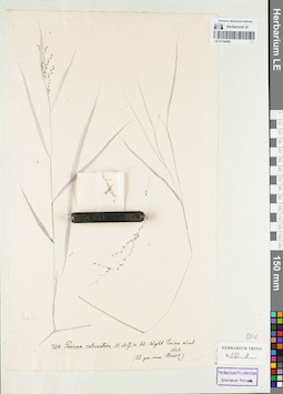
LE 01154585
Groups of specimens: Гербарий Карла Бернхарда Триниуса; Соглашение Минобрнауки №075-15-2021-1056Record creation: 2021-12-02, Marina Yarichina, PhotoScan D2Citation: Specimen LE 01154585 // Virtual herbarium of Komarov Botanical Institute RAS — http://re.herbariumle.ru/01154585
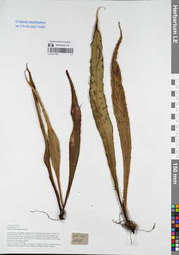
LE 01077700
Asplenium antrophyoides Christ det. Averyanov, Leonid Vladimirovich at 27.03.2017
Collectors: Averyanov, Leonid Vladimirovich; Tien Hiep Nguyen; Khang Sinh Nguyen; et al. Field collecting number: LA-VN1756. Collection date: 27.03.2017. Administrative regions: LA - Vientiane Province. Groups of specimens: L. V. Averyanov specimens; L. V. Averyanov herbarium; Соглашение Минобрнауки №075-15-2021-1056Original label text:FLORA OF LAOS
Polypodiaceae s.l.
Asplenium antrophyoides Christ
Vientiane prov., Kasi distr., between Pa Chao and Nam Ken villages, Pa Chao Mt., around point 19°19′35.5′'N 102°22′57.7′'E.
Secondary broad-leaved evergreen dry forest on very steep rocky mountain slopes composed by solid marble like highly eroded limestone at elev. 1100-1200 m a.s.l.
Lithophytic and epiphytic fern on rather open steep rocky slope. Common.
LA-VN 1756 27 March 2017
Coll.: L.Averyanov, N.T.Hiep, N.S.Khang, C.Q.Ngan, T.Maisak, Khamla Inkhavilay, Hongthong Southyvohanh, Pinmany Sisavath, Chanthala Cheuaysamphanh.
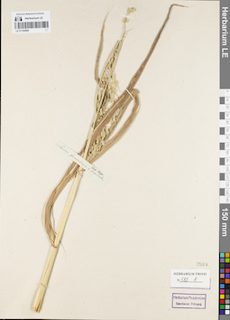
LE 01154584
Groups of specimens: Гербарий Карла Бернхарда Триниуса; Соглашение Минобрнауки №075-15-2021-1056Record creation: 2021-12-02, Marina Yarichina, PhotoScan D2Citation: Specimen LE 01154584 // Virtual herbarium of Komarov Botanical Institute RAS — http://re.herbariumle.ru/01154584
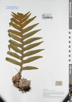
LE 01077699
Pseudodrynaria coronans (Wall. ex Mett.) Ching det. Averyanov, Leonid Vladimirovich at 31.03.2017
Collectors: Averyanov, Leonid Vladimirovich; Tien Hiep Nguyen; Khang Sinh Nguyen; et al. Field collecting number: LA-VN1944. Collection date: 31.03.2017. Administrative regions: LA - Luang Prabang Province. Groups of specimens: L. V. Averyanov specimens; L. V. Averyanov herbarium; Соглашение Минобрнауки №075-15-2021-1056Original label text:FLORA OF LAOS
Polypodiaceae s.l.
Pseudodrynaria coronans (Wall. ex Mett.) Ching
Luang Prabang prov., Ngoy distr., Nong Khiew village, Ta Nang Non Mountain around point 20°33′29.2″N 102°36′54.5″E.
Secondary semideciduous and evergreen dry forest on very steep rocky mountain slopes composed by solid marble like highly eroded limestone at elev. 600-650 m a.s.l.
Epiphyte and lithophyte on mossy rocky mountain tops. Common.
LA-VN 1944 31 March 2017
Coll.: L.Averyanov, N.T.Hiep, N.S.Khang, C.Q.Ngan, T.Maisak, Vichith Lamxay, Koudkeo Phommachanh, Phizar Sayalath, Keooudone Souvannakhoummane.
Coordinates (geographic position): 20° 33′ 29.2″ N, 102° 36′ 54.5″ E ±1000 mRecord creation: 2021-12-02, Tatiana Maisak, PhotoScan D2Citation: Specimen LE 01077699 // Virtual herbarium of Komarov Botanical Institute RAS — http://re.herbariumle.ru/01077699Polypodiaceae s.l.
Pseudodrynaria coronans (Wall. ex Mett.) Ching
Luang Prabang prov., Ngoy distr., Nong Khiew village, Ta Nang Non Mountain around point 20°33′29.2″N 102°36′54.5″E.
Secondary semideciduous and evergreen dry forest on very steep rocky mountain slopes composed by solid marble like highly eroded limestone at elev. 600-650 m a.s.l.
Epiphyte and lithophyte on mossy rocky mountain tops. Common.
LA-VN 1944 31 March 2017
Coll.: L.Averyanov, N.T.Hiep, N.S.Khang, C.Q.Ngan, T.Maisak, Vichith Lamxay, Koudkeo Phommachanh, Phizar Sayalath, Keooudone Souvannakhoummane.
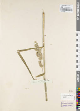
LE 01154583
Groups of specimens: Гербарий Карла Бернхарда Триниуса; Соглашение Минобрнауки №075-15-2021-1056Record creation: 2021-12-02, Marina Yarichina, PhotoScan D2Citation: Specimen LE 01154583 // Virtual herbarium of Komarov Botanical Institute RAS — http://re.herbariumle.ru/01154583
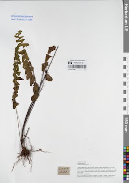
LE 01077698
Adiantum flabellulatum L. ⟮prelim. ID⟯ det. Averyanov, Leonid Vladimirovich at 06.04.2017
Collectors: Averyanov, Leonid Vladimirovich; Tien Hiep Nguyen; Khang Sinh Nguyen; et al. Field collecting number: LA-VN2188. Collection date: 06.04.2017. Administrative regions: LA - Luang Prabang Province. Groups of specimens: L. V. Averyanov specimens; L. V. Averyanov herbarium; Соглашение Минобрнауки №075-15-2021-1056Original label text:FLORA OF LAOS
Coordinates (geographic position): 19° 57′ 23.5″ N, 102° 26′ 16.4″ E ±1000 mRecord creation: 2021-12-02, Tatiana Maisak, PhotoScan D2Citation: Specimen LE 01077698 // Virtual herbarium of Komarov Botanical Institute RAS — http://re.herbariumle.ru/01077698Polypodiaceae s.l. (Adiantaceae)
Adiantum flabellulatum L.?
Luang Prabang prov., Pon Xay distr., Nam Bo village, around point 19°57′23.5′'N 102°26′16.4′'E.
Degraded primary evergreen and semideciduous forest on very steep rocky mountain slopes composed by solid marble like highly eroded limestone at elev. 650-750 m a.s.l.
LA-VN 2188 6 April 2017
Coll.: L.Averyanov, N.T.Hiep, N.S.Khang, C.Q.Ngan, T.Maisak, Vichith Lamxay, Koudkeo Phommachanh, Phizar Sayalath, Keooudone Souvannakhoummane.
Adiantum flabellulatum L.?
Luang Prabang prov., Pon Xay distr., Nam Bo village, around point 19°57′23.5′'N 102°26′16.4′'E.
Degraded primary evergreen and semideciduous forest on very steep rocky mountain slopes composed by solid marble like highly eroded limestone at elev. 650-750 m a.s.l.
LA-VN 2188 6 April 2017
Coll.: L.Averyanov, N.T.Hiep, N.S.Khang, C.Q.Ngan, T.Maisak, Vichith Lamxay, Koudkeo Phommachanh, Phizar Sayalath, Keooudone Souvannakhoummane.
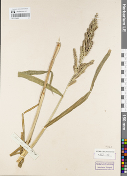
LE 01154582
Groups of specimens: Гербарий Карла Бернхарда Триниуса; Соглашение Минобрнауки №075-15-2021-1056Record creation: 2021-12-02, Marina Yarichina, PhotoScan D2Citation: Specimen LE 01154582 // Virtual herbarium of Komarov Botanical Institute RAS — http://re.herbariumle.ru/01154582
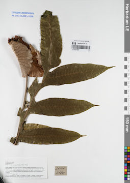
LE 01077697
Pseudodrynaria coronans (Wall. ex Mett.) Ching det. Averyanov, Leonid Vladimirovich at 06.04.2017
Collectors: Averyanov, Leonid Vladimirovich; Tien Hiep Nguyen; Khang Sinh Nguyen; et al. Field collecting number: LA-VN2170. Collection date: 06.04.2017. Administrative regions: LA - Luang Prabang Province. Groups of specimens: L. V. Averyanov specimens; L. V. Averyanov herbarium; Соглашение Минобрнауки №075-15-2021-1056Original label text:FLORA OF LAOS
Polypodiaceae s.l.
Pseudodrynaria coronans (Wall. ex Mett.) Ching
Luang Prabang prov., Pon Xay distr., Nam Bo village, around point 19°57′23.5′'N 102°26′16.4′'E.
Degraded primary evergreen and semideciduous forest on very steep rocky mountain slopes composed by solid marble like highly eroded limestone at elev. 650-750 m a.s.l.
Creeping epiphyte and lithophyte on mossy rocky mountain top. Common.
LA-VN 2170 6 April 2017
Coll.: L.Averyanov, N.T.Hiep, N.S.Khang, C.Q.Ngan, T.Maisak, Vichith Lamxay, Koudkeo Phommachanh, Phizar Sayalath, Keooudone Souvannakhoummane.
Coordinates (geographic position): 19° 57′ 23.5″ N, 102° 26′ 16.4″ E ±1000 mRecord creation: 2021-12-02, Tatiana Maisak, PhotoScan D2Citation: Specimen LE 01077697 // Virtual herbarium of Komarov Botanical Institute RAS — http://re.herbariumle.ru/01077697Polypodiaceae s.l.
Pseudodrynaria coronans (Wall. ex Mett.) Ching
Luang Prabang prov., Pon Xay distr., Nam Bo village, around point 19°57′23.5′'N 102°26′16.4′'E.
Degraded primary evergreen and semideciduous forest on very steep rocky mountain slopes composed by solid marble like highly eroded limestone at elev. 650-750 m a.s.l.
Creeping epiphyte and lithophyte on mossy rocky mountain top. Common.
LA-VN 2170 6 April 2017
Coll.: L.Averyanov, N.T.Hiep, N.S.Khang, C.Q.Ngan, T.Maisak, Vichith Lamxay, Koudkeo Phommachanh, Phizar Sayalath, Keooudone Souvannakhoummane.
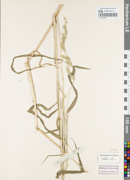
LE 01154581
Groups of specimens: Гербарий Карла Бернхарда Триниуса; Соглашение Минобрнауки №075-15-2021-1056Record creation: 2021-12-02, Marina Yarichina, PhotoScan D2Citation: Specimen LE 01154581 // Virtual herbarium of Komarov Botanical Institute RAS — http://re.herbariumle.ru/01154581
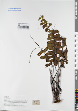
LE 01077696
Adiantum flabellulatum L. ⟮prelim. ID⟯ det. Averyanov, Leonid Vladimirovich at 05.04.2017
Collectors: Averyanov, Leonid Vladimirovich; Tien Hiep Nguyen; Khang Sinh Nguyen; et al. Field collecting number: LA-VN2140. Collection date: 05.04.2017. Administrative regions: LA - Luang Prabang Province. Groups of specimens: L. V. Averyanov specimens; L. V. Averyanov herbarium; Соглашение Минобрнауки №075-15-2021-1056Original label text:FLORA OF LAOS
Polypodiaceae s.l.
Adiantum flabellulatum L.?
Luang Prabang prov., Pon Xay distr., along the way to Bane Phou Souong village, Pha Hiua Bin Toc Mountain, around point 19°57′37.0′'N 102°25′03.0′'E.
Degraded primary evergreen and semideciduous forest on very steep rocky mountain slopes composed by solid marble like highly eroded limestone at elev. 600-850 m a.s.l.
Terrestrial fern on steep rocky mountain slope. Common.
LA-VN 2140 5 April 2017
Coll.: L.Averyanov, N.T.Hiep, N.S.Khang, C.Q.Ngan, T.Maisak, Vichith Lamxay, Koudkeo Phommachanh, Phizar Sayalath, Keooudone Souvannakhoummane.
Coordinates (geographic position): 19° 57′ 37″ N, 102° 25′ 3″ E ±1000 mRecord creation: 2021-12-02, Tatiana Maisak, PhotoScan D2Citation: Specimen LE 01077696 // Virtual herbarium of Komarov Botanical Institute RAS — http://re.herbariumle.ru/01077696Polypodiaceae s.l.
Adiantum flabellulatum L.?
Luang Prabang prov., Pon Xay distr., along the way to Bane Phou Souong village, Pha Hiua Bin Toc Mountain, around point 19°57′37.0′'N 102°25′03.0′'E.
Degraded primary evergreen and semideciduous forest on very steep rocky mountain slopes composed by solid marble like highly eroded limestone at elev. 600-850 m a.s.l.
Terrestrial fern on steep rocky mountain slope. Common.
LA-VN 2140 5 April 2017
Coll.: L.Averyanov, N.T.Hiep, N.S.Khang, C.Q.Ngan, T.Maisak, Vichith Lamxay, Koudkeo Phommachanh, Phizar Sayalath, Keooudone Souvannakhoummane.
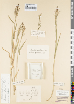
LE 01154580
Groups of specimens: Гербарий Карла Бернхарда Триниуса; Соглашение Минобрнауки №075-15-2021-1056Record creation: 2021-12-02, Marina Yarichina, PhotoScan D2Citation: Specimen LE 01154580 // Virtual herbarium of Komarov Botanical Institute RAS — http://re.herbariumle.ru/01154580
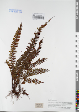
LE 01077695
Asplenium caudatum G.Forst. ⟮prelim. ID⟯ det. Averyanov, Leonid Vladimirovich at 05.04.2017
Collectors: Averyanov, Leonid Vladimirovich; Tien Hiep Nguyen; Khang Sinh Nguyen; et al. Field collecting number: LA-VN2138. Collection date: 05.04.2017. Administrative regions: LA - Luang Prabang Province. Groups of specimens: L. V. Averyanov specimens; L. V. Averyanov herbarium; Соглашение Минобрнауки №075-15-2021-1056Original label text:FLORA OF LAOS
Polypodiaceae s.l.
Asplenium caudatum G. Forst.?
Luang Prabang prov., Pon Xay distr., along the way to Bane Phou Souong village, Pha Hiua Bin Toc Mountain, around point 19°57′37.0′'N 102°25′03.0′'E.
Degraded primary evergreen and semideciduous forest on very steep rocky mountain slopes composed by solid marble like highly eroded limestone at elev. 600-850 m a.s.l.
Terrestrial and lithophytic fern on steep rocky mountain slope. Very common.
LA-VN 2138 5 April 2017
Coll.: L.Averyanov, N.T.Hiep, N.S.Khang, C.Q.Ngan, T.Maisak, Vichith Lamxay, Koudkeo Phommachanh, Phizar Sayalath, Keooudone Souvannakhoummane.
Coordinates (geographic position): 19° 57′ 37″ N, 102° 25′ 3″ E ±1000 mRecord creation: 2021-12-02, Tatiana Maisak, PhotoScan D2Citation: Specimen LE 01077695 // Virtual herbarium of Komarov Botanical Institute RAS — http://re.herbariumle.ru/01077695Polypodiaceae s.l.
Asplenium caudatum G. Forst.?
Luang Prabang prov., Pon Xay distr., along the way to Bane Phou Souong village, Pha Hiua Bin Toc Mountain, around point 19°57′37.0′'N 102°25′03.0′'E.
Degraded primary evergreen and semideciduous forest on very steep rocky mountain slopes composed by solid marble like highly eroded limestone at elev. 600-850 m a.s.l.
Terrestrial and lithophytic fern on steep rocky mountain slope. Very common.
LA-VN 2138 5 April 2017
Coll.: L.Averyanov, N.T.Hiep, N.S.Khang, C.Q.Ngan, T.Maisak, Vichith Lamxay, Koudkeo Phommachanh, Phizar Sayalath, Keooudone Souvannakhoummane.
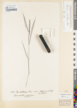
LE 01154579
Groups of specimens: Гербарий Карла Бернхарда Триниуса; Соглашение Минобрнауки №075-15-2021-1056Record creation: 2021-12-02, Marina Yarichina, PhotoScan D2Citation: Specimen LE 01154579 // Virtual herbarium of Komarov Botanical Institute RAS — http://re.herbariumle.ru/01154579
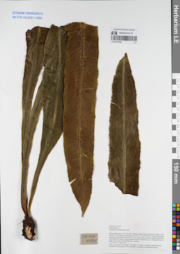
LE 01077694
Asplenium antrophyoides Christ det. Averyanov, Leonid Vladimirovich at 05.04.2017
Collectors: Averyanov, Leonid Vladimirovich; Tien Hiep Nguyen; Khang Sinh Nguyen; et al. Field collecting number: LA-VN2131. Collection date: 05.04.2017. Administrative regions: LA - Luang Prabang Province. Groups of specimens: L. V. Averyanov specimens; L. V. Averyanov herbarium; Соглашение Минобрнауки №075-15-2021-1056Original label text:FLORA OF LAOS
Polypodiaceae s.l.
Asplenium antrophyoides Christ
Luang Prabang prov., Pon Xay distr., between Houay Man and Nam Bo villages, Phou Hua Ben Toc Mountain, around point 19°57′33.1′'N 102°25′25.8′'E.
Degraded primary evergreen and semideciduous forest on very steep rocky mountain slopes composed by solid marble like highly eroded limestone at elev. 500-650 m a.s.l.
Lithophytic fern in shady rocky slope near mountain top. Common.
LA-VN 2131 5 April 2017
Coll.: L.Averyanov, N.T.Hiep, N.S.Khang, C.Q.Ngan, T.Maisak, Vichith Lamxay, Koudkeo Phommachanh, Phizar Sayalath, Keooudone Souvannakhoummane.
Coordinates (geographic position): 19° 57′ 33.1″ N, 102° 25′ 25.8″ E ±1000 mRecord creation: 2021-12-02, Tatiana Maisak, PhotoScan D2Citation: Specimen LE 01077694 // Virtual herbarium of Komarov Botanical Institute RAS — http://re.herbariumle.ru/01077694Polypodiaceae s.l.
Asplenium antrophyoides Christ
Luang Prabang prov., Pon Xay distr., between Houay Man and Nam Bo villages, Phou Hua Ben Toc Mountain, around point 19°57′33.1′'N 102°25′25.8′'E.
Degraded primary evergreen and semideciduous forest on very steep rocky mountain slopes composed by solid marble like highly eroded limestone at elev. 500-650 m a.s.l.
Lithophytic fern in shady rocky slope near mountain top. Common.
LA-VN 2131 5 April 2017
Coll.: L.Averyanov, N.T.Hiep, N.S.Khang, C.Q.Ngan, T.Maisak, Vichith Lamxay, Koudkeo Phommachanh, Phizar Sayalath, Keooudone Souvannakhoummane.
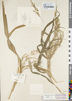
LE 01154578
Groups of specimens: Гербарий Карла Бернхарда Триниуса; Соглашение Минобрнауки №075-15-2021-1056Record creation: 2021-12-02, Marina Yarichina, PhotoScan D2Citation: Specimen LE 01154578 // Virtual herbarium of Komarov Botanical Institute RAS — http://re.herbariumle.ru/01154578
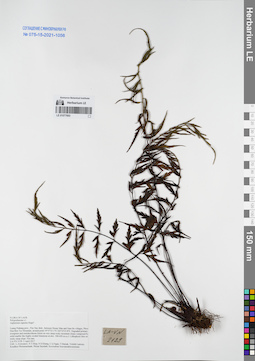
LE 01077693
Asplenium rupestre Hope ⟮prelim. ID⟯ det. Averyanov, Leonid Vladimirovich at 05.04.2017
Collectors: Averyanov, Leonid Vladimirovich; Tien Hiep Nguyen; Khang Sinh Nguyen; et al. Field collecting number: LA-VN2129. Collection date: 05.04.2017. Administrative regions: LA - Luang Prabang Province. Groups of specimens: L. V. Averyanov specimens; L. V. Averyanov herbarium; Соглашение Минобрнауки №075-15-2021-1056Original label text:FLORA OF LAOS
Polypodiaceae s.l.
Coordinates (geographic position): 19° 57′ 33.1″ N, 102° 25′ 25.8″ E ±1000 mRecord creation: 2021-12-02, Tatiana Maisak, PhotoScan D2Citation: Specimen LE 01077693 // Virtual herbarium of Komarov Botanical Institute RAS — http://re.herbariumle.ru/01077693Polypodiaceae s.l.
Asplenium rupestre Hope?
Luang Prabang prov., Pon Xay distr., between Houay Man and Nam Bo villages, Phou Hua Ben Toc Mountain, around point 19°57′33.1′'N 102°25′25.8′'E.
Degraded primary evergreen and semideciduous forest on very steep rocky mountain slopes composed by solid marble like highly eroded limestone at elev. 500-650 m a.s.l.
Lithophytic fern on rocky steep slope. Not rare.
LA-VN 2129 5 April 2017
Coll.: L.Averyanov, N.T.Hiep, N.S.Khang, C.Q.Ngan, T.Maisak, Vichith Lamxay, Koudkeo Phommachanh, Phizar Sayalath, Keooudone Souvannakhoummane.
Luang Prabang prov., Pon Xay distr., between Houay Man and Nam Bo villages, Phou Hua Ben Toc Mountain, around point 19°57′33.1′'N 102°25′25.8′'E.
Degraded primary evergreen and semideciduous forest on very steep rocky mountain slopes composed by solid marble like highly eroded limestone at elev. 500-650 m a.s.l.
Lithophytic fern on rocky steep slope. Not rare.
LA-VN 2129 5 April 2017
Coll.: L.Averyanov, N.T.Hiep, N.S.Khang, C.Q.Ngan, T.Maisak, Vichith Lamxay, Koudkeo Phommachanh, Phizar Sayalath, Keooudone Souvannakhoummane.
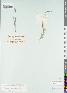
LE 01154577
Groups of specimens: Гербарий Карла Бернхарда Триниуса; Соглашение Минобрнауки №075-15-2021-1056Record creation: 2021-12-02, Marina Yarichina, PhotoScan D2Citation: Specimen LE 01154577 // Virtual herbarium of Komarov Botanical Institute RAS — http://re.herbariumle.ru/01154577
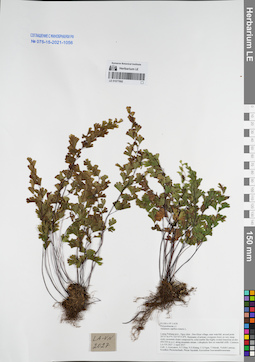
LE 01077692
Adiantum capillus-veneris L. det. Averyanov, Leonid Vladimirovich at 02.04.2017
Collectors: Averyanov, Leonid Vladimirovich; Tien Hiep Nguyen; Khang Sinh Nguyen; et al. Field collecting number: LA-VN2027. Collection date: 02.04.2017. Administrative regions: LA - Luang Prabang Province. Groups of specimens: L. V. Averyanov specimens; L. V. Averyanov herbarium; Соглашение Минобрнауки №075-15-2021-1056Original label text:FLORA OF LAOS
Polypodiaceae s.l.
Adiantum capillus-veneris L.
Luang Prabang prov., Ngoy distr., Don Khun village, near waterfall, around point 20°31′36.9′'N 102°35′15.8′'E.
Remnants of primary evergreen forest on very steep rocky mountain slopes composed by solid marble like highly eroded limestone at elev. 450-550 m a.s.l. along mountain stream.
Lithophytic fern on waterfall cliffs. Common.
LA-VN 2027 2 April 2017
Coll.: L.Averyanov, N.T.Hiep, N.S.Khang, C.Q.Ngan, T.Maisak, Vichith Lamxay, Koudkeo Phommachanh, Phizar Sayalath, Keooudone Souvannakhoummane.
Coordinates (geographic position): 20° 31′ 36.9″ N, 102° 35′ 15.8″ E ±1000 mRecord creation: 2021-12-02, Tatiana Maisak, PhotoScan D2Citation: Specimen LE 01077692 // Virtual herbarium of Komarov Botanical Institute RAS — http://re.herbariumle.ru/01077692Polypodiaceae s.l.
Adiantum capillus-veneris L.
Luang Prabang prov., Ngoy distr., Don Khun village, near waterfall, around point 20°31′36.9′'N 102°35′15.8′'E.
Remnants of primary evergreen forest on very steep rocky mountain slopes composed by solid marble like highly eroded limestone at elev. 450-550 m a.s.l. along mountain stream.
Lithophytic fern on waterfall cliffs. Common.
LA-VN 2027 2 April 2017
Coll.: L.Averyanov, N.T.Hiep, N.S.Khang, C.Q.Ngan, T.Maisak, Vichith Lamxay, Koudkeo Phommachanh, Phizar Sayalath, Keooudone Souvannakhoummane.
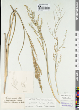
LE 01154576
Groups of specimens: Гербарий Карла Бернхарда Триниуса; Соглашение Минобрнауки №075-15-2021-1056Record creation: 2021-12-02, Marina Yarichina, PhotoScan D2Citation: Specimen LE 01154576 // Virtual herbarium of Komarov Botanical Institute RAS — http://re.herbariumle.ru/01154576
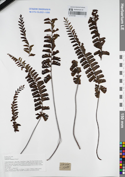
LE 01077691
Asplenium caudatum G.Forst. ⟮prelim. ID⟯ det. Averyanov, Leonid Vladimirovich at 31.03.2017
Collectors: Averyanov, Leonid Vladimirovich; Tien Hiep Nguyen; Khang Sinh Nguyen; et al. Field collecting number: LA-VN1893. Collection date: 31.03.2017. Administrative regions: LA - Luang Prabang Province. Groups of specimens: L. V. Averyanov specimens; L. V. Averyanov herbarium; Соглашение Минобрнауки №075-15-2021-1056Original label text:FLORA OF LAOS
Polypodiaceae
Asplenium caudatum G.Forst.?
Luang Prabang prov., Ngoy distr., Nong Khiew village, Pha Deng Mountain around point 20°34′14.3′'N 102°37′31.8′'E.
Secondary semideciduous and evergreen dry forest on very steep rocky mountain slopes composed by solid marble like highly eroded limestone at elev. 700-825 m a.s.l.
Terrestrial and lithophytic fern on mossy mountain top. Common.
LA-VN 1893 31 March 2017
Coll.: L.Averyanov, N.T.Hiep, N.S.Khang, C.Q.Ngan, T.Maisak, Vichith Lamxay, Koudkeo Phommachanh, Phizar Sayalath, Keooudone Souvannakhoummane.
Coordinates (geographic position): 20° 34′ 14.3″ N, 102° 37′ 31.8″ E ±1000 mRecord creation: 2021-12-02, Tatiana Maisak, PhotoScan D2Citation: Specimen LE 01077691 // Virtual herbarium of Komarov Botanical Institute RAS — http://re.herbariumle.ru/01077691Polypodiaceae
Asplenium caudatum G.Forst.?
Luang Prabang prov., Ngoy distr., Nong Khiew village, Pha Deng Mountain around point 20°34′14.3′'N 102°37′31.8′'E.
Secondary semideciduous and evergreen dry forest on very steep rocky mountain slopes composed by solid marble like highly eroded limestone at elev. 700-825 m a.s.l.
Terrestrial and lithophytic fern on mossy mountain top. Common.
LA-VN 1893 31 March 2017
Coll.: L.Averyanov, N.T.Hiep, N.S.Khang, C.Q.Ngan, T.Maisak, Vichith Lamxay, Koudkeo Phommachanh, Phizar Sayalath, Keooudone Souvannakhoummane.
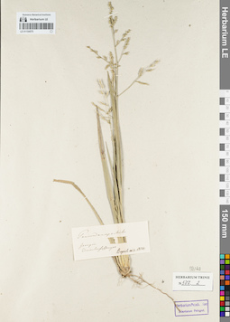
LE 01154575
Groups of specimens: Гербарий Карла Бернхарда Триниуса; Соглашение Минобрнауки №075-15-2021-1056Record creation: 2021-12-02, Marina Yarichina, PhotoScan D2Citation: Specimen LE 01154575 // Virtual herbarium of Komarov Botanical Institute RAS — http://re.herbariumle.ru/01154575
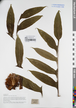
LE 01077690
Pseudodrynaria coronans (Wall. ex Mett.) Ching det. Averyanov, Leonid Vladimirovich at 27.03.2017
Collectors: Averyanov, Leonid Vladimirovich; Tien Hiep Nguyen; Khang Sinh Nguyen; et al. Field collecting number: LA-VN1753. Collection date: 27.03.2017. Administrative regions: LA - Vientiane Province. Groups of specimens: L. V. Averyanov specimens; L. V. Averyanov herbarium; Соглашение Минобрнауки №075-15-2021-1056Original label text:FLORA OF LAOS
Polypodiaceae s.l.
Pseudodrynaria coronans (Wall. ex Mett.) Ching
Vientiane prov., Kasi distr., between Pa Chao and Nam Ken villages, Pa Chao Mt., around point 19°19′35.5′'N 102°22′57.7′'E.
Secondary broad-leaved evergreen dry forest on very steep rocky mountain slopes composed by solid marble like highly eroded limestone at elev. 1100-1200 m a.s.l.
Epiphyte on mossy trees on shady steep rocky slope. Occasional.
LA-VN 1753 27 March 2017
Coll.: L.Averyanov, N.T.Hiep, N.S.Khang, C.Q.Ngan, T.Maisak, Khamla Inkhavilay, Hongthong Southyvohanh, Pinmany Sisavath, Chanthala Cheuaysamphanh.
Coordinates (geographic position): 19° 19′ 35.5″ N, 102° 22′ 57.7″ E ±1000 mRecord creation: 2021-12-02, Tatiana Maisak, PhotoScan D2Citation: Specimen LE 01077690 // Virtual herbarium of Komarov Botanical Institute RAS — http://re.herbariumle.ru/01077690Polypodiaceae s.l.
Pseudodrynaria coronans (Wall. ex Mett.) Ching
Vientiane prov., Kasi distr., between Pa Chao and Nam Ken villages, Pa Chao Mt., around point 19°19′35.5′'N 102°22′57.7′'E.
Secondary broad-leaved evergreen dry forest on very steep rocky mountain slopes composed by solid marble like highly eroded limestone at elev. 1100-1200 m a.s.l.
Epiphyte on mossy trees on shady steep rocky slope. Occasional.
LA-VN 1753 27 March 2017
Coll.: L.Averyanov, N.T.Hiep, N.S.Khang, C.Q.Ngan, T.Maisak, Khamla Inkhavilay, Hongthong Southyvohanh, Pinmany Sisavath, Chanthala Cheuaysamphanh.
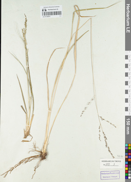
LE 01154574
Groups of specimens: Гербарий Карла Бернхарда Триниуса; Соглашение Минобрнауки №075-15-2021-1056Record creation: 2021-12-02, Marina Yarichina, PhotoScan D2Citation: Specimen LE 01154574 // Virtual herbarium of Komarov Botanical Institute RAS — http://re.herbariumle.ru/01154574
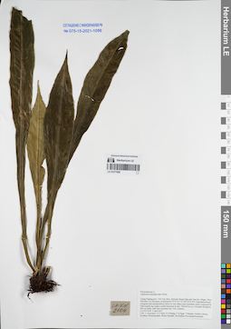
LE 01077689
Asplenium antrophyoides Christ det. Averyanov, Leonid Vladimirovich at 05.04.2017
Collectors: Averyanov, Leonid Vladimirovich; Tien Hiep Nguyen; Khang Sinh Nguyen; et al. Field collecting number: LA-VN2104. Collection date: 05.04.2017. Administrative regions: LA - Luang Prabang Province. Groups of specimens: L. V. Averyanov specimens; L. V. Averyanov herbarium; Соглашение Минобрнауки №075-15-2021-1056Original label text:FLORA OF LAOS
Polypodiaceae s.l.
Asplenium antrophyoides Christ
Luang Prabang prov., Pon Xay distr., between Houay Man and Nam Bo villages, Phou Hua Ben Toc Mountain, around point 19°57′33.1′'N 102°25′25.8′'E.
Degraded primary evergreen and semideciduous forest on very steep rocky mountain slopes composed by solid marble like highly eroded limestone at elev. 500-650 m a.s.l.
Rosulate lthophytic ferb on shady cliffs near mountain top. Very common.
LA-VN 2104 5 April 2017
Coll.: L.Averyanov, N.T.Hiep, N.S.Khang, C.Q.Ngan, T.Maisak, Vichith Lamxay, Koudkeo Phommachanh, Phizar Sayalath, Keooudone Souvannakhoummane.
Coordinates (geographic position): 19° 57′ 33.1″ N, 102° 25′ 25.8″ E ±1000 mRecord creation: 2021-12-02, Tatiana Maisak, PhotoScan D2Citation: Specimen LE 01077689 // Virtual herbarium of Komarov Botanical Institute RAS — http://re.herbariumle.ru/01077689Polypodiaceae s.l.
Asplenium antrophyoides Christ
Luang Prabang prov., Pon Xay distr., between Houay Man and Nam Bo villages, Phou Hua Ben Toc Mountain, around point 19°57′33.1′'N 102°25′25.8′'E.
Degraded primary evergreen and semideciduous forest on very steep rocky mountain slopes composed by solid marble like highly eroded limestone at elev. 500-650 m a.s.l.
Rosulate lthophytic ferb on shady cliffs near mountain top. Very common.
LA-VN 2104 5 April 2017
Coll.: L.Averyanov, N.T.Hiep, N.S.Khang, C.Q.Ngan, T.Maisak, Vichith Lamxay, Koudkeo Phommachanh, Phizar Sayalath, Keooudone Souvannakhoummane.
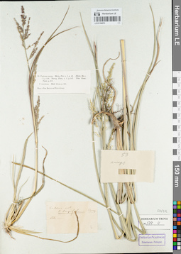
LE 01154573
Groups of specimens: Гербарий Карла Бернхарда Триниуса; Соглашение Минобрнауки №075-15-2021-1056Record creation: 2021-12-02, Marina Yarichina, PhotoScan D2Citation: Specimen LE 01154573 // Virtual herbarium of Komarov Botanical Institute RAS — http://re.herbariumle.ru/01154573
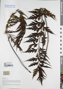
LE 01077688
Asplenium rupestre Hope ⟮prelim. ID⟯ det. Averyanov, Leonid Vladimirovich at 26.03.2017
Collectors: Averyanov, Leonid Vladimirovich; Tien Hiep Nguyen; Khang Sinh Nguyen; et al. Field collecting number: LA-VN1745. Collection date: 26.03.2017. Administrative regions: LA - Vientiane Province. Groups of specimens: L. V. Averyanov specimens; L. V. Averyanov herbarium; Соглашение Минобрнауки №075-15-2021-1056Original label text:FLORA OF LAOS
Polypodiaceae s.l.
Asplenium rupestre Hope?
Vientiane prov., Kasi distr., between Pa Chao and Nam Ken villages, Pa Chao Mt., around point 19°19′50.6′'N 102°21′20.5′'E.Secondary broad-leaved evergreen dry forest on very steep rocky mountain slopes composed by solid marble like highly eroded limestone at elev. 1000-1100 m a.s.l. Lithophytic fern on rocky steep slope. Not rare. LA-VN 1745 26 March 2017
Coll.: L.Averyanov, N.T.Hiep, N.S.Khang, C.Q.Ngan, T.Maisak, Khamla Inkhavilay, Hongthong Southyvohanh, Pinmany Sisavath, Chanthala Cheuaysamphanh.
Coordinates (geographic position): 19° 19′ 50.6″ N, 102° 21′ 20.5″ E ±1000 mRecord creation: 2021-12-02, Tatiana Maisak, PhotoScan D2. Processing status: work_status_1Citation: Specimen LE 01077688 // Virtual herbarium of Komarov Botanical Institute RAS — http://re.herbariumle.ru/01077688Polypodiaceae s.l.
Asplenium rupestre Hope?
Vientiane prov., Kasi distr., between Pa Chao and Nam Ken villages, Pa Chao Mt., around point 19°19′50.6′'N 102°21′20.5′'E.Secondary broad-leaved evergreen dry forest on very steep rocky mountain slopes composed by solid marble like highly eroded limestone at elev. 1000-1100 m a.s.l. Lithophytic fern on rocky steep slope. Not rare. LA-VN 1745 26 March 2017
Coll.: L.Averyanov, N.T.Hiep, N.S.Khang, C.Q.Ngan, T.Maisak, Khamla Inkhavilay, Hongthong Southyvohanh, Pinmany Sisavath, Chanthala Cheuaysamphanh.
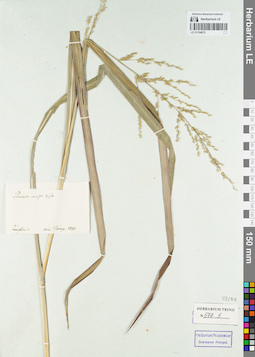
LE 01154572
Groups of specimens: Гербарий Карла Бернхарда Триниуса; Соглашение Минобрнауки №075-15-2021-1056Record creation: 2021-12-02, Marina Yarichina, PhotoScan D2Citation: Specimen LE 01154572 // Virtual herbarium of Komarov Botanical Institute RAS — http://re.herbariumle.ru/01154572
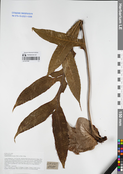
LE 01077687
Pseudodrynaria coronans (Wall. ex Mett.) Ching det. Averyanov, Leonid Vladimirovich at 05.04.2017
Collectors: Averyanov, Leonid Vladimirovich; Tien Hiep Nguyen; Khang Sinh Nguyen; et al. Field collecting number: LA-VN2099. Collection date: 05.04.2017. Administrative regions: LA - Luang Prabang Province. Groups of specimens: L. V. Averyanov specimens; L. V. Averyanov herbarium; Соглашение Минобрнауки №075-15-2021-1056Original label text:FLORA OF LAOS
Polypodiaceae s.l.
Pseudodrynaria coronans (Wall. ex Mett.) Ching
Luang Prabang prov., Pon Xay distr., between Houay Man and Nam Bo villages, Phou Hua Ben Toc Mountain, around point 19°57′33.1′'N 102°25′25.8′'E.
Degraded primary evergreen and semideciduous forest on very steep rocky mountain slopes composed by solid marble like highly eroded limestone at elev. 500-650 m a.s.l.
Creeping fern on mossy rocks on mountain top. Leaves with white along nerves (fungi infection?) Common.
LA-VN 2099 5 April 2017
Coll.: L.Averyanov, N.T.Hiep, N.S.Khang, C.Q.Ngan, T.Maisak, Vichith Lamxay, Koudkeo Phommachanh, Phizar Sayalath, Keooudone Souvannakhoummane.
Coordinates (geographic position): 19° 57′ 33.1″ N, 102° 25′ 25.8″ E ±1000 mRecord creation: 2021-12-02, Tatiana Maisak, PhotoScan D2Citation: Specimen LE 01077687 // Virtual herbarium of Komarov Botanical Institute RAS — http://re.herbariumle.ru/01077687Polypodiaceae s.l.
Pseudodrynaria coronans (Wall. ex Mett.) Ching
Luang Prabang prov., Pon Xay distr., between Houay Man and Nam Bo villages, Phou Hua Ben Toc Mountain, around point 19°57′33.1′'N 102°25′25.8′'E.
Degraded primary evergreen and semideciduous forest on very steep rocky mountain slopes composed by solid marble like highly eroded limestone at elev. 500-650 m a.s.l.
Creeping fern on mossy rocks on mountain top. Leaves with white along nerves (fungi infection?) Common.
LA-VN 2099 5 April 2017
Coll.: L.Averyanov, N.T.Hiep, N.S.Khang, C.Q.Ngan, T.Maisak, Vichith Lamxay, Koudkeo Phommachanh, Phizar Sayalath, Keooudone Souvannakhoummane.
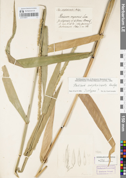
LE 01154571
Groups of specimens: Гербарий Карла Бернхарда Триниуса; Соглашение Минобрнауки №075-15-2021-1056Record creation: 2021-12-02, Marina Yarichina, PhotoScan D2Citation: Specimen LE 01154571 // Virtual herbarium of Komarov Botanical Institute RAS — http://re.herbariumle.ru/01154571