View
Add
Copy
Edit
Delete
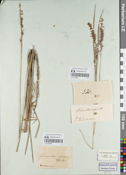
LE 01154619
Groups of specimens: Гербарий Карла Бернхарда Триниуса; Соглашение Минобрнауки №075-15-2021-1056Record creation: 2021-12-02, Marina Yarichina, PhotoScan D2Citation: Specimen LE 01154619 // Virtual herbarium of Komarov Botanical Institute RAS — http://re.herbariumle.ru/01154619
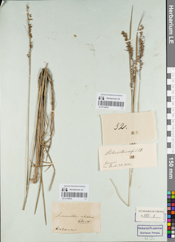
LE 01154618
Groups of specimens: Гербарий Карла Бернхарда Триниуса; Соглашение Минобрнауки №075-15-2021-1056Record creation: 2021-12-02, Marina Yarichina, PhotoScan D2Citation: Specimen LE 01154618 // Virtual herbarium of Komarov Botanical Institute RAS — http://re.herbariumle.ru/01154618
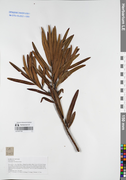
LE 01077730
Podocarpus neriifolius D.Don det. Averyanov, Leonid Vladimirovich at 27.09.2016
Collectors: Averyanov, Leonid Vladimirovich; Tien Hiep Nguyen; Khang Sinh Nguyen; et al. Field collecting number: CPC8062. Collection date: 27.09.2016. Administrative regions: VN - Tinh Son La. Groups of specimens: L. V. Averyanov specimens; L. V. Averyanov herbarium; Соглашение Минобрнауки №075-15-2021-1056Original label text:FLORA OF VIETNAM
Podocarpaceae
Podocarpus neriifolius D.Don
Coordinates (geographic position): 20° 46′ 2″ N, 104° 37′ 3.1″ E ±1000 mRecord creation: 2021-12-02, Tatiana Maisak, PhotoScan D2Citation: Specimen LE 01077730 // Virtual herbarium of Komarov Botanical Institute RAS — http://re.herbariumle.ru/01077730Podocarpaceae
Podocarpus neriifolius D.Don
Son La Prov., Moc Chau Distr., Chieng Son comm., about 1 km to NE from Chieng Son Village, around point 20°46′02.0N 104°37′03.1E.
Remnants of primary broad-leaved evergreen forest on tops of hills composed with karstic highly eroded yellow-white limestone at elevation 1150-1250 m a.s.l.
Tree 4-6 m tall on mountain top. Not common.
27 September 2016 CPC 8062
Coll.: L.Averyanov, N.T.Hiep, N.S.Khang, C.Q.Ngan, T.V.Maisak, N.T.Son.
Remnants of primary broad-leaved evergreen forest on tops of hills composed with karstic highly eroded yellow-white limestone at elevation 1150-1250 m a.s.l.
Tree 4-6 m tall on mountain top. Not common.
27 September 2016 CPC 8062
Coll.: L.Averyanov, N.T.Hiep, N.S.Khang, C.Q.Ngan, T.V.Maisak, N.T.Son.
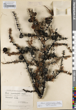
LE 01146567
Groups of specimens: Образцы сектора Сибири и Дальнего Востока России; Соглашение Минобрнауки №075-15-2021-1056Record creation: 2021-12-02, Larisa Orlova, PhotoScan D2Citation: Specimen LE 01146567 // Virtual herbarium of Komarov Botanical Institute RAS — http://re.herbariumle.ru/01146567
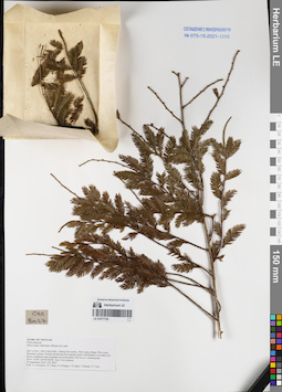
LE 01077729
Dacrycarpus imbricatus (Blume) de Laub. det. Averyanov, Leonid Vladimirovich at 25.09.2016
Collectors: Averyanov, Leonid Vladimirovich; Tien Hiep Nguyen; Khang Sinh Nguyen; et al. Field collecting number: CPC8027. Collection date: 25.09.2016. Administrative regions: VN - Tinh Son La. Groups of specimens: L. V. Averyanov specimens; L. V. Averyanov herbarium; Соглашение Минобрнауки №075-15-2021-1056Original label text:FLORA OF VIETNAM
Podocarpaceae
Dacrycarpus imbricatus (Blume) de Laub.
Son La Prov., Moc Chau Distr., Chieng Son comm., Pha Luong village, Pha Luong Mountain system.
Primary broad-leaved evergreen forest with bamboo on eroded red-brown sandstone near mountain top at elevation 1425 m a.s.l. around point 20°41′30.9N 104°38′08.9E.
Tree. Not common.
25 September 2016 CPC 8027
Coll.: L.Averyanov, N.T.Hiep, N.S.Khang, C.Q.Ngan, T.V.Maisak, N.T.Son.
Coordinates (geographic position): 20° 41′ 30.9″ N, 104° 38′ 8.9″ E ±1000 mRecord creation: 2021-12-02, Tatiana Maisak, PhotoScan D2Citation: Specimen LE 01077729 // Virtual herbarium of Komarov Botanical Institute RAS — http://re.herbariumle.ru/01077729Podocarpaceae
Dacrycarpus imbricatus (Blume) de Laub.
Son La Prov., Moc Chau Distr., Chieng Son comm., Pha Luong village, Pha Luong Mountain system.
Primary broad-leaved evergreen forest with bamboo on eroded red-brown sandstone near mountain top at elevation 1425 m a.s.l. around point 20°41′30.9N 104°38′08.9E.
Tree. Not common.
25 September 2016 CPC 8027
Coll.: L.Averyanov, N.T.Hiep, N.S.Khang, C.Q.Ngan, T.V.Maisak, N.T.Son.
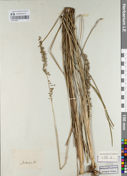
LE 01154617
Groups of specimens: Гербарий Карла Бернхарда Триниуса; Соглашение Минобрнауки №075-15-2021-1056Record creation: 2021-12-02, Marina Yarichina, PhotoScan D2Citation: Specimen LE 01154617 // Virtual herbarium of Komarov Botanical Institute RAS — http://re.herbariumle.ru/01154617
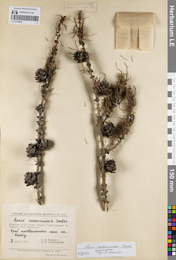
LE 01146566
Groups of specimens: Образцы сектора Сибири и Дальнего Востока России; Соглашение Минобрнауки №075-15-2021-1056Record creation: 2021-12-02, Larisa Orlova, PhotoScan D2Citation: Specimen LE 01146566 // Virtual herbarium of Komarov Botanical Institute RAS — http://re.herbariumle.ru/01146566
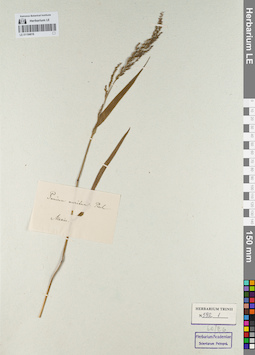
LE 01154616
Groups of specimens: Гербарий Карла Бернхарда Триниуса; Соглашение Минобрнауки №075-15-2021-1056Record creation: 2021-12-02, Marina Yarichina, PhotoScan D2Citation: Specimen LE 01154616 // Virtual herbarium of Komarov Botanical Institute RAS — http://re.herbariumle.ru/01154616
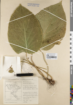
LE 01077728
Primula chapaensis Gagnep. det. Avrorin, Nikolay Alexandrovich at 04.06.1963
Collectors: Luong Ngoc Toan; Avrorin, Nikolay Alexandrovich Field collecting number: Avrorin 12308. Collection date: 04.06.1963. Administrative regions: VN - Tinh Lao Cai. Groups of specimens: L. V. Averyanov specimens; L. V. Averyanov herbarium; Соглашение Минобрнауки №075-15-2021-1056Original label text:FLORA OF VIETNAM
Primulaceae
Record creation: 2021-12-02, Tatiana Maisak, PhotoScan D2Citation: Specimen LE 01077728 // Virtual herbarium of Komarov Botanical Institute RAS — http://re.herbariumle.ru/01077728Primulaceae
Primula chapaensis Gagnep.
Lao Cai Prov., N Avrorin 12308
Coll. Luong Ngoc Toan, Avrorin, Nikolay Alexandrovich,
04.06.1963
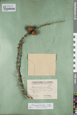
LE 01146564
Groups of specimens: Образцы сектора Сибири и Дальнего Востока России; Соглашение Минобрнауки №075-15-2021-1056Record creation: 2021-12-02, Larisa Orlova, PhotoScan D2Citation: Specimen LE 01146564 // Virtual herbarium of Komarov Botanical Institute RAS — http://re.herbariumle.ru/01146564
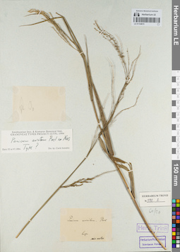
LE 01154615
Groups of specimens: Гербарий Карла Бернхарда Триниуса; Соглашение Минобрнауки №075-15-2021-1056Record creation: 2021-12-02, Marina Yarichina, PhotoScan D2Citation: Specimen LE 01154615 // Virtual herbarium of Komarov Botanical Institute RAS — http://re.herbariumle.ru/01154615
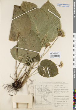
LE 01077727
Primula chapaensis Gagnep. det. Avrorin, Nikolay Alexandrovich at 04.06.1963
Collectors: Luong Ngoc Toan; Avrorin, Nikolay Alexandrovich Field collecting number: Avrorin 12346a. Collection date: 04.06.1963. Administrative regions: VN - Tinh Lao Cai. Groups of specimens: L. V. Averyanov specimens; L. V. Averyanov herbarium; Соглашение Минобрнауки №075-15-2021-1056Original label text:FLORA OF VIETNAM
Primulaceae
Record creation: 2021-12-02, Tatiana Maisak, PhotoScan D2Citation: Specimen LE 01077727 // Virtual herbarium of Komarov Botanical Institute RAS — http://re.herbariumle.ru/01077727Primulaceae
Primula chapaensis Gagnep.
Lao Cai Prov., N Avrorin 12346a
Coll. Luong Ngoc Toan, Avrorin, Nikolay Alexandrovich.
04.06.1963
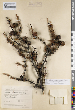
LE 01146563
Groups of specimens: Образцы сектора Сибири и Дальнего Востока России; Соглашение Минобрнауки №075-15-2021-1056Record creation: 2021-12-02, Larisa Orlova, PhotoScan D2Citation: Specimen LE 01146563 // Virtual herbarium of Komarov Botanical Institute RAS — http://re.herbariumle.ru/01146563
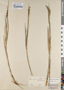
LE 01154614
Groups of specimens: Гербарий Карла Бернхарда Триниуса; Соглашение Минобрнауки №075-15-2021-1056Record creation: 2021-12-02, Marina Yarichina, PhotoScan D2Citation: Specimen LE 01154614 // Virtual herbarium of Komarov Botanical Institute RAS — http://re.herbariumle.ru/01154614
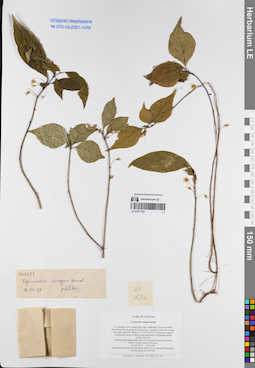
LE 01077726
Lysimachia insignis Hemsl. det. Phan Ke Loc at 29.07.1997
Collectors: Averyanov, Leonid Vladimirovich; Tien Hiep Nguyen; Phan Ke Loc Field collecting number: VH4573. Collection date: 15.05.1997. Administrative regions: VN - Tinh Quang Binh. Groups of specimens: L. V. Averyanov specimens; L. V. Averyanov herbarium; Соглашение Минобрнауки №075-15-2021-1056Original label text:FLORA OF VIETNAM
Lysimachia insignis Hemsl.
N. Vietnam, Prov. Quang Binh, distr. Minh Hoa, 72 km to NWW
from Dong Hoi, municipalite Thong Hoa, vicinities of Yen Son village, limestone massif Ke Bang (N 17°40′ E 105°57′). Primary evergreen broadleaved forest on steep slopes and bluffs of limestone mesas
at 200-250 m alt.
Terrestrial and epilitic herb up to 0.3 m hg on wet open limestone
bluffs. Flowers yellow. Not rare.
VH 4573 15.05.1997
International Botanical Expedition of the U.S.A. National Geographic
Society (grant No 5803-96)
Collectors: L. Averyanov, N.T. Hiep, P.K. Loc
Coordinates (geographic position): 17° 40′ N, 105° 57′ E ±1000 mRecord creation: 2021-12-02, Tatiana Maisak, PhotoScan D2Citation: Specimen LE 01077726 // Virtual herbarium of Komarov Botanical Institute RAS — http://re.herbariumle.ru/01077726Lysimachia insignis Hemsl.
N. Vietnam, Prov. Quang Binh, distr. Minh Hoa, 72 km to NWW
from Dong Hoi, municipalite Thong Hoa, vicinities of Yen Son village, limestone massif Ke Bang (N 17°40′ E 105°57′). Primary evergreen broadleaved forest on steep slopes and bluffs of limestone mesas
at 200-250 m alt.
Terrestrial and epilitic herb up to 0.3 m hg on wet open limestone
bluffs. Flowers yellow. Not rare.
VH 4573 15.05.1997
International Botanical Expedition of the U.S.A. National Geographic
Society (grant No 5803-96)
Collectors: L. Averyanov, N.T. Hiep, P.K. Loc
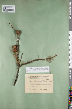
LE 01146562
Groups of specimens: Образцы сектора Сибири и Дальнего Востока России; Соглашение Минобрнауки №075-15-2021-1056Record creation: 2021-12-02, Larisa Orlova, PhotoScan D2Citation: Specimen LE 01146562 // Virtual herbarium of Komarov Botanical Institute RAS — http://re.herbariumle.ru/01146562
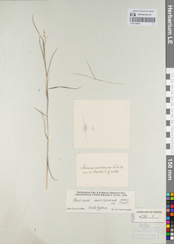
LE 01154613
Groups of specimens: Гербарий Карла Бернхарда Триниуса; Соглашение Минобрнауки №075-15-2021-1056Record creation: 2021-12-02, Marina Yarichina, PhotoScan D2Citation: Specimen LE 01154613 // Virtual herbarium of Komarov Botanical Institute RAS — http://re.herbariumle.ru/01154613
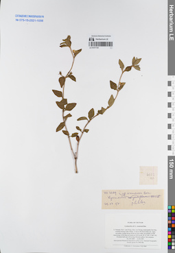
LE 01077725
Lysimachia siamensis Bonati det. Phan Ke Loc at 29.07.1997
Collectors: Averyanov, Leonid Vladimirovich; N.Q. Binh Field collecting number: VH3889. Collection date: 12.04.1997. Administrative regions: VN - Tinh Lam GJong. Groups of specimens: L. V. Averyanov specimens; L. V. Averyanov herbarium; Соглашение Минобрнауки №075-15-2021-1056Original label text:FLORA OF VIETNAM
Primulaceae
Lysimachia aff. L. siamensis Bon
S. Vietnam, Prov. Lam Dong, distr. Lac Duong, municipalite Da Chay, vicinities Klong Lanh village, 31 km to NE from Dalat city. Open secondary swamp along stream in river valley at foothills of NW macroslope of Bi Dup mt system at 1450 m alt. (N 12° 08′, E 108° 39′). Prostrate herb up to 20 cm hg. Flowers yellow. Not common. VH 3889 12.04.1997
International Botanical Expedition of the U.S.A. National Geographic
Society (grant No 5803-96)
Collectors: L. Averyanov, N.Q. Binh
Coordinates (geographic position): 12° 8′ N, 108° 39′ E ±1000 mRecord creation: 2021-12-02, Tatiana Maisak, PhotoScan D2. Processing status: work_status_1Citation: Specimen LE 01077725 // Virtual herbarium of Komarov Botanical Institute RAS — http://re.herbariumle.ru/01077725Primulaceae
Lysimachia aff. L. siamensis Bon
S. Vietnam, Prov. Lam Dong, distr. Lac Duong, municipalite Da Chay, vicinities Klong Lanh village, 31 km to NE from Dalat city. Open secondary swamp along stream in river valley at foothills of NW macroslope of Bi Dup mt system at 1450 m alt. (N 12° 08′, E 108° 39′). Prostrate herb up to 20 cm hg. Flowers yellow. Not common. VH 3889 12.04.1997
International Botanical Expedition of the U.S.A. National Geographic
Society (grant No 5803-96)
Collectors: L. Averyanov, N.Q. Binh
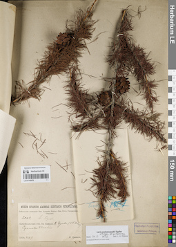
LE 01146476
Groups of specimens: Образцы сектора Сибири и Дальнего Востока России; Соглашение Минобрнауки №075-15-2021-1056Record creation: 2021-12-02, Larisa Orlova, PhotoScan D2Citation: Specimen LE 01146476 // Virtual herbarium of Komarov Botanical Institute RAS — http://re.herbariumle.ru/01146476
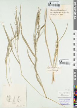
LE 01154611
Groups of specimens: Гербарий Карла Бернхарда Триниуса; Соглашение Минобрнауки №075-15-2021-1056Record creation: 2021-12-02, Marina Yarichina, PhotoScan D2Citation: Specimen LE 01154611 // Virtual herbarium of Komarov Botanical Institute RAS — http://re.herbariumle.ru/01154611
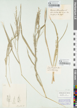
LE 01154612
Groups of specimens: Гербарий Карла Бернхарда Триниуса; Соглашение Минобрнауки №075-15-2021-1056Record creation: 2021-12-02, Marina Yarichina, PhotoScan D2Citation: Specimen LE 01154612 // Virtual herbarium of Komarov Botanical Institute RAS — http://re.herbariumle.ru/01154612
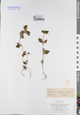
LE 01077724
Lysimachia congestiflora Hemsl. det. Phan Ke Loc at 29.07.1997
Collectors: Averyanov, Leonid Vladimirovich; N.Q. Binh; Tien Hiep Nguyen Field collecting number: VH4109. Collection date: 20.04.1997. Administrative regions: VN - Tinh Lam GJong. Groups of specimens: L. V. Averyanov specimens; L. V. Averyanov herbarium; Соглашение Минобрнауки №075-15-2021-1056Original label text:FLORA OF VIETNAM
Lysimachia congestiflora Hemsl.
S. Vietnam, Prov. Lam Dong, distr. Lac Duong, municipalite Da Chay,
29 km to NEE from Dalat city. Old open evergreen broadleaved secondary forest rich in primary elements along mt river
on W macroslope of Bi Dup mt system at 1450 m alt.
(N 12° 08′, E 108° 39′).
Prostrate herb in wet open places. Flowers yellow. Not common.
VH 4109 20.04.1997
International Botanical Expedition of the U.S.A. National Geographic
Society (grant No 5803-96)
Collectors: L. Averyanov, N.Q. Binh, N.T. Hiep
Coordinates (geographic position): 12° 8′ N, 108° 39′ E ±1000 mRecord creation: 2021-12-02, Tatiana Maisak, PhotoScan D2Citation: Specimen LE 01077724 // Virtual herbarium of Komarov Botanical Institute RAS — http://re.herbariumle.ru/01077724Lysimachia congestiflora Hemsl.
S. Vietnam, Prov. Lam Dong, distr. Lac Duong, municipalite Da Chay,
29 km to NEE from Dalat city. Old open evergreen broadleaved secondary forest rich in primary elements along mt river
on W macroslope of Bi Dup mt system at 1450 m alt.
(N 12° 08′, E 108° 39′).
Prostrate herb in wet open places. Flowers yellow. Not common.
VH 4109 20.04.1997
International Botanical Expedition of the U.S.A. National Geographic
Society (grant No 5803-96)
Collectors: L. Averyanov, N.Q. Binh, N.T. Hiep
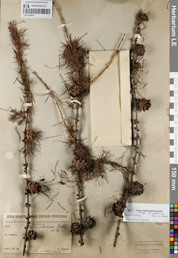
LE 01146475
Groups of specimens: Образцы сектора Сибири и Дальнего Востока России; Соглашение Минобрнауки №075-15-2021-1056Record creation: 2021-12-02, Larisa Orlova, PhotoScan D2Citation: Specimen LE 01146475 // Virtual herbarium of Komarov Botanical Institute RAS — http://re.herbariumle.ru/01146475
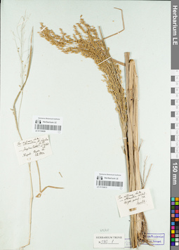
LE 01154609
Groups of specimens: Гербарий Карла Бернхарда Триниуса; Соглашение Минобрнауки №075-15-2021-1056Record creation: 2021-12-02, Marina Yarichina, PhotoScan D2Citation: Specimen LE 01154609 // Virtual herbarium of Komarov Botanical Institute RAS — http://re.herbariumle.ru/01154609
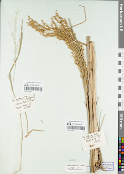
LE 01154610
Groups of specimens: Гербарий Карла Бернхарда Триниуса; Соглашение Минобрнауки №075-15-2021-1056Record creation: 2021-12-02, Marina Yarichina, PhotoScan D2Citation: Specimen LE 01154610 // Virtual herbarium of Komarov Botanical Institute RAS — http://re.herbariumle.ru/01154610
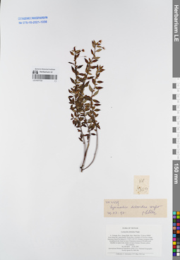
LE 01077723
Lysimachia deltoidea Wight det. Phan Ke Loc at 16.05.1997
Collectors: Averyanov, Leonid Vladimirovich; Tien Hiep Nguyen; Phan Ke Loc Field collecting number: VH4659. Collection date: 16.05.1997. Administrative regions: VN - Tinh Quang Binh. Groups of specimens: L. V. Averyanov specimens; L. V. Averyanov herbarium; Соглашение Минобрнауки №075-15-2021-1056Original label text:FLORA OF VIETNAM
Lysimachia deltoidea Wight
N. Vietnam, Prov. Quang Binh, distr. Minh Hoa, 72 km to NWW
from Dong Hoi, municipalite Thong Hoa, vicinities of Yen Son village, limestone massif Ke Bang (N 17°40′ E 105°57′). Primary evergreen open broadleaved dry forest on top of limestone mesas at 550-600 m alt.
Shrublet on open rocky slopes on tops of mesas. Flowers yellow.
Not common.
VH 4659 16.05.1997
International Botanical Expedition of the U.S.A. National Geographic
Society (grant No 5803-96)
Collectors: L. Averyanov, N.T. Hiep, P.K. Loc
Coordinates (geographic position): 17° 40′ N, 105° 57′ E ±1000 mRecord creation: 2021-12-02, Tatiana Maisak, PhotoScan D2Citation: Specimen LE 01077723 // Virtual herbarium of Komarov Botanical Institute RAS — http://re.herbariumle.ru/01077723Lysimachia deltoidea Wight
N. Vietnam, Prov. Quang Binh, distr. Minh Hoa, 72 km to NWW
from Dong Hoi, municipalite Thong Hoa, vicinities of Yen Son village, limestone massif Ke Bang (N 17°40′ E 105°57′). Primary evergreen open broadleaved dry forest on top of limestone mesas at 550-600 m alt.
Shrublet on open rocky slopes on tops of mesas. Flowers yellow.
Not common.
VH 4659 16.05.1997
International Botanical Expedition of the U.S.A. National Geographic
Society (grant No 5803-96)
Collectors: L. Averyanov, N.T. Hiep, P.K. Loc
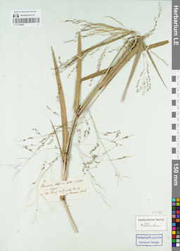
LE 01154608
Groups of specimens: Гербарий Карла Бернхарда Триниуса; Соглашение Минобрнауки №075-15-2021-1056Record creation: 2021-12-02, Marina Yarichina, PhotoScan D2Citation: Specimen LE 01154608 // Virtual herbarium of Komarov Botanical Institute RAS — http://re.herbariumle.ru/01154608
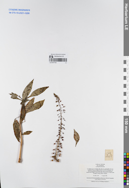
LE 01077722
Lysimachia decurrens G.Forst det. Averyanov, Leonid Vladimirovich at 14.04.1999
Collectors: Phan Ke Loc; P.H. Hoang; Averyanov, Leonid Vladimirovich Field collecting number: CBL1334. Collection date: 14.04.1999. Administrative regions: VN - Tinh Cao Bang. Groups of specimens: L. V. Averyanov specimens; L. V. Averyanov herbarium; Соглашение Минобрнауки №075-15-2021-1056Original label text:FLORA OF VIETNAM
Primulaceae
Lysimachia decurranse
N. Vietnam, prov. Cao Bang, distr. Bao Lac, municipality Yen Lac,
vicinities of Yen Lac village (N 22°44′ E 105°50′). Secondary wet
short tall grasslands on alluvial shale valley between limestone
remnant karst ridges at 1000-1050 m elev. Herb up to 0.5 m hg in open
wet place. Flowers white. Common.
CBL 1334 14 April 1999
International Botanical Expedition of the U.S.A. National Geographic
Society (grant No 6300-98)
Collectors: P.K.Loc, P.H.Hoang, Averyanov L.
Coordinates (geographic position): 22° 44′ N, 105° 50′ E ±1000 mRecord creation: 2021-12-02, Tatiana Maisak, PhotoScan D2Citation: Specimen LE 01077722 // Virtual herbarium of Komarov Botanical Institute RAS — http://re.herbariumle.ru/01077722Primulaceae
Lysimachia decurranse
N. Vietnam, prov. Cao Bang, distr. Bao Lac, municipality Yen Lac,
vicinities of Yen Lac village (N 22°44′ E 105°50′). Secondary wet
short tall grasslands on alluvial shale valley between limestone
remnant karst ridges at 1000-1050 m elev. Herb up to 0.5 m hg in open
wet place. Flowers white. Common.
CBL 1334 14 April 1999
International Botanical Expedition of the U.S.A. National Geographic
Society (grant No 6300-98)
Collectors: P.K.Loc, P.H.Hoang, Averyanov L.
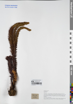
LE 01077721
Huperzia sp. det. Averyanov, Leonid Vladimirovich at 22.03.2017
Collectors: Averyanov, Leonid Vladimirovich; Tien Hiep Nguyen; Khang Sinh Nguyen; et al. Field collecting number: LA-VN1532. Collection date: 22.03.2017. Administrative regions: LA - Vientiane Province. Groups of specimens: L. V. Averyanov specimens; L. V. Averyanov herbarium; Соглашение Минобрнауки №075-15-2021-1056Original label text:FLORA OF LAOS
Lycopodiaceae
Huperzia sp.
Vientiane prov., Vang Vieng distr., Oa Hom village, around point 19°05′57.0′'N 102°23′19.9′'E.
Secondary broad-leaved evergreen and semideciduous dry forest with on very steep rocky mountain slopes composed by solid marble like highly eroded limestone at elev. 650-750 m a.s.l.
Epiphyte on mossy tree on rocky mountain top. Occasional.
LA-VN 1532 22 March 2017
Coll.: L.Averyanov, N.T.Hiep, N.S.Khang, C.Q.Ngan, T.Maisak, Khamla Inkhavilay, Hongthong Southyvohanh, Pinmany Sisavath, Chanthala Cheuaysamphanh.
Coordinates (geographic position): 19° 5′ 57″ N, 102° 23′ 19.9″ E ±1000 mRecord creation: 2021-12-02, Tatiana Maisak, PhotoScan D2Citation: Specimen LE 01077721 // Virtual herbarium of Komarov Botanical Institute RAS — http://re.herbariumle.ru/01077721Lycopodiaceae
Huperzia sp.
Vientiane prov., Vang Vieng distr., Oa Hom village, around point 19°05′57.0′'N 102°23′19.9′'E.
Secondary broad-leaved evergreen and semideciduous dry forest with on very steep rocky mountain slopes composed by solid marble like highly eroded limestone at elev. 650-750 m a.s.l.
Epiphyte on mossy tree on rocky mountain top. Occasional.
LA-VN 1532 22 March 2017
Coll.: L.Averyanov, N.T.Hiep, N.S.Khang, C.Q.Ngan, T.Maisak, Khamla Inkhavilay, Hongthong Southyvohanh, Pinmany Sisavath, Chanthala Cheuaysamphanh.
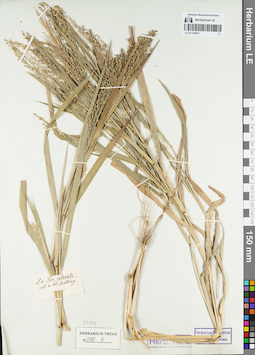
LE 01154607
Groups of specimens: Гербарий Карла Бернхарда Триниуса; Соглашение Минобрнауки №075-15-2021-1056Record creation: 2021-12-02, Marina Yarichina, PhotoScan D2Citation: Specimen LE 01154607 // Virtual herbarium of Komarov Botanical Institute RAS — http://re.herbariumle.ru/01154607
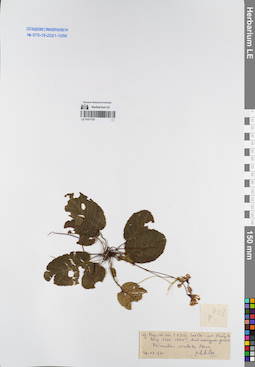
LE 01077720
Primula cordata Merr. det. Phan Ke Loc at 29.07.1997
Collectors: Phan Ke Loc Field collecting number: P-7313. Collection date: 29.07.1997. Administrative regions: VN - Tinh Lao Cai. Groups of specimens: L. V. Averyanov specimens; L. V. Averyanov herbarium; Соглашение Минобрнауки №075-15-2021-1056Original label text:FLORA OF VIETNAM
Primulaceae
Record creation: 2021-12-02, Tatiana Maisak, PhotoScan D2Citation: Specimen LE 01077720 // Virtual herbarium of Komarov Botanical Institute RAS — http://re.herbariumle.ru/01077720Primulaceae
Primula cordata Merr.
Leg. Phan Ke Loc, P-7313
Lao Cai, 29.07.1997
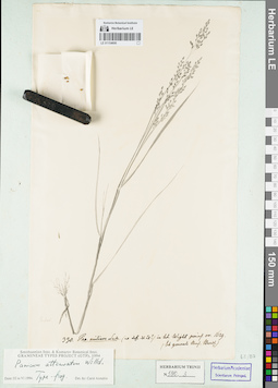
LE 01154606
Groups of specimens: Гербарий Карла Бернхарда Триниуса; Соглашение Минобрнауки №075-15-2021-1056Record creation: 2021-12-02, Marina Yarichina, PhotoScan D2Citation: Specimen LE 01154606 // Virtual herbarium of Komarov Botanical Institute RAS — http://re.herbariumle.ru/01154606
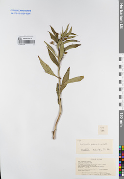
LE 01077719
Lysimachia peduncularis Wall. det. N.T. Ban at 03.08.1995
Collectors: Averyanov, Leonid Vladimirovich; N.T. Ban; N.Q. Binh; et al. Field collecting number: VH733. Collection date: 13.03.1995. Administrative regions: VN - Kon Tum. Groups of specimens: L. V. Averyanov specimens; L. V. Averyanov herbarium; Соглашение Минобрнауки №075-15-2021-1056Original label text:FLORA OF VIETNAM
Primulaceae
Record creation: 2021-12-02, Tatiana Maisak, PhotoScan D2Citation: Specimen LE 01077719 // Virtual herbarium of Komarov Botanical Institute RAS — http://re.herbariumle.ru/01077719Primulaceae
Lysimachia peduncularis Wall.
S. Vietnam, Prov. Kon Tum.
VH 733 , 13.03.1995
det. N.T. Ban at 03.08.1995
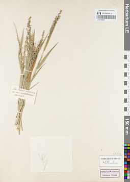
LE 01154605
Groups of specimens: Гербарий Карла Бернхарда Триниуса; Соглашение Минобрнауки №075-15-2021-1056Record creation: 2021-12-02, Marina Yarichina, PhotoScan D2Citation: Specimen LE 01154605 // Virtual herbarium of Komarov Botanical Institute RAS — http://re.herbariumle.ru/01154605
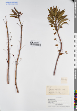
LE 01077718
Lysimachia peduncularis Wall. det. N.T. Ban at 03.08.1995
Collectors: Averyanov, Leonid Vladimirovich; N.T. Ban; N.Q. Binh; et al. Field collecting number: VH198. Collection date: 23.02.1995. Administrative regions: VN - Kon Tum. Groups of specimens: L. V. Averyanov specimens; L. V. Averyanov herbarium; Соглашение Минобрнауки №075-15-2021-1056Original label text:FLORA OF VIETNAM
Primulaceae
Record creation: 2021-12-02, Tatiana Maisak, PhotoScan D2Citation: Specimen LE 01077718 // Virtual herbarium of Komarov Botanical Institute RAS — http://re.herbariumle.ru/01077718Primulaceae
Lysimachia peduncularis Wall.
Prov. Kon Tum
VH 198, 23.02.1995.
det. N.T. Ban at 03.08.1995
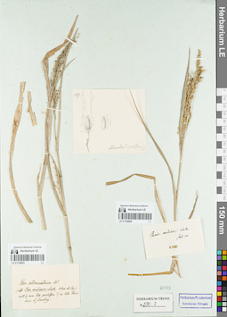
LE 01154604
Groups of specimens: Гербарий Карла Бернхарда Триниуса; Соглашение Минобрнауки №075-15-2021-1056Record creation: 2021-12-02, Marina Yarichina, PhotoScan D2Citation: Specimen LE 01154604 // Virtual herbarium of Komarov Botanical Institute RAS — http://re.herbariumle.ru/01154604
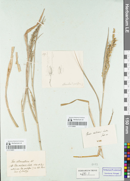
LE 01154603
Groups of specimens: Гербарий Карла Бернхарда Триниуса; Соглашение Минобрнауки №075-15-2021-1056Record creation: 2021-12-02, Marina Yarichina, PhotoScan D2Citation: Specimen LE 01154603 // Virtual herbarium of Komarov Botanical Institute RAS — http://re.herbariumle.ru/01154603
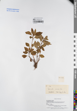
LE 01077717
Lysimachia siamensis Bonati det. N.T. Ban at 03.08.1995
Collectors: Averyanov, Leonid Vladimirovich; N.T. Ban; N.Q. Binh; et al. Field collecting number: VH329. Collection date: 02.03.1995. Administrative regions: VN - Kon Tum. Groups of specimens: L. V. Averyanov specimens; L. V. Averyanov herbarium; Соглашение Минобрнауки №075-15-2021-1056Original label text:FLORA OF VIETNAM
Primulaceae
Record creation: 2021-12-02, Tatiana Maisak, PhotoScan D2Citation: Specimen LE 01077717 // Virtual herbarium of Komarov Botanical Institute RAS — http://re.herbariumle.ru/01077717Primulaceae
Lysimachia siamensis Bonati
S.Vietnam, Prov. Kon Tum
VH 329, 02.03.1995
det. N.T. Ban
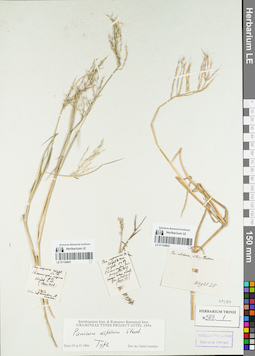
LE 01154602
Groups of specimens: Гербарий Карла Бернхарда Триниуса; Соглашение Минобрнауки №075-15-2021-1056Record creation: 2021-12-02, Marina Yarichina, PhotoScan D2Citation: Specimen LE 01154602 // Virtual herbarium of Komarov Botanical Institute RAS — http://re.herbariumle.ru/01154602
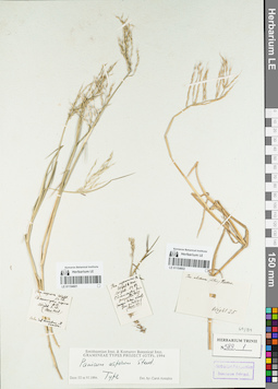
LE 01154601
Groups of specimens: Гербарий Карла Бернхарда Триниуса; Соглашение Минобрнауки №075-15-2021-1056Record creation: 2021-12-02, Marina Yarichina, PhotoScan D2Citation: Specimen LE 01154601 // Virtual herbarium of Komarov Botanical Institute RAS — http://re.herbariumle.ru/01154601
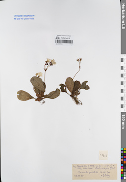
LE 01077716
Primula petelotii W.W.Sm. det. Phan Ke Loc at 29.07.1997
Collectors: Phan Ke Loc Field collecting number: P-7318. Collection date: 29.07.1997. Administrative regions: VN - Tinh Lao Cai. Groups of specimens: L. V. Averyanov specimens; L. V. Averyanov herbarium; Соглашение Минобрнауки №075-15-2021-1056Original label text:FLORA OF VIETNAM
Primulaceae
Record creation: 2021-12-02, Tatiana Maisak, PhotoScan D2Citation: Specimen LE 01077716 // Virtual herbarium of Komarov Botanical Institute RAS — http://re.herbariumle.ru/01077716Primulaceae
Primula petelotii W.W.Sm.
Lao Cai
Leg. Phan Ke Loc,
P-7318, 29.07.1997
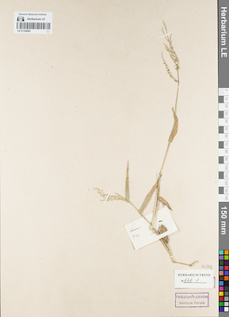
LE 01154600
Groups of specimens: Гербарий Карла Бернхарда Триниуса; Соглашение Минобрнауки №075-15-2021-1056Record creation: 2021-12-02, Marina Yarichina, PhotoScan D2Citation: Specimen LE 01154600 // Virtual herbarium of Komarov Botanical Institute RAS — http://re.herbariumle.ru/01154600
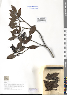
LE 01077715
Photinia cucphuongensis T.H.Nguyên & Yakovlev ⟮prelim. ID⟯ det. Averyanov, Leonid Vladimirovich at 22.09.2016
Collectors: Averyanov, Leonid Vladimirovich; Tien Hiep Nguyen; Khang Sinh Nguyen; et al. Field collecting number: CPC7932. Collection date: 22.09.2016. Administrative regions: VN - Tinh Son La. Groups of specimens: L. V. Averyanov specimens; L. V. Averyanov herbarium; Соглашение Минобрнауки №075-15-2021-1056Original label text:FLORA OF VIETNAM
Rosaceae
Photinia cucphuongensis T.H.Nguyen & Yakovlev?
Son La Prov., Moc Chau Distr., Chieng Son comm., Pha Luong village, Pha Luong Mountains.
Primary evergreen broad-leaved and mixed forest with Pinus cernua on mountain tops and steep summit slopes composed with highly eroded red-brown sandstone at elevation 1400-1500 m a.s.l. around point 20°41′33.2N 104°37′37.0E.
Terrestrial and lithophytic treelet or shrub to 3 m tall in open mossy rocky place near mountain top. Fruits bluish-purple-black. Common.
22 September 2016 CPC 7932.
Coll.: L.Averyanov, N.T.Hiep, N.S.Khang, C.Q.Ngan, T.V.Maisak, N.T.Son.
Coordinates (geographic position): 20° 41′ 33.2″ N, 104° 37′ 37″ E ±1000 mRecord creation: 2021-12-02, Tatiana Maisak, PhotoScan D2Citation: Specimen LE 01077715 // Virtual herbarium of Komarov Botanical Institute RAS — http://re.herbariumle.ru/01077715Rosaceae
Photinia cucphuongensis T.H.Nguyen & Yakovlev?
Son La Prov., Moc Chau Distr., Chieng Son comm., Pha Luong village, Pha Luong Mountains.
Primary evergreen broad-leaved and mixed forest with Pinus cernua on mountain tops and steep summit slopes composed with highly eroded red-brown sandstone at elevation 1400-1500 m a.s.l. around point 20°41′33.2N 104°37′37.0E.
Terrestrial and lithophytic treelet or shrub to 3 m tall in open mossy rocky place near mountain top. Fruits bluish-purple-black. Common.
22 September 2016 CPC 7932.
Coll.: L.Averyanov, N.T.Hiep, N.S.Khang, C.Q.Ngan, T.V.Maisak, N.T.Son.
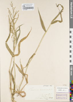
LE 01154599
Groups of specimens: Гербарий Карла Бернхарда Триниуса; Соглашение Минобрнауки №075-15-2021-1056Record creation: 2021-12-02, Marina Yarichina, PhotoScan D2Citation: Specimen LE 01154599 // Virtual herbarium of Komarov Botanical Institute RAS — http://re.herbariumle.ru/01154599
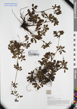
LE 01077714
Potentilla nilgerrensis (Schltdl. ex J. Gay) Mabb. det. Averyanov, Leonid Vladimirovich at 20.11.2014
Collectors: Averyanov, Leonid Vladimirovich; Tien Hiep Nguyen; Khang Sinh Nguyen; et al. Field collecting number: CPC7529. Collection date: 20.11.2014. Administrative regions: VN - Tinh Cao Bang. Groups of specimens: L. V. Averyanov specimens; L. V. Averyanov herbarium; Соглашение Минобрнауки №075-15-2021-1056Original label text:FLORA OF VIETNAM
Rosaceae
Potentilla nilgerrensis (Schltdl. ex J.Gay) Mabb.
Cao Bang Prov., Bao Lac Distr., Hong An municipality, Mi Lung village.
Primary broad-leaved and mixed humid evergreen forest on very steep slopes and along rocky ridge composed with solid crystalline highly eroded limestone at elevation 1500-1550 m a.s.l. around point 22°50′01.3″N 105°50′05.7″E.
Prostrate hern on short tall rocky grassland on alluvial foothill of limestone hill. Flowers yellow. Common.
20 November 2014 CPC 7529
Coll.: L.Averyanov, N.T.Hiep, N.S.Khang, T.Maisak, L.Osinovetz
Coordinates (geographic position): 22° 50′ 1.3″ N, 105° 50′ 5.7″ E ±1000 mRecord creation: 2021-12-02, Tatiana Maisak, PhotoScan D2Citation: Specimen LE 01077714 // Virtual herbarium of Komarov Botanical Institute RAS — http://re.herbariumle.ru/01077714Rosaceae
Potentilla nilgerrensis (Schltdl. ex J.Gay) Mabb.
Cao Bang Prov., Bao Lac Distr., Hong An municipality, Mi Lung village.
Primary broad-leaved and mixed humid evergreen forest on very steep slopes and along rocky ridge composed with solid crystalline highly eroded limestone at elevation 1500-1550 m a.s.l. around point 22°50′01.3″N 105°50′05.7″E.
Prostrate hern on short tall rocky grassland on alluvial foothill of limestone hill. Flowers yellow. Common.
20 November 2014 CPC 7529
Coll.: L.Averyanov, N.T.Hiep, N.S.Khang, T.Maisak, L.Osinovetz
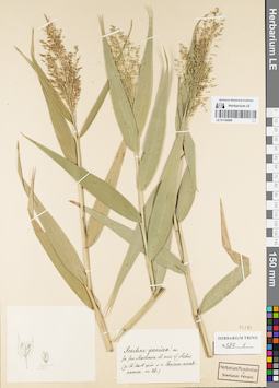
LE 01154598
Groups of specimens: Гербарий Карла Бернхарда Триниуса; Соглашение Минобрнауки №075-15-2021-1056Record creation: 2021-12-02, Marina Yarichina, PhotoScan D2Citation: Specimen LE 01154598 // Virtual herbarium of Komarov Botanical Institute RAS — http://re.herbariumle.ru/01154598
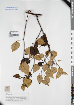
LE 01077713
Rubus ochraceus Cardot det. Averyanov, Leonid Vladimirovich at 20.11.2014
Collectors: Averyanov, Leonid Vladimirovich; Tien Hiep Nguyen; Khang Sinh Nguyen; et al. Field collecting number: CPC7538. Collection date: 20.11.2014. Administrative regions: VN - Tinh Cao Bang. Groups of specimens: L. V. Averyanov specimens; L. V. Averyanov herbarium; Соглашение Минобрнауки №075-15-2021-1056Original label text:FLORA OF VIETNAM
Rosaceae
Rubus ochraceus Cardot
Cao Bang Prov., Bao Lac Distr., Hong An municipality, Mi Lung village.
Primary broad-leaved and mixed humid evergreen forest on very steep slopes and along rocky ridge composed with solid crystalline highly eroded limestone at elevation 1500-1550 m a.s.l. around point 22°50′01.3″N 105°50′05.7″E.
Scandent shrub with shoots ro 2-3 m long in open rocky cliff along ridge edge. Fruits red. Very common.
20 November 2014 CPC 7538
Coll.: L.Averyanov, N.T.Hiep, N.S.Khang, T.Maisak, L.Osinovetz
Coordinates (geographic position): 22° 50′ 1.3″ N, 105° 50′ 5.7″ E ±1000 mRecord creation: 2021-12-02, Tatiana Maisak, PhotoScan D2Citation: Specimen LE 01077713 // Virtual herbarium of Komarov Botanical Institute RAS — http://re.herbariumle.ru/01077713Rosaceae
Rubus ochraceus Cardot
Cao Bang Prov., Bao Lac Distr., Hong An municipality, Mi Lung village.
Primary broad-leaved and mixed humid evergreen forest on very steep slopes and along rocky ridge composed with solid crystalline highly eroded limestone at elevation 1500-1550 m a.s.l. around point 22°50′01.3″N 105°50′05.7″E.
Scandent shrub with shoots ro 2-3 m long in open rocky cliff along ridge edge. Fruits red. Very common.
20 November 2014 CPC 7538
Coll.: L.Averyanov, N.T.Hiep, N.S.Khang, T.Maisak, L.Osinovetz
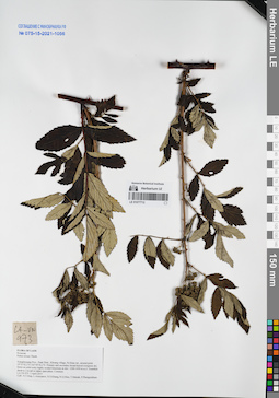
LE 01077712
Rubus niveus Thunb. det. Averyanov, Leonid Vladimirovich at 03.04.2015
Collectors: Tien Hiep Nguyen; Averyanov, Leonid Vladimirovich; Khang Sinh Nguyen; et al. Field collecting number: LA-VN973. Collection date: 03.04.2015. Administrative regions: LA - Xiangkhouang. Groups of specimens: L. V. Averyanov specimens; L. V. Averyanov herbarium; Соглашение Минобрнауки №075-15-2021-1056Original label text:FLORA OF LAOS
Rosaceae
Rubus niveus Thunb.
Xiangkhouang Prov., Peak Distr., Khoang village, Pa Khao mt., around point 19°33′02.2′N 103°39′56.3′E.
Primary and secondary broad-leaved evergreen dry forest on solid rocky highly eroded limestone at elev. 1200-1450 m a.s.l.
Scandent shrub to 3 m tall in rather open place. Common.
LA-VN 973 3 April 2015
Coll.: N.T.Hiep, L.Averyanov, N.S.Khang, N.Q.Hieu, T.Maisak, Pheng Phengsintham.
Coordinates (geographic position): 19° 33′ 2.2″ N, 103° 39′ 56.3″ E ±1000 mRecord creation: 2021-12-02, Tatiana Maisak, PhotoScan D2Citation: Specimen LE 01077712 // Virtual herbarium of Komarov Botanical Institute RAS — http://re.herbariumle.ru/01077712Rosaceae
Rubus niveus Thunb.
Xiangkhouang Prov., Peak Distr., Khoang village, Pa Khao mt., around point 19°33′02.2′N 103°39′56.3′E.
Primary and secondary broad-leaved evergreen dry forest on solid rocky highly eroded limestone at elev. 1200-1450 m a.s.l.
Scandent shrub to 3 m tall in rather open place. Common.
LA-VN 973 3 April 2015
Coll.: N.T.Hiep, L.Averyanov, N.S.Khang, N.Q.Hieu, T.Maisak, Pheng Phengsintham.
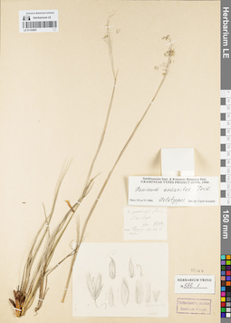
LE 01154597
Groups of specimens: Гербарий Карла Бернхарда Триниуса; Соглашение Минобрнауки №075-15-2021-1056Record creation: 2021-12-02, Marina Yarichina, PhotoScan D2Citation: Specimen LE 01154597 // Virtual herbarium of Komarov Botanical Institute RAS — http://re.herbariumle.ru/01154597
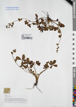
LE 01077711
Potentilla nepalensis Hook. det. Averyanov, Leonid Vladimirovich at 02.04.2015
Collectors: Tien Hiep Nguyen; Averyanov, Leonid Vladimirovich; Khang Sinh Nguyen; et al. Field collecting number: LA-VN911. Collection date: 02.04.2015. Administrative regions: LA - Xiangkhouang. Groups of specimens: L. V. Averyanov specimens; L. V. Averyanov herbarium; Соглашение Минобрнауки №075-15-2021-1056Original label text:FLORA OF LAOS
Rosaceae
Potentilla nepalensis Hook.
Xiangkhouang Prov., Peak Distr., Oran village, around point 19°38′53”N 103°23′12”E.
Primary and secondary broad-leaved evergreen dry forest on shale sandstone slopes and along ridge edge at elev. about 1750-1850 m a.s.l.
Prostrate herb on short tall open grassland among secondaru shrubs. Flowers yellow. Common.
LA-VN 911 2 April 2015
Coll.: N.T.Hiep, L.Averyanov, N.S.Khang, N.Q.Hieu, T.Maisak, Pheng Phengsintham.
Coordinates (geographic position): 19° 38′ 53″ N, 103° 23′ 12″ E ±1000 mRecord creation: 2021-12-02, Tatiana Maisak, PhotoScan D2Citation: Specimen LE 01077711 // Virtual herbarium of Komarov Botanical Institute RAS — http://re.herbariumle.ru/01077711Rosaceae
Potentilla nepalensis Hook.
Xiangkhouang Prov., Peak Distr., Oran village, around point 19°38′53”N 103°23′12”E.
Primary and secondary broad-leaved evergreen dry forest on shale sandstone slopes and along ridge edge at elev. about 1750-1850 m a.s.l.
Prostrate herb on short tall open grassland among secondaru shrubs. Flowers yellow. Common.
LA-VN 911 2 April 2015
Coll.: N.T.Hiep, L.Averyanov, N.S.Khang, N.Q.Hieu, T.Maisak, Pheng Phengsintham.