View
Add
Copy
Edit
Delete
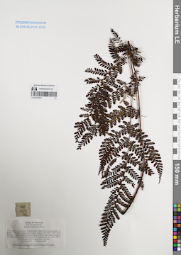
LE 01077819
Diacalpe aspidioides Blume det. Averyanov, Leonid Vladimirovich at 18.03.2002
Collectors: Averyanov, Leonid Vladimirovich; Phan Ke Loc; et al. Field collecting number: HAL2507. Collection date: 18.03.2002. Administrative regions: VN - Tinh Lao Cai. Groups of specimens: L. V. Averyanov specimens; L. V. Averyanov herbarium; Соглашение Минобрнауки №075-15-2021-1056Original label text:FLORA OF VIETNAM
Dryopteridaceae
Diacalpe aspidioides Blume
Northern Vietnam, Lao Cai Prov., Van Ban Distr., Khanh Yen Ha
municipality, to the SW of Na Nheo village (in the vicinity of point
21°57′34′'N, 104°13′49′'E). Primary evergreen broad-leaved wet montane
forest with Fokienia hodginsii on steep granite and quartzite slopes
of SW exposition at elev. 1800-1900 m a.s.l. Terrestrial fern in shady
place. Not rare. HAL 2507 18 March 2002
Collectors: L.Averyanov, P.K.Loc, D.T.Doan (FFI Project).
Coordinates (geographic position): 21° 57′ 34″ N, 104° 13′ 49″ E ±1000 mRecord creation: 2022-01-18, Galina Savich, PhotoScan D2. Processing status: work_status_1Citation: Specimen LE 01077819 // Virtual herbarium of Komarov Botanical Institute RAS — http://re.herbariumle.ru/01077819Dryopteridaceae
Diacalpe aspidioides Blume
Northern Vietnam, Lao Cai Prov., Van Ban Distr., Khanh Yen Ha
municipality, to the SW of Na Nheo village (in the vicinity of point
21°57′34′'N, 104°13′49′'E). Primary evergreen broad-leaved wet montane
forest with Fokienia hodginsii on steep granite and quartzite slopes
of SW exposition at elev. 1800-1900 m a.s.l. Terrestrial fern in shady
place. Not rare. HAL 2507 18 March 2002
Collectors: L.Averyanov, P.K.Loc, D.T.Doan (FFI Project).
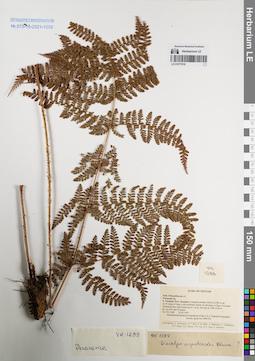
LE 01077818
Diacalpe aspidioides Blume ⟮prelim. ID⟯
Additional identifications: Peranema sp. det. Averyanov, Leonid Vladimirovich at 10.04.1995 Collectors: Averyanov, Leonid Vladimirovich; et al. Field collecting number: VH1288. Collection date: 10.04.1995. Administrative regions: VN - Kon Tum. Groups of specimens: L. V. Averyanov specimens; L. V. Averyanov herbarium; Соглашение Минобрнауки №075-15-2021-1056Original label text:FLORA OF VIETNAM
Polypodiaceae s.l.
Peranema sp.
S. Vietnam, Prov. Kontum. Evergreen primary forest at 2000 m alt.
on W slope of Ngoc Linh mountain system on elevation to Ngoc Gua peak.
Terrestrial fern with fronds up to 1 m lg. Not rare at 1900-2100 m
alt. on NW and W slopes. VH 1288 10.04.1995
International Botanical Expedition of the U.S.A. National Geographic
Society (grant No 5094-93)
Participants: L. Averyanov, N.T. Ban, N. Q. Binh, A. Budantzev, L. Budantzev, N.T. Hiep, D.D. Huyen, P.K. Loc, N.X. Tam, G. Yakovlev
Record creation: 2022-01-18, Galina Savich, PhotoScan D2. Processing status: work_status_1Citation: Specimen LE 01077818 // Virtual herbarium of Komarov Botanical Institute RAS — http://re.herbariumle.ru/01077818Polypodiaceae s.l.
Peranema sp.
S. Vietnam, Prov. Kontum. Evergreen primary forest at 2000 m alt.
on W slope of Ngoc Linh mountain system on elevation to Ngoc Gua peak.
Terrestrial fern with fronds up to 1 m lg. Not rare at 1900-2100 m
alt. on NW and W slopes. VH 1288 10.04.1995
International Botanical Expedition of the U.S.A. National Geographic
Society (grant No 5094-93)
Participants: L. Averyanov, N.T. Ban, N. Q. Binh, A. Budantzev, L. Budantzev, N.T. Hiep, D.D. Huyen, P.K. Loc, N.X. Tam, G. Yakovlev
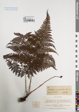
LE 01077817
Diacalpe aspidioides Blume det. Phan Ke Loc at 21.03.1997
Collectors: Averyanov, Leonid Vladimirovich; N.Q. Binh; Phan Ke Loc Field collecting number: VH021. Collection date: 21.03.1997. Administrative regions: VN - Tinh Lam GJong. Groups of specimens: L. V. Averyanov specimens; L. V. Averyanov herbarium; Соглашение Минобрнауки №075-15-2021-1056Original label text:FLORA OF VIETNAM
Record creation: 2022-01-18, Galina Savich, PhotoScan D2Citation: Specimen LE 01077817 // Virtual herbarium of Komarov Botanical Institute RAS — http://re.herbariumle.ru/01077817Diacalpe aspidioides Blume
Lam Dong Prov.
VH 021, 21.03.1997
Leg. Averyanov L. et.al.
Det. Phan Ke Loc at 21.03.1997
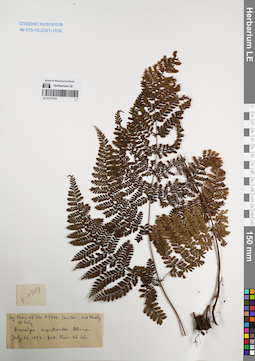
LE 01077816
Diacalpe aspidioides Blume det. Phan Ke Loc at 23.07.1997
Collectors: Phan Ke Loc Field collecting number: P-7349. Collection date: 23.07.1997. Administrative regions: VN - Tinh Lao Cai. Groups of specimens: L. V. Averyanov specimens; L. V. Averyanov herbarium; Соглашение Минобрнауки №075-15-2021-1056Original label text:FLORA OF VIETNAM
Record creation: 2022-01-18, Galina Savich, PhotoScan D2Citation: Specimen LE 01077816 // Virtual herbarium of Komarov Botanical Institute RAS — http://re.herbariumle.ru/01077816Diacalpe aspidioides Blume
Lao Cai Prov.
P-7349, 23.07.1997
Det. Phan Ke Loc
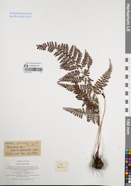
LE 01077815
Diacalpe aspidioides Blume det. Phan Ke Loc at 23.07.1997
Additional identifications: Diacalpe aspidioides Blume det. Averyanov, Leonid Vladimirovich at 21.03.1997 Collectors: Averyanov, Leonid Vladimirovich; N.Q. Binh; Phan Ke Loc Field collecting number: VH3012. Collection date: 21.03.1997. Administrative regions: VN - Tinh Lam GJong. Groups of specimens: L. V. Averyanov specimens; L. V. Averyanov herbarium; Соглашение Минобрнауки №075-15-2021-1056Original label text:FLORA OF VIETNAM
Diacalpe aspidioides Blume.
Coordinates (geographic position): 12° 5′ N, 108° 40′ E ±1000 mRecord creation: 2022-01-18, Galina Savich, PhotoScan D2. Processing status: work_status_1Citation: Specimen LE 01077815 // Virtual herbarium of Komarov Botanical Institute RAS — http://re.herbariumle.ru/01077815Diacalpe aspidioides Blume.
S. Vietnam, Prov. Lam Dong, 29 km to NE from Dalat city, distr.
Lac Duong, municipalite Da Chay. Closed broadleaved cloud forest
on main peak of Bi Dup mountain system at 2260 m alt.(N 12° 05′, E 108° 40′).
Terrestrial fern on wet steep slopes. Not rare.VH 3012 21.03.1997
International Botanical Expedition of the U.S.A. National Geographic
Society (grant No 5803-96)
Collectors: L. Averyanov, N.Q. Binh, P.K. Loc
on main peak of Bi Dup mountain system at 2260 m alt.(N 12° 05′, E 108° 40′).
Terrestrial fern on wet steep slopes. Not rare.VH 3012 21.03.1997
International Botanical Expedition of the U.S.A. National Geographic
Society (grant No 5803-96)
Collectors: L. Averyanov, N.Q. Binh, P.K. Loc
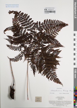
LE 01077814
Monachosorum henryi Christ det. Shmakov, Aleksandr Ivanovich at 02.01.2008
Additional identifications: Monachosorum sp. det. Averyanov, Leonid Vladimirovich at 09.11.2005 Collectors: Averyanov, Leonid Vladimirovich; Phan Ke Loc; et al. Field collecting number: HLF5632. Collection date: 09.11.2005. Administrative regions: VN - Dak Nong. Groups of specimens: L. V. Averyanov specimens; L. V. Averyanov herbarium; Соглашение Минобрнауки №075-15-2021-1056Original label text:FLORA OF VIETNAM
Plants of Ta Dung Nature Reserve
Polypodiaceae s.l.
Monocosorum sp.
Vietnam, Dak Nong Prov., Dak Glong Distr., Dak Plao Municipality, steep mountain slopes along main ridge of Ta Dung mountain system at elevation 1700-1985 m a.s.l. around point of highest peak at 11°51′30″N 108°02′08″E.
Primary broad-leaved evergreen closed wet mossy cloudy forest on crystalline highly metamorphosed sandstone.Terrestrial fern in shady places. Locally common. HLF 5632 9 November 2005.
Coll. L.Averyanov, P.K.Loc, T.V.Thao, N.T.Vinh.
Grant from Henry Luce Foundation.
Coordinates (geographic position): 11° 51′ 30″ N, 108° 2′ 8″ E ±1000 mRecord creation: 2022-01-18, Galina Savich, PhotoScan D2. Processing status: work_status_1Citation: Specimen LE 01077814 // Virtual herbarium of Komarov Botanical Institute RAS — http://re.herbariumle.ru/01077814Plants of Ta Dung Nature Reserve
Polypodiaceae s.l.
Monocosorum sp.
Vietnam, Dak Nong Prov., Dak Glong Distr., Dak Plao Municipality, steep mountain slopes along main ridge of Ta Dung mountain system at elevation 1700-1985 m a.s.l. around point of highest peak at 11°51′30″N 108°02′08″E.
Primary broad-leaved evergreen closed wet mossy cloudy forest on crystalline highly metamorphosed sandstone.Terrestrial fern in shady places. Locally common. HLF 5632 9 November 2005.
Coll. L.Averyanov, P.K.Loc, T.V.Thao, N.T.Vinh.
Grant from Henry Luce Foundation.
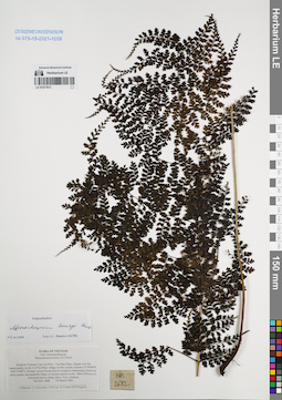
LE 01077813
Monachosorum henryi Christ det. Shmakov, Aleksandr Ivanovich at 02.01.2008
Additional identifications: Monachosorum henryi Christ det. Averyanov, Leonid Vladimirovich at 24.03.2002 Collectors: Averyanov, Leonid Vladimirovich; Phan Ke Loc; D.T. Doan Field collecting number: HAL2682. Collection date: 24.03.2002. Administrative regions: VN - Tinh Lao Cai. Groups of specimens: L. V. Averyanov specimens; L. V. Averyanov herbarium; Соглашение Минобрнауки №075-15-2021-1056Original label text:FLORA OF VIETNAM
Dennstaedtiaceae
Monachosorum henryi H. Christ
Northern Vietnam, Lao Cai Prov., Van Ban Distr., Khanh Yen Ha
municipality, to the S of Na Nheo village (in the vicinity of point
21°59′04′'N, 104°15′08′'E). Primary closed broad-leaved evergreen
submontane forest on steep granite and quartzite slopes of stream
canyon at elev. 900-1250 m a.s.l. Terrestrial fern in shady place. Very
common. HAL 2682 24 March 2002
Collectors: L.Averyanov, P.K.Loc, D.T.Doan (FFI Project).
Coordinates (geographic position): 21° 59′ 4″ N, 104° 15′ 8″ E ±1000 mRecord creation: 2022-01-18, Galina Savich, PhotoScan D2. Processing status: work_status_1Citation: Specimen LE 01077813 // Virtual herbarium of Komarov Botanical Institute RAS — http://re.herbariumle.ru/01077813Dennstaedtiaceae
Monachosorum henryi H. Christ
Northern Vietnam, Lao Cai Prov., Van Ban Distr., Khanh Yen Ha
municipality, to the S of Na Nheo village (in the vicinity of point
21°59′04′'N, 104°15′08′'E). Primary closed broad-leaved evergreen
submontane forest on steep granite and quartzite slopes of stream
canyon at elev. 900-1250 m a.s.l. Terrestrial fern in shady place. Very
common. HAL 2682 24 March 2002
Collectors: L.Averyanov, P.K.Loc, D.T.Doan (FFI Project).
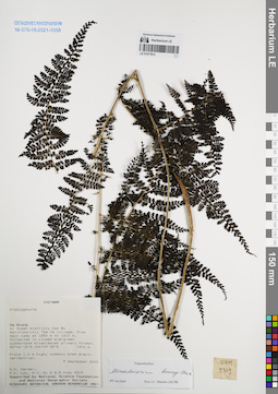
LE 01077812
Monachosorum henryi Christ det. Shmakov, Aleksandr Ivanovich at 02.01.2008
Collectors: D.K. Harder; et al. Field collecting number: DKH5319. Collection date: 09.09.2000. Administrative regions: VN - Tinh Ha Giang. Groups of specimens: L. V. Averyanov specimens; L. V. Averyanov herbarium; Соглашение Минобрнауки №075-15-2021-1056Original label text:FLORA OF VIETNAM
Record creation: 2022-01-18, Galina Savich, PhotoScan D2Citation: Specimen LE 01077812 // Virtual herbarium of Komarov Botanical Institute RAS — http://re.herbariumle.ru/01077812Monachosorum henryi Christ
Ha Giang Prov.
DKH 5319, 09.09.2000
D.K. Harder et.al
det. Shmakov, Aleksandr Ivanovich at 02.01.2008
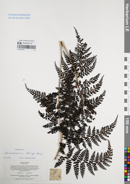
LE 01077811
Monachosorum henryi Christ det. Shmakov, Aleksandr Ivanovich at 02.01.2008
Additional identifications: Monachosorum sp. det. Phan Ke Loc at 03.05.1999 Collectors: Phan Ke Loc; P.H. Hoang; Averyanov, Leonid Vladimirovich Field collecting number: CBL2162. Collection date: 03.05.1999. Administrative regions: VN - Tinh Ha Giang. Groups of specimens: L. V. Averyanov specimens; L. V. Averyanov herbarium; Соглашение Минобрнауки №075-15-2021-1056Original label text:FLORA OF VIETNAM
Monacosorum sp.
N. Vietnam, prov. Ha Giang, distr. Yen Minh, municipality Du Gia, E
slopes of Phu Tha Ca mountain system at 1900 m elev. (N 23°56′ E
105°13′). Primary evergreen broadleaved very wet mossy cloud forest on
quartzite very steep slopes. Terrestrial fern on shady steep rocky
quartzite slopes. Not rare. CBL 2162 03 May 1999
International Botanical Expedition of the U.S.A. National Geographic
Society (grant No 6300-98)
Collectors: P.K.Loc, P.H.Hoang, Averyanov L.
Coordinates (geographic position): 23° 56′ N, 105° 13′ E ±1000 mRecord creation: 2022-01-18, Galina Savich, PhotoScan D2. Processing status: work_status_1Citation: Specimen LE 01077811 // Virtual herbarium of Komarov Botanical Institute RAS — http://re.herbariumle.ru/01077811Monacosorum sp.
N. Vietnam, prov. Ha Giang, distr. Yen Minh, municipality Du Gia, E
slopes of Phu Tha Ca mountain system at 1900 m elev. (N 23°56′ E
105°13′). Primary evergreen broadleaved very wet mossy cloud forest on
quartzite very steep slopes. Terrestrial fern on shady steep rocky
quartzite slopes. Not rare. CBL 2162 03 May 1999
International Botanical Expedition of the U.S.A. National Geographic
Society (grant No 6300-98)
Collectors: P.K.Loc, P.H.Hoang, Averyanov L.
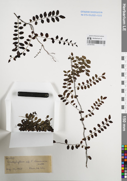
LE 01077810
Teratophyllum clemensiae Holttum det. Phan Ke Loc at 15.08.1997
Collectors: Averyanov, Leonid Vladimirovich; et al. Field collecting number: VH4827. Collection date: 18.05.1997. Administrative regions: VN - Tinh Quang Binh. Groups of specimens: L. V. Averyanov specimens; L. V. Averyanov herbarium; Соглашение Минобрнауки №075-15-2021-1056Original label text:FLORA OF VIETNAM
Polypodiaceae s.l.
Teratophyllum clemensiae Holttum
Record creation: 2022-01-18, Galina Savich, PhotoScan D2Citation: Specimen LE 01077810 // Virtual herbarium of Komarov Botanical Institute RAS — http://re.herbariumle.ru/01077810Polypodiaceae s.l.
Teratophyllum clemensiae Holttum
N. Vietnam, Prov. Quang Binh, distr. Minh Hoa, 72 km to NWW from Dong Hoi, municipalite Thuong Hoa, Yen Son village, limestone massif Ke Bang (N 17°40' E 105°57'). Broadleaved evergreen primary dry closed forest on steep slopes and bluffs of limestone mesas and ridges at 400-450 m alt. Creeping epiphytic vine up to 4 m lg on shadow steep slopes. Rare.
No VH 4827 18.05.1997
International Botanical Expedition of the U.S.A. National Geographic Society (grant No 5803-96)
Collectors: L. Averyanov, N.T. Hiep, P.K. Loc
det. Phan Ke Loc at 15.08.1997
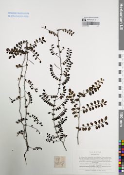
LE 01077809
Teratophyllum clemensiae Holttum ⟮prelim. ID⟯ det. Averyanov, Leonid Vladimirovich at 13.10.2023
Additional identifications: Polypodiaceae sp. det. Averyanov, Leonid Vladimirovich at 18.05.1997 Collectors: Averyanov, Leonid Vladimirovich; Tien Hiep Nguyen; Phan Ke Loc Field collecting number: VH4827. Collection date: 18.05.1997. Administrative regions: VN - Tinh Quang Binh. Groups of specimens: L. V. Averyanov specimens; L. V. Averyanov herbarium; Соглашение Минобрнауки №075-15-2021-1056Original label text:FLORA OF VIETNAM
Polypodiaceae sp.
N. Vietnam, Prov. Quang Binh, distr. Minh Hoa, 72 km to NWW from Dong Hoi, municipalite Thuong Hoa, Yen Son village, limestone massif Ke Bang (N 17°40′ E 105°57′). Broadleaved evergreen primary dry closed forest on steep slopes and bluffs of limestone mesas and ridges at 400-450 m alt. Creeping epiphytic vine up to 4 m lg on shadow steep slopes. Rare.
VH 4827 18.05.1997
International Botanical Expedition of the U.S.A. National Geographic Society (grant No 5803-96)
Collectors: L. Averyanov, N.T. Hiep, P.K. Loc
Coordinates (geographic position): 17° 40′ N, 105° 57′ E ±1000 mRecord creation: 2022-01-18, Galina Savich, PhotoScan D2Citation: Specimen LE 01077809 // Virtual herbarium of Komarov Botanical Institute RAS — http://re.herbariumle.ru/01077809Polypodiaceae sp.
N. Vietnam, Prov. Quang Binh, distr. Minh Hoa, 72 km to NWW from Dong Hoi, municipalite Thuong Hoa, Yen Son village, limestone massif Ke Bang (N 17°40′ E 105°57′). Broadleaved evergreen primary dry closed forest on steep slopes and bluffs of limestone mesas and ridges at 400-450 m alt. Creeping epiphytic vine up to 4 m lg on shadow steep slopes. Rare.
VH 4827 18.05.1997
International Botanical Expedition of the U.S.A. National Geographic Society (grant No 5803-96)
Collectors: L. Averyanov, N.T. Hiep, P.K. Loc
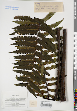
LE 01068300
Cyathea gigantea (Wall. ex Hook.) Holttum det. Phan Ke Loc at 22.07.1997
Collectors: Averyanov, Leonid Vladimirovich; N.Q. Binh; Phan Ke Loc Field collecting number: VH3589. Collection date: 03.04.1997. Administrative regions: VN - Tinh Ninh Thuan. Groups of specimens: L. V. Averyanov specimens; L. V. Averyanov herbarium; Соглашение Минобрнауки №075-15-2021-1056Original label text:FLORA OF VIETNAM
Cyathea gigantea (Hook.) Holtt.
S. Vietnam, Prov. Ninh Thuan, distr. Ninh Son, municipalite Phuoc Binh
in 34 km to NE from Dalat city. Closed primary broadleaved forest
along mt ridge between Bi Dup and Gia Rinh mt. mt at 1800-1900 m alt.
(N 12° 07′, E 108° 42′).
Woody fern with stem up to 2 m hg and fronds about 2 m lg in deep wet
stream canyon. Not rare.
VH 3589 03.04.1997
International Botanical Expedition of the U.S.A. National Geographic
Society (grant No 5803-96)
Collectors: L. Averyanov, N.Q. Binh, P.K. Loc
Coordinates (geographic position): 12° 7′ N, 108° 42′ E ±1000 mRecord creation: 2022-01-18, Galina Savich, PhotoScan D2Citation: Specimen LE 01068300 // Virtual herbarium of Komarov Botanical Institute RAS — http://re.herbariumle.ru/01068300Cyathea gigantea (Hook.) Holtt.
S. Vietnam, Prov. Ninh Thuan, distr. Ninh Son, municipalite Phuoc Binh
in 34 km to NE from Dalat city. Closed primary broadleaved forest
along mt ridge between Bi Dup and Gia Rinh mt. mt at 1800-1900 m alt.
(N 12° 07′, E 108° 42′).
Woody fern with stem up to 2 m hg and fronds about 2 m lg in deep wet
stream canyon. Not rare.
VH 3589 03.04.1997
International Botanical Expedition of the U.S.A. National Geographic
Society (grant No 5803-96)
Collectors: L. Averyanov, N.Q. Binh, P.K. Loc
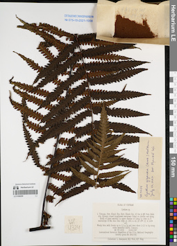
LE 01068299
Cyathea gigantea (Wall. ex Hook.) Holttum det. Phan Ke Loc at 22.07.1997
Collectors: Averyanov, Leonid Vladimirovich; N.Q. Binh; Tien Hiep Nguyen Field collecting number: VH4324. Collection date: 24.04.1997. Administrative regions: VN - Tinh Khanh Hoa. Groups of specimens: L. V. Averyanov specimens; L. V. Averyanov herbarium; Соглашение Минобрнауки №075-15-2021-1056Original label text:FLORA OF VIETNAM
Cyathea gigantea (Hook.) Holtt.
S. Vietnam, Prov. Khanh Hoa, distr. Khanh Son, 42 km to NE from Dalat
city. Primary closed broadleaved evergreen forest on shelfes and along
bluffs of giant waterfall in upper reaches of Lieng Ly river
on E macroslope of Hon Giao mt. ridge at 1300 m alt.
(N 12° 12′, E 108° 44′).
Woody fern with fronds up to 2.5 m lg and stem about 2-2.5 m hg along
rocky waterfall bluffs. Common.
VH 4324 24.04.1997
International Botanical Expedition of the U.S.A. National Geographic
Society (grant No 5803-96)
Collectors: L. Averyanov, N.Q. Binh, N.T. Hiep
Coordinates (geographic position): 12° 12′ N, 108° 44′ E ±1000 mRecord creation: 2022-01-18, Galina Savich, PhotoScan D2Citation: Specimen LE 01068299 // Virtual herbarium of Komarov Botanical Institute RAS — http://re.herbariumle.ru/01068299Cyathea gigantea (Hook.) Holtt.
S. Vietnam, Prov. Khanh Hoa, distr. Khanh Son, 42 km to NE from Dalat
city. Primary closed broadleaved evergreen forest on shelfes and along
bluffs of giant waterfall in upper reaches of Lieng Ly river
on E macroslope of Hon Giao mt. ridge at 1300 m alt.
(N 12° 12′, E 108° 44′).
Woody fern with fronds up to 2.5 m lg and stem about 2-2.5 m hg along
rocky waterfall bluffs. Common.
VH 4324 24.04.1997
International Botanical Expedition of the U.S.A. National Geographic
Society (grant No 5803-96)
Collectors: L. Averyanov, N.Q. Binh, N.T. Hiep
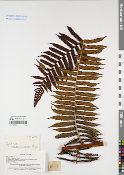
LE 01068298
Cyathea contaminans Copel. det. Averyanov, Leonid Vladimirovich at 23.02.1995
Collectors: Averyanov, Leonid Vladimirovich; N.T. Ban; N.Q. Binh; et al. Field collecting number: VH219. Collection date: 23.02.1995. Administrative regions: VN - Kon Tum. Groups of specimens: L. V. Averyanov specimens; L. V. Averyanov herbarium; Соглашение Минобрнауки №075-15-2021-1056Original label text:FLORA OF VIETNAM
Fam. Cyatheaceae
Record creation: 2022-01-18, Galina Savich, PhotoScan D2Citation: Specimen LE 01068298 // Virtual herbarium of Komarov Botanical Institute RAS — http://re.herbariumle.ru/01068298Fam. Cyatheaceae
Cyathea contaminans Copel.
S. Vietnam, Prov. Kon Tum.
VH 219 23.02.1995
Participants : L. Averyanov, N.T.Ban, N.Q.Binh et. al.
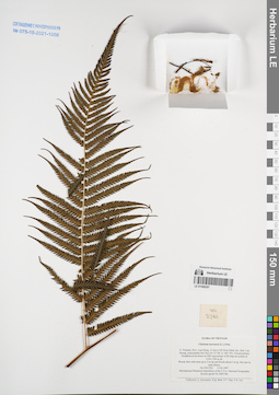
LE 01068297
Cibotium barometz (L.) J.Sm. det. Averyanov, Leonid Vladimirovich at 17.03.1997
Collectors: Averyanov, Leonid Vladimirovich; N.Q. Binh; Nong Van Duy; Phan Ke Loc Field collecting number: VH2761. Collection date: 17.03.1997. Administrative regions: VN - Tinh Lam GJong. Groups of specimens: L. V. Averyanov specimens; L. V. Averyanov herbarium; Соглашение Минобрнауки №075-15-2021-1056Original label text:FLORA OF VIETNAM
Cibotium barometz (L.) J.Sm.
S. Vietnam, Prov. Lam Dong, 31 km to NE from Dalat city, distr. Lac
Duong, municipalite Da Chay (N 12° 08′, E 108° 39′). Closed primary
broadleaved mt forest on NW macroslope of Bi Dup mt system at
1550-1700 m alt.
Woody fern with stem up to 2 m hg and fronds about 3 m lg. Not rare in
open places.
VH 2761 17.03.1997
International Botanical Expedition of the U.S.A. National Geographic
Society (grant No 5803-96)
Collectors: L. Averyanov, N.Q. Binh, N.V. Duy, P.K. Loc
Coordinates (geographic position): 12° 8′ N, 108° 39′ E ±1000 mRecord creation: 2022-01-18, Galina Savich, PhotoScan D2Citation: Specimen LE 01068297 // Virtual herbarium of Komarov Botanical Institute RAS — http://re.herbariumle.ru/01068297Cibotium barometz (L.) J.Sm.
S. Vietnam, Prov. Lam Dong, 31 km to NE from Dalat city, distr. Lac
Duong, municipalite Da Chay (N 12° 08′, E 108° 39′). Closed primary
broadleaved mt forest on NW macroslope of Bi Dup mt system at
1550-1700 m alt.
Woody fern with stem up to 2 m hg and fronds about 3 m lg. Not rare in
open places.
VH 2761 17.03.1997
International Botanical Expedition of the U.S.A. National Geographic
Society (grant No 5803-96)
Collectors: L. Averyanov, N.Q. Binh, N.V. Duy, P.K. Loc
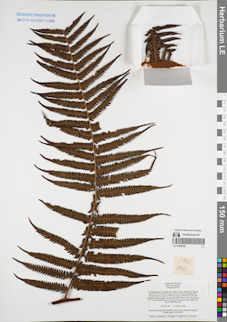
LE 01068296
Cibotium barometz (L.) J.Sm. det. Averyanov, Leonid Vladimirovich at 11.11.1998
Collectors: Averyanov, Leonid Vladimirovich; N.Q. Binh; Tien Hiep Nguyen; Phan Ke Loc; Nguyen Xuan Tam Field collecting number: CBL146. Collection date: 11.11.1998. Administrative regions: VN - Tinh Cao Bang. Groups of specimens: L. V. Averyanov specimens; L. V. Averyanov herbarium; Соглашение Минобрнауки №075-15-2021-1056Original label text:FLORA OF VIETNAM
Polypodiaceae
Cybotium baromez
N. Vietnam, prov. Cao Bang, distr. Nguyen Binh, municipality Nguyen
Binh (N 22°37′ E 105°52′), about 41 km to W from Cao Bang town.
Elevation from Le A pass to Na Ni mt. peak at 1400-1900 m alt. Old
secondary closed evegreen wet mountain forest. Woody fern with stem up
to 1.5 m hg with fronds about 3 m lg in wet canyons of mt stream. Not
rare at 13001500 m alt.
CBL 146 11-12 Nov. 1998
International Botanical Expedition of the U.S.A. National Geographic
Society (grant No 6300-98)
Collectors: Averyanov L., N.Q.Binh, N.T.Hiep, P.K.Loc, N.X.Tam.
Coordinates (geographic position): 22° 37′ N, 105° 52′ E ±1000 mRecord creation: 2022-01-18, Galina Savich, PhotoScan D2Citation: Specimen LE 01068296 // Virtual herbarium of Komarov Botanical Institute RAS — http://re.herbariumle.ru/01068296Polypodiaceae
Cybotium baromez
N. Vietnam, prov. Cao Bang, distr. Nguyen Binh, municipality Nguyen
Binh (N 22°37′ E 105°52′), about 41 km to W from Cao Bang town.
Elevation from Le A pass to Na Ni mt. peak at 1400-1900 m alt. Old
secondary closed evegreen wet mountain forest. Woody fern with stem up
to 1.5 m hg with fronds about 3 m lg in wet canyons of mt stream. Not
rare at 13001500 m alt.
CBL 146 11-12 Nov. 1998
International Botanical Expedition of the U.S.A. National Geographic
Society (grant No 6300-98)
Collectors: Averyanov L., N.Q.Binh, N.T.Hiep, P.K.Loc, N.X.Tam.
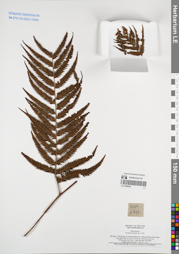
LE 01068295
Cibotium barometz (L.) J.Sm. det. N.Tap at 30.03.2006
Collectors: N.Tap; Ngo Van Trai Field collecting number: HLF6347. Collection date: 30.03.2006. Administrative regions: VN - Tinh Quang Tri. Groups of specimens: L. V. Averyanov specimens; L. V. Averyanov herbarium; Соглашение Минобрнауки №075-15-2021-1056Original label text:VLORA OF VIETNAM
Record creation: 2022-01-18, Galina Savich, PhotoScan D2Citation: Specimen LE 01068295 // Virtual herbarium of Komarov Botanical Institute RAS — http://re.herbariumle.ru/01068295Disksoniaceae
Cibotium barometz (L.) J.Sm.
Tinh Quang Tri Prov.
N.Tap , Ngo Van Trai
30.03.2006 HLF 6347
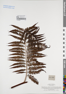
LE 01068294
Cibotium barometz (L.) J.Sm. det. Averyanov, Leonid Vladimirovich at 30.03.2006
Collectors: Tien Hiep Nguyen; Averyanov, Leonid Vladimirovich; Phan Ke Loc; et al. Field collecting number: HLF5894. Collection date: 30.03.2006. Administrative regions: VN - Tinh Quang Tri. Groups of specimens: L. V. Averyanov specimens; L. V. Averyanov herbarium; Соглашение Минобрнауки №075-15-2021-1056Original label text:FLORA OF VIETNAM
Polypodiaceae s.l. (Dicksoniaceae)
Cibotium barometz
Vietnam, Quang Tri Prov., Huong Hoa Distr., Huong Phung Municipality, vicinities of Sa Mui pass, around point 16°46′49″N 106°35′28″E at elevation about 600-700 m a.s.l.
Remnants of primary broad-leaved evergreen submontane forest along rocky river valley on shale rocks.
Terrestrial fern in open slope. Common.
HLF 5894 30 March 2006.
Coll. N.T.Hiep, L.Averyanov, P.K.Loc, P.V.The, N.S.Khang, P.H.Duc, L.T.Son, S.Bounphanmy, T.K.Ratana, O.Sonliya, T.Q.Dang, N.V.Hien, H.T.N.Trang, L.T.Chau.
Grant from Henry Luce Foundation.
Vietnam, Quang Tri Prov., Huong Hoa Distr., Huong Phung Municipality, vicinities of Sa Mui pass, around point 16°46′49″N 106°35′28″E at elevation about 600-700 m a.s.l.
Remnants of primary broad-leaved evergreen submontane forest along rocky river valley on shale rocks.
Terrestrial fern in open slope. Common.
HLF 5894 30 March 2006.
Coll. N.T.Hiep, L.Averyanov, P.K.Loc, P.V.The, N.S.Khang, P.H.Duc, L.T.Son, S.Bounphanmy, T.K.Ratana, O.Sonliya, T.Q.Dang, N.V.Hien, H.T.N.Trang, L.T.Chau.
Grant from Henry Luce Foundation.
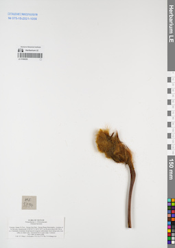
LE 01068293
Cibotium barometz (L.) J.Sm. det. Averyanov, Leonid Vladimirovich at 30.03.2006
Collectors: Tien Hiep Nguyen; Averyanov, Leonid Vladimirovich; Phan Ke Loc; et al. Field collecting number: HLF5894. Collection date: 30.03.2006. Administrative regions: VN - Tinh Quang Tri. Groups of specimens: L. V. Averyanov specimens; L. V. Averyanov herbarium; Соглашение Минобрнауки №075-15-2021-1056Original label text:FLORA OF VIETNAM
Polypodiaceae s.l. (Dicksoniaceae)
Cibotium barometz
Vietnam, Quang Tri Prov., Huong Hoa Distr., Huong Phung Municipality, vicinities of Sa Mui pass, around point 16°46′49″N 106°35′28″E at elevation about 600-700 m a.s.l.
Remnants of primary broad-leaved evergreen submontane forest along rocky river valley on shale rocks.
Terrestrial fern in open slope. Common.
HLF 5894 30 March 2006.
Coll. N.T.Hiep, L.Averyanov, P.K.Loc, P.V.The, N.S.Khang, P.H.Duc, L.T.Son, S.Bounphanmy, T.K.Ratana, O.Sonliya, T.Q.Dang, N.V.Hien, H.T.N.Trang, L.T.Chau.
Grant from Henry Luce Foundation.
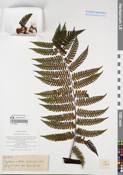
LE 01068292
Cyathea salletii Tardieu & C.Chr. ex C.Chr. & Tardieu det. Phan Ke Loc at 22.07.1997
Collectors: Averyanov, Leonid Vladimirovich; N.Q. Binh; Phan Ke Loc Field collecting number: VH2856. Collection date: 18.03.1997. Administrative regions: VN - Tinh Lam GJong. Groups of specimens: L. V. Averyanov specimens; L. V. Averyanov herbarium; Соглашение Минобрнауки №075-15-2021-1056Original label text:FLORA OF VIETNAM
Cyathea salletti Tardieu et C.Chr.
S. Vietnam, Prov. Lam Dong, distr. Lac Duong, municipalite Da Chay,
35 km to NE from Dalat city. Closed primary broadleaved mt forest
on W macroslope of Gia Rinh mt. ridge at 1800-1900 m alt.
(N 12° 09′, E 108° 41′).
Woody fern with stem up to 3 m hg and fronds about 2.5 m lg. Not rare
in deep wet canyons.
VH 2856 18.03.1997
International Botanical Expedition of the U.S.A. National Geographic
Society (grant No 5803-96)
Collectors: L. Averyanov, N.Q. Binh, P.K. Loc
Coordinates (geographic position): 12° 9′ N, 108° 41′ E ±1000 mRecord creation: 2022-01-18, Galina Savich, PhotoScan D2Citation: Specimen LE 01068292 // Virtual herbarium of Komarov Botanical Institute RAS — http://re.herbariumle.ru/01068292Cyathea salletti Tardieu et C.Chr.
S. Vietnam, Prov. Lam Dong, distr. Lac Duong, municipalite Da Chay,
35 km to NE from Dalat city. Closed primary broadleaved mt forest
on W macroslope of Gia Rinh mt. ridge at 1800-1900 m alt.
(N 12° 09′, E 108° 41′).
Woody fern with stem up to 3 m hg and fronds about 2.5 m lg. Not rare
in deep wet canyons.
VH 2856 18.03.1997
International Botanical Expedition of the U.S.A. National Geographic
Society (grant No 5803-96)
Collectors: L. Averyanov, N.Q. Binh, P.K. Loc
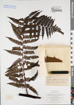
LE 01068291
Cyathea salletii Tardieu & C.Chr. ex C.Chr. & Tardieu det. Phan Ke Loc at 22.07.1997
Collectors: Averyanov, Leonid Vladimirovich; N.Q. Binh; Phan Ke Loc Field collecting number: VH3128. Collection date: 23.03.1997. Administrative regions: VN - Tinh Lam GJong. Groups of specimens: L. V. Averyanov specimens; L. V. Averyanov herbarium; Соглашение Минобрнауки №075-15-2021-1056Original label text:FLORA OF VIETNAM
Cyathea salletti Tardieu et C.Chr.
S. Vietnam, Prov. Lam Dong, 29 km to NE from Dalat city, distr.
Lac Duong, municipalite Da Chay. Primary wet closed broadleaved cloud
forest along main Bi Dup ridge at 1900-2000 m alt.
(N 12° 06′, E 108° 39′).
Woody fern with stem up to 4 m hg and fronds about 2 m lg on steep
slopes of wet stream canyon. Not common.
VH 3128 23.03.1997
International Botanical Expedition of the U.S.A. National Geographic
Society (grant No 5803-96)
Collectors: L. Averyanov, N.Q. Binh, P.K. Loc
Coordinates (geographic position): 12° 6′ N, 108° 39′ E ±1000 mRecord creation: 2022-01-18, Galina Savich, PhotoScan D2Citation: Specimen LE 01068291 // Virtual herbarium of Komarov Botanical Institute RAS — http://re.herbariumle.ru/01068291Cyathea salletti Tardieu et C.Chr.
S. Vietnam, Prov. Lam Dong, 29 km to NE from Dalat city, distr.
Lac Duong, municipalite Da Chay. Primary wet closed broadleaved cloud
forest along main Bi Dup ridge at 1900-2000 m alt.
(N 12° 06′, E 108° 39′).
Woody fern with stem up to 4 m hg and fronds about 2 m lg on steep
slopes of wet stream canyon. Not common.
VH 3128 23.03.1997
International Botanical Expedition of the U.S.A. National Geographic
Society (grant No 5803-96)
Collectors: L. Averyanov, N.Q. Binh, P.K. Loc
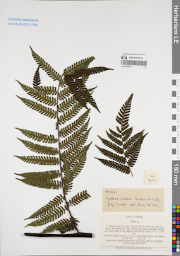
LE 01068290
Cyathea salletii Tardieu & C.Chr. ex C.Chr. & Tardieu det. Phan Ke Loc at 22.07.1997
Collectors: Averyanov, Leonid Vladimirovich; N.Q. Binh; Phan Ke Loc Field collecting number: VH3104. Collection date: 23.03.1997. Administrative regions: VN - Tinh Lam GJong. Groups of specimens: L. V. Averyanov specimens; L. V. Averyanov herbarium; Соглашение Минобрнауки №075-15-2021-1056Original label text:FLORA OF VIETNAM
Cyathea salletti Tardieu et C.Chr.
S. Vietnam, Prov. Lam Dong, 29 km to NE from Dalat city, distr.
Lac Duong, municipalite Da Chay. Primary wet closed broadleaved cloud
forest along main Bi Dup ridge at 1900-2000 m alt.
(N 12° 06′, E 108° 39′).
Woody fern with stem up to 4 m hg in wet stream canyon. Not common.
VH 3104 23.03.1997
International Botanical Expedition of the U.S.A. National Geographic
Society (grant No 5803-96)
Collectors: L. Averyanov, N.Q. Binh, P.K. Loc
Coordinates (geographic position): 12° 6′ N, 108° 39′ E ±1000 mRecord creation: 2022-01-18, Galina Savich, PhotoScan D2Citation: Specimen LE 01068290 // Virtual herbarium of Komarov Botanical Institute RAS — http://re.herbariumle.ru/01068290Cyathea salletti Tardieu et C.Chr.
S. Vietnam, Prov. Lam Dong, 29 km to NE from Dalat city, distr.
Lac Duong, municipalite Da Chay. Primary wet closed broadleaved cloud
forest along main Bi Dup ridge at 1900-2000 m alt.
(N 12° 06′, E 108° 39′).
Woody fern with stem up to 4 m hg in wet stream canyon. Not common.
VH 3104 23.03.1997
International Botanical Expedition of the U.S.A. National Geographic
Society (grant No 5803-96)
Collectors: L. Averyanov, N.Q. Binh, P.K. Loc
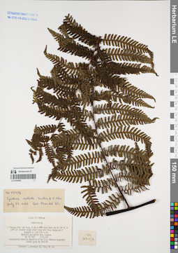
LE 01068289
Cyathea salletii Tardieu & C.Chr. ex C.Chr. & Tardieu det. Phan Ke Loc at 22.07.1995
Collectors: Averyanov, Leonid Vladimirovich; N.Q. Binh; Phan Ke Loc Field collecting number: VH2547. Collection date: 11.03.1997. Administrative regions: VN - Tinh Lam GJong. Groups of specimens: L. V. Averyanov specimens; L. V. Averyanov herbarium; Соглашение Минобрнауки №075-15-2021-1056Original label text:FLORA OF VIETNAM
Asplenium wrightii Eaton
S. Vietnam, Prov. Lam Dong, 14 km to NNW from Dalat city (N 12° 05′, E 108° 22′). Primary closed mixed forest with Pinus kesiya and P.
krempfii at 1740-1760 m alt.
Epiphytic and epilitic fern. Common.
VH 2547 11.03.1997
International Botanical Expedition of the U.S.A. National Geographic
Society (grant No 5803-96)
Collectors: L. Averyanov, N.Q. Binh, N.V. Duy, P.K. Loc
Coordinates (geographic position): 12° 5′ N, 108° 22′ E ±1000 mRecord creation: 2022-01-18, Galina Savich, PhotoScan D2Citation: Specimen LE 01068289 // Virtual herbarium of Komarov Botanical Institute RAS — http://re.herbariumle.ru/01068289Asplenium wrightii Eaton
S. Vietnam, Prov. Lam Dong, 14 km to NNW from Dalat city (N 12° 05′, E 108° 22′). Primary closed mixed forest with Pinus kesiya and P.
krempfii at 1740-1760 m alt.
Epiphytic and epilitic fern. Common.
VH 2547 11.03.1997
International Botanical Expedition of the U.S.A. National Geographic
Society (grant No 5803-96)
Collectors: L. Averyanov, N.Q. Binh, N.V. Duy, P.K. Loc
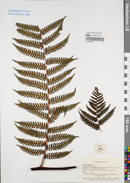
LE 01068288
Cyathea salletii Tardieu & C.Chr. ex C.Chr. & Tardieu det. Averyanov, Leonid Vladimirovich at 24.03.1995
Collectors: Averyanov, Leonid Vladimirovich; et al. Field collecting number: VH917. Collection date: 24.03.1995. Administrative regions: VN - Tinh Quang Nam. Groups of specimens: L. V. Averyanov specimens; L. V. Averyanov herbarium; Соглашение Минобрнауки №075-15-2021-1056Original label text:FLORA OF VIETNAM
Polypodiaceae s.l.
Cybothium sp. ?
S. Vietnam, Prov. Quangnam-Danang. Evegreen close primary forest
on NE slope of Ngoc Linh mountain system at 2000 m alt.
Woody fern with stem up to 3 m high and fronds near 2 m lg. Rare on N
slopes.
VH 917 24.03.1995
International Botanical Expedition of the U.S.A. National Geographic
Society (grant No 5094-93)
Participants: L. Averyanov, N.T. Ban, A. Budantzev, L. Budantzev,
N.T. Hiep, D.D. Huyen, P.K. Loc, G. Yakovlev
Record creation: 2022-01-18, Galina Savich, PhotoScan D2Citation: Specimen LE 01068288 // Virtual herbarium of Komarov Botanical Institute RAS — http://re.herbariumle.ru/01068288Polypodiaceae s.l.
Cybothium sp. ?
S. Vietnam, Prov. Quangnam-Danang. Evegreen close primary forest
on NE slope of Ngoc Linh mountain system at 2000 m alt.
Woody fern with stem up to 3 m high and fronds near 2 m lg. Rare on N
slopes.
VH 917 24.03.1995
International Botanical Expedition of the U.S.A. National Geographic
Society (grant No 5094-93)
Participants: L. Averyanov, N.T. Ban, A. Budantzev, L. Budantzev,
N.T. Hiep, D.D. Huyen, P.K. Loc, G. Yakovlev
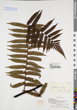
LE 01068287
Cyathea salletii Tardieu & C.Chr. ex C.Chr. & Tardieu det. Averyanov, Leonid Vladimirovich at 23.02.1995
Collectors: Averyanov, Leonid Vladimirovich; et al. Field collecting number: VH029. Collection date: 23.02.1995. Administrative regions: VN - Kon Tum. Groups of specimens: L. V. Averyanov specimens; L. V. Averyanov herbarium; Соглашение Минобрнауки №075-15-2021-1056Original label text:FLORA OF VIETNAM
Polypodiaceae s.l.
Cyathea salletii Jord.et C.Chr.
S. Vietnam, Prov. Kontum. NW slopes of Ngoc Linh mountain system
at 1200 m alt. near Ngoc Linh village. Evergreen primary forest.
Woody fern up[ to 4 m high, with fronds up to 3 m length.
VH 029 23.02.1995
International Botanical Expedition of the U.S.A. National Geographic
Society (grant No 5094-93)
Participants: L. Averyanov, N.T. Ban, N. Q. Binh, A. Budantzev, L. Budantzev, N.T. Hiep, D.D. Huyen, P.K. Loc, N.X. Tam, G. Yakovlev
Record creation: 2022-01-18, Galina Savich, PhotoScan D2Citation: Specimen LE 01068287 // Virtual herbarium of Komarov Botanical Institute RAS — http://re.herbariumle.ru/01068287Polypodiaceae s.l.
Cyathea salletii Jord.et C.Chr.
S. Vietnam, Prov. Kontum. NW slopes of Ngoc Linh mountain system
at 1200 m alt. near Ngoc Linh village. Evergreen primary forest.
Woody fern up[ to 4 m high, with fronds up to 3 m length.
VH 029 23.02.1995
International Botanical Expedition of the U.S.A. National Geographic
Society (grant No 5094-93)
Participants: L. Averyanov, N.T. Ban, N. Q. Binh, A. Budantzev, L. Budantzev, N.T. Hiep, D.D. Huyen, P.K. Loc, N.X. Tam, G. Yakovlev
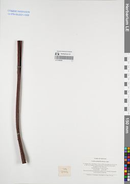
LE 01068286
Cyathea podophylla Copel. det. Averyanov, Leonid Vladimirovich at 11.03.1997
Collectors: Averyanov, Leonid Vladimirovich; N.Q. Binh; Nguyen Van Duy; Phan Ke Loc Field collecting number: VH2548. Collection date: 11.03.1997. Administrative regions: VN - Tinh Lam GJong. Groups of specimens: L. V. Averyanov specimens; L. V. Averyanov herbarium; Соглашение Минобрнауки №075-15-2021-1056Original label text:FLORA OF VIETNAM
Cyathea podophylla (Hook.) Copel.
S. Vietnam, Prov. Lam Dong, 14 km to NNW from Dalat city (N 12° 05′, E 108° 22′). Primary closed mixed forest with Pinus kesiya and P.
krempfii at 1740-1760 m alt.
Woody fern up to 3 m hg. Not rare.
VH 2548 11.03.1997
International Botanical Expedition of the U.S.A. National Geographic
Society (grant No 5803-96)
Collectors: L. Averyanov, N.Q. Binh, N.V. Duy, P.K. Loc
Coordinates (geographic position): 12° 5′ N, 108° 22′ E ±1000 mRecord creation: 2022-01-18, Galina Savich, PhotoScan D2Citation: Specimen LE 01068286 // Virtual herbarium of Komarov Botanical Institute RAS — http://re.herbariumle.ru/01068286Cyathea podophylla (Hook.) Copel.
S. Vietnam, Prov. Lam Dong, 14 km to NNW from Dalat city (N 12° 05′, E 108° 22′). Primary closed mixed forest with Pinus kesiya and P.
krempfii at 1740-1760 m alt.
Woody fern up to 3 m hg. Not rare.
VH 2548 11.03.1997
International Botanical Expedition of the U.S.A. National Geographic
Society (grant No 5803-96)
Collectors: L. Averyanov, N.Q. Binh, N.V. Duy, P.K. Loc
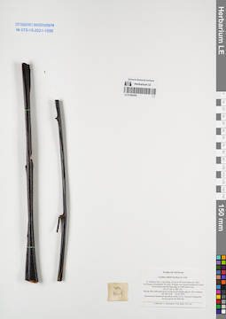
LE 01068285
Cyathea salletii Tardieu & C.Chr. ex C.Chr. & Tardieu det. Averyanov, Leonid Vladimirovich at 23.03.1997
Collectors: Averyanov, Leonid Vladimirovich; N.Q. Binh; Phan Ke Loc Field collecting number: VH3104. Collection date: 23.03.1997. Administrative regions: VN - Tinh Lam GJong. Groups of specimens: L. V. Averyanov specimens; L. V. Averyanov herbarium; Соглашение Минобрнауки №075-15-2021-1056Original label text:FLORA OF VIETNAM
Cyathea salletti Tardieu et C.Chr.
S. Vietnam, Prov. Lam Dong, 29 km to NE from Dalat city, distr.
Lac Duong, municipalite Da Chay. Primary wet closed broadleaved cloud
forest along main Bi Dup ridge at 1900-2000 m alt.
(N 12° 06′, E 108° 39′).
Woody fern with stem up to 4 m hg in wet stream canyon. Not common.
VH 3104 23.03.1997
International Botanical Expedition of the U.S.A. National Geographic
Society (grant No 5803-96)
Collectors: L. Averyanov, N.Q. Binh, P.K. Loc
Coordinates (geographic position): 12° 6′ N, 108° 39′ E ±1000 mRecord creation: 2022-01-18, Galina Savich, PhotoScan D2Citation: Specimen LE 01068285 // Virtual herbarium of Komarov Botanical Institute RAS — http://re.herbariumle.ru/01068285Cyathea salletti Tardieu et C.Chr.
S. Vietnam, Prov. Lam Dong, 29 km to NE from Dalat city, distr.
Lac Duong, municipalite Da Chay. Primary wet closed broadleaved cloud
forest along main Bi Dup ridge at 1900-2000 m alt.
(N 12° 06′, E 108° 39′).
Woody fern with stem up to 4 m hg in wet stream canyon. Not common.
VH 3104 23.03.1997
International Botanical Expedition of the U.S.A. National Geographic
Society (grant No 5803-96)
Collectors: L. Averyanov, N.Q. Binh, P.K. Loc
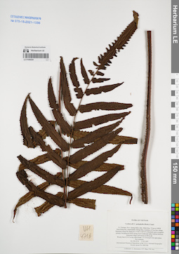
LE 01068284
Cyathea podophylla Copel. det. Averyanov, Leonid Vladimirovich at 17.05.1997
Collectors: Averyanov, Leonid Vladimirovich; Tien Hiep Nguyen; Phan Ke Loc Field collecting number: VH4716. Collection date: 17.05.1997. Administrative regions: VN - Tinh Quang Binh. Groups of specimens: L. V. Averyanov specimens; L. V. Averyanov herbarium; Соглашение Минобрнауки №075-15-2021-1056Original label text:FLORA OF VIETNAM
Cyathea aff. C. podophylla (Hook.) Copel.
N. Vietnam, Prov. Quang Binh, distr. Minh Hoa, 72 km to NWW
from Dong Hoi, municipalite Thong Hoa, vicinities of Yen Son village, limestone massif Ke Bang (N 17°40′ E 105°57′). Remnant open evergreen primary broadleaved forest along river in alluvial valley bottom between limestone ridges and mesas at 200 m
alt.
Woody fern 0.2-0.3 m hg with fronds 1.5-1.8 m lg in wet open place.
Not common.
VH 4716 17.05.1997
International Botanical Expedition of the U.S.A. National Geographic
Society (grant No 5803-96)
Coordinates (geographic position): 17° 40′ N, 105° 57′ E ±1000 mRecord creation: 2022-01-18, Galina Savich, PhotoScan D2Citation: Specimen LE 01068284 // Virtual herbarium of Komarov Botanical Institute RAS — http://re.herbariumle.ru/01068284Cyathea aff. C. podophylla (Hook.) Copel.
N. Vietnam, Prov. Quang Binh, distr. Minh Hoa, 72 km to NWW
from Dong Hoi, municipalite Thong Hoa, vicinities of Yen Son village, limestone massif Ke Bang (N 17°40′ E 105°57′). Remnant open evergreen primary broadleaved forest along river in alluvial valley bottom between limestone ridges and mesas at 200 m
alt.
Woody fern 0.2-0.3 m hg with fronds 1.5-1.8 m lg in wet open place.
Not common.
VH 4716 17.05.1997
International Botanical Expedition of the U.S.A. National Geographic
Society (grant No 5803-96)
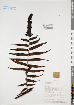
LE 01068283
Cyathea podophylla Copel. det. Averyanov, Leonid Vladimirovich at 14.04.2000
Collectors: Averyanov, Leonid Vladimirovich; et al. Field collecting number: VH5064. Collection date: 14.04.2000. Administrative regions: VN - Kon Tum. Groups of specimens: L. V. Averyanov specimens; L. V. Averyanov herbarium; Соглашение Минобрнауки №075-15-2021-1056Original label text:FLORA OF VIETNAM
Coordinates (geographic position): 14° 39′ N, 108° 25′ E ±1000 mRecord creation: 2022-01-18, Galina Savich, PhotoScan D2Citation: Specimen LE 01068283 // Virtual herbarium of Komarov Botanical Institute RAS — http://re.herbariumle.ru/01068283Polypodiaceae s.l.
Cyathea podophylla Copel.
S. Vietnam, Kontum Prov., Kon Plong Distr., Hieu Municipality, Mang La
forest enterprise (14°39′N, 108°25′E). Primary evergreen broad-leaved
closed dry forest on steep slopes of granite mountains at elev. 1200
m. Woody fern with stem up to 0.5 hg and fronds up to 2 m lg in shady
places. Common.
Cyathea podophylla Copel.
S. Vietnam, Kontum Prov., Kon Plong Distr., Hieu Municipality, Mang La
forest enterprise (14°39′N, 108°25′E). Primary evergreen broad-leaved
closed dry forest on steep slopes of granite mountains at elev. 1200
m. Woody fern with stem up to 0.5 hg and fronds up to 2 m lg in shady
places. Common.
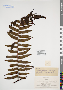
LE 01068282
Cyathea podophylla Copel. det. Phan Ke Loc at 22.07.1997
Collectors: Averyanov, Leonid Vladimirovich; N.Q. Binh; Phan Ke Loc Field collecting number: VH2548. Collection date: 11.03.1997. Administrative regions: VN - Tinh Lam GJong. Groups of specimens: L. V. Averyanov specimens; L. V. Averyanov herbarium; Соглашение Минобрнауки №075-15-2021-1056Original label text:FLORA OF VIETNAM
Cyathea podophylla (Hook.) Copel.
S. Vietnam, Prov. Lam Dong, 14 km to NNW from Dalat city (N 12° 05′, E 108° 22′). Primary closed mixed forest with Pinus kesiya and P.
krempfii at 1740-1760 m alt.
Woody fern up to 3 m hg. Not rare.
VH 2548 11.03.1997
International Botanical Expedition of the U.S.A. National Geographic
Society (grant No 5803-96)
Collectors: L. Averyanov, N.Q. Binh, N.V. Duy, P.K. Loc
Coordinates (geographic position): 12° 5′ N, 108° 22′ E ±1000 mRecord creation: 2022-01-18, Galina Savich, PhotoScan D2Citation: Specimen LE 01068282 // Virtual herbarium of Komarov Botanical Institute RAS — http://re.herbariumle.ru/01068282Cyathea podophylla (Hook.) Copel.
S. Vietnam, Prov. Lam Dong, 14 km to NNW from Dalat city (N 12° 05′, E 108° 22′). Primary closed mixed forest with Pinus kesiya and P.
krempfii at 1740-1760 m alt.
Woody fern up to 3 m hg. Not rare.
VH 2548 11.03.1997
International Botanical Expedition of the U.S.A. National Geographic
Society (grant No 5803-96)
Collectors: L. Averyanov, N.Q. Binh, N.V. Duy, P.K. Loc
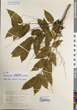
LE 01068281
Pentaspadon annamense (Evrard & Tardieu) P.H.Hô det. N.H. Cuong at 20.04.2018
Collectors: Averyanov, Leonid Vladimirovich; Kudryavtzeva, Ekaterina Petrovna Field collecting number: Averyanov 188. Collection date: 06.11.1989. Administrative regions: VN - Tinh Khanh Hoa. Groups of specimens: L. V. Averyanov specimens; L. V. Averyanov herbarium; Соглашение Минобрнауки №075-15-2021-1056Original label text:FLORA VIETNAMICA
Record creation: 2022-01-18, Galina Savich, PhotoScan D2Citation: Specimen LE 01068281 // Virtual herbarium of Komarov Botanical Institute RAS — http://re.herbariumle.ru/0106828116 РЕЙС НИС "АКАДЕМИК А. НЕСМЕЯНОВ"
Pentaspadon annamense (Evrard & Tardieu) P.H.Hô
Tinh Khanh Hoa Prov.
Averyanov 188, 06.11.1989
Leg. Averyanov L., Kudryavtzeva E.
Det. N.H. Cuong at 20.04.2018
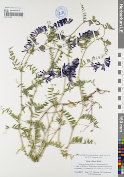
LE 01181080
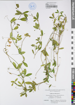
Groups of specimens: Образцы сектора Восточной Европы; Соглашение Минобрнауки №075-15-2021-1056Record creation: 2022-01-18, Larisa Orlova, PhotoScan D2Citation: Specimen LE 01181080 // Virtual herbarium of Komarov Botanical Institute RAS — http://re.herbariumle.ru/01181080
LE 01181079
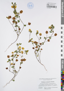
Groups of specimens: Образцы сектора Восточной Европы; Соглашение Минобрнауки №075-15-2021-1056Record creation: 2022-01-18, Larisa Orlova, PhotoScan D2Citation: Specimen LE 01181079 // Virtual herbarium of Komarov Botanical Institute RAS — http://re.herbariumle.ru/01181079
LE 01181078
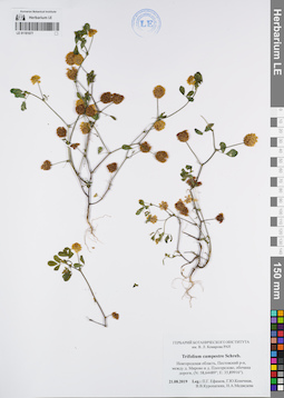
Groups of specimens: Образцы сектора Восточной Европы; Соглашение Минобрнауки №075-15-2021-1056Record creation: 2022-01-18, Larisa Orlova, PhotoScan D2Citation: Specimen LE 01181078 // Virtual herbarium of Komarov Botanical Institute RAS — http://re.herbariumle.ru/01181078
LE 01181077
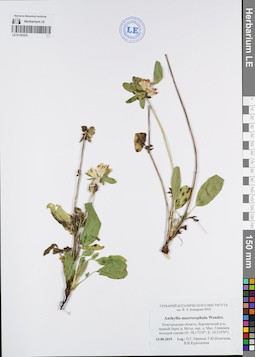
Groups of specimens: Образцы сектора Восточной Европы; Соглашение Минобрнауки №075-15-2021-1056Record creation: 2022-01-18, Larisa Orlova, PhotoScan D2Citation: Specimen LE 01181077 // Virtual herbarium of Komarov Botanical Institute RAS — http://re.herbariumle.ru/01181077
LE 01181076
Groups of specimens: Образцы сектора Восточной Европы; Соглашение Минобрнауки №075-15-2021-1056Record creation: 2022-01-18, Larisa Orlova, PhotoScan D2Citation: Specimen LE 01181076 // Virtual herbarium of Komarov Botanical Institute RAS — http://re.herbariumle.ru/01181076
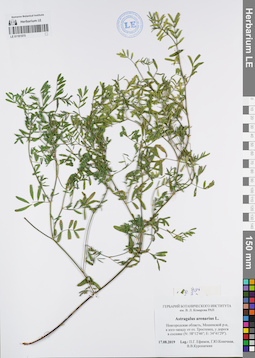
LE 01181075
Astragalus arenarius L.
Administrative regions: RU - Russian Federation. Groups of specimens: Образцы сектора Восточной Европы; Соглашение Минобрнауки №075-15-2021-1056Record creation: 2022-01-18, Larisa Orlova, PhotoScan D2Citation: Specimen LE 01181075 // Virtual herbarium of Komarov Botanical Institute RAS — http://re.herbariumle.ru/01181075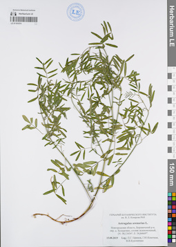
LE 01181074
Astragalus arenarius L.
Administrative regions: RU - Russian Federation. Groups of specimens: Образцы сектора Восточной Европы; Соглашение Минобрнауки №075-15-2021-1056Record creation: 2022-01-18, Larisa Orlova, PhotoScan D2Citation: Specimen LE 01181074 // Virtual herbarium of Komarov Botanical Institute RAS — http://re.herbariumle.ru/01181074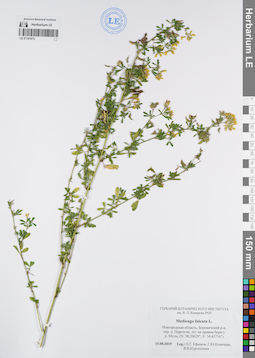
LE 01181073
Groups of specimens: Образцы сектора Восточной Европы; Соглашение Минобрнауки №075-15-2021-1056Record creation: 2022-01-18, Larisa Orlova, PhotoScan D2Citation: Specimen LE 01181073 // Virtual herbarium of Komarov Botanical Institute RAS — http://re.herbariumle.ru/01181073
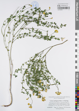
LE 01181072
Groups of specimens: Образцы сектора Восточной Европы; Соглашение Минобрнауки №075-15-2021-1056Record creation: 2022-01-18, Larisa Orlova, PhotoScan D2Citation: Specimen LE 01181072 // Virtual herbarium of Komarov Botanical Institute RAS — http://re.herbariumle.ru/01181072
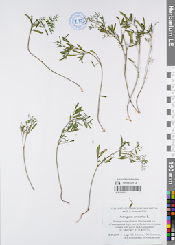
LE 01181071
Astragalus arenarius L.
Administrative regions: RU - Russian Federation. Groups of specimens: Образцы сектора Восточной Европы; Соглашение Минобрнауки №075-15-2021-1056Record creation: 2022-01-18, Larisa Orlova, PhotoScan D2Citation: Specimen LE 01181071 // Virtual herbarium of Komarov Botanical Institute RAS — http://re.herbariumle.ru/01181071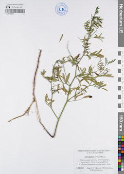
LE 01181070
Astragalus arenarius L.
Administrative regions: RU - Russian Federation. Groups of specimens: Образцы сектора Восточной Европы; Соглашение Минобрнауки №075-15-2021-1056Record creation: 2022-01-18, Larisa Orlova, PhotoScan D2Citation: Specimen LE 01181070 // Virtual herbarium of Komarov Botanical Institute RAS — http://re.herbariumle.ru/01181070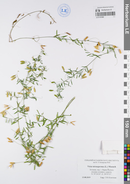
LE 01181069
Groups of specimens: Образцы сектора Восточной Европы; Соглашение Минобрнауки №075-15-2021-1056Record creation: 2022-01-18, Larisa Orlova, PhotoScan D2Citation: Specimen LE 01181069 // Virtual herbarium of Komarov Botanical Institute RAS — http://re.herbariumle.ru/01181069
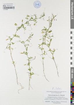
LE 01181068
Groups of specimens: Образцы сектора Восточной Европы; Соглашение Минобрнауки №075-15-2021-1056Record creation: 2022-01-18, Larisa Orlova, PhotoScan D2Citation: Specimen LE 01181068 // Virtual herbarium of Komarov Botanical Institute RAS — http://re.herbariumle.ru/01181068
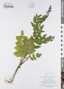
LE 01181067
Groups of specimens: Образцы сектора Восточной Европы; Соглашение Минобрнауки №075-15-2021-1056Record creation: 2022-01-18, Larisa Orlova, PhotoScan D2Citation: Specimen LE 01181067 // Virtual herbarium of Komarov Botanical Institute RAS — http://re.herbariumle.ru/01181067
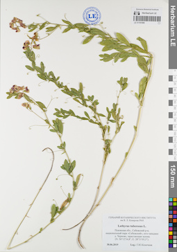
LE 01181066
Groups of specimens: Образцы сектора Восточной Европы; Соглашение Минобрнауки №075-15-2021-1056Record creation: 2022-01-18, Larisa Orlova, PhotoScan D2Citation: Specimen LE 01181066 // Virtual herbarium of Komarov Botanical Institute RAS — http://re.herbariumle.ru/01181066
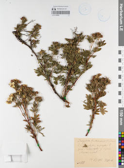
LE 01180966
Groups of specimens: Образцы сектора Восточной Европы; Соглашение Минобрнауки №075-15-2021-1056Record creation: 2022-01-18, Larisa Orlova, PhotoScan D2Citation: Specimen LE 01180966 // Virtual herbarium of Komarov Botanical Institute RAS — http://re.herbariumle.ru/01180966
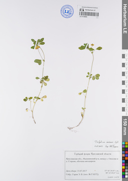
LE 01180965
Groups of specimens: Образцы сектора Восточной Европы; Соглашение Минобрнауки №075-15-2021-1056Record creation: 2022-01-18, Larisa Orlova, PhotoScan D2Citation: Specimen LE 01180965 // Virtual herbarium of Komarov Botanical Institute RAS — http://re.herbariumle.ru/01180965
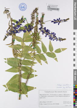
LE 01180964
Groups of specimens: Образцы сектора Восточной Европы; Соглашение Минобрнауки №075-15-2021-1056Record creation: 2022-01-18, Larisa Orlova, PhotoScan D2Citation: Specimen LE 01180964 // Virtual herbarium of Komarov Botanical Institute RAS — http://re.herbariumle.ru/01180964
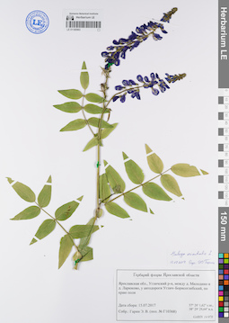
LE 01180963
Groups of specimens: Образцы сектора Восточной Европы; Соглашение Минобрнауки №075-15-2021-1056Record creation: 2022-01-18, Larisa Orlova, PhotoScan D2Citation: Specimen LE 01180963 // Virtual herbarium of Komarov Botanical Institute RAS — http://re.herbariumle.ru/01180963