View
Add
Copy
Edit
Delete
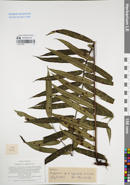
LE 01077985
Angiopteris repandula de Vriese det. Averyanov, Leonid Vladimirovich at 28.03.1997
Collectors: Averyanov, Leonid Vladimirovich; N.Q. Binh; Phan Ke Loc Field collecting number: VH3324. Collection date: 28.03.1997. Administrative regions: VN - Tinh Lam GJong. Groups of specimens: L. V. Averyanov specimens; L. V. Averyanov herbarium; Соглашение Минобрнауки №075-15-2021-1056Original label text:FLORA OF VIETNAM
Angiopteris aff. A. repandula de Vriese
S. Vietnam, Prov. Lam Dong, distr. Lac Duong, municipalite Da Chay,
32.5 km to NE from Dalat city (N 12° 07′, E 108° 41′). Very wet closed
primary broadleaved mt forest along deep shadow stream canyon
on NNW macroslope of Bi Dup mt system at 1800-1900 m alt.
Large terrestrial fern with fronds up to 3.5 m lg on wet stream rocks.
Not rare at 1700-1800 m alt.
VH 3324 28.03.1997
International Botanical Expedition of the U.S.A. National Geographic
Society (grant No 5803-96)
Collectors: L. Averyanov, N.Q. Binh, P.K. Loc
Coordinates (geographic position): 12° 7′ N, 108° 41′ E ±1000 mRecord creation: 2022-01-18, Galina Savich, PhotoScan D2Citation: Specimen LE 01077985 // Virtual herbarium of Komarov Botanical Institute RAS — http://re.herbariumle.ru/01077985Angiopteris aff. A. repandula de Vriese
S. Vietnam, Prov. Lam Dong, distr. Lac Duong, municipalite Da Chay,
32.5 km to NE from Dalat city (N 12° 07′, E 108° 41′). Very wet closed
primary broadleaved mt forest along deep shadow stream canyon
on NNW macroslope of Bi Dup mt system at 1800-1900 m alt.
Large terrestrial fern with fronds up to 3.5 m lg on wet stream rocks.
Not rare at 1700-1800 m alt.
VH 3324 28.03.1997
International Botanical Expedition of the U.S.A. National Geographic
Society (grant No 5803-96)
Collectors: L. Averyanov, N.Q. Binh, P.K. Loc
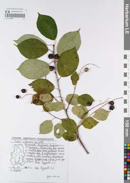
LE 01106986
Padus virginiana (L.) Mill. det. Pusyrev, Alexander Nikolaevich at 2019
Collectors: Pusyrev, Alexander Nikolaevich Field collecting number: Дублет. Collection date: 13.08.2019. Administrative regions: RUUdmurtskaya Respublika - Alnashskiy Rayon. Place of collection: северо-восточная окраина с. Алнаши, близ восточного тупика ул. Сосновая, верхняя часть залесённого склона к лыжной базе Олимпиец, разреженная часть соснового леса, в местах сваливания мусора.Groups of specimens: Образцы сектора Восточной Европы; Соглашение Минобрнауки №075-15-2021-1056; Гербарий Удмуртского Госуниверситета.Original label text:Гербарий Удмуртского Госуниверситета. Padus virginiana (L.) Mill. Удмуртская Республика, Алнашский р-н, СВ окраина с. Алнаши, близ вост. тупика ул. Сосновая, верхн. часть залесённого склона к лыжной базе. В разреженной части соснового леса, в местах сваливания мусора. Изредка, плод. и вегет. особи, одичавшее. 13.VIII.2019 г. Дублет. Собр. Пузырёв А.Н. Опр. Пузырёв А.Н. [на этикетке представлена картосхема, на которой имеется контурная карта Удмуртской Республики, красная точка нарисована внизу нижней левой трети карты]
Landscape in location of collection: верхняя часть залесённого склона к лыжной базеHabitat / plant community in location of collecting: разреженная часть соснового леса, в местах сваливания мусораCoordinates (geographic position): 56° 11′ 39.33″ N, 52° 29′ 35.67″ E ±100 mRecord creation: 2022-01-18, Larisa Orlova, PhotoScan D2Citation: Specimen LE 01106986 // Virtual herbarium of Komarov Botanical Institute RAS — http://re.herbariumle.ru/01106986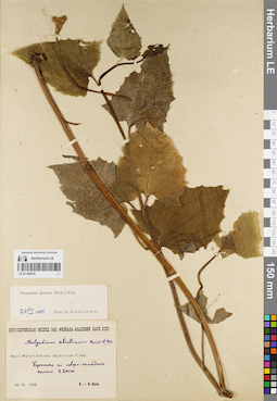
LE 01180919
Prenanthes abietina (Boiss. & Balansa) Kirp. det. Kirpicznikov, Moisey Elevich at 26.02.1964
Collectors: Busch, Elizaveta Aleksandrovna; Busch, Nikolai Adolfovich (Nikolaj Adolfowitsch) Collection date: 18.07.1933. Administrative regions: GE - Georgia. Subregion: South Ossetia. Expedition: Юго-Осетинская экспедиция Закавказского филиала АН СССР (1933)Groups of specimens: Образцы сектора Кавказа; Соглашение Минобрнауки №075-15-2021-1056Original label text:Басс. Малой Лиахвы Шуацхури. Г. Нэх. Березняк на северо-западном склоне, 2200 м.
Record creation: 2022-01-18, Ivan Tatanov, PhotoScan D2Citation: Specimen LE 01180919 // Virtual herbarium of Komarov Botanical Institute RAS — http://re.herbariumle.ru/01180919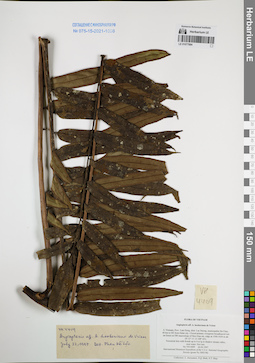
LE 01077984
Angiopteris hookeriana de Vriese ⟮prelim. ID⟯ det. Phan Ke Loc at 22.07.1997
Collectors: Averyanov, Leonid Vladimirovich; N.Q. Binh; Tien Hiep Nguyen Field collecting number: VH4409. Collection date: 26.04.1997. Administrative regions: VN - Tinh Lam GJong. Groups of specimens: L. V. Averyanov specimens; L. V. Averyanov herbarium; Соглашение Минобрнауки №075-15-2021-1056Original label text:FLORA OF VIETNAM
Angiopteris aff. A. hookeriana de Vriese
S. Vietnam, Prov. Lam Dong, distr. Lac Duong, municipalite Da Chay,
40 km to NE from Dalat city. Closed primary evergreen broadleaved wet
mt forest on SW macroslope of Hon Giao mt. ridge at 1500-1650 m alt.
(N 12° 11′, E 108° 43′). Terrestrial fern with fronds up to 4 m lg in shadow
Coordinates (geographic position): 12° 11′ N, 108° 43′ E ±1000 mRecord creation: 2022-01-18, Galina Savich, PhotoScan D2. Processing status: work_status_1Citation: Specimen LE 01077984 // Virtual herbarium of Komarov Botanical Institute RAS — http://re.herbariumle.ru/01077984Angiopteris aff. A. hookeriana de Vriese
S. Vietnam, Prov. Lam Dong, distr. Lac Duong, municipalite Da Chay,
40 km to NE from Dalat city. Closed primary evergreen broadleaved wet
mt forest on SW macroslope of Hon Giao mt. ridge at 1500-1650 m alt.
(N 12° 11′, E 108° 43′). Terrestrial fern with fronds up to 4 m lg in shadow
stream valley,near water. Not rare. VH 4409 26.04.1997
International Botanical Expedition of the U.S.A. National Geographic
Society (grant No 5803-96)
Collectors: L. Averyanov, N.Q. Binh, N.T. Hiep
Society (grant No 5803-96)
Collectors: L. Averyanov, N.Q. Binh, N.T. Hiep
LE 01106985
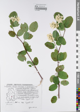
Amelanchier alnifolia (Nutt.) Nutt. × Amelanchier spicata (Lam.) C. Koch det. Pusyrev, Alexander Nikolaevich at 2020
Collectors: Pusyrev, Alexander Nikolaevich Field collecting number: s.n. Collection date: 23.05.2020. Administrative regions: RU - Udmurtskaya Respublika - Izhevsk. Place of collection: г. Ижевск, Индустриальный р-н, ул. Автозаводская на участке между остановками трамвая "Ул. Татьяны Барамзиной" и "Проспект М.Т. Калашникова", сосновая посадка, близ её края, недалеко от садоогородов, одичавшее.Groups of specimens: Образцы сектора Восточной Европы; Соглашение Минобрнауки №075-15-2021-1056; Гербарий Удмуртского Госуниверситета.Original label text:Гербарий Удмуртского Госуниверситета. Amelanchier alnifolia (Nutt.) Nutt. × Amelanchier spicata (Lam.) C. Koch. Удмуртская Республика, г. Ижевск, Индустриальный р-н, ул. Автозаводская на участке между остановками трамвая "Ул. Татьяны Барамзиной" и "Проспект М.Т. Калашникова". В сосновой посадке, близ её края, недалеко от садоогородов. Одичавшее. 23 V 2020 г. Собр. Пузырёв А.Н. Опр. Пузырёв А.Н. [на этикетке представлена картосхема, на которой изображена контурная карта Удмуртской Республики, посередине нижней трети карты стоит широкая красная точка]
Landscape in location of collection: сосновая посадка недалеко от садоогородовHabitat / plant community in location of collecting: сосновая посадка, близ края, одичавшееCoordinates (geographic position): 56° 51′ 31.3″ N, 53° 16′ 32.11″ E ±800 mRecord creation: 2022-01-18, Larisa Orlova, PhotoScan D2Citation: Specimen LE 01106985 // Virtual herbarium of Komarov Botanical Institute RAS — http://re.herbariumle.ru/01106985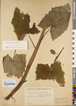
LE 01180918
Prenanthes abietina (Boiss. & Balansa) Kirp. det. Kirpicznikov, Moisey Elevich at 26.02.1964
Collectors: Busch, Elizaveta Aleksandrovna; Busch, Nikolai Adolfovich (Nikolaj Adolfowitsch) Field collecting number: 19. Collection date: 19.07.1928. Administrative regions: GE - Georgia. Subregion: South Ossetia. Expedition: Юго-Осетинская экспедиция АН СССР ()Groups of specimens: Образцы сектора Кавказа; Соглашение Минобрнауки №075-15-2021-1056Original label text:Гора Фэс-Фэтэн. Лес на SO склоне. 1850 м.
Record creation: 2022-01-18, Ivan Tatanov, PhotoScan D2Citation: Specimen LE 01180918 // Virtual herbarium of Komarov Botanical Institute RAS — http://re.herbariumle.ru/01180918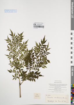
LE 01077983
Ptisana sambucina (Blume) Murdock det. Averyanov, Leonid Vladimirovich at 22.02.2026
Additional identifications: Marattia sambucina Blume det. Phan Ke Loc at 19.07.1997 Collectors: Averyanov, Leonid Vladimirovich; N.Q. Binh; Phan Ke Loc Field collecting number: VH2858. Collection date: 18.03.1997. Administrative regions: VN - Tinh Lam GJong. Groups of specimens: L. V. Averyanov specimens; L. V. Averyanov herbarium; Соглашение Минобрнауки №075-15-2021-1056Original label text:FLORA OF VIETNAM
Coordinates (geographic position): 12° 9′ N, 108° 41′ E ±1000 mRecord creation: 2022-01-18, Galina Savich, PhotoScan D2. Processing status: work_status_1Citation: Specimen LE 01077983 // Virtual herbarium of Komarov Botanical Institute RAS — http://re.herbariumle.ru/01077983Marattiaceae
Marattia sambucina Blume
S. Vietnam, Prov. Lam Dong, distr. Lac Duong, municipalite Da Chay, 35 km to NE from Dalat city. Closed primary broadleaved mt forest on W macroslope of Gia Rinh mt. ridge at 1800-1900 m alt. (N 12° 09′, E 108° 41′). Terrestrial large fern with fronds up to 1.5 m lg on steep slopes of deep wet canyon. Rare. VH 2858 18.03.1997
Marattia sambucina Blume
S. Vietnam, Prov. Lam Dong, distr. Lac Duong, municipalite Da Chay, 35 km to NE from Dalat city. Closed primary broadleaved mt forest on W macroslope of Gia Rinh mt. ridge at 1800-1900 m alt. (N 12° 09′, E 108° 41′). Terrestrial large fern with fronds up to 1.5 m lg on steep slopes of deep wet canyon. Rare. VH 2858 18.03.1997
International Botanical Expedition of the U.S.A. National Geographic Society (grant No 5803-96)
Collectors: L. Averyanov, N.Q. Binh, P.K. Loc
Collectors: L. Averyanov, N.Q. Binh, P.K. Loc
LE 01106984
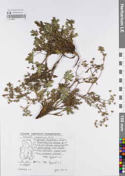
Potentilla × angarensis Popov det. Pusyrev, Alexander Nikolaevich at 2019
Collectors: Pusyrev, Alexander Nikolaevich Field collecting number: Дублет. Collection date: 18.08.2019. Administrative regions: RUUdmurtskaya Respublika - Alnashskiy Rayon. Place of collection: с. Алнаши, ул. Поперечная, близ частных домов N 16, N 12, N 10, обочина асфальтированной дороги (проезд шоссе Ижевск-Алнаши), небольшие группы генеративных и вегетативных растений; заносное.Groups of specimens: Образцы сектора Восточной Европы; Соглашение Минобрнауки №075-15-2021-1056; Гербарий Удмуртского Госуниверситета.Original label text:Гербарий Удмуртского Госуниверситета. Potentilla angarensis M. Pop. Удмуртская Республика, с. Алнаши, ул. Поперечная, близ частных домов N 16, N 12, N 10. Обочина асфальтированной дороги (проезд шоссе Ижевск-Алнаши). Небольшие группы генер. и вегет. растений; заносное. 18.VIII.2019 г. Дублет. Алнашский р-н. Собр. Пузырёв А.Н. Опр. Пузырёв А.Н. [на этикетке представлена картосхема, на которой присутствует контурная карта Удмуртской Республики, красная точка стоит внизу нижней левой четверти карты]
Landscape in location of collection: обочина асфальтированной дороги (проезд шоссе)Habitat / plant community in location of collecting: небольшие группы генеративных и вегетативных растений; заносноеCoordinates (geographic position): 56° 11′ 25.25″ N, 52° 28′ 17.03″ E ±200 mRecord creation: 2022-01-18, Larisa Orlova, PhotoScan D2Citation: Specimen LE 01106984 // Virtual herbarium of Komarov Botanical Institute RAS — http://re.herbariumle.ru/01106984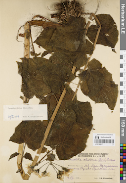
LE 01180917
Prenanthes abietina (Boiss. & Balansa) Kirp. det. Kirpicznikov, Moisey Elevich at 26.02.1964
Collectors: Schtakelberg, B.A. Collection date: 04.08.1938. Administrative regions: GE - Georgia. Subregion: South Ossetia, Dzau District. Groups of specimens: Образцы сектора Кавказа; Соглашение Минобрнауки №075-15-2021-1056Original label text:Местность Эрмани. Левый борт Бретатского ущелья. Буково-березовый лес
Coordinates (geographic position): 42° 30′ 41.76″ N, 44° 14′ 42″ ERecord creation: 2022-01-18, Ivan Tatanov, PhotoScan D2Citation: Specimen LE 01180917 // Virtual herbarium of Komarov Botanical Institute RAS — http://re.herbariumle.ru/01180917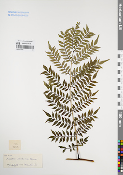
LE 01077982
Ptisana sambucina (Blume) Murdock det. Averyanov, Leonid Vladimirovich at 22.02.2026
Additional identifications: Marattia sambucina Blume det. Phan Ke Loc at 19.07.1997 Collectors: Averyanov, Leonid Vladimirovich; et al. Field collecting number: VH3123. Collection date: 19.07.1997. Administrative regions: VN - Tinh Lam GJong. Groups of specimens: L. V. Averyanov specimens; L. V. Averyanov herbarium; Flora of VietnamOriginal label text:FLORA OF VIETNAM
Coordinates (geographic position): 12° 6′ N, 108° 39′ E ±1000 mRecord creation: 2022-01-18, Galina Savich, PhotoScan D2. Processing status: work_status_1Citation: Specimen LE 01077982 // Virtual herbarium of Komarov Botanical Institute RAS — http://re.herbariumle.ru/01077982Marattiaceae
Marattia sambucina Blume
S. Vietnam, Prov. Lam Dong, 29 km to NE from Dalat city, distr. Lac Duong, municipalite Da Chay. Primary wet closed broadleaved cloud forest along main Bi Dup ridge at 1900-2000 m alt. (N 12° 06′, E 108° 39′). Terrestrial fern with fronds up to 1.5 m lg. On steep slopes of very wet shadow stream canyon. Rare. VH 3123 23.03.1997
Marattia sambucina Blume
S. Vietnam, Prov. Lam Dong, 29 km to NE from Dalat city, distr. Lac Duong, municipalite Da Chay. Primary wet closed broadleaved cloud forest along main Bi Dup ridge at 1900-2000 m alt. (N 12° 06′, E 108° 39′). Terrestrial fern with fronds up to 1.5 m lg. On steep slopes of very wet shadow stream canyon. Rare. VH 3123 23.03.1997
International Botanical Expedition of the U.S.A. National Geographic Society (grant No 5803-96)
Collectors: L. Averyanov, N.Q. Binh, P.K. Loc
Collectors: L. Averyanov, N.Q. Binh, P.K. Loc
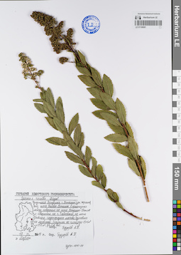
LE 01106981
Spiraea × rosalba Dippel det. Pusyrev, Alexander Nikolaevich at 2017
Collectors: Pusyrev, Alexander Nikolaevich Field collecting number: Дублет. Collection date: 19.09.2017. Administrative regions: RUUdmurtskaya Respublika - Votkinskiy Rayon. Place of collection: г. Воткинск (западная окраина), близ шоссе Ижевск-Воткинск в промежутке между поворотом на шоссе Воткинск-Светлое и поворотом на г. Чайковский, на месте бывшего садоогородного массива, одичавшее на луговинах.Groups of specimens: Образцы сектора Восточной Европы; Соглашение Минобрнауки №075-15-2021-1056; Гербарий Удмуртского Госуниверситета.Original label text:Гербарий Удмуртского Госуниверситета. Spiraea × rosalba Dippel. Удмуртская Республика, г. Воткинск (зап. окраина), близ шоссе Ижевск-Воткинск в промежутке между поворотом на шоссе Воткинск-Светлое и поворотом на г. Чайковский, на месте бывшего садоогородного массива. Одичавшее на луговинах. 2 колонии, на площади 15x1 м2 и 7x7 м2, до 2 м выс. 19.IX.2017 г. Дублет. Собр. Пузырев А.Н., опр. Пузырев А.Н. [на этикетке представлена картосхема, содержащая контурную карту Удмуртской Республики, красная точка стоит вверху правой нижней трети карты]
Landscape in location of collection: место бывшего садоогородного массива близ шоссеHabitat / plant community in location of collecting: одичавшее на луговинахCoordinates (geographic position): 57° 1′ 57.73″ N, 53° 55′ 47.01″ E ±700 mRecord creation: 2022-01-18, Larisa Orlova, PhotoScan D2Citation: Specimen LE 01106981 // Virtual herbarium of Komarov Botanical Institute RAS — http://re.herbariumle.ru/01106981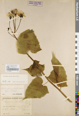
LE 01180916
Prenanthes abietina (Boiss. & Balansa) Kirp. det. Kirpicznikov, Moisey Elevich at 26.02.1964
Collectors: Busch, Elizaveta Aleksandrovna; Busch, Nikolai Adolfovich (Nikolaj Adolfowitsch) Field collecting number: 44. Collection date: 21.08.1928. Administrative regions: GE - Georgia. Subregion: South Ossetia. Expedition: Юго-Осетинская экспедиция АН СССР ()Groups of specimens: Образцы сектора Кавказа; Соглашение Минобрнауки №075-15-2021-1056Original label text:Гора Сырх-Лаберта. Лес в сторону Бубе-кахер. 2000 м. Опушка
Record creation: 2022-01-18, Ivan Tatanov, PhotoScan D2Citation: Specimen LE 01180916 // Virtual herbarium of Komarov Botanical Institute RAS — http://re.herbariumle.ru/01180916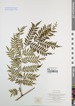
LE 01077981
Ptisana sambucina (Blume) Murdock det. Averyanov, Leonid Vladimirovich at 22.02.2026
Additional identifications: Marattia sambucina Blume det. Averyanov, Leonid Vladimirovich at 23.03.1997 Collectors: Averyanov, Leonid Vladimirovich; N.Q. Binh; Phan Ke Loc Field collecting number: VH3123. Collection date: 23.03.1997. Administrative regions: VN - Tinh Lam GJong. Groups of specimens: L. V. Averyanov specimens; L. V. Averyanov herbarium; Соглашение Минобрнауки №075-15-2021-1056Original label text:FLORA OF VIETNAM
Coordinates (geographic position): 12° 6′ N, 108° 39′ E ±1000 mRecord creation: 2022-01-18, Galina Savich, PhotoScan D2. Processing status: work_status_1Citation: Specimen LE 01077981 // Virtual herbarium of Komarov Botanical Institute RAS — http://re.herbariumle.ru/01077981Marattiaceae
Marattia sambucina Blume
S. Vietnam, Prov. Lam Dong, 29 km to NE from Dalat city, distr. Lac Duong, municipalite Da Chay. Primary wet closed broadleaved cloud forest along main Bi Dup ridge at 1900-2000 m alt. (N 12° 06′, E 108° 39′). Terrestrial fern with fronds up to 1.5 m lg. On steep slopes of very wet shadow stream canyon. Rare. VH 3123 23.03.1997
Marattia sambucina Blume
S. Vietnam, Prov. Lam Dong, 29 km to NE from Dalat city, distr. Lac Duong, municipalite Da Chay. Primary wet closed broadleaved cloud forest along main Bi Dup ridge at 1900-2000 m alt. (N 12° 06′, E 108° 39′). Terrestrial fern with fronds up to 1.5 m lg. On steep slopes of very wet shadow stream canyon. Rare. VH 3123 23.03.1997
International Botanical Expedition of the U.S.A. National Geographic Society (grant No 5803-96)
Collectors: L. Averyanov, N.Q. Binh, P.K. Loc
Collectors: L. Averyanov, N.Q. Binh, P.K. Loc
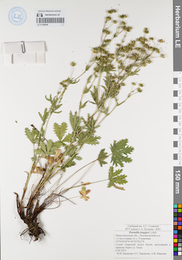
LE 01106344
Potentilla longipes Ledeb. det. Kazakova Marina Vasil'evna, Baranova, Olga Germanovna, Ivanova, A. V. at 2019
Collectors: Kazakova Marina Vasil'evna; Baranova, Olga Germanovna; Ivanova, A. V. Field collecting number: s.n. Collection date: 06.06.2019. Administrative regions: RU - Nizhegorodskaya Oblast' - Lukoyanovskiy Rayon. Place of collection: 1,5 км к северу от с. Ульяновка, сухой открытый склон балки, выходящей к правому берегу р. Теша.Groups of specimens: Образцы сектора Восточной Европы; Соглашение Минобрнауки №075-15-2021-1056; Гербарий имени Е. Г. Гущиной.; РГУ имени С.А. Есенина - RSUOriginal label text:Гербарий имени Е. Г. Гущиной. РГУ имени С.А. Есенина - RSU. Potentilla longipes Ledeb. Нижегородская обл., Лукояновский р-н, 1,5 км к северу от с. Ульяновка. 55°03'05,8''N 44°23'30,5''E Сухой открытый склон балки, выходящей к правому берегу р. Теша. 6.06.2019. М.В. Казакова, О.Г. Баранова, А.В. Иванова
Landscape in location of collection: сухой открытый склон балки, выходящей к правому берегу рекиCoordinates (geographic position): 55° 3′ 5.8″ N, 44° 23′ 30.5″ E ±100 mRecord creation: 2022-01-18, Larisa Orlova, PhotoScan D2Citation: Specimen LE 01106344 // Virtual herbarium of Komarov Botanical Institute RAS — http://re.herbariumle.ru/01106344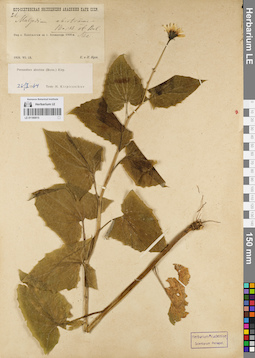
LE 01180915
Prenanthes abietina (Boiss. & Balansa) Kirp. det. Kirpicznikov, Moisey Elevich at 26.02.1964
Collectors: Busch, Elizaveta Aleksandrovna; Busch, Nikolai Adolfovich (Nikolaj Adolfowitsch) Field collecting number: 21. Collection date: 23.07.1928. Administrative regions: GE - Georgia. Subregion: South Ossetia, Dzau District. Expedition: Юго-Осетинская экспедиция АН СССР ()Groups of specimens: Образцы сектора Кавказа; Соглашение Минобрнауки №075-15-2021-1056Original label text:Над с. Хампалгом на г. Алхашенда. 1900 м.
Coordinates (geographic position): 42° 27′ 7″ N, 43° 45′ 47″ ERecord creation: 2022-01-18, Ivan Tatanov, PhotoScan D2Citation: Specimen LE 01180915 // Virtual herbarium of Komarov Botanical Institute RAS — http://re.herbariumle.ru/01180915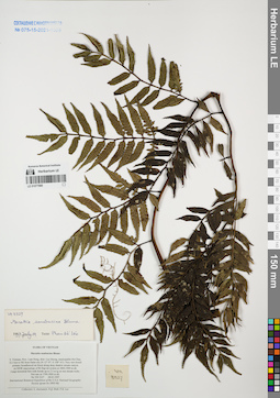
LE 01077980
Ptisana sambucina (Blume) Murdock det. Averyanov, Leonid Vladimirovich at 22.02.2026
Additional identifications: Marattia sambucina Blume det. Phan Ke Loc at 19.07.1997 Collectors: Averyanov, Leonid Vladimirovich; N.Q. Binh; Phan Ke Loc Field collecting number: VH3327. Collection date: 28.03.1997. Administrative regions: VN - Tinh Lam GJong. Groups of specimens: L. V. Averyanov specimens; L. V. Averyanov herbarium; Соглашение Минобрнауки №075-15-2021-1056Original label text:FLORA OF VIETNAM
Coordinates (geographic position): 12° 7′ N, 108° 41′ E ±1000 mRecord creation: 2022-01-18, Galina Savich, PhotoScan D2. Processing status: work_status_1Citation: Specimen LE 01077980 // Virtual herbarium of Komarov Botanical Institute RAS — http://re.herbariumle.ru/01077980Marattiaceae
Marattia sambucina Blume
S. Vietnam, Prov. Lam Dong, distr. Lac Duong, municipalite Da Chay, 32.5 km to NE from Dalat city (N 12° 07′, E 108° 41′). Very wet closed primary broadleaved mt forest along deep shadow stream canyon on NNW macroslope of Bi Dup mt system at 1800-1900 m alt. Large terrestrial fern with fronds up to 2.5 m lg on wet stream rocks. Not rare at 1700-1800 m alt. VH 3327 28.03.1997
Marattia sambucina Blume
S. Vietnam, Prov. Lam Dong, distr. Lac Duong, municipalite Da Chay, 32.5 km to NE from Dalat city (N 12° 07′, E 108° 41′). Very wet closed primary broadleaved mt forest along deep shadow stream canyon on NNW macroslope of Bi Dup mt system at 1800-1900 m alt. Large terrestrial fern with fronds up to 2.5 m lg on wet stream rocks. Not rare at 1700-1800 m alt. VH 3327 28.03.1997
International Botanical Expedition of the U.S.A. National Geographic Society (grant No 5803-96)
Collectors: L. Averyanov, N.Q. Binh, P.K. Loc
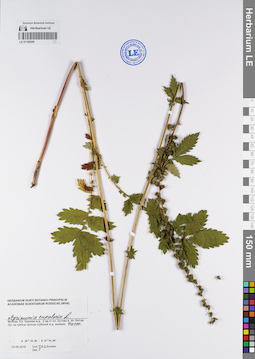
LE 01106309
Agrimonia eupatoria L. det. Bochkin, V. D. at 2015
Collectors: Bochkin, V. D. Field collecting number: s.n. Collection date: 03.08.2015. Administrative regions: RU - Moscow Oblast - Leninskiy Rayon. Place of collection: Москва. Юг. Курская ж.д. 2 км от пл. Бутово к пл. Битца, луг на гребне склона глубокой железнодорожной выемки.Groups of specimens: Образцы сектора Восточной Европы; Соглашение Минобрнауки №075-15-2021-1056; Herbarium Horti botanici principalis Academiae scientiarum rossicae (MHA)Original label text:Herbarium Horti botanici principalis Aacademiae scientiarum rossicae (MHA). Agrimonia eupatoria L. Москва. Юг. Курская ж.д. 2 км от пл. Бутово к пл. Битца. Луг на гребне склона глубокой ж.д. выемки. Часто. N 55°33,09' - E 37°34,89' 03.08.2015. Coll., Det.: В.Д. Бочкин
Landscape in location of collection: луг на гребне склона глубокой железнодорожной выемкиHabitat / plant community in location of collecting: лугCoordinates (geographic position): 55° 33′ 24.18″ N, 37° 35′ 20.45″ E ±300 mRecord creation: 2022-01-18, Larisa Orlova, PhotoScan D2Citation: Specimen LE 01106309 // Virtual herbarium of Komarov Botanical Institute RAS — http://re.herbariumle.ru/01106309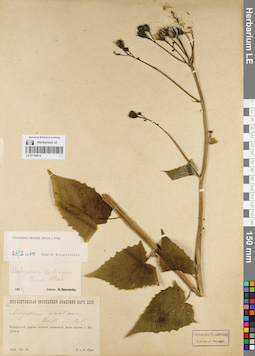
LE 01180914
Prenanthes abietina (Boiss. & Balansa) Kirp. det. Kirpicznikov, Moisey Elevich at 26.02.1964
Collectors: Busch, Elizaveta Aleksandrovna; Busch, Nikolai Adolfovich (Nikolaj Adolfowitsch) Field collecting number: 36. Collection date: 10.08.1928. Administrative regions: GE - Georgia. Subregion: South Ossetia, Dzau District. Expedition: Юго-Осетинская экспедиция АН СССР ()Groups of specimens: Образцы сектора Кавказа; Соглашение Минобрнауки №075-15-2021-1056Original label text:Кударский район, остатки священной рощи против с. Лет. 2000 м.
Coordinates (geographic position): 42° 33′ 8.03″ N, 43° 49′ 27.16″ ERecord creation: 2022-01-18, Ivan Tatanov, PhotoScan D2Citation: Specimen LE 01180914 // Virtual herbarium of Komarov Botanical Institute RAS — http://re.herbariumle.ru/01180914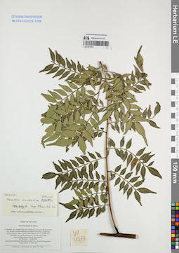
LE 01077979
Ptisana sambucina (Blume) Murdock det. Averyanov, Leonid Vladimirovich at 22.02.2026
Additional identifications: Marattia sambucina Blume det. Phan Ke Loc at 19.07.1997 Collectors: Averyanov, Leonid Vladimirovich; N.Q. Binh; Tien Hiep Nguyen Field collecting number: VH4333. Collection date: 25.04.1997. Administrative regions: VN - Tinh Khanh Hoa. Groups of specimens: L. V. Averyanov specimens; L. V. Averyanov herbarium; Соглашение Минобрнауки №075-15-2021-1056Original label text:FLORA OF VIETNAM
Coordinates (geographic position): 12° 12′ N, 108° 44′ E ±1000 mRecord creation: 2022-01-18, Galina Savich, PhotoScan D2. Processing status: work_status_1Citation: Specimen LE 01077979 // Virtual herbarium of Komarov Botanical Institute RAS — http://re.herbariumle.ru/01077979Marattiaceae
Marattia sambucina Blume
S. Vietnam, Prov. Khanh Hoa, distr. Khanh Son, 42 km to NE from Dalat city. Primary closed broadleaved evergreen forest on E macroslope of Hon Giao mt. ridge at 1600-1700 m alt. (N 12° 12′, E 108° 44′). Terrestrial fern with fronds up to 1.5 m lg on steep rocky slopes of deep stream canyon. Not common. VH 4333 25.04.1997
Marattia sambucina Blume
S. Vietnam, Prov. Khanh Hoa, distr. Khanh Son, 42 km to NE from Dalat city. Primary closed broadleaved evergreen forest on E macroslope of Hon Giao mt. ridge at 1600-1700 m alt. (N 12° 12′, E 108° 44′). Terrestrial fern with fronds up to 1.5 m lg on steep rocky slopes of deep stream canyon. Not common. VH 4333 25.04.1997
International Botanical Expedition of the U.S.A. National Geographic Society (grant No 5803-96)
Collectors: L. Averyanov, N.Q. Binh, N.T. Hiep
Collectors: L. Averyanov, N.Q. Binh, N.T. Hiep
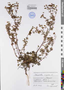
LE 01106301
Potentilla argentea L. det. Miniaev, Nikolai Aleksandrovich at 1956
Collectors: Miniaev, Nikolai Aleksandrovich Field collecting number: s.n. Collection date: 21.09.1956. Administrative regions: RU - Sankt-Peterburg - Kurortnyy Rayon. Place of collection: ст. Репино, морская дюна с Matricaria matricarioides.Groups of specimens: Образцы сектора Восточной Европы; Соглашение Минобрнауки №075-15-2021-1056; Herbarium Universitatis PetropolitanaeOriginal label text:Herbarium Universitatis Petropolitanae. Potentilla argentea L. Ленинградская область, ст. Репино, морская дюна с Matricaria matricarioides. 21.09.1956. Leg. Determ. Н.А. Миняев
Landscape in location of collection: морская дюнаHabitat / plant community in location of collecting: морская дюна с Matricaria matricarioidesSubstrate in collecting location: песокCoordinates (geographic position): 60° 9′ 45.21″ N, 29° 51′ 56.05″ E ±3000 mRecord creation: 2022-01-18, Larisa Orlova, PhotoScan D2Citation: Specimen LE 01106301 // Virtual herbarium of Komarov Botanical Institute RAS — http://re.herbariumle.ru/01106301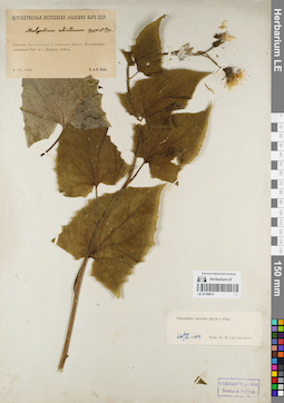
LE 01180913
Prenanthes abietina (Boiss. & Balansa) Kirp. det. Kirpicznikov, Moisey Elevich at 26.02.1964
Collectors: Busch, Elizaveta Aleksandrovna; Busch, Nikolai Adolfovich (Nikolaj Adolfowitsch) Collection date: 08.08.1930. Administrative regions: GE - Georgia. Subregion: South Ossetia. Expedition: Юго-Осетинская экспедиция АН СССР ()Groups of specimens: Образцы сектора Кавказа; Соглашение Минобрнауки №075-15-2021-1056Original label text:Верховья Куптинского ущелья. Заросль Rhododendron caucasicum Pall. на г. Дзириса. 2100 м.
Record creation: 2022-01-18, Ivan Tatanov, PhotoScan D2Citation: Specimen LE 01180913 // Virtual herbarium of Komarov Botanical Institute RAS — http://re.herbariumle.ru/01180913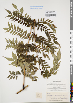
LE 01077978
Ptisana sambucina (Blume) Murdock det. Averyanov, Leonid Vladimirovich at 22.02.2026
Additional identifications: Marattia sambucina Blume det. Phan Ke Loc at 19.07.1997 Collectors: Averyanov, Leonid Vladimirovich; N.Q. Binh; Phan Ke Loc Field collecting number: VH3590. Collection date: 03.04.1997. Administrative regions: VN - Tinh Ninh Thuan. Groups of specimens: L. V. Averyanov specimens; L. V. Averyanov herbarium; Соглашение Минобрнауки №075-15-2021-1056Original label text:FLORA OF VIETNAM
Coordinates (geographic position): 12° 7′ N, 108° 42′ E ±1000 mRecord creation: 2022-01-18, Galina Savich, PhotoScan D2. Processing status: work_status_1Citation: Specimen LE 01077978 // Virtual herbarium of Komarov Botanical Institute RAS — http://re.herbariumle.ru/01077978Marattiaceae
Marattia sambucina Blume
S. Vietnam, Prov. Ninh Thuan, distr. Ninh Son, municipalite Phuoc Binh in 34 km to NE from Dalat city. Closed primary broadleaved forest along mt ridge between Bi Dup and Gia Rinh mt. mt at 1800-1900 m alt.
(N 12° 07′, E 108° 42′). Large terrestrial fern with fronds up to 2.5 m lg on wet steep slopes of wet stream canyon. Not rare. VH 3590 03.04.1997
Marattia sambucina Blume
S. Vietnam, Prov. Ninh Thuan, distr. Ninh Son, municipalite Phuoc Binh in 34 km to NE from Dalat city. Closed primary broadleaved forest along mt ridge between Bi Dup and Gia Rinh mt. mt at 1800-1900 m alt.
(N 12° 07′, E 108° 42′). Large terrestrial fern with fronds up to 2.5 m lg on wet steep slopes of wet stream canyon. Not rare. VH 3590 03.04.1997
International Botanical Expedition of the U.S.A. National Geographic Society (grant No 5803-96)
Collectors: L. Averyanov, N.Q. Binh, P.K. Loc
Collectors: L. Averyanov, N.Q. Binh, P.K. Loc
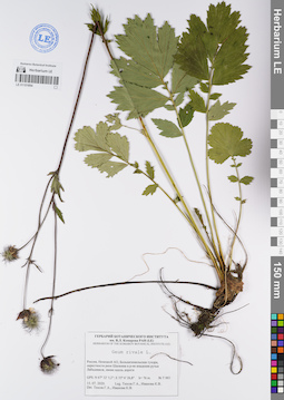
LE 01101894
Groups of specimens: Образцы сектора Восточной Европы; Соглашение Минобрнауки №075-15-2021-1056Record creation: 2022-01-18, Larisa Orlova, PhotoScan D2Citation: Specimen LE 01101894 // Virtual herbarium of Komarov Botanical Institute RAS — http://re.herbariumle.ru/01101894
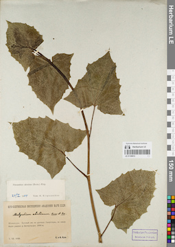
LE 01180912
Prenanthes abietina (Boiss. & Balansa) Kirp. det. Kirpicznikov, Moisey Elevich at 26.02.1964
Collectors: Busch, Elizaveta Aleksandrovna; Busch, Nikolai Adolfovich (Nikolaj Adolfowitsch) Collection date: 07.07.1930. Administrative regions: GE - Georgia. Subregion: South Ossetia. Expedition: Юго-Осетинская экспедиция АН СССР ()Groups of specimens: Образцы сектора Кавказа; Соглашение Минобрнауки №075-15-2021-1056Original label text:Шуацхури. Буковый лес на урочище Галергевдэн, на левом борте ущелья р. Бестауты-дон. 2000 м.
Record creation: 2022-01-18, Ivan Tatanov, PhotoScan D2Citation: Specimen LE 01180912 // Virtual herbarium of Komarov Botanical Institute RAS — http://re.herbariumle.ru/01180912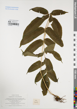
LE 01077977
Coniogramme fraxinea (Don) Diels ⟮prelim. ID⟯ det. Averyanov, Leonid Vladimirovich at 23.03.1997
Collectors: Averyanov, Leonid Vladimirovich; N.Q. Binh; Phan Ke Loc Field collecting number: VH3109. Collection date: 23.03.1997. Administrative regions: VN - Tinh Lam GJong. Groups of specimens: L. V. Averyanov specimens; L. V. Averyanov herbarium; Соглашение Минобрнауки №075-15-2021-1056Original label text:FLORA OF VIETNAM
Coniogramme aff. C. fraxinea (D.Don) Diels
S. Vietnam, Prov. Lam Dong, 29 km to NE from Dalat city, distr.
Lac Duong, municipalite Da Chay. Primary wet closed broadleaved cloud
forest along main Bi Dup ridge at 1900-2000 m alt.
(N 12° 06′, E 108° 39′). Terrestrial fern on steep slopes. Common.
VH 3109 23.03.1997
International Botanical Expedition of the U.S.A. National Geographic
Society (grant No 5803-96)
Collectors: L. Averyanov, N.Q. Binh, P.K. Loc
Coordinates (geographic position): 12° 6′ N, 108° 39′ E ±1000 mRecord creation: 2022-01-18, Galina Savich, PhotoScan D2. Processing status: work_status_1Citation: Specimen LE 01077977 // Virtual herbarium of Komarov Botanical Institute RAS — http://re.herbariumle.ru/01077977Coniogramme aff. C. fraxinea (D.Don) Diels
S. Vietnam, Prov. Lam Dong, 29 km to NE from Dalat city, distr.
Lac Duong, municipalite Da Chay. Primary wet closed broadleaved cloud
forest along main Bi Dup ridge at 1900-2000 m alt.
(N 12° 06′, E 108° 39′). Terrestrial fern on steep slopes. Common.
VH 3109 23.03.1997
International Botanical Expedition of the U.S.A. National Geographic
Society (grant No 5803-96)
Collectors: L. Averyanov, N.Q. Binh, P.K. Loc
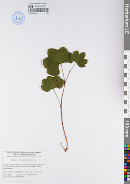
LE 01080418
Rubus chamaemorus L. det. Tyusov, Grigorii Anatol'evich, Ivanova, K. V. at 22.07.2020
Collectors: Tyusov, Grigorii Anatol'evich; Ivanova, K. V. Collection date: 22.07.2020. Administrative regions: RU - Nenetskiy Avtonomnyy Okrug - Zapolyarny Rayon. Groups of specimens: Образцы сектора Восточной Европы; Соглашение Минобрнауки №075-15-2021-1056; Флора Урала и прилегающих территорий (проект)Original label text:Россия, Ненецкой АО, Большеземельская тундра, окрестности реки Шапкина в р-не впадения ручья Лабадяввож, ивняк разнотравный
GPS: N 67°32'9"; Е 55°6'26,1" h= 83 м н.у.м. описание 17
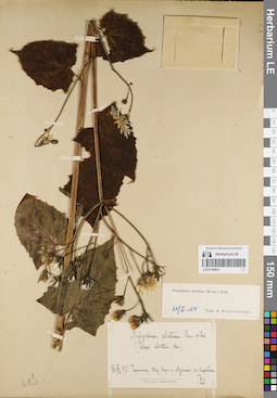
LE 01180911
Prenanthes abietina (Boiss. & Balansa) Kirp. det. Kirpicznikov, Moisey Elevich at 26.02.1964
Collectors: Lipsky, Vladimir Ippolitovich Collection date: 05.08.1895. Administrative regions: RU - Krasnodarskiy Kray. Groups of specimens: Образцы сектора Кавказа; Соглашение Минобрнауки №075-15-2021-1056Original label text:Черноморский округ, верховья р. Мзымты, оз. Кардабача [?Кардывач]
Record creation: 2022-01-18, Ivan Tatanov, PhotoScan D2Citation: Specimen LE 01180911 // Virtual herbarium of Komarov Botanical Institute RAS — http://re.herbariumle.ru/01180911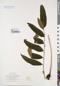
LE 01077976
Coniogramme fraxinea (Don) Diels det. Averyanov, Leonid Vladimirovich at 02.04.1997
Collectors: Averyanov, Leonid Vladimirovich; N.Q. Binh; Phan Ke Loc Field collecting number: VH3554. Collection date: 02.04.1997. Administrative regions: VN - Tinh Ninh Thuan. Groups of specimens: L. V. Averyanov specimens; L. V. Averyanov herbarium; Соглашение Минобрнауки №075-15-2021-1056Original label text:FLORA OF VIETNAM
Coniogramme fraxinea (D.Don) Diels
S. Vietnam, Prov. Ninh Thuan, distr. Ninh Son, municipalite Phuoc
Binh, 37 km to NE from Dalat city. Closed primary broadleaved mt
forest on E macroslope of Gia Rinh mt. ridge at 1300-1400 m alt.
(N 12° 06′, E 108° 43′). Terrestrial fern on steep shadow mt slopes. Common.
VH 3554 02.04.1997
International Botanical Expedition of the U.S.A. National Geographic
Society (grant No 5803-96)
Collectors: L. Averyanov, N.Q. Binh, P.K. Loc
Coordinates (geographic position): 12° 6′ N, 108° 43′ E ±1000 mRecord creation: 2022-01-18, Galina Savich, PhotoScan D2. Processing status: work_status_1Citation: Specimen LE 01077976 // Virtual herbarium of Komarov Botanical Institute RAS — http://re.herbariumle.ru/01077976Coniogramme fraxinea (D.Don) Diels
S. Vietnam, Prov. Ninh Thuan, distr. Ninh Son, municipalite Phuoc
Binh, 37 km to NE from Dalat city. Closed primary broadleaved mt
forest on E macroslope of Gia Rinh mt. ridge at 1300-1400 m alt.
(N 12° 06′, E 108° 43′). Terrestrial fern on steep shadow mt slopes. Common.
VH 3554 02.04.1997
International Botanical Expedition of the U.S.A. National Geographic
Society (grant No 5803-96)
Collectors: L. Averyanov, N.Q. Binh, P.K. Loc
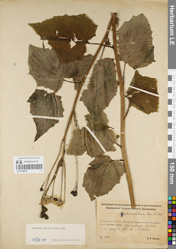
LE 01180910
Prenanthes abietina (Boiss. & Balansa) Kirp. det. Kirpicznikov, Moisey Elevich at 26.02.1964
Collectors: Leskov, Alexandr Ivanovich Collection date: 02.08.1930. Administrative regions: RU - Krasnodarskiy Kray. Expedition: Экспедиция по исследованию флоры и растительности Кавказского государственного заповедника (1928 -1930)Groups of specimens: Образцы сектора Кавказа; Соглашение Минобрнауки №075-15-2021-1056Original label text:Западный Кавказ. Кавказский государственный заповедник и его охранная полоса, субальпийский березняк по склону к прав. бер. р. Бамбачки
Record creation: 2022-01-18, Ivan Tatanov, PhotoScan D2Citation: Specimen LE 01180910 // Virtual herbarium of Komarov Botanical Institute RAS — http://re.herbariumle.ru/01180910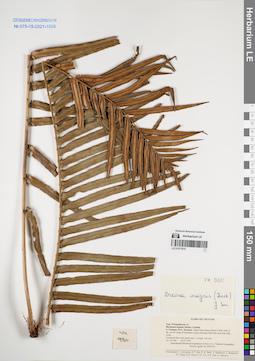
LE 01077975
Brainea insignis (Hook.) J.Sm. det. Averyanov, Leonid Vladimirovich at 28.03.1995
Collectors: Averyanov, Leonid Vladimirovich; et al. Field collecting number: VH980. Collection date: 28.03.1995. Administrative regions: VN - Kon Tum. Groups of specimens: L. V. Averyanov specimens; L. V. Averyanov herbarium; Соглашение Минобрнауки №075-15-2021-1056Original label text:FLORA OF VIETNAM
Polypodiaceae s.l.
Blechnum insignis(Hook.)J.Smith
S. Vietnam, Prov. Kontum. Open Pinus khasya forest at 900-1000 m
alt. on SW slope of mountain system between Dak Poko and Dak Mek
rivers. Terrestrial fern with stems near 1 m high. Not rare.
VH 980 28.03.1995
International Botanical Expedition of the U.S.A. National Geographic
Society (grant No 5094-93)
Participants: L. Averyanov, N.T. Ban, A. Budantzev, L. Budantzev,
N.T. Hiep, D.D. Huyen, P.K. Loc, G. Yakovlev
Record creation: 2022-01-18, Galina Savich, PhotoScan D2. Processing status: work_status_1Citation: Specimen LE 01077975 // Virtual herbarium of Komarov Botanical Institute RAS — http://re.herbariumle.ru/01077975Polypodiaceae s.l.
Blechnum insignis(Hook.)J.Smith
S. Vietnam, Prov. Kontum. Open Pinus khasya forest at 900-1000 m
alt. on SW slope of mountain system between Dak Poko and Dak Mek
rivers. Terrestrial fern with stems near 1 m high. Not rare.
VH 980 28.03.1995
International Botanical Expedition of the U.S.A. National Geographic
Society (grant No 5094-93)
Participants: L. Averyanov, N.T. Ban, A. Budantzev, L. Budantzev,
N.T. Hiep, D.D. Huyen, P.K. Loc, G. Yakovlev
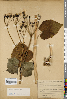
LE 01180909
Prenanthes abietina (Boiss. & Balansa) Kirp. det. Kirpicznikov, Moisey Elevich at 26.02.1964
Collectors: Vassiljeva, Lydia Ivanovna Collection date: 23.07.1935. Administrative regions: RU - Respublika Adygeya. Groups of specimens: Образцы сектора Кавказа; Соглашение Минобрнауки №075-15-2021-1056Original label text:Гербарий Кавказского гос. заповедника. Близ Каменного моря, поляна в верхней зоне леса
Coordinates (geographic position): 44° 1′ 22.32″ N, 40° 1′ 12.17″ ERecord creation: 2022-01-18, Ivan Tatanov, PhotoScan D2Citation: Specimen LE 01180909 // Virtual herbarium of Komarov Botanical Institute RAS — http://re.herbariumle.ru/01180909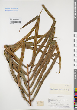
LE 01077974
Blechnum orientale L. det. Averyanov, Leonid Vladimirovich at 23.02.1995
Collectors: Averyanov, Leonid Vladimirovich; et al. Field collecting number: VH022. Collection date: 23.02.1995. Administrative regions: VN - Kon Tum. Groups of specimens: L. V. Averyanov specimens; L. V. Averyanov herbarium; Соглашение Минобрнауки №075-15-2021-1056Original label text:FLORA OF VIETNAM
Polypodiaceae s.l.
Blechnum orientale L.
S. Vietnam, Prov. Kontum. NW slopes of Ngoc Linh mountain system
at 1200 m alt. near Ngoc Linh village. Evergreen primary forest on road
side. Terrestrial fern with fronds up to 3 m length. VH 022 23.02.1995
International Botanical Expedition of the U.S.A. National Geographic Society
Record creation: 2022-01-18, Galina Savich, PhotoScan D2. Processing status: work_status_1Citation: Specimen LE 01077974 // Virtual herbarium of Komarov Botanical Institute RAS — http://re.herbariumle.ru/01077974Polypodiaceae s.l.
Blechnum orientale L.
S. Vietnam, Prov. Kontum. NW slopes of Ngoc Linh mountain system
at 1200 m alt. near Ngoc Linh village. Evergreen primary forest on road
side. Terrestrial fern with fronds up to 3 m length. VH 022 23.02.1995
International Botanical Expedition of the U.S.A. National Geographic Society
(grant No 5094-93)
Participants: L. Averyanov, N.T. Ban, N. Q. Binh, A. Budantzev, L. Budantzev, N.T. Hiep, D.D. Huyen, P.K. Loc, N.X. Tam, G. Yakovlev
Participants: L. Averyanov, N.T. Ban, N. Q. Binh, A. Budantzev, L. Budantzev, N.T. Hiep, D.D. Huyen, P.K. Loc, N.X. Tam, G. Yakovlev
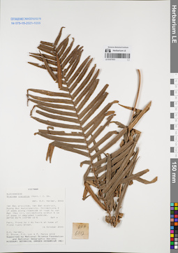
LE 01077973
Brainea insignis (Hook.) J.Sm. det. D.K. Harder at 16.10.2000
Collectors: D.K. Harder; et al. Field collecting number: DKH6012. Collection date: 16.10.2000. Administrative regions: VN - Tinh Yen Bai. Groups of specimens: L. V. Averyanov specimens; L. V. Averyanov herbarium; Соглашение Минобрнауки №075-15-2021-1056Original label text:FLORA OF VIETNAM
Record creation: 2022-01-18, Galina Savich, PhotoScan D2Citation: Specimen LE 01077973 // Virtual herbarium of Komarov Botanical Institute RAS — http://re.herbariumle.ru/01077973Brainea insignis (Hook.) J.Sm.
Yen Bai Prov.
DKH 6012, 16.10.2000
D.K. Harder et.al.
det. D.K. Harder at 16.10.2000
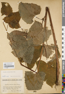
LE 01180908
Prenanthes abietina (Boiss. & Balansa) Kirp. det. Kirpicznikov, Moisey Elevich at 26.02.1964
Collectors: Vassiljeva, Lydia Ivanovna Collection date: 05.08.1935. Administrative regions: RU - Respublika Adygeya. Subregion: Майкопский район. Groups of specimens: Образцы сектора Кавказа; Соглашение Минобрнауки №075-15-2021-1056Original label text:Кавказский заповедник, Майкопский район, Главный маршрут, спуск с пастбища Абаго в дол. р. Безыменка, крупнотравный лес
Record creation: 2022-01-18, Ivan Tatanov, PhotoScan D2Citation: Specimen LE 01180908 // Virtual herbarium of Komarov Botanical Institute RAS — http://re.herbariumle.ru/01180908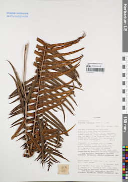
LE 01077972
Brainea insignis (Hook.) J.Sm. det. D.K. Harder at 2000
Collectors: D.K. Harder; et al. Field collecting number: DKH6020. Collection date: 17.10.2000. Administrative regions: VN - Tinh Yen Bai. Groups of specimens: L. V. Averyanov specimens; L. V. Averyanov herbarium; Соглашение Минобрнауки №075-15-2021-1056Original label text:FLORA OF VIETNAM
Record creation: 2022-01-18, Galina Savich, PhotoScan D2Citation: Specimen LE 01077972 // Virtual herbarium of Komarov Botanical Institute RAS — http://re.herbariumle.ru/01077972Brainea insignis (Hook.) J.Sm.
Yen Bai Prov.
DKH 6020, 17.10.2000
D.K. Harder et. al.
Det. D.K. Harder at 2000
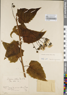
LE 01180907
Prenanthes abietina (Boiss. & Balansa) Kirp. det. Kirpicznikov, Moisey Elevich at 26.02.1964
Collectors: Lipsky, Vladimir Ippolitovich Collection date: 03.08.1895. Administrative regions: RU - Krasnodarskiy Kray. Groups of specimens: Образцы сектора Кавказа; Соглашение Минобрнауки №075-15-2021-1056Original label text:Черноморский округ, лес. горы к вост. от р. Пслуха (приток Мзымты)
Record creation: 2022-01-18, Ivan Tatanov, PhotoScan D2Citation: Specimen LE 01180907 // Virtual herbarium of Komarov Botanical Institute RAS — http://re.herbariumle.ru/01180907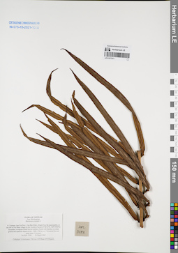
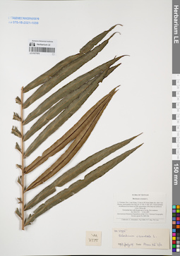
LE 01077971
Blechnum orientale L. det. Averyanov, Leonid Vladimirovich at 20.03.2002
Collectors: Averyanov, Leonid Vladimirovich; et al. Field collecting number: HAL2588. Collection date: 20.03.2002. Administrative regions: VN - Tinh Lao Cai. Groups of specimens: L. V. Averyanov specimens; L. V. Averyanov herbarium; Соглашение Минобрнауки №075-15-2021-1056Original label text:FLORA OF VIETNAM
Blechnaceae
Blechnum orientale L.
Northern Vietnam, Lao Cai Prov., Van Ban Distr., Khanh Yen Ha
municipality, to the SW of Na Nheo village (in the vicinity of point
21°58′12′'N, 104°14′02′'E). Secondary evergreen broad-leaved montane
forest with bamboo on steep granite and quartzite slopes at elev.
1600-1700 m a.s.l. Terrestrial fern on steep slope. Common.
HAL 2588 20 March 2002
Collectors: L.Averyanov, P.K.Loc, D.T.Doan (FFI Project).
Coordinates (geographic position): 21° 58′ 12″ N, 104° 14′ 2″ E ±1000 mRecord creation: 2022-01-18, Galina Savich, PhotoScan D2. Processing status: work_status_1Citation: Specimen LE 01077971 // Virtual herbarium of Komarov Botanical Institute RAS — http://re.herbariumle.ru/01077971Blechnaceae
Blechnum orientale L.
Northern Vietnam, Lao Cai Prov., Van Ban Distr., Khanh Yen Ha
municipality, to the SW of Na Nheo village (in the vicinity of point
21°58′12′'N, 104°14′02′'E). Secondary evergreen broad-leaved montane
forest with bamboo on steep granite and quartzite slopes at elev.
1600-1700 m a.s.l. Terrestrial fern on steep slope. Common.
HAL 2588 20 March 2002
Collectors: L.Averyanov, P.K.Loc, D.T.Doan (FFI Project).
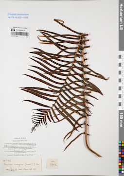
LE 01077970
Blechnum orientale L. det. Phan Ke Loc at 19.07.1997
Collectors: Averyanov, Leonid Vladimirovich; et al. Field collecting number: VH2775. Collection date: 17.03.1997. Administrative regions: VN - Tinh Lam GJong. Groups of specimens: L. V. Averyanov specimens; L. V. Averyanov herbarium; Соглашение Минобрнауки №075-15-2021-1056Original label text:FLORA OF VIETNAM
Blechnum orientale L.
S. Vietnam, Prov. Lam Dong, 31 km to NE from Dalat city, distr. Lac
Duong, municipalite Da Chay (N 12° 08′, E 108° 39′). Closed primary
broadleaved mt forest on NW macroslope of Bi Dup mt system at
1550-1700 m alt. Terrestrial fern with fronds up to 2 m lg. Not common.
VH 2775 17.03.1997
International Botanical Expedition of the U.S.A. National Geographic
Society (grant No 5803-96)
Collectors: L. Averyanov, N.Q. Binh, N.V. Duy, P.K. Loc
Coordinates (geographic position): 12° 8′ N, 108° 39′ E ±1000 mRecord creation: 2022-01-18, Galina Savich, PhotoScan D2. Processing status: work_status_1Citation: Specimen LE 01077970 // Virtual herbarium of Komarov Botanical Institute RAS — http://re.herbariumle.ru/01077970Blechnum orientale L.
S. Vietnam, Prov. Lam Dong, 31 km to NE from Dalat city, distr. Lac
Duong, municipalite Da Chay (N 12° 08′, E 108° 39′). Closed primary
broadleaved mt forest on NW macroslope of Bi Dup mt system at
1550-1700 m alt. Terrestrial fern with fronds up to 2 m lg. Not common.
VH 2775 17.03.1997
International Botanical Expedition of the U.S.A. National Geographic
Society (grant No 5803-96)
Collectors: L. Averyanov, N.Q. Binh, N.V. Duy, P.K. Loc
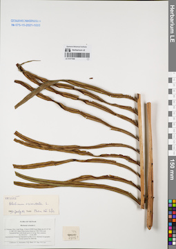
LE 01077969
Brainea insignis (Hook.) J.Sm. det. Phan Ke Loc at 19.07.1997
Collectors: Averyanov, Leonid Vladimirovich; et al. Field collecting number: VH2702. Collection date: 15.03.1997. Administrative regions: VN - Tinh Lam GJong. Groups of specimens: L. V. Averyanov specimens; L. V. Averyanov herbarium; Соглашение Минобрнауки №075-15-2021-1056Original label text:FLORA OF VIETNAM
Brainea insignis (Hook.) J.Sm.
S. Vietnam, Prov. Lam Dong, 31 km to NE from Dalat city, distr. Lac
Duong, municipalite Da Chay, vicinities Klong Lanh village (N 12° 08′,
E 108° 39′). Old open secondary coniferous forest with domination of
Pinus kesiya on NW macroslope of Bi Dup mt system at 1600-1700 m alt.
Woody fern with stem up to 1.5 m hg. Very common. VH 2702 15.03.1997
International Botanical Expedition of the U.S.A. National Geographic
Society (grant No 5803-96)
Collectors: L. Averyanov, N.Q. Binh, N.V. Duy, P.K. Loc
Coordinates (geographic position): 12° 8′ N, 108° 39′ E ±1000 mRecord creation: 2022-01-18, Galina Savich, PhotoScan D2. Processing status: work_status_1Citation: Specimen LE 01077969 // Virtual herbarium of Komarov Botanical Institute RAS — http://re.herbariumle.ru/01077969Brainea insignis (Hook.) J.Sm.
S. Vietnam, Prov. Lam Dong, 31 km to NE from Dalat city, distr. Lac
Duong, municipalite Da Chay, vicinities Klong Lanh village (N 12° 08′,
E 108° 39′). Old open secondary coniferous forest with domination of
Pinus kesiya on NW macroslope of Bi Dup mt system at 1600-1700 m alt.
Woody fern with stem up to 1.5 m hg. Very common. VH 2702 15.03.1997
International Botanical Expedition of the U.S.A. National Geographic
Society (grant No 5803-96)
Collectors: L. Averyanov, N.Q. Binh, N.V. Duy, P.K. Loc
LE 01077968
Blechnum orientale L. det. Phan Ke Loc at 19.07.1997
Collectors: Averyanov, Leonid Vladimirovich; N.Q. Binh; et al. Field collecting number: VH2515. Collection date: 11.03.1997. Administrative regions: VN - Tinh Lam GJong. Groups of specimens: L. V. Averyanov specimens; L. V. Averyanov herbarium; Соглашение Минобрнауки №075-15-2021-1056Original label text:FLORA OF VIETNAM
Blechnum orientale L.
S. Vietnam, Prov. Lam Dong, 14 km to NNW from Dalat city (N 12° 05′, E 108° 22′). Open Pinus kesiya forest at 1740-1760 m alt. Terrestrial fern with fronds up to 2.5 m lg. Very common. VH 2515 11.03.1997
International Botanical Expedition of the U.S.A. National Geographic Society (grant No 5803-96)
Collectors: L. Averyanov, N.Q. Binh, N.V. Duy, P.K. Loc
Coordinates (geographic position): 12° 5′ N, 108° 22′ E ±1000 mRecord creation: 2022-01-18, Galina Savich, PhotoScan D2. Processing status: work_status_1Citation: Specimen LE 01077968 // Virtual herbarium of Komarov Botanical Institute RAS — http://re.herbariumle.ru/01077968Blechnum orientale L.
S. Vietnam, Prov. Lam Dong, 14 km to NNW from Dalat city (N 12° 05′, E 108° 22′). Open Pinus kesiya forest at 1740-1760 m alt. Terrestrial fern with fronds up to 2.5 m lg. Very common. VH 2515 11.03.1997
International Botanical Expedition of the U.S.A. National Geographic Society (grant No 5803-96)
Collectors: L. Averyanov, N.Q. Binh, N.V. Duy, P.K. Loc
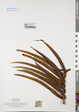
LE 01077967
Blechnum orientale L. det. Averyanov, Leonid Vladimirovich at 25.03.2006
Collectors: Averyanov, Leonid Vladimirovich; Phan Ke Loc; The Van Pham; Khang Sinh Nguyen; et al. Field collecting number: HLF6203. Collection date: 25.03.2006. Administrative regions: VN - Tinh Quang Tri. Groups of specimens: L. V. Averyanov specimens; L. V. Averyanov herbarium; Соглашение Минобрнауки №075-15-2021-1056Original label text:FLORA OF VIETNAM
Plants of Da Krong Nature Reserve
Polypodiaceae s.l. (Blechnaceae)
Blechnum orientale
Vietnam, Quang Tri Prov., Da Krong Distr., Huc Nghi Municipality, in vicinities of Cop village around point 16°27′50″N 107°00′41″E at elevation about 428 m a.s.l.
Secondary broad-leaved evergreen lowland forest on montane hills composed with shale.
Terrestrial fern in open steep slope. Very common. HLF 6203 25 March 2006.
Coll. L.Averyanov, P.K.Loc, P.V.The, N.S.Khang, N.V.Huy, D.C.Tri, L.M.Tuan, T.T.Tu, P.K.Vuong, P.V.Bao, P.X.Dieu, H.T.Phuong.
Grant from Henry Luce Foundation.
Coordinates (geographic position): 16° 27′ 50″ N, 107° 0′ 41″ E ±1000 mRecord creation: 2022-01-18, Galina Savich, PhotoScan D2. Processing status: work_status_1Citation: Specimen LE 01077967 // Virtual herbarium of Komarov Botanical Institute RAS — http://re.herbariumle.ru/01077967Plants of Da Krong Nature Reserve
Polypodiaceae s.l. (Blechnaceae)
Blechnum orientale
Vietnam, Quang Tri Prov., Da Krong Distr., Huc Nghi Municipality, in vicinities of Cop village around point 16°27′50″N 107°00′41″E at elevation about 428 m a.s.l.
Secondary broad-leaved evergreen lowland forest on montane hills composed with shale.
Terrestrial fern in open steep slope. Very common. HLF 6203 25 March 2006.
Coll. L.Averyanov, P.K.Loc, P.V.The, N.S.Khang, N.V.Huy, D.C.Tri, L.M.Tuan, T.T.Tu, P.K.Vuong, P.V.Bao, P.X.Dieu, H.T.Phuong.
Grant from Henry Luce Foundation.
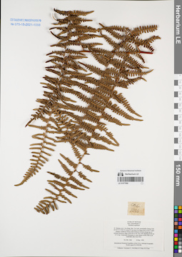
LE 01077966
Pteridium aquilinum (L.) Kuhn det. Averyanov, Leonid Vladimirovich at 10.12.1998
Collectors: Averyanov, Leonid Vladimirovich; N.Q. Binh; Tien Hiep Nguyen; Nguyen Xuan Tam Field collecting number: CBL1066. Collection date: 10.12.1998. Administrative regions: VN - Tinh Cao Bang. Groups of specimens: L. V. Averyanov specimens; L. V. Averyanov herbarium; Соглашение Минобрнауки №075-15-2021-1056Original label text:FLORA OF VIETNAM
Polypodiaceae s.l.
Pteridium aquilinum
N. Vietnam, prov. Cao Bang, distr. Tra Linh, municipality Quang Vinh
(N 22°51′ E 106°14′), about 21 km from Cao Bang town to the N. Open
primary coniferous forest (with Pseudotsuga brevifolia) along tops of
remnant limestone ridge at 850-900 m alt. Fern with climbing fronds up
to 3 m lg. Commonest dominante on open slopes at 600-1000 m alt
(especially after forest fire). CBL 1066 10 Dec. 1998
International Botanical Expedition of the U.S.A. National Geographic
Society (grant No 6300-98)
Collectors: Averyanov L., N.Q.Binh, N.T.Hiep, N.X.Tam.
Coordinates (geographic position): 22° 51′ N, 106° 14′ E ±1000 mRecord creation: 2022-01-18, Galina Savich, PhotoScan D2. Processing status: work_status_1Citation: Specimen LE 01077966 // Virtual herbarium of Komarov Botanical Institute RAS — http://re.herbariumle.ru/01077966Polypodiaceae s.l.
Pteridium aquilinum
N. Vietnam, prov. Cao Bang, distr. Tra Linh, municipality Quang Vinh
(N 22°51′ E 106°14′), about 21 km from Cao Bang town to the N. Open
primary coniferous forest (with Pseudotsuga brevifolia) along tops of
remnant limestone ridge at 850-900 m alt. Fern with climbing fronds up
to 3 m lg. Commonest dominante on open slopes at 600-1000 m alt
(especially after forest fire). CBL 1066 10 Dec. 1998
International Botanical Expedition of the U.S.A. National Geographic
Society (grant No 6300-98)
Collectors: Averyanov L., N.Q.Binh, N.T.Hiep, N.X.Tam.
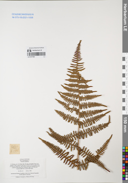
LE 01077965
Pteridium aquilinum (L.) Kuhn det. Averyanov, Leonid Vladimirovich at 25.11.1998
Collectors: Averyanov, Leonid Vladimirovich; Phan Ke Loc; Nguyen Xuan Tam Field collecting number: CBL615. Collection date: 25.11.1998. Administrative regions: VN - Tinh Cao Bang. Groups of specimens: L. V. Averyanov specimens; L. V. Averyanov herbarium; Соглашение Минобрнауки №075-15-2021-1056Original label text:FLORA OF VIETNAM
Polypodiaceae s.l.
Pteridium aquilinum
N. Vietnam, prov. Cao Bang, distr. Ha Lang, municipality Dong Loan,
vicinities of Ban Lung and Lung Phuc (N 22°46′ E 106°44′), about 50 km
to E from Cao Bang town. Open primary mixed mossy semideciduous and
coniferous forest along tops of limestone ridge at 650-700 m alt.
Common epilite fern on open steep slopes. CBL 615 25 Nov. 1998
International Botanical Expedition of the U.S.A. National Geographic
Society (grant No 6300-98)
Collectors: Averyanov L., P.K.Loc, N.X.Tam.
Coordinates (geographic position): 22° 46′ N, 106° 44′ E ±1000 mRecord creation: 2022-01-18, Galina Savich, PhotoScan D2. Processing status: work_status_1Citation: Specimen LE 01077965 // Virtual herbarium of Komarov Botanical Institute RAS — http://re.herbariumle.ru/01077965Polypodiaceae s.l.
Pteridium aquilinum
N. Vietnam, prov. Cao Bang, distr. Ha Lang, municipality Dong Loan,
vicinities of Ban Lung and Lung Phuc (N 22°46′ E 106°44′), about 50 km
to E from Cao Bang town. Open primary mixed mossy semideciduous and
coniferous forest along tops of limestone ridge at 650-700 m alt.
Common epilite fern on open steep slopes. CBL 615 25 Nov. 1998
International Botanical Expedition of the U.S.A. National Geographic
Society (grant No 6300-98)
Collectors: Averyanov L., P.K.Loc, N.X.Tam.
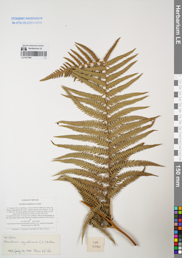
LE 01077964
Pteridium aquilinum (L.) Kuhn det. Phan Ke Loc at 19.07.1997
Collectors: Averyanov, Leonid Vladimirovich; N.Q. Binh; Nguyen Van Duy; Phan Ke Loc Field collecting number: VH2740. Collection date: 16.03.1997. Administrative regions: VN - Tinh Lam GJong. Groups of specimens: L. V. Averyanov specimens; L. V. Averyanov herbarium; Соглашение Минобрнауки №075-15-2021-1056Original label text:FLORA OF VIETNAM
Pteridium aquilinum (L.) Kuhn
S. Vietnam, Prov. Lam Dong, 31 km to NE from Dalat city, distr. Lac
Duong, municipalite Da Chay, vicinities Klong Lanh village (N 12° 08′,
E 108° 39′). Secondary shrub communitys on open dry slopes on NW
macroslope of Bi Dup mt system at 1450-1500 m alt. Terrestrial fern up to 1.5 m hg.
Coordinates (geographic position): 12° 8′ N, 108° 39′ E ±1000 mRecord creation: 2022-01-18, Galina Savich, PhotoScan D2. Processing status: work_status_1Citation: Specimen LE 01077964 // Virtual herbarium of Komarov Botanical Institute RAS — http://re.herbariumle.ru/01077964Pteridium aquilinum (L.) Kuhn
S. Vietnam, Prov. Lam Dong, 31 km to NE from Dalat city, distr. Lac
Duong, municipalite Da Chay, vicinities Klong Lanh village (N 12° 08′,
E 108° 39′). Secondary shrub communitys on open dry slopes on NW
macroslope of Bi Dup mt system at 1450-1500 m alt. Terrestrial fern up to 1.5 m hg.
Very common. Often monodominante on dry open slopes and in forb stratum of coniferous
forests at 1450-1650 m alt. VH 2740 16.03.1997
International Botanical Expedition of the U.S.A. National Geographic
Society (grant No 5803-96)
Collectors: L. Averyanov, N.Q. Binh, N.V. Duy, P.K. Loc
International Botanical Expedition of the U.S.A. National Geographic
Society (grant No 5803-96)
Collectors: L. Averyanov, N.Q. Binh, N.V. Duy, P.K. Loc
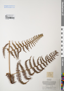
LE 01077963
Pteridium aquilinum (L.) Kuhn det. Averyanov, Leonid Vladimirovich at 12.12.1998
Collectors: Averyanov, Leonid Vladimirovich; N.Q. Binh; et al. Field collecting number: CBL1119. Collection date: 12.12.1998. Administrative regions: VN - Tinh Cao Bang. Groups of specimens: L. V. Averyanov specimens; L. V. Averyanov herbarium; Соглашение Минобрнауки №075-15-2021-1056Original label text:FLORA OF VIETNAM
Polypodiaceae s.l.
Pteridium aquilinum
N. Vietnam, prov. Cao Bang, distr. Tra Linh, municipality Co Muoi,
vicinities of Lung Dat village (N 22°51′ E 106°14′), about 22 km from
Cao Bang town to the N. Primary mixed semideciduous forest (with
Pseudotsuga brevifolia) along tops of limestone ridge at 900-1000 m alt.
Terrestrial fern with vine fronds up to 3 m lg in open places.
Dominante plant in open slopes and cliffs in secondary plant
communities (especially after fire). CBL 1119 12 Dec. 1998
International Botanical Expedition of the U.S.A. National Geographic
Society (grant No 6300-98)
Collectors: Averyanov L., N.Q.Binh, N.T.Hiep, P.K.Loc, N.X.Tam.
Coordinates (geographic position): 22° 51′ N, 106° 14′ E ±1000 mRecord creation: 2022-01-18, Galina Savich, PhotoScan D2. Processing status: work_status_1Citation: Specimen LE 01077963 // Virtual herbarium of Komarov Botanical Institute RAS — http://re.herbariumle.ru/01077963Polypodiaceae s.l.
Pteridium aquilinum
N. Vietnam, prov. Cao Bang, distr. Tra Linh, municipality Co Muoi,
vicinities of Lung Dat village (N 22°51′ E 106°14′), about 22 km from
Cao Bang town to the N. Primary mixed semideciduous forest (with
Pseudotsuga brevifolia) along tops of limestone ridge at 900-1000 m alt.
Terrestrial fern with vine fronds up to 3 m lg in open places.
Dominante plant in open slopes and cliffs in secondary plant
communities (especially after fire). CBL 1119 12 Dec. 1998
International Botanical Expedition of the U.S.A. National Geographic
Society (grant No 6300-98)
Collectors: Averyanov L., N.Q.Binh, N.T.Hiep, P.K.Loc, N.X.Tam.
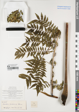
LE 01077962
Ptisana sambucina (Blume) Murdock det. Averyanov, Leonid Vladimirovich at 22.02.2026
Additional identifications: Marattia sambucina Blume det. Phan Ke Loc at 19.07.1997 Collectors: Averyanov, Leonid Vladimirovich; N.Q. Binh; Nguyen Van Duy; Phan Ke Loc Field collecting number: VH2525. Collection date: 11.03.1997. Administrative regions: VN - Tinh Lam GJong. Groups of specimens: L. V. Averyanov specimens; L. V. Averyanov herbarium; Соглашение Минобрнауки №075-15-2021-1056Original label text:FLORA OF VIETNAM
Coordinates (geographic position): 12° 5′ N, 108° 22′ E ±1000 mRecord creation: 2022-01-18, Galina Savich, PhotoScan D2. Processing status: work_status_1Citation: Specimen LE 01077962 // Virtual herbarium of Komarov Botanical Institute RAS — http://re.herbariumle.ru/01077962Marattiaceae
Marattia sambucina Blume
S. Vietnam, Prov. Lam Dong, 14 km to NNW from Dalat city (N 12° 05′, E 108° 22′). Primary closed mixed forest with Pinus kesiya and P.krempfii at 1740-1760 m alt. Terrstrial fern with fronds up to 3 m lg. Common on wet shadow placesalong stream rocks. VH 2525 11.03.1997 International Botanical Expedition of the U.S.A. National Geographic Society (grant No 5803-96)
Collectors: L. Averyanov, N.Q. Binh, N.V. Duy, P.K. Loc
Marattia sambucina Blume
S. Vietnam, Prov. Lam Dong, 14 km to NNW from Dalat city (N 12° 05′, E 108° 22′). Primary closed mixed forest with Pinus kesiya and P.krempfii at 1740-1760 m alt. Terrstrial fern with fronds up to 3 m lg. Common on wet shadow placesalong stream rocks. VH 2525 11.03.1997 International Botanical Expedition of the U.S.A. National Geographic Society (grant No 5803-96)
Collectors: L. Averyanov, N.Q. Binh, N.V. Duy, P.K. Loc
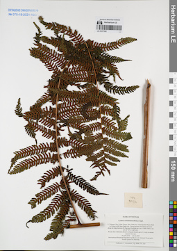
LE 01077961
Cyathea contaminans Copel. det. Averyanov, Leonid Vladimirovich at 03.04.1997
Collectors: Averyanov, Leonid Vladimirovich; N.Q. Binh; Phan Ke Loc Field collecting number: VH3576. Collection date: 03.04.1997. Administrative regions: VN - Tinh Ninh Thuan. Groups of specimens: L. V. Averyanov specimens; L. V. Averyanov herbarium; Соглашение Минобрнауки №075-15-2021-1056Original label text:FLORA OF VIETNAM
Cyathea contaminans (Hook.) Copel.
S. Vietnam, Prov. Ninh Thuan, distr. Ninh Son, municipalite Phuoc Binh
in 34 km to NE from Dalat city. Closed primary broadleaved forest
along mt ridge between Bi Dup and Gia Rinh mt. mt at 1800-1900 m alt.
(N 12° 07′, E 108° 42′). Woody fern with stem about 6 m hg and fronds up to 3.5 m lg in stream
canyon. Not rare. VH 3576 03.04.1997. International Botanical Expedition of the U.S.A. National Geographic
Society (grant No 5803-96)
Collectors: L. Averyanov, N.Q. Binh, P.K. Loc
Coordinates (geographic position): 12° 7′ N, 108° 42′ E ±1000 mRecord creation: 2022-01-18, Galina Savich, PhotoScan D2Citation: Specimen LE 01077961 // Virtual herbarium of Komarov Botanical Institute RAS — http://re.herbariumle.ru/01077961Cyathea contaminans (Hook.) Copel.
S. Vietnam, Prov. Ninh Thuan, distr. Ninh Son, municipalite Phuoc Binh
in 34 km to NE from Dalat city. Closed primary broadleaved forest
along mt ridge between Bi Dup and Gia Rinh mt. mt at 1800-1900 m alt.
(N 12° 07′, E 108° 42′). Woody fern with stem about 6 m hg and fronds up to 3.5 m lg in stream
canyon. Not rare. VH 3576 03.04.1997. International Botanical Expedition of the U.S.A. National Geographic
Society (grant No 5803-96)
Collectors: L. Averyanov, N.Q. Binh, P.K. Loc
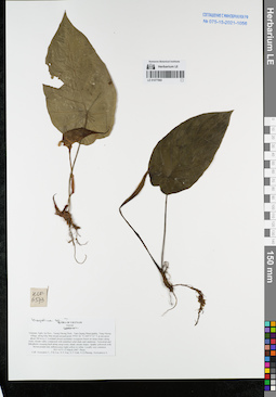
LE 01077960
Hapaline sp. det. Averyanov, Leonid Vladimirovich at 15.03.2007
Collectors: Averyanov, Leonid Vladimirovich; et al. Field collecting number: HLF6573. Collection date: 15.03.2007. Administrative regions: VN - Tinh Nghe An. Groups of specimens: L. V. Averyanov specimens; L. V. Averyanov herbarium; Соглашение Минобрнауки №075-15-2021-1056Original label text:FLORA OF VIETNAM
Araceae
Hapaline sp.?
Vietnam, Nghe An Prov., Tuong Duong Distr., Tam Quang Municipality, Tung Huong village, along Khe Mat stream around point 19°03′26″N 104°37′22″E at elevation about 200 m a.s.l. Lowland closed secondary evergreen forest on steep slopes along rocky stream valley composed with stratified solid shale and sandstone. Terrestrial and lithophytic creeping herb along steep rocky shady stream slopes. Spathe yellowish with brown-purple tint, inflorescence light yellow to white. Locally very common.
HLF 6573 15 March 2007. Photo.
Coll. Averyanov L., P.K.Loc, N.V.Trai, N.T.Vinh, N.D.Phuong, Averyanova A.
Grant from Henry Luce Foundation.
Coordinates (geographic position): 19° 3′ 26″ N, 104° 37′ 22″ E ±1000 mRecord creation: 2022-01-18, Galina Savich, PhotoScan D2. Processing status: work_status_1Citation: Specimen LE 01077960 // Virtual herbarium of Komarov Botanical Institute RAS — http://re.herbariumle.ru/01077960Araceae
Hapaline sp.?
Vietnam, Nghe An Prov., Tuong Duong Distr., Tam Quang Municipality, Tung Huong village, along Khe Mat stream around point 19°03′26″N 104°37′22″E at elevation about 200 m a.s.l. Lowland closed secondary evergreen forest on steep slopes along rocky stream valley composed with stratified solid shale and sandstone. Terrestrial and lithophytic creeping herb along steep rocky shady stream slopes. Spathe yellowish with brown-purple tint, inflorescence light yellow to white. Locally very common.
HLF 6573 15 March 2007. Photo.
Coll. Averyanov L., P.K.Loc, N.V.Trai, N.T.Vinh, N.D.Phuong, Averyanova A.
Grant from Henry Luce Foundation.
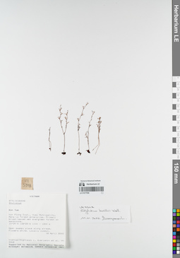
LE 01077956
Stylidium kunthii Wall. det. Averyanov, Leonid Vladimirovich at 11.01.2022
Collectors: Averyanov, Leonid Vladimirovich; et al. Field collecting number: VH5348. Collection date: 18.04.2000. Administrative regions: VN - Kon Tum. Groups of specimens: L. V. Averyanov specimens; L. V. Averyanov herbarium; Соглашение Минобрнауки №075-15-2021-1056Original label text:FLORA OF VIETNAM
Stilidaceae
Stylidium sp.
S. Vietnam, Kontum Prov., Kon Plong Distr., Hieu Municipality, Mang La
forest enterprise (14°39′N, 108°25′E). Primary broad-leaved wet
evergreen forest on sandstone at elev. 1100-1200 m. Open swampy place
along stream. Flowers white. Locally common. VH 5348 18.04.2000
International Botanical Expedition of the U.S.A. National Geographic
Society (grant No 6383-98)
Collectors: L.Averyanov, P.K.Loc, P.H.Hoang, D.X.Du, N.T.Vinh
Coordinates (geographic position): 14° 39′ N, 108° 25′ E ±1000 mRecord creation: 2022-01-18, Galina Savich, PhotoScan D2. Processing status: work_status_1Citation: Specimen LE 01077956 // Virtual herbarium of Komarov Botanical Institute RAS — http://re.herbariumle.ru/01077956Stilidaceae
Stylidium sp.
S. Vietnam, Kontum Prov., Kon Plong Distr., Hieu Municipality, Mang La
forest enterprise (14°39′N, 108°25′E). Primary broad-leaved wet
evergreen forest on sandstone at elev. 1100-1200 m. Open swampy place
along stream. Flowers white. Locally common. VH 5348 18.04.2000
International Botanical Expedition of the U.S.A. National Geographic
Society (grant No 6383-98)
Collectors: L.Averyanov, P.K.Loc, P.H.Hoang, D.X.Du, N.T.Vinh
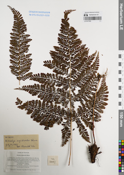
LE 01077820
Diacalpe aspidioides Blume det. Phan Ke Loc at 23.07.1997
Collectors: Averyanov, Leonid Vladimirovich; et al. Field collecting number: VH2667. Collection date: 15.03.1997. Administrative regions: VN - Tinh Lam GJong. Groups of specimens: L. V. Averyanov specimens; L. V. Averyanov herbarium; Соглашение Минобрнауки №075-15-2021-1056Original label text:FLORA OF VIETNAM
Diacalpe aspidioides Blume
S. Vietnam, Prov. Lam Dong, 31 km to NE from Dalat city, distr. Lac
Duong, municipalite Da Chay, vicinities Klong Lanh village (N 12° 08′,
E 108° 39′). Closed primary broadleaved mt forest on NW macroslope of
Bi Dup mt system at 1850-1950 m alt. Terrestrial fern. Common. VH 2667 15.03.1997
International Botanical Expedition of the U.S.A. National Geographic
Society (grant No 5803-96)
Collectors: L. Averyanov, N.Q. Binh, N.V. Duy, P.K. Loc
Coordinates (geographic position): 12° 8′ N, 108° 39′ E ±1000 mRecord creation: 2022-01-18, Galina Savich, PhotoScan D2. Processing status: work_status_1Citation: Specimen LE 01077820 // Virtual herbarium of Komarov Botanical Institute RAS — http://re.herbariumle.ru/01077820Diacalpe aspidioides Blume
S. Vietnam, Prov. Lam Dong, 31 km to NE from Dalat city, distr. Lac
Duong, municipalite Da Chay, vicinities Klong Lanh village (N 12° 08′,
E 108° 39′). Closed primary broadleaved mt forest on NW macroslope of
Bi Dup mt system at 1850-1950 m alt. Terrestrial fern. Common. VH 2667 15.03.1997
International Botanical Expedition of the U.S.A. National Geographic
Society (grant No 5803-96)
Collectors: L. Averyanov, N.Q. Binh, N.V. Duy, P.K. Loc