View
Add
Copy
Edit
Delete
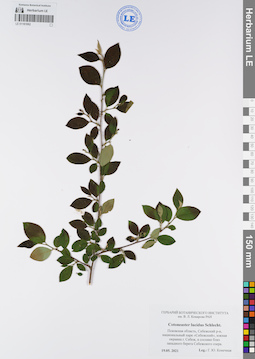
LE 01181062
Groups of specimens: Образцы сектора Восточной Европы; Соглашение Минобрнауки №075-15-2021-1056Record creation: 2022-01-18, Larisa Orlova, PhotoScan D2Citation: Specimen LE 01181062 // Virtual herbarium of Komarov Botanical Institute RAS — http://re.herbariumle.ru/01181062
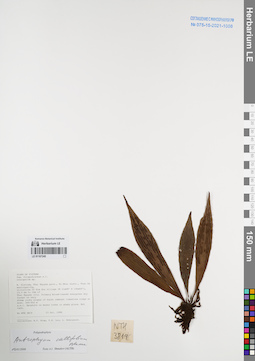
LE 01167245
Antrophyum callifolium Blume det. Shmakov, Aleksandr Ivanovich at 02.01.2008
Collectors: Tien Hiep Nguyen; Phan Ke Loc; Averyanov, Leonid Vladimirovich Field collecting number: NTH3819. Collection date: 23.10.1999. Administrative regions: VN - Tinh Thai Nguyen. Groups of specimens: L. V. Averyanov specimens; L. V. Averyanov herbarium; Соглашение Минобрнауки №075-15-2021-1056Original label text:FLORA OF VIETNAM
Polypodiaceae s.l.
Anthrophium sp.
N. Vietnam, Thai Nguyen prov., Vo Nhai distr., Than Sa municipality,
vicinities of Kim Son village (N 21°48′ E 105°54′), 23.3 km to 18° of
Thai Nguyen city. Primary broadleaved evergreen dry forest on very
steep rocky slopes of karst remnant limestone ridge at elev. 300-450 m
a.s.l. Epiphyte on mossy trees in shady place. Not rare.
NTH 3819 23 Oct. 1999
Collectors: N.T. Hiep, P.K. Loc, L. Averyanov.
Coordinates (geographic position): 21° 48′ N, 105° 54′ E ±1000 mRecord creation: 2022-01-18, Galina Savich, PhotoScan D2. Processing status: work_status_1Citation: Specimen LE 01167245 // Virtual herbarium of Komarov Botanical Institute RAS — http://re.herbariumle.ru/01167245Polypodiaceae s.l.
Anthrophium sp.
N. Vietnam, Thai Nguyen prov., Vo Nhai distr., Than Sa municipality,
vicinities of Kim Son village (N 21°48′ E 105°54′), 23.3 km to 18° of
Thai Nguyen city. Primary broadleaved evergreen dry forest on very
steep rocky slopes of karst remnant limestone ridge at elev. 300-450 m
a.s.l. Epiphyte on mossy trees in shady place. Not rare.
NTH 3819 23 Oct. 1999
Collectors: N.T. Hiep, P.K. Loc, L. Averyanov.
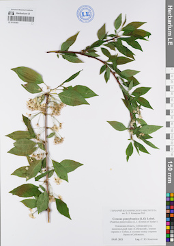
LE 01181061
Groups of specimens: Образцы сектора Восточной Европы; Соглашение Минобрнауки №075-15-2021-1056Record creation: 2022-01-18, Larisa Orlova, PhotoScan D2Citation: Specimen LE 01181061 // Virtual herbarium of Komarov Botanical Institute RAS — http://re.herbariumle.ru/01181061
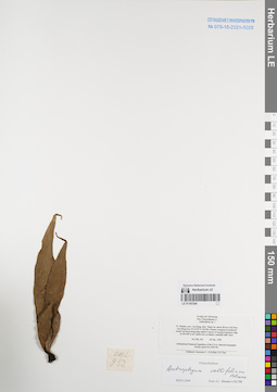
LE 01167244
Antrophyum callifolium Blume det. Shmakov, Aleksandr Ivanovich at 02.01.2008
Collectors: Averyanov, Leonid Vladimirovich; N.Q. Binh; Nguyen Xuan Tam Field collecting number: CBL952. Collection date: 06.12.1998. Administrative regions: VN - Tinh Cao Bang. Groups of specimens: L. V. Averyanov specimens; L. V. Averyanov herbarium; Соглашение Минобрнауки №075-15-2021-1056Original label text:FLORA OF VIETNAM
Polypodiaceae s.l.
Anthrophium sp. ?
N. Vietnam, prov. Cao Bang, distr. Thach An, about 28 km to SE from
Cao Bang town (N 22°29′ E 106°28). Primary evergreen broadleaved
closed wet forest along deep shadow canyon of remnant limestone ridge
at 300-400 m alt. Epilite fern on shadow waterfall cliffs. Rare.
CBL 952 06 Dec. 1998
International Botanical Expedition of the U.S.A. National Geographic
Society (grant No 6300-98)
Collectors: Averyanov L., N.Q.Binh, N.X.Tam.
Coordinates (geographic position): 22° 29′ N, 106° 28′ E ±1000 mRecord creation: 2022-01-18, Galina Savich, PhotoScan D2. Processing status: work_status_1Citation: Specimen LE 01167244 // Virtual herbarium of Komarov Botanical Institute RAS — http://re.herbariumle.ru/01167244Polypodiaceae s.l.
Anthrophium sp. ?
N. Vietnam, prov. Cao Bang, distr. Thach An, about 28 km to SE from
Cao Bang town (N 22°29′ E 106°28). Primary evergreen broadleaved
closed wet forest along deep shadow canyon of remnant limestone ridge
at 300-400 m alt. Epilite fern on shadow waterfall cliffs. Rare.
CBL 952 06 Dec. 1998
International Botanical Expedition of the U.S.A. National Geographic
Society (grant No 6300-98)
Collectors: Averyanov L., N.Q.Binh, N.X.Tam.
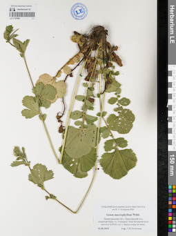
LE 01181060
Groups of specimens: Образцы сектора Восточной Европы; Соглашение Минобрнауки №075-15-2021-1056Record creation: 2022-01-18, Larisa Orlova, PhotoScan D2Citation: Specimen LE 01181060 // Virtual herbarium of Komarov Botanical Institute RAS — http://re.herbariumle.ru/01181060
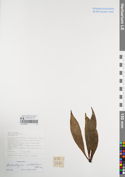
LE 01167243
Antrophyum callifolium Blume det. Shmakov, Aleksandr Ivanovich at 02.01.2008
Collectors: Tien Hiep Nguyen; Phan Ke Loc; Averyanov, Leonid Vladimirovich Field collecting number: NTH3762. Collection date: 22.10.1999. Administrative regions: VN - Tinh Thai Nguyen. Groups of specimens: L. V. Averyanov specimens; L. V. Averyanov herbarium; Соглашение Минобрнауки №075-15-2021-1056Original label text:FLORA OF VIETNAM
Polypodiaceae s.l.
Anthrophium sp.
N. Vietnam, Thai Nguyen prov., Vo Nhai distr., Than Sa municipality,
vicinities of Kim Son village (N 21°48′ E 105°54′), 23.3 km to 18° of
Thai Nguyen city. Primary closed evergreen broadleaved forest on steep
rocky slopes and cliffs of remnant karst limestone ridge at about
100-200 m a.s.l. Lithophytic fern in shady place. Not common.
NTH 3762 22 Oct. 1999
Collectors: N.T. Hiep, P.K. Loc, L. Averyanov.
Coordinates (geographic position): 21° 48′ N, 105° 54′ E ±1000 mRecord creation: 2022-01-18, Galina Savich, PhotoScan D2. Processing status: work_status_1Citation: Specimen LE 01167243 // Virtual herbarium of Komarov Botanical Institute RAS — http://re.herbariumle.ru/01167243Polypodiaceae s.l.
Anthrophium sp.
N. Vietnam, Thai Nguyen prov., Vo Nhai distr., Than Sa municipality,
vicinities of Kim Son village (N 21°48′ E 105°54′), 23.3 km to 18° of
Thai Nguyen city. Primary closed evergreen broadleaved forest on steep
rocky slopes and cliffs of remnant karst limestone ridge at about
100-200 m a.s.l. Lithophytic fern in shady place. Not common.
NTH 3762 22 Oct. 1999
Collectors: N.T. Hiep, P.K. Loc, L. Averyanov.
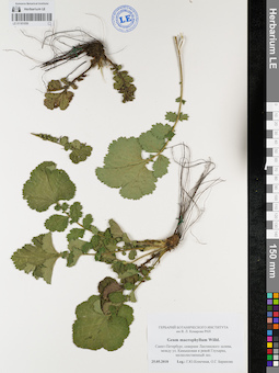
LE 01181059
Groups of specimens: Образцы сектора Восточной Европы; Соглашение Минобрнауки №075-15-2021-1056Record creation: 2022-01-18, Larisa Orlova, PhotoScan D2Citation: Specimen LE 01181059 // Virtual herbarium of Komarov Botanical Institute RAS — http://re.herbariumle.ru/01181059
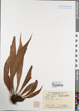
LE 01167242
Antrophyum callifolium Blume det. Takhtajan, Armen Leonovich. at 21.01.1975
Collectors: Takhtajan, Armen Leonovich. Field collecting number: Takhtajan 8492. Collection date: 21.01.1975. Administrative regions: VN - Tinh Lao Cai. Groups of specimens: L. V. Averyanov specimens; L. V. Averyanov herbarium; Соглашение Минобрнауки №075-15-2021-1056Original label text:FLORA OF VIETNAM
Antrophyum callifolium Blume.
Record creation: 2022-01-18, Galina Savich, PhotoScan D2Citation: Specimen LE 01167242 // Virtual herbarium of Komarov Botanical Institute RAS — http://re.herbariumle.ru/01167242Antrophyum callifolium Blume.
Lao Cai Prov.
Takhtajan 8492, 21.01.1975
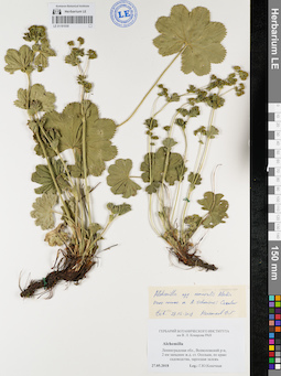
LE 01181058
Groups of specimens: Образцы сектора Восточной Европы; Соглашение Минобрнауки №075-15-2021-1056Record creation: 2022-01-18, Larisa Orlova, PhotoScan D2Citation: Specimen LE 01181058 // Virtual herbarium of Komarov Botanical Institute RAS — http://re.herbariumle.ru/01181058
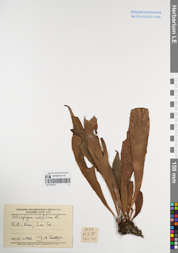
LE 01167241
Antrophyum callifolium Blume det. Takhtajan, Armen Leonovich. at 21.01.1975
Collectors: Takhtajan, Armen Leonovich. Field collecting number: Takhtajan 8492. Collection date: 21.01.1975. Administrative regions: VN - Tinh Lao Cai. Groups of specimens: L. V. Averyanov specimens; L. V. Averyanov herbarium; Соглашение Минобрнауки №075-15-2021-1056Original label text:FLORA OF VIETNAM
Record creation: 2022-01-18, Galina Savich, PhotoScan D2Citation: Specimen LE 01167241 // Virtual herbarium of Komarov Botanical Institute RAS — http://re.herbariumle.ru/01167241Antrophyum callifolium Blume
Lao Cai Prov., Takhtajan 8492.
21.01.1975
LE 01181057
Groups of specimens: Образцы сектора Восточной Европы; Соглашение Минобрнауки №075-15-2021-1056Record creation: 2022-01-18, Larisa Orlova, PhotoScan D2Citation: Specimen LE 01181057 // Virtual herbarium of Komarov Botanical Institute RAS — http://re.herbariumle.ru/01181057
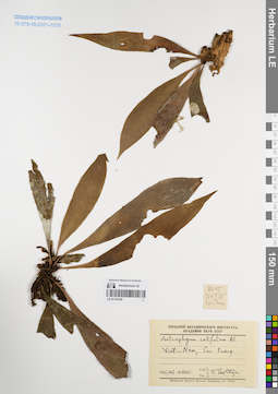
LE 01167240
Antrophyum callifolium Blume det. Takhtajan, Armen Leonovich. at 30.01.1975
Collectors: Takhtajan, Armen Leonovich. Field collecting number: Takhtajan 8645. Collection date: 30.01.1975. Administrative regions: VN - Vietnam. Groups of specimens: L. V. Averyanov specimens; L. V. Averyanov herbarium; Соглашение Минобрнауки №075-15-2021-1056Original label text:FLORA OF VIETNAM
Antrophyum callifolium Blume.
Record creation: 2022-01-18, Galina Savich, PhotoScan D2Citation: Specimen LE 01167240 // Virtual herbarium of Komarov Botanical Institute RAS — http://re.herbariumle.ru/01167240Antrophyum callifolium Blume.
Takhtajan 8645, 30.01.1975
LE 01181056
Groups of specimens: Образцы сектора Восточной Европы; Соглашение Минобрнауки №075-15-2021-1056Record creation: 2022-01-18, Larisa Orlova, PhotoScan D2Citation: Specimen LE 01181056 // Virtual herbarium of Komarov Botanical Institute RAS — http://re.herbariumle.ru/01181056
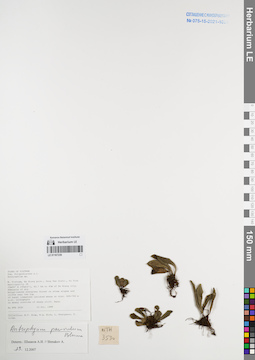
LE 01167239
Antrophyum parvulum Blume det. Shmakov, Aleksandr Ivanovich at 29.12.2007
Collectors: Tien Hiep Nguyen; N.Q. Binh; Averyanov, Leonid Vladimirovich; P. Cribb Field collecting number: NTH3530. Collection date: 10.10.1999. Administrative regions: VN - Tinh Ha Giang. Groups of specimens: L. V. Averyanov specimens; L. V. Averyanov herbarium; Соглашение Минобрнауки №075-15-2021-1056Original label text:FLORA OF VIETNAM
Polypodiaceae s.l.
Coordinates (geographic position): 23° 5′ N, 105° 15′ E ±1000 mRecord creation: 2022-01-18, Galina Savich, PhotoScan D2Citation: Specimen LE 01167239 // Virtual herbarium of Komarov Botanical Institute RAS — http://re.herbariumle.ru/01167239Polypodiaceae s.l.
Anthrophium sp.
N. Vietnam, Ha Giang prov., Dong Van distr., Tu Tinh municipality (N
23°05′ E 105°15′), 40.7 km to 43° of Ha Giang city. Remnants of dry
broadleaved evergreen forest on steep slopes and cliffs near the top
of karst limestone isolated mesae at elev. 600-750 m a.s.l. Lithophyte
on mossy crevices of shady cliff. Rare.
NTH 3530 10 Oct. 1999
Collectors: N.T. Hiep, N.Q. Binh, L. Averyanov, P. Cribb.
N. Vietnam, Ha Giang prov., Dong Van distr., Tu Tinh municipality (N
23°05′ E 105°15′), 40.7 km to 43° of Ha Giang city. Remnants of dry
broadleaved evergreen forest on steep slopes and cliffs near the top
of karst limestone isolated mesae at elev. 600-750 m a.s.l. Lithophyte
on mossy crevices of shady cliff. Rare.
NTH 3530 10 Oct. 1999
Collectors: N.T. Hiep, N.Q. Binh, L. Averyanov, P. Cribb.
LE 01181055
Groups of specimens: Образцы сектора Восточной Европы; Соглашение Минобрнауки №075-15-2021-1056Record creation: 2022-01-18, Larisa Orlova, PhotoScan D2Citation: Specimen LE 01181055 // Virtual herbarium of Komarov Botanical Institute RAS — http://re.herbariumle.ru/01181055
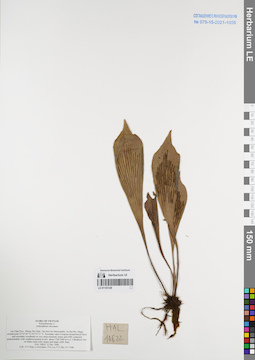
LE 01167238
Antrophyum obovatum Baker det. Averyanov, Leonid Vladimirovich at 12.12.2006
Collectors: Tien Hiep Nguyen; Averyanov, Leonid Vladimirovich; Phan Ke Loc; et al. Field collecting number: HAL10622. Collection date: 12.12.2006. Administrative regions: VN - Tinh Lai Chau. Groups of specimens: L. V. Averyanov specimens; L. V. Averyanov herbarium; Соглашение Минобрнауки №075-15-2021-1056Original label text:FLORA OF VIETNAM
Polypodiaceae s.l.
Anthrophium obovatum
Lai Chau Prov., Phong Tho Distr., Sin Suoi Ho Municipality, Sa Ma Pho village, around point 22°32′20″N 103°33′31″E.
Secondary open evergreen broad-leaved forest and secondary woodlands on very steep mountain slopes and cliffs composed predominantly with weathered granite at elev. about 1700-1900 m a.s.l.
Lithophytic fern on shady steep rocky slopes and shady cliffs. Rare.
HAL 10622 12 Dec. 2006
Coll.: Nguyen Tien Hiep, L.Averyanov, Phan Ke Loc, Pham Van The, N.T.Vinh.
Coordinates (geographic position): 22° 32′ 20″ N, 103° 33′ 31″ E ±1000 mRecord creation: 2022-01-18, Galina Savich, PhotoScan D2Citation: Specimen LE 01167238 // Virtual herbarium of Komarov Botanical Institute RAS — http://re.herbariumle.ru/01167238Polypodiaceae s.l.
Anthrophium obovatum
Lai Chau Prov., Phong Tho Distr., Sin Suoi Ho Municipality, Sa Ma Pho village, around point 22°32′20″N 103°33′31″E.
Secondary open evergreen broad-leaved forest and secondary woodlands on very steep mountain slopes and cliffs composed predominantly with weathered granite at elev. about 1700-1900 m a.s.l.
Lithophytic fern on shady steep rocky slopes and shady cliffs. Rare.
HAL 10622 12 Dec. 2006
Coll.: Nguyen Tien Hiep, L.Averyanov, Phan Ke Loc, Pham Van The, N.T.Vinh.
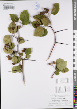
LE 01181054
Groups of specimens: Образцы сектора Восточной Европы; Соглашение Минобрнауки №075-15-2021-1056Record creation: 2022-01-18, Larisa Orlova, PhotoScan D2Citation: Specimen LE 01181054 // Virtual herbarium of Komarov Botanical Institute RAS — http://re.herbariumle.ru/01181054
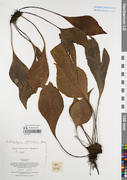
LE 01167237
Antrophyum obovatum Baker det. Shmakov, Aleksandr Ivanovich at 03.05.1999
Collectors: Phan Ke Loc; P.H. Hoang; Averyanov, Leonid Vladimirovich Field collecting number: CBL2096. Collection date: 03.05.1999. Administrative regions: VN - Hau Giang. Groups of specimens: L. V. Averyanov specimens; L. V. Averyanov herbarium; Соглашение Минобрнауки №075-15-2021-1056Original label text:FLORA OF VIETNAM
Anthrophium sp.
N. Vietnam, prov. Ha Giang, distr. Yen Minh, municipality Du Gia, E
slopes of Phu Tha Ca mountain system at 1100-1200 m elev. (N 23°56′ E
105°13′). Primary evergreen broadleaved very wet mountain forest on
shale very steep slopes. Lithophyte fern on shady vertical
shale-quartzite cliff. Not common.
CBL 2096 03 May 1999
International Botanical Expedition of the U.S.A. National Geographic
Society (grant No 6300-98)
Collectors: P.K.Loc, P.H.Hoang, Averyanov L.
Coordinates (geographic position): 23° 56′ N, 105° 13′ E ±1000 mRecord creation: 2022-01-18, Galina Savich, PhotoScan D2Citation: Specimen LE 01167237 // Virtual herbarium of Komarov Botanical Institute RAS — http://re.herbariumle.ru/01167237Anthrophium sp.
N. Vietnam, prov. Ha Giang, distr. Yen Minh, municipality Du Gia, E
slopes of Phu Tha Ca mountain system at 1100-1200 m elev. (N 23°56′ E
105°13′). Primary evergreen broadleaved very wet mountain forest on
shale very steep slopes. Lithophyte fern on shady vertical
shale-quartzite cliff. Not common.
CBL 2096 03 May 1999
International Botanical Expedition of the U.S.A. National Geographic
Society (grant No 6300-98)
Collectors: P.K.Loc, P.H.Hoang, Averyanov L.
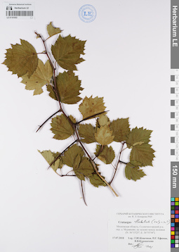
LE 01181053
Groups of specimens: Образцы сектора Восточной Европы; Соглашение Минобрнауки №075-15-2021-1056Record creation: 2022-01-18, Larisa Orlova, PhotoScan D2Citation: Specimen LE 01181053 // Virtual herbarium of Komarov Botanical Institute RAS — http://re.herbariumle.ru/01181053
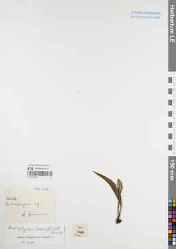
LE 01167236
Antrophyum superficiale Christ det. Shmakov, Aleksandr Ivanovich at 29.12.2007
Collectors: Busch Field collecting number: VH1110. Collection date: 29.12.2007. Administrative regions: VN - Vietnam. Groups of specimens: L. V. Averyanov specimens; L. V. Averyanov herbarium; Соглашение Минобрнауки №075-15-2021-1056Original label text:FLORA OF VIETNAM
Record creation: 2022-01-18, Galina Savich, PhotoScan D2Citation: Specimen LE 01167236 // Virtual herbarium of Komarov Botanical Institute RAS — http://re.herbariumle.ru/01167236Antrophyum superficiale Christ
VH 1110
det. Shmakov, Aleksandr Ivanovich, 29.12.2007
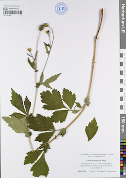
LE 01181052
Groups of specimens: Образцы сектора Восточной Европы; Соглашение Минобрнауки №075-15-2021-1056Record creation: 2022-01-18, Larisa Orlova, PhotoScan D2Citation: Specimen LE 01181052 // Virtual herbarium of Komarov Botanical Institute RAS — http://re.herbariumle.ru/01181052
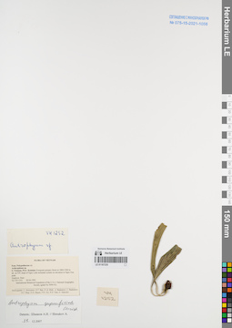
LE 01167235
Antrophyum superficiale Christ det. Shmakov, Aleksandr Ivanovich at 29.12.2007
Collectors: Averyanov, Leonid Vladimirovich; Nguyen Tien Ban; N.Q. Binh; et al. Field collecting number: VH1252. Collection date: 09.04.1995. Administrative regions: VN - Kon Tum. Groups of specimens: L. V. Averyanov specimens; L. V. Averyanov herbarium; Соглашение Минобрнауки №075-15-2021-1056Original label text:FLORA OF VIETNAM
Polypodiaceae s.l.
Arthrophium sp.
S. Vietnam, Prov. Kontum. Evergreen primary forest at 1800-1900 m
alt. on NW slope of Ngoc Linh mountain system on elevation to Ngoc Gua
peak.
Epiphyte. Rare.
VH 1252 09.04.1995
International Botanical Expedition of the U.S.A. National Geographic
Society (grant No 5094-93)
Participants: L. Averyanov, N.T. Ban, N. Q. Binh, A. Budantzev, L. Budantzev, N.T. Hiep, D.D. Huyen, P.K. Loc, N.X. Tam, G. Yakovlev
Record creation: 2022-01-18, Galina Savich, PhotoScan D2Citation: Specimen LE 01167235 // Virtual herbarium of Komarov Botanical Institute RAS — http://re.herbariumle.ru/01167235Polypodiaceae s.l.
Arthrophium sp.
S. Vietnam, Prov. Kontum. Evergreen primary forest at 1800-1900 m
alt. on NW slope of Ngoc Linh mountain system on elevation to Ngoc Gua
peak.
Epiphyte. Rare.
VH 1252 09.04.1995
International Botanical Expedition of the U.S.A. National Geographic
Society (grant No 5094-93)
Participants: L. Averyanov, N.T. Ban, N. Q. Binh, A. Budantzev, L. Budantzev, N.T. Hiep, D.D. Huyen, P.K. Loc, N.X. Tam, G. Yakovlev
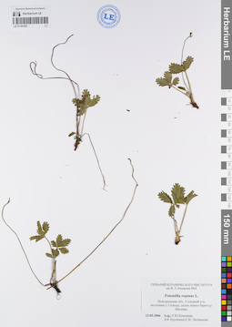
LE 01181051
Groups of specimens: Образцы сектора Восточной Европы; Соглашение Минобрнауки №075-15-2021-1056Record creation: 2022-01-18, Larisa Orlova, PhotoScan D2Citation: Specimen LE 01181051 // Virtual herbarium of Komarov Botanical Institute RAS — http://re.herbariumle.ru/01181051
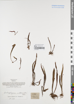
LE 01167234
Antrophyum vittarioides Baker det. Shmakov, Aleksandr Ivanovich at 29.12.2007
Collectors: Tien Hiep Nguyen; Averyanov, Leonid Vladimirovich; The Van Pham Field collecting number: HAL10119. Collection date: 24.11.2006. Administrative regions: VN - Tinh Lai Chau. Groups of specimens: L. V. Averyanov specimens; L. V. Averyanov herbarium; Соглашение Минобрнауки №075-15-2021-1056Original label text:FLORA OF VIETNAM
Poilypodiaceae s.l.
Anthrophium sp.
Lai Chau Prov., Muong Te Distr., Muong Te Municipality, Nam Cum village, around point 22°32′06″N 102°32′29″E.
Epiphytic and lithophytic fern in shady places along water line of the river. Locally common.
HAL 10119 24 Nov. 2006
Coll.: Nguyen Tien Hiep, L.Averyanov, Pham Van The.
Record creation: 2022-01-18, Galina Savich, PhotoScan D2Citation: Specimen LE 01167234 // Virtual herbarium of Komarov Botanical Institute RAS — http://re.herbariumle.ru/01167234Poilypodiaceae s.l.
Anthrophium sp.
Lai Chau Prov., Muong Te Distr., Muong Te Municipality, Nam Cum village, around point 22°32′06″N 102°32′29″E.
Epiphytic and lithophytic fern in shady places along water line of the river. Locally common.
HAL 10119 24 Nov. 2006
Coll.: Nguyen Tien Hiep, L.Averyanov, Pham Van The.
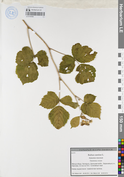
LE 01181050
Groups of specimens: Образцы сектора Восточной Европы; Соглашение Минобрнауки №075-15-2021-1056Record creation: 2022-01-18, Larisa Orlova, PhotoScan D2Citation: Specimen LE 01181050 // Virtual herbarium of Komarov Botanical Institute RAS — http://re.herbariumle.ru/01181050
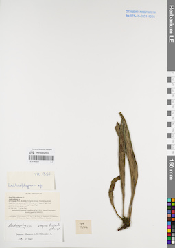
LE 01167233
Antrophyum superficiale Christ det. Shmakov, Aleksandr Ivanovich at 29.12.2007
Collectors: Averyanov, Leonid Vladimirovich; Nguyen Tien Ban; N.Q. Binh; et al. Field collecting number: VH1356. Collection date: 14.04.1995. Administrative regions: VN - Kon Tum. Groups of specimens: L. V. Averyanov specimens; L. V. Averyanov herbarium; Соглашение Минобрнауки №075-15-2021-1056Original label text:FLORA OF VIETNAM
Polypodiaceae s.l.
Anthrophium sp.
S. Vietnam, Prov. Kontum. Evergreen primary forest along stream
(Dak Mek river system) at 850-900 m alt. on W slope of Ngoc Linh
mountain system abowe Muong Hoong village.
Epiphyte in very shadov place.
VH 1356 14.04.1995
International Botanical Expedition of the U.S.A. National Geographic
Society (grant No 5094-93)
Participants: L. Averyanov, N.T. Ban, N. Q. Binh, A. Budantzev, L. Budantzev, N.T. Hiep, D.D. Huyen, P.K. Loc, N.X. Tam, G. Yakovlev
Record creation: 2022-01-18, Galina Savich, PhotoScan D2Citation: Specimen LE 01167233 // Virtual herbarium of Komarov Botanical Institute RAS — http://re.herbariumle.ru/01167233Polypodiaceae s.l.
Anthrophium sp.
S. Vietnam, Prov. Kontum. Evergreen primary forest along stream
(Dak Mek river system) at 850-900 m alt. on W slope of Ngoc Linh
mountain system abowe Muong Hoong village.
Epiphyte in very shadov place.
VH 1356 14.04.1995
International Botanical Expedition of the U.S.A. National Geographic
Society (grant No 5094-93)
Participants: L. Averyanov, N.T. Ban, N. Q. Binh, A. Budantzev, L. Budantzev, N.T. Hiep, D.D. Huyen, P.K. Loc, N.X. Tam, G. Yakovlev
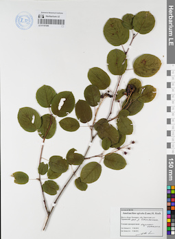
LE 01181049
Groups of specimens: Образцы сектора Восточной Европы; Соглашение Минобрнауки №075-15-2021-1056Record creation: 2022-01-18, Larisa Orlova, PhotoScan D2Citation: Specimen LE 01181049 // Virtual herbarium of Komarov Botanical Institute RAS — http://re.herbariumle.ru/01181049
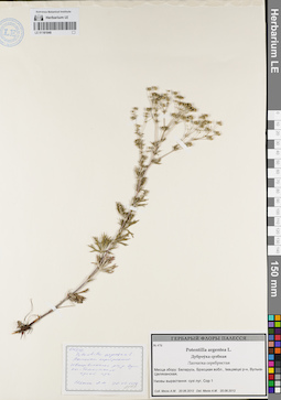
LE 01181048
Groups of specimens: Образцы сектора Восточной Европы; Соглашение Минобрнауки №075-15-2021-1056Record creation: 2022-01-18, Larisa Orlova, PhotoScan D2Citation: Specimen LE 01181048 // Virtual herbarium of Komarov Botanical Institute RAS — http://re.herbariumle.ru/01181048
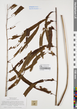
LE 01167232
Phymatosorus lucidus (Roxb.) Pic.Serm. det. Averyanov, Leonid Vladimirovich at 14.03.2002
Collectors: Averyanov, Leonid Vladimirovich; Phan Ke Loc; D.T. Doan Field collecting number: HAL2289. Collection date: 14.03.2002. Administrative regions: VN - Tinh Lao Cai. Groups of specimens: L. V. Averyanov specimens; L. V. Averyanov herbarium; Соглашение Минобрнауки №075-15-2021-1056Original label text:FLORA OF VIETNAM
Polypodiaceae
Phymatosorus lucidus (Roxb.) Pic.Serm.
Northern Vietnam, Lao Cai Prov., Van Ban Distr., Khanh Yen Ha
municipality, elevation from Na Nheo village to the S from 680 to
880 m a.s.l. (around point 21°59′24′'N, 104°16′23′'E). Secondary evergreen broad-leaved wet submontane forest on very steep granite
and quartzite slopes of river canyon. Epiphyte on mossy tree.
Common. Usually associated with Asplenium nidus.
HAL 2289 14 March 2002
Collectors: L.Averyanov, P.K.Loc, D.T.Doan (FFI Project).
Coordinates (geographic position): 21° 59′ 24″ N, 104° 16′ 23″ E ±1000 mRecord creation: 2022-01-18, Galina Savich, PhotoScan D2Citation: Specimen LE 01167232 // Virtual herbarium of Komarov Botanical Institute RAS — http://re.herbariumle.ru/01167232Polypodiaceae
Phymatosorus lucidus (Roxb.) Pic.Serm.
Northern Vietnam, Lao Cai Prov., Van Ban Distr., Khanh Yen Ha
municipality, elevation from Na Nheo village to the S from 680 to
880 m a.s.l. (around point 21°59′24′'N, 104°16′23′'E). Secondary evergreen broad-leaved wet submontane forest on very steep granite
and quartzite slopes of river canyon. Epiphyte on mossy tree.
Common. Usually associated with Asplenium nidus.
HAL 2289 14 March 2002
Collectors: L.Averyanov, P.K.Loc, D.T.Doan (FFI Project).
LE 01181047
Groups of specimens: Образцы сектора Восточной Европы; Соглашение Минобрнауки №075-15-2021-1056Record creation: 2022-01-18, Larisa Orlova, PhotoScan D2Citation: Specimen LE 01181047 // Virtual herbarium of Komarov Botanical Institute RAS — http://re.herbariumle.ru/01181047
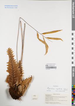
LE 01167231
Drynaria rigidula (Sw.) Bedd. det. Shmakov, Aleksandr Ivanovich at 02.01.2008
Collectors: Averyanov, Leonid Vladimirovich; Nguyen Tien Ban; et al. Field collecting number: VH2120. Collection date: 29.11.1995. Administrative regions: VN - Kon Tum. Groups of specimens: L. V. Averyanov specimens; L. V. Averyanov herbarium; Соглашение Минобрнауки №075-15-2021-1056; Flora of VietnamOriginal label text:FLORA OF VIETNAM
Polypodiaceae s.l.
Pseudodrynaria sp. ?
S. Vietnam, Prov. Kon Tum, Distr. Dak Gley, about 6-8 km to the N of Dak Gley town. Secondary evergreen dry forest rich in primary elements with bamboo domination at 750-850 m alt.
Epiphyte fern associated with Cycas pectinata. Rare.
VH 2120 29.11.1995
International Botanical Expedition of the U.S.A. National Geographic Society (grant No 5094-93)
Participants: L. Averyanov, N.T. Ban, A. Budantzev, L. Budantzev, N.T. Hiep, D.D. Huyen, P.K. Loc, G. Yakovlev
Record creation: 2022-01-18, Galina Savich, PhotoScan D2Citation: Specimen LE 01167231 // Virtual herbarium of Komarov Botanical Institute RAS — http://re.herbariumle.ru/01167231Polypodiaceae s.l.
Pseudodrynaria sp. ?
S. Vietnam, Prov. Kon Tum, Distr. Dak Gley, about 6-8 km to the N of Dak Gley town. Secondary evergreen dry forest rich in primary elements with bamboo domination at 750-850 m alt.
Epiphyte fern associated with Cycas pectinata. Rare.
VH 2120 29.11.1995
International Botanical Expedition of the U.S.A. National Geographic Society (grant No 5094-93)
Participants: L. Averyanov, N.T. Ban, A. Budantzev, L. Budantzev, N.T. Hiep, D.D. Huyen, P.K. Loc, G. Yakovlev
LE 01181046
Groups of specimens: Образцы сектора Восточной Европы; Соглашение Минобрнауки №075-15-2021-1056Record creation: 2022-01-18, Larisa Orlova, PhotoScan D2Citation: Specimen LE 01181046 // Virtual herbarium of Komarov Botanical Institute RAS — http://re.herbariumle.ru/01181046
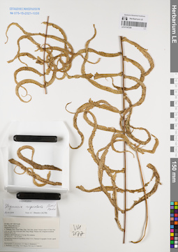
LE 01167230
Drynaria rigidula (Sw.) Bedd. det. Shmakov, Aleksandr Ivanovich at 03.01.2008
Collectors: Averyanov, Leonid Vladimirovich; Nguyen Tien Ban; et al. Field collecting number: VH2177. Collection date: 02.12.1995. Administrative regions: VN - Kon Tum. Groups of specimens: L. V. Averyanov specimens; L. V. Averyanov herbarium; Соглашение Минобрнауки №075-15-2021-1056Original label text:FLORA OF VIETNAM
Polypodiaceae s.l.
Pseudodrynaria sp. ?
S. Vietnam, Prov. Kon Tum, Distr. Dak Gley, about 7-8 km to the S of Dak Gley town on Dak Poko river near Dak Tung village. Primary dry evergreen mountain forest at 800 m alt.
Epiphyte with fronds up to 1.5 m lg. Not common.
VH 2177 02.12.1995
International Botanical Expedition of the U.S.A. National Geographic Society (grant No 5094-93)
Participants: L. Averyanov, N.T. Ban, A. Budantzev, L. Budantzev, N.T. Hiep, D.D. Huyen, P.K. Loc, G. Yakovlev
Record creation: 2022-01-18, Galina Savich, PhotoScan D2Citation: Specimen LE 01167230 // Virtual herbarium of Komarov Botanical Institute RAS — http://re.herbariumle.ru/01167230Polypodiaceae s.l.
Pseudodrynaria sp. ?
S. Vietnam, Prov. Kon Tum, Distr. Dak Gley, about 7-8 km to the S of Dak Gley town on Dak Poko river near Dak Tung village. Primary dry evergreen mountain forest at 800 m alt.
Epiphyte with fronds up to 1.5 m lg. Not common.
VH 2177 02.12.1995
International Botanical Expedition of the U.S.A. National Geographic Society (grant No 5094-93)
Participants: L. Averyanov, N.T. Ban, A. Budantzev, L. Budantzev, N.T. Hiep, D.D. Huyen, P.K. Loc, G. Yakovlev
LE 01181040
Groups of specimens: Образцы сектора Восточной Европы; Соглашение Минобрнауки №075-15-2021-1056Record creation: 2022-01-18, Larisa Orlova, PhotoScan D2Citation: Specimen LE 01181040 // Virtual herbarium of Komarov Botanical Institute RAS — http://re.herbariumle.ru/01181040
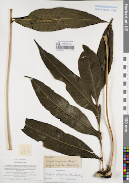
LE 01167229
Colysis elliptica (Thunb.) Ching det. Shmakov, Aleksandr Ivanovich at 02.01.2008
Additional identifications: Colysis longisora Ching det. Phan Ke Loc at 22.07.1997 Collectors: Averyanov, Leonid Vladimirovich; Tien Hiep Nguyen; Phan Ke Loc Field collecting number: VH4585. Collection date: 15.05.1997. Administrative regions: VN - Tinh Quang Binh. Groups of specimens: L. V. Averyanov specimens; L. V. Averyanov herbarium; Соглашение Минобрнауки №075-15-2021-1056Original label text:FLORA OF VIETNAM
Colysis longisora Ching
N. Vietnam, Prov. Quang Binh, distr. Minh Hoa, 72 km to NWW
from Dong Hoi, municipalite Thong Hoa, vicinities of Yen Son village, limestone massif Ke Bang (N 17°40′ E 105°57′). Primary evergreen broadleaved forest on steep slopes and bluffs of limestone mesas
at 200-250 m alt. Epilitic and terrestrial fern on shadow steep slopes. Common. VH 4585 15.05.1997
International Botanical Expedition of the U.S.A. National Geographic Society (grant No 5803-96)
Collectors: L. Averyanov, N.T. Hiep, P.K. Loc
Coordinates (geographic position): 17° 40′ N, 105° 57′ E ±1000 mRecord creation: 2022-01-18, Galina Savich, PhotoScan D2. Processing status: work_status_1Citation: Specimen LE 01167229 // Virtual herbarium of Komarov Botanical Institute RAS — http://re.herbariumle.ru/01167229Colysis longisora Ching
N. Vietnam, Prov. Quang Binh, distr. Minh Hoa, 72 km to NWW
from Dong Hoi, municipalite Thong Hoa, vicinities of Yen Son village, limestone massif Ke Bang (N 17°40′ E 105°57′). Primary evergreen broadleaved forest on steep slopes and bluffs of limestone mesas
at 200-250 m alt. Epilitic and terrestrial fern on shadow steep slopes. Common. VH 4585 15.05.1997
International Botanical Expedition of the U.S.A. National Geographic Society (grant No 5803-96)
Collectors: L. Averyanov, N.T. Hiep, P.K. Loc
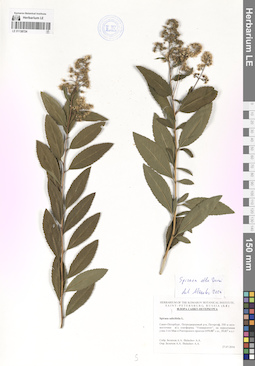
LE 01138724
Spiraea alba Du Roi det. Czkalov, Andrey Vjacheslavovich at 2024
Additional identifications: Spiraea salicifolia L. det. Belechov, Andrey A. at 2016 Collectors: Belechov, Andrey A. Collection date: 27.07.2016. Administrative regions: RU - Sankt-Peterburg. Groups of specimens: Образцы сектора Восточной Европы; Соглашение Минобрнауки №075-15-2021-1056Original label text:г. Санкт-Петербург, Петродворцовый район, Петергоф, 550 м юго-восточнее железнодорожной платформы "Университет", на пересечении улиц 1-го Мая и Ректорского проезда.
Coordinates (geographic position): 59° 52′ 48″ N, 29° 49′ 48″ E ±1000 mRecord creation: 2022-01-18, Larisa Orlova, PhotoScan D2Citation: Specimen LE 01138724 // Virtual herbarium of Komarov Botanical Institute RAS — http://re.herbariumle.ru/01138724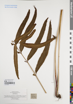
LE 01167228
Taenitis blechnoides (Willd.) Sw. det. Phan Ke Loc at 23.03.2006
Collectors: Phan Ke Loc; Khang Sinh Nguyen; et al. Field collecting number: HLF6154. Collection date: 23.03.2006. Administrative regions: VN - Tinh Quang Tri. Groups of specimens: L. V. Averyanov specimens; L. V. Averyanov herbarium; Соглашение Минобрнауки №075-15-2021-1056Original label text:FLORA OF VIETNAM
Plants of the Da Krong Nature Reserve
Polypodiaceae s.l.
Taenitis blechnoides
Vietnam, Quang Tri Prov., Da Krong Distr., Huc Nghi Municipality, La To Vill., along La Sam stream, around point 16°29′00″ N, 107°00′40″ E, 432 m a.s.l., shaly mt.
Terrestrial on stream bank and slopes of secondary closed evergreen broad-leaved mixte with bamboo forest; very common.
HLF 6154 23 Mar 2006.
Coll.: P.K.Loc, N.S.Khang, D.C.Tri, N.V.Huy, H.T.Phuong, P.V.Bao, P.X.Dieu, L.M.Tuan, T.T.Tu, P.K.Vuong.
Grant from Henry Luce Foundation.
Record creation: 2022-01-18, Galina Savich, PhotoScan D2Citation: Specimen LE 01167228 // Virtual herbarium of Komarov Botanical Institute RAS — http://re.herbariumle.ru/01167228Plants of the Da Krong Nature Reserve
Polypodiaceae s.l.
Taenitis blechnoides
Vietnam, Quang Tri Prov., Da Krong Distr., Huc Nghi Municipality, La To Vill., along La Sam stream, around point 16°29′00″ N, 107°00′40″ E, 432 m a.s.l., shaly mt.
Terrestrial on stream bank and slopes of secondary closed evergreen broad-leaved mixte with bamboo forest; very common.
HLF 6154 23 Mar 2006.
Coll.: P.K.Loc, N.S.Khang, D.C.Tri, N.V.Huy, H.T.Phuong, P.V.Bao, P.X.Dieu, L.M.Tuan, T.T.Tu, P.K.Vuong.
Grant from Henry Luce Foundation.
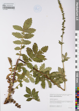
LE 01138594
Groups of specimens: Образцы сектора Восточной Европы; Соглашение Минобрнауки №075-15-2021-1056Record creation: 2022-01-18, Larisa Orlova, PhotoScan D2Citation: Specimen LE 01138594 // Virtual herbarium of Komarov Botanical Institute RAS — http://re.herbariumle.ru/01138594
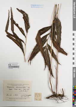
LE 01167227
Taenitis blechnoides (Willd.) Sw. det. V.N.Tu at 01.02.1975
Collectors: Takhtajan, Armen Leonovich. Field collecting number: Takhtajan 8706. Collection date: 01.02.1975. Administrative regions: VN - Tinh Nghe An. Groups of specimens: L. V. Averyanov specimens; L. V. Averyanov herbarium; Соглашение Минобрнауки №075-15-2021-1056Original label text:FLORA OF VIETNAM
Record creation: 2022-01-18, Galina Savich, PhotoScan D2Citation: Specimen LE 01167227 // Virtual herbarium of Komarov Botanical Institute RAS — http://re.herbariumle.ru/01167227Taenitis blechnoides (Willd.) Sw.
Nghe An Prov.
Takhtajan 8706, 01.02.1975
det. V.N.Tu 01.02.1975
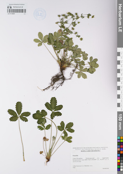
LE 01138587
Groups of specimens: Образцы сектора Восточной Европы; Соглашение Минобрнауки №075-15-2021-1056Record creation: 2022-01-18, Larisa Orlova, PhotoScan D2Citation: Specimen LE 01138587 // Virtual herbarium of Komarov Botanical Institute RAS — http://re.herbariumle.ru/01138587
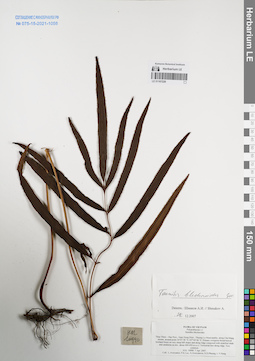
LE 01167226
Taenitis blechnoides (Willd.) Sw. det. Shmakov, Aleksandr Ivanovich at 28.12.2007
Collectors: Averyanov, Leonid Vladimirovich; Phan Ke Loc; et al. Field collecting number: HAL10990. Collection date: 07.04.2090. Administrative regions: VN - Tinh Thua Thien-Hue. Groups of specimens: L. V. Averyanov specimens; L. V. Averyanov herbarium; Соглашение Минобрнауки №075-15-2021-1056Original label text:FLORA OF VIETNAM
Polypodiaceae s.l.
Stenithis blechnoides
Thua Thien – Hue Prov., Nam Dong Distr., Thuong Lo Municipality, along Cha Mang stream, around point 16°07′58″N 107°44′46″E.
Primary evergreen broad-leaved lowland forest on very steep hill slopes and along ridge composed with stratified shale and sandstone at elev. about 400-450 m a.s.l.
Terrestrial fern along ridge. Very common.
HAL 10990 7 Apr. 2007.
Coll.: L.Averyanov, Phan Ke Loc, A.Averyanova, N.D.Phuong, L.V.Hung.
Coordinates (geographic position): 16° 7′ 58″ N, 107° 44′ 46″ E ±1000 mRecord creation: 2022-01-18, Galina Savich, PhotoScan D2Citation: Specimen LE 01167226 // Virtual herbarium of Komarov Botanical Institute RAS — http://re.herbariumle.ru/01167226Polypodiaceae s.l.
Stenithis blechnoides
Thua Thien – Hue Prov., Nam Dong Distr., Thuong Lo Municipality, along Cha Mang stream, around point 16°07′58″N 107°44′46″E.
Primary evergreen broad-leaved lowland forest on very steep hill slopes and along ridge composed with stratified shale and sandstone at elev. about 400-450 m a.s.l.
Terrestrial fern along ridge. Very common.
HAL 10990 7 Apr. 2007.
Coll.: L.Averyanov, Phan Ke Loc, A.Averyanova, N.D.Phuong, L.V.Hung.
LE 01138222
Groups of specimens: Образцы сектора Восточной Европы; Соглашение Минобрнауки №075-15-2021-1056Record creation: 2022-01-18, Larisa Orlova, PhotoScan D2Citation: Specimen LE 01138222 // Virtual herbarium of Komarov Botanical Institute RAS — http://re.herbariumle.ru/01138222
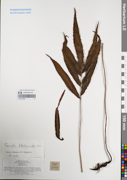
LE 01167225
Taenitis blechnoides (Willd.) Sw. det. Shmakov, Aleksandr Ivanovich at 28.12.2007
Collectors: Averyanov, Leonid Vladimirovich; Phan Ke Loc; To Van Thao; Vinh Tien Nguyen Field collecting number: HLF5747. Collection date: 11.11.2005. Administrative regions: VN - Dak Nong. Groups of specimens: L. V. Averyanov specimens; L. V. Averyanov herbarium; Соглашение Минобрнауки №075-15-2021-1056Original label text:FLORA OF VIETNAM
Plants of Ta Dung Nature Reserve
Polypodiaceae s.l.
Ctenithis blechnoides
Vietnam, Dak Nong Prov., Dak Glong Distr., Dak Som Municipality, around point 11°53′06″N 107°55′15″E at elevation about 800 m a.s.l. in vicinities of Dak Som village.
Remnants of old secondary broad-leaved evergreen dry forest on tops of hills composed with basalt.
Terrestrial fern. Very common.
HLF 5747 11 November 2005.
Coll. L.Averyanov, P.K.Loc, T.V.Thao, N.T.Vinh.
Grant from Henry Luce Foundation.
Coordinates (geographic position): 11° 53′ 6″ N, 107° 55′ 15″ E ±1000 mRecord creation: 2022-01-18, Galina Savich, PhotoScan D2Citation: Specimen LE 01167225 // Virtual herbarium of Komarov Botanical Institute RAS — http://re.herbariumle.ru/01167225Plants of Ta Dung Nature Reserve
Polypodiaceae s.l.
Ctenithis blechnoides
Vietnam, Dak Nong Prov., Dak Glong Distr., Dak Som Municipality, around point 11°53′06″N 107°55′15″E at elevation about 800 m a.s.l. in vicinities of Dak Som village.
Remnants of old secondary broad-leaved evergreen dry forest on tops of hills composed with basalt.
Terrestrial fern. Very common.
HLF 5747 11 November 2005.
Coll. L.Averyanov, P.K.Loc, T.V.Thao, N.T.Vinh.
Grant from Henry Luce Foundation.
LE 01138041
Groups of specimens: Образцы сектора Восточной Европы; Соглашение Минобрнауки №075-15-2021-1056Record creation: 2022-01-18, Larisa Orlova, PhotoScan D2Citation: Specimen LE 01138041 // Virtual herbarium of Komarov Botanical Institute RAS — http://re.herbariumle.ru/01138041
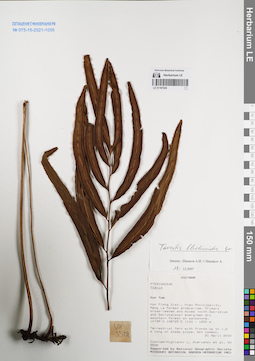
LE 01167224
Taenitis blechnoides (Willd.) Sw. det. Shmakov, Aleksandr Ivanovich at 28.12.2007
Collectors: Averyanov, Leonid Vladimirovich; et al. Field collecting number: VH5508. Collection date: 21.04.2000. Administrative regions: VN - Kon Tum. Groups of specimens: L. V. Averyanov specimens; L. V. Averyanov herbarium; Соглашение Минобрнауки №075-15-2021-1056Original label text:FLORA OF VIETNAM
Polypodiaceae
Pteris sp.
S. Vietnam, Kontum Prov., Kon Plong Distr., Hieu Municipality, Mang La
forest enterprise (14°39′N, 108°25′E). Primary broad-leaved and mixed
(with Dacrydium and Dacrycarpus) evergreen dry mountain forest at
elev. about 1100-1200 m on sandstone. Terrestrial fern with fronds up
to 1.2 m lg on steep slope. Not common.
VH 5508 21.04.2000
International Botanical Expedition of the U.S.A. National Geographic
Society (grant No 6383-98)
Collectors: L.Averyanov, P.H.Hoang, D.X.Du, N.T.Vinh
Coordinates (geographic position): 14° 39′ N, 108° 25′ E ±1000 mRecord creation: 2022-01-18, Galina Savich, PhotoScan D2Citation: Specimen LE 01167224 // Virtual herbarium of Komarov Botanical Institute RAS — http://re.herbariumle.ru/01167224Polypodiaceae
Pteris sp.
S. Vietnam, Kontum Prov., Kon Plong Distr., Hieu Municipality, Mang La
forest enterprise (14°39′N, 108°25′E). Primary broad-leaved and mixed
(with Dacrydium and Dacrycarpus) evergreen dry mountain forest at
elev. about 1100-1200 m on sandstone. Terrestrial fern with fronds up
to 1.2 m lg on steep slope. Not common.
VH 5508 21.04.2000
International Botanical Expedition of the U.S.A. National Geographic
Society (grant No 6383-98)
Collectors: L.Averyanov, P.H.Hoang, D.X.Du, N.T.Vinh
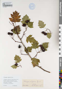
LE 01138003
Groups of specimens: Образцы сектора Восточной Европы; Соглашение Минобрнауки №075-15-2021-1056Record creation: 2022-01-18, Larisa Orlova, PhotoScan D2Citation: Specimen LE 01138003 // Virtual herbarium of Komarov Botanical Institute RAS — http://re.herbariumle.ru/01138003
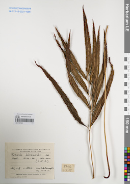
LE 01167223
Taenitis blechnoides (Willd.) Sw. det. V.N.Tu at 01.02.1975
Collectors: Takhtajan, Armen Leonovich. Field collecting number: Takhtajan 8706. Collection date: 01.02.1975. Administrative regions: VN - Tinh Nghe An. Groups of specimens: L. V. Averyanov specimens; L. V. Averyanov herbarium; Соглашение Минобрнауки №075-15-2021-1056Original label text:FLORA OF VIETNAM
Record creation: 2022-01-18, Galina Savich, PhotoScan D2Citation: Specimen LE 01167223 // Virtual herbarium of Komarov Botanical Institute RAS — http://re.herbariumle.ru/01167223Taenitis blechnoides (Willd.) Sw.
Nghe An Prov.
Takhtajan 8706, 01.02.1975
Det.V.N.Tu,
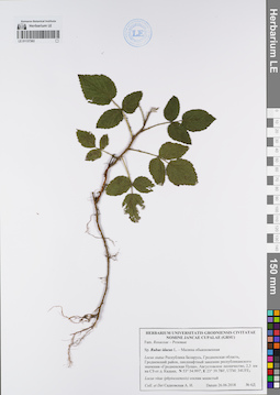
LE 01137363
Groups of specimens: Образцы сектора Восточной Европы; Соглашение Минобрнауки №075-15-2021-1056Record creation: 2022-01-18, Larisa Orlova, PhotoScan D2Citation: Specimen LE 01137363 // Virtual herbarium of Komarov Botanical Institute RAS — http://re.herbariumle.ru/01137363

LE 01167222
Capparis cantoniensis Lour. det. Dorofeyev, Vladimir Ivanovich at 29.08.1986
Collectors: Busch Field collecting number: P-5561. Collection date: 31.07.1985. Groups of specimens: L. V. Averyanov specimens; L. V. Averyanov herbarium; Соглашение Минобрнауки №075-15-2021-1056Original label text:Capparidaceae
Capparis cantoniensis Lour.
Vietnam, sine loc., Phan Ke Loc, P-5561, 31.07.1985
Det. Dorofeev V., 29.08.1908
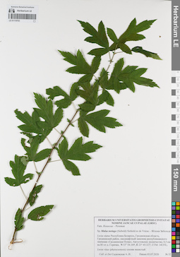
LE 01119703
Groups of specimens: Образцы сектора Восточной Европы; Соглашение Минобрнауки №075-15-2021-1056Record creation: 2022-01-18, Larisa Orlova, PhotoScan D2Citation: Specimen LE 01119703 // Virtual herbarium of Komarov Botanical Institute RAS — http://re.herbariumle.ru/01119703