View
Add
Copy
Edit
Delete
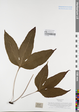
LE 01167292
Colysis digitata Ching det. Averyanov, Leonid Vladimirovich at 17.03.2007
Collectors: Averyanov, Leonid Vladimirovich; et al. Field collecting number: HLF6612. Collection date: 17.03.2007. Administrative regions: VN - Tinh Nghe An. Groups of specimens: L. V. Averyanov specimens; L. V. Averyanov herbarium; Соглашение Минобрнауки №075-15-2021-1056Original label text:FLORA OF VIETNAM
Polypodiaceae s.l.
Colysis digitata
Vietnam, Nghe An Prov., Tuong Duong Distr., Tam Quang Municipality, Tung Huong village, along Khe Mat stream around point 19°03′07″N 104°36′57″E at elevation about 355 m a.s.l. Lowland closed secondary old evergreen forest on steep slopes along rocky stream valley composed with stratified solid shale and sandstone.
Lithophytic fern along steep rocky shady stream slopes and along ridges. Common. HLF 6612 17 March 2007.
Coll. Averyanov L., P.K.Loc, N.V.Trai, N.T.Vinh, N.D.Phuong, Averyanova A.
Grant from Henry Luce Foundation.
Coordinates (geographic position): 19° 3′ 7″ N, 104° 36′ 57″ E ±1000 mRecord creation: 2022-01-18, Galina Savich, PhotoScan D2. Processing status: work_status_1Citation: Specimen LE 01167292 // Virtual herbarium of Komarov Botanical Institute RAS — http://re.herbariumle.ru/01167292Polypodiaceae s.l.
Colysis digitata
Vietnam, Nghe An Prov., Tuong Duong Distr., Tam Quang Municipality, Tung Huong village, along Khe Mat stream around point 19°03′07″N 104°36′57″E at elevation about 355 m a.s.l. Lowland closed secondary old evergreen forest on steep slopes along rocky stream valley composed with stratified solid shale and sandstone.
Lithophytic fern along steep rocky shady stream slopes and along ridges. Common. HLF 6612 17 March 2007.
Coll. Averyanov L., P.K.Loc, N.V.Trai, N.T.Vinh, N.D.Phuong, Averyanova A.
Grant from Henry Luce Foundation.
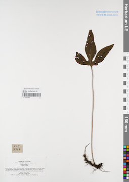
LE 01167291
Colysis digitata Ching det. Phan Ke Loc at 23.03.2006
Collectors: Phan Ke Loc; et al. Field collecting number: HLF5787. Collection date: 23.03.2006. Administrative regions: VN - Tinh Quang Tri. Groups of specimens: L. V. Averyanov specimens; L. V. Averyanov herbarium; Соглашение Минобрнауки №075-15-2021-1056Original label text:FLORA OF VIETNAM
Plants of the Da Krong Nature Reserve
Polypodiaceae s.l.
Colysis digitata
Vietnam, Quang Tri Prov., Da Krong Distr., Huc Nghi Municipality, La To Vill., along La Sam stream, around point 16°29′00″ N, 107°00′40″ E, 432 m a.s.l., shaly mt. Lithophyte. On stream banks, secondary closed evergreen broad-leaved mixte with bamboo forest; rare. HLF 5787 23 Mar 2006.
Coll.: P.K. Loc. N.V. Huy, H.T. Phuong, D.C. Tri, T.T. Tu.
Grant from Henry Luce Foundation.
Record creation: 2022-01-18, Galina Savich, PhotoScan D2. Processing status: work_status_1Citation: Specimen LE 01167291 // Virtual herbarium of Komarov Botanical Institute RAS — http://re.herbariumle.ru/01167291Plants of the Da Krong Nature Reserve
Polypodiaceae s.l.
Colysis digitata
Vietnam, Quang Tri Prov., Da Krong Distr., Huc Nghi Municipality, La To Vill., along La Sam stream, around point 16°29′00″ N, 107°00′40″ E, 432 m a.s.l., shaly mt. Lithophyte. On stream banks, secondary closed evergreen broad-leaved mixte with bamboo forest; rare. HLF 5787 23 Mar 2006.
Coll.: P.K. Loc. N.V. Huy, H.T. Phuong, D.C. Tri, T.T. Tu.
Grant from Henry Luce Foundation.
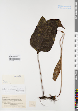
LE 01167290
Colysis pedunculata Ching det. Shmakov, Aleksandr Ivanovich at 02.01.2008
Collectors: Averyanov, Leonid Vladimirovich; et al. Field collecting number: VH1416. Collection date: 15.04.1995. Administrative regions: VN - Kon Tum. Groups of specimens: L. V. Averyanov specimens; L. V. Averyanov herbarium; Соглашение Минобрнауки №075-15-2021-1056Original label text:FLORA OF VIETNAM
Polypodiaceae s.l.
?
S. Vietnam, Prov. Kontum. Primary evegreen mixed forest (with Pinus kesiya) at 800-900 m alt. on NW slope of Ngoc Linh mountain system 5-10 km to N of Muong Hoong village. Terrestrial fern with fronds up to 0.7 m lg. Rare. VH 1416 15.04.1995
International Botanical Expedition of the U.S.A. National Geographic Society (grant No 5094-93)
Participants: L. Averyanov, N.T. Ban, N. Q. Binh, A. Budantzev, L. Budantzev, N.T. Hiep, D.D. Huyen, P.K. Loc, N.X. Tam, G. Yakovlev
Record creation: 2022-01-18, Galina Savich, PhotoScan D2. Processing status: work_status_1Citation: Specimen LE 01167290 // Virtual herbarium of Komarov Botanical Institute RAS — http://re.herbariumle.ru/01167290Polypodiaceae s.l.
?
S. Vietnam, Prov. Kontum. Primary evegreen mixed forest (with Pinus kesiya) at 800-900 m alt. on NW slope of Ngoc Linh mountain system 5-10 km to N of Muong Hoong village. Terrestrial fern with fronds up to 0.7 m lg. Rare. VH 1416 15.04.1995
International Botanical Expedition of the U.S.A. National Geographic Society (grant No 5094-93)
Participants: L. Averyanov, N.T. Ban, N. Q. Binh, A. Budantzev, L. Budantzev, N.T. Hiep, D.D. Huyen, P.K. Loc, N.X. Tam, G. Yakovlev
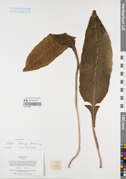
LE 01167289
Colysis henryi Ching. det. Shmakov, Aleksandr Ivanovich at 02.01.2008
Collectors: Averyanov, Leonid Vladimirovich; Phan Ke Loc; Nguyen Xuan Tam Field collecting number: CBL338. Collection date: 18.11.1998. Administrative regions: VN - Tinh Cao Bang. Groups of specimens: L. V. Averyanov specimens; L. V. Averyanov herbarium; Соглашение Минобрнауки №075-15-2021-1056Original label text:FLORA OF VIETNAM
Polypodiaceae s.l.
Colysis sp.
N. Vietnam, prov. Cao Bang, distr. Bao Lac, municipality Ca Thanh,
about 3 km to SW from Yen Lac village (N 22°44′ E 105°50′), about 42
km to NWW from Cao Bang town. Secondary evegreen wet closed
broadleaved forest on alluvial foothills of limestone remnant ridge at
1250-1300 m alt. Epilite fern on shadow wet rocks. Not common.
CBL 338 18 Nov. 1998
Coordinates (geographic position): 22° 44′ N, 105° 50′ E ±1000 mRecord creation: 2022-01-18, Galina Savich, PhotoScan D2. Processing status: work_status_1Citation: Specimen LE 01167289 // Virtual herbarium of Komarov Botanical Institute RAS — http://re.herbariumle.ru/01167289Polypodiaceae s.l.
Colysis sp.
N. Vietnam, prov. Cao Bang, distr. Bao Lac, municipality Ca Thanh,
about 3 km to SW from Yen Lac village (N 22°44′ E 105°50′), about 42
km to NWW from Cao Bang town. Secondary evegreen wet closed
broadleaved forest on alluvial foothills of limestone remnant ridge at
1250-1300 m alt. Epilite fern on shadow wet rocks. Not common.
CBL 338 18 Nov. 1998
International Botanical Expedition of the U.S.A. National Geographic
Society (grant No 6300-98)
Collectors: Averyanov L., P.K.Loc, N.X.Tam.
Society (grant No 6300-98)
Collectors: Averyanov L., P.K.Loc, N.X.Tam.
LE 01167288
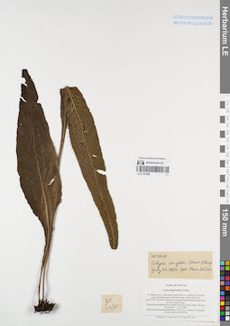
Colysis wrightii Ching det. Phan Ke Loc at 23.07.1997
Collectors: Averyanov, Leonid Vladimirovich; Tien Hiep Nguyen; Phan Ke Loc Field collecting number: VH5017. Collection date: 31.05.1997. Administrative regions: VN - Tinh Thai Nguyen. Groups of specimens: L. V. Averyanov specimens; L. V. Averyanov herbarium; Соглашение Минобрнауки №075-15-2021-1056Original label text:FLORA OF VIETNAM
Colysis wightii (Hook.) Ching
N. Vietnam, Prov. Thai Nguyen, distr. Dai Tu, vicinities of Tam Dao town, NE macroslope of Tam Dao ridge at 950-1000 m alt. (N 21°27′ E 105°38′). Closed wet evergreen broad-leaved primary forest on very steep mt slope.
Terrestrial and epilitic fern on shadow wet steep rocky slopes. Not rare. VH 5017 31.05.1997
International Botanical Expedition of the U.S.A. National Geographic Society (grant No 5803-96)
Collectors: L.Averyanov, N.T.Hiep, P.K.Loc
Coordinates (geographic position): 21° 27′ N, 105° 38′ E ±1000 mRecord creation: 2022-01-18, Galina Savich, PhotoScan D2. Processing status: work_status_1Citation: Specimen LE 01167288 // Virtual herbarium of Komarov Botanical Institute RAS — http://re.herbariumle.ru/01167288Colysis wightii (Hook.) Ching
N. Vietnam, Prov. Thai Nguyen, distr. Dai Tu, vicinities of Tam Dao town, NE macroslope of Tam Dao ridge at 950-1000 m alt. (N 21°27′ E 105°38′). Closed wet evergreen broad-leaved primary forest on very steep mt slope.
Terrestrial and epilitic fern on shadow wet steep rocky slopes. Not rare. VH 5017 31.05.1997
International Botanical Expedition of the U.S.A. National Geographic Society (grant No 5803-96)
Collectors: L.Averyanov, N.T.Hiep, P.K.Loc
LE 01167287
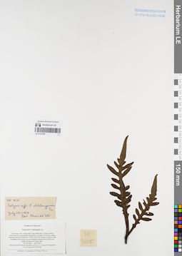
Colysis chilangensis V.N.Tu ⟮prelim. ID⟯ det. Phan Ke Loc at 23.07.1997
Collectors: Averyanov, Leonid Vladimirovich; Tien Hiep Nguyen; Phan Ke Loc Field collecting number: VH4625. Collection date: 16.05.1997. Administrative regions: VN - Tinh Quang Binh. Groups of specimens: L. V. Averyanov specimens; L. V. Averyanov herbarium; Соглашение Минобрнауки №075-15-2021-1056Original label text:FLORA OF VIETNAM
Colysis aff. C. chilangensis Tu
N. Vietnam, Prov. Quang Binh, distr. Minh Hoa, 72 km to NWW from Dong Hoi, municipalite Thong Hoa, vicinities of Yen Son village, limestone massif Ke Bang (N 17°40′ E 105°57′). Primary evergreen open broadleaved dry forest on top of limestone mesas at 450-500 m alt. Epilite on steep dry slopes. Rare.
VH 4625 16.05.1997
International Botanical Expedition of the U.S.A. National Geographic Society (grant No 5803-96)
Collectors: L. Averyanov, N.T. Hiep, P.K. Loc
Coordinates (geographic position): 17° 40′ N, 105° 57′ E ±1000 mRecord creation: 2022-01-18, Galina Savich, PhotoScan D2. Processing status: work_status_1Citation: Specimen LE 01167287 // Virtual herbarium of Komarov Botanical Institute RAS — http://re.herbariumle.ru/01167287Colysis aff. C. chilangensis Tu
N. Vietnam, Prov. Quang Binh, distr. Minh Hoa, 72 km to NWW from Dong Hoi, municipalite Thong Hoa, vicinities of Yen Son village, limestone massif Ke Bang (N 17°40′ E 105°57′). Primary evergreen open broadleaved dry forest on top of limestone mesas at 450-500 m alt. Epilite on steep dry slopes. Rare.
VH 4625 16.05.1997
International Botanical Expedition of the U.S.A. National Geographic Society (grant No 5803-96)
Collectors: L. Averyanov, N.T. Hiep, P.K. Loc
LE 01167286
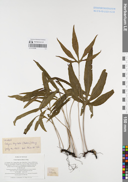
Colysis digitata Ching det. Phan Ke Loc at 19.07.1997
Collectors: Averyanov, Leonid Vladimirovich; Tien Hiep Nguyen; Phan Ke Loc Field collecting number: VH4808. Collection date: 18.05.1997. Administrative regions: VN - Tinh Quang Binh. Groups of specimens: L. V. Averyanov specimens; L. V. Averyanov herbarium; Соглашение Минобрнауки №075-15-2021-1056Original label text:FLORA OF VIETNAM
Colysis digitata (Baker) Ching
N. Vietnam, Prov. Quang Binh, distr. Minh Hoa, 72 km to NWW from Dong Hoi, municipalite Thuong Hoa, Yen Son village, limestone massif Ke Bang (N 17°40′ E 105°57′). Broadleaved evergreen closed dry primary forest on steep slopes and bluffs of limestone mesas at 300-500 m alt. Terrestrial and epilitic fern with fronds up to 0.3 m lg on shadow steep rocky slope. Common at 400-450 m alt. alt. VH 4808 18.05.1997
International Botanical Expedition of the U.S.A. National Geographic
Society (grant No 5803-96)
Collectors: L. Averyanov, N.T. Hiep, P.K. Loc
Coordinates (geographic position): 17° 40′ N, 105° 57′ E ±1000 mRecord creation: 2022-01-18, Galina Savich, PhotoScan D2. Processing status: work_status_1Citation: Specimen LE 01167286 // Virtual herbarium of Komarov Botanical Institute RAS — http://re.herbariumle.ru/01167286Colysis digitata (Baker) Ching
N. Vietnam, Prov. Quang Binh, distr. Minh Hoa, 72 km to NWW from Dong Hoi, municipalite Thuong Hoa, Yen Son village, limestone massif Ke Bang (N 17°40′ E 105°57′). Broadleaved evergreen closed dry primary forest on steep slopes and bluffs of limestone mesas at 300-500 m alt. Terrestrial and epilitic fern with fronds up to 0.3 m lg on shadow steep rocky slope. Common at 400-450 m alt. alt. VH 4808 18.05.1997
International Botanical Expedition of the U.S.A. National Geographic
Society (grant No 5803-96)
Collectors: L. Averyanov, N.T. Hiep, P.K. Loc
LE 01167285
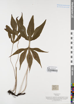
Colysis digitata Ching det. Averyanov, Leonid Vladimirovich at 28.03.2006
Collectors: Averyanov, Leonid Vladimirovich; Phan Ke Loc; The Van Pham Field collecting number: HLF6273. Collection date: 28.03.2006. Administrative regions: VN - Tinh Quang Tri. Groups of specimens: L. V. Averyanov specimens; L. V. Averyanov herbarium; Соглашение Минобрнауки №075-15-2021-1056Original label text:FLORA OF VIETNAM
Polypodiaceae s.l.
Colysis digitata
Vietnam, Quang Tri Prov., Huong Hoa Distr., Huong Phung Municipality, Sa Mui pass, around point 16°47′42″N 106°35′50″E at elevation about 1000 m a.s.l. Secondary broad-leaved evergreen submontane forest on shale mountains. Creeping lithophytic fern on wet mossy rocks along rocky shady stream valley. Very common.
HLF 6273 28 March 2006.
Coll. L.Averyanov, P.K.Loc, P.V.The.
Grant from Henry Luce Foundation.
Coordinates (geographic position): 16° 47′ 42″ N, 106° 35′ 50″ E ±1000 mRecord creation: 2022-01-18, Galina Savich, PhotoScan D2. Processing status: work_status_1Citation: Specimen LE 01167285 // Virtual herbarium of Komarov Botanical Institute RAS — http://re.herbariumle.ru/01167285Polypodiaceae s.l.
Colysis digitata
Vietnam, Quang Tri Prov., Huong Hoa Distr., Huong Phung Municipality, Sa Mui pass, around point 16°47′42″N 106°35′50″E at elevation about 1000 m a.s.l. Secondary broad-leaved evergreen submontane forest on shale mountains. Creeping lithophytic fern on wet mossy rocks along rocky shady stream valley. Very common.
HLF 6273 28 March 2006.
Coll. L.Averyanov, P.K.Loc, P.V.The.
Grant from Henry Luce Foundation.
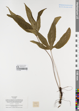
LE 01167284
Colysis digitata Ching det. Averyanov, Leonid Vladimirovich at 14.12.1998
Collectors: Averyanov, Leonid Vladimirovich; N.Q. Binh; Tien Hiep Nguyen; et al. Field collecting number: CBL1234. Collection date: 14.12.1998. Administrative regions: VN - Tinh Cao Bang. Groups of specimens: L. V. Averyanov specimens; L. V. Averyanov herbarium; Соглашение Минобрнауки №075-15-2021-1056Original label text:FLORA OF VIETNAM
Polypodiaceae
Colysis digitata
N. Vietnam, prov. Cao Bang, distr. Tra Linh, municipality Quoc Toan,
vicinities of Lung Tao village (N 22°45′ E 106°19′), about 12 km from
Cao Bang town to the NNE. Primary semideciduous open broadleaved
forest on steep slopes and bluffs of remnant limestone ridge at
600-800 m alt. Terrestrial fern in shadow places. Common.
CBL 1234 14 Dec. 1998
International Botanical Expedition of the U.S.A. National Geographic
Society (grant No 6300-98)
Collectors: N.T.Hiep, N.Q.Binh, P.K.Loc, N.X.Tam, Averyanov L.
Coordinates (geographic position): 22° 45′ N, 106° 19′ E ±1000 mRecord creation: 2022-01-18, Galina Savich, PhotoScan D2. Processing status: work_status_1Citation: Specimen LE 01167284 // Virtual herbarium of Komarov Botanical Institute RAS — http://re.herbariumle.ru/01167284Polypodiaceae
Colysis digitata
N. Vietnam, prov. Cao Bang, distr. Tra Linh, municipality Quoc Toan,
vicinities of Lung Tao village (N 22°45′ E 106°19′), about 12 km from
Cao Bang town to the NNE. Primary semideciduous open broadleaved
forest on steep slopes and bluffs of remnant limestone ridge at
600-800 m alt. Terrestrial fern in shadow places. Common.
CBL 1234 14 Dec. 1998
International Botanical Expedition of the U.S.A. National Geographic
Society (grant No 6300-98)
Collectors: N.T.Hiep, N.Q.Binh, P.K.Loc, N.X.Tam, Averyanov L.
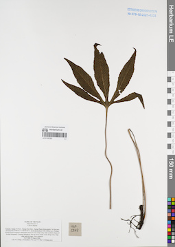
LE 01167283
Colysis digitata Ching det. Averyanov, Leonid Vladimirovich at 29.03.2006
Collectors: Tien Hiep Nguyen; Averyanov, Leonid Vladimirovich; Phan Ke Loc; The Van Pham; Khang Sinh Nguyen; et al. Field collecting number: HLF5848. Collection date: 29.03.2006. Administrative regions: VN - Tinh Quang Tri. Groups of specimens: L. V. Averyanov specimens; L. V. Averyanov herbarium; Соглашение Минобрнауки №075-15-2021-1056Original label text:FLORA OF VIETNAM
Polypodiaceae s.l.
Colysis digitata
Vietnam, Quang Tri Prov., Huong Hoa Distr., Huong Phung Municipality, Sa Mui pass, around point 16°48′36″N 106°34′44″E at elevation about 1300-1400 m a.s.l. Primary broad-leaved evergreen submontane forest on very steep rocky shale southern slopes of Sa Mui Mountain. Creeping lithophytic fern on mossy shady rocks along rocky ridge edge and on slopes. Very common. HLF 5848 29 March 2006.
Coll. N.T.Hiep, L.Averyanov, P.K.Loc, P.V.The, N.S.Khang, P.H.Duc, L.T.Son, S.Bounphanmy, T.K.Ratana, O.Sonliya, T.Q.Dang, N.V.Hien, H.T.N.Trang, L.T.Chau.
Grant from Henry Luce Foundation.
Coordinates (geographic position): 16° 48′ 36″ N, 106° 34′ 44″ E ±1000 mRecord creation: 2022-01-18, Galina Savich, PhotoScan D2. Processing status: work_status_1Citation: Specimen LE 01167283 // Virtual herbarium of Komarov Botanical Institute RAS — http://re.herbariumle.ru/01167283Polypodiaceae s.l.
Colysis digitata
Vietnam, Quang Tri Prov., Huong Hoa Distr., Huong Phung Municipality, Sa Mui pass, around point 16°48′36″N 106°34′44″E at elevation about 1300-1400 m a.s.l. Primary broad-leaved evergreen submontane forest on very steep rocky shale southern slopes of Sa Mui Mountain. Creeping lithophytic fern on mossy shady rocks along rocky ridge edge and on slopes. Very common. HLF 5848 29 March 2006.
Coll. N.T.Hiep, L.Averyanov, P.K.Loc, P.V.The, N.S.Khang, P.H.Duc, L.T.Son, S.Bounphanmy, T.K.Ratana, O.Sonliya, T.Q.Dang, N.V.Hien, H.T.N.Trang, L.T.Chau.
Grant from Henry Luce Foundation.
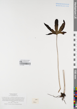
LE 01167282
Colysis digitata Ching det. Averyanov, Leonid Vladimirovich at 27.03.2002
Collectors: Averyanov, Leonid Vladimirovich; et al. Field collecting number: HAL2804. Collection date: 27.03.2002. Administrative regions: VN - Tinh Lao Cai. Groups of specimens: L. V. Averyanov specimens; L. V. Averyanov herbarium; Соглашение Минобрнауки №075-15-2021-1056Original label text:FLORA OF VIETNAM
Polypodiaceae
Colysis digitata (Baker) Ching
Northern Vietnam, Lao Cai Prov., Van Ban Distr., Khanh Yen Ha municipality, to the S of Na Nheo village (in the vicinity of point 21°59′04′'N, 104°15′08′'E). Primary closed broad-leaved evergreen wet
submontane forest on steep granite and quartzite slopes of stream canyon at elev. 900-1150 m a.s.l. Terrestrial, lithophytic and epiphytic fern at the base of old mossy trees. Common. HAL 2804 27 March 2002
Collectors: L.Averyanov, P.K.Loc, D.T.Doan (FFI Project).
Coordinates (geographic position): 21° 59′ 4″ N, 104° 15′ 8″ E ±1000 mRecord creation: 2022-01-18, Galina Savich, PhotoScan D2. Processing status: work_status_1Citation: Specimen LE 01167282 // Virtual herbarium of Komarov Botanical Institute RAS — http://re.herbariumle.ru/01167282Polypodiaceae
Colysis digitata (Baker) Ching
Northern Vietnam, Lao Cai Prov., Van Ban Distr., Khanh Yen Ha municipality, to the S of Na Nheo village (in the vicinity of point 21°59′04′'N, 104°15′08′'E). Primary closed broad-leaved evergreen wet
submontane forest on steep granite and quartzite slopes of stream canyon at elev. 900-1150 m a.s.l. Terrestrial, lithophytic and epiphytic fern at the base of old mossy trees. Common. HAL 2804 27 March 2002
Collectors: L.Averyanov, P.K.Loc, D.T.Doan (FFI Project).
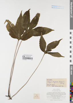
LE 01167281
Colysis digitata Ching det. Phan Ke Loc at 23.07.1997
Collectors: Averyanov, Leonid Vladimirovich; Tien Hiep Nguyen; Phan Ke Loc Field collecting number: VH4789. Collection date: 18.05.1997. Administrative regions: VN - Tinh Quang Binh. Groups of specimens: L. V. Averyanov specimens; L. V. Averyanov herbarium; Соглашение Минобрнауки №075-15-2021-1056Original label text:FLORA OF VIETNAM
Colysis digitata (Baker) Ching
N. Vietnam, Prov. Quang Binh, distr. Minh Hoa, 72 km to NWW
from Dong Hoi, municipalite Thong Hoa, vicinities of Yen Son village, limestone massif Ke Bang (N 17°40′ E 105°57′). Remnant open evergreen primary broadleaved forest along river in alluvial valley bottom between limestone ridges and mesas at 200 m alt. Terrestrial and subepiphytic fern in shadow steep stream slopes. Not rare. VH 4789 18.05.1997
International Botanical Expedition of the U.S.A. National Geographic
Society (grant No 5803-96)
Collectors: L. Averyanov, N.T. Hiep, P.K. Loc
Coordinates (geographic position): 17° 40′ N, 105° 57′ E ±1000 mRecord creation: 2022-01-18, Galina Savich, PhotoScan D2. Processing status: work_status_1Citation: Specimen LE 01167281 // Virtual herbarium of Komarov Botanical Institute RAS — http://re.herbariumle.ru/01167281Colysis digitata (Baker) Ching
N. Vietnam, Prov. Quang Binh, distr. Minh Hoa, 72 km to NWW
from Dong Hoi, municipalite Thong Hoa, vicinities of Yen Son village, limestone massif Ke Bang (N 17°40′ E 105°57′). Remnant open evergreen primary broadleaved forest along river in alluvial valley bottom between limestone ridges and mesas at 200 m alt. Terrestrial and subepiphytic fern in shadow steep stream slopes. Not rare. VH 4789 18.05.1997
International Botanical Expedition of the U.S.A. National Geographic
Society (grant No 5803-96)
Collectors: L. Averyanov, N.T. Hiep, P.K. Loc
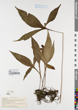
LE 01167280
Colysis digitata Ching det. Averyanov, Leonid Vladimirovich at 23.11.1995
Collectors: Averyanov, Leonid Vladimirovich; et al. Field collecting number: VH1939. Collection date: 23.11.1995. Administrative regions: VN - Kon Tum. Groups of specimens: L. V. Averyanov specimens; L. V. Averyanov herbarium; Соглашение Минобрнауки №075-15-2021-1056Original label text:FLORA OF VIETNAM
Polypodiaceae
Colysis vegetata
S. Vietnam, Prov. Kon Tum, Distr. Dak Gley, about 15-18 km to NW of Dak Gley town, near Mang Khen (Dak Che) village. Primary evergreen mountain very wet forest in deep stream canyon at 1000 m alt.
Terrestrial and epiphyte at base of stems. Not rare. VH 1939 23.11.1995
International Botanical Expedition of the U.S.A. National Geographic Society (grant No 5094-93)
Participants: L. Averyanov, N.T. Ban, A. Budantzev, L. Budantzev, N.T. Hiep, D.D. Huyen, P.K. Loc, G. Yakovlev
Record creation: 2022-01-18, Galina Savich, PhotoScan D2. Processing status: work_status_1Citation: Specimen LE 01167280 // Virtual herbarium of Komarov Botanical Institute RAS — http://re.herbariumle.ru/01167280Polypodiaceae
Colysis vegetata
S. Vietnam, Prov. Kon Tum, Distr. Dak Gley, about 15-18 km to NW of Dak Gley town, near Mang Khen (Dak Che) village. Primary evergreen mountain very wet forest in deep stream canyon at 1000 m alt.
Terrestrial and epiphyte at base of stems. Not rare. VH 1939 23.11.1995
International Botanical Expedition of the U.S.A. National Geographic Society (grant No 5094-93)
Participants: L. Averyanov, N.T. Ban, A. Budantzev, L. Budantzev, N.T. Hiep, D.D. Huyen, P.K. Loc, G. Yakovlev
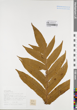
LE 01167279
Pseudodrynaria coronans (Wall. ex Mett.) Ching det. Averyanov, Leonid Vladimirovich at 20.10.1999
Collectors: Tien Hiep Nguyen; Phan Ke Loc; Averyanov, Leonid Vladimirovich Field collecting number: NTH3738. Collection date: 20.10.1999. Administrative regions: VN - Tinh Bac Kan. Groups of specimens: L. V. Averyanov specimens; L. V. Averyanov herbarium; Соглашение Минобрнауки №075-15-2021-1056Original label text:FLORA OF VIETNAM
Polypodiaceae s.l.
Pseudodrynaria coronans
N. Vietnam, Bac Can prov., Na Ri distr., Kim Hy municipality,
vicinities of Lung Hin Con village (N 22°17′ E 106°03′), 27 km to 55°
of Bac Can city. Primary evergreen broadleaved closed forest on very
steep rocky slope of karst remnant limestone ridge at elev. 600-700 m
a.s.l. Epiphyte and occasional lithophyte. Very common. NTH 3738 20 Oct. 1999
Collectors: N.T. Hiep, P.K. Loc, L. Averyanov.
Coordinates (geographic position): 22° 17′ N, 106° 3′ E ±1000 mRecord creation: 2022-01-18, Galina Savich, PhotoScan D2. Processing status: work_status_1Citation: Specimen LE 01167279 // Virtual herbarium of Komarov Botanical Institute RAS — http://re.herbariumle.ru/01167279Polypodiaceae s.l.
Pseudodrynaria coronans
N. Vietnam, Bac Can prov., Na Ri distr., Kim Hy municipality,
vicinities of Lung Hin Con village (N 22°17′ E 106°03′), 27 km to 55°
of Bac Can city. Primary evergreen broadleaved closed forest on very
steep rocky slope of karst remnant limestone ridge at elev. 600-700 m
a.s.l. Epiphyte and occasional lithophyte. Very common. NTH 3738 20 Oct. 1999
Collectors: N.T. Hiep, P.K. Loc, L. Averyanov.
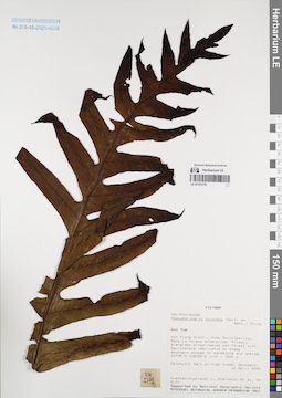
LE 01167278
Pseudodrynaria coronans (Wall. ex Mett.) Ching det. Averyanov, Leonid Vladimirovich at 16.04.2000
Collectors: Averyanov, Leonid Vladimirovich; et al. Field collecting number: VH5171. Collection date: 16.04.2000. Administrative regions: VN - Kon Tum. Groups of specimens: L. V. Averyanov specimens; L. V. Averyanov herbarium; Соглашение Минобрнауки №075-15-2021-1056Original label text:FLORA OF VIETNAM
Polypodiaceae
Pseudodrynaria coronans
S. Vietnam, Kontum Prov., Kon Plong Distr., Hieu Municipality, Mang La
forest enterprise (14°39′N, 108°25′E). Primary evergreen broad-leaved
wet forest with Dacrycarpus imbricatus on steep mt. slopes on
sandstone & gneiss at elev. 1100-1200 m. Epiphyte fern on high
trees. Abundant. VH 5171 16.04.2000
International Botanical Expedition of the U.S.A. National Geographic
Society (grant No 6383-98)
Collectors: L.Averyanov, P.K.Loc, P.H.Hoang, D.X.Du, N.T.Vinh
Coordinates (geographic position): 14° 39′ N, 108° 25′ E ±1000 mRecord creation: 2022-01-18, Galina Savich, PhotoScan D2. Processing status: work_status_1Citation: Specimen LE 01167278 // Virtual herbarium of Komarov Botanical Institute RAS — http://re.herbariumle.ru/01167278Polypodiaceae
Pseudodrynaria coronans
S. Vietnam, Kontum Prov., Kon Plong Distr., Hieu Municipality, Mang La
forest enterprise (14°39′N, 108°25′E). Primary evergreen broad-leaved
wet forest with Dacrycarpus imbricatus on steep mt. slopes on
sandstone & gneiss at elev. 1100-1200 m. Epiphyte fern on high
trees. Abundant. VH 5171 16.04.2000
International Botanical Expedition of the U.S.A. National Geographic
Society (grant No 6383-98)
Collectors: L.Averyanov, P.K.Loc, P.H.Hoang, D.X.Du, N.T.Vinh
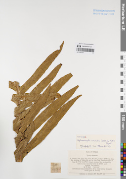
LE 01167277
Aglaomorpha coronans (Mett.) Copel. det. Phan Ke Loc at 19.07.1997
Collectors: Averyanov, Leonid Vladimirovich; Tien Hiep Nguyen; Phan Ke Loc Field collecting number: VH4698. Collection date: 16.05.1997. Administrative regions: VN - Tinh Quang Binh. Groups of specimens: L. V. Averyanov specimens; L. V. Averyanov herbarium; Соглашение Минобрнауки №075-15-2021-1056Original label text:FLORA OF VIETNAM
Drymoglossum piloselloides (L.) Presl
N. Vietnam, Prov. Quang Binh, distr. Minh Hoa, 72 km to NWW from Dong Hoi, municipalite Thong Hoa, vicinities of Yen Son village, limestone massif Ke Bang (N 17°40′ E 105°57′). Primary evergreen open broadleaved dry forest on top of limestone mesas at 550-600 m alt. Epiphyte. Very common. VH 4698 16.05.1997
International Botanical Expedition of the U.S.A. National Geographic
Society (grant No 5803-96)
Collectors: L. Averyanov, N.T. Hiep, P.K. Loc
Coordinates (geographic position): 17° 40′ N, 105° 57′ E ±1000 mRecord creation: 2022-01-18, Galina Savich, PhotoScan D2. Processing status: work_status_1Citation: Specimen LE 01167277 // Virtual herbarium of Komarov Botanical Institute RAS — http://re.herbariumle.ru/01167277Drymoglossum piloselloides (L.) Presl
N. Vietnam, Prov. Quang Binh, distr. Minh Hoa, 72 km to NWW from Dong Hoi, municipalite Thong Hoa, vicinities of Yen Son village, limestone massif Ke Bang (N 17°40′ E 105°57′). Primary evergreen open broadleaved dry forest on top of limestone mesas at 550-600 m alt. Epiphyte. Very common. VH 4698 16.05.1997
International Botanical Expedition of the U.S.A. National Geographic
Society (grant No 5803-96)
Collectors: L. Averyanov, N.T. Hiep, P.K. Loc
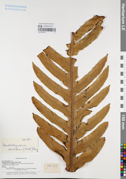
LE 01167276
Pseudodrynaria coronans (Wall. ex Mett.) Ching det. Averyanov, Leonid Vladimirovich at 23.02.1995
Collectors: Averyanov, Leonid Vladimirovich; et al. Field collecting number: VH169. Collection date: 23.02.1995. Administrative regions: VN - Kon Tum. Groups of specimens: L. V. Averyanov specimens; L. V. Averyanov herbarium; Соглашение Минобрнауки №075-15-2021-1056Original label text:FLORA OF VIETNAM
Polypodiaceae
Pseudodrynaria coronans (Wall.) Ching
South Vietnam, Prov. Kontum. NW slopes of Ngoc Linh mountain system at 1800 m elevation. Open secondary forest. Epiphyte. VH 169 23 February 1995
International Botanical Expedition sponsored by the National Geographic Society (Grant 5094-93).
Participants: L. Averyanov, N.T. Ban, N. Q. Binh, A. Budantzev, L. Budantzev, N.T. Hiep, D.D. Huyen, P.K. Loc, N.X. Tam, G. Yakovlev.
Record creation: 2022-01-18, Galina Savich, PhotoScan D2. Processing status: work_status_1Citation: Specimen LE 01167276 // Virtual herbarium of Komarov Botanical Institute RAS — http://re.herbariumle.ru/01167276Polypodiaceae
Pseudodrynaria coronans (Wall.) Ching
South Vietnam, Prov. Kontum. NW slopes of Ngoc Linh mountain system at 1800 m elevation. Open secondary forest. Epiphyte. VH 169 23 February 1995
International Botanical Expedition sponsored by the National Geographic Society (Grant 5094-93).
Participants: L. Averyanov, N.T. Ban, N. Q. Binh, A. Budantzev, L. Budantzev, N.T. Hiep, D.D. Huyen, P.K. Loc, N.X. Tam, G. Yakovlev.
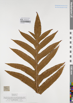
LE 01167275
Aglaomorpha coronans (Mett.) Copel. det. Averyanov, Leonid Vladimirovich at 30.03.2006
Collectors: Tien Hiep Nguyen; Averyanov, Leonid Vladimirovich; et al. Field collecting number: HLF5906. Collection date: 30.03.2006. Administrative regions: VN - Tinh Quang Tri. Groups of specimens: L. V. Averyanov specimens; L. V. Averyanov herbarium; Соглашение Минобрнауки №075-15-2021-1056Original label text:FLORA OF VIETNAM
Polypodiaceae s.l.
Aglaomorpha coronans
Vietnam, Quang Tri Prov., Huong Hoa Distr., Huong Phung Municipality, vicinities of Sa Mui pass, around point 16°46′49″N 106°35′28″E at elevation about 600-700 m a.s.l.
Remnants of primary broad-leaved evergreen submontane forest along rocky river valley on shale rocks.
Epiphyte on tall trees. Very common. HLF 5906 30 March 2006.
Coll. N.T.Hiep, L.Averyanov, P.K.Loc, P.V.The, N.S.Khang, P.H.Duc, L.T.Son, S.Bounphanmy, T.K.Ratana, O.Sonliya, T.Q.Dang, N.V.Hien, H.T.N.Trang, L.T.Chau.
Grant from Henry Luce Foundation.
Coordinates (geographic position): 16° 46′ 49″ N, 106° 35′ 28″ E ±1000 mRecord creation: 2022-01-18, Galina Savich, PhotoScan D2. Processing status: work_status_1Citation: Specimen LE 01167275 // Virtual herbarium of Komarov Botanical Institute RAS — http://re.herbariumle.ru/01167275Polypodiaceae s.l.
Aglaomorpha coronans
Vietnam, Quang Tri Prov., Huong Hoa Distr., Huong Phung Municipality, vicinities of Sa Mui pass, around point 16°46′49″N 106°35′28″E at elevation about 600-700 m a.s.l.
Remnants of primary broad-leaved evergreen submontane forest along rocky river valley on shale rocks.
Epiphyte on tall trees. Very common. HLF 5906 30 March 2006.
Coll. N.T.Hiep, L.Averyanov, P.K.Loc, P.V.The, N.S.Khang, P.H.Duc, L.T.Son, S.Bounphanmy, T.K.Ratana, O.Sonliya, T.Q.Dang, N.V.Hien, H.T.N.Trang, L.T.Chau.
Grant from Henry Luce Foundation.
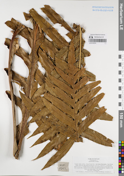
LE 01167274
Aglaomorpha coronans (Mett.) Copel. det. Averyanov, Leonid Vladimirovich at 19.03.2007
Collectors: Averyanov, Leonid Vladimirovich; et al. Field collecting number: HLF6762. Collection date: 19.03.2007. Administrative regions: VN - Tinh Nghe An. Groups of specimens: L. V. Averyanov specimens; L. V. Averyanov herbarium; Соглашение Минобрнауки №075-15-2021-1056Original label text:FLORA OF VIETNAM
Polypodiaceae s.l.
Aglaomorpha coronans
Vietnam, Nghe An Prov., Tuong Duong Distr., Tam Quang Municipality, Tung Huong village, along Khe Mat stream around point 19°03′09″N 104°36′53″E at elevation about 355 m a.s.l.
Lowland closed secondary old evergreen forest on steep slopes along rocky stream valley composed with stratified solid shale and sandstone. Epiphyte on tall mossy trees along stream. Very common.
HLF 6762 19 March 2007.
Coll. Averyanov L., P.K.Loc, N.V.Trai, N.T.Vinh, N.D.Phuong, Averyanova A.
Grant from Henry Luce Foundation.
Coordinates (geographic position): 19° 3′ 9″ N, 104° 36′ 53″ E ±1000 mRecord creation: 2022-01-18, Galina Savich, PhotoScan D2. Processing status: work_status_1Citation: Specimen LE 01167274 // Virtual herbarium of Komarov Botanical Institute RAS — http://re.herbariumle.ru/01167274Polypodiaceae s.l.
Aglaomorpha coronans
Vietnam, Nghe An Prov., Tuong Duong Distr., Tam Quang Municipality, Tung Huong village, along Khe Mat stream around point 19°03′09″N 104°36′53″E at elevation about 355 m a.s.l.
Lowland closed secondary old evergreen forest on steep slopes along rocky stream valley composed with stratified solid shale and sandstone. Epiphyte on tall mossy trees along stream. Very common.
HLF 6762 19 March 2007.
Coll. Averyanov L., P.K.Loc, N.V.Trai, N.T.Vinh, N.D.Phuong, Averyanova A.
Grant from Henry Luce Foundation.
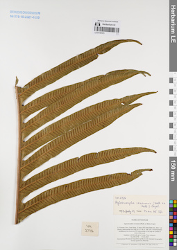
LE 01167273
Aglaomorpha coronans (Mett.) Copel. det. Phan Ke Loc at 19.07.1997
Collectors: Averyanov, Leonid Vladimirovich; et al. Field collecting number: VH2778. Collection date: 17.03.1997. Administrative regions: VN - Tinh Lam GJong. Groups of specimens: L. V. Averyanov specimens; L. V. Averyanov herbarium; Соглашение Минобрнауки №075-15-2021-1056Original label text:FLORA OF VIETNAM
Aglaomorpha coronans (Wall. ex Mett.) Copel.
S. Vietnam, Prov. Lam Dong, 31 km to NE from Dalat city, distr. Lac
Duong, municipalite Da Chay (N 12° 08′, E 108° 39′). Closed primary
broadleaved mt forest on NW macroslope of Bi Dup mt system at
1550-1700 m alt. Epiphyte with fronds up to 2 m lg. Very common.
VH 2778 17.03.1997
International Botanical Expedition of the U.S.A. National Geographic
Society (grant No 5803-96)
Collectors: L. Averyanov, N.Q. Binh, N.V. Duy, P.K. Loc
Coordinates (geographic position): 12° 8′ N, 108° 39′ E ±1000 mRecord creation: 2022-01-18, Galina Savich, PhotoScan D2. Processing status: work_status_1Citation: Specimen LE 01167273 // Virtual herbarium of Komarov Botanical Institute RAS — http://re.herbariumle.ru/01167273Aglaomorpha coronans (Wall. ex Mett.) Copel.
S. Vietnam, Prov. Lam Dong, 31 km to NE from Dalat city, distr. Lac
Duong, municipalite Da Chay (N 12° 08′, E 108° 39′). Closed primary
broadleaved mt forest on NW macroslope of Bi Dup mt system at
1550-1700 m alt. Epiphyte with fronds up to 2 m lg. Very common.
VH 2778 17.03.1997
International Botanical Expedition of the U.S.A. National Geographic
Society (grant No 5803-96)
Collectors: L. Averyanov, N.Q. Binh, N.V. Duy, P.K. Loc
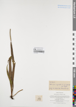
LE 01167272
Belvisia spicata (L.f.) Mirb. ex Copel. det. Phan Ke Loc at 21.07.1997
Collectors: Averyanov, Leonid Vladimirovich; N.Q. Binh; Phan Ke Loc Field collecting number: VH2922. Collection date: 19.03.1997. Administrative regions: VN - Tinh Lam GJong. Groups of specimens: L. V. Averyanov specimens; L. V. Averyanov herbarium; Соглашение Минобрнауки №075-15-2021-1056Original label text:FLORA OF VIETNAM
Belvisia spicata (L.f.) Mirbel ex Copel.
S. Vietnam, Prov. Lam Dong, distr. Lac Duong, municipalite Da Chay,
35 km to NE from Dalat city. Closed primary broadleaved mt forest along
stream canyon on W macroslope of Gia Rinh mt. ridge at 1500 m alt.
(N 12° 09′, E 108° 41′). Epiphyte on high old trees. Not rare.
VH 2922 19.03.1997
International Botanical Expedition of the U.S.A. National Geographic
Society (grant No 5803-96)
Collectors: L. Averyanov, N.Q. Binh, P.K. Loc
Coordinates (geographic position): 12° 9′ N, 108° 41′ E ±1000 mRecord creation: 2022-01-18, Galina Savich, PhotoScan D2. Processing status: work_status_1Citation: Specimen LE 01167272 // Virtual herbarium of Komarov Botanical Institute RAS — http://re.herbariumle.ru/01167272Belvisia spicata (L.f.) Mirbel ex Copel.
S. Vietnam, Prov. Lam Dong, distr. Lac Duong, municipalite Da Chay,
35 km to NE from Dalat city. Closed primary broadleaved mt forest along
stream canyon on W macroslope of Gia Rinh mt. ridge at 1500 m alt.
(N 12° 09′, E 108° 41′). Epiphyte on high old trees. Not rare.
VH 2922 19.03.1997
International Botanical Expedition of the U.S.A. National Geographic
Society (grant No 5803-96)
Collectors: L. Averyanov, N.Q. Binh, P.K. Loc
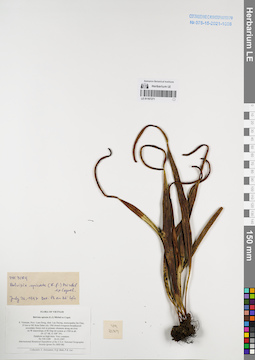
LE 01167271
Belvisia spicata (L.f.) Mirb. ex Copel. det. Phan Ke Loc at 21.07.1997
Collectors: Averyanov, Leonid Vladimirovich; N.Q. Binh; Phan Ke Loc Field collecting number: VH3189. Collection date: 26.03.1997. Administrative regions: VN - Tinh Lam GJong. Groups of specimens: L. V. Averyanov specimens; L. V. Averyanov herbarium; Соглашение Минобрнауки №075-15-2021-1056Original label text:FLORA OF VIETNAM
Belvisia spicata (L.f.) Mirbel ex Copel.
S. Vietnam, Prov. Lam Dong, distr. Lac Duong, municipalite Da Chay,
35 km to NE from Dalat city. Old closed evergreen broadleaved secondary forest rich in primary elements along mt river on W macroslope of Bi Dup mt system at 1500 m alt. (N 12° 08′, E 108° 39′). Epiphyte on high trees. Very common. VH 3189 26.03.1997
Coordinates (geographic position): 12° 8′ N, 108° 39′ E ±1000 mRecord creation: 2022-01-18, Galina Savich, PhotoScan D2. Processing status: work_status_1Citation: Specimen LE 01167271 // Virtual herbarium of Komarov Botanical Institute RAS — http://re.herbariumle.ru/01167271Belvisia spicata (L.f.) Mirbel ex Copel.
S. Vietnam, Prov. Lam Dong, distr. Lac Duong, municipalite Da Chay,
35 km to NE from Dalat city. Old closed evergreen broadleaved secondary forest rich in primary elements along mt river on W macroslope of Bi Dup mt system at 1500 m alt. (N 12° 08′, E 108° 39′). Epiphyte on high trees. Very common. VH 3189 26.03.1997
International Botanical Expedition of the U.S.A. National Geographic
Society (grant No 5803-96)
Collectors: L. Averyanov, N.Q. Binh, P.K. Loc
Society (grant No 5803-96)
Collectors: L. Averyanov, N.Q. Binh, P.K. Loc
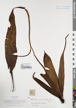
LE 01167270
Belvisia mucronata (Fée) Copel. det. Shmakov, Aleksandr Ivanovich at 29.12.2007
Collectors: Phan Ke Loc; Averyanov, Leonid Vladimirovich; et al. Field collecting number: HAL5017. Collection date: 02.05.2004. Administrative regions: VN - Tinh Ha Tinh. Groups of specimens: L. V. Averyanov specimens; L. V. Averyanov herbarium; Соглашение Минобрнауки №075-15-2021-1056Original label text:FLORA OF VIETNAM
Polypodiaceae
Belvisia sp.
N.Vietnam, Ha Tinh Prov., Huong Son Distr., Son Kim Municipality, Rao
Bun stream around point 18°23′39′'N, 105°15′12′'E. Primary
broad-leaved evergreen closed wet forest on very steep shale slopes of
river canyon at elevation about 300 m a.s.l. Epiphyte on trees along stream. Occasional.
HAL 5017 2 May 2004 (Photo)
Collectors: P.K.Loc, L.Averyanov, P.V.The, N.T.Vinh.
Coordinates (geographic position): 18° 23′ 39″ N, 105° 15′ 12″ E ±1000 mRecord creation: 2022-01-18, Galina Savich, PhotoScan D2. Processing status: work_status_1Citation: Specimen LE 01167270 // Virtual herbarium of Komarov Botanical Institute RAS — http://re.herbariumle.ru/01167270Polypodiaceae
Belvisia sp.
N.Vietnam, Ha Tinh Prov., Huong Son Distr., Son Kim Municipality, Rao
Bun stream around point 18°23′39′'N, 105°15′12′'E. Primary
broad-leaved evergreen closed wet forest on very steep shale slopes of
river canyon at elevation about 300 m a.s.l. Epiphyte on trees along stream. Occasional.
HAL 5017 2 May 2004 (Photo)
Collectors: P.K.Loc, L.Averyanov, P.V.The, N.T.Vinh.
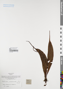
LE 01167269
Belvisia mucronata (Fée) Copel. det. Shmakov, Aleksandr Ivanovich at 29.12.2007
Collectors: Averyanov, Leonid Vladimirovich; Phan Ke Loc; The Van Pham Field collecting number: HLF6275. Collection date: 28.03.2006. Administrative regions: VN - Tinh Quang Tri. Groups of specimens: L. V. Averyanov specimens; L. V. Averyanov herbarium; Соглашение Минобрнауки №075-15-2021-1056Original label text:FLORA OF VIETNAM
Polypodiaceae s.l.
Belvesia sp.
Vietnam, Quang Tri Prov., Huong Hoa Distr., Huong Phung Municipality, Sa Mui pass, around point 16°47′42″N 106°35′50″E at elevation about 1000 m a.s.l. Secondary broad-leaved evergreen submontane forest on shale mountains. Epiphyte on tall trees along rocky shady stream valley. Locally common. HLF 6275 28 March 2006.
Coll. L.Averyanov, P.K.Loc, P.V.The.
Grant from Henry Luce Foundation.
Coordinates (geographic position): 16° 47′ 42″ N, 106° 35′ 50″ E ±1000 mRecord creation: 2022-01-18, Galina Savich, PhotoScan D2. Processing status: work_status_1Citation: Specimen LE 01167269 // Virtual herbarium of Komarov Botanical Institute RAS — http://re.herbariumle.ru/01167269Polypodiaceae s.l.
Belvesia sp.
Vietnam, Quang Tri Prov., Huong Hoa Distr., Huong Phung Municipality, Sa Mui pass, around point 16°47′42″N 106°35′50″E at elevation about 1000 m a.s.l. Secondary broad-leaved evergreen submontane forest on shale mountains. Epiphyte on tall trees along rocky shady stream valley. Locally common. HLF 6275 28 March 2006.
Coll. L.Averyanov, P.K.Loc, P.V.The.
Grant from Henry Luce Foundation.
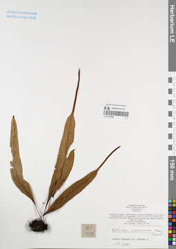
LE 01167268
Belvisia mucronata (Fée) Copel. det. Shmakov, Aleksandr Ivanovich at 29.12.2007
Collectors: Averyanov, Leonid Vladimirovich; et al. Field collecting number: HLF5535. Collection date: 05.11.2005. Administrative regions: VN - Dak Nong. Groups of specimens: L. V. Averyanov specimens; L. V. Averyanov herbarium; Соглашение Минобрнауки №075-15-2021-1056Original label text:FLORA OF VIETNAM
Plants of Ta Dung Nature Reserve
Polypodiaceae s.l.
Belvesia sp.
Vietnam, Dak Nong Prov., Dak Glong Distr., Dak Som Municipality, steep hill slopes at elevation 800-900 m a.s.l. around point 11°52′50″N 107°55′35″E. Primary broad-leaved evergreen fractionally logged dry forest along ridge edge. Epiphyte on tall mossy trees. Very common. HLF 5535 5 November 2005.
Coll. L.Averyanov, T.V.Thao, N.T.Vinh.
Grant from Henry Luce Foundation.
Coordinates (geographic position): 11° 52′ 50″ N, 107° 55′ 35″ E ±1000 mRecord creation: 2022-01-18, Galina Savich, PhotoScan D2. Processing status: work_status_1Citation: Specimen LE 01167268 // Virtual herbarium of Komarov Botanical Institute RAS — http://re.herbariumle.ru/01167268Plants of Ta Dung Nature Reserve
Polypodiaceae s.l.
Belvesia sp.
Vietnam, Dak Nong Prov., Dak Glong Distr., Dak Som Municipality, steep hill slopes at elevation 800-900 m a.s.l. around point 11°52′50″N 107°55′35″E. Primary broad-leaved evergreen fractionally logged dry forest along ridge edge. Epiphyte on tall mossy trees. Very common. HLF 5535 5 November 2005.
Coll. L.Averyanov, T.V.Thao, N.T.Vinh.
Grant from Henry Luce Foundation.
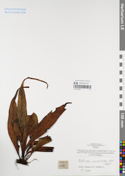
LE 01167267
Belvisia mucronata (Fée) Copel. det. Shmakov, Aleksandr Ivanovich at 29.12.2007
Collectors: Phan Ke Loc; Khang Sinh Nguyen; et al. Field collecting number: HLF6134. Collection date: 24.03.2006. Administrative regions: VN - Tinh Quang Tri. Groups of specimens: L. V. Averyanov specimens; L. V. Averyanov herbarium; Соглашение Минобрнауки №075-15-2021-1056Original label text:FLORA OF VIETNAM
Plants of the Da Krong Nature Reserve
Polypodiaceae s.l.
Belvisia sp.
Vietnam, Quang Tri Prov., Da Krong Distr., Huc Nghi Municipality, La To Vill., along La Sam stream, around point 16°29′00″ N, 107°00′40″ E, 432 m a.s.l., shaly mt. Epiphyte. In secondary closed evergreen broad-leaved lowland forests on shaly. Rare. HLF 6134 24 Mar 2006.
Coll.: P.K.Loc, N.S.Khang, D.C.Tri, N.V.Huy, H.T.Phuong, P.V.Bao, P.X.Dieu, L.M.Tuan, T.T.Tu, P.K.Vuong.
Grant from Henry Luce Foundation.
Record creation: 2022-01-18, Galina Savich, PhotoScan D2. Processing status: work_status_1Citation: Specimen LE 01167267 // Virtual herbarium of Komarov Botanical Institute RAS — http://re.herbariumle.ru/01167267Plants of the Da Krong Nature Reserve
Polypodiaceae s.l.
Belvisia sp.
Vietnam, Quang Tri Prov., Da Krong Distr., Huc Nghi Municipality, La To Vill., along La Sam stream, around point 16°29′00″ N, 107°00′40″ E, 432 m a.s.l., shaly mt. Epiphyte. In secondary closed evergreen broad-leaved lowland forests on shaly. Rare. HLF 6134 24 Mar 2006.
Coll.: P.K.Loc, N.S.Khang, D.C.Tri, N.V.Huy, H.T.Phuong, P.V.Bao, P.X.Dieu, L.M.Tuan, T.T.Tu, P.K.Vuong.
Grant from Henry Luce Foundation.
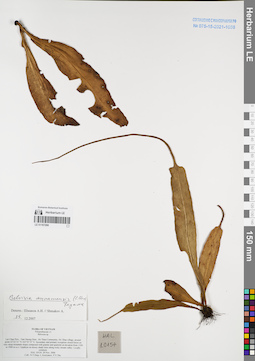
LE 01167266
Belvisia annamensis (C. Chr.) S.H. Fu det. Shmakov, Aleksandr Ivanovich at 25.12.2007
Collectors: Tien Hiep Nguyen; Averyanov, Leonid Vladimirovich; The Van Pham Field collecting number: HAL10154. Collection date: 29.11.2006. Administrative regions: VN - Tinh Lai Chau. Groups of specimens: L. V. Averyanov specimens; L. V. Averyanov herbarium; Соглашение Минобрнауки №075-15-2021-1056Original label text:FLORA OF VIETNAM
Polypodiaceae s.l.
Belvesia sp.
Lai Chau Prov., Tam Duong Distr., Ho Thau Community, Ho Thau village, around point 22°22′31″N 103°35′15″E.
Secondary and primary evergreen closed forest on very steep mountain slopes composed with granite and quartzite at elevation from 1100 to 1900 m a.s.l. Epiphyte on mossy shady trees along rocky stream valley. Locally common. HAL 10154 29 Nov. 2006
Coll.: Nguyen Tien Hiep, L.Averyanov, Pham Van The.
Coordinates (geographic position): 22° 22′ 31″ N, 103° 35′ 15″ E ±1000 mRecord creation: 2022-01-18, Galina Savich, PhotoScan D2. Processing status: work_status_1Citation: Specimen LE 01167266 // Virtual herbarium of Komarov Botanical Institute RAS — http://re.herbariumle.ru/01167266Polypodiaceae s.l.
Belvesia sp.
Lai Chau Prov., Tam Duong Distr., Ho Thau Community, Ho Thau village, around point 22°22′31″N 103°35′15″E.
Secondary and primary evergreen closed forest on very steep mountain slopes composed with granite and quartzite at elevation from 1100 to 1900 m a.s.l. Epiphyte on mossy shady trees along rocky stream valley. Locally common. HAL 10154 29 Nov. 2006
Coll.: Nguyen Tien Hiep, L.Averyanov, Pham Van The.
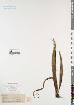
LE 01167265
Belvisia henryi (Hieron. ex C.Chr.) Raym. det. Phan Ke Loc at 20.07.1997
Collectors: Averyanov, Leonid Vladimirovich; et al. Field collecting number: VH2777. Collection date: 17.03.1997. Administrative regions: VN - Tinh Lam GJong. Groups of specimens: L. V. Averyanov specimens; L. V. Averyanov herbarium; Соглашение Минобрнауки №075-15-2021-1056Original label text:FLORA OF VIETNAM
Belvisia henryi (C.Chr.) Raymond
S. Vietnam, Prov. Lam Dong, 31 km to NE from Dalat city, distr. Lac
Duong, municipalite Da Chay (N 12° 08′, E 108° 39′). Closed primary
broadleaved mt forest on NW macroslope of Bi Dup mt system at
1550-1700 m alt. Epiphyte on high trees. Common. VH 2777 17.03.1997
International Botanical Expedition of the U.S.A. National Geographic
Society (grant No 5803-96)
Collectors: L. Averyanov, N.Q. Binh, N.V. Duy, P.K. Loc
Coordinates (geographic position): 12° 8′ N, 108° 39′ E ±1000 mRecord creation: 2022-01-18, Galina Savich, PhotoScan D2. Processing status: work_status_1Citation: Specimen LE 01167265 // Virtual herbarium of Komarov Botanical Institute RAS — http://re.herbariumle.ru/01167265Belvisia henryi (C.Chr.) Raymond
S. Vietnam, Prov. Lam Dong, 31 km to NE from Dalat city, distr. Lac
Duong, municipalite Da Chay (N 12° 08′, E 108° 39′). Closed primary
broadleaved mt forest on NW macroslope of Bi Dup mt system at
1550-1700 m alt. Epiphyte on high trees. Common. VH 2777 17.03.1997
International Botanical Expedition of the U.S.A. National Geographic
Society (grant No 5803-96)
Collectors: L. Averyanov, N.Q. Binh, N.V. Duy, P.K. Loc
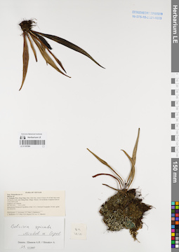
LE 01167264
Belvisia spicata (L.f.) Mirb. ex Copel. det. Shmakov, Aleksandr Ivanovich at 29.12.2007
Collectors: Averyanov, Leonid Vladimirovich; et al. Field collecting number: VH1610. Collection date: 14.11.1995. Administrative regions: VN - Kon Tum. Groups of specimens: L. V. Averyanov specimens; L. V. Averyanov herbarium; Соглашение Минобрнауки №075-15-2021-1056Original label text:FLORA OF VIETNAM
Polypodiaceae s.l.
Belvisia sp.
S. Vietnam, Prov. Kon Tum, Distr. Dak Gley, about 12 km to N of Dak Gley town (24 km by road), near Mang Khen village. Primary wet mountain evergreen forest at 1100-1200 m alt. Epiphyte, not common.
VH 1610 14.11.1995
International Botanical Expedition of the U.S.A. National Geographic Society (grant No 5094-93)
Participants: L. Averyanov, N.T. Ban, A. Budantzev, L. Budantzev, N.T. Hiep, D.D. Huyen, P.K. Loc, G. Yakovlev
Record creation: 2022-01-18, Galina Savich, PhotoScan D2. Processing status: work_status_1Citation: Specimen LE 01167264 // Virtual herbarium of Komarov Botanical Institute RAS — http://re.herbariumle.ru/01167264Polypodiaceae s.l.
Belvisia sp.
S. Vietnam, Prov. Kon Tum, Distr. Dak Gley, about 12 km to N of Dak Gley town (24 km by road), near Mang Khen village. Primary wet mountain evergreen forest at 1100-1200 m alt. Epiphyte, not common.
VH 1610 14.11.1995
International Botanical Expedition of the U.S.A. National Geographic Society (grant No 5094-93)
Participants: L. Averyanov, N.T. Ban, A. Budantzev, L. Budantzev, N.T. Hiep, D.D. Huyen, P.K. Loc, G. Yakovlev
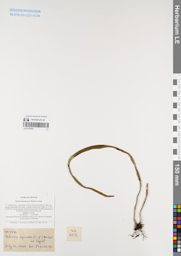
LE 01167263
Belvisia spicata (L.f.) Mirb. ex Copel. det. Phan Ke Loc at 21.07.1997
Collectors: Averyanov, Leonid Vladimirovich; et al. Field collecting number: VH2671. Collection date: 15.03.1997. Administrative regions: VN - Tinh Lam GJong. Groups of specimens: L. V. Averyanov specimens; L. V. Averyanov herbarium; Соглашение Минобрнауки №075-15-2021-1056Original label text:FLORA OF VIETNAM
Belvisia spicata (L.f.) Mirbel ex Copel.
S. Vietnam, Prov. Lam Dong, 31 km to NE from Dalat city, distr. Lac
Duong, municipalite Da Chay, vicinities Klong Lanh village (N 12° 08′,
E 108° 39′). Closed primary broadleaved mt forest on NW macroslope of
Bi Dup mt system at 1850-1950 m alt. Epiphyte. Not rare. VH 2671 15.03.1997
International Botanical Expedition of the U.S.A. National Geographic
Society (grant No 5803-96)
Collectors: L. Averyanov, N.Q. Binh, N.V. Duy, P.K. Loc
Coordinates (geographic position): 12° 8′ N, 108° 39′ E ±1000 mRecord creation: 2022-01-18, Galina Savich, PhotoScan D2. Processing status: work_status_1Citation: Specimen LE 01167263 // Virtual herbarium of Komarov Botanical Institute RAS — http://re.herbariumle.ru/01167263Belvisia spicata (L.f.) Mirbel ex Copel.
S. Vietnam, Prov. Lam Dong, 31 km to NE from Dalat city, distr. Lac
Duong, municipalite Da Chay, vicinities Klong Lanh village (N 12° 08′,
E 108° 39′). Closed primary broadleaved mt forest on NW macroslope of
Bi Dup mt system at 1850-1950 m alt. Epiphyte. Not rare. VH 2671 15.03.1997
International Botanical Expedition of the U.S.A. National Geographic
Society (grant No 5803-96)
Collectors: L. Averyanov, N.Q. Binh, N.V. Duy, P.K. Loc
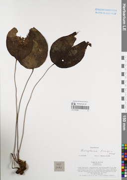
LE 01167262
Cheiropleuria bicuspis (Blume) C.Presl det. Shmakov, Aleksandr Ivanovich at 02.01.2008
Collectors: Averyanov, Leonid Vladimirovich; Phan Ke Loc; et al. Field collecting number: HLF7087. Collection date: 25.03.2007. Administrative regions: VN - Tinh Nghe An. Groups of specimens: L. V. Averyanov specimens; L. V. Averyanov herbarium; Соглашение Минобрнауки №075-15-2021-1056Original label text:FLORA OF VIETNAM
Polypodiaceae s.l.
Aneupleura bicuspis
Vietnam, Nghe An Prov., Tuong Duong Distr., Tam Hop Municipality, Pa Lom village, around point 19°05′07″N 104°20′55″E at elevation 1450-1550 m a.s.l. Submontane primary evergreen closed forest on very steep mountain slopes composed with stratified solid shale. Terrestrial fern on very steep slopes along tops of ridge and on very steep rocky shady mountain slopes. Not common. HLF 7087 25 March 2007.
Coll. Averyanov L., P.K.Loc, N.V.Trai, N.T.Vinh, N.D.Phuong, Averyanova A.
Grant from Henry Luce Foundation.
Coordinates (geographic position): 19° 5′ 7″ N, 104° 20′ 55″ E ±1000 mRecord creation: 2022-01-18, Galina Savich, PhotoScan D2. Processing status: work_status_1Citation: Specimen LE 01167262 // Virtual herbarium of Komarov Botanical Institute RAS — http://re.herbariumle.ru/01167262Polypodiaceae s.l.
Aneupleura bicuspis
Vietnam, Nghe An Prov., Tuong Duong Distr., Tam Hop Municipality, Pa Lom village, around point 19°05′07″N 104°20′55″E at elevation 1450-1550 m a.s.l. Submontane primary evergreen closed forest on very steep mountain slopes composed with stratified solid shale. Terrestrial fern on very steep slopes along tops of ridge and on very steep rocky shady mountain slopes. Not common. HLF 7087 25 March 2007.
Coll. Averyanov L., P.K.Loc, N.V.Trai, N.T.Vinh, N.D.Phuong, Averyanova A.
Grant from Henry Luce Foundation.
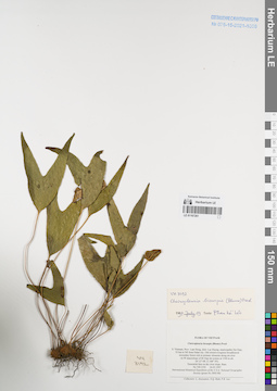
LE 01167261
Cheiropleuria bicuspis (Blume) C.Presl det. Phan Ke Loc at 19.07.1997
Collectors: Averyanov, Leonid Vladimirovich; et al. Field collecting number: VH3192. Collection date: 26.03.1997. Administrative regions: VN - Tinh Lam GJong. Groups of specimens: L. V. Averyanov specimens; L. V. Averyanov herbarium; Соглашение Минобрнауки №075-15-2021-1056Original label text:FLORA OF VIETNAM
Cheiropleuria bicuspis (Blume) Presl
S. Vietnam, Prov. Lam Dong, distr. Lac Duong, municipalite Da Chay,
35 km to NE from Dalat city. Old closed evergreen broadleaved secondary forest rich in primary elements along mt river on W macroslope of Bi Dup mt system at 1500 m alt. (N 12° 08′, E 108° 39′).
Terrestrial fern on dry river slope. Rare. VH 3192 26.03.1997
International Botanical Expedition of the U.S.A. National Geographic
Society (grant No 5803-96)
Collectors: L. Averyanov, N.Q. Binh, P.K. Loc
Coordinates (geographic position): 12° 8′ N, 108° 39′ E ±1000 mRecord creation: 2022-01-18, Galina Savich, PhotoScan D2. Processing status: work_status_1Citation: Specimen LE 01167261 // Virtual herbarium of Komarov Botanical Institute RAS — http://re.herbariumle.ru/01167261Cheiropleuria bicuspis (Blume) Presl
S. Vietnam, Prov. Lam Dong, distr. Lac Duong, municipalite Da Chay,
35 km to NE from Dalat city. Old closed evergreen broadleaved secondary forest rich in primary elements along mt river on W macroslope of Bi Dup mt system at 1500 m alt. (N 12° 08′, E 108° 39′).
Terrestrial fern on dry river slope. Rare. VH 3192 26.03.1997
International Botanical Expedition of the U.S.A. National Geographic
Society (grant No 5803-96)
Collectors: L. Averyanov, N.Q. Binh, P.K. Loc
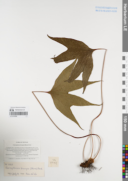
LE 01167260
Cheiropleuria bicuspis (Blume) C.Presl det. Phan Ke Loc at 19.07.1997
Collectors: Averyanov, Leonid Vladimirovich; et al. Field collecting number: VH2587. Collection date: 13.03.1997. Administrative regions: VN - Tinh Lam GJong. Groups of specimens: L. V. Averyanov specimens; L. V. Averyanov herbarium; Соглашение Минобрнауки №075-15-2021-1056Original label text:FLORA OF VIETNAM
Cheiropleuria bicuspis (Blume) Presl
S. Vietnam, Prov. Lam Dong, 8.5 km to S from Dalat city (N 11° 54′,
E 108° 27′). Closed mixed secondary forest with Dacrycarpus imbricatus
rich in primary elements along stream canyon at 1300-1400 m alt.
Terrestrial fern on steep slopes. Common. VH 2587 13.03.1997
International Botanical Expedition of the U.S.A. National Geographic
Society (grant No 5803-96)
Collectors: L. Averyanov, N.Q. Binh, N.V. Duy, P.K. Loc
Coordinates (geographic position): 11° 54′ N, 108° 27′ E ±1000 mRecord creation: 2022-01-18, Galina Savich, PhotoScan D2. Processing status: work_status_1Citation: Specimen LE 01167260 // Virtual herbarium of Komarov Botanical Institute RAS — http://re.herbariumle.ru/01167260Cheiropleuria bicuspis (Blume) Presl
S. Vietnam, Prov. Lam Dong, 8.5 km to S from Dalat city (N 11° 54′,
E 108° 27′). Closed mixed secondary forest with Dacrycarpus imbricatus
rich in primary elements along stream canyon at 1300-1400 m alt.
Terrestrial fern on steep slopes. Common. VH 2587 13.03.1997
International Botanical Expedition of the U.S.A. National Geographic
Society (grant No 5803-96)
Collectors: L. Averyanov, N.Q. Binh, N.V. Duy, P.K. Loc
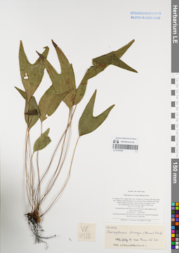
LE 01167259
Cheiropleuria bicuspis (Blume) C.Presl det. Phan Ke Loc at 19.07.1997
Collectors: Averyanov, Leonid Vladimirovich; et al. Field collecting number: VH4328. Collection date: 25.04.1997. Administrative regions: VN - Tinh Khanh Hoa. Groups of specimens: L. V. Averyanov specimens; L. V. Averyanov herbarium; Соглашение Минобрнауки №075-15-2021-1056Original label text:FLORA OF VIETNAM
Cheiropleuria bicuspis (Blume) Presl
S. Vietnam, Prov. Khanh Hoa, distr. Khanh Son, 42 km to NE from Dalat
city. Primary closed broadleaved evergreen forest on shelfes and along
bluffs of giant waterfall in upper reaches of Lieng Ly river
on E macroslope of Hon Giao mt. ridge at 1300 m alt.
(N 12° 12′, E 108° 44′).
Terrestrial fern with fronds up to 0.4 m lg on steep shadow river
slopes. Not common.VH 4328 25.04.1997
International Botanical Expedition of the U.S.A. National Geographic
Society (grant No 5803-96)
Collectors: L. Averyanov, N.Q. Binh, N.T. Hiep
Coordinates (geographic position): 12° 12′ N, 108° 44′ E ±1000 mRecord creation: 2022-01-18, Galina Savich, PhotoScan D2. Processing status: work_status_1Citation: Specimen LE 01167259 // Virtual herbarium of Komarov Botanical Institute RAS — http://re.herbariumle.ru/01167259Cheiropleuria bicuspis (Blume) Presl
S. Vietnam, Prov. Khanh Hoa, distr. Khanh Son, 42 km to NE from Dalat
city. Primary closed broadleaved evergreen forest on shelfes and along
bluffs of giant waterfall in upper reaches of Lieng Ly river
on E macroslope of Hon Giao mt. ridge at 1300 m alt.
(N 12° 12′, E 108° 44′).
Terrestrial fern with fronds up to 0.4 m lg on steep shadow river
slopes. Not common.VH 4328 25.04.1997
International Botanical Expedition of the U.S.A. National Geographic
Society (grant No 5803-96)
Collectors: L. Averyanov, N.Q. Binh, N.T. Hiep
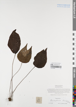
LE 01167258
Cheiropleuria bicuspis (Blume) C.Presl det. Shmakov, Aleksandr Ivanovich at 02.01.2008
Collectors: Phan Ke Loc; Averyanov, Leonid Vladimirovich; et al. Field collecting number: HAL5064. Collection date: 03.05.2004. Administrative regions: VN - Tinh Ha Tinh. Groups of specimens: L. V. Averyanov specimens; L. V. Averyanov herbarium; Соглашение Минобрнауки №075-15-2021-1056Original label text:FLORA OF VIETNAM
Polypodiaceae s.l.
Neocheiropleuria bicuspis
N.Vietnam, Ha Tinh Prov., Huong Son Distr., Son Kim Municipality, Rao
Bun stream around point 18°23′39′'N, 105°15′12′'E. Primary coniferous
closed forest with Fokienia hodginsii and Dacrydium elatum along ridge
rib and on slopes near the ridge tops at elevation 1100-1200 m a.s.l.
(Kho Mu mt.).
Terrestrial fern on very steep and vertical mossy shady slope.
Occasional. HAL 5064 3 May 2004
Collectors: P.K.Loc, L.Averyanov, P.V.The, N.T.Vinh.
Coordinates (geographic position): 18° 23′ 39″ N, 105° 15′ 12″ E ±1000 mRecord creation: 2022-01-18, Galina Savich, PhotoScan D2. Processing status: work_status_1Citation: Specimen LE 01167258 // Virtual herbarium of Komarov Botanical Institute RAS — http://re.herbariumle.ru/01167258Polypodiaceae s.l.
Neocheiropleuria bicuspis
N.Vietnam, Ha Tinh Prov., Huong Son Distr., Son Kim Municipality, Rao
Bun stream around point 18°23′39′'N, 105°15′12′'E. Primary coniferous
closed forest with Fokienia hodginsii and Dacrydium elatum along ridge
rib and on slopes near the ridge tops at elevation 1100-1200 m a.s.l.
(Kho Mu mt.).
Terrestrial fern on very steep and vertical mossy shady slope.
Occasional. HAL 5064 3 May 2004
Collectors: P.K.Loc, L.Averyanov, P.V.The, N.T.Vinh.
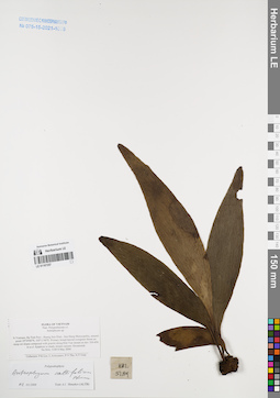
LE 01167257
Antrophyum callifolium Blume det. Shmakov, Aleksandr Ivanovich at 02.01.2008
Collectors: Averyanov, Leonid Vladimirovich; et al. Field collecting number: HAL5189. Collection date: 08.05.2004. Administrative regions: VN - Tinh Ha Tinh. Groups of specimens: L. V. Averyanov specimens; L. V. Averyanov herbarium; Соглашение Минобрнауки №075-15-2021-1056Original label text:FLORA OF VIETNAM
Polypodiaceae s.l.
Antrophyum sp.
N.Vietnam, Ha Tinh Prov., Huong Son Distr., Son Hong Municipality,
around point 18°34′06′'N, 105°11′40′'E. Primary broad-leaved evergreen
forest on steep mt slopes composed with granite along Khe Van stream
at elev 350-450 m a.s.l. Epiphyte in shady stream canyon. Occasional.
HAL 5189 8 May 2004
Collectors: P.K.Loc, L.Averyanov, P.V.The, N.T.Vinh.
Coordinates (geographic position): 18° 34′ 6″ N, 105° 11′ 40″ E ±1000 mRecord creation: 2022-01-18, Galina Savich, PhotoScan D2. Processing status: work_status_1Citation: Specimen LE 01167257 // Virtual herbarium of Komarov Botanical Institute RAS — http://re.herbariumle.ru/01167257Polypodiaceae s.l.
Antrophyum sp.
N.Vietnam, Ha Tinh Prov., Huong Son Distr., Son Hong Municipality,
around point 18°34′06′'N, 105°11′40′'E. Primary broad-leaved evergreen
forest on steep mt slopes composed with granite along Khe Van stream
at elev 350-450 m a.s.l. Epiphyte in shady stream canyon. Occasional.
HAL 5189 8 May 2004
Collectors: P.K.Loc, L.Averyanov, P.V.The, N.T.Vinh.
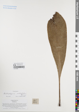
LE 01167256
Antrophyum callifolium Blume det. Shmakov, Aleksandr Ivanovich at 02.01.2008
Collectors: Averyanov, Leonid Vladimirovich; et al. Field collecting number: HLF6619. Collection date: 17.03.2007. Administrative regions: VN - Tinh Nghe An. Groups of specimens: L. V. Averyanov specimens; L. V. Averyanov herbarium; Соглашение Минобрнауки №075-15-2021-1056Original label text:FLORA OF VIETNAM
Polypodiaceae s.l.
Anthrophium sp.
Vietnam, Nghe An Prov., Tuong Duong Distr., Tam Quang Municipality, Tung Huong village, along Khe Mat stream around point 19°03′07″N 104°36′57″E at elevation about 355 m a.s.l.
Lowland closed secondary old evergreen forest on steep slopes along rocky stream valley composed with stratified solid shale and sandstone. Epiphyte on mossy old trees along rocky shady stream valley. Not common.
HLF 6619 17 March 2007.
Coll. Averyanov L., P.K.Loc, N.V.Trai, N.T.Vinh, N.D.Phuong, Averyanova A.
Grant from Henry Luce Foundation.
Coordinates (geographic position): 19° 3′ 7″ N, 104° 36′ 57″ E ±1000 mRecord creation: 2022-01-18, Galina Savich, PhotoScan D2. Processing status: work_status_1Citation: Specimen LE 01167256 // Virtual herbarium of Komarov Botanical Institute RAS — http://re.herbariumle.ru/01167256Polypodiaceae s.l.
Anthrophium sp.
Vietnam, Nghe An Prov., Tuong Duong Distr., Tam Quang Municipality, Tung Huong village, along Khe Mat stream around point 19°03′07″N 104°36′57″E at elevation about 355 m a.s.l.
Lowland closed secondary old evergreen forest on steep slopes along rocky stream valley composed with stratified solid shale and sandstone. Epiphyte on mossy old trees along rocky shady stream valley. Not common.
HLF 6619 17 March 2007.
Coll. Averyanov L., P.K.Loc, N.V.Trai, N.T.Vinh, N.D.Phuong, Averyanova A.
Grant from Henry Luce Foundation.
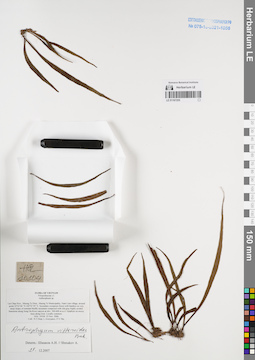
LE 01167255
Antrophyum vittarioides Baker det. Shmakov, Aleksandr Ivanovich at 29.12.2007
Collectors: Tien Hiep Nguyen; Averyanov, Leonid Vladimirovich; The Van Pham Field collecting number: HAL10104. Collection date: 23.11.2006. Administrative regions: VN - Tinh Lai Chau. Groups of specimens: L. V. Averyanov specimens; L. V. Averyanov herbarium; Соглашение Минобрнауки №075-15-2021-1056Original label text:FLORA OF VIETNAM
Polypodiaceae s.l.
Anthrophium sp.
Lai Chau Prov., Muong Te Distr., Muong Te Municipality, Nam Cum village, around point 22°32′06″N 102°32′29″E. Secondary evergreen forest with bamboo on very steep slopes of remnant bluffly mountain composed with slid gray highly eroded limestone along Song Da River canyon at elev. 300-600 m a.s.l.
Epiphyte on mossy trees along river. Locally common. HAL 10104 23 Nov. 2006
Coll.: Nguyen Tien Hiep, L.Averyanov, Pham Van The.
Coordinates (geographic position): 22° 32′ 6″ N, 102° 32′ 29″ E ±1000 mRecord creation: 2022-01-18, Galina Savich, PhotoScan D2. Processing status: work_status_1Citation: Specimen LE 01167255 // Virtual herbarium of Komarov Botanical Institute RAS — http://re.herbariumle.ru/01167255Polypodiaceae s.l.
Anthrophium sp.
Lai Chau Prov., Muong Te Distr., Muong Te Municipality, Nam Cum village, around point 22°32′06″N 102°32′29″E. Secondary evergreen forest with bamboo on very steep slopes of remnant bluffly mountain composed with slid gray highly eroded limestone along Song Da River canyon at elev. 300-600 m a.s.l.
Epiphyte on mossy trees along river. Locally common. HAL 10104 23 Nov. 2006
Coll.: Nguyen Tien Hiep, L.Averyanov, Pham Van The.
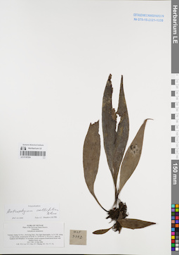
LE 01167254
Antrophyum callifolium Blume det. Shmakov, Aleksandr Ivanovich at 02.01.2008
Collectors: Phan Ke Loc; et al. Field collecting number: HLF5782. Collection date: 23.03.2006. Administrative regions: VN - Tinh Quang Tri. Groups of specimens: L. V. Averyanov specimens; L. V. Averyanov herbarium; Соглашение Минобрнауки №075-15-2021-1056Original label text:FLORA OF VIETNAM
Plants of the Da Krong Nature Reserve
Vittariaceae
Antrophyum annamensis
Vietnam, Quang Tri Prov., Da Krong Distr., Huc Nghi Municipality, La To Vill., along La Sam stream, around point 16°29′00″ N, 107°00′40″ E, 432 m a.s.l., shaly mt. Epiphyte and lithophyte. In secondary closed evergreen broad-leaved mixte with bamboo forest; rare. HLF 5782 23 Mar 2006.
Coll.: P.K. Loc. N.V. Huy, H.T. Phuong, D.C. Tri, T.T. Tu.
Grant from Henry Luce Foundation.
Record creation: 2022-01-18, Galina Savich, PhotoScan D2. Processing status: work_status_1Citation: Specimen LE 01167254 // Virtual herbarium of Komarov Botanical Institute RAS — http://re.herbariumle.ru/01167254Plants of the Da Krong Nature Reserve
Vittariaceae
Antrophyum annamensis
Vietnam, Quang Tri Prov., Da Krong Distr., Huc Nghi Municipality, La To Vill., along La Sam stream, around point 16°29′00″ N, 107°00′40″ E, 432 m a.s.l., shaly mt. Epiphyte and lithophyte. In secondary closed evergreen broad-leaved mixte with bamboo forest; rare. HLF 5782 23 Mar 2006.
Coll.: P.K. Loc. N.V. Huy, H.T. Phuong, D.C. Tri, T.T. Tu.
Grant from Henry Luce Foundation.
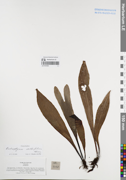
LE 01167253
Antrophyum callifolium Blume det. Shmakov, Aleksandr Ivanovich at 02.01.2008
Collectors: Phan Ke Loc; et al. Field collecting number: HAL9194. Collection date: 30.08.2006. Administrative regions: VN - Tinh Thai Nguyen. Groups of specimens: L. V. Averyanov specimens; L. V. Averyanov herbarium; Соглашение Минобрнауки №075-15-2021-1056Original label text:FLORA OF VIETNAM
Vittariaceae
Antrophyum
Record creation: 2022-01-18, Galina Savich, PhotoScan D2. Processing status: work_status_1Citation: Specimen LE 01167253 // Virtual herbarium of Komarov Botanical Institute RAS — http://re.herbariumle.ru/01167253Vittariaceae
Antrophyum
Thai Nguyen Prov., Vo Nhai Distr., Than Sa Mun., Ngoc Son 2 vill., around point 21?51′09″ N, 105?53′51″ E, 253 m a.s.l. Clustered on cliffs of heavily logged closed evergreen broad-leaved lowland forests on slopes of limestone mountains. Lithophyte. HAL 9194 30 Aug 2006 Id. by Phan Ke Loc
Collectors: Phan Ke Loc, Nguyen Tien Vinh and Nguyen Sinh Khang
Collected with the financial support from NYBG, U.S.A.
Collectors: Phan Ke Loc, Nguyen Tien Vinh and Nguyen Sinh Khang
Collected with the financial support from NYBG, U.S.A.
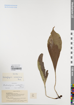
LE 01167252
Antrophyum callifolium Blume det. Shmakov, Aleksandr Ivanovich at 02.01.2008
Collectors: Averyanov, Leonid Vladimirovich; et al. Field collecting number: VH890. Collection date: 23.03.1995. Administrative regions: VN - Tinh Quang Nam. Groups of specimens: L. V. Averyanov specimens; L. V. Averyanov herbarium; Соглашение Минобрнауки №075-15-2021-1056Original label text:FLORA OF VIETNAM
Polypodiaceae s.l.
Anthrophyum annamense C.Chr.et Tard.
S. Vietnam, Prov. Quangnam-Danang. Evergreen close primary forest
on SE slope of Ngoc Linh mountain system at 1800 m alt., near the
boundary of Kontum and Quangnam-Danang provinces.
Epilite. VH 890 23.03.1995
International Botanical Expedition of the U.S.A. National Geographic
Society (grant No 5094-93)
Participants: L. Averyanov, N.T. Ban, N. Q. Binh, A. Budantzev, L. Budantzev, N.T. Hiep, D.D. Huyen, P.K. Loc, N.X. Tam, G. Yakovlev
Record creation: 2022-01-18, Galina Savich, PhotoScan D2. Processing status: work_status_1Citation: Specimen LE 01167252 // Virtual herbarium of Komarov Botanical Institute RAS — http://re.herbariumle.ru/01167252Polypodiaceae s.l.
Anthrophyum annamense C.Chr.et Tard.
S. Vietnam, Prov. Quangnam-Danang. Evergreen close primary forest
on SE slope of Ngoc Linh mountain system at 1800 m alt., near the
boundary of Kontum and Quangnam-Danang provinces.
Epilite. VH 890 23.03.1995
International Botanical Expedition of the U.S.A. National Geographic
Society (grant No 5094-93)
Participants: L. Averyanov, N.T. Ban, N. Q. Binh, A. Budantzev, L. Budantzev, N.T. Hiep, D.D. Huyen, P.K. Loc, N.X. Tam, G. Yakovlev
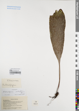
LE 01167251
Antrophyum callifolium Blume det. Shmakov, Aleksandr Ivanovich at 02.01.2008
Collectors: Averyanov, Leonid Vladimirovich; et al. Field collecting number: VH1751. Collection date: 17.11.1995. Administrative regions: VN - Kon Tum. Groups of specimens: L. V. Averyanov specimens; L. V. Averyanov herbarium; Соглашение Минобрнауки №075-15-2021-1056Original label text:FLORA OF VIETNAM
Polypodiaceae
Anthrophium annamense
S. Vietnam, Prov. Kon Tum, Distr. Dak Gley, about 12 km to N of Dak
Gley town (24 km by road), near Mang Khen village. Primary wet
mountain evergreen forest at 1100-1200 m alt.
Epiphite. Rare, in wet shadow places along streams.
VH 1751 17.11.1995
International Botanical Expedition of the U.S.A. National Geographic
Society (grant No 5094-93)
Participants: L. Averyanov, N.T. Ban, A. Budantzev, L. Budantzev,
N.T. Hiep, D.D. Huyen, P.K. Loc, G. Yakovlev
Record creation: 2022-01-18, Galina Savich, PhotoScan D2. Processing status: work_status_1Citation: Specimen LE 01167251 // Virtual herbarium of Komarov Botanical Institute RAS — http://re.herbariumle.ru/01167251Polypodiaceae
Anthrophium annamense
S. Vietnam, Prov. Kon Tum, Distr. Dak Gley, about 12 km to N of Dak
Gley town (24 km by road), near Mang Khen village. Primary wet
mountain evergreen forest at 1100-1200 m alt.
Epiphite. Rare, in wet shadow places along streams.
VH 1751 17.11.1995
International Botanical Expedition of the U.S.A. National Geographic
Society (grant No 5094-93)
Participants: L. Averyanov, N.T. Ban, A. Budantzev, L. Budantzev,
N.T. Hiep, D.D. Huyen, P.K. Loc, G. Yakovlev
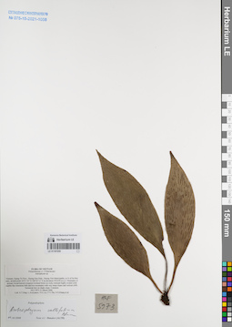
LE 01167250
Antrophyum callifolium Blume det. Shmakov, Aleksandr Ivanovich at 02.01.2008
Collectors: Averyanov, Leonid Vladimirovich; Phan Ke Loc; et al. Field collecting number: HLF5973. Collection date: 31.03.2006. Administrative regions: VN - Tinh Quang Tri. Groups of specimens: L. V. Averyanov specimens; L. V. Averyanov herbarium; Соглашение Минобрнауки №075-15-2021-1056Original label text:FLORA OF VIETNAM
Polypodiaceae s.l. (Vittariaceae)
Antrophyum sp.
Vietnam, Quang Tri Prov., Huong Hoa Distr., Huong Viet Municipality, to N of Sa Mui pass, around point 16°51′14″N 106°34′13″E at elevation 550-650 m a.s.l.
Remnants of primary broad-leaved evergreen lowland forest on rocky remnant highly eroded solid marble-like limestone hills and low mountains with very steep slopes and vertical cliffs. Terrestrial fern on shady slope. Common. HLF 5973 31 March 2006.
Coll. N.T.Hiep, L.Averyanov, P.K.Loc, P.V.The, N.S.Khang, P.H.Duc, L.T.Son, S.Bounphanmy, T.K.Ratana, O.Sonliya, T.Q.Dang, N.V.Hien, H.T.N.Trang, L.T.Chau.
Grant from Henry Luce Foundation.
Coordinates (geographic position): 16° 51′ 14″ N, 106° 34′ 13″ E ±1000 mRecord creation: 2022-01-18, Galina Savich, PhotoScan D2. Processing status: work_status_1Citation: Specimen LE 01167250 // Virtual herbarium of Komarov Botanical Institute RAS — http://re.herbariumle.ru/01167250Polypodiaceae s.l. (Vittariaceae)
Antrophyum sp.
Vietnam, Quang Tri Prov., Huong Hoa Distr., Huong Viet Municipality, to N of Sa Mui pass, around point 16°51′14″N 106°34′13″E at elevation 550-650 m a.s.l.
Remnants of primary broad-leaved evergreen lowland forest on rocky remnant highly eroded solid marble-like limestone hills and low mountains with very steep slopes and vertical cliffs. Terrestrial fern on shady slope. Common. HLF 5973 31 March 2006.
Coll. N.T.Hiep, L.Averyanov, P.K.Loc, P.V.The, N.S.Khang, P.H.Duc, L.T.Son, S.Bounphanmy, T.K.Ratana, O.Sonliya, T.Q.Dang, N.V.Hien, H.T.N.Trang, L.T.Chau.
Grant from Henry Luce Foundation.
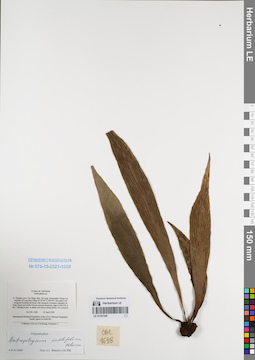
LE 01167249
Antrophyum callifolium Blume det. Shmakov, Aleksandr Ivanovich at 02.01.2008
Collectors: Phan Ke Loc; P.H. Hoang; Averyanov, Leonid Vladimirovich Field collecting number: CBL1638. Collection date: 23.04.1999. Administrative regions: VN - Tinh Cao Bang. Groups of specimens: L. V. Averyanov specimens; L. V. Averyanov herbarium; Соглашение Минобрнауки №075-15-2021-1056Original label text:FLORA OF VIETNAM
Anthrophium sp.
N. Vietnam, prov. Cao Bang, distr. Ha Lang, municipality Thang Loi,
vicinities of Lung Sam village (N 22°45′ E 106°42′). Secondary wet
evergreen broadleaved forest with remnants of primary elements on
steep slopes and bluffs of karst remnant limestone ridge at 500-550 m
elev. Lithophyte fern in shady wet canyon along stream. Not common.
CBL 1638 23 April 1999
International Botanical Expedition of the U.S.A. National Geographic
Society (grant No 6300-98)
Collectors: P.K.Loc, P.H.Hoang, Averyanov L.
Coordinates (geographic position): 22° 45′ N, 106° 42′ E ±1000 mRecord creation: 2022-01-18, Galina Savich, PhotoScan D2. Processing status: work_status_1Citation: Specimen LE 01167249 // Virtual herbarium of Komarov Botanical Institute RAS — http://re.herbariumle.ru/01167249Anthrophium sp.
N. Vietnam, prov. Cao Bang, distr. Ha Lang, municipality Thang Loi,
vicinities of Lung Sam village (N 22°45′ E 106°42′). Secondary wet
evergreen broadleaved forest with remnants of primary elements on
steep slopes and bluffs of karst remnant limestone ridge at 500-550 m
elev. Lithophyte fern in shady wet canyon along stream. Not common.
CBL 1638 23 April 1999
International Botanical Expedition of the U.S.A. National Geographic
Society (grant No 6300-98)
Collectors: P.K.Loc, P.H.Hoang, Averyanov L.
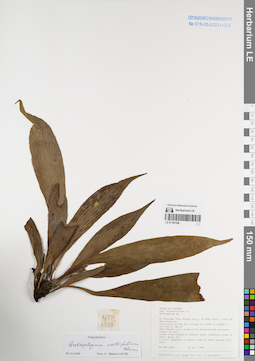
LE 01167248
Antrophyum callifolium Blume det. Shmakov, Aleksandr Ivanovich at 02.01.2008
Collectors: Tien Hiep Nguyen; Phan Ke Loc; Averyanov, Leonid Vladimirovich Field collecting number: NTH3887. Collection date: 24.10.1999. Administrative regions: VN - Tinh Thai Nguyen. Groups of specimens: L. V. Averyanov specimens; L. V. Averyanov herbarium; Соглашение Минобрнауки №075-15-2021-1056Original label text:FLORA OF VIETNAM
Polypodiaceae s.l.
Anthrophium sp.
N. Vietnam, Thai Nguyen prov., Vo Nhai distr., Than Sa municipality,
vicinities of Kim Son village (N 21°48′ E 105°54′), 23.3 km to 18° of
Thai Nguyen city. Primary dry broadleaved evergreen forest on very
steep rocky slopes of remnant karst limestone ridge at elev. about 300
m a.s.l. Epiphyte on mossy trees in shady places. Not rare.
NTH 3887 24 Oct. 1999
Collectors: N.T. Hiep, P.K. Loc, L. Averyanov.
Coordinates (geographic position): 21° 48′ N, 105° 54′ E ±1000 mRecord creation: 2022-01-18, Galina Savich, PhotoScan D2. Processing status: work_status_1Citation: Specimen LE 01167248 // Virtual herbarium of Komarov Botanical Institute RAS — http://re.herbariumle.ru/01167248Polypodiaceae s.l.
Anthrophium sp.
N. Vietnam, Thai Nguyen prov., Vo Nhai distr., Than Sa municipality,
vicinities of Kim Son village (N 21°48′ E 105°54′), 23.3 km to 18° of
Thai Nguyen city. Primary dry broadleaved evergreen forest on very
steep rocky slopes of remnant karst limestone ridge at elev. about 300
m a.s.l. Epiphyte on mossy trees in shady places. Not rare.
NTH 3887 24 Oct. 1999
Collectors: N.T. Hiep, P.K. Loc, L. Averyanov.
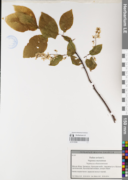
LE 01181065
Groups of specimens: Образцы сектора Восточной Европы; Соглашение Минобрнауки №075-15-2021-1056Record creation: 2022-01-18, Larisa Orlova, PhotoScan D2Citation: Specimen LE 01181065 // Virtual herbarium of Komarov Botanical Institute RAS — http://re.herbariumle.ru/01181065
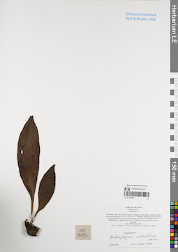
LE 01167247
Antrophyum callifolium Blume det. Shmakov, Aleksandr Ivanovich at 02.01.2008
Collectors: Averyanov, Leonid Vladimirovich; et al. Field collecting number: HAL10892. Collection date: 05.04.2007. Administrative regions: VN - Tinh Thua Thien-Hue. Groups of specimens: L. V. Averyanov specimens; L. V. Averyanov herbarium; Соглашение Минобрнауки №075-15-2021-1056Original label text:FLORA OF VIETNAM
Polypodiaceae s.l.
Antrophium sp.
Thua Thien – Hue Prov., Nam Dong Distr., Thuong Lo Municipality, along Cha Mang stream, around point 16°07′46″N 107°44′24″E. nants of primary evergreen broad-leaved lowland forest on very steep hill slopes composed with stratified shale and sandstone at elev. about 250-300 m a.s.l. Lithophyte along shady rocky stream. Common. HAL 10892 5 Apr. 2007.
Coll.: L.Averyanov, Phan Ke Loc, A.Averyanova, N.D.Phuong, L.V.Hung.
Coordinates (geographic position): 16° 7′ 46″ N, 107° 44′ 24″ E ±1000 mRecord creation: 2022-01-18, Galina Savich, PhotoScan D2. Processing status: work_status_1Citation: Specimen LE 01167247 // Virtual herbarium of Komarov Botanical Institute RAS — http://re.herbariumle.ru/01167247Polypodiaceae s.l.
Antrophium sp.
Thua Thien – Hue Prov., Nam Dong Distr., Thuong Lo Municipality, along Cha Mang stream, around point 16°07′46″N 107°44′24″E. nants of primary evergreen broad-leaved lowland forest on very steep hill slopes composed with stratified shale and sandstone at elev. about 250-300 m a.s.l. Lithophyte along shady rocky stream. Common. HAL 10892 5 Apr. 2007.
Coll.: L.Averyanov, Phan Ke Loc, A.Averyanova, N.D.Phuong, L.V.Hung.
LE 01181064
Groups of specimens: Образцы сектора Восточной Европы; Соглашение Минобрнауки №075-15-2021-1056Record creation: 2022-01-18, Larisa Orlova, PhotoScan D2Citation: Specimen LE 01181064 // Virtual herbarium of Komarov Botanical Institute RAS — http://re.herbariumle.ru/01181064
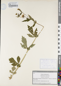
LE 01181063
Groups of specimens: Образцы сектора Восточной Европы; Соглашение Минобрнауки №075-15-2021-1056Record creation: 2022-01-18, Larisa Orlova, PhotoScan D2Citation: Specimen LE 01181063 // Virtual herbarium of Komarov Botanical Institute RAS — http://re.herbariumle.ru/01181063
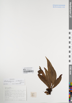
LE 01167246
Antrophyum callifolium Blume det. Shmakov, Aleksandr Ivanovich at 02.01.2008
Collectors: Tien Hiep Nguyen; Phan Ke Loc; Averyanov, Leonid Vladimirovich Field collecting number: NTH3864. Collection date: 24.10.1999. Administrative regions: VN - Tinh Thai Nguyen. Groups of specimens: L. V. Averyanov specimens; L. V. Averyanov herbarium; Соглашение Минобрнауки №075-15-2021-1056Original label text:FLORA OF VIETNAM
Polypodiaceae s.l.
Anthrophium sp.
N. Vietnam, Thai Nguyen prov., Vo Nhai distr., Than Sa municipality,
vicinities of Kim Son village (N 21°48′ E 105°54′), 23.3 km to 18° of
Thai Nguyen city. Secondary open broadleaved forest and shrubs on very
steep rocky slopes of remnant karst limestone ridge at elev. about 100
m a.s.l. Lithophytic fern on shady rocks. Not rare. NTH 3864 24 Oct. 1999
Collectors: N.T. Hiep, P.K. Loc, L. Averyanov.
Coordinates (geographic position): 21° 48′ N, 105° 54′ E ±1000 mRecord creation: 2022-01-18, Galina Savich, PhotoScan D2. Processing status: work_status_1Citation: Specimen LE 01167246 // Virtual herbarium of Komarov Botanical Institute RAS — http://re.herbariumle.ru/01167246Polypodiaceae s.l.
Anthrophium sp.
N. Vietnam, Thai Nguyen prov., Vo Nhai distr., Than Sa municipality,
vicinities of Kim Son village (N 21°48′ E 105°54′), 23.3 km to 18° of
Thai Nguyen city. Secondary open broadleaved forest and shrubs on very
steep rocky slopes of remnant karst limestone ridge at elev. about 100
m a.s.l. Lithophytic fern on shady rocks. Not rare. NTH 3864 24 Oct. 1999
Collectors: N.T. Hiep, P.K. Loc, L. Averyanov.