View
Add
Copy
Edit
Delete
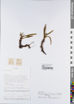
LE 01167526
Cleisocentron klossii (Ridl.) Garay det. Averyanov, Leonid Vladimirovich at 28.02.2022
Collectors: Averyanov, Leonid Vladimirovich; et al. Field collecting number: VH6214. Collection date: 09.05.2000. Administrative regions: VN - Tinh GJak Lak. Groups of specimens: L. V. Averyanov specimens; L. V. Averyanov herbarium; Orchids of Vietnam, Laos and CambodiaOriginal label text:FLORA OF VIETNAM
Coordinates (geographic position): 12° 30′ N, 108° 30′ E ±1000 mRecord creation: 2022-03-03, Galina Savich, PhotoScan D2. Processing status: work_status_1Citation: Specimen LE 01167526 // Virtual herbarium of Komarov Botanical Institute RAS — http://re.herbariumle.ru/01167526Orchidaceae
Cleisocentron klossii (Ridl.) Garay ( = Bidupia bicamerata Aver.)
S. Vietnam, Dak Lac Prov., Krong Bong Distr., Cu Pui Municipality, elevation from Dak Tour village (12°30′N, 108°30′E) to main peak of Chu Yang Sinh mt system (12°24′N, 108°26′E) along Dak Tour river (N slope). Primary mossy cloud mixed forest (with Pinus, Fokienia, Dacrydium and Dacrycarpus) on very steep granite slopes at elev. 2100-2300 m. Epiphyte on high trees. Flowers pink-purple. Common.
VH 6214 09.05.2000
International Botanical Expedition of the U.S.A. National Geographic Society (grant No 6383-98)
Collectors: L.Averyanov, N.T.Hiep, N.Q.Hieu, P.H.Hoang, D.X.Du, N.T.Vinh
Cleisocentron klossii (Ridl.) Garay ( = Bidupia bicamerata Aver.)
S. Vietnam, Dak Lac Prov., Krong Bong Distr., Cu Pui Municipality, elevation from Dak Tour village (12°30′N, 108°30′E) to main peak of Chu Yang Sinh mt system (12°24′N, 108°26′E) along Dak Tour river (N slope). Primary mossy cloud mixed forest (with Pinus, Fokienia, Dacrydium and Dacrycarpus) on very steep granite slopes at elev. 2100-2300 m. Epiphyte on high trees. Flowers pink-purple. Common.
VH 6214 09.05.2000
International Botanical Expedition of the U.S.A. National Geographic Society (grant No 6383-98)
Collectors: L.Averyanov, N.T.Hiep, N.Q.Hieu, P.H.Hoang, D.X.Du, N.T.Vinh
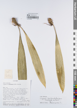
LE 01167525
Liparis dendrochiloides Seidenf. ex Aver. det. Averyanov, Leonid Vladimirovich at 28.02.2022
Collectors: Averyanov, Leonid Vladimirovich; et al. Field collecting number: VH6463. Collection date: 12.05.2000. Administrative regions: VN - Tinh GJak Lak. Groups of specimens: L. V. Averyanov specimens; L. V. Averyanov herbarium; Orchids of Vietnam, Laos and CambodiaOriginal label text:FLORA OF VIETNAM
Coordinates (geographic position): 12° 30′ N, 108° 30′ E ±1000 mRecord creation: 2022-03-03, Galina Savich, PhotoScan D2Citation: Specimen LE 01167525 // Virtual herbarium of Komarov Botanical Institute RAS — http://re.herbariumle.ru/01167525Orchidaceae
Liparis distans ?
S. Vietnam, Dak Lac Prov., Krong Bong Distr., Cu Pui Municipality, elevation from Dak Tour village (12°30′N, 108°30′E) to main peak of Chu Yang Sinh mt system (12°24′N, 108°26′E) along Dak Tour river (N slope). Primary closed mountain broad-leaved evergreen forest on granite slopes along river canyon at elev. 800-900 m. Epiphytic and Lithophytic herb on very steep rocky river slope. Not rare.
VH 6463 12.05.2000
International Botanical Expedition of the U.S.A. National Geographic Society (grant No 6383-98)
Collectors: L.Averyanov, N.T.Hiep, N.Q.Hieu, P.H.Hoang, D.X.Du, N.T.Vinh
Liparis distans ?
S. Vietnam, Dak Lac Prov., Krong Bong Distr., Cu Pui Municipality, elevation from Dak Tour village (12°30′N, 108°30′E) to main peak of Chu Yang Sinh mt system (12°24′N, 108°26′E) along Dak Tour river (N slope). Primary closed mountain broad-leaved evergreen forest on granite slopes along river canyon at elev. 800-900 m. Epiphytic and Lithophytic herb on very steep rocky river slope. Not rare.
VH 6463 12.05.2000
International Botanical Expedition of the U.S.A. National Geographic Society (grant No 6383-98)
Collectors: L.Averyanov, N.T.Hiep, N.Q.Hieu, P.H.Hoang, D.X.Du, N.T.Vinh
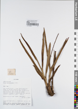
LE 01167524
Mycaranthes floribunda (D.Don) S.C.Chen & J.J.Wood det. Averyanov, Leonid Vladimirovich at 02.01.2025
Additional identifications: Eria paniculata Lindl. det. Averyanov, Leonid Vladimirovich at 16.04.2000 Collectors: Averyanov, Leonid Vladimirovich; et al. Field collecting number: VH5230. Collection date: 16.04.2000. Administrative regions: VN - Kon Tum. Groups of specimens: L. V. Averyanov specimens; L. V. Averyanov herbarium; Orchids of Vietnam, Laos and CambodiaOriginal label text:FLORA OF VIETNAM
Coordinates (geographic position): 14° 39′ N, 108° 25′ E ±1000 mRecord creation: 2022-03-03, Galina Savich, PhotoScan D2. Processing status: work_status_1Citation: Specimen LE 01167524 // Virtual herbarium of Komarov Botanical Institute RAS — http://re.herbariumle.ru/01167524Orchidaceae
Eria paniculata
S. Vietnam, Kontum Prov., Kon Plong Distr., Hieu Municipality, Mang La forest enterprise (14°39′N, 108°25′E). Primary evergreen broad-leaved wet forest with Dacrycarpus imbricatus on steep mt. slopes on sandstone & gneiss at elev. 1100-1200 m. Epiphyte on high trees. Abundant.
Eria paniculata
S. Vietnam, Kontum Prov., Kon Plong Distr., Hieu Municipality, Mang La forest enterprise (14°39′N, 108°25′E). Primary evergreen broad-leaved wet forest with Dacrycarpus imbricatus on steep mt. slopes on sandstone & gneiss at elev. 1100-1200 m. Epiphyte on high trees. Abundant.
VH 5230 16.04.2000
International Botanical Expedition of the U.S.A. National Geographic Society (grant No 6383-98)
International Botanical Expedition of the U.S.A. National Geographic Society (grant No 6383-98)
Collectors: L.Averyanov, P.K.Loc, P.H.Hoang, D.X.Du, N.T.Vinh
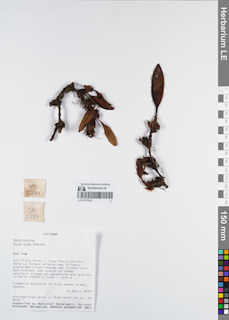
LE 01167523
Campanulorchis thao (Gagnep.) S.C.Chen & J.J.Wood det. Averyanov, Leonid Vladimirovich at 06.07.2022
Additional identifications: Eria thao Gagnep. det. Averyanov, Leonid Vladimirovich at 16.04.2000 Collectors: Averyanov, Leonid Vladimirovich; et al. Field collecting number: VH5234. Collection date: 16.04.2000. Administrative regions: VN - Kon Tum. Groups of specimens: L. V. Averyanov specimens; L. V. Averyanov herbarium; Orchids of Vietnam, Laos and CambodiaOriginal label text:FLORA OF VIETNAM
Coordinates (geographic position): 14° 39′ N, 108° 25′ E ±1000 mRecord creation: 2022-03-03, Galina Savich, PhotoScan D2. Processing status: work_status_1Citation: Specimen LE 01167523 // Virtual herbarium of Komarov Botanical Institute RAS — http://re.herbariumle.ru/01167523Orchidaceae
Eria thao
S. Vietnam, Kontum Prov., Kon Plong Distr., Hieu Municipality, Mang La forest enterprise (14°39′N, 108°25′E). Primary evergreen broad-leaved wet forest with Dacrycarpus imbricatus on steep mt. slopes on sandstone & gneiss at elev. 1100-1200 m. Creeping epiphyte on high mossy trees. Common.
VH 5234 16.04.2000
International Botanical Expedition of the U.S.A. National Geographic Society (grant No 6383-98)
Collectors: L.Averyanov, P.K.Loc, P.H.Hoang, D.X.Du, N.T.Vinh
Eria thao
S. Vietnam, Kontum Prov., Kon Plong Distr., Hieu Municipality, Mang La forest enterprise (14°39′N, 108°25′E). Primary evergreen broad-leaved wet forest with Dacrycarpus imbricatus on steep mt. slopes on sandstone & gneiss at elev. 1100-1200 m. Creeping epiphyte on high mossy trees. Common.
VH 5234 16.04.2000
International Botanical Expedition of the U.S.A. National Geographic Society (grant No 6383-98)
Collectors: L.Averyanov, P.K.Loc, P.H.Hoang, D.X.Du, N.T.Vinh
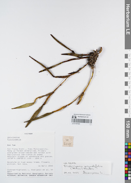
LE 01167522
Flickingeria angustifolia (Blume) A.D.Hawkes det. Averyanov, Leonid Vladimirovich at 16.04.2000
Collectors: Averyanov, Leonid Vladimirovich; et al. Field collecting number: VH5247. Collection date: 16.04.2000. Administrative regions: VN - Kon Tum. Groups of specimens: L. V. Averyanov specimens; L. V. Averyanov herbarium; Orchids of Vietnam, Laos and CambodiaOriginal label text:FLORA OF VIETNAM
Coordinates (geographic position): 14° 39′ N, 108° 25′ E ±1000 mRecord creation: 2022-03-03, Galina Savich, PhotoScan D2. Processing status: work_status_1Citation: Specimen LE 01167522 // Virtual herbarium of Komarov Botanical Institute RAS — http://re.herbariumle.ru/01167522Orchidaceae
Flickingeria angustifolia (Blume) Hawkes
S. Vietnam, Kontum Prov., Kon Plong Distr., Hieu Municipality, Mang La forest enterprise (14°39′N, 108°25′E). Primary evergreen broad-leaved wet forest with Dacrycarpus imbricatus on steep mt. slopes on sandstone & gneiss at elev. 1100-1200 m. Epiphyte on high mossy trees. Flowers pinkish. Not rare.
VH 5247 16.04.2000
International Botanical Expedition of the U.S.A. National Geographic Society (grant No 6383-98)
Collectors: L.Averyanov, P.K.Loc, P.H.Hoang, D.X.Du, N.T.Vinh
Flickingeria angustifolia (Blume) Hawkes
S. Vietnam, Kontum Prov., Kon Plong Distr., Hieu Municipality, Mang La forest enterprise (14°39′N, 108°25′E). Primary evergreen broad-leaved wet forest with Dacrycarpus imbricatus on steep mt. slopes on sandstone & gneiss at elev. 1100-1200 m. Epiphyte on high mossy trees. Flowers pinkish. Not rare.
VH 5247 16.04.2000
International Botanical Expedition of the U.S.A. National Geographic Society (grant No 6383-98)
Collectors: L.Averyanov, P.K.Loc, P.H.Hoang, D.X.Du, N.T.Vinh
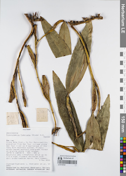
LE 01167521
Flickingeria fimbriata (Blume) A.D.Hawkes det. Averyanov, Leonid Vladimirovich at 03.05.2000
Collectors: Averyanov, Leonid Vladimirovich; et al. Field collecting number: VH5954. Collection date: 03.05.2000. Administrative regions: VN - Tinh GJak Lak. Groups of specimens: L. V. Averyanov specimens; L. V. Averyanov herbarium; Orchids of Vietnam, Laos and CambodiaOriginal label text:FLORA OF VIETNAM
Coordinates (geographic position): 12° 30′ N, 108° 30′ E ±1000 mRecord creation: 2022-03-03, Galina Savich, PhotoScan D2. Processing status: work_status_1Citation: Specimen LE 01167521 // Virtual herbarium of Komarov Botanical Institute RAS — http://re.herbariumle.ru/01167521Orchidaceae
Flickingeria fimbriata (Blume) Hawkes
S. Vietnam, Dak Lac Prov., Krong Bong Distr., Cu Pui Municipality, elevation from Dak Tour village (12°30′N, 108°30′E) along Dak Tour river on N macroslope of Chu Yang Sinh mt system. Primary broad-leaved mountain evergreen forest on granites along river slopes at elev. 500-550 m. Epiphytic and lithophytic shrub up to 1.5 m hg. Flowers yellowish with dull brown-reddish marks. Very common.
VH 5954 03.05.2000
International Botanical Expedition of the U.S.A. National Geographic Society (grant No 6383-98)
Collectors: L.Averyanov, N.T.Hiep, N.Q.Hieu, P.H.Hoang, D.X.Du, N.T.Vinh
Flickingeria fimbriata (Blume) Hawkes
S. Vietnam, Dak Lac Prov., Krong Bong Distr., Cu Pui Municipality, elevation from Dak Tour village (12°30′N, 108°30′E) along Dak Tour river on N macroslope of Chu Yang Sinh mt system. Primary broad-leaved mountain evergreen forest on granites along river slopes at elev. 500-550 m. Epiphytic and lithophytic shrub up to 1.5 m hg. Flowers yellowish with dull brown-reddish marks. Very common.
VH 5954 03.05.2000
International Botanical Expedition of the U.S.A. National Geographic Society (grant No 6383-98)
Collectors: L.Averyanov, N.T.Hiep, N.Q.Hieu, P.H.Hoang, D.X.Du, N.T.Vinh
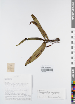
LE 01167520
Gastrochilus calceolaris (Sm.) D.Don det. Averyanov, Leonid Vladimirovich at 24.02.2022
Collectors: Averyanov, Leonid Vladimirovich; et al. Field collecting number: VH6254. Collection date: 07.05.2000. Administrative regions: VN - Tinh GJak Lak. Groups of specimens: L. V. Averyanov specimens; L. V. Averyanov herbarium; Orchids of Vietnam, Laos and CambodiaOriginal label text:FLORA OF VIETNAM
Coordinates (geographic position): 12° 30′ N, 108° 30′ E ±1000 mRecord creation: 2022-03-03, Galina Savich, PhotoScan D2. Processing status: work_status_1Citation: Specimen LE 01167520 // Virtual herbarium of Komarov Botanical Institute RAS — http://re.herbariumle.ru/01167520Orchidaceae
Gastrochilus sp.
S. Vietnam, Dak Lac Prov., Krong Bong Distr., Cu Pui Municipality, elevation from Dak Tour village (12°30′N, 108°30′E) to main peak of Chu Yang Sinh mt system (12°24′N, 108°26′E) along Dak Tour river (N slope). Primary closed wet broad-leaved and mixed forest (with Pinus, Fokienia, Dacrydium and Dacrycarpus) on steep granite slopes at elev. 1200-1550 m. Epiphyte on mossy trees. Not rare.
VH 6254 07.05.2000
International Botanical Expedition of the U.S.A. National Geographic Society (grant No 6383-98)
Collectors: L.Averyanov, N.T.Hiep, N.Q.Hieu, P.H.Hoang, D.X.Du, N.T.Vinh
Gastrochilus sp.
S. Vietnam, Dak Lac Prov., Krong Bong Distr., Cu Pui Municipality, elevation from Dak Tour village (12°30′N, 108°30′E) to main peak of Chu Yang Sinh mt system (12°24′N, 108°26′E) along Dak Tour river (N slope). Primary closed wet broad-leaved and mixed forest (with Pinus, Fokienia, Dacrydium and Dacrycarpus) on steep granite slopes at elev. 1200-1550 m. Epiphyte on mossy trees. Not rare.
VH 6254 07.05.2000
International Botanical Expedition of the U.S.A. National Geographic Society (grant No 6383-98)
Collectors: L.Averyanov, N.T.Hiep, N.Q.Hieu, P.H.Hoang, D.X.Du, N.T.Vinh
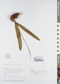
LE 01167519
Epigeneium cacuminis (Gagnep.) Summerh. det. Averyanov, Leonid Vladimirovich at 24.02.2022
Collectors: Averyanov, Leonid Vladimirovich; et al. Field collecting number: VH6157. Collection date: 09.05.2000. Administrative regions: VN - Tinh GJak Lak. Groups of specimens: L. V. Averyanov specimens; L. V. Averyanov herbarium; Orchids of Vietnam, Laos and CambodiaOriginal label text:FLORA OF VIETNAM
Coordinates (geographic position): 12° 30′ N, 108° 30′ E ±1000 mRecord creation: 2022-03-03, Galina Savich, PhotoScan D2. Processing status: work_status_1Citation: Specimen LE 01167519 // Virtual herbarium of Komarov Botanical Institute RAS — http://re.herbariumle.ru/01167519Orchidaceae
Epigeneium labuanum
S. Vietnam, Dak Lac Prov., Krong Bong Distr., Cu Pui Municipality, elevation from Dak Tour village (12°30′N, 108°30′E) to main peak of Chu Yang Sinh mt system (12°24′N, 108°26′E) along Dak Tour river (N slope). Primary mossy cloud mixed forest (with Pinus, Fokienia, Dacrydium and Dacrycarpus) on very steep granite slopes at elev. 2000-2200 m. Epiphyte on high trees. Common.
VH 6157 09.05.2000
International Botanical Expedition of the U.S.A. National Geographic Society (grant No 6383-98)
Collectors: L.Averyanov, N.T.Hiep, N.Q.Hieu, P.H.Hoang, D.X.Du, N.T.Vinh
Epigeneium labuanum
S. Vietnam, Dak Lac Prov., Krong Bong Distr., Cu Pui Municipality, elevation from Dak Tour village (12°30′N, 108°30′E) to main peak of Chu Yang Sinh mt system (12°24′N, 108°26′E) along Dak Tour river (N slope). Primary mossy cloud mixed forest (with Pinus, Fokienia, Dacrydium and Dacrycarpus) on very steep granite slopes at elev. 2000-2200 m. Epiphyte on high trees. Common.
VH 6157 09.05.2000
International Botanical Expedition of the U.S.A. National Geographic Society (grant No 6383-98)
Collectors: L.Averyanov, N.T.Hiep, N.Q.Hieu, P.H.Hoang, D.X.Du, N.T.Vinh
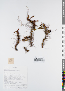
LE 01167518
Epigeneium clemensiae Gagnep. det. Averyanov, Leonid Vladimirovich at 25.12.2022
Additional identifications: Epigeneium chapaense Gagnep. det. Averyanov, Leonid Vladimirovich at 09.05.2000 Collectors: Averyanov, Leonid Vladimirovich; et al. Field collecting number: VH6153. Collection date: 09.05.2000. Administrative regions: VN - Tinh GJak Lak. Groups of specimens: L. V. Averyanov specimens; L. V. Averyanov herbarium; Orchids of Vietnam, Laos and CambodiaOriginal label text:FLORA OF VIETNAM
Coordinates (geographic position): 12° 30′ N, 108° 30′ E ±1000 mRecord creation: 2022-03-03, Galina Savich, PhotoScan D2. Processing status: work_status_1Citation: Specimen LE 01167518 // Virtual herbarium of Komarov Botanical Institute RAS — http://re.herbariumle.ru/01167518 Orchidaceae
Epigeneium chapaense
S. Vietnam, Dak Lac Prov., Krong Bong Distr., Cu Pui Municipality, elevation from Dak Tour village (12°30′N, 108°30′E) to main peak of Chu Yang Sinh mt system (12°24′N, 108°26′E) along Dak Tour river (N slope). Primary mossy cloud mixed forest (with Pinus, Fokienia, Dacrydium and Dacrycarpus) on very steep granite slopes at elev. 2000-2200 m. Epiphyte. Very common.
VH 6153 09.05.2000
International Botanical Expedition of the U.S.A. National Geographic Society (grant No 6383-98)
Collectors: L.Averyanov, N.T.Hiep, N.Q.Hieu, P.H.Hoang, D.X.Du, N.T.Vinh
Epigeneium chapaense
S. Vietnam, Dak Lac Prov., Krong Bong Distr., Cu Pui Municipality, elevation from Dak Tour village (12°30′N, 108°30′E) to main peak of Chu Yang Sinh mt system (12°24′N, 108°26′E) along Dak Tour river (N slope). Primary mossy cloud mixed forest (with Pinus, Fokienia, Dacrydium and Dacrycarpus) on very steep granite slopes at elev. 2000-2200 m. Epiphyte. Very common.
VH 6153 09.05.2000
International Botanical Expedition of the U.S.A. National Geographic Society (grant No 6383-98)
Collectors: L.Averyanov, N.T.Hiep, N.Q.Hieu, P.H.Hoang, D.X.Du, N.T.Vinh
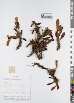
LE 01167517
Epigeneium clemensiae Gagnep. det. Averyanov, Leonid Vladimirovich at 25.12.2022
Additional identifications: Epigeneium chapaense Gagnep. det. Averyanov, Leonid Vladimirovich at 16.04.2000 Collectors: Averyanov, Leonid Vladimirovich; et al. Field collecting number: VH5240. Collection date: 16.04.2000. Administrative regions: VN - Kon Tum. Groups of specimens: L. V. Averyanov specimens; L. V. Averyanov herbarium; Orchids of Vietnam, Laos and CambodiaOriginal label text:FLORA OF VIETNAM
Coordinates (geographic position): 14° 39′ N, 108° 25′ E ±1000 mRecord creation: 2022-03-03, Galina Savich, PhotoScan D2. Processing status: work_status_1Citation: Specimen LE 01167517 // Virtual herbarium of Komarov Botanical Institute RAS — http://re.herbariumle.ru/01167517Orchidaceae
Epigeneium chapaense
S. Vietnam, Kontum Prov., Kon Plong Distr., Hieu Municipality, Mang La forest enterprise (14°39′N, 108°25′E). Primary evergreen broad-leaved wet forest with Dacrycarpus imbricatus on steep mt. slopes on sandstone & gneiss at elev. 1100-1200 m. Epiphyte on high tree. Not common.
VH 5240 16.04.2000
International Botanical Expedition of the U.S.A. National Geographic Society (grant No 6383-98)
Collectors: L.Averyanov, P.K.Loc, P.H.Hoang, D.X.Du, N.T.Vinh
Epigeneium chapaense
S. Vietnam, Kontum Prov., Kon Plong Distr., Hieu Municipality, Mang La forest enterprise (14°39′N, 108°25′E). Primary evergreen broad-leaved wet forest with Dacrycarpus imbricatus on steep mt. slopes on sandstone & gneiss at elev. 1100-1200 m. Epiphyte on high tree. Not common.
VH 5240 16.04.2000
International Botanical Expedition of the U.S.A. National Geographic Society (grant No 6383-98)
Collectors: L.Averyanov, P.K.Loc, P.H.Hoang, D.X.Du, N.T.Vinh
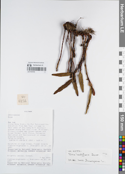
LE 01167516
Eria lactiflora Aver. det. Averyanov, Leonid Vladimirovich at 24.02.2022
Collectors: Averyanov, Leonid Vladimirovich; et al. Field collecting number: VH6257. Collection date: 07.05.2000. Administrative regions: VN - Tinh GJak Lak. Groups of specimens: L. V. Averyanov specimens; L. V. Averyanov herbarium; Orchids of Vietnam, Laos and CambodiaOriginal label text:FLORA OF VIETNAM
Coordinates (geographic position): 12° 30′ N, 108° 30′ E ±1000 mRecord creation: 2022-03-03, Galina Savich, PhotoScan D2. Processing status: work_status_1Citation: Specimen LE 01167516 // Virtual herbarium of Komarov Botanical Institute RAS — http://re.herbariumle.ru/01167516Orchidaceae
Eria lactiflora aff.
S. Vietnam, Dak Lac Prov., Krong Bong Distr., Cu Pui Municipality, elevation from Dak Tour village (12°30′N, 108°30′E) to main peak of Chu Yang Sinh mt system (12°24′N, 108°26′E) along Dak Tour river (N slope). Primary closed wet broad-leaved and mixed forest (with Pinus, Fokienia, Dacrydium and Dacrycarpus) on steep granite slopes at elev. 1450-1600 m. Epiphyte on high trees. Flower bracts brightly yellow. Common.
VH 6257 07.05.2000
International Botanical Expedition of the U.S.A. National Geographic Society (grant No 6383-98)
Collectors: L.Averyanov, N.T.Hiep, N.Q.Hieu, P.H.Hoang, D.X.Du, N.T.Vinh
Eria lactiflora aff.
S. Vietnam, Dak Lac Prov., Krong Bong Distr., Cu Pui Municipality, elevation from Dak Tour village (12°30′N, 108°30′E) to main peak of Chu Yang Sinh mt system (12°24′N, 108°26′E) along Dak Tour river (N slope). Primary closed wet broad-leaved and mixed forest (with Pinus, Fokienia, Dacrydium and Dacrycarpus) on steep granite slopes at elev. 1450-1600 m. Epiphyte on high trees. Flower bracts brightly yellow. Common.
VH 6257 07.05.2000
International Botanical Expedition of the U.S.A. National Geographic Society (grant No 6383-98)
Collectors: L.Averyanov, N.T.Hiep, N.Q.Hieu, P.H.Hoang, D.X.Du, N.T.Vinh
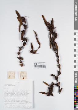
LE 01167515
Campanulorchis thao (Gagnep.) S.C.Chen & J.J.Wood det. Averyanov, Leonid Vladimirovich at 06.07.2022
Additional identifications: Eria thao Gagnep. det. Averyanov, Leonid Vladimirovich at 07.05.2000 Collectors: Averyanov, Leonid Vladimirovich; et al. Field collecting number: VH6262. Collection date: 07.05.2000. Administrative regions: VN - Tinh GJak Lak. Groups of specimens: L. V. Averyanov specimens; L. V. Averyanov herbarium; Orchids of Vietnam, Laos and CambodiaOriginal label text:FLORA OF VIETNAM
Coordinates (geographic position): 12° 30′ N, 108° 30′ E ±1000 mRecord creation: 2022-03-03, Galina Savich, PhotoScan D2. Processing status: work_status_1Citation: Specimen LE 01167515 // Virtual herbarium of Komarov Botanical Institute RAS — http://re.herbariumle.ru/01167515Orchidaceae
Eria thao
S. Vietnam, Dak Lac Prov., Krong Bong Distr., Cu Pui Municipality, elevation from Dak Tour village (12°30′N, 108°30′E) to main peak of Chu Yang Sinh mt system (12°24′N, 108°26′E) along Dak Tour river (N slope). Primary closed wet broad-leaved and mixed forest (with Pinus, Fokienia, Dacrydium and Dacrycarpus) on steep granite slopes at elev. 1550 m. Epiphyte on high trees. Very common.
VH 6262 07.05.2000
International Botanical Expedition of the U.S.A. National Geographic Society (grant No 6383-98)
Collectors: L.Averyanov, N.T.Hiep, N.Q.Hieu, P.H.Hoang, D.X.Du, N.T.Vinh
Eria thao
S. Vietnam, Dak Lac Prov., Krong Bong Distr., Cu Pui Municipality, elevation from Dak Tour village (12°30′N, 108°30′E) to main peak of Chu Yang Sinh mt system (12°24′N, 108°26′E) along Dak Tour river (N slope). Primary closed wet broad-leaved and mixed forest (with Pinus, Fokienia, Dacrydium and Dacrycarpus) on steep granite slopes at elev. 1550 m. Epiphyte on high trees. Very common.
VH 6262 07.05.2000
International Botanical Expedition of the U.S.A. National Geographic Society (grant No 6383-98)
Collectors: L.Averyanov, N.T.Hiep, N.Q.Hieu, P.H.Hoang, D.X.Du, N.T.Vinh
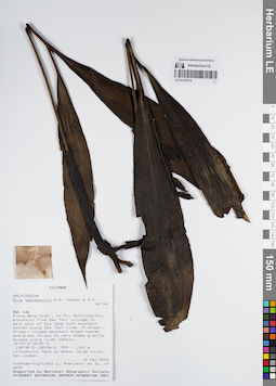
LE 01167514
Eria gagnepainii A.D.Hawkes & A.H.Heller det. Averyanov, Leonid Vladimirovich at 12.05.2000
Collectors: Averyanov, Leonid Vladimirovich; et al. Field collecting number: VH6434. Collection date: 12.05.2000. Administrative regions: VN - Tinh GJak Lak. Groups of specimens: L. V. Averyanov specimens; L. V. Averyanov herbarium; Orchids of Vietnam, Laos and CambodiaOriginal label text:FLORA OF VIETNAM
Coordinates (geographic position): 12° 30′ N, 108° 30′ E ±1000 mRecord creation: 2022-03-03, Galina Savich, PhotoScan D2. Processing status: work_status_1Citation: Specimen LE 01167514 // Virtual herbarium of Komarov Botanical Institute RAS — http://re.herbariumle.ru/01167514Orchidaceae
Eria gagnepainei
S. Vietnam, Dak Lac Prov., Krong Bong Distr., Cu Pui Municipality, elevation from Dak Tour village (12°30′N, 108°30′E) to main peak of Chu Yang Sinh mt system (12°24′N, 108°26′E) along Dak Tour river (N slope). Primary closed mountain broad-leaved evergreen forest on very steep granite slopes along river canyon at elev. 1100 m. Lithophytic herb on mossy large rocks. Not common.
VH 6434 12.05.2000
International Botanical Expedition of the U.S.A. National Geographic Society (grant No 6383-98)
Collectors: L.Averyanov, N.T.Hiep, N.Q.Hieu, P.H.Hoang, D.X.Du, N.T.Vinh
Eria gagnepainei
S. Vietnam, Dak Lac Prov., Krong Bong Distr., Cu Pui Municipality, elevation from Dak Tour village (12°30′N, 108°30′E) to main peak of Chu Yang Sinh mt system (12°24′N, 108°26′E) along Dak Tour river (N slope). Primary closed mountain broad-leaved evergreen forest on very steep granite slopes along river canyon at elev. 1100 m. Lithophytic herb on mossy large rocks. Not common.
VH 6434 12.05.2000
International Botanical Expedition of the U.S.A. National Geographic Society (grant No 6383-98)
Collectors: L.Averyanov, N.T.Hiep, N.Q.Hieu, P.H.Hoang, D.X.Du, N.T.Vinh
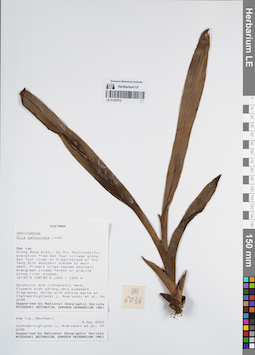
LE 01167513
Mycaranthes floribunda (D.Don) S.C.Chen & J.J.Wood det. Averyanov, Leonid Vladimirovich at 02.01.2025
Additional identifications: Eria paniculata Lindl. det. Averyanov, Leonid Vladimirovich at 05.05.2000 Collectors: Averyanov, Leonid Vladimirovich; et al. Field collecting number: VH6038. Collection date: 05.05.2000. Administrative regions: VN - Tinh GJak Lak. Groups of specimens: L. V. Averyanov specimens; L. V. Averyanov herbarium; Orchids of Vietnam, Laos and CambodiaOriginal label text:FLORA OF VIETNAM
Coordinates (geographic position): 12° 30′ N, 108° 30′ E ±1000 mRecord creation: 2022-03-03, Galina Savich, PhotoScan D2. Processing status: work_status_1Citation: Specimen LE 01167513 // Virtual herbarium of Komarov Botanical Institute RAS — http://re.herbariumle.ru/01167513Orchidaceae
Eria paniculata
S. Vietnam, Dak Lac Prov., Krong Bong Distr., Cu Pui Municipality, elevation from Dak Tour village (12°30′N, 108°30′E) along Dak Tour river on N macroslope of Chu Yang Sinh mt system to main peak (12°24′N, 108°26′E). Primary broad-leaved mountain evergreen closed forest on granites along river slopes at elev. 1000-1200 m. Epiphyte and lithophyte herb. Flowers with strong very pleasant fragrance, white with purple marks on the lip. Abundant.
VH 6038 05-06.05.2000
International Botanical Expedition of the U.S.A. National Geographic Society (grant No 6383-98)
Collectors: L.Averyanov, N.T.Hiep, N.Q.Hieu, P.H.Hoang, D.X.Du, N.T.Vinh
Eria paniculata
S. Vietnam, Dak Lac Prov., Krong Bong Distr., Cu Pui Municipality, elevation from Dak Tour village (12°30′N, 108°30′E) along Dak Tour river on N macroslope of Chu Yang Sinh mt system to main peak (12°24′N, 108°26′E). Primary broad-leaved mountain evergreen closed forest on granites along river slopes at elev. 1000-1200 m. Epiphyte and lithophyte herb. Flowers with strong very pleasant fragrance, white with purple marks on the lip. Abundant.
VH 6038 05-06.05.2000
International Botanical Expedition of the U.S.A. National Geographic Society (grant No 6383-98)
Collectors: L.Averyanov, N.T.Hiep, N.Q.Hieu, P.H.Hoang, D.X.Du, N.T.Vinh
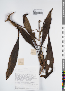
LE 01167512
Eria tomentosa (J.Koenig) Hook.f. det. Averyanov, Leonid Vladimirovich at 03.05.2000
Collectors: Averyanov, Leonid Vladimirovich; et al. Field collecting number: VH5946. Collection date: 03.05.2000. Administrative regions: VN - Tinh GJak Lak. Groups of specimens: L. V. Averyanov specimens; L. V. Averyanov herbarium; Orchids of Vietnam, Laos and CambodiaOriginal label text:FLORA OF VIETNAM
Coordinates (geographic position): 12° 30′ N, 108° 30′ E ±1000 mRecord creation: 2022-03-03, Galina Savich, PhotoScan D2. Processing status: work_status_1Citation: Specimen LE 01167512 // Virtual herbarium of Komarov Botanical Institute RAS — http://re.herbariumle.ru/01167512Orchidaceae
Eria tomentosa aff.
S. Vietnam, Dak Lac Prov., Krong Bong Distr., Cu Pui Municipality, elevation from Dak Tour village (12°30′N, 108°30′E) along Dak Tour river on N macroslope of Chu Yang Sinh mt system. Primary broad-leaved mountain evergreen forest on granites along river slopes at elev. 500-550 m. Epiphytic and lithophytic creeping vine about 1 m lg. Common.
VH 5946 03.05.2000
International Botanical Expedition of the U.S.A. National Geographic Society (grant No 6383-98)
Collectors: L.Averyanov, N.T.Hiep, N.Q.Hieu, P.H.Hoang, D.X.Du, N.T.Vinh
Eria tomentosa aff.
S. Vietnam, Dak Lac Prov., Krong Bong Distr., Cu Pui Municipality, elevation from Dak Tour village (12°30′N, 108°30′E) along Dak Tour river on N macroslope of Chu Yang Sinh mt system. Primary broad-leaved mountain evergreen forest on granites along river slopes at elev. 500-550 m. Epiphytic and lithophytic creeping vine about 1 m lg. Common.
VH 5946 03.05.2000
International Botanical Expedition of the U.S.A. National Geographic Society (grant No 6383-98)
Collectors: L.Averyanov, N.T.Hiep, N.Q.Hieu, P.H.Hoang, D.X.Du, N.T.Vinh
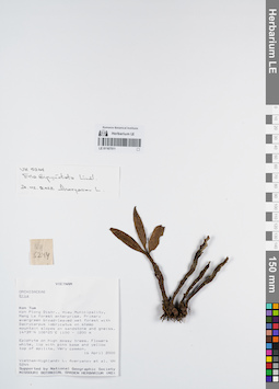
LE 01167511
Eria bipunctata Lindl. det. Averyanov, Leonid Vladimirovich at 24.02.2022
Collectors: Averyanov, Leonid Vladimirovich; et al. Field collecting number: VH5244. Collection date: 16.04.2000. Administrative regions: VN - Kon Tum. Groups of specimens: L. V. Averyanov specimens; L. V. Averyanov herbarium; Orchids of Vietnam, Laos and CambodiaOriginal label text:FLORA OF VIETNAM
Coordinates (geographic position): 14° 39′ N, 108° 25′ E ±1000 mRecord creation: 2022-03-03, Galina Savich, PhotoScan D2. Processing status: work_status_1Citation: Specimen LE 01167511 // Virtual herbarium of Komarov Botanical Institute RAS — http://re.herbariumle.ru/01167511Orchidaceae
Eria bipunctata Lindl.
Eria bipunctata Lindl.
S. Vietnam, Kontum Prov., Kon Plong Distr., Hieu Municipality, Mang La forest enterprise (14°39′N, 108°25′E). Primary evergreen broad-leaved wet forest with Dacrycarpus imbricatus on steep mt. slopes on sandstone & gneiss at elev. 1100-1200 m. Epiphyte on high mossy trees. Flowers white, lip with pink base and yellow top of epilite. Very common.
VH 5244 16.04.2000
International Botanical Expedition of the U.S.A. National Geographic Society (grant No 6383-98)
Collectors: L.Averyanov, P.K.Loc, P.H.Hoang, D.X.Du, N.T.Vinh
VH 5244 16.04.2000
International Botanical Expedition of the U.S.A. National Geographic Society (grant No 6383-98)
Collectors: L.Averyanov, P.K.Loc, P.H.Hoang, D.X.Du, N.T.Vinh
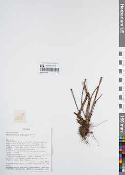
LE 01167510
Ceratostylis subulata Blume det. Averyanov, Leonid Vladimirovich at 04.05.2000
Collectors: Averyanov, Leonid Vladimirovich; et al. Field collecting number: VH6077. Collection date: 04.05.2000. Administrative regions: VN - Tinh GJak Lak. Groups of specimens: L. V. Averyanov specimens; L. V. Averyanov herbarium; Orchids of Vietnam, Laos and CambodiaOriginal label text:FLORA OF VIETNAM
Coordinates (geographic position): 12° 30′ N, 108° 30′ E ±1000 mRecord creation: 2022-03-03, Galina Savich, PhotoScan D2. Processing status: work_status_1Citation: Specimen LE 01167510 // Virtual herbarium of Komarov Botanical Institute RAS — http://re.herbariumle.ru/01167510Orchidaceae
Ceratostylis subulata Blume
S. Vietnam, Dak Lac Prov., Krong Bong Distr., Cu Pui Municipality, elevation from Dak Tour village (12°30′N, 108°30′E) to main peak of Chu Yang Sinh mt system (12°24′N, 108°26′E) along Dak Tour river (N slope). Primary wet closed mountain broad-leaved forest on granites along river slopes at elev. 500-900 m. Epiphyte on mossy trees above river in shady place. Not rare.
VH 6077 04.05.2000
International Botanical Expedition of the U.S.A. National Geographic Society (grant No 6383-98)
Collectors: L.Averyanov, N.T.Hiep, N.Q.Hieu, P.H.Hoang, D.X.Du, N.T.Vinh
Ceratostylis subulata Blume
S. Vietnam, Dak Lac Prov., Krong Bong Distr., Cu Pui Municipality, elevation from Dak Tour village (12°30′N, 108°30′E) to main peak of Chu Yang Sinh mt system (12°24′N, 108°26′E) along Dak Tour river (N slope). Primary wet closed mountain broad-leaved forest on granites along river slopes at elev. 500-900 m. Epiphyte on mossy trees above river in shady place. Not rare.
VH 6077 04.05.2000
International Botanical Expedition of the U.S.A. National Geographic Society (grant No 6383-98)
Collectors: L.Averyanov, N.T.Hiep, N.Q.Hieu, P.H.Hoang, D.X.Du, N.T.Vinh
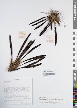
LE 01167509
Ceratostylis radiata J.J.Sm. det. Averyanov, Leonid Vladimirovich at 06.05.2000
Collectors: Averyanov, Leonid Vladimirovich; et al. Field collecting number: VH6266. Collection date: 06.05.2000. Administrative regions: VN - Tinh GJak Lak. Groups of specimens: L. V. Averyanov specimens; L. V. Averyanov herbarium; Orchids of Vietnam, Laos and CambodiaOriginal label text:FLORA OF VIETNAM
Coordinates (geographic position): 12° 30′ N, 108° 30′ E ±1000 mRecord creation: 2022-03-03, Galina Savich, PhotoScan D2. Processing status: work_status_1Citation: Specimen LE 01167509 // Virtual herbarium of Komarov Botanical Institute RAS — http://re.herbariumle.ru/01167509Orchidaceae
Ceratostylis sp.
S. Vietnam, Dak Lac Prov., Krong Bong Distr., Cu Pui Municipality, elevation from Dak Tour village (12°30′N, 108°30′E) to main peak of Chu Yang Sinh mt system (12°24′N, 108°26′E) along Dak Tour river (N slope). Primary closed wet broad-leaved forest on steep granite slopes at elev. 1200-1250 m. Epiphyte on mossy trees along river. Very common.
VH 6266 06.05.2000
International Botanical Expedition of the U.S.A. National Geographic Society (grant No 6383-98)
Collectors: L.Averyanov, N.T.Hiep, N.Q.Hieu, P.H.Hoang, D.X.Du, N.T.Vinh
Ceratostylis sp.
S. Vietnam, Dak Lac Prov., Krong Bong Distr., Cu Pui Municipality, elevation from Dak Tour village (12°30′N, 108°30′E) to main peak of Chu Yang Sinh mt system (12°24′N, 108°26′E) along Dak Tour river (N slope). Primary closed wet broad-leaved forest on steep granite slopes at elev. 1200-1250 m. Epiphyte on mossy trees along river. Very common.
VH 6266 06.05.2000
International Botanical Expedition of the U.S.A. National Geographic Society (grant No 6383-98)
Collectors: L.Averyanov, N.T.Hiep, N.Q.Hieu, P.H.Hoang, D.X.Du, N.T.Vinh
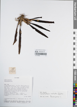
LE 01167508
Ceratostylis radiata J.J.Sm. det. Averyanov, Leonid Vladimirovich at 24.02.2022
Collectors: Averyanov, Leonid Vladimirovich; et al. Field collecting number: VH6024. Collection date: 05.05.2000. Administrative regions: VN - Tinh GJak Lak. Groups of specimens: L. V. Averyanov specimens; L. V. Averyanov herbarium; Orchids of Vietnam, Laos and CambodiaOriginal label text:FLORA OF VIETNAM
Coordinates (geographic position): 12° 30′ N, 108° 30′ E ±1000 mRecord creation: 2022-03-03, Galina Savich, PhotoScan D2. Processing status: work_status_1Citation: Specimen LE 01167508 // Virtual herbarium of Komarov Botanical Institute RAS — http://re.herbariumle.ru/01167508Orchidaceae
Ceratostylis sp.
S. Vietnam, Dak Lac Prov., Krong Bong Distr., Cu Pui Municipality, elevation from Dak Tour village (12°30′N, 108°30′E) along Dak Tour river on N macroslope of Chu Yang Sinh mt system to main peak (12°24′N, 108°26′E). Primary broad-leaved mountain evergreen closed forest on granites along river slopes at elev. 1000-1200 m. Epiphyte on high mossy trees. Very common.
VH 6024 05-06.05.2000
International Botanical Expedition of the U.S.A. National Geographic Society (grant No 6383-98)
Collectors: L.Averyanov, N.T.Hiep, N.Q.Hieu, P.H.Hoang, D.X.Du, N.T.Vinh
Ceratostylis sp.
S. Vietnam, Dak Lac Prov., Krong Bong Distr., Cu Pui Municipality, elevation from Dak Tour village (12°30′N, 108°30′E) along Dak Tour river on N macroslope of Chu Yang Sinh mt system to main peak (12°24′N, 108°26′E). Primary broad-leaved mountain evergreen closed forest on granites along river slopes at elev. 1000-1200 m. Epiphyte on high mossy trees. Very common.
VH 6024 05-06.05.2000
International Botanical Expedition of the U.S.A. National Geographic Society (grant No 6383-98)
Collectors: L.Averyanov, N.T.Hiep, N.Q.Hieu, P.H.Hoang, D.X.Du, N.T.Vinh
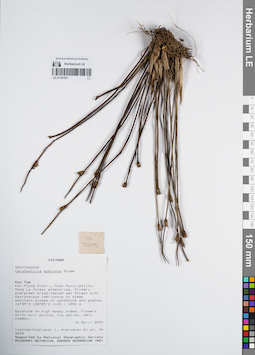
LE 01167507
Ceratostylis subulata Blume det. Averyanov, Leonid Vladimirovich at 16.04.2000
Collectors: Averyanov, Leonid Vladimirovich; et al. Field collecting number: VH5245. Collection date: 16.04.2000. Administrative regions: VN - Kon Tum. Groups of specimens: L. V. Averyanov specimens; L. V. Averyanov herbarium; Orchids of Vietnam, Laos and CambodiaOriginal label text:FLORA OF VIETNAM
Coordinates (geographic position): 14° 39′ N, 108° 25′ E ±1000 mRecord creation: 2022-03-03, Galina Savich, PhotoScan D2. Processing status: work_status_1Citation: Specimen LE 01167507 // Virtual herbarium of Komarov Botanical Institute RAS — http://re.herbariumle.ru/01167507Orchidaceae
Ceratostylis subulata
S. Vietnam, Kontum Prov., Kon Plong Distr., Hieu Municipality, Mang La forest enterprise (14°39′N, 108°25′E). Primary evergreen broad-leaved wet forest with Dacrycarpus imbricatus on steep mt. slopes on sandstone & gneiss at elev. 1100-1200 m. Epiphyte on high mossy trees. Flowers dirty dull purple, lip yellow. Very common.
VH 5245 16.04.2000
International Botanical Expedition of the U.S.A. National Geographic Society (grant No 6383-98)
Collectors: L.Averyanov, P.K.Loc, P.H.Hoang, D.X.Du, N.T.Vinh
Ceratostylis subulata
S. Vietnam, Kontum Prov., Kon Plong Distr., Hieu Municipality, Mang La forest enterprise (14°39′N, 108°25′E). Primary evergreen broad-leaved wet forest with Dacrycarpus imbricatus on steep mt. slopes on sandstone & gneiss at elev. 1100-1200 m. Epiphyte on high mossy trees. Flowers dirty dull purple, lip yellow. Very common.
VH 5245 16.04.2000
International Botanical Expedition of the U.S.A. National Geographic Society (grant No 6383-98)
Collectors: L.Averyanov, P.K.Loc, P.H.Hoang, D.X.Du, N.T.Vinh
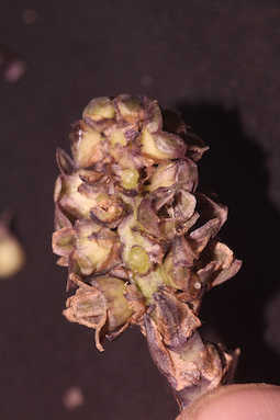
LE 01167506
Plocoglottis bokorensis (Gagnep.) Seidenf. det. Averyanov, Leonid Vladimirovich at 24.02.2022
Collectors: Averyanov, Leonid Vladimirovich; et al. Field collecting number: VH6435. Collection date: 12.05.2000. Administrative regions: VN - Tinh GJak Lak. Groups of specimens: L. V. Averyanov specimens; L. V. Averyanov herbarium; Orchids of Vietnam, Laos and CambodiaOriginal label text:FLORA OF VIETNAM
Coordinates (geographic position): 12° 30′ N, 108° 30′ E ±1000 mRecord creation: 2022-03-03, Galina Savich, PhotoScan D2. Processing status: work_status_1Citation: Specimen LE 01167506 // Virtual herbarium of Komarov Botanical Institute RAS — http://re.herbariumle.ru/01167506Orchidaceae
Plocoglottis bokorensis (Gagnepain) Seidenf.
S. Vietnam, Dak Lac Prov., Krong Bong Distr., Cu Pui Municipality, elevation from Dak Tour village (12°30′N, 108°30′E) to main peak of Chu Yang Sinh mt system (12°24′N, 108°26′E) along Dak Tour river (N slope). Primary closed mountain broad-leaved evergreen forest on very steep granite slopes along river canyon at elev. 1100 m. Terrestrial herb up to 1.5 m hg on shady rocky river slope. Rare.
VH 6435 12.05.2000
International Botanical Expedition of the U.S.A. National Geographic Society (grant No 6383-98)
Collectors: L.Averyanov, N.T.Hiep, N.Q.Hieu, P.H.Hoang, D.X.Du, N.T.Vinh
Plocoglottis bokorensis (Gagnepain) Seidenf.
S. Vietnam, Dak Lac Prov., Krong Bong Distr., Cu Pui Municipality, elevation from Dak Tour village (12°30′N, 108°30′E) to main peak of Chu Yang Sinh mt system (12°24′N, 108°26′E) along Dak Tour river (N slope). Primary closed mountain broad-leaved evergreen forest on very steep granite slopes along river canyon at elev. 1100 m. Terrestrial herb up to 1.5 m hg on shady rocky river slope. Rare.
VH 6435 12.05.2000
International Botanical Expedition of the U.S.A. National Geographic Society (grant No 6383-98)
Collectors: L.Averyanov, N.T.Hiep, N.Q.Hieu, P.H.Hoang, D.X.Du, N.T.Vinh
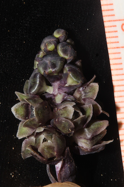
LE 01167505
Smitinandia helferi (Hook.f.) Garay det. Averyanov, Leonid Vladimirovich at 24.02.2022
Collectors: Averyanov, Leonid Vladimirovich; et al. Field collecting number: VH6371. Collection date: 11.05.2000. Administrative regions: VN - Tinh GJak Lak. Groups of specimens: L. V. Averyanov specimens; L. V. Averyanov herbarium; Orchids of Vietnam, Laos and CambodiaOriginal label text:FLORA OF VIETNAM
Coordinates (geographic position): 12° 30′ N, 108° 30′ E ±1000 mRecord creation: 2022-03-03, Galina Savich, PhotoScan D2. Processing status: work_status_1Citation: Specimen LE 01167505 // Virtual herbarium of Komarov Botanical Institute RAS — http://re.herbariumle.ru/01167505Orchidaceae
Cleisostoma sp.
S. Vietnam, Dak Lac Prov., Krong Bong Distr., Cu Pui Municipality, elevation from Dak Tour village (12°30′N, 108°30′E) to main peak of Chu Yang Sinh mt system (12°24′N, 108°26′E) along Dak Tour river (N slope). Primary wet closed mountain broad-leaved and mixed forest on granites along very steep shady slopes of river canyon at elev. 1700-1750 m. Lithophyte on shady wet cliffs of river canyon. Leaves purple-violet spotted. Rare.
VH 6371 11.05.2000
International Botanical Expedition of the U.S.A. National Geographic Society (grant No 6383-98)
Collectors: L.Averyanov, N.T.Hiep, N.Q.Hieu, P.H.Hoang, D.X.Du, N.T.Vinh
Cleisostoma sp.
S. Vietnam, Dak Lac Prov., Krong Bong Distr., Cu Pui Municipality, elevation from Dak Tour village (12°30′N, 108°30′E) to main peak of Chu Yang Sinh mt system (12°24′N, 108°26′E) along Dak Tour river (N slope). Primary wet closed mountain broad-leaved and mixed forest on granites along very steep shady slopes of river canyon at elev. 1700-1750 m. Lithophyte on shady wet cliffs of river canyon. Leaves purple-violet spotted. Rare.
VH 6371 11.05.2000
International Botanical Expedition of the U.S.A. National Geographic Society (grant No 6383-98)
Collectors: L.Averyanov, N.T.Hiep, N.Q.Hieu, P.H.Hoang, D.X.Du, N.T.Vinh
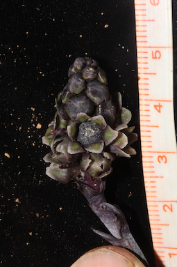
LE 01167504
Aerides odorata Lour. ⟮prelim. ID⟯ det. Averyanov, Leonid Vladimirovich at 24.02.2022
Collectors: Averyanov, Leonid Vladimirovich; et al. Field collecting number: VH5666. Collection date: 23.04.2000. Administrative regions: VN - Kon Tum. Groups of specimens: L. V. Averyanov specimens; L. V. Averyanov herbarium; Orchids of Vietnam, Laos and CambodiaOriginal label text:FLORA OF VIETNAM
Coordinates (geographic position): 14° 39′ N, 108° 25′ E ±1000 mRecord creation: 2022-03-03, Galina Savich, PhotoScan D2. Processing status: work_status_1Citation: Specimen LE 01167504 // Virtual herbarium of Komarov Botanical Institute RAS — http://re.herbariumle.ru/01167504Orchidaceae
Cleisostoma burmanica ?
S. Vietnam, Kontum Prov., Kon Plong Distr., Hieu Municipality, Mang La forest enterprise (14°39′N, 108°25′E). Primary broad-leaved closed evergreen wet mountain forest on sandstone steep slopes of forest river at elev. 1100-1200 m. Epiphyte on high tree. Rare.
VH 5666 24.04.2000
International Botanical Expedition of the U.S.A. National Geographic Society (grant No 6383-98)
Collectors: L.Averyanov, P.H.Hoang, D.X.Du, N.T.Vinh
Cleisostoma burmanica ?
S. Vietnam, Kontum Prov., Kon Plong Distr., Hieu Municipality, Mang La forest enterprise (14°39′N, 108°25′E). Primary broad-leaved closed evergreen wet mountain forest on sandstone steep slopes of forest river at elev. 1100-1200 m. Epiphyte on high tree. Rare.
VH 5666 24.04.2000
International Botanical Expedition of the U.S.A. National Geographic Society (grant No 6383-98)
Collectors: L.Averyanov, P.H.Hoang, D.X.Du, N.T.Vinh
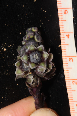
LE 01167503
Cleisostoma striatum (Rchb.f.) N.E.Br. det. Averyanov, Leonid Vladimirovich at 23.04.2000
Collectors: Averyanov, Leonid Vladimirovich; et al. Field collecting number: VH5694. Collection date: 23.04.2000. Administrative regions: VN - Kon Tum. Groups of specimens: L. V. Averyanov specimens; L. V. Averyanov herbarium; Orchids of Vietnam, Laos and CambodiaOriginal label text:FLORA OF VIETNAM
Coordinates (geographic position): 14° 39′ N, 108° 25′ E ±1000 mRecord creation: 2022-03-03, Galina Savich, PhotoScan D2. Processing status: work_status_1Citation: Specimen LE 01167503 // Virtual herbarium of Komarov Botanical Institute RAS — http://re.herbariumle.ru/01167503Orchidaceae
Cleisostoma striatum
S. Vietnam, Kontum Prov., Kon Plong Distr., Hieu Municipality, Mang La forest enterprise (14°39′N, 108°25′E). Primary broad-leaved closed evergreen wet mountain forest on sandstone steep slopes of forest river at elev. 1100-1200 m. Epiphyte on high tree. Rare.
VH 5694 24.04.2000
International Botanical Expedition of the U.S.A. National Geographic Society (grant No 6383-98)
Collectors: L.Averyanov, P.H.Hoang, D.X.Du, N.T.Vinh
Cleisostoma striatum
S. Vietnam, Kontum Prov., Kon Plong Distr., Hieu Municipality, Mang La forest enterprise (14°39′N, 108°25′E). Primary broad-leaved closed evergreen wet mountain forest on sandstone steep slopes of forest river at elev. 1100-1200 m. Epiphyte on high tree. Rare.
VH 5694 24.04.2000
International Botanical Expedition of the U.S.A. National Geographic Society (grant No 6383-98)
Collectors: L.Averyanov, P.H.Hoang, D.X.Du, N.T.Vinh
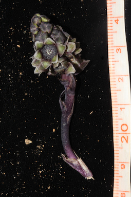
LE 01167502
Coelogyne rigida C.S.P.Parish & Rchb.f. det. Averyanov, Leonid Vladimirovich at 28.04.2000
Collectors: Averyanov, Leonid Vladimirovich; et al. Field collecting number: VH5815. Collection date: 28.04.2000. Administrative regions: VN - Kon Tum. Groups of specimens: L. V. Averyanov specimens; L. V. Averyanov herbarium; Orchids of Vietnam, Laos and CambodiaOriginal label text:FLORA OF VIETNAM
S. Vietnam, Kontum Prov., Sa Thay Distr., Sa Son Municipality, Chu Mom Ray nature reserve (14°25′N, 107°44′E). Secondary open broad-leaved evergreen dry forest on granites at elev. 500-600 m. Epiphyte on high tree. Not common.
VH 5815 28 04.2000
International Botanical Expedition of the U.S.A. National Geographic Society (grant No 6383-98)
Collectors: L.Averyanov, P.K.Loc, P.H.Hoang, D.X.Du, N.T.Vinh
Coordinates (geographic position): 14° 25′ N, 107° 44′ E ±1000 mRecord creation: 2022-03-03, Galina Savich, PhotoScan D2. Processing status: work_status_1Citation: Specimen LE 01167502 // Virtual herbarium of Komarov Botanical Institute RAS — http://re.herbariumle.ru/01167502Orchidaceae
Coelogyne rigida aff.
Coelogyne rigida aff.
S. Vietnam, Kontum Prov., Sa Thay Distr., Sa Son Municipality, Chu Mom Ray nature reserve (14°25′N, 107°44′E). Secondary open broad-leaved evergreen dry forest on granites at elev. 500-600 m. Epiphyte on high tree. Not common.
VH 5815 28 04.2000
International Botanical Expedition of the U.S.A. National Geographic Society (grant No 6383-98)
Collectors: L.Averyanov, P.K.Loc, P.H.Hoang, D.X.Du, N.T.Vinh
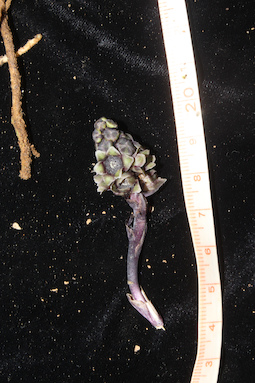
LE 01167501
Cymbidium lancifolium Hook. det. Averyanov, Leonid Vladimirovich at 09.05.2000
Collectors: Averyanov, Leonid Vladimirovich; et al. Field collecting number: VH6184. Collection date: 09.05.2000. Administrative regions: VN - Tinh GJak Lak. Groups of specimens: L. V. Averyanov specimens; L. V. Averyanov herbarium; Orchids of Vietnam, Laos and CambodiaOriginal label text:FLORA OF VIETNAM
Coordinates (geographic position): 12° 30′ N, 108° 30′ E ±1000 mRecord creation: 2022-03-03, Galina Savich, PhotoScan D2. Processing status: work_status_1Citation: Specimen LE 01167501 // Virtual herbarium of Komarov Botanical Institute RAS — http://re.herbariumle.ru/01167501Orchidaceae
Cymbidium lancifolium
S. Vietnam, Dak Lac Prov., Krong Bong Distr., Cu Pui Municipality, elevation from Dak Tour village (12°30′N, 108°30′E) to main peak of Chu Yang Sinh mt system (12°24′N, 108°26′E) along Dak Tour river (N slope). Primary wet closed mixed forest (with Pinus, Fokienia, Dacrydium and Dacrycarpus) along ridge at elev. 1600-1700 m. Terrestrial herb on shady steep slope. Not rare.
VH 6184 09.05.2000
International Botanical Expedition of the U.S.A. National Geographic Society (grant No 6383-98)
Collectors: L.Averyanov, N.T.Hiep, N.Q.Hieu, P.H.Hoang, D.X.Du, N.T.Vinh
Cymbidium lancifolium
S. Vietnam, Dak Lac Prov., Krong Bong Distr., Cu Pui Municipality, elevation from Dak Tour village (12°30′N, 108°30′E) to main peak of Chu Yang Sinh mt system (12°24′N, 108°26′E) along Dak Tour river (N slope). Primary wet closed mixed forest (with Pinus, Fokienia, Dacrydium and Dacrycarpus) along ridge at elev. 1600-1700 m. Terrestrial herb on shady steep slope. Not rare.
VH 6184 09.05.2000
International Botanical Expedition of the U.S.A. National Geographic Society (grant No 6383-98)
Collectors: L.Averyanov, N.T.Hiep, N.Q.Hieu, P.H.Hoang, D.X.Du, N.T.Vinh
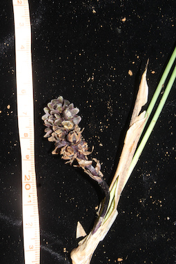
LE 01167500
Cymbidium aloifolium (L.) Sw. det. Averyanov, Leonid Vladimirovich at 03.05.2000
Collectors: Averyanov, Leonid Vladimirovich; et al. Field collecting number: VH5966. Collection date: 03.05.2000. Administrative regions: VN - Tinh GJak Lak. Groups of specimens: L. V. Averyanov specimens; L. V. Averyanov herbarium; Orchids of Vietnam, Laos and CambodiaOriginal label text:FLORA OF VIETNAM
Coordinates (geographic position): 12° 30′ N, 108° 30′ E ±1000 mRecord creation: 2022-03-03, Galina Savich, PhotoScan D2. Processing status: work_status_1Citation: Specimen LE 01167500 // Virtual herbarium of Komarov Botanical Institute RAS — http://re.herbariumle.ru/01167500Orchidaceae
Cymbidium aloifolium
S. Vietnam, Dak Lac Prov., Krong Bong Distr., Cu Pui Municipality, elevation from Dak Tour village (12°30′N, 108°30′E) along Dak Tour river on N macroslope of Chu Yang Sinh mt system. Primary broad-leaved mountain evergreen forest on granites along river slopes at elev. 500-550 m. Lithophyte and epiphyte along river. Very common.
VH 5966 03.05.2000
International Botanical Expedition of the U.S.A. National Geographic Society (grant No 6383-98)
Collectors: L.Averyanov, N.T.Hiep, N.Q.Hieu, P.H.Hoang, D.X.Du, N.T.Vinh
Cymbidium aloifolium
S. Vietnam, Dak Lac Prov., Krong Bong Distr., Cu Pui Municipality, elevation from Dak Tour village (12°30′N, 108°30′E) along Dak Tour river on N macroslope of Chu Yang Sinh mt system. Primary broad-leaved mountain evergreen forest on granites along river slopes at elev. 500-550 m. Lithophyte and epiphyte along river. Very common.
VH 5966 03.05.2000
International Botanical Expedition of the U.S.A. National Geographic Society (grant No 6383-98)
Collectors: L.Averyanov, N.T.Hiep, N.Q.Hieu, P.H.Hoang, D.X.Du, N.T.Vinh
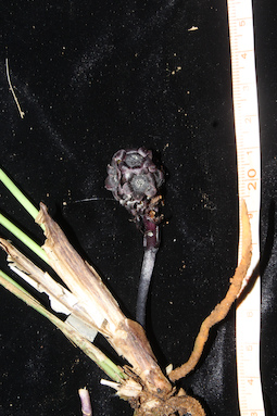
LE 01167499
Dendrobium devonianum Paxton det. Averyanov, Leonid Vladimirovich at 24.02.2022
Collectors: Averyanov, Leonid Vladimirovich; et al. Field collecting number: VH6003. Collection date: 03.05.2000. Administrative regions: VN - Tinh GJak Lak. Groups of specimens: L. V. Averyanov specimens; L. V. Averyanov herbarium; Orchids of Vietnam, Laos and CambodiaOriginal label text:FLORA OF VIETNAM
Coordinates (geographic position): 12° 30′ N, 108° 30′ E ±1000 mRecord creation: 2022-03-03, Galina Savich, PhotoScan D2. Processing status: work_status_1Citation: Specimen LE 01167499 // Virtual herbarium of Komarov Botanical Institute RAS — http://re.herbariumle.ru/01167499Orchidaceae
Dendrobium gratiosissimum ?
S. Vietnam, Dak Lac Prov., Krong Bong Distr., Cu Pui Municipality, elevation from Dak Tour village (12°30′N, 108°30′E) along Dak Tour river on N macroslope of Chu Yang Sinh mt system. Primary broad-leaved mountain evergreen forest on granites along river slopes at elev. 500-550 m. Epiphyte along river. Not common.
VH 6003 03.05.2000
International Botanical Expedition of the U.S.A. National Geographic Society (grant No 6383-98)
Collectors: L.Averyanov, N.T.Hiep, N.Q.Hieu, P.H.Hoang, D.X.Du, N.T.Vinh
Dendrobium gratiosissimum ?
S. Vietnam, Dak Lac Prov., Krong Bong Distr., Cu Pui Municipality, elevation from Dak Tour village (12°30′N, 108°30′E) along Dak Tour river on N macroslope of Chu Yang Sinh mt system. Primary broad-leaved mountain evergreen forest on granites along river slopes at elev. 500-550 m. Epiphyte along river. Not common.
VH 6003 03.05.2000
International Botanical Expedition of the U.S.A. National Geographic Society (grant No 6383-98)
Collectors: L.Averyanov, N.T.Hiep, N.Q.Hieu, P.H.Hoang, D.X.Du, N.T.Vinh
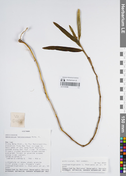
LE 01167498
Dendrobium hercoglossum Rchb.f. det. Averyanov, Leonid Vladimirovich at 12.05.2000
Collectors: Averyanov, Leonid Vladimirovich; et al. Field collecting number: VH6465. Collection date: 12.05.2000. Administrative regions: VN - Tinh GJak Lak. Groups of specimens: L. V. Averyanov specimens; L. V. Averyanov herbarium; Orchids of Vietnam, Laos and CambodiaOriginal label text:FLORA OF VIETNAM
Coordinates (geographic position): 12° 30′ N, 108° 30′ E ±1000 mRecord creation: 2022-03-03, Galina Savich, PhotoScan D2. Processing status: work_status_1Citation: Specimen LE 01167498 // Virtual herbarium of Komarov Botanical Institute RAS — http://re.herbariumle.ru/01167498Orchidaceae
Dendrobium hercoglossum Rchb.f.
S. Vietnam, Dak Lac Prov., Krong Bong Distr., Cu Pui Municipality, elevation from Dak Tour village (12°30′N, 108°30′E) to main peak of Chu Yang Sinh mt system (12°24′N, 108°26′E) along Dak Tour river (N slope). Primary closed mountain broad-leaved evergreen forest on granite slopes along river canyon at elev. 800 m. Lithophyte on mossy shady granite cliff along river. Flowers light pink-violet. Not common.
VH 6465 12.05.2000
International Botanical Expedition of the U.S.A. National Geographic Society (grant No 6383-98)
Collectors: L.Averyanov, N.T.Hiep, N.Q.Hieu, P.H.Hoang, D.X.Du, N.T.Vinh
Dendrobium hercoglossum Rchb.f.
S. Vietnam, Dak Lac Prov., Krong Bong Distr., Cu Pui Municipality, elevation from Dak Tour village (12°30′N, 108°30′E) to main peak of Chu Yang Sinh mt system (12°24′N, 108°26′E) along Dak Tour river (N slope). Primary closed mountain broad-leaved evergreen forest on granite slopes along river canyon at elev. 800 m. Lithophyte on mossy shady granite cliff along river. Flowers light pink-violet. Not common.
VH 6465 12.05.2000
International Botanical Expedition of the U.S.A. National Geographic Society (grant No 6383-98)
Collectors: L.Averyanov, N.T.Hiep, N.Q.Hieu, P.H.Hoang, D.X.Du, N.T.Vinh
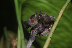
LE 01167497
Dendrobium spatella Rchb.f. det. Averyanov, Leonid Vladimirovich at 03.05.2000
Collectors: Averyanov, Leonid Vladimirovich; et al. Field collecting number: VH5972. Collection date: 03.05.2000. Administrative regions: VN - Tinh GJak Lak. Groups of specimens: L. V. Averyanov specimens; L. V. Averyanov herbarium; Orchids of Vietnam, Laos and CambodiaOriginal label text:FLORA OF VIETNAM
Coordinates (geographic position): 12° 30′ N, 108° 30′ E ±1000 mRecord creation: 2022-03-03, Galina Savich, PhotoScan D2. Processing status: work_status_1Citation: Specimen LE 01167497 // Virtual herbarium of Komarov Botanical Institute RAS — http://re.herbariumle.ru/01167497Orchidaceae
Dendrobium acinaciforme
S. Vietnam, Dak Lac Prov., Krong Bong Distr., Cu Pui Municipality, elevation from Dak Tour village (12°30′N, 108°30′E) along Dak Tour river on N macroslope of Chu Yang Sinh mt system. Primary broad-leaved mountain evergreen forest on granites along river slopes at elev. 500-550 m. Epiphyte in open places along river. Common.
VH 5972 03.05.2000
International Botanical Expedition of the U.S.A. National Geographic Society (grant No 6383-98)
Collectors: L.Averyanov, N.T.Hiep, N.Q.Hieu, P.H.Hoang, D.X.Du, N.T.Vinh
Dendrobium acinaciforme
S. Vietnam, Dak Lac Prov., Krong Bong Distr., Cu Pui Municipality, elevation from Dak Tour village (12°30′N, 108°30′E) along Dak Tour river on N macroslope of Chu Yang Sinh mt system. Primary broad-leaved mountain evergreen forest on granites along river slopes at elev. 500-550 m. Epiphyte in open places along river. Common.
VH 5972 03.05.2000
International Botanical Expedition of the U.S.A. National Geographic Society (grant No 6383-98)
Collectors: L.Averyanov, N.T.Hiep, N.Q.Hieu, P.H.Hoang, D.X.Du, N.T.Vinh
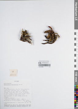
LE 01167496
Dendrobium bellatulum Rolfe det. Averyanov, Leonid Vladimirovich at 09.05.2000
Collectors: Averyanov, Leonid Vladimirovich; et al. Field collecting number: VH6155. Collection date: 09.05.2000. Administrative regions: VN - Tinh GJak Lak. Groups of specimens: L. V. Averyanov specimens; L. V. Averyanov herbarium; Orchids of Vietnam, Laos and CambodiaOriginal label text:FLORA OF VIETNAM
Coordinates (geographic position): 12° 30′ N, 108° 30′ E ±1000 mRecord creation: 2022-03-03, Galina Savich, PhotoScan D2. Processing status: work_status_1Citation: Specimen LE 01167496 // Virtual herbarium of Komarov Botanical Institute RAS — http://re.herbariumle.ru/01167496Orchidaceae
Dendrobium bellatulum
S. Vietnam, Dak Lac Prov., Krong Bong Distr., Cu Pui Municipality, elevation from Dak Tour village (12°30′N, 108°30′E) to main peak of Chu Yang Sinh mt system (12°24′N, 108°26′E) along Dak Tour river (N slope). Primary mossy cloud mixed forest (with Pinus, Fokienia, Dacrydium and Dacrycarpus) on very steep granite slopes at elev. 2000 m. Epiphyte on Pinus krempfii. Not rare.
VH 6155 09.05.2000
International Botanical Expedition of the U.S.A. National Geographic Society (grant No 6383-98)
Collectors: L.Averyanov, N.T.Hiep, N.Q.Hieu, P.H.Hoang, D.X.Du, N.T.Vinh
Dendrobium bellatulum
S. Vietnam, Dak Lac Prov., Krong Bong Distr., Cu Pui Municipality, elevation from Dak Tour village (12°30′N, 108°30′E) to main peak of Chu Yang Sinh mt system (12°24′N, 108°26′E) along Dak Tour river (N slope). Primary mossy cloud mixed forest (with Pinus, Fokienia, Dacrydium and Dacrycarpus) on very steep granite slopes at elev. 2000 m. Epiphyte on Pinus krempfii. Not rare.
VH 6155 09.05.2000
International Botanical Expedition of the U.S.A. National Geographic Society (grant No 6383-98)
Collectors: L.Averyanov, N.T.Hiep, N.Q.Hieu, P.H.Hoang, D.X.Du, N.T.Vinh
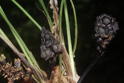
LE 01167495
Dendrobium crumenatum Sw. det. Averyanov, Leonid Vladimirovich at 03.05.2000
Collectors: Averyanov, Leonid Vladimirovich; et al. Field collecting number: VH5947. Collection date: 03.05.2000. Administrative regions: VN - Tinh GJak Lak. Groups of specimens: L. V. Averyanov specimens; L. V. Averyanov herbarium; Orchids of Vietnam, Laos and CambodiaOriginal label text:FLORA OF VIETNAM
Coordinates (geographic position): 12° 30′ N, 108° 30′ E ±1000 mRecord creation: 2022-03-03, Galina Savich, PhotoScan D2. Processing status: work_status_1Citation: Specimen LE 01167495 // Virtual herbarium of Komarov Botanical Institute RAS — http://re.herbariumle.ru/01167495Orchidaceae
Dendrobium crumenatum Sw.
S. Vietnam, Dak Lac Prov., Krong Bong Distr., Cu Pui Municipality, elevation from Dak Tour village (12°30′N, 108°30′E) along Dak Tour river on N macroslope of Chu Yang Sinh mt system. Primary broad-leaved mountain evergreen forest on granites along river slopes at elev. 500-550 m. Epiphytic and lithophytic shrublet. Very common.
VH 5947 03.05.2000
International Botanical Expedition of the U.S.A. National Geographic Society (grant No 6383-98)
Collectors: L.Averyanov, N.T.Hiep, N.Q.Hieu, P.H.Hoang, D.X.Du, N.T.Vinh
Dendrobium crumenatum Sw.
S. Vietnam, Dak Lac Prov., Krong Bong Distr., Cu Pui Municipality, elevation from Dak Tour village (12°30′N, 108°30′E) along Dak Tour river on N macroslope of Chu Yang Sinh mt system. Primary broad-leaved mountain evergreen forest on granites along river slopes at elev. 500-550 m. Epiphytic and lithophytic shrublet. Very common.
VH 5947 03.05.2000
International Botanical Expedition of the U.S.A. National Geographic Society (grant No 6383-98)
Collectors: L.Averyanov, N.T.Hiep, N.Q.Hieu, P.H.Hoang, D.X.Du, N.T.Vinh
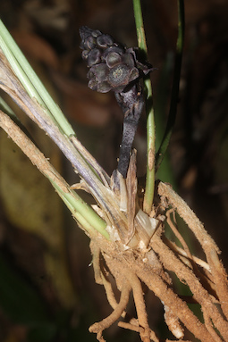
LE 01167494
Dendrobium crumenatum Sw. det. Averyanov, Leonid Vladimirovich at 03.05.2000
Collectors: Averyanov, Leonid Vladimirovich; et al. Field collecting number: VH5947. Collection date: 03.05.2000. Administrative regions: VN - Tinh GJak Lak. Groups of specimens: L. V. Averyanov specimens; L. V. Averyanov herbarium; Orchids of Vietnam, Laos and CambodiaOriginal label text:FLORA OF VIETNAM
Coordinates (geographic position): 12° 30′ N, 108° 30′ E ±1000 mRecord creation: 2022-03-03, Galina Savich, PhotoScan D2. Processing status: work_status_1Citation: Specimen LE 01167494 // Virtual herbarium of Komarov Botanical Institute RAS — http://re.herbariumle.ru/01167494Orchidaceae
Dendrobium crumenatum Sw.
S. Vietnam, Dak Lac Prov., Krong Bong Distr., Cu Pui Municipality, elevation from Dak Tour village (12°30′N, 108°30′E) along Dak Tour river on N macroslope of Chu Yang Sinh mt system. Primary broad-leaved mountain evergreen forest on granites along river slopes at elev. 500-550 m. Epiphytic and lithophytic shrublet. Very common.
VH 5947 03.05.2000
International Botanical Expedition of the U.S.A. National Geographic Society (grant No 6383-98)
Collectors: L.Averyanov, N.T.Hiep, N.Q.Hieu, P.H.Hoang, D.X.Du, N.T.Vinh
Dendrobium crumenatum Sw.
S. Vietnam, Dak Lac Prov., Krong Bong Distr., Cu Pui Municipality, elevation from Dak Tour village (12°30′N, 108°30′E) along Dak Tour river on N macroslope of Chu Yang Sinh mt system. Primary broad-leaved mountain evergreen forest on granites along river slopes at elev. 500-550 m. Epiphytic and lithophytic shrublet. Very common.
VH 5947 03.05.2000
International Botanical Expedition of the U.S.A. National Geographic Society (grant No 6383-98)
Collectors: L.Averyanov, N.T.Hiep, N.Q.Hieu, P.H.Hoang, D.X.Du, N.T.Vinh
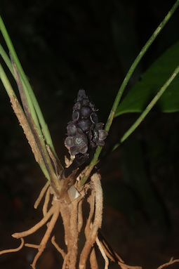
LE 01167493
Dendrobium salaccense (Blume) Lindl. det. Averyanov, Leonid Vladimirovich at 03.05.2000
Collectors: Averyanov, Leonid Vladimirovich; et al. Field collecting number: VH5948. Collection date: 03.05.2000. Administrative regions: VN - Tinh GJak Lak. Groups of specimens: L. V. Averyanov specimens; L. V. Averyanov herbarium; Orchids of Vietnam, Laos and CambodiaOriginal label text:FLORA OF VIETNAM
Coordinates (geographic position): 12° 30′ N, 108° 30′ E ±1000 mRecord creation: 2022-03-03, Galina Savich, PhotoScan D2. Processing status: work_status_1Citation: Specimen LE 01167493 // Virtual herbarium of Komarov Botanical Institute RAS — http://re.herbariumle.ru/01167493Orchidaceae
Dendrobium salaccense (Blume) Lindl.
S. Vietnam, Dak Lac Prov., Krong Bong Distr., Cu Pui Municipality, elevation from Dak Tour village (12°30′N, 108°30′E) along Dak Tour river on N macroslope of Chu Yang Sinh mt system. Primary broad-leaved mountain evergreen forest on granites along river slopes at elev. 500-550 m. Epiphytic and lithophytic shrublet. Flowers yellowish. Not common.
VH 5948 03.05.2000
International Botanical Expedition of the U.S.A. National Geographic Society (grant No 6383-98)
Collectors: L.Averyanov, N.T.Hiep, N.Q.Hieu, P.H.Hoang, D.X.Du, N.T.Vinh
Dendrobium salaccense (Blume) Lindl.
S. Vietnam, Dak Lac Prov., Krong Bong Distr., Cu Pui Municipality, elevation from Dak Tour village (12°30′N, 108°30′E) along Dak Tour river on N macroslope of Chu Yang Sinh mt system. Primary broad-leaved mountain evergreen forest on granites along river slopes at elev. 500-550 m. Epiphytic and lithophytic shrublet. Flowers yellowish. Not common.
VH 5948 03.05.2000
International Botanical Expedition of the U.S.A. National Geographic Society (grant No 6383-98)
Collectors: L.Averyanov, N.T.Hiep, N.Q.Hieu, P.H.Hoang, D.X.Du, N.T.Vinh
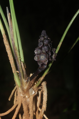
LE 01167492
Dendrobium palpebrae Lindl. det. Averyanov, Leonid Vladimirovich at 28.02.2022
Collectors: Averyanov, Leonid Vladimirovich; et al. Field collecting number: VH5810. Collection date: 28.04.2000. Administrative regions: VN - Kon Tum. Groups of specimens: L. V. Averyanov specimens; L. V. Averyanov herbarium; Orchids of Vietnam, Laos and CambodiaOriginal label text:FLORA OF VIETNAM
Coordinates (geographic position): 14° 25′ N, 107° 44′ E ±1000 mRecord creation: 2022-03-03, Galina Savich, PhotoScan D2. Processing status: work_status_1Citation: Specimen LE 01167492 // Virtual herbarium of Komarov Botanical Institute RAS — http://re.herbariumle.ru/01167492Orchidaceae
Dendrobium farmeri ?
S. Vietnam, Kontum Prov., Sa Thay Distr., Sa Son Municipality, Chu Mom Ray nature reserve (14°25′N, 107°44′E). Secondary open broad-leaved evergreen dry forest on granites at elev. 500-600 m. Epiphyte on high tree. Common.
VH 5810 28 04.2000
International Botanical Expedition of the U.S.A. National Geographic Society (grant No 6383-98)
Collectors: L.Averyanov, P.K.Loc, P.H.Hoang, D.X.Du, N.T.Vinh
Dendrobium farmeri ?
S. Vietnam, Kontum Prov., Sa Thay Distr., Sa Son Municipality, Chu Mom Ray nature reserve (14°25′N, 107°44′E). Secondary open broad-leaved evergreen dry forest on granites at elev. 500-600 m. Epiphyte on high tree. Common.
VH 5810 28 04.2000
International Botanical Expedition of the U.S.A. National Geographic Society (grant No 6383-98)
Collectors: L.Averyanov, P.K.Loc, P.H.Hoang, D.X.Du, N.T.Vinh
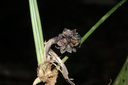
LE 01167491
Dendrobium salaccense (Blume) Lindl. det. Averyanov, Leonid Vladimirovich at 28.04.2000
Collectors: Averyanov, Leonid Vladimirovich; et al. Field collecting number: VH5811. Collection date: 28.04.2000. Administrative regions: VN - Kon Tum. Groups of specimens: L. V. Averyanov specimens; L. V. Averyanov herbarium; Orchids of Vietnam, Laos and CambodiaOriginal label text:FLORA OF VIETNAM
Coordinates (geographic position): 14° 25′ N, 107° 44′ E ±1000 mRecord creation: 2022-03-03, Galina Savich, PhotoScan D2. Processing status: work_status_1Citation: Specimen LE 01167491 // Virtual herbarium of Komarov Botanical Institute RAS — http://re.herbariumle.ru/01167491Orchidaceae
Dendrobium salaccense ?
S. Vietnam, Kontum Prov., Sa Thay Distr., Sa Son Municipality, Chu Mom Ray nature reserve (14°25′N, 107°44′E). Secondary open broad-leaved evergreen dry forest on granites at elev. 500-600 m. Epiphyte on high tree. Common.
VH 5811 28 04.2000
International Botanical Expedition of the U.S.A. National Geographic Society (grant No 6383-98)
Collectors: L.Averyanov, P.K.Loc, P.H.Hoang, D.X.Du, N.T.Vinh
Dendrobium salaccense ?
S. Vietnam, Kontum Prov., Sa Thay Distr., Sa Son Municipality, Chu Mom Ray nature reserve (14°25′N, 107°44′E). Secondary open broad-leaved evergreen dry forest on granites at elev. 500-600 m. Epiphyte on high tree. Common.
VH 5811 28 04.2000
International Botanical Expedition of the U.S.A. National Geographic Society (grant No 6383-98)
Collectors: L.Averyanov, P.K.Loc, P.H.Hoang, D.X.Du, N.T.Vinh
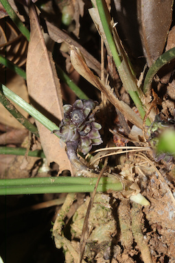
LE 01167490
Dendrobium kontumense Gagnep. det. Averyanov, Leonid Vladimirovich at 28.02.2022
Collectors: Averyanov, Leonid Vladimirovich; et al. Field collecting number: VH6292. Collection date: 06.05.2000. Administrative regions: VN - Tinh GJak Lak. Groups of specimens: L. V. Averyanov specimens; L. V. Averyanov herbarium; Orchids of Vietnam, Laos and CambodiaOriginal label text:FLORA OF VIETNAM
Coordinates (geographic position): 12° 30′ N, 108° 30′ E ±1000 mRecord creation: 2022-03-03, Galina Savich, PhotoScan D2. Processing status: work_status_1Citation: Specimen LE 01167490 // Virtual herbarium of Komarov Botanical Institute RAS — http://re.herbariumle.ru/01167490Orchidaceae
Dendrobium virgineum ?
S. Vietnam, Dak Lac Prov., Krong Bong Distr., Cu Pui Municipality, elevation from Dak Tour village (12°30′N, 108°30′E) to main peak of Chu Yang Sinh mt system (12°24′N, 108°26′E) along Dak Tour river (N slope). Primary closed wet broad-leaved forest on steep granite slopes at elev. 1300 m. Epiphyte on high trees. Not common.
VH 6292 07.05.2000
International Botanical Expedition of the U.S.A. National Geographic Society (grant No 6383-98)
Collectors: L.Averyanov, N.T.Hiep, N.Q.Hieu, P.H.Hoang, D.X.Du, N.T.Vinh
Dendrobium virgineum ?
S. Vietnam, Dak Lac Prov., Krong Bong Distr., Cu Pui Municipality, elevation from Dak Tour village (12°30′N, 108°30′E) to main peak of Chu Yang Sinh mt system (12°24′N, 108°26′E) along Dak Tour river (N slope). Primary closed wet broad-leaved forest on steep granite slopes at elev. 1300 m. Epiphyte on high trees. Not common.
VH 6292 07.05.2000
International Botanical Expedition of the U.S.A. National Geographic Society (grant No 6383-98)
Collectors: L.Averyanov, N.T.Hiep, N.Q.Hieu, P.H.Hoang, D.X.Du, N.T.Vinh
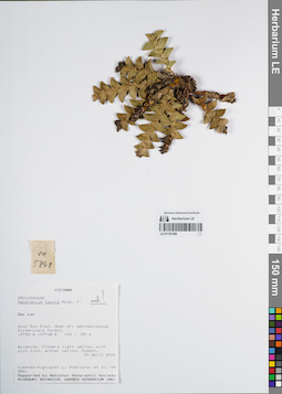
LE 01167489
Dendrobium leonis (Lindl.) Rchb.f. det. Averyanov, Leonid Vladimirovich at 30.04.2000
Collectors: Averyanov, Leonid Vladimirovich; et al. Field collecting number: VH5841. Collection date: 30.04.2000. Administrative regions: VN - Tinh GJak Lak. Groups of specimens: L. V. Averyanov specimens; L. V. Averyanov herbarium; Orchids of Vietnam, Laos and CambodiaOriginal label text:FLORA OF VIETNAM
Coordinates (geographic position): 12° 53′ N, 107° 48′ E ±1000 mRecord creation: 2022-03-03, Galina Savich, PhotoScan D2. Processing status: work_status_1Citation: Specimen LE 01167489 // Virtual herbarium of Komarov Botanical Institute RAS — http://re.herbariumle.ru/01167489Orchidaceae
Dendrobium leonis (Lindl.) Rchb.f.
S. Vietnam, Dak Lac Prov., Buon Don Distr. (approximately 12°53′N, 107°48′E). Open dry semideciduous Dipterocarp forest at elev. 100-150 m. Epiphyte. Flowers light yellow, with pink tint, anther yellow. Common.
VH 5841 30.04.2000
International Botanical Expedition of the U.S.A. National Geographic Society (grant No 6383-98)
Collectors: L.Averyanov, N.T.Hiep, N.Q.Hieu, P.H.Hoang, D.X.Du, N.T.Vinh
Dendrobium leonis (Lindl.) Rchb.f.
S. Vietnam, Dak Lac Prov., Buon Don Distr. (approximately 12°53′N, 107°48′E). Open dry semideciduous Dipterocarp forest at elev. 100-150 m. Epiphyte. Flowers light yellow, with pink tint, anther yellow. Common.
VH 5841 30.04.2000
International Botanical Expedition of the U.S.A. National Geographic Society (grant No 6383-98)
Collectors: L.Averyanov, N.T.Hiep, N.Q.Hieu, P.H.Hoang, D.X.Du, N.T.Vinh
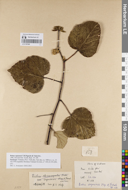
LE 01167420
Paratype of Rubus sapaensis T.H.Nguyên & Yakovlev det. Tien Hiep Nguyen, Yakovlev, Gennady Pavlovich at 14.08.1980
Collectors: Yakovlev, Gennady Pavlovich; et al. Field collecting number: LX-VN 158. Collection date: 06.1976. Administrative regions: VN - Tinh Vinh Phuc. Groups of specimens: L. V. Averyanov specimens; L. V. Averyanov herbarium; Соглашение Минобрнауки №075-15-2021-1056Original label text:FLORA OF VIETNAM
Rosaceae
Rubus sapaensis T.H.Nguyên & Yakovlev,
1982, Novosti Sist. Vyssh. Rast. 19: 109.
Paratype: Vietnam, Prov. Vinh phu, Tam dao, ca. 1000 m s. m., 25 VII 1976 expeditio floristica Vietnam-Sovietic, no 158 LX-VN (HN, LE).
Det.: L. Averyanov 28 02 2022
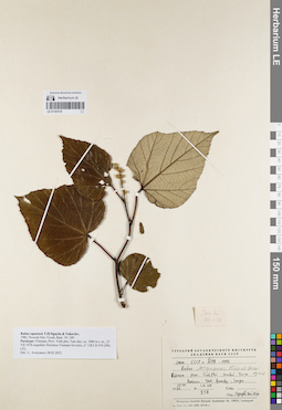
LE 01167419
Paratype of Rubus sapaensis T.H.Nguyên & Yakovlev det. Tien Hiep Nguyen, Yakovlev, Gennady Pavlovich at 1982
Collectors: Yakovlev, Gennady Pavlovich; et al. Field collecting number: LX-VN 158. Collection date: 25.07.1976. Administrative regions: VN - Tinh Vinh Phuc. Groups of specimens: L. V. Averyanov specimens; L. V. Averyanov herbarium; Соглашение Минобрнауки №075-15-2021-1056Original label text:FLORA OF VIETNAM
Rosaceae
Rubus sapaensis T.H.Nguyên & Yakovlev,
1982, Novosti Sist. Vyssh. Rast. 19: 109.
Paratype: Vietnam, Prov. Vinh phu, Tam dao, ca. 1000 m s. m., 25 VII 1976 expeditio floristica Vietnam-Sovietic, no 158 LX-VN (HN, LE).
Det.: L. Averyanov 28 02 2022
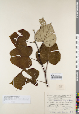
LE 01167418
Paratype of Rubus sapaensis T.H.Nguyên & Yakovlev det. Tien Hiep Nguyen, Yakovlev, Gennady Pavlovich at 1982
Collectors: Yakovlev, Gennady Pavlovich; et al. Field collecting number: LX-VN 158. Collection date: 25.07.1976. Administrative regions: VN - Tinh Vinh Phuc. Groups of specimens: L. V. Averyanov specimens; L. V. Averyanov herbarium; Соглашение Минобрнауки №075-15-2021-1056Original label text:FLORA OF VIETNAM
Rosaceae
Rubus sapaensis T.H.Nguyên & Yakovlev,
1982, Novosti Sist. Vyssh. Rast. 19: 109.
Paratype: Vietnam, Prov. Vinh phu, Tam dao, ca. 1000 m s. m., 25 VII 1976 expeditio floristica Vietnam-Sovietic, no 158 LX-VN (HN, LE).
Det.: L. Averyanov 28 02 2022
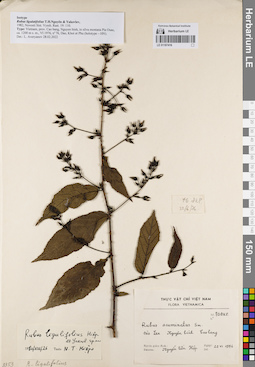
LE 01167416
Isotype of Rubus ligulatifolius T.H.Nguyên & Yakovlev det. Tien Hiep Nguyen, Yakovlev, Gennady Pavlovich at 26.08.1980
Collectors: Dao; Khoi; Phu Field collecting number: DKP 076. Collection date: 06.1976. Administrative regions: VN - Tinh Cao Bang. Groups of specimens: L. V. Averyanov specimens; L. V. Averyanov herbarium; Соглашение Минобрнауки №075-15-2021-1056Original label text:FLORA OF VIETNAM
Rosaceae
Isotype
Rubus ligulatifolius T.H.Nguyên & Yakovlev,
1982, Novosti Sist. Vyssh. Rast. 19: 110.
Type: Vietnam, prov. Cao bang, Nguyen binh, in silva montana Pia Ouac, ca. 1200 m s. m., VI 1976, no 76, Dao, Khoi et Phu (holotype – HN).
Det.: L. Averyanov 28 02 2022
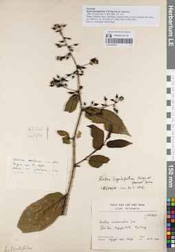
LE 01167415
Paratype of Rubus ligulatifolius T.H.Nguyên & Yakovlev det. Tien Hiep Nguyen, Yakovlev, Gennady Pavlovich at 06.1976
Collectors: Dao; Khoi; Phu Field collecting number: 005. Collection date: 06.1976. Administrative regions: VN - Tinh Cao Bang. Groups of specimens: L. V. Averyanov specimens; L. V. Averyanov herbarium; Соглашение Минобрнауки №075-15-2021-1056Original label text:FLORA OF VIETNAM
Rosaceae
Paratype
Rubus ligulatifolius T.H.Nguyên & Yakovlev,
1982, Novosti Sist. Vyssh. Rast. 19: 110.
Type: Vietnam, prov. Cao bang, Nguyen binh, in silva montana Pia Ouac, ca. 1200 m s. m., VI 1976, no 5, Dao, Khoi et Phu (HN).
Det.: L. Averyanov 28 02 2022
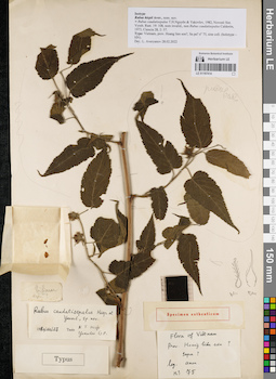
LE 01167414
Isotype of Rubus hiepii Aver. ⟨not published name⟩ det. Averyanov, Leonid Vladimirovich at 28.02.2022
Additional identifications: Isotype of Rubus caudatisepalus T.H.Nguyên & Yakovlev det. Tien Hiep Nguyen, Yakovlev, Gennady Pavlovich at 27.12.1980 Collectors: Busch Field collecting number: 075. Collection date: 27.12.1980. Administrative regions: VN - Tinh Lao Cai. Groups of specimens: L. V. Averyanov specimens; L. V. Averyanov herbarium; Соглашение Минобрнауки №075-15-2021-1056Original label text:FLORA OF VIETNAM
Rosaceae
Rubus hiepii Aver., nom. nov.
≡ Rubus caudatisepalus T.H.Nguyên & Yakovlev, 1982, Novosti Sist. Vyssh. Rast. 19: 108, nom invalid., non Rubus caudatisepalus Calderón, 1973, Ciencia 28, 2: 57.
Type: Vietnam, prov. Hoang lien son?, Sa pa? no 75, sine coll. (holotype – HN).
Det.: L. Averyanov 28.02.2022
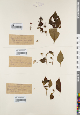
LE 01077957
Lycianthes biflora (Lour.) Bitter det. Nguyen Thi Nhan at 07.12.1964
Collectors: Nguyen Thi Nhan Field collecting number: Khoi 2577. Collection date: 07.12.1964. Administrative regions: VN - Tinh Lao Cai. Groups of specimens: L. V. Averyanov specimens; L. V. Averyanov herbarium; Соглашение Минобрнауки №075-15-2021-1056Original label text:FLORA OF VIETNAM
Record creation: 2022-03-03, Galina Savich, PhotoScan D2. Processing status: work_status_1Citation: Specimen LE 01077957 // Virtual herbarium of Komarov Botanical Institute RAS — http://re.herbariumle.ru/01077957Solanaceae
Lycianthes biflora (Lour.) Bitter
Lao Cai, Sapa, 07 12 1964, N.D. Khoi 2577.
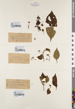
LE 01077958
Lycianthes biflora Bitter det. Nguyen Thi Nhan
Collectors: Nguyen Thi Nhan Field collecting number: 7654. Collection date: 1976. Administrative regions: VN - Vietnam. Groups of specimens: L. V. Averyanov specimens; L. V. Averyanov herbarium; Соглашение Минобрнауки №075-15-2021-1056; Flora of VietnamOriginal label text:FLORA OF VIETNAM
Record creation: 2022-03-03, Galina Savich, PhotoScan D2. Processing status: work_status_1Citation: Specimen LE 01077958 // Virtual herbarium of Komarov Botanical Institute RAS — http://re.herbariumle.ru/01077958Solanaceae
Lycianthes biflora Bitter
7654
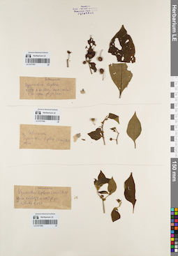
LE 01077959
Lycianthes biflora Bitter det. Nguyen Thi Nhan at 09.07.1976
Collectors: Nguyen Thi Nhan Field collecting number: V.X. Phuong 16150. Collection date: 09.07.1976. Administrative regions: VN - Vietnam. Groups of specimens: L. V. Averyanov specimens; L. V. Averyanov herbarium; Соглашение Минобрнауки №075-15-2021-1056Original label text:FLORA OF VIETNAM
Record creation: 2022-03-03, Galina Savich, PhotoScan D2. Processing status: work_status_1Citation: Specimen LE 01077959 // Virtual herbarium of Komarov Botanical Institute RAS — http://re.herbariumle.ru/01077959Solanaceae
Lycianthes biflora Bitter.
Son Ca, Hat lot
V.X. Phuong 16150, 09.07.1976
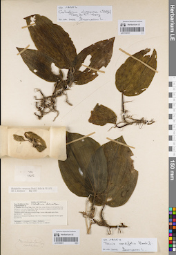
LE 01167417
Tainia cordifolia Hook.f. det. Averyanov, Leonid Vladimirovich at 01.03.2022
Collectors: Averyanov, Leonid Vladimirovich; et al. Field collecting number: VH1875a. Collection date: 21.11.1995. Administrative regions: VN - Kon Tum. Groups of specimens: L. V. Averyanov specimens; L. V. Averyanov herbarium; Orchids of Vietnam, Laos and CambodiaOriginal label text:FLORA OF VIETNAM
Orchidaceae Juss.
Nephelaphyllum sp.
S. Vietnam, Prov. Kon Tum, Distr. Dak Gley, about 12 km to N of Dak Gley town (24 km by road), near Mang Khen village. Secondary evergreen mountain forest rich in primary elements at 1000-1100 m alt. Terrestrial herb in wet places on top of ridge. Leaves with purple spots. Rare.
No VH 1875a 21.11.1995
International Botanical Expedition of the U.S.A. National Geographic Society (grant No 5094-93)
Participants: L. Averyanov, N.T. Ban, A. Budantzev, L. Budantzev, N.T. Hiep, D.D. Huyen, P.K. Loc, G. Yakovlev
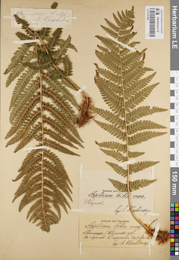
LE 01181400
Aspidium filix-mas (L.) Sw. det. Korshinsky, Sergei Ivanovitsch
Collectors: Korshinsky, Sergei Ivanovitsch Collection date: 02.07. Administrative regions: RU - Tatarstan - Tetyushskiy Rayon. Groups of specimens: Образцы сектора Восточной Европы; Флора Урала и прилегающих территорий (проект); Соглашение Минобрнауки №075-15-2021-1056Original label text:Казанская губерния, Тетюши. В оврагах в перелеске к реке Волге.
Coordinates (geographic position): 54° 56′ 41.65″ N, 48° 50′ 19.44″ E ±2000 mRecord creation: 2022-03-03, Denis Melnikov, PhotoScan D2. Processing status: sample requires separationCitation: Specimen LE 01181400 // Virtual herbarium of Komarov Botanical Institute RAS — http://re.herbariumle.ru/01181400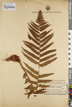
LE 01181399
Polystichum filix-mas (L.) Roth det. Anonymous
Collectors: Claus, Karl Ernst Collection date: 1850. Administrative regions: RU - Tatarstan - Gorod Kazan'. Groups of specimens: Образцы сектора Восточной Европы; Флора Урала и прилегающих территорий (проект); Соглашение Минобрнауки №075-15-2021-1056; Herbarium J. KlingeOriginal label text:В тенистых лесах и оврагах. В медицине употребляется корневище (radix ... maris), как горько-ароматное, особенно противоглистное средство. Kasan [Казань].
Coordinates (geographic position): 55° 47′ 30.35″ N, 49° 6′ 17.67″ E ±5000 mRecord creation: 2022-03-03, Denis Melnikov, PhotoScan D2Citation: Specimen LE 01181399 // Virtual herbarium of Komarov Botanical Institute RAS — http://re.herbariumle.ru/01181399