View
Add
Copy
Edit
Delete
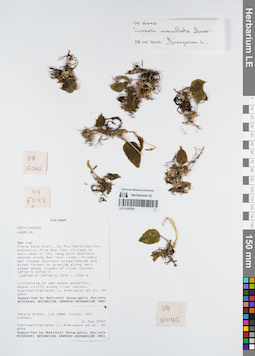
LE 01167576
Isotype of Liparis mamillata Aver. det. Averyanov, Leonid Vladimirovich at 28.02.2022
Collectors: Averyanov, Leonid Vladimirovich; et al. Field collecting number: VH6046. Collection date: 11.05.2000. Administrative regions: VN - Tinh GJak Lak. Groups of specimens: L. V. Averyanov specimens; L. V. Averyanov herbarium; Orchids of Vietnam, Laos and CambodiaOriginal label text:FLORA OF VIETNAM
Orchidaceae
Liparis mammillata Aver., sp. nov. Type
S. Vietnam, Dak Lac Prov., Krong Bong Distr., Cu Pui Municipality, elevation from Dak Tour village (12°30′N, 108°30′E) to main peak of Chu Yang Sinh mt system (12°24′N, 108°26′E) along Dak Tour river (N slope). Primary wet closed mountain broad-leaved and mixed forest on granites along very steep shady slopes of river canyon at elev. 1500-1700 m. Lithophyte on wet shady waterfall mossy cliffs along river canyon. Tepals green, lip deep violet. Not common.
VH 6046 11.05.2000
International Botanical Expedition of the U.S.A. National Geographic Society (grant No 6383-98)
Collectors: L.Averyanov, N.T.Hiep, N.Q.Hieu, P.H.Hoang, D.X.Du, N.T.Vinh
Coordinates (geographic position): 12° 30′ N, 108° 30′ E ±1000 mRecord creation: 2022-03-03, Galina Savich, PhotoScan D2. Processing status: work_status_1Citation: Specimen LE 01167576 // Virtual herbarium of Komarov Botanical Institute RAS — http://re.herbariumle.ru/01167576Orchidaceae
Liparis mammillata Aver., sp. nov. Type
S. Vietnam, Dak Lac Prov., Krong Bong Distr., Cu Pui Municipality, elevation from Dak Tour village (12°30′N, 108°30′E) to main peak of Chu Yang Sinh mt system (12°24′N, 108°26′E) along Dak Tour river (N slope). Primary wet closed mountain broad-leaved and mixed forest on granites along very steep shady slopes of river canyon at elev. 1500-1700 m. Lithophyte on wet shady waterfall mossy cliffs along river canyon. Tepals green, lip deep violet. Not common.
VH 6046 11.05.2000
International Botanical Expedition of the U.S.A. National Geographic Society (grant No 6383-98)
Collectors: L.Averyanov, N.T.Hiep, N.Q.Hieu, P.H.Hoang, D.X.Du, N.T.Vinh
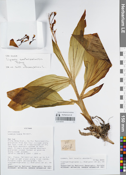
LE 01167575
Liparis sootenzanensis Fukuy. det. Averyanov, Leonid Vladimirovich at 28.02.2022
Collectors: Averyanov, Leonid Vladimirovich; et al. Field collecting number: VH6027. Collection date: 05.05.2000. Administrative regions: VN - Tinh GJak Lak. Groups of specimens: L. V. Averyanov specimens; L. V. Averyanov herbarium; Orchids of Vietnam, Laos and CambodiaOriginal label text:FLORA OF VIETNAM
Coordinates (geographic position): 12° 30′ N, 108° 30′ E ±1000 mRecord creation: 2022-03-03, Galina Savich, PhotoScan D2. Processing status: work_status_1Citation: Specimen LE 01167575 // Virtual herbarium of Komarov Botanical Institute RAS — http://re.herbariumle.ru/01167575Orchidaceae
Liparis kontumensis Aver., sp. nov. = Liparis nigra var. flava Aver.
S. Vietnam, Dak Lac Prov., Krong Bong Distr., Cu Pui Municipality, elevation from Dak Tour village (12°30′N, 108°30′E) along Dak Tour river on N macroslope of Chu Yang Sinh mt system to main peak (12°24′N, 108°26′E). Primary broad-leaved mountain evergreen closed forest on granites along river slopes at elev. 1000-1200 m. Terrestrial herb up to 0.4 m hg in wet place along river rocks. Flowers light yellow-green. Not common, but locally abundant.
VH 6027 05-06.05.2000
International Botanical Expedition of the U.S.A. National Geographic Society (grant No 6383-98)
Collectors: L.Averyanov, N.T.Hiep, N.Q.Hieu, P.H.Hoang, D.X.Du, N.T.Vinh
Liparis kontumensis Aver., sp. nov. = Liparis nigra var. flava Aver.
S. Vietnam, Dak Lac Prov., Krong Bong Distr., Cu Pui Municipality, elevation from Dak Tour village (12°30′N, 108°30′E) along Dak Tour river on N macroslope of Chu Yang Sinh mt system to main peak (12°24′N, 108°26′E). Primary broad-leaved mountain evergreen closed forest on granites along river slopes at elev. 1000-1200 m. Terrestrial herb up to 0.4 m hg in wet place along river rocks. Flowers light yellow-green. Not common, but locally abundant.
VH 6027 05-06.05.2000
International Botanical Expedition of the U.S.A. National Geographic Society (grant No 6383-98)
Collectors: L.Averyanov, N.T.Hiep, N.Q.Hieu, P.H.Hoang, D.X.Du, N.T.Vinh
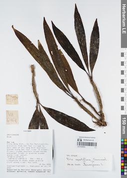
LE 01167574
Eria apertiflora Summerh. ⟮prelim. ID⟯ det. Averyanov, Leonid Vladimirovich at 28.02.2022
Collectors: Averyanov, Leonid Vladimirovich; et al. Field collecting number: VH6464. Collection date: 12.05.2000. Administrative regions: VN - Tinh GJak Lak. Groups of specimens: L. V. Averyanov specimens; L. V. Averyanov herbarium; Orchids of Vietnam, Laos and CambodiaOriginal label text:FLORA OF VIETNAM
Coordinates (geographic position): 12° 30′ N, 108° 30′ E ±1000 mRecord creation: 2022-03-03, Galina Savich, PhotoScan D2. Processing status: work_status_1Citation: Specimen LE 01167574 // Virtual herbarium of Komarov Botanical Institute RAS — http://re.herbariumle.ru/01167574Orchidaceae
Eria sp.
S. Vietnam, Dak Lac Prov., Krong Bong Distr., Cu Pui Municipality, elevation from Dak Tour village (12°30′N, 108°30′E) to main peak of Chu Yang Sinh mt system (12°24′N, 108°26′E) along Dak Tour river (N slope). Primary closed mountain broad-leaved evergreen forest on granite slopes along river canyon at elev. 800 m. Lithophyte on mossy shady granite cliff along river. Not rare.
VH 6464 12.05.2000
International Botanical Expedition of the U.S.A. National Geographic Society (grant No 6383-98)
Collectors: L.Averyanov, N.T.Hiep, N.Q.Hieu, P.H.Hoang, D.X.Du, N.T.Vinh
Eria sp.
S. Vietnam, Dak Lac Prov., Krong Bong Distr., Cu Pui Municipality, elevation from Dak Tour village (12°30′N, 108°30′E) to main peak of Chu Yang Sinh mt system (12°24′N, 108°26′E) along Dak Tour river (N slope). Primary closed mountain broad-leaved evergreen forest on granite slopes along river canyon at elev. 800 m. Lithophyte on mossy shady granite cliff along river. Not rare.
VH 6464 12.05.2000
International Botanical Expedition of the U.S.A. National Geographic Society (grant No 6383-98)
Collectors: L.Averyanov, N.T.Hiep, N.Q.Hieu, P.H.Hoang, D.X.Du, N.T.Vinh
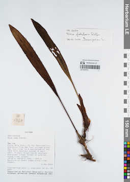
LE 01167573
Campanulorchis longipes (Gagnep.) J.Ponert det. Averyanov, Leonid Vladimirovich at 06.07.2022
Additional identifications: Eria globifera Rolfe det. Averyanov, Leonid Vladimirovich at 28.02.2022 Collectors: Averyanov, Leonid Vladimirovich; et al. Field collecting number: VH6020. Collection date: 05.05.2000. Administrative regions: VN - Tinh GJak Lak. Groups of specimens: L. V. Averyanov specimens; L. V. Averyanov herbarium; Orchids of Vietnam, Laos and CambodiaOriginal label text:FLORA OF VIETNAM
Coordinates (geographic position): 12° 30′ N, 108° 30′ E ±1000 mRecord creation: 2022-03-03, Galina Savich, PhotoScan D2. Processing status: work_status_1Citation: Specimen LE 01167573 // Virtual herbarium of Komarov Botanical Institute RAS — http://re.herbariumle.ru/01167573Orchidaceae
Eria thao
S. Vietnam, Dak Lac Prov., Krong Bong Distr., Cu Pui Municipality, elevation from Dak Tour village (12°30′N, 108°30′E) along Dak Tour river on N macroslope of Chu Yang Sinh mt system to main peak (12°24′N, 108°26′E). Primary broad-leaved mountain evergreen closed forest on granites along river slopes at elev. 1000-1200 m. Epiphyte on mossy trees along river. Common.
VH 6020 05-06.05.2000
International Botanical Expedition of the U.S.A. National Geographic Society (grant No 6383-98)
Collectors: L.Averyanov, N.T.Hiep, N.Q.Hieu, P.H.Hoang, D.X.Du, N.T.Vinh
Eria thao
S. Vietnam, Dak Lac Prov., Krong Bong Distr., Cu Pui Municipality, elevation from Dak Tour village (12°30′N, 108°30′E) along Dak Tour river on N macroslope of Chu Yang Sinh mt system to main peak (12°24′N, 108°26′E). Primary broad-leaved mountain evergreen closed forest on granites along river slopes at elev. 1000-1200 m. Epiphyte on mossy trees along river. Common.
VH 6020 05-06.05.2000
International Botanical Expedition of the U.S.A. National Geographic Society (grant No 6383-98)
Collectors: L.Averyanov, N.T.Hiep, N.Q.Hieu, P.H.Hoang, D.X.Du, N.T.Vinh
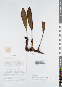
LE 01167572
Campanulorchis longipes (Gagnep.) J.Ponert det. Averyanov, Leonid Vladimirovich at 06.07.2022
Additional identifications: Eria globifera Rolfe det. Averyanov, Leonid Vladimirovich at 28.02.2022 Collectors: Averyanov, Leonid Vladimirovich; et al. Field collecting number: VH6149. Collection date: 09.05.2000. Administrative regions: VN - Tinh GJak Lak. Groups of specimens: L. V. Averyanov specimens; L. V. Averyanov herbarium; Orchids of Vietnam, Laos and CambodiaOriginal label text:FLORA OF VIETNAM
Coordinates (geographic position): 12° 30′ N, 108° 30′ E ±1000 mRecord creation: 2022-03-03, Galina Savich, PhotoScan D2. Processing status: work_status_1Citation: Specimen LE 01167572 // Virtual herbarium of Komarov Botanical Institute RAS — http://re.herbariumle.ru/01167572Orchidaceae
Eria thao
S. Vietnam, Dak Lac Prov., Krong Bong Distr., Cu Pui Municipality, elevation from Dak Tour village (12°30′N, 108°30′E) to main peak of Chu Yang Sinh mt system (12°24′N, 108°26′E) along Dak Tour river (N slope). Primary mossy cloud mixed forest (with Pinus, Fokienia, Dacrydium and Dacrycarpus) on very steep granite slopes at elev. 2100-2200 m. Epiphyte. Flowers white, tepals with purple stripes, lip with yellow margin. Abundant.
VH 6149 09.05.2000
International Botanical Expedition of the U.S.A. National Geographic Society (grant No 6383-98)
Collectors: L.Averyanov, N.T.Hiep, N.Q.Hieu, P.H.Hoang, D.X.Du, N.T.Vinh
Eria thao
S. Vietnam, Dak Lac Prov., Krong Bong Distr., Cu Pui Municipality, elevation from Dak Tour village (12°30′N, 108°30′E) to main peak of Chu Yang Sinh mt system (12°24′N, 108°26′E) along Dak Tour river (N slope). Primary mossy cloud mixed forest (with Pinus, Fokienia, Dacrydium and Dacrycarpus) on very steep granite slopes at elev. 2100-2200 m. Epiphyte. Flowers white, tepals with purple stripes, lip with yellow margin. Abundant.
VH 6149 09.05.2000
International Botanical Expedition of the U.S.A. National Geographic Society (grant No 6383-98)
Collectors: L.Averyanov, N.T.Hiep, N.Q.Hieu, P.H.Hoang, D.X.Du, N.T.Vinh
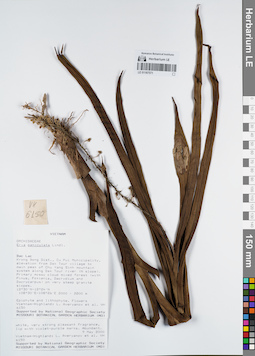
LE 01167571
Mycaranthes floribunda (D.Don) S.C.Chen & J.J.Wood det. Averyanov, Leonid Vladimirovich at 02.01.2025
Additional identifications: Eria paniculata Lindl. det. Averyanov, Leonid Vladimirovich at 09.05.2000 Collectors: Averyanov, Leonid Vladimirovich; et al. Field collecting number: VH6150. Collection date: 09.05.2000. Administrative regions: VN - Tinh GJak Lak. Groups of specimens: L. V. Averyanov specimens; L. V. Averyanov herbarium; Orchids of Vietnam, Laos and CambodiaOriginal label text:FLORA OF VIETNAM
Coordinates (geographic position): 12° 30′ N, 108° 30′ E ±1000 mRecord creation: 2022-03-03, Galina Savich, PhotoScan D2. Processing status: work_status_1Citation: Specimen LE 01167571 // Virtual herbarium of Komarov Botanical Institute RAS — http://re.herbariumle.ru/01167571Orchidaceae
Eria paniculata
S. Vietnam, Dak Lac Prov., Krong Bong Distr., Cu Pui Municipality, elevation from Dak Tour village (12°30′N, 108°30′E) to main peak of Chu Yang Sinh mt system (12°24′N, 108°26′E) along Dak Tour river (N slope). Primary mossy cloud mixed forest (with Pinus, Fokienia, Dacrydium and Dacrycarpus) on very steep granite slopes at elev. 2100-2200 m. Epiphyte and lithophyte. Flowers white, very strong pleasant fragrant, lip with violet-purple marks. Abundant.
VH 6150 09.05.2000
International Botanical Expedition of the U.S.A. National Geographic Society (grant No 6383-98)
Collectors: L.Averyanov, N.T.Hiep, N.Q.Hieu, P.H.Hoang, D.X.Du, N.T.Vinh
Eria paniculata
S. Vietnam, Dak Lac Prov., Krong Bong Distr., Cu Pui Municipality, elevation from Dak Tour village (12°30′N, 108°30′E) to main peak of Chu Yang Sinh mt system (12°24′N, 108°26′E) along Dak Tour river (N slope). Primary mossy cloud mixed forest (with Pinus, Fokienia, Dacrydium and Dacrycarpus) on very steep granite slopes at elev. 2100-2200 m. Epiphyte and lithophyte. Flowers white, very strong pleasant fragrant, lip with violet-purple marks. Abundant.
VH 6150 09.05.2000
International Botanical Expedition of the U.S.A. National Geographic Society (grant No 6383-98)
Collectors: L.Averyanov, N.T.Hiep, N.Q.Hieu, P.H.Hoang, D.X.Du, N.T.Vinh
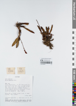
LE 01167570
Eria obscura Aver. det. Averyanov, Leonid Vladimirovich at 03.05.2000
Collectors: Averyanov, Leonid Vladimirovich; et al. Field collecting number: VH5968. Collection date: 03.05.2000. Administrative regions: VN - Tinh GJak Lak. Groups of specimens: L. V. Averyanov specimens; L. V. Averyanov herbarium; Orchids of Vietnam, Laos and CambodiaOriginal label text:FLORA OF VIETNAM
Coordinates (geographic position): 12° 30′ N, 108° 30′ E ±1000 mRecord creation: 2022-03-03, Galina Savich, PhotoScan D2. Processing status: work_status_1Citation: Specimen LE 01167570 // Virtual herbarium of Komarov Botanical Institute RAS — http://re.herbariumle.ru/01167570Orchidaceae
Eria obscura Aver.
S. Vietnam, Dak Lac Prov., Krong Bong Distr., Cu Pui Municipality, elevation from Dak Tour village (12°30′N, 108°30′E) along Dak Tour river on N macroslope of Chu Yang Sinh mt system. Primary broad-leaved mountain evergreen forest on granites along river slopes at elev. 500-550 m. Epiphyte on trees along river in open places. Very common.
VH 5968 03.05.2000
International Botanical Expedition of the U.S.A. National Geographic Society (grant No 6383-98)
Collectors: L.Averyanov, N.T.Hiep, N.Q.Hieu, P.H.Hoang, D.X.Du, N.T.Vinh
Eria obscura Aver.
S. Vietnam, Dak Lac Prov., Krong Bong Distr., Cu Pui Municipality, elevation from Dak Tour village (12°30′N, 108°30′E) along Dak Tour river on N macroslope of Chu Yang Sinh mt system. Primary broad-leaved mountain evergreen forest on granites along river slopes at elev. 500-550 m. Epiphyte on trees along river in open places. Very common.
VH 5968 03.05.2000
International Botanical Expedition of the U.S.A. National Geographic Society (grant No 6383-98)
Collectors: L.Averyanov, N.T.Hiep, N.Q.Hieu, P.H.Hoang, D.X.Du, N.T.Vinh
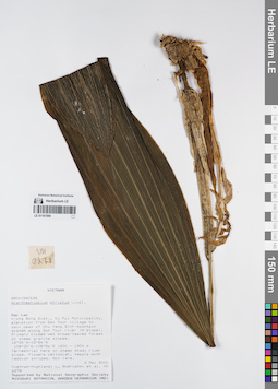
LE 01167569
Acanthophippium striatum Lindl. det. Averyanov, Leonid Vladimirovich at 06.05.2000
Collectors: Averyanov, Leonid Vladimirovich; et al. Field collecting number: VH6278. Collection date: 06.05.2000. Administrative regions: VN - Tinh GJak Lak. Groups of specimens: L. V. Averyanov specimens; L. V. Averyanov herbarium; Orchids of Vietnam, Laos and CambodiaOriginal label text:FLORA OF VIETNAM
Coordinates (geographic position): 12° 30′ N, 108° 30′ E ±1000 mRecord creation: 2022-03-03, Galina Savich, PhotoScan D2. Processing status: work_status_1Citation: Specimen LE 01167569 // Virtual herbarium of Komarov Botanical Institute RAS — http://re.herbariumle.ru/01167569Orchidaceae
Acanthephippium striatum
S. Vietnam, Dak Lac Prov., Krong Bong Distr., Cu Pui Municipality, elevation from Dak Tour village (12°30′N, 108°30′E) to main peak of Chu Yang Sinh mt system (12°24′N, 108°26′E) along Dak Tour river (N slope). Primary closed wet broad-leaved forest on steep granite slopes at elev. 1200-1250 m. Terrestrial herb on steep shady river slope. Flowers yellowish, tepals with reddish stripes. Not rare.
VH 6278 06.05.2000
International Botanical Expedition of the U.S.A. National Geographic Society (grant No 6383-98)
Collectors: L.Averyanov, N.T.Hiep, N.Q.Hieu, P.H.Hoang, D.X.Du, N.T.Vinh
Acanthephippium striatum
S. Vietnam, Dak Lac Prov., Krong Bong Distr., Cu Pui Municipality, elevation from Dak Tour village (12°30′N, 108°30′E) to main peak of Chu Yang Sinh mt system (12°24′N, 108°26′E) along Dak Tour river (N slope). Primary closed wet broad-leaved forest on steep granite slopes at elev. 1200-1250 m. Terrestrial herb on steep shady river slope. Flowers yellowish, tepals with reddish stripes. Not rare.
VH 6278 06.05.2000
International Botanical Expedition of the U.S.A. National Geographic Society (grant No 6383-98)
Collectors: L.Averyanov, N.T.Hiep, N.Q.Hieu, P.H.Hoang, D.X.Du, N.T.Vinh
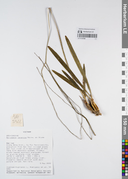
LE 01167568
Acriopsis liliifolia (J.Koenig) Ormerod det. Averyanov, Leonid Vladimirovich at 14.03.2022
Additional identifications: Acriopsis javanica Blume det. Averyanov, Leonid Vladimirovich at 03.05.2000 Collectors: Averyanov, Leonid Vladimirovich; et al. Field collecting number: VH5951. Collection date: 03.05.2000. Administrative regions: VN - Tinh GJak Lak. Groups of specimens: L. V. Averyanov specimens; L. V. Averyanov herbarium; Orchids of Vietnam, Laos and CambodiaOriginal label text:FLORA OF VIETNAM
Coordinates (geographic position): 12° 30′ N, 108° 30′ E ±1000 mRecord creation: 2022-03-03, Galina Savich, PhotoScan D2. Processing status: work_status_1Citation: Specimen LE 01167568 // Virtual herbarium of Komarov Botanical Institute RAS — http://re.herbariumle.ru/01167568Orchidaceae
Acriopsis javanica
S. Vietnam, Dak Lac Prov., Krong Bong Distr., Cu Pui Municipality, elevation from Dak Tour village (12°30′N, 108°30′E) along Dak Tour river on N macroslope of Chu Yang Sinh mt system. Primary broad-leaved mountain evergreen forest on granites along river slopes at elev. 500-550 m. Epiphyte on high trees along river. Flowers: tepals whitish with dull purple stripe. Not rare.
VH 5951 03.05.2000
International Botanical Expedition of the U.S.A. National Geographic Society (grant No 6383-98)
Collectors: L.Averyanov, N.T.Hiep, N.Q.Hieu, P.H.Hoang, D.X.Du, N.T.Vinh
Acriopsis javanica
S. Vietnam, Dak Lac Prov., Krong Bong Distr., Cu Pui Municipality, elevation from Dak Tour village (12°30′N, 108°30′E) along Dak Tour river on N macroslope of Chu Yang Sinh mt system. Primary broad-leaved mountain evergreen forest on granites along river slopes at elev. 500-550 m. Epiphyte on high trees along river. Flowers: tepals whitish with dull purple stripe. Not rare.
VH 5951 03.05.2000
International Botanical Expedition of the U.S.A. National Geographic Society (grant No 6383-98)
Collectors: L.Averyanov, N.T.Hiep, N.Q.Hieu, P.H.Hoang, D.X.Du, N.T.Vinh
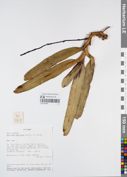
LE 01167567
Aerides odorata Lour. det. Averyanov, Leonid Vladimirovich at 28.04.2000
Collectors: Averyanov, Leonid Vladimirovich; et al. Field collecting number: VH5813. Collection date: 28.04.2000. Administrative regions: VN - Kon Tum. Groups of specimens: L. V. Averyanov specimens; L. V. Averyanov herbarium; Orchids of Vietnam, Laos and CambodiaOriginal label text:FLORA OF VIETNAM
Coordinates (geographic position): 14° 25′ N, 107° 44′ E ±1000 mRecord creation: 2022-03-03, Galina Savich, PhotoScan D2. Processing status: work_status_1Citation: Specimen LE 01167567 // Virtual herbarium of Komarov Botanical Institute RAS — http://re.herbariumle.ru/01167567Orchidaceae
Aerides odorata
S. Vietnam, Kontum Prov., Sa Thay Distr., Sa Son Municipality, Chu Mom Ray nature reserve (14°25′N, 107°44′E). Secondary open broad-leaved evergreen dry forest on granites at elev. 500-600 m. Epiphyte on high tree. Common.
VH 5813 28 04.2000
International Botanical Expedition of the U.S.A. National Geographic Society (grant No 6383-98)
Collectors: L.Averyanov, P.K.Loc, P.H.Hoang, D.X.Du, N.T.Vinh
Aerides odorata
S. Vietnam, Kontum Prov., Sa Thay Distr., Sa Son Municipality, Chu Mom Ray nature reserve (14°25′N, 107°44′E). Secondary open broad-leaved evergreen dry forest on granites at elev. 500-600 m. Epiphyte on high tree. Common.
VH 5813 28 04.2000
International Botanical Expedition of the U.S.A. National Geographic Society (grant No 6383-98)
Collectors: L.Averyanov, P.K.Loc, P.H.Hoang, D.X.Du, N.T.Vinh
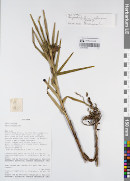
LE 01167566
Agrostophyllum callosum Rchb.f. det. Averyanov, Leonid Vladimirovich at 24.02.2022
Collectors: Averyanov, Leonid Vladimirovich; et al. Field collecting number: VH6430. Collection date: 11.05.2000. Administrative regions: VN - Tinh GJak Lak. Groups of specimens: L. V. Averyanov specimens; L. V. Averyanov herbarium; Orchids of Vietnam, Laos and CambodiaOriginal label text:FLORA OF VIETNAM
Coordinates (geographic position): 12° 30′ N, 108° 30′ E ±1000 mRecord creation: 2022-03-03, Galina Savich, PhotoScan D2. Processing status: work_status_1Citation: Specimen LE 01167566 // Virtual herbarium of Komarov Botanical Institute RAS — http://re.herbariumle.ru/01167566Orchidaceae
Agrostophyllum sp.
S. Vietnam, Dak Lac Prov., Krong Bong Distr., Cu Pui Municipality, elevation from Dak Tour village (12°30′N, 108°30′E) to main peak of Chu Yang Sinh mt system (12°24′N, 108°26′E) along Dak Tour river (N slope). Primary wet closed mountain broad-leaved and mixed forest on granites along very steep shady slopes of river at elev. 1700 m. Lithophytic herb up to 0.5 m hg on open mossy wet waterfall shelves. Not common.
VH 6430 11.05.2000
International Botanical Expedition of the U.S.A. National Geographic Society (grant No 6383-98)
Collectors: L.Averyanov, N.T.Hiep, N.Q.Hieu, P.H.Hoang, D.X.Du, N.T.Vinh
Agrostophyllum sp.
S. Vietnam, Dak Lac Prov., Krong Bong Distr., Cu Pui Municipality, elevation from Dak Tour village (12°30′N, 108°30′E) to main peak of Chu Yang Sinh mt system (12°24′N, 108°26′E) along Dak Tour river (N slope). Primary wet closed mountain broad-leaved and mixed forest on granites along very steep shady slopes of river at elev. 1700 m. Lithophytic herb up to 0.5 m hg on open mossy wet waterfall shelves. Not common.
VH 6430 11.05.2000
International Botanical Expedition of the U.S.A. National Geographic Society (grant No 6383-98)
Collectors: L.Averyanov, N.T.Hiep, N.Q.Hieu, P.H.Hoang, D.X.Du, N.T.Vinh
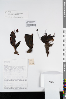
LE 01167565
Amitostigma bidupense (Aver.) Aver. det. Averyanov, Leonid Vladimirovich at 24.02.2022
Collectors: Averyanov, Leonid Vladimirovich; et al. Field collecting number: VH6159. Collection date: 09.05.2000. Administrative regions: VN - Tinh GJak Lak. Groups of specimens: L. V. Averyanov specimens; L. V. Averyanov herbarium; Orchids of Vietnam, Laos and CambodiaOriginal label text:FLORA OF VIETNAM
Coordinates (geographic position): 12° 30′ N, 108° 30′ E ±1000 mRecord creation: 2022-03-03, Galina Savich, PhotoScan D2. Processing status: work_status_1Citation: Specimen LE 01167565 // Virtual herbarium of Komarov Botanical Institute RAS — http://re.herbariumle.ru/01167565Orchidaceae
Amitostigma bidupense Aver.
S. Vietnam, Dak Lac Prov., Krong Bong Distr., Cu Pui Municipality, elevation from Dak Tour village (12°30′N, 108°30′E) to main peak of Chu Yang Sinh mt system (12°24′N, 108°26′E) along Dak Tour river (N slope). Primary mossy cloud mixed forest (with Pinus, Fokienia, Dacrydium and Dacrycarpus) on very steep granite slopes at elev. 2000-2200 m. Lithophyte on vertical mossy cliffs. Flowers pink-purple. Very common at elev. 2000-2400 m.
VH 6159 09.05.2000
International Botanical Expedition of the U.S.A. National Geographic Society (grant No 6383-98)
Collectors: L.Averyanov, N.T.Hiep, N.Q.Hieu, P.H.Hoang, D.X.Du, N.T.Vinh
Amitostigma bidupense Aver.
S. Vietnam, Dak Lac Prov., Krong Bong Distr., Cu Pui Municipality, elevation from Dak Tour village (12°30′N, 108°30′E) to main peak of Chu Yang Sinh mt system (12°24′N, 108°26′E) along Dak Tour river (N slope). Primary mossy cloud mixed forest (with Pinus, Fokienia, Dacrydium and Dacrycarpus) on very steep granite slopes at elev. 2000-2200 m. Lithophyte on vertical mossy cliffs. Flowers pink-purple. Very common at elev. 2000-2400 m.
VH 6159 09.05.2000
International Botanical Expedition of the U.S.A. National Geographic Society (grant No 6383-98)
Collectors: L.Averyanov, N.T.Hiep, N.Q.Hieu, P.H.Hoang, D.X.Du, N.T.Vinh
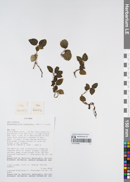
LE 01167564
Anoectochilus roxburghii (Wall.) Lindl. det. Averyanov, Leonid Vladimirovich at 05.05.2000
Collectors: Averyanov, Leonid Vladimirovich; et al. Field collecting number: VH6023. Collection date: 05.05.2000. Administrative regions: VN - Tinh GJak Lak. Groups of specimens: L. V. Averyanov specimens; L. V. Averyanov herbarium; Orchids of Vietnam, Laos and CambodiaOriginal label text:FLORA OF VIETNAM
Coordinates (geographic position): 12° 30′ N, 108° 30′ E ±1000 mRecord creation: 2022-03-03, Galina Savich, PhotoScan D2. Processing status: work_status_1Citation: Specimen LE 01167564 // Virtual herbarium of Komarov Botanical Institute RAS — http://re.herbariumle.ru/01167564Orchidaceae
Anoectochilus roxburghii
S. Vietnam, Dak Lac Prov., Krong Bong Distr., Cu Pui Municipality, elevation from Dak Tour village (12°30′N, 108°30′E) along Dak Tour river on N macroslope of Chu Yang Sinh mt system to main peak (12°24′N, 108°26′E). Primary broad-leaved mountain evergreen closed forest on granites along river slopes at elev. 1000-1200 m. Terrestrial and lithophytic creeping rosette herb on shady slopes. Leaves velvety deep brown-green with yellow, light green, pink or reddish nerves. Common.
VH 6023 05-06.05.2000
International Botanical Expedition of the U.S.A. National Geographic Society (grant No 6383-98)
Collectors: L.Averyanov, N.T.Hiep, N.Q.Hieu, P.H.Hoang, D.X.Du, N.T.Vinh
Anoectochilus roxburghii
S. Vietnam, Dak Lac Prov., Krong Bong Distr., Cu Pui Municipality, elevation from Dak Tour village (12°30′N, 108°30′E) along Dak Tour river on N macroslope of Chu Yang Sinh mt system to main peak (12°24′N, 108°26′E). Primary broad-leaved mountain evergreen closed forest on granites along river slopes at elev. 1000-1200 m. Terrestrial and lithophytic creeping rosette herb on shady slopes. Leaves velvety deep brown-green with yellow, light green, pink or reddish nerves. Common.
VH 6023 05-06.05.2000
International Botanical Expedition of the U.S.A. National Geographic Society (grant No 6383-98)
Collectors: L.Averyanov, N.T.Hiep, N.Q.Hieu, P.H.Hoang, D.X.Du, N.T.Vinh
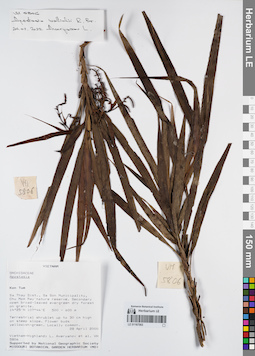
LE 01167563
Apostasia wallichii R.Br. det. Averyanov, Leonid Vladimirovich at 24.02.2022
Collectors: Averyanov, Leonid Vladimirovich; et al. Field collecting number: VH5806. Collection date: 28.04.2000. Administrative regions: VN - Kon Tum. Groups of specimens: L. V. Averyanov specimens; L. V. Averyanov herbarium; Orchids of Vietnam, Laos and CambodiaOriginal label text:FLORA OF VIETNAM
Coordinates (geographic position): 14° 25′ N, 107° 44′ E ±1000 mRecord creation: 2022-03-03, Galina Savich, PhotoScan D2. Processing status: work_status_1Citation: Specimen LE 01167563 // Virtual herbarium of Komarov Botanical Institute RAS — http://re.herbariumle.ru/01167563Orchidaceae
Apostasia sp.
S. Vietnam, Kontum Prov., Sa Thay Distr., Sa Son Municipality, Chu Mom Ray nature reserve (14°25′N, 107°44′E). Secondary open broad-leaved evergreen dry forest on granites at elev. 500-600 m. Terrestrial shrublet up to 30 cm hg on steep slope. Flower buds yellowish-green. Locally common.
VH 5806 28 04.2000
International Botanical Expedition of the U.S.A. National Geographic Society (grant No 6383-98)
Collectors: L.Averyanov, P.K.Loc, P.H.Hoang, D.X.Du, N.T.Vinh
Apostasia sp.
S. Vietnam, Kontum Prov., Sa Thay Distr., Sa Son Municipality, Chu Mom Ray nature reserve (14°25′N, 107°44′E). Secondary open broad-leaved evergreen dry forest on granites at elev. 500-600 m. Terrestrial shrublet up to 30 cm hg on steep slope. Flower buds yellowish-green. Locally common.
VH 5806 28 04.2000
International Botanical Expedition of the U.S.A. National Geographic Society (grant No 6383-98)
Collectors: L.Averyanov, P.K.Loc, P.H.Hoang, D.X.Du, N.T.Vinh
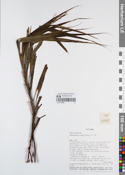
LE 01167562
Apostasia wallichii R.Br. det. Averyanov, Leonid Vladimirovich at 04.05.2000
Collectors: Averyanov, Leonid Vladimirovich; et al. Field collecting number: VH6095. Collection date: 04.05.2000. Administrative regions: VN - Tinh GJak Lak. Groups of specimens: L. V. Averyanov specimens; L. V. Averyanov herbarium; Orchids of Vietnam, Laos and CambodiaOriginal label text:FLORA OF VIETNAM
Coordinates (geographic position): 12° 30′ N, 108° 30′ E ±1000 mRecord creation: 2022-03-03, Galina Savich, PhotoScan D2. Processing status: work_status_1Citation: Specimen LE 01167562 // Virtual herbarium of Komarov Botanical Institute RAS — http://re.herbariumle.ru/01167562Orchidaceae
Apostasia wallichii ?
S. Vietnam, Dak Lac Prov., Krong Bong Distr., Cu Pui Municipality, elevation from Dak Tour village (12°30′N, 108°30′E) to main peak of Chu Yang Sinh mt system (12°24′N, 108°26′E) along Dak Tour river (N slope). Primary wet closed mountain broad-leaved forest on granites along river slopes at elev. 500-900 m. Terrestrial herb or shrublet up to 0.5 m hg in shady place. Not rare.
VH 6095 04.05.2000
International Botanical Expedition of the U.S.A. National Geographic Society (grant No 6383-98)
Collectors: L.Averyanov, N.T.Hiep, N.Q.Hieu, P.H.Hoang, D.X.Du, N.T.Vinh
Apostasia wallichii ?
S. Vietnam, Dak Lac Prov., Krong Bong Distr., Cu Pui Municipality, elevation from Dak Tour village (12°30′N, 108°30′E) to main peak of Chu Yang Sinh mt system (12°24′N, 108°26′E) along Dak Tour river (N slope). Primary wet closed mountain broad-leaved forest on granites along river slopes at elev. 500-900 m. Terrestrial herb or shrublet up to 0.5 m hg in shady place. Not rare.
VH 6095 04.05.2000
International Botanical Expedition of the U.S.A. National Geographic Society (grant No 6383-98)
Collectors: L.Averyanov, N.T.Hiep, N.Q.Hieu, P.H.Hoang, D.X.Du, N.T.Vinh
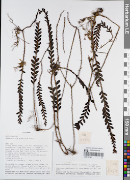
LE 01167561
Appendicula gracilis Aver. det. Averyanov, Leonid Vladimirovich at 04.05.2000
Collectors: Averyanov, Leonid Vladimirovich; et al. Field collecting number: VH6074. Collection date: 04.05.2000. Administrative regions: VN - Tinh GJak Lak. Groups of specimens: L. V. Averyanov specimens; L. V. Averyanov herbarium; Orchids of Vietnam, Laos and CambodiaOriginal label text:FLORA OF VIETNAM
Coordinates (geographic position): 12° 30′ N, 108° 30′ E ±1000 mRecord creation: 2022-03-03, Galina Savich, PhotoScan D2. Processing status: work_status_1Citation: Specimen LE 01167561 // Virtual herbarium of Komarov Botanical Institute RAS — http://re.herbariumle.ru/01167561Orchidaceae
Appendicula gracilis Aver.
S. Vietnam, Dak Lac Prov., Krong Bong Distr., Cu Pui Municipality, elevation from Dak Tour village (12°30′N, 108°30′E) to main peak of Chu Yang Sinh mt system (12°24′N, 108°26′E) along Dak Tour river (N slope). Primary wet closed mountain broad-leaved forest on granites along river slopes at elev. 500-900 m. Epiphyte on mossy trees along river in shady places. Flowers white, lip with purple-violet marks. Locally abundant.
VH 6074 04.05.2000
International Botanical Expedition of the U.S.A. National Geographic Society (grant No 6383-98)
Collectors: L.Averyanov, N.T.Hiep, N.Q.Hieu, P.H.Hoang, D.X.Du, N.T.Vinh
Appendicula gracilis Aver.
S. Vietnam, Dak Lac Prov., Krong Bong Distr., Cu Pui Municipality, elevation from Dak Tour village (12°30′N, 108°30′E) to main peak of Chu Yang Sinh mt system (12°24′N, 108°26′E) along Dak Tour river (N slope). Primary wet closed mountain broad-leaved forest on granites along river slopes at elev. 500-900 m. Epiphyte on mossy trees along river in shady places. Flowers white, lip with purple-violet marks. Locally abundant.
VH 6074 04.05.2000
International Botanical Expedition of the U.S.A. National Geographic Society (grant No 6383-98)
Collectors: L.Averyanov, N.T.Hiep, N.Q.Hieu, P.H.Hoang, D.X.Du, N.T.Vinh
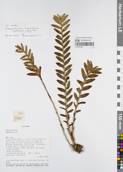
LE 01167560
Appendicula hexandra (J.Koenig) J.J.Sm. det. Averyanov, Leonid Vladimirovich at 24.02.2022
Collectors: Averyanov, Leonid Vladimirovich; et al. Field collecting number: VH6086. Collection date: 04.05.2000. Administrative regions: VN - Tinh GJak Lak. Groups of specimens: L. V. Averyanov specimens; L. V. Averyanov herbarium; Orchids of Vietnam, Laos and CambodiaOriginal label text:FLORA OF VIETNAM
Coordinates (geographic position): 12° 30′ N, 108° 30′ E ±1000 mRecord creation: 2022-03-03, Galina Savich, PhotoScan D2. Processing status: work_status_1Citation: Specimen LE 01167560 // Virtual herbarium of Komarov Botanical Institute RAS — http://re.herbariumle.ru/01167560Orchidaceae
Appendicula sp.
S. Vietnam, Dak Lac Prov., Krong Bong Distr., Cu Pui Municipality, elevation from Dak Tour village (12°30′N, 108°30′E) to main peak of Chu Yang Sinh mt system (12°24′N, 108°26′E) along Dak Tour river (N slope). Primary wet closed mountain broad-leaved forest on granites along river slopes at elev. 500-900 m. Epiphyte. Abundant.
VH 6086 04.05.2000
International Botanical Expedition of the U.S.A. National Geographic Society (grant No 6383-98)
Collectors: L.Averyanov, N.T.Hiep, N.Q.Hieu, P.H.Hoang, D.X.Du, N.T.Vinh
Appendicula sp.
S. Vietnam, Dak Lac Prov., Krong Bong Distr., Cu Pui Municipality, elevation from Dak Tour village (12°30′N, 108°30′E) to main peak of Chu Yang Sinh mt system (12°24′N, 108°26′E) along Dak Tour river (N slope). Primary wet closed mountain broad-leaved forest on granites along river slopes at elev. 500-900 m. Epiphyte. Abundant.
VH 6086 04.05.2000
International Botanical Expedition of the U.S.A. National Geographic Society (grant No 6383-98)
Collectors: L.Averyanov, N.T.Hiep, N.Q.Hieu, P.H.Hoang, D.X.Du, N.T.Vinh
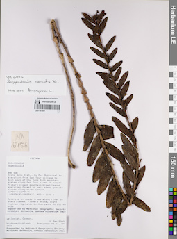
LE 01167559
Appendicula cornuta Blume det. Averyanov, Leonid Vladimirovich at 24.02.2022
Collectors: Averyanov, Leonid Vladimirovich; et al. Field collecting number: VH6456. Collection date: 12.05.2000. Administrative regions: VN - Tinh GJak Lak. Groups of specimens: L. V. Averyanov specimens; L. V. Averyanov herbarium; Orchids of Vietnam, Laos and CambodiaOriginal label text:FLORA OF VIETNAM
Coordinates (geographic position): 12° 30′ N, 108° 30′ E ±1000 mRecord creation: 2022-03-03, Galina Savich, PhotoScan D2. Processing status: work_status_1Citation: Specimen LE 01167559 // Virtual herbarium of Komarov Botanical Institute RAS — http://re.herbariumle.ru/01167559Orchidaceae
Appendicula hexandra (Koen.) J.J.Smith
S. Vietnam, Dak Lac Prov., Krong Bong Distr., Cu Pui Municipality, elevation from Dak Tour village (12°30′N, 108°30′E) to main peak of Chu Yang Sinh mt system (12°24′N, 108°26′E) along Dak Tour river (N slope). Primary closed mountain broad-leaved evergreen forest on granite slopes along river canyon at elev. 1000 m. Epiphyte on mossy trees along river in shady places. Flowers white, light yellowish. Common.
VH 6456 12.05.2000
International Botanical Expedition of the U.S.A. National Geographic Society (grant No 6383-98)
Collectors: L.Averyanov, N.T.Hiep, N.Q.Hieu, P.H.Hoang, D.X.Du, N.T.Vinh
Appendicula hexandra (Koen.) J.J.Smith
S. Vietnam, Dak Lac Prov., Krong Bong Distr., Cu Pui Municipality, elevation from Dak Tour village (12°30′N, 108°30′E) to main peak of Chu Yang Sinh mt system (12°24′N, 108°26′E) along Dak Tour river (N slope). Primary closed mountain broad-leaved evergreen forest on granite slopes along river canyon at elev. 1000 m. Epiphyte on mossy trees along river in shady places. Flowers white, light yellowish. Common.
VH 6456 12.05.2000
International Botanical Expedition of the U.S.A. National Geographic Society (grant No 6383-98)
Collectors: L.Averyanov, N.T.Hiep, N.Q.Hieu, P.H.Hoang, D.X.Du, N.T.Vinh
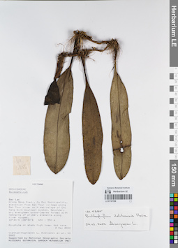
LE 01167558
Bulbophyllum delitescens Hance det. Averyanov, Leonid Vladimirovich at 24.02.2022
Collectors: Averyanov, Leonid Vladimirovich; et al. Field collecting number: VH5885. Collection date: 02.05.2000. Administrative regions: VN - Tinh GJak Lak. Groups of specimens: L. V. Averyanov specimens; L. V. Averyanov herbarium; Orchids of Vietnam, Laos and CambodiaOriginal label text:FLORA OF VIETNAM
Coordinates (geographic position): 12° 30′ N, 108° 30′ E ±1000 mRecord creation: 2022-03-03, Galina Savich, PhotoScan D2. Processing status: work_status_1Citation: Specimen LE 01167558 // Virtual herbarium of Komarov Botanical Institute RAS — http://re.herbariumle.ru/01167558Orchidaceae
Bulbophyllum hiepii aff.
S. Vietnam, Dak Lac Prov., Krong Bong Distr., Cu Pui Municipality, elevation from Dak Tour village (12°30′N, 108°30′E) along Dak Tour river on N macroslope of Chu Yang Sinh mt system. Secondary dry evergreen broad-leaved forest with remnants of primary elements along river slopes at elev. 450-550 m. Epiphyte on shady high tree. Not rare.
VH 5885 02.05.2000
International Botanical Expedition of the U.S.A. National Geographic Society (grant No 6383-98)
Collectors: L.Averyanov, N.T.Hiep, N.Q.Hieu, P.H.Hoang, D.X.Du, N.T.Vinh
Bulbophyllum hiepii aff.
S. Vietnam, Dak Lac Prov., Krong Bong Distr., Cu Pui Municipality, elevation from Dak Tour village (12°30′N, 108°30′E) along Dak Tour river on N macroslope of Chu Yang Sinh mt system. Secondary dry evergreen broad-leaved forest with remnants of primary elements along river slopes at elev. 450-550 m. Epiphyte on shady high tree. Not rare.
VH 5885 02.05.2000
International Botanical Expedition of the U.S.A. National Geographic Society (grant No 6383-98)
Collectors: L.Averyanov, N.T.Hiep, N.Q.Hieu, P.H.Hoang, D.X.Du, N.T.Vinh
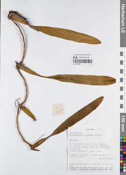
LE 01167557
Bulbophyllum orientale Seidenf. det. Averyanov, Leonid Vladimirovich at 28.04.2000
Collectors: Averyanov, Leonid Vladimirovich; et al. Field collecting number: VH5805. Collection date: 28.04.2000. Administrative regions: VN - Kon Tum. Groups of specimens: L. V. Averyanov specimens; L. V. Averyanov herbarium; Orchids of Vietnam, Laos and CambodiaOriginal label text:FLORA OF VIETNAM
Coordinates (geographic position): 14° 25′ N, 107° 44′ E ±1000 mRecord creation: 2022-03-03, Galina Savich, PhotoScan D2. Processing status: work_status_1Citation: Specimen LE 01167557 // Virtual herbarium of Komarov Botanical Institute RAS — http://re.herbariumle.ru/01167557Orchidaceae
Bulbophyllum orientale ?
S. Vietnam, Kontum Prov., Sa Thay Distr., Sa Son Municipality, Chu Mom Ray nature reserve (14°25′N, 107°44′E). Secondary open broad-leaved evergreen dry forest on granites at elev. 500-600 m. Creeping epiphyte in shady place along stream. Common.
VH 5805 28 04.2000
International Botanical Expedition of the U.S.A. National Geographic Society (grant No 6383-98)
Collectors: L.Averyanov, P.K.Loc, P.H.Hoang, D.X.Du, N.T.Vinh
Bulbophyllum orientale ?
S. Vietnam, Kontum Prov., Sa Thay Distr., Sa Son Municipality, Chu Mom Ray nature reserve (14°25′N, 107°44′E). Secondary open broad-leaved evergreen dry forest on granites at elev. 500-600 m. Creeping epiphyte in shady place along stream. Common.
VH 5805 28 04.2000
International Botanical Expedition of the U.S.A. National Geographic Society (grant No 6383-98)
Collectors: L.Averyanov, P.K.Loc, P.H.Hoang, D.X.Du, N.T.Vinh
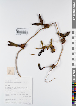
LE 01167556
Bulbophyllum blepharistes Rchb.f. det. Averyanov, Leonid Vladimirovich at 28.04.2000
Collectors: Averyanov, Leonid Vladimirovich; et al. Field collecting number: VH5807. Collection date: 28.04.2000. Administrative regions: VN - Kon Tum. Groups of specimens: L. V. Averyanov specimens; L. V. Averyanov herbarium; Orchids of Vietnam, Laos and CambodiaOriginal label text:FLORA OF VIETNAM
Coordinates (geographic position): 14° 25′ N, 107° 44′ E ±1000 mRecord creation: 2022-03-03, Galina Savich, PhotoScan D2. Processing status: work_status_1Citation: Specimen LE 01167556 // Virtual herbarium of Komarov Botanical Institute RAS — http://re.herbariumle.ru/01167556Orchidaceae
Bulbophyllum blepharistes
S. Vietnam, Kontum Prov., Sa Thay Distr., Sa Son Municipality, Chu Mom Ray nature reserve (14°25′N, 107°44′E). Secondary open broad-leaved evergreen dry forest on granites at elev. 500-600 m. Creeping epiphyte on high tree. Not common.
VH 5807 28 04.2000
International Botanical Expedition of the U.S.A. National Geographic Society (grant No 6383-98)
Collectors: L.Averyanov, P.K.Loc, P.H.Hoang, D.X.Du, N.T.Vinh
Bulbophyllum blepharistes
S. Vietnam, Kontum Prov., Sa Thay Distr., Sa Son Municipality, Chu Mom Ray nature reserve (14°25′N, 107°44′E). Secondary open broad-leaved evergreen dry forest on granites at elev. 500-600 m. Creeping epiphyte on high tree. Not common.
VH 5807 28 04.2000
International Botanical Expedition of the U.S.A. National Geographic Society (grant No 6383-98)
Collectors: L.Averyanov, P.K.Loc, P.H.Hoang, D.X.Du, N.T.Vinh
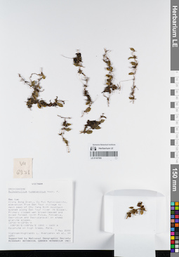
LE 01167555
Bulbophyllum hymenanthum Hook.f. det. Averyanov, Leonid Vladimirovich at 07.05.2000
Collectors: Averyanov, Leonid Vladimirovich; et al. Field collecting number: VH6251. Collection date: 07.05.2000. Administrative regions: VN - Tinh GJak Lak. Groups of specimens: L. V. Averyanov specimens; L. V. Averyanov herbarium; Orchids of Vietnam, Laos and CambodiaOriginal label text:FLORA OF VIETNAM
Coordinates (geographic position): 12° 30′ N, 108° 30′ E ±1000 mRecord creation: 2022-03-03, Galina Savich, PhotoScan D2. Processing status: work_status_1Citation: Specimen LE 01167555 // Virtual herbarium of Komarov Botanical Institute RAS — http://re.herbariumle.ru/01167555Orchidaceae
Bulbophyllum hymenanthum
S. Vietnam, Dak Lac Prov., Krong Bong Distr., Cu Pui Municipality, elevation from Dak Tour village (12°30′N, 108°30′E) to main peak of Chu Yang Sinh mt system (12°24′N, 108°26′E) along Dak Tour river (N slope). Primary closed wet broad-leaved and mixed forest (with Pinus, Fokienia, Dacrydium and Dacrycarpus) on steep granite slopes at elev. 1200-1550 m. Epiphyte on high trees. Rare.
Bulbophyllum hymenanthum
S. Vietnam, Dak Lac Prov., Krong Bong Distr., Cu Pui Municipality, elevation from Dak Tour village (12°30′N, 108°30′E) to main peak of Chu Yang Sinh mt system (12°24′N, 108°26′E) along Dak Tour river (N slope). Primary closed wet broad-leaved and mixed forest (with Pinus, Fokienia, Dacrydium and Dacrycarpus) on steep granite slopes at elev. 1200-1550 m. Epiphyte on high trees. Rare.
VH 6251 07.05.2000
International Botanical Expedition of the U.S.A. National Geographic Society (grant No 6383-98)
Collectors: L.Averyanov, N.T.Hiep, N.Q.Hieu, P.H.Hoang, D.X.Du, N.T.Vinh
International Botanical Expedition of the U.S.A. National Geographic Society (grant No 6383-98)
Collectors: L.Averyanov, N.T.Hiep, N.Q.Hieu, P.H.Hoang, D.X.Du, N.T.Vinh
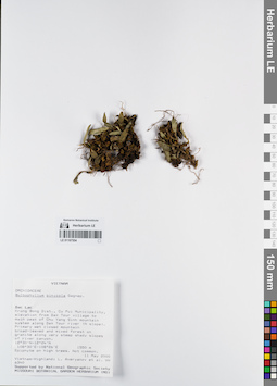
LE 01167554
Bulbophyllum pinicolum Gagnep. det. Averyanov, Leonid Vladimirovich at 11.05.2000
Collectors: Averyanov, Leonid Vladimirovich; et al. Field collecting number: VH6340. Collection date: 11.05.2000. Administrative regions: VN - Tinh GJak Lak. Groups of specimens: L. V. Averyanov specimens; L. V. Averyanov herbarium; Orchids of Vietnam, Laos and CambodiaOriginal label text:FLORA OF VIETNAM
Coordinates (geographic position): 12° 30′ N, 108° 30′ E ±1000 mRecord creation: 2022-03-03, Galina Savich, PhotoScan D2. Processing status: work_status_1Citation: Specimen LE 01167554 // Virtual herbarium of Komarov Botanical Institute RAS — http://re.herbariumle.ru/01167554Orchidaceae
Bulbophyllum pinicolum
S. Vietnam, Dak Lac Prov., Krong Bong Distr., Cu Pui Municipality, elevation from Dak Tour village (12°30′N, 108°30′E) to main peak of Chu Yang Sinh mt system (12°24′N, 108°26′E) along Dak Tour river (N slope). Primary wet closed mountain broad-leaved and mixed forest on granites along very steep shady slopes of river canyon at elev. 1550 m. Epiphyte on high trees. Not common.
VH 6340 11.05.2000
International Botanical Expedition of the U.S.A. National Geographic Society (grant No 6383-98)
Collectors: L.Averyanov, N.T.Hiep, N.Q.Hieu, P.H.Hoang, D.X.Du, N.T.Vinh
Bulbophyllum pinicolum
S. Vietnam, Dak Lac Prov., Krong Bong Distr., Cu Pui Municipality, elevation from Dak Tour village (12°30′N, 108°30′E) to main peak of Chu Yang Sinh mt system (12°24′N, 108°26′E) along Dak Tour river (N slope). Primary wet closed mountain broad-leaved and mixed forest on granites along very steep shady slopes of river canyon at elev. 1550 m. Epiphyte on high trees. Not common.
VH 6340 11.05.2000
International Botanical Expedition of the U.S.A. National Geographic Society (grant No 6383-98)
Collectors: L.Averyanov, N.T.Hiep, N.Q.Hieu, P.H.Hoang, D.X.Du, N.T.Vinh
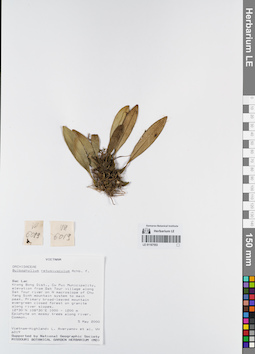
LE 01167553
Bulbophyllum retusiusculum Rchb.f. det. Averyanov, Leonid Vladimirovich at 05.05.2000
Collectors: Averyanov, Leonid Vladimirovich; et al. Field collecting number: VH6019. Collection date: 05.05.2000. Administrative regions: VN - Tinh GJak Lak. Groups of specimens: L. V. Averyanov specimens; L. V. Averyanov herbarium; Orchids of Vietnam, Laos and CambodiaOriginal label text:FLORA OF VIETNAM
Coordinates (geographic position): 12° 30′ N, 108° 30′ E ±1000 mRecord creation: 2022-03-03, Galina Savich, PhotoScan D2. Processing status: work_status_1Citation: Specimen LE 01167553 // Virtual herbarium of Komarov Botanical Institute RAS — http://re.herbariumle.ru/01167553Orchidaceae
Bulbophyllum retusiusculum
S. Vietnam, Dak Lac Prov., Krong Bong Distr., Cu Pui Municipality, elevation from Dak Tour village (12°30′N, 108°30′E) along Dak Tour river on N macroslope of Chu Yang Sinh mt system to main peak (12°24′N, 108°26′E). Primary broad-leaved mountain evergreen closed forest on granites along river slopes at elev. 1000-1200 m. Epiphyte on mossy trees along river. Common.
VH 6019 05-06.05.2000
International Botanical Expedition of the U.S.A. National Geographic Society (grant No 6383-98)
Collectors: L.Averyanov, N.T.Hiep, N.Q.Hieu, P.H.Hoang, D.X.Du, N.T.Vinh
Bulbophyllum retusiusculum
S. Vietnam, Dak Lac Prov., Krong Bong Distr., Cu Pui Municipality, elevation from Dak Tour village (12°30′N, 108°30′E) along Dak Tour river on N macroslope of Chu Yang Sinh mt system to main peak (12°24′N, 108°26′E). Primary broad-leaved mountain evergreen closed forest on granites along river slopes at elev. 1000-1200 m. Epiphyte on mossy trees along river. Common.
VH 6019 05-06.05.2000
International Botanical Expedition of the U.S.A. National Geographic Society (grant No 6383-98)
Collectors: L.Averyanov, N.T.Hiep, N.Q.Hieu, P.H.Hoang, D.X.Du, N.T.Vinh
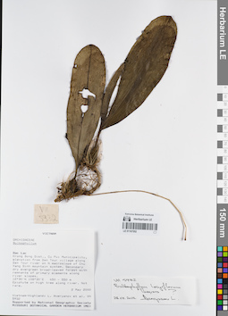
LE 01167552
Bulbophyllum longiflorum Thouars ⟮prelim. ID⟯ det. Averyanov, Leonid Vladimirovich at 28.02.2022
Collectors: Averyanov, Leonid Vladimirovich; et al. Field collecting number: VH5932. Collection date: 02.05.2000. Administrative regions: VN - Tinh GJak Lak. Groups of specimens: L. V. Averyanov specimens; L. V. Averyanov herbarium; Orchids of Vietnam, Laos and CambodiaOriginal label text:FLORA OF VIETNAM
Coordinates (geographic position): 12° 30′ N, 108° 30′ E ±1000 mRecord creation: 2022-03-03, Galina Savich, PhotoScan D2. Processing status: work_status_1Citation: Specimen LE 01167552 // Virtual herbarium of Komarov Botanical Institute RAS — http://re.herbariumle.ru/01167552Orchidaceae
Bulbophyllum sp.
S. Vietnam, Dak Lac Prov., Krong Bong Distr., Cu Pui Municipality, elevation from Dak Tour village (12°30′N, 108°30′E) along Dak Tour river on N macroslope of Chu Yang Sinh mt system. Secondary dry evergreen broad-leaved forest with remnants of primary elements along river slopes at elev. 450-550 m. Epiphyte on high tree along river. Not rare.
Bulbophyllum sp.
S. Vietnam, Dak Lac Prov., Krong Bong Distr., Cu Pui Municipality, elevation from Dak Tour village (12°30′N, 108°30′E) along Dak Tour river on N macroslope of Chu Yang Sinh mt system. Secondary dry evergreen broad-leaved forest with remnants of primary elements along river slopes at elev. 450-550 m. Epiphyte on high tree along river. Not rare.
VH 5932 02.05.2000
International Botanical Expedition of the U.S.A. National Geographic Society (grant No 6383-98)
Collectors: L.Averyanov, N.T.Hiep, N.Q.Hieu, P.H.Hoang, D.X.Du, N.T.Vinh
International Botanical Expedition of the U.S.A. National Geographic Society (grant No 6383-98)
Collectors: L.Averyanov, N.T.Hiep, N.Q.Hieu, P.H.Hoang, D.X.Du, N.T.Vinh
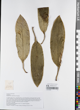
LE 01167551
Bulbophyllum clipeibulbum J.J.Verm. det. Averyanov, Leonid Vladimirovich at 07.05.2000
Collectors: Averyanov, Leonid Vladimirovich; et al. Field collecting number: VH6256. Collection date: 07.05.2000. Administrative regions: VN - Tinh GJak Lak. Groups of specimens: L. V. Averyanov specimens; L. V. Averyanov herbarium; Orchids of Vietnam, Laos and CambodiaOriginal label text:FLORA OF VIETNAM
Coordinates (geographic position): 12° 30′ N, 108° 30′ E ±1000 mRecord creation: 2022-03-03, Galina Savich, PhotoScan D2. Processing status: work_status_1Citation: Specimen LE 01167551 // Virtual herbarium of Komarov Botanical Institute RAS — http://re.herbariumle.ru/01167551Orchidaceae
Bulbophyllum clipeibulbum Vermeulen
S. Vietnam, Dak Lac Prov., Krong Bong Distr., Cu Pui Municipality, elevation from Dak Tour village (12°30′N, 108°30′E) to main peak of Chu Yang Sinh mt system (12°24′N, 108°26′E) along Dak Tour river (N slope). Primary closed wet broad-leaved and mixed forest (with Pinus, Fokienia, Dacrydium and Dacrycarpus) on steep granite slopes at elev. 1450 m. Creeping epiphyte on high trees. Inflorescence fleshy up to 0.6 m lg. Flowers dirty brown-purplish. Not common.
VH 6256 07.05.2000
International Botanical Expedition of the U.S.A. National Geographic Society (grant No 6383-98)
Collectors: L.Averyanov, N.T.Hiep, N.Q.Hieu, P.H.Hoang, D.X.Du, N.T.Vinh
Bulbophyllum clipeibulbum Vermeulen
S. Vietnam, Dak Lac Prov., Krong Bong Distr., Cu Pui Municipality, elevation from Dak Tour village (12°30′N, 108°30′E) to main peak of Chu Yang Sinh mt system (12°24′N, 108°26′E) along Dak Tour river (N slope). Primary closed wet broad-leaved and mixed forest (with Pinus, Fokienia, Dacrydium and Dacrycarpus) on steep granite slopes at elev. 1450 m. Creeping epiphyte on high trees. Inflorescence fleshy up to 0.6 m lg. Flowers dirty brown-purplish. Not common.
VH 6256 07.05.2000
International Botanical Expedition of the U.S.A. National Geographic Society (grant No 6383-98)
Collectors: L.Averyanov, N.T.Hiep, N.Q.Hieu, P.H.Hoang, D.X.Du, N.T.Vinh
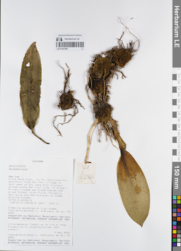
LE 01167550
Bulbophyllum clipeibulbum J.J.Verm. det. Averyanov, Leonid Vladimirovich at 07.05.2000
Collectors: Averyanov, Leonid Vladimirovich; et al. Field collecting number: VH6256. Collection date: 07.05.2000. Administrative regions: VN - Tinh GJak Lak. Groups of specimens: L. V. Averyanov specimens; L. V. Averyanov herbarium; Orchids of Vietnam, Laos and CambodiaOriginal label text:FLORA OF VIETNAM
Coordinates (geographic position): 12° 30′ N, 108° 30′ E ±1000 mRecord creation: 2022-03-03, Galina Savich, PhotoScan D2. Processing status: work_status_1Citation: Specimen LE 01167550 // Virtual herbarium of Komarov Botanical Institute RAS — http://re.herbariumle.ru/01167550Orchidaceae
Bulbophyllum clipeibulbum Vermeulen
S. Vietnam, Dak Lac Prov., Krong Bong Distr., Cu Pui Municipality, elevation from Dak Tour village (12°30′N, 108°30′E) to main peak of Chu Yang Sinh mt system (12°24′N, 108°26′E) along Dak Tour river (N slope). Primary closed wet broad-leaved and mixed forest (with Pinus, Fokienia, Dacrydium and Dacrycarpus) on steep granite slopes at elev. 1450 m. Creeping epiphyte on high trees. Inflorescence fleshy up to 0.6 m lg. Flowers dirty brown-purplish. Not common.
VH 6256 07.05.2000
International Botanical Expedition of the U.S.A. National Geographic Society (grant No 6383-98)
Collectors: L.Averyanov, N.T.Hiep, N.Q.Hieu, P.H.Hoang, D.X.Du, N.T.Vinh
Bulbophyllum clipeibulbum Vermeulen
S. Vietnam, Dak Lac Prov., Krong Bong Distr., Cu Pui Municipality, elevation from Dak Tour village (12°30′N, 108°30′E) to main peak of Chu Yang Sinh mt system (12°24′N, 108°26′E) along Dak Tour river (N slope). Primary closed wet broad-leaved and mixed forest (with Pinus, Fokienia, Dacrydium and Dacrycarpus) on steep granite slopes at elev. 1450 m. Creeping epiphyte on high trees. Inflorescence fleshy up to 0.6 m lg. Flowers dirty brown-purplish. Not common.
VH 6256 07.05.2000
International Botanical Expedition of the U.S.A. National Geographic Society (grant No 6383-98)
Collectors: L.Averyanov, N.T.Hiep, N.Q.Hieu, P.H.Hoang, D.X.Du, N.T.Vinh
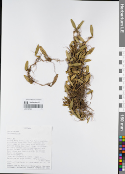
LE 01167549
Bulbophyllum astelidum Aver. ⟮prelim. ID⟯ det. Averyanov, Leonid Vladimirovich at 07.05.2000
Collectors: Averyanov, Leonid Vladimirovich; et al. Field collecting number: VH6258. Collection date: 07.05.2000. Administrative regions: VN - Tinh GJak Lak. Groups of specimens: L. V. Averyanov specimens; L. V. Averyanov herbarium; Orchids of Vietnam, Laos and CambodiaOriginal label text:FLORA OF VIETNAM
Coordinates (geographic position): 12° 30′ N, 108° 30′ E ±1000 mRecord creation: 2022-03-03, Galina Savich, PhotoScan D2. Processing status: work_status_1Citation: Specimen LE 01167549 // Virtual herbarium of Komarov Botanical Institute RAS — http://re.herbariumle.ru/01167549Orchidaceae
Bulbophyllum astelidum ?
S. Vietnam, Dak Lac Prov., Krong Bong Distr., Cu Pui Municipality, elevation from Dak Tour village (12°30′N, 108°30′E) to main peak of Chu Yang Sinh mt system (12°24′N, 108°26′E) along Dak Tour river (N slope). Primary closed wet broad-leaved and mixed forest (with Pinus, Fokienia, Dacrydium and Dacrycarpus) on steep granite slopes at elev. 1450 m. Epiphyte on high trees. Very common.
VH 6258 07.05.2000
International Botanical Expedition of the U.S.A. National Geographic Society (grant No 6383-98)
Collectors: L.Averyanov, N.T.Hiep, N.Q.Hieu, P.H.Hoang, D.X.Du, N.T.Vinh
Bulbophyllum astelidum ?
S. Vietnam, Dak Lac Prov., Krong Bong Distr., Cu Pui Municipality, elevation from Dak Tour village (12°30′N, 108°30′E) to main peak of Chu Yang Sinh mt system (12°24′N, 108°26′E) along Dak Tour river (N slope). Primary closed wet broad-leaved and mixed forest (with Pinus, Fokienia, Dacrydium and Dacrycarpus) on steep granite slopes at elev. 1450 m. Epiphyte on high trees. Very common.
VH 6258 07.05.2000
International Botanical Expedition of the U.S.A. National Geographic Society (grant No 6383-98)
Collectors: L.Averyanov, N.T.Hiep, N.Q.Hieu, P.H.Hoang, D.X.Du, N.T.Vinh
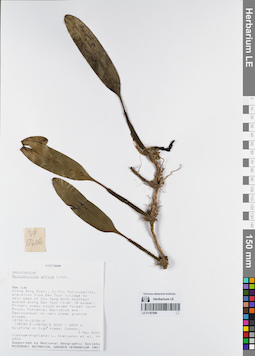
LE 01167548
Bulbophyllum affine Lindl. det. Averyanov, Leonid Vladimirovich at 09.05.2000
Collectors: Averyanov, Leonid Vladimirovich; et al. Field collecting number: VH6206. Collection date: 09.05.2000. Administrative regions: VN - Tinh GJak Lak. Groups of specimens: L. V. Averyanov specimens; L. V. Averyanov herbarium; Orchids of Vietnam, Laos and CambodiaOriginal label text:FLORA OF VIETNAM
Coordinates (geographic position): 12° 30′ N, 108° 30′ E ±1000 mRecord creation: 2022-03-03, Galina Savich, PhotoScan D2. Processing status: work_status_1Citation: Specimen LE 01167548 // Virtual herbarium of Komarov Botanical Institute RAS — http://re.herbariumle.ru/01167548Orchidaceae
Bulbophyllum affine ?
S. Vietnam, Dak Lac Prov., Krong Bong Distr., Cu Pui Municipality, elevation from Dak Tour village (12°30′N, 108°30′E) to main peak of Chu Yang Sinh mt system (12°24′N, 108°26′E) along Dak Tour river (N slope). Primary mossy cloud mixed forest (with Pinus, Fokienia, Dacrydium and Dacrycarpus) on very steep granite slopes at elev. 2000-2200 m. Epiphyte on high trees. Common.
VH 6206 09.05.2000
International Botanical Expedition of the U.S.A. National Geographic Society (grant No 6383-98)
Collectors: L.Averyanov, N.T.Hiep, N.Q.Hieu, P.H.Hoang, D.X.Du, N.T.Vinh
Bulbophyllum affine ?
S. Vietnam, Dak Lac Prov., Krong Bong Distr., Cu Pui Municipality, elevation from Dak Tour village (12°30′N, 108°30′E) to main peak of Chu Yang Sinh mt system (12°24′N, 108°26′E) along Dak Tour river (N slope). Primary mossy cloud mixed forest (with Pinus, Fokienia, Dacrydium and Dacrycarpus) on very steep granite slopes at elev. 2000-2200 m. Epiphyte on high trees. Common.
VH 6206 09.05.2000
International Botanical Expedition of the U.S.A. National Geographic Society (grant No 6383-98)
Collectors: L.Averyanov, N.T.Hiep, N.Q.Hieu, P.H.Hoang, D.X.Du, N.T.Vinh
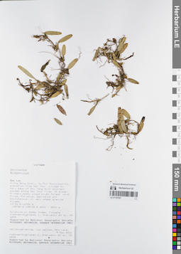
LE 01167547
Bulbophyllum astelidum Aver. ⟮prelim. ID⟯ det. Averyanov, Leonid Vladimirovich at 09.05.2000
Collectors: Averyanov, Leonid Vladimirovich; et al. Field collecting number: VH6208. Collection date: 09.05.2000. Administrative regions: VN - Tinh GJak Lak. Groups of specimens: L. V. Averyanov specimens; L. V. Averyanov herbarium; Orchids of Vietnam, Laos and CambodiaOriginal label text:FLORA OF VIETNAM
Coordinates (geographic position): 12° 30′ N, 108° 30′ E ±1000 mRecord creation: 2022-03-03, Galina Savich, PhotoScan D2. Processing status: work_status_1Citation: Specimen LE 01167547 // Virtual herbarium of Komarov Botanical Institute RAS — http://re.herbariumle.ru/01167547Orchidaceae
Bulbophyllum astelidum Aver.
S. Vietnam, Dak Lac Prov., Krong Bong Distr., Cu Pui Municipality, elevation from Dak Tour village (12°30′N, 108°30′E) to main peak of Chu Yang Sinh mt system (12°24′N, 108°26′E) along Dak Tour river (N slope). Primary mossy cloud mixed forest (with Pinus, Fokienia, Dacrydium and Dacrycarpus) on very steep granite slopes at elev. 2000-2200 m. Epiphyte on mossy trees. Flowers yellowish-white, lip yellow. Not rare.
VH 6208 09.05.2000
International Botanical Expedition of the U.S.A. National Geographic Society (grant No 6383-98)
Collectors: L.Averyanov, N.T.Hiep, N.Q.Hieu, P.H.Hoang, D.X.Du, N.T.Vinh
Bulbophyllum astelidum Aver.
S. Vietnam, Dak Lac Prov., Krong Bong Distr., Cu Pui Municipality, elevation from Dak Tour village (12°30′N, 108°30′E) to main peak of Chu Yang Sinh mt system (12°24′N, 108°26′E) along Dak Tour river (N slope). Primary mossy cloud mixed forest (with Pinus, Fokienia, Dacrydium and Dacrycarpus) on very steep granite slopes at elev. 2000-2200 m. Epiphyte on mossy trees. Flowers yellowish-white, lip yellow. Not rare.
VH 6208 09.05.2000
International Botanical Expedition of the U.S.A. National Geographic Society (grant No 6383-98)
Collectors: L.Averyanov, N.T.Hiep, N.Q.Hieu, P.H.Hoang, D.X.Du, N.T.Vinh
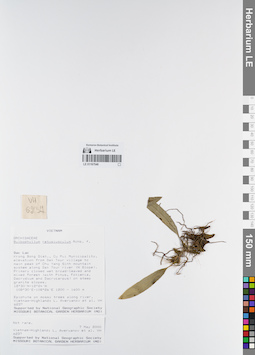
LE 01167546
Bulbophyllum retusiusculum Rchb.f. det. Averyanov, Leonid Vladimirovich at 07.05.2000
Collectors: Averyanov, Leonid Vladimirovich; et al. Field collecting number: VH6237. Collection date: 07.05.2000. Administrative regions: VN - Tinh GJak Lak. Groups of specimens: L. V. Averyanov specimens; L. V. Averyanov herbarium; Orchids of Vietnam, Laos and CambodiaOriginal label text:FLORA OF VIETNAM
Coordinates (geographic position): 12° 30′ N, 108° 30′ E ±1000 mRecord creation: 2022-03-03, Galina Savich, PhotoScan D2. Processing status: work_status_1Citation: Specimen LE 01167546 // Virtual herbarium of Komarov Botanical Institute RAS — http://re.herbariumle.ru/01167546Orchidaceae
Bulbophyllum retusiusculum Rchb.f.
S. Vietnam, Dak Lac Prov., Krong Bong Distr., Cu Pui Municipality, elevation from Dak Tour village (12°30′N, 108°30′E) to main peak of Chu Yang Sinh mt system (12°24′N, 108°26′E) along Dak Tour river (N slope). Primary closed wet broad-leaved and mixed forest (with Pinus, Fokienia, Dacrydium and Dacrycarpus) on steep granite slopes at elev. 1200-1300 m. Epiphyte on mossy trees along river. Not rare.
VH 6237 08.05.2000
International Botanical Expedition of the U.S.A. National Geographic Society (grant No 6383-98)
Collectors: L.Averyanov, N.T.Hiep, N.Q.Hieu, P.H.Hoang, D.X.Du, N.T.Vinh
Bulbophyllum retusiusculum Rchb.f.
S. Vietnam, Dak Lac Prov., Krong Bong Distr., Cu Pui Municipality, elevation from Dak Tour village (12°30′N, 108°30′E) to main peak of Chu Yang Sinh mt system (12°24′N, 108°26′E) along Dak Tour river (N slope). Primary closed wet broad-leaved and mixed forest (with Pinus, Fokienia, Dacrydium and Dacrycarpus) on steep granite slopes at elev. 1200-1300 m. Epiphyte on mossy trees along river. Not rare.
VH 6237 08.05.2000
International Botanical Expedition of the U.S.A. National Geographic Society (grant No 6383-98)
Collectors: L.Averyanov, N.T.Hiep, N.Q.Hieu, P.H.Hoang, D.X.Du, N.T.Vinh
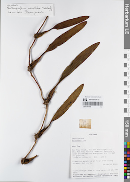
LE 01167545
Bulbophyllum orientale Seidenf. det. Averyanov, Leonid Vladimirovich at 28.02.2022
Collectors: Averyanov, Leonid Vladimirovich; et al. Field collecting number: VH5802. Collection date: 28.04.2000. Administrative regions: VN - Kon Tum. Groups of specimens: L. V. Averyanov specimens; L. V. Averyanov herbarium; Orchids of Vietnam, Laos and CambodiaOriginal label text:FLORA OF VIETNAM
Coordinates (geographic position): 14° 25′ N, 107° 44′ E ±1000 mRecord creation: 2022-03-03, Galina Savich, PhotoScan D2. Processing status: work_status_1Citation: Specimen LE 01167545 // Virtual herbarium of Komarov Botanical Institute RAS — http://re.herbariumle.ru/01167545Orchidaceae
Bulbophyllum sp.
S. Vietnam, Kontum Prov., Sa Thay Distr., Sa Son Municipality, Chu Mom Ray nature reserve (14°25′N, 107°44′E). Secondary open broad-leaved evergreen dry forest on granites at elev. 500-600 m. Creeping epiphyte on high tree along stream. Not rare.
VH 5802 28 04.2000
International Botanical Expedition of the U.S.A. National Geographic Society (grant No 6383-98)
Collectors: L.Averyanov, P.K.Loc, P.H.Hoang, D.X.Du, N.T.Vinh
Bulbophyllum sp.
S. Vietnam, Kontum Prov., Sa Thay Distr., Sa Son Municipality, Chu Mom Ray nature reserve (14°25′N, 107°44′E). Secondary open broad-leaved evergreen dry forest on granites at elev. 500-600 m. Creeping epiphyte on high tree along stream. Not rare.
VH 5802 28 04.2000
International Botanical Expedition of the U.S.A. National Geographic Society (grant No 6383-98)
Collectors: L.Averyanov, P.K.Loc, P.H.Hoang, D.X.Du, N.T.Vinh
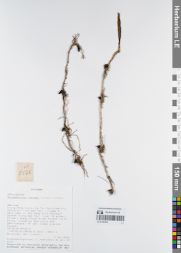
LE 01167544
Bulbophyllum reptans (Lindl.) Lindl. det. Averyanov, Leonid Vladimirovich at 09.05.2000
Collectors: Averyanov, Leonid Vladimirovich; et al. Field collecting number: VH6151. Collection date: 09.05.2000. Administrative regions: VN - Tinh GJak Lak. Groups of specimens: L. V. Averyanov specimens; L. V. Averyanov herbarium; Orchids of Vietnam, Laos and CambodiaOriginal label text:FLORA OF VIETNAM
Coordinates (geographic position): 12° 30′ N, 108° 30′ E ±1000 mRecord creation: 2022-03-03, Galina Savich, PhotoScan D2. Processing status: work_status_1Citation: Specimen LE 01167544 // Virtual herbarium of Komarov Botanical Institute RAS — http://re.herbariumle.ru/01167544Orchidaceae
Bulbophyllum reptans
S. Vietnam, Dak Lac Prov., Krong Bong Distr., Cu Pui Municipality, elevation from Dak Tour village (12°30′N, 108°30′E) to main peak of Chu Yang Sinh mt system (12°24′N, 108°26′E) along Dak Tour river (N slope). Primary mossy cloud mixed forest (with Pinus, Fokienia, Dacrydium and Dacrycarpus) on very steep granite slopes at elev. 2100-2200 m. Epiphyte. Very common.
VH 6151 09.05.2000
International Botanical Expedition of the U.S.A. National Geographic Society (grant No 6383-98)
Collectors: L.Averyanov, N.T.Hiep, N.Q.Hieu, P.H.Hoang, D.X.Du, N.T.Vinh
Bulbophyllum reptans
S. Vietnam, Dak Lac Prov., Krong Bong Distr., Cu Pui Municipality, elevation from Dak Tour village (12°30′N, 108°30′E) to main peak of Chu Yang Sinh mt system (12°24′N, 108°26′E) along Dak Tour river (N slope). Primary mossy cloud mixed forest (with Pinus, Fokienia, Dacrydium and Dacrycarpus) on very steep granite slopes at elev. 2100-2200 m. Epiphyte. Very common.
VH 6151 09.05.2000
International Botanical Expedition of the U.S.A. National Geographic Society (grant No 6383-98)
Collectors: L.Averyanov, N.T.Hiep, N.Q.Hieu, P.H.Hoang, D.X.Du, N.T.Vinh
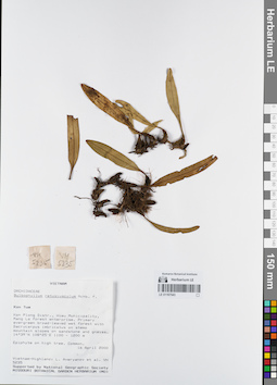
LE 01167543
Bulbophyllum retusiusculum Rchb.f. det. Averyanov, Leonid Vladimirovich at 16.04.2000
Collectors: Averyanov, Leonid Vladimirovich; et al. Field collecting number: VH5235. Collection date: 16.04.2000. Administrative regions: VN - Kon Tum. Groups of specimens: L. V. Averyanov specimens; L. V. Averyanov herbarium; Orchids of Vietnam, Laos and CambodiaOriginal label text:FLORA OF VIETNAM
Coordinates (geographic position): 14° 39′ N, 108° 25′ E ±1000 mRecord creation: 2022-03-03, Galina Savich, PhotoScan D2. Processing status: work_status_1Citation: Specimen LE 01167543 // Virtual herbarium of Komarov Botanical Institute RAS — http://re.herbariumle.ru/01167543Orchidaceae
Bulbophyllum retusiusculum
S. Vietnam, Kontum Prov., Kon Plong Distr., Hieu Municipality, Mang La forest enterprise (14°39′N, 108°25′E). Primary evergreen broad-leaved wet forest with Dacrycarpus imbricatus on steep mt. slopes on sandstone & gneiss at elev. 1100-1200 m. Epiphyte on high tree. Common.
VH 5235 16.04.2000
International Botanical Expedition of the U.S.A. National Geographic Society (grant No 6383-98)
Collectors: L.Averyanov, P.K.Loc, P.H.Hoang, D.X.Du, N.T.Vinh
Bulbophyllum retusiusculum
S. Vietnam, Kontum Prov., Kon Plong Distr., Hieu Municipality, Mang La forest enterprise (14°39′N, 108°25′E). Primary evergreen broad-leaved wet forest with Dacrycarpus imbricatus on steep mt. slopes on sandstone & gneiss at elev. 1100-1200 m. Epiphyte on high tree. Common.
VH 5235 16.04.2000
International Botanical Expedition of the U.S.A. National Geographic Society (grant No 6383-98)
Collectors: L.Averyanov, P.K.Loc, P.H.Hoang, D.X.Du, N.T.Vinh
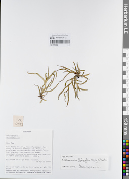
LE 01167542
Oberonia falcata King & Pantl. det. Averyanov, Leonid Vladimirovich at 28.02.2022
Collectors: Averyanov, Leonid Vladimirovich; et al. Field collecting number: VH5233. Collection date: 16.04.2000. Administrative regions: VN - Kon Tum. Groups of specimens: L. V. Averyanov specimens; L. V. Averyanov herbarium; Orchids of Vietnam, Laos and CambodiaOriginal label text:FLORA OF VIETNAM
Coordinates (geographic position): 14° 39′ N, 108° 25′ E ±1000 mRecord creation: 2022-03-03, Galina Savich, PhotoScan D2. Processing status: work_status_1Citation: Specimen LE 01167542 // Virtual herbarium of Komarov Botanical Institute RAS — http://re.herbariumle.ru/01167542Orchidaceae
Bulbophyllum sp.
S. Vietnam, Kontum Prov., Kon Plong Distr., Hieu Municipality, Mang La forest enterprise (14°39′N, 108°25′E). Primary evergreen broad-leaved wet forest with Dacrycarpus imbricatus on steep mt. slopes on sandstone & gneiss at elev. 1100-1200 m. Epiphyte on high tree. Common.
VH 5233 16.04.2000
International Botanical Expedition of the U.S.A. National Geographic Society (grant No 6383-98)
Collectors: L.Averyanov, P.K.Loc, P.H.Hoang, D.X.Du, N.T.Vinh
Bulbophyllum sp.
S. Vietnam, Kontum Prov., Kon Plong Distr., Hieu Municipality, Mang La forest enterprise (14°39′N, 108°25′E). Primary evergreen broad-leaved wet forest with Dacrycarpus imbricatus on steep mt. slopes on sandstone & gneiss at elev. 1100-1200 m. Epiphyte on high tree. Common.
VH 5233 16.04.2000
International Botanical Expedition of the U.S.A. National Geographic Society (grant No 6383-98)
Collectors: L.Averyanov, P.K.Loc, P.H.Hoang, D.X.Du, N.T.Vinh
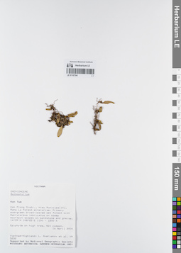
LE 01167541
Bulbophyllum sp. det. Averyanov, Leonid Vladimirovich at 16.04.2000
Collectors: Averyanov, Leonid Vladimirovich; et al. Field collecting number: VH5232. Collection date: 16.04.2000. Administrative regions: VN - Kon Tum. Groups of specimens: L. V. Averyanov specimens; L. V. Averyanov herbarium; Orchids of Vietnam, Laos and CambodiaOriginal label text:FLORA OF VIETNAM
Coordinates (geographic position): 14° 39′ N, 108° 25′ E ±1000 mRecord creation: 2022-03-03, Galina Savich, PhotoScan D2Citation: Specimen LE 01167541 // Virtual herbarium of Komarov Botanical Institute RAS — http://re.herbariumle.ru/01167541Orchidaceae
Bulbophyllum sp.
S. Vietnam, Kontum Prov., Kon Plong Distr., Hieu Municipality, Mang La forest enterprise (14°39′N, 108°25′E). Primary evergreen broad-leaved wet forest with Dacrycarpus imbricatus on steep mt. slopes on sandstone & gneiss at elev. 1100-1200 m. Epiphyte on high tree. Not common.
VH 5232 16.04.2000
International Botanical Expedition of the U.S.A. National Geographic Society (grant No 6383-98)
Collectors: L.Averyanov, P.K.Loc, P.H.Hoang, D.X.Du, N.T.Vinh
Bulbophyllum sp.
S. Vietnam, Kontum Prov., Kon Plong Distr., Hieu Municipality, Mang La forest enterprise (14°39′N, 108°25′E). Primary evergreen broad-leaved wet forest with Dacrycarpus imbricatus on steep mt. slopes on sandstone & gneiss at elev. 1100-1200 m. Epiphyte on high tree. Not common.
VH 5232 16.04.2000
International Botanical Expedition of the U.S.A. National Geographic Society (grant No 6383-98)
Collectors: L.Averyanov, P.K.Loc, P.H.Hoang, D.X.Du, N.T.Vinh
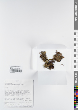
LE 01167540
Bulbophyllum catenarium Ridl. det. Averyanov, Leonid Vladimirovich at 16.04.2000
Collectors: Averyanov, Leonid Vladimirovich; et al. Field collecting number: VH5249. Collection date: 16.04.2000. Administrative regions: VN - Kon Tum. Groups of specimens: L. V. Averyanov specimens; L. V. Averyanov herbarium; Orchids of Vietnam, Laos and CambodiaOriginal label text:FLORA OF VIETNAM
Coordinates (geographic position): 14° 39′ N, 108° 25′ E ±1000 mRecord creation: 2022-03-03, Galina Savich, PhotoScan D2. Processing status: work_status_1Citation: Specimen LE 01167540 // Virtual herbarium of Komarov Botanical Institute RAS — http://re.herbariumle.ru/01167540Orchidaceae
Bulbophyllum catenarium Ridl.
S. Vietnam, Kontum Prov., Kon Plong Distr., Hieu Municipality, Mang La forest enterprise (14°39′N, 108°25′E). Primary evergreen broad-leaved wet forest with Dacrycarpus imbricatus on steep mt. slopes on sandstone & gneiss at elev. 1100-1200 m. Epiphyte on high mossy trees. Flowers yellow, lip deep red. Rare.
VH 5249 16.04.2000
International Botanical Expedition of the U.S.A. National Geographic Society (grant No 6383-98)
Collectors: L.Averyanov, P.K.Loc, P.H.Hoang, D.X.Du, N.T.Vinh
Bulbophyllum catenarium Ridl.
S. Vietnam, Kontum Prov., Kon Plong Distr., Hieu Municipality, Mang La forest enterprise (14°39′N, 108°25′E). Primary evergreen broad-leaved wet forest with Dacrycarpus imbricatus on steep mt. slopes on sandstone & gneiss at elev. 1100-1200 m. Epiphyte on high mossy trees. Flowers yellow, lip deep red. Rare.
VH 5249 16.04.2000
International Botanical Expedition of the U.S.A. National Geographic Society (grant No 6383-98)
Collectors: L.Averyanov, P.K.Loc, P.H.Hoang, D.X.Du, N.T.Vinh
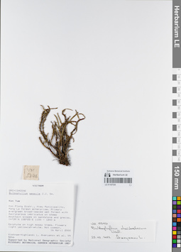
LE 01167539
Bulbophyllum clandestinum Lindl. det. Averyanov, Leonid Vladimirovich at 28.02.2022
Additional identifications: Bulbophyllum sessile J.J.Sm. det. Averyanov, Leonid Vladimirovich at 16.04.2000 Collectors: Averyanov, Leonid Vladimirovich; et al. Field collecting number: VH5246. Collection date: 16.04.2000. Administrative regions: VN - Kon Tum. Groups of specimens: L. V. Averyanov specimens; L. V. Averyanov herbarium; Orchids of Vietnam, Laos and CambodiaOriginal label text:FLORA OF VIETNAM
Coordinates (geographic position): 14° 39′ N, 108° 25′ E ±1000 mRecord creation: 2022-03-03, Galina Savich, PhotoScan D2. Processing status: work_status_1Citation: Specimen LE 01167539 // Virtual herbarium of Komarov Botanical Institute RAS — http://re.herbariumle.ru/01167539Orchidaceae
Bulbophyllum sessile (Koen.) J.J.Smith
S. Vietnam, Kontum Prov., Kon Plong Distr., Hieu Municipality, Mang La forest enterprise (14°39′N, 108°25′E). Primary evergreen broad-leaved wet forest with Dacrycarpus imbricatus on steep mt. slopes on sandstone & gneiss at elev. 1100-1200 m. Epiphyte on high mossy trees. Flowers light yellowish-white. Not common.
VH 5246 16.04.2000
International Botanical Expedition of the U.S.A. National Geographic Society (grant No 6383-98)
Collectors: L.Averyanov, P.K.Loc, P.H.Hoang, D.X.Du, N.T.Vinh
Bulbophyllum sessile (Koen.) J.J.Smith
S. Vietnam, Kontum Prov., Kon Plong Distr., Hieu Municipality, Mang La forest enterprise (14°39′N, 108°25′E). Primary evergreen broad-leaved wet forest with Dacrycarpus imbricatus on steep mt. slopes on sandstone & gneiss at elev. 1100-1200 m. Epiphyte on high mossy trees. Flowers light yellowish-white. Not common.
VH 5246 16.04.2000
International Botanical Expedition of the U.S.A. National Geographic Society (grant No 6383-98)
Collectors: L.Averyanov, P.K.Loc, P.H.Hoang, D.X.Du, N.T.Vinh
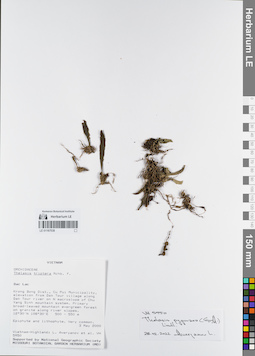
LE 01167538
Thelasis pygmaea (Griff.) Lindl. det. Averyanov, Leonid Vladimirovich at 28.02.2022
Collectors: Averyanov, Leonid Vladimirovich; et al. Field collecting number: VH5950. Collection date: 03.05.2000. Administrative regions: VN - Tinh GJak Lak. Groups of specimens: L. V. Averyanov specimens; L. V. Averyanov herbarium; Orchids of Vietnam, Laos and CambodiaOriginal label text:FLORA OF VIETNAM
Coordinates (geographic position): 12° 30′ N, 108° 30′ E ±1000 mRecord creation: 2022-03-03, Galina Savich, PhotoScan D2Citation: Specimen LE 01167538 // Virtual herbarium of Komarov Botanical Institute RAS — http://re.herbariumle.ru/01167538Orchidaceae
Thelasis triptera ?
S. Vietnam, Dak Lac Prov., Krong Bong Distr., Cu Pui Municipality, elevation from Dak Tour village (12°30′N, 108°30′E) along Dak Tour river on N macroslope of Chu Yang Sinh mt system. Primary broad-leaved mountain evergreen forest on granites along river slopes at elev. 500-550 m. Epiphyte and lithophyte. Very common.
Thelasis triptera ?
S. Vietnam, Dak Lac Prov., Krong Bong Distr., Cu Pui Municipality, elevation from Dak Tour village (12°30′N, 108°30′E) along Dak Tour river on N macroslope of Chu Yang Sinh mt system. Primary broad-leaved mountain evergreen forest on granites along river slopes at elev. 500-550 m. Epiphyte and lithophyte. Very common.
VH 5950 03.05.2000
International Botanical Expedition of the U.S.A. National Geographic Society (grant No 6383-98)
Collectors: L.Averyanov, N.T.Hiep, N.Q.Hieu, P.H.Hoang, D.X.Du, N.T.Vinh
International Botanical Expedition of the U.S.A. National Geographic Society (grant No 6383-98)
Collectors: L.Averyanov, N.T.Hiep, N.Q.Hieu, P.H.Hoang, D.X.Du, N.T.Vinh
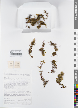
LE 01167537
Trichotosia dasyphylla (E.C.Parish & Rchb.f.) Kraenzl. det. Averyanov, Leonid Vladimirovich at 07.05.2000
Collectors: Averyanov, Leonid Vladimirovich; et al. Field collecting number: VH6241. Collection date: 07.05.2000. Administrative regions: VN - Tinh GJak Lak. Groups of specimens: L. V. Averyanov specimens; L. V. Averyanov herbarium; Orchids of Vietnam, Laos and CambodiaOriginal label text:FLORA OF VIETNAM
Coordinates (geographic position): 12° 30′ N, 108° 30′ E ±1000 mRecord creation: 2022-03-03, Galina Savich, PhotoScan D2. Processing status: work_status_1Citation: Specimen LE 01167537 // Virtual herbarium of Komarov Botanical Institute RAS — http://re.herbariumle.ru/01167537Orchidaceae
Trichotosia dasyphylla
S. Vietnam, Dak Lac Prov., Krong Bong Distr., Cu Pui Municipality, elevation from Dak Tour village (12°30′N, 108°30′E) to main peak of Chu Yang Sinh mt system (12°24′N, 108°26′E) along Dak Tour river (N slope). Primary closed wet broad-leaved and mixed forest (with Pinus, Fokienia, Dacrydium and Dacrycarpus) on steep granite slopes at elev. 1200-1300 m. Epiphytic creeping vine on high trees. Not rare.
VH 6241 08.05.2000
International Botanical Expedition of the U.S.A. National Geographic Society (grant No 6383-98)
Collectors: L.Averyanov, N.T.Hiep, N.Q.Hieu, P.H.Hoang, D.X.Du, N.T.Vinh
Trichotosia dasyphylla
S. Vietnam, Dak Lac Prov., Krong Bong Distr., Cu Pui Municipality, elevation from Dak Tour village (12°30′N, 108°30′E) to main peak of Chu Yang Sinh mt system (12°24′N, 108°26′E) along Dak Tour river (N slope). Primary closed wet broad-leaved and mixed forest (with Pinus, Fokienia, Dacrydium and Dacrycarpus) on steep granite slopes at elev. 1200-1300 m. Epiphytic creeping vine on high trees. Not rare.
VH 6241 08.05.2000
International Botanical Expedition of the U.S.A. National Geographic Society (grant No 6383-98)
Collectors: L.Averyanov, N.T.Hiep, N.Q.Hieu, P.H.Hoang, D.X.Du, N.T.Vinh
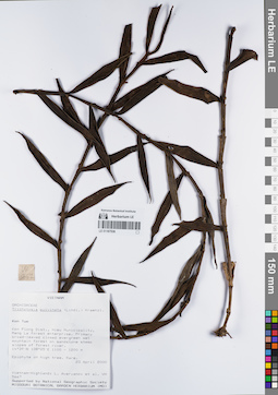
LE 01167536
Trichotosia pulvinata (Lindl.) Kraenzl. det. Averyanov, Leonid Vladimirovich at 23.04.2000
Collectors: Averyanov, Leonid Vladimirovich; et al. Field collecting number: VH5667. Collection date: 23.04.2000. Administrative regions: VN - Kon Tum. Groups of specimens: L. V. Averyanov specimens; L. V. Averyanov herbarium; Orchids of Vietnam, Laos and CambodiaOriginal label text:FLORA OF VIETNAM
Coordinates (geographic position): 14° 39′ N, 108° 25′ E ±1000 mRecord creation: 2022-03-03, Galina Savich, PhotoScan D2. Processing status: work_status_1Citation: Specimen LE 01167536 // Virtual herbarium of Komarov Botanical Institute RAS — http://re.herbariumle.ru/01167536Orchidaceae
Trichotosia pulvinata ?
S. Vietnam, Kontum Prov., Kon Plong Distr., Hieu Municipality, Mang La forest enterprise (14°39′N, 108°25′E). Primary broad-leaved closed evergreen wet mountain forest on sandstone steep slopes of forest river at elev. 1100-1200 m. Epiphyte on high tree. Rare.
VH 5667 24.04.2000
International Botanical Expedition of the U.S.A. National Geographic Society (grant No 6383-98)
Collectors: L.Averyanov, P.H.Hoang, D.X.Du, N.T.Vinh
Trichotosia pulvinata ?
S. Vietnam, Kontum Prov., Kon Plong Distr., Hieu Municipality, Mang La forest enterprise (14°39′N, 108°25′E). Primary broad-leaved closed evergreen wet mountain forest on sandstone steep slopes of forest river at elev. 1100-1200 m. Epiphyte on high tree. Rare.
VH 5667 24.04.2000
International Botanical Expedition of the U.S.A. National Geographic Society (grant No 6383-98)
Collectors: L.Averyanov, P.H.Hoang, D.X.Du, N.T.Vinh
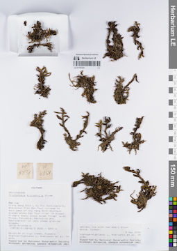
LE 01167535
Trichotosia microphylla Blume det. Averyanov, Leonid Vladimirovich at 09.05.2000
Collectors: Averyanov, Leonid Vladimirovich; et al. Field collecting number: VH6154. Collection date: 09.05.2000. Administrative regions: VN - Tinh GJak Lak. Groups of specimens: L. V. Averyanov specimens; L. V. Averyanov herbarium; Orchids of Vietnam, Laos and CambodiaOriginal label text:FLORA OF VIETNAM
Coordinates (geographic position): 12° 30′ N, 108° 30′ E ±1000 mRecord creation: 2022-03-03, Galina Savich, PhotoScan D2. Processing status: work_status_1Citation: Specimen LE 01167535 // Virtual herbarium of Komarov Botanical Institute RAS — http://re.herbariumle.ru/01167535Orchidaceae
Trichotosia microphylla
S. Vietnam, Dak Lac Prov., Krong Bong Distr., Cu Pui Municipality, elevation from Dak Tour village (12°30′N, 108°30′E) to main peak of Chu Yang Sinh mt system (12°24′N, 108°26′E) along Dak Tour river (N slope). Primary mossy cloud mixed forest (with Pinus, Fokienia, Dacrydium and Dacrycarpus) on very steep granite slopes at elev. 2000 m. Epiphyte on high trees. Flowers yellow, lip with two small brown spots. Common.
VH 6154 09.05.2000
International Botanical Expedition of the U.S.A. National Geographic Society (grant No 6383-98)
Collectors: L.Averyanov, N.T.Hiep, N.Q.Hieu, P.H.Hoang, D.X.Du, N.T.Vinh
Trichotosia microphylla
S. Vietnam, Dak Lac Prov., Krong Bong Distr., Cu Pui Municipality, elevation from Dak Tour village (12°30′N, 108°30′E) to main peak of Chu Yang Sinh mt system (12°24′N, 108°26′E) along Dak Tour river (N slope). Primary mossy cloud mixed forest (with Pinus, Fokienia, Dacrydium and Dacrycarpus) on very steep granite slopes at elev. 2000 m. Epiphyte on high trees. Flowers yellow, lip with two small brown spots. Common.
VH 6154 09.05.2000
International Botanical Expedition of the U.S.A. National Geographic Society (grant No 6383-98)
Collectors: L.Averyanov, N.T.Hiep, N.Q.Hieu, P.H.Hoang, D.X.Du, N.T.Vinh
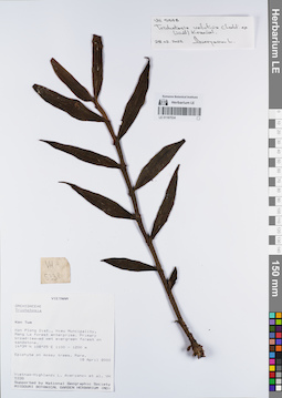
LE 01167534
Trichotosia velutina (Lindl.) Kraenzl. det. Averyanov, Leonid Vladimirovich at 28.02.2022
Collectors: Averyanov, Leonid Vladimirovich; et al. Field collecting number: VH5338. Collection date: 18.04.2000. Administrative regions: VN - Kon Tum. Groups of specimens: L. V. Averyanov specimens; L. V. Averyanov herbarium; Orchids of Vietnam, Laos and CambodiaOriginal label text:FLORA OF VIETNAM
Coordinates (geographic position): 14° 39′ N, 108° 25′ E ±1000 mRecord creation: 2022-03-03, Galina Savich, PhotoScan D2. Processing status: work_status_1Citation: Specimen LE 01167534 // Virtual herbarium of Komarov Botanical Institute RAS — http://re.herbariumle.ru/01167534Orchidaceae
Trichotosia sp.
S. Vietnam, Kontum Prov., Kon Plong Distr., Hieu Municipality, Mang La forest enterprise (14°39′N, 108°25′E). Primary broad-leaved wet evergreen forest on sandstone at elev. 1100-1200 m. Epiphyte on mossy trees. Rare.
VH 5338 18.04.2000
International Botanical Expedition of the U.S.A. National Geographic Society (grant No 6383-98)
Collectors: L.Averyanov, P.K.Loc, P.H.Hoang, D.X.Du, N.T.Vinh
Trichotosia sp.
S. Vietnam, Kontum Prov., Kon Plong Distr., Hieu Municipality, Mang La forest enterprise (14°39′N, 108°25′E). Primary broad-leaved wet evergreen forest on sandstone at elev. 1100-1200 m. Epiphyte on mossy trees. Rare.
VH 5338 18.04.2000
International Botanical Expedition of the U.S.A. National Geographic Society (grant No 6383-98)
Collectors: L.Averyanov, P.K.Loc, P.H.Hoang, D.X.Du, N.T.Vinh
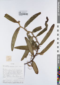
LE 01167533
Thrixspermum calceolus (Lindl.) Rchb.f. det. Averyanov, Leonid Vladimirovich at 02.05.2000
Collectors: Averyanov, Leonid Vladimirovich; et al. Field collecting number: VH5889. Collection date: 02.05.2000. Administrative regions: VN - Tinh GJak Lak. Groups of specimens: L. V. Averyanov specimens; L. V. Averyanov herbarium; Orchids of Vietnam, Laos and CambodiaOriginal label text:FLORA OF VIETNAM
Coordinates (geographic position): 12° 30′ N, 108° 30′ E ±1000 mRecord creation: 2022-03-03, Galina Savich, PhotoScan D2. Processing status: work_status_1Citation: Specimen LE 01167533 // Virtual herbarium of Komarov Botanical Institute RAS — http://re.herbariumle.ru/01167533Orchidaceae
Thrixspermum calceolus
S. Vietnam, Dak Lac Prov., Krong Bong Distr., Cu Pui Municipality, elevation from Dak Tour village (12°30′N, 108°30′E) along Dak Tour river on N macroslope of Chu Yang Sinh mt system. Secondary dry evergreen broad-leaved forest with remnants of primary elements along river slopes at elev. 450-550 m. Pendant epiphyte in shady place. Not common.
VH 5889 02.05.2000
International Botanical Expedition of the U.S.A. National Geographic Society (grant No 6383-98)
Collectors: L.Averyanov, N.T.Hiep, N.Q.Hieu, P.H.Hoang, D.X.Du, N.T.Vinh
Thrixspermum calceolus
S. Vietnam, Dak Lac Prov., Krong Bong Distr., Cu Pui Municipality, elevation from Dak Tour village (12°30′N, 108°30′E) along Dak Tour river on N macroslope of Chu Yang Sinh mt system. Secondary dry evergreen broad-leaved forest with remnants of primary elements along river slopes at elev. 450-550 m. Pendant epiphyte in shady place. Not common.
VH 5889 02.05.2000
International Botanical Expedition of the U.S.A. National Geographic Society (grant No 6383-98)
Collectors: L.Averyanov, N.T.Hiep, N.Q.Hieu, P.H.Hoang, D.X.Du, N.T.Vinh
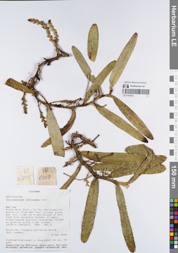
LE 01167532
Thrixspermum centipeda Lour. det. Averyanov, Leonid Vladimirovich at 03.05.2000
Collectors: Averyanov, Leonid Vladimirovich; et al. Field collecting number: VH6004. Collection date: 03.05.2000. Administrative regions: VN - Tinh GJak Lak. Groups of specimens: L. V. Averyanov specimens; L. V. Averyanov herbarium; Orchids of Vietnam, Laos and CambodiaOriginal label text:FLORA OF VIETNAM
Coordinates (geographic position): 12° 30′ N, 108° 30′ E ±1000 mRecord creation: 2022-03-03, Galina Savich, PhotoScan D2. Processing status: work_status_1Citation: Specimen LE 01167532 // Virtual herbarium of Komarov Botanical Institute RAS — http://re.herbariumle.ru/01167532Orchidaceae
Thrixspermum fragrans Ridl.
S. Vietnam, Dak Lac Prov., Krong Bong Distr., Cu Pui Municipality, elevation from Dak Tour village (12°30′N, 108°30′E) along Dak Tour river on N macroslope of Chu Yang Sinh mt system. Primary broad-leaved mountain evergreen forest on granites along river slopes at elev. 500-550 m. Epiphyte. Flowers yellowish-white. Very common.
VH 6004 03.05.2000
International Botanical Expedition of the U.S.A. National Geographic Society (grant No 6383-98)
Collectors: L.Averyanov, N.T.Hiep, N.Q.Hieu, P.H.Hoang, D.X.Du, N.T.Vinh
Thrixspermum fragrans Ridl.
S. Vietnam, Dak Lac Prov., Krong Bong Distr., Cu Pui Municipality, elevation from Dak Tour village (12°30′N, 108°30′E) along Dak Tour river on N macroslope of Chu Yang Sinh mt system. Primary broad-leaved mountain evergreen forest on granites along river slopes at elev. 500-550 m. Epiphyte. Flowers yellowish-white. Very common.
VH 6004 03.05.2000
International Botanical Expedition of the U.S.A. National Geographic Society (grant No 6383-98)
Collectors: L.Averyanov, N.T.Hiep, N.Q.Hieu, P.H.Hoang, D.X.Du, N.T.Vinh
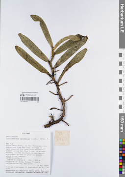
LE 01167531
Thrixspermum calceolus (Lindl.) Rchb.f. det. Averyanov, Leonid Vladimirovich at 12.05.2000
Collectors: Averyanov, Leonid Vladimirovich; et al. Field collecting number: VH6460. Collection date: 12.05.2000. Administrative regions: VN - Tinh GJak Lak. Groups of specimens: L. V. Averyanov specimens; L. V. Averyanov herbarium; Orchids of Vietnam, Laos and CambodiaOriginal label text:FLORA OF VIETNAM
Coordinates (geographic position): 12° 30′ N, 108° 30′ E ±1000 mRecord creation: 2022-03-03, Galina Savich, PhotoScan D2. Processing status: work_status_1Citation: Specimen LE 01167531 // Virtual herbarium of Komarov Botanical Institute RAS — http://re.herbariumle.ru/01167531Orchidaceae
Thrixspermum calceolus
S. Vietnam, Dak Lac Prov., Krong Bong Distr., Cu Pui Municipality, elevation from Dak Tour village (12°30′N, 108°30′E) to main peak of Chu Yang Sinh mt system (12°24′N, 108°26′E) along Dak Tour river (N slope). Primary closed mountain broad-leaved evergreen forest on granite slopes along river canyon at elev. 900 m. Epiphyte on mossy trees. Flowers yellowish-white. Not rare.
VH 6460 12.05.2000
Thrixspermum calceolus
S. Vietnam, Dak Lac Prov., Krong Bong Distr., Cu Pui Municipality, elevation from Dak Tour village (12°30′N, 108°30′E) to main peak of Chu Yang Sinh mt system (12°24′N, 108°26′E) along Dak Tour river (N slope). Primary closed mountain broad-leaved evergreen forest on granite slopes along river canyon at elev. 900 m. Epiphyte on mossy trees. Flowers yellowish-white. Not rare.
VH 6460 12.05.2000
International Botanical Expedition of the U.S.A. National Geographic Society (grant No 6383-98)
Collectors: L.Averyanov, N.T.Hiep, N.Q.Hieu, P.H.Hoang, D.X.Du, N.T.Vinh
Collectors: L.Averyanov, N.T.Hiep, N.Q.Hieu, P.H.Hoang, D.X.Du, N.T.Vinh
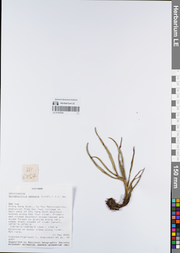
LE 01167530
Schoenorchis gemmata (Lindl.) J.J.Sm. det. Averyanov, Leonid Vladimirovich at 11.05.2000
Collectors: Averyanov, Leonid Vladimirovich; et al. Field collecting number: VH6057. Collection date: 11.05.2000. Administrative regions: VN - Tinh GJak Lak. Groups of specimens: L. V. Averyanov specimens; L. V. Averyanov herbarium; Orchids of Vietnam, Laos and CambodiaOriginal label text:FLORA OF VIETNAM
Coordinates (geographic position): 12° 30′ N, 108° 30′ E ±1000 mRecord creation: 2022-03-03, Galina Savich, PhotoScan D2. Processing status: work_status_1Citation: Specimen LE 01167530 // Virtual herbarium of Komarov Botanical Institute RAS — http://re.herbariumle.ru/01167530Orchidaceae
Schoenorchis gemmata
S. Vietnam, Dak Lac Prov., Krong Bong Distr., Cu Pui Municipality, elevation from Dak Tour village (12°30′N, 108°30′E) to main peak of Chu Yang Sinh mt system (12°24′N, 108°26′E) along Dak Tour river (N slope). Primary wet closed mountain broad-leaved and mixed forest on granites along very steep shady slopes of river canyon at elev. 1500-1700 m. Epiphyte on mossy trees along river. Not rare.
VH 6057 11.05.2000
International Botanical Expedition of the U.S.A. National Geographic Society (grant No 6383-98)
Collectors: L.Averyanov, N.T.Hiep, N.Q.Hieu, P.H.Hoang, D.X.Du, N.T.Vinh
Schoenorchis gemmata
S. Vietnam, Dak Lac Prov., Krong Bong Distr., Cu Pui Municipality, elevation from Dak Tour village (12°30′N, 108°30′E) to main peak of Chu Yang Sinh mt system (12°24′N, 108°26′E) along Dak Tour river (N slope). Primary wet closed mountain broad-leaved and mixed forest on granites along very steep shady slopes of river canyon at elev. 1500-1700 m. Epiphyte on mossy trees along river. Not rare.
VH 6057 11.05.2000
International Botanical Expedition of the U.S.A. National Geographic Society (grant No 6383-98)
Collectors: L.Averyanov, N.T.Hiep, N.Q.Hieu, P.H.Hoang, D.X.Du, N.T.Vinh
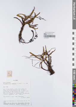
LE 01167529
Schoenorchis gemmata (Lindl.) J.J.Sm. det. Averyanov, Leonid Vladimirovich at 16.04.2000
Collectors: Averyanov, Leonid Vladimirovich; et al. Field collecting number: VH5237. Collection date: 16.04.2000. Administrative regions: VN - Kon Tum. Groups of specimens: L. V. Averyanov specimens; L. V. Averyanov herbarium; Orchids of Vietnam, Laos and CambodiaOriginal label text:FLORA OF VIETNAM
Coordinates (geographic position): 14° 39′ N, 108° 25′ E ±1000 mRecord creation: 2022-03-03, Galina Savich, PhotoScan D2. Processing status: work_status_1Citation: Specimen LE 01167529 // Virtual herbarium of Komarov Botanical Institute RAS — http://re.herbariumle.ru/01167529Orchidaceae
Shoenorchis gemmata
S. Vietnam, Kontum Prov., Kon Plong Distr., Hieu Municipality, Mang La forest enterprise (14°39′N, 108°25′E). Primary evergreen broad-leaved wet forest with Dacrycarpus imbricatus on steep mt. slopes on sandstone & gneiss at elev. 1100-1200 m. Epiphyte on high tree. Abundant.
VH 5237 16.04.2000
International Botanical Expedition of the U.S.A. National Geographic Society (grant No 6383-98)
Collectors: L.Averyanov, P.K.Loc, P.H.Hoang, D.X.Du, N.T.Vinh
Shoenorchis gemmata
S. Vietnam, Kontum Prov., Kon Plong Distr., Hieu Municipality, Mang La forest enterprise (14°39′N, 108°25′E). Primary evergreen broad-leaved wet forest with Dacrycarpus imbricatus on steep mt. slopes on sandstone & gneiss at elev. 1100-1200 m. Epiphyte on high tree. Abundant.
VH 5237 16.04.2000
International Botanical Expedition of the U.S.A. National Geographic Society (grant No 6383-98)
Collectors: L.Averyanov, P.K.Loc, P.H.Hoang, D.X.Du, N.T.Vinh
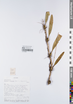
LE 01167528
Sunipia scariosa Lindl. det. Averyanov, Leonid Vladimirovich at 09.05.2000
Collectors: Averyanov, Leonid Vladimirovich; et al. Field collecting number: VH6216. Collection date: 09.05.2000. Administrative regions: VN - Tinh GJak Lak. Groups of specimens: L. V. Averyanov specimens; L. V. Averyanov herbarium; Orchids of Vietnam, Laos and CambodiaOriginal label text:FLORA OF VIETNAM
Coordinates (geographic position): 12° 30′ N, 108° 30′ E ±1000 mRecord creation: 2022-03-03, Galina Savich, PhotoScan D2. Processing status: work_status_1Citation: Specimen LE 01167528 // Virtual herbarium of Komarov Botanical Institute RAS — http://re.herbariumle.ru/01167528Orchidaceae
Sunipia racemosa
S. Vietnam, Dak Lac Prov., Krong Bong Distr., Cu Pui Municipality, elevation from Dak Tour village (12°30′N, 108°30′E) to main peak of Chu Yang Sinh mt system (12°24′N, 108°26′E) along Dak Tour river (N slope). Primary mossy cloud mixed forest (with Pinus, Fokienia, Dacrydium and Dacrycarpus) on very steep granite slopes at elev. 1900-2100 m. Epiphyte on high trees. Common.
VH 6216 09.05.2000
International Botanical Expedition of the U.S.A. National Geographic Society (grant No 6383-98)
Collectors: L.Averyanov, N.T.Hiep, N.Q.Hieu, P.H.Hoang, D.X.Du, N.T.Vinh
Sunipia racemosa
S. Vietnam, Dak Lac Prov., Krong Bong Distr., Cu Pui Municipality, elevation from Dak Tour village (12°30′N, 108°30′E) to main peak of Chu Yang Sinh mt system (12°24′N, 108°26′E) along Dak Tour river (N slope). Primary mossy cloud mixed forest (with Pinus, Fokienia, Dacrydium and Dacrycarpus) on very steep granite slopes at elev. 1900-2100 m. Epiphyte on high trees. Common.
VH 6216 09.05.2000
International Botanical Expedition of the U.S.A. National Geographic Society (grant No 6383-98)
Collectors: L.Averyanov, N.T.Hiep, N.Q.Hieu, P.H.Hoang, D.X.Du, N.T.Vinh
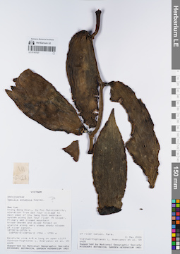
LE 01167527
Miguelia annamica (Gagnep.) Aver. det. Averyanov, Leonid Vladimirovich at 04.03.2022
Additional identifications: Vanilla annamica Gagnep. ⟮prelim. ID⟯ det. Averyanov, Leonid Vladimirovich at 11.05.2000 Collectors: Averyanov, Leonid Vladimirovich; et al. Field collecting number: VH6428. Collection date: 11.05.2000. Administrative regions: VN - Tinh GJak Lak. Groups of specimens: L. V. Averyanov specimens; L. V. Averyanov herbarium; Orchids of Vietnam, Laos and CambodiaOriginal label text:FLORA OF VIETNAM
Orchidaceae
Vanilla annamensis
S. Vietnam, Dak Lac Prov., Krong Bong Distr., Cu Pui Municipality, elevation from Dak Tour village (12°30′N, 108°30′E) to main peak of Chu Yang Sinh mt system (12°24′N, 108°26′E) along Dak Tour river (N slope). Primary wet closed mountain broad-leaved and mixed forest on granites along very steep shady slopes of river at elev. 1700 m. Epiphyte vine 6-8 m lg on open cliff of river canyon. Rare.
VH 6428 11.05.2000
International Botanical Expedition of the U.S.A. National Geographic Society (grant No 6383-98)
Collectors: L.Averyanov, N.T.Hiep, N.Q.Hieu, P.H.Hoang, D.X.Du, N.T.Vinh
Vanilla annamensis
S. Vietnam, Dak Lac Prov., Krong Bong Distr., Cu Pui Municipality, elevation from Dak Tour village (12°30′N, 108°30′E) to main peak of Chu Yang Sinh mt system (12°24′N, 108°26′E) along Dak Tour river (N slope). Primary wet closed mountain broad-leaved and mixed forest on granites along very steep shady slopes of river at elev. 1700 m. Epiphyte vine 6-8 m lg on open cliff of river canyon. Rare.
VH 6428 11.05.2000
International Botanical Expedition of the U.S.A. National Geographic Society (grant No 6383-98)
Collectors: L.Averyanov, N.T.Hiep, N.Q.Hieu, P.H.Hoang, D.X.Du, N.T.Vinh