View
Add
Copy
Edit
Delete
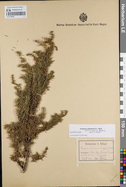
LE 01148576
Juniperus niemannii E.L. Wolf det. Orlova, Larisa Vladimirovna at 06.03.2022
Additional identifications: Juniperus communis var. pyramidalis Sjus. det. Klinge, Johannes Christoph at 1894 Collectors: Klinge, Johannes Christoph Collection date: 24.06.1894. Administrative regions: EE - Harjumaa. Place of collection: дер. Паэ, Айа (Aya), Kersa, кирпичная кладка возле Лембахена.Groups of specimens: Образцы сектора Восточной Европы; Соглашение Минобрнауки №075-15-2021-1056; Herbarium J. KlingeOriginal label text:Herbarium J. Klinge. Juniperus communis v. pyramidale. Fundort: Livl., Aya, Kersa. Ziegelei auf Lehmbahen, Vier[...]. 24 VI 94. leg. J. Klinge.
Habitat / plant community in location of collecting: кирпичная кладкаCoordinates (geographic position): 59° 11′ 45.87″ N, 24° 0′ 38.52″ E ±1000 mRecord creation: 2022-03-12, Larisa Orlova, PhotoScan D2Citation: Specimen LE 01148576 // Virtual herbarium of Komarov Botanical Institute RAS — http://re.herbariumle.ru/01148576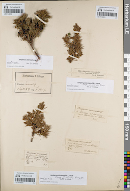
LE 01148573
Juniperus sibirica Burgsd. det. Klinge, Johannes Christoph at 1884
Collectors: Klinge, Johannes Christoph Collection date: 05.09.1884. Administrative regions: EE - Saaremaa. Place of collection: дер. Сааре (Saare, Saarenhof).Groups of specimens: Образцы сектора Восточной Европы; Соглашение Минобрнауки №075-15-2021-1056; Herbarium J. KlingeOriginal label text:Herbarium J. Klinge. Fundort: Saarenhof. 5 Septe. 84. leg. J. Klinge.
Coordinates (geographic position): 58° 21′ 35.28″ N, 22° 42′ 18.27″ E ±2000 mRecord creation: 2022-03-12, Larisa Orlova, PhotoScan D2Citation: Specimen LE 01148573 // Virtual herbarium of Komarov Botanical Institute RAS — http://re.herbariumle.ru/01148573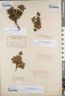
LE 01148574
Groups of specimens: Образцы сектора Восточной Европы; Соглашение Минобрнауки №075-15-2021-1056Record creation: 2022-03-12, Larisa Orlova, PhotoScan D2Citation: Specimen LE 01148574 // Virtual herbarium of Komarov Botanical Institute RAS — http://re.herbariumle.ru/01148574
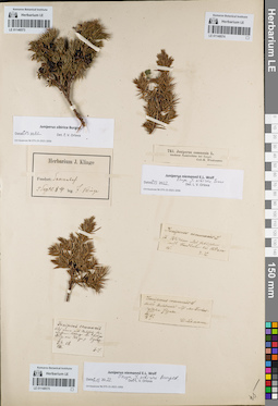
LE 01148575
Juniperus niemannii E.L. Wolf ⟨close to J. sibirica Burgsd.⟩ det. Orlova, Larisa Vladimirovna at 06.03.2022
Additional identifications: Juniperus communis L. det. Lehmann, Johann Georg Christian at 1858 Collectors: Lehmann, Johann Georg Christian Collection date: 08.1858. Administrative regions: EE - Saaremaa. Place of collection: около дер. Колга (Kolga), prope Ignaz.Groups of specimens: Образцы сектора Восточной Европы; Соглашение Минобрнауки №075-15-2021-1056Original label text:Juniperus communis. Auf einen mit Nad(v)alsinlz[?] [...] Alfanga bei Kolga Drag, am 21x um p. Ignaz. fin/VIII 58. E.L.
Coordinates (geographic position): 58° 21′ 57.78″ N, 22° 52′ 28.57″ E ±2000 mRecord creation: 2022-03-12, Larisa Orlova, PhotoScan D2Citation: Specimen LE 01148575 // Virtual herbarium of Komarov Botanical Institute RAS — http://re.herbariumle.ru/01148575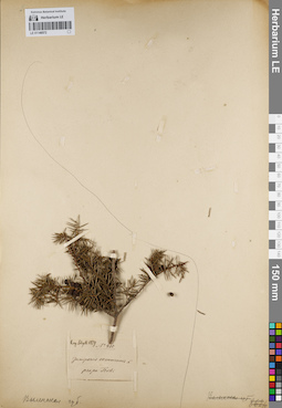
LE 01148572
Juniperus communis L. det. Schell, Julian K. at 1879
Collectors: Schell, Julian K. Field collecting number: 430. Collection date: 1879. Administrative regions: BY - Grodno Oblast. Subregion: Ивьевский район. Place of collection: возле дер. Троки (Troki).Groups of specimens: Образцы сектора Восточной Европы; Соглашение Минобрнауки №075-15-2021-1056Original label text:Leg. Schell 1879. № 430. Juniperus communis L. prope Troki.
Coordinates (geographic position): 54° 13′ 6.59″ N, 25° 46′ 1.12″ E ±2000 mRecord creation: 2022-03-12, Larisa Orlova, PhotoScan D2Citation: Specimen LE 01148572 // Virtual herbarium of Komarov Botanical Institute RAS — http://re.herbariumle.ru/01148572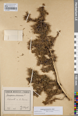
LE 01148571
Juniperus niemannii E.L. Wolf ⟨close to Juniperus communis L.⟩ det. Orlova, Larisa Vladimirovna at 06.03.2022
Additional identifications: Juniperus communis L. det. Regel, Constantin Andreas von at 1922 Collectors: Regel, Constantin Andreas von Collection date: 28.05.1922. Administrative regions: LT - Kaunas County - Kauno rajonas. Place of collection: сосновый лес в районе г. Каунас [kieferwald im Kr. Kaunas].Groups of specimens: Образцы сектора Восточной Европы; Соглашение Минобрнауки №075-15-2021-1056; Herbarium Universitatis LithuanicaeOriginal label text:Herbarium Universitatis Lithuanicae. Juniperus communis L. Kieferwald im Kr. Kaunas. 28/V 1922. leg.,det. C. Regel.
Habitat / plant community in location of collecting: сосновый лесCoordinates (geographic position): 54° 53′ 48.47″ N, 23° 53′ 11.79″ E ±30000 mRecord creation: 2022-03-12, Larisa Orlova, PhotoScan D2Citation: Specimen LE 01148571 // Virtual herbarium of Komarov Botanical Institute RAS — http://re.herbariumle.ru/01148571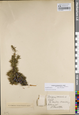
LE 01148570
Juniperus niemannii E.L. Wolf ⟨intermediate forma⟩ det. Orlova, Larisa Vladimirovna at 06.03.2022
Additional identifications: Juniperus communis L. det. Milyutin, Sergey Nikolaevich at 1911 Collectors: Milyutin, Sergey Nikolaevich Field collecting number: 2657. Collection date: 15.07.1911. Administrative regions: LT - Lithuania. Place of collection: близ с. Посодни Шавельского уезда Ковенской губернии.Groups of specimens: Образцы сектора Восточной Европы; Соглашение Минобрнауки №075-15-2021-1056; С.Н. Милютин: Растения Ковенской губернииOriginal label text:Juniperus communis L. 2657. Бл. Посодни Шавельск. у. Ковенск. губ. 15 июля 1911 г.
Coordinates (geographic position): 55° 55′ 58.09″ N, 23° 19′ 3.67″ E ±60000 mRecord creation: 2022-03-12, Larisa Orlova, PhotoScan D2Citation: Specimen LE 01148570 // Virtual herbarium of Komarov Botanical Institute RAS — http://re.herbariumle.ru/01148570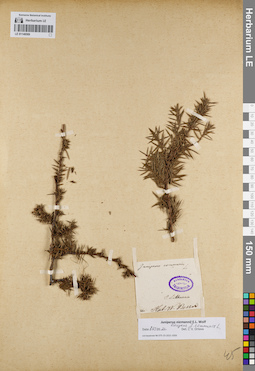
LE 01148569
Groups of specimens: Образцы сектора Восточной Европы; Соглашение Минобрнауки №075-15-2021-1056Record creation: 2022-03-12, Larisa Orlova, PhotoScan D2Citation: Specimen LE 01148569 // Virtual herbarium of Komarov Botanical Institute RAS — http://re.herbariumle.ru/01148569
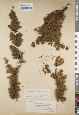
LE 01148568
Juniperus sibirica Burgsd. det. Kondratjuk, Evgeniĭ Nikolaevich at 15.03.1958
Additional identifications: Juniperus communis L. det. Dybowski, Wladyslaw Ivanovich at 1903 Collectors: Dybowski, Wladyslaw Ivanovich Field collecting number: 1023. Collection date: 20.05.1903. Administrative regions: BY - Grodno Oblast - Novogrudskiy Rayon. Place of collection: дер. Няньково (Niankow).Groups of specimens: Образцы сектора Восточной Европы; Соглашение Минобрнауки №075-15-2021-1056; Dr. E. Woloszczak. Flora polonica exciccataOriginal label text:Dr. E. Woloszczak. Flora polonica exsiccata. 1023. Juniperus communis. L. Sp. pl. ed. 1. p. 1040 (1753). Lithuania. Niankow, distr. Nowogrodek. Na wzgorzach piaszczystych. Zebr. 20. maja 1903. W. Dybowski.
Coordinates (geographic position): 53° 42′ 43.96″ N, 26° 0′ 15.58″ E ±2000 mRecord creation: 2022-03-12, Larisa Orlova, PhotoScan D2Citation: Specimen LE 01148568 // Virtual herbarium of Komarov Botanical Institute RAS — http://re.herbariumle.ru/01148568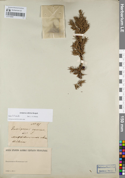
LE 01148567
Groups of specimens: Образцы сектора Восточной Европы; Соглашение Минобрнауки №075-15-2021-1056Record creation: 2022-03-12, Larisa Orlova, PhotoScan D2Citation: Specimen LE 01148567 // Virtual herbarium of Komarov Botanical Institute RAS — http://re.herbariumle.ru/01148567
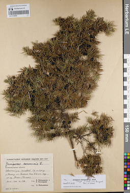
LE 01148566
Juniperus niemannii E.L. Wolf ⟨close to J. sibirica Burgsd.⟩ det. Orlova, Larisa Vladimirovna at 06.03.2022
Additional identifications: Juniperus communis L. det. Pobedimova, Evgeniia Georgievna at 1949 Collectors: Pobedimova, Evgeniia Georgievna; Ratnitsyna, Zinaida Andrejevna Field collecting number: 598. Collection date: 22.06.1949. Administrative regions: RU - Kaliningradskaya Oblast' - Nemanskiy Rayon. Place of collection: сосновый бор на берегу р. Неман у пос. Большое Село в 6 км южнее гор. Неман.Expedition: Калининградская экспедиция Академии Наук СССР 1949 года (1949)Groups of specimens: Образцы сектора Восточной Европы; Соглашение Минобрнауки №075-15-2021-1056Original label text:Калининградская экспедиция Академии наук СССР. Juniperus communis L. Калининградская область: Советский р-н. Сосновый бор на берегу р. Неман у пос. Большое Село в 6 км к югу от гор. Неман (...). 22-VI 1949. № 598. Собр. Е. Победимова и З. Ратницына. Опр. Е. Победимова.
Landscape in location of collection: берег рекиHabitat / plant community in location of collecting: сосновый борCoordinates (geographic position): 55° 1′ 27.99″ N, 22° 7′ 16.87″ E ±2000 mRecord creation: 2022-03-12, Larisa Orlova, PhotoScan D2Citation: Specimen LE 01148566 // Virtual herbarium of Komarov Botanical Institute RAS — http://re.herbariumle.ru/01148566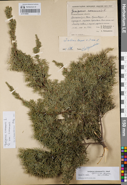
LE 01148565
Juniperus niemannii E.L. Wolf ⟨intermediate forma⟩ det. Orlova, Larisa Vladimirovna at 06.03.2022
Additional identifications: Juniperus communis L. det. Pobedimova, Evgeniia Georgievna at 1949; Juniperus sibirica Burgsd. × Juniperus communis L. det. Kondratjuk, Evgeniĭ Nikolaevich at 15.03.1958; Juniperus communis var. communis det. Farjon, Aljos at 02.2012 Collectors: Pobedimova, Evgeniia Georgievna; Ratnitsyna, Zinaida Andrejevna Field collecting number: 1753. Collection date: 11.08.1949. Administrative regions: RU - Kaliningradskaya Oblast' - Gorod Baltiysk. Place of collection: г. Балтийск, Балтийская коса (коса Фрише-Нерунг), подножие берегового вала около быв. пос. Ламбер-хавеи, к югу от морского канала.Expedition: Калининградская экспедиция Академии Наук СССР 1949 года (1949)Groups of specimens: Образцы сектора Восточной Европы; Соглашение Минобрнауки №075-15-2021-1056Original label text:Калининградская экспедиция Академии наук СССР. Juniperus communis L. Калининградская область: Приморский р-н. Коса Фриш-Нерунг. У подножия морского берегового вала около пос. Ламбер-хавеи, к югу от морского канала. 11-VIII 1949. № 1753. Собр. Е. Победимова и З. Ратницына. Опр. Е.Победимова.
Landscape in location of collection: подножье морского берегового валаCoordinates (geographic position): 54° 37′ 55.72″ N, 19° 52′ 52.32″ E ±50000 mRecord creation: 2022-03-12, Larisa Orlova, PhotoScan D2Citation: Specimen LE 01148565 // Virtual herbarium of Komarov Botanical Institute RAS — http://re.herbariumle.ru/01148565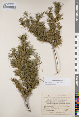
LE 01148564
Juniperus communis L. det. Orlova, Larisa Vladimirovna at 06.03.2022
Additional identifications: Juniperus communis var. neckii Graebn. f. globosa Medw. det. Rozanova, N. at 1923 Collectors: Rozanova, N. Field collecting number: 304. Collection date: 30.07.1923. Administrative regions: RU - Kirovskaya Oblast' - Nolinskiy Rayon. Топоним: Медведский бор. Place of collection: Медведский бор, Тукмачевская казенная лесная дача, провал N 43в, в лесу.Expedition: Медведская экспедиция (1923)Groups of specimens: Образцы сектора Восточной Европы; Соглашение Минобрнауки №075-15-2021-1056; Ex Herbario Musei Regionalis Wiatkensis.Original label text:Ex Herbario Musei Regionalis Wiatkensis. Студенческий кружок изучения местной природы при Вятском педагогическом институте имени Ленина. Медведская экспедиция. Juniperus communis L. var. Neckii Graebn. f. globosa Medw. Вятск. губ. Медведский бор Нолинского уезда. Тукмачевская каз. лесн. дача. Провал № 43в. В сосново-еловом лесу. Собр. Опр. Н. Розанова. № 304. VII 30 1923 г. A. Fokin. Iter Medwedkense. 1923.
Landscape in location of collection: провалHabitat / plant community in location of collecting: сосново-еловый лесCoordinates (geographic position): 57° 23′ 24.4″ N, 50° 5′ 32.06″ E ±10000 mRecord creation: 2022-03-12, Larisa Orlova, PhotoScan D2Citation: Specimen LE 01148564 // Virtual herbarium of Komarov Botanical Institute RAS — http://re.herbariumle.ru/01148564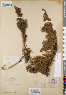
LE 01148562
Groups of specimens: Образцы сектора Восточной Европы; Соглашение Минобрнауки №075-15-2021-1056Record creation: 2022-03-12, Larisa Orlova, PhotoScan D2Citation: Specimen LE 01148562 // Virtual herbarium of Komarov Botanical Institute RAS — http://re.herbariumle.ru/01148562
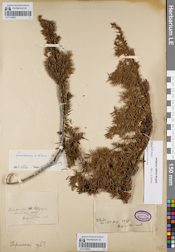
LE 01148563
Groups of specimens: Образцы сектора Восточной Европы; Соглашение Минобрнауки №075-15-2021-1056Record creation: 2022-03-12, Larisa Orlova, PhotoScan D2Citation: Specimen LE 01148563 // Virtual herbarium of Komarov Botanical Institute RAS — http://re.herbariumle.ru/01148563
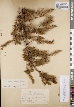
LE 01148561
Groups of specimens: Образцы сектора Восточной Европы; Соглашение Минобрнауки №075-15-2021-1056Record creation: 2022-03-12, Larisa Orlova, PhotoScan D2Citation: Specimen LE 01148561 // Virtual herbarium of Komarov Botanical Institute RAS — http://re.herbariumle.ru/01148561
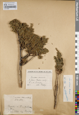
LE 01148560
Juniperus sibirica Burgsd. det. Kondratjuk, Evgeniĭ Nikolaevich at 15.03.1958
Additional identifications: Juniperus communis L. det. Richter G. D. at 1923 Collectors: Richter G. D. Collection date: 03.08.1923. Administrative regions: RU - Bashkortostan - Beloretskiy Rayon. Place of collection: перевал между г. Б. и М. Ямантау.Expedition: Южно-Уральская экспедиция КЕПС (1923)Groups of specimens: Образцы сектора Восточной Европы; Соглашение Минобрнауки №075-15-2021-1056Original label text:[1]Ю. Уральск. экспедиция КЕПС. Перевал м. Б. и М. Яман-тау. 3 VIII 1923 г. Собр. Рихтер. [2] Herbarium Instituti Botanici Acd. Sc. URSS. Juniperus communis. Ю. Урал. Перевал между Б. и М. Ямантау. 1923. Собр. Рихтер.
Landscape in location of collection: горный перевалCoordinates (geographic position): 54° 14′ 51.66″ N, 58° 6′ 56.61″ E ±2000 mRecord creation: 2022-03-12, Larisa Orlova, PhotoScan D2Citation: Specimen LE 01148560 // Virtual herbarium of Komarov Botanical Institute RAS — http://re.herbariumle.ru/01148560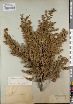
LE 01148559
Groups of specimens: Образцы сектора Восточной Европы; Соглашение Минобрнауки №075-15-2021-1056Record creation: 2022-03-12, Larisa Orlova, PhotoScan D2Citation: Specimen LE 01148559 // Virtual herbarium of Komarov Botanical Institute RAS — http://re.herbariumle.ru/01148559
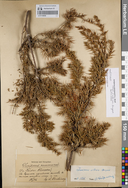
LE 01148558
Juniperus niemannii E.L. Wolf ⟨close to J. sibirica Burgsd.⟩ det. Orlova, Larisa Vladimirovna at 06.03.2022
Additional identifications: Juniperus communis L. det. Korshinsky, Sergei Ivanovitsch at 1886; Juniperus sibirica Burgsd. det. Kondratjuk, Evgeniĭ Nikolaevich at 15.03.1958 Collectors: Korshinsky, Sergei Ivanovitsch Collection date: 15.05.1886. Administrative regions: RU - Kirovskaya Oblast' - Malmyzhskiy Rayon. Place of collection: с. Большой Китяк, на вершинах мергельных холмов.Groups of specimens: Образцы сектора Восточной Европы; Соглашение Минобрнауки №075-15-2021-1056Original label text:Herbarium horti Petropolitani. Juniperus communis. У с. Больш. Китяка. На вершинах мергельных холмов в сколках соснового леса и на. 15 V 1886. leg. S. Korshinsky.
Landscape in location of collection: вершина мергельного холмаHabitat / plant community in location of collecting: сколки соснового лесаCoordinates (geographic position): 56° 20′ 34.99″ N, 50° 44′ 52.32″ E ±200 mRecord creation: 2022-03-12, Larisa Orlova, PhotoScan D2Citation: Specimen LE 01148558 // Virtual herbarium of Komarov Botanical Institute RAS — http://re.herbariumle.ru/01148558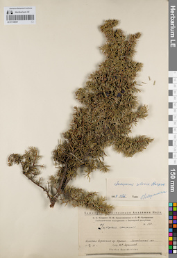
LE 01148557
Juniperus sibirica Burgsd. det. Kondratjuk, Evgeniĭ Nikolaevich at 15.03.1958
Additional identifications: Juniperus communis L. det. Afanasiev, Konstantin Sergeevich at 1931 Collectors: Afanasiev, Konstantin Sergeevich Field collecting number: 520. Collection date: 26.09.1931. Administrative regions: RU - Bashkortostan - Abzelilovskiy Rayon. Place of collection: плоская вершина хр. Крака, лес.Expedition: Башкирская экспедиция Академии наук. Геоботанические исследования в Башкирской республике (1930 -1931)Groups of specimens: Образцы сектора Восточной Европы; Соглашение Минобрнауки №075-15-2021-1056Original label text:Башкирская Экспедиция Академии Наук. Геоботанические исследования в Башкирской республике. № 520. Juniperus communis. Плоская вершина хр. Крака. Лиственный лес. 26 IX 1931 г. Собр. Н.Р. Афанасьев. Plantae Baschkiricae.
Landscape in location of collection: плоская вершина хребтаHabitat / plant community in location of collecting: лиственный лесCoordinates (geographic position): 53° 35′ 11.84″ N, 58° 1′ 23.73″ E ±5000 mRecord creation: 2022-03-12, Larisa Orlova, PhotoScan D2Citation: Specimen LE 01148557 // Virtual herbarium of Komarov Botanical Institute RAS — http://re.herbariumle.ru/01148557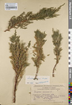
LE 01148556
Juniperus sibirica Burgsd. det. Kondratjuk, Evgeniĭ Nikolaevich at 15.03.1958
Additional identifications: Juniperus communis L. det. Kachurin, M.H. at 1931 Collectors: Kachurin, M.H. Collection date: 07.1931. Administrative regions: RU - Bashkortostan - Khaybullinskiy Rayon. Place of collection: березовый колок в 500 м севернее дер. Абдулнасырово, долина ручья.Expedition: Башкирская экспедиция Академии наук. Геоботанические исследования в Башкирской республике (1930 -1931)Groups of specimens: Образцы сектора Восточной Европы; Соглашение Минобрнауки №075-15-2021-1056Original label text:Башкирская Экспедиция Академии Наук. Геоботанические исследования в Башкирской республике. Juniperus communis L. б. Зилаирский кантон. Хайбулинский район. В долине ручья, в березовом колке, в 1/2 килом. к северу от деревни Абдулнасырово. 1931 июль г. Собр. М. Качурин. Plantae Baschkiricae.
Landscape in location of collection: долина ручьяHabitat / plant community in location of collecting: березовый колокCoordinates (geographic position): 52° 16′ 54.83″ N, 58° 25′ 10.57″ E ±2000 mRecord creation: 2022-03-12, Larisa Orlova, PhotoScan D2Citation: Specimen LE 01148556 // Virtual herbarium of Komarov Botanical Institute RAS — http://re.herbariumle.ru/01148556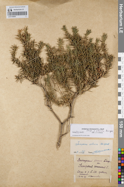
LE 01148555
Juniperus niemannii E.L. Wolf det. Orlova, Larisa Vladimirovna at 06.03.2022
Additional identifications: Juniperus communis L. det. Ipatova, A. at 1929; Juniperus sibirica Burgsd. det. Kondratjuk, Evgeniĭ Nikolaevich at 15.03.1958 Collectors: Ipatova, A. Collection date: 19.08.1929. Administrative regions: RU - Bashkortostan. Place of collection: склон к р. Большой Ик, средина течения.Expedition: Зилаирский кантон Башрки (1929)Groups of specimens: Образцы сектора Восточной Европы; Соглашение Минобрнауки №075-15-2021-1056Original label text:Зилаирский кантон Башрки. Juniperus communis L. Склон к р. Б. Ик. Средина течения. 19 VIII 29. А. Ипатова
Landscape in location of collection: склон к рекеCoordinates (geographic position): 55° 44′ 15.17″ N, 58° 46′ 10.69″ E ±100000 mRecord creation: 2022-03-12, Larisa Orlova, PhotoScan D2Citation: Specimen LE 01148555 // Virtual herbarium of Komarov Botanical Institute RAS — http://re.herbariumle.ru/01148555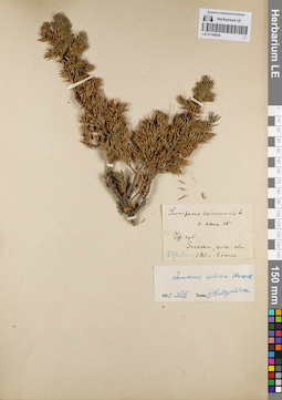
LE 01148554
Juniperus sibirica Burgsd. det. Kondratjuk, Evgeniĭ Nikolaevich at 15.03.1958
Additional identifications: Juniperus communis var. nana Willd. det. Busch at 1892 Collectors: Borodin Collection date: 08.07.1892. Administrative regions: RU - Chelyabinskaya Oblast' - Katav-Ivanovskiy Rayon. Place of collection: хр. Зигальга, альпийская область.Groups of specimens: Образцы сектора Восточной Европы; Соглашение Минобрнауки №075-15-2021-1056Original label text:Juniperus communis L. v. nana W. Уф. губ. Зигальга, альп. обл. Бородин. 1892 г. 8 июля.
Habitat / plant community in location of collecting: альпийская областьCoordinates (geographic position): 54° 35′ 38.76″ N, 58° 33′ 36.28″ E ±20000 mRecord creation: 2022-03-12, Larisa Orlova, PhotoScan D2Citation: Specimen LE 01148554 // Virtual herbarium of Komarov Botanical Institute RAS — http://re.herbariumle.ru/01148554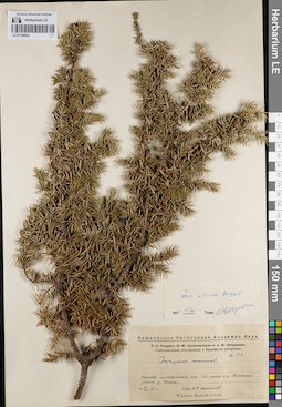
LE 01148553
Juniperus sibirica Burgsd. det. Kondratjuk, Evgeniĭ Nikolaevich at 15.03.1958
Additional identifications: Juniperus communis L. det. Afanasiev, Konstantin Sergeevich at 1931 Collectors: Afanasiev, Konstantin Sergeevich Field collecting number: 412. Collection date: 26.08.1931. Administrative regions: RU - Bashkortostan. Place of collection: северный склон к р. Уйнаган (?), система р. Узян, лес.Expedition: Башкирская экспедиция Академии наук. Геоботанические исследования в Башкирской республике (1930 -1931)Groups of specimens: Образцы сектора Восточной Европы; Соглашение Минобрнауки №075-15-2021-1056Original label text:Башкирская Экспедиция Академии Наук. Геоботанические исследования в Башкирской республике. № 340. Juniperus communis. Сосново-лиственный лес. Сев. склон к р. Уйнаган (сист. р. Узяна). 26 VIII 1931 г. Собр. Н.Р. Афанасьев. Plantae Baschkiricae.
Landscape in location of collection: склон к рекеHabitat / plant community in location of collecting: смешанный сосново-лиственный лесCoordinates (geographic position): 53° 16′ 34.9″ N, 57° 44′ 35.28″ E ±200000 mRecord creation: 2022-03-12, Larisa Orlova, PhotoScan D2Citation: Specimen LE 01148553 // Virtual herbarium of Komarov Botanical Institute RAS — http://re.herbariumle.ru/01148553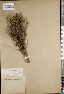
LE 01148552
Juniperus sibirica Burgsd. det. Kondratjuk, Evgeniĭ Nikolaevich at 15.03.1958
Additional identifications: Juniperus communis L. det. Bulavkina-Onchukova, Anna Aleksandrovna at 1912 Collectors: Bulavkina-Onchukova, Anna Aleksandrovna Collection date: 14.07.1912. Administrative regions: RU - Chelyabinskaya Oblast' - Katav-Ivanovskiy Rayon. Place of collection: сосновый лес западнее г. Катав-Ивановск.Groups of specimens: Образцы сектора Восточной Европы; Соглашение Минобрнауки №075-15-2021-1056; А. А. Булавкина. Растения Уфимской губ.Original label text:А.А. Булавкина. Растения Уфимской губ. Juniperus communis L. В сосновом лесу к зап. от Катава. Окр---и Катав-Ивановского завода. 14 VII 1912 г.
Habitat / plant community in location of collecting: сосновый лесCoordinates (geographic position): 54° 45′ 17.37″ N, 58° 9′ 59.16″ E ±5000 mRecord creation: 2022-03-12, Larisa Orlova, PhotoScan D2Citation: Specimen LE 01148552 // Virtual herbarium of Komarov Botanical Institute RAS — http://re.herbariumle.ru/01148552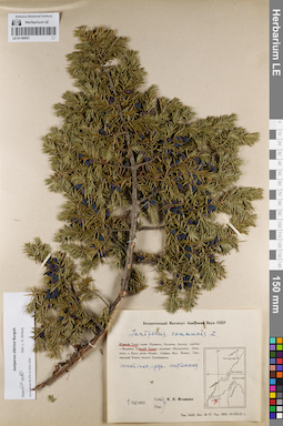
LE 01148551
Juniperus sibirica Burgsd. det. Orlova, Larisa Vladimirovna at 06.03.2022
Additional identifications: Juniperus communis L. det. Igoschina, Kapitolina Nikolaevna at 1957 Collectors: Igoschina, Kapitolina Nikolaevna Collection date: 01.07.1957. Administrative regions: RU - Bashkortostan - Abzelilovskiy Rayon. Place of collection: южная часть хр. Крака, южный склон, среди лиственниц.Groups of specimens: Образцы сектора Восточной Европы; Соглашение Минобрнауки №075-15-2021-1056Original label text:Ботанический Институт Академии Наук СССР. Juniperus communis L. Южный Урал: хребет Южный Крака. Южный склон, среди лиственниц. 1 VII 1957. Собр. Опр. К.Н. Игошина.
Landscape in location of collection: склон горного хребтаHabitat / plant community in location of collecting: лиственничникCoordinates (geographic position): 53° 31′ 26.58″ N, 58° 0′ 36.6″ E ±4000 mRecord creation: 2022-03-12, Larisa Orlova, PhotoScan D2Citation: Specimen LE 01148551 // Virtual herbarium of Komarov Botanical Institute RAS — http://re.herbariumle.ru/01148551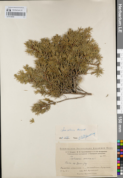
LE 01148550
Juniperus sibirica Burgsd. det. Kondratjuk, Evgeniĭ Nikolaevich at 15.03.1958
Additional identifications: Juniperus communis L. det. Afanasiev, Konstantin Sergeevich at 1931 Collectors: Afanasiev, Konstantin Sergeevich Field collecting number: 340. Collection date: 10.08.1931. Administrative regions: RU - Bashkortostan. Place of collection: район хр. Уралтау, скалистое обнажение "Аи[Ли?]пповская вершина".Expedition: Башкирская экспедиция Академии наук. Геоботанические исследования в Башкирской республике (1930 -1931)Groups of specimens: Образцы сектора Восточной Европы; Соглашение Минобрнауки №075-15-2021-1056Original label text:Башкирская Экспедиция Академии Наук. Геоботанические исследования в Башкирской республике. № 340. Juniperus communis. Район хр. Урал-тау. Скалистое обнажение г. "Аипповская вершина". 10 VIII 1931 г. Собр. Н.Р. Афанасьев. Plantae Baschkiricae.
Landscape in location of collection: скалистое обнажениеCoordinates (geographic position): 54° 27′ 18.67″ N, 59° 6′ 59.96″ E ±60000 mRecord creation: 2022-03-12, Larisa Orlova, PhotoScan D2Citation: Specimen LE 01148550 // Virtual herbarium of Komarov Botanical Institute RAS — http://re.herbariumle.ru/01148550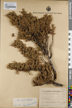
LE 01148549
Juniperus sibirica Burgsd. det. Kondratjuk, Evgeniĭ Nikolaevich at 15.03.1958
Additional identifications: Juniperus communis L. det. Bulavkina-Onchukova, Anna Aleksandrovna at 1912 Collectors: Bulavkina-Onchukova, Anna Aleksandrovna Collection date: 24.07.1912. Administrative regions: RU - Chelyabinskaya Oblast' - Katav-Ivanovskiy Rayon. Place of collection: хр. Зигальга, окрестности Катав-Ивановского литейного завода, на границе с Оренбургской губернией.Groups of specimens: Образцы сектора Восточной Европы; Соглашение Минобрнауки №075-15-2021-1056; А. А. Булавкина. Растения Уфимской губ.Original label text:А.А. Булавкина. Растения Уфимской губ. Juniperus communis L. На Зигальге. (Окр---и Катав-Ивановского завода.) На границе с Оренб. губ. 24 VII 1912 г.
Coordinates (geographic position): 54° 35′ 38.76″ N, 58° 33′ 36.28″ E ±20000 mRecord creation: 2022-03-12, Larisa Orlova, PhotoScan D2Citation: Specimen LE 01148549 // Virtual herbarium of Komarov Botanical Institute RAS — http://re.herbariumle.ru/01148549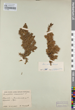
LE 01148548
Juniperus sibirica Burgsd. det. Kondratjuk, Evgeniĭ Nikolaevich at 15.03.1958
Additional identifications: Juniperus communis L. det. Panaev, F. at 1876 Collectors: Panaev, F. Collection date: 30.05.1876. Administrative regions: RU - Perm Krai - Solikamskiy Rayon. Place of collection: в черте г. Соликамск (быв. с. Красное), луг.Groups of specimens: Образцы сектора Восточной Европы; Соглашение Минобрнауки №075-15-2021-1056Original label text:Museum Botanicum Academiae Scientiarum Petropolitanae. Juniperus communis L. Пермск. г., Соликамск. у. С. Красное. Луг. 1876 г. 30-V (цвит.) Ф. Панаев
Habitat / plant community in location of collecting: лугCoordinates (geographic position): 59° 38′ 57.09″ N, 56° 46′ 13.41″ E ±10000 mRecord creation: 2022-03-12, Larisa Orlova, PhotoScan D2Citation: Specimen LE 01148548 // Virtual herbarium of Komarov Botanical Institute RAS — http://re.herbariumle.ru/01148548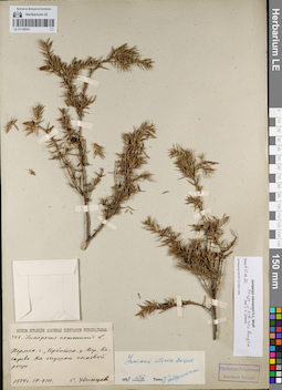
LE 01148547
Juniperus niemannii E.L. Wolf ⟨close to J. sibirica Burgsd.⟩ det. Orlova, Larisa Vladimirovna at 06.03.2022
Additional identifications: Juniperus communis L. det. Udintsev S. at 1884; Juniperus sibirica Burgsd. det. Kondratjuk, Evgeniĭ Nikolaevich at 15.03.1958 Collectors: Udintsev S. Field collecting number: 347. Collection date: 19.08.1884. Place of collection: дер. Косарева, на опушке сосновой рощи.Groups of specimens: Образцы сектора Восточной Европы; Соглашение Минобрнауки №075-15-2021-1056Original label text:Museum Botanicum Academiae Scientiarum Petropolitanae. 347. Juniperus communis L. Пермск. г., Ирбитск. у. Дер. Косарева. На опушке сосновой рощи. 1884 г. 19-VIII. С. Удинцев.
Habitat / plant community in location of collecting: опушка соснового лесаCoordinates (geographic position): 58° 3′ 41.77″ N, 63° 8′ 12.47″ E ±4000 mRecord creation: 2022-03-12, Larisa Orlova, PhotoScan D2Citation: Specimen LE 01148547 // Virtual herbarium of Komarov Botanical Institute RAS — http://re.herbariumle.ru/01148547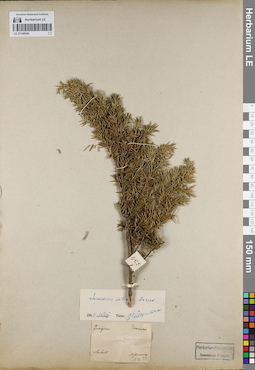
LE 01148546
Juniperus sibirica Burgsd. det. Kondratjuk, Evgeniĭ Nikolaevich at 15.03.1958
Additional identifications: Juniperus communis L. det. Nesterowsky, Yakov Kononovich at 1837 Collectors: Nesterowsky, Yakov Kononovich Collection date: 1837. Administrative regions: RU - Chelyabinskaya Oblast' - Gorod Zlatoust. Place of collection: г. Златоуст.Groups of specimens: Образцы сектора Восточной Европы; Соглашение Минобрнауки №075-15-2021-1056Original label text:Juniperus communis. Slatoust. Nesterowsky. 1837. N.
Coordinates (geographic position): 55° 10′ 23.21″ N, 59° 40′ 20.73″ E ±20000 mRecord creation: 2022-03-12, Larisa Orlova, PhotoScan D2Citation: Specimen LE 01148546 // Virtual herbarium of Komarov Botanical Institute RAS — http://re.herbariumle.ru/01148546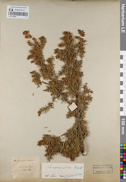
LE 01148545
Juniperus sibirica Burgsd. det. Kondratjuk, Evgeniĭ Nikolaevich at 15.03.1958
Additional identifications: Juniperus communis L. det. Nesterowsky, Yakov Kononovich at 1848 Collectors: Nesterowsky, Yakov Kononovich Field collecting number: 268. Collection date: 1848. Administrative regions: RU - Perm Krai - Permskiy Rayon. Place of collection: около г. Пермь (circa urb. Perm).Groups of specimens: Образцы сектора Восточной Европы; Соглашение Минобрнауки №075-15-2021-1056Original label text:268. Juniperus communis. Circa urb. Perm. Nesder. 1848.
Coordinates (geographic position): 58° 0′ 37.64″ N, 56° 13′ 45.99″ E ±30000 mRecord creation: 2022-03-12, Larisa Orlova, PhotoScan D2Citation: Specimen LE 01148545 // Virtual herbarium of Komarov Botanical Institute RAS — http://re.herbariumle.ru/01148545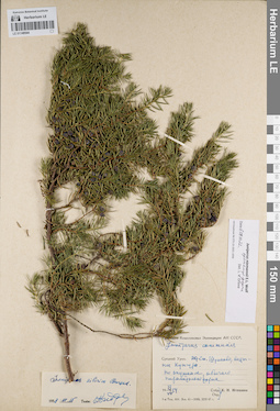
LE 01148544
Juniperus niemannii E.L. Wolf ⟨intermediate forma⟩ det. Orlova, Larisa Vladimirovna at 06.03.2022
Additional identifications: Juniperus communis L. det. Igoschina, Kapitolina Nikolaevna at 1954; Juniperus sibirica Burgsd. det. Kondratjuk, Evgeniĭ Nikolaevich at 15.03.1958 Collectors: Igoschina, Kapitolina Nikolaevna Collection date: 13.07.1954. Administrative regions: RU - Perm Krai - Kishertskiy Rayon. Place of collection: ж.д. станция Шумково, восточнее Кунгура, по опушкам.Expedition: Уральская комплексная экспедиция АН СССР (1939 -1958)Groups of specimens: Образцы сектора Восточной Европы; Соглашение Минобрнауки №075-15-2021-1056Object features: По опушкам, обычно. Пирамидальна формаOriginal label text:Уральская Комплексная Экспедиция АН СССР. Juniperus communis L. Средний Урал. Ж.д. ст. Шумково, восточнее Кунгура. По опушкам, обычно. Пирамидальная форма. 13 VII 1954. Собр. Опр. К.Н. Игошина.
Habitat / plant community in location of collecting: опушка лесаCoordinates (geographic position): 57° 22′ 15.94″ N, 57° 25′ 31.18″ E ±2000 mRecord creation: 2022-03-12, Larisa Orlova, PhotoScan D2Citation: Specimen LE 01148544 // Virtual herbarium of Komarov Botanical Institute RAS — http://re.herbariumle.ru/01148544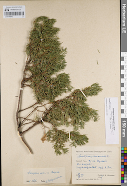
LE 01148543
Juniperus niemannii E.L. Wolf ⟨close to Juniperus communis L.⟩ det. Orlova, Larisa Vladimirovna at 06.03.2022
Additional identifications: Juniperus communis L. det. Igoschina, Kapitolina Nikolaevna at 1954; Juniperus sibirica Burgsd. det. Kondratjuk, Evgeniĭ Nikolaevich at 15.03.1958 Collectors: Igoschina, Kapitolina Nikolaevna Collection date: 13.07.1954. Administrative regions: RU - Perm Krai - Kishertskiy Rayon. Place of collection: ж.д. станция Шумково, на опушке.Expedition: Уральская комплексная экспедиция АН СССР (1939 -1958)Groups of specimens: Образцы сектора Восточной Европы; Соглашение Минобрнауки №075-15-2021-1056Object features: Пирамидальный куст h 2 мOriginal label text:Уральская Комплексная Экспедиция АН СССР. Juniperus communis L. Средний Урал. Ж.д. ст. Шумково. На опушке. Пирамидальный куст h 2 м. 13 VII 1954. Собр. Опр. К.Н. Игошина.
Habitat / plant community in location of collecting: опушка лесаCoordinates (geographic position): 57° 22′ 16.85″ N, 57° 25′ 32.39″ E ±1000 mRecord creation: 2022-03-12, Larisa Orlova, PhotoScan D2Citation: Specimen LE 01148543 // Virtual herbarium of Komarov Botanical Institute RAS — http://re.herbariumle.ru/01148543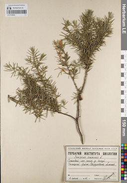
LE 01148542
Juniperus communis L. det. Storozheva, Mariya Mihajlovna at 1961
Collectors: Storozheva, Mariya Mihajlovna Collection date: 02.07.1961. Administrative regions: RUSverdlovskaya Oblast' - Talitskiy Rayon. Place of collection: лес возле д. Кокуй.Groups of specimens: Образцы сектора Восточной Европы; Соглашение Минобрнауки №075-15-2021-1056; Гербарий Института биологии Уральского филиала АН СССРOriginal label text:Уральский филиал Академии наук СССР. Гербарий института биологии. Juniperus communis L. Сосновый лес около д. Кокуй. Талицкий район, Свердловская область. 2 июля 1961 г. Собрал Определил М. Сторожева
Habitat / plant community in location of collecting: сосновый лесCoordinates (geographic position): 57° 14′ 1.03″ N, 63° 13′ 2.83″ E ±2000 mRecord creation: 2022-03-12, Larisa Orlova, PhotoScan D2Citation: Specimen LE 01148542 // Virtual herbarium of Komarov Botanical Institute RAS — http://re.herbariumle.ru/01148542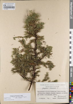
LE 01148541
Juniperus niemannii E.L. Wolf ⟨close to J. sibirica Burgsd.⟩ det. Orlova, Larisa Vladimirovna at 06.03.2022
Additional identifications: Juniperus communis L. det. Storozheva, Mariya Mihajlovna at 1978 Collectors: Salmina, N.P. Collection date: 04.08.1978. Administrative regions: RU - Sverdlovskaya Oblast' - Gorod Karpinsk. Place of collection: окрестности пос. Кытлым, около бывшего пос. Юдинский на восточном склоне г. Косьвинский Камень.Groups of specimens: Образцы сектора Восточной Европы; Соглашение Минобрнауки №075-15-2021-1056; Гербарий Института экологии растений и животных Уральского научного центра АН СССРOriginal label text:Гербарий Института экологии растений и животных Уральского научного центра АН СССР. Juniperus communis L. Свердловская область. Карпинский район. окр. пос. Кытлым. около бывшего поселка Юдинский на восточном склоне г. Косьвинский Камень. 4 августа 1978 г. Собрал Салмина Н.П. Определил Сторожева М.М.
Landscape in location of collection: склон горыCoordinates (geographic position): 59° 30′ 58.94″ N, 59° 5′ 4.96″ E ±2000 mRecord creation: 2022-03-12, Larisa Orlova, PhotoScan D2Citation: Specimen LE 01148541 // Virtual herbarium of Komarov Botanical Institute RAS — http://re.herbariumle.ru/01148541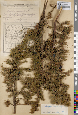
LE 01148540
Juniperus sibirica Burgsd. det. Kondratjuk, Evgeniĭ Nikolaevich at 15.03.1958
Additional identifications: Juniperus communis L. det. Miryahin at 1931 Collectors: Miryahin Collection date: 16.09.1931. Administrative regions: RU - Bashkortostan - Gafuriyskiy Rayon. Place of collection: Окр. усадьбы 6го участка Т.-Кот. "Мясосовхоза". Зап. склон гор. Крынты бл. [скалы? ручья?] Ак-таш.Expedition: Башкирская экспедиция Академии наук. Геоботанические исследования в Башкирской республике (1930 -1931)Groups of specimens: Образцы сектора Восточной Европы; Соглашение Минобрнауки №075-15-2021-1056Original label text:Башкирская Экспедиция Академии Наук. О.Э. Кнорринг, И.М. Крашенинников и С.М. Кучеровская. Геоботанические исследования в Башкирской республике. Juniperus communis L. Окр. усадьбы 6го участка Т.-Кот. "Мясосовхоза". Зап. склон гор. Крынты бл. Ак-таш. На скалах. 16 IX 1931 г. Собр. Миряхин. Plantae Baschkiricae.
Landscape in location of collection: скалыCoordinates (geographic position): 54° 11′ 5.83″ N, 56° 44′ 39.37″ E ±10000 mRecord creation: 2022-03-12, Larisa Orlova, PhotoScan D2Citation: Specimen LE 01148540 // Virtual herbarium of Komarov Botanical Institute RAS — http://re.herbariumle.ru/01148540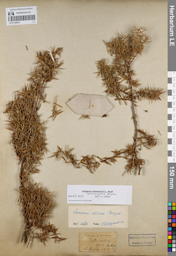
LE 01148539
Juniperus niemannii E.L. Wolf det. Orlova, Larisa Vladimirovna at 06.03.2022
Additional identifications: Juniperus communis L. det. Meyer, Carl Anton von at 1826; Juniperus sibirica Burgsd. det. Kondratjuk, Evgeniĭ Nikolaevich at 15.03.1958 Collectors: Meyer, Carl Anton von Collection date: 1826. Administrative regions: RU - Sverdlovskaya Oblast' - Municipalnoe obrazovanie «gorod Ekaterinburg». Place of collection: г. Екатеринбург.Groups of specimens: Образцы сектора Восточной Европы; Соглашение Минобрнауки №075-15-2021-1056; Herb. C.A. MeyerObject features: Кустарничек 60 см выс. (Fruticulus vix 2 pedal)Original label text:Juniperus communis. Catherinenburg. 1826. Hb. Meye[r]. Fruticulus vix 2 pedal.
Coordinates (geographic position): 56° 50′ 16.84″ N, 60° 35′ 50.91″ E ±40000 mRecord creation: 2022-03-12, Larisa Orlova, PhotoScan D2Citation: Specimen LE 01148539 // Virtual herbarium of Komarov Botanical Institute RAS — http://re.herbariumle.ru/01148539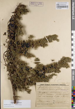
LE 01148538
Juniperus sibirica Burgsd. det. Orlova, Larisa Vladimirovna at 06.03.2022
Additional identifications: Juniperus communis var. vulgaris Spud. var. globosa Medw. det. Sidneva, S. V. at 1931 Collectors: Sidneva, S. V. Field collecting number: Dupla. Collection date: 10.07.1931. Administrative regions: RU - Udmurtskaya Respublika - Zav'yalovskiy Rayon. Place of collection: окрестности г. Ижевск, елово-сосновый лес по склону в долине р. Позимь.Groups of specimens: Образцы сектора Восточной Европы; Соглашение Минобрнауки №075-15-2021-1056; Гербарий Горьковского Государственного УниверситетаOriginal label text:Гербарий Горьковского Государственного Университета. Juniperus communis L. v. vulgaris Spud. v. globosa Medw. Dupla. Удмуртская Автономная обл. (окр. г. Ижевска. Елово-сосновый лес по склону в дол. р. Позими. 10/VII 1931 г. Leg. Det. Сиднева С.
Landscape in location of collection: склон к долине рекиHabitat / plant community in location of collecting: елово-сосновый лесCoordinates (geographic position): 56° 52′ 21.06″ N, 53° 29′ 28.32″ E ±10000 mRecord creation: 2022-03-12, Larisa Orlova, PhotoScan D2Citation: Specimen LE 01148538 // Virtual herbarium of Komarov Botanical Institute RAS — http://re.herbariumle.ru/01148538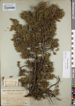
LE 01148537
Juniperus sibirica Burgsd. det. Orlova, Larisa Vladimirovna at 06.03.2022
Additional identifications: Juniperus nana Willd. det. Tjulina (Tyulina), Lyudmila Nikolaevna at 1929 Collectors: Tjulina (Tyulina), Lyudmila Nikolaevna Field collecting number: 216. Collection date: 22.08.1929. Administrative regions: RU - Bashkortostan - Beloretskiy Rayon. Place of collection: г. Иремель, вершина г. Малый Иремель, россыпи кварцита.Groups of specimens: Образцы сектора Восточной Европы; Соглашение Минобрнауки №075-15-2021-1056Original label text:Museum Botanicum Academiae Scientiarum Petropolitanae. № 216. Juniperus nana Willd. Южный Урал. Гора Иремель. Вершина Мал. Иремеля. Россыпи кварцита. 1929.22/VIII. Л. Тюлина.
Landscape in location of collection: вершина горыSubstrate in collecting location: кварцитCoordinates (geographic position): 54° 33′ 9.19″ N, 58° 53′ 46.01″ E ±1000 mRecord creation: 2022-03-12, Larisa Orlova, PhotoScan D2Citation: Specimen LE 01148537 // Virtual herbarium of Komarov Botanical Institute RAS — http://re.herbariumle.ru/01148537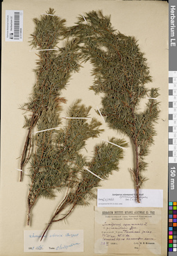
LE 01148536
Juniperus niemannii E.L. Wolf ⟨intermediate forma⟩ det. Orlova, Larisa Vladimirovna at 06.03.2022
Additional identifications: Juniperus communis var. pyramidalis Sjus. det. Igoschina, Kapitolina Nikolaevna at 1939; Juniperus sibirica Burgsd. det. Kondratjuk, Evgeniĭ Nikolaevich at 15.03.1958 Collectors: Igoschina, Kapitolina Nikolaevna Collection date: 26.06.1939. Administrative regions: RU - Sverdlovskaya Oblast' - Polevskoy Gorod. Place of collection: гор. Полевской, Полевской машиностроительный завод, сосновый бор на каменистом холме (гора Думная?).Expedition: Геоботанический отряд Уральской Комплексной экспедиции Академии Наук СССР (1939 -1940)Groups of specimens: Образцы сектора Восточной Европы; Соглашение Минобрнауки №075-15-2021-1056Original label text:Herbarium Instituti Botanici Academiae Sc. URSS. Геоботанический отряд Уральской Комплексной экспедиции Академии Наук СССР. Juniperus communis L. v. pyramidalis Sjus. Средний Урал. Полевской завод. 56°25' с.ш. 60°10' вд. Сосновый бор на каменистом холме. 26 VI 1939 г. Собр., опр. К.Н, Игошина.
Landscape in location of collection: каменистый холмHabitat / plant community in location of collecting: сосновый борCoordinates (geographic position): 56° 26′ 22.1″ N, 60° 11′ 19.46″ E ±200 mRecord creation: 2022-03-12, Larisa Orlova, PhotoScan D2Citation: Specimen LE 01148536 // Virtual herbarium of Komarov Botanical Institute RAS — http://re.herbariumle.ru/01148536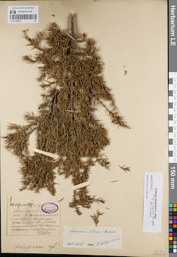
LE 01148535
Groups of specimens: Образцы сектора Восточной Европы; Соглашение Минобрнауки №075-15-2021-1056Record creation: 2022-03-12, Larisa Orlova, PhotoScan D2Citation: Specimen LE 01148535 // Virtual herbarium of Komarov Botanical Institute RAS — http://re.herbariumle.ru/01148535
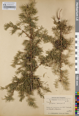
LE 01148534
Juniperus communis L. det. Nekrasova, Vera Leontievna at 1920
Collectors: Nekrasova, Vera Leontievna Field collecting number: 60. Collection date: 20.08.1920. Administrative regions: RU - Udmurtskaya Respublika - Sarapul'skiy Rayon. Place of collection: окрестности г. Сарапул, лес в верховьях р. Юрманка.Expedition: В. Л. Некрасова: Растения Вятской губернии (1920)Groups of specimens: Образцы сектора Восточной Европы; Соглашение Минобрнауки №075-15-2021-1056Original label text:Herbarium Horti Petropolitani. В.Л. Некрасова: Растения Вятской губ. № 60. Juniperus communis L. Вятская губ. Сарапульский уезд: окр. Сарапула, лес в верхов. р. Юрманки. 1920 20/VIII. W.L. Nekrassowa: Plantae gub. Wiatka.
Habitat / plant community in location of collecting: лесCoordinates (geographic position): 56° 28′ 56.01″ N, 53° 45′ 48.6″ E ±2000 mRecord creation: 2022-03-12, Larisa Orlova, PhotoScan D2Citation: Specimen LE 01148534 // Virtual herbarium of Komarov Botanical Institute RAS — http://re.herbariumle.ru/01148534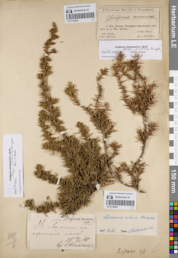
LE 01148532
Juniperus niemannii E.L. Wolf ⟨close to J. sibirica Burgsd.⟩ det. Orlova, Larisa Vladimirovna at 05.03.2022
Additional identifications: Juniperus communis L. det. Korshinsky, Sergei Ivanovitsch at 1886 Collectors: Korshinsky, Sergei Ivanovitsch Collection date: 15.05.1886. Administrative regions: RU - Kirovskaya Oblast' - Malmyzhskiy Rayon. Place of collection: с. Большой Китяк, на южных мергельных склонах по р. Большая Китячка.Groups of specimens: Образцы сектора Восточной Европы; Соглашение Минобрнауки №075-15-2021-1056; S. Korzhinsky Flora Cis- and Transwolgensis (объединить с S. Korzchinsky. Flora Cis- et Transwolgensis., это удалить)Original label text:S. Korzchinsky. Flora Cis- et Transwolgensis. Juniperus communis. С. Бол. Китяк. На южных мергельных склонах по р. Бол. Китяку. Gub. Wiatka. Distr. Malmyzch. 15 Мая 1886 г. leg. S. Korzchinsky
Landscape in location of collection: склон южной экспозиции к берегу рекиSubstrate in collecting location: мергельCoordinates (geographic position): 56° 20′ 32.86″ N, 50° 44′ 48.58″ E ±2000 mRecord creation: 2022-03-12, Larisa Orlova, PhotoScan D2Citation: Specimen LE 01148532 // Virtual herbarium of Komarov Botanical Institute RAS — http://re.herbariumle.ru/01148532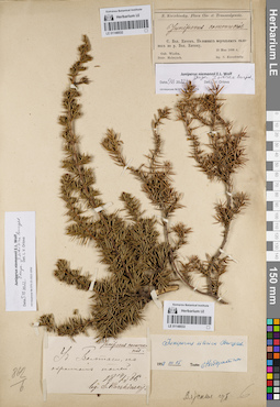
LE 01148533
Juniperus niemannii E.L. Wolf ⟨close to J. sibirica Burgsd.⟩ det. Orlova, Larisa Vladimirovna at 05.03.2022
Additional identifications: Juniperus communis L. det. Korshinsky, Sergei Ivanovitsch at 1886; Juniperus sibirica Burgsd. det. Kondratjuk, Evgeniĭ Nikolaevich at 15.03.1958 Collectors: Korshinsky, Sergei Ivanovitsch Collection date: 14.05.1886. Administrative regions: RU - Tatarstan - Baltasinskiy Rayon. Place of collection: уд. Балтаси, по окраинам полей.Groups of specimens: Образцы сектора Восточной Европы; Соглашение Минобрнауки №075-15-2021-1056; S. Korzhinsky Flora Cis- and Transwolgensis (объединить с S. Korzchinsky. Flora Cis- et Transwolgensis., это удалить)Original label text:Juniperus communis. Уд. Балтаси, по окраинам полей. 14/V 1886. leg. S. Korshinsky.
Habitat / plant community in location of collecting: полеCoordinates (geographic position): 56° 20′ 46.63″ N, 50° 12′ 24.82″ E ±5000 mRecord creation: 2022-03-12, Larisa Orlova, PhotoScan D2Citation: Specimen LE 01148533 // Virtual herbarium of Komarov Botanical Institute RAS — http://re.herbariumle.ru/01148533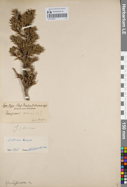
LE 01148531
Groups of specimens: Образцы сектора Восточной Европы; Соглашение Минобрнауки №075-15-2021-1056Record creation: 2022-03-12, Larisa Orlova, PhotoScan D2Citation: Specimen LE 01148531 // Virtual herbarium of Komarov Botanical Institute RAS — http://re.herbariumle.ru/01148531
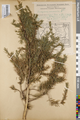
LE 01148530
Juniperus communis L. det. Noskov, Aleksandr Kupriyanovich, Lind, Adolf Genrih Ehduardovich at 1929
Collectors: Noskov, Aleksandr Kupriyanovich; Lind, Adolf Genrih Ehduardovich Field collecting number: 67. Collection date: 27.06.1929. Administrative regions: RU - Bashkortostan - Duvanskiy Rayon. Place of collection: вершина "Птичной" горы между с. Метели и с. Абдуллино.Expedition: Башкирская экспедиция Академии наук. Геоботанические исследования в Месягутовском кантоне (1928 -1930)Groups of specimens: Образцы сектора Восточной Европы; Соглашение Минобрнауки №075-15-2021-1056Original label text:Башкирская экспедиция Академии Наук. Носков А.К., Линд А.Э. Геоботанические исследования в Месягутовском кантоне. № 67. Juniperus communis L. Месягутовский кантон. Левый берег р. Ай между сел. Метели и Абдуллино. Вершина "Птичной горы". Примесь щебня. 27 VI 1928 г. Собр. Носков и Линд. Plantae Baschkiricae.
Substrate in collecting location: примесь щебняCoordinates (geographic position): 56° 2′ 22.28″ N, 57° 56′ 55.27″ E ±10000 mRecord creation: 2022-03-12, Larisa Orlova, PhotoScan D2Citation: Specimen LE 01148530 // Virtual herbarium of Komarov Botanical Institute RAS — http://re.herbariumle.ru/01148530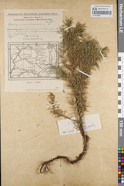
LE 01148529
Juniperus communis L. ⟨Vidi⟩ det. Kondratjuk, Evgeniĭ Nikolaevich at 15.03.1958
Additional identifications: Juniperus communis L. det. Lind, Adolf Genrih Ehduardovich at 1929 Collectors: Lind, Adolf Genrih Ehduardovich Field collecting number: 197. Collection date: 11.07.1929. Administrative regions: RU - Bashkortostan - Duvanskiy Rayon. Place of collection: вершина "Птичной" горы севернее с. Метели.Expedition: Башкирская экспедиция Академии наук. Геоботанические исследования в Месягутовском кантоне (1928 -1930)Groups of specimens: Образцы сектора Восточной Европы; Соглашение Минобрнауки №075-15-2021-1056Original label text:Башкирская экспедиция Академии Наук. Носков А.К., Линд Т.П. Геоботанические исследования в Месягутовском кантоне. №197. Juniperus communis L. Месягутовский кантон. "Птичная" гора на N от с. Метели. Вершина. Грунт со щебнем. 11 VII 1929 г. Собр. Линд. Plantae Baschkiricae.
Landscape in location of collection: вершина горыSubstrate in collecting location: грунт со щебнемCoordinates (geographic position): 56° 2′ 22.28″ N, 57° 56′ 55.27″ E ±10000 mRecord creation: 2022-03-12, Larisa Orlova, PhotoScan D2Citation: Specimen LE 01148529 // Virtual herbarium of Komarov Botanical Institute RAS — http://re.herbariumle.ru/01148529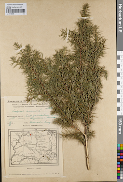
LE 01148528
Juniperus communis L. det. Lind, Adolf Genrih Ehduardovich, Vassiljev, Jakov Jakovlevitch at 1928
Collectors: Vassiljev, Jakov Jakovlevitch; Lind, Adolf Genrih Ehduardovich Field collecting number: 235а. Collection date: 26.07.1928. Administrative regions: RU - Bashkortostan - Duvanskiy Rayon. Place of collection: долина р. Ай, между сел. Абдуллино и Метели.Expedition: Башкирская экспедиция Академии наук. Геоботанические исследования в Месягутовском кантоне (1928 -1930)Groups of specimens: Образцы сектора Восточной Европы; Соглашение Минобрнауки №075-15-2021-1056Original label text:Башкирская экспедиция Академии Наук. Носков А.К., Васильев Я.Я., Линд Т.П., Михайлов П. Геоботанические исследования в Месягутовском кантоне. № 235а. Juniperus communis L. Месягутовский кантон. Елово-пихтовый лес. Долина р. Ай. Между сел. Абдуллино и Метели. 26 VII 1928 г. Собр. Васильев и Линд. Plantae Baschkiricae.
Landscape in location of collection: берег рекиHabitat / plant community in location of collecting: елово-пихтовый лесCoordinates (geographic position): 56° 2′ 45.92″ N, 57° 57′ 53.1″ E ±10000 mRecord creation: 2022-03-12, Larisa Orlova, PhotoScan D2Citation: Specimen LE 01148528 // Virtual herbarium of Komarov Botanical Institute RAS — http://re.herbariumle.ru/01148528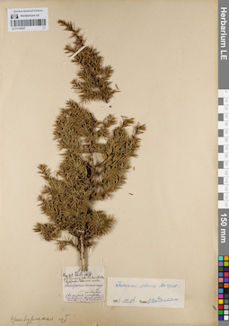
LE 01148527
Juniperus sibirica Burgsd. det. Kondratjuk, Evgeniĭ Nikolaevich at 14.03.1958
Additional identifications: Juniperus communis var. intermedia (Schur.) Sanio det. Schell, Julian K. at 1878 Collectors: Schell, Julian K. Field collecting number: 212а. Collection date: 1878. Administrative regions: RU - Bashkortostan - Beloretskiy Rayon. Place of collection: с. Верхний Авзян, Авзяно-Петровский завод.Groups of specimens: Образцы сектора Восточной Европы; Соглашение Минобрнауки №075-15-2021-1056Object features: кустарник вверх поднимающийся, а не стелющийсяOriginal label text:N 212a. Leg. Jul. Schell 1878, Gub. Orenburg, distr. Werchne-Uralsk, Awsjano-Petrowski sawod. Juniperus communis L. var. intermedia.(В низких местах, кустарник вверх поднимающийся, а не стелющийся)
Landscape in location of collection: на низких местахCoordinates (geographic position): 53° 32′ 28.35″ N, 57° 30′ 37.16″ E ±10000 mRecord creation: 2022-03-12, Larisa Orlova, PhotoScan D2Citation: Specimen LE 01148527 // Virtual herbarium of Komarov Botanical Institute RAS — http://re.herbariumle.ru/01148527