View
Add
Copy
Edit
Delete
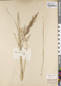
LE 01163525
Groups of specimens: Гербарий Карла Бернхарда Триниуса; Соглашение Минобрнауки №075-15-2021-1056Record creation: 2022-06-16, Larisa Orlova, PhotoScan D2Citation: Specimen LE 01163525 // Virtual herbarium of Komarov Botanical Institute RAS — http://re.herbariumle.ru/01163525
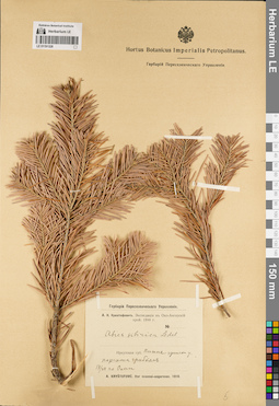
LE 01191328
Abies sibirica Ledeb. det. Kryshtofowicz, African Nikolaevich at 1910
Collectors: Kryshtofowicz, African Nikolaevich Collection date: 17.07.1910. Administrative regions: RU - Irkutskaya Oblast' - Nizhneudinskiy Rayon. Place of collection: по р. Омь.Expedition: А.Н. Криштофович: Экспедиция в Око-Ангарский край. 1910 г. (1910)Groups of specimens: Образцы сектора Сибири и Дальнего Востока России; Соглашение Минобрнауки №075-15-2021-1056; Гербарий Переселенческого УправленияOriginal label text:Гербарий Переселенческого Управления. А.Н. Криштофович. Экспедиция в Око-Ангарский край. 1910 г. Abies sibirica Ledeb. Иркутская губ. Нижнеудински у. поражена грибком. 17/VII. по Оми. A. Kristofovic. Iter ocaensi-angarense. 1910
Coordinates (geographic position): 54° 35′ 19.49″ N, 99° 6′ 20.91″ E ±250000 mRecord creation: 2022-06-16, Larisa Orlova, PhotoScan D2Citation: Specimen LE 01191328 // Virtual herbarium of Komarov Botanical Institute RAS — http://re.herbariumle.ru/01191328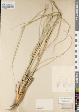
LE 01163524
Groups of specimens: Гербарий Карла Бернхарда Триниуса; Соглашение Минобрнауки №075-15-2021-1056Record creation: 2022-06-16, Larisa Orlova, PhotoScan D2Citation: Specimen LE 01163524 // Virtual herbarium of Komarov Botanical Institute RAS — http://re.herbariumle.ru/01163524
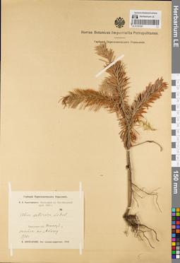
LE 01191327
Abies sibirica Ledeb. det. Kryshtofowicz, African Nikolaevich at 1910
Collectors: Kryshtofowicz, African Nikolaevich Collection date: 09.07.1910. Administrative regions: RU - Irkutskaya Oblast' - Nizhneudinskiy Rayon. Place of collection: тайга по р. Айоп.Expedition: А.Н. Криштофович: Экспедиция в Око-Ангарский край. 1910 г. (1910)Groups of specimens: Образцы сектора Сибири и Дальнего Востока России; Соглашение Минобрнауки №075-15-2021-1056; Гербарий Переселенческого УправленияOriginal label text:Гербарий Переселенческого Управления. А.Н. Криштофович. Экспедиция в Око-Ангарский край. 1910 г. Abies sibirica Ledeb. Иркутская губ. Нижнеуд. у. тайга по Айопу. 9/VII. A. Kristofovic. Iter ocaensi-angarense. 1910
Landscape in location of collection: берег рекиHabitat / plant community in location of collecting: тайгаCoordinates (geographic position): 54° 54′ 4.46″ N, 99° 1′ 34.99″ E ±250000 mRecord creation: 2022-06-16, Larisa Orlova, PhotoScan D2Citation: Specimen LE 01191327 // Virtual herbarium of Komarov Botanical Institute RAS — http://re.herbariumle.ru/01191327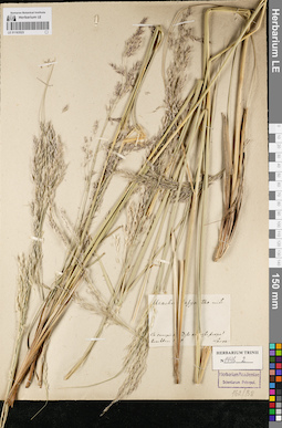
LE 01163523
Groups of specimens: Гербарий Карла Бернхарда Триниуса; Соглашение Минобрнауки №075-15-2021-1056Record creation: 2022-06-16, Larisa Orlova, PhotoScan D2Citation: Specimen LE 01163523 // Virtual herbarium of Komarov Botanical Institute RAS — http://re.herbariumle.ru/01163523
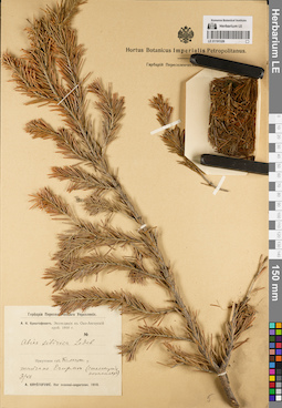
LE 01191326
Abies sibirica Ledeb. det. Kryshtofowicz, African Nikolaevich at 1910
Collectors: Kryshtofowicz, African Nikolaevich Collection date: 03.07.1910. Administrative regions: RU - Irkutskaya Oblast' - Balaganskiy Rayon. Place of collection: тайга по р. Егирма.Expedition: А.Н. Криштофович: Экспедиция в Око-Ангарский край. 1910 г. (1910)Groups of specimens: Образцы сектора Сибири и Дальнего Востока России; Соглашение Минобрнауки №075-15-2021-1056; Гербарий Переселенческого УправленияObject features: стелющийся экземплярOriginal label text:Гербарий Переселенческого Управления. А.Н. Криштофович. Экспедиция в Око-Ангарский край. 1910 г. Abies sibirica Ledeb. Иркутская губ. Балаган. у. тайга по Егирме (стелющийся экземпляр). 3/VII. A. Kristofovic. Iter ocaensi-angarense. 1910
Landscape in location of collection: берег рекиHabitat / plant community in location of collecting: тайгаCoordinates (geographic position): 55° 6′ 42.48″ N, 103° 6′ 24.12″ E ±40000 mRecord creation: 2022-06-16, Larisa Orlova, PhotoScan D2Citation: Specimen LE 01191326 // Virtual herbarium of Komarov Botanical Institute RAS — http://re.herbariumle.ru/01191326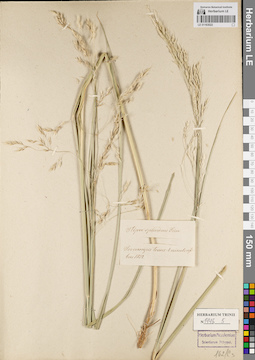
LE 01163522
Groups of specimens: Гербарий Карла Бернхарда Триниуса; Соглашение Минобрнауки №075-15-2021-1056Record creation: 2022-06-16, Larisa Orlova, PhotoScan D2Citation: Specimen LE 01163522 // Virtual herbarium of Komarov Botanical Institute RAS — http://re.herbariumle.ru/01163522
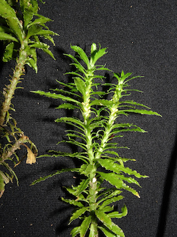
LE 01123129
Nervilia plicata (Andrews) Schltr. det. Khang Sinh Nguyen, Averyanov, Leonid Vladimirovich at 15.06.2022
Collectors: Ma Cong; Khang Sinh Nguyen Field collecting number: Khang Sinh Nguyen s.n.. Collection date: 2022. Administrative regions: VN - Gia Lai. Groups of specimens: L. V. Averyanov specimens; L. V. Averyanov photos; Orchids of Vietnam, Laos and CambodiaOriginal label text:FLORA OF VIETNAM
Orchidaceae
Nervilia plicata Schltr.
Gia Lai province, Chu Prong district, Ia O municipality.
Photos by Ma Cong, Khang Sinh Nguyen s.n.
All photos © - Ma Cong & Khang Sinh Nguyen.
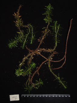
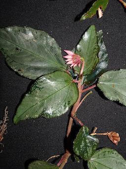
LE 01123128
Nervilia plicata (Andrews) Schltr. det. Khang Sinh Nguyen, Averyanov, Leonid Vladimirovich at 15.06.2022
Collectors: Ma Cong; Khang Sinh Nguyen Field collecting number: Khang Sinh Nguyen s.n.. Collection date: 2022. Administrative regions: VN - Gia Lai. Groups of specimens: L. V. Averyanov specimens; L. V. Averyanov photos; Orchids of Vietnam, Laos and CambodiaOriginal label text:FLORA OF VIETNAM
Orchidaceae
Nervilia plicata Schltr.
Gia Lai province, Chu Prong district, Ia O municipality.
Photos by Ma Cong, Khang Sinh Nguyen s.n.
All photos © - Ma Cong & Khang Sinh Nguyen.
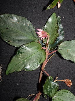
LE 01123127
Tainia cordifolia Hook.f. det. Averyanov, Leonid Vladimirovich at 15.06.2022
Collectors: Kuznetsov, A.N.; S.P. Kuznetsova Field collecting number: Kuznetsov s.n.. Collection date: 08.06.2022. Administrative regions: VN - Gia Lai. Groups of specimens: L. V. Averyanov specimens; L. V. Averyanov photos; Orchids of Vietnam, Laos and CambodiaOriginal label text:SOUTHERN VIETNAM
Gia Lai prov., K'Bang distr., Son Lang municip.
Kon Chu Rang Nature Reserve
31 km ESE of Mang Den town
N 14° 28' 17'' E 108° 33' 09''
Kuznetsov A.N., Kuznetsova S.P. s.n.
08.06.2022
All photos © - A.N. Kuznetsov
LE 01123126
Erythrorchis altissima (Blume) Blume det. Averyanov, Leonid Vladimirovich at 15.06.2022
Collectors: Do Phuong Field collecting number: Do Phuong s.n.. Collection date: 12.06.2022. Administrative regions: VN - Tinh Khanh Hoa. Groups of specimens: L. V. Averyanov specimens; L. V. Averyanov photos; Orchids of Vietnam, Laos and CambodiaOriginal label text:FLORA OF VIETNAM
Orchidaceae
Erythrorchis altissima (Blume) Blume
Vietnam, Khanh Hoa province, Van Ninh district, Van Phu commune,
12 June 2022, photo by Do Phuong sn.,
All photos © - Do Phuong
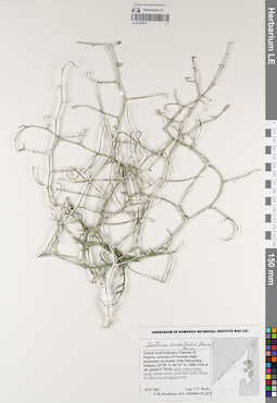
LE 01182672
Lactuca orientalis (Boiss.) Boiss. det. Byalt, Vyacheslav Vyacheslavovich, Korshunov, Vladimir Mikhailovich, Melnikov, Denis Germanovich at 18.04.2022
Collectors: Byalt, Vyacheslav Vyacheslavovich; Korshunov, Vladimir Mikhailovich; Melnikov, Denis Germanovich Field collecting number: 104. Collection date: 18.04.2022. Administrative regions: AE - Al Fujayrah. Place of collection: Emirate of Fujaira, environs of Tawaian, high mountains on border with Musandam (Oman) [point 5/707d]: stony valley of dry creek.Groups of specimens: Образцы общего сектора; Соглашение Минобрнауки №075-15-2021-1056; Бялт В.В.: Флора ФуджейрыOriginal label text:United Arab Emirates. Emirate of Fujaira, environs of Tawaian, high mountains on border with Musandam (Oman), 25°38' N, 56°07' E, 1000-1126 m alt. [point 5/707d]: stony valley of dry creek.
Landscape in location of collection: каменистая долина сухого ущельяCoordinates (geographic position): 25° 38′ 0″ N, 56° 7′ 0″ E ±100 m 1100 m a.s.l.Record creation: 2022-06-15, Denis Melnikov, PhotoScan D2Citation: Specimen LE 01182672 // Virtual herbarium of Komarov Botanical Institute RAS — http://re.herbariumle.ru/01182672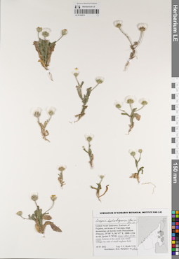
LE 01182674
Crepis kotschyana (Boiss.) Boiss. det. Byalt, Vyacheslav Vyacheslavovich, Korshunov, Vladimir Mikhailovich, Melnikov, Denis Germanovich at 18.04.2022
Collectors: Byalt, Vyacheslav Vyacheslavovich; Korshunov, Vladimir Mikhailovich; Melnikov, Denis Germanovich Field collecting number: 132. Collection date: 18.04.2022. Administrative regions: AE - Al Fujayrah. Place of collection: Emirate of Fujaira, environs of Tawaian, high mountains on border with Musandam (Oman) [point 5/707d]: stony valley of dry creek.Groups of specimens: Бялт В.В.: Флора Фуджейры; Соглашение Минобрнауки №075-15-2021-1056; Образцы общего сектора; Бялт В.В.: Флора ФуджейрыOriginal label text:United Arab Emirates. Emirate of Fujaira, environs of Tawaian, high mountains on border with Musandam (Oman), 25°38' N, 56°07' E, 1000-1126 m alt. [point 5/707d]: stony valley of dry creek
Landscape in location of collection: каменистая долина сухого ущельяCoordinates (geographic position): 25° 38′ 0″ N, 56° 7′ 0″ E, 1100 m a.s.l.Record creation: 2022-06-15, Denis Melnikov, PhotoScan D2Citation: Specimen LE 01182674 // Virtual herbarium of Komarov Botanical Institute RAS — http://re.herbariumle.ru/01182674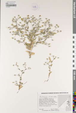
LE 01182673
Pentanema divaricatum Cass. det. Byalt, Vyacheslav Vyacheslavovich, Korshunov, Vladimir Mikhailovich, Melnikov, Denis Germanovich at 18.04.2022
Collectors: Byalt, Vyacheslav Vyacheslavovich; Korshunov, Vladimir Mikhailovich; Melnikov, Denis Germanovich Field collecting number: 93(2). Collection date: 18.04.2022. Administrative regions: AE - Al Fujayrah. Place of collection: Emirate of Fujaira, environs of Tawaian, high mountains on border with Musandam (Oman) [point 5/707d]: stony valley of dry creek.Groups of specimens: Образцы общего сектора; Соглашение Минобрнауки №075-15-2021-1056; Бялт В.В.: Флора ФуджейрыOriginal label text:United Arab Emirates. Emirate of Fujaira, environs of Tawaian, high mountains on border with Musandam (Oman), 25°38' N, 56°07' E, 1000-1126 m alt. [point 5/707d]: stony valley of dry creek
Landscape in location of collection: каменистая долина сухого ущельяCoordinates (geographic position): 25° 38′ 0″ N, 56° 7′ 0″ E ±100 m 1100 m a.s.l.Record creation: 2022-06-15, Denis Melnikov, PhotoScan D2Citation: Specimen LE 01182673 // Virtual herbarium of Komarov Botanical Institute RAS — http://re.herbariumle.ru/01182673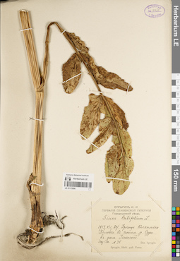
LE 01175596
Sium latifolium L. det. Sprygin, Ivan Ivanovich at 24.07.1913
Collectors: Sprygin, Ivan Ivanovich Field collecting number: 35. Collection date: 24.07.1913. Administrative regions: RU - Penzenskaya Oblast' - Penzenskiy Rayon. Groups of specimens: Образцы сектора Восточной Европы; Соглашение Минобрнауки №075-15-2021-1056; Спрыгин И. И. Гербарий Пензенской губернии.Original label text:Городищенский уезд. Урочище Кичкилейка. Болота в пойме реки Суры. В даче Успенской.
Coordinates (geographic position): 53° 6′ 50.35″ N, 45° 7′ 22.36″ E ±2000 mRecord creation: 2022-06-15, Denis Melnikov, PhotoScan D2Citation: Specimen LE 01175596 // Virtual herbarium of Komarov Botanical Institute RAS — http://re.herbariumle.ru/01175596Sprygin, Herb. gub. Pensa.
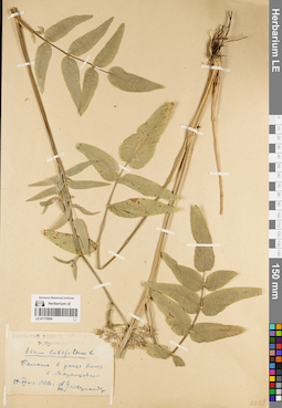
LE 01175594
Sium latifolium L. det. Vernander, Tatyana Borisovna at 29.07.1922
Collectors: Vernander, Tatyana Borisovna Collection date: 29.07.1922. Administrative regions: RU - Tambovskaya Oblast' - Znamenskiy Rayon. Groups of specimens: Образцы сектора Восточной Европы; Соглашение Минобрнауки №075-15-2021-1056Original label text:ГЕРБАРИЙ ТАМБОВСКОЙ ...
Coordinates (geographic position): 52° 27′ 4.77″ N, 41° 24′ 41.43″ E ±1000 mRecord creation: 2022-06-15, Denis Melnikov, PhotoScan D2Citation: Specimen LE 01175594 // Virtual herbarium of Komarov Botanical Institute RAS — http://re.herbariumle.ru/01175594Т. Вернандер
Болото в роще близ села Воронцовка.
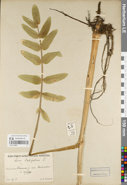
LE 01175593
Sium latifolium L. det. Iljinski, Alexei Porfirievich at 13.07.1912
Collectors: Iljinski, Alexei Porfirievich Collection date: 13.07.1912. Administrative regions: RU - Tverskaya Oblast' - Kimrskiy Rayon. Groups of specimens: Образцы сектора Восточной Европы; Соглашение Минобрнауки №075-15-2021-1056Original label text:MUSEUM BOTANICUM ACADEMIAE SCIENTARUM ROSSICAE.
Coordinates (geographic position): 57° 7′ 17.89″ N, 37° 36′ 30.13″ E ±500 mRecord creation: 2022-06-15, Denis Melnikov, PhotoScan D2Citation: Specimen LE 01175593 // Virtual herbarium of Komarov Botanical Institute RAS — http://re.herbariumle.ru/01175593Тверская губерния. Кашинский уезд. Имение Дымовка.
В пруде.
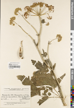
LE 01175645
Collectors: Yunatov, Alexander Afanasievich Collection date: 26.05.1967. Administrative regions: RU - Volgogradskaya Oblast' - Novonikolayevskiy Rayon. Groups of specimens: Образцы сектора Восточной Европы; Соглашение Минобрнауки №075-15-2021-1056Original label text: Coordinates (geographic position): 50° 47′ 41.09″ N, 42° 32′ 47.37″ E ±500 mRecord creation: 2022-06-15, Denis Melnikov, PhotoScan D2Citation: Specimen LE 01175645 // Virtual herbarium of Komarov Botanical Institute RAS — http://re.herbariumle.ru/01175645
ГЕРБАРИЙ БОТАНИЧЕСКОГО ИНСТИТУТА АКАДЕМИИ НАУК СССР
Волгоградская область, Ново-Нколаевский район, в 5 км южнее поселка Куликовского. Склоны вербовой балки.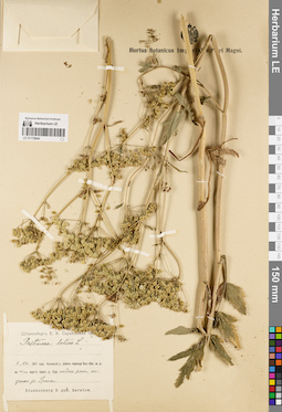
LE 01175644
Pastinaca sativa L. det. Stuckenberg, Elisabeth Karlovna at 01.08.1911
Collectors: Stuckenberg, Elisabeth Karlovna Collection date: 01.08.1911. Administrative regions: RU - Penzenskaya Oblast' - Gorodishchenskiy Rayon. Groups of specimens: Образцы сектора Восточной Европы; Соглашение Минобрнауки №075-15-2021-1056Original label text:Штукенберг Е. К. Саратовская губерния.
Coordinates (geographic position): 53° 9′ 14.34″ N, 45° 59′ 4.91″ E ±2000 mRecord creation: 2022-06-15, Denis Melnikov, PhotoScan D2Citation: Specimen LE 01175644 // Virtual herbarium of Komarov Botanical Institute RAS — http://re.herbariumle.ru/01175644Кузнецкий уезд; район перехода Сызранско-Вяземской железной дороги на 908/909 версте через реку Суру. Пойма реки к устью реки Уранки.
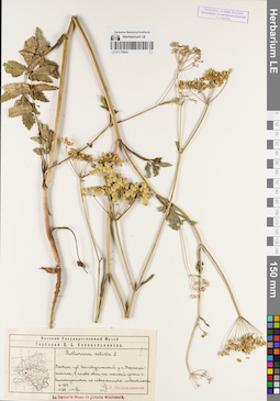
LE 01175643
Pastinaca sativa L. det. Kolokolnikov, Leonid Borisovich at 01.08.1928
Collectors: Kolokolnikov, Leonid Borisovich Field collecting number: 187. Collection date: 01.08.1928. Administrative regions: RU - Kirovskaya Oblast' - Verkhoshizhemskiy Rayon. Groups of specimens: Образцы сектора Восточной Европы; Соглашение Минобрнауки №075-15-2021-1056; Гербарий Л. Б. Колокольникова; Флора Урала и прилегающих территорий (проект)Original label text:Вятский Государственный Музей
Вятская губерния, Халтуринский уезд, у села Верхошижемье, в посеве овса на мелкой супеси с выхождением по поверхность известняка.Ex Herbario Musei Regionalis Wiatkensis.
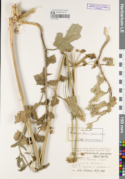
LE 01175642
Pastinaca clausii (Ledeb.) Pimenov det. Pimenov, Michael Georgievich at 2009
Additional identifications: Malabaila graveolens (M. Bieb.) Hoffm. det. Bochkin, V. D. at 19.02.1999 Collectors: Klinkova G. Yu.; Rybnikova T. Collection date: 28.05.1990. Administrative regions: RU - Astrakhanskaya Oblast' - Akhtubinskiy Rayon. Groups of specimens: Образцы сектора Восточной Европы; Соглашение Минобрнауки №075-15-2021-1056Original label text:Астраханская область,
Coordinates (geographic position): 47° 48′ 24.15″ N, 46° 43′ 26.21″ E ±2000 mRecord creation: 2022-06-15, Denis Melnikov, PhotoScan D2. Processing status: label contains unreadable dataCitation: Specimen LE 01175642 // Virtual herbarium of Komarov Botanical Institute RAS — http://re.herbariumle.ru/01175642..... от села Золотуха, у дороги
47°49′ N - 46°45′ E
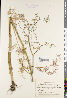
LE 01175641
Oenanthe aquatica (L.) Poir. det. Tzvelev, Nikolai Nikolaievich at 29.06.1979
Collectors: Tzvelev, Nikolai Nikolaievich Field collecting number: 857. Collection date: 29.06.1979. Administrative regions: RU - Voronezhskaya Oblast'. Топоним: Хоперский государственный природный заповедник. Groups of specimens: Образцы сектора Восточной Европы; Соглашение Минобрнауки №075-15-2021-1056Original label text:Воронежская область, Хоперский заповедник, левобережье Хопра в 15 - 16 км к северо-востоку от Новохоперска, берег болота Дологое к северо-востоку от села Озерного.
Coordinates (geographic position): 51° 13′ 23.3″ N, 41° 49′ 14.14″ E ±2000 mRecord creation: 2022-06-15, Denis Melnikov, PhotoScan D2Citation: Specimen LE 01175641 // Virtual herbarium of Komarov Botanical Institute RAS — http://re.herbariumle.ru/01175641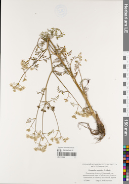
LE 01175600
Oenanthe aquatica (L.) Poir. det. Konechnaya, Galina Yurievna at 05.07.2001
Collectors: Konechnaya, Galina Yurievna Collection date: 05.07.2001. Administrative regions: RU - Pskovskaya Oblast' - Sebezhskiy Rayon. Топоним: Национальный парк "Себежский", Псковская область. Groups of specimens: Образцы сектора Восточной Европы; Соглашение Минобрнауки №075-15-2021-1056Original label text:Псковская область, Себежский район, национальный парк "Себежский", близ озера Анисимово, в канаве у шоссейной дороги.
Coordinates (geographic position): 56° 12′ 43.48″ N, 28° 38′ 24.19″ E ±1000 mRecord creation: 2022-06-15, Denis Melnikov, PhotoScan D2Citation: Specimen LE 01175600 // Virtual herbarium of Komarov Botanical Institute RAS — http://re.herbariumle.ru/01175600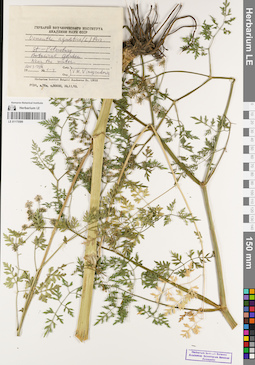
LE 01175599
Oenanthe aquatica (L.) Poir. det. Vinogradova, Vera Mikhailovna at 19.09.2003
Collectors: Vinogradova, Vera Mikhailovna Field collecting number: 1 - 4. Collection date: 19.09.2003. Administrative regions: RU - Sankt-Peterburg - Petrogradskiy Rayon. Groups of specimens: Образцы сектора Восточной Европы; Соглашение Минобрнауки №075-15-2021-1056Original label text:St-Peterburg
Coordinates (geographic position): 59° 58′ 9.58″ N, 30° 19′ 38.81″ E ±300 mRecord creation: 2022-06-15, Denis Melnikov, PhotoScan D2Citation: Specimen LE 01175599 // Virtual herbarium of Komarov Botanical Institute RAS — http://re.herbariumle.ru/01175599Botanical garden
Near the water
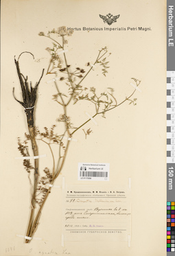
LE 01175598
Oenanthe phellandrium Lam. det. IIjin, Modest Mikhailovich at 25.06.1915
Collectors: IIjin, Modest Mikhailovich Field collecting number: 74. Collection date: 25.06.1915. Administrative regions: RU - Bashkortostan - Sterlitamakskiy Rayon. Expedition: И. М. Крашенинников, М. М. Ильин, В. А. Петров. Ботанико-географическое обследование Уфимской губернии (1915)Groups of specimens: Образцы сектора Восточной Европы; Соглашение Минобрнауки №075-15-2021-1056; Флора Урала и прилегающих территорий (проект)Original label text:Стерлитамакский уезд. Верстах в 8 на юго-запад от Стерлитамака, болотце среди степи.
Coordinates (geographic position): 53° 34′ 57.87″ N, 55° 51′ 50.32″ E ±1000 mRecord creation: 2022-06-15, Denis Melnikov, PhotoScan D2Citation: Specimen LE 01175598 // Virtual herbarium of Komarov Botanical Institute RAS — http://re.herbariumle.ru/01175598УФМСКОЕ ГУБЕРНСКОЕ ЗЕМСТВО.
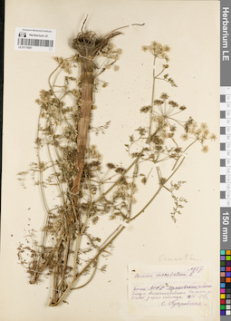
LE 01175597
Conium maculatum L. det. Kutscherovskaya, Sofia Evgenevna at 12.07.34
Collectors: Kutscherovskaya, Sofia Evgenevna Field collecting number: 127. Collection date: 12.07.34. Administrative regions: RU - Bashkortostan - Kugarchinskiy Rayon. Groups of specimens: Образцы сектора Восточной Европы; Соглашение Минобрнауки №075-15-2021-1056; Флора Урала и прилегающих территорий (проект)Original label text:Башкирская АССР. Мраковский район.
Coordinates (geographic position): 52° 53′ 35.35″ N, 56° 21′ 26.41″ E ±5000 mRecord creation: 2022-06-15, Denis Melnikov, PhotoScan D2Citation: Specimen LE 01175597 // Virtual herbarium of Komarov Botanical Institute RAS — http://re.herbariumle.ru/01175597Близ поселка Александровского, долина реки Белой, у края болотца.
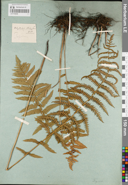
LE 01182638
Polystichum thelypteris (L.) Roth det. Busch
Collectors: Busch Administrative regions: RU - Perm Krai. Groups of specimens: Образцы сектора Восточной Европы; Флора Урала и прилегающих территорий (проект); Соглашение Минобрнауки №075-15-2021-1056Original label text:Городок.
Record creation: 2022-06-15, Denis Melnikov, PhotoScan D2Citation: Specimen LE 01182638 // Virtual herbarium of Komarov Botanical Institute RAS — http://re.herbariumle.ru/01182638Пермск. [Приписка внизу на листе карандашом, неразборчиво]
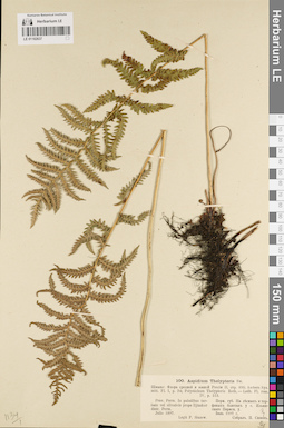
LE 01182637
Aspidium thelypteris (L.) Sw. det. Busch
Collectors: Siuzew (Sjuzew, Siuzev), Paul Wasiljevich Collection date: 07.1897. Administrative regions: RU - Perm Krai - Il'inskiy Rayon. Groups of specimens: Образцы сектора Восточной Европы; Флора Урала и прилегающих территорий (проект); Соглашение Минобрнауки №075-15-2021-1056Original label text:Prov. Perm. In paludibus turfosis vel silvaticis prope Iljinskoe, distr. Perm.
Пермская губерния. На лесных и торфяных болотах у села Ильинского Пермского уезда.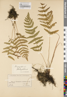
LE 01182636
Dryopteris thelypteris (L.) A. Gray det. Fedtschenko, Boris Alexeevich at 1886
Collectors: Korshinsky, Sergei Ivanovitsch Collection date: 11.06.1886. Administrative regions: RU - Bashkortostan - Burayevskiy Rayon. Groups of specimens: Образцы сектора Восточной Европы; Флора Урала и прилегающих территорий (проект); Соглашение Минобрнауки №075-15-2021-1056Original label text:Flora Cis- et Transwolgensis.
Между деревнями Тонгатаровой и Аргышевой. В травяном болоте.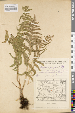
LE 01182635
Dryopteris thelypteris (L.) A. Gray det. Lind, Adolf Genrih Ehduardovich, Vassiljev, Jakov Jakovlevitch at 10.08.1928
Collectors: Lind, Adolf Genrih Ehduardovich; Vassiljev, Jakov Jakovlevitch Field collecting number: 376а. Collection date: 10.08.1928. Administrative regions: RU - Bashkortostan - Duvanskiy Rayon. Expedition: Башкирская экспедиция Академии наук. Геоботанические исследования в Месягутовском кантоне (1928 -1930)Groups of specimens: Образцы сектора Восточной Европы; Флора Урала и прилегающих территорий (проект); Соглашение Минобрнауки №075-15-2021-1056Original label text:По болоту в кустарнике около сел Озерное [Озеро] и Сикияз.
Coordinates (geographic position): 55° 29′ 47.15″ N, 58° 8′ 7.23″ E ±2000 mRecord creation: 2022-06-15, Denis Melnikov, PhotoScan D2Citation: Specimen LE 01182635 // Virtual herbarium of Komarov Botanical Institute RAS — http://re.herbariumle.ru/01182635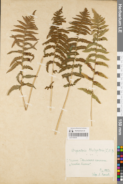
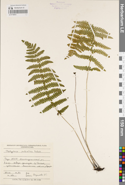
LE 01182634
Dryopteris thelypteris (L.) A. Gray det. Noskov, Aleksandr Kupriyanovich at 17.08.1928
Collectors: Noskov, Aleksandr Kupriyanovich Collection date: 17.08.1928. Administrative regions: RU - Bashkortostan - Iglinskiy Rayon. Groups of specimens: Образцы сектора Восточной Европы; Флора Урала и прилегающих территорий (проект); Соглашение Минобрнауки №075-15-2021-1056Original label text:Село Иглино Уфимского кантона.
Coordinates (geographic position): 54° 49′ 29.56″ N, 56° 24′ 56.79″ E ±5000 mRecord creation: 2022-06-15, Denis Melnikov, PhotoScan D2Citation: Specimen LE 01182634 // Virtual herbarium of Komarov Botanical Institute RAS — http://re.herbariumle.ru/01182634"Сосновое болото"
LE 01182633
Thelypteris palustris Schott det. Baranova, Olga Germanovna at 29.06.1983
Collectors: Baranova, Olga Germanovna Field collecting number: 483. Collection date: 29.06.1983. Administrative regions: RU - Udmurtskaya Respublika - Malopurginskiy Rayon. Groups of specimens: Образцы сектора Восточной Европы; Флора Урала и прилегающих территорий (проект); Соглашение Минобрнауки №075-15-2021-1056; Herbarium Universitatis LeninopolitanaeOriginal label text:Удмуртская АССР, Малопургинский район, в 1 км северо-западнее деревни Гожня, заболоченная облесненная пойма реки Агрызки.
Coordinates (geographic position): 56° 33′ 34.07″ N, 52° 50′ 29.3″ E ±500 mRecord creation: 2022-06-15, Denis Melnikov, PhotoScan D2Citation: Specimen LE 01182633 // Virtual herbarium of Komarov Botanical Institute RAS — http://re.herbariumle.ru/01182633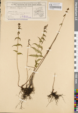
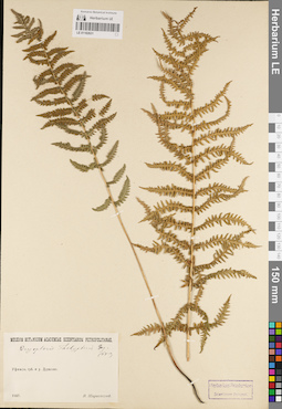
LE 01182632
Aspidium thelypteris (L.) Sw. det. Kolokolnikov, Leonid Borisovich at 1928
Collectors: Domnin, A. Field collecting number: 2128. Collection date: 22.07.1928. Administrative regions: RU - Kirovskaya Oblast' - Kirovo-Chepetskiy Rayon. Expedition: Вятская почвенная экспедиция Государственного Почвенного Института НКЗ (1928 -1929)Groups of specimens: Образцы сектора Восточной Европы; Флора Урала и прилегающих территорий (проект); Соглашение Минобрнауки №075-15-2021-1056; Ex Herbario Musei Regionalis Wiatkensis.Original label text:Вятская губерния и уезд.
Coordinates (geographic position): 58° 19′ 24.97″ N, 49° 47′ 57.94″ E ±1000 mRecord creation: 2022-06-15, Denis Melnikov, PhotoScan D2Citation: Specimen LE 01182632 // Virtual herbarium of Komarov Botanical Institute RAS — http://re.herbariumle.ru/01182632Раменская казенная лесная дача, 43 квадрат, у села Бурмакина.
В Fontanopinetum caricosum.
LE 01182631
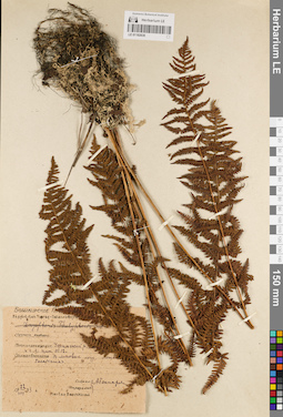
Dryopteris thelypteris (L.) A. Gray det. Schirajewsky, Ivan I. at 1907
Collectors: Schirajewsky, Ivan I. Collection date: 1907. Administrative regions: RU - Bashkortostan - Chishminskiy Rayon. Groups of specimens: Образцы сектора Восточной Европы; Флора Урала и прилегающих территорий (проект); Соглашение Минобрнауки №075-15-2021-1056Original label text:MUSEUM BOTANICUM ACADEMIAE SCIENTARUM PETROPOLITANAE.
Coordinates (geographic position): 54° 25′ 25.51″ N, 55° 17′ 14.05″ E ±2000 mRecord creation: 2022-06-15, Denis Melnikov, PhotoScan D2Citation: Specimen LE 01182631 // Virtual herbarium of Komarov Botanical Institute RAS — http://re.herbariumle.ru/01182631Уфимская губерния и уезд. Дурасово.
LE 01182630
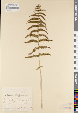
Collectors: Goncharova, A. Collection date: 22.08.1933. Administrative regions: RU - Bashkortostan - Ufimskiy Rayon. Groups of specimens: Образцы сектора Восточной Европы; Флора Урала и прилегающих территорий (проект); Соглашение Минобрнауки №075-15-2021-1056Original label text:
Башкирское .....
Record creation: 2022-06-15, Denis Melnikov, PhotoScan D2Citation: Specimen LE 01182630 // Virtual herbarium of Komarov Botanical Institute RAS — http://re.herbariumle.ru/01182630Уфимский район ..... к снверо-западу (клм) 11 - 12 [км]
В липовом лесу, ложб..... болотистая.
LE 01182629
Aspidium thelypteris (L.) Sw. det. Ispolatov, Yevgeny Ivanovich at 19.08.1909
Collectors: Ispolatov, Yevgeny Ivanovich Collection date: 19.08.1909. Administrative regions: RU - Samarskaya Oblast' - Isaklinskiy Rayon. Groups of specimens: Образцы сектора Восточной Европы; Флора Урала и прилегающих территорий (проект); Соглашение Минобрнауки №075-15-2021-1056Original label text:Самарская губерния, Бугурусланский уезд.
Coordinates (geographic position): 53° 50′ 0.07″ N, 51° 37′ 39.3″ E ±1000 mRecord creation: 2022-06-15, Denis Melnikov, PhotoScan D2Citation: Specimen LE 01182629 // Virtual herbarium of Komarov Botanical Institute RAS — http://re.herbariumle.ru/01182629Среди кустов на топком болоте в устье Молочной [река Черная] речки, около мельницы.
Окрестности деревни Новая Боголюбовка.
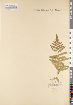
LE 01182628
Polystichum thelypteris (L.) Roth det. Schell, Julian K. at 1878
Collectors: Schell, Julian K. Collection date: 1878. Administrative regions: RU - Bashkortostan. Groups of specimens: Образцы сектора Восточной Европы; Флора Урала и прилегающих территорий (проект); Соглашение Минобрнауки №075-15-2021-1056Original label text:Gubernia Ufa, distrrict Belebei, prope Tschekadi - Tamakowa [?]
Record creation: 2022-06-15, Denis Melnikov, PhotoScan D2. Processing status: label contains unreadable dataCitation: Specimen LE 01182628 // Virtual herbarium of Komarov Botanical Institute RAS — http://re.herbariumle.ru/01182628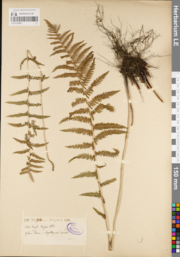
LE 01182627
Polystichum thelypteris (L.) Roth det. Krylov, Porphyriy Nikitich at 1876
Collectors: Krylov, Porphyriy Nikitich Field collecting number: 776. Collection date: 1876. Administrative regions: RU - Chelyabinskaya Oblast' - Gorod Kyshtym. Groups of specimens: Образцы сектора Восточной Европы; Флора Урала и прилегающих территорий (проект); Соглашение Минобрнауки №075-15-2021-1056; Herbarium TrautvetterOriginal label text:Gubernia Perm -- Kyschtymski zawod.
Coordinates (geographic position): 55° 42′ 35.06″ N, 60° 32′ 8.76″ E ±5000 mRecord creation: 2022-06-15, Denis Melnikov, PhotoScan D2Citation: Specimen LE 01182627 // Virtual herbarium of Komarov Botanical Institute RAS — http://re.herbariumle.ru/01182627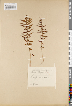
LE 01182626
Dryopteris thelypteris (L.) A. Gray det. Bulavkina-Onchukova, Anna Aleksandrovna at 14.07.1912
Collectors: Bulavkina-Onchukova, Anna Aleksandrovna Collection date: 14.07.1912. Administrative regions: RU - Chelyabinskaya Oblast' - Katav-Ivanovskiy Rayon. Groups of specimens: Образцы сектора Восточной Европы; Флора Урала и прилегающих территорий (проект); Соглашение Минобрнауки №075-15-2021-1056Original label text:Растения Уфимской губернии.
Coordinates (geographic position): 54° 45′ 47.29″ N, 58° 10′ 41.16″ E ±2000 mRecord creation: 2022-06-15, Denis Melnikov, PhotoScan D2Citation: Specimen LE 01182626 // Virtual herbarium of Komarov Botanical Institute RAS — http://re.herbariumle.ru/01182626На болоте к западу от завода.
Окрестности Катав-Ивановского завода.
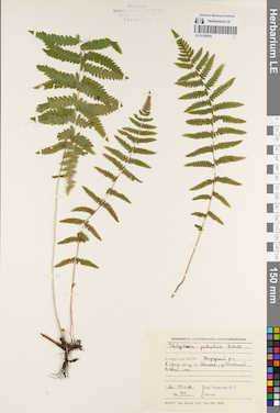
LE 01182625
Thelypteris palustris Schott det. Baranova, Olga Germanovna at 26.07.1987
Collectors: Baranova, Olga Germanovna Field collecting number: 429. Collection date: 26.07.1987. Administrative regions: RUUdmurtskaya Respublika - Kiznerskiy Rayon. Groups of specimens: Образцы сектора Восточной Европы; Флора Урала и прилегающих территорий (проект); Соглашение Минобрнауки №075-15-2021-1056; Herbarium Universitatis LeninopolitanaeOriginal label text:HERBARIUM UNIVERSITATIS LENINOPOLITANAE
Coordinates (geographic position): 56° 4′ 50.89″ N, 51° 36′ 38.73″ E ±1000 mRecord creation: 2022-06-15, Denis Melnikov, PhotoScan D2Citation: Specimen LE 01182625 // Virtual herbarium of Komarov Botanical Institute RAS — http://re.herbariumle.ru/01182625Удмуртская АССР, Кизнерский район, в 10 км юго-западнее от села Бемыж, заболоченный еловый лес.
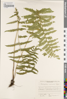
LE 01182624
Thelypteris palustris Schott det. Baranova, Olga Germanovna at 10.08.1986
Collectors: Baranova, Olga Germanovna Field collecting number: 100. Collection date: 10.08.1986. Administrative regions: RUUdmurtskaya Respublika - Yarskiy Rayon. Groups of specimens: Образцы сектора Восточной Европы; Флора Урала и прилегающих территорий (проект); Соглашение Минобрнауки №075-15-2021-1056; Herbarium Universitatis LeninopolitanaeOriginal label text:FLORA LENINOPOLITANA [?]
Coordinates (geographic position): 58° 20′ 34.4″ N, 51° 49′ 36.92″ E ±500 mRecord creation: 2022-06-15, Denis Melnikov, PhotoScan D2Citation: Specimen LE 01182624 // Virtual herbarium of Komarov Botanical Institute RAS — http://re.herbariumle.ru/01182624Удмуртская АССР, Ярский район, в 2,5 км западнее от деревни Сосновка, заболоченный еловый лес.
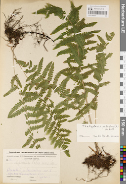
LE 01182623
Thelypteris palustris Schott det. Fraser-Jenkins, Ch. at 1976
Additional identifications: Aspidium filix-mas (L.) Sw. det. Gurskiy, L. K. at 1915 Collectors: Gurskiy, L. K. Field collecting number: 31. Collection date: 1915. Administrative regions: RU - Samarskaya Oblast'. Топоним: Красносамарский лес. Groups of specimens: Образцы сектора Восточной Европы; Флора Урала и прилегающих территорий (проект); Соглашение Минобрнауки №075-15-2021-1056; Гербарий Самарской губернии, собранный Д. ЯнишевскимOriginal label text:Сельско-хозяйственный и естественно-исторический музей Самарского Губернского Земства.
Coordinates (geographic position): 53° 1′ 11.13″ N, 51° 0′ 59.05″ E ±10000 mRecord creation: 2022-06-15, Denis Melnikov, PhotoScan D2Citation: Specimen LE 01182623 // Virtual herbarium of Komarov Botanical Institute RAS — http://re.herbariumle.ru/01182623Гербарий, составл. Д.Е. Янишевским при гео-ботанич. исследованиях Самарской губернии.
Ольховый и березовый лес в Красно-Самарской Даче.
Бузулукский уезд.
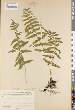
LE 01182622
Additional identifications: Aspidium filix-mas (L.) Sw. det. Gurskiy, L. K. at 22.07.1915; Thelypteris palustris Schott det. Busch Collectors: Gurskiy, L. K. Field collecting number: 21. Collection date: 22.07.1915. Administrative regions: RU - Samarskaya Oblast' - Borskiy Rayon. Groups of specimens: Образцы сектора Восточной Европы; Флора Урала и прилегающих территорий (проект); Соглашение Минобрнауки №075-15-2021-1056; Гербарий Самарской губернии, собранный Д. ЯнишевскимOriginal label text:
Сельско-хозяйственный и естественно-исторический музей Самарского Губернского Земства.
Coordinates (geographic position): 53° 3′ 53.65″ N, 51° 56′ 13.3″ E ±2000 mRecord creation: 2022-06-15, Denis Melnikov, PhotoScan D2Citation: Specimen LE 01182622 // Virtual herbarium of Komarov Botanical Institute RAS — http://re.herbariumle.ru/01182622Гербарий, составл. Д.Е. Янишевским при гео-ботанич. исследованиях Самарской губернии.
Сосновый лес и березовые рощи в нем.
Скобелевское лесничество [скорее всего, ныне поселок Красная Зорька].
Бузулукский уезд.
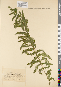
LE 01182621
Aspidium thelypteris (L.) Sw. det. Litvinov, Dimitri Ivanovich at 30.07.1895
Collectors: Litvinov, Dimitri Ivanovich Collection date: 30.07.1895. Administrative regions: RU - Orenburgskaya Oblast' - Sol'-Iletskiy Rayon. Groups of specimens: Образцы сектора Восточной Европы; Флора Урала и прилегающих территорий (проект); Соглашение Минобрнауки №075-15-2021-1056Original label text:Herbarium Horti Petropolitani.
Coordinates (geographic position): 51° 5′ 53.97″ N, 55° 18′ 38.13″ E ±2000 mRecord creation: 2022-06-15, Denis Melnikov, PhotoScan D2Citation: Specimen LE 01182621 // Virtual herbarium of Komarov Botanical Institute RAS — http://re.herbariumle.ru/01182621Оренбургская губерния.
Ольшанник на реке Курале близ станции Григорьевской.
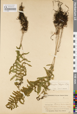
LE 01182620
Dryopteris thelypteris (L.) A. Gray det. Kosinskiy (Kossinski), Konstantin Konstantinovich at 10.1920
Collectors: Vereitinov, Ivan Aleksandrovich; Ovczinnikov, Pavel Nikolaevich Collection date: 26.05.1920. Administrative regions: RU - Bashkortostan - Ufimskiy Rayon. Expedition: П. Н. Овчинников. Растения Уфимской флоры (1919 -1920)Groups of specimens: Образцы сектора Восточной Европы; Флора Урала и прилегающих территорий (проект); Соглашение Минобрнауки №075-15-2021-1056Original label text:Окрестности Уфы. Болото у Солдатского поселка (С). По кочковатым сырым местам.
Coordinates (geographic position): 54° 44′ 30.94″ N, 55° 57′ 8.58″ E ±2000 mRecord creation: 2022-06-15, Denis Melnikov, PhotoScan D2Citation: Specimen LE 01182620 // Virtual herbarium of Komarov Botanical Institute RAS — http://re.herbariumle.ru/01182620P. N. Owczinnikow. Plantae Florae ufimensis.
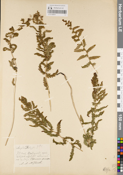
LE 01182619
Aspidium thelypteris (L.) Sw. det. Antonov, Aleksandr Aleksandrovitch
Collectors: Antonov, Aleksandr Aleksandrovitch Administrative regions: RU - Bashkortostan. Groups of specimens: Образцы сектора Восточной Европы; Флора Урала и прилегающих территорий (проект); Соглашение Минобрнауки №075-15-2021-1056Original label text:22 мая. Окаймляет края плавучих островов ......
Record creation: 2022-06-15, Denis Melnikov, PhotoScan D2. Processing status: label contains unreadable dataCitation: Specimen LE 01182619 // Virtual herbarium of Komarov Botanical Institute RAS — http://re.herbariumle.ru/01182619Уфимская флора
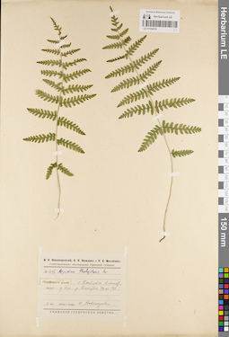
LE 01182618
Aspidium thelypteris (L.) Sw. det. Novopokrovsky, Ivan Vassiljevich at 02.07.1916
Collectors: Novopokrovsky, Ivan Vassiljevich Field collecting number: 1097. Collection date: 02.07.1916. Administrative regions: RU - Bashkortostan - Bakalinskiy Rayon. Expedition: И. В. Новопокровский, В. Н. Яковлев, П. Хр. Михайлов. Геоботаническое обследование Уфимской губернии. (1916)Groups of specimens: Образцы сектора Восточной Европы; Флора Урала и прилегающих территорий (проект); Соглашение Минобрнауки №075-15-2021-1056Original label text:Белебеевский уезд. Село Токберды. Ольшанник у берега реки Токберды. Пр. уч. 126.
Coordinates (geographic position): 55° 8′ 11.67″ N, 53° 53′ 3.61″ E ±2000 mRecord creation: 2022-06-15, Denis Melnikov, PhotoScan D2Citation: Specimen LE 01182618 // Virtual herbarium of Komarov Botanical Institute RAS — http://re.herbariumle.ru/01182618УФИМСКОЕ ГУБЕРНСКОЕ ЗЕМСТВО.
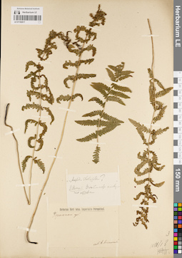
LE 01182617
Aspidium thelypteris (L.) Sw. det. Antonov, Aleksandr Aleksandrovitch
Collectors: Antonov, Aleksandr Aleksandrovitch Administrative regions: RU - Bashkortostan. Groups of specimens: Образцы сектора Восточной Европы; Флора Урала и прилегающих территорий (проект); Соглашение Минобрнауки №075-15-2021-1056Original label text:Herbarium Horti botan. Imperialis Petropolitani.
Record creation: 2022-06-15, Denis Melnikov, PhotoScan D2Citation: Specimen LE 01182617 // Virtual herbarium of Komarov Botanical Institute RAS — http://re.herbariumle.ru/01182617Уфимской губернии.
22 мая. Окаймляет плавучие острова.
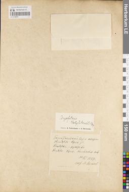
LE 01182616
Dryopteris thelypteris (L.) A. Gray det. Fedtschenko, Boris Alexeevich, Borissova, Antonina Georgievna
Collectors: Noskov, Aleksandr Kupriyanovich Collection date: 30.05.1927. Administrative regions: RU - Bashkortostan - Tuymazinskiy Rayon. Groups of specimens: Образцы сектора Восточной Европы; Флора Урала и прилегающих территорий (проект); Соглашение Минобрнауки №075-15-2021-1056Original label text:Болотистый берег озера Кандрыкуль у деревни Кандры-Кутуй.
Coordinates (geographic position): 54° 30′ 51.5″ N, 54° 5′ 32.07″ E ±2000 mRecord creation: 2022-06-15, Denis Melnikov, PhotoScan D2Citation: Specimen LE 01182616 // Virtual herbarium of Komarov Botanical Institute RAS — http://re.herbariumle.ru/01182616Кандрыкуль-Белебеевский кантон.
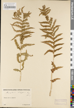
LE 01182615
Dryopteris thelypteris (L.) A. Gray det. Schirajewsky, Ivan I. at 1907
Collectors: Schirajewsky, Ivan I. Collection date: 1907. Administrative regions: RU - Bashkortostan - Chishminskiy Rayon. Groups of specimens: Образцы сектора Восточной Европы; Флора Урала и прилегающих территорий (проект); Соглашение Минобрнауки №075-15-2021-1056Original label text:MUSEUM BOTANICUM ACADEMIAE SCIENTARUM PETROPOLITANAE
Coordinates (geographic position): 54° 25′ 26.78″ N, 55° 17′ 16.11″ E ±1000 mRecord creation: 2022-06-15, Denis Melnikov, PhotoScan D2Citation: Specimen LE 01182615 // Virtual herbarium of Komarov Botanical Institute RAS — http://re.herbariumle.ru/01182615Уфимская губерния и уезд. Дурасово