View
Add
Copy
Edit
Delete
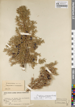
LE 01191613
Juniperus niemannii E.L. Wolf ⟨intermediate forma⟩ det. Orlova, Larisa Vladimirovna at 09.07.2022
Additional identifications: Juniperus communis L. det. Ikonnikov-Galitzky, Nikolai Petrovic at 12.09.1940 Collectors: Poplavskaya (Poplawska), Henrietta Ippolitovna; Blagoveshchensky, N.V. Field collecting number: 1033. Collection date: 29.06.1909. Administrative regions: RU - Zabaykal'skiy Kray - Mogochinskiy Rayon. Place of collection: водораздел между р. Шилка и р. Черный Урюм, р. Большие Кудечи, дно пади.Groups of specimens: Образцы сектора Сибири и Дальнего Востока России; Соглашение Минобрнауки №075-15-2021-1056Original label text:Museum Botanicum Academiae Scientiarum Petropolitanae. 1033. Забайкальск. обл. Нерчинско-Завод. окр. Водораздел между рр. Шилкой и Черным Урюмом. Б. Кудеча. На дне пади. 1909.VI.29. Собр. Н.В. Благовещенский и Г.И. Поплавская
Landscape in location of collection: дно падиCoordinates (geographic position): 53° 32′ 11.34″ N, 119° 9′ 20.11″ E ±5000 mRecord creation: 2022-07-09, Larisa Orlova, PhotoScan D2. Part 1.Citation: Specimen LE 01191613 // Virtual herbarium of Komarov Botanical Institute RAS — http://re.herbariumle.ru/01191613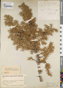
LE 01191612
Juniperus communis L. det. Poplavskaya (Poplawska), Henrietta Ippolitovna, Blagoveshchensky, N.V. at 1909
Additional identifications: Juniperus communis L. det. Ikonnikov-Galitzky, Nikolai Petrovic at 12.09.1940 Collectors: Poplavskaya (Poplawska), Henrietta Ippolitovna; Blagoveshchensky, N.V. Field collecting number: 1083. Collection date: 10.07.1909. Administrative regions: RU - Zabaykal'skiy Kray. Place of collection: водораздел между р. Шилка и Черный Урюм, падь р. Маргорунда.Groups of specimens: Образцы сектора Сибири и Дальнего Востока России; Соглашение Минобрнауки №075-15-2021-1056Original label text:[1]Juniperus communis стелющаяся падь Маргорунда 10/VIII 09 Шилкинская экспедиция [2] Museum Botanicum Academiae Scientiarum Petropolitanae. 1083. Забайкальск. обл. Нерчинско-Завод. окр. Водораздел между рр. Шилкой и Черным Урюмом. Падь р. Маргорунды. 1909.VII.10. Собр. Н.В. Благовещенский и Г.И. Поплавская
Landscape in location of collection: падьCoordinates (geographic position): 52° 57′ 37.53″ N, 118° 30′ 55.8″ E ±240000 mRecord creation: 2022-07-09, Larisa Orlova, PhotoScan D2. Part 1.Citation: Specimen LE 01191612 // Virtual herbarium of Komarov Botanical Institute RAS — http://re.herbariumle.ru/01191612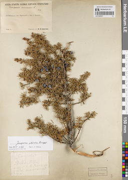
LE 01191611
Juniperus sibirica Burgsd. det. Orlova, Larisa Vladimirovna at 09.07.2022
Additional identifications: Juniperus communis L. det. Steinberg, Elisabeth Ivanovna Collectors: Sukaczev, Vladimir Nikolajevich Collection date: 05.1909. Administrative regions: RU - Zabaykal'skiy Kray - Sretenskiy Rayon. Place of collection: окрестности с. Шеметово (Бянкино).Groups of specimens: Образцы сектора Сибири и Дальнего Востока России; Соглашение Минобрнауки №075-15-2021-1056Original label text:[1]Museum Botanicum Academiae Scientiarum Petropolitanae. Juniperus communis L. Е.Ш[тейнберг]. Забайкальск. обл. Нерчинский у. Окр. с. Бянкина. 1909.V. Получено от В.Н. Сукачева [2] "Багул" 28 Ап. 1909 г. близ с. Бянкино, заб. об. на склоне горы
Coordinates (geographic position): 51° 59′ 57.49″ N, 116° 56′ 34.89″ E ±5000 mRecord creation: 2022-07-09, Larisa Orlova, PhotoScan D2. Part 1.Citation: Specimen LE 01191611 // Virtual herbarium of Komarov Botanical Institute RAS — http://re.herbariumle.ru/01191611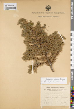
LE 01191610
Juniperus sibirica Burgsd. det. Orlova, Larisa Vladimirovna at 09.07.2022
Additional identifications: Juniperus communis L. det. Kusnezow, Nicolai Ivanovitch at 1909 Collectors: Kusnezow, Nicolai Ivanovitch Field collecting number: 1059. Collection date: 10.07.1909. Administrative regions: RU - Zabaykal'skiy Kray - Nerchinsko-Zavodskiy Rayon. Place of collection: лес на дне пади Мургулунда у ее истока.Expedition: Н.И. Кузнецов. Экспедиция в Нерчинский округ Забайкальской области. 1909 г. (1909)Groups of specimens: Образцы сектора Сибири и Дальнего Востока России; Соглашение Минобрнауки №075-15-2021-1056; Гербарий Переселенческого УправленияOriginal label text:Гербарий Переселенческого Управления. Н.И. Кузнецов. Экспедиция в Нерчинский округ Забайкальской области. 1909 г. Juniperus communis L. Забайкальская область, Нерчинский округ. Лес на дне пади Мургулунда у ее истока. 10.VII.1909. № 1059
Landscape in location of collection: дно падиHabitat / plant community in location of collecting: лесCoordinates (geographic position): 51° 20′ 59.24″ N, 119° 28′ 42.57″ E ±130000 mRecord creation: 2022-07-09, Larisa Orlova, PhotoScan D2. Part 1.Citation: Specimen LE 01191610 // Virtual herbarium of Komarov Botanical Institute RAS — http://re.herbariumle.ru/01191610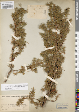
LE 01191609
Juniperus niemannii E.L. Wolf ⟨intermediate forma⟩ det. Orlova, Larisa Vladimirovna at 09.07.2022
Collectors: Poplavskaya (Poplawska), Henrietta Ippolitovna; Sukaczev, Vladimir Nikolajevich Field collecting number: 1033/1567. Collection date: 04.08.1910. Administrative regions: RU - Zabaykal'skiy Kray - Mogochinskiy Rayon. Place of collection: бассейн р. Амазар, верховья р. Малая Могоча, вдоль ручья, впадающего в р. Малая Могоча, 23-ая стоянка.Groups of specimens: Образцы сектора Сибири и Дальнего Востока России; Соглашение Минобрнауки №075-15-2021-1056Original label text:[1]juniperus 4/VIII Там же 1567 [2]Museum Botanicum Academiae Scientiarum Petropolitanae. 1033. Забайкальск. обл. Нерчинск. окр. Бассейн р. Амазара. Верховья р. Малой Магочи. Вдоль ручья, впадающего в р. М. Магочу. 23-ая стоянка. (N=1567) 1910.VIII.4. В. Сукачев и Г. Поплавская
Landscape in location of collection: берег ручьяCoordinates (geographic position): 54° 6′ 45.84″ N, 120° 11′ 21.33″ E ±10000 mRecord creation: 2022-07-09, Larisa Orlova, PhotoScan D2. Part 1.Citation: Specimen LE 01191609 // Virtual herbarium of Komarov Botanical Institute RAS — http://re.herbariumle.ru/01191609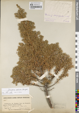
LE 01191608
Groups of specimens: Образцы сектора Сибири и Дальнего Востока России; Соглашение Минобрнауки №075-15-2021-1056Record creation: 2022-07-09, Larisa Orlova, PhotoScan D2. Part 1.Citation: Specimen LE 01191608 // Virtual herbarium of Komarov Botanical Institute RAS — http://re.herbariumle.ru/01191608
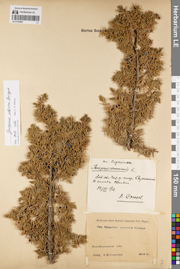
LE 01191607
Juniperus sibirica Burgsd. det. Orlova, Larisa Vladimirovna at 09.07.2022
Additional identifications: Juniperus communis L. det. Soyuzov, Viktor Ivanovich at 1912 Collectors: Soyuzov, Viktor Ivanovich Collection date: 14.06.1912. Administrative regions: RU - Zabaykal'skiy Kray - Chitinskiy Rayon. Place of collection: голец Саранакан, в камнях.Groups of specimens: Образцы сектора Сибири и Дальнего Востока России; Соглашение Минобрнауки №075-15-2021-1056; От Общества изучения СибириObject features: ОбильноOriginal label text:[1]сем. Cupressineae. Juniperus communis L. Заб. обл. Чит. у. голец "Саранакан". В камнях. Обильно. 14/VI 912. В. Союзов [2] Herbarium Horti Botanici Imperialis Petri Magni. От Общества изучения Сибири. Забайкальская обл. Собр. В.И. Союзов. 1912 г.
Landscape in location of collection: камни на склоне гольцаCoordinates (geographic position): 52° 34′ 45.34″ N, 113° 47′ 13.54″ E ±5000 mRecord creation: 2022-07-09, Larisa Orlova, PhotoScan D2. Part 1.Citation: Specimen LE 01191607 // Virtual herbarium of Komarov Botanical Institute RAS — http://re.herbariumle.ru/01191607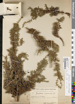
LE 01191605
Juniperus sibirica Burgsd. det. Orlova, Larisa Vladimirovna at 09.07.2022
Additional identifications: Juniperus communis L. det. Steinberg, Elisabeth Ivanovna at 1915 Collectors: Poplavskaya (Poplawska), Henrietta Ippolitovna; Sukaczev, Vladimir Nikolajevich Field collecting number: 2602. Collection date: 26.07.1915. Administrative regions: RU - Irkutskaya Oblast'; RU - Respublika Buryatiya. Place of collection: оз. Байкал, берег оз. Байкал близ устья р. Северная.Expedition: Байкальская экспедиция Императорской Академии Наук (1915)Groups of specimens: Образцы сектора Сибири и Дальнего Востока России; Соглашение Минобрнауки №075-15-2021-1056Original label text:Museum Botanicum Academiae Scientiarum Petropolitanae. Байкальская экспедиция императорской Академии Наук. 2602. Juniperus communis L. Забайкальск. обл. Оз. Байкал. Берег Байкала близ устья р. Северной. 1915.VII.26. В. Сукачев и Г. Поплавская. Det. E. Steinberg
Landscape in location of collection: берег крупного озераCoordinates (geographic position): 53° 24′ 19.2″ N, 107° 40′ 23.01″ E ±320000 mRecord creation: 2022-07-09, Larisa Orlova, PhotoScan D2. Part 1.Citation: Specimen LE 01191605 // Virtual herbarium of Komarov Botanical Institute RAS — http://re.herbariumle.ru/01191605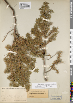
LE 01191604
Juniperus niemannii E.L. Wolf ⟨intermediate forma⟩ det. Orlova, Larisa Vladimirovna at 09.07.2022
Additional identifications: Juniperus communis L. det. Ikonnikov-Galitzky, Nikolai Petrovic at 12.09.1940 Collectors: Poplavskaya (Poplawska), Henrietta Ippolitovna; Sukaczev, Vladimir Nikolajevich Field collecting number: 1033. Collection date: 04.08.1910. Administrative regions: RU - Zabaykal'skiy Kray - Mogochinskiy Rayon. Place of collection: бассейн р. Амазар, верховья р. Малая Могоча, вдоль ручья, впадающего в р. Малая Могоча, 23-ая стоянка.Groups of specimens: Образцы сектора Сибири и Дальнего Востока России; Соглашение Минобрнауки №075-15-2021-1056Original label text:Museum Botanicum Academiae Scientiarum Petropolitanae. 1033. Забайкальск. обл. Нерчинск. окр. Бассейн р. Амазара. Верховья р. Малой Магочи. Вдоль ручья, впадающего в р. М. Магочу. 23-ая стоянка. (N=1567) 1910.VIII.4. В. Сукачев и Г. Поплавская
Landscape in location of collection: берег ручьяCoordinates (geographic position): 54° 6′ 45.84″ N, 120° 11′ 21.33″ E ±10000 mRecord creation: 2022-07-09, Larisa Orlova, PhotoScan D2. Part 1.Citation: Specimen LE 01191604 // Virtual herbarium of Komarov Botanical Institute RAS — http://re.herbariumle.ru/01191604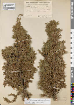
LE 01191603
Juniperus sibirica Burgsd. det. Orlova, Larisa Vladimirovna at 09.07.2022
Additional identifications: Juniperus communis L. det. Steinberg, Elisabeth Ivanovna at 1915 Collectors: Sukaczev, Vladimir Nikolajevich Field collecting number: 2700. Collection date: 28.07.1915. Administrative regions: RU - Respublika Buryatiya - Selenginskiy Rayon. Place of collection: оз. Байкал, Мысовск-Кяхтинский тракт, редкий лес.Expedition: Байкальская экспедиция Императорской Академии Наук (1915)Groups of specimens: Образцы сектора Сибири и Дальнего Востока России; Соглашение Минобрнауки №075-15-2021-1056Original label text:Museum Botanicum Academiae Scientiarum Petropolitanae. Байкальская экспедиция императорской Академии Наук. 2700. Juniperus communis L. Забайкальск. обл. Оз. Байкал. Мысовск-Кяхтинский тракт. В редком лесу. 1915.VII.28. В. Сукачев. Det. E. Steinberg
Habitat / plant community in location of collecting: редкий лесCoordinates (geographic position): 51° 4′ 28.79″ N, 106° 6′ 48.08″ E ±75000 mRecord creation: 2022-07-09, Larisa Orlova, PhotoScan D2. Part 1.Citation: Specimen LE 01191603 // Virtual herbarium of Komarov Botanical Institute RAS — http://re.herbariumle.ru/01191603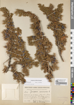
LE 01191602
Juniperus sibirica Burgsd. det. Orlova, Larisa Vladimirovna at 09.07.2022
Additional identifications: Juniperus communis L. det. Steinberg, Elisabeth Ivanovna Collectors: Poplavskaya (Poplawska), Henrietta Ippolitovna; Sukaczev, Vladimir Nikolajevich Field collecting number: 2762. Collection date: 29.07.1915. Administrative regions: RU - Respublika Buryatiya - Kabanskiy Rayon. Place of collection: Мысовск-Кяхтинский тракт, ст. Улятыйская (Уляты) [в 1 версте от высочайшей вершины хр. Хамар-Дабан, в 60 верстах от с. Темник на север, недалеко от долины р. Мысовка], сухой елово-кедровый лес.Expedition: Байкальская экспедиция Императорской Академии Наук (1915)Groups of specimens: Образцы сектора Сибири и Дальнего Востока России; Соглашение Минобрнауки №075-15-2021-1056Object features: Большой кустOriginal label text:Museum Botanicum Academiae Scientiarum Petropolitanae. Байкальская экспедиция Императорской Академии Наук. 2762. Juniperus communis L. Забайкальск. обл. Оз. Байкал. Мысовск-Кяхтинский тракт. Ст. Уляты. Сухой елово-кедровый лес. Большой куст. 1915.VII.29. В. Сукачев и Г. Поплавская. Det. E. Steinberg
Landscape in location of collection: склон горного хребтаHabitat / plant community in location of collecting: сухой елово-кедровый лесCoordinates (geographic position): 51° 29′ 42.95″ N, 105° 58′ 39.22″ E ±10000 mRecord creation: 2022-07-09, Larisa Orlova, PhotoScan D2. Part 1.Citation: Specimen LE 01191602 // Virtual herbarium of Komarov Botanical Institute RAS — http://re.herbariumle.ru/01191602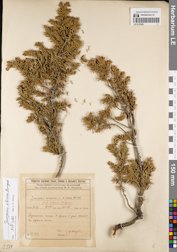
LE 01191601
Juniperus sibirica Burgsd. det. Orlova, Larisa Vladimirovna at 09.07.2022
Additional identifications: Juniperus communis var. nana Willd. det. Nasarow, Mikhail Ivanovich at 1929; Juniperus sibirica Burgsd. det. Nasarow, Mikhail Ivanovich at 1929 Collectors: Nasarow, Mikhail Ivanovich Field collecting number: 12.564. Collection date: 27.07.1929. Administrative regions: RU - Respublika Buryatiya - Tunkinskiy Rayon. Place of collection: Тункинские гольцы, р. Иркут (Архыт) в устье р. Хонголдой, вершина гольца.Expedition: Хамар-Дабано-Тункинская экспедиция под общим руководством М.И. Назарова (1929)Groups of specimens: Образцы сектора Сибири и Дальнего Востока России; Соглашение Минобрнауки №075-15-2021-1056; Общество изучения Урала, Сибири и Дальнего ВостокаOriginal label text:Общество изучения Урала, Сибири и Дальнего Востока. Хамар-Дабано-Тункинская Экспедиция под общим руководством М.И. Назарова. Juniperus communis L. v. nana Willd. (=J. sibirica Burgsdorf) 1929.VII.27. 51°, 54' lat. bor. 101°, 48' long. or. Grinw. Тункинские гольцы. Р. Архыт в устье Хонхолоя. На вершине гольца. № 12.564. Leg. Determ. М. Назаров
Landscape in location of collection: вершина гольцаCoordinates (geographic position): 51° 42′ 26.04″ N, 101° 39′ 34.11″ E ±5000 mRecord creation: 2022-07-09, Larisa Orlova, PhotoScan D2. Part 1.Citation: Specimen LE 01191601 // Virtual herbarium of Komarov Botanical Institute RAS — http://re.herbariumle.ru/01191601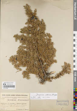
LE 01191600
Juniperus sibirica Burgsd. det. Orlova, Larisa Vladimirovna at 09.07.2022
Additional identifications: Juniperus communis L. det. Busch Collectors: Lebedeva, Z.; Korotky, Mikhail Fedorovich Field collecting number: 482. Collection date: 12.07.1914. Administrative regions: RU - Zabaykal'skiy Kray - Tungokochenskiy Rayon. Place of collection: Витимское плоскогорье, перевал в обход россыпей р. Ишанда (Ижинда), лиственничный лес.Expedition: Муйская экспедиция М.Ф. Короткого (1914)Groups of specimens: Образцы сектора Сибири и Дальнего Востока России; Соглашение Минобрнауки №075-15-2021-1056; Из гербария Переселенческого управленияOriginal label text:Museum Botanicum Academiae Scientiarum Petropolitanae. Из гербария Переселенческого Управления. Муйская экспедиция М.Ф. Короткого. N 482. Juniperus communis L. Забайкальск. обл. Баргузинск. у. Витимское плоскогорье. Перевал в обход россыпей р. Ижинде. Циплинкоw. В лиственничном лесу. 1914.VII-12. М. Короткий и З. Лебедева
Landscape in location of collection: горный перевал в обход россыпей рекиHabitat / plant community in location of collecting: лиственничный лесCoordinates (geographic position): 53° 27′ 57.78″ N, 114° 48′ 40.96″ E ±2000 mRecord creation: 2022-07-09, Larisa Orlova, PhotoScan D2. Part 1.Citation: Specimen LE 01191600 // Virtual herbarium of Komarov Botanical Institute RAS — http://re.herbariumle.ru/01191600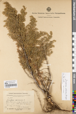
LE 01191599
Juniperus sibirica Burgsd. det. Orlova, Larisa Vladimirovna at 09.07.2022
Additional identifications: Juniperus communis L. det. Schipczinski, Nikolaj Valerianovich at 1912 Collectors: Schipczinski, Nikolaj Valerianovich Field collecting number: 525. Collection date: 06.08.1912. Administrative regions: RU - Respublika Buryatiya - Severo-Baykal'skiy Rayon. Place of collection: берег оз. Байкал между Дагарским маяком и губой Аяя, руч. Эрекшакан (Ираксокал), лес по склону.Expedition: В.Н. Сукачев. Верхне-Ангарская экспедиция Забайкальской области 1912 г. () (1912)Groups of specimens: Образцы сектора Сибири и Дальнего Востока России; Соглашение Минобрнауки №075-15-2021-1056; Гербарий Переселенческого УправленияOriginal label text:Гербарий Переселенческого Управления. В.Н. Сукачев. Верхне-Ангарская экспедиция Забайкальской области 1912 г. № 525. Juniperus communis L. Берег Байкала между Дагарским маяком и губой Аяя. Ручей Ираксокал. В лесу по склону. 6/VIII. Собр. Н. Шипчинский. W. Sukaczew. Iter Transbaicalense ad fl. Angara Superior. 1912
Landscape in location of collection: склон по берегу ручьяHabitat / plant community in location of collecting: лес по склонуCoordinates (geographic position): 55° 34′ 21.1″ N, 109° 54′ 13.9″ E ±5000 mRecord creation: 2022-07-09, Larisa Orlova, PhotoScan D2. Part 1.Citation: Specimen LE 01191599 // Virtual herbarium of Komarov Botanical Institute RAS — http://re.herbariumle.ru/01191599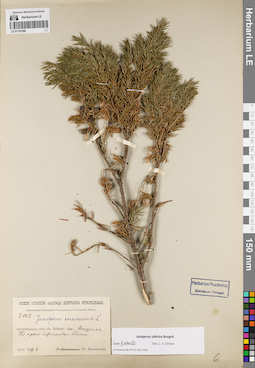
LE 01191598
Juniperus sibirica Burgsd. det. Orlova, Larisa Vladimirovna at 09.07.2022
Additional identifications: Juniperus communis L. det. Busch Collectors: Zinserling (Tsinzerling), Iurij (Yuri, Georgius) Dmitrievitch Field collecting number: 3102. Collection date: 06.08.1915. Administrative regions: RU - Respublika Buryatiya - Kabanskiy Rayon. Place of collection: ж.д. ст. Мишиха, край сфагнового болота.Expedition: Байкальская экспедиция Императорской Академии Наук (1915)Groups of specimens: Образцы сектора Сибири и Дальнего Востока России; Соглашение Минобрнауки №075-15-2021-1056Original label text:Museum Botanicum Academiae Scientiarum Petropolitanae. Байкальская экспедиция Императорской Академии Наук. 3102. Juniperus communis L. Забайкальск. обл. Оз. Байкал. ст. Мишиха. По краю сфагнового болота. 1915.VIII.6. Ю. Цинзерлинг
Habitat / plant community in location of collecting: край сфагнового болотаCoordinates (geographic position): 51° 39′ 9.47″ N, 105° 35′ 23.46″ E ±10000 mRecord creation: 2022-07-09, Larisa Orlova, PhotoScan D2. Part 1.Citation: Specimen LE 01191598 // Virtual herbarium of Komarov Botanical Institute RAS — http://re.herbariumle.ru/01191598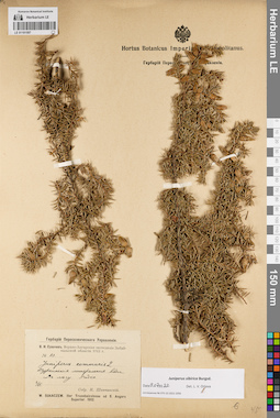
LE 01191597
Juniperus sibirica Burgsd. det. Orlova, Larisa Vladimirovna at 09.07.2022
Additional identifications: Juniperus communis L. det. Schipczinski, Nikolaj Valerianovich at 1912 Collectors: Schipczinski, Nikolaj Valerianovich Field collecting number: 83. Collection date: 02.06.1912. Administrative regions: RU - Respublika Buryatiya - Pribaykal'skiy Rayon. Place of collection: с. Горячинск, Туркинский горячий источник (Туркинские минеральные воды), в лесу.Expedition: В.Н. Сукачев. Верхне-Ангарская экспедиция Забайкальской области 1912 г. () (1912)Groups of specimens: Образцы сектора Сибири и Дальнего Востока России; Соглашение Минобрнауки №075-15-2021-1056; Гербарий Переселенческого УправленияObject features: редкоOriginal label text:Гербарий Переселенческого Управления. В.Н. Сукачев. Верхне-Ангарская экспедиция Забайкальской области 1912 г. № 83. Juniperus communis L. Туркинские минеральные воды. В лесу. Редко. 2/VI. Собр. Н. Шипчинский. W. Sukaczew. Iter Transbaicalense ad fl. Angara Superior. 1912
Landscape in location of collection: горячий источникHabitat / plant community in location of collecting: лесCoordinates (geographic position): 52° 59′ 14.24″ N, 108° 18′ 29.09″ E ±1000 mRecord creation: 2022-07-09, Larisa Orlova, PhotoScan D2. Part 1.Citation: Specimen LE 01191597 // Virtual herbarium of Komarov Botanical Institute RAS — http://re.herbariumle.ru/01191597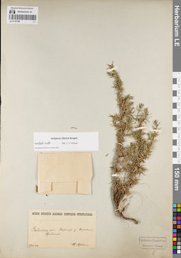
LE 01191596
Juniperus sibirica Burgsd. det. Orlova, Larisa Vladimirovna at 09.07.2022
Additional identifications: Juniperus communis L. det. Busch Collectors: Arndt, P. Collection date: 08.1910. Administrative regions: RU - Zabaykal'skiy Kray - Khilokskiy Rayon. Place of collection: Вершина г. Цибитуй.Groups of specimens: Образцы сектора Сибири и Дальнего Востока России; Соглашение Минобрнауки №075-15-2021-1056Original label text:Museum Botanicum Academiae Scientiarum Petropolitanae. Juniperus communis L. Забайкаль. обл. Верхнеуд. у. Вершина Цибитуя. 1910.VIII. П. Арндт
Landscape in location of collection: вершина горыCoordinates (geographic position): 51° 8′ 14.64″ N, 110° 21′ 40.31″ E ±500 mRecord creation: 2022-07-09, Larisa Orlova, PhotoScan D2. Part 1.Citation: Specimen LE 01191596 // Virtual herbarium of Komarov Botanical Institute RAS — http://re.herbariumle.ru/01191596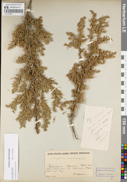
LE 01191595
Juniperus sibirica Burgsd. det. Orlova, Larisa Vladimirovna at 09.07.2022
Additional identifications: Juniperus communis L. det. Arndt, P. at 1910 Collectors: Arndt, P. Collection date: 18.06.1910. Administrative regions: RU - Zabaykal'skiy Kray - Khilokskiy Rayon. Place of collection: Право-Хилокская лесная дача, ж.д. ст. Гыршелун (Гыршелун-Тарбагатай).Groups of specimens: Образцы сектора Сибири и Дальнего Востока России; Соглашение Минобрнауки №075-15-2021-1056Original label text:[1]18/VI Т. Тайга. Почва силикат. россып [тогц.] сухая на осыпи. мест. [2]Museum Botanicum Academiae Scientiarum Petropolitanae. Juniperus communis L. Забайкаль. обл. Верхнеуд. у. Право-Хилокская лесная дача. Ст. Гыршелун-Тарбагатай Заб. ж.д. 1910.VI.18. П. Арндт
Habitat / plant community in location of collecting: окружение железнодорожной станцииCoordinates (geographic position): 51° 24′ 27.64″ N, 110° 39′ 35.47″ E ±10000 mRecord creation: 2022-07-09, Larisa Orlova, PhotoScan D2. Part 1.Citation: Specimen LE 01191595 // Virtual herbarium of Komarov Botanical Institute RAS — http://re.herbariumle.ru/01191595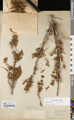
LE 01191593
Juniperus sibirica Burgsd. det. Orlova, Larisa Vladimirovna at 09.07.2022
Additional identifications: Juniperus communis L. det. Busch Collectors: Turczaninow, Nicolai Stepanowisch Collection date: 1829. Administrative regions: RU - Respublika Buryatiya. Place of collection: линия р. Селенга, лесистые горы.Groups of specimens: Образцы сектора Сибири и Дальнего Востока России; Соглашение Минобрнауки №075-15-2021-1056; Ex herbario TurczaninowianoOriginal label text:In montibus sylvosis in vicinis de linerum Selinginensium 1829 Turcz
Landscape in location of collection: горный склонHabitat / plant community in location of collecting: горный лесCoordinates (geographic position): 51° 41′ 1.12″ N, 107° 19′ 39.51″ E ±150000 mRecord creation: 2022-07-09, Larisa Orlova, PhotoScan D2. Part 1.Citation: Specimen LE 01191593 // Virtual herbarium of Komarov Botanical Institute RAS — http://re.herbariumle.ru/01191593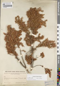
LE 01191592
Juniperus sibirica Burgsd. det. Orlova, Larisa Vladimirovna at 09.07.2022
Collectors: Korotky, Mikhail Fedorovich; Nikolaev, P. Field collecting number: 104. Collection date: 14.05.1911. Administrative regions: RU - Respublika Buryatiya - Barguzinskiy Rayon. Place of collection: окрестности с. Баргузин, подошва горы на склоне.Expedition: Баргузинская почвен.-ботан. партия командированной по Высочайшему повелению Амурской Экспедиции ()Groups of specimens: Образцы сектора Сибири и Дальнего Востока России; Соглашение Минобрнауки №075-15-2021-1056Original label text:Museum Botanicum Academiae Scientiarum Petropolitanae. Баргузинская почвен.-ботан. партия командированной по высочайшему повелению Амурской Экспедиции. 104. Забайкальск. обл., окр. гор. Баргузина. У подошвы горы на склоне. 1911.V.13-14. М. Короткий и П. Николаев
Landscape in location of collection: подошва горы на склонеCoordinates (geographic position): 53° 37′ 38″ N, 109° 36′ 45.17″ E ±5000 mRecord creation: 2022-07-09, Larisa Orlova, PhotoScan D2. Part 1.Citation: Specimen LE 01191592 // Virtual herbarium of Komarov Botanical Institute RAS — http://re.herbariumle.ru/01191592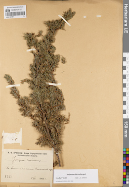
LE 01191591
Juniperus sibirica Burgsd. det. Orlova, Larisa Vladimirovna at 09.07.2022
Additional identifications: Juniperus communis L. det. Kryukov, Innokentij Fedorovitch at 1905 Collectors: Kryukov, Innokentij Fedorovitch Field collecting number: 1747. Collection date: 08.08.1905. Administrative regions: RU - Respublika Buryatiya - Bauntovskiy Rayon. Place of collection: восточный склон хр. Икатский (Икатские горы).Expedition: И.Ф. Крюков: Флора Баргузинской тайги Забайкальской области (1905)Groups of specimens: Образцы сектора Сибири и Дальнего Востока России; Соглашение Минобрнауки №075-15-2021-1056Original label text:И.Ф. Крюков: Флора Баргузинской тайги Забайкальской области. Juniperus communis. На восточном склоне Икатских гор. 1747. 8 VIII 1905 г.
Landscape in location of collection: склон горного хребтаCoordinates (geographic position): 53° 35′ 57.12″ N, 111° 0′ 0″ E ±20000 mRecord creation: 2022-07-09, Larisa Orlova, PhotoScan D2. Part 1.Citation: Specimen LE 01191591 // Virtual herbarium of Komarov Botanical Institute RAS — http://re.herbariumle.ru/01191591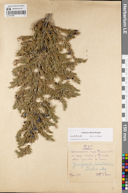
LE 01191590
Juniperus sibirica Burgsd. det. Orlova, Larisa Vladimirovna at 09.07.2022
Additional identifications: Juniperus pseudosabina Fisch. & C.A. Mey. det. Mikhno, Petr Savvich at 1928 Collectors: Mikhno, Petr Savvich Collection date: 17.07.1928. Administrative regions: RU - Respublika Buryatiya - Dzhidinskiy Rayon. Place of collection: окрестности оз. Таглей в 16 км от среднего течения р. Темник (левый приток р. Селенга).Groups of specimens: Образцы сектора Сибири и Дальнего Востока России; Соглашение Минобрнауки №075-15-2021-1056; Б.М.Р.Original label text:Б.М.Р. Окрестности озера Таглей в 15 в. от средн. течения р. Темника левого притока р. Селенги. Juniperus pseudosabina Fisch. x Mey. 17/VII-1928 г. Собр. П. Михно
Landscape in location of collection: окрестности озераCoordinates (geographic position): 50° 57′ 14.66″ N, 104° 51′ 35.08″ E ±10000 mRecord creation: 2022-07-09, Larisa Orlova, PhotoScan D2. Part 1.Citation: Specimen LE 01191590 // Virtual herbarium of Komarov Botanical Institute RAS — http://re.herbariumle.ru/01191590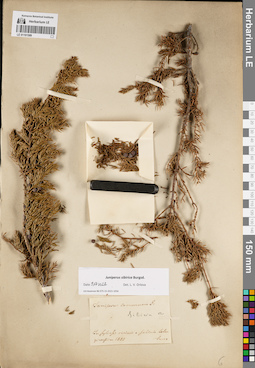
LE 01191589
Groups of specimens: Образцы сектора Сибири и Дальнего Востока России; Соглашение Минобрнауки №075-15-2021-1056Record creation: 2022-07-09, Larisa Orlova, PhotoScan D2. Part 1.Citation: Specimen LE 01191589 // Virtual herbarium of Komarov Botanical Institute RAS — http://re.herbariumle.ru/01191589
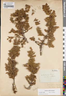
LE 01191587
Juniperus communis var. nana Loud. det. Busch
Additional identifications: Juniperus sibirica Burgsd. det. Orlova, Larisa Vladimirovna at 09.07.2022 Collectors: Salesov Groups of specimens: Образцы сектора Сибири и Дальнего Востока России; Соглашение Минобрнауки №075-15-2021-1056Record creation: 2022-07-09, Larisa Orlova, PhotoScan D2. Part 1.Citation: Specimen LE 01191587 // Virtual herbarium of Komarov Botanical Institute RAS — http://re.herbariumle.ru/01191587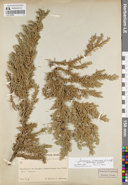
LE 01191586
Juniperus niemannii E.L. Wolf ⟨intermediate forma⟩ det. Orlova, Larisa Vladimirovna at 09.07.2022
Collectors: Poplavskaya (Poplawska), Henrietta Ippolitovna; Sukaczev, Vladimir Nikolajevich Field collecting number: 397. Collection date: 29.06.1912. Administrative regions: RU - Respublika Buryatiya - Severo-Baykal'skiy Rayon. Place of collection: бассейн р. Верхней Ангары, окрестности дер. Ченчи, сухой сосняк.Expedition: Верхне-Ангарская экспедиция В.Н. Сукачёва (1912)Groups of specimens: Образцы сектора Сибири и Дальнего Востока России; Соглашение Минобрнауки №075-15-2021-1056; Из гербария Переселенческого управленияOriginal label text:Museum Botanicum Academiae Scientiarum Petropolitanae. Из гербария Переселенческого Управления. Верхне-Ангарская экспедиция В.Н. Сукачева. 397. Забайкальск. обл. Бассейн р. Верхней Ангары. Окр. д. Ченчи. Сухой сосняк. 1912.VI.29. В. Сукачев и Г. Поплавская
Habitat / plant community in location of collecting: сухой соснякCoordinates (geographic position): 55° 57′ 57.52″ N, 110° 59′ 45.15″ E ±10000 mRecord creation: 2022-07-09, Larisa Orlova, PhotoScan D2. Part 1.Citation: Specimen LE 01191586 // Virtual herbarium of Komarov Botanical Institute RAS — http://re.herbariumle.ru/01191586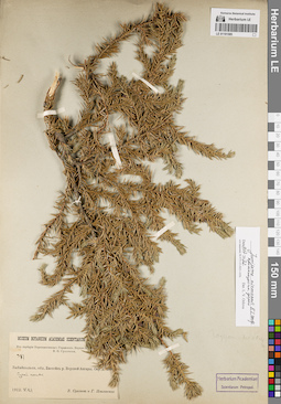
LE 01191585
Juniperus niemannii E.L. Wolf ⟨intermediate forma⟩ det. Orlova, Larisa Vladimirovna at 09.07.2022
Collectors: Poplavskaya (Poplawska), Henrietta Ippolitovna; Sukaczev, Vladimir Nikolajevich Field collecting number: 397. Collection date: 29.06.1912. Administrative regions: RU - Respublika Buryatiya - Severo-Baykal'skiy Rayon. Place of collection: бассейн р. Верхней Ангары, окрестности дер. Ченчи, сухой сосняк.Expedition: Верхне-Ангарская экспедиция В.Н. Сукачёва (1912)Groups of specimens: Образцы сектора Сибири и Дальнего Востока России; Соглашение Минобрнауки №075-15-2021-1056; Из гербария Переселенческого управленияOriginal label text:Museum Botanicum Academiae Scientiarum Petropolitanae. Из гербария Переселенческого Управления. Верхне-Ангарская экспедиция В.Н. Сукачева. 397. Забайкальск. обл. Бассейн р. Верхней Ангары. Окр. д. Ченчи. Сухой сосняк. 1912.VI.29. В. Сукачев и Г. Поплавская
Habitat / plant community in location of collecting: сухой соснякCoordinates (geographic position): 55° 57′ 57.52″ N, 110° 59′ 45.15″ E ±10000 mRecord creation: 2022-07-09, Larisa Orlova, PhotoScan D2. Part 1.Citation: Specimen LE 01191585 // Virtual herbarium of Komarov Botanical Institute RAS — http://re.herbariumle.ru/01191585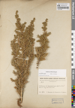
LE 01191584
Juniperus sibirica Burgsd. det. Orlova, Larisa Vladimirovna at 09.07.2022
Collectors: Poplavskaya (Poplawska), Henrietta Ippolitovna; Poplavsky, M. I.; Ditmer, Erna E. Field collecting number: 2079. Collection date: 30.07.1913. Administrative regions: RU - Respublika Buryatiya - Pribaykal'skiy Rayon. Place of collection: Трасса 81К-001 (Баргузинский тракт), щебенчатый склон близ бывшей ст. Хаимская (Хаимск).Expedition: Верхне-Удинская экспедиция Г.И. Поплавской (1913)Groups of specimens: Образцы сектора Сибири и Дальнего Востока России; Соглашение Минобрнауки №075-15-2021-1056; Из гербария Переселенческого управленияOriginal label text:Гербарий Переселенческого Управления. Г.И. Поплавская. Верхнеудинская экспедиция 1913 г. № 2079. Забайкальск. обл. Баргузинский тракт. Щебенчатый склон близ ст. Хаимск. VII.30. H. Poplawska. Iter Transbaicalense inter stat Tataurovo et stat. Goriaczinsk. 1913
Landscape in location of collection: щебенчатый склон вдоль трактаCoordinates (geographic position): 52° 30′ 36.44″ N, 108° 2′ 55.09″ E ±10000 mRecord creation: 2022-07-09, Larisa Orlova, PhotoScan D2. Part 1.Citation: Specimen LE 01191584 // Virtual herbarium of Komarov Botanical Institute RAS — http://re.herbariumle.ru/01191584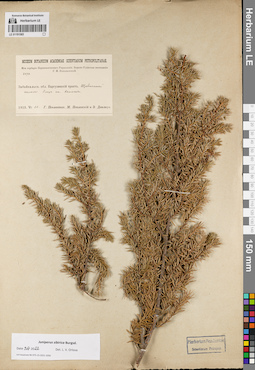
LE 01191583
Juniperus sibirica Burgsd. det. Orlova, Larisa Vladimirovna at 09.07.2022
Collectors: Poplavskaya (Poplawska), Henrietta Ippolitovna; Poplavsky, M. I.; Ditmer, Erna E. Field collecting number: 2079. Collection date: 30.07.1913. Administrative regions: RU - Respublika Buryatiya - Pribaykal'skiy Rayon. Place of collection: Трасса 81К-001 (Баргузинский тракт), щебенчатый склон близ бывшей ст. Хаимская (Хаимск).Expedition: Верхне-Удинская экспедиция Г.И. Поплавской (1913)Groups of specimens: Образцы сектора Сибири и Дальнего Востока России; Соглашение Минобрнауки №075-15-2021-1056; Из гербария Переселенческого управленияOriginal label text:Гербарий Переселенческого Управления. Г.И. Поплавская. Верхнеудинская экспедиция 1913 г. № 2079. Забайкальск. обл. Баргузинский тракт. Щебенчатый склон близ ст. Хаимск. VII.30. H. Poplawska. Iter Transbaicalense inter stat Tataurovo et stat. Goriaczinsk. 1913
Landscape in location of collection: щебенчатый склон вдоль трактаCoordinates (geographic position): 52° 30′ 36.44″ N, 108° 2′ 55.09″ E ±10000 mRecord creation: 2022-07-09, Larisa Orlova, PhotoScan D2. Part 1.Citation: Specimen LE 01191583 // Virtual herbarium of Komarov Botanical Institute RAS — http://re.herbariumle.ru/01191583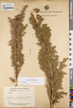
LE 01191582
Juniperus sibirica Burgsd. det. Orlova, Larisa Vladimirovna at 09.07.2022
Collectors: Poplavskaya (Poplawska), Henrietta Ippolitovna Field collecting number: 2079. Collection date: 30.07.1913. Administrative regions: RU - Respublika Buryatiya - Pribaykal'skiy Rayon. Place of collection: Трасса 81К-001 (Баргузинский тракт), щебенчатый склон близ бывшей ст. Хаимская (Хаимск).Expedition: Г.И. Поплавская. Верхнеудинская экспедиция (1913)Groups of specimens: Образцы сектора Сибири и Дальнего Востока России; Соглашение Минобрнауки №075-15-2021-1056; Гербарий Переселенческого УправленияOriginal label text:Гербарий Переселенческого Управления. Г.И. Поплавская. Верхнеудинская экспедиция 1913 г. № 2079. Забайкальск. обл. Баргузинский тракт. Щебенчатый склон близ ст. Хаимск. VII.30. H. Poplawska. Iter Transbaicalense inter stat Tataurovo et stat. Goriaczinsk. 1913
Landscape in location of collection: щебенчатый склонHabitat / plant community in location of collecting: лесCoordinates (geographic position): 52° 30′ 36.44″ N, 108° 2′ 55.09″ E ±10000 mRecord creation: 2022-07-09, Larisa Orlova, PhotoScan D2. Part 1.Citation: Specimen LE 01191582 // Virtual herbarium of Komarov Botanical Institute RAS — http://re.herbariumle.ru/01191582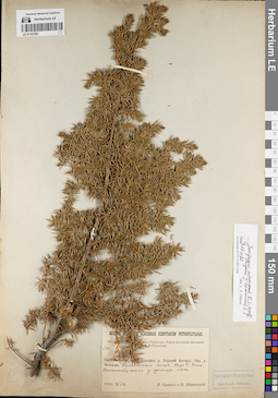
LE 01191581
Juniperus niemannii E.L. Wolf ⟨close to Juniperus communis L.⟩ det. Orlova, Larisa Vladimirovna at 09.07.2022
Collectors: Sukaczev, Vladimir Nikolajevich; Schipczinski, Nikolaj Valerianovich Field collecting number: 308. Collection date: 18.06.1912. Administrative regions: RU - Respublika Buryatiya - Severo-Baykal'skiy Rayon. Place of collection: бассейн р. Верхняя Ангара, окрестности дер. Чечевки, Душкачанский голец, падь Большая Ухта, каменистая осыпь у границы леса.Expedition: Верхне-Ангарская экспедиция В.Н. Сукачёва (1912)Groups of specimens: Образцы сектора Сибири и Дальнего Востока России; Соглашение Минобрнауки №075-15-2021-1056; Из гербария Переселенческого управленияOriginal label text:Museum Botanicum Academiae Scientiarum Petropolitanae. Из гербария Переселенческого Управления. Верхне-Ангарская экспедиция В.Н. Сукачева. 308. Забайкальск. обл. Бассейн р. Верхней Ангары. Окр. д. Чечевок. Душкачанский голец. Падь Б. Ухта. Каменистая осыпь у границы леса. 1912.VI.18. В. Сукачев и Н. Шипчинский
Landscape in location of collection: каменистая осыпь у границы леса в пределах падиHabitat / plant community in location of collecting: у границы лесаCoordinates (geographic position): 55° 47′ 0.33″ N, 109° 36′ 43.3″ E ±20000 mRecord creation: 2022-07-09, Larisa Orlova, PhotoScan D2. Part 1.Citation: Specimen LE 01191581 // Virtual herbarium of Komarov Botanical Institute RAS — http://re.herbariumle.ru/01191581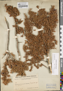
LE 01191580
Juniperus sibirica Burgsd. det. Orlova, Larisa Vladimirovna at 09.07.2022
Collectors: Korotky, Mikhail Fedorovich; Nikolaev, P. Field collecting number: 104. Collection date: 14.05.1911. Administrative regions: RU - Respublika Buryatiya - Barguzinskiy Rayon. Place of collection: окрестности с. Баргузин, подошва горы на склоне.Expedition: Баргузинская почвен.-ботан. партия командированной по Высочайшему повелению Амурской Экспедиции ()Groups of specimens: Образцы сектора Сибири и Дальнего Востока России; Соглашение Минобрнауки №075-15-2021-1056Original label text:Museum Botanicum Academiae Scientiarum Petropolitanae. Баргузинская почвен.-ботан. партия командированной по высочайшему повелению Амурской Экспедиции. 104. Забайкальск. обл., окр. гор. Баргузина. У подошвы горы на склоне. 1911. V.13-14 М. Короткий и П. Николаев
Landscape in location of collection: подошва горы на склонеCoordinates (geographic position): 53° 37′ 39.38″ N, 109° 36′ 32.95″ E ±10000 mRecord creation: 2022-07-09, Larisa Orlova, PhotoScan D2. Part 1.Citation: Specimen LE 01191580 // Virtual herbarium of Komarov Botanical Institute RAS — http://re.herbariumle.ru/01191580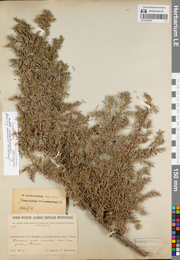
LE 01191578
Juniperus niemannii E.L. Wolf ⟨intermediate forma⟩ det. Orlova, Larisa Vladimirovna at 09.07.2022
Additional identifications: Juniperus communis L. det. Ikonnikov-Galitzky, Nikolai Petrovic at 12.09.1940 Collectors: Poplavskaya (Poplawska), Henrietta Ippolitovna; Sukaczev, Vladimir Nikolajevich Field collecting number: 1539. Collection date: 19.08.1912. Administrative regions: RU - Respublika Buryatiya - Severo-Baykal'skiy Rayon. Place of collection: бассейн р. Верхней Ангары, окрестности дер. Ченчи, тенистый елово-пихтовый лес близ устья р. Светлая (Акушанда).Expedition: Верхне-Ангарская экспедиция В.Н. Сукачёва (1912)Groups of specimens: Образцы сектора Сибири и Дальнего Востока России; Соглашение Минобрнауки №075-15-2021-1056; Гербарий Переселенческого УправленияOriginal label text:Museum Botanicum Academiae Scientiarum Petropolitanae. Из гербария Переселенческого Управления. Верхне-Ангарская экспедиция В.Н. Сукачева. 1540. Забайкальск. обл. Бассейн р. Верхней Ангары. Окр. д. Ченчи. Тенистый елово-пихтовый лес близ устья р. Светлой. 1912.VIII.19. В. Сукачев и Г. Поплавская
Landscape in location of collection: берег рекиHabitat / plant community in location of collecting: тенистый елово-пихтовый лесCoordinates (geographic position): 55° 58′ 0.6″ N, 110° 59′ 47.47″ E ±10000 mRecord creation: 2022-07-09, Larisa Orlova, PhotoScan D2. Part 1.Citation: Specimen LE 01191578 // Virtual herbarium of Komarov Botanical Institute RAS — http://re.herbariumle.ru/01191578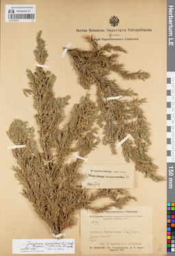
LE 01191577
Juniperus niemannii E.L. Wolf ⟨close to Juniperus sibirica Burgsd.⟩ det. Orlova, Larisa Vladimirovna at 09.07.2022
Additional identifications: Juniperus communis L. det. Ikonnikov-Galitzky, Nikolai Petrovic at 12.09.1940 Collectors: Poplavskaya (Poplawska), Henrietta Ippolitovna; Sukaczev, Vladimir Nikolajevich Field collecting number: 397. Collection date: 29.06.1912. Administrative regions: RU - Respublika Buryatiya - Severo-Baykal'skiy Rayon. Place of collection: бассейн р. Верхней Ангары, окрестности дер. Ченчи, сухой сосняк.Expedition: В.Н. Сукачев. Верхне-Ангарская экспедиция Забайкальской области 1912 г. () (1912)Groups of specimens: Образцы сектора Сибири и Дальнего Востока России; Соглашение Минобрнауки №075-15-2021-1056; Гербарий Переселенческого УправленияOriginal label text:Гербарий Переселенческого Управления. В.Н. Сукачев. Верхне-Ангарская экспедиция Забайкальской области 1912 г. № 397. Бассейн р. Верхней Ангары. Окр. д. Ченчи. Сухой сосняк. 29.VI Собр. В. Сукачев и Г. Поплавская. W. Sukaczew. Iter Transbaicalense ad fl. Angara Superior. 1912
Landscape in location of collection: берег крупной рекиHabitat / plant community in location of collecting: сухой соснякCoordinates (geographic position): 55° 57′ 57.52″ N, 110° 59′ 45.15″ E ±10000 mRecord creation: 2022-07-09, Larisa Orlova, PhotoScan D2. Part 1.Citation: Specimen LE 01191577 // Virtual herbarium of Komarov Botanical Institute RAS — http://re.herbariumle.ru/01191577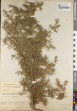
LE 01191576
Juniperus communis L. det. Ikonnikov-Galitzky, Nikolai Petrovic at 12.09.1940
Collectors: Poplavskaya (Poplawska), Henrietta Ippolitovna; Sukaczev, Vladimir Nikolajevich Field collecting number: 1540. Collection date: 19.08.1912. Administrative regions: RU - Respublika Buryatiya - Severo-Baykal'skiy Rayon. Place of collection: бассейн р. Верхней Ангары, окрестности дер. Ченчи, тенистый елово-пихтовый лес близ устья р. Светлая (Акушанда).Expedition: Верхне-Ангарская экспедиция В.Н. Сукачёва (1912)Groups of specimens: Образцы сектора Сибири и Дальнего Востока России; Соглашение Минобрнауки №075-15-2021-1056; Из гербария Переселенческого управленияOriginal label text:Museum Botanicum Academiae Scientiarum Petropolitanae. Из гербария Переселенческого Управления. Верхне-Ангарская экспедиция В.Н. Сукачева. 1540. Забайкальск. обл. Бассейн р. Верхней Ангары. Окр. д. Ченчи. Тенистый елово-пихтовый лес близ устья р. Светлой. 1912.VIII.19. В. Сукачев и Г. Поплавская
Landscape in location of collection: берег рекиHabitat / plant community in location of collecting: тенистый елово-пихтовый лесCoordinates (geographic position): 55° 58′ 0.6″ N, 110° 59′ 47.47″ E ±10000 mRecord creation: 2022-07-09, Larisa Orlova, PhotoScan D2. Part 1.Citation: Specimen LE 01191576 // Virtual herbarium of Komarov Botanical Institute RAS — http://re.herbariumle.ru/01191576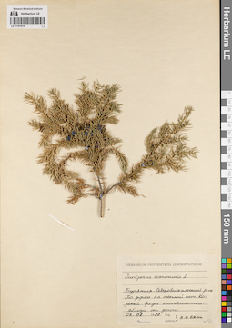
LE 01191575
Juniperus communis L. det. Byalt, Vyacheslav Vyacheslavovich at 1988
Collectors: Byalt, Vyacheslav Vyacheslavovich Collection date: 06.08.1988. Administrative regions: RU - Respublika Buryatiya - Severo-Baykal'skiy Rayon. Place of collection: по дороге на теплый источник Кореней [в тайге по дороге от р. Дзелинда], среди лиственничника, вблизи от дороги.Groups of specimens: Образцы сектора Сибири и Дальнего Востока России; Соглашение Минобрнауки №075-15-2021-1056; Herbarium Universitatis LeninopolitanaeOriginal label text:Herbarium universitatis Leninopolitanae. Juniperus communis L. Бурятия. Северобайкальский р-он. По дороге на теплый ист. Кореней. Среди лиственичника. Вблизи от дороги. 06.08.1988. Leg. Determ. В.В. Бялт
Landscape in location of collection: вблизи от дорогиHabitat / plant community in location of collecting: лиственничникCoordinates (geographic position): 55° 58′ 13.23″ N, 110° 31′ 14.18″ E ±20000 mRecord creation: 2022-07-09, Larisa Orlova, PhotoScan D2. Part 1.Citation: Specimen LE 01191575 // Virtual herbarium of Komarov Botanical Institute RAS — http://re.herbariumle.ru/01191575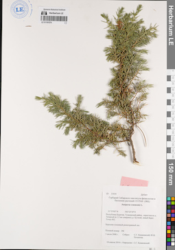
LE 01191574
Juniperus communis L. det. Kazanovsky, Sergei Grigorjevich at 18.04.2014
Collectors: Pochinchik, Yu.N.; Kazanovsky, Sergei Grigorjevich Field collecting number: 190 / 33939 Дублет. Collection date: 03.07.2008. Administrative regions: RU - Respublika Buryatiya - Tunkinskiy Rayon. Place of collection: окрестности дер. Тагархай (в 1,5 км севернее), левый берег р. Бугатай, точка 002, березово-сосновый разнотравный лес.Groups of specimens: Образцы сектора Сибири и Дальнего Востока России; Соглашение Минобрнауки №075-15-2021-1056; Гербарий Сибирского института физиологии и биохимии растений СО РАН (IRK)Original label text:ID 33939 Дублет Гербарий Сибирского института физиологии и биохимии растений СО РАН (IRK) Juniperus communis L. 51°53'05'' N 102°22'10'' E Республика Бурятия, Тункинский район, окрестности д. Тагархай (в 1,5 км севернее), р. Бугатай, левый берег. Точка 002. Березово-сосновый разнотравный лес. Полевой номер: 190. 3 июля 2008 г. Собрал: С.Г. Казановский, Ю.Н. Починчик. 18 апреля 2014 г. Определил: С.Г. Казановский
Landscape in location of collection: берег рекиHabitat / plant community in location of collecting: березово-сосновый разнотравный лесCoordinates (geographic position): 51° 53′ 5″ N, 102° 22′ 10″ E ±500 mRecord creation: 2022-07-09, Larisa Orlova, PhotoScan D2. Part 1.Citation: Specimen LE 01191574 // Virtual herbarium of Komarov Botanical Institute RAS — http://re.herbariumle.ru/01191574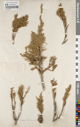
LE 01191553
Groups of specimens: Образцы сектора Сибири и Дальнего Востока России; Соглашение Минобрнауки №075-15-2021-1056Record creation: 2022-07-09, Larisa Orlova, PhotoScan D2. Part 1.Citation: Specimen LE 01191553 // Virtual herbarium of Komarov Botanical Institute RAS — http://re.herbariumle.ru/01191553
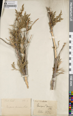
LE 01191552
Juniperus davurica Pall. det. Ledebour, Carl (Karl) Friedrich von [Ledebour]
Collectors: Ledebour, Carl (Karl) Friedrich von [Ledebour] Collection date: 1826. Administrative regions: RU - Altayskiy Kray; RU - Respublika Altay. Place of collection: Алтай.Groups of specimens: Образцы сектора Сибири и Дальнего Востока России; Соглашение Минобрнауки №075-15-2021-1056; Herb. LedebourOriginal label text:[1]Herb. Ledeb. 862.4. juniperus davurica Pall. [2] Herb. Ledebour 1501. Juniperus davurica Pall. Altai. 1826
Record creation: 2022-07-09, Larisa Orlova, PhotoScan D2. Part 1.Citation: Specimen LE 01191552 // Virtual herbarium of Komarov Botanical Institute RAS — http://re.herbariumle.ru/01191552
LE 01191551
Groups of specimens: Образцы сектора Сибири и Дальнего Востока России; Соглашение Минобрнауки №075-15-2021-1056Record creation: 2022-07-09, Larisa Orlova, PhotoScan D2. Part 1.Citation: Specimen LE 01191551 // Virtual herbarium of Komarov Botanical Institute RAS — http://re.herbariumle.ru/01191551
LE 01191550
Groups of specimens: Образцы сектора Сибири и Дальнего Востока России; Соглашение Минобрнауки №075-15-2021-1056Record creation: 2022-07-09, Larisa Orlova, PhotoScan D2. Part 1.Citation: Specimen LE 01191550 // Virtual herbarium of Komarov Botanical Institute RAS — http://re.herbariumle.ru/01191550
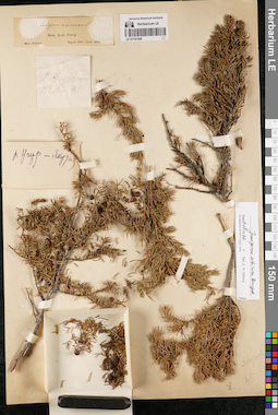
LE 01191549
Groups of specimens: Образцы сектора Сибири и Дальнего Востока России; Соглашение Минобрнауки №075-15-2021-1056Record creation: 2022-07-09, Larisa Orlova, PhotoScan D2. Part 1.Citation: Specimen LE 01191549 // Virtual herbarium of Komarov Botanical Institute RAS — http://re.herbariumle.ru/01191549
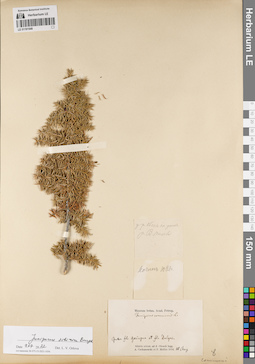
LE 01191548
Juniperus sibirica Burgsd. det. Orlova, Larisa Vladimirovna at 09.07.2022
Additional identifications: Juniperus communis L. det. Trautvetter, Rudolf Ernst von Collectors: Czekanowski, Alexander Piotr; Müller (Mueller), Ferdinand Ferdinandovich Collection date: 10.08.1874. Administrative regions: RU - Respublika Sakha (Yakutiya) - Olenyoksky District. Subregion: Оленекский улус. Place of collection: Inter fl. Gaiugua et fl. Dalgas.Groups of specimens: Образцы сектора Сибири и Дальнего Востока России; Соглашение Минобрнауки №075-15-2021-1056; Museum botan. Acad. Petrop.Original label text:[1]у р. Оленек на устье р. В. Томбы [2]Ночлег 10 Авг. [3] Museum botan. Acad. Petrop. Juniperus communis L. Inter fl. Gaingna et fl. Dalgas. Sibiria orient. ad fl. Olenek legg. A. Czekanowski et F. Müller 1874. 10 Aug
Coordinates (geographic position): 67° 17′ 59.43″ N, 106° 54′ 54.72″ E ±1000 mRecord creation: 2022-07-09, Larisa Orlova, PhotoScan D2. Part 1.Citation: Specimen LE 01191548 // Virtual herbarium of Komarov Botanical Institute RAS — http://re.herbariumle.ru/01191548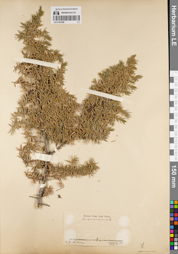
LE 01191546
Juniperus communis L. det. Trautvetter, Rudolf Ernst von
Collectors: Czekanowski, Alexander Piotr Collection date: 28.06.1875. Groups of specimens: Образцы сектора Сибири и Дальнего Востока России; Соглашение Минобрнауки №075-15-2021-1056; Museum botan. Acad. Petrop.Original label text:Ad fluv. Lenam inferiorem, ad fl. Naschim. Czekanowski. 1875. 28 Junii
Coordinates (geographic position): 65° 44′ 44.09″ N, 124° 9′ 38.2″ E ±2000 mRecord creation: 2022-07-09, Larisa Orlova, PhotoScan D2. Part 1.Citation: Specimen LE 01191546 // Virtual herbarium of Komarov Botanical Institute RAS — http://re.herbariumle.ru/01191546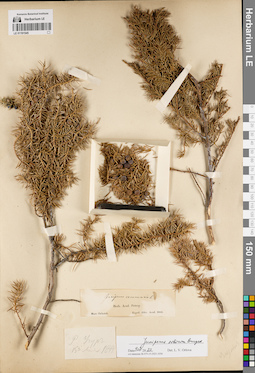
LE 01191545
Groups of specimens: Образцы сектора Сибири и Дальнего Востока России; Соглашение Минобрнауки №075-15-2021-1056Record creation: 2022-07-09, Larisa Orlova, PhotoScan D2. Part 1.Citation: Specimen LE 01191545 // Virtual herbarium of Komarov Botanical Institute RAS — http://re.herbariumle.ru/01191545
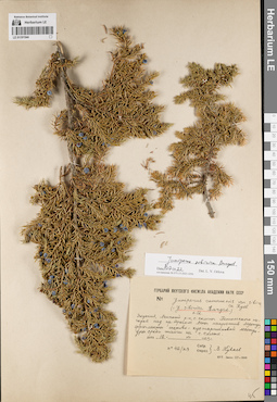
LE 01191544
Juniperus sibirica Burgsd. det. Orlova, Larisa Vladimirovna at 09.07.2022
Additional identifications: Juniperus communis var. sibirica Rydb. det. Kuvaev, Vladimir Borisovich at 1953; Juniperus sibirica Burgsd. det. Kuvaev, Vladimir Borisovich at 1953 Collectors: Kuvaev, Vladimir Borisovich Field collecting number: 42/29. Collection date: 16.07.1953. Administrative regions: RU - Respublika Sakha (Yakutiya) - Lenskiy Rayon. Subregion: Ленский улус. Place of collection: северные склоны Патомского нагорья над правым берегом р. Лена напротив г. Ленск (микрорайон Мухтуй), фрагменты осоково-кустарничковой лесотундры среди тайги на северном склоне.Groups of specimens: Образцы сектора Сибири и Дальнего Востока России; Соглашение Минобрнауки №075-15-2021-1056; Гербарий Якутского филиала Академии Наук СССРOriginal label text:Гербарий Якутского филиала Академии наук СССР. Juniperus communis var. sibirica Rydb. (= J. sibirica Burgsd.) 0.12. Якутия, Ленский р-н, с. склоны Патомского нагорья над пр. берегом Лены напротив Мухтуя, фрагменты осоково-кустарничковой лесотундры среди тайги на с. склоне. дата 16 VII 1953 г. no. 42/29. Собр. Опред. В. Куваев
Landscape in location of collection: северный склон нагорьяHabitat / plant community in location of collecting: фрагменты осоково-кустарничковой лесотундры среди тайгиCoordinates (geographic position): 60° 41′ 21.98″ N, 114° 54′ 32.16″ E ±2000 mRecord creation: 2022-07-09, Larisa Orlova, PhotoScan D2. Part 1.Citation: Specimen LE 01191544 // Virtual herbarium of Komarov Botanical Institute RAS — http://re.herbariumle.ru/01191544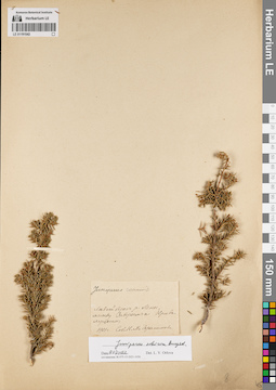
LE 01191542
Juniperus sibirica Burgsd. det. Orlova, Larisa Vladimirovna at 09.07.2022
Additional identifications: Juniperus communis L. det. Gerasimova, K.M. at 1901 Collectors: Gerasimova, K.M. Collection date: 1901. Administrative regions: RU - Irkutskaya Oblast' - Kirenskiy Rayon. Place of collection: левый берег р. Лена, между дер. Заборье и дер. Кривая Лука.Groups of specimens: Образцы сектора Сибири и Дальнего Востока России; Соглашение Минобрнауки №075-15-2021-1056Original label text:Juniperus communis. Левый берег р. Лены, между Заборьем и Кривалуцким. 1901 г. Соб. К.М. Герасимова
Landscape in location of collection: берег крупной рекиCoordinates (geographic position): 57° 35′ 59.14″ N, 107° 50′ 33.82″ E ±500 mRecord creation: 2022-07-09, Larisa Orlova, PhotoScan D2. Part 1.Citation: Specimen LE 01191542 // Virtual herbarium of Komarov Botanical Institute RAS — http://re.herbariumle.ru/01191542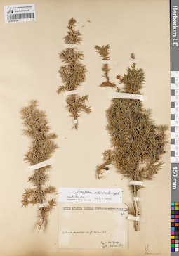
LE 01191541
Juniperus sibirica Burgsd. det. Orlova, Larisa Vladimirovna at 09.07.2022
Collectors: Maack, Richard Otto Field collecting number: дубл.. Collection date: 1854. Administrative regions: RU - Respublika Sakha (Yakutiya). Subregion: Мирнинский улус. Place of collection: Восточная Сибирь, р. Вилюй 64° с.ш..Expedition: R.Maack Exped. soc. geogr. ()Groups of specimens: Образцы сектора Сибири и Дальнего Востока России; Соглашение Минобрнауки №075-15-2021-1056Original label text:Museum Botanicum Academiae Scientiarum Petropolitanae. дубл. Sibiria orientalis. ad fl. Wilui 64°. Exped. Soc. Geogr. leg. R. Maack 1854
Landscape in location of collection: берег рекиCoordinates (geographic position): 64° 0′ 40.41″ N, 109° 20′ 4.34″ E ±120000 mRecord creation: 2022-07-09, Larisa Orlova, PhotoScan D2. Part 1.Citation: Specimen LE 01191541 // Virtual herbarium of Komarov Botanical Institute RAS — http://re.herbariumle.ru/01191541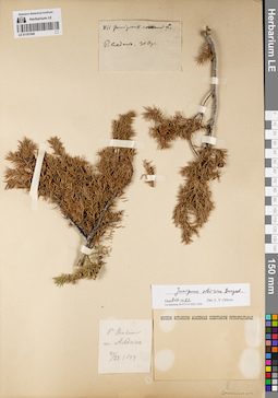
LE 01191540
Groups of specimens: Образцы сектора Сибири и Дальнего Востока России; Соглашение Минобрнауки №075-15-2021-1056Record creation: 2022-07-09, Larisa Orlova, PhotoScan D2. Part 1.Citation: Specimen LE 01191540 // Virtual herbarium of Komarov Botanical Institute RAS — http://re.herbariumle.ru/01191540
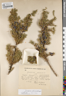
LE 01191539
Juniperus sibirica Burgsd. det. Orlova, Larisa Vladimirovna at 09.07.2022
Additional identifications: Juniperus communis L. det. Kuvaev, Vladimir Borisovich at 1953 Collectors: Kuvaev, Vladimir Borisovich Field collecting number: 64/2. Collection date: 24.07.1953. Administrative regions: RU - Respublika Sakha (Yakutiya) - Lenskiy Rayon. Subregion: Ленский улус. Place of collection: мертвопокровный бор на песчаной гриве по надпойме левого берега р. Лена 3 км ниже г. Ленск (микрорайон Мухтуй).Groups of specimens: Образцы сектора Сибири и Дальнего Востока России; Соглашение Минобрнауки №075-15-2021-1056; Гербарий Якутского филиала Академии Наук СССРOriginal label text:Гербарий Якутского филиала Академии наук СССР. Juniperus communis L. о. 21. Якутия, Ленский р-н, мертвопокровный бор на песчаной гриве по надпойме л. берега Лены 3 км ниже поселка Мухтуя. дата 24 VII 1953 г. no. 64/2. Собр. Опред. В. Куваев
Habitat / plant community in location of collecting: мертвопокровный борSubstrate in collecting location: песокCoordinates (geographic position): 60° 41′ 21.72″ N, 114° 49′ 39.14″ E ±5000 mRecord creation: 2022-07-09, Larisa Orlova, PhotoScan D2. Part 1.Citation: Specimen LE 01191539 // Virtual herbarium of Komarov Botanical Institute RAS — http://re.herbariumle.ru/01191539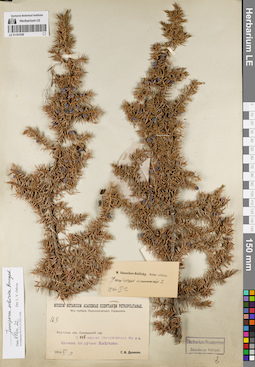
LE 01191538
Juniperus sibirica Burgsd. det. Orlova, Larisa Vladimirovna at 09.07.2022
Additional identifications: Juniperus communis L. det. Ikonnikov-Galitzky, Nikolai Petrovic at 12.09.1940 Collectors: Dolenko, G. I. Field collecting number: 163. Collection date: 13.06.1914. Administrative regions: RU - Respublika Sakha (Yakutiya) - Aldanskiy Rayon. Subregion: Алданский улус. Place of collection: 122 км северо-западнее г. Олекминск, ельник по руч. Хойголах (Хайгалах).Groups of specimens: Образцы сектора Сибири и Дальнего Востока России; Соглашение Минобрнауки №075-15-2021-1056; Из гербария Переселенческого управленияOriginal label text:Museum Botanicum Academiae Scientiarum Petropolitanae. Из гербария Переселенческого Управления. 163. Якутская обл. Олекминский окр. В 115 вер. от Олекминска на с з. Ельник по ручью Хайгалах. 1914.VI,13. Г.И. Доленко
Landscape in location of collection: берег ручьяHabitat / plant community in location of collecting: ельникCoordinates (geographic position): 58° 54′ 44.64″ N, 125° 51′ 23.76″ E ±1000 mRecord creation: 2022-07-09, Larisa Orlova, PhotoScan D2. Part 1.Citation: Specimen LE 01191538 // Virtual herbarium of Komarov Botanical Institute RAS — http://re.herbariumle.ru/01191538