View
Add
Copy
Edit
Delete
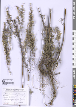
LE 01327076
Groups of specimens: Образцы сектора Восточной ЕвропыRecord creation: 2026-01-12, Peter Efimov, PhotoScan D2Citation: Specimen LE 01327076 // Virtual herbarium of Komarov Botanical Institute RAS — http://re.herbariumle.ru/01327076
LE 01327075
Groups of specimens: Образцы сектора Восточной ЕвропыRecord creation: 2026-01-12, Peter Efimov, PhotoScan D2Citation: Specimen LE 01327075 // Virtual herbarium of Komarov Botanical Institute RAS — http://re.herbariumle.ru/01327075
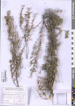
LE 01327074
Groups of specimens: Образцы сектора Восточной ЕвропыRecord creation: 2026-01-12, Peter Efimov, PhotoScan D2Citation: Specimen LE 01327074 // Virtual herbarium of Komarov Botanical Institute RAS — http://re.herbariumle.ru/01327074
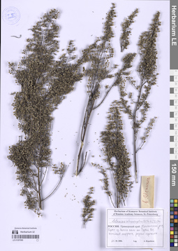
LE 01327041
Groups of specimens: Образцы сектора Восточной ЕвропыRecord creation: 2026-01-12, Peter Efimov, PhotoScan D2Citation: Specimen LE 01327041 // Virtual herbarium of Komarov Botanical Institute RAS — http://re.herbariumle.ru/01327041
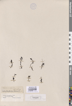
LE 00018369
Groups of specimens: Образцы общего сектора; Типовые образцы Общего сектораRecord creation: 2026-01-13, Марина Витальевна ЯричинаCitation: Specimen LE 00018369 // Virtual herbarium of Komarov Botanical Institute RAS — http://re.herbariumle.ru/00018369
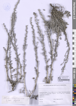
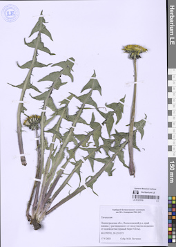
LE 01357138
Artemisia schrenkiana Ledeb. det. Korobkov, Aleksandr Aleksandrovich
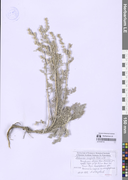
Collectors: Safronova, Irina Nikolayevna Administrative regions: RU - Zabaykal'skiy Kray - Borzinskiy Rayon. Groups of specimens: Образцы сектора Сибири и Дальнего Востока РоссииCoordinates (geographic position): 50° 20′ 44.7″ N, 116° 55′ 37.7″ E ±1000 mComment:До указанных координат - 29 км на ВЮВ от Борзи, рядом пос. Ключевское. Семиозерье поблизости не нашлось.
Record creation: 2026-01-13, Марина Витальевна ЯричинаCitation: Specimen LE 01357138 // Virtual herbarium of Komarov Botanical Institute RAS — http://re.herbariumle.ru/01357138Вероятно, где-то опечатка...
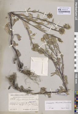
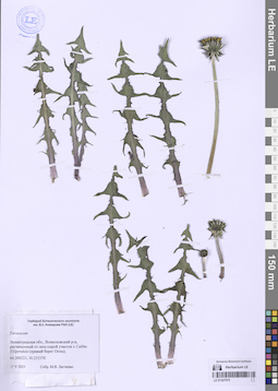
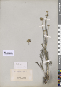
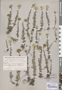
LE 01357129
Tridactylina kirilowii (Turcz.) Sch. Bip. det. Tzvelev, Nikolai Nikolaievich
Collectors: Zinserling (Tsinzerling), Iurij (Yuri, Georgius) Dmitrievitch Groups of specimens: Образцы сектора Сибири и Дальнего Востока РоссииRecord creation: 2026-01-13, Марина Витальевна ЯричинаCitation: Specimen LE 01357129 // Virtual herbarium of Komarov Botanical Institute RAS — http://re.herbariumle.ru/01357129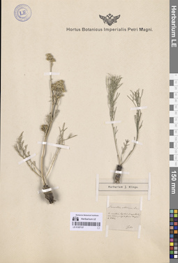
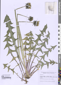
LE 01357137
Filifolium sibiricum (L.) Kitam.
Administrative regions: RU - Irkutskaya Oblast' - Irkutskiy Rayon. Groups of specimens: Образцы сектора Сибири и Дальнего Востока РоссииOriginal label text:In montosis, lapidosis et rupestribus non rarum, v. gr. ad fluvia Angara et Irkut.
Record creation: 2026-01-13, Marina Yarichina, PhotoScan D2Citation: Specimen LE 01357137 // Virtual herbarium of Komarov Botanical Institute RAS — http://re.herbariumle.ru/01357137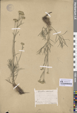
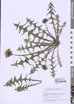
LE 01357136
Filifolium sibiricum (L.) Kitam.
Additional identifications: Tanacetum sibiricum L. det. Glehn, Peter von. Collectors: Augustinowicz, Foma Matveevich Collection date: 09.07.1874. Administrative regions: RU - Irkutskaya Oblast' - Kachugskiy Rayon. Groups of specimens: Образцы сектора Сибири и Дальнего Востока РоссииOriginal label text:Иркутской губернии. За Иркутском, по дороге в Якутск, в 3х верстах от Мало-Манзурской станции на глинистой гари, около речки Манзуровки, впадающей в р. Лену.
Coordinates (geographic position): 53° 30′ 34.23″ N, 106° 0′ 48.91″ E ±700 mRecord creation: 2026-01-13, Marina Yarichina, PhotoScan D2Citation: Specimen LE 01357136 // Virtual herbarium of Komarov Botanical Institute RAS — http://re.herbariumle.ru/01357136Название речки не Манзуровка, а Манзовка.
п.с. название реки - Манзурка.
LE 01357135
Filifolium sibiricum (L.) Kitam.
Collectors: Vitkovskij, Nikolai Ivanovich Collection date: 19.06. Administrative regions: RU - Irkutskaya Oblast' - Angarskiy Rayon. Groups of specimens: Образцы сектора Сибири и Дальнего Востока РоссииOriginal label text:Окрестности г. Иркутска.
Record creation: 2026-01-13, Marina Yarichina, PhotoScan D2Citation: Specimen LE 01357135 // Virtual herbarium of Komarov Botanical Institute RAS — http://re.herbariumle.ru/01357135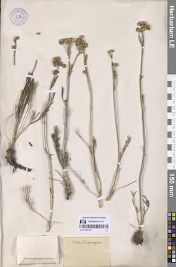
LE 01357134
Filifolium sibiricum (L.) Kitam.
Collectors: Karpinsky, Mihail Mihajlovich Administrative regions: RU - Irkutskaya Oblast'. Groups of specimens: Образцы сектора Сибири и Дальнего Востока РоссииRecord creation: 2026-01-13, Marina Yarichina, PhotoScan D2Citation: Specimen LE 01357134 // Virtual herbarium of Komarov Botanical Institute RAS — http://re.herbariumle.ru/01357134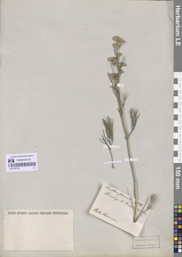
LE 01357133
Filifolium sibiricum (L.) Kitam.
Collectors: Czekanowski, Alexander Piotr Field collecting number: 206. Administrative regions: RU - Irkutskaya Oblast'. Groups of specimens: Образцы сектора Сибири и Дальнего Востока РоссииOriginal label text:Baicalensis e Большая Радевка
Record creation: 2026-01-13, Marina Yarichina, PhotoScan D2Citation: Specimen LE 01357133 // Virtual herbarium of Komarov Botanical Institute RAS — http://re.herbariumle.ru/01357133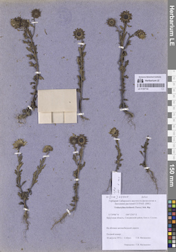
LE 01357132
Tridactylina kirilowii (Turcz.) Sch. Bip. det. Matyashenko, G. V.
Collectors: Matyashenko, G. V. Collection date: 30.08.1973. Administrative regions: RU - Irkutskaya Oblast' - Slyudyanskiy Rayon. Groups of specimens: Образцы сектора Сибири и Дальнего Востока РоссииOriginal label text:Иркутская область, Слюдянский район, близ пос. Солзан. На обочине автомобильной дороги.
Coordinates (geographic position): 51° 29′ 6″ N, 104° 12′ 3″ E ±1000 mRecord creation: 2026-01-13, Marina Yarichina, PhotoScan D2Citation: Specimen LE 01357132 // Virtual herbarium of Komarov Botanical Institute RAS — http://re.herbariumle.ru/0135713251°29'06" N, 104°12'03" E
LE 01357131
Tridactylina kirilowii (Turcz.) Sch. Bip.
Collectors: Sukaczev, Vladimir Nikolajevich; Zinserling (Tsinzerling), Iurij (Yuri, Georgius) Dmitrievitch Administrative regions: RU - Irkutskaya Oblast' - Slyudyanskiy Rayon. Groups of specimens: Образцы сектора Сибири и Дальнего Востока РоссииCoordinates (geographic position): 51° 28′ 52.33″ N, 104° 37′ 16.05″ E ±200 mRecord creation: 2026-01-13, Marina Yarichina, PhotoScan D2Citation: Specimen LE 01357131 // Virtual herbarium of Komarov Botanical Institute RAS — http://re.herbariumle.ru/01357131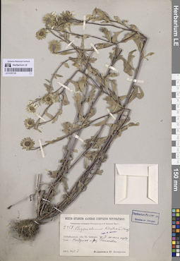
LE 01357130
Tridactylina kirilowii (Turcz.) Sch. Bip.
Collectors: Zinserling (Tsinzerling), Iurij (Yuri, Georgius) Dmitrievitch Administrative regions: RU - Irkutskaya Oblast' - Slyudyanskiy Rayon. Groups of specimens: Образцы сектора Сибири и Дальнего Востока РоссииCoordinates (geographic position): 51° 27′ 7.95″ N, 104° 34′ 57.71″ E ±700 mRecord creation: 2026-01-13, Marina Yarichina, PhotoScan D2Citation: Specimen LE 01357130 // Virtual herbarium of Komarov Botanical Institute RAS — http://re.herbariumle.ru/01357130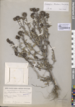
LE 01357128
Tridactylina kirilowii (Turcz.) Sch. Bip. det. Tzvelev, Nikolai Nikolaievich
Collectors: Sukaczev, Vladimir Nikolajevich; Poplavskaya (Poplawska), Henrietta Ippolitovna Administrative regions: RU - Irkutskaya Oblast' - Slyudyanskiy Rayon. Groups of specimens: Образцы сектора Сибири и Дальнего Востока РоссииCoordinates (geographic position): 51° 32′ 7.98″ N, 104° 6′ 4.25″ E ±300 mRecord creation: 2026-01-13, Marina Yarichina, PhotoScan D2Citation: Specimen LE 01357128 // Virtual herbarium of Komarov Botanical Institute RAS — http://re.herbariumle.ru/01357128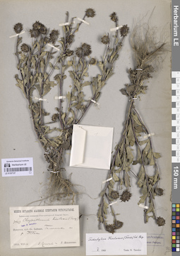
LE 01357127
Tridactylina kirilowii (Turcz.) Sch. Bip. det. Tzvelev, Nikolai Nikolaievich
Collectors: Sukaczev, Vladimir Nikolajevich; Poplavskaya (Poplawska), Henrietta Ippolitovna Administrative regions: RU - Irkutskaya Oblast' - Slyudyanskiy Rayon. Groups of specimens: Образцы сектора Сибири и Дальнего Востока РоссииCoordinates (geographic position): 51° 32′ 12.03″ N, 104° 5′ 56.5″ E ±300 mRecord creation: 2026-01-13, Marina Yarichina, PhotoScan D2Citation: Specimen LE 01357127 // Virtual herbarium of Komarov Botanical Institute RAS — http://re.herbariumle.ru/01357127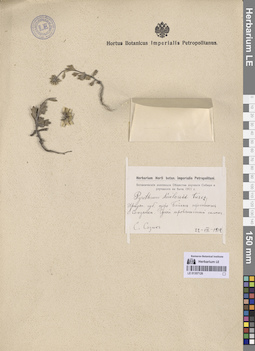
LE 01357126
Tridactylina kirilowii (Turcz.) Sch. Bip.
Additional identifications: Pyrethrum kirilowii Turcz. Collectors: Sizykh, S. Administrative regions: RU - Irkutskaya Oblast' - Slyudyanskiy Rayon. Groups of specimens: Образцы сектора Сибири и Дальнего Востока РоссииCoordinates (geographic position): 51° 39′ 10.6″ N, 103° 42′ 5.73″ E ±1000 mRecord creation: 2026-01-13, Marina Yarichina, PhotoScan D2Citation: Specimen LE 01357126 // Virtual herbarium of Komarov Botanical Institute RAS — http://re.herbariumle.ru/01357126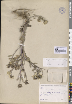
LE 01357125
Tridactylina kirilowii (Turcz.) Sch. Bip. det. Tzvelev, Nikolai Nikolaievich
Collectors: Sukaczev, Vladimir Nikolajevich Administrative regions: RU - Irkutskaya Oblast' - Slyudyanskiy Rayon. Groups of specimens: Образцы сектора Сибири и Дальнего Востока РоссииRecord creation: 2026-01-13, Marina Yarichina, PhotoScan D2Citation: Specimen LE 01357125 // Virtual herbarium of Komarov Botanical Institute RAS — http://re.herbariumle.ru/01357125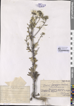
LE 01357124
Tridactylina kirilowii (Turcz.) Sch. Bip. det. Sautin, E. A.
Collectors: Sautin, E. A. Administrative regions: RU - Irkutskaya Oblast' - Slyudyanskiy Rayon. Groups of specimens: Образцы сектора Сибири и Дальнего Востока РоссииCoordinates (geographic position): 51° 29′ 16.01″ N, 104° 17′ 59.98″ E ±700 mRecord creation: 2026-01-13, Marina Yarichina, PhotoScan D2Citation: Specimen LE 01357124 // Virtual herbarium of Komarov Botanical Institute RAS — http://re.herbariumle.ru/01357124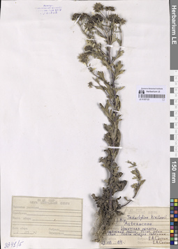
LE 01357123
Tridactylina kirilowii (Turcz.) Sch. Bip. det. Sautin, E. A.
Collectors: Sautin, E. A. Administrative regions: RU - Irkutskaya Oblast' - Slyudyanskiy Rayon. Groups of specimens: Образцы сектора Сибири и Дальнего Востока РоссииCoordinates (geographic position): 51° 33′ 11.12″ N, 104° 3′ 9.95″ E ±200 mRecord creation: 2026-01-13, Marina Yarichina, PhotoScan D2Citation: Specimen LE 01357123 // Virtual herbarium of Komarov Botanical Institute RAS — http://re.herbariumle.ru/01357123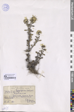
LE 01357122
Tridactylina kirilowii (Turcz.) Sch. Bip. det. Sautin, E. A.
Collectors: Sautin, E. A. Administrative regions: RU - Irkutskaya Oblast' - Slyudyanskiy Rayon. Groups of specimens: Образцы сектора Сибири и Дальнего Востока РоссииCoordinates (geographic position): 51° 31′ 41.53″ N, 104° 9′ 36.98″ E ±200 mRecord creation: 2026-01-13, Marina Yarichina, PhotoScan D2Citation: Specimen LE 01357122 // Virtual herbarium of Komarov Botanical Institute RAS — http://re.herbariumle.ru/01357122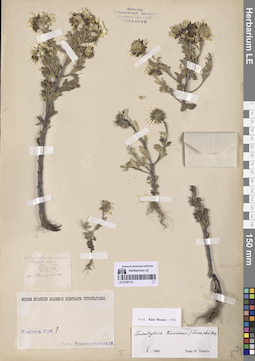
LE 01357121
Tridactylina kirilowii (Turcz.) Sch. Bip. det. Tzvelev, Nikolai Nikolaievich
Collectors: Ksenzhopolsky (Księżpolski), Wladislav Thomasz Collection date: 16.08.1876. Administrative regions: RU - Irkutskaya Oblast' - Slyudyanskiy Rayon. Groups of specimens: Образцы сектора Сибири и Дальнего Востока РоссииOriginal label text:Кругобайкальский тракт, р. Солзан
Coordinates (geographic position): 51° 30′ 34.08″ N, 104° 9′ 35.9″ E ±300 mRecord creation: 2026-01-13, Marina Yarichina, PhotoScan D2Citation: Specimen LE 01357121 // Virtual herbarium of Komarov Botanical Institute RAS — http://re.herbariumle.ru/01357121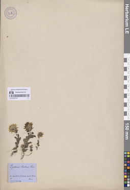
LE 01357119
Tridactylina kirilowii (Turcz.) Sch. Bip.
Additional identifications: Pyrethrum kirilowii Turcz. det. Turczaninow, Nicolai Stepanowisch Collectors: Turczaninow, Nicolai Stepanowisch Administrative regions: RU - Irkutskaya Oblast' - Slyudyanskiy Rayon. Groups of specimens: Образцы сектора Сибири и Дальнего Востока РоссииOriginal label text:In lapidosis ad ripam merid. Baicales.
Record creation: 2026-01-13, Marina Yarichina, PhotoScan D2Citation: Specimen LE 01357119 // Virtual herbarium of Komarov Botanical Institute RAS — http://re.herbariumle.ru/01357119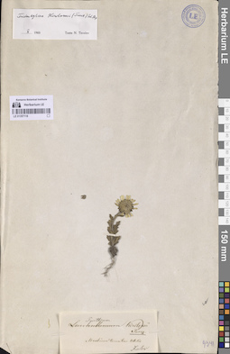
LE 01357118
Tridactylina kirilowii (Turcz.) Sch. Bip. det. Tzvelev, Nikolai Nikolaievich
Additional identifications: Pyrethrum kirilowii Turcz. Collectors: Kirilov, Ivan Petrovich Administrative regions: RU - Irkutskaya Oblast' - Slyudyanskiy Rayon. Groups of specimens: Образцы сектора Сибири и Дальнего Востока РоссииOriginal label text:Ad ostium torrentum Utulik.
Coordinates (geographic position): 51° 33′ 14.34″ N, 104° 2′ 49.58″ E ±300 mRecord creation: 2026-01-13, Marina Yarichina, PhotoScan D2Citation: Specimen LE 01357118 // Virtual herbarium of Komarov Botanical Institute RAS — http://re.herbariumle.ru/01357118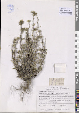
LE 01357117
Tridactylina kirilowii (Turcz.) Sch. Bip. det. Anenkhonov, Oleg Arnoldovich
Collectors: Anenkhonov, Oleg Arnoldovich Administrative regions: RU - Respublika Buryatiya - Selenginskiy Rayon. Groups of specimens: Образцы сектора Сибири и Дальнего Востока РоссииCoordinates (geographic position): 51° 13′ 53.18″ N, 105° 30′ 28.79″ E ±1000 mRecord creation: 2026-01-13, Marina Yarichina, PhotoScan D2Citation: Specimen LE 01357117 // Virtual herbarium of Komarov Botanical Institute RAS — http://re.herbariumle.ru/01357117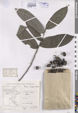
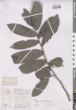
LE 00018368
Groups of specimens: Образцы общего сектораRecord creation: 2026-01-13, Marina Yarichina, PhotoScan D2Citation: Specimen LE 00018368 // Virtual herbarium of Komarov Botanical Institute RAS — http://re.herbariumle.ru/00018368
LE 00018367
Groups of specimens: Образцы общего сектораRecord creation: 2026-01-13, Marina Yarichina, PhotoScan D2Citation: Specimen LE 00018367 // Virtual herbarium of Komarov Botanical Institute RAS — http://re.herbariumle.ru/00018367
LE 01357110
Artemisia compacta Fisch. ex DC. det. Korobkov, Aleksandr Aleksandrovich
Collectors: Korobkov, Aleksandr Aleksandrovich Administrative regions: RU - Respublika Altay - Kosh-Agachskiy Rayon. Groups of specimens: Образцы сектора Сибири и Дальнего Востока РоссииCoordinates (geographic position): 50° 4′ 12.19″ N, 88° 24′ 42.68″ E ±700 mRecord creation: 2026-01-12, Marina Yarichina, PhotoScan D2Citation: Specimen LE 01357110 // Virtual herbarium of Komarov Botanical Institute RAS — http://re.herbariumle.ru/01357110
LE 01357109
Artemisia nitrosa Weber ex Stechm. det. Korobkov, Aleksandr Aleksandrovich
Collectors: Korolyuk A. Yu. Administrative regions: RU - Altayskiy Kray - Tabunskiy Rayon. Groups of specimens: Образцы сектора Сибири и Дальнего Востока РоссииCoordinates (geographic position): 53° 2′ 16.18″ N, 79° 4′ 31.26″ E ±1000 mRecord creation: 2026-01-12, Marina Yarichina, PhotoScan D2Citation: Specimen LE 01357109 // Virtual herbarium of Komarov Botanical Institute RAS — http://re.herbariumle.ru/01357109
LE 01357108
Artemisia nitrosa Weber ex Stechm. det. Korobkov, Aleksandr Aleksandrovich
Collectors: Korolyuk A. Yu. Administrative regions: RU - Altayskiy Kray - Mikhaylovskiy Rayon. Groups of specimens: Образцы сектора Сибири и Дальнего Востока РоссииCoordinates (geographic position): 51° 56′ 1.37″ N, 79° 15′ 0.49″ E ±1000 mRecord creation: 2026-01-12, Marina Yarichina, PhotoScan D2Citation: Specimen LE 01357108 // Virtual herbarium of Komarov Botanical Institute RAS — http://re.herbariumle.ru/01357108
LE 01357107
Artemisia schischkinii Krasch. det. Korobkov, Aleksandr Aleksandrovich
Collectors: Korobkov, Aleksandr Aleksandrovich Administrative regions: RU - Respublika Altay - Kosh-Agachskiy Rayon. Groups of specimens: Образцы сектора Сибири и Дальнего Востока РоссииCoordinates (geographic position): 50° 4′ 13.35″ N, 88° 24′ 40.25″ E ±7000 mRecord creation: 2026-01-12, Marina Yarichina, PhotoScan D2Citation: Specimen LE 01357107 // Virtual herbarium of Komarov Botanical Institute RAS — http://re.herbariumle.ru/01357107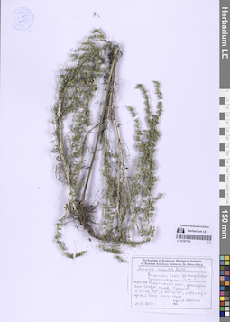
LE 01357106
Artemisia commutata Besser det. Korobkov, Aleksandr Aleksandrovich
Collectors: Afonina, Olga Mikhailovna Administrative regions: RU - Respublika Buryatiya - Tunkinskiy Rayon. Groups of specimens: Образцы сектора Сибири и Дальнего Востока РоссииRecord creation: 2026-01-12, Marina Yarichina, PhotoScan D2Citation: Specimen LE 01357106 // Virtual herbarium of Komarov Botanical Institute RAS — http://re.herbariumle.ru/01357106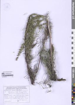
LE 01357105
Artemisia commutata Besser det. Korobkov, Aleksandr Aleksandrovich
Collectors: Afonina, Olga Mikhailovna Administrative regions: RU - Respublika Buryatiya - Tunkinskiy Rayon. Groups of specimens: Образцы сектора Сибири и Дальнего Востока РоссииRecord creation: 2026-01-12, Marina Yarichina, PhotoScan D2Citation: Specimen LE 01357105 // Virtual herbarium of Komarov Botanical Institute RAS — http://re.herbariumle.ru/01357105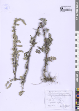
LE 01357104
Artemisia mongolica (Besser) Fisch. ex Nakai det. Korobkov, Aleksandr Aleksandrovich
Collectors: Afonina, Olga Mikhailovna Administrative regions: RU - Zabaykal'skiy Kray - Kyrinskiy Rayon. Groups of specimens: Образцы сектора Сибири и Дальнего Востока РоссииRecord creation: 2026-01-12, Marina Yarichina, PhotoScan D2Citation: Specimen LE 01357104 // Virtual herbarium of Komarov Botanical Institute RAS — http://re.herbariumle.ru/01357104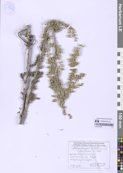
LE 01357103
Artemisia jacutica Drobow det. Korobkov, Aleksandr Aleksandrovich
Collectors: Afonina, Olga Mikhailovna Administrative regions: RU - Zabaykal'skiy Kray - Kyrinskiy Rayon. Groups of specimens: Образцы сектора Сибири и Дальнего Востока РоссииRecord creation: 2026-01-12, Marina Yarichina, PhotoScan D2Citation: Specimen LE 01357103 // Virtual herbarium of Komarov Botanical Institute RAS — http://re.herbariumle.ru/01357103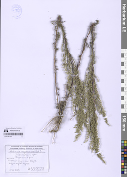
LE 01357102
Artemisia scoparia Waldst. & Kit. det. Korobkov, Aleksandr Aleksandrovich
Collectors: Afonina, Olga Mikhailovna Administrative regions: RU - Zabaykal'skiy Kray - Kyrinskiy Rayon. Groups of specimens: Образцы сектора Сибири и Дальнего Востока РоссииRecord creation: 2026-01-12, Marina Yarichina, PhotoScan D2Citation: Specimen LE 01357102 // Virtual herbarium of Komarov Botanical Institute RAS — http://re.herbariumle.ru/01357102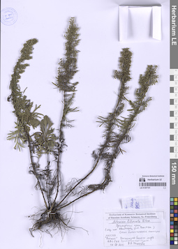
LE 01357101
Artemisia littoricola Kitam. det. Korobkov, Aleksandr Aleksandrovich
Collectors: Kotseruba, Violetta Vladimirovna Administrative regions: RU - Primorskiy Kray - Shkotovskiy Rayon. Groups of specimens: Образцы сектора Сибири и Дальнего Востока РоссииCoordinates (geographic position): 42° 53′ 36.14″ N, 132° 44′ 2.87″ E ±300 mRecord creation: 2026-01-12, Marina Yarichina, PhotoScan D2Citation: Specimen LE 01357101 // Virtual herbarium of Komarov Botanical Institute RAS — http://re.herbariumle.ru/01357101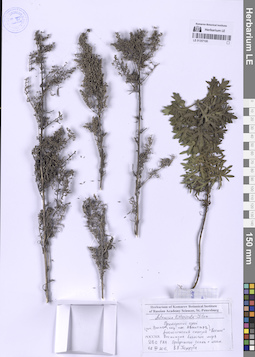
LE 01357100
Artemisia littoricola Kitam. det. Korobkov, Aleksandr Aleksandrovich
Collectors: Kotseruba, Violetta Vladimirovna Administrative regions: RU - Primorskiy Kray - Shkotovskiy Rayon. Groups of specimens: Образцы сектора Сибири и Дальнего Востока РоссииCoordinates (geographic position): 42° 53′ 32.39″ N, 132° 44′ 3.94″ E ±500 mRecord creation: 2026-01-12, Marina Yarichina, PhotoScan D2Citation: Specimen LE 01357100 // Virtual herbarium of Komarov Botanical Institute RAS — http://re.herbariumle.ru/01357100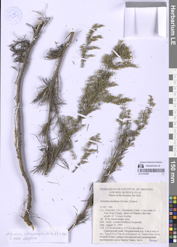
LE 01357099
Artemisia intramongolica H.C. Fu det. Korobkov, Aleksandr Aleksandrovich
Additional identifications: Artemisia macilenta (Maxim.) Krasch. det. Kozhevnikov, Andrey Evgenievich Collectors: Kozhevnikov, Andrey Evgenievich; Kozhevnikova, Zoya Vitaljevna Field collecting number: 187-459. Collection date: 31.08.1997. Administrative regions: RU - Primorskiy Kray - Khankayskiy Rayon. Groups of specimens: Образцы сектора Сибири и Дальнего Востока РоссииOriginal label text:Приморский край, Пограничный район, 4 км к югу от пос. Турий Рог (Турга), побережье оз. Ханка близ устья Второй Речки: травяно-кустарниковые разреженные группировки вдоль берега Ханки, часто.
Coordinates (geographic position): 45° 11′ 51.82″ N, 131° 59′ 44.39″ E ±200 m 70 m a.s.l.Record creation: 2026-01-12, Marina Yarichina, PhotoScan D2Citation: Specimen LE 01357099 // Virtual herbarium of Komarov Botanical Institute RAS — http://re.herbariumle.ru/01357099Lrimorsky terr., Khankaisky distr.: 4 km south of Tury Rog (Turga), shore of Khanka Lake near mouth of Vtoraya Rechka.
Alt. 70 m, forest-steppe zone.
Hab. sandy coastal shrubland, frequently.
LE 01357098
Artemisia intramongolica H.C. Fu det. Korobkov, Aleksandr Aleksandrovich
Collectors: Korobkov, Aleksandr Aleksandrovich Collection date: 21.10.2006. Administrative regions: RU - Primorskiy Kray - Khankayskiy Rayon. Groups of specimens: Образцы сектора Сибири и Дальнего Востока РоссииOriginal label text:Россия, Приморский край, Ханкайский район, берег оз. Ханка около пос. Турий Рог, песчаная терраса, редкие куртины.
Coordinates (geographic position): 45° 13′ 46.53″ N, 131° 59′ 5.61″ E ±200 mRecord creation: 2026-01-12, Marina Yarichina, PhotoScan D2Citation: Specimen LE 01357098 // Virtual herbarium of Komarov Botanical Institute RAS — http://re.herbariumle.ru/01357098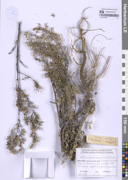
LE 01357097
Artemisia intramongolica H.C. Fu det. Korobkov, Aleksandr Aleksandrovich
Collectors: Korobkov, Aleksandr Aleksandrovich Field collecting number: 07-147. Collection date: 21.10.2006. Administrative regions: RU - Primorskiy Kray - Khankayskiy Rayon. Groups of specimens: Образцы сектора Сибири и Дальнего Востока РоссииOriginal label text:Россия, Приморский край, Ханкайский район, берег оз. Ханка около пос. Турий Рог, песчаная терраса, редкие куртины.
Coordinates (geographic position): 45° 13′ 46.48″ N, 131° 59′ 5.71″ E ±200 mRecord creation: 2026-01-12, Marina Yarichina, PhotoScan D2Citation: Specimen LE 01357097 // Virtual herbarium of Komarov Botanical Institute RAS — http://re.herbariumle.ru/013570972n=36
LE 01357096
Artemisia intramongolica H.C. Fu det. Korobkov, Aleksandr Aleksandrovich
Collectors: Korobkov, Aleksandr Aleksandrovich Collection date: 21.10.2006. Administrative regions: RU - Primorskiy Kray - Khankayskiy Rayon. Groups of specimens: Образцы сектора Сибири и Дальнего Востока РоссииOriginal label text:Россия, Приморский край, Ханкайский район, берег оз. Ханка около пос. Турий Рог, песчаная терраса, редкие куртины.
Coordinates (geographic position): 45° 13′ 36.33″ N, 131° 59′ 0.73″ E ±300 mRecord creation: 2026-01-12, Marina Yarichina, PhotoScan D2Citation: Specimen LE 01357096 // Virtual herbarium of Komarov Botanical Institute RAS — http://re.herbariumle.ru/013570962n=36
LE 01357095
Artemisia intramongolica H.C. Fu det. Korobkov, Aleksandr Aleksandrovich
Collectors: Korobkov, Aleksandr Aleksandrovich Collection date: 21.10.2006. Administrative regions: RU - Primorskiy Kray - Khankayskiy Rayon. Groups of specimens: Образцы сектора Сибири и Дальнего Востока РоссииOriginal label text:Россия, Приморский край, Ханкайский район, берег оз. Ханка около пос. Турий Рог, песчаная терраса, редкие куртины.
Coordinates (geographic position): 45° 13′ 49.7″ N, 131° 59′ 5.57″ E ±300 mRecord creation: 2026-01-12, Marina Yarichina, PhotoScan D2Citation: Specimen LE 01357095 // Virtual herbarium of Komarov Botanical Institute RAS — http://re.herbariumle.ru/01357095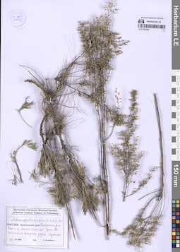
LE 01357094
Artemisia intramongolica H.C. Fu det. Korobkov, Aleksandr Aleksandrovich
Collectors: Korobkov, Aleksandr Aleksandrovich Collection date: 21.10.2006. Administrative regions: RU - Primorskiy Kray - Khankayskiy Rayon. Groups of specimens: Образцы сектора Сибири и Дальнего Востока РоссииOriginal label text:Россия, Приморский край, Ханкайский район, берег оз. Ханка около пос. Турий Рог, песчаная терраса, редкие куртины.
Coordinates (geographic position): 45° 13′ 52.07″ N, 131° 59′ 5.08″ E ±300 mRecord creation: 2026-01-12, Marina Yarichina, PhotoScan D2Citation: Specimen LE 01357094 // Virtual herbarium of Komarov Botanical Institute RAS — http://re.herbariumle.ru/01357094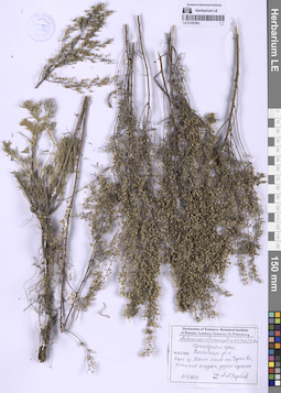
LE 01357093
Artemisia intramongolica H.C. Fu det. Korobkov, Aleksandr Aleksandrovich
Collectors: Korobkov, Aleksandr Aleksandrovich Collection date: 21.10.2006. Administrative regions: RU - Primorskiy Kray - Khankayskiy Rayon. Groups of specimens: Образцы сектора Сибири и Дальнего Востока РоссииOriginal label text:Россия, Приморский край, Ханкайский район, берег оз. Ханка около пос. Турий Рог, песчаная терраса, редкие куртины.
Coordinates (geographic position): 45° 13′ 51.67″ N, 131° 59′ 5.74″ E ±300 mRecord creation: 2026-01-12, Marina Yarichina, PhotoScan D2Citation: Specimen LE 01357093 // Virtual herbarium of Komarov Botanical Institute RAS — http://re.herbariumle.ru/01357093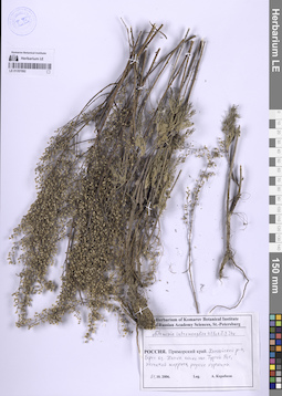
LE 01357092
Artemisia intramongolica H.C. Fu det. Korobkov, Aleksandr Aleksandrovich
Collectors: Korobkov, Aleksandr Aleksandrovich Collection date: 21.10.2006. Administrative regions: RU - Primorskiy Kray - Khankayskiy Rayon. Groups of specimens: Образцы сектора Сибири и Дальнего Востока РоссииOriginal label text:Россия, Приморский край, Ханкайский район, берег оз. Ханка около пос. Турий Рог, песчаная терраса, редкие куртины.
Coordinates (geographic position): 45° 13′ 51.31″ N, 131° 59′ 5.89″ E ±300 mRecord creation: 2026-01-12, Marina Yarichina, PhotoScan D2Citation: Specimen LE 01357092 // Virtual herbarium of Komarov Botanical Institute RAS — http://re.herbariumle.ru/01357092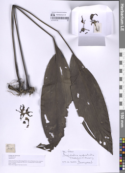
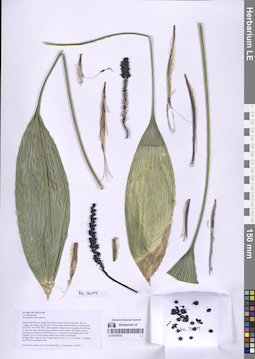
LE 01357120
Aspidistra subrotata Y.Wan & C.C.Huang det. Averyanov, Leonid Vladimirovich at 09.12.2025
Collectors: Nguyen Van Canh Field collecting number: AL3310. Collection date: 09.12.2025. Administrative regions: VN - Tinh Quang Nam. Groups of specimens: L. V. Averyanov specimens; L. V. Averyanov herbarium; Flora of VietnamOriginal label text:FLORA OF VIETNAM
Convallariaceae
Aspidistra sp.
Quang Nam Province, Nam Giang District, Sao La Protection Area, evergreen forest at elevation of about 600-700 m a.s.l., terrestrial herb. Flowers dark purple. Common.
March 2022, Nguyen Van Canh, AL3310.
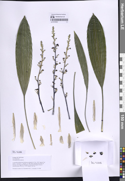
LE 01318333
Peliosanthes teta Andrews det. Averyanov, Leonid Vladimirovich at 27.11.2025
Collectors: Cuong, Huu Nguyen; et al. Field collecting number: AL3019. Collection date: 27.11.2025. Administrative regions: VN - Tinh Thanh Hoa. Groups of specimens: L. V. Averyanov specimens; L. V. Averyanov herbarium; Flora of VietnamOriginal label text:FLORA OF VIETNAM
Convallariaceae
Peliosanthes sp.
Thanh Hoa Province, Quan Hoa District, Nam Dong Community, Ban Lo Village, Ke Stream, the territory of Nam Dong National Reserve around point 22º25’46’’N 105º36’58’E. Old secondary broad-leaved evergreen humid forest on wet very steep alluvial slopes based on solid, marble-like highly eroded limestone at elevation of 600–800 m a.s.l.
Terrestrial rhizomatous herb with big leaf to 0.6 m long on steep shady rocky slope. Occasional.
04 May 2024, Nguyen Huu Cuong, Nguyen Van Ly, L. Averyanov, T. Maisak, AL3019 (living plants only).
LE 01318332
Peliosanthes teta Andrews det. Averyanov, Leonid Vladimirovich at 27.11.2025
Collectors: Nguyen Van Canh Field collecting number: AL1688. Collection date: 27.11.2025. Administrative regions: VN - Vietnam. Groups of specimens: L. V. Averyanov specimens; L. V. Averyanov herbarium; Flora of VietnamOriginal label text:FLORA OF VIETNAM
Convallariaceae
Peliosanthes teta Andrews
Living plant obtained and herbarium prepared at 25 Nov. 2022, Nguyen Van Canh, L. Averyanov, T. Maisak, AL 1688.
Plant originated from Dak Lak Province, Chu Yang Sinh Mountains, broad-leaved evergreen forest at elevations about 700 m a.s.l., 2018, Nguyen Van Can.
Flowered in culture in 7 February 2025, L. Averyanov, T. Maisak, AL1688.