View
Add
Copy
Edit
Delete
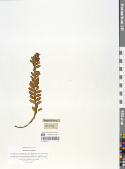
LE 01054972
Appendicula torta Blume det. Averyanov, Leonid Vladimirovich at 09.04.2011
Collectors: The Van Pham Field collecting number: CPC2329. Collection date: 09.04.2011. Administrative regions: VN - Tinh Dien Bien. Groups of specimens: L. V. Averyanov specimens; L. V. Averyanov herbarium; Orchids of Vietnam, Laos and CambodiaOriginal label text:FLORA OF VIETNAM.
Coordinates (geographic position): 21° 12′ 16″ N, 102° 57′ 27″ E ±1000 mRecord creation: 2019-06-11, Leonid Averyanov, PhotoScan D1. Processing status: work_status_1Citation: Specimen LE 01054972 // Virtual herbarium of Komarov Botanical Institute RAS — http://re.herbariumle.ru/01054972Orchidaceae.
Appendicula torta Blume.
Dien Bien Prov., Dien Bien Distr., Na U Municipality, Hua Thanh village, around point 21°12'16"N 102°57'27"E. Highly destroyed primary closed evergreen broad-leaved submontane forest on rocky crystalline marble-like rocky limestone at elevation 1000-1100 m a.s.l. Epiphyte on old trees on rocky top of mountain. Not common. CPC 2329 9 April 2011. Coll.: P.V.The.
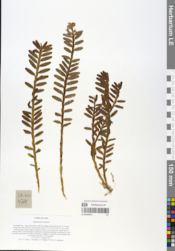
LE 01054971
Appendicula torta Blume det. Averyanov, Leonid Vladimirovich at 15.03.2013
Collectors: Tien Hiep Nguyen; Averyanov, Leonid Vladimirovich; et al. Field collecting number: LA VN474. Collection date: 15.03.2013. Administrative regions: LA - Vientiane Province. Groups of specimens: L. V. Averyanov specimens; L. V. Averyanov herbarium; Orchids of Vietnam, Laos and CambodiaOriginal label text:FLORA OF LAOS.
Coordinates (geographic position): 18° 56′ 11.5″ N, 102° 20′ 5″ E ±1000 mRecord creation: 2019-06-11, Leonid Averyanov, PhotoScan D1. Processing status: work_status_1Citation: Specimen LE 01054971 // Virtual herbarium of Komarov Botanical Institute RAS — http://re.herbariumle.ru/01054971Orchidaceae.
Appendicula torta Blume.
Vientiane Prov., Vang Vieng Distr., Phol Xai village, about 8 km to the W of Vang Vieng town, Phar Poon Mt., around point 18°56'11.5"N 102°20'05.0"E. Dry broad-leaved primary and secondary evergreen forest on very steep rocky slopes and on vertical cliffs of remnant highly eroded rocky limestone mountains composed by solid crystalline limestone at elevation 300-900 m. Epiphyte on tall trees near mountain tops at elevation 800-900 m. Not common. LA-VN 474 15 March 2013. Coll.: N.T.Hiep, L.Averyanov, N.S.Khang, P.V.The, S.Lorphengsy
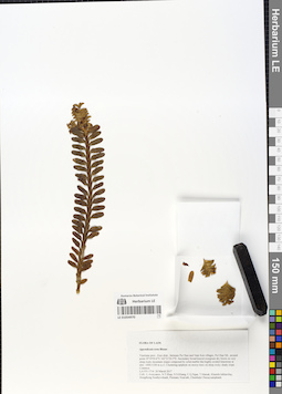
LE 01054970
Appendicula torta Blume det. Averyanov, Leonid Vladimirovich at 26.03.2017
Collectors: Averyanov, Leonid Vladimirovich; et al. Field collecting number: LA VN 1714. Collection date: 26.03.2017. Administrative regions: LA - Vientiane Province. Groups of specimens: L. V. Averyanov specimens; L. V. Averyanov herbarium; Orchids of Vietnam, Laos and CambodiaOriginal label text:FLORA OF LAOS
Orchidaceae
Appendicula torta Blume
Vientiane prov., Kasi distr., between Pa Chao and Nam Ken villages, Pa Chao Mt., around point 19°19'50.6''N 102°21'20.5''E.
Secondary broad-leaved evergreen dry forest on very steep rocky mountain slopes composed by solid marble like highly eroded limestone at elev. 1000-1100 m a.s.l.
Clustering epiphyte on mossy trees on steep rocky shady slope. Common.
LA-VN 1714 26 March 2017
Coll.: L.Averyanov, N.T.Hiep, N.S.Khang, C.Q.Ngan, T.Maisak, Khamla Inkhavilay, Hongthong Southyvohanh, Pinmany Sisavath, Chanthala Cheuaysamphanh.
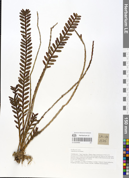
LE 01054969
Appendicula torta Blume det. Averyanov, Leonid Vladimirovich at 23.03.2017
Collectors: Averyanov, Leonid Vladimirovich; et al. Field collecting number: LA VN 1576. Collection date: 23.03.2017. Administrative regions: LA - Vientiane Province. Groups of specimens: L. V. Averyanov specimens; L. V. Averyanov herbarium; Orchids of Vietnam, Laos and CambodiaOriginal label text:FLORA OF LAOS
Orchidaceae
Appendicula torta Blume
Vientiane prov., Vang Vieng distr., Patang village, around point 19°04′15.6′'N 102°24′33.2′'E.
Secondary broad-leaved semi-deciduous dry forest on very steep rocky mountain slopes composed by solid marble like highly eroded limestone at elev. about 670 m a.s.l.
Lithophytic herb. Not common.
LA-VN 1576 23 March 2017
Coll.: L.Averyanov, N.T.Hiep, N.S.Khang, C.Q.Ngan, T.Maisak, Khamla Inkhavilay, Hongthong Southyvohanh, Pinmany Sisavath, Chanthala Cheuaysamphanh.
Coordinates (geographic position): 19° 4′ 15.6″ N, 102° 24′ 33.2″ E ±1000 mRecord creation: 2019-06-11, Leonid Averyanov, PhotoScan D1Citation: Specimen LE 01054969 // Virtual herbarium of Komarov Botanical Institute RAS — http://re.herbariumle.ru/01054969Orchidaceae
Appendicula torta Blume
Vientiane prov., Vang Vieng distr., Patang village, around point 19°04′15.6′'N 102°24′33.2′'E.
Secondary broad-leaved semi-deciduous dry forest on very steep rocky mountain slopes composed by solid marble like highly eroded limestone at elev. about 670 m a.s.l.
Lithophytic herb. Not common.
LA-VN 1576 23 March 2017
Coll.: L.Averyanov, N.T.Hiep, N.S.Khang, C.Q.Ngan, T.Maisak, Khamla Inkhavilay, Hongthong Southyvohanh, Pinmany Sisavath, Chanthala Cheuaysamphanh.
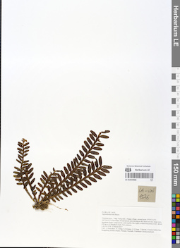
LE 01054968
Appendicula torta Blume det. Averyanov, Leonid Vladimirovich at 23.03.2017
Collectors: Averyanov, Leonid Vladimirovich; et al. Field collecting number: LA VN 1576. Collection date: 23.03.2017. Administrative regions: LA - Vientiane Province. Groups of specimens: L. V. Averyanov specimens; L. V. Averyanov herbarium; Orchids of Vietnam, Laos and CambodiaOriginal label text:FLORA OF LAOS
Orchidaceae
Appendicula torta Blume
Vientiane prov., Vang Vieng distr., Patang village, around point 19°04′15.6′'N 102°24′33.2′'E.
Secondary broad-leaved semi-deciduous dry forest on very steep rocky mountain slopes composed by solid marble like highly eroded limestone at elev. about 670 m a.s.l.
Lithophytic herb. Not common.
LA-VN 1576 23 March 2017
Coll.: L.Averyanov, N.T.Hiep, N.S.Khang, C.Q.Ngan, T.Maisak, Khamla Inkhavilay, Hongthong Southyvohanh, Pinmany Sisavath, Chanthala Cheuaysamphanh.
Orchidaceae
Appendicula torta Blume
Vientiane prov., Vang Vieng distr., Patang village, around point 19°04′15.6′'N 102°24′33.2′'E.
Secondary broad-leaved semi-deciduous dry forest on very steep rocky mountain slopes composed by solid marble like highly eroded limestone at elev. about 670 m a.s.l.
Lithophytic herb. Not common.
LA-VN 1576 23 March 2017
Coll.: L.Averyanov, N.T.Hiep, N.S.Khang, C.Q.Ngan, T.Maisak, Khamla Inkhavilay, Hongthong Southyvohanh, Pinmany Sisavath, Chanthala Cheuaysamphanh.
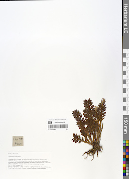
LE 01054967
Appendicula torta Blume det. Averyanov, Leonid Vladimirovich at 28.03.2017
Collectors: Averyanov, Leonid Vladimirovich; Tien Hiep Nguyen; et al. Field collecting number: LA VN1839. Collection date: 28.03.2017. Administrative regions: LA - Vientiane Province. Groups of specimens: L. V. Averyanov specimens; L. V. Averyanov herbarium; Orchids of Vietnam, Laos and CambodiaOriginal label text:FLORA OF LAOS.
Coordinates (geographic position): 19° 6′ 10.9″ N, 102° 10′ 46.1″ E ±1000 mRecord creation: 2019-06-11, Leonid Averyanov, PhotoScan D1. Processing status: work_status_1Citation: Specimen LE 01054967 // Virtual herbarium of Komarov Botanical Institute RAS — http://re.herbariumle.ru/01054967Orchidaceae.
Appendicula torta Blume.
Vientiane prov., Kasi distr., Si Sang Vone village, around point 19°06'10.9"N 102°10'46.1"E. Secondary and primary evergreen dry forest on very steep rocky mountain slopes composed by solid marble like highly eroded limestone at elev. 600-750 m a.s.l. Epiphyte on mossy old tree on rocky mountain top. Not rare. LA-VN 1839 28 March 2017. Coll.: L.Averyanov, N.T.Hiep, N.S.Khang, C.Q.Ngan, T.Maisak, Khamla Inkhavilay, Hongthong Southyvohanh, Pinmany Sisavath, Chanthala Cheuaysamphanh.
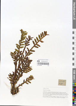
LE 01054966
Appendicula torta Blume det. Averyanov, Leonid Vladimirovich at 25.03.2017
Collectors: Averyanov, Leonid Vladimirovich; Tien Hiep Nguyen; et al. Field collecting number: LA VN1681. Collection date: 25.03.2017. Administrative regions: LA - Vientiane Province. Groups of specimens: L. V. Averyanov specimens; L. V. Averyanov herbarium; Orchids of Vietnam, Laos and CambodiaOriginal label text:FLORA OF LAOS.
Coordinates (geographic position): 19° 17′ 47.9″ N, 102° 8′ 58.9″ E ±1000 mRecord creation: 2019-06-11, Leonid Averyanov, PhotoScan D1. Processing status: work_status_1Citation: Specimen LE 01054966 // Virtual herbarium of Komarov Botanical Institute RAS — http://re.herbariumle.ru/01054966Orchidaceae.
Appendicula torta Blume.
Vientiane prov., Kasi distr., between San and Tham Tai villages, around point 19°17'47.9"N 102°08'58.9"E. Secondary broad-leaved evergreen dry forest on very steep rocky mountain slopes composed by solid marble like highly eroded limestone at elev. 900-1000 m a.s.l. Epiphyte on tall mossy trees on shady rocky slope. Not rare. LA-VN 1681 25 March 2017. Coll.: L.Averyanov, N.T.Hiep, N.S.Khang, C.Q.Ngan, T.Maisak, Khamla Inkhavilay, Hongthong Southyvohanh, Pinmany Sisavath, Chanthala Cheuaysamphanh.
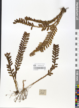
LE 01054965
Appendicula torta Blume det. Averyanov, Leonid Vladimirovich at 26.03.2017
Collectors: Averyanov, Leonid Vladimirovich; et al. Field collecting number: LA VN 1714. Collection date: 26.03.2017. Administrative regions: LA - Vientiane Province. Groups of specimens: L. V. Averyanov specimens; L. V. Averyanov herbarium; Orchids of Vietnam, Laos and CambodiaOriginal label text:FLORA OF LAOS
Orchidaceae
Appendicula torta Blume
Vientiane prov., Kasi distr., between Pa Chao and Nam Ken villages, Pa Chao Mt., around point 19°19'50.6''N 102°21'20.5''E.
Secondary broad-leaved evergreen dry forest on very steep rocky mountain slopes composed by solid marble like highly eroded limestone at elev. 1000-1100 m a.s.l.
Clustering epiphyte on mossy trees on steep rocky shady slope. Common.
LA-VN 1714 26 March 2017
Coll.: L.Averyanov, N.T.Hiep, N.S.Khang, C.Q.Ngan, T.Maisak, Khamla Inkhavilay, Hongthong Southyvohanh, Pinmany Sisavath, Chanthala Cheuaysamphanh.
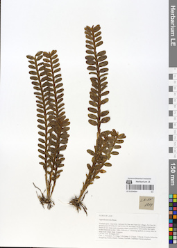
LE 01054964
Appendicula torta Blume det. Averyanov, Leonid Vladimirovich at 26.03.2017
Collectors: Averyanov, Leonid Vladimirovich; et al. Field collecting number: LA VN 1714. Collection date: 26.03.2017. Administrative regions: LA - Vientiane Province. Groups of specimens: L. V. Averyanov specimens; L. V. Averyanov herbarium; Orchids of Vietnam, Laos and CambodiaOriginal label text:FLORA OF LAOS
Orchidaceae
Appendicula torta Blume
Vientiane prov., Kasi distr., between Pa Chao and Nam Ken villages, Pa Chao Mt., around point 19°19'50.6''N 102°21'20.5''E.
Secondary broad-leaved evergreen dry forest on very steep rocky mountain slopes composed by solid marble like highly eroded limestone at elev. 1000-1100 m a.s.l.
Clustering epiphyte on mossy trees on steep rocky shady slope. Common.
LA-VN 1714 26 March 2017
Coll.: L.Averyanov, N.T.Hiep, N.S.Khang, C.Q.Ngan, T.Maisak, Khamla Inkhavilay, Hongthong Southyvohanh, Pinmany Sisavath, Chanthala Cheuaysamphanh.
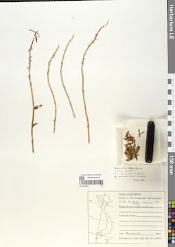
LE 01054963
Appendicula reflexa Blume det. Averyanov, Leonid Vladimirovich at 1987
Collectors: Averyanov, Leonid Vladimirovich Field collecting number: LX-VN A7701 , LX-VN A7702. Collection date: 10.08.1987. Administrative regions: VN - Vietnam. Groups of specimens: L. V. Averyanov specimens; L. V. Averyanov herbarium; Orchids of Vietnam, Laos and CambodiaOriginal label text:FLORA VIETNAMICA
Record creation: 2019-06-11, Leonid Averyanov, PhotoScan D1Citation: Specimen LE 01054963 // Virtual herbarium of Komarov Botanical Institute RAS — http://re.herbariumle.ru/01054963Soviet - Vietnamese Expedition
LX-VN A 7701 A.7702
Orchidaceae
Appendicula reflexa Blume
Vietnam sine loc., sine dt., sine coll., sine num.
Fl. et coll in horto 10.08.1987
Det. Averyanov L. 1987
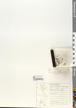
LE 01054962
Appendicula reflexa Blume det. Averyanov, Leonid Vladimirovich at 1987
Collectors: Averyanov, Leonid Vladimirovich; et al. Field collecting number: LX-VN s.n. GN 0/299. Collection date: 1983. Administrative regions: VN - Vietnam. Groups of specimens: L. V. Averyanov specimens; L. V. Averyanov herbarium; Orchids of Vietnam, Laos and CambodiaOriginal label text:FLORA VIETNAMICA
Soviet – Vietnamese Expedition
LX-VN s.n. Garden Number 0/299
1983
Orchidaceae
Appendicula reflexa Blume
Soviet – Vietnamese Expedition
LX-VN s.n. Garden Number 0/299
1983
Orchidaceae
Appendicula reflexa Blume
Vietnam. "83-299"
Fl. et coll. in horto 10.08.1987
Det.: L. Averyanov 1987
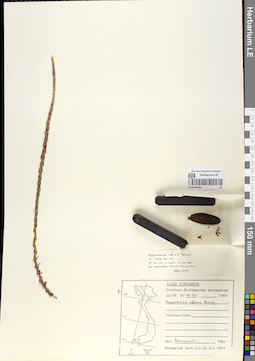
LE 01054961
Appendicula reflexa Blume det. Averyanov, Leonid Vladimirovich at 1987
Collectors: Averyanov, Leonid Vladimirovich; et al. Field collecting number: LX-VN s.n. GN 83-237. Collection date: 1987. Administrative regions: VN - Vietnam. Groups of specimens: L. V. Averyanov specimens; L. V. Averyanov herbarium; Orchids of Vietnam, Laos and CambodiaOriginal label text:FLORA VIETNAMICA
Soviet – Vietnamese Expedition
LX-VN s.n. Garden Number 83-237
1987
Orchidaceae
Appendicula reflexa Blume
Vietnam. "OPB 83-237"
Fl. et coll. in horto 10.08.1987
Det.: L. Averyanov 1987
Soviet – Vietnamese Expedition
LX-VN s.n. Garden Number 83-237
1987
Orchidaceae
Appendicula reflexa Blume
Vietnam. "OPB 83-237"
Fl. et coll. in horto 10.08.1987
Det.: L. Averyanov 1987
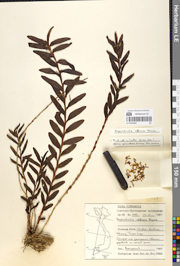
LE 01054960
Appendicula reflexa Blume det. Averyanov, Leonid Vladimirovich at 07.01.1989
Collectors: Averyanov, Leonid Vladimirovich; et al. Field collecting number: LX-VN 4287. Collection date: 07.01.1989. Administrative regions: VN - Gia Lai; VN - Kon Tum. Groups of specimens: L. V. Averyanov specimens; L. V. Averyanov herbarium; Orchids of Vietnam, Laos and CambodiaOriginal label text:FLORA VIETNAMICA
Soviet – Vietnamese Expedition
LX-VN 4287
07.01.1989
Orchidaceae
Appendicula reflexa Blume
Vietnam. Prov. Gia Lai Kon Tum, Kbang, Tram Lap.
Soviet – Vietnamese Expedition
LX-VN 4287
07.01.1989
Orchidaceae
Appendicula reflexa Blume
Vietnam. Prov. Gia Lai Kon Tum, Kbang, Tram Lap.
Fl. et coll. in horto 24.06.1991
Det.: L. Averyanov 07.01.1989
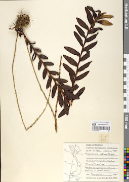
LE 01054959
Appendicula reflexa Blume det. Averyanov, Leonid Vladimirovich at 07.01.1989
Collectors: Averyanov, Leonid Vladimirovich; et al. Field collecting number: LX-VN 4287. Collection date: 07.01.1989. Administrative regions: VN - Gia Lai; VN - Kon Tum. Groups of specimens: L. V. Averyanov specimens; L. V. Averyanov herbarium; Orchids of Vietnam, Laos and CambodiaOriginal label text:FLORA VIETNAMICA
Soviet – Vietnamese Expedition
LX-VN 4287
07.01.1989
Orchidaceae
Appendicula reflexa Blume
LX-VN 4287
07.01.1989
Orchidaceae
Appendicula reflexa Blume
Vietnam. Prov. Gia Lai Kon Tum, Kbang, Tram Lap.
Det.: L. Averyanov 07.01.1989
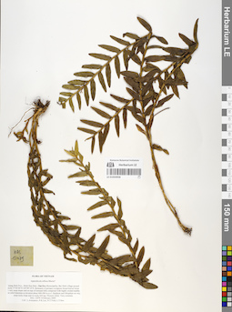
LE 01054958
Appendicula reflexa Blume ⟮prelim. ID⟯ det. Averyanov, Leonid Vladimirovich at 08.02.2009
Collectors: Averyanov, Leonid Vladimirovich; Phan Ke Loc; et al. Field collecting number: HAL12479. Collection date: 08.02.2009. Administrative regions: VN - Tinh Quang Binh. Groups of specimens: L. V. Averyanov specimens; L. V. Averyanov herbarium; Orchids of Vietnam, Laos and CambodiaOriginal label text:FLORA OF VIETNAM.
Coordinates (geographic position): 17° 44′ 4″ N, 105° 49′ 14″ E ±1000 mRecord creation: 2019-06-11, Leonid Averyanov, PhotoScan D1. Processing status: work_status_1Citation: Specimen LE 01054958 // Virtual herbarium of Komarov Botanical Institute RAS — http://re.herbariumle.ru/01054958Orchidaceae.
Appendicula reflexa Blume?
Quang Binh Prov., Minh Hoa Distr., Dan Hoa Municipality, Bai Dinh village around point 17°44'04"N 105°49'14"E. Remnants of primary evergreen broad-leaved forest on very steep slopes and on tops of remnant hills composed with highly eroded marble-like solid limestone at elevation about 400-500 m a.s.l. Epiphyte and lithophyte on very steep rocky slope near to rocky hill top. Flowers white. Very common. HAL 12479 8 February 2009. Coll.: L.Averyanov, P.K.Loc, N.T.Vinh, L.T.Son.
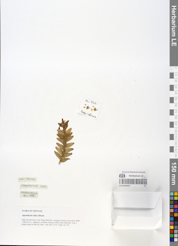
LE 01054957
Appendicula reflexa Blume det. Averyanov, Leonid Vladimirovich at 2017
Collectors: Nguyen Van Canh Field collecting number: AL327. Collection date: 07.2017. Administrative regions: VN - Tinh GJak Lak. Groups of specimens: L. V. Averyanov specimens; L. V. Averyanov herbarium; Orchids of Vietnam, Laos and CambodiaOriginal label text:FLORA OF VIETNAM.
Record creation: 2019-06-11, Leonid Averyanov, PhotoScan D1. Processing status: work_status_1Citation: Specimen LE 01054957 // Virtual herbarium of Komarov Botanical Institute RAS — http://re.herbariumle.ru/01054957Appendicula reflexa Blume.
Dak Lak province, Chu Yang Sinh Mt., evergreen forest at elevation 1000-1100 m a.s.l., epiphyte, common, flowers white with yellowish, with 2 purple spots on the lip, June - July 2017, N.V. Canh, AL 327.
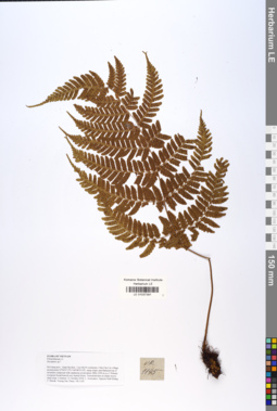
LE 01037391
Dryopteris sparsa (D.Don) Kuntze det. Averyanov, Leonid Vladimirovich at 07.09.2019
Additional identifications: Dryopteris sp. det. Averyanov, Leonid Vladimirovich at 21.10.2018 Collectors: Averyanov, Leonid Vladimirovich; Khang Sinh Nguyen; Maisak, Tatiana Viktorovna; Truong Duc Thieu Field collecting number: VR1145. Collection date: 21.10.2018. Administrative regions: VN - Tinh Ha Giang. Groups of specimens: L. V. Averyanov specimens; L. V. Averyanov herbarium; L. V. Averyanov photosOriginal label text:FLORA OF VIETNAM
Coordinates (geographic position): 23° 4′ 47.2″ N, 104° 48′ 55.6″ E ±1000 mComment: Polypodiaceae s.l.
Dryopteris sp.?
Ha Giang prov., Quan Ba distr., Cao Ma Po commune, Chin Chu Lin village, around point 23º04ʹ47.2ʺN 104º48ʹ55.6ʺE, steep slopes and flattened top of mountain composed with sandstone at elevation 1800–1950 m a.s.l. Primary evergreen broad-leaved very humid forest. Terrestrial fern on shady mossy steep slope. Common. 21 October 2018, L. Averyanov, Nguyen Sinh Khang, T. Maisak, Truong Duc Thieu, VR 1145.
All photos © L. Averyanov & K.S. Nguyen
Record creation: 2019-06-11, Leonid Averyanov, PhotoScan D1Citation: Specimen LE 01037391 // Virtual herbarium of Komarov Botanical Institute RAS — http://re.herbariumle.ru/01037391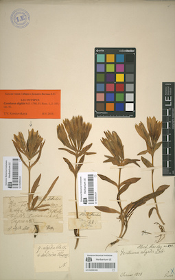
LE 01053128
Gentiana algida Pall. det. Turczaninow, Nicolai Stepanowisch
Collectors: Turczaninow, Nicolai Stepanowisch Collection date: 1828. Administrative regions: RU - Irkutskaya Oblast' - Slyudyanskiy Rayon. Groups of specimens: Образцы сектора Сибири и Дальнего Востока России; Herb. FischerOriginal label text:Chamar
Record creation: 2019-06-10, Marina Yarichina, from old scansCitation: Specimen LE 01053128 // Virtual herbarium of Komarov Botanical Institute RAS — http://re.herbariumle.ru/01053128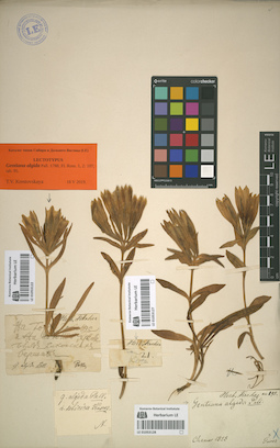
LE 01053127
Gentiana algida Pall.
Field collecting number: 21. Groups of specimens: Образцы сектора Сибири и Дальнего Востока России; Herb. FischerRecord creation: 2019-06-10, Marina Yarichina, from old scansCitation: Specimen LE 01053127 // Virtual herbarium of Komarov Botanical Institute RAS — http://re.herbariumle.ru/01053127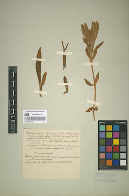
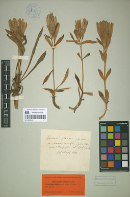
LE 01053126
Specimen originale of Gentiana algida Pall. det. Krestovskaya, Tatiana Valerievna at 05.2019
Additional identifications: Gentiana algida Pall. det. Pott, Johann Friedrich Collectors: Pallas, Peter (Pyotr) Simon von Collection date: 1773. Administrative regions: RU - Zabaykal'skiy Kray. Groups of specimens: Типовые образцы сектора Сибири и Дальнего Востока РоссииOriginal label text:Gentiana algida Pall. Fl. Ross. Tom. I. P. II. p. 214... Fl. in patris Augusto. Hab. in summis cacuminibus et jugis alpium Sibiriae orientalis, in Davuria et in Camschatka. Ibidem legit Dr. Prof. Pallas et misit 776 1778 [этикетку полностью писал J.F. Pott]
LE 01053125
Specimen originale of Gentiana algida Pall. det. Krestovskaya, Tatiana Valerievna at 18.05.2019
Collectors: Georgi, Johann Gottlieb Collection date: 08.1772. Administrative regions: RU - Respublika Buryatiya - Barguzinskiy Rayon. Groups of specimens: Типовые образцы сектора Сибири и Дальнего Востока РоссииOriginal label text:In summis montibus sylvatibus inter Bargusin et Kutschida.
Sub. nom. "Gentiana flammea sp. nova."
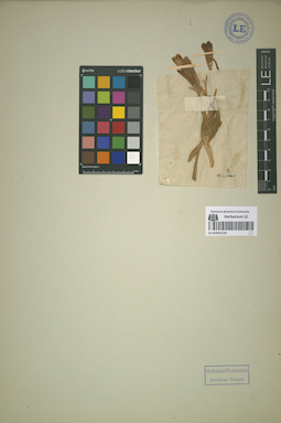
LE 01053124
Gentiana algida Pall.
Administrative regions: RU - Irkutskaya Oblast'. Groups of specimens: Образцы сектора Сибири и Дальнего Востока России; Hb. StellerRecord creation: 2019-06-10, Marina Yarichina, from old scansCitation: Specimen LE 01053124 // Virtual herbarium of Komarov Botanical Institute RAS — http://re.herbariumle.ru/01053124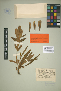
LE 01053123
Isolectotype of Gentiana algida Pall. det. Krestovskaya, Tatiana Valerievna at 18.05.2019
Collectors: Sokolov, Nikita Petrovich Collection date: 1773. Administrative regions: RU - Zabaykal'skiy Kray - Chitinskiy Rayon. Топоним: голец Сохондо (Сохондо). Groups of specimens: Типовые образцы сектора Сибири и Дальнего Востока РоссииOriginal label text:На горе Чоконде близ самых снегов и на верху Яблоннова хребта около Чикойских ве[р]шин
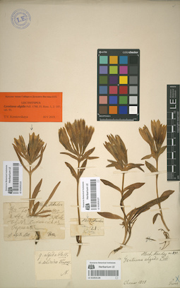
LE 01053122
Lectotype of Gentiana algida Pall. det. Krestovskaya, Tatiana Valerievna at 18.05.2019
Additional identifications: Gentiana algida Pall. Collectors: Pallas, Peter (Pyotr) Simon von; Sokolov, Nikita Petrovich Collection date: 1773. Administrative regions: RU - Zabaykal'skiy Kray - Chitinskiy Rayon. Топоним: голец Сохондо (Сохондо). Groups of specimens: Типовые образцы сектора Сибири и Дальнего Востока России; Herb. FischerOriginal label text:На горе Чоконде и на Яблонном хребте близ Чикойских вершин
[31 VII – 3 VIII 1773] - дата сбора приводится ориентировочно, согласно дневникам экспедиции
Lectotype publ.: 2019, Turczaninowia 22 (3): 125.
Record creation: 2019-06-10, Marina Yarichina, from old scansCitation: Specimen LE 01053122 // Virtual herbarium of Komarov Botanical Institute RAS — http://re.herbariumle.ru/01053122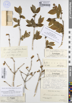
LE 01051383
Record creation: 2019-06-10, Marina Yarichina, from old scansCitation: Specimen LE 01051383 // Virtual herbarium of Komarov Botanical Institute RAS — http://re.herbariumle.ru/01051383
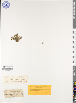
LE 01050644
Record creation: 2019-06-10, Marina Yarichina, from old scansCitation: Specimen LE 01050644 // Virtual herbarium of Komarov Botanical Institute RAS — http://re.herbariumle.ru/01050644
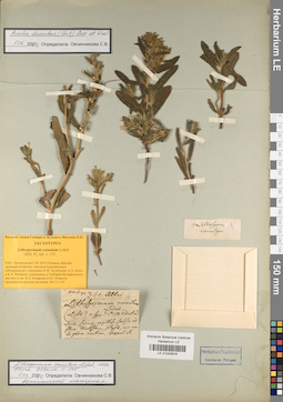
LE 01043916
Additional identifications: Lithospermum cornutum Ledeb. det. Meyer, Carl Anton von at 1826; Arnebia decumbens (Vent.) Coss. & Kralik det. Ovchinnikova Svetlana Vasilievna at 05.06.2010; Lectotype of Lithospermum cornutum Ledeb. det. Ovchinnikova Svetlana Vasilievna at 24.12.2018 Collectors: Meyer, Carl Anton von Field collecting number: 361. Collection date: 06.05.1826. Administrative regions: KZ - East Kazakhstan. Expedition: Экспедиция на Алтай и в Восточный Казахстан (1826 -1826)Groups of specimens: Типовые образцы сектора Сибири и Дальнего Востока России; Herb. C.A. MeyerOriginal label text:
Altai. Locis siccis argiloso-salsis ad fluv. Kurtchum, Irtysch, nec non ad pagum montis Arcaul et Dolenkara. [часть текста находится на обороте этикетки!]
Record creation: 2019-06-10, Marina Yarichina, from old scansCitation: Specimen LE 01043916 // Virtual herbarium of Komarov Botanical Institute RAS — http://re.herbariumle.ru/01043916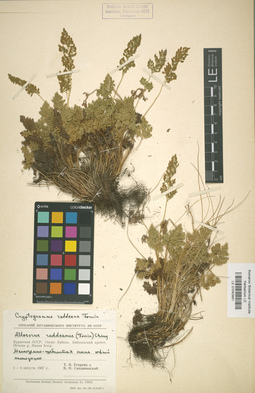
LE 01043881
Cryptogramma raddeana Fomin
Collectors: Egorova, Tatiana Vladimirovna; Siplivinsky, Vladimir Nikolaevich Collection date: 01.08.1967. Administrative regions: RU - Respublika Buryatiya - Severo-Baykal'skiy Rayon. Original label text:Бурятская АССР, озеро Байкал, Байкальский хребет, истоки р. Малая Коса. Мелкоземно-щебнистая осыпь южной экспозиции.
Coordinates (geographic position): 54° 44′ 25.54″ N, 108° 43′ 6.41″ ERecord creation: 2019-06-10, Marina Yarichina, from old scansCitation: Specimen LE 01043881 // Virtual herbarium of Komarov Botanical Institute RAS — http://re.herbariumle.ru/01043881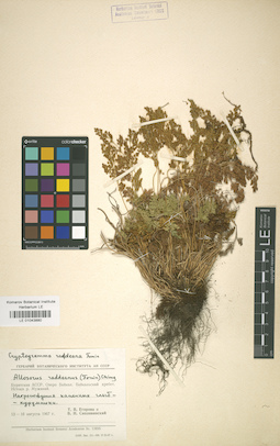
LE 01043880
Cryptogramma raddeana Fomin
Collectors: Egorova, Tatiana Vladimirovna; Siplivinsky, Vladimir Nikolaevich Collection date: 13.08.1967. Administrative regions: RU - Respublika Buryatiya - Severo-Baykal'skiy Rayon. Original label text:Бурятская АССР, озеро Байкал, Байкальский хребет, истоки р. Мужинай. Нагромождение каменных глыб - курумники.
Coordinates (geographic position): 54° 54′ 45.42″ N, 108° 44′ 47.99″ E ±1000 mRecord creation: 2019-06-10, Marina Yarichina, from old scansCitation: Specimen LE 01043880 // Virtual herbarium of Komarov Botanical Institute RAS — http://re.herbariumle.ru/01043880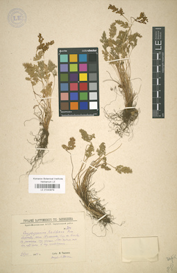
LE 01043879
Cryptogramma raddeana Fomin det. Tjulina (Tyulina), Lyudmila Nikolaevna
Collectors: Tjulina (Tyulina), Lyudmila Nikolaevna Field collecting number: 750. Collection date: 26.08.1943. Administrative regions: RU - Respublika Buryatiya - Severo-Baykal'skiy Rayon. Original label text:Бурят-Монгольская АССР, Баргузинский район.
Record creation: 2019-06-10, Marina Yarichina, from old scansCitation: Specimen LE 01043879 // Virtual herbarium of Komarov Botanical Institute RAS — http://re.herbariumle.ru/01043879Верховья речки Шумилиха (близ села Сосновка). На россыпях над озером, альпийский-субальпийский пояс. На подъеме.
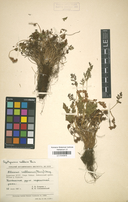
LE 01043878
Cryptogramma raddeana Fomin
Collectors: Siplivinsky, Vladimir Nikolaevich; Egorova, Tatiana Vladimirovna Collection date: 10.07.1967. Administrative regions: RU - Respublika Buryatiya - Severo-Baykal'skiy Rayon. Original label text:Бурятская АССР, озеро Байкал, Байкальский хребет, истоки р. Куркула. Каменистое русло пересохшей реки.
Record creation: 2019-06-10, Marina Yarichina, from old scansCitation: Specimen LE 01043878 // Virtual herbarium of Komarov Botanical Institute RAS — http://re.herbariumle.ru/01043878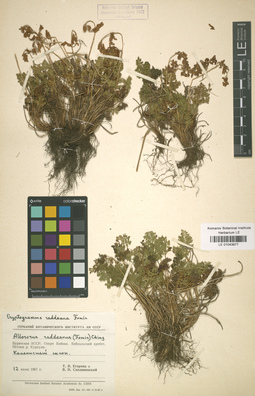
LE 01043877
Cryptogramma raddeana Fomin
Collectors: Egorova, Tatiana Vladimirovna; Siplivinsky, Vladimir Nikolaevich Collection date: 12.07.1967. Administrative regions: RU - Respublika Buryatiya - Severo-Baykal'skiy Rayon. Original label text:Бурятская АССР, озеро Байкал, Байкальский хребет, истоки р. Куркула. Каменистый слон.
Record creation: 2019-06-10, Marina Yarichina, from old scansCitation: Specimen LE 01043877 // Virtual herbarium of Komarov Botanical Institute RAS — http://re.herbariumle.ru/01043877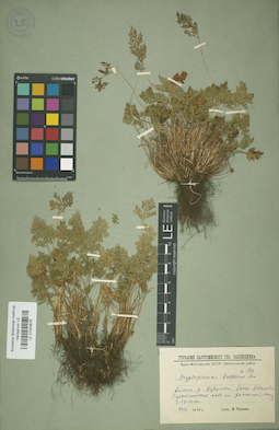
LE 01043876
Cryptogramma raddeana Fomin det. Tjulina (Tyulina), Lyudmila Nikolaevna
Collectors: Tjulina (Tyulina), Lyudmila Nikolaevna Field collecting number: 500. Collection date: 20.07.1940. Administrative regions: RU - Respublika Buryatiya - Severo-Baykal'skiy Rayon. Original label text:Бурят-Монгольская АССР. Баргузинский район.
Record creation: 2019-06-10, Marina Yarichina, from old scansCitation: Specimen LE 01043876 // Virtual herbarium of Komarov Botanical Institute RAS — http://re.herbariumle.ru/01043876Долина р. Кудалкан, выше водопада. Субальпийский пояс, на россыпи между глыбами.
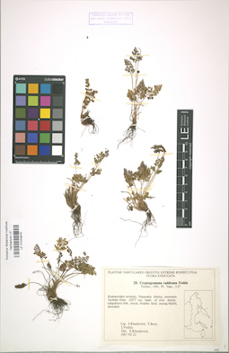
LE 01043875
Cryptogramma raddeana Fomin det. Kharkevich, Sigismund Semenovich
Collectors: Kharkevich, Sigismund Semenovich; Butsch, Tamara Georgievna; Vyshin, Igor Borisovich Field collecting number: 28. Collection date: 22.07.1983. Administrative regions: RU - Khabarovskiy Kray - Nanayskiy Rayon. Groups of specimens: Plantae vasculares Orientis Extremi Rossici (VLA). Flora ExsiccataOriginal label text:Khabarovsky territory, Nanayskiy distr., mountain Tardoky-Yany (2077 m), basin of river Anyuy, subgoltzovy belt, circus, boulder field, among blocks, abundant.
Coordinates (geographic position): 48° 53′ 52.42″ N, 138° 3′ 12.04″ E ±1000 m, 2077 m a.s.l.Record creation: 2019-06-10, Marina Yarichina, from old scansCitation: Specimen LE 01043875 // Virtual herbarium of Komarov Botanical Institute RAS — http://re.herbariumle.ru/01043875
LE 01043836
Tulipa uniflora (L.) Besser & Backer
Collectors: Maltzev, Nicolai Ivanovich Collection date: 02.05.1907. Groups of specimens: Образцы сектора Сибири и Дальнего Востока РоссииCoordinates (geographic position): 54° 24′ 24.2″ N, 103° 17′ 54.87″ E ±1000 mComment:Растение в цветах.
Record creation: 2019-06-10, Marina Yarichina, from old scansCitation: Specimen LE 01043836 // Virtual herbarium of Komarov Botanical Institute RAS — http://re.herbariumle.ru/01043836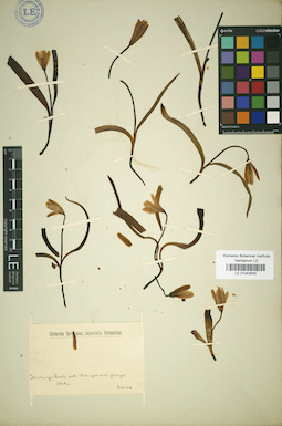
LE 01043835
Tulipa uniflora (L.) Besser & Backer
Collectors: Turczaninow, Nicolai Stepanowisch Administrative regions: RU - Irkutskaya Oblast'. Groups of specimens: Образцы сектора Сибири и Дальнего Востока РоссииRecord creation: 2019-06-10, Marina Yarichina, from old scansCitation: Specimen LE 01043835 // Virtual herbarium of Komarov Botanical Institute RAS — http://re.herbariumle.ru/01043835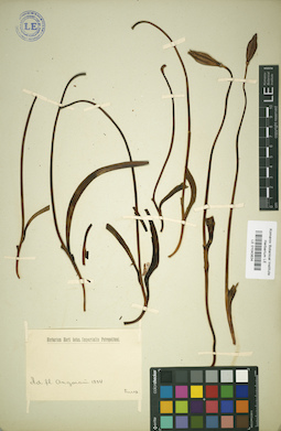
LE 01043834
Tulipa uniflora (L.) Besser & Backer
Collectors: Turczaninow, Nicolai Stepanowisch Administrative regions: RU - Irkutskaya Oblast'. Groups of specimens: Образцы сектора Сибири и Дальнего Востока РоссииRecord creation: 2019-06-10, Marina Yarichina, from old scansCitation: Specimen LE 01043834 // Virtual herbarium of Komarov Botanical Institute RAS — http://re.herbariumle.ru/01043834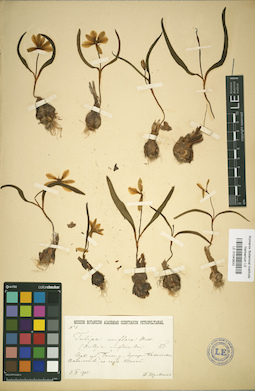
LE 01043833
Tulipa uniflora (L.) Besser & Backer det. Borodin, Ivan Parfenevich
Collectors: Shul'gin, Prokopiy Ivanovich Administrative regions: RU - Irkutskaya Oblast' - Ziminskiy Rayon. Groups of specimens: Образцы сектора Сибири и Дальнего Востока РоссииRecord creation: 2019-06-10, Marina Yarichina, from old scansCitation: Specimen LE 01043833 // Virtual herbarium of Komarov Botanical Institute RAS — http://re.herbariumle.ru/01043833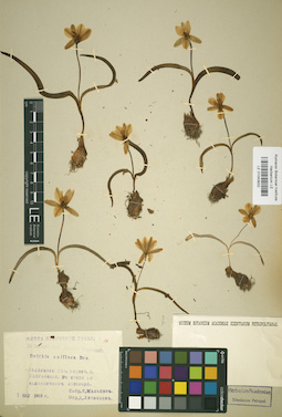
LE 01043832
Tulipa uniflora (L.) Besser & Backer
Collectors: Maltzev, Nicolai Ivanovich Administrative regions: RU - Irkutskaya Oblast' - Balaganskiy Rayon. Groups of specimens: Образцы сектора Сибири и Дальнего Востока РоссииRecord creation: 2019-06-10, Marina Yarichina, from old scansCitation: Specimen LE 01043832 // Virtual herbarium of Komarov Botanical Institute RAS — http://re.herbariumle.ru/01043832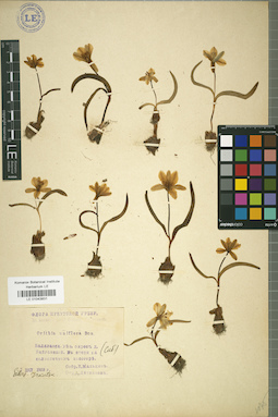
LE 01043831
Tulipa uniflora (L.) Besser & Backer
Collectors: Maltzev, Nicolai Ivanovich Administrative regions: RU - Irkutskaya Oblast' - Balaganskiy Rayon. Groups of specimens: Образцы сектора Сибири и Дальнего Востока РоссииRecord creation: 2019-06-10, Marina Yarichina, from old scansCitation: Specimen LE 01043831 // Virtual herbarium of Komarov Botanical Institute RAS — http://re.herbariumle.ru/01043831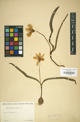
LE 01043830
Tulipa uniflora (L.) Besser & Backer
Collectors: Maltzev, Nicolai Ivanovich Administrative regions: RU - Irkutskaya Oblast' - Balaganskiy Rayon. Groups of specimens: Образцы сектора Сибири и Дальнего Востока РоссииRecord creation: 2019-06-10, Marina Yarichina, from old scansCitation: Specimen LE 01043830 // Virtual herbarium of Komarov Botanical Institute RAS — http://re.herbariumle.ru/01043830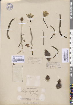
LE 01043829
Tulipa uniflora (L.) Besser & Backer det. Glehn, Peter von.
Collectors: Czekanowski, Alexander Piotr Field collecting number: 1. Collection date: 23.04.1867. Administrative regions: RU - Irkutskaya Oblast' - Bratskiy Rayon. Place of collection: д. Пьянова (берег Братского водохранилища).Groups of specimens: Образцы сектора Сибири и Дальнего Востока РоссииOriginal label text:Am den zeimlich steilen Sundidehange des Angara Thales in W Niederung des Dorfes Pianowa, ... № 3 Alyssum № 8й Pulsatilla № 4 - ...
Coordinates (geographic position): 56° 4′ 22.2″ N, 101° 41′ 58.86″ E ±200 mComment: Inter Irkutzk et Jenisseisk, ad fl. Angara (Tunguska super.) prope pagum Padun.
Пьянова была затоплена при постройке Братского водохранилища. Располагалась между Братским и Падунским острогом (нынешний Братск).
Record creation: 2019-06-10, Marina Yarichina, from old scansCitation: Specimen LE 01043829 // Virtual herbarium of Komarov Botanical Institute RAS — http://re.herbariumle.ru/01043829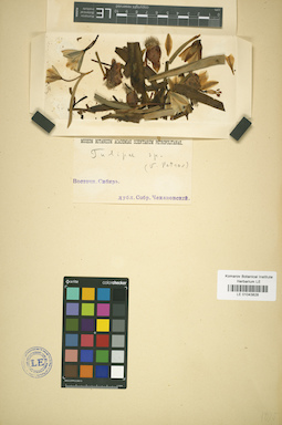
LE 01043828
Tulipa uniflora (L.) Besser & Backer
Collectors: Czekanowski, Alexander Piotr Collection date: 04.1867. Administrative regions: RU - Irkutskaya Oblast' - Bratsk Urban Okrug. Топоним: Падун (Братск). Groups of specimens: Образцы сектора Сибири и Дальнего Востока РоссииOriginal label text:Восточная Сибирь
Coordinates (geographic position): 56° 18′ 9.96″ N, 101° 48′ 10.89″ E ±2000 mRecord creation: 2019-06-10, Marina Yarichina, from old scansCitation: Specimen LE 01043828 // Virtual herbarium of Komarov Botanical Institute RAS — http://re.herbariumle.ru/01043828Inter Irkutzk et Jenisseisk, ad fl. Angara (Tunguska super.) prope pagum Padun
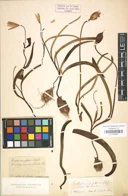
LE 01043827
Tulipa uniflora (L.) Besser & Backer
Collectors: Turczaninow, Nicolai Stepanowisch Administrative regions: RU - Irkutskaya Oblast'. Groups of specimens: Образцы сектора Сибири и Дальнего Востока РоссииRecord creation: 2019-06-10, Marina Yarichina, from old scansCitation: Specimen LE 01043827 // Virtual herbarium of Komarov Botanical Institute RAS — http://re.herbariumle.ru/01043827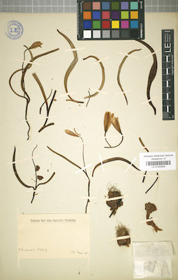
LE 01043826
Tulipa uniflora (L.) Besser & Backer
Collectors: Schukin, Semen Semenovich Administrative regions: RU - Irkutskaya Oblast'. Groups of specimens: Образцы сектора Сибири и Дальнего Востока РоссииRecord creation: 2019-06-10, Marina Yarichina, from old scansCitation: Specimen LE 01043826 // Virtual herbarium of Komarov Botanical Institute RAS — http://re.herbariumle.ru/01043826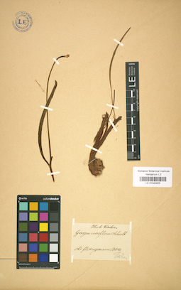
LE 01043825
Tulipa uniflora (L.) Besser & Backer
Collectors: Turczaninow, Nicolai Stepanowisch Administrative regions: RU - Irkutskaya Oblast'. Groups of specimens: Образцы сектора Сибири и Дальнего Востока РоссииRecord creation: 2019-06-10, Marina Yarichina, from old scansCitation: Specimen LE 01043825 // Virtual herbarium of Komarov Botanical Institute RAS — http://re.herbariumle.ru/01043825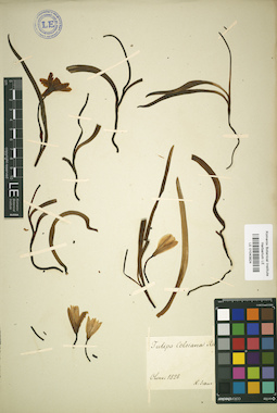
LE 01043824
Tulipa uniflora (L.) Besser & Backer
Collectors: Schukin, Semen Semenovich Administrative regions: RU - Irkutskaya Oblast'. Groups of specimens: Образцы сектора Сибири и Дальнего Востока РоссииRecord creation: 2019-06-10, Marina Yarichina, from old scansCitation: Specimen LE 01043824 // Virtual herbarium of Komarov Botanical Institute RAS — http://re.herbariumle.ru/01043824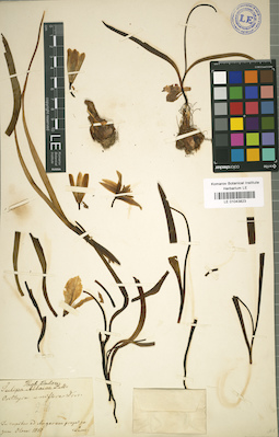
LE 01043823
Tulipa uniflora (L.) Besser & Backer
Collectors: Turczaninow, Nicolai Stepanowisch Administrative regions: RU - Irkutskaya Oblast'. Groups of specimens: Образцы сектора Сибири и Дальнего Востока РоссииRecord creation: 2019-06-10, Marina Yarichina, from old scansCitation: Specimen LE 01043823 // Virtual herbarium of Komarov Botanical Institute RAS — http://re.herbariumle.ru/01043823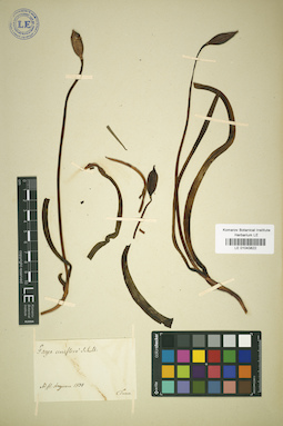
LE 01043822
Tulipa uniflora (L.) Besser & Backer
Collectors: Turczaninow, Nicolai Stepanowisch Administrative regions: RU - Irkutskaya Oblast'. Groups of specimens: Образцы сектора Сибири и Дальнего Востока РоссииRecord creation: 2019-06-10, Marina Yarichina, from old scansCitation: Specimen LE 01043822 // Virtual herbarium of Komarov Botanical Institute RAS — http://re.herbariumle.ru/01043822