View
Add
Copy
Edit
Delete
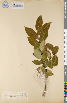
LE 01080360
Salix pentandra L.
Collectors: Novopokrovsky, Ivan Vassiljevich; Krascheninnikov, Ippolit (Hippolit) Mikhailovich Field collecting number: 655. Collection date: 30.06.1915. Administrative regions: RU - Bashkortostan. Expedition: Геоботаническое (Ботанико-географическое) обследование Уфимской губернии (1915 -1916)Groups of specimens: Образцы сектора Восточной ЕвропыRecord creation: 2020-12-01, Denis Melnikov, PhotoScan D2Citation: Specimen LE 01080360 // Virtual herbarium of Komarov Botanical Institute RAS — http://re.herbariumle.ru/01080360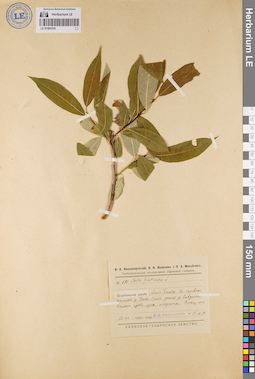
LE 01080359
Salix pentandra L. det. Novopokrovsky, Ivan Vassiljevich at 1916
Collectors: Novopokrovsky, Ivan Vassiljevich; Yakovlev V. N. Field collecting number: 191. Collection date: 15.06.1916. Administrative regions: RU - Bashkortostan - Belebeyevskiy Rayon. Expedition: Геоботаническое (Ботанико-географическое) обследование Уфимской губернии (1915 -1916)Groups of specimens: Образцы сектора Восточной ЕвропыOriginal label text:Уфимская губерния, Белебеевский уезд, близ Белебея. В заливной долине реки Усеня, близ устья речки Сивушки. Колок среди луга, опушка. Площадка №16.
Coordinates (geographic position): 54° 6′ 39.88″ N, 54° 12′ 9.57″ E ±500 mRecord creation: 2020-12-01, Denis Melnikov, PhotoScan D2Citation: Specimen LE 01080359 // Virtual herbarium of Komarov Botanical Institute RAS — http://re.herbariumle.ru/01080359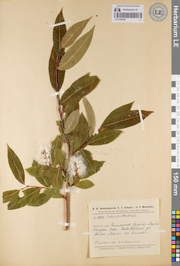
LE 01080358
Salix pentandra L. det. Novopokrovsky, Ivan Vassiljevich at 1915
Collectors: Novopokrovsky, Ivan Vassiljevich Field collecting number: 1260. Collection date: 19.07.1915. Administrative regions: RU - Bashkortostan - Chishminskiy Rayon. Expedition: Геоботаническое (Ботанико-географическое) обследование Уфимской губернии (1915 -1916)Groups of specimens: Образцы сектора Восточной ЕвропыOriginal label text:Уфимская губерния и уезд, Чишминская сельско-хозяйственная станция, заповедный участок. Пойма, лес на болоте.
Coordinates (geographic position): 54° 33′ 42.3″ N, 55° 26′ 33.75″ E ±1000 mRecord creation: 2020-12-01, Denis Melnikov, PhotoScan D2Citation: Specimen LE 01080358 // Virtual herbarium of Komarov Botanical Institute RAS — http://re.herbariumle.ru/01080358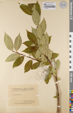
LE 01080357
Salix pentandra L. det. Novopokrovsky, Ivan Vassiljevich at 1915
Collectors: Novopokrovsky, Ivan Vassiljevich; Zaytzev, E. S.; Mikhailov, Petr Christophorowicz Field collecting number: 655. Collection date: 1915. Administrative regions: RU - Bashkortostan - Sterlitamakskiy Rayon. Expedition: Геоботаническое (Ботанико-географическое) обследование Уфимской губернии (1915 -1916)Groups of specimens: Образцы сектора Восточной ЕвропыOriginal label text:Уфимская губерния, Стерлитамакский уезд.
Record creation: 2020-12-01, Denis Melnikov, PhotoScan D2Citation: Specimen LE 01080357 // Virtual herbarium of Komarov Botanical Institute RAS — http://re.herbariumle.ru/01080357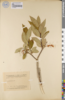
LE 01080356
Salix pentandra L. det. Novopokrovsky, Ivan Vassiljevich at 1915
Collectors: Novopokrovsky, Ivan Vassiljevich; Zaytzev, E. S.; Mikhailov, Petr Christophorowicz Field collecting number: 655. Collection date: 1915. Administrative regions: RU - Bashkortostan - Sterlitamakskiy Rayon. Expedition: Геоботаническое (Ботанико-географическое) обследование Уфимской губернии (1915 -1916)Groups of specimens: Образцы сектора Восточной ЕвропыOriginal label text:Уфимская губерния, Стерлитамакский уезд.
Record creation: 2020-12-01, Denis Melnikov, PhotoScan D2Citation: Specimen LE 01080356 // Virtual herbarium of Komarov Botanical Institute RAS — http://re.herbariumle.ru/01080356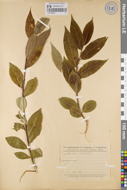
LE 01080355
Salix pentandra L. det. Novopokrovsky, Ivan Vassiljevich at 1916
Collectors: Novopokrovsky, Ivan Vassiljevich Field collecting number: 1680. Collection date: 1916. Administrative regions: RU - Bashkortostan - Belebeyevskiy Rayon. Expedition: Геоботаническое (Ботанико-географическое) обследование Уфимской губернии (1915 -1916)Groups of specimens: Образцы сектора Восточной ЕвропыOriginal label text:Уфимская губерния, Белебеевский уезд.
Record creation: 2020-12-01, Denis Melnikov, PhotoScan D2Citation: Specimen LE 01080355 // Virtual herbarium of Komarov Botanical Institute RAS — http://re.herbariumle.ru/01080355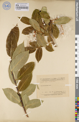
LE 01080354
Salix pentandra L. det. Novopokrovsky, Ivan Vassiljevich at 1915
Collectors: Novopokrovsky, Ivan Vassiljevich; Zaytzev, E. S.; Mikhailov, Petr Christophorowicz Field collecting number: 655. Collection date: 1915. Administrative regions: RU - Bashkortostan - Sterlitamakskiy Rayon. Expedition: Геоботаническое (Ботанико-географическое) обследование Уфимской губернии (1915 -1916)Groups of specimens: Образцы сектора Восточной ЕвропыOriginal label text:Уфимская губерния, Стерлитамакский уезд.
Record creation: 2020-12-01, Denis Melnikov, PhotoScan D2Citation: Specimen LE 01080354 // Virtual herbarium of Komarov Botanical Institute RAS — http://re.herbariumle.ru/01080354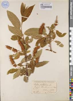
LE 01080353
Salix pentandra L. det. Korshinsky, Sergei Ivanovitsch at 1886
Collectors: Korshinsky, Sergei Ivanovitsch Collection date: 23.06.1886. Administrative regions: RU - Bashkortostan - Karaidel'skiy Rayon. Groups of specimens: Образцы сектора Восточной ЕвропыOriginal label text:Gubernia Ufa., distr. Birsk. [Уфимская губерния, Бирский кантон], между деревнями Явгельдиным и Араткулом.
Coordinates (geographic position): 55° 49′ 34.07″ N, 56° 26′ 50.01″ E ±2000 mRecord creation: 2020-12-01, Denis Melnikov, PhotoScan D2Citation: Specimen LE 01080353 // Virtual herbarium of Komarov Botanical Institute RAS — http://re.herbariumle.ru/01080353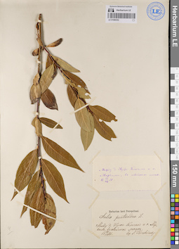
LE 01080352
Salix pentandra L. det. Korshinsky, Sergei Ivanovitsch at 1881
Collectors: Korshinsky, Sergei Ivanovitsch Collection date: 21.08.1881. Administrative regions: RU - Respublika Mariy-El - Morkinskiy Rayon. Groups of specimens: Образцы сектора Восточной ЕвропыOriginal label text:Между деревней Нуж-Ключем и селом Морками, в хвойных лесах.
Coordinates (geographic position): 56° 25′ 7.16″ N, 49° 9′ 44.2″ E ±3000 mRecord creation: 2020-12-01, Denis Melnikov, PhotoScan D2Citation: Specimen LE 01080352 // Virtual herbarium of Komarov Botanical Institute RAS — http://re.herbariumle.ru/01080352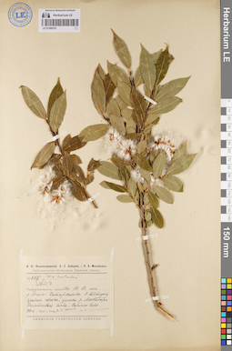
LE 01080351
Salix pentandra L. det. Novopokrovsky, Ivan Vassiljevich at 1915
Collectors: Zaytzev, E. S.; Novopokrovsky, Ivan Vassiljevich Field collecting number: 655. Collection date: 30.06.1915. Administrative regions: RU - Bashkortostan - Fedorovskiy Rayon. Expedition: Геоботаническое (Ботанико-географическое) обследование Уфимской губернии (1915 -1916)Groups of specimens: Образцы сектора Восточной ЕвропыOriginal label text:Уфимская губерния, Стерлитамакский уезд, к юго-востоку от деревни Бала-Чатырманова. У подножья правого склона долины реки Ашкадара. Болотистая почва. Заросли Salix.
Coordinates (geographic position): 53° 4′ 32.13″ N, 55° 24′ 15.66″ E ±1000 mRecord creation: 2020-12-01, Denis Melnikov, PhotoScan D2Citation: Specimen LE 01080351 // Virtual herbarium of Komarov Botanical Institute RAS — http://re.herbariumle.ru/01080351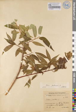
LE 01080350
Salix pentandra L. det. Nevski, Sergei Arsenjevic at 02.02.1931
Collectors: Grebner, Wladimir Wladimirovich Field collecting number: 606. Collection date: 23.07.1929. Administrative regions: RU - Orenburgskaya Oblast' - Gayskiy Rayon. Groups of specimens: Образцы сектора Восточной ЕвропыOriginal label text:Оренбургский округ, Новопокровский район, окрестности станции Халилов, аллювии у Губерли.
Coordinates (geographic position): 51° 23′ 59.9″ N, 58° 9′ 50.9″ E ±1000 mRecord creation: 2020-12-01, Denis Melnikov, PhotoScan D2Citation: Specimen LE 01080350 // Virtual herbarium of Komarov Botanical Institute RAS — http://re.herbariumle.ru/01080350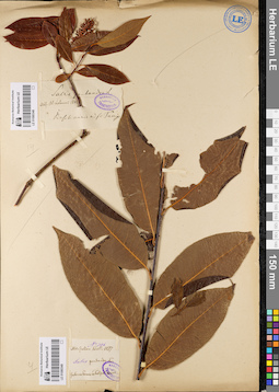
LE 01080348
Salix pentandra L. det. Trautvetter, Rudolf Ernst von
Collectors: Lehmann, Alexander Adolfovich Collection date: 1841. Administrative regions: RU - Bashkortostan. Groups of specimens: Образцы сектора Восточной Европы; Herbarium TrautvetterOriginal label text:Baschkiria, ad flumen ....
Record creation: 2020-12-01, Denis Melnikov, PhotoScan D2. Processing status: label contains unreadable dataCitation: Specimen LE 01080348 // Virtual herbarium of Komarov Botanical Institute RAS — http://re.herbariumle.ru/01080348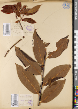
LE 01080349
Salix pentandra L.
Collectors: Schell, Julian K. Field collecting number: 396. Collection date: 1877. Administrative regions: RUSverdlovskaya Oblast' - Talitskiy Rayon. Groups of specimens: Образцы сектора Восточной ЕвропыOriginal label text:Gubernia Perm, Talizki sawod
Coordinates (geographic position): 57° 0′ 37.32″ N, 63° 43′ 34.72″ E ±2000 mRecord creation: 2020-12-01, Denis Melnikov, PhotoScan D2Citation: Specimen LE 01080349 // Virtual herbarium of Komarov Botanical Institute RAS — http://re.herbariumle.ru/01080349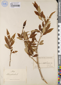
LE 01080347
Salix pentandra L. det. Teplouchow, Fedor (Theodor) Alexandrowitsch
Collectors: Korshinsky, Sergei Ivanovitsch Collection date: 22.06.1886. Administrative regions: RU - Bashkortostan - Bakalinskiy Rayon. Groups of specimens: Образцы сектора Восточной ЕвропыOriginal label text:Gubernia Ufa., distr. Birsk. [Уфимская губерния, Бирский кантон], Деревня Дяушева. В озере.
Coordinates (geographic position): 55° 4′ 54.4″ N, 53° 39′ 39.38″ E ±1000 mRecord creation: 2020-12-01, Denis Melnikov, PhotoScan D2Citation: Specimen LE 01080347 // Virtual herbarium of Komarov Botanical Institute RAS — http://re.herbariumle.ru/01080347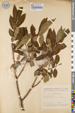
LE 01080346
Salix pentandra L.
Collectors: Petrov, Vsevolod Alekxeevich Collection date: 23.07.1915. Administrative regions: RU - Bashkortostan - Ishimbayskiy Rayon. Expedition: Геоботаническое (Ботанико-географическое) обследование Уфимской губернии (1915 -1916)Groups of specimens: Образцы сектора Восточной ЕвропыOriginal label text:Уфимская губерния, Стерлитамакский уезд, окрестности реки Зимзи (бассейн реки Урюка).
Coordinates (geographic position): 53° 16′ 6.67″ N, 56° 49′ 20.01″ E ±2000 mRecord creation: 2020-12-01, Denis Melnikov, PhotoScan D2Citation: Specimen LE 01080346 // Virtual herbarium of Komarov Botanical Institute RAS — http://re.herbariumle.ru/01080346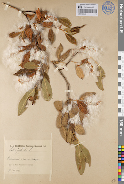
LE 01080345
Salix pentandra L. det. Bulavkina-Onchukova, Anna Aleksandrovna at 18.07.1912
Collectors: Bulavkina-Onchukova, Anna Aleksandrovna Collection date: 18.07.1912. Administrative regions: RU - Chelyabinskaya Oblast' - Katav-Ivanovskiy Rayon. Groups of specimens: Образцы сектора Восточной ЕвропыOriginal label text:Уфимская губерния, окрестности Катав-Ивановского завода, ольшанник к западу от завода.
Coordinates (geographic position): 54° 45′ 20.24″ N, 58° 11′ 22.24″ E ±1000 mRecord creation: 2020-12-01, Denis Melnikov, PhotoScan D2Citation: Specimen LE 01080345 // Virtual herbarium of Komarov Botanical Institute RAS — http://re.herbariumle.ru/01080345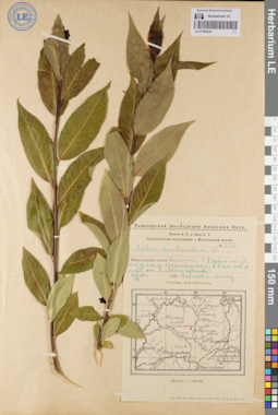
LE 01080344
Salix pentandra L. det. Noskov, Aleksandr Kupriyanovich, Lind, Adolf Genrih Ehduardovich at 1929
Collectors: Noskov, Aleksandr Kupriyanovich; Lind, Adolf Genrih Ehduardovich Field collecting number: 137. Collection date: 05.07.1929. Administrative regions: RU - Bashkortostan - Duvanskiy Rayon. Expedition: Башкирская экспедиция Академии наук. Геоботанические исследования в Месягутовском кантоне (1928 -1930)Groups of specimens: Образцы сектора Восточной ЕвропыOriginal label text:Башкирия, Месягутовский кантон, болото в 1,5 км на запад от деревни Каракулево, в 8 км на запад от села Месягутово.
Coordinates (geographic position): 55° 34′ 29.39″ N, 58° 7′ 36.17″ E ±200 mRecord creation: 2020-12-01, Denis Melnikov, PhotoScan D2Citation: Specimen LE 01080344 // Virtual herbarium of Komarov Botanical Institute RAS — http://re.herbariumle.ru/01080344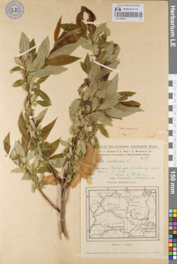
LE 01080343
Additional identifications: Salix pentandra L. det. Noskov, Aleksandr Kupriyanovich, Mikhailov, Petr Christophorowicz at 1928; Salix pentandra L. det. Nasarow, Mikhail Ivanovich at 1929 Collectors: Noskov, Aleksandr Kupriyanovich; Mikhailov, Petr Christophorowicz Field collecting number: 57. Administrative regions: RU - Bashkortostan - Kiginskiy Rayon. Expedition: Башкирская экспедиция Академии наук. Геоботанические исследования в Месягутовском кантоне (1928 -1930)Groups of specimens: Образцы сектора Восточной ЕвропыOriginal label text:
Башкирия, Месягутовский кантон, сырой луг по левому пологому берегу реки Киги, около села Верхние Киги.
Coordinates (geographic position): 55° 25′ 39.1″ N, 58° 35′ 4.98″ E ±1000 mComment: Текст этикетки частично закрыт
Record creation: 2020-12-01, Denis Melnikov, PhotoScan D2. Processing status: label contains unreadable data; special marks (look in the comment)Citation: Specimen LE 01080343 // Virtual herbarium of Komarov Botanical Institute RAS — http://re.herbariumle.ru/01080343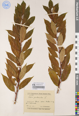
LE 01080342
Salix pentandra L. det. Ovczinnikov, Pavel Nikolaevich at 1925
Collectors: Ovczinnikov, Pavel Nikolaevich Field collecting number: 53. Collection date: 11.08.1925. Administrative regions: RU - Bashkortostan - Mishkinskiy Rayon. Groups of specimens: Образцы сектора Восточной ЕвропыOriginal label text:Башкирия, Бирский кантон, вдоль речки Шадыи к югу от деревни Чабыково [Чебыково].
Coordinates (geographic position): 55° 29′ 49.88″ N, 55° 42′ 21.98″ E ±1000 mRecord creation: 2020-12-01, Denis Melnikov, PhotoScan D2Citation: Specimen LE 01080342 // Virtual herbarium of Komarov Botanical Institute RAS — http://re.herbariumle.ru/01080342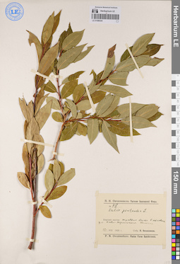
LE 01080341
Salix pentandra L. det. Ovczinnikov, Pavel Nikolaevich at 1925
Collectors: Ovczinnikov, Pavel Nikolaevich Field collecting number: 78. Collection date: 12.08.1925. Administrative regions: RU - Bashkortostan - Mishkinskiy Rayon. Groups of specimens: Образцы сектора Восточной ЕвропыOriginal label text:Башкирия, Бирский кантон, травяное болото в котловине западнее села Ново-Троицкого. Одиночно.
Coordinates (geographic position): 55° 44′ 29.07″ N, 56° 11′ 59.5″ E ±500 mRecord creation: 2020-12-01, Denis Melnikov, PhotoScan D2Citation: Specimen LE 01080341 // Virtual herbarium of Komarov Botanical Institute RAS — http://re.herbariumle.ru/01080341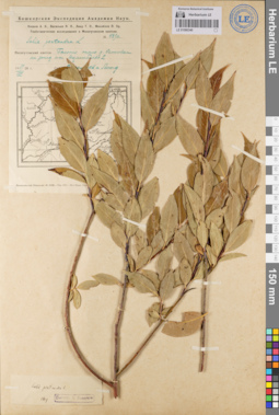
LE 01080340
Additional identifications: Salix pentandra L. det. Vassiljev, Jakov Jakovlevitch, Lind, Adolf Genrih Ehduardovich at 1928; Salix pentandra L. det. Nasarow, Mikhail Ivanovich at 1929 Collectors: Vassiljev, Jakov Jakovlevitch; Lind, Adolf Genrih Ehduardovich Field collecting number: 489а. Collection date: 19.08.1928. Administrative regions: RU - Bashkortostan - Salavatskiy Rayon. Expedition: Башкирская экспедиция Академии наук. Геоботанические исследования в Месягутовском кантоне (1928 -1930)Groups of specimens: Образцы сектора Восточной ЕвропыOriginal label text:
Башкирия, Месягутовский кантон, болото около деревни Осиновки на запад от
Coordinates (geographic position): 55° 24′ 50.72″ N, 57° 46′ 33.27″ E ±500 mRecord creation: 2020-12-01, Denis Melnikov, PhotoScan D2Citation: Specimen LE 01080340 // Virtual herbarium of Komarov Botanical Institute RAS — http://re.herbariumle.ru/01080340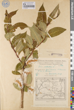
LE 01080339
Additional identifications: Salix pentandra L. det. Vassiljev, Jakov Jakovlevitch, Lind, Adolf Genrih Ehduardovich at 1928; Salix pentandra L. det. Nasarow, Mikhail Ivanovich at 1929 Collectors: Vassiljev, Jakov Jakovlevitch; Lind, Adolf Genrih Ehduardovich Field collecting number: 431а. Collection date: 15.08.1928. Administrative regions: RU - Bashkortostan - Salavatskiy Rayon. Expedition: Башкирская экспедиция Академии наук. Геоботанические исследования в Месягутовском кантоне (1928 -1930)Groups of specimens: Образцы сектора Восточной ЕвропыOriginal label text:
Башкирия, Месягутовский кантон, край болота в 3 км на N [север] от села Аркаул.
Coordinates (geographic position): 55° 25′ 35.67″ N, 57° 55′ 30.34″ E ±200 mRecord creation: 2020-12-01, Denis Melnikov, PhotoScan D2Citation: Specimen LE 01080339 // Virtual herbarium of Komarov Botanical Institute RAS — http://re.herbariumle.ru/01080339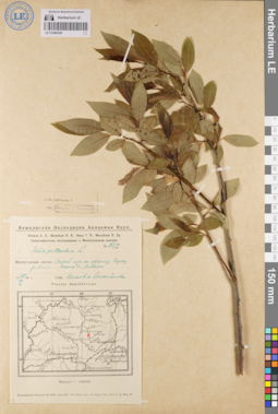
LE 01080338
Additional identifications: Salix pentandra L. det. Noskov, Aleksandr Kupriyanovich, Mikhailov, Petr Christophorowicz at 1928; Salix pentandra L. det. Nasarow, Mikhail Ivanovich at 1929 Collectors: Noskov, Aleksandr Kupriyanovich; Mikhailov, Petr Christophorowicz Field collecting number: 53/I. Collection date: 25.06.1928. Administrative regions: RU - Bashkortostan - Kiginskiy Rayon. Expedition: Башкирская экспедиция Академии наук. Геоботанические исследования в Месягутовском кантоне (1928 -1930)Groups of specimens: Образцы сектора Восточной ЕвропыOriginal label text:
Башкирия, Месягутовский кантон, сырой луг по левому берегу реки Киги, около села Верхние Киги.
Coordinates (geographic position): 55° 22′ 36.97″ N, 58° 36′ 23.78″ E ±2000 mRecord creation: 2020-12-01, Denis Melnikov, PhotoScan D2Citation: Specimen LE 01080338 // Virtual herbarium of Komarov Botanical Institute RAS — http://re.herbariumle.ru/01080338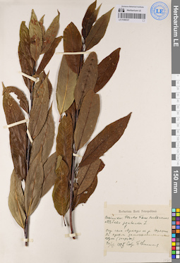
LE 01080337
Salix pentandra L. ⟮s. l.⟯ det. Ovczinnikov, Pavel Nikolaevich at 1925
Collectors: Ovczinnikov, Pavel Nikolaevich Field collecting number: 328. Collection date: 20.08.1925. Administrative regions: RU - Bashkortostan - Salavatskiy Rayon. Groups of specimens: Образцы сектора Восточной ЕвропыOriginal label text:Башкирия, окрестности села Аркаул на реке Юрезани [Юрюзани]. По краям заторфованного озерка (запруды).
Coordinates (geographic position): 55° 23′ 27.38″ N, 57° 55′ 16.37″ E ±200 mRecord creation: 2020-12-01, Denis Melnikov, PhotoScan D2Citation: Specimen LE 01080337 // Virtual herbarium of Komarov Botanical Institute RAS — http://re.herbariumle.ru/01080337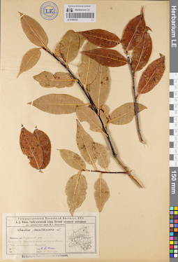
LE 01080336
Salix pentandra L. det. Nasarow, Mikhail Ivanovich at 1929
Collectors: Fokin, Alexander Dmitrievich Field collecting number: 4722. Collection date: 22.09.1929. Administrative regions: RU - Kirovskaya Oblast' - Verkhnekamskiy Rayon. Expedition: Вятская почвенная экспедиция Государственного Почвенного Института НКЗ (1928 -1929)Groups of specimens: Образцы сектора Восточной ЕвропыOriginal label text:Вятская губерния, Омутнинский уезд. Куст до 7 м высоты в пойме левого берега реки Камы в 3 км выше устья реки Нырмича.
Coordinates (geographic position): 59° 41′ 13.78″ N, 52° 36′ 23.96″ E ±500 mRecord creation: 2020-12-01, Denis Melnikov, PhotoScan D2Citation: Specimen LE 01080336 // Virtual herbarium of Komarov Botanical Institute RAS — http://re.herbariumle.ru/01080336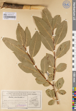
LE 01080335
Salix pentandra L. det. Nasarow, Mikhail Ivanovich at 1929
Collectors: Kolokolnikov, Leonid Borisovich Field collecting number: 4228. Collection date: 13.08.1929. Administrative regions: RU - Kirovskaya Oblast' - Omutninskiy Rayon. Expedition: Вятская почвенная экспедиция Государственного Почвенного Института НКЗ (1928 -1929)Groups of specimens: Образцы сектора Восточной ЕвропыOriginal label text:Вятская губерния, Омутнинский уезд, Омутнинская казенная лесная дача в 38 км от Черной Холуницы по дороге в город Омутнинск, между Бисеровским починком и городом Омутнинском. Дерево 7 м высоты.
Coordinates (geographic position): 58° 41′ 11.4″ N, 52° 11′ 4.41″ E ±1500 mRecord creation: 2020-12-01, Denis Melnikov, PhotoScan D2Citation: Specimen LE 01080335 // Virtual herbarium of Komarov Botanical Institute RAS — http://re.herbariumle.ru/01080335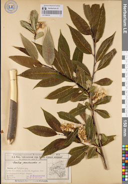
LE 01080334
Salix pentandra L. det. Nasarow, Mikhail Ivanovich at 1929
Collectors: Kolokolnikov, Leonid Borisovich Field collecting number: 3458. Collection date: 09.07.1929. Administrative regions: RU - Kirovskaya Oblast' - Belokholunitskiy Rayon. Expedition: Вятская почвенная экспедиция Государственного Почвенного Института НКЗ (1928 -1929)Groups of specimens: Образцы сектора Восточной ЕвропыOriginal label text:Вятская губерния, Слободской уезд. Деревце 2,5 м высоты на берегу реки Белой Холуницы близ Бело-Холуницкого завода. Изредка.
Coordinates (geographic position): 58° 50′ 21″ N, 50° 50′ 21.03″ E ±500 mRecord creation: 2020-12-01, Denis Melnikov, PhotoScan D2Citation: Specimen LE 01080334 // Virtual herbarium of Komarov Botanical Institute RAS — http://re.herbariumle.ru/01080334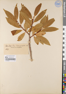
LE 01080333
Salix pentandra L.
Collectors: Anonymous Collection date: 1925. Administrative regions: RU - Chelyabinskaya Oblast'. Groups of specimens: Образцы сектора Восточной ЕвропыOriginal label text:Златоустовский округ. Горн. Кори.
Record creation: 2020-12-01, Denis Melnikov, PhotoScan D2Citation: Specimen LE 01080333 // Virtual herbarium of Komarov Botanical Institute RAS — http://re.herbariumle.ru/01080333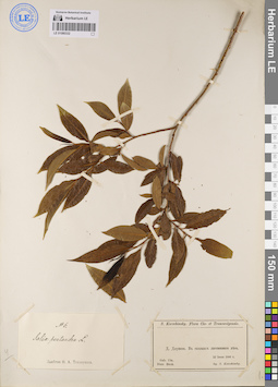
LE 01080332
Salix pentandra L. det. Teplouchow, Fedor (Theodor) Alexandrowitsch
Collectors: Korshinsky, Sergei Ivanovitsch Collection date: 22.06.1886. Administrative regions: RU - Bashkortostan - Bakalinskiy Rayon. Groups of specimens: Образцы сектора Восточной ЕвропыOriginal label text:Gubernia Ufa., distr. Birsk. [Уфимская губерния, Бирский кантон], Деревня Дяушева. В сколках лиственного леса.
Coordinates (geographic position): 55° 4′ 57.15″ N, 53° 38′ 48.44″ E ±2000 mRecord creation: 2020-12-01, Denis Melnikov, PhotoScan D2Citation: Specimen LE 01080332 // Virtual herbarium of Komarov Botanical Institute RAS — http://re.herbariumle.ru/01080332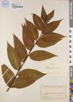
LE 01080331
Salix pentandra L. det. Teplouchow, Fedor (Theodor) Alexandrowitsch
Collectors: Korshinsky, Sergei Ivanovitsch Collection date: 30.07.1887. Administrative regions: RU - Sverdlovskaya Oblast' - Shalinskiy Rayon. Groups of specimens: Образцы сектора Восточной ЕвропыOriginal label text:Gubernia Perm., distr. Krassnoufimsk [Пермская губерния, Красноуфимский округ], Уткинский завод. В травяно-торфяном болоте за рекой Чусовой.
Coordinates (geographic position): 57° 10′ 44.67″ N, 59° 22′ 35.09″ E ±3000 mRecord creation: 2020-12-01, Denis Melnikov, PhotoScan D2Citation: Specimen LE 01080331 // Virtual herbarium of Komarov Botanical Institute RAS — http://re.herbariumle.ru/01080331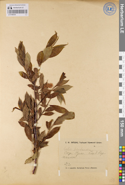
LE 01080330
Salix pentandra L. det. Lipschitz, Sergej Julievitsch at 1920
Collectors: Lipschitz, Sergej Julievitsch Collection date: 30.05.1929. Administrative regions: RU - Bashkortostan - Ufimskiy Rayon. Groups of specimens: Образцы сектора Восточной ЕвропыOriginal label text:Окрестности Уфы, близ деревни Киржацкой.
Coordinates (geographic position): 54° 45′ 59.3″ N, 55° 53′ 49.01″ E ±1000 mRecord creation: 2020-12-01, Denis Melnikov, PhotoScan D2Citation: Specimen LE 01080330 // Virtual herbarium of Komarov Botanical Institute RAS — http://re.herbariumle.ru/01080330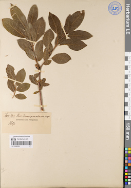
LE 01080329
Salix pentandra L.
Collectors: Anonymous Collection date: 1925. Administrative regions: RU - Chelyabinskaya Oblast'. Groups of specimens: Образцы сектора Восточной ЕвропыOriginal label text:Златоустовский округ. Горн. Кори.
Record creation: 2020-12-01, Denis Melnikov, PhotoScan D2Citation: Specimen LE 01080329 // Virtual herbarium of Komarov Botanical Institute RAS — http://re.herbariumle.ru/01080329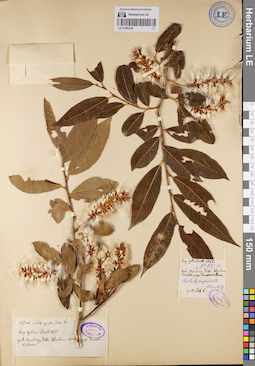
LE 01080328
Additional identifications: Salix pentandra L. det. Trautvetter, Rudolf Ernst von; Salix cuspidata Schultz det. Schell, Julian K. at 1878 Collectors: Schell, Julian K. Field collecting number: 227а. Collection date: 1878. Administrative regions: RU - Kurganskaya Oblast' - Al'menevskiy Rayon. Groups of specimens: Образцы сектора Восточной Европы; Herbarium TrautvetterOriginal label text:
Gubernia Orenburg, distr. Werchne-Uralsk, prope Kasakkulowa
Coordinates (geographic position): 54° 54′ 51″ N, 63° 12′ 15″ E ±2000 mRecord creation: 2020-12-01, Denis Melnikov, PhotoScan D2Citation: Specimen LE 01080328 // Virtual herbarium of Komarov Botanical Institute RAS — http://re.herbariumle.ru/01080328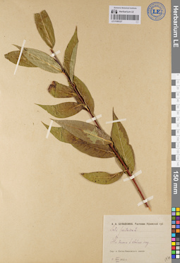
LE 01080327
Salix pentandra L. det. Bulavkina-Onchukova, Anna Aleksandrovna at 1912
Collectors: Bulavkina-Onchukova, Anna Aleksandrovna Collection date: 11.08.1912. Administrative regions: RU - Chelyabinskaya Oblast' - Katav-Ivanovskiy Rayon. Groups of specimens: Образцы сектора Восточной ЕвропыOriginal label text:Уфимская губерния, окрестности Катав-Ивановского завода. На болоте в хвойном лесу.
Coordinates (geographic position): 54° 44′ 52.07″ N, 58° 12′ 20.85″ E ±500 mRecord creation: 2020-12-01, Denis Melnikov, PhotoScan D2Citation: Specimen LE 01080327 // Virtual herbarium of Komarov Botanical Institute RAS — http://re.herbariumle.ru/01080327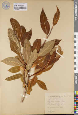
LE 01080326
Salix pentandra L. det. Bulavkina-Onchukova, Anna Aleksandrovna at 25.07.1912
Collectors: Bulavkina-Onchukova, Anna Aleksandrovna Collection date: 25.07.1912. Administrative regions: RU - Chelyabinskaya Oblast' - Katav-Ivanovskiy Rayon. Groups of specimens: Образцы сектора Восточной ЕвропыOriginal label text:Уфимская губерния. Окрестности Катав-Ивановского завода, на склоне Зигальги. Мало. На границе Оренбургской губернии.
Coordinates (geographic position): 54° 34′ 39.35″ N, 58° 27′ 28.6″ E ±5000 mRecord creation: 2020-12-01, Denis Melnikov, PhotoScan D2Citation: Specimen LE 01080326 // Virtual herbarium of Komarov Botanical Institute RAS — http://re.herbariumle.ru/01080326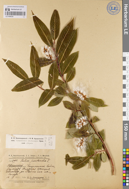
LE 01080325
Salix pentandra L. det. Novopokrovsky, Ivan Vassiljevich at 1915
Collectors: Novopokrovsky, Ivan Vassiljevich Field collecting number: 1260. Collection date: 19.07.1915. Administrative regions: RU - Bashkortostan - Chishminskiy Rayon. Expedition: Геоботаническое (Ботанико-географическое) обследование Уфимской губернии (1915 -1916)Groups of specimens: Образцы сектора Восточной ЕвропыOriginal label text:Уфимская губерния и уезд, Чишминская сельскохозяйственная опытная станция, заповедный участок. Пойма, лес на болоте.
Coordinates (geographic position): 54° 33′ 42.3″ N, 55° 26′ 33.75″ E ±1000 mRecord creation: 2020-12-01, Denis Melnikov, PhotoScan D2Citation: Specimen LE 01080325 // Virtual herbarium of Komarov Botanical Institute RAS — http://re.herbariumle.ru/01080325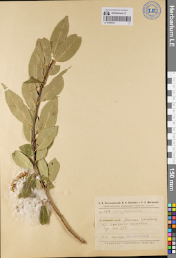
LE 01080324
Salix pentandra L. det. Novopokrovsky, Ivan Vassiljevich at 1916
Collectors: Novopokrovsky, Ivan Vassiljevich Field collecting number: 1159. Collection date: 14.07.1916. Administrative regions: RU - Bashkortostan - Tuymazinskiy Rayon. Expedition: Геоботаническое (Ботанико-географическое) обследование Уфимской губернии (1915 -1916)Groups of specimens: Образцы сектора Восточной ЕвропыOriginal label text:Уфимская губерния, Белебеевский уезд, урочище Кындык близ Константиновки. Пр. пл. 139.
Coordinates (geographic position): 54° 25′ 50.57″ N, 53° 52′ 39.66″ E ±2000 mRecord creation: 2020-12-01, Denis Melnikov, PhotoScan D2Citation: Specimen LE 01080324 // Virtual herbarium of Komarov Botanical Institute RAS — http://re.herbariumle.ru/01080324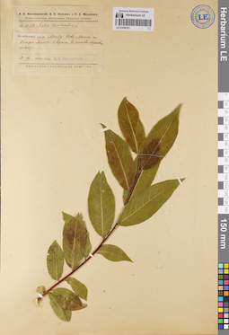
LE 01080323
Salix pentandra L. det. Novopokrovsky, Ivan Vassiljevich at 1916
Collectors: Novopokrovsky, Ivan Vassiljevich Field collecting number: 1080. Collection date: 09.07.1916. Administrative regions: RU - Bashkortostan - Bakalinskiy Rayon. Expedition: Геоботаническое (Ботанико-географическое) обследование Уфимской губернии (1915 -1916)Groups of specimens: Образцы сектора Восточной ЕвропыOriginal label text:Уфимская губерния, Белебеевский уезд, между Ново-Маты и Старо-Маты. Овраг в осиново-березовом лесу.
Coordinates (geographic position): 55° 15′ 9.13″ N, 53° 59′ 53.29″ E ±500 mRecord creation: 2020-12-01, Denis Melnikov, PhotoScan D2Citation: Specimen LE 01080323 // Virtual herbarium of Komarov Botanical Institute RAS — http://re.herbariumle.ru/01080323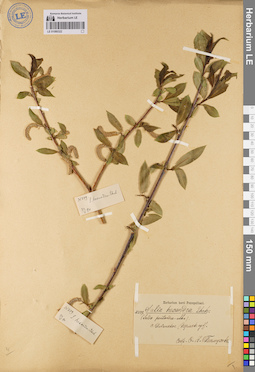
LE 01080322
Additional identifications: Salix pentandra L.; Salix hexandra Ehrh. det. Teplouchow, Fedor (Theodor) Alexandrowitsch Collectors: Teplouchow, Fedor (Theodor) Alexandrowitsch Field collecting number: 509. Collection date: 23.05.1890. Administrative regions: RU - Perm Krai - Il'inskiy Rayon. Groups of specimens: Образцы сектора Восточной ЕвропыOriginal label text:
Село Ильинское (Пермская губерния).
Coordinates (geographic position): 58° 34′ 19.55″ N, 55° 41′ 58.03″ E ±500 mRecord creation: 2020-12-01, Denis Melnikov, PhotoScan D2Citation: Specimen LE 01080322 // Virtual herbarium of Komarov Botanical Institute RAS — http://re.herbariumle.ru/01080322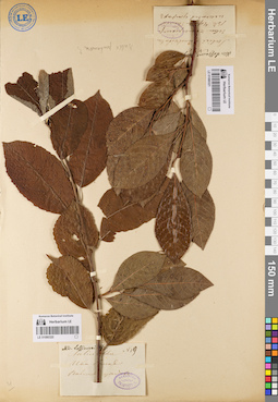
LE 01080320
Salix pentandra L.
Collectors: Lossiewski Field collecting number: 19. Groups of specimens: Образцы сектора Восточной Европы; Herbarium TrautvetterRecord creation: 2020-12-01, Denis Melnikov, PhotoScan D2Citation: Specimen LE 01080320 // Virtual herbarium of Komarov Botanical Institute RAS — http://re.herbariumle.ru/01080320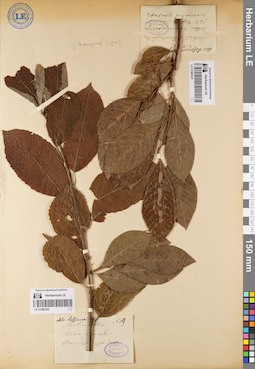
LE 01080321
Salix pentandra L.
Collectors: Lossiewski Groups of specimens: Образцы сектора Восточной Европы; Herbarium TrautvetterRecord creation: 2020-12-01, Denis Melnikov, PhotoScan D2. Processing status: data is not fully enteredCitation: Specimen LE 01080321 // Virtual herbarium of Komarov Botanical Institute RAS — http://re.herbariumle.ru/01080321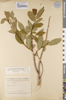
LE 01080319
Salix pentandra L. det. Novopokrovsky, Ivan Vassiljevich at 1915
Collectors: Novopokrovsky, Ivan Vassiljevich Field collecting number: 262. Collection date: 25.06.1915. Administrative regions: RU - Bashkortostan - Sterlibashevskiy Rayon. Expedition: Геоботаническое (Ботанико-географическое) обследование Уфимской губернии (1915 -1916)Groups of specimens: Образцы сектора Восточной ЕвропыOriginal label text:Уфимская губерния, Стерлитамакский уезд, деревня Стерлибаш. В долине реки Стерли. Топк. Почва болотистая. Лес.
Coordinates (geographic position): 53° 27′ 11.48″ N, 55° 12′ 51.04″ E ±500 mRecord creation: 2020-12-01, Denis Melnikov, PhotoScan D2Citation: Specimen LE 01080319 // Virtual herbarium of Komarov Botanical Institute RAS — http://re.herbariumle.ru/01080319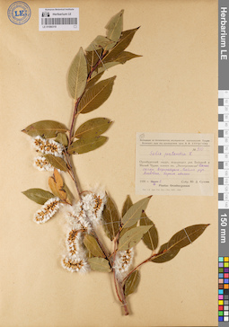
LE 01080318
Salix pentandra L. det. Suchowa, Ju. D. at 1930
Collectors: Suchowa, Ju. D. Field collecting number: 810. Collection date: 07.09.1930. Administrative regions: RU - Orenburgskaya Oblast' - Novosergiyevskiy Rayon. Expedition: Экспедиция по ботаническому исследованию зерносовхозов Средне-Волжского края под руководством проф. И.И. Спрыгина_ (1929 -1933)Groups of specimens: Образцы сектора Восточной ЕвропыOriginal label text:Оренбургский округ, водораздел рек Большой и Малый Чуран, совхоз имени "Электрозавода". Южный склон водораздела. Пойма ручья Хлебовка, заросль ивняка.
Coordinates (geographic position): 52° 27′ 18.03″ N, 53° 57′ 25.61″ E ±2000 mRecord creation: 2020-12-01, Denis Melnikov, PhotoScan D2Citation: Specimen LE 01080318 // Virtual herbarium of Komarov Botanical Institute RAS — http://re.herbariumle.ru/01080318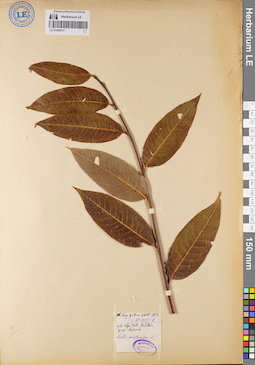
LE 01080317
Salix pentandra L. det. Schell, Julian K. at 1878
Collectors: Schell, Julian K. Field collecting number: 227b. Collection date: 1878. Administrative regions: RU - Bashkortostan - Belebeyevskiy Rayon. Groups of specimens: Образцы сектора Восточной Европы; Herbarium TrautvetterOriginal label text:Gebernia Ufa, district Belibei, prope Rebasch.
Coordinates (geographic position): 53° 57′ 14.31″ N, 54° 1′ 51.72″ E ±1000 mRecord creation: 2020-12-01, Denis Melnikov, PhotoScan D2Citation: Specimen LE 01080317 // Virtual herbarium of Komarov Botanical Institute RAS — http://re.herbariumle.ru/01080317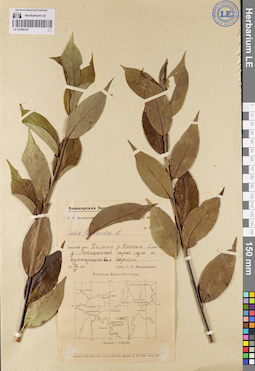
LE 01080316
Salix pentandra L. det. Kutscherovskaya, Sofia Evgenevna at 1930
Collection date: 22.07.1930. Administrative regions: RU - Bashkortostan - Mishkinskiy Rayon. Expedition: Башкирская экспедиция Академии наук. Геоботанические исследования в Башкирской республике (1930 -1931)Groups of specimens: Образцы сектора Восточной ЕвропыOriginal label text:Бирский кантон, долина реки Кипчак, близ деревни Лепешкиной, сырые луга и кустарниковые заросли.
Coordinates (geographic position): 55° 40′ 44.7″ N, 55° 47′ 11.84″ E ±5000 mRecord creation: 2020-12-01, Denis Melnikov, PhotoScan D2Citation: Specimen LE 01080316 // Virtual herbarium of Komarov Botanical Institute RAS — http://re.herbariumle.ru/01080316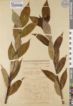
LE 01080315
Salix pentandra L. det. Kutscherovskaya, Sofia Evgenevna at 1930
Collectors: Kutscherovskaya, Sofia Evgenevna Field collecting number: 916. Collection date: 02.09.1930. Administrative regions: RU - Tatarstan - Aktanyshskiy Rayon. Expedition: Башкирская экспедиция Академии наук. Геоботанические исследования в Башкирской республике (1930 -1931)Groups of specimens: Образцы сектора Восточной ЕвропыOriginal label text:Бирский кантон, деревня Уразаево...... в Сакловку, у речки.
Coordinates (geographic position): 55° 45′ 25.83″ N, 53° 55′ 7.26″ E ±1000 mRecord creation: 2020-12-01, Denis Melnikov, PhotoScan D2. Processing status: data is not fully enteredCitation: Specimen LE 01080315 // Virtual herbarium of Komarov Botanical Institute RAS — http://re.herbariumle.ru/01080315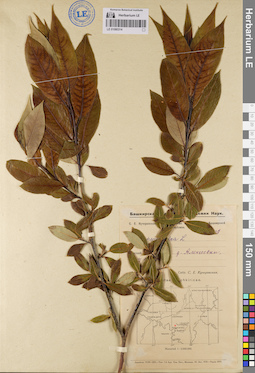
LE 01080314
Salix pentandra L.
Collectors: Kutscherovskaya, Sofia Evgenevna Groups of specimens: Образцы сектора Восточной ЕвропыRecord creation: 2020-12-01, Denis Melnikov, PhotoScan D2. Processing status: data is not fully enteredCitation: Specimen LE 01080314 // Virtual herbarium of Komarov Botanical Institute RAS — http://re.herbariumle.ru/01080314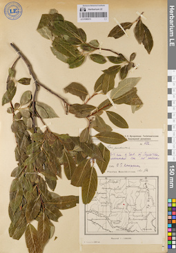
LE 01080313
Salix pentandra L.
Collectors: Knorring, Olga Evertovna Field collecting number: 632. Expedition: Башкирская Экспедиция Академии Наук. О.Э. Кнорринг, И.М. Крашенинников, С.Е. Кучеровская. Геоботанические исследования в Зилаирском кантоне (1928 -1929)Groups of specimens: Образцы сектора Восточной ЕвропыRecord creation: 2020-12-01, Denis Melnikov, PhotoScan D2. Processing status: data is not fully enteredCitation: Specimen LE 01080313 // Virtual herbarium of Komarov Botanical Institute RAS — http://re.herbariumle.ru/01080313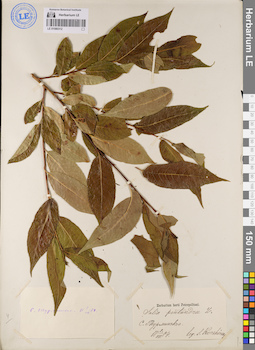
LE 01080312
Salix pentandra L. det. Korshinsky, Sergei Ivanovitsch at 1884
Collectors: Korshinsky, Sergei Ivanovitsch Collection date: 09.07.1884. Administrative regions: RU - Tatarstan - Kaybitskiy Rayon. Groups of specimens: Образцы сектора Восточной ЕвропыOriginal label text:Село Турминское.
Coordinates (geographic position): 55° 20′ 38.52″ N, 47° 52′ 42.61″ E ±1000 mRecord creation: 2020-12-01, Denis Melnikov, PhotoScan D2Citation: Specimen LE 01080312 // Virtual herbarium of Komarov Botanical Institute RAS — http://re.herbariumle.ru/01080312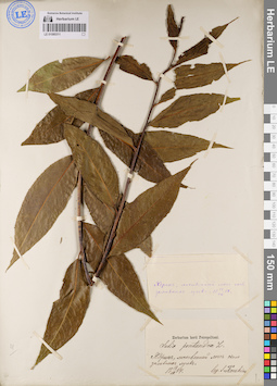
LE 01080311
Salix pentandra L. det. Korshinsky, Sergei Ivanovitsch at 1884
Collectors: Korshinsky, Sergei Ivanovitsch Collection date: 14.07.1884. Administrative regions: RU - Chuvashskaya Respublika - Yadrinskiy Rayon. Groups of specimens: Образцы сектора Восточной ЕвропыOriginal label text:Ядрин, лиственный лес около заливных лугов.
Coordinates (geographic position): 55° 56′ 36.91″ N, 46° 12′ 39.77″ E ±1000 mRecord creation: 2020-12-01, Denis Melnikov, PhotoScan D2Citation: Specimen LE 01080311 // Virtual herbarium of Komarov Botanical Institute RAS — http://re.herbariumle.ru/01080311