View
Add
Copy
Edit
Delete
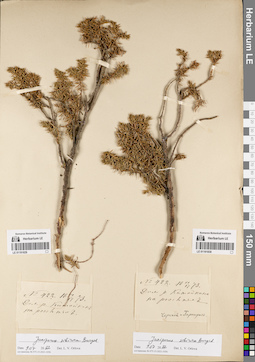
LE 01191830
Juniperus sibirica Burgsd. det. Orlova, Larisa Vladimirovna at 09.07.2022
Collectors: Czerski, Jan Stanisław Franciszek; Hartung, Nikolai Field collecting number: 422. Collection date: 17.06.1873. Administrative regions: RU - Respublika Buryatiya - Okinskiy Rayon. Place of collection: долина р. Китойкин, россыпи.Groups of specimens: Образцы сектора Сибири и Дальнего Востока России; Соглашение Минобрнауки №075-15-2021-1056Original label text:№ 422. VI 17 1873. Дол. р. Китойкина на россыпях. Черский и Гартунг
Landscape in location of collection: россыпи в долине рекиCoordinates (geographic position): 52° 10′ 52.56″ N, 102° 16′ 48.08″ E ±15000 mRecord creation: 2022-07-09, Larisa Orlova, PhotoScan D2. Part 1.Citation: Specimen LE 01191830 // Virtual herbarium of Komarov Botanical Institute RAS — http://re.herbariumle.ru/01191830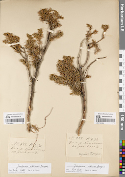
LE 01191829
Juniperus sibirica Burgsd. det. Orlova, Larisa Vladimirovna at 09.07.2022
Collectors: Czerski, Jan Stanisław Franciszek; Hartung, Nikolai Field collecting number: 422. Collection date: 17.06.1873. Administrative regions: RU - Respublika Buryatiya - Okinskiy Rayon. Place of collection: долина р. Китойкин, россыпи.Groups of specimens: Образцы сектора Сибири и Дальнего Востока России; Соглашение Минобрнауки №075-15-2021-1056Original label text:№ 422. 17 / Vi 1873. дол. р. Китойкин на россыпях
Landscape in location of collection: россыпи в долине рекиCoordinates (geographic position): 52° 10′ 52.56″ N, 102° 16′ 48.08″ E ±15000 mRecord creation: 2022-07-09, Larisa Orlova, PhotoScan D2. Part 1.Citation: Specimen LE 01191829 // Virtual herbarium of Komarov Botanical Institute RAS — http://re.herbariumle.ru/01191829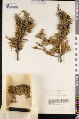
LE 01191828
Juniperus sibirica Burgsd. det. Lomonosova, Maria Nikolaevna at 1971
Collectors: Lomonosova, Maria Nikolaevna Collection date: 19.07.1971. Administrative regions: RU - Respublika Tyva - Piy-Khemskiy Rayon. Subregion: Пий-Хемский кожуун. Place of collection: Западный Саян, хр. Уюкский, окр. лыжн. ст. Тайга, южный склон, лиственнично-кедровая поросль с кустарниково-разнотравно-осочковым покровом.Groups of specimens: Образцы сектора Сибири и Дальнего Востока России; Соглашение Минобрнауки №075-15-2021-1056; Гербарий Центрального Сибирского ботанического сада СО АН СССРOriginal label text:Гербарий Центрального Сибирского ботанического сада СО АН СССР. Juniperus sibirica Burgsd. Зап. Саян. Уюкский хребет, окр. ст. Тайга, южный склон. Лиственнично-кедровая поросль с кустарниково-разнотравно-осочковый покровом. Выс. 1720м. 19.7.1971г. М. Ломоносова
Landscape in location of collection: южный склон горного хребтаHabitat / plant community in location of collecting: лиственнично-кедровая поросль с кустарниково-разнотравно-осочковым покровомCoordinates (geographic position): 51° 58′ 28.89″ N, 94° 5′ 36.39″ E ±2000 m, 1720 m a.s.l.Record creation: 2022-07-09, Larisa Orlova, PhotoScan D2. Part 1.Citation: Specimen LE 01191828 // Virtual herbarium of Komarov Botanical Institute RAS — http://re.herbariumle.ru/01191828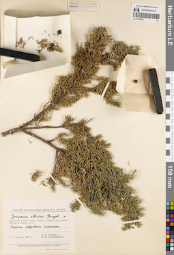
LE 01191827
Juniperus sibirica Burgsd. det. Egorova, Tatiana Vladimirovna, Siplivinsky, Vladimir Nikolaevich at 1967
Collectors: Egorova, Tatiana Vladimirovna; Siplivinsky, Vladimir Nikolaevich Collection date: 03.08.1967. Administrative regions: RU - Respublika Buryatiya - Severo-Baykal'skiy Rayon. Place of collection: оз. Байкал, хр. Байкальский, исток р. Малая Коса, заросли кедрового стланика.Groups of specimens: Образцы сектора Сибири и Дальнего Востока России; Соглашение Минобрнауки №075-15-2021-1056Original label text:Гербарий Ботанического института АН СССР. Juniperus sibirica Burgsd. Бурятская АССР. Озеро Байкал. Байкальский хребет. Истоки р. Малая Коса. Заросли кедрового стланика. 1-3 августа 1967 г. Т.В. Егорова и В.Н. Сипливинский. Herbarium Instituti Botanici Academiae Sc. URSS
Landscape in location of collection: берег горной рекиHabitat / plant community in location of collecting: заросли кедрового стланикаCoordinates (geographic position): 54° 44′ 33.08″ N, 108° 42′ 47.19″ E ±3000 mRecord creation: 2022-07-09, Larisa Orlova, PhotoScan D2. Part 1.Citation: Specimen LE 01191827 // Virtual herbarium of Komarov Botanical Institute RAS — http://re.herbariumle.ru/01191827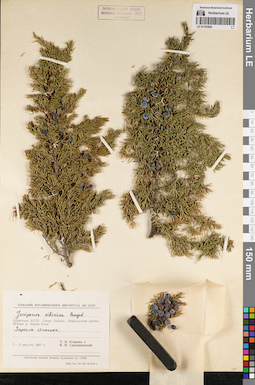
LE 01191826
Juniperus sibirica Burgsd. det. Egorova, Tatiana Vladimirovna, Siplivinsky, Vladimir Nikolaevich at 1967
Collectors: Egorova, Tatiana Vladimirovna; Siplivinsky, Vladimir Nikolaevich Collection date: 03.08.1967. Administrative regions: RU - Respublika Buryatiya - Severo-Baykal'skiy Rayon. Place of collection: оз. Байкал, хр. Байкальский, исток р. Малая Коса, заросли стланика.Groups of specimens: Образцы сектора Сибири и Дальнего Востока России; Соглашение Минобрнауки №075-15-2021-1056Original label text:Гербарий Ботанического института АН СССР. Juniperus sibirica Burgsd. Бурятская АССР. Озеро Байкал. Байкальский хребет. Истоки р. Малая Коса. Заросли стланика. 1-3 августа 1967 г. Т.В. Егорова и В.Н. Сипливинский. Herbarium Instituti Botanici Academiae Sc. URSS
Landscape in location of collection: берег горной рекиHabitat / plant community in location of collecting: заросли стланикаCoordinates (geographic position): 54° 44′ 33.08″ N, 108° 42′ 47.19″ E ±3000 mRecord creation: 2022-07-09, Larisa Orlova, PhotoScan D2. Part 1.Citation: Specimen LE 01191826 // Virtual herbarium of Komarov Botanical Institute RAS — http://re.herbariumle.ru/01191826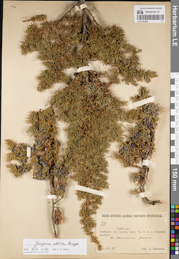
LE 01191825
Juniperus sibirica Burgsd. det. Orlova, Larisa Vladimirovna at 09.07.2022
Collectors: Litvinov, Dimitri Ivanovich Field collecting number: 331 / 5. Collection date: 29.07.1903. Administrative regions: RU - Zabaykal'skiy Kray - Karymskiy Rayon. Place of collection: близ ст. ж.д. Седловой [разъезд], на каменистой россыпи.Groups of specimens: Образцы сектора Сибири и Дальнего Востока России; Соглашение Минобрнауки №075-15-2021-1056Original label text:Museum Botanicum Academiae Scientiarum Petropolitanae. 5. 331. Забайкальск. обл. (восточн. часть). Сланик. Близ ст. ж.д. "Седловой разъезд". На каменистой россыпи. 1903.VII.29 Собр. Д. Литвинов
Landscape in location of collection: каменистая россыпьCoordinates (geographic position): 51° 28′ 49.3″ N, 114° 32′ 30.55″ E ±3000 mRecord creation: 2022-07-09, Larisa Orlova, PhotoScan D2. Part 1.Citation: Specimen LE 01191825 // Virtual herbarium of Komarov Botanical Institute RAS — http://re.herbariumle.ru/01191825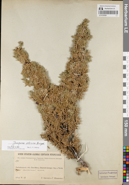
LE 01191824
Juniperus sibirica Burgsd. det. Orlova, Larisa Vladimirovna at 09.07.2022
Collectors: Poplavskaya (Poplawska), Henrietta Ippolitovna; Sukaczev, Vladimir Nikolajevich Field collecting number: 398. Collection date: 29.06.1912. Administrative regions: RU - Respublika Buryatiya - Severo-Baykal'skiy Rayon. Place of collection: бассейн р. Верхняя Ангара, окрестности дер. Ченчи, сухой каменистый склон.Expedition: Верхне-Ангарская экспедиция В.Н. Сукачёва (1912)Groups of specimens: Образцы сектора Сибири и Дальнего Востока России; Соглашение Минобрнауки №075-15-2021-1056; Из гербария Переселенческого управленияOriginal label text:Museum Botanicum Academiae Scientiarum Petropolitanae. Из гербария Переселенческого Управления. Верхне-Ангарская экспедиция В.Н. Сукачева. 398. Забайкальск. обл. Бассейн р. Верхней Ангары. Окр. д. Ченчи. Сухой каменистый склон. 1912.VI.29. В. Сукачев и Г. Поплавская
Landscape in location of collection: сухой каменистый склонCoordinates (geographic position): 55° 57′ 57.52″ N, 110° 59′ 45.15″ E ±10000 mRecord creation: 2022-07-09, Larisa Orlova, PhotoScan D2. Part 1.Citation: Specimen LE 01191824 // Virtual herbarium of Komarov Botanical Institute RAS — http://re.herbariumle.ru/01191824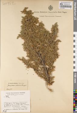
LE 01191823
Juniperus sibirica Burgsd. det. Ikonnikov-Galitzky, Nikolai Petrovic at 12.09.1940
Collectors: Lebedeva, Z.; Korotky, Mikhail Fedorovich Field collecting number: 482. Collection date: 12.07.1914. Administrative regions: RU - Respublika Buryatiya - Severo-Baykal'skiy Rayon. Place of collection: Витимское плоскогорье, перевал в обход россыпей р. Уокит Ципинский, лиственничный мшистый лес.Expedition: М.Ф. Короткий. Муйская экспедиция (1914)Groups of specimens: Образцы сектора Сибири и Дальнего Востока России; Соглашение Минобрнауки №075-15-2021-1056; Гербарий Переселенческого УправленияOriginal label text:Гербарий Переселенческого Управления. М.Ф. Короткий. Муйская экспедиция 1914 г. № 482. Забайкальская обл., Баргузинский у. Витимское плоскогорье. Перевал в обход россыпей р. Уокита Ципинского. В лиственничном мшистом лесу. Собр. М. Короткий и З. Лебедева. M. Korotkij. Iter Transbaicalense. Distr. Bargusin. 1914
Landscape in location of collection: горный перевал в обход речных россыпейHabitat / plant community in location of collecting: лиственничный мшистый лесCoordinates (geographic position): 56° 15′ 25.73″ N, 109° 33′ 17.52″ E ±50000 mRecord creation: 2022-07-09, Larisa Orlova, PhotoScan D2. Part 1.Citation: Specimen LE 01191823 // Virtual herbarium of Komarov Botanical Institute RAS — http://re.herbariumle.ru/01191823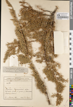
LE 01191822
Juniperus sibirica Burkh. × Juniperus dahurica Pall. det. Busch at 1929
Collectors: Rudin, B.V. Field collecting number: 84. Collection date: 08.08.1929. Administrative regions: RU - Zabaykal'skiy Kray - Tungiro-Olekminskiy Rayon. Place of collection: вершина сопки в устье р. Верхняя Мокла (Моклокона).Expedition: Д.В.К.П.У. Приморская переселенческая партия. Геоботанические исследования Михайловского района В.П. Баяновой, М.А. Жуковой и Е.А. Гриневич, под руководством И.В. Кузнецова 1929 г. (1929 -1930)Groups of specimens: Образцы сектора Сибири и Дальнего Востока России; Соглашение Минобрнауки №075-15-2021-1056Original label text:Д.В.К.П.У. Приморская пересенческая партия. Геоботанические исследования Михайловского района В.П. Баяновой, М.А. Жуковой и Е.А. Гриневич, под руководством И.В. Кузнецова 1929 г. № 84. Тунгиро-Олекминский район. Вершина сопки, в устье р. Моклоконы (Верхн. Моклы). "8" августа 1929 г. Собрал Б.В. Рудин. I.W. Kusnezow: Iter in distr. Mychajlowsky. Provinciae Austro-ussuriensis
Landscape in location of collection: вершина сопкиCoordinates (geographic position): 54° 43′ 48.91″ N, 119° 15′ 30.87″ E ±5000 mRecord creation: 2022-07-09, Larisa Orlova, PhotoScan D2. Part 1.Citation: Specimen LE 01191822 // Virtual herbarium of Komarov Botanical Institute RAS — http://re.herbariumle.ru/01191822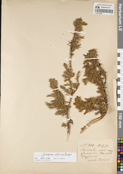
LE 01191821
Juniperus sibirica Burgsd. det. Orlova, Larisa Vladimirovna at 09.07.2022
Collectors: Czerski, Jan Stanisław Franciszek; Hartung, Nikolai Field collecting number: 400. Collection date: 12.06.1873. Administrative regions: RU - Respublika Buryatiya - Okinskiy Rayon. Place of collection: склоны гор, окружающих пер. Нилан-Сарам.Groups of specimens: Образцы сектора Сибири и Дальнего Востока России; Соглашение Минобрнауки №075-15-2021-1056Original label text:№ 400. 12/VI 1873 [стар. стиль]. Склоны гор окружающих Нилан-Сарам. Черский и Гартунг
Landscape in location of collection: склон горыCoordinates (geographic position): 52° 15′ 0″ N, 102° 10′ 0.01″ E ±1000 mRecord creation: 2022-07-09, Larisa Orlova, PhotoScan D2. Part 1.Citation: Specimen LE 01191821 // Virtual herbarium of Komarov Botanical Institute RAS — http://re.herbariumle.ru/01191821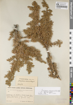
LE 01191820
Juniperus niemannii E.L. Wolf ⟨intermediate forma⟩ det. Orlova, Larisa Vladimirovna at 09.07.2022
Additional identifications: Juniperus sibirica Burgsd. det. Ikonnikov-Galitzky, Nikolai Petrovic at 12.09.1940 Collectors: Schipczinski, Nikolaj Valerianovich; Sukaczev, Vladimir Nikolajevich Field collecting number: 308. Collection date: 18.06.1912. Administrative regions: RU - Respublika Buryatiya - Severo-Baykal'skiy Rayon. Place of collection: бассейн р. Верхняя Ангара, окрестности дер. Чечевки, Душкачанский голец, падь Большая Ухта, каменистая осыпь у границы леса.Expedition: Верхне-Ангарская экспедиция В.Н. Сукачёва (1912)Groups of specimens: Образцы сектора Сибири и Дальнего Востока России; Соглашение Минобрнауки №075-15-2021-1056; Из гербария Переселенческого управленияOriginal label text:Museum Botanicum Academiae Scientiarum Petropolitanae. Из гербария Переселенческого Управления. Верхне-Ангарская экспедиция В.Н. Сукачева. 308. Забайкальск. обл. Бассейн р. Верхней Ангары. Окр. д. Чечевок. Душкачанский голец. Падь Б. Ухта. Каменистая осыпь у границы леса. 1912.VI.18. В. Сукачев и Н. Шипчинский
Landscape in location of collection: каменистая осыпь у границы леса в пределах падиHabitat / plant community in location of collecting: у границы лесаCoordinates (geographic position): 55° 47′ 0.33″ N, 109° 36′ 43.3″ E ±20000 mRecord creation: 2022-07-09, Larisa Orlova, PhotoScan D2. Part 1.Citation: Specimen LE 01191820 // Virtual herbarium of Komarov Botanical Institute RAS — http://re.herbariumle.ru/01191820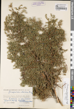
LE 01191819
Juniperus niemannii E.L. Wolf ⟨intermediate forma⟩ det. Orlova, Larisa Vladimirovna at 09.07.2022
Additional identifications: Juniperus sibirica Burgsd. det. Lukitscheva, A.N. at 1961 Collectors: Lukitscheva, A.N. Collection date: 08.1961. Administrative regions: RU - Irkutskaya Oblast' - Ust'-Kutskiy Rayon. Place of collection: бассейн р.р. Куты, Купы, мелкоувалистое плато, на карбонатных породах, ельник с примесью других пород осоково-высокотравный.Groups of specimens: Образцы сектора Сибири и Дальнего Востока России; Соглашение Минобрнауки №075-15-2021-1056Original label text:Гербарий Ботанического института АН СССР. Juniperus sibirica Burgsd. Иркутская область, Усть-Кутский район. Бассейн р.р. Куты, Купы. Мелкоувалистое плато, на карбонатных породах. Ельник с примесью других пород осоково-высокотравный. 1961 г. август. А. Лукичева
Landscape in location of collection: мелкоувалистое платоHabitat / plant community in location of collecting: ельник с примесью других пород осоково-высокотравныйSubstrate in collecting location: карбонатные породыCoordinates (geographic position): 56° 56′ 1.61″ N, 105° 0′ 42.79″ E ±135000 mRecord creation: 2022-07-09, Larisa Orlova, PhotoScan D2. Part 1.Citation: Specimen LE 01191819 // Virtual herbarium of Komarov Botanical Institute RAS — http://re.herbariumle.ru/01191819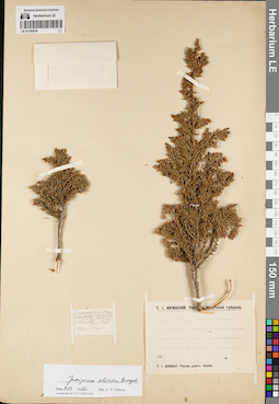
LE 01191818
Juniperus sibirica Burgsd. det. Orlova, Larisa Vladimirovna at 09.07.2022
Additional identifications: Juniperus communis L. det. Jurinsky (Yurinsky), Tikhon Osipovich at 1900 Collectors: Jurinsky (Yurinsky), Tikhon Osipovich Collection date: 06.1900. Administrative regions: RU - Respublika Buryatiya - Zakamenskiy Rayon. Place of collection: у подножья и по склону хр. Хамар-Дабан.Expedition: Т.И. Юринский: Растения Иркутской губернии (1900)Groups of specimens: Образцы сектора Сибири и Дальнего Востока России; Соглашение Минобрнауки №075-15-2021-1056Original label text:[1]Можжевел. обык. Juniperus communis у подн. и по склону Хам. Даб. 1900 г. июнь [2]Т.И. Юринский: Растения Иркутской губернии. 190..... T.J. Jurinsky: Plantae gubern. Irkutsk
Landscape in location of collection: подножье и склон горного хребтаCoordinates (geographic position): 51° 17′ 13.56″ N, 104° 19′ 30.88″ E ±20000 mRecord creation: 2022-07-09, Larisa Orlova, PhotoScan D2. Part 1.Citation: Specimen LE 01191818 // Virtual herbarium of Komarov Botanical Institute RAS — http://re.herbariumle.ru/01191818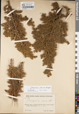
LE 01191817
Juniperus sibirica Burgsd. det. Orlova, Larisa Vladimirovna at 09.07.2022
Additional identifications: Juniperus nana Willd. det. Borodin, Ivan Parfenevich Collectors: Borodin, Ivan Parfenevich Field collecting number: 188. Collection date: 26.06.1902. Administrative regions: RU - Irkutskaya Oblast' - Irkutskiy Rayon. Place of collection: Старый Кяхтинский тракт, хр. Комар (Хамар-Дабан) близ раб. пос. Култук, на гольце.Groups of specimens: Образцы сектора Сибири и Дальнего Востока России; Соглашение Минобрнауки №075-15-2021-1056Original label text:Museum Botanicum Academiae Scientiarum Petropolitanae. № 188. Juniperus nana W. Иркутский округ. Старый Кяхтинский тракт. Комар (Хамар-Дабан) близ Култука. На гольце. 26 VI.1902. Собр. И. Бородин
Landscape in location of collection: склон гольцаCoordinates (geographic position): 51° 17′ 12.75″ N, 104° 19′ 29.32″ E ±10000 mRecord creation: 2022-07-09, Larisa Orlova, PhotoScan D2. Part 1.Citation: Specimen LE 01191817 // Virtual herbarium of Komarov Botanical Institute RAS — http://re.herbariumle.ru/01191817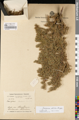
LE 01191816
Juniperus sibirica Burgsd. det. Orlova, Larisa Vladimirovna at 09.07.2022
Additional identifications: Juniperus sp. det. Kusnezow, Nicolai Ivanovitch at 1910; Juniperus nana Willd. det. Busch Collectors: Kusnezow, Nicolai Ivanovitch Field collecting number: 1132. Collection date: 16.07.1910. Administrative regions: RU - Irkutskaya Oblast' - Kazachinsko-Lenskiy Rayon. Place of collection: лес на водоразделе р. Тыктит - р. Маректа.Expedition: Н.И. Кузнецов. Лено-Киренгская экспедиция Иркутской губ. 1910 г. (1910)Groups of specimens: Образцы сектора Сибири и Дальнего Востока России; Соглашение Минобрнауки №075-15-2021-1056; Гербарий Переселенческого УправленияOriginal label text:Гербарий Переселенческого Управления. Н.И. Кузнецов. Лено-Киренгская экспедиция Иркутской губ. 1910 г. № 1132. 16 / VII 1910 г. Juniperus nana Willd. Лес на водоразделе Тыктит-Маректа. N.I. Kusnezow: Iter Ircutense ad fl. Lena et Kirenga. 1910
Landscape in location of collection: водораздел двух рекHabitat / plant community in location of collecting: лесCoordinates (geographic position): 55° 11′ 50.87″ N, 107° 4′ 4.3″ E ±100000 mRecord creation: 2022-07-09, Larisa Orlova, PhotoScan D2. Part 1.Citation: Specimen LE 01191816 // Virtual herbarium of Komarov Botanical Institute RAS — http://re.herbariumle.ru/01191816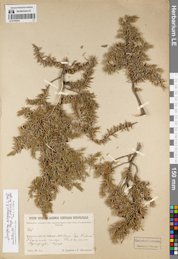
LE 01191814
Juniperus niemannii E.L. Wolf ⟨close to Juniperus sibirica Burgsd.⟩ det. Orlova, Larisa Vladimirovna at 09.07.2022
Collectors: Poplavskaya (Poplawska), Henrietta Ippolitovna; Sukaczev, Vladimir Nikolajevich Field collecting number: 426. Collection date: 30.06.1914. Administrative regions: RU - Respublika Buryatiya - Severo-Baykal'skiy Rayon. Place of collection: северо-западный берег оз. Байкал, гор. Кивелей, у вершины гольца, на камнях.Expedition: Байкальская экспедиция Императорской Академии наук и Императорского Русского географического общества (1914)Groups of specimens: Образцы сектора Сибири и Дальнего Востока России; Соглашение Минобрнауки №075-15-2021-1056Object features: Прижатый кустOriginal label text:Museum Botanicum Academiae Scientiarum Petropolitanae. Байкальская экспедиция имп. Академии Наук и имп. Русск. Географического общества. 426. Иркутск. губ. Оз. Байкал. NW берег. Гора Кивелей. У вершины гольца. На камнях. Прижатый куст. 1914.VI.30. В. Сукачев и Г. Поплавская
Landscape in location of collection: камни на вершине гольцаCoordinates (geographic position): 55° 19′ 19.81″ N, 108° 54′ 47.31″ E ±20000 mRecord creation: 2022-07-09, Larisa Orlova, PhotoScan D2. Part 1.Citation: Specimen LE 01191814 // Virtual herbarium of Komarov Botanical Institute RAS — http://re.herbariumle.ru/01191814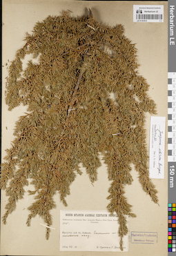
LE 01191813
Juniperus sibirica Burgsd. det. Orlova, Larisa Vladimirovna at 09.07.2022
Collectors: Poplavskaya (Poplawska), Henrietta Ippolitovna; Sukaczev, Vladimir Nikolajevich Field collecting number: 1345. Collection date: 18.07.1914. Administrative regions: RU - Respublika Buryatiya - Severo-Baykal'skiy Rayon. Place of collection: оз. Байкал, галечник на мысу Котельниковский.Expedition: Байкальская экспедиция Императорской Академии наук и Императорского Русского географического общества (1914)Groups of specimens: Образцы сектора Сибири и Дальнего Востока России; Соглашение Минобрнауки №075-15-2021-1056Original label text:Museum Botanicum Academiae Scientiarum Petropolitanae. Байкальская экспедиция имп. Академии Наук и имп. Русск. Географ. Общества. 1345. Иркутск. губ. Оз. Байкал. Галечник на [Котель]никовском мысу. 1914.VII.18 В. Сукачев и Г. Поплавская
Substrate in collecting location: галечникCoordinates (geographic position): 55° 2′ 26.32″ N, 109° 5′ 35.17″ E ±5000 mRecord creation: 2022-07-09, Larisa Orlova, PhotoScan D2. Part 1.Citation: Specimen LE 01191813 // Virtual herbarium of Komarov Botanical Institute RAS — http://re.herbariumle.ru/01191813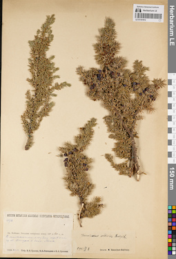
LE 01191812
Juniperus sibirica Burgsd. det. Ikonnikov-Galitzky, Nikolai Petrovic at 08.04.1941
Collectors: Sukaczev, Vladimir Nikolajevich; Bryzzhev, Nikolay Alexandrovich Field collecting number: 1078. Collection date: 13.07.1928. Administrative regions: RU - Irkutskaya Oblast' - Ol'khonskiy Rayon. Place of collection: лиственничный лес близ перевала у мыса Онгуренский (Онгурск) в бассейне р. Лена.Groups of specimens: Образцы сектора Сибири и Дальнего Востока России; Соглашение Минобрнауки №075-15-2021-1056Original label text:Museum Botanicum Academiae Scientiarum Petropolitanae. 1078. Оз. Байкал. Западное побережье между 53° и 55° с.ш. В лиственичном лесу близ перевала у м. Онгурск в басс. Лены. 1928.VII.13. Собр. В.Н. Сукачев и Н.А. Брызжев
Landscape in location of collection: горный перевалHabitat / plant community in location of collecting: лиственничный лесCoordinates (geographic position): 53° 36′ 56.77″ N, 107° 36′ 38.01″ E ±20000 mRecord creation: 2022-07-09, Larisa Orlova, PhotoScan D2. Part 1.Citation: Specimen LE 01191812 // Virtual herbarium of Komarov Botanical Institute RAS — http://re.herbariumle.ru/01191812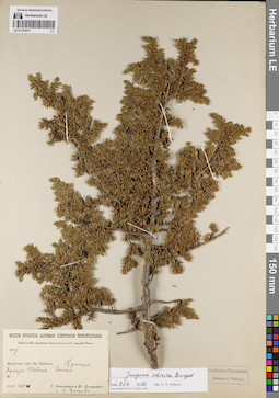
LE 01191811
Juniperus sibirica Burgsd. det. Orlova, Larisa Vladimirovna at 09.07.2022
Collectors: Poplavskaya (Poplawska), Henrietta Ippolitovna; Zinserling (Tsinzerling), Iurij (Yuri, Georgius) Dmitrievitch; Sukaczev, Vladimir Nikolajevich Field collecting number: 2057. Collection date: 11.07.1915. Administrative regions: RU - Irkutskaya Oblast' - Irkutskiy Rayon. Place of collection: оз. Байкал, раб. пос. Култук, гор. Хамар-Дабан, голец.Expedition: Байкальская экспедиция Императорской Академии Наук (1915)Groups of specimens: Образцы сектора Сибири и Дальнего Востока России; Соглашение Минобрнауки №075-15-2021-1056Original label text:Museum Botanicum Academiae Scientiarum Petropolitanae. Байкальская экспедиция императорской Академии Наук. 2057. Иркутск. губ. Оз. Байкал. Култук. Хамар-Дабан. Голец. 1915.VII.11. Г. Поплавская и Ю. Цинзерлинг и В. Сукачев
Landscape in location of collection: склон гольцаCoordinates (geographic position): 51° 55′ 7.38″ N, 105° 4′ 59.15″ E ±20000 mRecord creation: 2022-07-09, Larisa Orlova, PhotoScan D2. Part 1.Citation: Specimen LE 01191811 // Virtual herbarium of Komarov Botanical Institute RAS — http://re.herbariumle.ru/01191811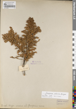
LE 01191810
Juniperus sibirica Burgsd. det. Orlova, Larisa Vladimirovna at 09.07.2022
Additional identifications: Juniperus nana Willd. det. Turczaninow, Nicolai Stepanowisch Collectors: Turczaninow, Nicolai Stepanowisch Collection date: 1828. Administrative regions: RU - Irkutskaya Oblast'. Place of collection: Ircutia [окрестности г. Иркутск, р. Лиственничная, раб. пос. Култук, вершины гор Хамар-Дабан и Баухат, берега р. Иркут до Турана].Groups of specimens: Образцы сектора Сибири и Дальнего Востока России; Соглашение Минобрнауки №075-15-2021-1056; Ex herbario TurczaninowianoOriginal label text:Ex herbario Turczaninowiano. Ircutia 1828. В герб. Турч. лежало над Juniperus nana.
Coordinates (geographic position): 52° 17′ 22.52″ N, 104° 16′ 50.18″ E ±400000 mRecord creation: 2022-07-09, Larisa Orlova, PhotoScan D2. Part 1.Citation: Specimen LE 01191810 // Virtual herbarium of Komarov Botanical Institute RAS — http://re.herbariumle.ru/01191810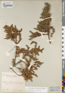
LE 01191809
Juniperus sibirica Burgsd. det. Orlova, Larisa Vladimirovna at 09.07.2022
Additional identifications: Juniperus communis var. nana Willd. det. Busch Collectors: Alexandrov, P. Field collecting number: 739. Collection date: 17.07.1911. Administrative regions: RU - Irkutskaya Oblast' - Kachugskiy Rayon. Place of collection: около р. Чанчур, за заимкой Засиха у дороги.Groups of specimens: Образцы сектора Сибири и Дальнего Востока России; Соглашение Минобрнауки №075-15-2021-1056Original label text:739. Juniperus communis L. var. nana (Willd.) Иркутск. губ. Верхоленск. у. Около речки Чанчура, за заимкой Засихой у дороги. 1911.VII.17. П. Александров
Landscape in location of collection: берег рекиHabitat / plant community in location of collecting: у дорогиCoordinates (geographic position): 53° 41′ 4.28″ N, 107° 18′ 29.67″ E ±30000 mRecord creation: 2022-07-09, Larisa Orlova, PhotoScan D2. Part 1.Citation: Specimen LE 01191809 // Virtual herbarium of Komarov Botanical Institute RAS — http://re.herbariumle.ru/01191809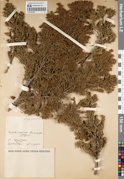
LE 01191808
Collectors: Sorokin, Nikolai Vassil'yevich Collection date: 26.06.1902. Groups of specimens: Образцы сектора Сибири и Дальнего Востока России; Соглашение Минобрнауки №075-15-2021-1056Record creation: 2022-07-09, Larisa Orlova, PhotoScan D2. Part 1.Citation: Specimen LE 01191808 // Virtual herbarium of Komarov Botanical Institute RAS — http://re.herbariumle.ru/01191808
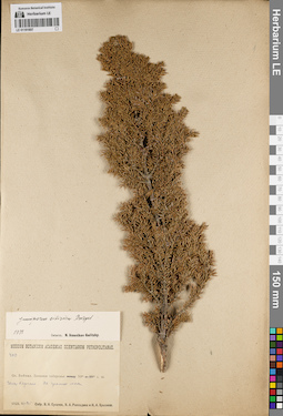
LE 01191807
Juniperus sibirica Burgsd. det. Ikonnikov-Galitzky, Nikolai Petrovic at 1938
Collectors: Rassadina, Ksenia Alexandrovna; Sukaczev, Vladimir Nikolajevich; Bryzzhev, Nikolay Alexandrovich Field collecting number: 409. Collection date: 25.06.1928. Administrative regions: RU - Respublika Buryatiya - Selenginskiy Rayon. Place of collection: западное побережье оз. Байкал, голец Харгана, граница леса.Groups of specimens: Образцы сектора Сибири и Дальнего Востока России; Соглашение Минобрнауки №075-15-2021-1056Original label text:Museum Botanicum Academiae Scientiarum Petropolitanae. 409. Оз. Байкал. Западное побережье 53° Голец Харгана. На границе леса. 1928.VI-25. Собр. В.Н. Сукачев, К.А. Рассадина и Н.А. Брызжев
Landscape in location of collection: горный склонHabitat / plant community in location of collecting: граница лесаCoordinates (geographic position): 51° 30′ 33.64″ N, 106° 48′ 20.07″ E ±5000 mRecord creation: 2022-07-09, Larisa Orlova, PhotoScan D2. Part 1.Citation: Specimen LE 01191807 // Virtual herbarium of Komarov Botanical Institute RAS — http://re.herbariumle.ru/01191807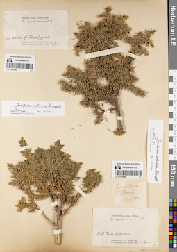
LE 01191547
Juniperus sibirica Burgsd. det. Orlova, Larisa Vladimirovna at 09.07.2022
Additional identifications: Juniperus communis L. det. Trautvetter, Rudolf Ernst von Collectors: Czekanowski, Alexander Piotr; Müller (Mueller), Ferdinand Ferdinandovich Collection date: 29.06.1874. Administrative regions: RU - Respublika Sakha (Yakutiya) - Olenyoksky District. Subregion: Оленекский улус. Place of collection: по р. Оленёк, возле устья р. Верхняя Томба.Groups of specimens: Образцы сектора Сибири и Дальнего Востока России; Соглашение Минобрнауки №075-15-2021-1056; Museum botan. Acad. Petrop.Original label text:Museum botan. Acad. Petrop. Juniperus communis L. Ad ostium fl. Tomba Superioris. Sibiria orient. ad fl. Olenek legg. A. Czekanowski et F. Müller 1874. 29 Junii
Landscape in location of collection: берег рекиCoordinates (geographic position): 67° 17′ 59.43″ N, 106° 54′ 54.72″ E ±1000 mRecord creation: 2022-07-09, Larisa Orlova, PhotoScan D2. Part 1.Citation: Specimen LE 01191547 // Virtual herbarium of Komarov Botanical Institute RAS — http://re.herbariumle.ru/01191547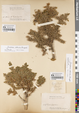
LE 01191806
Juniperus sibirica Burgsd. det. Orlova, Larisa Vladimirovna at 09.07.2022
Additional identifications: Juniperus communis L. det. Trautvetter, Rudolf Ernst von Collectors: Czekanowski, Alexander Piotr; Müller (Mueller), Ferdinand Ferdinandovich Collection date: 23.06.1874. Administrative regions: RU - Respublika Sakha (Yakutiya) - Olenyoksky District. Place of collection: Восточная Сибирь, бассейн р. Оленёк, р. Верхняя Томба (Ad fl. Tomba Superiorem. Sibiria orient. ad fl. Olenek).Groups of specimens: Образцы сектора Сибири и Дальнего Востока России; Соглашение Минобрнауки №075-15-2021-1056; Museum botan. Acad. Petrop.Original label text:[1]Берег р. Верхн. Томбы 23 Июня [2]Museum botan. Acad. Petrop. Juniperus communis L. Ad fl. Tomba Superiorem. Sibiria orient. ad fl. Olenek legg. A. Czekanowski et F. Müller 1874. 23 Junii
Landscape in location of collection: берег рекиCoordinates (geographic position): 67° 2′ 59.14″ N, 106° 42′ 22.68″ E ±30000 mRecord creation: 2022-07-09, Larisa Orlova, PhotoScan D2. Part 1.Citation: Specimen LE 01191806 // Virtual herbarium of Komarov Botanical Institute RAS — http://re.herbariumle.ru/01191806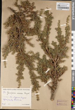
LE 01191805
Juniperus sibirica Burgsd. det. Busch
Collectors: Sukaczev, Vladimir Nikolajevich Field collecting number: 270. Collection date: 14.08.1925. Administrative regions: RU - Irkutskaya Oblast' - Slyudyanskiy Rayon. Place of collection: оз. Байкал, ст. Мурино, край тракта близ оз. Байкал.Groups of specimens: Образцы сектора Сибири и Дальнего Востока России; Соглашение Минобрнауки №075-15-2021-1056Original label text:Museum Botanicum Academiae Scientiarum Petropolitanae. 270. Juniperus sibirica Burgsd. Оз. Байкал. Ст. Мурино. У края тракта близ Байкала. 14.VIII.1925 г. Собр. В. Сукачев
Landscape in location of collection: берег крупного озераHabitat / plant community in location of collecting: край трактаCoordinates (geographic position): 51° 28′ 33.19″ N, 104° 24′ 21.38″ E ±2000 mRecord creation: 2022-07-09, Larisa Orlova, PhotoScan D2. Part 1.Citation: Specimen LE 01191805 // Virtual herbarium of Komarov Botanical Institute RAS — http://re.herbariumle.ru/01191805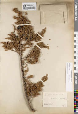
LE 01191804
Juniperus sibirica Burgsd. det. Orlova, Larisa Vladimirovna at 09.07.2022
Additional identifications: Juniperus communis L. det. Turczaninow, Nicolai Stepanowisch at 1828 Collectors: Turczaninow, Nicolai Stepanowisch Collection date: 1828. Administrative regions: RU - Irkutskaya Oblast' - Slyudyanskiy Rayon. Place of collection: Восточная Сибирь, раб. пос. Култук.Groups of specimens: Образцы сектора Сибири и Дальнего Востока России; Соглашение Минобрнауки №075-15-2021-1056Original label text:Juniperus communis L. Sibiria oriental. Kultuk 1928 Turcz
Coordinates (geographic position): 51° 43′ 31.65″ N, 103° 42′ 33.47″ E ±15000 mRecord creation: 2022-07-09, Larisa Orlova, PhotoScan D2. Part 1.Citation: Specimen LE 01191804 // Virtual herbarium of Komarov Botanical Institute RAS — http://re.herbariumle.ru/01191804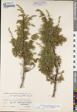
LE 01191803
Juniperus niemannii E.L. Wolf ⟨intermediate forma⟩ det. Orlova, Larisa Vladimirovna at 09.07.2022
Additional identifications: Juniperus sibirica Burgsd. det. Lukitscheva, A.N. at 1961 Collectors: Lukitscheva, A.N. Collection date: 08.1961. Administrative regions: RU - Irkutskaya Oblast' - Ust'-Kutskiy Rayon. Place of collection: бассейн р. Кута, р. Купа, мелкоувалистое плато, на карбонатных породах, сухой каменистый склон.Groups of specimens: Образцы сектора Сибири и Дальнего Востока России; Соглашение Минобрнауки №075-15-2021-1056Original label text:Гербарий Ботанического института АН СССР. Juniperus sibirica L. Иркутская область, Усть-Кутский район. Бассейн р.р. Куты, Купы. Мелкоувалистое плато, на карбонатных породах. Сухой каменистый склон. 1961 г. август. А. Лукичева
Landscape in location of collection: сухой каменистый склонSubstrate in collecting location: карбонатные породыCoordinates (geographic position): 56° 56′ 1.61″ N, 105° 0′ 42.79″ E ±135000 mRecord creation: 2022-07-09, Larisa Orlova, PhotoScan D2. Part 1.Citation: Specimen LE 01191803 // Virtual herbarium of Komarov Botanical Institute RAS — http://re.herbariumle.ru/01191803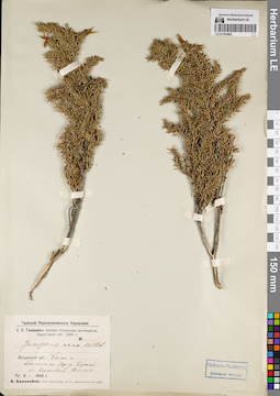
LE 01191802
Juniperus nana Willd. det. Ganeschin, Sergej Sergejewitsch at 1909
Collectors: Ganeschin, Sergej Sergejewitsch Collection date: 20.05.1909. Administrative regions: RU - Irkutskaya Oblast' - Ust'-Udinskiy Rayon. Place of collection: болото по берегу р. Черная (приток р. Илим) близ верховья р. Илим.Expedition: С.С. Ганешин: Ангаро-Илимская экспедиция, Иркутской губ. 1909 г. (1909)Groups of specimens: Образцы сектора Сибири и Дальнего Востока России; Соглашение Минобрнауки №075-15-2021-1056; Гербарий Переселенческого УправленияOriginal label text:Гербарий Переселенческого Управления. С.С. Ганешин: Ангаро-Илимская экспедиция, Иркутской губ. 1909 г. Juniperus nana Willd. Иркутской губ.: Балаг. у. Болото по бер. р. Черной бл. верховья Илима. 20 V. 1909 г. S. Ganeschin: Iter Irkutense ad fl. Angara-Illim 1909
Landscape in location of collection: берег рекиHabitat / plant community in location of collecting: болотоCoordinates (geographic position): 54° 41′ 15.68″ N, 103° 43′ 7.37″ E ±3000 mRecord creation: 2022-07-09, Larisa Orlova, PhotoScan D2. Part 1.Citation: Specimen LE 01191802 // Virtual herbarium of Komarov Botanical Institute RAS — http://re.herbariumle.ru/01191802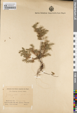
LE 01191801
Juniperus sibirica Burgsd. det. Akatov, V.N. at 1912
Additional identifications: Juniperus nana Willd. det. Akatov, V.N. at 1912 Collectors: Akatov, V.N. Collection date: 1912. Administrative regions: RU - Irkutskaya Oblast' - Bodaybinskiy Rayon. Place of collection: р. Ныгри, кл. Верный, прииск Верный.Groups of specimens: Образцы сектора Сибири и Дальнего Востока России; Соглашение Минобрнауки №075-15-2021-1056; От Общества изучения СибириOriginal label text:Herbarium Horti Botanici Imperialis Petri Magni. От Общества изучения Сибири. Juniperus sibirica = J. nana. Иркут. окр. прииск Верный. Собр. В.Н. Акатов. 1912 г.
Coordinates (geographic position): 58° 32′ 23.7″ N, 115° 19′ 49.24″ E ±2000 mRecord creation: 2022-07-09, Larisa Orlova, PhotoScan D2. Part 1.Citation: Specimen LE 01191801 // Virtual herbarium of Komarov Botanical Institute RAS — http://re.herbariumle.ru/01191801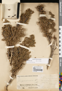
LE 01191800
Juniperus sibirica Burgsd. det. Orlova, Larisa Vladimirovna at 09.07.2022
Additional identifications: Juniperus nana Willd. det. Borodin, Ivan Parfenevich Collectors: Golovnin, David Nikolaevich Field collecting number: 64. Collection date: 14.07.1901. Administrative regions: RU - Irkutskaya Oblast' - Nizhneudinskiy Rayon. Place of collection: бассейн р. Уда, р. Уда близ устья р. Нерха, на горах по моховому ковру.Groups of specimens: Образцы сектора Сибири и Дальнего Востока России; Соглашение Минобрнауки №075-15-2021-1056Object features: Обыкновен.Original label text:[1]Museum Botanicum Academiae Scientiarum Petropolitanae. 64. Juniperus nana W. (ИБ). Иркутск. губ. Нижнеуд. у. Басс. р. Уды. Р. Уда бл. устья р. Нерхи. На горах по моховому ковру. 14 Июля 1901. Собр. Д.И. Головнин. [2] Можжевельн.? р. Уда бл. устья р. Нерхи. На горах, по моховому покрову. Обыкновен. 14 июля
Landscape in location of collection: гораHabitat / plant community in location of collecting: моховой коверCoordinates (geographic position): 53° 50′ 14.92″ N, 98° 20′ 9.45″ E ±2500 mRecord creation: 2022-07-09, Larisa Orlova, PhotoScan D2. Part 1.Citation: Specimen LE 01191800 // Virtual herbarium of Komarov Botanical Institute RAS — http://re.herbariumle.ru/01191800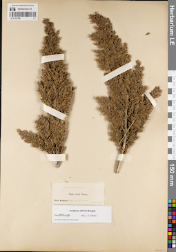
LE 01191799
Groups of specimens: Образцы сектора Сибири и Дальнего Востока России; Соглашение Минобрнауки №075-15-2021-1056Record creation: 2022-07-09, Larisa Orlova, PhotoScan D2. Part 1.Citation: Specimen LE 01191799 // Virtual herbarium of Komarov Botanical Institute RAS — http://re.herbariumle.ru/01191799
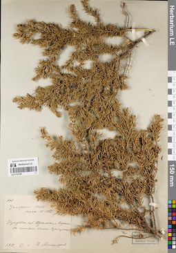
LE 01191798
Juniperus nana Willd. det. Ganeschin, Sergej Sergejewitsch
Collectors: Alexandrov, P. Field collecting number: 991. Collection date: 03.06.1912. Administrative regions: RU - Irkutskaya Oblast' - Kazachinsko-Lenskiy Rayon. Place of collection: с. Карам, моховое болото, кустарник.Groups of specimens: Образцы сектора Сибири и Дальнего Востока России; Соглашение Минобрнауки №075-15-2021-1056Object features: КустарникOriginal label text:991. juniperus nana Willd. (СГ) Иркутск. губ. Верхоленск. у. с. Карам. На моховом болоте. Кустарник. 1912.VI.3. П. Александров
Habitat / plant community in location of collecting: моховое болотоCoordinates (geographic position): 55° 8′ 33.27″ N, 107° 36′ 2.81″ E ±10000 mRecord creation: 2022-07-09, Larisa Orlova, PhotoScan D2. Part 1.Citation: Specimen LE 01191798 // Virtual herbarium of Komarov Botanical Institute RAS — http://re.herbariumle.ru/01191798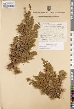
LE 01191797
Juniperus sibirica Burgsd. det. Orlova, Larisa Vladimirovna at 09.07.2022
Additional identifications: Juniperus communis var. nana Willd. det. Kusnezow (Kuznetszov, Kusnezov), Ivan Vasilievich at 1913; Juniperus nana Willd. det. Kusnezow (Kuznetszov, Kusnezov), Ivan Vasilievich at 1913 Collectors: Kusnezow (Kuznetszov, Kusnezov), Ivan Vasilievich Field collecting number: 3993. Collection date: 19.07.1913. Administrative regions: RU - Respublika Tyva - Todzhinskiy Rayon. Subregion: Тоджинский кожуун. Place of collection: склон к р. Алгияк (павый приток р. Сыстыг-Хем).Expedition: И.В. Кузнецов: Экспедиция в Урянхай. 1913 (1913)Groups of specimens: Образцы сектора Сибири и Дальнего Востока России; Соглашение Минобрнауки №075-15-2021-1056; Гербарий Переселенческого УправленияOriginal label text:Гербарий Переселенческого Управления. И.В. Кузнецов: Экспедиция в Урянхай. 1913. № 3993. Juniperus communis v. nana = J. nana Willd. Урянхайские владения. По склону к р. Алгиаку (прав. прит. р. Систиг-Кема). 19.VII. J.W. Kusnezow: Iter ad reg. Urjanchai. 1913
Landscape in location of collection: склон к рекеCoordinates (geographic position): 53° 7′ 15.73″ N, 94° 47′ 5.52″ E ±10000 mRecord creation: 2022-07-09, Larisa Orlova, PhotoScan D2. Part 1.Citation: Specimen LE 01191797 // Virtual herbarium of Komarov Botanical Institute RAS — http://re.herbariumle.ru/01191797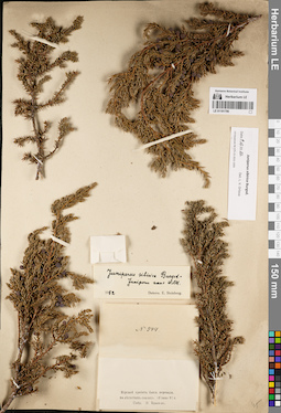
LE 01191796
Juniperus sibirica Burgsd. det. Orlova, Larisa Vladimirovna at 09.07.2022
Additional identifications: Juniperus sibirica Burgsd. det. Steinberg, Elisabeth Ivanovna at 1952; Juniperus nana Willd. det. Steinberg, Elisabeth Ivanovna at 1952 Collectors: Krylov, Porphyriy Nikitich Field collecting number: 944. Collection date: 10.06.1892. Administrative regions: RU - Krasnoyarskiy Kray - Yermakovskiy Rayon. Place of collection: хр. Мирской близ перевала, на лесистых скалах.Groups of specimens: Образцы сектора Сибири и Дальнего Востока России; Соглашение Минобрнауки №075-15-2021-1056Original label text:№ 944. Мирской хребет близ перевала, на лесистых скалах. 10 июня 92 г. Собр. П. Крылов
Landscape in location of collection: лесистые скалыHabitat / plant community in location of collecting: лесCoordinates (geographic position): 52° 23′ 57.12″ N, 92° 48′ 0″ E ±20000 mRecord creation: 2022-07-09, Larisa Orlova, PhotoScan D2. Part 1.Citation: Specimen LE 01191796 // Virtual herbarium of Komarov Botanical Institute RAS — http://re.herbariumle.ru/01191796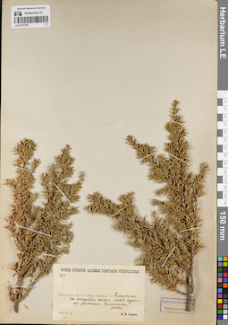
LE 01191795
Groups of specimens: Образцы сектора Сибири и Дальнего Востока России; Соглашение Минобрнауки №075-15-2021-1056Record creation: 2022-07-09, Larisa Orlova, PhotoScan D2. Part 1.Citation: Specimen LE 01191795 // Virtual herbarium of Komarov Botanical Institute RAS — http://re.herbariumle.ru/01191795
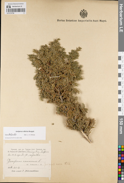
LE 01191794
Juniperus sibirica Burgsd. det. Orlova, Larisa Vladimirovna at 09.07.2022
Additional identifications: Juniperus communis var. nana Willd. det. Miklashevskaya, Henrika Pavlovna at 1915; Juniperus nana Willd. det. Busch Collectors: Miklashevskaya, Henrika Pavlovna Collection date: 20.07.1915. Administrative regions: RU - Respublika Tyva - Tandinskiy Rayon. Subregion: Тандинский кожуун. Place of collection: долина р. Дурген (Тургень) (система Элегеса), пос. Бай-Хаак (Верхне-Никольский), хр. Танну-Ола, кедрач в 11 км от пос. Бай-Хаак.Groups of specimens: Образцы сектора Сибири и Дальнего Востока России; Соглашение Минобрнауки №075-15-2021-1056Object features: нередкоOriginal label text:Урянхай, дол. рч. Тургень (сист. Элегеса), пос. В.-Никольский (Бай-Хак), Танну-Ола, кедрач в 10 в. от В-Н., нередко. Juniperus communis L. v. nana = Juniperus nana. 1915-20-VII. Собр. и опред. Г. Миклашевская
Habitat / plant community in location of collecting: кедрачCoordinates (geographic position): 51° 6′ 36.96″ N, 94° 36′ 14.8″ E ±10000 mRecord creation: 2022-07-09, Larisa Orlova, PhotoScan D2. Part 1.Citation: Specimen LE 01191794 // Virtual herbarium of Komarov Botanical Institute RAS — http://re.herbariumle.ru/01191794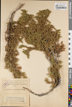
LE 01191793
Juniperus sibirica Burgsd. det. Sobolevskaja, Kira Arkadyevna at 1945
Collectors: Sobolevskaja, Kira Arkadyevna Field collecting number: дублет. Collection date: 31.07.1945. Administrative regions: RU - Respublika Tyva. Subregion: Чеди-Хольский кожуун. Place of collection: хр. Восточный Танну-Ола, долина р. Пахчи-одыр притока р. Тарбаган, мох-лишайниковая тундра.Expedition: Тувинская ботаническая экспедиция (1945 -1947)Groups of specimens: Образцы сектора Сибири и Дальнего Востока России; Соглашение Минобрнауки №075-15-2021-1056; Зап.-Сиб. Филиал Академии Наук СССРOriginal label text:Дублет. Зап.-Сиб. Филиал Академии Наук СССР. Тувинская ботаническая экспедиция 1945. Juniperus sibirica Burgs. Тувинская обл. Хр.В. Танну-Ола. Долина р. Пахчи-одыр прит. р. Тарбаган-ных - 50° 53' с.ш. и 93° 58' в.д. Мох-лишайн. тундра. 31.VII.1945. К.А. Соболевская
Landscape in location of collection: долина рекиHabitat / plant community in location of collecting: мох-лишайниковая тундраCoordinates (geographic position): 50° 53′ 14.06″ N, 94° 0′ 32.47″ E ±5000 mRecord creation: 2022-07-09, Larisa Orlova, PhotoScan D2. Part 1.Citation: Specimen LE 01191793 // Virtual herbarium of Komarov Botanical Institute RAS — http://re.herbariumle.ru/01191793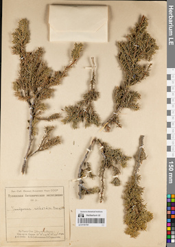
LE 01191791
Juniperus sibirica Burgsd. det. Sobolevskaja, Kira Arkadyevna, Stennikova O. at 1946
Collectors: Sobolevskaja, Kira Arkadyevna; Stennikova O. Collection date: 05.06.1946. Administrative regions: RU - Respublika Tyva - Erzinskiy Rayon. Subregion: Эрзинский кожуун. Place of collection: хр. Танну-Ола, долина р. Нарын, окрестности притока [прииска?] р. Нарын, скалы.Expedition: Тувинская ботаническая экспедиция (1945 -1947)Groups of specimens: Образцы сектора Сибири и Дальнего Востока России; Соглашение Минобрнауки №075-15-2021-1056; Зап.-Сиб. Филиал Академии Наук СССРOriginal label text:Зап.-Сиб. Филиал Академии Наук СССР. Тувинская ботаническая экспедиция 1946. Juniperus sibirica Burgsd. Хр. Танну-Ола. Долина р. Нарын. Окр. пр-ка Нарын. 50° 10' с.ш. 96° 30' в.д. Скалы. 5-VI-1946г. К.А. Соболевская. О. Стенникова
Landscape in location of collection: скалыCoordinates (geographic position): 50° 10′ 0″ N, 96° 30′ 0″ E ±1000 mRecord creation: 2022-07-09, Larisa Orlova, PhotoScan D2. Part 1.Citation: Specimen LE 01191791 // Virtual herbarium of Komarov Botanical Institute RAS — http://re.herbariumle.ru/01191791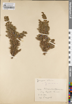
LE 01191790
Juniperus sibirica Burgsd. det. Oschurkow, V.A. at 1912
Additional identifications: Juniperus nana Willd. det. Busch at 1912 Collectors: Oschurkow, V.A. Collection date: 09.07.1912. Administrative regions: RU - Respublika Tyva - Bay-Tayginskiy Rayon. Subregion: Бай-Тайгинский кожуун. Place of collection: озера Андожер куль (Андошер куль) близ верховья р. Кемчик.Groups of specimens: Образцы сектора Сибири и Дальнего Востока России; Соглашение Минобрнауки №075-15-2021-1056Original label text:juniperus sibirica = J. nana. озера Андожер куль (Андошер куль) близ верховий Кемчика 9 VII 1912 Собр. Ошурков
Landscape in location of collection: берег озераCoordinates (geographic position): 50° 52′ 9.93″ N, 89° 21′ 51.61″ E ±5000 mRecord creation: 2022-07-09, Larisa Orlova, PhotoScan D2. Part 1.Citation: Specimen LE 01191790 // Virtual herbarium of Komarov Botanical Institute RAS — http://re.herbariumle.ru/01191790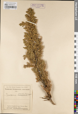
LE 01191789
Juniperus sibirica Burgsd. det. Sobolevskaja, Kira Arkadyevna, Stennikova O. at 1946
Additional identifications: Juniperus communis L. det. Sobolevskaja, Kira Arkadyevna, Stennikova O. at 1946 Collectors: Sobolevskaja, Kira Arkadyevna; Stennikova O. Collection date: 21.06.1946. Administrative regions: RU - Respublika Tyva. Subregion: Каа-Хемский кожуун. Place of collection: хр. Танну-Ола, долина р. Каргам-Пыш, тайга.Expedition: Тувинская ботаническая экспедиция (1945 -1947)Groups of specimens: Образцы сектора Сибири и Дальнего Востока России; Соглашение Минобрнауки №075-15-2021-1056; Зап.-Сиб. Филиал Академии Наук СССРOriginal label text:Зап.-Сиб. Филиал Академии Наук СССР. Тувинская ботаническая экспедиция 1946. Juniperus sibirica Burgsd. Хр. Танну-Ола. Долина реки Каргам-Пыш. 50° 53' с.ш. 96° 36' в.д. Тайга. 21-VI-1946г. К.А. Соболевская. О. Стенникова
Landscape in location of collection: долина рекиHabitat / plant community in location of collecting: тайгаCoordinates (geographic position): 50° 53′ 0″ N, 96° 36′ 0″ E ±5000 mRecord creation: 2022-07-09, Larisa Orlova, PhotoScan D2. Part 1.Citation: Specimen LE 01191789 // Virtual herbarium of Komarov Botanical Institute RAS — http://re.herbariumle.ru/01191789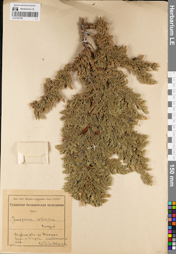
LE 01191788
Juniperus sibirica Burgsd. det. Sobolevskaja, Kira Arkadyevna at 1947
Collectors: Sobolevskaja, Kira Arkadyevna Collection date: 10.08.1947. Administrative regions: RU - Respublika Tyva. Subregion: Тере-Хольский кожуун. Place of collection: хр. Шапшал, верховье р. Каргы, лиственничный лес.Expedition: Тувинская ботаническая экспедиция (1945 -1947)Groups of specimens: Образцы сектора Сибири и Дальнего Востока России; Соглашение Минобрнауки №075-15-2021-1056; Зап.-Сиб. Филиал Академии Наук СССРOriginal label text:Зап.-Сиб. Филиал Академии Наук СССР. Тувинская ботаническая экспедиция 1947. Juniperus sibirica Burgsd. Тувин. обл. хр. Шапшал. Верх. р. Каргы, лиственничн. лес. 10 VIII. К. Соболевская
Habitat / plant community in location of collecting: лиственничный лесCoordinates (geographic position): 50° 23′ 22.96″ N, 96° 41′ 46.11″ E ±20000 mRecord creation: 2022-07-09, Larisa Orlova, PhotoScan D2. Part 1.Citation: Specimen LE 01191788 // Virtual herbarium of Komarov Botanical Institute RAS — http://re.herbariumle.ru/01191788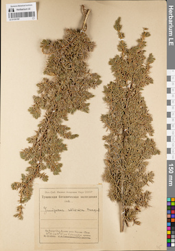
LE 01191787
Juniperus sibirica Burgsd. det. Sobolevskaja, Kira Arkadyevna, Stennikova O. at 1946
Collectors: Sobolevskaja, Kira Arkadyevna; Stennikova O. Collection date: 21.06.1946. Administrative regions: RU - Respublika Tyva - Kaa-Khemskiy Rayon. Subregion: Каа-Хемский кожуун. Place of collection: хр. Танну-Ола, долина р. Каргам-Пыш, субальпийские ерники.Expedition: Тувинская ботаническая экспедиция (1945 -1947)Groups of specimens: Образцы сектора Сибири и Дальнего Востока России; Соглашение Минобрнауки №075-15-2021-1056; Зап.-Сиб. Филиал Академии Наук СССРOriginal label text:Зап.-Сиб. Филиал Академии Наук СССР. Тувинская ботаническая экспедиция 1946. Juniperus sibirica Burgsd. Хр. Танну-Ола. Долина реки Каргам-Пыш. 50° 53' с.ш. 96° 36' в.д. Субальпийск. ерники. 21-VI-1946г. К.А. Соболевская. О. Стенникова
Landscape in location of collection: долина рекиHabitat / plant community in location of collecting: субальпийские ерникиCoordinates (geographic position): 50° 53′ 0″ N, 96° 36′ 0″ E ±5000 mRecord creation: 2022-07-09, Larisa Orlova, PhotoScan D2. Part 1.Citation: Specimen LE 01191787 // Virtual herbarium of Komarov Botanical Institute RAS — http://re.herbariumle.ru/01191787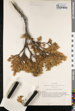
LE 01191786
Juniperus sibirica Burgsd. det. Khanminchun, Valery Mikhailovich, Misin, V. at 1971
Collectors: Khanminchun, Valery Mikhailovich; Misin, V. Field collecting number: 5374. Collection date: 24.06.1971. Administrative regions: RU - Respublika Tyva - Tandinskiy Rayon. Subregion: Тандинский кожуун. Place of collection: северный склон хр. Восточный Танну-Ола, бассейн р. Дурген, верховье руч. Проездной, перевал, осочково-дриасовая тундра, у скал.Groups of specimens: Образцы сектора Сибири и Дальнего Востока России; Соглашение Минобрнауки №075-15-2021-1056; Гербарий Центрального Сибирского ботанического сада СО АН СССРOriginal label text:Гербарий Центрального Сибирского ботанического сада СО АН СССР. Juniperus sibirica Burgsd. № 5374. Тувинская АССР, Тандинский р-н, северный склон хр. В. Танну-Ола, выс. 2075м, бассейн р. Дурген, верховье Проездного ручья, перевал. Осочково-дриасовая тундра, у скал. 24.6.1971г. В. Ханминчун, В. Мисин
Landscape in location of collection: горный перевалHabitat / plant community in location of collecting: осочково-дриасовая тундраCoordinates (geographic position): 50° 59′ 39.7″ N, 94° 23′ 31.93″ E ±5000 m, 2075 m a.s.l.Record creation: 2022-07-09, Larisa Orlova, PhotoScan D2. Part 1.Citation: Specimen LE 01191786 // Virtual herbarium of Komarov Botanical Institute RAS — http://re.herbariumle.ru/01191786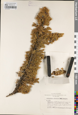
LE 01191785
Juniperus sibirica Burgsd. det. Khanminchun, Valery Mikhailovich at 1971
Collectors: Khanminchun, Valery Mikhailovich; Degtyarev, M. Field collecting number: 5374. Collection date: 28.07.1971. Administrative regions: RU - Respublika Tyva - Tandinskiy Rayon. Subregion: Тандинский кожуун. Place of collection: северный склон хр. Восточный Танну-Ола, окрестности дер. Сосновка в 9 км на юго-юго-запад, лог руч. Малый Дурген, лиственнично-кедровый лес.Groups of specimens: Образцы сектора Сибири и Дальнего Востока России; Соглашение Минобрнауки №075-15-2021-1056; Гербарий Центрального Сибирского ботанического сада СО АН СССРOriginal label text:Гербарий Центрального Сибирского ботанического сада СО АН СССР. Juniperus sibirica [Pall. - crossed out] Burgsd. № 5374. Тувинская АССР, Тандинский р-н, сев. склон хр. В. Танну-Ола, выс. 1600м., окр. д. Сосновка в 9км на Юг-Юг-Запад. Лог ручья Малый Дурген. Лиственнично-кедровый лес. 28.VII.1971г. В. Ханминчун, М. Дегтярев
Landscape in location of collection: лог горного ручьяHabitat / plant community in location of collecting: лиственнично-кедровый лесCoordinates (geographic position): 51° 4′ 7.2″ N, 94° 26′ 11.72″ E ±500 m, 1600 m a.s.l.Record creation: 2022-07-09, Larisa Orlova, PhotoScan D2. Part 1.Citation: Specimen LE 01191785 // Virtual herbarium of Komarov Botanical Institute RAS — http://re.herbariumle.ru/01191785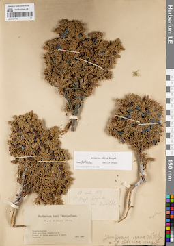
LE 01191784
Juniperus sibirica Burgsd. det. Orlova, Larisa Vladimirovna at 09.07.2022
Additional identifications: Juniperus nana Willd. det. Busch; Juniperus sibirica Burgsd. det. Busch Collectors: Potanin, Grigorii Nikolajevic Collection date: 28.09.1879. Administrative regions: RU - Respublika Tyva. Place of collection: р. Убур Амрбек, склон хр. Танну-Ола.Expedition: Pl. a G.N. Potanin collectae (1879 -1880)Groups of specimens: Образцы сектора Сибири и Дальнего Востока России; Соглашение Минобрнауки №075-15-2021-1056Original label text:[1]28 сент. 1879. Р. Убур Амрбек [...] скл. Танну-Олы. [2] Herbarium horti Petropolitani. Pl. a G.N. Potanin collectae. Mongolia borealis. Circa lacus Ubsa, Kirghiz-nor et Kosogol. Ad Ienisei superiorem et jugum Tannu-ola. 1879, 1880
Coordinates (geographic position): 50° 11′ 46.16″ N, 97° 12′ 6.59″ E ±200000 mRecord creation: 2022-07-09, Larisa Orlova, PhotoScan D2. Part 1.Citation: Specimen LE 01191784 // Virtual herbarium of Komarov Botanical Institute RAS — http://re.herbariumle.ru/01191784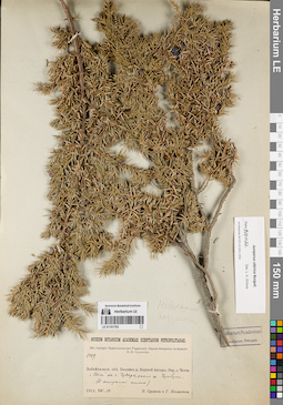
LE 01191783
Juniperus sibirica Burgsd. det. Orlova, Larisa Vladimirovna at 09.07.2022
Collectors: Poplavskaya (Poplawska), Henrietta Ippolitovna; Sukaczev, Vladimir Nikolajevich Field collecting number: 1429. Collection date: 18.08.1912. Administrative regions: RU - Respublika Buryatiya - Severo-Baykal'skiy Rayon. Place of collection: бассейн р. Верхней Ангары, окрестности быв. дер. Ченчи, "волы" на г. Чуварь, около оз. Чумбуки.Expedition: Верхне-Ангарская экспедиция В.Н. Сукачёва (1912)Groups of specimens: Образцы сектора Сибири и Дальнего Востока России; Соглашение Минобрнауки №075-15-2021-1056; Из гербария Переселенческого управленияObject features: Небольшие подушечкиOriginal label text:Museum Botanicum Academiae Scientiarum Petropolitanae. Из гербария Переселенческого Управления. Бассейн р. Верхней Ангары. Окр. д. Ченчи. "Волы" на г. Чуварь, около оз. Чумбуки (S открытый склон). 1912.VIII.18. В. Сукачев и Г. Поплавская
Landscape in location of collection: "волы" на гореCoordinates (geographic position): 55° 56′ 55.57″ N, 111° 1′ 51.36″ E ±2000 mRecord creation: 2022-07-09, Larisa Orlova, PhotoScan D2. Part 1.Citation: Specimen LE 01191783 // Virtual herbarium of Komarov Botanical Institute RAS — http://re.herbariumle.ru/01191783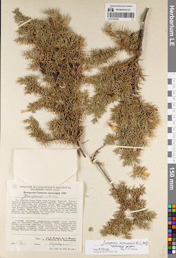
LE 01191782
Juniperus niemannii E.L. Wolf ⟨intermediate forma⟩ det. Orlova, Larisa Vladimirovna at 09.07.2022
Additional identifications: Juniperus sibirica Burgsd. det. Shukhobodsky, Boris Alexandrovich Collectors: Fedorov, Alexander Alexandrovich; Fedorov, Andrey Aleksandrovich; Nikitin, A.A.; Krasilnikov, Pavel Konstantinovich Field collecting number: 196. Collection date: 12.08.1949. Administrative regions: RU - Krasnoyarskiy Kray - Sayanskiy Rayon. Place of collection: долина р. Янга, г. Тукшинское Белогорье, лиственничная кедровая тайга, скалы таежного пояса.Expedition: Центрально-Саянская экспедиция 1949 (1949)Groups of specimens: Образцы сектора Сибири и Дальнего Востока России; Соглашение Минобрнауки №075-15-2021-1056Original label text:Гербарий Ботанического института Академии Наук СССР. Центрально-Саянская экспедиция 1949. Juniperus sibirica. долина Янги. Белогорье Тукшинское. Лиственничная кедровая тайга. Скалы таежного пояса. Собр.: Ал. А. Федоров, Ан. А. Федоров, А. А. Никитин, П.К. Красильников. 1949 12.VIII. Опред.: Шухободский
Landscape in location of collection: скалы таежного поясаHabitat / plant community in location of collecting: лиственнично-кедровая тайгаCoordinates (geographic position): 54° 24′ 58.74″ N, 95° 44′ 2.48″ E ±5000 mRecord creation: 2022-07-09, Larisa Orlova, PhotoScan D2. Part 1.Citation: Specimen LE 01191782 // Virtual herbarium of Komarov Botanical Institute RAS — http://re.herbariumle.ru/01191782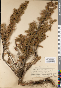
LE 01191781
Juniperus sibirica Burgsd. det. Shroeter, A.I. at 1946
Collectors: Shroeter, A.I. Collection date: 10.08.1946. Administrative regions: RU - Respublika Tyva. Subregion: Улуг-Хемский кожуун. Place of collection: р. Сайлиг-Хем в 10 км от места его впадения в р. Чаа-Холь.Expedition: А.И. Шретер. Растения Центральной Тувы 1946 г. (1946)Groups of specimens: Образцы сектора Сибири и Дальнего Востока России; Соглашение Минобрнауки №075-15-2021-1056; Н.И.И. Ботаники МГУOriginal label text:Н.И.И. Ботаники МГУ. А.И. Шретер. Растения Центральной Тувы 1946 г. Juniperus sibirica Burgsd. р. Сайлиг-Хем в 10 км от места его впадения в р. Чаа-Холь. Мохово-лишайниковая тундра с редкими кедрами по каменистой осыпи с.в. экспозиции. 10/VIII 46. А. Шретер
Landscape in location of collection: каменистая осыпь северо-восточной экспозицииHabitat / plant community in location of collecting: мохово-лишайниковая тундра с редкими кедрамиCoordinates (geographic position): 51° 14′ 32.51″ N, 92° 18′ 32.67″ E ±2000 mRecord creation: 2022-07-09, Larisa Orlova, PhotoScan D2. Part 1.Citation: Specimen LE 01191781 // Virtual herbarium of Komarov Botanical Institute RAS — http://re.herbariumle.ru/01191781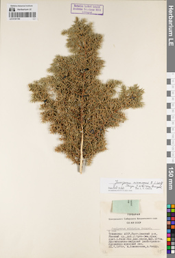
LE 01191780
Juniperus niemannii E.L. Wolf ⟨close to Juniperus sibirica Burgsd.⟩ det. Orlova, Larisa Vladimirovna at 09.07.2022
Additional identifications: Juniperus sibirica Burgsd. det. Choodu, A., Lomonosova, Maria Nikolaevna at 1976 Collectors: Lomonosova, Maria Nikolaevna; Choodu, A. Field collecting number: 266. Collection date: 22.07.1976. Administrative regions: RU - Respublika Tyva. Subregion: Улуг-Хемский кожуун. Place of collection: Уюкский хр., долина р. Ортаа-Хем, правый приток р. Баян-Кол, южный склон.Groups of specimens: Образцы сектора Сибири и Дальнего Востока России; Соглашение Минобрнауки №075-15-2021-1056; Гербарий Центрального Сибирского ботанического сада СО АН СССРOriginal label text:Гербарий Центрального Сибирского ботанического сада СО АН СССР. Juniperus sibirica Burgsd. № 266. Тувинская АССР, Улуг-Хемский р-н, Уюкский хр., дол. р. Орто-Хем, прав. прит. р. Баян-Кол, южн. склон, выс. 1870м. Лиственнично-кедровый разнотравно-бруснично-ирисовый лес. 22.7.1976г. М. Ломоносова, А. Чоод
Landscape in location of collection: южный склонCoordinates (geographic position): 51° 48′ 33.32″ N, 93° 22′ 59.33″ E ±5000 m, 1870 m a.s.l.Record creation: 2022-07-09, Larisa Orlova, PhotoScan D2. Part 1.Citation: Specimen LE 01191780 // Virtual herbarium of Komarov Botanical Institute RAS — http://re.herbariumle.ru/01191780