View
Add
Copy
Edit
Delete
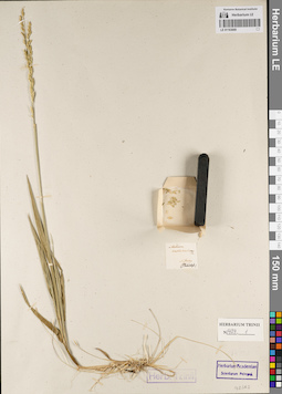
LE 01163669
Groups of specimens: Гербарий Карла Бернхарда Триниуса; Соглашение Минобрнауки №075-15-2021-1056Record creation: 2022-07-01, Larisa Orlova, PhotoScan D2. Part 2.Citation: Specimen LE 01163669 // Virtual herbarium of Komarov Botanical Institute RAS — http://re.herbariumle.ru/01163669
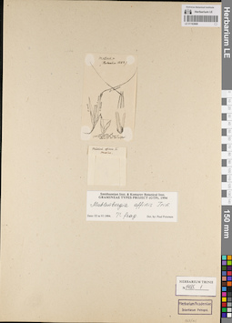
LE 01163668
Groups of specimens: Гербарий Карла Бернхарда Триниуса; Соглашение Минобрнауки №075-15-2021-1056Record creation: 2022-07-01, Larisa Orlova, PhotoScan D2. Part 2.Citation: Specimen LE 01163668 // Virtual herbarium of Komarov Botanical Institute RAS — http://re.herbariumle.ru/01163668
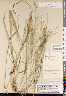
LE 01163667
Groups of specimens: Гербарий Карла Бернхарда Триниуса; Соглашение Минобрнауки №075-15-2021-1056Record creation: 2022-07-01, Larisa Orlova, PhotoScan D2. Part 2.Citation: Specimen LE 01163667 // Virtual herbarium of Komarov Botanical Institute RAS — http://re.herbariumle.ru/01163667
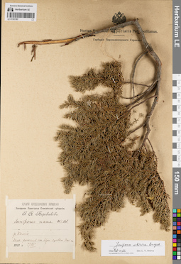
LE 01191767
Juniperus sibirica Burgsd. det. Orlova, Larisa Vladimirovna at 01.07.2022
Additional identifications: Juniperus nana Willd. det. Borovikov, Georgy Andrejevich at 1910 Collectors: Borovikov, Georgy Andrejevich Collection date: 05.07.1910. Administrative regions: RU - Krasnoyarskiy Kray - Evenkiyskiy District. Place of collection: р. Комо, каменистая россыпь на вершине хребта, тайга.Expedition: Западное Заангарье Енисейской губернии. Г. А. Боровиков (1909 -1910)Groups of specimens: Образцы сектора Сибири и Дальнего Востока России; Соглашение Минобрнауки №075-15-2021-1056; Гербарий Переселенческого УправленияOriginal label text:Гербарий Переселенческого Управления. Западное Заангарье Енисейской губернии. Г.А. Боровиков. Juniperus nana Wild. р. Комо. Кам. россыпь на верш. хребта. Тайга. 1910 г. 5/VII
Landscape in location of collection: каменистая россыпь на вершине хребтаHabitat / plant community in location of collecting: тайгаCoordinates (geographic position): 61° 5′ 41.38″ N, 96° 28′ 7.31″ E ±100000 mRecord creation: 2022-07-01, Larisa Orlova, PhotoScan D2. Part 1.Citation: Specimen LE 01191767 // Virtual herbarium of Komarov Botanical Institute RAS — http://re.herbariumle.ru/01191767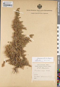
LE 01191766
Juniperus sibirica Burgsd. det. Orlova, Larisa Vladimirovna at 01.07.2022
Additional identifications: Juniperus nana Willd. det. Borovikov, Georgy Andrejevich at 1910 Collectors: Borovikov, Georgy Andrejevich Collection date: 27.06.1910. Administrative regions: RU - Krasnoyarskiy Kray; RU - Krasnoyarskiy Kray - Evenkiyskiy District. Place of collection: Западное Заангарье, р. Комо, сосна на глинистом склоне к югу.Expedition: Западное Заангарье Енисейской губернии. Г. А. Боровиков (1909 -1910)Groups of specimens: Образцы сектора Сибири и Дальнего Востока России; Соглашение Минобрнауки №075-15-2021-1056; Гербарий Переселенческого УправленияOriginal label text:Гербарий Переселенческого Управления. Западное Заангарье Енисейской губернии. Г.А. Боровиков. Juniperus nana Wild. р. Комо. 27-VI Сосна на глин. склоне к S. 1910 г.
Landscape in location of collection: глинистый склон к югуHabitat / plant community in location of collecting: отдельная соснаCoordinates (geographic position): 61° 5′ 41.38″ N, 96° 28′ 7.31″ E ±100000 mRecord creation: 2022-07-01, Larisa Orlova, PhotoScan D2. Part 1.Citation: Specimen LE 01191766 // Virtual herbarium of Komarov Botanical Institute RAS — http://re.herbariumle.ru/01191766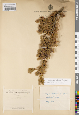
LE 01191765
Juniperus sibirica Burgsd. det. Orlova, Larisa Vladimirovna at 01.07.2022
Additional identifications: Juniperus nana Willd. det. Busch Collectors: Kusnezow, Nicolai Ivanovitch; Reverdatto, Viktor Vladimirovich Collection date: 26.05.1914. Administrative regions: RU - Krasnoyarskiy Kray - Turukhanskiy Rayon. Place of collection: окрестности дер. Мироедиха, редко, хвойный лес.Groups of specimens: Образцы сектора Сибири и Дальнего Востока России; Соглашение Минобрнауки №075-15-2021-1056; Гербарий Переселенческого УправленияObject features: редк.Original label text:[1]Гербарий Переселенческого Управления. Н.И. Кузнецов и В.В. Ревердатто Экспедиция в Туруханский край. 1914 г. J. nana Willd. N.I. Kusnezow et W.W. Reverdatto. Iter ad distr. Turuchansk gub. Enisseisk. 1914 [2] Окр. д. Мироедихи редк. хвойный лес. 26/V 914г.
Habitat / plant community in location of collecting: хвойный лесCoordinates (geographic position): 65° 35′ 43.06″ N, 88° 4′ 2.12″ E ±2000 mRecord creation: 2022-07-01, Larisa Orlova, PhotoScan D2. Part 1.Citation: Specimen LE 01191765 // Virtual herbarium of Komarov Botanical Institute RAS — http://re.herbariumle.ru/01191765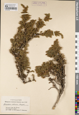
LE 01191764
Juniperus sibirica Burgsd. det. Mogilevtzeva, A., Anjiganov, V. at 1965
Collectors: Mogilevtzeva, A.; Anjiganov, V. Collection date: 30.06.1965. Administrative regions: RU - Krasnoyarskiy Kray - Karatuzskiy Rayon. Place of collection: Западный Саян, хр. Ергаки, кустарниковая тундра.Groups of specimens: Образцы сектора Сибири и Дальнего Востока России; Соглашение Минобрнауки №075-15-2021-1056; Гербарий Сибирского отделения Академии наук СССРOriginal label text:Гербарий Сибирского отделения Академии наук СССР. Juniperus sibirica Burgsd. Западный Саян. Хр. Ергаки. Кустарниковая тундра. 30-VI 1965г. А. Могилевцева, В. Анжиганов
Landscape in location of collection: склон горного хребтаHabitat / plant community in location of collecting: кустарниковая тундраCoordinates (geographic position): 52° 51′ 7.55″ N, 93° 24′ 20.04″ E ±10000 mRecord creation: 2022-07-01, Larisa Orlova, PhotoScan D2. Part 1.Citation: Specimen LE 01191764 // Virtual herbarium of Komarov Botanical Institute RAS — http://re.herbariumle.ru/01191764
LE 01191763
Juniperus sibirica Burgsd. det. Orlova, Larisa Vladimirovna at 01.07.2022
Additional identifications: Juniperus nana Willd. det. Borovikov, Georgy Andrejevich at 1910 Collectors: Borovikov, Georgy Andrejevich Collection date: 21.06.1910. Administrative regions: RU - Krasnoyarskiy Kray - Boguchanskiy Rayon. Place of collection: р. Микчанда, кедровая тайга.Expedition: Западное Заангарье Енисейской губернии. Г. А. Боровиков (1909 -1910)Groups of specimens: Образцы сектора Сибири и Дальнего Востока России; Соглашение Минобрнауки №075-15-2021-1056; Гербарий Переселенческого УправленияOriginal label text:Гербарий Переселенческого Управления. Западное Заангарье Енисейской губернии. Г.А. Боровиков. Juniperus nana Wild. р. Микчанда. Кедровая тайга. 21-VI. 1910 г
Landscape in location of collection: берег рекиHabitat / plant community in location of collecting: кедровая тайгаCoordinates (geographic position): 59° 23′ 13.74″ N, 96° 52′ 40.5″ E ±20000 mRecord creation: 2022-07-01, Larisa Orlova, PhotoScan D2. Part 1.Citation: Specimen LE 01191763 // Virtual herbarium of Komarov Botanical Institute RAS — http://re.herbariumle.ru/01191763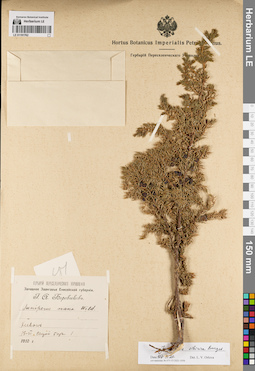
LE 01191762
Juniperus sibirica Burgsd. det. Orlova, Larisa Vladimirovna at 01.07.2022
Additional identifications: Juniperus nana Willd. det. Borovikov, Georgy Andrejevich at 1910 Collectors: Borovikov, Georgy Andrejevich Collection date: 18.06.1910. Administrative regions: RU - Krasnoyarskiy Kray - Boguchanskiy Rayon. Place of collection: р. Хивон, сырой бор.Expedition: Западное Заангарье Енисейской губернии. Г. А. Боровиков (1909 -1910)Groups of specimens: Образцы сектора Сибири и Дальнего Востока России; Соглашение Минобрнауки №075-15-2021-1056; Гербарий Переселенческого УправленияOriginal label text:Гербарий Переселенческого Управления. Западное Заангарье Енисейской губернии. Г.А. Боровиков. Juniperus nana Wild. Хивон. 18-VI Сырой бор. 1910 г.
Landscape in location of collection: берег рекиHabitat / plant community in location of collecting: сырой борCoordinates (geographic position): 58° 56′ 35.99″ N, 96° 51′ 50.65″ E ±10000 mRecord creation: 2022-07-01, Larisa Orlova, PhotoScan D2. Part 1.Citation: Specimen LE 01191762 // Virtual herbarium of Komarov Botanical Institute RAS — http://re.herbariumle.ru/01191762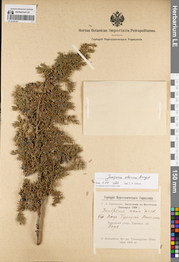
LE 01191761
Juniperus sibirica Burgsd. det. Orlova, Larisa Vladimirovna at 01.07.2022
Additional identifications: Juniperus nana Willd. det. Borovikov, Georgy Andrejevich at 1909 Collectors: Borovikov, Georgy Andrejevich Collection date: 01.08.1909. Administrative regions: RU - Krasnoyarskiy Kray - Evenkiyskiy District. Place of collection: р. Подкаменная Тунгуска, ур. Панолик, бор.Expedition: Г.А. Боровиков: Экспедиция в Восточное Заангарье (1909)Groups of specimens: Образцы сектора Сибири и Дальнего Востока России; Соглашение Минобрнауки №075-15-2021-1056; Гербарий Переселенческого УправленияOriginal label text:Гербарий Переселенческого Управления. Г.А. Боровиков. Экспедиция в Восточное Заангарье 1909 г. Juniperus nana Wild. 1/VIII. Подк. Тунгуска. Панолик. Енисейский уезд, Енисейск. губ. Бор. G. Borowikow: Iter per Transangariam Orientalem 1909 an
Habitat / plant community in location of collecting: борCoordinates (geographic position): 60° 21′ 29.92″ N, 101° 20′ 18.75″ E ±5000 mRecord creation: 2022-07-01, Larisa Orlova, PhotoScan D2. Part 1.Citation: Specimen LE 01191761 // Virtual herbarium of Komarov Botanical Institute RAS — http://re.herbariumle.ru/01191761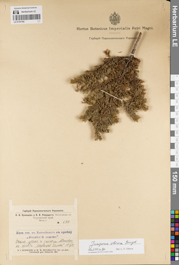
LE 01191760
Juniperus sibirica Burgsd. det. Orlova, Larisa Vladimirovna at 01.07.2022
Collectors: Kusnezow, Nicolai Ivanovitch; Reverdatto, Viktor Vladimirovich Field collecting number: 683. Collection date: 01.07.1914. Administrative regions: RU - Krasnoyarskiy Kray - Taymyrsky Dolgano-Nenetsky District. Place of collection: путь от ст. Хантайского к хр. Медвежий камень, скалы, утесы и заросли Alnaster на хр. Медвежий Камень.Expedition: Н.И. Кузнецов и В.В. Ревердатто. Экспедиция в Туруханский край. 1914 г. (1914)Groups of specimens: Образцы сектора Сибири и Дальнего Востока России; Соглашение Минобрнауки №075-15-2021-1056; Гербарий Переселенческого УправленияOriginal label text:Гербарий Переселенческого Управления. Н.И. Кузнецов и В.В. Ревердатто Экспедиция в Туруханский край. 1914 г. № 683. Juniperus nana Willd. Путь от ст. Хантайского к хребту "Медвежий камень". Скалы, утесы и заросли Alnaster на хребте "Медвежий Камень". 1/VII 1914 г. N.I. Kusnezow et W.W. Reverdatto. Iter ad distr. Turuchansk gub. Enisseisk. 1914
Landscape in location of collection: скалы и утесыHabitat / plant community in location of collecting: заросли AlnasterCoordinates (geographic position): 68° 8′ 13.94″ N, 86° 44′ 6.79″ E ±100000 mRecord creation: 2022-07-01, Larisa Orlova, PhotoScan D2. Part 1.Citation: Specimen LE 01191760 // Virtual herbarium of Komarov Botanical Institute RAS — http://re.herbariumle.ru/01191760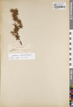
LE 01191759
Groups of specimens: Образцы сектора Сибири и Дальнего Востока России; Соглашение Минобрнауки №075-15-2021-1056Record creation: 2022-07-01, Larisa Orlova, PhotoScan D2. Part 1.Citation: Specimen LE 01191759 // Virtual herbarium of Komarov Botanical Institute RAS — http://re.herbariumle.ru/01191759
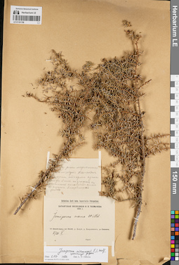
LE 01191758
Juniperus niemannii E.L. Wolf ⟨intermediate forma⟩ det. Orlova, Larisa Vladimirovna at 01.07.2022
Additional identifications: Juniperus nana Willd. det. Tolmachev, Innokentij Pavlovich at 1905 Collectors: Tolmachev, Innokentij Pavlovich Collection date: 21.05.1905. Administrative regions: RU - Krasnoyarskiy Kray - Taymyrsky Dolgano-Nenetsky District. Place of collection: р. Котуй, р. Сордонгнох (Хоордоннох).Expedition: Хатангская экспедиция И.П. Толмачева (1905)Groups of specimens: Образцы сектора Сибири и Дальнего Востока России; Соглашение Минобрнауки №075-15-2021-1056Original label text:[1]8/21 V 1905. На берегу речки можевельнной. [...]куты его завут кы-тунь. Два сучка от одного куста. Ягоды были позеленые и осыпались. После будет взят с корнем. Встречается редко [2] Herbarium Horti botan. Imperialis Petropolitani. Хатангская экспедиция И.П. Толмачева 1905 г. Juniperus nana Willd. р. Котуй, р. Хоордоннох. 8/21 V. Опред
Landscape in location of collection: берег рекиCoordinates (geographic position): 69° 28′ 54.97″ N, 103° 22′ 28.47″ E ±5000 mRecord creation: 2022-07-01, Larisa Orlova, PhotoScan D2. Part 1.Citation: Specimen LE 01191758 // Virtual herbarium of Komarov Botanical Institute RAS — http://re.herbariumle.ru/01191758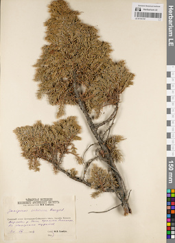
LE 01191757
Juniperus sibirica Burgsd. det. Sambuk, Feodosij Viktorovich at 1934
Collectors: Sambuk, Feodosij Viktorovich Collection date: 30.08.1934. Administrative regions: RU - Krasnoyarskiy Kray - Taymyrsky Dolgano-Nenetsky District. Place of collection: бассейн р. Хатанга, верховья р. Укси, притока р. Большая Романиха, обнажение туфитов.Expedition: Таймырская экспедиция Всесоюзного Арктического Института под начальством Ф.В. Самбука (1934)Groups of specimens: Образцы сектора Сибири и Дальнего Востока России; Соглашение Минобрнауки №075-15-2021-1056Original label text:Таймырская экспедиция Всесоюзного Арктического института под начальством Ф.В. Самбука. Juniperus sibirica Burgsd. Северный склон Центрально-Сибирского плато. Бассейн Хатанги. Верховья р. Укси, притока Романихи. На обнажении туфитов. 30 VIII 1934. Собр. Опр. Ф.В. Самбук
Landscape in location of collection: обнажение туфитовCoordinates (geographic position): 70° 33′ 22.42″ N, 100° 13′ 32.31″ E ±5000 mRecord creation: 2022-07-01, Larisa Orlova, PhotoScan D2. Part 1.Citation: Specimen LE 01191757 // Virtual herbarium of Komarov Botanical Institute RAS — http://re.herbariumle.ru/01191757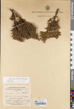
LE 01191756
Juniperus sibirica Burgsd. det. Orlova, Larisa Vladimirovna at 01.07.2022
Additional identifications: Juniperus nana Willd. det. Kusnezow, Nicolai Ivanovitch, Reverdatto, Viktor Vladimirovich at 1914 Collectors: Kusnezow, Nicolai Ivanovitch; Reverdatto, Viktor Vladimirovich Field collecting number: 688. Collection date: 01.07.1914. Administrative regions: RU - Krasnoyarskiy Kray - Taymyrsky Dolgano-Nenetsky District. Place of collection: путь от ст. Хантайский к хр. Медвежий Камень, кустарные заросли по склонам хр. Медвежий Камень.Expedition: Н.И. Кузнецов и В.В. Ревердатто. Экспедиция в Туруханский край. 1914 г. (1914)Groups of specimens: Образцы сектора Сибири и Дальнего Востока России; Соглашение Минобрнауки №075-15-2021-1056; Гербарий Переселенческого УправленияOriginal label text:Гербарий Переселенческого Управления. Н.И. Кузнецов и В.В. Ревердатто Экспедиция в Туруханский край. 1914 г. № 688. Juniperus nana Willd. Путь от ст. Хантайского к хребту "Медвежий камень". Кустарные заросли по склонам хребта "Медвежий Камень". 1/VII 1914 г. N.I. Kusnezow et W.W. Reverdatto. Iter ad distr. Turuchansk gub. Enisseisk. 1914
Landscape in location of collection: склон горного хребтаHabitat / plant community in location of collecting: кустарные зарослиCoordinates (geographic position): 68° 11′ 4.92″ N, 86° 46′ 42.66″ E ±100000 mRecord creation: 2022-07-01, Larisa Orlova, PhotoScan D2. Part 1.Citation: Specimen LE 01191756 // Virtual herbarium of Komarov Botanical Institute RAS — http://re.herbariumle.ru/01191756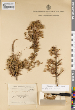
LE 01191755
Juniperus sibirica Burgsd. det. Orlova, Larisa Vladimirovna at 01.07.2022
Additional identifications: Juniperus nana Willd. det. Busch Collectors: Avramenok, A.M. Field collecting number: 3667. Collection date: 20.06.1914. Administrative regions: RU - Krasnoyarskiy Kray - Taymyrsky Dolgano-Nenetsky District. Place of collection: окрестности пос. Дудинка, тундра.Expedition: А.М. Авраменок. Экспедиция в Туруханский край (1914)Groups of specimens: Образцы сектора Сибири и Дальнего Востока России; Соглашение Минобрнауки №075-15-2021-1056; Гербарий Переселенческого УправленияOriginal label text:Гербарий Переселенческого Управления. А.М. Авраменок. Экспедиция в Туруханский край. 1914 г. № 3667. Juniperus nana L. Окрестности сел. Дудинка. В тундре. A.M. Awramenok. Iter ad distr. Turuchansk gub. Enisseisk 1914. 20/VI
Habitat / plant community in location of collecting: тундраCoordinates (geographic position): 69° 25′ 3.73″ N, 86° 13′ 33.69″ E ±10000 mRecord creation: 2022-07-01, Larisa Orlova, PhotoScan D2. Part 1.Citation: Specimen LE 01191755 // Virtual herbarium of Komarov Botanical Institute RAS — http://re.herbariumle.ru/01191755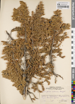
LE 01191754
Juniperus sibirica Burgsd. det. Sambuk, Feodosij Viktorovich at 1935
Collectors: Avramchik Collection date: 01.07.1935. Administrative regions: RU - Krasnoyarskiy Kray - Taymyrsky Dolgano-Nenetsky District. Place of collection: бассейн р. Хатанга, устье р. Медвежья, надпойма, на лугу высокого уровня.Expedition: Таймырская экспедиция Всесоюзного Арктического Института под начальством Ф.В. Самбука (1934)Groups of specimens: Образцы сектора Сибири и Дальнего Востока России; Соглашение Минобрнауки №075-15-2021-1056Original label text:Таймырская экспедиция Всесоюзного Арктического института под начальством Ф.В. Самбука. Juniperus sibirica Burgsd. Бассейн Хатанги. устье р. Медвежьей. Надпойма, на лугу высокого уровня. 1.VII.1935. Собр. Аврамчик. Опр. Ф.В. Самбук
Landscape in location of collection: надпойма рекиHabitat / plant community in location of collecting: луг высокого уровняCoordinates (geographic position): 70° 51′ 16.68″ N, 104° 51′ 7.03″ E ±30000 mRecord creation: 2022-07-01, Larisa Orlova, PhotoScan D2. Part 1.Citation: Specimen LE 01191754 // Virtual herbarium of Komarov Botanical Institute RAS — http://re.herbariumle.ru/01191754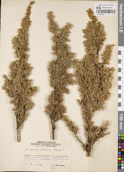
LE 01191753
Juniperus sibirica Burgsd. det. Sambuk, Feodosij Viktorovich at 1934
Collectors: Sambuk, Feodosij Viktorovich Collection date: 05.09.1934. Administrative regions: RU - Krasnoyarskiy Kray - Taymyrsky Dolgano-Nenetsky District. Place of collection: Бассейн р. Хатанга, Мамонтовая сопка между р. Большая Романиха и р. Медвежья, лиственничный лес.Expedition: Таймырская экспедиция Всесоюзного Арктического Института под начальством Ф.В. Самбука (1934)Groups of specimens: Образцы сектора Сибири и Дальнего Востока России; Соглашение Минобрнауки №075-15-2021-1056Original label text:Таймырская экспедиция Всесоюзного Арктического института под начальством Ф.В. Самбука. Juniperus sibirica Burgsd. Северный склон Центрально-Сибирского плато. Бассейн Хатанги. Мамонтовая сопка между рр. Романихой и Медвежьей. В лиственничном лесу. 5 IX 1934. Собр. Опр. Ф.В. Самбук
Landscape in location of collection: склон сопкиHabitat / plant community in location of collecting: лиственничный лесCoordinates (geographic position): 70° 49′ 18.76″ N, 101° 39′ 6.8″ E ±110000 mRecord creation: 2022-07-01, Larisa Orlova, PhotoScan D2. Part 1.Citation: Specimen LE 01191753 // Virtual herbarium of Komarov Botanical Institute RAS — http://re.herbariumle.ru/01191753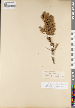
LE 01191752
Groups of specimens: Образцы сектора Сибири и Дальнего Востока России; Соглашение Минобрнауки №075-15-2021-1056Record creation: 2022-07-01, Larisa Orlova, PhotoScan D2. Part 1.Citation: Specimen LE 01191752 // Virtual herbarium of Komarov Botanical Institute RAS — http://re.herbariumle.ru/01191752
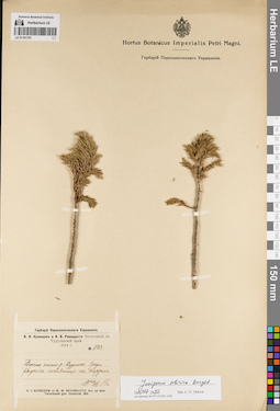
LE 01191751
Juniperus sibirica Burgsd. det. Orlova, Larisa Vladimirovna at 01.07.2022
Collectors: Kusnezow, Nicolai Ivanovitch; Reverdatto, Viktor Vladimirovich Field collecting number: 1123. Collection date: 20.07.1914. Administrative regions: RU - Krasnoyarskiy Kray - Taymyrsky Dolgano-Nenetsky District. Place of collection: верхнее течение р. Дудинка, среди редких лиственниц на террасе.Expedition: Н.И. Кузнецов и В.В. Ревердатто. Экспедиция в Туруханский край. 1914 г. (1914)Groups of specimens: Образцы сектора Сибири и Дальнего Востока России; Соглашение Минобрнауки №075-15-2021-1056; Гербарий Переселенческого УправленияOriginal label text:Гербарий Переселенческого Управления. Н.И. Кузнецов и В.В. Ревердатто Экспедиция в Туруханский край. 1914 г. № 1123. Верхнее течение р. Дудинки. Среди редких лиственниц на террасе. 20/VII 1914. N.I. Kusnezow et W.W. Reverdatto. Iter ad distr. Turuchansk gub. Enisseisk. 1914
Landscape in location of collection: речная террасаHabitat / plant community in location of collecting: редкие лиственницыCoordinates (geographic position): 68° 43′ 30.05″ N, 88° 20′ 47.48″ E ±10000 mRecord creation: 2022-07-01, Larisa Orlova, PhotoScan D2. Part 1.Citation: Specimen LE 01191751 // Virtual herbarium of Komarov Botanical Institute RAS — http://re.herbariumle.ru/01191751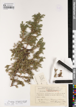
LE 01191750
Juniperus sibirica Burgsd. × Juniperus communis L. det. Kuvaev, Vladimir Borisovich, Savich, A. at 1979
Collectors: Kuvaev, Vladimir Borisovich; Savich; Savin Field collecting number: 485-2. Collection date: 12.07.1979. Administrative regions: RU - Krasnoyarskiy Kray - Turukhanskiy Rayon. Place of collection: с. Мирное, опушка тайги у Мирновской поляны по Осиновой тропе на правом берегу р. Енисей.Groups of specimens: Образцы сектора Сибири и Дальнего Востока России; Соглашение Минобрнауки №075-15-2021-1056; Ministerium Agriculturae USSR Laboratorium centrale naturae protectionis HerbariumOriginal label text:Ministerium Agriculturae USSR. Laboratorium centrale naturae protectionis Herbarium. Juniperus sibirica Burgsd. × communis L. Красноярский кр. Туруханский р-н. Опушка тайги у Мирновской поляны по Осиноой тропе на пр. берегу Енисея. 43 м. 12 VII 1979 г. Leg. Куваев, Савич, Савин. No. 485-2. Determ. В. Куваев, А. Савич
Landscape in location of collection: тропа на берегу крупной рекиHabitat / plant community in location of collecting: опушка тайгиCoordinates (geographic position): 62° 18′ 1.32″ N, 89° 1′ 38.74″ E ±2000 mRecord creation: 2022-07-01, Larisa Orlova, PhotoScan D2. Part 1.Citation: Specimen LE 01191750 // Virtual herbarium of Komarov Botanical Institute RAS — http://re.herbariumle.ru/01191750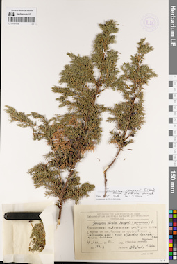
LE 01191749
Juniperus niemannii E.L. Wolf ⟨close to Juniperus sibirica Burgsd.⟩ det. Orlova, Larisa Vladimirovna at 01.07.2022
Additional identifications: Juniperus sibirica Burgsd. × Juniperus communis L. det. Kuvaev, Vladimir Borisovich, Savich, A. at 1978 Collectors: Kuvaevs; Burskaya Field collecting number: 275-3. Collection date: 12.07.1978. Administrative regions: RU - Krasnoyarskiy Kray - Turukhanskiy Rayon. Place of collection: опушка тайги у тропы от с. Мирное по правому берегу р. Енисей.Groups of specimens: Образцы сектора Сибири и Дальнего Востока России; Соглашение Минобрнауки №075-15-2021-1056; Ministerium Agriculturae USSR Laboratorium centrale naturae protectionis HerbariumObject features: Стволика нет - куст образован восходящими ветвямиOriginal label text:Ministerium Agriculturae USSR. Laboratorium centrale naturae protectionis Herbarium. Juniperus sibirica Burgsd. × communis L. Красноярский кр. Туруханский р-н. Опушка тайги у тропы от пос. Мирное по пр. бер. Енисея. Стволика нет - куст образован восходящими ветвями. 42 м. 12 VII 1978 г. Leg. Куваевы, Бурская. No. 275-3. Determ. В. Куваев, А. Савич
Landscape in location of collection: таежная тропа по берегу крупной рекиHabitat / plant community in location of collecting: опушка тайгиCoordinates (geographic position): 62° 17′ 55.4″ N, 89° 1′ 17.44″ E ±2000 mRecord creation: 2022-07-01, Larisa Orlova, PhotoScan D2. Part 1.Citation: Specimen LE 01191749 // Virtual herbarium of Komarov Botanical Institute RAS — http://re.herbariumle.ru/01191749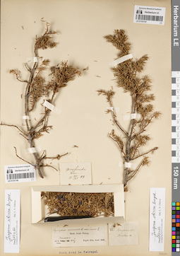
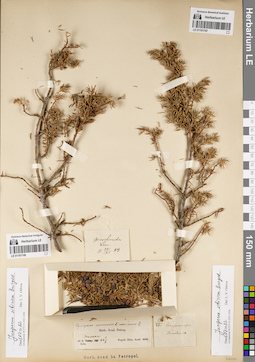
LE 01191747
Groups of specimens: Образцы сектора Сибири и Дальнего Востока России; Соглашение Минобрнауки №075-15-2021-1056Record creation: 2022-07-01, Larisa Orlova, PhotoScan D2. Part 1.Citation: Specimen LE 01191747 // Virtual herbarium of Komarov Botanical Institute RAS — http://re.herbariumle.ru/01191747
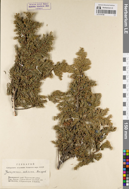
LE 01191748
Groups of specimens: Образцы сектора Сибири и Дальнего Востока России; Соглашение Минобрнауки №075-15-2021-1056Record creation: 2022-07-01, Larisa Orlova, PhotoScan D2. Part 1.Citation: Specimen LE 01191748 // Virtual herbarium of Komarov Botanical Institute RAS — http://re.herbariumle.ru/01191748
LE 01191746
Juniperus sibirica Burgsd. det. Ershova, E., Krasnoborov, Ivan Moiseevich at 1962
Collectors: Ershova, E.; Krasnoborov, Ivan Moiseevich Collection date: 23.08.1962. Administrative regions: RU - Krasnoyarskiy Kray - Kuraginskiy Rayon. Place of collection: гора Москва, субальпийский пихтовый лес.Groups of specimens: Образцы сектора Сибири и Дальнего Востока России; Соглашение Минобрнауки №075-15-2021-1056; Гербарий Сибирского отделения Академии наук СССРOriginal label text:Гербарий Сибирского отделения Академии наук СССР. Juniperus sibirica Burgsd. Красноярский край. Курагинский район. Гора Москва. Субальпийский пихтовый лес. 23-VIII-1962г. И. Красноборов. Э. Ершова
Landscape in location of collection: субальпийский горный поясHabitat / plant community in location of collecting: субальпийский пихтовый лесCoordinates (geographic position): 54° 21′ 8.2″ N, 93° 55′ 7.24″ E ±3000 mRecord creation: 2022-07-01, Larisa Orlova, PhotoScan D2. Part 1.Citation: Specimen LE 01191746 // Virtual herbarium of Komarov Botanical Institute RAS — http://re.herbariumle.ru/01191746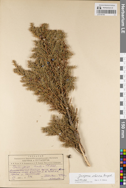
LE 01191745
Juniperus sibirica Burgsd. det. Orlova, Larisa Vladimirovna at 01.07.2022
Additional identifications: Juniperus nana Willd. det. IIjin, Modest Mikhailovich at 1931 Collectors: IIjin, Modest Mikhailovich; Ovchinnikov B. N. Field collecting number: 396. Collection date: 24.08.1931. Administrative regions: RU - Krasnoyarskiy Kray - Shushenskiy Rayon. Place of collection: Западные Саяны, берег высокогорного озера в истоках р. Большой Чисплет (приток р. Кантегир).Expedition: М.М. Ильин, Б.Н. Овчинников и А.Ф. Иванова. Минусинская экспедиция (1931)Groups of specimens: Образцы сектора Сибири и Дальнего Востока России; Соглашение Минобрнауки №075-15-2021-1056; Гербарий Всесоюзного Научно-исследовательского института каучука и гуттаперчиOriginal label text:Гербарий Всесоюзного Научно-Исследовательского Института каучука и гуттаперчи. М.М. Ильин, Б.Н. Овчинников и А.Ф. Иванова. Минусинская экспедиция. Juniperus nana Willd. Минусинский окр. Западн. Саяны. Берег высокогорного озера в истоках р. Б. Чисплек /приток р. Кантегирь/. 24 VIII 1931 г. № 396. Leg. М. Ильин и Б. Овчин. Det. М. Ильин
Landscape in location of collection: берег высокогорного озераCoordinates (geographic position): 52° 32′ 21.45″ N, 90° 58′ 31.89″ E ±3000 mRecord creation: 2022-07-01, Larisa Orlova, PhotoScan D2. Part 1.Citation: Specimen LE 01191745 // Virtual herbarium of Komarov Botanical Institute RAS — http://re.herbariumle.ru/01191745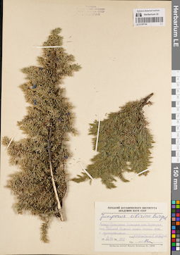
LE 01191744
Juniperus sibirica Burgsd. det. Kozhevnikov, Yury Pavlovich, Andreev, M.D. at 1977
Collectors: Kozhevnikov, Yury Pavlovich; Andreev, M.D. Field collecting number: 1047. Collection date: 07.08.1977. Administrative regions: RU - Krasnoyarskiy Kray - Taymyrsky Dolgano-Nenetsky District. Place of collection: г. Норильск, горы Хараелах, пос. Талнах, нижняя часть склона горы с кустарниками.Groups of specimens: Образцы сектора Сибири и Дальнего Востока России; Соглашение Минобрнауки №075-15-2021-1056Original label text:Гербарий Ботанического института Академии наук СССР. Juniperus sibirica Burgsd. Запад Путораны. Норильск, горы Хараелах, пос. Талнах. Нижняя часть склона горы с кустарниками. 7/VIII 1977 г. № 1047. Собр. Опр. Ю.П. Кожевников, М.Д. Андреев
Landscape in location of collection: нижняя часть склона горыHabitat / plant community in location of collecting: кустарникCoordinates (geographic position): 69° 38′ 35.39″ N, 89° 37′ 49.87″ E ±10000 mRecord creation: 2022-07-01, Larisa Orlova, PhotoScan D2. Part 1.Citation: Specimen LE 01191744 // Virtual herbarium of Komarov Botanical Institute RAS — http://re.herbariumle.ru/01191744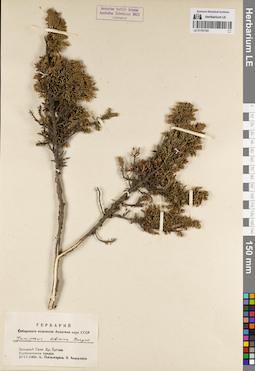
LE 01191743
Juniperus sibirica Burgsd. det. Mogilevtzeva, A., Anjiganov, V. at 1965
Collectors: Mogilevtzeva, A.; Anjiganov, V. Collection date: 30.06.1965. Administrative regions: RU - Krasnoyarskiy Kray - Karatuzskiy Rayon. Place of collection: Западный Саян, хр. Ергаки, кустарниковая тундра.Groups of specimens: Образцы сектора Сибири и Дальнего Востока России; Соглашение Минобрнауки №075-15-2021-1056; Гербарий Сибирского отделения Академии наук СССРOriginal label text:Гербарий Сибирского отделения Академии наук СССР. Juniperus sibirica Burgsd. Западный Саян. Хр. Ергаки. Кустарниковая тундра. 30-VI 1965г. А. Могилевцева, В. Анжеганов
Habitat / plant community in location of collecting: кустарниковая тундраCoordinates (geographic position): 52° 51′ 2.16″ N, 93° 24′ 40.62″ E ±6000 mRecord creation: 2022-07-01, Larisa Orlova, PhotoScan D2. Part 1.Citation: Specimen LE 01191743 // Virtual herbarium of Komarov Botanical Institute RAS — http://re.herbariumle.ru/01191743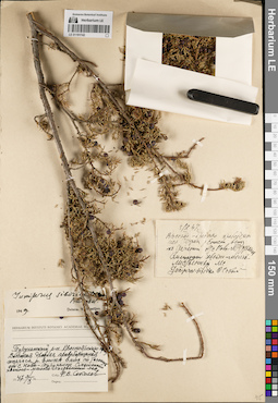
LE 01191742
Juniperus sibirica Burgsd. det. Vassiljev, Viktor Nikolayevich at 1949
Additional identifications: Juniperus sibirica Burgsd. det. Sokolov, Ph.V. at 1947 Collectors: Sokolov, Ph.V. Collection date: 03.10.1947. Administrative regions: RU - Krasnoyarskiy Kray - Turukhanskiy Rayon. Place of collection: высокая древняя правобережная терраса р. Енисей вниз по течению от с. Ново-Туруханск., смешанный хвойно-мелколиственный лес.Groups of specimens: Образцы сектора Сибири и Дальнего Востока России; Соглашение Минобрнауки №075-15-2021-1056Original label text:[1]Herbarium Instituti Botanici Academiae Sc. URSS. Туруханский р-н. Красноярского края. Высокая древняя правобережная терраса р. Енисей вниз по течению от с. Ново-Туруханск. Смешанный хвойно-мелколиственный лес. 1947 3/X. Собр. Ф.В. Соколов [2] 3/X 47. Высокая-древняя правобережная терраса р. Енисей вниз по течению от с. Ново-Туруханска. Смешанный хвойно-мелколиственный лес. Juniperus sibirica. Ф. Соколов
Landscape in location of collection: высокая древняя правобережная террасаHabitat / plant community in location of collecting: смешанный хвойно-мелколиственный лесCoordinates (geographic position): 65° 42′ 34.54″ N, 88° 5′ 6.05″ E ±10000 mRecord creation: 2022-07-01, Larisa Orlova, PhotoScan D2. Part 1.Citation: Specimen LE 01191742 // Virtual herbarium of Komarov Botanical Institute RAS — http://re.herbariumle.ru/01191742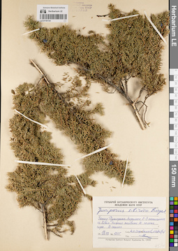
LE 01191741
Juniperus sibirica Burgsd. det. Kozhevnikov, Yury Pavlovich, Andreev, M.D. at 1977
Collectors: Kozhevnikov, Yury Pavlovich; Andreev, M.D. Field collecting number: 1255. Collection date: 14.08.1977. Administrative regions: RU - Krasnoyarskiy Kray - Taymyrsky Dolgano-Nenetsky District. Place of collection: запад плато Путорана, г. Норильск, северо-западная оконечность оз. Кета, нижняя половина южного склона горы, в скалах.Groups of specimens: Образцы сектора Сибири и Дальнего Востока России; Соглашение Минобрнауки №075-15-2021-1056Original label text:Гербарий Ботанического института Академии наук СССР. juniperus sibirica Burgsd. Запад Путораны. Норильск, С-З оконечность оз. Кета. Нижняя половина Ю. склона горы. В скалах. 14 VIII 1977 г. № 1255. Собр. Опр. Ю.П. Кожевников, М.Д. Андреев. Herbarium Instituti Botanici Academiae Sc. URSS
Landscape in location of collection: нижняя половина южного склона горыHabitat / plant community in location of collecting: скалыCoordinates (geographic position): 68° 49′ 57.35″ N, 89° 52′ 19.45″ E ±20000 mRecord creation: 2022-07-01, Larisa Orlova, PhotoScan D2. Part 1.Citation: Specimen LE 01191741 // Virtual herbarium of Komarov Botanical Institute RAS — http://re.herbariumle.ru/01191741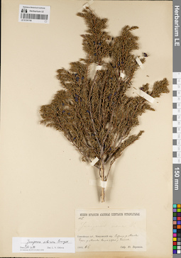
LE 01191740
Juniperus sibirica Burgsd. det. Orlova, Larisa Vladimirovna at 01.07.2022
Additional identifications: Juniperus nana Willd. det. Busch Collectors: Woronov, Jurij (Georg) Nikolaewich Field collecting number: 45. Collection date: 06.06.1903. Administrative regions: RU - Krasnoyarskiy Kray - Partizanskiy Rayon. Place of collection: система р. Маны, берег р. Правая Мана выше устья р. Болой.Groups of specimens: Образцы сектора Сибири и Дальнего Востока России; Соглашение Минобрнауки №075-15-2021-1056Original label text:Museum Botanicum Academiae Scientiarum Petropolitanae. no. 45. Juniperus nana W. Енисейская губ., Минусинский окр. Система р. Маны. Берег р. Маны выше устья р. Болоя. 1903.6.VI. Собр. Ю. Воронов
Landscape in location of collection: берег рекиCoordinates (geographic position): 54° 35′ 28.49″ N, 94° 46′ 17.25″ E ±2000 mRecord creation: 2022-07-01, Larisa Orlova, PhotoScan D2. Part 1.Citation: Specimen LE 01191740 // Virtual herbarium of Komarov Botanical Institute RAS — http://re.herbariumle.ru/01191740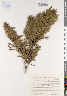
LE 01191739
Juniperus sibirica Burgsd. det. Rebristaya (Pigulevskaya), Olga Vladimirovna, Kiton, S.V. at 1986
Collectors: Rebristaya (Pigulevskaya), Olga Vladimirovna; Kiton, S.V. Field collecting number: 6264. Collection date: 02.08.1986. Administrative regions: RU - Yamalo-Nenetskiy Avtonomnyy Okrug - Nadymskiy Rayon. Place of collection: п-ов Тазовский, побережье Обской губы, низовья р. Лайяха, на сухом песчаном разнотравном склоне.Groups of specimens: Образцы сектора Сибири и Дальнего Востока России; Соглашение Минобрнауки №075-15-2021-1056Original label text:Гербарий Ботанического института АН СССР. № 6264. Juniperus sibirica Burgsd. Полуостров Тазовский. Побережье Обской губы, низовья р. Лайяха. На сухом песчаном разнотравном склоне. 2 VIII 1986 г. О.В. Ребристая С.В. Хитон
Landscape in location of collection: склонHabitat / plant community in location of collecting: разнотравный склонSubstrate in collecting location: сухой песокCoordinates (geographic position): 68° 6′ 12.89″ N, 74° 50′ 25.92″ E ±10000 mRecord creation: 2022-07-01, Larisa Orlova, PhotoScan D2. Part 1.Citation: Specimen LE 01191739 // Virtual herbarium of Komarov Botanical Institute RAS — http://re.herbariumle.ru/01191739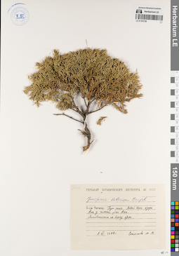
LE 01191738
Juniperus sibirica Burgsd. det. Busch
Collectors: Sokolova, Maria Vladimirovna Collection date: 08.06.1977. Administrative regions: RU - Krasnoyarskiy Kray - Taymyrsky Dolgano-Nenetsky District. Place of collection: п-ов Таймыр, плато Путорана, левый берег оз. Аян у истока р. Аян, лиственничник по берегу озера.Groups of specimens: Образцы сектора Сибири и Дальнего Востока России; Соглашение Минобрнауки №075-15-2021-1056Original label text:Гербарий Ботанического института АН СССР. Juniperus sibirica Burgsd. П-ов Таймыр. Путораны. Левый берег озера Аян у истока реки Аян. Лиственичник по берегу озера. 8.VI.1977 г. Соколова М.В.
Landscape in location of collection: берег озераHabitat / plant community in location of collecting: лиственничникCoordinates (geographic position): 69° 17′ 19.16″ N, 93° 35′ 54.86″ E ±50000 mRecord creation: 2022-07-01, Larisa Orlova, PhotoScan D2. Part 1.Citation: Specimen LE 01191738 // Virtual herbarium of Komarov Botanical Institute RAS — http://re.herbariumle.ru/01191738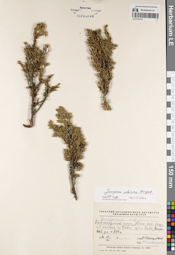
LE 01191737
Juniperus sibirica Burgsd. det. Orlova, Larisa Vladimirovna at 01.07.2022
Additional identifications: Juniperus sibirica Burgsd. det. Kozhevnikov, Yury Pavlovich Collectors: Snigirevskaya, Natalya Sergeevna Collection date: 23.07.1970. Administrative regions: RU - Krasnoyarskiy Kray - Evenkiyskiy District. Place of collection: северная оконечность оз. Виви, правый берег р. Вивихорон (Виви).Groups of specimens: Образцы сектора Сибири и Дальнего Востока России; Соглашение Минобрнауки №075-15-2021-1056Original label text:Гербарий Ботанического института Академии наук СССР. Juniperus sibirica. Красноярский край, Эвенк. нац. округ, сев. оконечн. оз. Виви, пр. б. р. Виви, высота над ул. ок. 850 м. 1970.23.VII. Собр. Н.С. Снигиревская. Опр. Кожевников Ю.
Landscape in location of collection: берег рекиCoordinates (geographic position): 67° 7′ 46.46″ N, 93° 56′ 58.79″ E ±5000 m, 850 m a.s.l.Record creation: 2022-07-01, Larisa Orlova, PhotoScan D2. Part 1.Citation: Specimen LE 01191737 // Virtual herbarium of Komarov Botanical Institute RAS — http://re.herbariumle.ru/01191737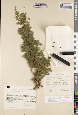
LE 01191736
Juniperus sibirica Burgsd. det. Orlova, Larisa Vladimirovna at 01.07.2022
Additional identifications: Juniperus sibirica Burgsd. det. Makhaeva L.V. at 1959 Collectors: Makhaeva L.V. Field collecting number: 11. Collection date: 12.08.1959. Administrative regions: RU - Krasnoyarskiy Kray - Taymyrsky Dolgano-Nenetsky District. Place of collection: заросли мохово-травяных ивняков с ольхой на прирусловом склоне к р. Соленая в 1 км выше устья р. Большой Яр.Groups of specimens: Образцы сектора Сибири и Дальнего Востока России; Соглашение Минобрнауки №075-15-2021-1056Original label text:[1]Juniperus sibiricus. Заросли мохово-травяных ивняков с ольхой на прирусловом склоне к реке Соленой в 1 км выше устья р. Б. Яр. опис. N 11. 12/VIII-59 г. Махаева [2] Гербарий Ботанического института Академии наук СССР. Таймырский Нац. округ. Заросли мохово-травяных ивняков с ольхой на прирусловом склоне к реке Соленой в 2 км. выше устья р. Б. Яр. 1959 11/VIII. N 11. Собр. Л.В. Махаева
Landscape in location of collection: прирусловой склон к рекеHabitat / plant community in location of collecting: заросли мохово-травяных ивняков с ольхой на прирусловом склонеCoordinates (geographic position): 68° 14′ 51.07″ N, 85° 8′ 32.85″ E ±1000 mRecord creation: 2022-07-01, Larisa Orlova, PhotoScan D2. Part 1.Citation: Specimen LE 01191736 // Virtual herbarium of Komarov Botanical Institute RAS — http://re.herbariumle.ru/01191736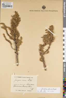
LE 01191735
Juniperus sibirica Burgsd. det. Orlova, Larisa Vladimirovna at 01.07.2022
Additional identifications: Juniperus nana Willd. det. Troizky, W.P. at 1912 Collectors: Troizky, W.P. Collection date: 29.06.1912. Administrative regions: RU - Krasnoyarskiy Kray - Sayanskiy Rayon. Place of collection: долина р. Дикий (Ералашный) Кан (истоки р. Кан до слияния с р. Тихой).Expedition: В.П. Троицкий: Растения Саянских гор (1912 -1913)Groups of specimens: Образцы сектора Сибири и Дальнего Востока России; Соглашение Минобрнауки №075-15-2021-1056Original label text:В.П. Троицкий: Растения Саянских гор. Juniperus nana Willd. Енисейская губ. Канский уезд: Дол. реки Ералашного (Дикого) Кана. 1912 29 VI. W.P. Troizky: Plantae montes Sajanensium
Landscape in location of collection: долина рекиCoordinates (geographic position): 54° 19′ 37.61″ N, 95° 34′ 11.68″ E ±10000 mRecord creation: 2022-07-01, Larisa Orlova, PhotoScan D2. Part 1.Citation: Specimen LE 01191735 // Virtual herbarium of Komarov Botanical Institute RAS — http://re.herbariumle.ru/01191735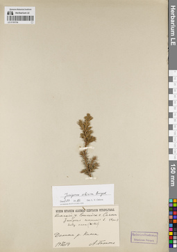
LE 01191734
Juniperus sibirica Burgsd. det. Orlova, Larisa Vladimirovna at 01.07.2022
Additional identifications: Juniperus communis ssp. nana (Willd.) Syme det. Krylov, Porphyriy Nikitich Collectors: Totto, A. Collection date: 24.08.1914. Administrative regions: RU - Krasnoyarskiy Kray - Sayanskiy Rayon. Place of collection: Саяны, долина р. Кан.Groups of specimens: Образцы сектора Сибири и Дальнего Востока России; Соглашение Минобрнауки №075-15-2021-1056Original label text:Museum Botanicum Academiae Scientiarum Petropolitanae. Канский у. Енисейск. г. Саяны. Juniperus communis L. subsp. nana (Willd.) (Крыл.) Долина р. Кана. 24 VIII 1914. А. Тотто
Landscape in location of collection: долина горной рекиCoordinates (geographic position): 54° 51′ 28″ N, 95° 11′ 58.46″ E ±40000 mRecord creation: 2022-07-01, Larisa Orlova, PhotoScan D2. Part 1.Citation: Specimen LE 01191734 // Virtual herbarium of Komarov Botanical Institute RAS — http://re.herbariumle.ru/01191734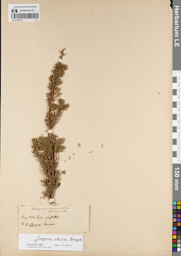
LE 01191733
Juniperus sibirica Burgsd. det. Orlova, Larisa Vladimirovna at 01.07.2022
Additional identifications: Juniperus communis var. nana Willd. det. Fuss, Victor Collectors: Fuss, Victor Collection date: 09.09.1881. Administrative regions: RU - Khanty-Mansiyskiy Avtonomnyy Okrug-Yugra - Beryozovsky Rayon. Place of collection: у р. Обь, возле пос. Березово.Groups of specimens: Образцы сектора Сибири и Дальнего Востока России; Соглашение Минобрнауки №075-15-2021-1056Original label text:Juniperus communis L. var. nana W. Leg. Victor Fuss. 9 Sept 1881. Ad fl. Ob, prope Beresowo
Landscape in location of collection: берег крупной рекиCoordinates (geographic position): 63° 56′ 8.73″ N, 65° 25′ 8.45″ E ±3000 mRecord creation: 2022-07-01, Larisa Orlova, PhotoScan D2. Part 1.Citation: Specimen LE 01191733 // Virtual herbarium of Komarov Botanical Institute RAS — http://re.herbariumle.ru/01191733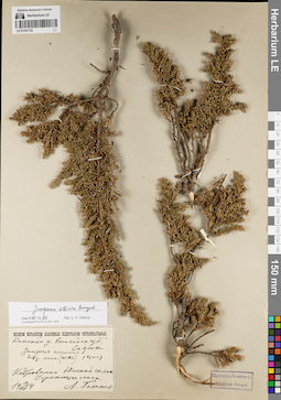
LE 01191732
Juniperus sibirica Burgsd. det. Orlova, Larisa Vladimirovna at 01.07.2022
Additional identifications: Juniperus communis ssp. nana (Willd.) Syme det. Krylov, Porphyriy Nikitich Collectors: Totto, A. Collection date: 19.07.1914. Administrative regions: RU - Respublika Tyva; RU - Krasnoyarskiy Kray - Sayanskiy Rayon. Place of collection: хр. Саяны, южный склон, кедровники, у границы леса.Groups of specimens: Образцы сектора Сибири и Дальнего Востока России; Соглашение Минобрнауки №075-15-2021-1056Original label text:Museum Botanicum Academiae Scientiarum Petropolitanae. Канский у. Енисейск. губ. Саяны. Juniperus communis L. subsp. nana (Willd.) (Крыл.) Кедровники. Южный склон. У границы леса. 19 VII 1914. А. Тотто
Landscape in location of collection: южный склон горного хребтаHabitat / plant community in location of collecting: кедровникCoordinates (geographic position): 53° 13′ 25.64″ N, 95° 14′ 8.42″ E ±200000 mRecord creation: 2022-07-01, Larisa Orlova, PhotoScan D2. Part 1.Citation: Specimen LE 01191732 // Virtual herbarium of Komarov Botanical Institute RAS — http://re.herbariumle.ru/01191732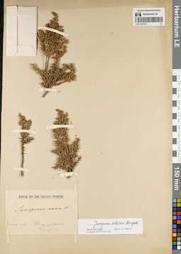
LE 01191731
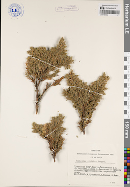
Collectors: Ulrich Groups of specimens: Образцы сектора Сибири и Дальнего Востока России; Соглашение Минобрнауки №075-15-2021-1056Record creation: 2022-07-01, Larisa Orlova, PhotoScan D2. Part 1.Citation: Specimen LE 01191731 // Virtual herbarium of Komarov Botanical Institute RAS — http://re.herbariumle.ru/01191731
LE 01191730
Juniperus sibirica Burgsd. det. Krasnikov, A., Schein, V., Maneev, A.G. at 1980
Collectors: Krasnikov, A.; Maneev, A.G.; Schein, V. Collection date: 16.07.1980. Administrative regions: RU - Respublika Tyva - Mongun-Tayginskiy Rayon. Subregion: Монгун-Тайгинский кожуун. Place of collection: хр. Чихачева, долина р. Чеди-тей (Джеты-Тей) в среднем течении, крупнокаменистая зарастающая осыпь.Groups of specimens: Образцы сектора Сибири и Дальнего Востока России; Соглашение Минобрнауки №075-15-2021-1056; Гербарий Центрального Сибирского ботанического сада СО АН СССРOriginal label text:Гербарий Центрального Сибирского ботанического сада СО АН СССР. Juniperus sibirica Burgsd. Тувинская АССР, Монгун-Тайгинский р-н., хр. Чихачева. Долина р. Джеты-тей в среднем течении. Крупнокаменистая зарастающая осыпь. 16.7.1980г. А. Красников, А. Манеев, В. Шеин
Landscape in location of collection: крупнокаменистая зарастающая осыпь в долине рекиCoordinates (geographic position): 50° 13′ 36.85″ N, 89° 30′ 51.84″ E ±2000 mRecord creation: 2022-07-01, Larisa Orlova, PhotoScan D2. Part 1.Citation: Specimen LE 01191730 // Virtual herbarium of Komarov Botanical Institute RAS — http://re.herbariumle.ru/01191730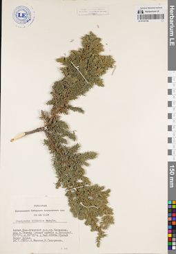
LE 01191729
Juniperus sibirica Burgsd. det. Maneev, A.G., Sidorenko, N. at 1981
Collectors: Maneev, A.G.; Sidorenko, N. Collection date: 26.07.1981. Administrative regions: RU - Respublika Altay - Kosh-Agachskiy Rayon. Place of collection: хр. Чихачева, долина р. Текелю (левый приток р. Бугузун), выс. 2300 м, правый берег ручья.Groups of specimens: Образцы сектора Сибири и Дальнего Востока России; Соглашение Минобрнауки №075-15-2021-1056; Гербарий Центрального Сибирского ботанического сада СО АН СССРOriginal label text:Гербарий Центрального Сибирского ботанического сада СО АН СССР. Juniperus sibirica Burgds. Алтай, Кош-Агачский р-н, хр. Чихачева, дол. р. Текелю (левый приток р. Бугузун). 50° 5' c.ш. 89° 25' в.д. Выс. 2300м. Правый берег ручья. 26.7.1981г. А. Манеев, Н. Сидоренко
Landscape in location of collection: правый берег ручьяCoordinates (geographic position): 50° 0′ 4.78″ N, 89° 24′ 26.54″ E ±10000 m, 2300 m a.s.l.Record creation: 2022-07-01, Larisa Orlova, PhotoScan D2. Part 1.Citation: Specimen LE 01191729 // Virtual herbarium of Komarov Botanical Institute RAS — http://re.herbariumle.ru/01191729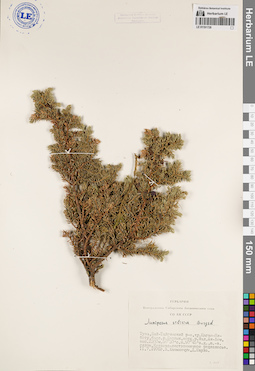
LE 01191728
Juniperus sibirica Burgsd. det. Khanminchun, Valery Mikhailovich, Shaulo Dmitry Nikolaevich at 1976
Collectors: Khanminchun, Valery Mikhailovich; Shaulo Dmitry Nikolaevich Collection date: 11.07.1976. Administrative regions: RU - Respublika Tyva. Subregion: Бай-Тайгинский кожуун. Place of collection: хр. Цаган-Шибету, бассейн р. Барлык, верховья р. Малый Ак-Хем, выс. 2300 м, 50° 30' с.ш. 90° 45' в.д., юго-восточный склон, кедрово-лиственничное редколесье.Groups of specimens: Образцы сектора Сибири и Дальнего Востока России; Соглашение Минобрнауки №075-15-2021-1056; Гербарий Центрального Сибирского ботанического сада СО АН СССРOriginal label text:Гербарий Центрального Сибирского ботанического сада СО АН СССР. Juniperus sibirica Burgsd. Тува, Бай-Тайгинский р-н, хр. Цаган-Шибету, басс. р. Барлык, верх. р. Мал. Ак-Хем, выс. 2300м. 50° 30' с.ш. 90° 45' в.д., ю.-в. склон. Кедрово-лиственничное редколесье. 11.7.1976г. В. Ханминчун, Д. Шауло
Landscape in location of collection: юго-восточный склонHabitat / plant community in location of collecting: кедрово-лиственничное редколесьеCoordinates (geographic position): 50° 38′ 17.21″ N, 90° 21′ 51.42″ E ±4000 mRecord creation: 2022-07-01, Larisa Orlova, PhotoScan D2. Part 1.Citation: Specimen LE 01191728 // Virtual herbarium of Komarov Botanical Institute RAS — http://re.herbariumle.ru/01191728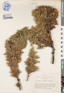
LE 01191727
Juniperus sibirica Burgsd. det. Khanminchun, Valery Mikhailovich, Shaulo Dmitry Nikolaevich at 1976
Collectors: Khanminchun, Valery Mikhailovich; Shaulo Dmitry Nikolaevich Collection date: 11.07.1976. Administrative regions: RU - Respublika Tyva. Subregion: Бай-Тайгинский кожуун. Place of collection: хр. Цаган-Шибету, бассейн р. Барлык, верховья р. Малый Ак-Хем, выс. 2300 м, 50° 30' с.ш. 90° 45' в.д., юго-восточный склон, альпийские лужайки среди крупнокаменистых россыпей.Groups of specimens: Образцы сектора Сибири и Дальнего Востока России; Соглашение Минобрнауки №075-15-2021-1056; Гербарий Центрального Сибирского ботанического сада СО АН СССРOriginal label text:Гербарий Центрального Сибирского ботанического сада СО АН СССР. Juniperus sibirica Burgsd. Тува, Бай-Тайгинский р-н, хр. Цаган-Шибету, басс. р. Барлык, верх. р. Мал. Ак-Хем, выс. 2300м. 50° 30' с.ш. 90° 45' в.д., ю.-в. склон. Альпийские лужайки среди крупнокаменистых россыпей. 11.7.1976г. В. Ханминчун, Д. Шауло
Landscape in location of collection: крупнокаменистые россыпи на юго-восточном склонеHabitat / plant community in location of collecting: альпийские лужайки среди крупнокаменистых россыпейCoordinates (geographic position): 50° 38′ 43.8″ N, 90° 21′ 8.05″ E ±5000 mRecord creation: 2022-07-01, Larisa Orlova, PhotoScan D2. Part 1.Citation: Specimen LE 01191727 // Virtual herbarium of Komarov Botanical Institute RAS — http://re.herbariumle.ru/01191727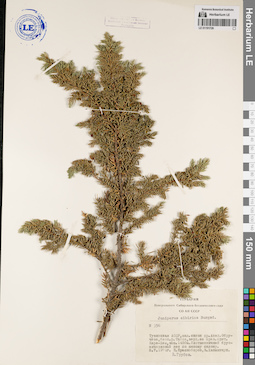
LE 01191726
Juniperus sibirica Burgsd. det. Grubov, Valery Ivanovich at 1974
Collectors: Khanminchun, Valery Mikhailovich; Krasnoborov, Ivan Moiseevich Field collecting number: 356. Collection date: 08.07.1974. Administrative regions: RU - Respublika Tyva. Subregion: Кызылский кожуун. Place of collection: западный склон хр. Акад. Обручева, бассейн р. Тапса, верховья ее правого притока р. Кара-Хем, выс. 1400м, лиственничный брусничниковый лес по южному склону.Groups of specimens: Образцы сектора Сибири и Дальнего Востока России; Соглашение Минобрнауки №075-15-2021-1056; Гербарий Центрального Сибирского ботанического сада СО АН СССРOriginal label text:Гербарий Центрального Сибирского ботанического сада СО АН СССР. Juniperus sibirica Burgsd. N 356. Тувинская АССР, зап. склон хр. Акад. Обручева, басс. р. Тапса, верх. ее прав. прит. Кара-Хем, выс. 1400м. Лиственничный брусничниковый лес по южному склону. 8.7.1974г. И. Красноборов, В. Ханминчун. В. Грубов
Landscape in location of collection: южный склонHabitat / plant community in location of collecting: лиственничный брусничниковый лес по южному склонуCoordinates (geographic position): 51° 58′ 31.14″ N, 95° 18′ 25.21″ E ±2000 mRecord creation: 2022-07-01, Larisa Orlova, PhotoScan D2. Part 1.Citation: Specimen LE 01191726 // Virtual herbarium of Komarov Botanical Institute RAS — http://re.herbariumle.ru/01191726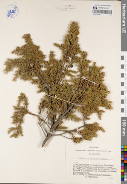
LE 01191725
Juniperus sibirica Burgsd. det. Bel'skaya, I., Khanminchun, Valery Mikhailovich, Rozhitsyna, V. at 1979
Collectors: Rozhitsyna, V.; Khanminchun, Valery Mikhailovich; Bel'skaya, I. Field collecting number: 36. Collection date: 17.08.1979. Administrative regions: RU - Respublika Tyva - Erzinskiy Rayon. Place of collection: нагорье Сангилен, бассейн р. Эрзин, верховья р. Кара-Суг (приток р. Улар), выс. 2280 м, юго-восточный склон (30°), ерники в комплексе со злаками, осочками и разнотравьем.Groups of specimens: Образцы сектора Сибири и Дальнего Востока России; Соглашение Минобрнауки №075-15-2021-1056; Гербарий Центрального Сибирского ботанического сада СО АН СССРOriginal label text:Гербарий Центрального Сибирского ботанического сада СО АН СССР. Juniperus sibirica Burgsd. № 36. Тува, Эрзинский р-н, нагорье Сангилен, басс. р. Эрзин, верх. р. Кара-Суг (прит. р. Улар), выс. 2280 м, юго-вост. склон (30°). Ерники в комплексе со злаками, осочками и разнотравьем. 17.8.1979г. В. Ханминчун, В. Рожицына, И. Бельская
Landscape in location of collection: юго-восточный склон к реке (30°)Habitat / plant community in location of collecting: ерники в комплексе со злаками, осочками и разнотравьемCoordinates (geographic position): 50° 29′ 25.19″ N, 95° 27′ 32.48″ E ±3000 m, 2280 m a.s.l.Record creation: 2022-07-01, Larisa Orlova, PhotoScan D2. Part 1.Citation: Specimen LE 01191725 // Virtual herbarium of Komarov Botanical Institute RAS — http://re.herbariumle.ru/01191725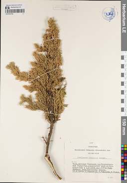
LE 01191724
Juniperus sibirica Burgsd. det. Rozhitsyna, V., Khanminchun, Valery Mikhailovich, Polev, Yu. at 1979
Collectors: Khanminchun, Valery Mikhailovich; Rozhitsyna, V.; Polev, Yu. Field collecting number: 53. Collection date: 10.08.1979. Administrative regions: RU - Respublika Tyva. Subregion: Тес-Хемский кожуун. Place of collection: нагорье Сангилен, хр. Остроконечный Танну-Ола, междуречье верховьев р. Кускунуг-Хем и р. Шурмак, выс. 2020 м, выше границы леса, ерниковая тундра.Groups of specimens: Образцы сектора Сибири и Дальнего Востока России; Соглашение Минобрнауки №075-15-2021-1056; Гербарий Центрального Сибирского ботанического сада СО АН СССРOriginal label text:Гербарий Центрального Сибирского ботанического сада СО АН СССР. Juniperus sibirica Burgsd. № 53. Тува, нагорье Сангилен, хр. Остроконечный Танну-Ола, междуречье верх. р. Кускунуг-Хем и р. Шурмак, выс. 2020м. Выше границы леса. Ерниковая тундра. 10.8.1979г. В. Ханминчун, В. Рожицына, Ю. Полев
Landscape in location of collection: склон горного хребта выше границы лесаHabitat / plant community in location of collecting: ерниковая тундраCoordinates (geographic position): 50° 35′ 37.09″ N, 95° 15′ 38.54″ E ±5000 mRecord creation: 2022-07-01, Larisa Orlova, PhotoScan D2. Part 1.Citation: Specimen LE 01191724 // Virtual herbarium of Komarov Botanical Institute RAS — http://re.herbariumle.ru/01191724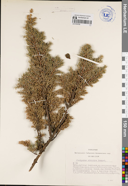
LE 01191723
Juniperus sibirica Burgsd. det. Khanminchun, Valery Mikhailovich, Danilov, M., Kritzin, A. at 1979
Collectors: Khanminchun, Valery Mikhailovich; Danilov, M.; Kritzin, A. Field collecting number: 56. Collection date: 03.08.1979. Administrative regions: RU - Respublika Tyva. Subregion: Тес-Хемский кожуун. Place of collection: нагорье Сангилен, хр. Остроконечный Танну-Ола, среднее течение р. Кускуннуг-Хем (приток р. Шурмак), вершина сопки, выс. 1650 м, голубично-зеленомошная гарь с порослью березы.Groups of specimens: Образцы сектора Сибири и Дальнего Востока России; Соглашение Минобрнауки №075-15-2021-1056; Гербарий Центрального Сибирского ботанического сада СО АН СССРOriginal label text:Гербарий Центрального Сибирского ботанического сада СО АН СССР. Juniperus sibirica Burgsd. № 56. Тува, нагорье Сангилен, хр. остроконечный Танну-Ола, сред. теч. р. Кускуннуг-Хем, (прит. р. Шурмак), вершина сопки, выс. 1650м. Голубично-зеленомошная гарь с порослью березы. 3.8.1979г. В. Ханминчун, М. Данилов, А. Крицын
Landscape in location of collection: вершина сопкиHabitat / plant community in location of collecting: голубично-зеленомошная гарь с порослью березыCoordinates (geographic position): 50° 37′ 26.37″ N, 95° 11′ 12.63″ E ±3000 mRecord creation: 2022-07-01, Larisa Orlova, PhotoScan D2. Part 1.Citation: Specimen LE 01191723 // Virtual herbarium of Komarov Botanical Institute RAS — http://re.herbariumle.ru/01191723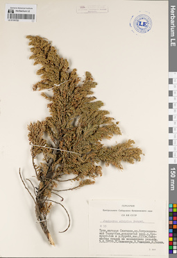
LE 01191722
Juniperus sibirica Burgsd. det. Rozhitsyna, V., Khanminchun, Valery Mikhailovich, Polev, Yu. at 1979
Collectors: Rozhitsyna, V.; Khanminchun, Valery Mikhailovich; Polev, Yu. Field collecting number: 55. Collection date: 05.08.1979. Administrative regions: RU - Respublika Tyva. Subregion: Тес-Хемский кожуун. Place of collection: нагорье Сангилен, хр. Остроконечный Танну-Ола, междуречье верховьев р. Кускунуг-Хем и р. Шурмак, выс. 2100 м, каменистая тундра на возвышениях рельефа.Groups of specimens: Образцы сектора Сибири и Дальнего Востока России; Соглашение Минобрнауки №075-15-2021-1056; Гербарий Центрального Сибирского ботанического сада СО АН СССРOriginal label text:Гербарий Центрального Сибирского ботанического сада СО АН СССР. Juniperus sibirica Burgsd. № 55. Тува, нагорье Сангилен, хр. Остроконечный Танну-Ола, междуречье верх. р. Кускунуг-Хем и р. Шурмак, выс. 2100м. Каменистая тундра на возвышениях рельефа. 5.8.1979г. В. Ханминчун, В. Рожицына, Ю. Полев
Landscape in location of collection: склон горного хребтаHabitat / plant community in location of collecting: каменистая тундра на возвышениях рельефаCoordinates (geographic position): 50° 34′ 12.28″ N, 95° 16′ 14.26″ E ±5000 m, 2100 m a.s.l.Record creation: 2022-07-01, Larisa Orlova, PhotoScan D2. Part 1.Citation: Specimen LE 01191722 // Virtual herbarium of Komarov Botanical Institute RAS — http://re.herbariumle.ru/01191722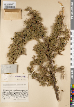
LE 01191721
Juniperus sibirica Burgsd. det. Vassiljev, Viktor Nikolayevich at 1948
Collectors: Sokolov, Ph.V. Field collecting number: 122. Collection date: 09.1947. Administrative regions: RU - Krasnoyarskiy Kray - Turukhanskiy Rayon. Place of collection: окрестности с. Старотуруханск, левобережный останец р. Турухан и р. Енисей несколько ниже устья р. Нижняя Тунгуска, смешанный хвойно-мелко-лиственный лес.Groups of specimens: Образцы сектора Сибири и Дальнего Востока России; Соглашение Минобрнауки №075-15-2021-1056Original label text:Herbarium Instituti Botanici Academiae Sc. URSS. Туруханский р-н. Красноярского края. Возле с. Старо-Туруханск. Левобережный останец р. Турухан и р. Енисей. Несколько ниже устья р. Н. Тунгуски. м. острова Монастырки. Смешанный хвойно-мелко-лиственный лес. 1947 VIII-IX. собр. Ф.В. Соколов
Landscape in location of collection: левобережный останец крупных рекHabitat / plant community in location of collecting: смешанный хвойно-мелко-лиственный лесCoordinates (geographic position): 65° 57′ 19.68″ N, 87° 51′ 14.75″ E ±20000 mRecord creation: 2022-07-01, Larisa Orlova, PhotoScan D2. Part 1.Citation: Specimen LE 01191721 // Virtual herbarium of Komarov Botanical Institute RAS — http://re.herbariumle.ru/01191721