View
Add
Copy
Edit
Delete
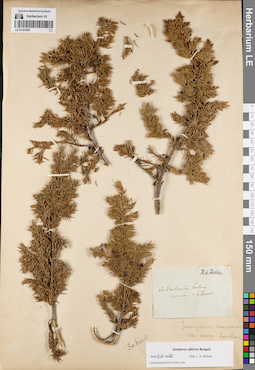
LE 01191789
Juniperus sibirica Burgsd. det. Sobolevskaja, Kira Arkadyevna, Stennikova O. at 1946
Additional identifications: Juniperus communis L. det. Sobolevskaja, Kira Arkadyevna, Stennikova O. at 1946 Collectors: Sobolevskaja, Kira Arkadyevna; Stennikova O. Collection date: 21.06.1946. Administrative regions: RU - Respublika Tyva. Subregion: Каа-Хемский кожуун. Place of collection: хр. Танну-Ола, долина р. Каргам-Пыш, тайга.Expedition: Тувинская ботаническая экспедиция (1945 -1947)Groups of specimens: Образцы сектора Сибири и Дальнего Востока России; Соглашение Минобрнауки №075-15-2021-1056; Зап.-Сиб. Филиал Академии Наук СССРOriginal label text:Зап.-Сиб. Филиал Академии Наук СССР. Тувинская ботаническая экспедиция 1946. Juniperus sibirica Burgsd. Хр. Танну-Ола. Долина реки Каргам-Пыш. 50° 53' с.ш. 96° 36' в.д. Тайга. 21-VI-1946г. К.А. Соболевская. О. Стенникова
Landscape in location of collection: долина рекиHabitat / plant community in location of collecting: тайгаCoordinates (geographic position): 50° 53′ 0″ N, 96° 36′ 0″ E ±5000 mRecord creation: 2022-07-09, Larisa Orlova, PhotoScan D2. Part 1.Citation: Specimen LE 01191789 // Virtual herbarium of Komarov Botanical Institute RAS — http://re.herbariumle.ru/01191789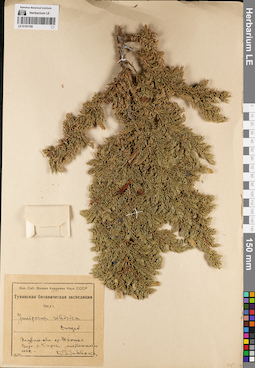
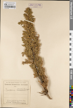
LE 01191788
Juniperus sibirica Burgsd. det. Sobolevskaja, Kira Arkadyevna at 1947
Collectors: Sobolevskaja, Kira Arkadyevna Collection date: 10.08.1947. Administrative regions: RU - Respublika Tyva. Subregion: Тере-Хольский кожуун. Place of collection: хр. Шапшал, верховье р. Каргы, лиственничный лес.Expedition: Тувинская ботаническая экспедиция (1945 -1947)Groups of specimens: Образцы сектора Сибири и Дальнего Востока России; Соглашение Минобрнауки №075-15-2021-1056; Зап.-Сиб. Филиал Академии Наук СССРOriginal label text:Зап.-Сиб. Филиал Академии Наук СССР. Тувинская ботаническая экспедиция 1947. Juniperus sibirica Burgsd. Тувин. обл. хр. Шапшал. Верх. р. Каргы, лиственничн. лес. 10 VIII. К. Соболевская
Habitat / plant community in location of collecting: лиственничный лесCoordinates (geographic position): 50° 23′ 22.96″ N, 96° 41′ 46.11″ E ±20000 mRecord creation: 2022-07-09, Larisa Orlova, PhotoScan D2. Part 1.Citation: Specimen LE 01191788 // Virtual herbarium of Komarov Botanical Institute RAS — http://re.herbariumle.ru/01191788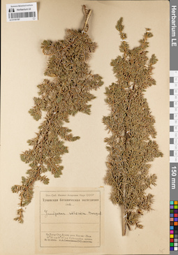
LE 01191787
Juniperus sibirica Burgsd. det. Sobolevskaja, Kira Arkadyevna, Stennikova O. at 1946
Collectors: Sobolevskaja, Kira Arkadyevna; Stennikova O. Collection date: 21.06.1946. Administrative regions: RU - Respublika Tyva - Kaa-Khemskiy Rayon. Subregion: Каа-Хемский кожуун. Place of collection: хр. Танну-Ола, долина р. Каргам-Пыш, субальпийские ерники.Expedition: Тувинская ботаническая экспедиция (1945 -1947)Groups of specimens: Образцы сектора Сибири и Дальнего Востока России; Соглашение Минобрнауки №075-15-2021-1056; Зап.-Сиб. Филиал Академии Наук СССРOriginal label text:Зап.-Сиб. Филиал Академии Наук СССР. Тувинская ботаническая экспедиция 1946. Juniperus sibirica Burgsd. Хр. Танну-Ола. Долина реки Каргам-Пыш. 50° 53' с.ш. 96° 36' в.д. Субальпийск. ерники. 21-VI-1946г. К.А. Соболевская. О. Стенникова
Landscape in location of collection: долина рекиHabitat / plant community in location of collecting: субальпийские ерникиCoordinates (geographic position): 50° 53′ 0″ N, 96° 36′ 0″ E ±5000 mRecord creation: 2022-07-09, Larisa Orlova, PhotoScan D2. Part 1.Citation: Specimen LE 01191787 // Virtual herbarium of Komarov Botanical Institute RAS — http://re.herbariumle.ru/01191787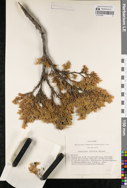
LE 01191786
Juniperus sibirica Burgsd. det. Khanminchun, Valery Mikhailovich, Misin, V. at 1971
Collectors: Khanminchun, Valery Mikhailovich; Misin, V. Field collecting number: 5374. Collection date: 24.06.1971. Administrative regions: RU - Respublika Tyva - Tandinskiy Rayon. Subregion: Тандинский кожуун. Place of collection: северный склон хр. Восточный Танну-Ола, бассейн р. Дурген, верховье руч. Проездной, перевал, осочково-дриасовая тундра, у скал.Groups of specimens: Образцы сектора Сибири и Дальнего Востока России; Соглашение Минобрнауки №075-15-2021-1056; Гербарий Центрального Сибирского ботанического сада СО АН СССРOriginal label text:Гербарий Центрального Сибирского ботанического сада СО АН СССР. Juniperus sibirica Burgsd. № 5374. Тувинская АССР, Тандинский р-н, северный склон хр. В. Танну-Ола, выс. 2075м, бассейн р. Дурген, верховье Проездного ручья, перевал. Осочково-дриасовая тундра, у скал. 24.6.1971г. В. Ханминчун, В. Мисин
Landscape in location of collection: горный перевалHabitat / plant community in location of collecting: осочково-дриасовая тундраCoordinates (geographic position): 50° 59′ 39.7″ N, 94° 23′ 31.93″ E ±5000 m, 2075 m a.s.l.Record creation: 2022-07-09, Larisa Orlova, PhotoScan D2. Part 1.Citation: Specimen LE 01191786 // Virtual herbarium of Komarov Botanical Institute RAS — http://re.herbariumle.ru/01191786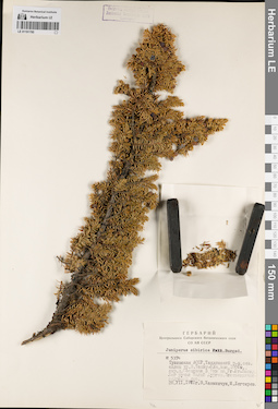
LE 01191785
Juniperus sibirica Burgsd. det. Khanminchun, Valery Mikhailovich at 1971
Collectors: Khanminchun, Valery Mikhailovich; Degtyarev, M. Field collecting number: 5374. Collection date: 28.07.1971. Administrative regions: RU - Respublika Tyva - Tandinskiy Rayon. Subregion: Тандинский кожуун. Place of collection: северный склон хр. Восточный Танну-Ола, окрестности дер. Сосновка в 9 км на юго-юго-запад, лог руч. Малый Дурген, лиственнично-кедровый лес.Groups of specimens: Образцы сектора Сибири и Дальнего Востока России; Соглашение Минобрнауки №075-15-2021-1056; Гербарий Центрального Сибирского ботанического сада СО АН СССРOriginal label text:Гербарий Центрального Сибирского ботанического сада СО АН СССР. Juniperus sibirica [Pall. - crossed out] Burgsd. № 5374. Тувинская АССР, Тандинский р-н, сев. склон хр. В. Танну-Ола, выс. 1600м., окр. д. Сосновка в 9км на Юг-Юг-Запад. Лог ручья Малый Дурген. Лиственнично-кедровый лес. 28.VII.1971г. В. Ханминчун, М. Дегтярев
Landscape in location of collection: лог горного ручьяHabitat / plant community in location of collecting: лиственнично-кедровый лесCoordinates (geographic position): 51° 4′ 7.2″ N, 94° 26′ 11.72″ E ±500 m, 1600 m a.s.l.Record creation: 2022-07-09, Larisa Orlova, PhotoScan D2. Part 1.Citation: Specimen LE 01191785 // Virtual herbarium of Komarov Botanical Institute RAS — http://re.herbariumle.ru/01191785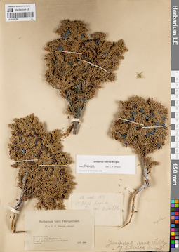
LE 01191784
Juniperus sibirica Burgsd. det. Orlova, Larisa Vladimirovna at 09.07.2022
Additional identifications: Juniperus nana Willd. det. Busch; Juniperus sibirica Burgsd. det. Busch Collectors: Potanin, Grigorii Nikolajevic Collection date: 28.09.1879. Administrative regions: RU - Respublika Tyva. Place of collection: р. Убур Амрбек, склон хр. Танну-Ола.Expedition: Pl. a G.N. Potanin collectae (1879 -1880)Groups of specimens: Образцы сектора Сибири и Дальнего Востока России; Соглашение Минобрнауки №075-15-2021-1056Original label text:[1]28 сент. 1879. Р. Убур Амрбек [...] скл. Танну-Олы. [2] Herbarium horti Petropolitani. Pl. a G.N. Potanin collectae. Mongolia borealis. Circa lacus Ubsa, Kirghiz-nor et Kosogol. Ad Ienisei superiorem et jugum Tannu-ola. 1879, 1880
Coordinates (geographic position): 50° 11′ 46.16″ N, 97° 12′ 6.59″ E ±200000 mRecord creation: 2022-07-09, Larisa Orlova, PhotoScan D2. Part 1.Citation: Specimen LE 01191784 // Virtual herbarium of Komarov Botanical Institute RAS — http://re.herbariumle.ru/01191784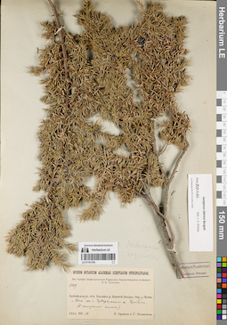
LE 01191783
Juniperus sibirica Burgsd. det. Orlova, Larisa Vladimirovna at 09.07.2022
Collectors: Poplavskaya (Poplawska), Henrietta Ippolitovna; Sukaczev, Vladimir Nikolajevich Field collecting number: 1429. Collection date: 18.08.1912. Administrative regions: RU - Respublika Buryatiya - Severo-Baykal'skiy Rayon. Place of collection: бассейн р. Верхней Ангары, окрестности быв. дер. Ченчи, "волы" на г. Чуварь, около оз. Чумбуки.Expedition: Верхне-Ангарская экспедиция В.Н. Сукачёва (1912)Groups of specimens: Образцы сектора Сибири и Дальнего Востока России; Соглашение Минобрнауки №075-15-2021-1056; Из гербария Переселенческого управленияObject features: Небольшие подушечкиOriginal label text:Museum Botanicum Academiae Scientiarum Petropolitanae. Из гербария Переселенческого Управления. Бассейн р. Верхней Ангары. Окр. д. Ченчи. "Волы" на г. Чуварь, около оз. Чумбуки (S открытый склон). 1912.VIII.18. В. Сукачев и Г. Поплавская
Landscape in location of collection: "волы" на гореCoordinates (geographic position): 55° 56′ 55.57″ N, 111° 1′ 51.36″ E ±2000 mRecord creation: 2022-07-09, Larisa Orlova, PhotoScan D2. Part 1.Citation: Specimen LE 01191783 // Virtual herbarium of Komarov Botanical Institute RAS — http://re.herbariumle.ru/01191783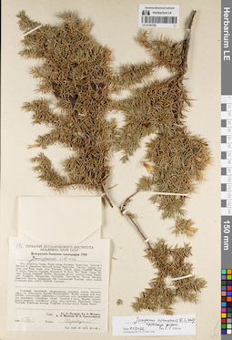
LE 01191782
Juniperus niemannii E.L. Wolf ⟨intermediate forma⟩ det. Orlova, Larisa Vladimirovna at 09.07.2022
Additional identifications: Juniperus sibirica Burgsd. det. Shukhobodsky, Boris Alexandrovich Collectors: Fedorov, Alexander Alexandrovich; Fedorov, Andrey Aleksandrovich; Nikitin, A.A.; Krasilnikov, Pavel Konstantinovich Field collecting number: 196. Collection date: 12.08.1949. Administrative regions: RU - Krasnoyarskiy Kray - Sayanskiy Rayon. Place of collection: долина р. Янга, г. Тукшинское Белогорье, лиственничная кедровая тайга, скалы таежного пояса.Expedition: Центрально-Саянская экспедиция 1949 (1949)Groups of specimens: Образцы сектора Сибири и Дальнего Востока России; Соглашение Минобрнауки №075-15-2021-1056Original label text:Гербарий Ботанического института Академии Наук СССР. Центрально-Саянская экспедиция 1949. Juniperus sibirica. долина Янги. Белогорье Тукшинское. Лиственничная кедровая тайга. Скалы таежного пояса. Собр.: Ал. А. Федоров, Ан. А. Федоров, А. А. Никитин, П.К. Красильников. 1949 12.VIII. Опред.: Шухободский
Landscape in location of collection: скалы таежного поясаHabitat / plant community in location of collecting: лиственнично-кедровая тайгаCoordinates (geographic position): 54° 24′ 58.74″ N, 95° 44′ 2.48″ E ±5000 mRecord creation: 2022-07-09, Larisa Orlova, PhotoScan D2. Part 1.Citation: Specimen LE 01191782 // Virtual herbarium of Komarov Botanical Institute RAS — http://re.herbariumle.ru/01191782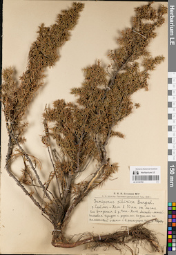
LE 01191781
Juniperus sibirica Burgsd. det. Shroeter, A.I. at 1946
Collectors: Shroeter, A.I. Collection date: 10.08.1946. Administrative regions: RU - Respublika Tyva. Subregion: Улуг-Хемский кожуун. Place of collection: р. Сайлиг-Хем в 10 км от места его впадения в р. Чаа-Холь.Expedition: А.И. Шретер. Растения Центральной Тувы 1946 г. (1946)Groups of specimens: Образцы сектора Сибири и Дальнего Востока России; Соглашение Минобрнауки №075-15-2021-1056; Н.И.И. Ботаники МГУOriginal label text:Н.И.И. Ботаники МГУ. А.И. Шретер. Растения Центральной Тувы 1946 г. Juniperus sibirica Burgsd. р. Сайлиг-Хем в 10 км от места его впадения в р. Чаа-Холь. Мохово-лишайниковая тундра с редкими кедрами по каменистой осыпи с.в. экспозиции. 10/VIII 46. А. Шретер
Landscape in location of collection: каменистая осыпь северо-восточной экспозицииHabitat / plant community in location of collecting: мохово-лишайниковая тундра с редкими кедрамиCoordinates (geographic position): 51° 14′ 32.51″ N, 92° 18′ 32.67″ E ±2000 mRecord creation: 2022-07-09, Larisa Orlova, PhotoScan D2. Part 1.Citation: Specimen LE 01191781 // Virtual herbarium of Komarov Botanical Institute RAS — http://re.herbariumle.ru/01191781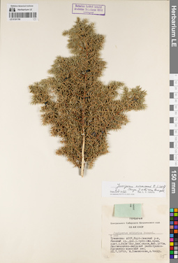
LE 01191780
Juniperus niemannii E.L. Wolf ⟨close to Juniperus sibirica Burgsd.⟩ det. Orlova, Larisa Vladimirovna at 09.07.2022
Additional identifications: Juniperus sibirica Burgsd. det. Choodu, A., Lomonosova, Maria Nikolaevna at 1976 Collectors: Lomonosova, Maria Nikolaevna; Choodu, A. Field collecting number: 266. Collection date: 22.07.1976. Administrative regions: RU - Respublika Tyva. Subregion: Улуг-Хемский кожуун. Place of collection: Уюкский хр., долина р. Ортаа-Хем, правый приток р. Баян-Кол, южный склон.Groups of specimens: Образцы сектора Сибири и Дальнего Востока России; Соглашение Минобрнауки №075-15-2021-1056; Гербарий Центрального Сибирского ботанического сада СО АН СССРOriginal label text:Гербарий Центрального Сибирского ботанического сада СО АН СССР. Juniperus sibirica Burgsd. № 266. Тувинская АССР, Улуг-Хемский р-н, Уюкский хр., дол. р. Орто-Хем, прав. прит. р. Баян-Кол, южн. склон, выс. 1870м. Лиственнично-кедровый разнотравно-бруснично-ирисовый лес. 22.7.1976г. М. Ломоносова, А. Чоод
Landscape in location of collection: южный склонCoordinates (geographic position): 51° 48′ 33.32″ N, 93° 22′ 59.33″ E ±5000 m, 1870 m a.s.l.Record creation: 2022-07-09, Larisa Orlova, PhotoScan D2. Part 1.Citation: Specimen LE 01191780 // Virtual herbarium of Komarov Botanical Institute RAS — http://re.herbariumle.ru/01191780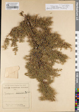
LE 01191779
Juniperus niemannii E.L. Wolf ⟨intermediate forma⟩ det. Orlova, Larisa Vladimirovna at 09.07.2022
Additional identifications: Juniperus communis L. det. Sobolevskaja, Kira Arkadyevna at 1946; Juniperus sibirica Burgsd. det. Sobolevskaja, Kira Arkadyevna at 1946 Collectors: Sobolevskaja, Kira Arkadyevna Collection date: 10.09.1946. Administrative regions: RU - Respublika Tyva. Subregion: Тоджинский кожуун. Place of collection: верховье р. Азас, пер. Артыш-Дабан.Expedition: Тувинская ботаническая экспедиция (1945 -1947)Groups of specimens: Образцы сектора Сибири и Дальнего Востока России; Соглашение Минобрнауки №075-15-2021-1056; Зап.-Сиб. Филиал Академии Наук СССРOriginal label text:Зап.-Сиб. Филиал Академии Наук СССР. Тувинская ботаническая экспедиция 1946. Juniperus [communis - crossed out] sibirica Burgsd. Верховье р. Азас пер. Артыш-Дабан. 10-IX 1946 г. К.А. Соболевская
Landscape in location of collection: горный перевалCoordinates (geographic position): 52° 24′ 46.25″ N, 97° 55′ 51.12″ E ±20000 mRecord creation: 2022-07-09, Larisa Orlova, PhotoScan D2. Part 1.Citation: Specimen LE 01191779 // Virtual herbarium of Komarov Botanical Institute RAS — http://re.herbariumle.ru/01191779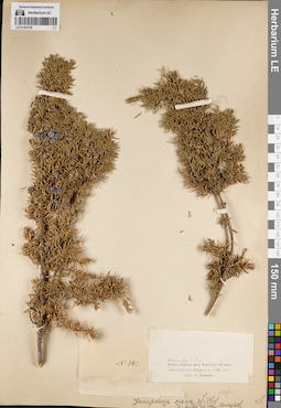
LE 01191778
Juniperus sibirica Burgsd. det. Busch
Additional identifications: Juniperus nana Willd. det. Busch Collectors: Krylov, Porphyriy Nikitich Field collecting number: 943. Collection date: 08.08.1892. Administrative regions: RU - Respublika Tyva. Subregion: Тоджинский кожуун. Place of collection: между станом на р. Азас (в 53 км от устья), и оз. Чевар-куль, лиственничный лес.Groups of specimens: Образцы сектора Сибири и Дальнего Востока России; Соглашение Минобрнауки №075-15-2021-1056Original label text:Poloma Лист. леса. Между станом на р. Азас (в 50 верст. от устья, и оз. Чевар-куль. 8 Авг. 92 г. Собр. П. Крылов
Landscape in location of collection: водораздел между озером и рекойHabitat / plant community in location of collecting: лиственный [лиственничный?] лесCoordinates (geographic position): 52° 30′ 29.64″ N, 97° 2′ 49.8″ E ±1000 mRecord creation: 2022-07-09, Larisa Orlova, PhotoScan D2. Part 1.Citation: Specimen LE 01191778 // Virtual herbarium of Komarov Botanical Institute RAS — http://re.herbariumle.ru/01191778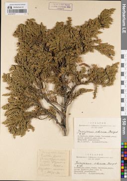
LE 01191777
Juniperus sibirica Burgsd. det. Krasnoborov, Ivan Moiseevich at 1970
Collectors: Krasnoborov, Ivan Moiseevich Field collecting number: 991. Collection date: 20.06.1970. Administrative regions: RU - Respublika Khakasiya. Subregion: Бейский район. Place of collection: хр. Алан, голец Таскалык, верховье руч. Дурной.Groups of specimens: Образцы сектора Сибири и Дальнего Востока России; Соглашение Минобрнауки №075-15-2021-1056; Гербарий Центрального Сибирского ботанического сада СО АН СССРOriginal label text:[1][2] Гербарий Центрального Сибирского ботанического сада СО АН СССР. Juniperus sibirica Burgsd. № 991. З. Саян, хр. Алан, голец Таскалык, верх. ручья Дурного, выс. 1500 м. Кедровое редколесье. 20.6.1970г. И. Красноборов [3] Западный Саян. Хребет Алан. Голец Таскалык в. ручья Дурного высота 1500 м Кедровое полесье 20/VI - 70
Landscape in location of collection: склон гольцаCoordinates (geographic position): 52° 50′ 20.56″ N, 91° 10′ 55.68″ E ±5000 mRecord creation: 2022-07-09, Larisa Orlova, PhotoScan D2. Part 1.Citation: Specimen LE 01191777 // Virtual herbarium of Komarov Botanical Institute RAS — http://re.herbariumle.ru/01191777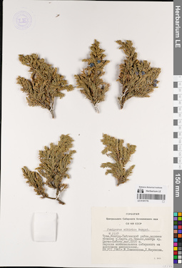
LE 01191776
Juniperus sibirica Burgsd. det. Lomonosova, Maria Nikolaevna, Mironova, L. at 1981
Collectors: Lomonosova, Maria Nikolaevna; Mironova, L. Field collecting number: 2337. Collection date: 29.07.1981. Administrative regions: RU - Respublika Tyva - Mongun-Tayginskiy Rayon. Subregion: Монгун-Тайгинский кожуун. Place of collection: верхнее течение р. Каргы, ур. Чамыяш, шлейфы хр. Цаган-Шибету.Groups of specimens: Образцы сектора Сибири и Дальнего Востока России; Соглашение Минобрнауки №075-15-2021-1056; Гербарий Центрального Сибирского ботанического сада СО АН СССРOriginal label text:Гербарий Центрального Сибирского ботанического сада СО АН СССР. Juniperus sibirica Burgsd. № 2337. Тува, Монгун-Тайгинский район, верхнее течение р. Каргы, ур. Чамыяш, шлейфы хр. Цаган-Шибету, выс. 2200 м. Заросли можжевельника сибирского на восточном микросклоне. 29.VII.1981г. М. Ломоносова, Л. Миронова
Habitat / plant community in location of collecting: заросли можжевельника сибирского на восточном микросклонеCoordinates (geographic position): 50° 28′ 4.68″ N, 89° 54′ 33.84″ E ±30000 m, 2200 m a.s.l.Record creation: 2022-07-09, Larisa Orlova, PhotoScan D2. Part 1.Citation: Specimen LE 01191776 // Virtual herbarium of Komarov Botanical Institute RAS — http://re.herbariumle.ru/01191776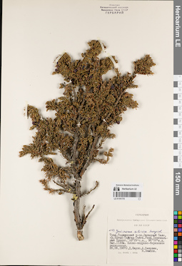
LE 01191775
Juniperus sibirica Burgsd. det. Nikulin, A., Shaulo Dmitry Nikolaevich, Zemtsov, V. at 1987
Collectors: Shaulo Dmitry Nikolaevich; Nikulin, A.; Zemtsov, V. Collection date: 26.06.1987. Administrative regions: RU - Krasnoyarskiy Kray - Kuraginskiy Rayon. Place of collection: Западный Саян, хр. Ергак-Тайгак-Тайга, река Перевальный Хуннуг, елово-кедрово-березовое редколесье.Groups of specimens: Образцы сектора Сибири и Дальнего Востока России; Соглашение Минобрнауки №075-15-2021-1056; Гербарий Центрального Сибирского ботанического сада СО АН СССРOriginal label text:Гербарий Центрального Сибирского ботанического сада СО АН СССР. N 153. Juniperus sibirica Burgsd. Тува, Тоджинский р-он, Западный Саян, хр. Ергак-Тайгак-Тайга. Река Перевальный Хуннуг. 53° 29' с.ш., 96° 08' в.д. Выс. 1130м. Елово-кедрово-березовое редколесье. 26.06.1987г. Д. Шауло, А. Никулин, В. Земцов
Habitat / plant community in location of collecting: елово-кедрово-березовое редколесьеCoordinates (geographic position): 53° 27′ 19.1″ N, 96° 4′ 43.85″ E ±10000 mRecord creation: 2022-07-09, Larisa Orlova, PhotoScan D2. Part 1.Citation: Specimen LE 01191775 // Virtual herbarium of Komarov Botanical Institute RAS — http://re.herbariumle.ru/01191775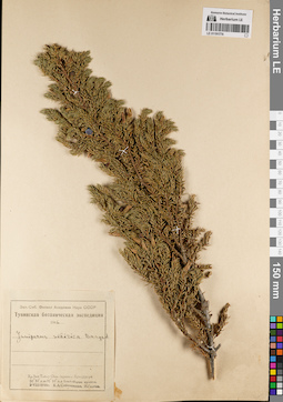
LE 01191774
Juniperus sibirica Burgsd. det. Sobolevskaja, Kira Arkadyevna, Glotov, I. at 1946
Collectors: Sobolevskaja, Kira Arkadyevna; Glotov, I. Collection date: 02.08.1946. Administrative regions: RU - Respublika Tyva - Ovyurskiy Rayon. Subregion: Овюрский кожуун. Place of collection: хр. Западный Танну-Ола, перевал Хондергей (Хундургун), альпийские ерники.Expedition: Тувинская ботаническая экспедиция (1945 -1947)Groups of specimens: Образцы сектора Сибири и Дальнего Востока России; Соглашение Минобрнауки №075-15-2021-1056; Зап.-Сиб. Филиал Академии Наук СССРOriginal label text:Зап.-Сиб. Филиал Академии Наук СССР. Тувинская ботаническая экспедиция 1946. Juniperus sibirica Burgsd. Хр. Зап. Танну-Ола. Перевал Хундургун. 50° 50' с.ш. 91° 59' в.д. Альпийские ерники. 2-VIII-1946г. К.А. Соболевская, И. Глотов
Landscape in location of collection: горный перевалHabitat / plant community in location of collecting: альпийские ерникиCoordinates (geographic position): 50° 50′ 0″ N, 91° 59′ 0″ E ±10000 mRecord creation: 2022-07-09, Larisa Orlova, PhotoScan D2. Part 1.Citation: Specimen LE 01191774 // Virtual herbarium of Komarov Botanical Institute RAS — http://re.herbariumle.ru/01191774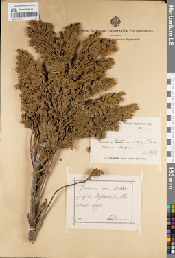
LE 01191773
Juniperus nana Willd. det. Tugarinov, Arkadiy Yakovlevich at 1912
Collectors: Tugarinov, Arkadiy Yakovlevich Collection date: 17.06.1912. Administrative regions: RU - Krasnoyarskiy Kray - Partizanskiy Rayon. Place of collection: окрестности оз. Манское.Expedition: А.Я. Тугаринов: Растения Саянских гор (1912)Groups of specimens: Образцы сектора Сибири и Дальнего Востока России; Соглашение Минобрнауки №075-15-2021-1056Original label text:[1]А.Я. Тугаринов: Растения Саянских гор. Енисейская губ. Красн. уезд: окр. Манского озера. 1912 17/VI. A.I. Tugarinow: Plantae montium Sajanensium [2] Juniperus nana Willd, 17-VI-12. Окрестности Манского озера. Coll. A. Tugarinow
Landscape in location of collection: окрестности озераCoordinates (geographic position): 54° 27′ 17.28″ N, 94° 44′ 39.38″ E ±5000 mRecord creation: 2022-07-09, Larisa Orlova, PhotoScan D2. Part 1.Citation: Specimen LE 01191773 // Virtual herbarium of Komarov Botanical Institute RAS — http://re.herbariumle.ru/01191773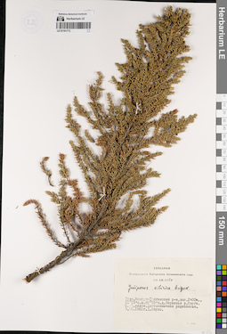
LE 01191772
Juniperus sibirica Burgsd. det. Shaulo Dmitry Nikolaevich at 1981
Collectors: Shaulo Dmitry Nikolaevich Collection date: 03.08.1981. Administrative regions: RU - Respublika Tyva - Mongun-Tayginskiy Rayon. Place of collection: верховье р. Каргы, северо-западный склон, лиственничное редколесье.Groups of specimens: Образцы сектора Сибири и Дальнего Востока России; Соглашение Минобрнауки №075-15-2021-1056; Гербарий Центрального Сибирского ботанического сада СО АН СССРOriginal label text:Гербарий Центрального Сибирского ботанического сада СО АН СССР. Juniperus sibirica Burgsd. Тува, Монгун-Тайгинский р-н, выс. 2400м., 50° 15' с.ш. 89° 55' в.д. Верховье р. Каргы. С.-З. склон. Лиственничное редколесье. 3.08.1981г. Д. Шауло
Landscape in location of collection: северо-западный склонHabitat / plant community in location of collecting: лиственничное редколесьеCoordinates (geographic position): 50° 15′ 0″ N, 89° 55′ 0″ E ±20000 mRecord creation: 2022-07-09, Larisa Orlova, PhotoScan D2. Part 1.Citation: Specimen LE 01191772 // Virtual herbarium of Komarov Botanical Institute RAS — http://re.herbariumle.ru/01191772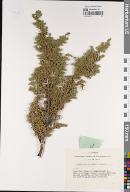
LE 01191771
Juniperus sibirica Burgsd. det. Kovaleva, I., Shaulo Dmitry Nikolaevich at 1978
Collectors: Kovaleva, I. Field collecting number: 831. Collection date: 10.07.1978. Administrative regions: RU - Respublika Tyva - Piy-Khemskiy Rayon. Place of collection: Тува, Зап. Саян, Куртушибинский хр., верховья р. Стерлиг, елово-сосново-лиственничный разнотравно-брусничный лес.Groups of specimens: Образцы сектора Сибири и Дальнего Востока России; Соглашение Минобрнауки №075-15-2021-1056; Гербарий Центрального Сибирского ботанического сада СО АН СССРOriginal label text:Гербарий Центрального Сибирского ботанического сада СО АН СССР. Juniperus sibirica Burgsd. № 831. Тува, Зап. Саян, Куртушибинский хр., верх. р. Стерлик. Елово-сосново-лиственничный разнотравно-брусничный лес. 10.7.1978г. Д. Шауло, И. Ковалева
Landscape in location of collection: склон горного хребтаHabitat / plant community in location of collecting: елово-сосново-лиственничный разнотравно-брусничный лесCoordinates (geographic position): 52° 26′ 23.97″ N, 93° 46′ 35.95″ E ±10000 mRecord creation: 2022-07-09, Larisa Orlova, PhotoScan D2. Part 1.Citation: Specimen LE 01191771 // Virtual herbarium of Komarov Botanical Institute RAS — http://re.herbariumle.ru/01191771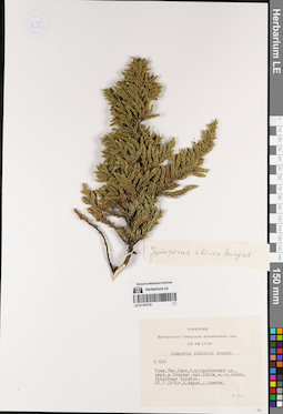
LE 01191770
Juniperus sibirica Burgsd. det. Busch
Additional identifications: Juniperus sibirica Burgsd. det. Dongak, D., Shaulo Dmitry Nikolaevich at 1978 Collectors: Shaulo Dmitry Nikolaevich; Dongak, D. Field collecting number: 828. Collection date: 26.07.1978. Administrative regions: RU - Respublika Tyva - Piy-Khemskiy Rayon. Subregion: Пий-Хемский кожуун. Place of collection: Западный Саян, Куртушибинский хр., верховье р. Стерлиг, юго-западный склон, ерниковые заросли.Groups of specimens: Образцы сектора Сибири и Дальнего Востока России; Соглашение Минобрнауки №075-15-2021-1056; Гербарий Центрального Сибирского ботанического сада СО АН СССРOriginal label text:Гербарий Центрального Сибирского ботанического сада СО АН СССР. Juniperus sibirica Burgsd. № 828. Тува, Зап. Саян, Куртушибинский хр., верх. р. Стерлик, выс. 1820м, ю.-з. склон. Ерниковые заросли. 26.7.1978г. Д. Шауло, Д. Донгак
Landscape in location of collection: склон горного хребтаHabitat / plant community in location of collecting: ерниковые зарослиCoordinates (geographic position): 52° 26′ 23.97″ N, 93° 46′ 35.95″ E ±10000 m, 1820 m a.s.l.Record creation: 2022-07-09, Larisa Orlova, PhotoScan D2. Part 1.Citation: Specimen LE 01191770 // Virtual herbarium of Komarov Botanical Institute RAS — http://re.herbariumle.ru/01191770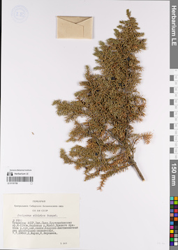
LE 01191769
Juniperus sibirica Burgsd. det. Voroshina, N., Shaulo Dmitry Nikolaevich at 1980
Collectors: Voroshina, N.; Shaulo Dmitry Nikolaevich Field collecting number: 2993. Collection date: 07.07.1980. Administrative regions: RU - Respublika Tyva - Piy-Khemskiy Rayon. Subregion: Пий-Хемский кожуун. Place of collection: Куртушибинский хр., верховье р. Мынас, правого притока р. Хут, западный склон, кедрово-лиственничный лес разнотравно-вейниковый.Groups of specimens: Образцы сектора Сибири и Дальнего Востока России; Соглашение Минобрнауки №075-15-2021-1056; Гербарий Центрального Сибирского ботанического сада СО АН СССРOriginal label text:Гербарий Центрального Сибирского ботанического сада СО АН СССР. Juniperus sibirica Burgsd. № 2993. Тувинская АССР, Зап. Саян, Куртушибинский хр. H-1140м. Верховья р. Мынас, правого притока р. Хут, зап. склон. Кедрово-лиственничный лес разнотравно-вейниковый. 7.7.1980г. Д. Шауло, Н. Ворошина
Landscape in location of collection: западный склон к рекеHabitat / plant community in location of collecting: кедрово-лиственничный лес разнотравно-вейниковыйCoordinates (geographic position): 52° 32′ 10.32″ N, 94° 26′ 34.75″ E ±10000 m, 1140 m a.s.l.Record creation: 2022-07-09, Larisa Orlova, PhotoScan D2. Part 1.Citation: Specimen LE 01191769 // Virtual herbarium of Komarov Botanical Institute RAS — http://re.herbariumle.ru/01191769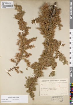
LE 01191768
Juniperus sibirica Burgsd. det. Orlova, Larisa Vladimirovna at 09.07.2022
Collectors: Poplavskaya (Poplawska), Henrietta Ippolitovna; Sukaczev, Vladimir Nikolajevich Field collecting number: 1652. Collection date: 27.07.1914. Administrative regions: RU - Respublika Buryatiya - Severo-Baykal'skiy Rayon. Place of collection: оз. Байкал, Котельниковский маяк, галечник р. Кутурлья.Expedition: Байкальская экспедиция Императорской Академии наук и Императорского Русского географического общества (1914)Groups of specimens: Образцы сектора Сибири и Дальнего Востока России; Соглашение Минобрнауки №075-15-2021-1056Original label text:Museum Botanicum Academiae Scientiarum Petropolitanae. Байкальская экспедиция Имп. Академии Наук и Имп. Русск. Географического Общества. 1652. Иркутск. губ. Оз. Байкал. Котельниковский маяк. Галечник р. Кутурльи. 1914.VII.27. В. Сукачев и Г. Поплавская
Landscape in location of collection: берег крупного озераSubstrate in collecting location: речной галечникCoordinates (geographic position): 55° 2′ 26.32″ N, 109° 5′ 35.17″ E ±5000 mRecord creation: 2022-07-09, Larisa Orlova, PhotoScan D2. Part 1.Citation: Specimen LE 01191768 // Virtual herbarium of Komarov Botanical Institute RAS — http://re.herbariumle.ru/01191768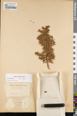
LE 01191617
Groups of specimens: Образцы сектора Сибири и Дальнего Востока России; Соглашение Минобрнауки №075-15-2021-1056Record creation: 2022-07-09, Larisa Orlova, PhotoScan D2. Part 1.Citation: Specimen LE 01191617 // Virtual herbarium of Komarov Botanical Institute RAS — http://re.herbariumle.ru/01191617
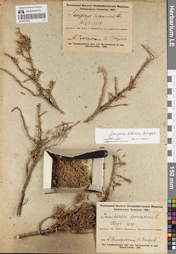
LE 01191616
Juniperus sibirica Burgsd. det. Orlova, Larisa Vladimirovna at 09.07.2022
Additional identifications: Juniperus communis L. det. Smirnov, V. at 1933 Collectors: Gammerman, Adel Fedorovna Collection date: 1933. Administrative regions: RU - Respublika Buryatiya - Zaigrayevskiy Rayon. Place of collection: Шуг. цер., долина р. Уды, улус Хотогор, окр. источника Ацагатский аршан.Expedition: Забайкальская экспедиция 1933 г. (1933)Groups of specimens: Образцы сектора Сибири и Дальнего Востока России; Соглашение Минобрнауки №075-15-2021-1056; Всесоюзный институт экспериментальной медициныOriginal label text:[1][2] Всесоюзный Институт Экспериментальной Медицины. Забайкальская Экспедиция 1933 г. Juniperus communis L. Шуг. цер. Долина р. Уды. Район с. Карымского. Окр. Ацагатского аршана. Собр. А. Гаммерман. Опред. В. Смирнов. Iter Transbaicalense inter urb. Verchneudinsk et stat. Novo-Kurbinsk. 1933.
Landscape in location of collection: окрестности минерального источникаCoordinates (geographic position): 52° 2′ 47.98″ N, 108° 16′ 7.82″ E ±10000 mRecord creation: 2022-07-09, Larisa Orlova, PhotoScan D2. Part 1.Citation: Specimen LE 01191616 // Virtual herbarium of Komarov Botanical Institute RAS — http://re.herbariumle.ru/01191616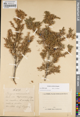
LE 01191615
Juniperus sibirica Burgsd. det. Orlova, Larisa Vladimirovna at 09.07.2022
Additional identifications: Juniperus communis L. det. Stukow, Georgij Andreevitch at 1894 Collectors: Stukow, Georgij Andreevitch Field collecting number: 226. Collection date: 06.1894. Administrative regions: RU - Zabaykal'skiy Kray - Nerchinskiy Rayon. Place of collection: по скалам в лесах близ с. Шивки.Expedition: Г.А. Стуков: Растения Забайкальской области (1907)Groups of specimens: Образцы сектора Сибири и Дальнего Востока России; Соглашение Минобрнауки №075-15-2021-1056Original label text:[1]N 226. Juniperus communis L. Заб. обл. Нерчинского уезда по скалам в лесах близ селения Шивки. VI-1894. Собр. Стуков [2] Г.А. Стуков: Растения Забайкальской области. 19-0. G.A. Stukow: Plantae transbaicalenses
Landscape in location of collection: скалыHabitat / plant community in location of collecting: лесCoordinates (geographic position): 51° 55′ 2.83″ N, 116° 42′ 13.66″ E ±10000 mRecord creation: 2022-07-09, Larisa Orlova, PhotoScan D2. Part 1.Citation: Specimen LE 01191615 // Virtual herbarium of Komarov Botanical Institute RAS — http://re.herbariumle.ru/01191615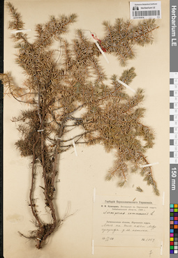
LE 01191614
Juniperus communis L. det. Kusnezow, Nicolai Ivanovitch at 1909
Collectors: Kusnezow, Nicolai Ivanovitch Field collecting number: 1059. Collection date: 10.07.1909. Administrative regions: RU - Zabaykal'skiy Kray - Nerchinsko-Zavodskiy Rayon. Place of collection: лес на дне пади Мургулунда у ее истока.Expedition: Н.И. Кузнецов. Экспедиция в Нерчинский округ Забайкальской области. 1909 г. (1909)Groups of specimens: Образцы сектора Сибири и Дальнего Востока России; Соглашение Минобрнауки №075-15-2021-1056; Гербарий Переселенческого УправленияOriginal label text:Гербарий Переселенческого Управления. Н.И. Кузнецов. Экспедиция в Нерчинский округ Забайкальской области. 1909 г. Juniperus communis L. Забайкальская область, Нерчинский округ. Лес на дне пади Мургулунда у ее истока. 10.VII.1909. № 1059
Landscape in location of collection: дно падиHabitat / plant community in location of collecting: лесCoordinates (geographic position): 51° 20′ 59.24″ N, 119° 28′ 42.57″ E ±130000 mRecord creation: 2022-07-09, Larisa Orlova, PhotoScan D2. Part 1.Citation: Specimen LE 01191614 // Virtual herbarium of Komarov Botanical Institute RAS — http://re.herbariumle.ru/01191614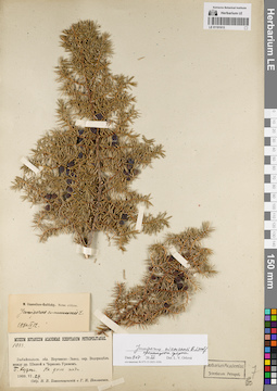
LE 01191613
Juniperus niemannii E.L. Wolf ⟨intermediate forma⟩ det. Orlova, Larisa Vladimirovna at 09.07.2022
Additional identifications: Juniperus communis L. det. Ikonnikov-Galitzky, Nikolai Petrovic at 12.09.1940 Collectors: Poplavskaya (Poplawska), Henrietta Ippolitovna; Blagoveshchensky, N.V. Field collecting number: 1033. Collection date: 29.06.1909. Administrative regions: RU - Zabaykal'skiy Kray - Mogochinskiy Rayon. Place of collection: водораздел между р. Шилка и р. Черный Урюм, р. Большие Кудечи, дно пади.Groups of specimens: Образцы сектора Сибири и Дальнего Востока России; Соглашение Минобрнауки №075-15-2021-1056Original label text:Museum Botanicum Academiae Scientiarum Petropolitanae. 1033. Забайкальск. обл. Нерчинско-Завод. окр. Водораздел между рр. Шилкой и Черным Урюмом. Б. Кудеча. На дне пади. 1909.VI.29. Собр. Н.В. Благовещенский и Г.И. Поплавская
Landscape in location of collection: дно падиCoordinates (geographic position): 53° 32′ 11.34″ N, 119° 9′ 20.11″ E ±5000 mRecord creation: 2022-07-09, Larisa Orlova, PhotoScan D2. Part 1.Citation: Specimen LE 01191613 // Virtual herbarium of Komarov Botanical Institute RAS — http://re.herbariumle.ru/01191613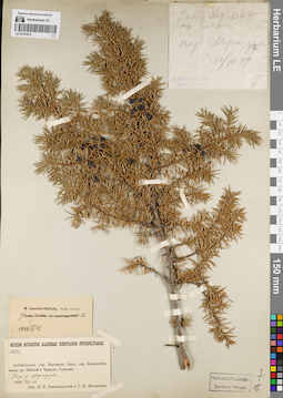
LE 01191612
Juniperus communis L. det. Poplavskaya (Poplawska), Henrietta Ippolitovna, Blagoveshchensky, N.V. at 1909
Additional identifications: Juniperus communis L. det. Ikonnikov-Galitzky, Nikolai Petrovic at 12.09.1940 Collectors: Poplavskaya (Poplawska), Henrietta Ippolitovna; Blagoveshchensky, N.V. Field collecting number: 1083. Collection date: 10.07.1909. Administrative regions: RU - Zabaykal'skiy Kray. Place of collection: водораздел между р. Шилка и Черный Урюм, падь р. Маргорунда.Groups of specimens: Образцы сектора Сибири и Дальнего Востока России; Соглашение Минобрнауки №075-15-2021-1056Original label text:[1]Juniperus communis стелющаяся падь Маргорунда 10/VIII 09 Шилкинская экспедиция [2] Museum Botanicum Academiae Scientiarum Petropolitanae. 1083. Забайкальск. обл. Нерчинско-Завод. окр. Водораздел между рр. Шилкой и Черным Урюмом. Падь р. Маргорунды. 1909.VII.10. Собр. Н.В. Благовещенский и Г.И. Поплавская
Landscape in location of collection: падьCoordinates (geographic position): 52° 57′ 37.53″ N, 118° 30′ 55.8″ E ±240000 mRecord creation: 2022-07-09, Larisa Orlova, PhotoScan D2. Part 1.Citation: Specimen LE 01191612 // Virtual herbarium of Komarov Botanical Institute RAS — http://re.herbariumle.ru/01191612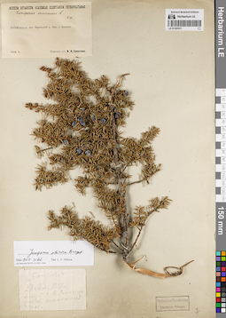
LE 01191611
Juniperus sibirica Burgsd. det. Orlova, Larisa Vladimirovna at 09.07.2022
Additional identifications: Juniperus communis L. det. Steinberg, Elisabeth Ivanovna Collectors: Sukaczev, Vladimir Nikolajevich Collection date: 05.1909. Administrative regions: RU - Zabaykal'skiy Kray - Sretenskiy Rayon. Place of collection: окрестности с. Шеметово (Бянкино).Groups of specimens: Образцы сектора Сибири и Дальнего Востока России; Соглашение Минобрнауки №075-15-2021-1056Original label text:[1]Museum Botanicum Academiae Scientiarum Petropolitanae. Juniperus communis L. Е.Ш[тейнберг]. Забайкальск. обл. Нерчинский у. Окр. с. Бянкина. 1909.V. Получено от В.Н. Сукачева [2] "Багул" 28 Ап. 1909 г. близ с. Бянкино, заб. об. на склоне горы
Coordinates (geographic position): 51° 59′ 57.49″ N, 116° 56′ 34.89″ E ±5000 mRecord creation: 2022-07-09, Larisa Orlova, PhotoScan D2. Part 1.Citation: Specimen LE 01191611 // Virtual herbarium of Komarov Botanical Institute RAS — http://re.herbariumle.ru/01191611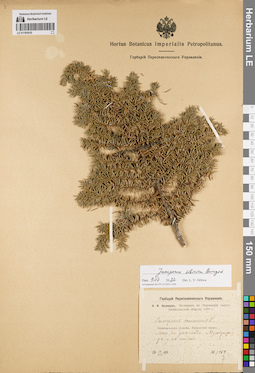
LE 01191610
Juniperus sibirica Burgsd. det. Orlova, Larisa Vladimirovna at 09.07.2022
Additional identifications: Juniperus communis L. det. Kusnezow, Nicolai Ivanovitch at 1909 Collectors: Kusnezow, Nicolai Ivanovitch Field collecting number: 1059. Collection date: 10.07.1909. Administrative regions: RU - Zabaykal'skiy Kray - Nerchinsko-Zavodskiy Rayon. Place of collection: лес на дне пади Мургулунда у ее истока.Expedition: Н.И. Кузнецов. Экспедиция в Нерчинский округ Забайкальской области. 1909 г. (1909)Groups of specimens: Образцы сектора Сибири и Дальнего Востока России; Соглашение Минобрнауки №075-15-2021-1056; Гербарий Переселенческого УправленияOriginal label text:Гербарий Переселенческого Управления. Н.И. Кузнецов. Экспедиция в Нерчинский округ Забайкальской области. 1909 г. Juniperus communis L. Забайкальская область, Нерчинский округ. Лес на дне пади Мургулунда у ее истока. 10.VII.1909. № 1059
Landscape in location of collection: дно падиHabitat / plant community in location of collecting: лесCoordinates (geographic position): 51° 20′ 59.24″ N, 119° 28′ 42.57″ E ±130000 mRecord creation: 2022-07-09, Larisa Orlova, PhotoScan D2. Part 1.Citation: Specimen LE 01191610 // Virtual herbarium of Komarov Botanical Institute RAS — http://re.herbariumle.ru/01191610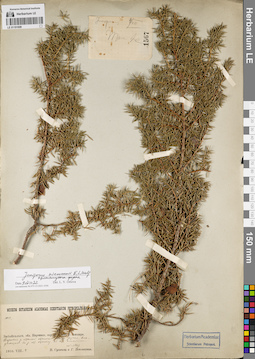
LE 01191609
Juniperus niemannii E.L. Wolf ⟨intermediate forma⟩ det. Orlova, Larisa Vladimirovna at 09.07.2022
Collectors: Poplavskaya (Poplawska), Henrietta Ippolitovna; Sukaczev, Vladimir Nikolajevich Field collecting number: 1033/1567. Collection date: 04.08.1910. Administrative regions: RU - Zabaykal'skiy Kray - Mogochinskiy Rayon. Place of collection: бассейн р. Амазар, верховья р. Малая Могоча, вдоль ручья, впадающего в р. Малая Могоча, 23-ая стоянка.Groups of specimens: Образцы сектора Сибири и Дальнего Востока России; Соглашение Минобрнауки №075-15-2021-1056Original label text:[1]juniperus 4/VIII Там же 1567 [2]Museum Botanicum Academiae Scientiarum Petropolitanae. 1033. Забайкальск. обл. Нерчинск. окр. Бассейн р. Амазара. Верховья р. Малой Магочи. Вдоль ручья, впадающего в р. М. Магочу. 23-ая стоянка. (N=1567) 1910.VIII.4. В. Сукачев и Г. Поплавская
Landscape in location of collection: берег ручьяCoordinates (geographic position): 54° 6′ 45.84″ N, 120° 11′ 21.33″ E ±10000 mRecord creation: 2022-07-09, Larisa Orlova, PhotoScan D2. Part 1.Citation: Specimen LE 01191609 // Virtual herbarium of Komarov Botanical Institute RAS — http://re.herbariumle.ru/01191609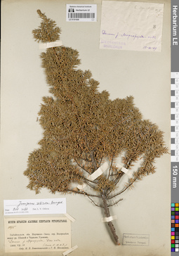
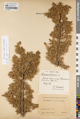
LE 01191608
Groups of specimens: Образцы сектора Сибири и Дальнего Востока России; Соглашение Минобрнауки №075-15-2021-1056Record creation: 2022-07-09, Larisa Orlova, PhotoScan D2. Part 1.Citation: Specimen LE 01191608 // Virtual herbarium of Komarov Botanical Institute RAS — http://re.herbariumle.ru/01191608
LE 01191607
Juniperus sibirica Burgsd. det. Orlova, Larisa Vladimirovna at 09.07.2022
Additional identifications: Juniperus communis L. det. Soyuzov, Viktor Ivanovich at 1912 Collectors: Soyuzov, Viktor Ivanovich Collection date: 14.06.1912. Administrative regions: RU - Zabaykal'skiy Kray - Chitinskiy Rayon. Place of collection: голец Саранакан, в камнях.Groups of specimens: Образцы сектора Сибири и Дальнего Востока России; Соглашение Минобрнауки №075-15-2021-1056; От Общества изучения СибириObject features: ОбильноOriginal label text:[1]сем. Cupressineae. Juniperus communis L. Заб. обл. Чит. у. голец "Саранакан". В камнях. Обильно. 14/VI 912. В. Союзов [2] Herbarium Horti Botanici Imperialis Petri Magni. От Общества изучения Сибири. Забайкальская обл. Собр. В.И. Союзов. 1912 г.
Landscape in location of collection: камни на склоне гольцаCoordinates (geographic position): 52° 34′ 45.34″ N, 113° 47′ 13.54″ E ±5000 mRecord creation: 2022-07-09, Larisa Orlova, PhotoScan D2. Part 1.Citation: Specimen LE 01191607 // Virtual herbarium of Komarov Botanical Institute RAS — http://re.herbariumle.ru/01191607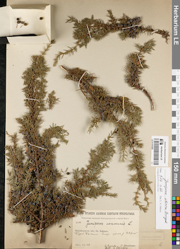
LE 01191605
Juniperus sibirica Burgsd. det. Orlova, Larisa Vladimirovna at 09.07.2022
Additional identifications: Juniperus communis L. det. Steinberg, Elisabeth Ivanovna at 1915 Collectors: Poplavskaya (Poplawska), Henrietta Ippolitovna; Sukaczev, Vladimir Nikolajevich Field collecting number: 2602. Collection date: 26.07.1915. Administrative regions: RU - Irkutskaya Oblast'; RU - Respublika Buryatiya. Place of collection: оз. Байкал, берег оз. Байкал близ устья р. Северная.Expedition: Байкальская экспедиция Императорской Академии Наук (1915)Groups of specimens: Образцы сектора Сибири и Дальнего Востока России; Соглашение Минобрнауки №075-15-2021-1056Original label text:Museum Botanicum Academiae Scientiarum Petropolitanae. Байкальская экспедиция императорской Академии Наук. 2602. Juniperus communis L. Забайкальск. обл. Оз. Байкал. Берег Байкала близ устья р. Северной. 1915.VII.26. В. Сукачев и Г. Поплавская. Det. E. Steinberg
Landscape in location of collection: берег крупного озераCoordinates (geographic position): 53° 24′ 19.2″ N, 107° 40′ 23.01″ E ±320000 mRecord creation: 2022-07-09, Larisa Orlova, PhotoScan D2. Part 1.Citation: Specimen LE 01191605 // Virtual herbarium of Komarov Botanical Institute RAS — http://re.herbariumle.ru/01191605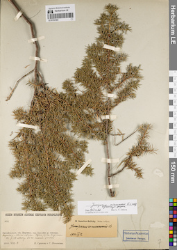
LE 01191604
Juniperus niemannii E.L. Wolf ⟨intermediate forma⟩ det. Orlova, Larisa Vladimirovna at 09.07.2022
Additional identifications: Juniperus communis L. det. Ikonnikov-Galitzky, Nikolai Petrovic at 12.09.1940 Collectors: Poplavskaya (Poplawska), Henrietta Ippolitovna; Sukaczev, Vladimir Nikolajevich Field collecting number: 1033. Collection date: 04.08.1910. Administrative regions: RU - Zabaykal'skiy Kray - Mogochinskiy Rayon. Place of collection: бассейн р. Амазар, верховья р. Малая Могоча, вдоль ручья, впадающего в р. Малая Могоча, 23-ая стоянка.Groups of specimens: Образцы сектора Сибири и Дальнего Востока России; Соглашение Минобрнауки №075-15-2021-1056Original label text:Museum Botanicum Academiae Scientiarum Petropolitanae. 1033. Забайкальск. обл. Нерчинск. окр. Бассейн р. Амазара. Верховья р. Малой Магочи. Вдоль ручья, впадающего в р. М. Магочу. 23-ая стоянка. (N=1567) 1910.VIII.4. В. Сукачев и Г. Поплавская
Landscape in location of collection: берег ручьяCoordinates (geographic position): 54° 6′ 45.84″ N, 120° 11′ 21.33″ E ±10000 mRecord creation: 2022-07-09, Larisa Orlova, PhotoScan D2. Part 1.Citation: Specimen LE 01191604 // Virtual herbarium of Komarov Botanical Institute RAS — http://re.herbariumle.ru/01191604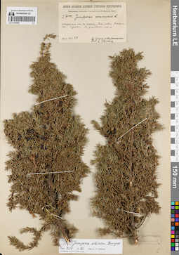
LE 01191603
Juniperus sibirica Burgsd. det. Orlova, Larisa Vladimirovna at 09.07.2022
Additional identifications: Juniperus communis L. det. Steinberg, Elisabeth Ivanovna at 1915 Collectors: Sukaczev, Vladimir Nikolajevich Field collecting number: 2700. Collection date: 28.07.1915. Administrative regions: RU - Respublika Buryatiya - Selenginskiy Rayon. Place of collection: оз. Байкал, Мысовск-Кяхтинский тракт, редкий лес.Expedition: Байкальская экспедиция Императорской Академии Наук (1915)Groups of specimens: Образцы сектора Сибири и Дальнего Востока России; Соглашение Минобрнауки №075-15-2021-1056Original label text:Museum Botanicum Academiae Scientiarum Petropolitanae. Байкальская экспедиция императорской Академии Наук. 2700. Juniperus communis L. Забайкальск. обл. Оз. Байкал. Мысовск-Кяхтинский тракт. В редком лесу. 1915.VII.28. В. Сукачев. Det. E. Steinberg
Habitat / plant community in location of collecting: редкий лесCoordinates (geographic position): 51° 4′ 28.79″ N, 106° 6′ 48.08″ E ±75000 mRecord creation: 2022-07-09, Larisa Orlova, PhotoScan D2. Part 1.Citation: Specimen LE 01191603 // Virtual herbarium of Komarov Botanical Institute RAS — http://re.herbariumle.ru/01191603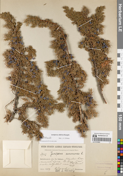
LE 01191602
Juniperus sibirica Burgsd. det. Orlova, Larisa Vladimirovna at 09.07.2022
Additional identifications: Juniperus communis L. det. Steinberg, Elisabeth Ivanovna Collectors: Poplavskaya (Poplawska), Henrietta Ippolitovna; Sukaczev, Vladimir Nikolajevich Field collecting number: 2762. Collection date: 29.07.1915. Administrative regions: RU - Respublika Buryatiya - Kabanskiy Rayon. Place of collection: Мысовск-Кяхтинский тракт, ст. Улятыйская (Уляты) [в 1 версте от высочайшей вершины хр. Хамар-Дабан, в 60 верстах от с. Темник на север, недалеко от долины р. Мысовка], сухой елово-кедровый лес.Expedition: Байкальская экспедиция Императорской Академии Наук (1915)Groups of specimens: Образцы сектора Сибири и Дальнего Востока России; Соглашение Минобрнауки №075-15-2021-1056Object features: Большой кустOriginal label text:Museum Botanicum Academiae Scientiarum Petropolitanae. Байкальская экспедиция Императорской Академии Наук. 2762. Juniperus communis L. Забайкальск. обл. Оз. Байкал. Мысовск-Кяхтинский тракт. Ст. Уляты. Сухой елово-кедровый лес. Большой куст. 1915.VII.29. В. Сукачев и Г. Поплавская. Det. E. Steinberg
Landscape in location of collection: склон горного хребтаHabitat / plant community in location of collecting: сухой елово-кедровый лесCoordinates (geographic position): 51° 29′ 42.95″ N, 105° 58′ 39.22″ E ±10000 mRecord creation: 2022-07-09, Larisa Orlova, PhotoScan D2. Part 1.Citation: Specimen LE 01191602 // Virtual herbarium of Komarov Botanical Institute RAS — http://re.herbariumle.ru/01191602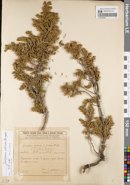
LE 01191601
Juniperus sibirica Burgsd. det. Orlova, Larisa Vladimirovna at 09.07.2022
Additional identifications: Juniperus communis var. nana Willd. det. Nasarow, Mikhail Ivanovich at 1929; Juniperus sibirica Burgsd. det. Nasarow, Mikhail Ivanovich at 1929 Collectors: Nasarow, Mikhail Ivanovich Field collecting number: 12.564. Collection date: 27.07.1929. Administrative regions: RU - Respublika Buryatiya - Tunkinskiy Rayon. Place of collection: Тункинские гольцы, р. Иркут (Архыт) в устье р. Хонголдой, вершина гольца.Expedition: Хамар-Дабано-Тункинская экспедиция под общим руководством М.И. Назарова (1929)Groups of specimens: Образцы сектора Сибири и Дальнего Востока России; Соглашение Минобрнауки №075-15-2021-1056; Общество изучения Урала, Сибири и Дальнего ВостокаOriginal label text:Общество изучения Урала, Сибири и Дальнего Востока. Хамар-Дабано-Тункинская Экспедиция под общим руководством М.И. Назарова. Juniperus communis L. v. nana Willd. (=J. sibirica Burgsdorf) 1929.VII.27. 51°, 54' lat. bor. 101°, 48' long. or. Grinw. Тункинские гольцы. Р. Архыт в устье Хонхолоя. На вершине гольца. № 12.564. Leg. Determ. М. Назаров
Landscape in location of collection: вершина гольцаCoordinates (geographic position): 51° 42′ 26.04″ N, 101° 39′ 34.11″ E ±5000 mRecord creation: 2022-07-09, Larisa Orlova, PhotoScan D2. Part 1.Citation: Specimen LE 01191601 // Virtual herbarium of Komarov Botanical Institute RAS — http://re.herbariumle.ru/01191601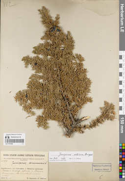
LE 01191600
Juniperus sibirica Burgsd. det. Orlova, Larisa Vladimirovna at 09.07.2022
Additional identifications: Juniperus communis L. det. Busch Collectors: Lebedeva, Z.; Korotky, Mikhail Fedorovich Field collecting number: 482. Collection date: 12.07.1914. Administrative regions: RU - Zabaykal'skiy Kray - Tungokochenskiy Rayon. Place of collection: Витимское плоскогорье, перевал в обход россыпей р. Ишанда (Ижинда), лиственничный лес.Expedition: Муйская экспедиция М.Ф. Короткого (1914)Groups of specimens: Образцы сектора Сибири и Дальнего Востока России; Соглашение Минобрнауки №075-15-2021-1056; Из гербария Переселенческого управленияOriginal label text:Museum Botanicum Academiae Scientiarum Petropolitanae. Из гербария Переселенческого Управления. Муйская экспедиция М.Ф. Короткого. N 482. Juniperus communis L. Забайкальск. обл. Баргузинск. у. Витимское плоскогорье. Перевал в обход россыпей р. Ижинде. Циплинкоw. В лиственничном лесу. 1914.VII-12. М. Короткий и З. Лебедева
Landscape in location of collection: горный перевал в обход россыпей рекиHabitat / plant community in location of collecting: лиственничный лесCoordinates (geographic position): 53° 27′ 57.78″ N, 114° 48′ 40.96″ E ±2000 mRecord creation: 2022-07-09, Larisa Orlova, PhotoScan D2. Part 1.Citation: Specimen LE 01191600 // Virtual herbarium of Komarov Botanical Institute RAS — http://re.herbariumle.ru/01191600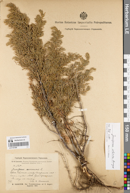
LE 01191599
Juniperus sibirica Burgsd. det. Orlova, Larisa Vladimirovna at 09.07.2022
Additional identifications: Juniperus communis L. det. Schipczinski, Nikolaj Valerianovich at 1912 Collectors: Schipczinski, Nikolaj Valerianovich Field collecting number: 525. Collection date: 06.08.1912. Administrative regions: RU - Respublika Buryatiya - Severo-Baykal'skiy Rayon. Place of collection: берег оз. Байкал между Дагарским маяком и губой Аяя, руч. Эрекшакан (Ираксокал), лес по склону.Expedition: В.Н. Сукачев. Верхне-Ангарская экспедиция Забайкальской области 1912 г. () (1912)Groups of specimens: Образцы сектора Сибири и Дальнего Востока России; Соглашение Минобрнауки №075-15-2021-1056; Гербарий Переселенческого УправленияOriginal label text:Гербарий Переселенческого Управления. В.Н. Сукачев. Верхне-Ангарская экспедиция Забайкальской области 1912 г. № 525. Juniperus communis L. Берег Байкала между Дагарским маяком и губой Аяя. Ручей Ираксокал. В лесу по склону. 6/VIII. Собр. Н. Шипчинский. W. Sukaczew. Iter Transbaicalense ad fl. Angara Superior. 1912
Landscape in location of collection: склон по берегу ручьяHabitat / plant community in location of collecting: лес по склонуCoordinates (geographic position): 55° 34′ 21.1″ N, 109° 54′ 13.9″ E ±5000 mRecord creation: 2022-07-09, Larisa Orlova, PhotoScan D2. Part 1.Citation: Specimen LE 01191599 // Virtual herbarium of Komarov Botanical Institute RAS — http://re.herbariumle.ru/01191599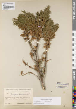
LE 01191598
Juniperus sibirica Burgsd. det. Orlova, Larisa Vladimirovna at 09.07.2022
Additional identifications: Juniperus communis L. det. Busch Collectors: Zinserling (Tsinzerling), Iurij (Yuri, Georgius) Dmitrievitch Field collecting number: 3102. Collection date: 06.08.1915. Administrative regions: RU - Respublika Buryatiya - Kabanskiy Rayon. Place of collection: ж.д. ст. Мишиха, край сфагнового болота.Expedition: Байкальская экспедиция Императорской Академии Наук (1915)Groups of specimens: Образцы сектора Сибири и Дальнего Востока России; Соглашение Минобрнауки №075-15-2021-1056Original label text:Museum Botanicum Academiae Scientiarum Petropolitanae. Байкальская экспедиция Императорской Академии Наук. 3102. Juniperus communis L. Забайкальск. обл. Оз. Байкал. ст. Мишиха. По краю сфагнового болота. 1915.VIII.6. Ю. Цинзерлинг
Habitat / plant community in location of collecting: край сфагнового болотаCoordinates (geographic position): 51° 39′ 9.47″ N, 105° 35′ 23.46″ E ±10000 mRecord creation: 2022-07-09, Larisa Orlova, PhotoScan D2. Part 1.Citation: Specimen LE 01191598 // Virtual herbarium of Komarov Botanical Institute RAS — http://re.herbariumle.ru/01191598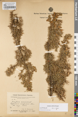
LE 01191597
Juniperus sibirica Burgsd. det. Orlova, Larisa Vladimirovna at 09.07.2022
Additional identifications: Juniperus communis L. det. Schipczinski, Nikolaj Valerianovich at 1912 Collectors: Schipczinski, Nikolaj Valerianovich Field collecting number: 83. Collection date: 02.06.1912. Administrative regions: RU - Respublika Buryatiya - Pribaykal'skiy Rayon. Place of collection: с. Горячинск, Туркинский горячий источник (Туркинские минеральные воды), в лесу.Expedition: В.Н. Сукачев. Верхне-Ангарская экспедиция Забайкальской области 1912 г. () (1912)Groups of specimens: Образцы сектора Сибири и Дальнего Востока России; Соглашение Минобрнауки №075-15-2021-1056; Гербарий Переселенческого УправленияObject features: редкоOriginal label text:Гербарий Переселенческого Управления. В.Н. Сукачев. Верхне-Ангарская экспедиция Забайкальской области 1912 г. № 83. Juniperus communis L. Туркинские минеральные воды. В лесу. Редко. 2/VI. Собр. Н. Шипчинский. W. Sukaczew. Iter Transbaicalense ad fl. Angara Superior. 1912
Landscape in location of collection: горячий источникHabitat / plant community in location of collecting: лесCoordinates (geographic position): 52° 59′ 14.24″ N, 108° 18′ 29.09″ E ±1000 mRecord creation: 2022-07-09, Larisa Orlova, PhotoScan D2. Part 1.Citation: Specimen LE 01191597 // Virtual herbarium of Komarov Botanical Institute RAS — http://re.herbariumle.ru/01191597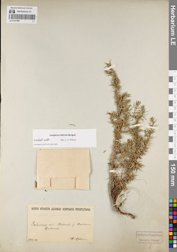
LE 01191596
Juniperus sibirica Burgsd. det. Orlova, Larisa Vladimirovna at 09.07.2022
Additional identifications: Juniperus communis L. det. Busch Collectors: Arndt, P. Collection date: 08.1910. Administrative regions: RU - Zabaykal'skiy Kray - Khilokskiy Rayon. Place of collection: Вершина г. Цибитуй.Groups of specimens: Образцы сектора Сибири и Дальнего Востока России; Соглашение Минобрнауки №075-15-2021-1056Original label text:Museum Botanicum Academiae Scientiarum Petropolitanae. Juniperus communis L. Забайкаль. обл. Верхнеуд. у. Вершина Цибитуя. 1910.VIII. П. Арндт
Landscape in location of collection: вершина горыCoordinates (geographic position): 51° 8′ 14.64″ N, 110° 21′ 40.31″ E ±500 mRecord creation: 2022-07-09, Larisa Orlova, PhotoScan D2. Part 1.Citation: Specimen LE 01191596 // Virtual herbarium of Komarov Botanical Institute RAS — http://re.herbariumle.ru/01191596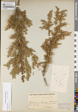
LE 01191595
Juniperus sibirica Burgsd. det. Orlova, Larisa Vladimirovna at 09.07.2022
Additional identifications: Juniperus communis L. det. Arndt, P. at 1910 Collectors: Arndt, P. Collection date: 18.06.1910. Administrative regions: RU - Zabaykal'skiy Kray - Khilokskiy Rayon. Place of collection: Право-Хилокская лесная дача, ж.д. ст. Гыршелун (Гыршелун-Тарбагатай).Groups of specimens: Образцы сектора Сибири и Дальнего Востока России; Соглашение Минобрнауки №075-15-2021-1056Original label text:[1]18/VI Т. Тайга. Почва силикат. россып [тогц.] сухая на осыпи. мест. [2]Museum Botanicum Academiae Scientiarum Petropolitanae. Juniperus communis L. Забайкаль. обл. Верхнеуд. у. Право-Хилокская лесная дача. Ст. Гыршелун-Тарбагатай Заб. ж.д. 1910.VI.18. П. Арндт
Habitat / plant community in location of collecting: окружение железнодорожной станцииCoordinates (geographic position): 51° 24′ 27.64″ N, 110° 39′ 35.47″ E ±10000 mRecord creation: 2022-07-09, Larisa Orlova, PhotoScan D2. Part 1.Citation: Specimen LE 01191595 // Virtual herbarium of Komarov Botanical Institute RAS — http://re.herbariumle.ru/01191595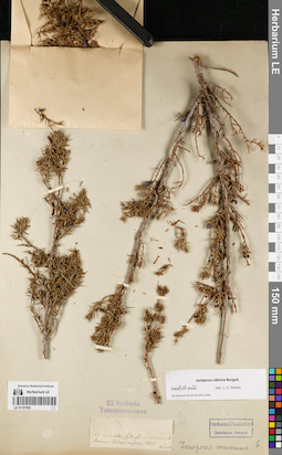
LE 01191593
Juniperus sibirica Burgsd. det. Orlova, Larisa Vladimirovna at 09.07.2022
Additional identifications: Juniperus communis L. det. Busch Collectors: Turczaninow, Nicolai Stepanowisch Collection date: 1829. Administrative regions: RU - Respublika Buryatiya. Place of collection: линия р. Селенга, лесистые горы.Groups of specimens: Образцы сектора Сибири и Дальнего Востока России; Соглашение Минобрнауки №075-15-2021-1056; Ex herbario TurczaninowianoOriginal label text:In montibus sylvosis in vicinis de linerum Selinginensium 1829 Turcz
Landscape in location of collection: горный склонHabitat / plant community in location of collecting: горный лесCoordinates (geographic position): 51° 41′ 1.12″ N, 107° 19′ 39.51″ E ±150000 mRecord creation: 2022-07-09, Larisa Orlova, PhotoScan D2. Part 1.Citation: Specimen LE 01191593 // Virtual herbarium of Komarov Botanical Institute RAS — http://re.herbariumle.ru/01191593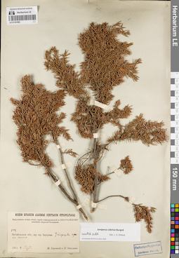
LE 01191592
Juniperus sibirica Burgsd. det. Orlova, Larisa Vladimirovna at 09.07.2022
Collectors: Korotky, Mikhail Fedorovich; Nikolaev, P. Field collecting number: 104. Collection date: 14.05.1911. Administrative regions: RU - Respublika Buryatiya - Barguzinskiy Rayon. Place of collection: окрестности с. Баргузин, подошва горы на склоне.Expedition: Баргузинская почвен.-ботан. партия командированной по Высочайшему повелению Амурской Экспедиции ()Groups of specimens: Образцы сектора Сибири и Дальнего Востока России; Соглашение Минобрнауки №075-15-2021-1056Original label text:Museum Botanicum Academiae Scientiarum Petropolitanae. Баргузинская почвен.-ботан. партия командированной по высочайшему повелению Амурской Экспедиции. 104. Забайкальск. обл., окр. гор. Баргузина. У подошвы горы на склоне. 1911.V.13-14. М. Короткий и П. Николаев
Landscape in location of collection: подошва горы на склонеCoordinates (geographic position): 53° 37′ 38″ N, 109° 36′ 45.17″ E ±5000 mRecord creation: 2022-07-09, Larisa Orlova, PhotoScan D2. Part 1.Citation: Specimen LE 01191592 // Virtual herbarium of Komarov Botanical Institute RAS — http://re.herbariumle.ru/01191592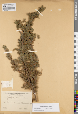
LE 01191591
Juniperus sibirica Burgsd. det. Orlova, Larisa Vladimirovna at 09.07.2022
Additional identifications: Juniperus communis L. det. Kryukov, Innokentij Fedorovitch at 1905 Collectors: Kryukov, Innokentij Fedorovitch Field collecting number: 1747. Collection date: 08.08.1905. Administrative regions: RU - Respublika Buryatiya - Bauntovskiy Rayon. Place of collection: восточный склон хр. Икатский (Икатские горы).Expedition: И.Ф. Крюков: Флора Баргузинской тайги Забайкальской области (1905)Groups of specimens: Образцы сектора Сибири и Дальнего Востока России; Соглашение Минобрнауки №075-15-2021-1056Original label text:И.Ф. Крюков: Флора Баргузинской тайги Забайкальской области. Juniperus communis. На восточном склоне Икатских гор. 1747. 8 VIII 1905 г.
Landscape in location of collection: склон горного хребтаCoordinates (geographic position): 53° 35′ 57.12″ N, 111° 0′ 0″ E ±20000 mRecord creation: 2022-07-09, Larisa Orlova, PhotoScan D2. Part 1.Citation: Specimen LE 01191591 // Virtual herbarium of Komarov Botanical Institute RAS — http://re.herbariumle.ru/01191591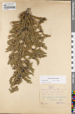
LE 01191590
Juniperus sibirica Burgsd. det. Orlova, Larisa Vladimirovna at 09.07.2022
Additional identifications: Juniperus pseudosabina Fisch. & C.A. Mey. det. Mikhno, Petr Savvich at 1928 Collectors: Mikhno, Petr Savvich Collection date: 17.07.1928. Administrative regions: RU - Respublika Buryatiya - Dzhidinskiy Rayon. Place of collection: окрестности оз. Таглей в 16 км от среднего течения р. Темник (левый приток р. Селенга).Groups of specimens: Образцы сектора Сибири и Дальнего Востока России; Соглашение Минобрнауки №075-15-2021-1056; Б.М.Р.Original label text:Б.М.Р. Окрестности озера Таглей в 15 в. от средн. течения р. Темника левого притока р. Селенги. Juniperus pseudosabina Fisch. x Mey. 17/VII-1928 г. Собр. П. Михно
Landscape in location of collection: окрестности озераCoordinates (geographic position): 50° 57′ 14.66″ N, 104° 51′ 35.08″ E ±10000 mRecord creation: 2022-07-09, Larisa Orlova, PhotoScan D2. Part 1.Citation: Specimen LE 01191590 // Virtual herbarium of Komarov Botanical Institute RAS — http://re.herbariumle.ru/01191590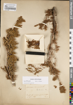
LE 01191589
Groups of specimens: Образцы сектора Сибири и Дальнего Востока России; Соглашение Минобрнауки №075-15-2021-1056Record creation: 2022-07-09, Larisa Orlova, PhotoScan D2. Part 1.Citation: Specimen LE 01191589 // Virtual herbarium of Komarov Botanical Institute RAS — http://re.herbariumle.ru/01191589