View
Add
Copy
Edit
Delete
LE 01290211
Groups of specimens: Образцы сектора Восточной ЕвропыRecord creation: 2024-08-03, Daria Yudova, PhotoScan D2.Citation: Specimen LE 01290211 // Virtual herbarium of Komarov Botanical Institute RAS — http://re.herbariumle.ru/01290211
LE 01290210
Groups of specimens: Образцы сектора Восточной ЕвропыRecord creation: 2024-08-03, Daria Yudova, PhotoScan D2.Citation: Specimen LE 01290210 // Virtual herbarium of Komarov Botanical Institute RAS — http://re.herbariumle.ru/01290210
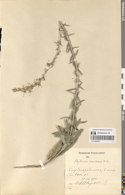
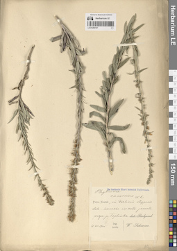
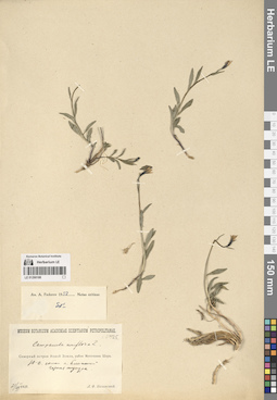
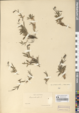
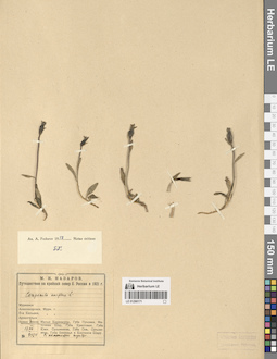
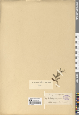
LE 01290209
Asyneuma canescens (Waldst. & Kit.) Griseb. & Schenk
Collectors: Schirajewsky, Ivan I. Collection date: 25.06.1903. Administrative regions: UA - Luhans'ka Oblast'. Groups of specimens: Образцы сектора Восточной ЕвропыOriginal label text:Близ Старобельска. На склонах меловых гор.
Coordinates (geographic position): 49° 18′ 5.85″ N, 38° 51′ 53.77″ EComment: 25.VI.1903
И. Шираевский
Near Starobelsk. On the slopes of chalk mountains.
Record creation: 2024-08-03, Daria Yudova, PhotoScan D2.Citation: Specimen LE 01290209 // Virtual herbarium of Komarov Botanical Institute RAS — http://re.herbariumle.ru/0129020925.06.1903
Coll. I. Schirajewsky
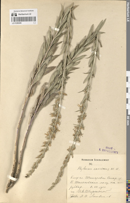
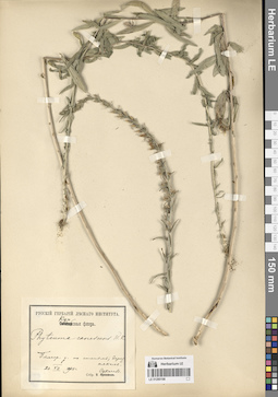
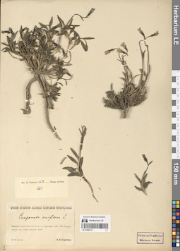
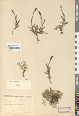
LE 01290208
Asyneuma canescens (Waldst. & Kit.) Griseb. & Schenk
Collectors: Schirajewsky, Ivan I. Collection date: 25.06.1903. Administrative regions: UA - Luhans'ka Oblast'. Groups of specimens: Образцы сектора Восточной ЕвропыOriginal label text:Харьковская губерния. Близ города Старобельска. Склоны меловых гор.
Coordinates (geographic position): 49° 18′ 5.85″ N, 38° 51′ 53.77″ EComment: 25.VI.1903
И. Шираевский
Kharkov province. Near the city of Starobelsk. Slopes of chalk mountains.
Record creation: 2024-08-03, Daria Yudova, PhotoScan D2.Citation: Specimen LE 01290208 // Virtual herbarium of Komarov Botanical Institute RAS — http://re.herbariumle.ru/0129020825.06.1903
Coll. I. Schirajewsky
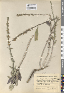
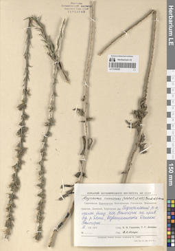
LE 01290207
Asyneuma canescens (Waldst. & Kit.) Griseb. & Schenk
Collectors: Schirajewsky, Ivan I. Collection date: 25.07.1904. Administrative regions: UA - Luhans'ka Oblast'. Groups of specimens: Образцы сектора Восточной ЕвропыOriginal label text:Близ Старобельска, в лесу (близ [Ком. л.])
Coordinates (geographic position): 49° 16′ 8.58″ N, 38° 52′ 11.07″ EComment: 25.VII.1904
Ив. Шираевский
Near Starobelsk, in the forest.
25.07.1904
Coll. I. Schirajewsky
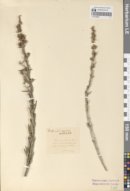
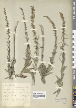
LE 01290206
Asyneuma canescens (Waldst. & Kit.) Griseb. & Schenk
Collectors: Schirajewsky, Ivan I. Collection date: 08.07.1904. Administrative regions: UA - Luhans'ka Oblast'. Groups of specimens: Образцы сектора Восточной ЕвропыOriginal label text:Близ села Титаровки Старобельского уезда. В Толоковском лесу, на порубках.
Coordinates (geographic position): 49° 13′ 55.14″ N, 38° 53′ 40.99″ EComment: 8.VII.1904
Ив. Шираевский
Near the village of Titarovka, Starobelsk district. In the Tolokovsky forest, in the clearings.
Record creation: 2024-08-03, Daria Yudova, PhotoScan D2.Citation: Specimen LE 01290206 // Virtual herbarium of Komarov Botanical Institute RAS — http://re.herbariumle.ru/012902068.07.1904
Coll. I. Schirajewsky
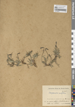
LE 01290205
Asyneuma canescens (Waldst. & Kit.) Griseb. & Schenk
Collectors: Tzvelev, Nikolai Nikolaievich Collection date: 10.10.1955. Administrative regions: UA - Kharkivs'ka Oblast'. Groups of specimens: Образцы сектора Восточной ЕвропыOriginal label text:Харьковская область. Окрестности города Харькова. Степные склоны балок, впадающих в пойму реки Роганки км в 3 юго-востоку от станции Рогань.
Coordinates (geographic position): 49° 52′ 57.31″ N, 36° 29′ 30.34″ EComment: 10.X.1955
Н. Цвелев
Kharkiv region. The outskirts of the city of Kharkiv. Steppe slopes of gullies flowing into the floodplain of the Roganka River, 3 km southeast of the Rogan station.
Record creation: 2024-08-03, Daria Yudova, PhotoScan D2.Citation: Specimen LE 01290205 // Virtual herbarium of Komarov Botanical Institute RAS — http://re.herbariumle.ru/0129020510.10.1955
Coll. N. Tzvelev

LE 01290204
Asyneuma canescens (Waldst. & Kit.) Griseb. & Schenk
Collectors: Tzvelev, Nikolai Nikolaievich Field collecting number: 15. Collection date: 30.09.1965. Administrative regions: UA - Ukraine. Groups of specimens: Образцы сектора Восточной ЕвропыOriginal label text:Харьковская обл., Змиевский район. Степной склон балки км в 2-3 к Ю-З от ст. Аксютовка.
Coordinates (geographic position): 49° 47′ 12.53″ N, 36° 10′ 56.72″ EComment: № 15
30.IX.1965
Н. Цвелев
Kharkiv region, Zmievsky district. 2-3 km to the south-west from Aksyutovka.
Record creation: 2024-08-03, Daria Yudova, PhotoScan D2.Citation: Specimen LE 01290204 // Virtual herbarium of Komarov Botanical Institute RAS — http://re.herbariumle.ru/01290204№ 15
30.09.1965
Coll. N. Tzvelev

LE 01290203
Asyneuma canescens (Waldst. & Kit.) Griseb. & Schenk det. Fedorov, Andrey Aleksandrovich at 1971
Collectors: Busch Administrative regions: UA - Ukraine. Groups of specimens: Образцы сектора Восточной ЕвропыOriginal label text:Charkow.
Coordinates (geographic position): 50° 0′ 37.64″ N, 36° 22′ 5.44″ EComment: Kharkiv
Record creation: 2024-08-03, Daria Yudova, PhotoScan D2.Citation: Specimen LE 01290203 // Virtual herbarium of Komarov Botanical Institute RAS — http://re.herbariumle.ru/01290203
LE 01290202
Asyneuma canescens (Waldst. & Kit.) Griseb. & Schenk det. Haare, Ado Oskarovich at 02.1988
Collectors: Siplivinsky, Vladimir Nikolaevich; Lovelius, Olga L. Collection date: 18.07.1968. Administrative regions: UA - Ukraine. Groups of specimens: Образцы сектора Восточной ЕвропыOriginal label text:Харьковская область, поляны в дубово-сосновом лесу южнее Краснодара [Краснограда?].
Coordinates (geographic position): 49° 19′ 46.86″ N, 35° 27′ 29.2″ EComment: 18.VII.1968
В. Н. Сипливинский, О. Л. Ловелиус
Kharkov region, clearings in an oak-pine forest south of Krasnodar [Krasnograd?].
Record creation: 2024-08-03, Daria Yudova, PhotoScan D2.Citation: Specimen LE 01290202 // Virtual herbarium of Komarov Botanical Institute RAS — http://re.herbariumle.ru/0129020218.07.1968
Coll. V. N. Siplivinsky, O. L. Lovelius
LE 01290201
Asyneuma canescens (Waldst. & Kit.) Griseb. & Schenk
Collectors: Rogowicz, Athanasi Semenovich Collection date: 08.08.1854. Administrative regions: UA - Ukraine. Groups of specimens: Образцы сектора Восточной ЕвропыOriginal label text:Полтавская губерния, Константиноградский уезд, около Малой Карловки, на степи.
Coordinates (geographic position): 49° 27′ 3.37″ N, 35° 7′ 14.74″ EComment: 8 августа 1854 г.
А. Рогович
Poltava province, Constantinograd district, near Malaya Karlovka, on the steppe.
Record creation: 2024-08-03, Daria Yudova, PhotoScan D2.Citation: Specimen LE 01290201 // Virtual herbarium of Komarov Botanical Institute RAS — http://re.herbariumle.ru/012902018.08.1854
Coll. A. Rogowicz
LE 01290200
Asyneuma canescens (Waldst. & Kit.) Griseb. & Schenk det. Haare, Ado Oskarovich
Collectors: Gladkova, Valentina Nikolaevna; Leonova, Tamara Geogrievna Collection date: 18.08.1970. Administrative regions: RU - Voronezhskaya Oblast'. Groups of specimens: Образцы сектора Восточной ЕвропыOriginal label text:Воронежская область, Подгоренский район, мелы близ пос. Белогорье на правом берегу реки Дона, возвышенность Донское Белогорье.
Coordinates (geographic position): 50° 30′ 30.1″ N, 40° 0′ 41.94″ EComment: 18.VIII.1970
В. Н. Гладкова, Т. Г. Леонова
Voronezh region, Podgorensky district, chalks near the village Belogorye on the right bank of the Don River, the Donskoye Belogorye upland.
Record creation: 2024-08-03, Daria Yudova, PhotoScan D2.Citation: Specimen LE 01290200 // Virtual herbarium of Komarov Botanical Institute RAS — http://re.herbariumle.ru/0129020018.08.1970
Сoll. V. N. Gladkova, T. G. Leonova
LE 01290199
Asyneuma canescens (Waldst. & Kit.) Griseb. & Schenk
Collectors: Sukaczev, Vladimir Nikolajevich Collection date: 16.07.1900. Administrative regions: RU - Belgorodskaya Oblast'. Groups of specimens: Образцы сектора Восточной ЕвропыOriginal label text:Prov. Kursk, in decliniis stepposis solo-humoso in creta jacente prope p. Toplinka. distr. Bielgorod.
Coordinates (geographic position): 50° 27′ 54.51″ N, 36° 39′ 51.22″ EComment: 16.VII.1900
W. Sukaczew
Belgorod oblast'. village Toplinka.
16.07.1900
V. N. Sukaczew
LE 01290198
Asyneuma canescens (Waldst. & Kit.) Griseb. & Schenk
Collectors: Sukaczev, Vladimir Nikolajevich Collection date: 20.07.1900. Administrative regions: RU - Belgorodskaya Oblast'. Groups of specimens: Образцы сектора Восточной ЕвропыOriginal label text:Белгор. у. по степям, березнякам.
Coordinates (geographic position): 50° 27′ 54.51″ N, 36° 39′ 51.22″ EComment: 20.VII.1900
В. Сукачев
Belgorod oblast'.
Record creation: 2024-08-03, Daria Yudova, PhotoScan D2.Citation: Specimen LE 01290198 // Virtual herbarium of Komarov Botanical Institute RAS — http://re.herbariumle.ru/0129019820.07.1900
Coll. V. N. Sukaczev
LE 01290197
Asyneuma canescens (Waldst. & Kit.) Griseb. & Schenk
Collectors: Sukaczev, Vladimir Nikolajevich Collection date: 16.07.1900. Administrative regions: RU - Belgorodskaya Oblast'. Groups of specimens: Образцы сектора Восточной ЕвропыOriginal label text:Prov. Kursk, in decliniis stepposis solo-humoso in creta jacente prope p. Toplinka. distr. Bielgorod.
Coordinates (geographic position): 50° 27′ 54.51″ N, 36° 39′ 51.22″ EComment: 16.VII.1900
W. Sukaczew
Belgorod oblast'. village Toplinka.
Record creation: 2024-08-03, Daria Yudova, PhotoScan D2.Citation: Specimen LE 01290197 // Virtual herbarium of Komarov Botanical Institute RAS — http://re.herbariumle.ru/01290197Сoll. W. Sukaczew
16.07.1900
LE 01290196
Asyneuma canescens (Waldst. & Kit.) Griseb. & Schenk
Collectors: Pallon, I.M. Collection date: 21.07.1902. Administrative regions: RU - Belgorodskaya Oblast'. Groups of specimens: Образцы сектора Восточной ЕвропыOriginal label text:Курская губ., белгородский у. На опушке леса у деревни Топлинки.
Coordinates (geographic position): 50° 27′ 54.51″ N, 36° 39′ 51.22″ EComment: 21.VII.1902
I. Паллон
Belgorod oblast'. village Toplinka.
Record creation: 2024-08-03, Daria Yudova, PhotoScan D2.Citation: Specimen LE 01290196 // Virtual herbarium of Komarov Botanical Institute RAS — http://re.herbariumle.ru/0129019621.07.1902
I. Pallon
LE 01290195
Asyneuma canescens (Waldst. & Kit.) Griseb. & Schenk
Collectors: Sukaczev, Vladimir Nikolajevich Collection date: 16.07.1900. Administrative regions: RU - Belgorodskaya Oblast'. Groups of specimens: Образцы сектора Восточной ЕвропыOriginal label text:Prov. Kursk, in decliniis stepposis solo-humoso in creta jacente prope p. Toplinka. distr. Bielgorod.
Coordinates (geographic position): 50° 27′ 54.51″ N, 36° 39′ 51.22″ EComment: 16.VII.1900
W. Sukaczew
Belgorod oblast'. village Toplinka.
Record creation: 2024-08-03, Daria Yudova, PhotoScan D2.Citation: Specimen LE 01290195 // Virtual herbarium of Komarov Botanical Institute RAS — http://re.herbariumle.ru/01290195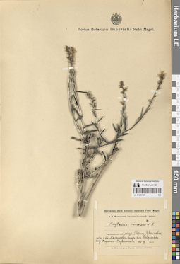
LE 01290194
Asyneuma canescens (Waldst. & Kit.) Griseb. & Schenk
Collectors: Michelson, Alexander Ivanovich Collection date: 25.08.1915. Administrative regions: UA - Ternopil's'ka Oblast'. Groups of specimens: Образцы сектора Восточной ЕвропыOriginal label text:Тарнопольск. губ., повят Збараж. Известковая гора у ст. Максимовка близ села Богдановка. Ж.д. Тарнополь - Подволочиск.
Coordinates (geographic position): 49° 35′ 51.31″ N, 25° 54′ 56.08″ EComment: 25.VIII.1915
А. И. Михельсон
Tarnopolskaya province, Zbarazh district. Limestone mountain near the railway station Maksimovka near the village of Bogdanovka. Railway Tarnopol - Podvolochysk.
25.08.1915A. I. Michelson
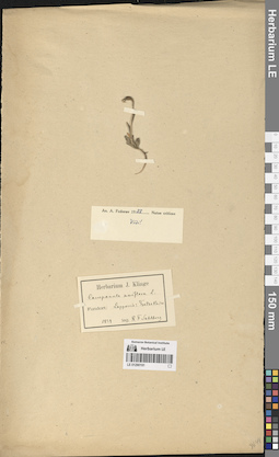
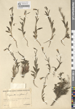
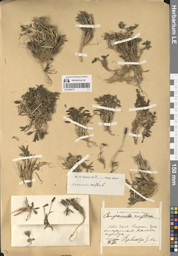
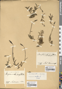
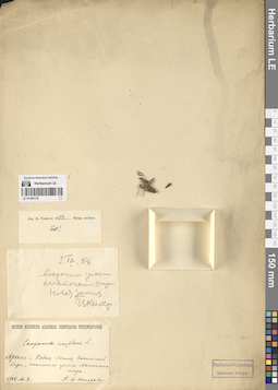
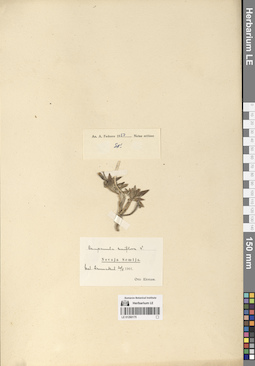
LE 01290193
Campanula uniflora L.
Collectors: Pohle, Christian Nikolai Richard Collection date: 04.07.1904. Administrative regions: RU - Arkhangel'skaya Oblast' - municipalnoe obrazovanie "Novaya Zemlya". Groups of specimens: Образцы сектора Восточной ЕвропыOriginal label text:R. Pohle, Prov. Archangel, 1904.
Coordinates (geographic position): 71° 32′ 11.19″ N, 52° 19′ 41.23″ EComment: Nowaja Semlja. Bjeluschja Guba.
Новая Земля. Белушья Губа.
Каменистая открытая тундра.
4.VII.
Novaya Zemlya. Belushya Guba.
Record creation: 2024-08-03, Daria Yudova, PhotoScan D2.Citation: Specimen LE 01290193 // Virtual herbarium of Komarov Botanical Institute RAS — http://re.herbariumle.ru/01290193Open rocky tundra.
4.07.1904
Coll. R. Pohle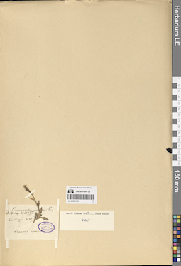
LE 01290192
Campanula uniflora L.
Collectors: Johan Ernst Adhemar Wirzén Collection date: 1840. Administrative regions: NO - Norway. Groups of specimens: Образцы сектора Восточной ЕвропыOriginal label text:Lapponia norwegica.
Record creation: 2024-08-03, Daria Yudova, PhotoScan D2.Citation: Specimen LE 01290192 // Virtual herbarium of Komarov Botanical Institute RAS — http://re.herbariumle.ru/01290192Ded. Wirzén 1840
LE 01290191
Campanula uniflora L.
Collectors: Sahlberg, R. F. Collection date: 1839. Administrative regions: NO - Norway. Groups of specimens: Образцы сектора Восточной ЕвропыOriginal label text:Fundort: Lapponia: TsatseKaise
Coordinates (geographic position): 68° 59′ 23.24″ N, 20° 9′ 1.91″ EComment: 1839
leg. R. F. Sahlberg
The Lyngen Alps region
Record creation: 2024-08-03, Daria Yudova, PhotoScan D2.Citation: Specimen LE 01290191 // Virtual herbarium of Komarov Botanical Institute RAS — http://re.herbariumle.ru/01290191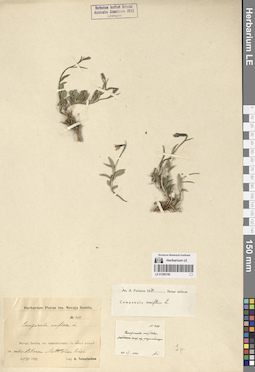
LE 01290190
Campanula uniflora L.
Collectors: Tolmatchew, Alexandr Innokentevich Field collecting number: 401. Collection date: 20.07.1924. Administrative regions: RU - Russian Federation. Groups of specimens: Образцы сектора Восточной ЕвропыOriginal label text:Novaja Semlia, ins. septentrionalis: in locis siccis ca. radio-stationem Matotschkin Schar.
Coordinates (geographic position): 73° 15′ 59″ N, 56° 23′ 19″ EComment: 20/VII.1924
Leg. A. Tolmatschew
Novaya Zemlya, Severny Island, surroundings of the Matochkin Shar radio station.
20.07.1924
Coll. A. I. Tolmatchew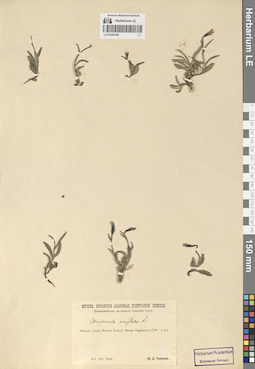
LE 01290189
Campanula uniflora L.
Collection date: 06.08.1926. Administrative regions: RU - Russian Federation. Groups of specimens: Образцы сектора Восточной ЕвропыOriginal label text:Южный остров Новой Земли, Малые Кармакулы (72 ° с.ш.).
Coordinates (geographic position): 72° 22′ 2.35″ N, 52° 41′ 53.62″ EComment: 6-7.VIII.1926
Ю.Д. Чирихин
Yuzhny Island of Novaja Zemlja, Malye Karmakuly (72 ° N)
6-7.VIII.1926Coll. Yu.D. Chirikhin
LE 01290188
Campanula uniflora L.
Collectors: Kazanskiy, A.F. Field collecting number: 125. Collection date: 21.07.1927. Administrative regions: RU - Russian Federation. Groups of specimens: Образцы сектора Восточной ЕвропыOriginal label text:Северный остров Новой Земли, район Маточкина Шара. Ю-В склон г. Ближней. Горная тундра.
Coordinates (geographic position): 73° 15′ 59″ N, 56° 23′ 19″ EComment: 21.VII.1927
А. Ф. Казанский
Severny Island of Novaya Zemlya, the Matochkin Shar
South-East slope of Mount Blizhnyaya. Mountain tundra.
21.07.1927
A. F. Kazanskiy
LE 01290187
Campanula uniflora L.
Collectors: Zubkov, Al. I. Collection date: 08.09.1930. Administrative regions: RU - Russian Federation. Expedition: Островная экспедиция Севкрайгосторга (1930)Groups of specimens: Образцы сектора Восточной ЕвропыOriginal label text:Южный остров Новой Земли. Губа Черная (70 ° 40 ' с.ш.). Каменистый склон горной гряды к NO от становища Красино.
Coordinates (geographic position): 70° 44′ 27.46″ N, 54° 28′ 40.17″ EComment: 1930.IX.8
А. И. Зубков.
Yuzhny Island of Novaja Zemlja. Chernaya Guba. Rocky slope of the mountain range to NO from Krasino.
8.09.1930
Coll. A. I. Zubkov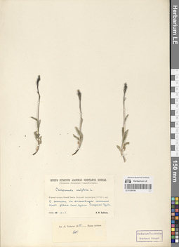
LE 01290186
Campanula uniflora L.
Collectors: Zubkov, Al. I. Collection date: 04.09.1930. Expedition: Островная экспедиция Севкрайгосторга (1930)Groups of specimens: Образцы сектора Восточной ЕвропыOriginal label text:Южный остров Новой Земли. Белуший полуостров.
Coordinates (geographic position): 71° 32′ 8.38″ N, 52° 20′ 31.5″ EComment: К востоку от становища, южный склон увала, близ берега Белушьей Губы.
1930.IX.4
А. И. Зубков
Yuzhny Island of Novaja Zemlja, near the shore of the Belushya Guba.
4.09.1930
Coll. A. I. Zubkov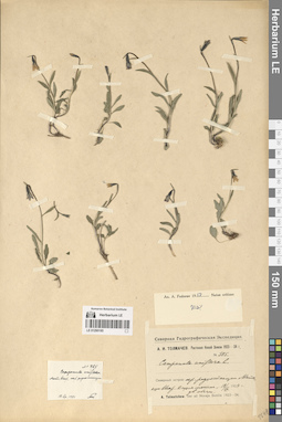
LE 01290185
Campanula uniflora L.
Collectors: Tolmatchew, Alexandr Innokentevich Field collecting number: 385. Collection date: 18.07.1924. Administrative regions: RU - Russian Federation. Expedition: Северная гидрографическая экспедиция (1923 -1924)Groups of specimens: Образцы сектора Восточной ЕвропыOriginal label text:Северный остров: окр. радиостанции Маточкин Шар. В сухих местах, дов. обычен.
18/VII.1924
Novaya Zemlya
Severny Island: surroundings of the Matochkin Shar radio station. In dry places, often.
18.07.1924
Coll. A. I. Tolmatchew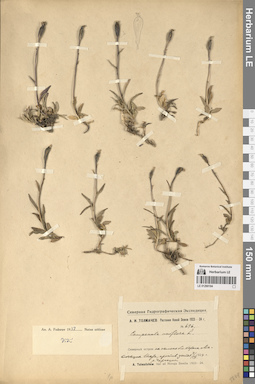
LE 01290184
Campanula uniflora L.
Collectors: Tolmatchew, Alexandr Innokentevich Field collecting number: 696. Collection date: 03.09.1924. Administrative regions: RU - Russian Federation. Groups of specimens: Образцы сектора Восточной ЕвропыOriginal label text:Северный остров: на склоне близ берега Маточкина Шара, против устья р. Чиракина.
Coordinates (geographic position): 73° 16′ 22.92″ N, 56° 9′ 11.52″ EComment: 3/IX.1924
Novaya Zemlya
Severny Island: on a slope near the bank of Matochkin Strait, opposite the mouth of the river Chirakina.
3.09.1924
Coll. A. I. Tolmatchew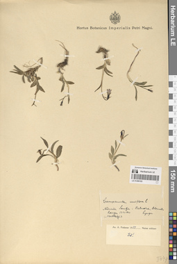
LE 01290183
Campanula uniflora L.
Collectors: Lynge B. Collection date: 17.07.1921. Groups of specimens: Образцы сектора Восточной ЕвропыOriginal label text:Novaia Semlja: Belucha, [...]
Coordinates (geographic position): 71° 32′ 16.18″ N, 52° 19′ 37.74″ ERecord creation: 2024-08-03, Daria Yudova, PhotoScan D2.Citation: Specimen LE 01290183 // Virtual herbarium of Komarov Botanical Institute RAS — http://re.herbariumle.ru/0129018317.07.1921
(Matotchkin)
Lynge
LE 01290182
Campanula uniflora L.
Collectors: Tolmatchew, Alexandr Innokentevich Field collecting number: 401. Collection date: 20.07.1924. Administrative regions: RU - Russian Federation. Groups of specimens: Образцы сектора Восточной ЕвропыOriginal label text:Северный остров: окр. радиостанции Маточкин Шар. В сухих местах, часто.
Coordinates (geographic position): 73° 15′ 59″ N, 56° 23′ 19″ EComment: 20/VII.1924
Novaya Zemlya
Severny Island: surroundings of the Matochkin Shar radio station. In dry places, often.
20.07.1924
Coll. A. I. Tolmatchew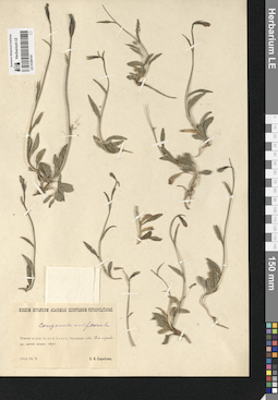
LE 01290181
Campanula uniflora L.
Collectors: Skribova S.K. Collection date: 02.08.1912. Administrative regions: RU - Russian Federation. Groups of specimens: Образцы сектора Восточной ЕвропыOriginal label text:Южный остров Новой Земли, Пропащая губа. На лужайке; южн. склон горы.
Coordinates (geographic position): 71° 7′ 42.55″ N, 53° 43′ 44.98″ EComment: 1912.VIII.2.
С. К. Скрибова.
Yuzhny Island of Novaja Zemlja, Propashchaya Guba.
On the lawn; on the southern slope of the mountain.
2.08.1912Coll. S.K. Skribova
LE 01290180
Campanula uniflora L.
Collectors: Skribova S.K. Collection date: 24.07.1912. Administrative regions: RU - Russian Federation. Groups of specimens: Образцы сектора Восточной ЕвропыOriginal label text:Южный остров Новой Земли, Пропащая губа. На берегу моря на южном склоне горы.
Coordinates (geographic position): 71° 7′ 42.55″ N, 53° 43′ 44.98″ EComment: 1912.VII.24.
С. К. Скрибова.
Yuzhny Island of Novaja Zemlja, Propashchaya Guba.
On the seashore on the southern slope of the mountain.
24.07.1912Coll. S.K. Skribova
LE 01290179
Campanula uniflora L.
Collectors: Pohle, Christian Nikolai Richard Collection date: 07.07.1904. Administrative regions: RU - Russian Federation. Groups of specimens: Образцы сектора Восточной ЕвропыOriginal label text:R. Pohle, Prov. Archangel, 1904.
Coordinates (geographic position): 71° 32′ 11.19″ N, 52° 19′ 41.23″ EComment: Nowaja Semlja. Bjeluschja Guba.
Новая Земля. Белушья Губа.
Открытая камен. тундра.
7.VII.
Novaya Zemlya. Belushya Guba.
Record creation: 2024-08-03, Daria Yudova, PhotoScan D2.Citation: Specimen LE 01290179 // Virtual herbarium of Komarov Botanical Institute RAS — http://re.herbariumle.ru/01290179Open rocky tundra.
7.07.1904
Coll. R. Pohle
LE 01290177
Campanula uniflora L.
Collectors: Pohle, Christian Nikolai Richard Collection date: 07.07.1904. Administrative regions: RU - Russian Federation. Groups of specimens: Образцы сектора Восточной ЕвропыOriginal label text:R. Pohle, Prov. Archangel, 1904.
Coordinates (geographic position): 72° 22′ 2.36″ N, 52° 41′ 55.25″ EComment: Nowaja Semlja. Mal. Karmakuli.
7.VII.
Novaya Zemlya. Malye Karmakuly.
7.07.1904
Coll. R. Pohle
LE 01290178
Campanula uniflora L.
Collectors: Pohle, Christian Nikolai Richard Collection date: 08.07.1904. Administrative regions: RU - Russian Federation. Groups of specimens: Образцы сектора Восточной ЕвропыOriginal label text:R. Pohle, Prov. Archangel, 1904.
Coordinates (geographic position): 73° 16′ 22.92″ N, 56° 9′ 11.52″ EComment: Nowaja Semlja. Matotsckin Schar.
8.VII
Novaya Zemlya. The Matochkin Strait.
Record creation: 2024-08-03, Daria Yudova, PhotoScan D2.Citation: Specimen LE 01290178 // Virtual herbarium of Komarov Botanical Institute RAS — http://re.herbariumle.ru/0129017808.07.1904
Coll. R. Pohle
LE 01290176
Campanula uniflora L.
Collectors: Nesterov, P.V. Collection date: 02.08.1908. Administrative regions: RU - Russian Federation. Groups of specimens: Образцы сектора Восточной ЕвропыOriginal label text:Арханг. г. Новая Земля, восточный берег, восточное устье Маточкина Шара.
Coordinates (geographic position): 73° 13′ 1.38″ N, 56° 20′ 55.14″ EComment: 1908.VIII.2.
П. В. Нестеров
Arkhangelsk province. Novaya Zemlya, eastern shore, eastern mouth of the Matochkin Strait.
02.08.1908Coll. P.V. Nesterov
LE 01290175
Campanula uniflora L.
Collectors: Otto Ekstam Collection date: 30.08.1901. Administrative regions: RU - Russian Federation. Groups of specimens: Образцы сектора Восточной ЕвропыOriginal label text:Novaja Semlja
Coordinates (geographic position): 72° 22′ 2.35″ N, 52° 41′ 53.62″ EComment: Mal. Karmakul 30/8 1901.
Otto Ekstam
Novaya Zemlya
Record creation: 2024-08-03, Daria Yudova, PhotoScan D2.Citation: Specimen LE 01290175 // Virtual herbarium of Komarov Botanical Institute RAS — http://re.herbariumle.ru/01290175Malye Karmakuly.
30.08.1901
Otto Ekstam
LE 01290174
Campanula uniflora L.
Collectors: N. Kriwoscheja Collection date: 1883. Administrative regions: RU - Russian Federation. Groups of specimens: Образцы сектора Восточной ЕвропыOriginal label text:Nowaya Semla. [Novaya Zemlya]
Coordinates (geographic position): 73° 59′ 54.38″ N, 56° 0′ 17.04″ ERecord creation: 2024-08-03, Daria Yudova, PhotoScan D2.Citation: Specimen LE 01290174 // Virtual herbarium of Komarov Botanical Institute RAS — http://re.herbariumle.ru/01290174N. Kriwoscheja, 1883
LE 01290173
Campanula uniflora L.
Collectors: N. Kriwoscheja Collection date: 1883. Administrative regions: RU - Russian Federation. Groups of specimens: Образцы сектора Восточной ЕвропыOriginal label text:Nowaya Semla. [Novaya Zemlya]
Coordinates (geographic position): 73° 59′ 54.38″ N, 56° 0′ 17.04″ ERecord creation: 2024-08-03, Daria Yudova, PhotoScan D2.Citation: Specimen LE 01290173 // Virtual herbarium of Komarov Botanical Institute RAS — http://re.herbariumle.ru/01290173N. Kriwoscheja, 1883
LE 01290172
Campanula uniflora L.
Collectors: Skribova S.K. Collection date: 24.07.1912. Administrative regions: RU - Russian Federation. Groups of specimens: Образцы сектора Восточной ЕвропыOriginal label text:Южный остров Новой Земли, Пропащая губа. На берегу моря на южном склоне горы.
Coordinates (geographic position): 71° 7′ 42.55″ N, 53° 43′ 44.98″ EComment: 1912.VII.24.
С. К. Скрибова.
Yuzhny Island of Novaja Zemlja, Propashchaya Guba.
On the seashore on the southern slope of the mountain.
24.07.1912Coll. S.K. Skribova
LE 01290171
Campanula uniflora L.
Collectors: Nasarow, Mikhail Ivanovich Field collecting number: 8454. Collection date: 17.08.1921. Administrative regions: RU - Russian Federation. Groups of specimens: Образцы сектора Восточной ЕвропыOriginal label text:Новая Земля, Малые Кармакулы.
Coordinates (geographic position): 72° 22′ 2.35″ N, 52° 41′ 53.62″ EComment: В каменистой тундре.
17.VIII.
№ 8454
Novaja Zemlja, Malye Karmakuly.
Rocky tundra.
17.08.1921
M. I. Nasarow.
LE 01290170
Campanula uniflora L.
Collectors: Tolmatchew, Alexandr Innokentevich Field collecting number: 833. Collection date: 10.09.1927. Administrative regions: RU - Russian Federation. Groups of specimens: Образцы сектора Восточной ЕвропыOriginal label text:Южный остров Новой Земли, Малые Кармакулы.
Coordinates (geographic position): 72° 22′ 2.35″ N, 52° 41′ 53.62″ EComment: Каменистая тундра к югу от становища.
Нередко, но в небольшом числе.
10.IX.1927
А.И. Толмачев.
Yuzhny Island of Novaja Zemlja, Malye Karmakuly.
Rocky tundra south of the camp. Often, but in small numbers.
10.09.1927
A. I. Tolmatchew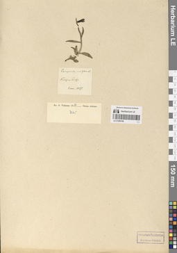
LE 01290169
Campanula uniflora L.
Collectors: Baer, Karl Reinhold Ernst von Collection date: 1837. Administrative regions: RU - Russian Federation. Groups of specimens: Образцы сектора Восточной ЕвропыOriginal label text:Novaja Semlja
Coordinates (geographic position): 74° 32′ 4.64″ N, 57° 14′ 6.73″ ERecord creation: 2024-08-03, Daria Yudova, PhotoScan D2.Citation: Specimen LE 01290169 // Virtual herbarium of Komarov Botanical Institute RAS — http://re.herbariumle.ru/01290169Baer. 1837
LE 01290168
Campanula uniflora L.
Collectors: Perfiljev, Ivan Aleksandrovich Collection date: 04.08.1926. Administrative regions: RU - Russian Federation. Groups of specimens: Образцы сектора Восточной ЕвропыOriginal label text:Новая Земля.
Coordinates (geographic position): 72° 22′ 2.36″ N, 52° 41′ 55.25″ EComment: Малые Кармакулы.
На торфяничке.
4 VIII 26
И. А. Перфильев
Novaya Zemlya.
Malye Karmakuly.
On the peat bog.
4.08.1926I. A. Perfiljev
LE 01290167
Campanula uniflora L.
Collectors: Grinevetsky, Leonid (Lev) Frantsevich Collection date: 1883. Administrative regions: RU - Russian Federation. Groups of specimens: Образцы сектора Восточной ЕвропыOriginal label text:Leg. Dr. Leonid Grinewezki 1883
Coordinates (geographic position): 72° 22′ 2.36″ N, 52° 41′ 55.25″ EComment: Nowaja Semlja - Sinus Karmakuli.
Novaya Zemlya. Karmakuli.
Record creation: 2024-08-03, Daria Yudova, PhotoScan D2.Citation: Specimen LE 01290167 // Virtual herbarium of Komarov Botanical Institute RAS — http://re.herbariumle.ru/01290167Coll. Leonid Grinevetsky
1883
LE 01290166
Campanula uniflora L.
Collectors: Tolmatchew, Alexandr Innokentevich Field collecting number: 401. Collection date: 20.07.1924. Administrative regions: RU - Russian Federation. Groups of specimens: Образцы сектора Восточной ЕвропыOriginal label text:Novaja Semlia, ins. septentrionalis: in locis sic. cis ca. radio-stat. Matotsckin Schar.
Coordinates (geographic position): 73° 15′ 59″ N, 56° 23′ 19″ EComment: 20/VII 1924
Leg. A. Tolmatschew.
Novaya Zemlya. The Matochkin Strait.
20.071924
Coll. A. Tolmatschew.
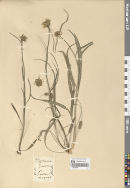
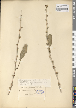
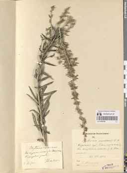
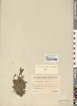
LE 01290668
Groups of specimens: Образцы общего сектораOriginal label text:
Phyteuma comosa Pentam monogy.
Record creation: 2024-08-04, Daria Yudova, PhotoScan D2.Citation: Specimen LE 01290668 // Virtual herbarium of Komarov Botanical Institute RAS — http://re.herbariumle.ru/01290668Cult. Kinel
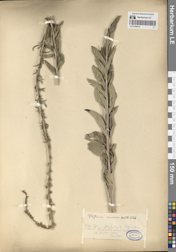
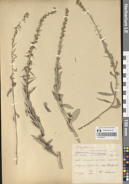
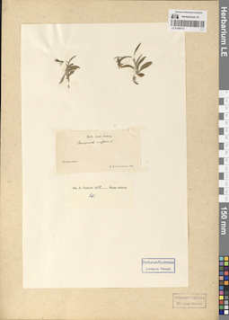
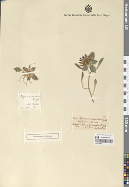
LE 01290667
Groups of specimens: Образцы общего сектораOriginal label text:
Phyteuma comosa
Record creation: 2024-08-04, Daria Yudova, PhotoScan D2.Citation: Specimen LE 01290667 // Virtual herbarium of Komarov Botanical Institute RAS — http://re.herbariumle.ru/01290667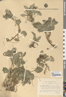
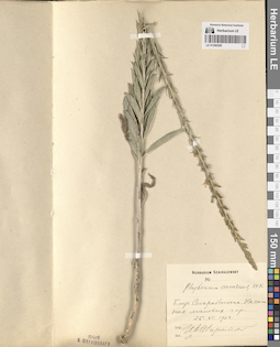
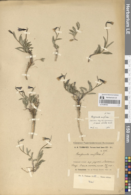
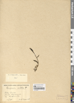
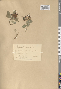
LE 01290666
Collectors: Pampanini, Renato Administrative regions: IT - Veneto. Groups of specimens: Образцы общего сектораOriginal label text:
Phyteuma comosa
Coordinates (geographic position): 46° 0′ 23.83″ N, 12° 10′ 15.08″ ERecord creation: 2024-08-04, Daria Yudova, PhotoScan D2.Citation: Specimen LE 01290666 // Virtual herbarium of Komarov Botanical Institute RAS — http://re.herbariumle.ru/01290666Loc. Venetia - Prov. di Treviso: Vittorio, prope pagum Tovena, abundans in rupibus calcareis, aridis, loco dicto Passo di S. Uboldo, Praealpinum Bellunensium, alt. 350-700 m - 25 Jun. 1904
R. Pampanini
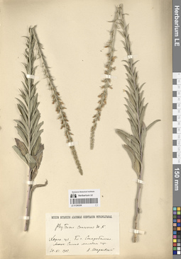
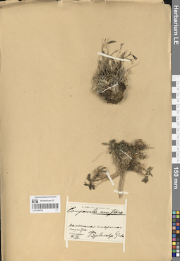
LE 01290665
Groups of specimens: Образцы общего сектораOriginal label text:
Phyteuma comosa
Record creation: 2024-08-04, Daria Yudova, PhotoScan D2.Citation: Specimen LE 01290665 // Virtual herbarium of Komarov Botanical Institute RAS — http://re.herbariumle.ru/01290665