View
Add
Copy
Edit
Delete
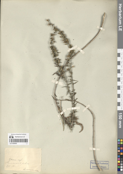
LE 01290697
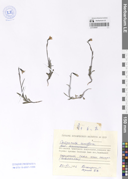
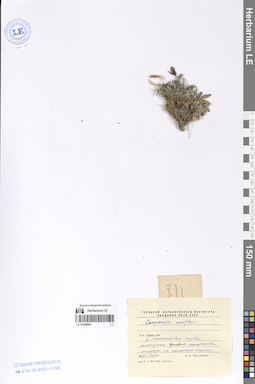
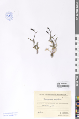
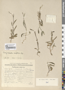
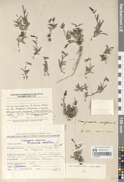
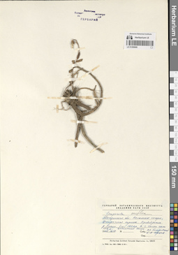
Campanula uniflora L.
Collectors: Balandin, Sergey Aleksandrovich; Jurtzev, Boris Alexandrovich Collection date: 23.07.1976. Administrative regions: RU - Chukotskiy Avtonomnyy Okrug. Groups of specimens: Образцы сектора Сибири и Дальнего Востока РоссииOriginal label text:(венчик темно-синий)
Coordinates (geographic position): 64° 55′ 38.54″ N, 172° 35′ 35.03″ WComment: Юго-восток Чукотского полуострова, северное побережье пролива Сенявина близ поселка Янракыннот. Подножье скал южной экспозиции (известняки).
23.VII.1976
Баландин С., Юрцев Б. А.
(dark blue corolla)
Record creation: 2024-08-04, Daria Yudova, PhotoScan D2.Citation: Specimen LE 01290697 // Virtual herbarium of Komarov Botanical Institute RAS — http://re.herbariumle.ru/01290697Southeast of the Chukotka Peninsula, northern coast of the Senyavin Strait near the village of Yanrakynnot. Foothills of the southern exposure cliffs (limestones).
23.07.1976
Coll. S. Balandin, B. A. Jurtzev
LE 01290696
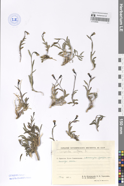
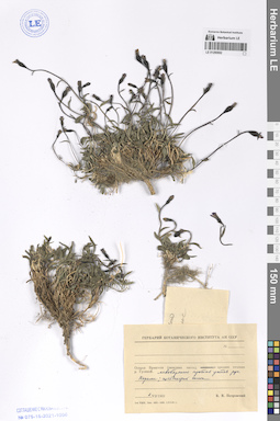
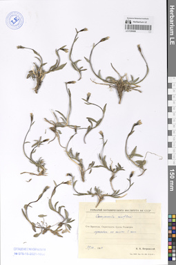
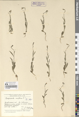
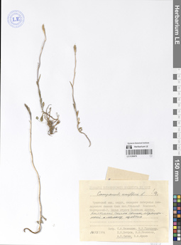
Campanula uniflora L.
Collectors: Petrovsky, Vladislav Vladimirovich; Taraskina, N.; Steinberg, O. D. Collection date: 14.07.1971. Administrative regions: RU - Chukotskiy Avtonomnyy Okrug. Groups of specimens: Образцы сектора Сибири и Дальнего Востока РоссииOriginal label text:Остров Врангеля. Бухта Сомнительная. Пятнистая тундра на [...] сопки.
Coordinates (geographic position): 70° 54′ 27.67″ N, 179° 27′ 17.39″ WComment: 14.VII.1971
В. В. Петровский, Н. Н. Тараскина, О. Д. Штейнберг
Wrangel Island. Somnitel'naya Bay. Spotted tundra on [...] hills.
Record creation: 2024-08-04, Daria Yudova, PhotoScan D2.Citation: Specimen LE 01290696 // Virtual herbarium of Komarov Botanical Institute RAS — http://re.herbariumle.ru/0129069614.07.1971
Coll. V. V. Petrovsky, N. N. Taraskina, O. D. Steinberg
LE 01290695
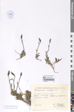
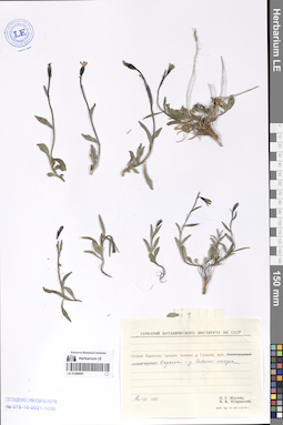
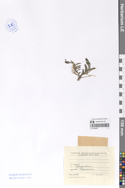
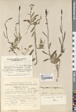
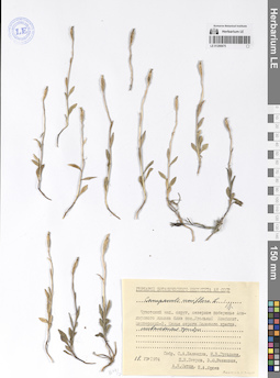
Campanula uniflora L. det. Petrovsky, Vladislav Vladimirovich
Collectors: Koroleva (Zaslavskaya), Tatiana Collection date: 11.08.1972. Administrative regions: RU - Chukotskiy Avtonomnyy Okrug. Groups of specimens: Образцы сектора Сибири и Дальнего Востока РоссииOriginal label text:Остров Врангеля, бухта Роджерс. Сухая полынная тундра у подножия S склона сопки.
Coordinates (geographic position): 70° 59′ 30.09″ N, 178° 23′ 48.25″ WComment: 11.VIII.1972
Т. Королева
Wrangel Island, Rogers Bay. Dry wormwood tundra at the foot of the S slope of the hill.
Record creation: 2024-08-04, Daria Yudova, PhotoScan D2.Citation: Specimen LE 01290695 // Virtual herbarium of Komarov Botanical Institute RAS — http://re.herbariumle.ru/0129069511.08.1972
Coll. Т. Koroleva
LE 01290694
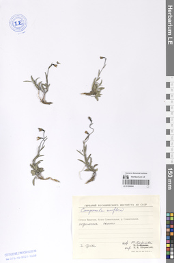
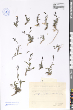
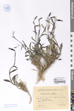
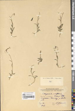
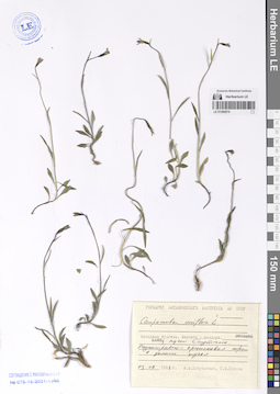
Campanula uniflora L. det. Petrovsky, Vladislav Vladimirovich
Collectors: Koroleva (Zaslavskaya), Tatiana Collection date: 02.08.1972. Administrative regions: RU - Chukotskiy Avtonomnyy Okrug. Groups of specimens: Образцы сектора Сибири и Дальнего Востока РоссииOriginal label text:Остров Врангеля, бухта Сомнительная, река Сомнительная. Подножье сопки.
Coordinates (geographic position): 70° 57′ 9.34″ N, 179° 35′ 39.17″ WComment: 2.VIII.1972
Т. Королева
Wrangel Island, Somnitelnaya Bay, Somnitelnaya River. Foot of the hill.
Record creation: 2024-08-04, Daria Yudova, PhotoScan D2.Citation: Specimen LE 01290694 // Virtual herbarium of Komarov Botanical Institute RAS — http://re.herbariumle.ru/012906942.08.1972
Coll. T. Koroleva
LE 01290693
Campanula uniflora L.
Collectors: Petrovsky, Vladislav Vladimirovich Collection date: 26.07.1964. Administrative regions: RU - Chukotskiy Avtonomnyy Okrug. Groups of specimens: Образцы сектора Сибири и Дальнего Востока РоссииOriginal label text:Остров Врангеля. Река Мамонтовая - низовья. Разнотравно-дриадово-лишайниковая тундра на пойменной террасе.
Coordinates (geographic position): 70° 54′ 16.98″ N, 179° 33′ 15.05″ EComment: 1964 - 26.VII
В. В. Петровский
Wrangel Island. Mamontovaya River - lower reaches. Forb-dryad-lichen tundra on a floodplain terrace.
Record creation: 2024-08-04, Daria Yudova, PhotoScan D2.Citation: Specimen LE 01290693 // Virtual herbarium of Komarov Botanical Institute RAS — http://re.herbariumle.ru/0129069326.07.1964
Coll. V. V. Petrovsky
LE 01290692
Campanula uniflora L.
Collectors: Petrovsky, Vladislav Vladimirovich Collection date: 01.07.1969. Groups of specimens: Образцы сектора Сибири и Дальнего Востока РоссииOriginal label text:Остров Врангеля (западная часть), среднее течение реки Гусиной. Левобережье против устья ручья Корали; щебнистый склон.
Comment: 1.VII.1969
В. В. Петровский
Wrangel Island (western part), middle reaches of the Gusinaya river. The Corali stream. Gravelly slope.
Record creation: 2024-08-04, Daria Yudova, PhotoScan D2.Citation: Specimen LE 01290692 // Virtual herbarium of Komarov Botanical Institute RAS — http://re.herbariumle.ru/012906921.07.1969
Coll. V. V. Petrovsky
LE 01290691
Campanula uniflora L.
Collectors: Zhukova, P. G.; Petrovsky, Vladislav Vladimirovich Collection date: 02.07.1970. Administrative regions: RU - Chukotskiy Avtonomnyy Okrug. Groups of specimens: Образцы сектора Сибири и Дальнего Востока РоссииOriginal label text:Остров Врангеля, среднее течение реки Гусиной, руч. Корали - у бывшего лагеря.
Comment: 2.VII.1970
П. Г. Жукова
В. В. Петровский
Wrangel Island, middle reaches of the Gusinaya river, the Corali stream.
Record creation: 2024-08-04, Daria Yudova, PhotoScan D2.Citation: Specimen LE 01290691 // Virtual herbarium of Komarov Botanical Institute RAS — http://re.herbariumle.ru/012906912.07.1970
Coll. P. G. Zhukova, V. V. Petrovsky
LE 01290690
Campanula uniflora L.
Collectors: Litvinova, N. M.; Tikhmenev, E. A. Collection date: 04.07.1970. Administrative regions: RU - Chukotskiy Avtonomnyy Okrug. Groups of specimens: Образцы сектора Сибири и Дальнего Востока РоссииOriginal label text:Остров Врангеля, бассейн реки Тундровой, окрестности горы Тундровой. Щебнистая тундра на S склоне горы.
Coordinates (geographic position): 71° 14′ 18.49″ N, 179° 57′ 15.75″ EComment: 4.VII.1970
Н. М. Литвинова
Е. А. Тихменев
Wrangel Island, the Tundrovaya River basin, surroundings of the Tundrovaya Mount. Rubble tundra on the S slope of the mountain.
4.07.1970Coll. N. M. Litvinova, E. A. Tikhmenev.
LE 01290689
Campanula uniflora L.
Collectors: Schamurin (Shamurin) V.Ph.; L. I. Shepelenko Collection date: 22.07.1966. Administrative regions: RU - Chukotskiy Avtonomnyy Okrug. Groups of specimens: Образцы сектора Сибири и Дальнего Востока РоссииOriginal label text:Чукотский национальный округ. Остров Врангеля, район бухты Сомнительной.
Coordinates (geographic position): 70° 56′ 54.68″ N, 179° 39′ 24.82″ WComment: Галечник реки.
22.VII.1966
В. Ф. Шамурин, Л. И. Шепеленко
Chukotka National District. Wrangel Island, vicinity of the Somnitelnaya Bay.
22.07.1966Coll. V. Ph. Schamurin, L. I. Shamurin
LE 01290688
Campanula uniflora L.
Collectors: Petrovsky, Vladislav Vladimirovich Collection date: 29.07.1964. Administrative regions: RU - Chukotskiy Avtonomnyy Okrug. Groups of specimens: Образцы сектора Сибири и Дальнего Востока РоссииOriginal label text:Остров Врангеля. Окрестности бухты Роджерса. Лужайка на склоне S экспозиции.
Coordinates (geographic position): 70° 59′ 4″ N, 178° 23′ 58″ EComment: 29.VII.1964
В. В. Петровский
Wrangel Island. Vicinity of the Rogers Bay. Lawn on a slope of the southern exposure.
29.07.1964Coll. V. V. Petrovsky
LE 01290687
Campanula uniflora L.
Collectors: Petrovsky, Vladislav Vladimirovich Collection date: 14.07.1964. Administrative regions: RU - Chukotskiy Avtonomnyy Okrug. Groups of specimens: Образцы сектора Сибири и Дальнего Востока РоссииOriginal label text:Остров Врангеля. Г. Тундровая. Щебнистая вершина.
Coordinates (geographic position): 71° 14′ 18.49″ N, 179° 57′ 15.75″ EComment: 1964.14.07
В. В. Петровский
Wrangel island, Tundrovaya mountain.
Record creation: 2024-08-04, Daria Yudova, PhotoScan D2.Citation: Specimen LE 01290687 // Virtual herbarium of Komarov Botanical Institute RAS — http://re.herbariumle.ru/01290687А rubble peak.
14.07.1964
Coll. V. V. Petrovsky
LE 01290686
Campanula uniflora L.
Collectors: Petrovsky, Vladislav Vladimirovich Collection date: 17.07.1969. Administrative regions: RU - Chukotskiy Avtonomnyy Okrug. Groups of specimens: Образцы сектора Сибири и Дальнего Востока РоссииOriginal label text:Остров Врангеля (западная часть), среднее течение р. Гусиной. Руч. Корали. Сухой щебнистый склон.
Coordinates (geographic position): 71° 6′ 48.01″ N, 179° 25′ 30.37″ EComment: Wrangel Island (western part), middle reaches of the Gusinaya river. The Corali stream. Dry gravelly slope.
Record creation: 2024-08-04, Daria Yudova, PhotoScan D2.Citation: Specimen LE 01290686 // Virtual herbarium of Komarov Botanical Institute RAS — http://re.herbariumle.ru/0129068617.07.1969
Coll. V. V. Petrovsky
LE 01290685
Campanula uniflora L.
Collectors: Petrovsky, Vladislav Vladimirovich Collection date: 07.08.1969. Administrative regions: RU - Chukotskiy Avtonomnyy Okrug. Groups of specimens: Образцы сектора Сибири и Дальнего Востока РоссииOriginal label text:Остров Врангеля (центральная часть), окрестности горы Советской, бассейн р. Хищников - верховья. Ручей Лагерный. Щебнистая тундра.
Coordinates (geographic position): 71° 4′ 13.79″ N, 179° 21′ 6.47″ WComment: 7.VIII.1969
В. В. Петровский
Wrangel Island (central part), surroundings of Sovetskaya Mountain, the Chischnaya river basin - upper reaches. The Lagerny stream. Rubble tundra.
Record creation: 2024-08-04, Daria Yudova, PhotoScan D2.Citation: Specimen LE 01290685 // Virtual herbarium of Komarov Botanical Institute RAS — http://re.herbariumle.ru/012906857.08.1969
Coll. V. V. Petrovsky
LE 01290684
Campanula uniflora L.
Collectors: Petrovsky, Vladislav Vladimirovich Collection date: 03.08.1964. Administrative regions: RU - Chukotskiy Avtonomnyy Okrug. Groups of specimens: Образцы сектора Сибири и Дальнего Востока РоссииOriginal label text:Остров Врангеля. Окрестности бухты Сомнительной. Зарастающий галечник ручья.
Coordinates (geographic position): 70° 56′ 54.68″ N, 179° 39′ 24.82″ WComment: 3.VIII.1964
В. В. Петровский
Wrangel Island. The vicinity of Somnitelnaya Bay. Overgrown pebbles of a stream.
Record creation: 2024-08-04, Daria Yudova, PhotoScan D2.Citation: Specimen LE 01290684 // Virtual herbarium of Komarov Botanical Institute RAS — http://re.herbariumle.ru/012906843.08.1964
V. V. Petrovsky
LE 01290683
Campanula uniflora L.
Collectors: Petrovsky, Vladislav Vladimirovich Collection date: 04.08.1964. Administrative regions: RU - Chukotskiy Avtonomnyy Okrug. Groups of specimens: Образцы сектора Сибири и Дальнего Востока РоссииOriginal label text:Остров Врангеля. Окрестности бухты Сомнительной. Речная терраса у метеоплощадки.
Coordinates (geographic position): 70° 53′ 29.45″ N, 179° 28′ 36.19″ WComment: 4.VIII.1964
В. В. Петровский
Wrangel Island. The environs of Somnitelnaya Bay. River terrace near the meteorological site.
Record creation: 2024-08-04, Daria Yudova, PhotoScan D2.Citation: Specimen LE 01290683 // Virtual herbarium of Komarov Botanical Institute RAS — http://re.herbariumle.ru/012906834.08.1964
Coll. V. V. Petrovsky
LE 01290682
Campanula uniflora L.
Collectors: Petrovsky, Vladislav Vladimirovich Collection date: 15.07.1965. Administrative regions: RU - Chukotskiy Avtonomnyy Okrug. Groups of specimens: Образцы сектора Сибири и Дальнего Востока РоссииOriginal label text:остров Врангеля, гора Тундровая.
Coordinates (geographic position): 71° 14′ 18.49″ N, 179° 57′ 15.75″ EComment: Wrangel island, Tundrovaya mountain.
15.VII.1965
Coбр. В. В. Петровский
Wrangel island, Tundrovaya mountain.
15.07.1965
Coll. V. V. Petrovsky
LE 01290681
Campanula uniflora L.
Collection date: 30.07.1951. Administrative regions: RU - Chukotskiy Avtonomnyy Okrug. Groups of specimens: Образцы сектора Сибири и Дальнего Востока РоссииOriginal label text:Залив Креста. Бухта Оловянная в 1 км от аэродрома на северо-восток. Долина горной реки с песчаными отмелями. Злаково-разнотравная луговинная тундра. Редко.
Coordinates (geographic position): 66° 12′ 36.31″ N, 179° 0′ 32.39″ WComment: 30 июля 1951 г.
Грибова
Kresta Bay. Olovyannaya Bay 1 km from the airfield to the northeast. Mountain river valley with sandbanks. Grass-forb meadow tundra. Rare.
Record creation: 2024-08-04, Daria Yudova, PhotoScan D2.Citation: Specimen LE 01290681 // Virtual herbarium of Komarov Botanical Institute RAS — http://re.herbariumle.ru/0129068130.07.1951
Coll. Gribova
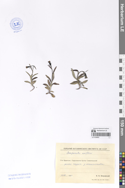
LE 01290680
Campanula uniflora L.
Collectors: Derviz-Sokolova, Tatiana Georgievna Field collecting number: 802. Collection date: 17.07.1964. Administrative regions: RU - Chukotskiy Avtonomnyy Okrug - Iul'tinskiy Rayon. Groups of specimens: Образцы сектора Сибири и Дальнего Востока РоссииOriginal label text:Магаданская обл. Пос. Эгвекинот. Кустарничковая тундра на конусе выноса. Каменистый субстрат.
Coordinates (geographic position): 66° 19′ 41.82″ N, 179° 7′ 51.56″ WComment: № 802
17.VII.1964
Т. Дервиз-Соколова
Magadan Region. The Egvekinot village. Shrub tundra on an alluvial fan. Rocky substrate.
Record creation: 2024-08-04, Daria Yudova, PhotoScan D2.Citation: Specimen LE 01290680 // Virtual herbarium of Komarov Botanical Institute RAS — http://re.herbariumle.ru/01290680№ 802
17.07.1964
Coll. T. Derviz-Sokolova
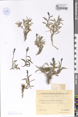
LE 01290679
Campanula uniflora L.
Collectors: Reutt, A.T. Field collecting number: 189. Collection date: 30.07.1956. Administrative regions: RU - Chukotskiy Avtonomnyy Okrug. Groups of specimens: Образцы сектора Сибири и Дальнего Востока РоссииOriginal label text:Чукотский национальный округ. Залив Креста, бухта Эвекинот [Эгвекинот] в 1 км от аэродрома на СВ. Долина горной реки с песчаными отмелями. Злаково-разнотравная луговинная тундра. Редко.
Coordinates (geographic position): 66° 22′ 7″ N, 179° 5′ 38.4″ WComment: № 189
30.VII.1956
А. Т. Реутт.
Chukotka National District. Kresta Gulf, Evekinot Bay [Egvekinot] 1 km from the airfield on the NE. Valley of a mountain river with sandbanks.
30.07.1956Coll. A.T. Reutt
LE 01290678
Campanula uniflora L.
Collectors: Vassiljev, Viktor Nikolayevich Field collecting number: 63. Collection date: 31.07.1932. Administrative regions: RU - Chukotskiy Avtonomnyy Okrug. Expedition: Чукотско-Анадырская экспедиция НКЗ (1932 -1933)Groups of specimens: Образцы сектора Сибири и Дальнего Востока РоссииOriginal label text:Бассейн р. Анадыря. Окрестности Ново-Мариинска. [Утес ...] р. Анадырем.
Coordinates (geographic position): 64° 44′ 15.4″ N, 177° 27′ 46.16″ EComment: № 63.
31/VII.1932
В. Васильев
Basin of the Anadyr River. Vicinity of the city of Novo-Mariinsk [= Anadyr].
№ 63
31.07.1932
Coll. V. N. Vassiljev
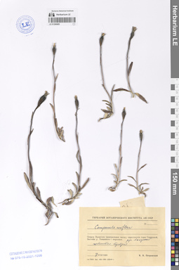
LE 01290677
Campanula uniflora L.
Collectors: Berezina Field collecting number: 269. Collection date: 08.07.1951. Administrative regions: RU - Chukotskiy Avtonomnyy Okrug. Groups of specimens: Образцы сектора Сибири и Дальнего Востока РоссииOriginal label text:Чукотский национальный округ, в 1 км на Ю-Зап. от пос. Анадырь. Морская терраса Анадырского лимана. Склон небольшого холма вост. экпоз. Щебнистая тундра. Часто.
Coordinates (geographic position): 64° 43′ 25.87″ N, 177° 31′ 44.98″ EComment: 1951 8.VII.
Березина
Chukotka National District, 1 km to the South-West from the Anadyr village. Marine terrace of the Anadyr Estuary. East facing slope of a small hill. Rubble tundra. Often.
Record creation: 2024-08-04, Daria Yudova, PhotoScan D2.Citation: Specimen LE 01290677 // Virtual herbarium of Komarov Botanical Institute RAS — http://re.herbariumle.ru/012906778.07.1951
Coll. Berezina
LE 01290676
Campanula uniflora L.
Collectors: Gruzdeva, Nina Vassiljevna; Sytin, Andrej Kirillovich Collection date: 14.08.1974. Administrative regions: RU - Chukotskiy Avtonomnyy Okrug. Groups of specimens: Образцы сектора Сибири и Дальнего Востока РоссииOriginal label text:Чукотский нац. округ, северное побережье Анадырского лимана близ пос. Угольный Комбинат, Шахтерский-3. Южные отроги Золотого хребта. Восточный склон сопки, обращенный к лиману, щебень.
Coordinates (geographic position): 64° 44′ 42.82″ N, 177° 39′ 23.16″ EComment: 14.VIII.1974
Н. В. Груздева, А. К. Сытин
Chukotka national okrug, northern coast of the Anadyr estuary near the village Coal Combine, Shakhtersky-3. Southern spurs of the Golden Ridge. The eastern slope of the hill, facing the estuary. Crushed stone.
18.08.1974Coll. N. V. Gruzdeva, A. K. Sytin
LE 01290675
Campanula uniflora L.
Collectors: Gruzdeva, Nina Vassiljevna; Sytin, Andrej Kirillovich Collection date: 18.08.1974. Administrative regions: RU - Chukotskiy Avtonomnyy Okrug. Groups of specimens: Образцы сектора Сибири и Дальнего Востока РоссииOriginal label text:Чукотский нац. округ, северное побережье Анадырского лимана близ пос. Угольный Комбинат, Шахтерский-3. Южные отроги Золотого хребта. Нивальная тундра.
Coordinates (geographic position): 64° 44′ 42.82″ N, 177° 39′ 23.16″ EComment: 18.VIII.1974
Н. В. Груздева, А. К. Сытин
Chukotka national okrug, northern coast of the Anadyr estuary near the village Coal Combine, Shakhtersky-3. Southern spurs of the Golden Ridge. Nival tundra.
18.08.1974Coll. N. V. Gruzdeva, A. K. Sytin
LE 01290674
Campanula uniflora L.
Collectors: Petrovsky, Vladislav Vladimirovich; Plieva, T.V. Collection date: 03.07.1981. Administrative regions: RU - Chukotskiy Avtonomnyy Okrug. Groups of specimens: Образцы сектора Сибири и Дальнего Востока РоссииOriginal label text:Западная Чукотка. Бассейн реки Анадырь. Большой Анюй, ручей Спутник. Разнотравно-ерничковая тундра в долине ручья.
Comment: 3.07.1981
В. В. Петровский, Т. В. Плиева
Western Chukotka. Basin of the Anadyr River. Bolshoy Anyui, the Sputnik stream. Forb-bush tundra in a stream valley.
3.07.1981
Coll. V. V. Petrovsky, T. V. Plieva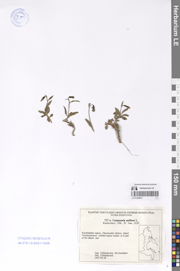
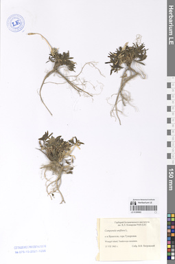
LE 01290673
Campanula uniflora L.
Collectors: Kharkevich, Sigismund Semenovich; Gorshkov, Michail Collection date: 29.07.1975. Administrative regions: RU - Kamtchatski Kray. Groups of specimens: Образцы сектора Сибири и Дальнего Востока РоссииOriginal label text:Kamchatskiy region, Olyoutorskiy district, island Vyerchoutourov, cobbled alpine tundra in S part of the island, rare.
Coordinates (geographic position): 59° 37′ 36.54″ N, 164° 39′ 42.06″ ERecord creation: 2024-08-04, Daria Yudova, PhotoScan D2.Citation: Specimen LE 01290673 // Virtual herbarium of Komarov Botanical Institute RAS — http://re.herbariumle.ru/01290673Leg. S. Kharkevich, M. Gorshkov
1975 VII 29
LE 01290672
Campanula uniflora L.
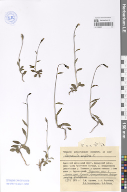
Collectors: Sekretareva, Nadezhda Alexandrovna; Jurtzev, Boris Alexandrovich Collection date: 29.07.1978. Administrative regions: RU - Chukotskiy Avtonomnyy Okrug. Groups of specimens: Образцы сектора Сибири и Дальнего Востока РоссииOriginal label text:Чукотский автономный округ, Анадырский район, южная часть Чукотского нагорья, р. Ильмынейвеем (левобережье р. Канчалан в среднем течении) близ устья р. Куропаточьей. Подножье скал в каньоне ручья "Озерного", пронизывающего высокую террасу правобережья.
Coordinates (geographic position): 66° 13′ 33.33″ N, 177° 19′ 10.49″ EComment: 29.VII.1978
Н. А. Секретарева, Б. А. Юрцев
Chukotka Autonomous Okrug, Anadyrsky district, southern part of the Chukotka Highlands, the Ilmyneyveem river (left bank of the Kanchalan river in the middle reaches) near the mouth of the Kuropatochiya river. The foot of the rocks in the canyon of the Ozerny stream.
29.07.1978Coll. N. A. Sekretareva, B. A. Jurtzev
LE 01290671
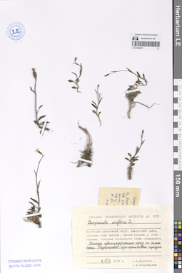
Campanula uniflora L.
Collectors: Korobkov, Aleksandr Aleksandrovich; Sekretareva, Nadezhda Alexandrovna Collection date: 07.07.1979. Administrative regions: RU - Chukotskiy Avtonomnyy Okrug. Groups of specimens: Образцы сектора Сибири и Дальнего Востока РоссииOriginal label text:Чукотский автономный округ, Анадырский район, верховья реки Танюрер, нижнее течение р. Ктепнайваам [Кытапнейваам?], северная оконечность озера Безымянного. Выходы известьсодержащих пород на склоне сопки. Разнотравно-кустарничковая тундра.
Coordinates (geographic position): 66° 39′ 30.65″ N, 176° 39′ 39.64″ EComment: 7.VII.1979
А. А. Коробков,
Н. А. Секретарева
Chukotka Autonomous Okrug, Anadyr region, upper reaches of the Tanyurer River, lower reaches of the Ktepnaivaam [Kytapneivaam?] river, northern tip of the Bezymyannoe lake. Outcrops of lime-containing rocks on the slope of the hill. Forb-shrub tundra.
07.07.1979Coll. A. A. Korobkov, N. A. Sekretareva
LE 01290670
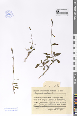
Campanula uniflora L.
Collectors: Korobkov, Aleksandr Aleksandrovich Collection date: 04.08.1978. Administrative regions: RU - Chukotskiy Avtonomnyy Okrug. Groups of specimens: Образцы сектора Сибири и Дальнего Востока РоссииOriginal label text:Чукотский автономный округ, Анадырский район, южная часть Чукотского нагорья, р. Ильмынейвеем (левобережье р. Канчалан в среднем течении) близ устья р. Куропаточьей. Подножье скал в каньоне ручья "Озерный", пронизывающего высокую террасу на правобережье.
Coordinates (geographic position): 66° 13′ 33.33″ N, 177° 19′ 10.49″ EComment: 4.VIII.1978
А. А. Коробков
Chukotka Autonomous Okrug, Anadyrsky district, southern part of the Chukotka Highlands, the Ilmyneyveem river (left bank of the Kanchalan river in the middle reaches) near the mouth of the Kuropatochiya river. The foot of the rocks in the canyon of the Ozerny stream.
04.08.1978Coll. A. A. Korobkov
LE 01290669
Campanula uniflora L.
Collectors: Petrovsky, Vladislav Vladimirovich; Jurtzev, Boris Alexandrovich Collection date: 12.09.1965. Administrative regions: RU - Magadanskaya Oblast'. Groups of specimens: Образцы сектора Сибири и Дальнего Востока РоссииOriginal label text:Магаданская обл. Колымское нагорье. Центральная трасса. Правобережье р. Хасын, близ 103 км, Ю-З склон сопки. Щебнистый склон. 1112 м.
Coordinates (geographic position): 60° 20′ 22.24″ N, 151° 6′ 33.87″ E 1112 m a.s.l.Comment: 1965.12.IX.
В.В. Петровский
Б.А. Юрцев
Magadan region. Kolyma Highlands. Central route. Right bank of the river Khasyn, near 103 km, south-west slope of the hill. Rubble slope. Alt. = 1112 m.
12.09.1965Coll. V. V. Petrovsky, B. A. Jurtzev
LE 01290284
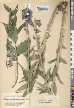
Adenophora golubinzevaeana Reverd.
Collection date: 17.07.1965. Administrative regions: RU - Krasnoyarskiy Kray. Groups of specimens: Образцы сектора Сибири и Дальнего Востока РоссииOriginal label text:Красноярский край. Западный Саян. Джебашский хребет в верховье реки Казанашки. У скал на гребне хребта.
Coordinates (geographic position): 52° 30′ 51.7″ N, 90° 47′ 24.35″ EComment: 17.VII.1965
С. В. Гудошников и В. П. Тимонин
Krasnoyarsk Territory. Western Sayan. Dzhebashsky Ridge in the upper reaches of the Kazanashka River. Near the rocks on the crest of the ridge.
Record creation: 2024-08-04, Daria Yudova, PhotoScan D2.Citation: Specimen LE 01290284 // Virtual herbarium of Komarov Botanical Institute RAS — http://re.herbariumle.ru/0129028417.07.1965
Coll. S. V. Gudoshnikov and V. P. Timonin
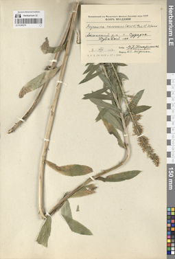
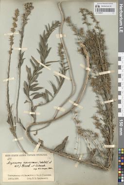
LE 01290281
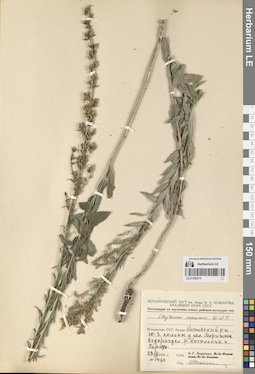
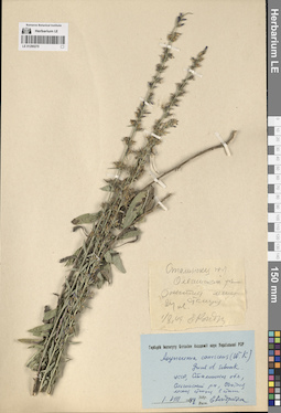
Asyneuma canescens (Waldst. & Kit.) Griseb. & Schenk det. Fedorov, Andrey Aleksandrovich at 1971
Collectors: Andreev, Vladimir Nikolaevich Field collecting number: 40. Collection date: 01.08.1949. Groups of specimens: Образцы сектора Восточной ЕвропыOriginal label text:Злотский лесхоз, кв. 103. Дубовый байрачный лес.
Coordinates (geographic position): 46° 40′ 48.89″ N, 28° 54′ 3.28″ EComment: 24.VIII.1949
Андреев В. Н.
Zlotsky forestry, apt. 103. Oak ravine forest.
Record creation: 2024-08-03, Daria Yudova, PhotoScan D2.Citation: Specimen LE 01290281 // Virtual herbarium of Komarov Botanical Institute RAS — http://re.herbariumle.ru/012902811.08.1949
Coll. V. N. Andreev
LE 01290280
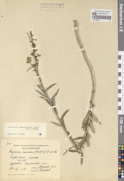
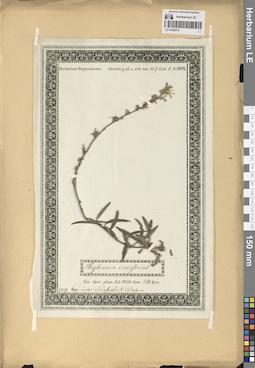
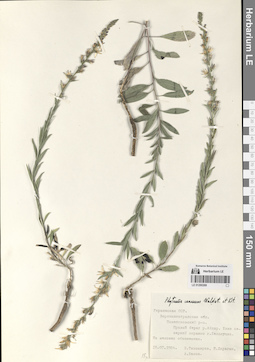
Asyneuma canescens (Waldst. & Kit.) Griseb. & Schenk det. Fedorov, Andrey Aleksandrovich at 1974
Collectors: Paczoski, Jozef Kondradjvich Collection date: 08.1885. Administrative regions: UA - Odes'ka Oblast'. Groups of specimens: Образцы сектора Восточной ЕвропыOriginal label text:Podolia
Coordinates (geographic position): 48° 6′ 4.91″ N, 30° 3′ 43.6″ ERecord creation: 2024-08-03, Daria Yudova, PhotoScan D2.Citation: Specimen LE 01290280 // Virtual herbarium of Komarov Botanical Institute RAS — http://re.herbariumle.ru/01290280(Podole [mias.] Sawran)
in sylvis
1885 Augustus
Пачоский [Paczoski]
LE 01290279
Groups of specimens: Образцы сектора Восточной ЕвропыRecord creation: 2024-08-03, Daria Yudova, PhotoScan D2.Citation: Specimen LE 01290279 // Virtual herbarium of Komarov Botanical Institute RAS — http://re.herbariumle.ru/01290279
LE 01290278
Groups of specimens: Образцы сектора Восточной ЕвропыRecord creation: 2024-08-03, Daria Yudova, PhotoScan D2.Citation: Specimen LE 01290278 // Virtual herbarium of Komarov Botanical Institute RAS — http://re.herbariumle.ru/01290278
LE 01290277
Groups of specimens: Образцы сектора Восточной ЕвропыRecord creation: 2024-08-03, Daria Yudova, PhotoScan D2.Citation: Specimen LE 01290277 // Virtual herbarium of Komarov Botanical Institute RAS — http://re.herbariumle.ru/01290277
LE 01290276
Groups of specimens: Образцы сектора Восточной ЕвропыRecord creation: 2024-08-03, Daria Yudova, PhotoScan D2.Citation: Specimen LE 01290276 // Virtual herbarium of Komarov Botanical Institute RAS — http://re.herbariumle.ru/01290276
LE 01290275
Groups of specimens: Образцы сектора Восточной ЕвропыRecord creation: 2024-08-03, Daria Yudova, PhotoScan D2.Citation: Specimen LE 01290275 // Virtual herbarium of Komarov Botanical Institute RAS — http://re.herbariumle.ru/01290275
LE 01290274
Groups of specimens: Образцы сектора Восточной ЕвропыRecord creation: 2024-08-03, Daria Yudova, PhotoScan D2.Citation: Specimen LE 01290274 // Virtual herbarium of Komarov Botanical Institute RAS — http://re.herbariumle.ru/01290274

LE 01290273
Groups of specimens: Образцы сектора Восточной ЕвропыRecord creation: 2024-08-03, Daria Yudova, PhotoScan D2.Citation: Specimen LE 01290273 // Virtual herbarium of Komarov Botanical Institute RAS — http://re.herbariumle.ru/01290273
LE 01290272
Groups of specimens: Образцы сектора Восточной ЕвропыRecord creation: 2024-08-03, Daria Yudova, PhotoScan D2.Citation: Specimen LE 01290272 // Virtual herbarium of Komarov Botanical Institute RAS — http://re.herbariumle.ru/01290272
LE 01290271
Groups of specimens: Образцы сектора Восточной ЕвропыRecord creation: 2024-08-03, Daria Yudova, PhotoScan D2.Citation: Specimen LE 01290271 // Virtual herbarium of Komarov Botanical Institute RAS — http://re.herbariumle.ru/01290271
LE 01290270
Groups of specimens: Образцы сектора Восточной ЕвропыRecord creation: 2024-08-03, Daria Yudova, PhotoScan D2.Citation: Specimen LE 01290270 // Virtual herbarium of Komarov Botanical Institute RAS — http://re.herbariumle.ru/01290270
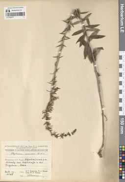
LE 01290269
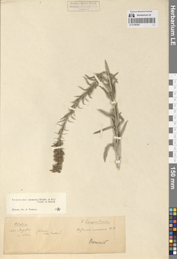
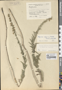
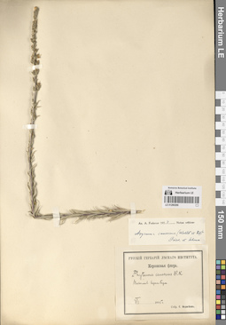
Asyneuma canescens (Waldst. & Kit.) Griseb. & Schenk
Collectors: Tikhomirov, V.; Daragan E.; Belov, A. K. Collection date: 18.07.1984. Administrative regions: UA - Ukraine. Groups of specimens: Образцы сектора Восточной ЕвропыOriginal label text:Украинская ССР. Ворошиловградская обл. Новопсковский р-н. Правый берег реки Айдар. Близ северной окраины г. Белолуцка. На меловых обнажениях.
Coordinates (geographic position): 49° 43′ 43.68″ N, 38° 58′ 41.67″ EComment: 18.07.1984
В. Тихомиров, Е. Дараган, А. Белов
Ukrainian SSR. Voroshilovgrad region. Novopskovsky district. Right bank of the Aidar River. Near the northern outskirts of Belolutsk. On chalk outcrops.
Record creation: 2024-08-03, Daria Yudova, PhotoScan D2.Citation: Specimen LE 01290269 // Virtual herbarium of Komarov Botanical Institute RAS — http://re.herbariumle.ru/0129026918.07.1984
Coll. V. Tikhomirov, E. Daragan, A. Belov.
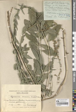
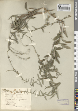
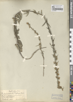
LE 01290268
Asyneuma canescens (Waldst. & Kit.) Griseb. & Schenk det. Damboldt at 1968
Additional identifications: Asyneuma salignum (Waldst. & Kit. ex Besser) Fed. det. Fedorov, Andrey Aleksandrovich at 1956 Collectors: Borissova, Antonina Georgievna Field collecting number: 47. Collection date: 17.07.1950. Administrative regions: UA - Ukraine. Groups of specimens: Образцы сектора Восточной ЕвропыOriginal label text:Украинская ССР. Долинский район. Окрестности заповедника Веселые Боковеньки. Степные северные склоны балки Скотоватки.
Coordinates (geographic position): 48° 12′ 54.47″ N, 32° 51′ 22.08″ EComment: № 47
17.VII.1950
А. Г. Борисова
Ukrainian SSR. Dolinsky district. The vicinity of the Veselye Bokovenki nature reserve.
Record creation: 2024-08-03, Daria Yudova, PhotoScan D2.Citation: Specimen LE 01290268 // Virtual herbarium of Komarov Botanical Institute RAS — http://re.herbariumle.ru/01290268№ 47
17.07.1950
Coll. A. G. Borissova
LE 01290267
Asyneuma canescens (Waldst. & Kit.) Griseb. & Schenk
Collectors: Levandowsky, B.G. Collection date: 12.08.1894. Administrative regions: UA - Ukraine. Groups of specimens: Образцы сектора Восточной ЕвропыOriginal label text:Херсонская губерния. Станция Ново-Полтавка. Степь около станции. Изредка.
Coordinates (geographic position): 47° 32′ 7.78″ N, 32° 31′ 4.56″ EComment: 12.VIII.1894
Левандовский
Kherson province. Novo-Poltavka station. Steppe near the station. Occasionally.
12.08.1894
Coll. Levandowsky
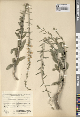
LE 01290266
Asyneuma canescens (Waldst. & Kit.) Griseb. & Schenk det. Fedorov, Andrey Aleksandrovich at 1954
Collectors: Fedoseev, S. Collection date: 07.1895. Administrative regions: UA - Ukraine. Groups of specimens: Образцы сектора Восточной ЕвропыOriginal label text:Николаев. Берега Буга
Coordinates (geographic position): 46° 57′ 29.07″ N, 31° 57′ 4.67″ EComment: VII.1895
С. Федосеев
Nikolaev. Banks of the Bug River
Record creation: 2024-08-03, Daria Yudova, PhotoScan D2.Citation: Specimen LE 01290266 // Virtual herbarium of Komarov Botanical Institute RAS — http://re.herbariumle.ru/0129026607.1895
Coll. S. Fedoseev
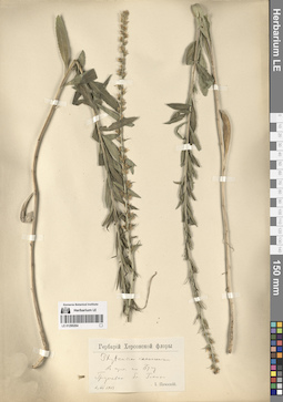
LE 01290265
Asyneuma canescens (Waldst. & Kit.) Griseb. & Schenk
Collectors: Alexeenko Collection date: 06.09.1893. Administrative regions: UA - Kyiv Oblast - Bila Tserkva Raion. Place of collection: Днепропетровск.Groups of specimens: Образцы сектора Восточной Европы; Herbarium Academiae Scientiarium Petropol. УДАЛИТЬOriginal label text:Herbarium Academiae Scientiarium Petropol.
Phyt. salignum Bess
Phyteuma canescens
Фитевма лохматая, синий цвет
Екатеринослав
6.9.1893 Городской лес. Алексеенко
Habitat / plant community in location of collecting: Городской лесRecord creation: 2024-08-03, Daria Yudova, PhotoScan D2.Citation: Specimen LE 01290265 // Virtual herbarium of Komarov Botanical Institute RAS — http://re.herbariumle.ru/01290265Phyt. salignum Bess
Phyteuma canescens
Фитевма лохматая, синий цвет
Екатеринослав
6.9.1893 Городской лес. Алексеенко
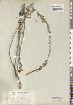
LE 01290264
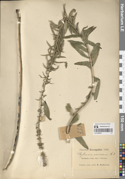
Asyneuma canescens (Waldst. & Kit.) Griseb. & Schenk
Collectors: Paczoski, Jozef Kondradjvich Collection date: 06.07.1903. Administrative regions: UA - Dnipropetrovska Oblast'. Place of collection: Грушевка близ Гол....Groups of specimens: Образцы сектора Восточной Европы; Гербарий Херсонской флорыOriginal label text:Гербарий Херсонской флоры.
Phyteuma canescens
в кустах по Бугу
Грушевка близ Гол...
6.7.1903 И. Пачоский
Habitat / plant community in location of collecting: в кустахRecord creation: 2024-08-03, Daria Yudova, PhotoScan D2.Citation: Specimen LE 01290264 // Virtual herbarium of Komarov Botanical Institute RAS — http://re.herbariumle.ru/01290264Phyteuma canescens
в кустах по Бугу
Грушевка близ Гол...
6.7.1903 И. Пачоский
LE 01290263
Asyneuma canescens (Waldst. & Kit.) Griseb. & Schenk
Collectors: Litvinov, Dimitri Ivanovich Collection date: 12.08.1888. Administrative regions: UA - Donets'ka Oblast'. Place of collection: Гора Саур-Могила.Groups of specimens: Образцы сектора Восточной Европы; Гербарий Д. Литвинова. Флора Донской областиOriginal label text:Herbarium Academiae Scientiarium Petropol.
Гербарий Д. Литвинова. Флора Донской области
Phyteuma canescens W. K.
Гора Саур-Могила, в лесу.
12.8.1888 ДЛ
Habitat / plant community in location of collecting: в лесуRecord creation: 2024-08-03, Daria Yudova, PhotoScan D2.Citation: Specimen LE 01290263 // Virtual herbarium of Komarov Botanical Institute RAS — http://re.herbariumle.ru/01290263Гербарий Д. Литвинова. Флора Донской области
Phyteuma canescens W. K.
Гора Саур-Могила, в лесу.
12.8.1888 ДЛ
LE 01290262
Collectors: Alexeenko Collection date: 08.1894. Administrative regions: UA - Luhans'ka Oblast'. Place of collection: Александровск.Groups of specimens: Образцы сектора Восточной Европы; Herbarium Academiae Scientiarium Petropol. УДАЛИТЬOriginal label text:
Herbarium Academiae Scientiarium Petropol.
Екат. губ., Александровск.
8.1894 Алексеенко
Record creation: 2024-08-03, Daria Yudova, PhotoScan D2.Citation: Specimen LE 01290262 // Virtual herbarium of Komarov Botanical Institute RAS — http://re.herbariumle.ru/01290262Екат. губ., Александровск.
8.1894 Алексеенко