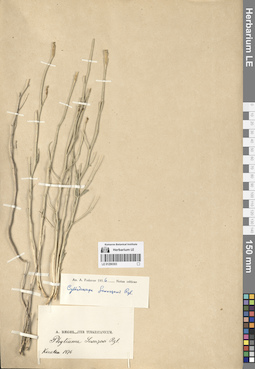
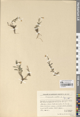
View
Add
Copy
Edit
Delete
LE 01290312
Groups of specimens: Образцы сектора Средней АзииRecord creation: 2024-08-04, Daria Yudova, PhotoScan D2.Citation: Specimen LE 01290312 // Virtual herbarium of Komarov Botanical Institute RAS — http://re.herbariumle.ru/01290312
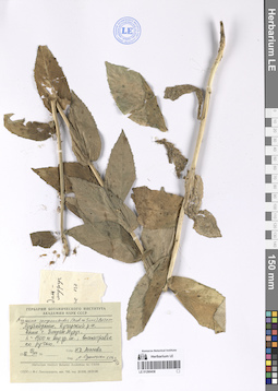
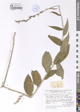
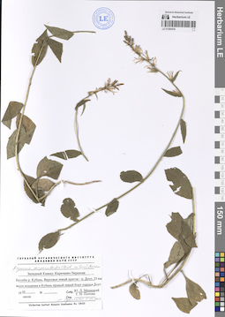
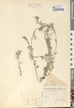
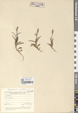
LE 01290439
Asyneuma campanuloides (M. Bieb. ex Sims) Bornm.
Collectors: Konechnaya, Galina Yurievna; Haare, Ado Oskarovich Collection date: 14.08.1974. Administrative regions: GE - Abkhazia. Groups of specimens: Образцы сектора Кавказа; Соглашение Минобрнауки №075-15-2021-1056Original label text:Грузинская ССР, Абхазская АССР, Военно-Сухумская дорога между Клухорским перевалом и Южным Приютом, долина реки Клыч, субальпийский луг, 2200 м н.у.м.
Coordinates (geographic position): 43° 12′ 19.75″ N, 41° 53′ 55.97″ E 2200 m a.s.l.Comment: 14.VIII.1974
Конечная Г. Ю., Хааре А. О.
Abkhazia. Military-Sukhumi road between the Klukhorsky pass and the Southern Shelter, Klych river valley, subalpine meadow, 2200 m above sea level.
Record creation: 2024-08-04, Daria Yudova, PhotoScan D2.Citation: Specimen LE 01290439 // Virtual herbarium of Komarov Botanical Institute RAS — http://re.herbariumle.ru/0129043914.08.1974
Coll. G. Yu. Konechnaya, A. O. Haare
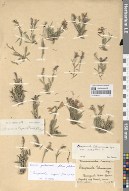
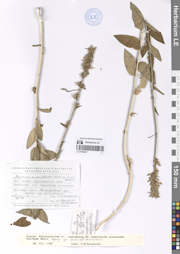
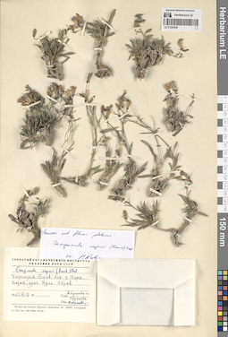
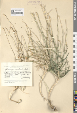
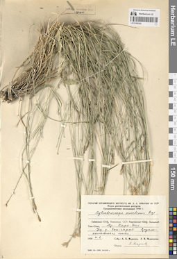
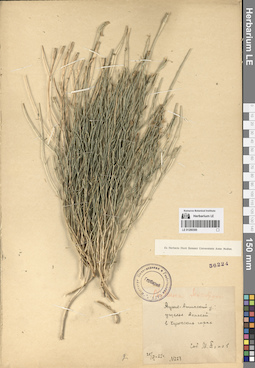
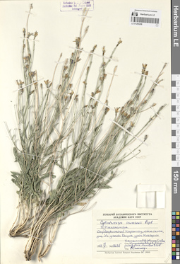
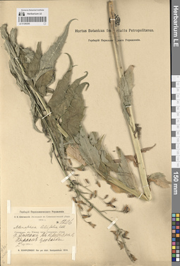
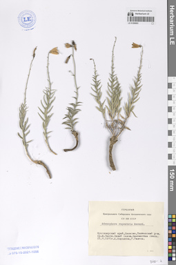
LE 01290311
Collectors: Pavlov, Nikolai Vasilievich Field collecting number: 987. Collection date: 09.08.1931. Groups of specimens: Образцы сектора Средней АзииOriginal label text:
Горы Талас-Алатау, в расщелинах скал в верховье реки Джебаглы-су, 3000 м.
Record creation: 2024-08-04, Daria Yudova, PhotoScan D2.Citation: Specimen LE 01290311 // Virtual herbarium of Komarov Botanical Institute RAS — http://re.herbariumle.ru/012903119.VIII.1931
№ 987
Н. В. Павлов
LE 01290438
Asyneuma campanuloides (M. Bieb. ex Sims) Bornm. det. Oganesjan (Oganesian), M. E. at 05.04.2017
Collectors: Agapova, N. D. Collection date: 13.07.1982. Administrative regions: AZ - Azerbaijan. Groups of specimens: Образцы сектора Кавказа; Соглашение Минобрнауки №075-15-2021-1056Original label text:Азербайджан, Кусарский район, выше села Зиндан Муруг, h = 1500 м над ур. м.; высокотравье по ручью.
Coordinates (geographic position): 41° 19′ 24.07″ N, 48° 10′ 28.64″ E 1500 m a.s.l.Comment: 13.VII.1982
Н. Д. Агапова
Azerbaijan, Kusar district, above the village of Zindan Murug, h = 1500 m above sea level; tall grass along the stream.
Record creation: 2024-08-04, Daria Yudova, PhotoScan D2.Citation: Specimen LE 01290438 // Virtual herbarium of Komarov Botanical Institute RAS — http://re.herbariumle.ru/0129043813.07.1982
Coll. N. D. Agapova
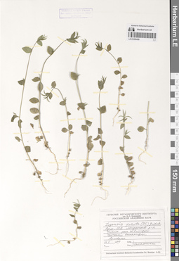
LE 01290437
Asyneuma campanuloides (M. Bieb. ex Sims) Bornm. det. Oganesjan (Oganesian), M. E. at 05.04.2017
Collection date: 28.07.1987. Administrative regions: RU - Respublika Adygeya. Groups of specimens: Образцы сектора Кавказа; Соглашение Минобрнауки №075-15-2021-1056Original label text:Западный Кавказ. Краснодарский край. Адыгейская А.О. Кавказский заповедник. Пастбище Абаго. Разнотравный луг, склон северной экспозиции.
Coordinates (geographic position): 44° 30′ 51.84″ N, 40° 15′ 33.12″ EComment: 28.VII.1987
Т. Е. Теплякова
Western Caucasus. Krasnodar region. Adygeyskaya A.O. Caucasian Nature Reserve. Abago pasture. Forb meadow, slope of northern exposure.
Record creation: 2024-08-04, Daria Yudova, PhotoScan D2.Citation: Specimen LE 01290437 // Virtual herbarium of Komarov Botanical Institute RAS — http://re.herbariumle.ru/0129043728.07.1987
Coll. T. E. Teplyakova
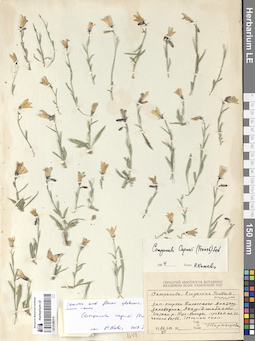
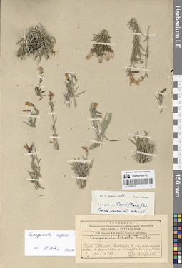
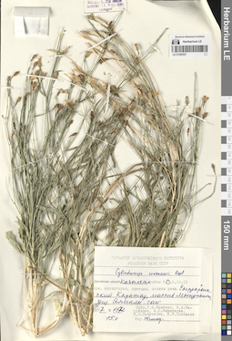
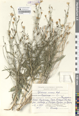
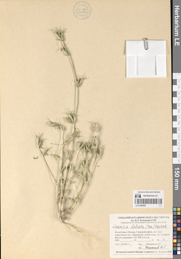
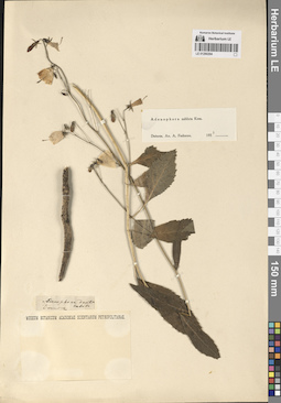
LE 01290310
Campanula capusii (Franch.) Fed. det. Kamelin, Rudolph Vladimirovich at 1964
Collectors: Karmyscheva, Nuraniya Halilovna Collection date: 26.07.1960. Administrative regions: KZ - South Kazakhstan - Tuerkistan Qalasy. Groups of specimens: Образцы сектора Средней АзииOriginal label text:Западные отроги Таласского Алатау, заповедник Аксу-Джабаглы. Истоки реки Кши-Каинды, правая по течению ветвь, трещины скал.
Coordinates (geographic position): 42° 22′ 14.4″ N, 70° 35′ 0.6″ EComment: 26.VII.1960
Н. Кармышева
Western spurs of Talas Alatau, Aksu-Dzhabagly Nature Reserve. Sources of the Kshi-Kaindy River, the right branch along the current, rock cracks.
Record creation: 2024-08-04, Daria Yudova, PhotoScan D2.Citation: Specimen LE 01290310 // Virtual herbarium of Komarov Botanical Institute RAS — http://re.herbariumle.ru/0129031026.07.1960
Coll. N. Karmyscheva
LE 01290309
Campanula capusii (Franch.) Fed. det. Kamelin, Rudolph Vladimirovich at 1971
Collection date: 22.06. Administrative regions: KG - Batken - Kadamjaiskiy Raion. Groups of specimens: Образцы сектора Средней АзииOriginal label text:Киргизская ССР, Ошская область, Алайский хребет. Урочище Гоуян, 7 км к югу от г. Хайдаркан-сай, h = 2000 - 2200 м.
Coordinates (geographic position): 39° 53′ 8.41″ N, 71° 22′ 50.1″ EComment: 22 июня 196-
Убукеева, Мурсалиев, Арбаева, Султанова
Kirghiz SSR, Osh region, Alai range. Gouyan, 7 km south of Khaidarkan-sai, h = 2000 - 2200 m.
June 22
Coll. Ubukeeva, Mursaliev, Arbaeva, Sultanova
LE 01290436
Asyneuma campanuloides (M. Bieb. ex Sims) Bornm. det. Oganesjan (Oganesian), M. E. at 05.04.2017
Collectors: Menitsky, Yuri Leonardovich; Popova, Tamara Nikitichna Field collecting number: 9. Collection date: 02.07.1998. Administrative regions: RU - Krasnodarskiy Kray. Groups of specimens: Образцы сектора Кавказа; Соглашение Минобрнауки №075-15-2021-1056Original label text:Западный Кавказ. Краснодарский край. Мостовский район, окрестности поселка Псебай. Левый борт реки Чохрах, гипсоносные обнажения, луговые Ю-В склоны выше уровня леса.
Coordinates (geographic position): 44° 25′ 58.06″ N, 40° 38′ 16.56″ EComment: № 9
2.VII.1998
Ю. Л. Меницкий, Т. Н. Попова
Western Caucasus. Krasnodar region. Mostovsky district, vicinity of the village of Psebay. The left side of the Chokhrakh River, gypsum-bearing outcrops, meadow SE slopes above forest level.
2.07.1998
Coll. Yu. L. Menitsky, T. N. Popova
LE 01290308
Additional identifications: Campanula lehmanniana Bunge; Campanula capusii (Franch.) Fed. Collection date: 17.06.1963. Administrative regions: KG - Kyrgyzstan. Groups of specimens: Образцы сектора Средней АзииOriginal label text:
Киргизия. Правый берег реки Кара-Казык, урочище Куль. Обрыв.
Coordinates (geographic position): 39° 43′ 34.21″ N, 71° 42′ 32.16″ EComment: 17.VI.1963
Айдарова и Убунеева
Kyrgyzstan. Right bank of the Kara-Kazyk river, Kul. Break.
Record creation: 2024-08-04, Daria Yudova, PhotoScan D2.Citation: Specimen LE 01290308 // Virtual herbarium of Komarov Botanical Institute RAS — http://re.herbariumle.ru/0129030817.06.1963
Coll. Aydarova and Ubukeeva
LE 01290435
Asyneuma campanuloides (M. Bieb. ex Sims) Bornm. det. Oganesjan (Oganesian), M. E. at 05.04.2017
Collectors: Menitsky, Yuri Leonardovich; Popova, Tamara Nikitichna Collection date: 07.1999. Administrative regions: RU - Karachayevo-Cherkesiya. Groups of specimens: Образцы сектора Кавказа; Соглашение Минобрнауки №075-15-2021-1056Original label text:Западный Кавказ. Карачаево-Черкесия. Бассейн реки Кубань, верховья, левый приток - река Доут, 25 км выше впадения в Кубань.
Coordinates (geographic position): 43° 28′ 20.26″ N, 41° 59′ 52.71″ EComment: июль 1999
Ю. Л. Меницкий, Т. Н. Попова
Western Caucasus. Karachaevo-Cherkessia. Basin of the Kuban River, upper reaches, left tributary - the Dout River, 25 km above the confluence with the Kuban.
07.1999
Coll. Yu. L. Menitsky, T. N. Popova
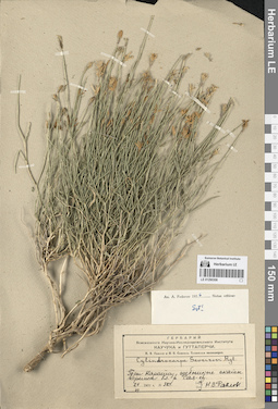
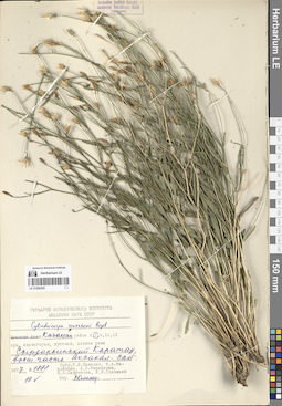
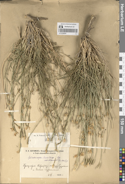
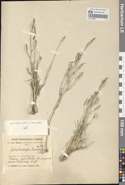
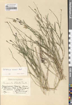
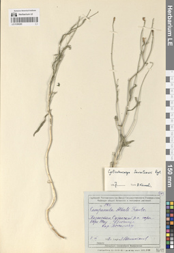
LE 01290307
Cylindrocarpa sewerzowii (Regel) Regel det. Kamelin, Rudolph Vladimirovich
Collectors: Kamelin, Rudolph Vladimirovich; Mikhajlova, Marina Аntonovna; Mishenkova, Antonina Petrovna; Safronova, Irina Nikolayevna; Soloviev, V. I. Field collecting number: 1572. Collection date: 15.05.1977. Administrative regions: KZ - South Kazakhstan - Tuerkistan Qalasy. Groups of specimens: Образцы сектора Средней АзииOriginal label text:Казахстан. Сырдарьинский Каратау, массив Мынджилги, ущелье Алмалы-сай.
Coordinates (geographic position): 43° 50′ 5.18″ N, 68° 37′ 55.69″ EComment: № 1572
15.V.1977
Р. В. Камелин, М. А. Михайлова, А. П. Мишенкова, И. Н. Сафронова, В. И. Соловьев
Kazakhstan. Syr Darya Karatau, Myndzhilgi massif, Almaly-sai gorge.
Record creation: 2024-08-04, Daria Yudova, PhotoScan D2.Citation: Specimen LE 01290307 // Virtual herbarium of Komarov Botanical Institute RAS — http://re.herbariumle.ru/01290307№ 1572
15.05.1977
Coll. R. V. Kamelin, M. A. Mikhajlova, A. P. Mishenkova, I. N. Safronova, V. I. Soloviov
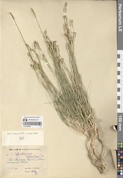
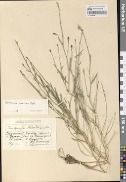
LE 01290306
Cylindrocarpa sewerzowii (Regel) Regel det. Pavlov, Nikolai Vasilievich
Collectors: Pavlov, Nikolai Vasilievich Field collecting number: 324. Collection date: 24.06.1931. Administrative regions: KZ - Zhambyl Oblysy. Expedition: Н. В. Павлов и Н. В. Самсель. Таласская экспедиция (1931 -1931)Groups of specimens: Образцы сектора Средней АзииOriginal label text:Горы Каратау, щебнистые скаты вершин близ реки Сая-су.
Coordinates (geographic position): 42° 53′ 41.89″ N, 70° 43′ 16.33″ EComment: № 324
24.VI.1931
Н. В. Павлов
Karatau Mountains, gravelly slopes of peaks near the Saya-su River.
Record creation: 2024-08-04, Daria Yudova, PhotoScan D2.Citation: Specimen LE 01290306 // Virtual herbarium of Komarov Botanical Institute RAS — http://re.herbariumle.ru/01290306№ 324
24.06.1931
Coll. N. V. Pavlov
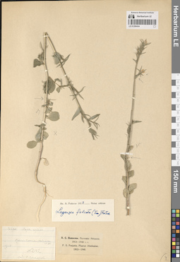
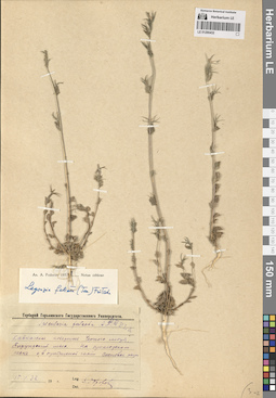
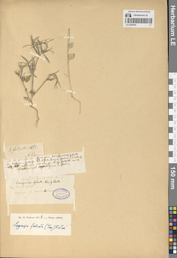
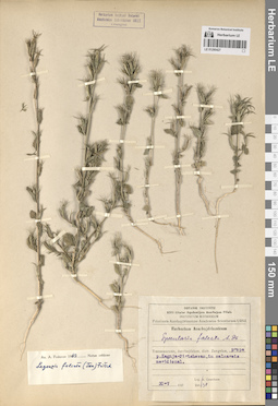
LE 01290434
Legousia falcata (Ten.) Fritsch det. Fedorov, Andrey Aleksandrovich at 1953
Collectors: Sakharov T. (G.?) Field collecting number: 2102. Collection date: 13.05.1918. Administrative regions: GE - Abkhazia. Groups of specimens: Образцы сектора Кавказа; Соглашение Минобрнауки №075-15-2021-1056Original label text:Гагры. Парк, сорное.
Coordinates (geographic position): 43° 16′ 51.64″ N, 40° 16′ 1.85″ EComment: 13.V.18
Г. Сахаров
Abkhazia. Gagra.
Record creation: 2024-08-04, Daria Yudova, PhotoScan D2.Citation: Specimen LE 01290434 // Virtual herbarium of Komarov Botanical Institute RAS — http://re.herbariumle.ru/0129043413.05.1918
Coll. G. Sakharov
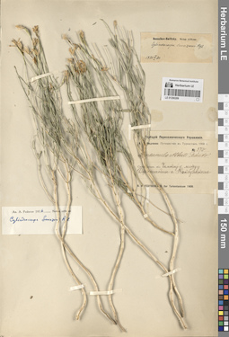
LE 01290305
Cylindrocarpa sewerzowii (Regel) Regel det. Kamelin, Rudolph Vladimirovich
Collectors: Kamelin, Rudolph Vladimirovich; Mikhajlova, Marina Аntonovna; Mishenkova, Antonina Petrovna; Safronova, Irina Nikolayevna; Soloviev, V. I. Field collecting number: 1881. Collection date: 19.05.1977. Administrative regions: KZ - Zhambyl Oblysy. Groups of specimens: Образцы сектора Средней АзииOriginal label text:Казахстан. Сырдарьинский Каратау, восточная часть. Аксакал-сай.
Coordinates (geographic position): 42° 58′ 36.91″ N, 70° 34′ 3.73″ EComment: № 1881
19.V.1977
Р. В. Камелин, М. А. Михайлова, А. П. Мишенкова, И. Н. Сафронова, В.И. Соловьев
Kazakhstan. Syr Darya Karatau, eastern part. Aksakalsai.
Record creation: 2024-08-04, Daria Yudova, PhotoScan D2.Citation: Specimen LE 01290305 // Virtual herbarium of Komarov Botanical Institute RAS — http://re.herbariumle.ru/01290305№ 1881
19.05.1977
Coll. R.V. Kamelin, M.A. Mikhajlova, A.P. Mishenkova, I.N. Safronova, V.I. Soloviev
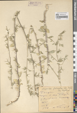
LE 01290433
Legousia falcata (Ten.) Fritsch det. Tzvelev, Nikolai Nikolaievich
Collectors: Komarov, Vladimir Leontjevich Collection date: 23.05.1940. Administrative regions: GE - Abkhazia. Groups of specimens: Образцы сектора Кавказа; Соглашение Минобрнауки №075-15-2021-1056Original label text:Гагры, дорога к мысу Пицунда. [...] галечники, луг.
Coordinates (geographic position): 43° 12′ 39.9″ N, 40° 18′ 6.15″ EComment: 23.V.1940
В. Комаров
Gagra, road to Cape Pitsunda.
Record creation: 2024-08-04, Daria Yudova, PhotoScan D2.Citation: Specimen LE 01290433 // Virtual herbarium of Komarov Botanical Institute RAS — http://re.herbariumle.ru/0129043323.05.1940
Coll. V. L. Komarov
LE 01290432
Legousia falcata (Ten.) Fritsch
Collectors: Gorohova, Zoya Nikandrovna Collection date: 15.05.1938. Administrative regions: GE - Abkhazia. Groups of specimens: Образцы сектора Кавказа; Соглашение Минобрнауки №075-15-2021-1056Original label text:Кавказское побережье Черного моря. Пицундский мыс. На приморском песке и в прибрежной части Сосновой рощи.
Coordinates (geographic position): 43° 10′ 18.06″ N, 40° 22′ 25.42″ EComment: 15.V.38
З. Горохова
Caucasian coast of the Black Sea. Pitsunda Cape. On the seaside sand and in the coastal part of Sosnovaya Roshcha.
Record creation: 2024-08-04, Daria Yudova, PhotoScan D2.Citation: Specimen LE 01290432 // Virtual herbarium of Komarov Botanical Institute RAS — http://re.herbariumle.ru/0129043215.05.1938
Coll. Z. Gorohova
LE 01290304
Cylindrocarpa sewerzowii (Regel) Regel det. Kamelin, Rudolph Vladimirovich
Collectors: Kamelin, Rudolph Vladimirovich Collection date: 27.08.1969. Administrative regions: KZ - Zhambyl Oblysy. Groups of specimens: Образцы сектора Средней АзииOriginal label text:Сырдарьинский Каратау, бассейн озера Бийликуль, ущелье Беркара, осыпи в средней части.
Coordinates (geographic position): 42° 54′ 11.64″ N, 70° 37′ 6.11″ EComment: 27.08.1969
Р. Камелин
Syr Darya Karatau, Berkara gorge, middle part, scree.
Record creation: 2024-08-04, Daria Yudova, PhotoScan D2.Citation: Specimen LE 01290304 // Virtual herbarium of Komarov Botanical Institute RAS — http://re.herbariumle.ru/0129030427.08.1969
Coll. R. Kamelin
LE 01290431
Legousia falcata (Ten.) Fritsch
Collectors: Komarov, Vladimir Leontjevich; Komarova, V. N. Collection date: 1944. Administrative regions: GE - Abkhazia. Groups of specimens: Образцы сектора Кавказа; Соглашение Минобрнауки №075-15-2021-1056Original label text:Гагры.
Coordinates (geographic position): 43° 16′ 52.12″ N, 40° 16′ 18.67″ EComment: 1944
В. Л. Комаров и Н. В. Комарова
Abkhazia, Gagra.
Record creation: 2024-08-04, Daria Yudova, PhotoScan D2.Citation: Specimen LE 01290431 // Virtual herbarium of Komarov Botanical Institute RAS — http://re.herbariumle.ru/012904311944
Coll. V. L. Komarov, N. V. Komarova
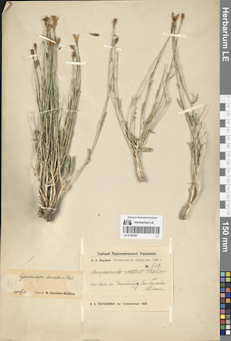
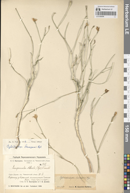
LE 01290303
Cylindrocarpa sewerzowii (Regel) Regel det. Fedorov, Andrey Aleksandrovich at 1956
Collection date: 1876. Administrative regions: KZ - Kazakhstan. Expedition: A. Regel. Iter Turkestanicum (1876 -1885)Groups of specimens: Образцы сектора Средней АзииOriginal label text:A. Regel. Iter Turkestanicum
Record creation: 2024-08-04, Daria Yudova, PhotoScan D2.Citation: Specimen LE 01290303 // Virtual herbarium of Komarov Botanical Institute RAS — http://re.herbariumle.ru/01290303Karatau 1876
LE 01290430
Legousia falcata (Ten.) Fritsch
Collectors: Ivanenko, Yuri Alekseevich Collection date: 21.06.2001. Administrative regions: RU - Krasnodarskiy Kray. Groups of specimens: Образцы сектора Кавказа; Соглашение Минобрнауки №075-15-2021-1056Original label text:Западное Закавказье, Краснодарский край, платформа Уч-Дере, на ж-д насыпи.
Coordinates (geographic position): 43° 39′ 36.08″ N, 39° 37′ 35.54″ EComment: 21 июня 2001 г.
Ю. А. Иваненко
Western Transcaucasia, Krasnodar region, Uch-Dere platform, on the railway embankment.
Record creation: 2024-08-04, Daria Yudova, PhotoScan D2.Citation: Specimen LE 01290430 // Virtual herbarium of Komarov Botanical Institute RAS — http://re.herbariumle.ru/0129043021.06.2001
Coll. Yu. A. Ivanenko
LE 01290302
Cylindrocarpa sewerzowii (Regel) Regel det. Markova, Lydia Pavlovna
Collectors: Markova, Lydia Pavlovna; Medvedeva, Liudmila Ivanovna Collection date: 02.06.1958. Administrative regions: KZ - South Kazakhstan - Tuerkistan Qalasy. Groups of specimens: Образцы сектора Средней АзииOriginal label text:Казахская ССР. Западный Тянь-Шань. Хребет Кара-Тау. Ущелье реки Кок-сарай. Крупно-каменистая осыпь.
Coordinates (geographic position): 43° 42′ 43.71″ N, 68° 15′ 58.96″ EComment: 2.VI.1958
Л. П. Маркова, Л. И. Медведева
Kazakhstan. Western Tien Shan. Karatau Ridge. Kok-Saray River Gorge. Large-rock scree.
Record creation: 2024-08-04, Daria Yudova, PhotoScan D2.Citation: Specimen LE 01290302 // Virtual herbarium of Komarov Botanical Institute RAS — http://re.herbariumle.ru/012903022.06.1958
Coll. L. P. Markova, L. I. Medvedeva
LE 01290429
Legousia falcata (Ten.) Fritsch
Collectors: Lagowski, Józef Administrative regions: RU - North Ossetia. Groups of specimens: Образцы сектора Кавказа; Соглашение Минобрнауки №075-15-2021-1056Original label text:Leg. Dr. Lagowski
Coordinates (geographic position): 43° 3′ 22.79″ N, 44° 14′ 45.27″ EComment: Алагир по течению Ардона.
North Ossetia. Alagir along the Ardon River.
Record creation: 2024-08-04, Daria Yudova, PhotoScan D2.Citation: Specimen LE 01290429 // Virtual herbarium of Komarov Botanical Institute RAS — http://re.herbariumle.ru/01290429Coll. Dr. Lagowski
LE 01290301
Cylindrocarpa sewerzowii (Regel) Regel det. Ikonnikov-Galitzky, Nikolai Petrovic at 20.03.1936
Collectors: Fedtschenko, Boris Alexeevich Field collecting number: 513. Collection date: 16.06.1908. Administrative regions: KZ - South Kazakhstan - Tuerkistan Qalasy. Groups of specimens: Образцы сектора Средней АзииOriginal label text:Сыр-Дарьинская область, Чимкентский уезд, Уч-булак.
Comment: 16 июня 1908
Б. А. Федченко
Syr-Darya region, Chimkent district [= Turkistan Region, formerly South Kazakhstan Region], Uch-bulak.
Record creation: 2024-08-04, Daria Yudova, PhotoScan D2.Citation: Specimen LE 01290301 // Virtual herbarium of Komarov Botanical Institute RAS — http://re.herbariumle.ru/0129030116.06.1908
Coll. B. A. Fedtschenko
LE 01290428
Legousia falcata (Ten.) Fritsch det. Gabrieljan, Elenora Tzolakovna
Collectors: Gabrieljan, Elenora Tzolakovna Collection date: 11.06.1978. Administrative regions: AM - Armenia. Groups of specimens: Образцы сектора Кавказа; Соглашение Минобрнауки №075-15-2021-1056Original label text:Армянская ССР, Мегринский район, Шванидзор, урочище Эхнаки дзор, можжевеловое редколесье, 1500 м, в трещинах скал.
Comment: 11.6.1978
E. Gabrielian
Armenia. Meghri district. Shvanidzor River Gorge.
Record creation: 2024-08-04, Daria Yudova, PhotoScan D2.Citation: Specimen LE 01290428 // Virtual herbarium of Komarov Botanical Institute RAS — http://re.herbariumle.ru/0129042811.06.1978
Coll. E. Gabrielian
LE 01290300
Cylindrocarpa sewerzowii (Regel) Regel
Collectors: Popov, Mikhail Grigorevich (Popow) Field collecting number: 223. Collection date: 25.06.1922. Administrative regions: KZ - Zhambyl Oblysy. Groups of specimens: Образцы сектора Средней АзииOriginal label text:Аулие-атинский уезд: ущелье Алмасай в Куюкских горах.
Comment: № 223
25.VI.22
Соб. М. Попов
Aulie-Ata district [= Jambyl Region]: Almasai gorge in the Kuyuk mountains.
№ 223
25.06.1922
Coll. M. Popov
LE 01290427
Legousia falcata (Ten.) Fritsch det. Fedorov, Andrey Aleksandrovich at 1963
Collectors: Grossheim, Alexander Alfonsovich Collection date: 30.05.1937. Administrative regions: AZ - Azerbaijan. Groups of specimens: Образцы сектора Кавказа; Соглашение Минобрнауки №075-15-2021-1056Original label text:Transcaucasia, Azerbajdzhan, distr. Zangelan, prope p. Kegnja-Pirtshevan [Кегна-Перчиван], in calcareis meridional.
Coordinates (geographic position): 39° 5′ 28.14″ N, 46° 38′ 27.67″ ERecord creation: 2024-08-04, Daria Yudova, PhotoScan D2.Citation: Specimen LE 01290427 // Virtual herbarium of Komarov Botanical Institute RAS — http://re.herbariumle.ru/0129042730.V.1937
Leg. A. Grossheim
LE 01290299
Cylindrocarpa sewerzowii (Regel) Regel det. Kamelin, Rudolph Vladimirovich
Collectors: Kamelin, Rudolph Vladimirovich; Mikhajlova, Marina Аntonovna; Mishenkova, Antonina Petrovna; Safronova, Irina Nikolayevna; Soloviev, V. I. Field collecting number: 1733. Collection date: 18.05.1977. Administrative regions: KZ - Zhambyl Oblysy. Groups of specimens: Образцы сектора Средней АзииOriginal label text:Казахстан, Сырдарьинский Каратау. Горы Улькун-Актау, ущелье между рекой Талды-Булак и рекой Бугунь.
Coordinates (geographic position): 43° 22′ 47.06″ N, 69° 59′ 37.01″ EComment: № 1733
18.V.1977
Р. В. Камелин, М. А. Михайлова, А. П. Мишенкова, И. Н. Сафронова, В. И. Соловьев.
Kazakhstan, Syr Darya Karatau. Ulkun-Aktau Mountains, gorge between the Taldy-Bulak River and the Bugun River.
Record creation: 2024-08-04, Daria Yudova, PhotoScan D2.Citation: Specimen LE 01290299 // Virtual herbarium of Komarov Botanical Institute RAS — http://re.herbariumle.ru/01290299№ 1733
18.05.1977
Coll. R. V. Kamelin, M. A. Mikhajlova, A. P. Mishenkova, I. N. Safronova, V. I. Soloviov.
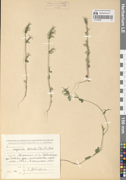
LE 01290426
Legousia falcata (Ten.) Fritsch
Collection date: 16.05.1979. Administrative regions: AM - Armenia. Groups of specimens: Образцы сектора Кавказа; Соглашение Минобрнауки №075-15-2021-1056Original label text:Армянская ССР, Мегринский район. Ущелье реки Шванидзор. Урочище Эхнакидзор. Арчевник.
Comment: 16.V.1979
Сагателян
Armenia. Meghri district. Shvanidzor River Gorge. Ehnakidzor.
Record creation: 2024-08-04, Daria Yudova, PhotoScan D2.Citation: Specimen LE 01290426 // Virtual herbarium of Komarov Botanical Institute RAS — http://re.herbariumle.ru/0129042616.05.1979
Coll. Sagatelyan
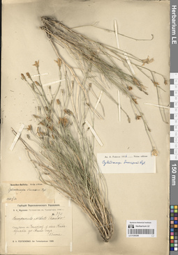
LE 01290298
Cylindrocarpa sewerzowii (Regel) Regel det. Kamelin, Rudolph Vladimirovich
Collectors: Kamelin, Rudolph Vladimirovich; Mikhajlova, Marina Аntonovna; Mishenkova, Antonina Petrovna; Safronova, Irina Nikolayevna; Soloviev, V. I. Field collecting number: 1235. Collection date: 11.05.1977. Administrative regions: KZ - South Kazakhstan - Tuerkistan Qalasy. Groups of specimens: Образцы сектора Средней АзииOriginal label text:Южный Казахстан. Сырдарьинский Каратау, южный склон, ущелье Уч-узень выше урочища Когашик.
Coordinates (geographic position): 43° 47′ 4.35″ N, 68° 4′ 58.38″ EComment: № 1235
11.V.1977
Камелин Р. В., Михайлова М. А., Мишенкова А. П., Сафронова И. Н, Соловьев В. И.
Southern Kazakhstan. Syr Darya Karatau, southern slope, Uch-Uzen gorge above Kogashik.
Record creation: 2024-08-04, Daria Yudova, PhotoScan D2.Citation: Specimen LE 01290298 // Virtual herbarium of Komarov Botanical Institute RAS — http://re.herbariumle.ru/01290298№ 1235
11.05.1977
Coll. Kamelin R.V., Mikhajlova M.A., Mishenkova A.P., Safronova I.N., Soloviov V.I.
LE 01290425
Legousia falcata (Ten.) Fritsch det. Melnikov, Denis Germanovich
Collectors: Melnikov, Denis Germanovich Field collecting number: 35. Collection date: 12.06.2013. Administrative regions: GE - Abkhazia. Groups of specimens: Образцы сектора Кавказа; Соглашение Минобрнауки №075-15-2021-1056Original label text:Республика Абхазия, Гагрский район, северо-восточные окрестности поселка Цандрыпш, склон горы, луг у дороги. Высота примерно 150-200 м н.у.м.
Coordinates (geographic position): 43° 23′ 32.49″ N, 40° 3′ 49.37″ EComment: № 35
12.06.2013
Мельников Д. Г.
Republic of Abkhazia, Gagra district, north-eastern outskirts of the village of Tsandrypsh, mountain slope, meadow near the road. Height is approximately 150-200 m above sea level.
Record creation: 2024-08-04, Daria Yudova, PhotoScan D2.Citation: Specimen LE 01290425 // Virtual herbarium of Komarov Botanical Institute RAS — http://re.herbariumle.ru/01290425№ 35
12.06.2013
Coll. D. G. Melnikov
LE 01290297
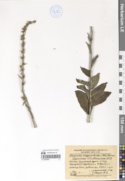
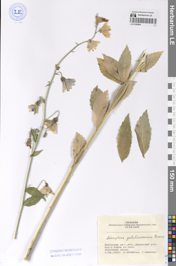
Adenophora taurica (Sukaczev) Juz.
Additional identifications: Adenophora liliifolia (L.) A. DC. Collectors: Korotky, Mikhail Fedorovich; Lebedeva, Z. Field collecting number: 163. Collection date: 04.08.1913. Administrative regions: KZ - Qostanay Oblysy - Kustanayskiy Rayon. Groups of specimens: Образцы сектора Средней АзииOriginal label text:№ 163
Coordinates (geographic position): 52° 5′ 9.89″ N, 62° 41′ 18.56″ EComment: Тургайская область. Кустанайский уезд, окрестности поселка Смайловского. В долине озера Мукукуль. На солончаковатых и кочковатых местах.
4.VIII.1913
М. Короткий, З. Лебедева
№ 163
Record creation: 2024-08-04, Daria Yudova, PhotoScan D2.Citation: Specimen LE 01290297 // Virtual herbarium of Komarov Botanical Institute RAS — http://re.herbariumle.ru/01290297Turgay region. Kustanai district, vicinity of the village of Smailovsky. In the valley of Lake Mukukul. In saline and hummocky places.
4.08.1913
Coll. M. Korotky, Z. Lebedeva
LE 01290296
Adenophora taurica (Sukaczev) Juz.
Additional identifications: Adenophora liliifolia (L.) A. DC. Collectors: Krascheninnikov, Ippolit (Hippolit) Mikhailovich Field collecting number: 841. Collection date: 30.07.1908. Expedition: И. М. Крашенинников: Экспедиция в Тургайский уезд (1908) (1908)Groups of specimens: Образцы сектора Средней АзииOriginal label text:И. М. Крашенинников: Экспедиция в Тургайский уезд 1908 г.
Coordinates (geographic position): 51° 42′ 56.7″ N, 65° 6′ 18.44″ EComment: № 841
Тургайская область и уезд, 2-я Наурзумская волость.
Березовый лесок правого берега реки Кара-Теке около горы [Шок-Тумсук].
30.VII.
I. M. Krasheninnikov: Expedition to Turgai district 1908
Record creation: 2024-08-04, Daria Yudova, PhotoScan D2.Citation: Specimen LE 01290296 // Virtual herbarium of Komarov Botanical Institute RAS — http://re.herbariumle.ru/01290296№ 841
Turgay region and district, 2nd Naurzum volost. Birch forest on the right bank of the Kara-Teke River near the mountain [Shok-Tumsuk].
30.07.1908
Coll. I. M. Krasheninnikov
LE 01290295
Adenophora taurica (Sukaczev) Juz.
Additional identifications: Adenophora liliifolia (L.) A. DC. Collectors: Schipczinski, Nikolaj Valerianovich Field collecting number: 1206. Collection date: 02.07.1914. Administrative regions: KZ - Kazakhstan. Expedition: Шипчинский Н.В. Экспедиция в Семипалатинский уезд (1914 -1914)Groups of specimens: Образцы сектора Средней АзииOriginal label text:Н.В. Шипчинский: Экспедиция в Семипалатинский уезд 1914 г.
Coordinates (geographic position): 50° 2′ 38.47″ N, 81° 46′ 58.73″ EComment: № 1206
Семипалатинская область. Южная часть Семипалатинского уезда. Горы Дунгалы. В березняке в сыром ущелье.
2.VII.1914
N.V. Shipchinsky: Expedition to Semipalatinsk district 1914
Record creation: 2024-08-04, Daria Yudova, PhotoScan D2.Citation: Specimen LE 01290295 // Virtual herbarium of Komarov Botanical Institute RAS — http://re.herbariumle.ru/01290295№ 1206
Semipalatinsk region. Southern part of Semipalatinsk district. Dungaly mountains. In a birch forest in a damp gorge.
2.07.1914
Coll. N.V. Shipchinsky
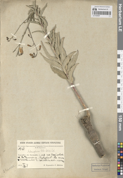
LE 01290294
Adenophora sublata Kom. det. Fedorov, Andrey Aleksandrovich at 1954
Groups of specimens: Образцы сектора Средней АзииOriginal label text:Adenophora denticulata
Record creation: 2024-08-04, Daria Yudova, PhotoScan D2.Citation: Specimen LE 01290294 // Virtual herbarium of Komarov Botanical Institute RAS — http://re.herbariumle.ru/01290294Davuria.
LE 01290293
Cylindrocarpa sewerzowii (Regel) Regel
Collectors: Abramov, Vladimir Alekseevich Абрамов, Владимир Алексеевич Collection date: 04.06.1905. Administrative regions: KG - Jalal-Abad oblast - Suzak. Expedition: В.А. Абрамов: Флора Западного Тянь-Шаня и Сыр-дарьинской области ()Groups of specimens: Образцы сектора Средней АзииOriginal label text:В.А. Абрамов: Флора Западного Тянь-Шаня и Сыр-дарьинской области
Coordinates (geographic position): 43° 57′ 14.25″ N, 68° 49′ 21.17″ EComment: Предгорье Каратау - между Сузаком и Челак-курганом.
4.VI.1905
V.A. Abramov: Flora of the Western Tien Shan and Syr Darya region
Record creation: 2024-08-04, Daria Yudova, PhotoScan D2.Citation: Specimen LE 01290293 // Virtual herbarium of Komarov Botanical Institute RAS — http://re.herbariumle.ru/01290293Karatau foothills - between Suzak and Chelak-kurgan.
4.06.1905
Coll. V. A. Abramov
LE 01290292
Cylindrocarpa sewerzowii (Regel) Regel
Field collecting number: 23. Collection date: 08.08.1934. Groups of specimens: Образцы сектора Средней АзииOriginal label text:Горы Каратау. Ущелье реки Джилаганата. Скалы.
Comment: 8.VIII.1934
M. M. et E. M. Iljin
Karatau Mountains. Jilaganat River Gorge. Rocks.
Record creation: 2024-08-04, Daria Yudova, PhotoScan D2.Citation: Specimen LE 01290292 // Virtual herbarium of Komarov Botanical Institute RAS — http://re.herbariumle.ru/012902928.08.1934
Coll. M. M. and E. M. Iljin
LE 01290291
Cylindrocarpa sewerzowii (Regel) Regel
Collectors: Minkwitz, Zinaida Alexandrovna Field collecting number: 734. Collection date: 14.06.1908. Administrative regions: KZ - South Kazakhstan - Tuerkistan Qalasy. Expedition: З. А. фон Минквиц: Экспедиция в Чимкентский уезд // Z. a Minkwitz: Iter ad distr. Tschimkent (1908)Groups of specimens: Образцы сектора Средней АзииOriginal label text:Сыр-Дарьинская область. Чимкентский уезд. Скалы при входе в ущелье реки Бересек
Coordinates (geographic position): 43° 38′ 51.03″ N, 68° 38′ 1.21″ EComment: 14.VI.1908
З. А. фон Минквиц
Syr-Darya region. Chimkent district. Rocks at the entrance to the Beresek river gorge.
Record creation: 2024-08-04, Daria Yudova, PhotoScan D2.Citation: Specimen LE 01290291 // Virtual herbarium of Komarov Botanical Institute RAS — http://re.herbariumle.ru/0129029114.06.1908
Coll. Z. A. Minkwitz
LE 01290290
Cylindrocarpa sewerzowii (Regel) Regel det. Fedorov, Andrey Aleksandrovich at 1956
Collectors: Neustruev, Sergey Semyonovich; Dolenko, G. I. Field collecting number: 145. Collection date: 20.06.1908. Groups of specimens: Образцы сектора Средней АзииOriginal label text:Сыр-Дарьинская область, Чимкентский уезд. Каратау, у вершины каменистой сопки Кара-чеку (Черная гора).
Comment: 20.VI.1908
С. С. Неуструев, Г. И. Доленко
Syr-Darya region, Chimkent district. Karatau, at the top of the rocky hill Kara-cheku (Black Mountain).
Record creation: 2024-08-04, Daria Yudova, PhotoScan D2.Citation: Specimen LE 01290290 // Virtual herbarium of Komarov Botanical Institute RAS — http://re.herbariumle.ru/0129029020.06.1908
Coll. S. S. Neustruev, G. I. Dolenko
LE 01290289
Cylindrocarpa sewerzowii (Regel) Regel det. Fedorov, Andrey Aleksandrovich at 1956
Collectors: Fedtschenko, Boris Alexeevich Field collecting number: 370. Collection date: 1908. Administrative regions: KZ - Kazakhstan. Expedition: Федченко Б. А. Путешествие в Туркестан // B. A. Fedtschenko. Iter Turkestanicum (1908)Groups of specimens: Образцы сектора Средней АзииOriginal label text:Федченко Б. А. Путешествие в Туркестан 1908 г.
Comment: Сыр-Дарьинская область. Чимкентский уезд, между Джингакты и Какбулаком
№ 370
Fedchenko B. A. Journey to Turkestan 1908
Record creation: 2024-08-04, Daria Yudova, PhotoScan D2.Citation: Specimen LE 01290289 // Virtual herbarium of Komarov Botanical Institute RAS — http://re.herbariumle.ru/01290289Syr-Darya region. Chimkent district, between Dzhingakty and Kakbulak
№ 370
1908
Coll. B. A. Fedchenko
LE 01290288
Cylindrocarpa sewerzowii (Regel) Regel det. Fedorov, Andrey Aleksandrovich at 1956
Collectors: Fedtschenko, Boris Alexeevich Field collecting number: 396. Collection date: 15.06.1908. Administrative regions: KZ - Kazakhstan. Expedition: Федченко Б. А. Путешествие в Туркестан // B. A. Fedtschenko. Iter Turkestanicum (1908)Groups of specimens: Образцы сектора Средней АзииOriginal label text:Федченко Б. А. Путешествие в Туркестан 1908 г.
Comment: Сыр-Дарьинская область. Чимкентский уезд. От Как-булака до Биш-саз.
15 июня
Fedchenko B. A. Journey to Turkestan 1908
Record creation: 2024-08-04, Daria Yudova, PhotoScan D2.Citation: Specimen LE 01290288 // Virtual herbarium of Komarov Botanical Institute RAS — http://re.herbariumle.ru/01290288Syr-Darya region. Chimkent district. From Kak-bulak to Bish-saz.
15.06.1908
Coll. B. A. Fedtschenko
LE 01290287
Cylindrocarpa sewerzowii (Regel) Regel det. Kamelin, Rudolph Vladimirovich at 1974
Collectors: Goloskokov, Vitalii Petrovich Collection date: 23.05.1963. Administrative regions: KZ - Zhambyl Oblysy. Groups of specimens: Образцы сектора Средней АзииOriginal label text:Сырдарьинский Каратау. Ущелье реки Беркара (бассейн озера Бийликуль). На скалах, в трещинах.
Coordinates (geographic position): 42° 55′ 5.81″ N, 70° 38′ 5.88″ EComment: 23.V.1963
В. П. Голоскоков
Syrdarya Karatau. Gorge of the Berkara River (basin of Lake Biylikul). On rocks, in cracks.
Record creation: 2024-08-04, Daria Yudova, PhotoScan D2.Citation: Specimen LE 01290287 // Virtual herbarium of Komarov Botanical Institute RAS — http://re.herbariumle.ru/0129028723.05.1963
Coll. V. P. Goloskokov
LE 01290286
Cylindrocarpa sewerzowii (Regel) Regel det. Kamelin, Rudolph Vladimirovich at 1974
Collectors: Goloskokov, Vitalii Petrovich Collection date: 23.05.1963. Administrative regions: KZ - Zhambyl Oblysy. Groups of specimens: Образцы сектора Средней АзииOriginal label text:Сырдарьинский Каратау. Ущелье реки Беркара (бассейн озера Бийликуль). На скалах, в трещинах.
Coordinates (geographic position): 42° 55′ 5.81″ N, 70° 38′ 5.88″ EComment: 23.V.1963
В. П. Голоскоков
Syrdarya Karatau. Gorge of the Berkara River (basin of Lake Biylikul). On rocks, in cracks.
Record creation: 2024-08-04, Daria Yudova, PhotoScan D2.Citation: Specimen LE 01290286 // Virtual herbarium of Komarov Botanical Institute RAS — http://re.herbariumle.ru/0129028623.05.1963
Coll. V. P. Goloskokov
LE 01290285
Cylindrocarpa sewerzowii (Regel) Regel det. Kamelin, Rudolph Vladimirovich at 1967
Collectors: Velikanova Field collecting number: 146. Collection date: 08.06.1932. Administrative regions: KZ - Kazakhstan. Groups of specimens: Образцы сектора Средней АзииOriginal label text:№ 146
Comment: Казахстан, Сузакский район, горы Каратау, урочище Кор-Джайляу.
8.VI.1932
Л. Великанова
№ 146
Record creation: 2024-08-04, Daria Yudova, PhotoScan D2.Citation: Specimen LE 01290285 // Virtual herbarium of Komarov Botanical Institute RAS — http://re.herbariumle.ru/01290285Kazakhstan, Suzak district, Karatau mountains, Kor-Dzhailyau tract.
8.06.1932
Coll. Velikanova
LE 01290804
Adenophora golubinzevaeana Reverd.
Collectors: Neyfeld, I.; Vlassova, G. Collection date: 09.08.1968. Administrative regions: RU - Respublika Khakasiya - Shirinskiy Rayon. Groups of specimens: Образцы сектора Сибири и Дальнего Востока РоссииOriginal label text:Хакасская автономная область, Ширинский район, окрестности села Ключи, озеро Белё. Березовый лесок.
Coordinates (geographic position): 54° 43′ 19.32″ N, 90° 4′ 8.18″ EComment: 9.VIII.1968
И. Нейфельд, Г. Власова
Khakassia, Shirinsky District, the outskirts of the Klyuchi village, Lake Bele. Birch forest.
9.08.1968
Coll. I. Neyfeld, G. Vlassova
LE 01290803
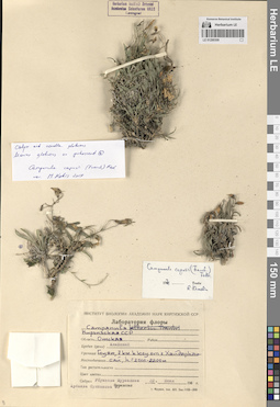
Adenophora rupestris Reverd.
Collection date: 23.07.1971. Administrative regions: RU - Respublika Khakasiya. Groups of specimens: Образцы сектора Сибири и Дальнего Востока РоссииOriginal label text:Красноярский край, Хакасия, Таштыпский район. Хребет Малый Саксы[р]. Южный склон. Каменистая степь.
Coordinates (geographic position): 53° 30′ 44.32″ N, 90° 35′ 49.91″ EComment: 23.7.1971
А. Королева, Г. Гилева
Khakassia, Tashtypsky District. Maly Saksy[r] Ridge. Southern slope. Rocky steppe.
23.07.1971
Coll. A. Koroleva, G. Gileva
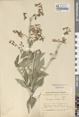
LE 01290802
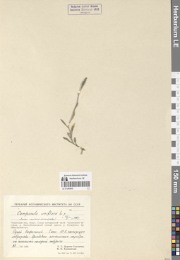
Campanula uniflora L.
Collectors: Derviz-Sokolova, Tatiana Georgievna; Bushanskaya, V.K. Collection date: 28.07.1966. Administrative regions: RU - Chukotskiy Avtonomnyy Okrug. Groups of specimens: Образцы сектора Сибири и Дальнего Востока РоссииOriginal label text:(Листья обильно реснитчатые)
Coordinates (geographic position): 69° 4′ 53.1″ N, 178° 28′ 12.96″ EComment: Чукотский национальный округ. Север центральной части Чукотского нагорья, река Экичуйгывеемкай (левый приток реки Куэквунь), хребет Эмнункэнигтун. Ручей Кафельный. Склон Ю-З экспозиции, кобрезиево-дриадовая каменистая тундра на плоскости нагорной террасы.
28.VII.1966
Т. Г. Дервиз-Соколова, В. К. Бушанская
(The leaves are abundantly ciliated) Chukotka National Okrug. North of the central part of the Chukotka Plateau, the Ekichuygyveemkay River (left tributary of the Kuekvun River), the Emnunkenigtun Ridge. Kafelny Creek. Slope of south-west exposure, kobresia-dryad rocky tundra on the plane of the mountain terrace.
28.07.1966
Coll. T. G. Derviz-Sokolova, V. K. Bushanskaya
LE 01290801
Campanula uniflora L.
Collectors: Kozhevnikov, Yury Pavlovich Collection date: 08.08.1972. Administrative regions: RU - Chukotskiy Avtonomnyy Okrug. Groups of specimens: Образцы сектора Сибири и Дальнего Востока РоссииOriginal label text:Восточная Чукотка. Верховья реки Гытхытхвэоуваам.
Coordinates (geographic position): 67° 9′ 11.67″ N, 178° 5′ 3.13″ WComment: Скалистый выступ известняков в нижней части N склона горы.
8.VIII.1972
Ю. П. Кожевников
Eastern Chukotka. Upper reaches of the Gytkhytkhveouvaam River. A rocky limestone outcrop at the bottom of the N slope of the mountain.
Record creation: 2024-08-04, Daria Yudova, PhotoScan D2.Citation: Specimen LE 01290801 // Virtual herbarium of Komarov Botanical Institute RAS — http://re.herbariumle.ru/012908018.08.1972
Coll. Yu. P. Kozhevnikov
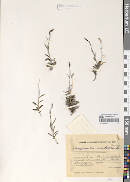
LE 01290800
Campanula uniflora L.
Collectors: Gorodkov, Boris Nikolaevich Collection date: 20.08.1938. Administrative regions: RU - Chukotskiy Avtonomnyy Okrug. Groups of specimens: Образцы сектора Сибири и Дальнего Востока РоссииOriginal label text:Дальний Восток. Остров Врангеля. Верховья реки Красный Флаг. Сухая лишайниково-моховая терраса в долине речки.
Coordinates (geographic position): 71° 17′ 14.73″ N, 178° 49′ 24.99″ WComment: 20.VIII.1938
Б. Н. Городков
Far East. Wrangel Island. Upper reaches of the Krasny Flag River. Dry lichen-moss terrace in the river valley.
Record creation: 2024-08-04, Daria Yudova, PhotoScan D2.Citation: Specimen LE 01290800 // Virtual herbarium of Komarov Botanical Institute RAS — http://re.herbariumle.ru/0129080020.08.1938
Coll. B. N. Gorodkov
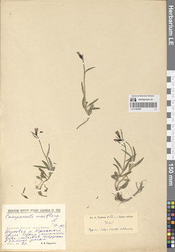
LE 01290799
Campanula uniflora L.
Collectors: Gavrilyuk, Victor Antonovich; Gagarin, P.K. Collection date: 30.06.1957. Administrative regions: RU - Chukotskiy Avtonomnyy Okrug. Groups of specimens: Образцы сектора Сибири и Дальнего Востока РоссииOriginal label text:Чукотский полуостров, юго-восточная оконечность. Окрестности Чаплинских горячих источников (64° 25' с. ш., 172° 30' з. д.). Левый берег реки Ульхум. Склоны гор на высоте 100-150 м н.у.м. Хорошо обогреваемый солнцем и заросший растительностью (кустарнички, разнотравье) участок. Хороший дренаж.
Coordinates (geographic position): 64° 26′ 9.16″ N, 172° 30′ 47.07″ WComment: 30.06.1957
В. А. Гаврилюк, П. К. Гагарин
Chukotka Peninsula, southeastern end. The area around the Chaplinsky hot springs (64° 25' N, 172° 30' W). Left bank of the Ulkhum River. Mountain slopes at an altitude of 100-150 m above sea level. An area well heated by the sun and overgrown with vegetation (shrubs, herbs). Good drainage.
Record creation: 2024-08-04, Daria Yudova, PhotoScan D2.Citation: Specimen LE 01290799 // Virtual herbarium of Komarov Botanical Institute RAS — http://re.herbariumle.ru/0129079930.06.1957
Coll. V. A. Gavrilyuk, P. K. Gagarin
LE 01290798
Campanula uniflora L.
Collectors: Tikhomirov, Boris Anatolievich Collection date: 17.08.1958. Administrative regions: RU - Chukotskiy Avtonomnyy Okrug. Groups of specimens: Образцы сектора Сибири и Дальнего Востока РоссииOriginal label text:Чукотка. Поселок Наукан.
Coordinates (geographic position): 66° 1′ 31.44″ N, 169° 42′ 27.69″ WComment: 17.VIII.1958
Б. Тихомиров
Chukotka. Naukan village.
Record creation: 2024-08-04, Daria Yudova, PhotoScan D2.Citation: Specimen LE 01290798 // Virtual herbarium of Komarov Botanical Institute RAS — http://re.herbariumle.ru/0129079817.08.1958
Coll. B. Tikhomirov