View
Add
Copy
Edit
Delete
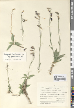
LE 01290336
Groups of specimens: Образцы сектора Средней АзииRecord creation: 2024-08-04, Daria Yudova, PhotoScan D2.Citation: Specimen LE 01290336 // Virtual herbarium of Komarov Botanical Institute RAS — http://re.herbariumle.ru/01290336
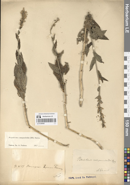
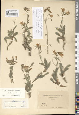
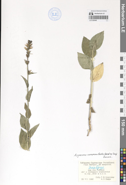
LE 01290465
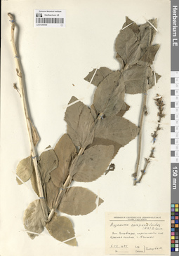
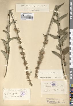
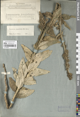
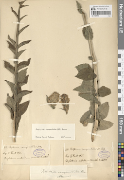
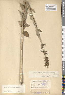
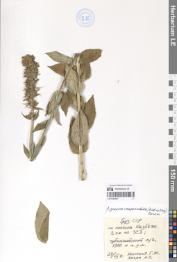
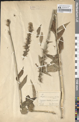
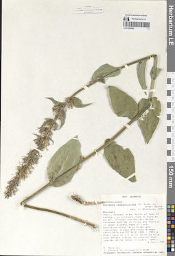
Asyneuma campanuloides (M. Bieb. ex Sims) Bornm. det. Fedorov, Andrey Aleksandrovich at 1954
Collection date: 29.06.1896. Administrative regions: RU - Stavropol'skiy Kray. Groups of specimens: Образцы сектора Кавказа; Соглашение Минобрнауки №075-15-2021-1056Original label text:96. VI.29 Пятигорск. Вершина Бештау.
Coordinates (geographic position): 44° 5′ 50.92″ N, 43° 1′ 25.63″ EComment: Stavropol'skiy Kray. Pyatigorsk. The Beshtau mount.
Record creation: 2024-08-04, Daria Yudova, PhotoScan D2.Citation: Specimen LE 01290465 // Virtual herbarium of Komarov Botanical Institute RAS — http://re.herbariumle.ru/0129046529.06.1896
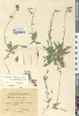
LE 01290335
Groups of specimens: Образцы сектора Средней АзииRecord creation: 2024-08-04, Daria Yudova, PhotoScan D2.Citation: Specimen LE 01290335 // Virtual herbarium of Komarov Botanical Institute RAS — http://re.herbariumle.ru/01290335
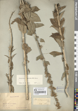
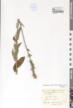
LE 01290464
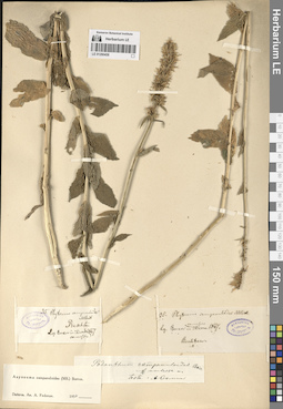
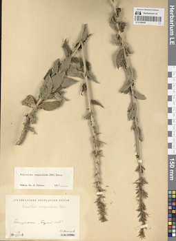
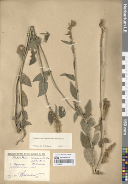
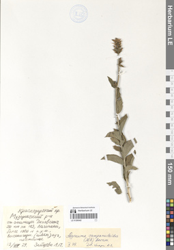
Asyneuma campanuloides (M. Bieb. ex Sims) Bornm. det. Fedorov, Andrey Aleksandrovich at 1954
Collectors: Alexeenko, Fyodor Nikitich Collection date: 17.07.1896. Administrative regions: RU - Kabardino-Balkarskaya Respublika. Groups of specimens: Образцы сектора Кавказа; Соглашение Минобрнауки №075-15-2021-1056Original label text:Prov. Terek. Ad fl. Baksan. prope Terskol. 7000'
Coordinates (geographic position): 43° 15′ 22.87″ N, 42° 31′ 16.32″ ERecord creation: 2024-08-04, Daria Yudova, PhotoScan D2.Citation: Specimen LE 01290464 // Virtual herbarium of Komarov Botanical Institute RAS — http://re.herbariumle.ru/0129046417 jul. 96
leg. Th. Alexeenko
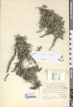
LE 01290334
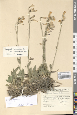
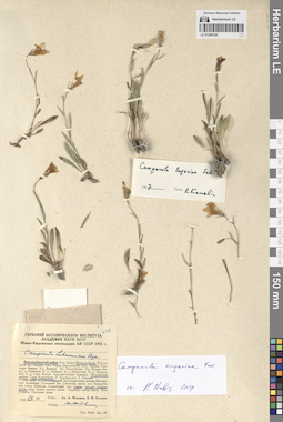
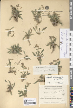
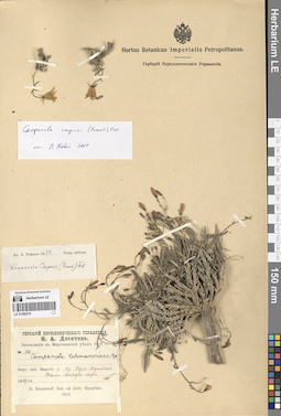
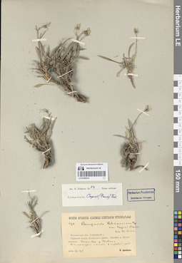
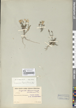
Campanula lehmanniana Bunge det. Kamelin, Rudolph Vladimirovich at 1967
Collectors: Kamelin, Rudolph Vladimirovich Collection date: 07.1965. Administrative regions: TJ - Tajikistan. Groups of specimens: Образцы сектора Средней АзииOriginal label text:Таджикистан, Гиссарский хребет, ущелье реки Варзоб, по скалам в 1 1/2 км к югу от устья Майхуры.
Coordinates (geographic position): 39° 0′ 41.64″ N, 68° 46′ 35.01″ EComment: VII.1965
Р. Камелин
Tajikistan, Gissar Range, Varzob River Gorge, along the rocks 1,5 km south of the mouth of the Maykhura.
Record creation: 2024-08-04, Daria Yudova, PhotoScan D2.Citation: Specimen LE 01290334 // Virtual herbarium of Komarov Botanical Institute RAS — http://re.herbariumle.ru/0129033407.1965
Coll. R. Kamelin
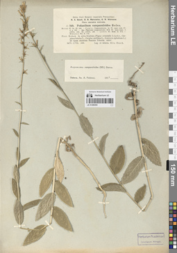
LE 01290463
Asyneuma campanuloides (M. Bieb. ex Sims) Bornm. det. Fedorov, Andrey Aleksandrovich at 1954
Collectors: Stuckenberg, Elisabeth Karlovna Collection date: 22.07.1912. Administrative regions: RU - Stavropol'skiy Kray. Groups of specimens: Образцы сектора Кавказа; Соглашение Минобрнауки №075-15-2021-1056Original label text:Терская область. Окрестности Кисловодска. На Седло-гору, склоны, луга.
Coordinates (geographic position): 43° 53′ 12.96″ N, 42° 47′ 18.1″ EComment: 1912.VII.22
E. Штукенберг
Stavropol'skiy Kray, vicinity of the Kislovodsk, the Sedlo mount.
Record creation: 2024-08-04, Daria Yudova, PhotoScan D2.Citation: Specimen LE 01290463 // Virtual herbarium of Komarov Botanical Institute RAS — http://re.herbariumle.ru/0129046322.07.1912
Coll. E. Stuckenberg
LE 01290333
Groups of specimens: Образцы сектора Средней АзииRecord creation: 2024-08-04, Daria Yudova, PhotoScan D2.Citation: Specimen LE 01290333 // Virtual herbarium of Komarov Botanical Institute RAS — http://re.herbariumle.ru/01290333
LE 01290462
Asyneuma campanuloides (M. Bieb. ex Sims) Bornm. det. Fedorov, Andrey Aleksandrovich at 1954
Collectors: Gordiagin (Gordyagin), Andrei Yakovlevich Collection date: 11.07.1911. Administrative regions: RU - Stavropol'skiy Kray. Groups of specimens: Образцы сектора Кавказа; Соглашение Минобрнауки №075-15-2021-1056; Herbarium universitatis KazanensisOriginal label text:Prov. Terek, distr. Pjatigorsk
Coordinates (geographic position): 43° 50′ 45.13″ N, 42° 51′ 46.29″ EComment: Б. Джинал - Кисловодск, в районе Треугольника.
11.VII.1911
A. Gordiagin
Stavropol'skiy Kray, Kislovodsk, the Dzhinal ridge.
Record creation: 2024-08-04, Daria Yudova, PhotoScan D2.Citation: Specimen LE 01290462 // Virtual herbarium of Komarov Botanical Institute RAS — http://re.herbariumle.ru/0129046211.07.1911
Coll. A. Gordiagin
LE 01290332
Groups of specimens: Образцы сектора Средней АзииRecord creation: 2024-08-04, Daria Yudova, PhotoScan D2.Citation: Specimen LE 01290332 // Virtual herbarium of Komarov Botanical Institute RAS — http://re.herbariumle.ru/01290332
LE 01290461
Asyneuma campanuloides (M. Bieb. ex Sims) Bornm. det. Fedorov, Andrey Aleksandrovich at 1954
Collectors: Alexeenko, Fyodor Nikitich Collection date: 28.06.1897. Administrative regions: RU - Dagestan - Buynakskiy Rayon. Groups of specimens: Образцы сектора Кавказа; Соглашение Минобрнауки №075-15-2021-1056Original label text:Prov. Terek. Distr. Chassaw-jurt, Salatau. Supra p. Honzagoi [= Honzahoi, Хонзахой], in pratis. 5000'.
Coordinates (geographic position): 42° 53′ 3.44″ N, 46° 47′ 58.21″ ERecord creation: 2024-08-04, Daria Yudova, PhotoScan D2.Citation: Specimen LE 01290461 // Virtual herbarium of Komarov Botanical Institute RAS — http://re.herbariumle.ru/0129046128.VI.1897
leg. Th. Alexeenko
LE 01290460
Asyneuma campanuloides (M. Bieb. ex Sims) Bornm. det. Fedorov, Andrey Aleksandrovich at 1954
Collectors: Alexeenko, Fyodor Nikitich Collection date: 01.08.1898. Administrative regions: RU - Dagestan. Groups of specimens: Образцы сектора Кавказа; Соглашение Минобрнауки №075-15-2021-1056Original label text:Prov. Dagestan. Distr. Samur. Prope pagum Kurusch. In pratis. 7600'.
Coordinates (geographic position): 41° 17′ 14.26″ N, 47° 49′ 59.22″ ERecord creation: 2024-08-04, Daria Yudova, PhotoScan D2.Citation: Specimen LE 01290460 // Virtual herbarium of Komarov Botanical Institute RAS — http://re.herbariumle.ru/012904601 aug. 1898
leg. Th. Alexeenko
LE 01290331
Groups of specimens: Образцы сектора Средней АзииRecord creation: 2024-08-04, Daria Yudova, PhotoScan D2.Citation: Specimen LE 01290331 // Virtual herbarium of Komarov Botanical Institute RAS — http://re.herbariumle.ru/01290331
LE 01290459
Asyneuma campanuloides (M. Bieb. ex Sims) Bornm. det. Goltsova N. N.
Collectors: Goltsova N. N. Collection date: 06.07.1975. Administrative regions: RU - Krasnodarskiy Kray. Groups of specimens: Образцы сектора Кавказа; Соглашение Минобрнауки №075-15-2021-1056Original label text:Западное Закавказье, окрестности поселка Красная поляна, г. Ачишхо.
Coordinates (geographic position): 43° 43′ 25.68″ N, 40° 7′ 45.8″ EComment: 6.VII.1975
Гольцова Н.
Western Transcaucasia, vicinity of the village of Krasnaya Polyana, the Achishkho mount.
Record creation: 2024-08-04, Daria Yudova, PhotoScan D2.Citation: Specimen LE 01290459 // Virtual herbarium of Komarov Botanical Institute RAS — http://re.herbariumle.ru/012904596.07.1975
Coll. N. Goltsova
LE 01290330
Groups of specimens: Образцы сектора Средней АзииRecord creation: 2024-08-04, Daria Yudova, PhotoScan D2.Citation: Specimen LE 01290330 // Virtual herbarium of Komarov Botanical Institute RAS — http://re.herbariumle.ru/01290330
LE 01290458
Asyneuma campanuloides (M. Bieb. ex Sims) Bornm. det. Fedorov, Andrey Aleksandrovich at 1954
Collectors: Becker, Alexander K. Field collecting number: 35. Collection date: 1867. Administrative regions: RU - Stavropol'skiy Kray. Groups of specimens: Образцы сектора Кавказа; Соглашение Минобрнауки №075-15-2021-1056Original label text:Beschtau.
Coordinates (geographic position): 44° 4′ 39.17″ N, 43° 0′ 52.87″ EComment: Leg. Becker 1867.
Stavropol'skiy Kray. Mount Beschtau.
Record creation: 2024-08-04, Daria Yudova, PhotoScan D2.Citation: Specimen LE 01290458 // Virtual herbarium of Komarov Botanical Institute RAS — http://re.herbariumle.ru/01290458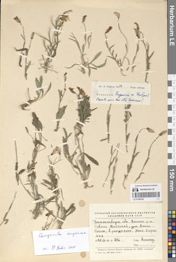
LE 01290329
Groups of specimens: Образцы сектора Средней АзииRecord creation: 2024-08-04, Daria Yudova, PhotoScan D2.Citation: Specimen LE 01290329 // Virtual herbarium of Komarov Botanical Institute RAS — http://re.herbariumle.ru/01290329
LE 01290457
Asyneuma campanuloides (M. Bieb. ex Sims) Bornm. det. Fedorov, Andrey Aleksandrovich at 1954
Collectors: Radde, Gustav Ferdinand Richard Johannes von Field collecting number: 250. Collection date: 29.07.1885. Administrative regions: RU - Dagestan. Groups of specimens: Образцы сектора Кавказа; Соглашение Минобрнауки №075-15-2021-1056Original label text:Leg. G. Radde 29.VII.1885
Coordinates (geographic position): 42° 32′ 42.61″ N, 46° 42′ 53.29″ ERecord creation: 2024-08-04, Daria Yudova, PhotoScan D2.Citation: Specimen LE 01290457 // Virtual herbarium of Komarov Botanical Institute RAS — http://re.herbariumle.ru/01290457Caucasus - Chunsach, 5500 - 6000'.
LE 01290328
Groups of specimens: Образцы сектора Средней АзииRecord creation: 2024-08-04, Daria Yudova, PhotoScan D2.Citation: Specimen LE 01290328 // Virtual herbarium of Komarov Botanical Institute RAS — http://re.herbariumle.ru/01290328
LE 01290456
Asyneuma campanuloides (M. Bieb. ex Sims) Bornm. det. Fedorov, Andrey Aleksandrovich at 1954
Collectors: Massagetov, Pitirim Sergeevich Collection date: 18.07.1903. Administrative regions: GE - Georgia. Groups of specimens: Образцы сектора Кавказа; Соглашение Минобрнауки №075-15-2021-1056Original label text:Бакуриани. ["..."]
18.VII.1903П. С. Массагетов
Georgia, Bakuriani.
Record creation: 2024-08-04, Daria Yudova, PhotoScan D2.Citation: Specimen LE 01290456 // Virtual herbarium of Komarov Botanical Institute RAS — http://re.herbariumle.ru/0129045618.07.1903
Coll. P. S. Massagetov
LE 01290327
Groups of specimens: Образцы сектора Средней АзииRecord creation: 2024-08-04, Daria Yudova, PhotoScan D2.Citation: Specimen LE 01290327 // Virtual herbarium of Komarov Botanical Institute RAS — http://re.herbariumle.ru/01290327
LE 01290455
Asyneuma campanuloides (M. Bieb. ex Sims) Bornm. det. Fedorov, Andrey Aleksandrovich at 1954
Collectors: Bordzilowski, Eugen Iwanowitsch Collection date: 04.07.1907. Administrative regions: GE - Georgia. Groups of specimens: Образцы сектора Кавказа; Соглашение Минобрнауки №075-15-2021-1056Original label text:Transcaucasia. Armenia Rossica.
Coordinates (geographic position): 41° 25′ 17.31″ N, 43° 34′ 1.54″ ERecord creation: 2024-08-04, Daria Yudova, PhotoScan D2.Citation: Specimen LE 01290455 // Virtual herbarium of Komarov Botanical Institute RAS — http://re.herbariumle.ru/01290455Distr. Akhalkalaki. In prato in decliviis angustiarum Busawetensium in via ex Akhalkalaki versus pagum Busawet [= Buzaveti].
4.VII.1907
Eug. Bordzilowski
LE 01290326
Groups of specimens: Образцы сектора Средней АзииRecord creation: 2024-08-04, Daria Yudova, PhotoScan D2.Citation: Specimen LE 01290326 // Virtual herbarium of Komarov Botanical Institute RAS — http://re.herbariumle.ru/01290326
LE 01290454
Asyneuma campanuloides (M. Bieb. ex Sims) Bornm. det. Fedorov, Andrey Aleksandrovich at 1954
Collectors: Busch, Elizaveta Aleksandrovna Collection date: 24.06.1908. Administrative regions: RU - Karachayevo-Cherkesiya. Groups of specimens: Образцы сектора Кавказа; Соглашение Минобрнауки №075-15-2021-1056Original label text:Prov. Kuban. In sylva frondosa ad ripam sinistram fluminid Teberda. 4200'.
Record creation: 2024-08-04, Daria Yudova, PhotoScan D2.Citation: Specimen LE 01290454 // Virtual herbarium of Komarov Botanical Institute RAS — http://re.herbariumle.ru/0129045424.VI. (7.VII). 1908
Leg. et determ. Elis. Busch
LE 01290325
Groups of specimens: Образцы сектора Средней АзииRecord creation: 2024-08-04, Daria Yudova, PhotoScan D2.Citation: Specimen LE 01290325 // Virtual herbarium of Komarov Botanical Institute RAS — http://re.herbariumle.ru/01290325
LE 01290453
Asyneuma campanuloides (M. Bieb. ex Sims) Bornm. det. Fedorov, Andrey Aleksandrovich at 1954
Field collecting number: 114. Collection date: 1872. Administrative regions: RU - Dagestan. Groups of specimens: Образцы сектора Кавказа; Соглашение Минобрнауки №075-15-2021-1056Original label text:Leg. J. Faust 1872
Coordinates (geographic position): 41° 17′ 26.37″ N, 47° 49′ 24.83″ ERecord creation: 2024-08-04, Daria Yudova, PhotoScan D2.Citation: Specimen LE 01290453 // Virtual herbarium of Komarov Botanical Institute RAS — http://re.herbariumle.ru/01290453Daghestan australis - Kurusch 8 - 12000'.
LE 01290324
Groups of specimens: Образцы сектора Средней АзииRecord creation: 2024-08-04, Daria Yudova, PhotoScan D2.Citation: Specimen LE 01290324 // Virtual herbarium of Komarov Botanical Institute RAS — http://re.herbariumle.ru/01290324
LE 01290452
Asyneuma campanuloides (M. Bieb. ex Sims) Bornm. det. Fedorov, Andrey Aleksandrovich at 1954
Collectors: Elenevsky, Richard Apollinarievich Collection date: 12.07.1940. Administrative regions: RU - Dagestan. Groups of specimens: Образцы сектора Кавказа; Соглашение Минобрнауки №075-15-2021-1056Original label text:Дагестан. Село Куруш. Субальпийский луг.
Coordinates (geographic position): 41° 17′ 4.39″ N, 47° 49′ 35.01″ EComment: 12/7 1940
Р. Еленевский
Dagestan. Village Kurush. Subalpine meadow.
Record creation: 2024-08-04, Daria Yudova, PhotoScan D2.Citation: Specimen LE 01290452 // Virtual herbarium of Komarov Botanical Institute RAS — http://re.herbariumle.ru/0129045212.07.1940
Coll. R. Elenevsky
LE 01290323
Groups of specimens: Образцы сектора Средней АзииRecord creation: 2024-08-04, Daria Yudova, PhotoScan D2.Citation: Specimen LE 01290323 // Virtual herbarium of Komarov Botanical Institute RAS — http://re.herbariumle.ru/01290323
LE 01290451
Asyneuma campanuloides (M. Bieb. ex Sims) Bornm. det. Fedorov, Andrey Aleksandrovich at 1954
Collectors: Becker, Alexander K. Field collecting number: 310. Collection date: 1873. Administrative regions: RU - Dagestan. Groups of specimens: Образцы сектора Кавказа; Соглашение Минобрнауки №075-15-2021-1056Original label text:310
Coordinates (geographic position): 41° 32′ 29.33″ N, 47° 46′ 0.29″ ERecord creation: 2024-08-04, Daria Yudova, PhotoScan D2.Citation: Specimen LE 01290451 // Virtual herbarium of Komarov Botanical Institute RAS — http://re.herbariumle.ru/01290451Leg. A. Becker 1873
Daghestan - Inter Kurach et Kro [= Gra?].
LE 01290322
Groups of specimens: Образцы сектора Средней АзииRecord creation: 2024-08-04, Daria Yudova, PhotoScan D2.Citation: Specimen LE 01290322 // Virtual herbarium of Komarov Botanical Institute RAS — http://re.herbariumle.ru/01290322
LE 01290450
Asyneuma campanuloides (M. Bieb. ex Sims) Bornm.
Collectors: Konechnaya, Galina Yurievna; Haare, Ado Oskarovich Collection date: 07.07.1991. Administrative regions: RU - Respublika Adygeya. Groups of specimens: Образцы сектора Кавказа; Соглашение Минобрнауки №075-15-2021-1056Original label text:Северный Кавказ, Адыгея, 70 км на юг от Майкопа, Лагонаки. Подножье. 4 км на СЗ от горы Фишт, западный склон, субальпика, 1800 м н.у.м.
Coordinates (geographic position): 43° 56′ 50.61″ N, 39° 53′ 35.99″ EComment: 7.07.1991
Г. Ю. Конечная, А. О. Хааре
Northern Caucasus, Adygea, 70 km south of Maykop, Lagonaki. 4 km NW from Mount Fisht, western slope, subalpine, 1800 m above sea level.
Record creation: 2024-08-04, Daria Yudova, PhotoScan D2.Citation: Specimen LE 01290450 // Virtual herbarium of Komarov Botanical Institute RAS — http://re.herbariumle.ru/012904507.07.1991
Coll. G. Yu. Konechnaya, A. O. Haare
LE 01290321
Groups of specimens: Образцы сектора Средней АзииRecord creation: 2024-08-04, Daria Yudova, PhotoScan D2.Citation: Specimen LE 01290321 // Virtual herbarium of Komarov Botanical Institute RAS — http://re.herbariumle.ru/01290321
LE 01290449
Asyneuma campanuloides (M. Bieb. ex Sims) Bornm.
Collectors: Konechnaya, Galina Yurievna; Haare, Ado Oskarovich Collection date: 29.07.1992. Administrative regions: RU - Kabardino-Balkarskaya Respublika. Groups of specimens: Образцы сектора Кавказа; Соглашение Минобрнауки №075-15-2021-1056Original label text:Кабардино-Балкарская Республика, гора Эльбрус, ЮВ макросклон. Над селом Терскол, луг у соснового редколесья, южный склон, 2240 м н.у.м.
Coordinates (geographic position): 43° 17′ 57.07″ N, 42° 29′ 2.07″ E 2240 m a.s.l.Comment: 29.VII.1992
Собр. Г. Ю. Конечная, А. О. Хааре
Kabardino-Balkarian Republic, Mount Elbrus, SE macroslope. Above the village of Terskol, meadow near pine woodland, southern slope, 2240 m above sea level.
Record creation: 2024-08-04, Daria Yudova, PhotoScan D2.Citation: Specimen LE 01290449 // Virtual herbarium of Komarov Botanical Institute RAS — http://re.herbariumle.ru/0129044929.07.1992
Coll. G. Yu. Konechnaya, A. O. Haare
LE 01290320
Groups of specimens: Образцы сектора Средней АзииRecord creation: 2024-08-04, Daria Yudova, PhotoScan D2.Citation: Specimen LE 01290320 // Virtual herbarium of Komarov Botanical Institute RAS — http://re.herbariumle.ru/01290320
LE 01290448
Asyneuma campanuloides (M. Bieb. ex Sims) Bornm.
Collectors: Konechnaya, Galina Yurievna; Haare, Ado Oskarovich Collection date: 18.07.1981. Administrative regions: RU - Karachayevo-Cherkesiya. Groups of specimens: Образцы сектора Кавказа; Соглашение Минобрнауки №075-15-2021-1056Original label text:Карачаево-Черкесская А. О. От Кисловодска 8 км на юг; горный луг, 1200 м н.у.м.
18.VII.1981
Собр. Г. Ю. Конечная, А. О. Хааре
Karachayevo-Cherkesiya
Record creation: 2024-08-04, Daria Yudova, PhotoScan D2.Citation: Specimen LE 01290448 // Virtual herbarium of Komarov Botanical Institute RAS — http://re.herbariumle.ru/01290448From Kislovodsk 8 km to the south; mountain meadow, 1200 m above sea level
18.07.1981
Coll. G. Yu. Konechnaya, A. O. Haare
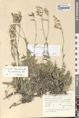
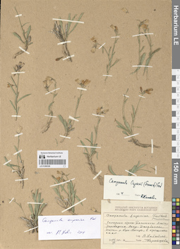
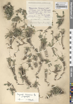
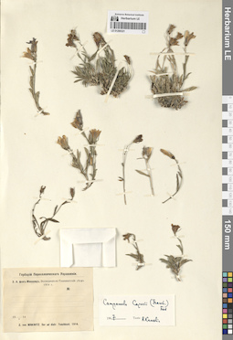
LE 01290319
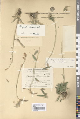
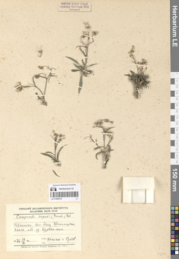
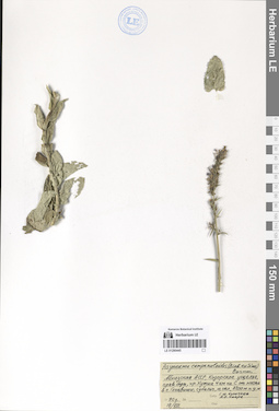
Campanula lehmanniana Bunge
Additional identifications: Campanula capusii (Franch.) Fed. det. Kamelin, Rudolph Vladimirovich Collectors: Botschantzev, Victor Petrovič Field collecting number: 112. Collection date: 15.07.1962. Administrative regions: KG - Kyrgyzstan. Groups of specimens: Образцы сектора Средней АзииOriginal label text:Алайский хребет. Междуречье Исфара-Сох. Ущелье Кара-куль к ЮЗ от кишлака Кара-булак. На известняковых скалах.
Coordinates (geographic position): 39° 54′ 5.2″ N, 70° 52′ 40.06″ EComment: № 112
15.VII.1962
Бочанцев В. П.
Alay Range. Isfara-Sokh interfluve. Kara-Kul Gorge to the southwest of Kara-bulak village. On limestone cliffs.
№ 112
15.07.1962
Coll. V. P. Botschantzev
LE 01290447
Asyneuma campanuloides (M. Bieb. ex Sims) Bornm.
Collectors: Konechnaya, Galina Yurievna; Haare, Ado Oskarovich Collection date: 27.07.1981. Administrative regions: GE - Georgia. Groups of specimens: Образцы сектора Кавказа; Соглашение Минобрнауки №075-15-2021-1056Original label text:Грузинская ССР. От поселка Казбеги 2 км на ЗСЗ; субальпийский луг, 1900 м н.у.м.
Coordinates (geographic position): 42° 39′ 42.87″ N, 44° 36′ 50.6″ EComment: 27.VII.81
Конечная Г. Ю., Хааре А. О.
Georgia, from the village of Kazbegi [= Stepantsminda] 2 km to the west-northwest; subalpine meadow, 1900 m above sea level
Record creation: 2024-08-04, Daria Yudova, PhotoScan D2.Citation: Specimen LE 01290447 // Virtual herbarium of Komarov Botanical Institute RAS — http://re.herbariumle.ru/0129044727.07.1981
Coll. G. Yu. Konechnaya, A. O. Haare
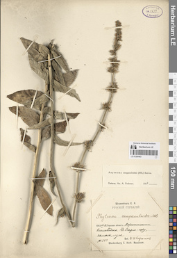
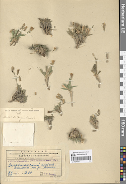
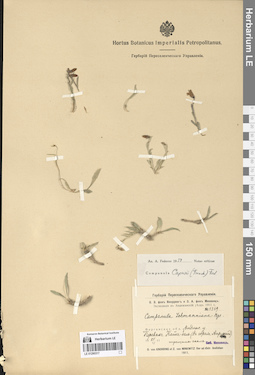
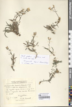
LE 01290318
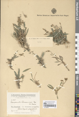
Campanula capusii (Franch.) Fed.
Collectors: Kamelin, Rudolph Vladimirovich; Pratov, Uktam Pratovich Collection date: 19.07.1976. Groups of specimens: Образцы сектора Средней АзииOriginal label text:Узбекистан, бассейн Аксу, Шахимардан, скалы наз озером Курбан-куль.
Record creation: 2024-08-04, Daria Yudova, PhotoScan D2.Citation: Specimen LE 01290318 // Virtual herbarium of Komarov Botanical Institute RAS — http://re.herbariumle.ru/0129031819.VII.1976
Камелин и Пратов
LE 01290446
Asyneuma campanuloides (M. Bieb. ex Sims) Bornm.
Collectors: Konechnaya, Galina Yurievna; Haare, Ado Oskarovich Collection date: 05.08.1992. Administrative regions: RU - Kabardino-Balkarskaya Respublika. Groups of specimens: Образцы сектора Кавказа; Соглашение Минобрнауки №075-15-2021-1056Original label text:Кабардино-Балкарская Республика. Главный Кавказский хребет, северный склон. Приэльбрусье. 2 км на ЮЮВ от села Терскол, луг в лесном поясе, 2100 м н.у.м.
Coordinates (geographic position): 43° 14′ 25.58″ N, 42° 32′ 1.29″ E 2100 m a.s.l.Comment: 5.VIII.1992
Собр. Г. Ю. Конечная, А. О. Хааре
Kabardino-Balkarian Republic. Main Caucasus ridge, northern slope. Elbrus region. 2 km to the south-southeast from the village of Terskol, meadow in the forest belt, 2100 m above sea level.
Record creation: 2024-08-04, Daria Yudova, PhotoScan D2.Citation: Specimen LE 01290446 // Virtual herbarium of Komarov Botanical Institute RAS — http://re.herbariumle.ru/012904465.08.1992
Coll. G. Yu. Konechnaya, A. O. Haare
LE 01290317
Groups of specimens: Образцы сектора Средней АзииRecord creation: 2024-08-04, Daria Yudova, PhotoScan D2.Citation: Specimen LE 01290317 // Virtual herbarium of Komarov Botanical Institute RAS — http://re.herbariumle.ru/01290317
LE 01290445
Asyneuma campanuloides (M. Bieb. ex Sims) Bornm.
Collectors: Konechnaya, Galina Yurievna; Haare, Ado Oskarovich Collection date: 19.08.1990. Administrative regions: GE - Abkhazia. Groups of specimens: Образцы сектора Кавказа; Соглашение Минобрнауки №075-15-2021-1056Original label text:Абхазская АССР, Кодорское ущелье, правый борт, хребет Хутиа 4 км на С от моста в с. Генцвиши; субальп., ю. склон, 2200 м н.у.м.
Coordinates (geographic position): 43° 10′ 16.04″ N, 41° 47′ 40.94″ EComment: 19.VIII.1990
Г. Ю. Конечная, А. О. Хааре
Abkhazia, right side of the Kodori Gorge, Khutia ridge 4 km to the north from the bridge in the village Gentsvishi; subalps, south slope, 2200 m above sea level.
Record creation: 2024-08-04, Daria Yudova, PhotoScan D2.Citation: Specimen LE 01290445 // Virtual herbarium of Komarov Botanical Institute RAS — http://re.herbariumle.ru/0129044519.08.1990
Coll. G. Yu. Konechnaya, A. O. Haare
LE 01290316
Groups of specimens: Образцы сектора Средней АзииRecord creation: 2024-08-04, Daria Yudova, PhotoScan D2.Citation: Specimen LE 01290316 // Virtual herbarium of Komarov Botanical Institute RAS — http://re.herbariumle.ru/01290316
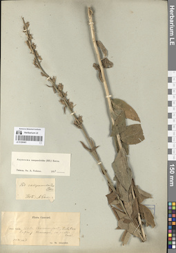
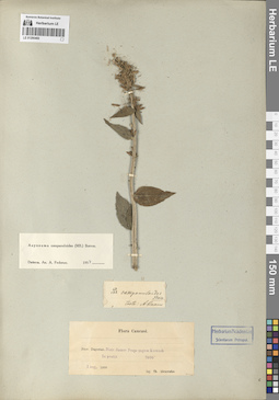
LE 01290444
Asyneuma campanuloides (M. Bieb. ex Sims) Bornm. det. Oganesjan (Oganesian), M. E. at 1997
Collectors: Menitsky, Yuri Leonardovich; Popova, Tamara Nikitichna Field collecting number: 31. Collection date: 09.08.1988. Administrative regions: RU - Kabardino-Balkarskaya Respublika. Groups of specimens: Образцы сектора Кавказа; Соглашение Минобрнауки №075-15-2021-1056Original label text:Северный Кавказ, Кабардино-Балкария, Советский район, правый борт Черека Безенгийского, 1 км выше сел. Безенги.
Coordinates (geographic position): 43° 12′ 2.16″ N, 43° 15′ 42.91″ EComment: 9.VIII.1988
№ 31
Ю. Меницкий, М. Оганесян
Northern Caucasus, Kabardino-Balkaria, Sovetsky district, Cherek Bezengiysky, 1 km above the village of Bezengi.
Record creation: 2024-08-04, Daria Yudova, PhotoScan D2.Citation: Specimen LE 01290444 // Virtual herbarium of Komarov Botanical Institute RAS — http://re.herbariumle.ru/012904449.08.1988
Coll. Yu. L. Menitsky, T. N. Popova
LE 01290315
Groups of specimens: Образцы сектора Средней АзииRecord creation: 2024-08-04, Daria Yudova, PhotoScan D2.Citation: Specimen LE 01290315 // Virtual herbarium of Komarov Botanical Institute RAS — http://re.herbariumle.ru/01290315
LE 01290443
Asyneuma campanuloides (M. Bieb. ex Sims) Bornm.
Collectors: Marcowicz, Vasilii Vasilevicz Collection date: 03.07.1899. Groups of specimens: Образцы сектора Кавказа; Соглашение Минобрнауки №075-15-2021-1056Original label text:Caucasus. Ossetia, in pratis alpinis.
Record creation: 2024-08-04, Daria Yudova, PhotoScan D2.Citation: Specimen LE 01290443 // Virtual herbarium of Komarov Botanical Institute RAS — http://re.herbariumle.ru/012904433.VII.99
6000 f.
Marcowitsch
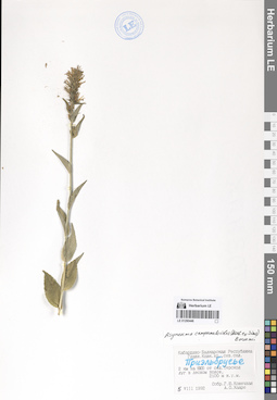
LE 01290442
Asyneuma campanuloides (M. Bieb. ex Sims) Bornm. det. Haare, Ado Oskarovich at 10.1979
Collectors: Zaitseva, L. Collection date: 13.07.1979. Administrative regions: RU - Krasnodarskiy Kray. Groups of specimens: Образцы сектора Кавказа; Соглашение Минобрнауки №075-15-2021-1056Original label text:Краснодарский край, Музорекский район, от станицы Даховская 20 км на ЮЗ, Лагонаки, более 1000 м н.у.м., высокогорный (альпийский) луг, пастбище.
Coordinates (geographic position): 44° 4′ 54.12″ N, 39° 59′ 25.13″ EComment: 13.VII.1979
Зайцева Л. П.
Krasnodar region, from the village of Dakhovskaya 20 km to the southwest, Lagonaki, more than 1000 m above sea level, high-mountain (alpine) meadow, pasture.
Record creation: 2024-08-04, Daria Yudova, PhotoScan D2.Citation: Specimen LE 01290442 // Virtual herbarium of Komarov Botanical Institute RAS — http://re.herbariumle.ru/0129044213.07.1979
Coll. L. P. Zaitseva
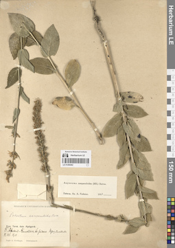
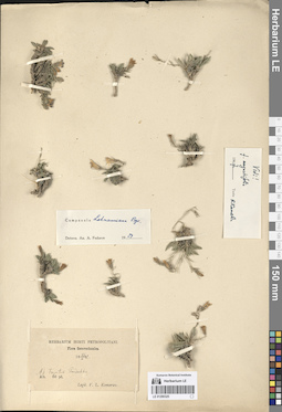
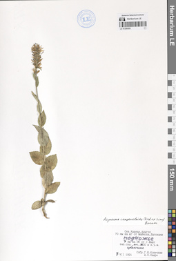
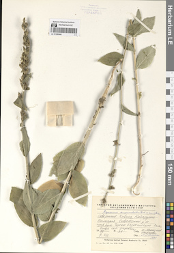
LE 01290314
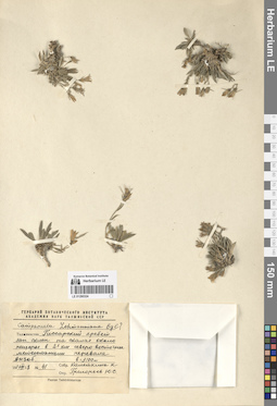
Campanula lehmanniana Bunge
Collectors: Drobow, Vasilii Petrovich Field collecting number: 272. Collection date: 25.07.1915. Groups of specimens: Образцы сектора Средней АзииRecord creation: 2024-08-04, Daria Yudova, PhotoScan D2.Citation: Specimen LE 01290314 // Virtual herbarium of Komarov Botanical Institute RAS — http://re.herbariumle.ru/01290314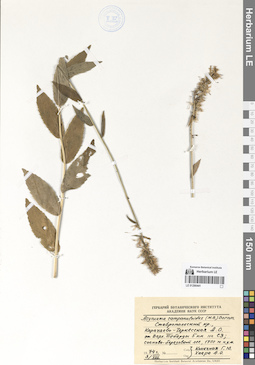
LE 01290441
Asyneuma campanuloides (M. Bieb. ex Sims) Bornm.
Collectors: Konechnaya, Galina Yurievna; Haare, Ado Oskarovich Collection date: 03.08.1974. Administrative regions: RU - Karachayevo-Cherkesiya. Groups of specimens: Образцы сектора Кавказа; Соглашение Минобрнауки №075-15-2021-1056Original label text:Ставропольский край, Карачаево-Черкесская А. О. От Верхней Теберды 5 км на СЗ; сосново-березовый лес, 1700 м н.у.м.
Coordinates (geographic position): 43° 34′ 33.7″ N, 41° 50′ 46.12″ E 1700 m a.s.l.Comment: 3.VIII.1974
Г. Ю. Конечная, А. О. Хааре
Karachayevo-Cherkesiya. From Verkhnyaya Teberda 5 km to the north-west; pine-birch forest, 1700 m a.s.l.
Record creation: 2024-08-04, Daria Yudova, PhotoScan D2.Citation: Specimen LE 01290441 // Virtual herbarium of Komarov Botanical Institute RAS — http://re.herbariumle.ru/012904413.08.1974
Coll. G. Yu. Konechnaya, A. O. Haare
LE 01290313
Groups of specimens: Образцы сектора Средней АзииRecord creation: 2024-08-04, Daria Yudova, PhotoScan D2.Citation: Specimen LE 01290313 // Virtual herbarium of Komarov Botanical Institute RAS — http://re.herbariumle.ru/01290313
LE 01290440
Asyneuma campanuloides (M. Bieb. ex Sims) Bornm.
Collectors: Merello, M.; Stone, J.; Chiboshvili, M. Field collecting number: 2435. Collection date: 03.07.1999. Groups of specimens: Образцы сектора Кавказа; Соглашение Минобрнауки №075-15-2021-1056Original label text:Mtiuleti
Coordinates (geographic position): 42° 43′ 52″ N, 44° 37′ 34″ ERecord creation: 2024-08-04, Daria Yudova, PhotoScan D2.Citation: Specimen LE 01290440 // Virtual herbarium of Komarov Botanical Institute RAS — http://re.herbariumle.ru/01290440Khevi, Kazbegi area. North of town of Kazbegi, on military road to Russian border, through the Dariali Gorge, forested patches of Pinus and Populus in upper slopes; base of rocky mountains along Tegri River and roadsides. Grassy and rocky slopes.
42° 43′ 52″ N, 44° 37′ 34″ E 1380 - 1500 m.
Erect herb to 1 m tall; corollas blue with petals lighter on outside than inside. White latex in plant.
3 July 1999
M. Merello, J. Stone, M. Chiboshvili 2435