View
Add
Copy
Edit
Delete
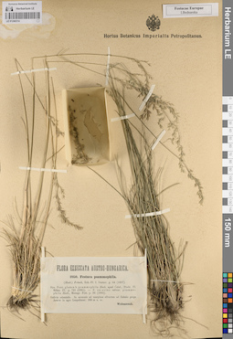
LE 01240314
Festuca psammophila (Hackel) Krajina det. Woloszczak, Eustach
Collectors: Woloszczak, Eustach Field collecting number: 3950. Collection date: 1900. Administrative regions: UA - L'vivs'ka Oblast'. Subregion: Яворовский район. Place of collection: Залесье возле пос. Ивано-Франково, опушка леса.Groups of specimens: Образцы сектора Восточной Европы; Соглашение Минобрнауки №075-15-2021-1056; Flora Exsiccata Austro-HungaricaOriginal label text:Flora exsiccata Austro-Hungarica. 3950. Festuca psammophila. (Hack.) Fritsch, Exk.-Fl. f. Oesterr. p. 64 (1897). Syn. Fest. glauca b. psammophila Hack. apud Čelak., Prodr. Fl. Böhm. IV, p. 721 (1881). - F. eu-ovina subvar. psammophila Hack., Monogr. Fest. p. 96 (1882). Galicia orientalis. In arenosis ad margines silvarum ad Zalesie prope Jawow in agro Leopoliensi; 200 m s.m. Woloszczak
Habitat / plant community in location of collecting: опушка лесаSubstrate in collecting location: песокCoordinates (geographic position): 49° 55′ 13.23″ N, 23° 44′ 5.22″ E ±15000 m 200 m a.s.l.Record creation: 2023-07-05, Artyom Borodushkin, PhotoScan D2.Citation: Specimen LE 01240314 // Virtual herbarium of Komarov Botanical Institute RAS — http://re.herbariumle.ru/01240314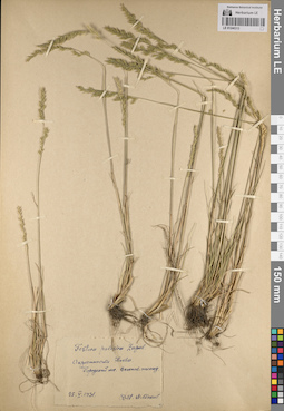
LE 01240313
Festuca polesica Zapał. det. Klokov, Michail Vasilijevich at 1931
Collectors: Klokov, Michail Vasilijevich Field collecting number: s.n. Collection date: 25.05.1931. Administrative regions: UA - Kyiv Oblast. Place of collection: окрестности г. Киев, городской лес, сосновые насаждения.Groups of specimens: Образцы сектора Восточной Европы; Соглашение Минобрнауки №075-15-2021-1056Original label text:Festuca polesica Zapal. Окрестности Киева. Городской лес. В соснов. насажд. 25.V.1931 Det. M. Klokav
Habitat / plant community in location of collecting: городской лес, сосновые насажденияCoordinates (geographic position): 50° 27′ 1.59″ N, 30° 31′ 24.78″ E ±30000 mRecord creation: 2023-07-05, Artyom Borodushkin, PhotoScan D2.Citation: Specimen LE 01240313 // Virtual herbarium of Komarov Botanical Institute RAS — http://re.herbariumle.ru/01240313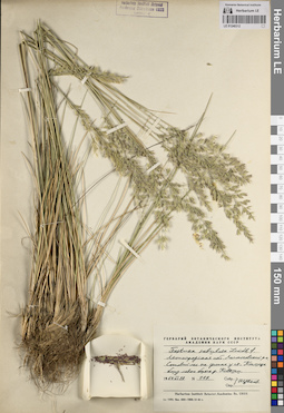
LE 01240312
Festuca sabulosa Lindb.f. det. Tzvelev, Nikolai Nikolaievich at 1964
Collectors: Tzvelev, Nikolai Nikolaievich Field collecting number: 119. Collection date: 28.06.1964. Administrative regions: RU - Leningradskaya Oblast' - Lomonosovskiy Rayon. Place of collection: сосновый лес на дюнах у ж.д. ст. Калище близ левого берега р. Коваши.Groups of specimens: Образцы сектора Восточной Европы; Соглашение Минобрнауки №075-15-2021-1056; Гербарий Ботанического Института Академии наук СССРOriginal label text:Гербарий Ботанического института Академии наук СССР. Festuca sabulosa Lindb. f. Ленинградская обл. Ломоносовский р-н. Сосновый лес на дюнах у ст. Калище близ левого берега р. Коваши. 1964 VI 28. N 119. Собр. Опр. Н. Цвелев
Landscape in location of collection: песчаные дюны близ левого берега рекиHabitat / plant community in location of collecting: соснякSubstrate in collecting location: песокCoordinates (geographic position): 59° 53′ 17.88″ N, 29° 3′ 57.99″ E ±1000 mRecord creation: 2023-07-05, Artyom Borodushkin, PhotoScan D2.Citation: Specimen LE 01240312 // Virtual herbarium of Komarov Botanical Institute RAS — http://re.herbariumle.ru/01240312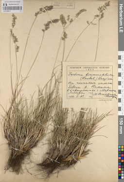
LE 01240311
Festuca psammophila (Hackel) Krajina det. Natkevshaite-Ivanauskis, M.
Collectors: Natkevshaite-Ivanauskis, M. Field collecting number: s.n. Collection date: 31.05.1966. Administrative regions: LT - Alytus County - Alytaus rajonas. Place of collection: песчаный склон берега р. Неман в окрестностях г. Меркине, Литва.Groups of specimens: Образцы сектора Восточной Европы; Соглашение Минобрнауки №075-15-2021-1056; Herbarium Universitatis Vilnensis LRSSOriginal label text:Herbarium Universitatis Vilnensis LRSS. Festuca psammophila (Hackel) Krajina. На песчаном склоне берега р. Немана в окрестностях г. Меркине, Литва. 1966.V.31. Leg. Det. М. Наткевшайте-Иванаускис
Landscape in location of collection: песчаный склон берега рекиSubstrate in collecting location: песокCoordinates (geographic position): 54° 9′ 27.6″ N, 24° 10′ 56.67″ E ±3000 mRecord creation: 2023-07-05, Artyom Borodushkin, PhotoScan D2.Citation: Specimen LE 01240311 // Virtual herbarium of Komarov Botanical Institute RAS — http://re.herbariumle.ru/01240311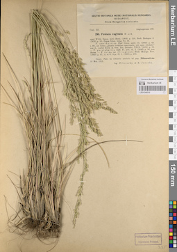
LE 01240310
Festuca vaginata auct. det. Filarszky, Jávorka, Sándor (Alexander) at 1913
Collectors: Filarszky; Jávorka, Sándor (Alexander) Field collecting number: 290. Collection date: 31.05.1913. Administrative regions: HU - Pest megye. Place of collection: Пилишсентиван, Пешт / Piliszentivan.Groups of specimens: Образцы сектора Восточной Европы; Соглашение Минобрнауки №075-15-2021-1056; Flora Hungarica exsiccataOriginal label text:Sectio Botanica Musei Nationalsi Hungarici. Budapest. Flora Hungarica exsiccata. Cent. III. Angiospermae 200. 290. Festuca vaginata W. et K. apud Willd. Enum. horti Berol. (1809) p. 116; Borb. Budapest fl. (1879) p. 53; Degen Gram. hung. No. 34. F. amethystina Host Gram. austr. II (1802) p. 63. t. 89., est forma "glumis fertilibus mucronatis, sub apice ciliolatis" non L., confer Kern. in Oest. Bot. Zeitschr. XXIX. (1879) p. 73. - F. guestphalica Sadl. Fl. pest. ed. 2. (1840) p. 56, non Boenn. - F. ovina var. (7) vaginata Hack. Monogr. Fest. (1882) p. 97; A. et G. Syn. II. 1. (1900) p. 473. Comit. Pest. In robinetis arenosis ad pag. Piliszentivan. 31 Mai. 1913. leg. Filarszky et S. Javorka.
Coordinates (geographic position): 47° 36′ 48.24″ N, 18° 53′ 19.73″ E ±3000 mRecord creation: 2023-07-05, Artyom Borodushkin, PhotoScan D2.Citation: Specimen LE 01240310 // Virtual herbarium of Komarov Botanical Institute RAS — http://re.herbariumle.ru/01240310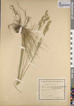
LE 01240309
Festuca taurica (Hack.) A. Kern. ex Trautv. det. Tzvelev, Nikolai Nikolaievich
Additional identifications: Festuca ovina L. det. Onuchin, S.; Festuca sulcata Hack. ⟮s. l.⟯ det. Tzvelev, Nikolai Nikolaievich Collectors: Onuchin, S. Field collecting number: s.n. Collection date: 05.1895. Administrative regions: UA - Mykolayivs'ka Oblast'. Place of collection: окрестности г. Николаев. Лес на песках, степь.Expedition: С. Онучин. Херсонская флора (1895)Groups of specimens: Образцы сектора Восточной Европы; Соглашение Минобрнауки №075-15-2021-1056; Русский гербарий Лесного институтаOriginal label text:Русский Гербарий Лесного Института. Херсонская флора. Festuca ovina L. Festuca sulcata (Hack.) Nym.=F. taurica (Hack.). Николаев. Лески на песках, степь. V 1895 г. Собр. С. Онучин[а]
Habitat / plant community in location of collecting: лес, степьSubstrate in collecting location: песокCoordinates (geographic position): 46° 58′ 32.07″ N, 31° 59′ 37.73″ E ±20000 mRecord creation: 2023-07-05, Artyom Borodushkin, PhotoScan D2.Citation: Specimen LE 01240309 // Virtual herbarium of Komarov Botanical Institute RAS — http://re.herbariumle.ru/01240309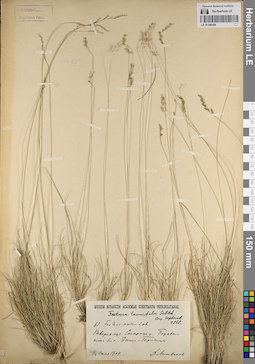
LE 01240308
Festuca tenuifolia Sibth. det. Tzvelev, Nikolai Nikolaievich at 1968
Additional identifications: Festuca ovina L. det. Litvinov, Dimitri Ivanovich at 1904 Collectors: Litvinov, Dimitri Ivanovich Field collecting number: 61. Collection date: 04.07.1904. Administrative regions: RU - Tverskaya Oblast' - Staritskiy Rayon. Place of collection: боровые пески близ с. Городище.Groups of specimens: Образцы сектора Восточной Европы; Соглашение Минобрнауки №075-15-2021-1056; Museum Botanicum Academiae Scientiarum PetropolitanaeOriginal label text:Museum Botanicum Academiae Scientiarum Petropolitanae. Festuca tenuifolia Sibth. Опр. Н. Цвелев. 1968 г. 61. Festuca ovina L. s.l. Тверск. губ. Старицк. у. Боровые пески бл. с. Выш-Городища. 1/4 июля 1904. Д. Литвинов
Habitat / plant community in location of collecting: борSubstrate in collecting location: боровые пескиCoordinates (geographic position): 56° 43′ 40.98″ N, 35° 20′ 48.39″ E ±3000 mRecord creation: 2023-07-05, Artyom Borodushkin, PhotoScan D2.Citation: Specimen LE 01240308 // Virtual herbarium of Komarov Botanical Institute RAS — http://re.herbariumle.ru/01240308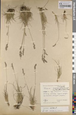
LE 01240307
Festuca ovina var. laevifolia (Hack.) A. Kozl. det. Tzvelev, Nikolai Nikolaievich
Additional identifications: Festuca supina Schur det. Igoschina, Kapitolina Nikolaevna at 1958; Festuca ovina L. det. Alexeev, Evgenii Borisovich at 03.1979 Collectors: Igoschina, Kapitolina Nikolaevna Field collecting number: s.n. Collection date: 23.07.1958. Administrative regions: RU - Perm Krai - Krasnovisherskiy Rayon. Place of collection: Северный Урал, гора Вогульский Камень, горные тундры на нижней нагорной террасе.Expedition: Уральская комплексная экспедиция АН СССР (1939 -1958)Groups of specimens: Образцы сектора Восточной Европы; Соглашение Минобрнауки №075-15-2021-1056Original label text:Уральская Комплексная Экспедиция АН СССР. Festuca supina Schur = F. ruprechtii ovina L. var. laevifolia (Hack.) A. Kozl. Северн. Урал. гора Вогульский Камень 60°18' сш, 59°10' вд. Горные тундры на нижней нагорной террасе. 23 VII 1958. Собр. Опр. К.Н. Игошина
Landscape in location of collection: нижняя нагорная террасаHabitat / plant community in location of collecting: горная тундраCoordinates (geographic position): 60° 18′ 0″ N, 59° 10′ 0″ E ±30000 mRecord creation: 2023-07-05, Artyom Borodushkin, PhotoScan D2.Citation: Specimen LE 01240307 // Virtual herbarium of Komarov Botanical Institute RAS — http://re.herbariumle.ru/01240307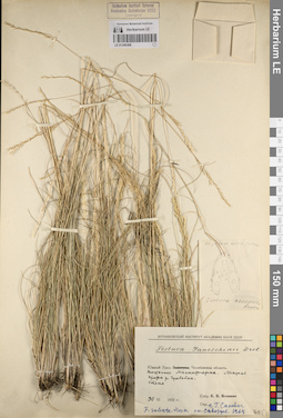
LE 01240306
Festuca ganeschinii Drob. det. Igoschina, Kapitolina Nikolaevna at 1955
Additional identifications: Festuca recognita Reverd. det. Busch; Festuca sulcata Hack. det. Sakovitch, N.H., Skvortsov, Alexei Konstantinovich at 1964 Collectors: Igoschina, Kapitolina Nikolaevna Field collecting number: s.n. Collection date: 30.06.1955. Administrative regions: RU - Chelyabinskaya Oblast' - Nagaybakskiy Rayon. Place of collection: Южный Урал: Челябинская область. Восточнее г. Магнитогорск. Лесостепь. Приток р. Гумбейка. Степь.Groups of specimens: Образцы сектора Восточной Европы; Соглашение Минобрнауки №075-15-2021-1056; Гербарий Ботанического Института Академии наук СССРOriginal label text:Ботанический институт Академии наук СССР. Festuca Ganeschinii Drob. Южный Урал: Челябинская область. Восточнее Магнитогорска. Лесостепь. Приток р. Гумбейки. Степь. 30 VI 1955 г. Собр. К.Н. Игошина. Опр. Н.Г. Сакович. F. sulcata Hack. см. Скворцов. 1964
Habitat / plant community in location of collecting: лесостепьCoordinates (geographic position): 53° 47′ 24.49″ N, 59° 35′ 33.69″ E ±60000 mRecord creation: 2023-07-05, Artyom Borodushkin, PhotoScan D2.Citation: Specimen LE 01240306 // Virtual herbarium of Komarov Botanical Institute RAS — http://re.herbariumle.ru/01240306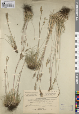
LE 01240305
Festuca pseudovina Hack. ex Wiesb. det. Degen A., de at 1899
Collectors: Degen A., de Field collecting number: 38. Collection date: 01.06.1899. Administrative regions: HU - Hajdu-Bihar. Place of collection: г. Пюшпёкладань / Püspök Ladany.Groups of specimens: Образцы сектора Восточной Европы; Соглашение Минобрнауки №075-15-2021-1056; Gramina HungaricaOriginal label text:Nr. 38. sz. Magyar Füvek Gyüjtemenye. Kiadja a budapesti m. kir. allami vetőmagvizsgalo allomas. Gramina Hungarica edita cura instituti sementi examin. reg. hung. budapestinensis. Festuca pseudovina. Hack Monogr. Festuc. Europ. (1882), p. 103, pro var. F. sulcatae (subvar. typica Hackel l.c.) Syn.: Festuca ovina, Host Gram. Austr. II (1802), t. 86. non L. Festuca ovina, α. vulgaris, Neilr. Fl. v. N.-Oesterr. (1859), p. 73. Festuca duriuscula, α. parviflora, Hack in Act. Mus. nat. hung. II. (1878.), p. 288. Juh-Csenkesz. Berbees Csenkesz. Juhperje. Apr.-Jun. Hajdu megye. Szaraz, szekes agyagon Püspök Ladany körül. Comit. Hajdu. In argillosis natronatis siccis ad Püspök Ladany. Közepszerü legelőfű. Szedte: Legit: Dr. A. de Degen. 1899. VI.1
Substrate in collecting location: сухие глинистые суглинкиCoordinates (geographic position): 47° 18′ 17.6″ N, 21° 6′ 23.07″ E ±3000 mRecord creation: 2023-07-05, Artyom Borodushkin, PhotoScan D2.Citation: Specimen LE 01240305 // Virtual herbarium of Komarov Botanical Institute RAS — http://re.herbariumle.ru/01240305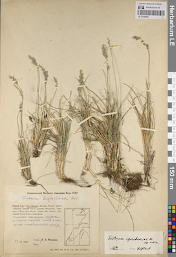
LE 01240304
Paratype of Festuca igoschiniae Tzvelev det. Tzvelev, Nikolai Nikolaievich at 1972
Additional identifications: Festuca kryloviana Reverd. det. Igoschina, Kapitolina Nikolaevna at 1957 Collectors: Igoschina, Kapitolina Nikolaevna Field collecting number: s.n. Collection date: 19.06.1957. Administrative regions: RU - Bashkortostan. Place of collection: Южный Урал: г. Иремель. Нижняя нагорная терраса у северного подножия главной сопки.Groups of specimens: Образцы сектора Восточной Европы; Соглашение Минобрнауки №075-15-2021-1056; Гербарий Ботанического Института Академии наук СССРOriginal label text:Ботанический институт Академии Наук СССР. Festuca kryloviana Rev. Южный Урал: гора Иремель. Нижняя нагорная терраса у северного подножия главной сопки. Горная лишайниковая тундра. 19 VI.1957. Собр. опр. К.Н. Игошина
Landscape in location of collection: нижняя нагорная терраса у северного подножия главной сопкиHabitat / plant community in location of collecting: горная лишайниковая тундраCoordinates (geographic position): 54° 31′ 51.71″ N, 58° 50′ 9.48″ E ±2000 mRecord creation: 2023-07-05, Artyom Borodushkin, PhotoScan D2.Citation: Specimen LE 01240304 // Virtual herbarium of Komarov Botanical Institute RAS — http://re.herbariumle.ru/01240304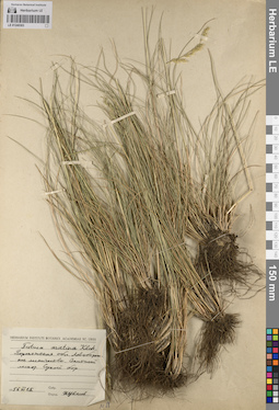
LE 01240303
Festuca arietina Klok. det. Tzvelev, Nikolai Nikolaievich at 1956
Collectors: Tzvelev, Nikolai Nikolaievich Field collecting number: s.n. Collection date: 15.06.1956. Administrative regions: RU - Voronezhskaya Oblast'. Subregion: город Воронеж. Place of collection: г. Воронеж. Левобережное лесничество. Опытный лесхоз. Сухой бор.Groups of specimens: Образцы сектора Восточной Европы; Соглашение Минобрнауки №075-15-2021-1056; Herbarium Instituti Botanici Academiae Sc. URSSOriginal label text:Herbarium Instituti Botanici Academiae Sc. URSS. Festuca arietina Klok. Воронежская обл. Левобережное лесничество. Опытный лесхоз. Сухой бор. 1956 VI 15. Собр. Опред Н. Цвелев
Habitat / plant community in location of collecting: сухой борCoordinates (geographic position): 51° 43′ 50.78″ N, 39° 21′ 37.5″ E ±15000 mRecord creation: 2023-07-05, Artyom Borodushkin, PhotoScan D2.Citation: Specimen LE 01240303 // Virtual herbarium of Komarov Botanical Institute RAS — http://re.herbariumle.ru/01240303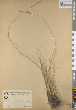
LE 01240302
Festuca callieri (St.-Ives) Markgr. det. Tzvelev, Nikolai Nikolaievich
Additional identifications: Festuca ovina L. det. Busch Collectors: Oettingen, Heinrich von Field collecting number: s.n. Collection date: 22.05.1910. Administrative regions: UA - Luhans'ka Oblast'. Subregion: Старобельский район. Place of collection: с. Новострельцовка, Стрелецкий конный завод, мел.Groups of specimens: Образцы сектора Восточной Европы; Соглашение Минобрнауки №075-15-2021-1056; Museum Botanicum Academiae Scientiarum RossicaeOriginal label text:Museum Botanicum Academiae Scientiarum Rossicae. Festuca callieri (St.-Ives) Markgr. Festuca ovina L. Харьк. губ. Старобельск. у. Стрелецкий завод. Мел. 1910 V-22. Г. фон Эттинген
Substrate in collecting location: мелCoordinates (geographic position): 49° 19′ 9.85″ N, 39° 54′ 48.63″ E ±2000 mRecord creation: 2023-07-05, Artyom Borodushkin, PhotoScan D2.Citation: Specimen LE 01240302 // Virtual herbarium of Komarov Botanical Institute RAS — http://re.herbariumle.ru/01240302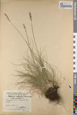
LE 01240301
Festuca callieri ssp. uralensis Tzvelev det. Tzvelev, Nikolai Nikolaievich
Collectors: Juzepczuk, Sergei Vasilievich Field collecting number: 1099. Collection date: 04.08.1948. Administrative regions: UA - Republic of Crimea - Gorodskoy okrug Alushta. Place of collection: Демерджи-яйла.Expedition: Юзепчук. Растения Крыма (1948)Groups of specimens: Образцы сектора Восточной Европы; Соглашение Минобрнауки №075-15-2021-1056; С.В. Юзепчук. Растения Крыма; Гербарий Ботанического института АН СССРOriginal label text:Гербарий Ботанического института АН СССР. С.В. Юзепчук. Растения Крыма. Festuca callieri (Hack.) Mackn. subsp. uralensis m. Демерджи-яйла. - in jaila Demerdzki. 1948.VIII.4. № 1099. Опред. Н. Цвелев. S. Juzepczuk. Plantae Tauricae
Coordinates (geographic position): 44° 46′ 28.35″ N, 34° 23′ 37.95″ E ±2000 mRecord creation: 2023-07-05, Artyom Borodushkin, PhotoScan D2.Citation: Specimen LE 01240301 // Virtual herbarium of Komarov Botanical Institute RAS — http://re.herbariumle.ru/01240301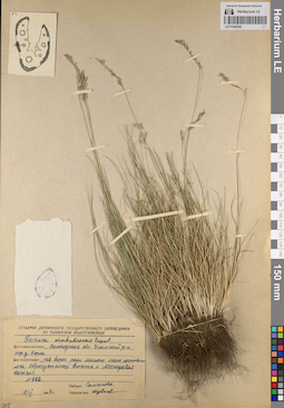
LE 01240300
Festuca makutrensis Zapał. det. Tzvelev, Nikolai Nikolaievich at 1947
Additional identifications: Festuca sp. det. Samsonova at 1947 Collectors: Samsonova Field collecting number: 822. Collection date: 18.06.1947. Administrative regions: RU - Vologodskaya Oblast' - Cherepovetskiy Rayon. Place of collection: Уломское сельское поселение, окрестности дер. Борок, левый берег р. Молога, около соснового леса.Groups of specimens: Образцы сектора Восточной Европы; Соглашение Минобрнауки №075-15-2021-1056; Гербарий Дарвинского государственного заповедника на Рыбинском водохранилищеOriginal label text:Гербарий Дарвинского государственного заповедника на Рыбинском водохранилище. Festuca makutrensis Zapal. Местонахождение Вологодская обл. Уломский р-н. окр. д. Борок. Местообитание лев. берег реки Мологи, около соснового леса. Образует ассоц. вместе с Astragalus danicus. N 822. 18/VI 1947 г. Собрал: Самсонова. Определил: Н. Цвелев
Landscape in location of collection: левый берег рекиHabitat / plant community in location of collecting: ассоциация Festuca makutrensis-Astragalus danicusCoordinates (geographic position): 58° 32′ 29.04″ N, 37° 32′ 31.03″ E ±5000 mRecord creation: 2023-07-05, Artyom Borodushkin, PhotoScan D2.Citation: Specimen LE 01240300 // Virtual herbarium of Komarov Botanical Institute RAS — http://re.herbariumle.ru/01240300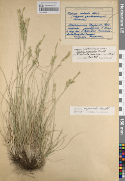
LE 01240299
Festuca rupicola Heuff. ⟨2n=42; = F. sulcata (Hack.) Nym. nom. illeg.⟩ det. Tzvelev, Nikolai Nikolaievich at 1967
Additional identifications: Festuca sulcata Hack. ⟨late-blooming ecotype / позднее зацветающий экотип⟩ det. Rusalova; Festuca rupicola Heuff. det. Alexeev, Evgenii Borisovich at 03.1979 Collectors: Rusalova Field collecting number: s.n. Collection date: 11.06.1966. Administrative regions: RU - Chelyabinskaya Oblast' - Troitskiy Rayon. Place of collection: Лесостепное Зауралье, Троицкий заповедник, степь в 30 км к югу от с. Троицк.Groups of specimens: Образцы сектора Восточной Европы; Соглашение Минобрнауки №075-15-2021-1056; Гербарий Пермского университетаOriginal label text:Гербарий Пермского Университета. Festuca sulcata Hack. (позднее зацветающий экотип). Лесостепное Зауралье, Троицкий заповедник, в 30 км к югу от г. Троицка, типчаково-ковыльная степь. 11/VI-66 г. Русалова
Habitat / plant community in location of collecting: типчаково-ковыльная степьRecord creation: 2023-07-05, Artyom Borodushkin, PhotoScan D2.Citation: Specimen LE 01240299 // Virtual herbarium of Komarov Botanical Institute RAS — http://re.herbariumle.ru/01240299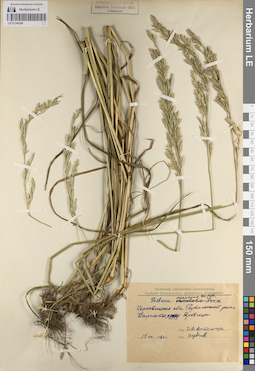
LE 01240298
Festuca apennina De Not. det. Tzvelev, Nikolai Nikolaievich
Additional identifications: Festuca orientalis Kern. det. Artemchuk, Ivan Vlasovich at 1960 Collectors: Artemchuk, Ivan Vlasovich Field collecting number: s.n. Collection date: 15.07.1960. Administrative regions: UA - Chernivets'ka Oblast' - Putyla Raion. Place of collection: Карпаты, хр. Яровец, г. Яровица.Groups of specimens: Образцы сектора Восточной Европы; Соглашение Минобрнауки №075-15-2021-1056; Гербарiй Чернівецького державного університетуOriginal label text:Herbarium Universitatis Cernoviciensis. Гербарий Чернівецького державного університету. Festuca apennina De Not. [orientalis Kern.]. Черновицкая обл. Путильский район. Карпаты, хр. Яровица. 15 VII 1960 р. Leg. И.В. Артемчук. Det. Н. Цвелев
Landscape in location of collection: склон горного хребтаCoordinates (geographic position): 47° 47′ 37.32″ N, 25° 1′ 42.6″ E ±3000 mRecord creation: 2023-07-05, Artyom Borodushkin, PhotoScan D2.Citation: Specimen LE 01240298 // Virtual herbarium of Komarov Botanical Institute RAS — http://re.herbariumle.ru/01240298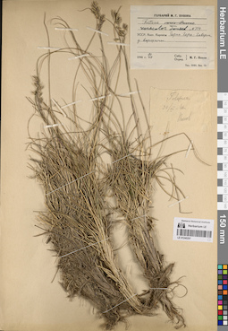
LE 01240297
Festuca versicolor Tausch det. Tzvelev, Nikolai Nikolaievich
Additional identifications: Festuca varia Haenke det. Popov, Mikhail Grigorevich (Popow) at 1946 Collectors: Popov, Mikhail Grigorevich (Popow) Field collecting number: 714. Collection date: 20.07.1946. Administrative regions: UA - Zakarpattia Oblast - Rakhiv Raion. Place of collection: Восточные Карпаты. Черна Гора: г. Говерла, у вершины.Groups of specimens: Образцы сектора Восточной Европы; Соглашение Минобрнауки №075-15-2021-1056; Гербарий М.Г. ПоповаOriginal label text:Гербарий М.Г. Попова Festuca [varia Haenke.] versicolor Tausch N 714. УССР. Вост. Карпаты. Черна Гора: Говерла у вершины. 1946 г. 20 VII. Собр. Опред. М.Г. Попов
Landscape in location of collection: вершина горыCoordinates (geographic position): 48° 9′ 35.02″ N, 24° 29′ 54.46″ E ±300 mRecord creation: 2023-07-05, Artyom Borodushkin, PhotoScan D2.Citation: Specimen LE 01240297 // Virtual herbarium of Komarov Botanical Institute RAS — http://re.herbariumle.ru/01240297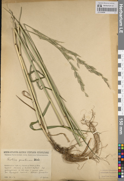
LE 01240296
Festuca pratensis Huds. det. Zubkov, Al. I. at 1928
Collectors: Zubkov, Al. I. Field collecting number: s.n. Collection date: 16.07.1928. Administrative regions: RU - Arkhangel'skaya Oblast' - Pinezhskiy Rayon. Place of collection: Бассейн р. Пинега, р. Юла. Правый приток р. Нижняя Шукша. Луг, расчищенный из-под леса в долине реки.Expedition: Пинежская Научно-исследовательская экспедиция Архангельского Губземуправления (1928)Groups of specimens: Образцы сектора Восточной Европы; Соглашение Минобрнауки №075-15-2021-1056; Museum Botanicum Academiae Scientiarum PetropolitanaeOriginal label text:Museum Botanicum Academiae Scientiarum Petropolitanae. Пинежская Научно-исследов. экспед. Архангельск. Губземуправления. Festuca pratensis Huds. Архангельск. губ. и у. Бассейн р. Пинеги, р. Юла. Правый приток р. Нижняя Шукша. Луг, расчищенный из под леса в долине реки. Асс. Agropyrum caninum-Dactylis glomerata. 1928. VII.-16. А. Зубков
Landscape in location of collection: луг в долине рекиHabitat / plant community in location of collecting: луговая ассоциация Agropyrum caninum-Dactylis glomerataCoordinates (geographic position): 63° 17′ 37.03″ N, 44° 30′ 56.81″ E ±60000 mRecord creation: 2023-07-05, Artyom Borodushkin, PhotoScan D2.Citation: Specimen LE 01240296 // Virtual herbarium of Komarov Botanical Institute RAS — http://re.herbariumle.ru/01240296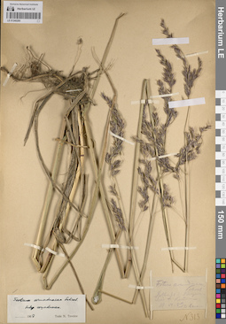
LE 01240295
Festuca arundinacea Schreb. det. Tzvelev, Nikolai Nikolaievich at 1967
Additional identifications: Festuca arundinacea Schreb. det. Lehmann, Ed. at 1889 Collectors: Lehmann, Ed. Field collecting number: 313. Collection date: 19.06.1889. Administrative regions: DE - Bavaria. Place of collection: Kauzern-See bei Kemmern / оз. Каузерн-Зее возле дер. Кеммерн.Groups of specimens: Образцы сектора Восточной Европы; Соглашение Минобрнауки №075-15-2021-1056Original label text:Festuca arundinacea Schreb. Sulbu sul d. Kauzern-See b[ei] Kem[m]ern. 19.VI.89. Ed. Lehmann N 313.
Landscape in location of collection: берег озераCoordinates (geographic position): 49° 57′ 13.21″ N, 10° 52′ 33.93″ E ±5000 mRecord creation: 2023-07-05, Artyom Borodushkin, PhotoScan D2.Citation: Specimen LE 01240295 // Virtual herbarium of Komarov Botanical Institute RAS — http://re.herbariumle.ru/01240295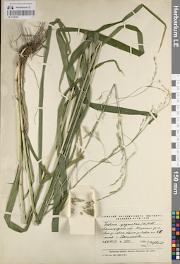
LE 01240294
Festuca gigantea (L.) Vill. det. Tzvelev, Nikolai Nikolaievich at 1964
Collectors: Tzvelev, Nikolai Nikolaievich Field collecting number: 315. Collection date: 07.08.1964. Administrative regions: RU - Leningradskaya Oblast' - Kirovskiy Rayon. Place of collection: лес у левого берега р. Лава в 6 км ниже с. Васильково.Groups of specimens: Образцы сектора Восточной Европы; Соглашение Минобрнауки №075-15-2021-1056; Гербарий Ботанического Института Академии наук СССРOriginal label text:Гербарий Ботанического института Академии наук СССР. Festuca gigantea (L.) Vill. Ленинградская обл. Мгинский р-н. Лес у левого берега р. Лавы км в 6 ниже с. Васильково. 1964 VIII 7. N 315. Собр. Опр. Н. Цвелев. Herbarium Instituti Botanici Academiae Sc. URSS
Landscape in location of collection: левый берег рекиHabitat / plant community in location of collecting: лесCoordinates (geographic position): 59° 50′ 1.91″ N, 31° 38′ 19.32″ E ±1000 mRecord creation: 2023-07-05, Artyom Borodushkin, PhotoScan D2.Citation: Specimen LE 01240294 // Virtual herbarium of Komarov Botanical Institute RAS — http://re.herbariumle.ru/01240294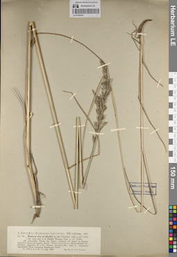
LE 01240293
Festuca porcii Hack. det. Busch
Collectors: Degen A., de Field collecting number: 390. Collection date: 11.08.1902. Administrative regions: RO - Judetul Bistrita-Nasaud. Place of collection: Berges Craciunel bei Rodna im Komitat Besztercze-Naszod in Ungarn / гора Крациунель возле Родна в Бистрице-Нэсэуд, Румыния/быв. Венгрия.Groups of specimens: Образцы сектора Восточной Европы; Соглашение Минобрнауки №075-15-2021-1056; A. Kneucker: Gramineae exsiccatae. XIII. Lieferung. 1903Original label text:A. Kneucker: Gramineae exsiccatae. XIII. Lieferung. 1903. Nr. 390. Festuca Porcii Hackel in Bot. Centralbl. VIII, p. 407 (1881) als nom.nud. u. in Hackel Monogr. Fest. p. 147 (1882). Auf grasreichen Wiesen des Berges Craciunel bei Rodna im Komitat Besztercze-Naszod in Ungarn; Kalk. Begleitpflanzen: Phleum Michelii All., Dianthus compactus W. u K., Festuca Apennina Dnt., rubra L., Alopecurus laguriformis Schur., Centaurea Kotschyana Heuff. Ca. 1400 m u.d.M.; 11.Aug. 1902. leg Dr. A. von Degen
Landscape in location of collection: склон горыCoordinates (geographic position): 47° 25′ 19.74″ N, 24° 48′ 54.87″ E ±3000 mRecord creation: 2023-07-05, Artyom Borodushkin, PhotoScan D2.Citation: Specimen LE 01240293 // Virtual herbarium of Komarov Botanical Institute RAS — http://re.herbariumle.ru/01240293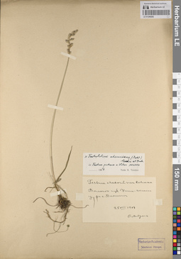
LE 01240292
×Festulolium adscendens (Retz.) Aschers. et Graebn. det. Tzvelev, Nikolai Nikolaievich at 1967
Additional identifications: Festuca elatior var. loliacea (Huds.) Wimm. det. Andreev, V. Collectors: Andreev, V. Field collecting number: s.n. Collection date: 25.08.1908. Administrative regions: RU - Komi - Sysol'skiy Rayon. Place of collection: с. Визинга.Groups of specimens: Образцы сектора Восточной Европы; Соглашение Минобрнауки №075-15-2021-1056Original label text:Festuca elator L. var. loliacea. Вологод. губ. Усть-Сысольс. у. в с. Визинге. 25 VIII 1908. В. Андреев
Coordinates (geographic position): 61° 4′ 33.19″ N, 50° 5′ 8.21″ E ±5000 mRecord creation: 2023-07-05, Artyom Borodushkin, PhotoScan D2.Citation: Specimen LE 01240292 // Virtual herbarium of Komarov Botanical Institute RAS — http://re.herbariumle.ru/01240292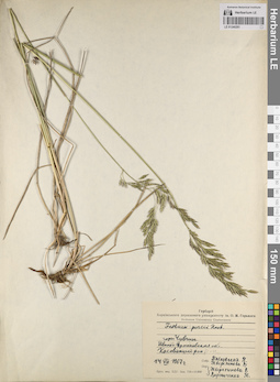
LE 01240291
Festuca porcii Hack. det. Tveritinova, V., Vernichenko, Yu. at 1967
Collectors: Pavlovskaya, N.; Tveritinova, V. Field collecting number: s.n. Collection date: 14.07.1967. Administrative regions: UA - Ivano-Frankivs'ka Oblast'. Subregion: Верховинский район. Place of collection: горы Чивчин.Groups of specimens: Образцы сектора Восточной Европы; Соглашение Минобрнауки №075-15-2021-1056; Гербарий Харьковского государственного университета им. О.М. ГорькогоOriginal label text:Гербарiй Харківського державного університету iм. О.М. Горького. Herbarium Universitatis Charkoviensis. Festuca porcii Hack. горы Чивчин. Ивано-Франковская обл. Касовский р-н. 14 VII 1967 г. Собр. Павловская Н. Тверитинова В. Опр. Тверитинова В. Верниченко Ю.
Landscape in location of collection: горный склонCoordinates (geographic position): 47° 51′ 52.63″ N, 24° 42′ 36.94″ E ±3000 mRecord creation: 2023-07-05, Artyom Borodushkin, PhotoScan D2.Citation: Specimen LE 01240291 // Virtual herbarium of Komarov Botanical Institute RAS — http://re.herbariumle.ru/01240291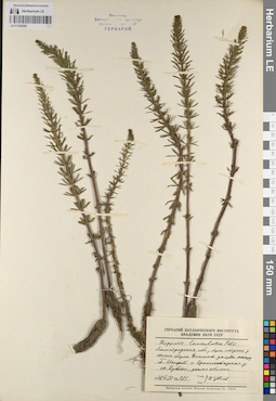
LE 01240290
Hippuris × lanceolata Retz. det. Tzvelev, Nikolai Nikolaievich at 1978
Collectors: Tzvelev, Nikolai Nikolaievich Field collecting number: 185. Collection date: 30.06.1978. Administrative regions: RU - Leningradskaya Oblast' - Lomonosovskiy Rayon. Place of collection: берег лагунки у южного берега Финского залива между ж.д. ст. Большая Ижора и г. Ораниенбаум у ж.д. ст. Дубочки.Groups of specimens: Образцы сектора Восточной Европы; Соглашение Минобрнауки №075-15-2021-1056Original label text:Гербарий Ботанического института Академии наук СССР. Hippuris lanceolata Retz. Ленинградская обл. берег лагунки у южного берега Финского залива между Б. Ижорой и Ораниенбаумом у ст. Дубочки, довольно обильно. 1978 VI 30. № 185. Собр. Опр. Н. Цвелев. Herbarium Instituti Botanici Academiae Sc. URSS
Landscape in location of collection: берег лагунки у южного берега Финского заливаCoordinates (geographic position): 59° 56′ 5.36″ N, 29° 36′ 33.59″ E ±500 mRecord creation: 2023-07-05, Artyom Borodushkin, PhotoScan D2.Citation: Specimen LE 01240290 // Virtual herbarium of Komarov Botanical Institute RAS — http://re.herbariumle.ru/01240290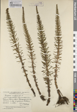
LE 01240289
Hippuris vulgaris L. det. Tzvelev, Nikolai Nikolaievich at 1964
Collectors: Tzvelev, Nikolai Nikolaievich Field collecting number: 139. Collection date: 01.07.1964. Administrative regions: RU - Leningradskaya Oblast' - Lomonosovskiy Rayon. Place of collection: небольшой водоем у берега Копорского залива в 5-6 км южнее устья р. Коваши.Groups of specimens: Образцы сектора Восточной Европы; Соглашение Минобрнауки №075-15-2021-1056; Гербарий Ботанического Института Академии наук СССРOriginal label text:Гербарий Ботанического института Академии наук СССР. Hippuris vulgaris L. s.l. Ленинградская обл. Ломоносовский р-н. Небольшой водоем у берега Копорского залива в 5-6 км к югу от устья р. Коваши. 1964 VII 1. N 139. Собр. Опр. Н. Цвелев. Herbarium Instituti Botanici Academiae Sc. URSS
Landscape in location of collection: небольшой водоем у берега Копорского заливаCoordinates (geographic position): 59° 50′ 29.04″ N, 29° 1′ 40.49″ E ±1000 mRecord creation: 2023-07-05, Artyom Borodushkin, PhotoScan D2.Citation: Specimen LE 01240289 // Virtual herbarium of Komarov Botanical Institute RAS — http://re.herbariumle.ru/01240289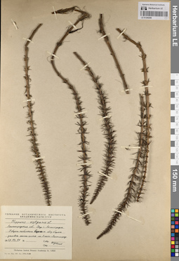
LE 01240288
Hippuris vulgaris L. det. Tzvelev, Nikolai Nikolaievich at 1959
Collectors: Tzvelev, Nikolai Nikolaievich Field collecting number: s.n. Collection date: 19.08.1959. Administrative regions: RU - Sankt-Peterburg - Primorskiy Rayon. Subregion: муниципальный округ Лахта-Ольгино. Place of collection: г. Санкт-Петербург, берег небольшого водоёма близ берега Финского залива южнее Приморского шоссе на участке Лахта-Старая Деревня.Groups of specimens: Образцы сектора Восточной Европы; Соглашение Минобрнауки №075-15-2021-1056; Гербарий Ботанического Института Академии наук СССРOriginal label text:Гербарий Ботанического института Академии наук СССР. Hippuris vulgaris L. Ленинградская обл. Окр. г. Ленинграда. У берега небольшого водоема близ берега залива южнее шоссе пос. Лахта-Ленинград. 1959 VIII 19. Собр. Опр. Н. Цвелев. Herbarium Instituti Botanici Academiae Sc. URSS
Landscape in location of collection: берег небольшого водоёма близ берега Финского заливаCoordinates (geographic position): 59° 59′ 17.35″ N, 30° 11′ 29.57″ E ±5000 mRecord creation: 2023-07-05, Artyom Borodushkin, PhotoScan D2.Citation: Specimen LE 01240288 // Virtual herbarium of Komarov Botanical Institute RAS — http://re.herbariumle.ru/01240288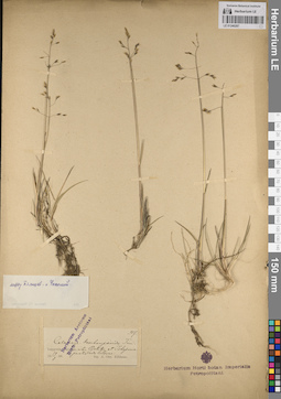
LE 01240287
Calamagrostis deschampsioides Trin. det. Kihlman, A. Osw. at 1889
Collectors: Kihlman, A. Osw. Field collecting number: 957. Collection date: 19.08.1889. Administrative regions: RU - Murmanskaya Oblast' - Terskiy Rayon. Place of collection: сельское поселение Варзуга, между р. Пялица и р. Чапома.Groups of specimens: Образцы сектора Восточной Европы; Соглашение Минобрнауки №075-15-2021-1056; Herbarium Arcticum Horti PetropolitaniOriginal label text:[1] Herbarium Arcticum Horti Petropolitani. 957. Calamagr. deschampsioides Trin. Lapponia Varsugae, inter Pjalitsa et Tshapoma proto udo litores. 19.8.1889. leg. A.Osw. Kihlman. [2] между Пялицей и Чапомой
Landscape in location of collection: междуречье двух рекCoordinates (geographic position): 66° 21′ 49.91″ N, 39° 5′ 55.26″ E ±20000 mRecord creation: 2023-07-05, Artyom Borodushkin, PhotoScan D2.Citation: Specimen LE 01240287 // Virtual herbarium of Komarov Botanical Institute RAS — http://re.herbariumle.ru/01240287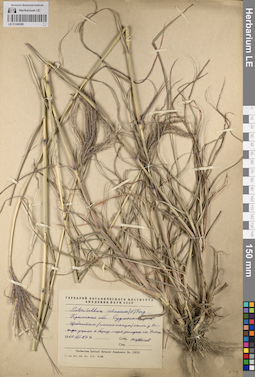
LE 01240286
Bothriochloa ischaemum (L.) Keng det. Tzvelev, Nikolai Nikolaievich
Collectors: Tzvelev, Nikolai Nikolaievich Field collecting number: s.n. Collection date: 27.08.1960. Administrative regions: UA - Republic of Crimea - Gorodskoy okrug Sudak. Place of collection: г. Судак, берег моря западнее кварт. Уютное.Groups of specimens: Образцы сектора Восточной Европы; Соглашение Минобрнауки №075-15-2021-1056; Гербарий Ботанического Института Академии наук СССРOriginal label text:Гербарий Ботанического института Академии наук СССР. Botriochloa ischaemma (L.) Keng. Крымская обл. Судакский р-н. Щебнистый (глинист. сланцы) склон у выхода ущелья к берегу моря западнее пос. Уютное. 1960 VIII 27. Собр. Опр. Н. Цвелев
Landscape in location of collection: щебнистый (глинистые сланцы) склон у выхода ущелья к берегу моряSubstrate in collecting location: глинистые сланцыCoordinates (geographic position): 44° 50′ 19.56″ N, 34° 56′ 58.64″ E ±200 mRecord creation: 2023-07-05, Artyom Borodushkin, PhotoScan D2.Citation: Specimen LE 01240286 // Virtual herbarium of Komarov Botanical Institute RAS — http://re.herbariumle.ru/01240286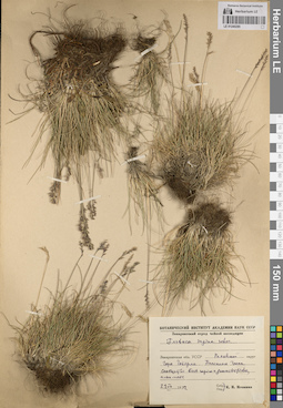
LE 01240285
Festuca supina Schur det. Igoschina, Kapitolina Nikolaevna at 1952
Collectors: Igoschina, Kapitolina Nikolaevna Field collecting number: s.n. Collection date: 29.07.1952. Administrative regions: UA - Zakarpattia Oblast - Rakhiv Raion. Place of collection: г. Говерла, полонина Гропа.Expedition: Закарпатский отряд чайной экспедиции (1949 -1952)Groups of specimens: Образцы сектора Восточной Европы; Соглашение Минобрнауки №075-15-2021-1056Original label text:Ботанический институт Академии наук СССР. Закарпатский отряд чайной экспедиции. Festuca supina Schur. Закарпатская обл. УССР. Раховский округ. Гора Говерла. Полонина Гропа. Сообщество Festuca supina+Juncus trifidus, альп. пояс. 29 VII 1952. Собр. Опр. К.Н. Игошина
Habitat / plant community in location of collecting: сообщество Festuca supina+Juncus trifidus, альпийский поясCoordinates (geographic position): 48° 9′ 36.48″ N, 24° 29′ 59.58″ E ±1000 mRecord creation: 2023-07-05, Artyom Borodushkin, PhotoScan D2.Citation: Specimen LE 01240285 // Virtual herbarium of Komarov Botanical Institute RAS — http://re.herbariumle.ru/01240285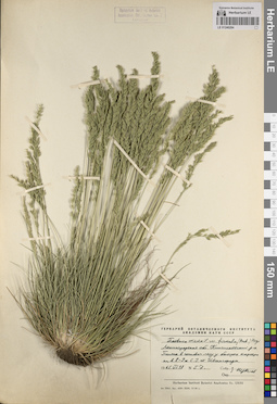
LE 01240284
Festuca ovina var. firmula (Hack.) Hegi det. Tzvelev, Nikolai Nikolaievich
Collectors: Tzvelev, Nikolai Nikolaievich Field collecting number: 57. Collection date: 18.06.1965. Administrative regions: RU - Leningradskaya Oblast' - Kingiseppskiy Rayon. Place of collection: поляна в сосновом лесу у большого карьера в 8-9 км северо-западнее г. Ивангород.Groups of specimens: Образцы сектора Восточной Европы; Соглашение Минобрнауки №075-15-2021-1056; Гербарий Ботанического Института Академии наук СССРOriginal label text:Гербарий Ботанического института Академии наук СССР. Festuca ovina L. var. firmula (Hack.) Hegi. Ленинградская обл. Кингисеппский р-н. Поляна в сосновом лесу у большого карьера км. в 8-9 к С.З. от Ивангорода. 1965 VI 18. N 57. Собр. Опр. Н. Цвелев. Herbarium Instituti Botanici Academiae Sc. URSS
Landscape in location of collection: поляна в лесу у большого карьераHabitat / plant community in location of collecting: соснякCoordinates (geographic position): 59° 27′ 35.15″ N, 28° 8′ 40.88″ E ±300 mRecord creation: 2023-07-05, Artyom Borodushkin, PhotoScan D2.Citation: Specimen LE 01240284 // Virtual herbarium of Komarov Botanical Institute RAS — http://re.herbariumle.ru/01240284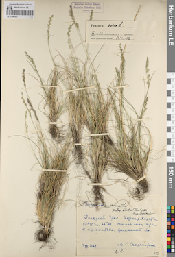
LE 01240283
Festuca ovina ssp. elata (Drob.) Tzvelev det. Tzvelev, Nikolai Nikolaievich
Additional identifications: Festuca ovina L. det. Skvortsov, Alexei Konstantinovich at 03.1962 Collectors: Sandomirskaya S. I. Field collecting number: с12. Collection date: 14.07.1961. Administrative regions: RU - Yamalo-Nenetskiy Avtonomnyy Okrug - Priural'skiy Rayon. Place of collection: Полярный Урал. Истоки р. Хадаты.Groups of specimens: Образцы сектора Восточной Европы; Соглашение Минобрнауки №075-15-2021-1056Original label text:Festuca ovina L. subsp. elata (Drob.) m. Опр. Н. Цвелев. Полярный Урал. Истоки р. Хадаты. 67°35' сш, 66° вд. Южный склон горы Н. н.у.м. ок 500 м. Среди камней. sp. 14 VII 1961. Собр. С. Сандомирская c12
Landscape in location of collection: южный склон горыCoordinates (geographic position): 67° 35′ 0″ N, 66° 0′ 0″ E ±10000 m 500 m a.s.l.Record creation: 2023-07-05, Artyom Borodushkin, PhotoScan D2.Citation: Specimen LE 01240283 // Virtual herbarium of Komarov Botanical Institute RAS — http://re.herbariumle.ru/01240283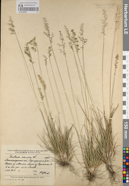
LE 01240282
Festuca ovina L. det. Tzvelev, Nikolai Nikolaievich
Collectors: Tzvelev, Nikolai Nikolaievich Field collecting number: s.n. Collection date: 01.07.1962. Administrative regions: RU - Leningradskaya Oblast' - Priozersky Rayon. Place of collection: дюны у северного берега оз. Вуокса в 6 км юго-западнее ст. Лосево.Groups of specimens: Образцы сектора Восточной Европы; Соглашение Минобрнауки №075-15-2021-1056; Гербарий Ботанического Института Академии наук СССРOriginal label text:Гербарий Ботанического института Академии наук СССР. Festuca ovina L. Ленинградская обл. Приозерский р-н. Дюны у северного берега оз. Вуоксы км в 6 к юго-зап. от ст. Лосево. 1962 VII 1. Собр. Опр. Н. Цвелев
Landscape in location of collection: дюны на берегу озераCoordinates (geographic position): 60° 40′ 28.4″ N, 29° 52′ 24.33″ E ±1000 mRecord creation: 2023-07-05, Artyom Borodushkin, PhotoScan D2.Citation: Specimen LE 01240282 // Virtual herbarium of Komarov Botanical Institute RAS — http://re.herbariumle.ru/01240282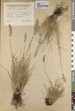
LE 01240281
Festuca supina Schur det. Igoschina, Kapitolina Nikolaevna at 1950
Collectors: Igoschina, Kapitolina Nikolaevna Field collecting number: s.n. Collection date: 27.06.1950. Administrative regions: UA - Zakarpattia Oblast - Rakhiv Raion. Place of collection: вершина г. Стог, восточнее г. Близницы, альпийский пояс.Expedition: Закарпатский отряд чайной экспедиции (1949 -1952)Groups of specimens: Образцы сектора Восточной Европы; Соглашение Минобрнауки №075-15-2021-1056Original label text:Ботанический институт Академии наук СССР. Закарпатский отряд чайной экспедиции. Festuca supina Schur. Закарпатская обл. УССР. Раховский округ. Гора Стог, восточнее горы Близницы. На вершине. Альп. пояс. 27 VI 1950. Собр., опр. К.Н. Игошина
Landscape in location of collection: вершина горыHabitat / plant community in location of collecting: альпийский поясCoordinates (geographic position): 48° 15′ 3.74″ N, 24° 13′ 25.45″ E ±1000 mRecord creation: 2023-07-05, Artyom Borodushkin, PhotoScan D2.Citation: Specimen LE 01240281 // Virtual herbarium of Komarov Botanical Institute RAS — http://re.herbariumle.ru/01240281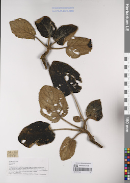
LE 01171141
Boea sp. det. Tien Hiep Nguyen at 03.04.2015
Collectors: Tien Hiep Nguyen; Averyanov, Leonid Vladimirovich; et al. Field collecting number: LA-VN947. Collection date: 03.04.2015. Administrative regions: LA - Xiangkhouang. Groups of specimens: L. V. Averyanov specimens; L. V. Averyanov herbarium; Соглашение Минобрнауки №075-15-2021-1056; Flora of LaosOriginal label text:FLORA OF LAOS
Gesneriaceae
Boea sp.
Xiangkhouang Prov., Peak Distr., Khoang village, Pa Khao mt., around point 19°33’02.2’N 103°39’56.3’E. Primary and secondary broad-leaved evergreen dry forest on solid rocky highly eroded limestone at elev. 1200-1450 m a.s.l. Lithophytic herb 10-20 cm tall on shady cliffs and rocky slopes. Common.
LA-VN 947 3 April 2015
Coll.: N.T.Hiep, L.Averyanov, N.S.Khang, N.Q.Hieu, T.Maisak, Pheng Phengsintham.

LE 01171140
Calcareoboea coccinea C.Y.Wu det. Averyanov, Leonid Vladimirovich at 02.10.2016
Collectors: Averyanov, Leonid Vladimirovich; Tien Hiep Nguyen; et al. Field collecting number: CPC8235. Collection date: 02.10.2016. Administrative regions: VN - Tinh Son La. Groups of specimens: L. V. Averyanov specimens; L. V. Averyanov herbarium; Соглашение Минобрнауки №075-15-2021-1056; Flora of VietnamOriginal label text:FLORA OF VIETNAM
Gesneriaceae
Calcareoboea coccinea C.Y.Wu
Son La Prov., Van Ho Distr., Van Ho comm., Hua Tat village, around point 20°46’21.7N 104°47’47.5E. Remnants of primary evergreen broad-leaved and mixed forest (with Pinus wangii) on very steep rocky slopes and on mountain tops composed with highly eroded karstic light gray marble-like limestone at elevation 1300-1350 m a.s.l. Lithophytic rosulate herb on vertical shady cliff. Flowers bright red. Common.
2 October 2016 CPC 8235 Photos.
Coll.: L.Averyanov, N.T.Hiep, N.S.Khang, C.Q.Ngan, T.V.Maisak, N.T.Son.
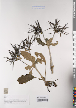
LE 01171139
Boea sp. det. Averyanov, Leonid Vladimirovich at 29.09.2016
Collectors: Averyanov, Leonid Vladimirovich; Tien Hiep Nguyen; et al. Field collecting number: CPC8109. Collection date: 29.09.2016. Administrative regions: VN - Tinh Son La. Groups of specimens: L. V. Averyanov specimens; L. V. Averyanov herbarium; Соглашение Минобрнауки №075-15-2021-1056; Flora of VietnamOriginal label text:FLORA OF VIETNAM
Gesneriaceae
Boea sp.
Son La Prov., Moc Chau Distr., Chieng Son comm., about 1 km to NE from Chieng Son village, around point 20°46’02.0N 104°37’03.1E.
Remnants of primary broad-leaved evergreen forest on tops of hills composed with karstic highly eroded yellow-white limestone at elevation 1100-1050 m a.s.l. Lithophytic herb on shady rocks. Flowers light blue. Common.
29 September 2016 CPC 8109
Coll.: L.Averyanov, N.T.Hiep, N.S.Khang, C.Q.Ngan, T.V.Maisak, N.T.Son.
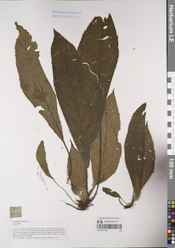
LE 01171138
Chirita sp. ⟮prelim. ID⟯ det. Averyanov, Leonid Vladimirovich at 29.09.2016
Collectors: Averyanov, Leonid Vladimirovich; Tien Hiep Nguyen; et al. Field collecting number: CPC8150. Collection date: 29.09.2016. Administrative regions: VN - Tinh Son La. Groups of specimens: L. V. Averyanov specimens; L. V. Averyanov herbarium; Соглашение Минобрнауки №075-15-2021-1056; Flora of VietnamOriginal label text:FLORA OF VIETNAM
Gesneriaceae
Chirita sp.?
Son La Prov., Moc Chau Distr., Chieng Son comm., Hin Pen village, around point 20°42’36.7N 104°35’11.0E. Primary and secondary evergreen broad-leaved forest on very steep slopes and cliffs of highly eroded red-brown sandstone at elevation about 1200 m a.s.l.
Lithophytic rosulate herb on vertical shady cliffs. Locally very common. 29 September 2016 CPC 8150
Coll.: L.Averyanov, N.T.Hiep, N.S.Khang, C.Q.Ngan, T.V.Maisak, N.T.Son.
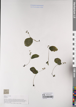
LE 01171137
Ornithoboea sp. det. Averyanov, Leonid Vladimirovich at 05.10.2016
Collectors: Averyanov, Leonid Vladimirovich; Tien Hiep Nguyen; et al. Field collecting number: CPC8247. Collection date: 05.10.2016. Administrative regions: VN - Tinh Lai Chau. Groups of specimens: L. V. Averyanov specimens; L. V. Averyanov herbarium; Соглашение Минобрнауки №075-15-2021-1056; Flora of VietnamOriginal label text:FLORA OF VIETNAM
Gesneriaceae
Ornithoboea sp.
Lai Chau Prov., Sin Ho Distr., De Phin comm., around point 22°19’05.9N 103°13’53.8E. Degraded primary and secondary evergreen broad-leaved forest on steep mountain slopes composed with shaly limestone at elevation about 1600 m a.s.l. Terrestrial herb in wet open place along stream. Flowers violet. Very common. 5 October 2016 CPC 8247
Coll.: L.Averyanov, N.T.Hiep, N.S.Khang, C.Q.Ngan, T.V.Maisak.
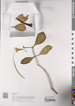
LE 01171136
Aeschynanthus sp. det. Averyanov, Leonid Vladimirovich at 29.09.2016
Collectors: Averyanov, Leonid Vladimirovich; Tien Hiep Nguyen; et al. Field collecting number: CPC8138. Collection date: 29.09.2016. Administrative regions: VN - Tinh Son La. Groups of specimens: L. V. Averyanov specimens; L. V. Averyanov herbarium; Соглашение Минобрнауки №075-15-2021-1056; Flora of VietnamOriginal label text:FLORA OF VIETNAM
Gesneriaceae
Aeschynanthus sp.
Son La Prov., Moc Chau Distr., Chieng Son comm., Hin Pen village, around point 20°42’36.7N 104°35’11.0E.
Primary and secondary evergreen broad-leaved forest on very steep slopes and cliffs of highly eroded red-brown sandstone at elevation about 1200 m a.s.l. Lithophytic undershrub 1-1.5 m tall on exposed mossy rocks. Flowers red. Rare.
29 September 2016 CPC 8138
Coll.: L.Averyanov, N.T.Hiep, N.S.Khang, C.Q.Ngan, T.V.Maisak, N.T.Son.
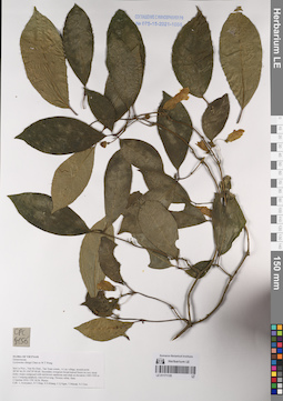
LE 01171135
Lysionotus chingii Chun ex W.T.Wang. det. Averyanov, Leonid Vladimirovich at 01.10.2016
Collectors: Averyanov, Leonid Vladimirovich; Tien Hiep Nguyen; et al. Field collecting number: CPC8156. Collection date: 01.10.2016. Administrative regions: VN - Tinh Son La. Groups of specimens: L. V. Averyanov specimens; L. V. Averyanov herbarium; Соглашение Минобрнауки №075-15-2021-1056; Flora of VietnamOriginal label text:FLORA OF VIETNAM
Gesneriaceae
Lysionotus chingii Chun ex W.T.Wang
Son La Prov., Van Ho Distr., Tan Xuan comm., A Lay village, around point 20°40’46.2N 104°39’49.6E.
Secondary evergreen broad-leaved forest on very steep rocky slopes composed with red-brown sandstone and shale at elevation 1300-1500 m a.s.l. Creeping epiphytic vine 6-8 m long. Flowers white. Rare. 1 October 2016 CPC 8156 Photos
Coll.: L.Averyanov, N.T.Hiep, N.S.Khang, C.Q.Ngan, T.V.Maisak, N.T.Son.
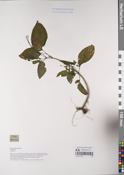
LE 01171134
Chirita sp. ⟮prelim. ID⟯ det. Averyanov, Leonid Vladimirovich at 25.09.2016
Collectors: Averyanov, Leonid Vladimirovich; Tien Hiep Nguyen; et al. Field collecting number: CPC8024. Collection date: 25.09.2016. Administrative regions: VN - Tinh Son La. Groups of specimens: L. V. Averyanov specimens; L. V. Averyanov herbarium; Соглашение Минобрнауки №075-15-2021-1056; Flora of VietnamOriginal label text:FLORA OF VIETNAM
Gesneriaceae
Chirita sp.?
Son La Prov., Moc Chau Distr., Chieng Son comm., Pha Luong village, Pha Luong Mountain system.
Primary broad-leaved evergreen forest with bamboo on eroded red-brown sandstone near mountain top at elevation 1425 m a.s.l. around point 20°41’30.9N 104°38’08.9E. Flowers white, tube with blue margin. 25 September 2016 CPC 8024
Coll.: L.Averyanov, N.T.Hiep, N.S.Khang, C.Q.Ngan, T.V.Maisak, N.T.Son.
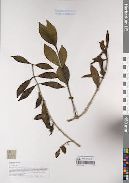
LE 01171133
Aeschynanthus sp. det. Averyanov, Leonid Vladimirovich at 27.09.2016
Collectors: Averyanov, Leonid Vladimirovich; Tien Hiep Nguyen; et al. Field collecting number: CPC8054. Collection date: 27.09.2016. Administrative regions: VN - Tinh Son La. Groups of specimens: L. V. Averyanov specimens; L. V. Averyanov herbarium; Соглашение Минобрнауки №075-15-2021-1056; Flora of VietnamOriginal label text:FLORA OF VIETNAM
Gesneriaceae
Aeschynanthus sp.
Son La Prov., Moc Chau Distr., Chieng Son comm., about 1 km to NE from Chieng Son Village, around point 20°46’02.0N 104°37’03.1E.
Remnants of primary broad-leaved evergreen forest on tops of hills composed with karstic highly eroded yellow-white limestone at elevation 1150-1250 m a.s.l. Climbing undershrub on mossy exposed rocks. Flowers red. Not rare. 27 September 2016 CPC 8054
Coll.: L.Averyanov, N.T.Hiep, N.S.Khang, C.Q.Ngan, T.V.Maisak, N.T.Son.
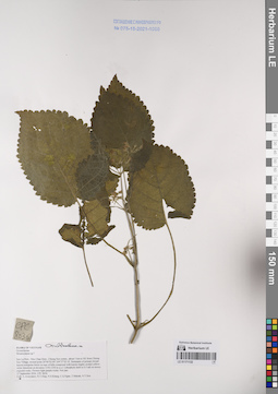
LE 01171132
Ornithoboea sp. det. Averyanov, Leonid Vladimirovich at 27.09.2016
Collectors: Averyanov, Leonid Vladimirovich; Tien Hiep Nguyen; et al. Field collecting number: CPC8036. Collection date: 27.09.2016. Administrative regions: VN - Tinh Son La. Groups of specimens: L. V. Averyanov specimens; L. V. Averyanov herbarium; Соглашение Минобрнауки №075-15-2021-1056; Flora of VietnamOriginal label text:FLORA OF VIETNAM
Gesneriaceae
Ornithoboea wildeana W.G.Craib
Son La Prov., Moc Chau Distr., Chieng Son comm., about 1 km to NE from Chieng Son Village, around point 20°46’02.0N 104°37’03.1E.
Remnants of primary broad-leaved evergreen forest on tops of hills composed with karstic highly eroded yellow-white limestone at elevation 1150-1250 m a.s.l. Lithophytic herb to 0.5 tall on mossy exposed rocks. Flowers light purple-violet. Not rare.
27 September 2016 CPC 8036
Coll.: L.Averyanov, N.T.Hiep, N.S.Khang, C.Q.Ngan, T.V.Maisak, N.T.Son.
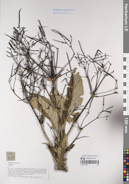
LE 01171131
Boea sp. det. Averyanov, Leonid Vladimirovich at 27.09.2016
Collectors: Averyanov, Leonid Vladimirovich; Tien Hiep Nguyen; et al. Field collecting number: CPC8075. Collection date: 27.09.2016. Administrative regions: VN - Tinh Son La. Groups of specimens: L. V. Averyanov specimens; L. V. Averyanov herbarium; Соглашение Минобрнауки №075-15-2021-1056; Flora of VietnamOriginal label text:FLORA OF VIETNAM
Gesneriaceae
Boea sp.
Son La Prov., Moc Chau Distr., Chieng Son comm., about 1 km to NE from Chieng Son Village, around point 20°46’02.0N 104°37’03.1E.
Remnants of primary broad-leaved evergreen forest on tops of hills composed with karstic highly eroded yellow-white limestone at elevation 1150-1250 m a.s.l. Erect lithophytic herb to 1 m tall on exposed mossy rocks near mountain top. Very common.
27 September 2016 CPC 8075
Coll.: L.Averyanov, N.T.Hiep, N.S.Khang, C.Q.Ngan, T.V.Maisak, N.T.Son.
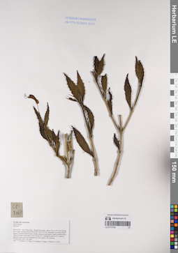
LE 01171130
Boea sp. ⟮prelim. ID⟯ det. Averyanov, Leonid Vladimirovich at 27.09.2016
Collectors: Averyanov, Leonid Vladimirovich; Tien Hiep Nguyen; et al. Field collecting number: CPC8067. Collection date: 27.09.2016. Administrative regions: VN - Tinh Son La. Groups of specimens: L. V. Averyanov specimens; L. V. Averyanov herbarium; Соглашение Минобрнауки №075-15-2021-1056; Flora of VietnamOriginal label text:FLORA OF VIETNAM
Gesneriaceae
Boea sp.?
Son La Prov., Moc Chau Distr., Chieng Son comm., about 1 km to NE from Chieng Son Village, around point 20°46’02.0N 104°37’03.1E.
Remnants of primary broad-leaved evergreen forest on tops of hills composed with karstic highly eroded yellow-white limestone at elevation 1150-1250 m a.s.l. Lithophytic herb to 0.5 m tall on exposed mossy rocks on mountain top. Fruits green. Not common.
27 September 2016 CPC 8067
Coll.: L.Averyanov, N.T.Hiep, N.S.Khang, C.Q.Ngan, T.V.Maisak, N.T.Son.
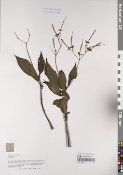
LE 01171129
Aeschynanthus sp. det. Averyanov, Leonid Vladimirovich at 27.09.2016
Collectors: Averyanov, Leonid Vladimirovich; et al. Field collecting number: CPC8066. Collection date: 27.09.2016. Administrative regions: VN - Tinh Son La. Groups of specimens: L. V. Averyanov specimens; L. V. Averyanov herbarium; Соглашение Минобрнауки №075-15-2021-1056; Flora of VietnamOriginal label text:FLORA OF VIETNAM
Gesneriaceae
Aeschynanthus sp.
Son La Prov., Moc Chau Distr., Chieng Son comm., about 1 km to NE from Chieng Son Village, around point 20°46’02.0N 104°37’03.1E.Remnants of primary broad-leaved evergreen forest on tops of hills composed with karstic highly eroded yellow-white limestone at elevation 1150-1250 m a.s.l. Climbing undershrub on mossy exposed rocks. Flowers red. Not rare.
27 September 2016 CPC 8066
Coll.: L.Averyanov, N.T.Hiep, N.S.Khang, C.Q.Ngan, T.V.Maisak, N.T.Son.
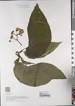
LE 01171128
Rhynchotechum sp. det. Averyanov, Leonid Vladimirovich at 01.10.2016
Collectors: Averyanov, Leonid Vladimirovich; et al. Field collecting number: CPC8158. Collection date: 01.10.2016. Administrative regions: VN - Tinh Son La. Groups of specimens: L. V. Averyanov specimens; L. V. Averyanov herbarium; Соглашение Минобрнауки №075-15-2021-1056; Flora of VietnamOriginal label text:FLORA OF VIETNAM
Gesneriaceae
Rhynchotechum sp.
Son La Prov., Van Ho Distr., Tan Xuan comm., A Lay village, around point 20°40’46.2N 104°39’49.6E. Secondary evergreen broad-leaved forest on very steep rocky slopes composed with red-brown sandstone and shale at elevation 1300-1500 m a.s.l.
Terrestrial and lithophytic herb on shady rocky slope. Flowers white, tube inside with light yellow spot. Not common.
1 October 2016 CPC 8158
Coll.: L.Averyanov, N.T.Hiep, N.S.Khang, C.Q.Ngan, T.V.Maisak, N.T.Son.
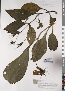
LE 01171127
Paraboea sp. ⟮prelim. ID⟯ det. Averyanov, Leonid Vladimirovich at 02.10.2016
Collectors: Averyanov, Leonid Vladimirovich; et al. Field collecting number: CPC8210. Collection date: 02.10.2016. Administrative regions: VN - Tinh Son La. Groups of specimens: L. V. Averyanov specimens; L. V. Averyanov herbarium; Соглашение Минобрнауки №075-15-2021-1056; Flora of VietnamOriginal label text:FLORA OF VIETNAM
Gesneriaceae
Hemiboea subcapitata C. B. Clarke var. Guangdongensis?
Son La Prov., Van Ho Distr., Van Ho comm., Hua Tat village, around point 20°46’21.7N 104°47’47.5E. Remnants of primary evergreen broad-leaved and mixed forest (with Pinus wangii) on very steep rocky slopes and on mountain tops composed with highly eroded karstic light gray marble-like limestone at elevation 1300-1350 m a.s.l. Terrestrial and lithophytic herb on wet rocky slope. Flowers white, tube inside with purple-violet stripes. Common.
2 October 2016 CPC 8210
Coll.: L.Averyanov, N.T.Hiep, N.S.Khang, C.Q.Ngan, T.V.Maisak, N.T.Son.
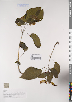
LE 01171126
Chirita sp. ⟮prelim. ID⟯ det. Averyanov, Leonid Vladimirovich at 22.09.2016
Collectors: Averyanov, Leonid Vladimirovich; et al. Field collecting number: CPC7914. Collection date: 22.09.2016. Administrative regions: VN - Tinh Son La. Groups of specimens: L. V. Averyanov specimens; L. V. Averyanov herbarium; Соглашение Минобрнауки №075-15-2021-1056; Flora of VietnamOriginal label text:FLORA OF VIETNAM
Gesneriaceae
Chirita sp.?
Son La Prov., Moc Chau Distr., Chieng Son comm., Pha Luong village, Pha Luong Mountains. Primary and secondary evergreen broad-leaved forest on very steep slopes and cliffs of highly eroded red-brown sandstone at elevation 1000-1050 m a.s.l. around point 20°42’02.1N 104°37’23.1E. Lithophytic herb on shady mossy cliffs and large rocks. Flowers white. Locally common.
22 September 2016 CPC 7914.
Coll.: L.Averyanov, N.T.Hiep, N.S.Khang, C.Q.Ngan, T.V.Maisak, N.T.Son.