View
Add
Copy
Edit
Delete
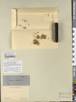
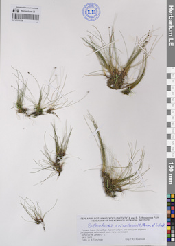
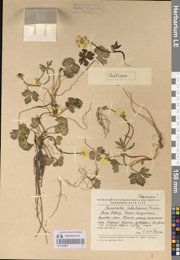
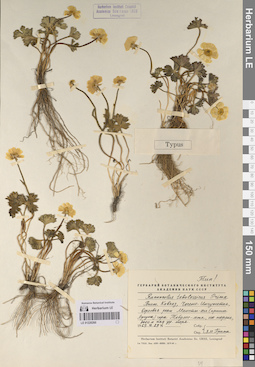
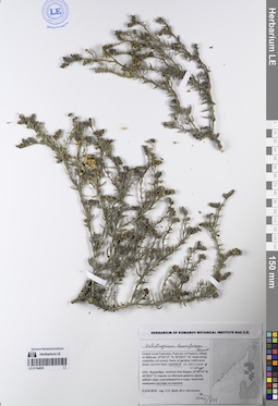
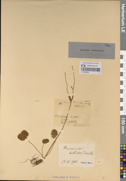
LE 01220738
Groups of specimens: Образцы сектора Кавказа; Типовые образцы сектора Кавказа; Соглашение Минобрнауки №075-15-2021-1056Record creation: 2023-07-28, Elena Portenier, PhotoScan D2.Citation: Specimen LE 01220738 // Virtual herbarium of Komarov Botanical Institute RAS — http://re.herbariumle.ru/01220738
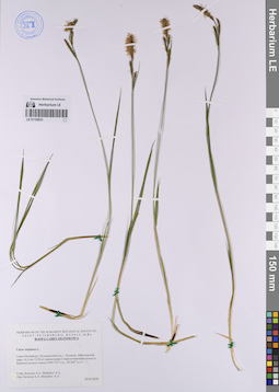
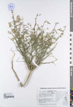
LE 01194859
Lycium shawii Roem. & Schult. det. Byalt, Vyacheslav Vyacheslavovich
Collectors: Byalt, Vyacheslav Vyacheslavovich; Korshunov, Vladimir Mikhailovich Field collecting number: 694. Collection date: 06.04.2018. Administrative regions: AE - United Arab Emirates. Place of collection: Фуджейра, северо-западные окрестности пос. Тавайан, доломитовый хребет: сухой ручей.Groups of specimens: Образцы общего сектора; Соглашение Минобрнауки №075-15-2021-1056; Бялт В.В.: Флора ФуджейрыOriginal label text: United Arab Emirates. Emirate of Fujaira, NW environs of Tawaian, 25°37'21.2"N 56°05'39.7"E, 600–650 m alt., limestone (dolomite) ridge: dry spring valley. – ОАЭ, Фуджейра, NW окрестности пос. Тавайан, 25°37'21.2"N 56°05'39.7"E, 600–650 м н. ур. м., доломитовый хребет: сухой ручей, 6 IV 2018, veg., V.V. Byalt, V. Korshunov 694
LE 01220264
Groups of specimens: Образцы сектора Кавказа; Типовые образцы сектора Кавказа; Соглашение Минобрнауки №075-15-2021-1056Record creation: 2023-07-26, Elena Portenier, PhotoScan D2.Citation: Specimen LE 01220264 // Virtual herbarium of Komarov Botanical Institute RAS — http://re.herbariumle.ru/01220264
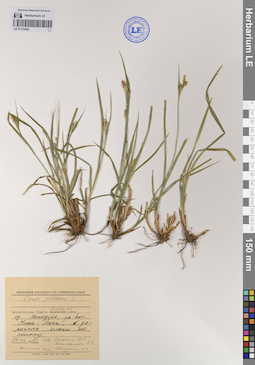
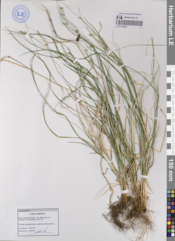
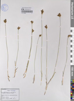
LE 01121845
Carex pallescens L. det. Solodina, N. N.
Collectors: Vargina, N. E.; Postovalova, G. G. Collection date: 27.06.1982. Administrative regions: RU - Arkhangel'skaya Oblast' - Plesetskiy Rayon. Топоним: Кенозерский национальный парк. Groups of specimens: Образцы сектора Восточной Европы; Соглашение Минобрнауки №075-15-2021-1056; Herbarium Universitatis LeninopolitanaeOriginal label text:Архангельская область, Плесецкий район, озеро Кенозеро, за поселком Усть-Поча, в зарослях ольхи по склону.
Coordinates (geographic position): 62° 9′ 15.22″ N, 38° 9′ 31.38″ E ±1000 mRecord creation: 2023-07-27, Artyom Borodushkin, PhotoScan D2.Citation: Specimen LE 01121845 // Virtual herbarium of Komarov Botanical Institute RAS — http://re.herbariumle.ru/01121845
LE 01202029
Eleocharis palustris (L.) Roem. & Schult. det. Egorova, Tatiana Vladimirovna
Collectors: Nikolaeva, L. P. Collection date: 28.06.1957. Administrative regions: MD - Cantemir. Groups of specimens: Образцы сектора Восточной Европы; Соглашение Минобрнауки №075-15-2021-1056; Флора МолдавииOriginal label text:Село Ларгуца × Тигечь Леовского района. Влажная луговина среди леса.
Coordinates (geographic position): 46° 20′ 44.31″ N, 28° 21′ 35.63″ E ±500 mRecord creation: 2023-07-26, Artyom Borodushkin, PhotoScan D2.Citation: Specimen LE 01202029 // Virtual herbarium of Komarov Botanical Institute RAS — http://re.herbariumle.ru/01202029
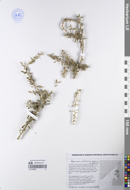
LE 01220737
Groups of specimens: Образцы сектора Кавказа; Типовые образцы сектора Кавказа; Соглашение Минобрнауки №075-15-2021-1056Record creation: 2023-07-28, Elena Portenier, PhotoScan D2.Citation: Specimen LE 01220737 // Virtual herbarium of Komarov Botanical Institute RAS — http://re.herbariumle.ru/01220737
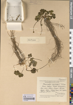
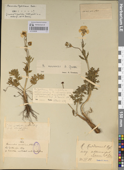
LE 01220263
Groups of specimens: Образцы сектора Кавказа; Типовые образцы сектора Кавказа; Соглашение Минобрнауки №075-15-2021-1056Record creation: 2023-07-26, Elena Portenier, PhotoScan D2.Citation: Specimen LE 01220263 // Virtual herbarium of Komarov Botanical Institute RAS — http://re.herbariumle.ru/01220263
LE 01194858
Heliotropium calcareum Stocks det. Byalt, Vyacheslav Vyacheslavovich
Collectors: Byalt, Vyacheslav Vyacheslavovich Field collecting number: 1261. Collection date: 14.12.2017. Administrative regions: AE - United Arab Emirates. Place of collection: Фуджейра, пос. Аль Бидия, окрестности г. Фуджейра, около плотины, сухое дно пруда ниже плотины.Groups of specimens: Образцы общего сектора; Соглашение Минобрнауки №075-15-2021-1056; Бялт В.В.: Флора ФуджейрыOriginal label text: United Arab Emirates. Emirate of Fujaira, environs of Al Fujeira, near dam, 25° 8' 24.34" N, 56°18'39.14"E: dry bottom of pond lower dam.– ОАЭ, Фуджейра, посёлок Аль Бидия, окр. г. Фуджейра, около плотины, 25° 8' 24.34" N, 56°18'39.14"E: сухое дно пруда ниже плотины, 14 XII 2017, fl., V.V. Byalt 1261
LE 01121225
Eleocharis acicularis (L.) Roem. & Schult. det. Konechnaya, Galina Yurievna
Collectors: Geltman, Dmitri Victorovich Collection date: 08.09.2006. Administrative regions: RU - Sankt-Peterburg - Kurortnyy Rayon. Groups of specimens: Образцы сектора Восточной Европы; Соглашение Минобрнауки №075-15-2021-1056Original label text:Россия, Санкт-Петербург, Курортный район, юго-западная окраина Сестрорецка, небольшой мыс, лагунное озерко.
60°05'03" Ν. 29°56′12″ E
Coordinates (geographic position): 60° 5′ 3″ N, 29° 56′ 12″ E ±100 mRecord creation: 2023-07-27, Artyom Borodushkin, PhotoScan D2.Citation: Specimen LE 01121225 // Virtual herbarium of Komarov Botanical Institute RAS — http://re.herbariumle.ru/0112122560°05'03" Ν. 29°56′12″ E
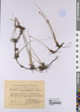
LE 01202028
Eleocharis argyrolepidoides Zinserl. det. Egorova, Tatiana Vladimirovna
Collectors: Gejdeman, Tatyana Sergeevna; Pozharisskaya, Lidiya Petrovna Collection date: 30.05.1952. Administrative regions: MD - Nisporeni. Groups of specimens: Образцы сектора Восточной Европы; Соглашение Минобрнауки №075-15-2021-1056; Флора МолдавииOriginal label text:Ниспоренский район, село Барбояны [Бэрбоень]. Пойменный луг в долине реки Прут.
Coordinates (geographic position): 47° 1′ 10.53″ N, 28° 3′ 11.17″ E ±1500 mRecord creation: 2023-07-26, Artyom Borodushkin, PhotoScan D2.Citation: Specimen LE 01202028 // Virtual herbarium of Komarov Botanical Institute RAS — http://re.herbariumle.ru/01202028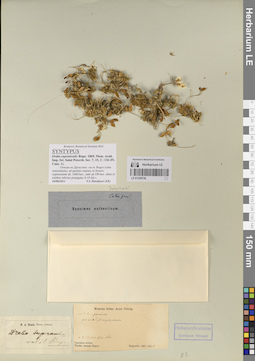
LE 01220736
Groups of specimens: Образцы сектора Кавказа; Типовые образцы сектора Кавказа; Соглашение Минобрнауки №075-15-2021-1056Record creation: 2023-07-28, Elena Portenier, PhotoScan D2.Citation: Specimen LE 01220736 // Virtual herbarium of Komarov Botanical Institute RAS — http://re.herbariumle.ru/01220736
LE 01220262
Groups of specimens: Образцы сектора Кавказа; Типовые образцы сектора Кавказа; Соглашение Минобрнауки №075-15-2021-1056Record creation: 2023-07-26, Elena Portenier, PhotoScan D2.Citation: Specimen LE 01220262 // Virtual herbarium of Komarov Botanical Institute RAS — http://re.herbariumle.ru/01220262
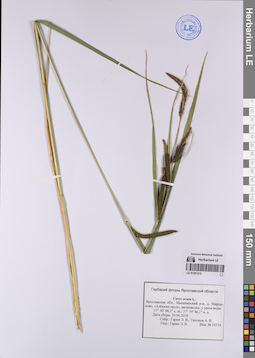
LE 01120536
Scirpus radicans Schkuhr det. Konechnaya, Galina Yurievna, Sorokina, Irina Alexandrovna at 08.06.2021
Collectors: Konechnaya, Galina Yurievna; Sorokina, Irina Alexandrovna Collection date: 08.06.2021. Administrative regions: RU - Sankt-Peterburg - Kurortnyy Rayon. Groups of specimens: Образцы сектора Восточной Европы; Соглашение Минобрнауки №075-15-2021-1056Original label text:Г. Санкт-Петербург, Курортный район, город Сестрорецк, берег Финского залива близ улицы Пляжная, по краю зарослей тростника, 60.09817°N; 29.94261°E.
Coordinates (geographic position): 60° 5′ 53.41″ N, 29° 56′ 33.4″ E ±100 mRecord creation: 2023-07-27, Artyom Borodushkin, PhotoScan D2.Citation: Specimen LE 01120536 // Virtual herbarium of Komarov Botanical Institute RAS — http://re.herbariumle.ru/01120536
LE 01202027
Eleocharis argyrolepidoides Zinserl. det. Egorova, Tatiana Vladimirovna
Collectors: Gejdeman, Tatyana Sergeevna; Pozharisskaya, Lidiya Petrovna; Pozharisskaya, M. P. Collection date: 21.05.1952. Administrative regions: MD - Municipiul Chisinau. Groups of specimens: Образцы сектора Восточной Европы; Соглашение Минобрнауки №075-15-2021-1056; Флора МолдавииOriginal label text:Кишиневский район, к северу от села Гидигич, пойменный луг в долине пеки Бык.
Coordinates (geographic position): 47° 4′ 22.31″ N, 28° 45′ 4.24″ E ±1000 mRecord creation: 2023-07-26, Artyom Borodushkin, PhotoScan D2.Citation: Specimen LE 01202027 // Virtual herbarium of Komarov Botanical Institute RAS — http://re.herbariumle.ru/01202027
LE 01220735
Groups of specimens: Образцы сектора Кавказа; Типовые образцы сектора Кавказа; Соглашение Минобрнауки №075-15-2021-1056Record creation: 2023-07-28, Elena Portenier, PhotoScan D2.Citation: Specimen LE 01220735 // Virtual herbarium of Komarov Botanical Institute RAS — http://re.herbariumle.ru/01220735
LE 01194857
Heliotropium calcareum Stocks det. Byalt, Vyacheslav Vyacheslavovich
Collectors: Byalt, Vyacheslav Vyacheslavovich; Korshunov, Mikhail Vladimirovich Field collecting number: 1262/22. Collection date: 25.03.2018. Administrative regions: AE - United Arab Emirates. Place of collection: эмират Фуджейра, окрестности пос. Аль Харай, пальмовая аллея вдоль шоссе: сорное в поливаемых кругах под деревьями и вокруг них.Groups of specimens: Образцы общего сектора; Соглашение Минобрнауки №075-15-2021-1056; Бялт В.В.: Флора ФуджейрыOriginal label text: United Arab Emirates. Emirate of Fujaira, environs of Al Haray, 25°23'53.9"N 56°19'55.3"E, palm alley along roadside: weeds on irrigated spots under trees. – ОАЭ, эмират Фуджейра, окр. пос. Аль Харай, 25°23'53.9"N 56°19'55.3"E, пальмовая аллея вдоль шоссе: сорняки в поливаемых кругах под деревьями и вокруг них, 25 III 2018, fl., fr., V.V. Byalt, M.V. Korshunov 1262/22
LE 01220261
Groups of specimens: Образцы сектора Кавказа; Типовые образцы сектора Кавказа; Соглашение Минобрнауки №075-15-2021-1056Record creation: 2023-07-26, Elena Portenier, PhotoScan D2.Citation: Specimen LE 01220261 // Virtual herbarium of Komarov Botanical Institute RAS — http://re.herbariumle.ru/01220261
LE 01120533
Carex cespitosa L. det. Belechov, Andrey A. at 22.05.2018
Collectors: Belechov, Andrey A. Collection date: 22.05.2018. Administrative regions: RU - Sankt-Peterburg - Pushkinskiy Rayon. Топоним: Баболовский (Бабловский) парк, город Пушкин, Санкт-Петербург. Groups of specimens: Образцы сектора Восточной Европы; Соглашение Минобрнауки №075-15-2021-1056; Флора Санкт-ПетербургаOriginal label text:Санкт-Петербург. Пушкинский район, город Пушкин, Баболовский парк, 1,5 км. севернее-северо-восточнее от пересечения Старогатчинского шоссе и Красносельского шоссе (59.712° с.ш., 30.362° в.д.)
Coordinates (geographic position): 59° 42′ 43.2″ N, 30° 21′ 43.2″ E ±100 mRecord creation: 2023-07-27, Artyom Borodushkin, PhotoScan D2.Citation: Specimen LE 01120533 // Virtual herbarium of Komarov Botanical Institute RAS — http://re.herbariumle.ru/01120533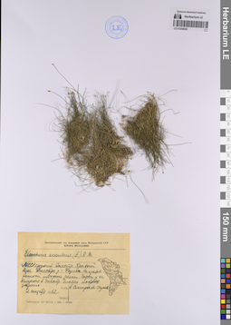
LE 01202026
Eleocharis acicularis (L.) Roem. & Schult. det. Smirnova-Garaeva, A. at 02.09.1962
Collectors: Smirnova-Garaeva, A. Collection date: 02.09.1962. Administrative regions: MD - Rezina. Groups of specimens: Образцы сектора Восточной Европы; Соглашение Минобрнауки №075-15-2021-1056; Флора МолдавииOriginal label text:МССР, средний Днестр. Правый берег Днестра у города Резина. На правобережной стороне речки Чорна у ее впадения в Днестр. Чистая ковровая заросль.
Coordinates (geographic position): 47° 46′ 23.8″ N, 28° 58′ 58.59″ E ±100 mRecord creation: 2023-07-26, Artyom Borodushkin, PhotoScan D2.Citation: Specimen LE 01202026 // Virtual herbarium of Komarov Botanical Institute RAS — http://re.herbariumle.ru/01202026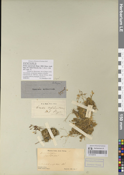
LE 01220734
Groups of specimens: Образцы сектора Кавказа; Типовые образцы сектора Кавказа; Соглашение Минобрнауки №075-15-2021-1056Record creation: 2023-07-28, Elena Portenier, PhotoScan D2.Citation: Specimen LE 01220734 // Virtual herbarium of Komarov Botanical Institute RAS — http://re.herbariumle.ru/01220734
LE 01220260
Groups of specimens: Образцы сектора Кавказа; Типовые образцы сектора Кавказа; Соглашение Минобрнауки №075-15-2021-1056Record creation: 2023-07-26, Elena Portenier, PhotoScan D2.Citation: Specimen LE 01220260 // Virtual herbarium of Komarov Botanical Institute RAS — http://re.herbariumle.ru/01220260
LE 01194856
Heliotropium calcareum Stocks det. Byalt, Vyacheslav Vyacheslavovich
Collectors: Byalt, Vyacheslav Vyacheslavovich; Korshunov, Mikhail Vladimirovich Field collecting number: 1263/27. Collection date: 25.03.2018. Administrative regions: AE - United Arab Emirates. Place of collection: эмират Фуджейра, окрестности пос. Аль Харай, пальмовая аллея вдоль шоссе: сорное в поливаемых кругах под деревьями и вокруг них.Groups of specimens: Образцы общего сектора; Соглашение Минобрнауки №075-15-2021-1056; Бялт В.В.: Флора ФуджейрыOriginal label text: United Arab Emirates. Emirate of Fujaira, environs of Al Haray, 25°23'53.9"N 56°19'55.3"E, palm alley along roadside: weeds on irrigated spots under trees. – ОАЭ, эмират Фуджейра, окр. пос. Аль Харай, 25°23'53.9"N 56°19'55.3"E, пальмовая аллея вдоль шоссе: сорняки в поливаемых кругах под деревьями и вокруг них, 25 III 2018, fl., fr., V.V. Byalt, M.V. Korshunov 1263/27
LE 01120532
Carex ericetorum Poll. det. Konechnaya, Galina Yurievna, Efimov, Peter Gennadievich, Kuropatkin, Vladislav Valerievich, Medvedeva, Nina Anatolyevna at 23.08.2019
Collectors: Konechnaya, Galina Yurievna; Efimov, Peter Gennadievich; Kuropatkin, Vladislav Valerievich; Medvedeva, Nina Anatolyevna Collection date: 23.08.2019. Administrative regions: RU - Novgorodskaya Oblast' - Pestovskiy Rayon. Groups of specimens: Образцы сектора Восточной Европы; Соглашение Минобрнауки №075-15-2021-1056Original label text:Новгородская область, Пестовский район. «Семытинский бор» (между реками Молога и Семытинка), на лини ЛЭП в сосняке брусничном, (N 58.49406° E 35.79412°).
Coordinates (geographic position): 58° 29′ 38.62″ N, 35° 47′ 38.83″ E ±100 mRecord creation: 2023-07-27, Artyom Borodushkin, PhotoScan D2.Citation: Specimen LE 01120532 // Virtual herbarium of Komarov Botanical Institute RAS — http://re.herbariumle.ru/01120532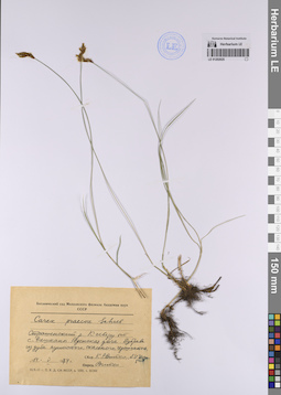
LE 01202025
Carex praecox Schreb. det. Vitko, Ksenia Romanovna at 14.05.1974
Collectors: Istratii, Afanasii Ivanovici; Vitko, Ksenia Romanovna Collection date: 14.05.1974. Administrative regions: MD - Raionul Straseni. Groups of specimens: Образцы сектора Восточной Европы; Соглашение Минобрнауки №075-15-2021-1056; Флора МолдавииOriginal label text:Страшенский район. К северу от села Ракшаны, Реденскя дача. Дубрава из дуба пушистого, скального, черешчатого.
Coordinates (geographic position): 47° 9′ 42.88″ N, 28° 40′ 39.04″ E ±1500 mRecord creation: 2023-07-26, Artyom Borodushkin, PhotoScan D2.Citation: Specimen LE 01202025 // Virtual herbarium of Komarov Botanical Institute RAS — http://re.herbariumle.ru/01202025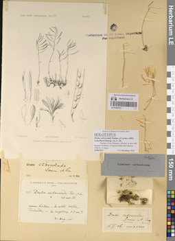
LE 01220733
Groups of specimens: Образцы сектора Кавказа; Типовые образцы сектора Кавказа; Соглашение Минобрнауки №075-15-2021-1056Record creation: 2023-07-28, Elena Portenier, PhotoScan D2.Citation: Specimen LE 01220733 // Virtual herbarium of Komarov Botanical Institute RAS — http://re.herbariumle.ru/01220733
LE 01220259
Groups of specimens: Образцы сектора Кавказа; Типовые образцы сектора Кавказа; Соглашение Минобрнауки №075-15-2021-1056Record creation: 2023-07-26, Elena Portenier, PhotoScan D2.Citation: Specimen LE 01220259 // Virtual herbarium of Komarov Botanical Institute RAS — http://re.herbariumle.ru/01220259
LE 01120531
Carex brizoides L. det. Efimov, Peter Gennadievich at 02.08.2020
Collectors: Efimov, Peter Gennadievich Collection date: 02.08.2020. Administrative regions: RU - Leningradskaya Oblast' - Gatchinskiy Rayon. Groups of specimens: Образцы сектора Восточной Европы; Соглашение Минобрнауки №075-15-2021-1056Original label text:Ленинградская область, Гатчинский район, между поселками Семрино и Сусанино, лесная дорога между поселками, идущая параллельно железной дороге приблизительно в 1 км к востоку от нее, опушка леса у перекрестка лесных дорог 59.4704117°N 30.3627400°E
Coordinates (geographic position): 59° 28′ 13.48″ N, 30° 21′ 45.86″ E ±100 mRecord creation: 2023-07-27, Artyom Borodushkin, PhotoScan D2.Citation: Specimen LE 01120531 // Virtual herbarium of Komarov Botanical Institute RAS — http://re.herbariumle.ru/01120531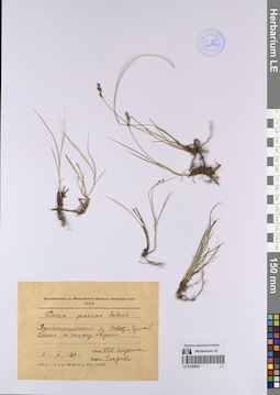
LE 01202024
Carex praecox Schreb. det. Egorova, Tatiana Vladimirovna
Collectors: Gejdeman, Tatyana Sergeevna Collection date: 09.04.1974. Administrative regions: MD - Taraclia. Groups of specimens: Образцы сектора Восточной Европы; Соглашение Минобрнауки №075-15-2021-1056; Флора МолдавииOriginal label text:Вулканештский район, совхоз "Чумай". Степь по склону оврага.
LE 01194855
Heliotropium bacciferum Forssk. det. Byalt, Vyacheslav Vyacheslavovich
Collectors: Byalt, Vyacheslav Vyacheslavovich; Korshunov, Mikhail Vladimirovich Field collecting number: 1264/511. Collection date: 04.04.2018. Administrative regions: AE - United Arab Emirates. Place of collection: Фуджейра, пос. Аль Бидия: пустырь на окраине.Groups of specimens: Образцы общего сектора; Соглашение Минобрнауки №075-15-2021-1056; Бялт В.В.: Флора ФуджейрыOriginal label text: United Arab Emirates. Emirate of Fujaira, village Al Bidiyah, 25°26'13" N, 56°20'2"° Е: on wasteland. – ОАЭ, Фуджейра, посёлок Аль Бидия, 25°26'13" N, 56°20'2"° Е: пустырь на окраине, 3–4 IV 2018, fr., V.V. Byalt, M.V. Korshunov 1264/511
LE 01220732
Groups of specimens: Образцы сектора Кавказа; Типовые образцы сектора Кавказа; Соглашение Минобрнауки №075-15-2021-1056Record creation: 2023-07-28, Elena Portenier, PhotoScan D2.Citation: Specimen LE 01220732 // Virtual herbarium of Komarov Botanical Institute RAS — http://re.herbariumle.ru/01220732
LE 01220258
Groups of specimens: Образцы сектора Кавказа; Типовые образцы сектора Кавказа; Соглашение Минобрнауки №075-15-2021-1056Record creation: 2023-07-26, Elena Portenier, PhotoScan D2.Citation: Specimen LE 01220258 // Virtual herbarium of Komarov Botanical Institute RAS — http://re.herbariumle.ru/01220258
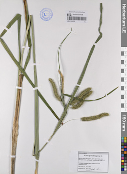
LE 01120530
Carex pseudocyperus L. det. Myalik, Aleksandr Nikolaevich (Myalіk, Alyaksandr Mіkalaevіch) at 20.07.2015
Collectors: Myalik, Aleksandr Nikolaevich (Myalіk, Alyaksandr Mіkalaevіch) Field collecting number: 281. Collection date: 20.07.2015. Administrative regions: BY - Brest Oblast - Ivatsevitski Rayon. Groups of specimens: Образцы сектора Восточной Европы; Соглашение Минобрнауки №075-15-2021-1056Original label text:Место сбора: Беларусь, область Брестская, район Ивацевичский, деревня Вулька-Телеханская, 4 км к северо-западу.
Условия произрастания: заболоченный черноольшанник.
LE 01201531
Carex brunnescens (Pers.) Poir. ⟮s. l.⟯ det. Byalt, Vyacheslav Vyacheslavovich at 22.06.1990
Collectors: Byalt, Vyacheslav Vyacheslavovich Collection date: 22.06.1990. Administrative regions: RU - Yaroslavskaya Oblast' - Poshekhonskiy Rayon. Groups of specimens: Образцы сектора Восточной Европы; Соглашение Минобрнауки №075-15-2021-1056Original label text:Ярославская область, Пошехонский район, колхоз Искра.
Водораздел рек Соть и Сегжа [в нижней этикетке - Носа]. Сырой ельник в лощине. Восточнее деревни Ларионово.
LE 01220731
Groups of specimens: Образцы сектора Кавказа; Типовые образцы сектора Кавказа; Соглашение Минобрнауки №075-15-2021-1056Record creation: 2023-07-28, Elena Portenier, PhotoScan D2.Citation: Specimen LE 01220731 // Virtual herbarium of Komarov Botanical Institute RAS — http://re.herbariumle.ru/01220731
LE 01220257
Groups of specimens: Образцы сектора Кавказа; Типовые образцы сектора Кавказа; Соглашение Минобрнауки №075-15-2021-1056Record creation: 2023-07-26, Elena Portenier, PhotoScan D2.Citation: Specimen LE 01220257 // Virtual herbarium of Komarov Botanical Institute RAS — http://re.herbariumle.ru/01220257
LE 01194854
Heliotropium europaeum L. det. Byalt, Vyacheslav Vyacheslavovich
Collectors: Byalt, Vyacheslav Vyacheslavovich; Korshunov, Vladimir Mikhailovich Field collecting number: 1265. Collection date: 31.03.2018. Administrative regions: AE - United Arab Emirates. Place of collection: эмират Фуджейра, окрестности пос. Дадна, устье вади Вурайя: сухое дно пруда.Groups of specimens: Образцы общего сектора; Соглашение Минобрнауки №075-15-2021-1056; Бялт В.В.: Флора ФуджейрыOriginal label text: United Arab Emirates. Emirate of Fujaira, env. of Dhadna, 25°30'33.6"N 56°18'15.1"E, 100-200 m alt., mouth of wadi Wurayah: dry bottom of pond. – ОАЭ, эмират Фуджейра, окр. пос. Дадна, 25°30'33.6"N 56°18'15.1"E, 100-200 м н. ур. м., устье вади Вурайя: сухое дно пруда, 31 III 2018, V.V. Byalt, V. Korshunov 1265
LE 01120529
Carex remota L. det. Myalik, Aleksandr Nikolaevich (Myalіk, Alyaksandr Mіkalaevіch) at 20.06.2015
Collectors: Myalik, Aleksandr Nikolaevich (Myalіk, Alyaksandr Mіkalaevіch) Field collecting number: 197. Collection date: 20.06.2015. Administrative regions: BY - Brest Oblast - Pinski Rayon. Groups of specimens: Образцы сектора Восточной Европы; Соглашение Минобрнауки №075-15-2021-1056Original label text:Место сбора: Беларусь, область Брестская, район Пинский, деревня Соколовка, 3,5 км к югу
Условия произрастания: широколиственный лес
Coordinates (geographic position): 52° 21′ 37.1″ N, 25° 50′ 19.1″ E ±500 mRecord creation: 2023-07-27, Artyom Borodushkin, PhotoScan D2.Citation: Specimen LE 01120529 // Virtual herbarium of Komarov Botanical Institute RAS — http://re.herbariumle.ru/01120529Условия произрастания: широколиственный лес
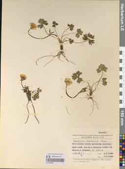
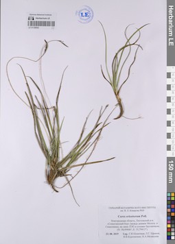
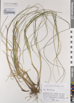
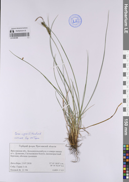
LE 01201313
Carex acuta L. det. Garin, Eduard Vital'evich at 20.06.2018
Collectors: Garin, Eduard Vital'evich; Tikhonov, A. V. Field collecting number: 16334. Collection date: 20.06.2018. Administrative regions: RU - Yaroslavskaya Oblast' - Myshkinskiy Rayon. Groups of specimens: Образцы сектора Восточной Европы; Соглашение Минобрнауки №075-15-2021-1056; Гербарий флоры Ярославской областиOriginal label text:Ярославская область, Мышкинский район, деревня Мартыново, "Аленкин пруд", мелководье, у уреза воды. 57°40'48.3" с.ш.; 37°59'46.1" в.д.
Coordinates (geographic position): 57° 40′ 48.3″ N, 37° 59′ 46.1″ E ±50 mRecord creation: 2023-07-26, Artyom Borodushkin, PhotoScan D2.Citation: Specimen LE 01201313 // Virtual herbarium of Komarov Botanical Institute RAS — http://re.herbariumle.ru/01201313
LE 01220730
Groups of specimens: Образцы сектора Кавказа; Типовые образцы сектора Кавказа; Соглашение Минобрнауки №075-15-2021-1056Record creation: 2023-07-28, Elena Portenier, PhotoScan D2.Citation: Specimen LE 01220730 // Virtual herbarium of Komarov Botanical Institute RAS — http://re.herbariumle.ru/01220730
LE 01220256
Groups of specimens: Образцы сектора Кавказа; Типовые образцы сектора Кавказа; Соглашение Минобрнауки №075-15-2021-1056Record creation: 2023-07-26, Elena Portenier, PhotoScan D2.Citation: Specimen LE 01220256 // Virtual herbarium of Komarov Botanical Institute RAS — http://re.herbariumle.ru/01220256
LE 01120528
Carex praecox Schreb. det. Myalik, Aleksandr Nikolaevich (Myalіk, Alyaksandr Mіkalaevіch) at 28.05.2015
Collectors: Myalik, Aleksandr Nikolaevich (Myalіk, Alyaksandr Mіkalaevіch) Field collecting number: 51. Collection date: 28.05.2015. Administrative regions: BY - Brest Oblast - Stolinski Rayon. Groups of specimens: Образцы сектора Восточной Европы; Соглашение Минобрнауки №075-15-2021-1056Original label text:Место сбора: Беларусь, область Брестская, район Столинский, деревня Семигостичи, 1 км к востоку
Условия произрастания: закустаренная обочина дороги
Coordinates (geographic position): 52° 5′ 35.59″ N, 27° 27′ 4.99″ E ±200 mRecord creation: 2023-07-27, Artyom Borodushkin, PhotoScan D2.Citation: Specimen LE 01120528 // Virtual herbarium of Komarov Botanical Institute RAS — http://re.herbariumle.ru/01120528Условия произрастания: закустаренная обочина дороги
LE 01201299
Carex nigra (L.) Reichard det. Garin, Eduard Vital'evich at 13.07.2018
Collectors: Garin, Eduard Vital'evich Field collecting number: 12194. Collection date: 13.07.2018. Administrative regions: RU - Yaroslavskaya Oblast' - Bol'shesel'skiy Rayon. Groups of specimens: Образцы сектора Восточной Европы; Соглашение Минобрнауки №075-15-2021-1056; Гербарий флоры Ярославской областиOriginal label text:Ярославская область, Большесельский район, к северо-западу от села Дунилово, Гостиловское болото, маловозрастный березняк, обочина тропинки.
Coordinates (geographic position): 57° 45′ 46.66″ N, 38° 50′ 55.71″ E ±3000 mRecord creation: 2023-07-26, Artyom Borodushkin, PhotoScan D2.Citation: Specimen LE 01201299 // Virtual herbarium of Komarov Botanical Institute RAS — http://re.herbariumle.ru/01201299
LE 01220729
Groups of specimens: Образцы сектора Кавказа; Типовые образцы сектора Кавказа; Соглашение Минобрнауки №075-15-2021-1056Record creation: 2023-07-28, Elena Portenier, PhotoScan D2.Citation: Specimen LE 01220729 // Virtual herbarium of Komarov Botanical Institute RAS — http://re.herbariumle.ru/01220729
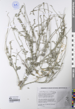
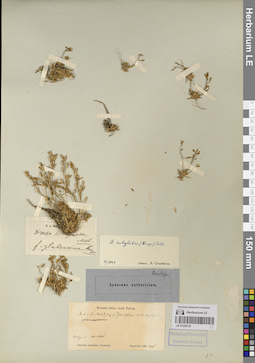
LE 01194853
Convolvulus virgatus Boiss. det. Byalt, Vyacheslav Vyacheslavovich
Collectors: Byalt, Vyacheslav Vyacheslavovich; Korshunov, Vladimir Mikhailovich; Melnikov, Denis Germanovich Field collecting number: 21. Collection date: 14.04.2022. Administrative regions: AE - United Arab Emirates. Place of collection: Emirate of Fujaira, SE environs of Dibba, territory of “Honey Park” [point 2]: bottom wadi.Groups of specimens: Образцы общего сектора; Соглашение Минобрнауки №075-15-2021-1056; Бялт В.В.: Флора ФуджейрыOriginal label text: United Arab Emirates. Emirate of Fujaira, SE environs of Dibba, ca. 25° 34.697' N, 56° 16.465' E, 60–100 м н. ур. м., territory of “Honey Park” [point 2]: bottom wadi, 14 IV 2022 Leg: V.V. Byalt, V.M. Korshunov, D.G. Melnikov
LE 01220255
Groups of specimens: Образцы сектора Кавказа; Типовые образцы сектора Кавказа; Соглашение Минобрнауки №075-15-2021-1056Record creation: 2023-07-26, Elena Portenier, PhotoScan D2.Citation: Specimen LE 01220255 // Virtual herbarium of Komarov Botanical Institute RAS — http://re.herbariumle.ru/01220255
LE 01120527
Carex echinata Murray det. Myalik, Aleksandr Nikolaevich (Myalіk, Alyaksandr Mіkalaevіch) at 24.06.2010
Collectors: Myalik, Aleksandr Nikolaevich (Myalіk, Alyaksandr Mіkalaevіch) Field collecting number: 493. Collection date: 24.06.2010. Administrative regions: BY - Brest Oblast - Ivatsevitski Rayon. Groups of specimens: Образцы сектора Восточной Европы; Соглашение Минобрнауки №075-15-2021-1056; Гербарий флоры Полесья (ГЕРБАРЫЙ ФЛОРЫ ПАЛЕССЯ)Original label text:Асака вожыстакалючая
Осока ёжистоколючая
Месца збору: Беларусь, Брэсцкая вобл., Івацэвіцкі р-н, Вулька- Целяханская, 7 км на ПнЗ [северо-запад]
Умовы вырастання: забалочаны дробналісцёвы лес, Sp
Coordinates (geographic position): 52° 34′ 18.12″ N, 25° 47′ 21.46″ E ±1000 mRecord creation: 2023-07-27, Artyom Borodushkin, PhotoScan D2.Citation: Specimen LE 01120527 // Virtual herbarium of Komarov Botanical Institute RAS — http://re.herbariumle.ru/01120527Осока ёжистоколючая
Месца збору: Беларусь, Брэсцкая вобл., Івацэвіцкі р-н, Вулька- Целяханская, 7 км на ПнЗ [северо-запад]
Умовы вырастання: забалочаны дробналісцёвы лес, Sp
LE 01200960
Collectors: Borissova, Antonina Georgievna Collection date: 19.07.1964. Administrative regions: RU - Leningradskaya Oblast' - Vsevolozhskiy Rayon. Groups of specimens: Образцы сектора Восточной Европы; Соглашение Минобрнауки №075-15-2021-1056Original label text:
Ленинградская область, Карельский перешеек, озеро Хепоярви.
Coordinates (geographic position): 60° 10′ 4.7″ N, 30° 34′ 26.53″ E ±1800 mRecord creation: 2023-07-26, Artyom Borodushkin, PhotoScan D2.Citation: Specimen LE 01200960 // Virtual herbarium of Komarov Botanical Institute RAS — http://re.herbariumle.ru/01200960
LE 01220728
Groups of specimens: Образцы сектора Кавказа; Типовые образцы сектора Кавказа; Соглашение Минобрнауки №075-15-2021-1056Record creation: 2023-07-28, Elena Portenier, PhotoScan D2.Citation: Specimen LE 01220728 // Virtual herbarium of Komarov Botanical Institute RAS — http://re.herbariumle.ru/01220728
LE 01220254
Groups of specimens: Образцы сектора Кавказа; Типовые образцы сектора Кавказа; Соглашение Минобрнауки №075-15-2021-1056Record creation: 2023-07-26, Elena Portenier, PhotoScan D2.Citation: Specimen LE 01220254 // Virtual herbarium of Komarov Botanical Institute RAS — http://re.herbariumle.ru/01220254
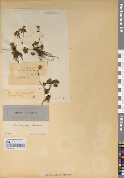
LE 01194852
Convolvulus virgatus Boiss. det. Byalt, Vyacheslav Vyacheslavovich
Additional identifications: Convolvulus glomeratus Choiry det. Byalt, Vyacheslav Vyacheslavovich Collectors: Byalt, Vyacheslav Vyacheslavovich; Korshunov, Mikhail Vladimirovich Field collecting number: 1056. Collection date: 27.03.2018. Administrative regions: AE - United Arab Emirates. Place of collection: эмират Фуджейра, шоссе из Аль Джейд в пос. Мазафи, сухой каменистый вади: на склонах и дне вади.Groups of specimens: Образцы общего сектора; Соглашение Минобрнауки №075-15-2021-1056; Бялт В.В.: Флора ФуджейрыOriginal label text: United Arab Emirates. Emirate of Fujaira, Al Jeid – Masafi road, 25°17'58.3"N 56°05'24.3" E: in dry stony wadi: slopes and bottom of wadi. – ОАЭ, эмират Фуджейра, шоссе из Аль Джейда в Мазафи, 25°17'58.3"N 56°05'24.3" E, сухой каменистый вади: на склонах и дне вади, 27 III 2018, V.V. Byalt, M.V. Korshunov 1056