View
Add
Copy
Edit
Delete
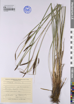
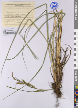
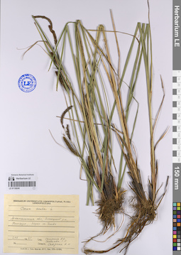
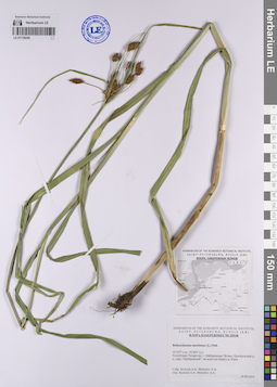
LE 01138247
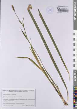
Carex acuta L. det. Solodina, N. N. at 03.08.1982
Collectors: Solodina, N. N.; Semenova, T. E. Collection date: 03.08.1982. Administrative regions: RU - Arkhangel'skaya Oblast' - Plesetskiy Rayon. Топоним: Кенозерский национальный парк. Groups of specimens: Образцы сектора Восточной Европы; Соглашение Минобрнауки №075-15-2021-1056; Herbarium Universitatis LeninopolitanaeOriginal label text:Архангельская область, Плесецкий район, Кенозеро, Тамбич-лахта, сырой заливной луг.
Coordinates (geographic position): 62° 2′ 32.8″ N, 38° 5′ 11.26″ E ±800 mRecord creation: 2023-07-27, Artyom Borodushkin, PhotoScan D2.Citation: Specimen LE 01138247 // Virtual herbarium of Komarov Botanical Institute RAS — http://re.herbariumle.ru/01138247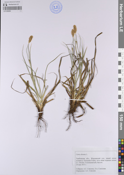
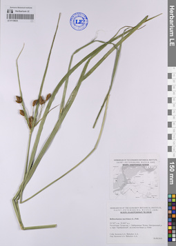
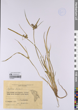
LE 01206594
Carex distans L. det. Sokolov, A. S. at 24.05.2015
Collectors: Sokolov, A. S.; Sokolova, L. A. Collection date: 24.05.2015. Administrative regions: RU - Tambovskaya Oblast'. Groups of specimens: Образцы сектора Восточной Европы; Соглашение Минобрнауки №075-15-2021-1056Original label text:Тамбовская область, Жердевский район, левый склон долины реки Большая Елань, чуть ниже порядка домов в селе Питим. Солонцеватый участок.
Coordinates (geographic position): 51° 45′ 27.77″ N, 41° 13′ 40.32″ E ±200 mRecord creation: 2023-07-26, Artyom Borodushkin, PhotoScan D2.Citation: Specimen LE 01206594 // Virtual herbarium of Komarov Botanical Institute RAS — http://re.herbariumle.ru/01206594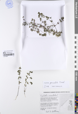
LE 01194878
Euphorbia granulata Forssk. det. Geltman, Dmitri Victorovich at 01.2021
Additional identifications: Euphorbia maculata L. det. Geltman, Dmitri Victorovich Collectors: Byalt, Vyacheslav Vyacheslavovich; Korshunov, Mikhail Vladimirovich Field collecting number: 1679. Collection date: 23.11.2019. Administrative regions: AE - United Arab Emirates. Place of collection: Фуджейра, горы Хаджар, старая дорога Масафи-Дибба, окрестности пос. Аль Хала, сорное возле АЗС ADNOC на газонах.Groups of specimens: Образцы общего сектора; Соглашение Минобрнауки №075-15-2021-1056; Бялт В.В.: Флора ФуджейрыOriginal label text: United Arab Emirates. Mts. Hajar. Old road Masafi-Dibba, vil. Al Khala, 25°28'58.62"N 56°11'31.12"E, ca. 190 m alt.: weeds near the gas station ADNOC on grass plots.– ОАЭ, Фуджейра, горы Хаджар. Старая дорога Масафи-Дибба, окр. Аль Хала, 25 ° 28'58.62 "N 56 ° 11'31.12" E, ок. 190 м н.ур.м.: сорняк возле АЗС ADNOC на газоннах, 23 XI 2019 V.V. Byalt, M.V. Korshunov 1679
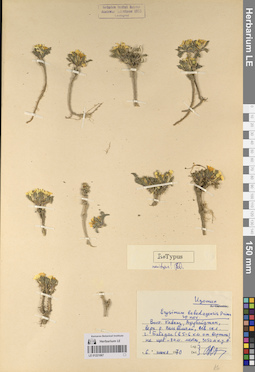
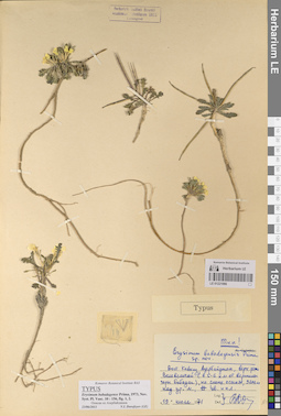
LE 01221067
Groups of specimens: Образцы сектора Кавказа; Типовые образцы сектора Кавказа; Соглашение Минобрнауки №075-15-2021-1056Record creation: 2023-07-28, Elena Portenier, PhotoScan D2.Citation: Specimen LE 01221067 // Virtual herbarium of Komarov Botanical Institute RAS — http://re.herbariumle.ru/01221067
LE 01138246
Carex acuta L. det. Solodina, N. N.
Collectors: Postovalova, G. G.; Vargina, N. E.; Zumina, E. K. Collection date: 23.08.1981. Administrative regions: RU - Arkhangel'skaya Oblast' - Plesetskiy Rayon. Топоним: Кенозерский национальный парк. Groups of specimens: Образцы сектора Восточной Европы; Соглашение Минобрнауки №075-15-2021-1056; Herbarium Universitatis LeninopolitanaeOriginal label text:Архангельская область, Плесецкий район, Кенозеро, ~ 4 км на юг от деревни Усть-Поча, берег Кенозера.
Coordinates (geographic position): 62° 9′ 15.22″ N, 38° 9′ 31.38″ E ±4000 mRecord creation: 2023-07-27, Artyom Borodushkin, PhotoScan D2.Citation: Specimen LE 01138246 // Virtual herbarium of Komarov Botanical Institute RAS — http://re.herbariumle.ru/01138246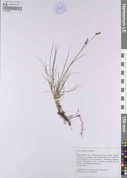
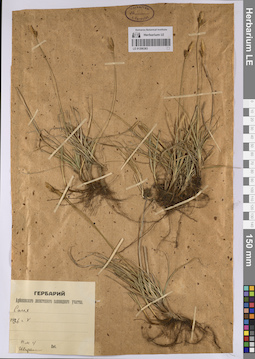
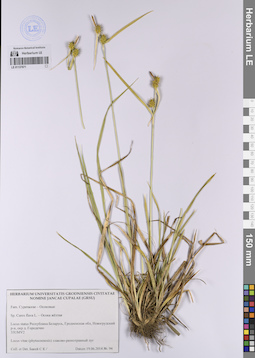
LE 01206593
Carex supina Willd. ex Wahlenb. det. Sokolov, A. S. at 18.05.2018
Collectors: Sokolov, A. S.; Sokolova, L. A. Collection date: 18.05.2018. Administrative regions: RU - Tambovskaya Oblast'. Groups of specimens: Образцы сектора Восточной Европы; Соглашение Минобрнауки №075-15-2021-1056Original label text:Тамбовская область, Жердевский район, левый склон долины реки Осиновка, урочище Субботино (N: 51.986610° E: 41.586146°) в 4,8 км южнее села Павлодар. Правый склон небольшой балки. Степное сообщество на почве с признаками засоления.
Coordinates (geographic position): 51° 59′ 11.72″ N, 41° 35′ 10.16″ ERecord creation: 2023-07-26, Artyom Borodushkin, PhotoScan D2.Citation: Specimen LE 01206593 // Virtual herbarium of Komarov Botanical Institute RAS — http://re.herbariumle.ru/01206593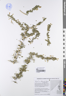
LE 01194877
Lycium shawii Roem. & Schult. det. Byalt, Vyacheslav Vyacheslavovich
Collectors: Byalt, Vyacheslav Vyacheslavovich; Korshunov, Mikhail Vladimirovich Field collecting number: 1534. Collection date: 23.11.2019. Administrative regions: AE - United Arab Emirates. Place of collection: Фуджейра, горы Хаджар, граница эмиратов Фуджейра и Рас-эль-Хайма, старая дорога Масафи-Дибба, вади: дно и боковые склоны.Groups of specimens: Образцы общего сектора; Соглашение Минобрнауки №075-15-2021-1056; Бялт В.В.: Флора ФуджейрыOriginal label text: United Arab Emirates. Mts. Hajar. Border of emirate of Fujaira and Ras al Khaima, old road Masafi-Dibba, 25°21'17.57"N 56°10'47.12"E, ca. 515 m alt.: Wadi bottom and side slopes.– ОАЭ, Фуджейра, горы Хаджар. Граница эмиратов Фуджейра и Рас-эль-Хайма, старая дорога Масафи-Дибба, 25 ° 21'17.57 "N 56 ° 10'47.12" E, ок. 515 м. Вади: на дне и боковых склонах, 23 XI 2019, fl., V.V. Byalt, M.V. Korshunov 1534
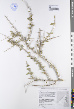
LE 01221066
Groups of specimens: Образцы сектора Кавказа; Типовые образцы сектора Кавказа; Соглашение Минобрнауки №075-15-2021-1056Record creation: 2023-07-28, Elena Portenier, PhotoScan D2.Citation: Specimen LE 01221066 // Virtual herbarium of Komarov Botanical Institute RAS — http://re.herbariumle.ru/01221066
LE 01138245
Carex acuta L. det. Solodina, N. N. at 02.08.1982
Collectors: Solodina, N. N.; Semenova, T. E. Collection date: 02.08.1982. Administrative regions: RU - Arkhangel'skaya Oblast' - Plesetskiy Rayon. Топоним: Кенозерский национальный парк. Groups of specimens: Образцы сектора Восточной Европы; Соглашение Минобрнауки №075-15-2021-1056; Herbarium Universitatis LeninopolitanaeOriginal label text:Архангельская область, Плесецкий район, Кенозеро, берег озера Баево [?].
Record creation: 2023-07-27, Artyom Borodushkin, PhotoScan D2.Citation: Specimen LE 01138245 // Virtual herbarium of Komarov Botanical Institute RAS — http://re.herbariumle.ru/01138245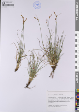
LE 01206592
Carex supina Willd. ex Wahlenb. det. Sokolov, A. S. at 13.05.2018
Collectors: Sokolov, A. S.; Sokolova, L. A. Collection date: 13.05.2018. Administrative regions: RU - Tambovskaya Oblast'. Groups of specimens: Образцы сектора Восточной Европы; Соглашение Минобрнауки №075-15-2021-1056Original label text:Тамбовская область, Жердевский район, левый склон долины реки Осиновка, урочище Субботино (N: 51.986610° E: 41.586146°) в 4,8 км южнее села Павлодар. Степное сообщество на почве с признаками засоления.
Coordinates (geographic position): 51° 59′ 11.72″ N, 41° 35′ 10.16″ E ±500 mRecord creation: 2023-07-26, Artyom Borodushkin, PhotoScan D2.Citation: Specimen LE 01206592 // Virtual herbarium of Komarov Botanical Institute RAS — http://re.herbariumle.ru/01206592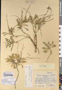
LE 01221065
Groups of specimens: Образцы сектора Кавказа; Типовые образцы сектора Кавказа; Соглашение Минобрнауки №075-15-2021-1056Record creation: 2023-07-28, Elena Portenier, PhotoScan D2.Citation: Specimen LE 01221065 // Virtual herbarium of Komarov Botanical Institute RAS — http://re.herbariumle.ru/01221065
LE 01194876
Lycium shawii Roem. & Schult. det. Byalt, Vyacheslav Vyacheslavovich
Collectors: Byalt, Vyacheslav Vyacheslavovich; Korshunov, Mikhail Vladimirovich Field collecting number: 1274/490. Collection date: 02.04.2018. Administrative regions: AE - United Arab Emirates. Place of collection: эмират Фуджейра, 2,5 км юго-западнее пос. Дахир, культивируется в частном саду.Groups of specimens: Образцы общего сектора; Соглашение Минобрнауки №075-15-2021-1056; Бялт В.В.: Флора ФуджейрыOriginal label text: United Arab Emirates. Emirate of Fujaira, 2,5 km to SW from Dahir, 25°30'28.7"N 56°07'59.8"E, ca. 150 m alt., cultivated in garden.– ОАЭ, эмират Фуджейра, 2,5 км SW от Дахир, 25°30'0.54"N 56° 7'52.40"E, ca. 150 м н. ур. м., культивируется в частном саду, 2 IV 2018, V.V. Byalt, M.V. Korshunov 1274/490
LE 01138240
Bolboschoenus maritimus (L.) Palla det. Belechov, Andrey A. at 26.08.2019
Collectors: Belechov, Andrey A. Collection date: 26.08.2019. Administrative regions: RU - Tatarstan - Gorod Naberezhnyye Chelny. Groups of specimens: Образцы сектора Восточной Европы; Соглашение Минобрнауки №075-15-2021-1056; А. А. Белехов. Флора г. Набережные Челны и его окрестностейOriginal label text:55.767° с.ш. 52.401° в.д.
Республика Татарстан, город Набережные Челны, Центральный район, парк "Прибрежный", на илистом берегу реки Кама.
LE 01206383
Carex sp. det. Sprygin, Ivan Ivanovich at 05.1936
Collectors: Sprygin, Ivan Ivanovich Collection date: 05.1936. Administrative regions: RU - Penzenskaya Oblast' - Penzenskiy Rayon. Топоним: Арбековский лес. Groups of specimens: Образцы сектора Восточной Европы; Соглашение Минобрнауки №075-15-2021-1056; Гербарий Арбековского лесостепного заповедного участкаOriginal label text:пм 4
Coordinates (geographic position): 53° 12′ 30.3″ N, 44° 53′ 34.57″ E ±5000 mRecord creation: 2023-07-26, Artyom Borodushkin, PhotoScan D2.Citation: Specimen LE 01206383 // Virtual herbarium of Komarov Botanical Institute RAS — http://re.herbariumle.ru/01206383
LE 01221064
Groups of specimens: Образцы сектора Кавказа; Типовые образцы сектора Кавказа; Соглашение Минобрнауки №075-15-2021-1056Record creation: 2023-07-28, Elena Portenier, PhotoScan D2.Citation: Specimen LE 01221064 // Virtual herbarium of Komarov Botanical Institute RAS — http://re.herbariumle.ru/01221064
LE 01138233
Bolboschoenus maritimus (L.) Palla det. Belechov, Andrey A. at 26.08.2019
Collectors: Belechov, Andrey A. Collection date: 26.08.2019. Administrative regions: RU - Tatarstan - Gorod Naberezhnyye Chelny. Groups of specimens: Образцы сектора Восточной Европы; Соглашение Минобрнауки №075-15-2021-1056; А. А. Белехов. Флора г. Набережные Челны и его окрестностейOriginal label text:55.767° с.ш. 52.401° в.д.
Республика Татарстан, город Набережные Челны, Центральный район, парк "Прибрежный", на илистом берегу реки Кама.
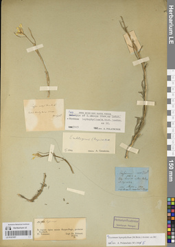
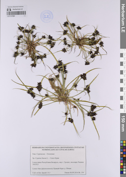
LE 01206324
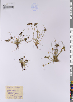
Cyperus fuscus L. det. Bobrov, A.
Collectors: Garin, Eduard Vital'evich Collection date: 07.08.1996. Administrative regions: RU - Yaroslavskaya Oblast' - Nekouzskiy Rayon. Groups of specimens: Образцы сектора Восточной Европы; Соглашение Минобрнауки №075-15-2021-1056Original label text:Ярославская область, Некоузский район, поселок Борок, берег канала.
Coordinates (geographic position): 58° 3′ 56.83″ N, 38° 14′ 59.93″ E ±1000 mRecord creation: 2023-07-26, Artyom Borodushkin, PhotoScan D2.Citation: Specimen LE 01206324 // Virtual herbarium of Komarov Botanical Institute RAS — http://re.herbariumle.ru/01206324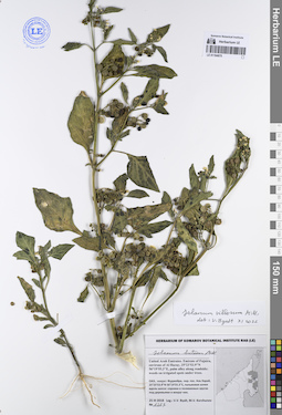
LE 01194875
Solanum villosum Mill. det. Byalt, Vyacheslav Vyacheslavovich at 11.2022
Additional identifications: Solanum luteum Mill. det. Byalt, Vyacheslav Vyacheslavovich Collectors: Byalt, Vyacheslav Vyacheslavovich; Korshunov, Mikhail Vladimirovich Field collecting number: 1267. Collection date: 25.03.2018. Administrative regions: AE - United Arab Emirates. Place of collection: эмират Фуджейра, окрестности пос. Аль Харай, пальмовая аллея вдоль шоссе: сорное в поливаемых кругах под деревьями и вокруг них.Groups of specimens: Образцы общего сектора; Соглашение Минобрнауки №075-15-2021-1056; Бялт В.В.: Флора ФуджейрыOriginal label text: United Arab Emirates. Emirate of Fujaira, environs of Al Haray, 25°23'53.9"N 56°19'55.3"E, palm alley along roadside: weeds on irrigated spots under trees. – ОАЭ, эмират Фуджейра, окр. пос. Аль Харай, 25°23'53.9"N 56°19'55.3"E, пальмовая аллея вдоль шоссе: сорняки в поливаемых кругах под деревьями и вокруг них, 25 III 2018, V.V. Byalt, M.V. Korshunov 1267
LE 01221063
Groups of specimens: Образцы сектора Кавказа; Типовые образцы сектора Кавказа; Соглашение Минобрнауки №075-15-2021-1056Record creation: 2023-07-28, Elena Portenier, PhotoScan D2.Citation: Specimen LE 01221063 // Virtual herbarium of Komarov Botanical Institute RAS — http://re.herbariumle.ru/01221063
LE 01137882
Carex aquatilis ssp. aquatilis det. Solodina, N. N. at 01.08.1982
Collectors: Solodina, N. N.; Semenova, T. E. Collection date: 01.08.1982. Administrative regions: RU - Arkhangel'skaya Oblast' - Plesetskiy Rayon. Топоним: Кенозерский национальный парк. Groups of specimens: Образцы сектора Восточной Европы; Соглашение Минобрнауки №075-15-2021-1056; Herbarium Universitatis LeninopolitanaeOriginal label text:Архангельская область, Плесецкий район, Кенозеро, в 2 км к северу от деревни Рыжково, по берегу Кенозера.
Coordinates (geographic position): 62° 8′ 1.55″ N, 38° 11′ 25.86″ E ±500 mRecord creation: 2023-07-27, Artyom Borodushkin, PhotoScan D2.Citation: Specimen LE 01137882 // Virtual herbarium of Komarov Botanical Institute RAS — http://re.herbariumle.ru/01137882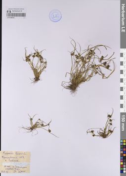
LE 01206323
Cyperus fuscus L. det. Garin, Eduard Vital'evich at 11.08.1996
Collectors: Garin, Eduard Vital'evich Collection date: 11.08.1996. Administrative regions: RU - Yaroslavskaya Oblast' - Rybinskiy Rayon. Groups of specimens: Образцы сектора Восточной Европы; Соглашение Минобрнауки №075-15-2021-1056Original label text:Ярославская область, город Рыбинск, устье реки Черемухи, илистый берег.
Coordinates (geographic position): 58° 2′ 42.84″ N, 38° 52′ 44.04″ E ±100 mRecord creation: 2023-07-26, Artyom Borodushkin, PhotoScan D2.Citation: Specimen LE 01206323 // Virtual herbarium of Komarov Botanical Institute RAS — http://re.herbariumle.ru/01206323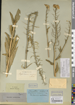
LE 01221062
Groups of specimens: Образцы сектора Кавказа; Типовые образцы сектора Кавказа; Соглашение Минобрнауки №075-15-2021-1056Record creation: 2023-07-28, Elena Portenier, PhotoScan D2.Citation: Specimen LE 01221062 // Virtual herbarium of Komarov Botanical Institute RAS — http://re.herbariumle.ru/01221062
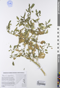
LE 01194874
Physalis angulata L. det. Byalt, Vyacheslav Vyacheslavovich
Collectors: Byalt, Vyacheslav Vyacheslavovich; Korshunov, Mikhail Vladimirovich Field collecting number: 1582. Collection date: 24.11.2019. Administrative regions: AE - United Arab Emirates. Place of collection: Фуджейра, Аль Тайба в окрестности г. Фуджейра, сорное в южной части фермы шейха Хамада II [точка 342], сорное в питомнике растений в юго-восточной части.Groups of specimens: Образцы общего сектора; Соглашение Минобрнауки №075-15-2021-1056; Бялт В.В.: Флора ФуджейрыOriginal label text: United Arab Emirates. Emirate of Fujaira, Al Taiba in environs of the city of Al Fujeira, 25°09'29.6"N 56°17'31"E: weed in irrigated places in SE part of farm of the Sheikh Khamad II [point 342], weed in plant nurcery. – ОАЭ, Фуджейра, Аль Тайба в окр. г. Фуджейра, 25°09'29.6"N 56°17'31"E: сорняк в S части фермы шейха Хамада II [точка 342], сорняк в питомнике растений в ЮВ части, 24 XI 2019, fl., fr., V.V. Byalt & M.V. Korshunov 1582
LE 01137881
Carex aquatilis ssp. aquatilis det. Solodina, N. N. at 02.08.1982
Collectors: Solodina, N. N.; Semenova, T. E. Collection date: 02.08.1982. Administrative regions: RU - Arkhangel'skaya Oblast' - Plesetskiy Rayon. Топоним: Кенозерский национальный парк. Groups of specimens: Образцы сектора Восточной Европы; Соглашение Минобрнауки №075-15-2021-1056; Herbarium Universitatis LeninopolitanaeOriginal label text:Архангельская область, Плесецкий район, Кенозеро, берег озера Баево [?].
Record creation: 2023-07-27, Artyom Borodushkin, PhotoScan D2.Citation: Specimen LE 01137881 // Virtual herbarium of Komarov Botanical Institute RAS — http://re.herbariumle.ru/01137881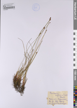
LE 01206321
Eleocharis uniglumis (Link) Schult. det. Papchenkov, Vladimir Gavrilovich at 14.06.1996
Collectors: Papchenkov, Vladimir Gavrilovich Collection date: 14.06.1996. Administrative regions: RU - Yaroslavskaya Oblast' - Pereslavskiy Rayon. Groups of specimens: Образцы сектора Восточной Европы; Соглашение Минобрнауки №075-15-2021-1056Original label text:Ярославская область, Переславский район, луг по южному берегу озера Плещеева.
Coordinates (geographic position): 56° 43′ 33.95″ N, 38° 47′ 17.41″ E ±3500 mRecord creation: 2023-07-26, Artyom Borodushkin, PhotoScan D2.Citation: Specimen LE 01206321 // Virtual herbarium of Komarov Botanical Institute RAS — http://re.herbariumle.ru/01206321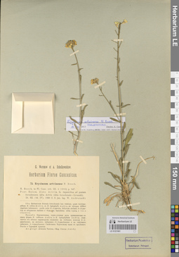
LE 01221061
Groups of specimens: Образцы сектора Кавказа; Типовые образцы сектора Кавказа; Соглашение Минобрнауки №075-15-2021-1056Record creation: 2023-07-28, Elena Portenier, PhotoScan D2.Citation: Specimen LE 01221061 // Virtual herbarium of Komarov Botanical Institute RAS — http://re.herbariumle.ru/01221061
LE 01194873
Physalis minima L. det. Byalt, Vyacheslav Vyacheslavovich
Collectors: Byalt, Vyacheslav Vyacheslavovich; Korshunov, Mikhail Vladimirovich Field collecting number: 1721/360. Collection date: 25.11.2019. Administrative regions: AE - United Arab Emirates. Place of collection: Фуджейра, пос. Кидфа [point 343]: сорное в орошаемом круге в переулке.Groups of specimens: Образцы общего сектора; Соглашение Минобрнауки №075-15-2021-1056; Бялт В.В.: Флора ФуджейрыOriginal label text: United Arab Emirates. Emirate of Fujaira, village Qidfa, 25°17'40.91"N 56°21'28.51"E [point 343]: in backstreet, in irrigated spot under tree. – ОАЭ, Фуджейра, пос. Кидфа, 25°17'40.91"N 56°21'28.51"E [point 343]: сорное в орошаемом круге в переулке, 25 XI 2019, fl., V.V. Byalt & M.V. Korshunov 1721/360
LE 01137717
Carex aquatilis ssp. aquatilis det. Solodina, N. N.
Collectors: Zumina, E. K.; Semenova, T. E. Collection date: 08.08.1982. Administrative regions: RU - Arkhangel'skaya Oblast' - Plesetskiy Rayon. Groups of specimens: Образцы сектора Восточной Европы; Соглашение Минобрнауки №075-15-2021-1056; Herbarium Universitatis LeninopolitanaeOriginal label text:Архангельская область, Плесецкий район, Кенозеро, берег озера Кривое [в окрестностях озера Кенозеро минимум три озера с названием Кривое].
Record creation: 2023-07-27, Artyom Borodushkin, PhotoScan D2.Citation: Specimen LE 01137717 // Virtual herbarium of Komarov Botanical Institute RAS — http://re.herbariumle.ru/01137717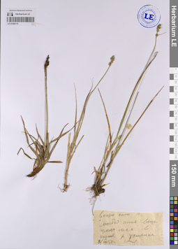
LE 01206174
Collectors: Busch Collection date: 08.08.1950. Administrative regions: RU - Orlovskaya Oblast' - Bolkhovskiy Rayon. Groups of specimens: Образцы сектора Восточной Европы; Соглашение Минобрнауки №075-15-2021-1056Original label text:
.... в истоке реки Томянка
Coordinates (geographic position): 53° 18′ 11.2″ N, 35° 53′ 34.48″ E ±4500 mRecord creation: 2023-07-26, Artyom Borodushkin, PhotoScan D2.. Processing status: label contains unreadable dataCitation: Specimen LE 01206174 // Virtual herbarium of Komarov Botanical Institute RAS — http://re.herbariumle.ru/01206174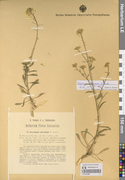
LE 01221060
Groups of specimens: Образцы сектора Кавказа; Типовые образцы сектора Кавказа; Соглашение Минобрнауки №075-15-2021-1056Record creation: 2023-07-28, Elena Portenier, PhotoScan D2.Citation: Specimen LE 01221060 // Virtual herbarium of Komarov Botanical Institute RAS — http://re.herbariumle.ru/01221060
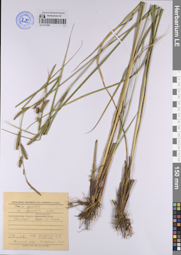
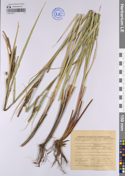
LE 01137671
Carex flava L. det. Bakej, S. K. at 19.06.2014
Collectors: Bakej, S. K. Field collecting number: 94. Collection date: 19.06.2014. Administrative regions: BY - Grodno Oblast - Novogrudskiy Rayon. Groups of specimens: Образцы сектора Восточной Европы; Соглашение Минобрнауки №075-15-2021-1056; Гербарий Университета города Гродно им. Я. Купалы (GRSU)Original label text:Осока жёлтая
Coordinates (geographic position): 53° 37′ 4.35″ N, 25° 52′ 24.28″ E ±1500 mRecord creation: 2023-07-27, Artyom Borodushkin, PhotoScan D2.Citation: Specimen LE 01137671 // Virtual herbarium of Komarov Botanical Institute RAS — http://re.herbariumle.ru/01137671Locus status Республика Беларусь, Гродненская область, Новогрудский район, окрестности деревни Городечно
35UMV2
Locus vitae (phytocoenosis) злаково-разнотравный луг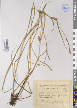
LE 01205562
Carex hirta L. det. Dobrochotova, Kseniya Vladimirovna at 09.07.1929
Collectors: Dobrochotova, Kseniya Vladimirovna Collection date: 09.07.1929. Administrative regions: RU - Nizhegorodskaya Oblast'. Groups of specimens: Образцы сектора Восточной Европы; Соглашение Минобрнауки №075-15-2021-1056; Гербарий окской биологической станцииOriginal label text:Бывшая Нижегородская губерния и уезд. Берег озера близ деревни Салово Каменской волости.
Coordinates (geographic position): 56° 9′ 39.29″ N, 43° 48′ 29.53″ E ±200 mRecord creation: 2023-07-26, Artyom Borodushkin, PhotoScan D2.Citation: Specimen LE 01205562 // Virtual herbarium of Komarov Botanical Institute RAS — http://re.herbariumle.ru/01205562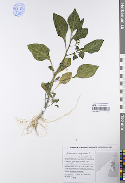
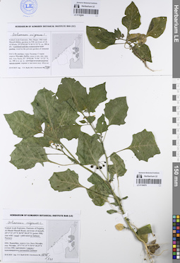
LE 01194872
Solanum nigrum L. det. Byalt, Vyacheslav Vyacheslavovich
Collectors: Byalt, Vyacheslav Vyacheslavovich; Korshunov, Mikhail Vladimirovich Field collecting number: 1727/169. Collection date: 23.11.2019. Administrative regions: AE - United Arab Emirates. Place of collection: Фуджейра, горы Хаджар. Старая дорога Масафи-Дибба: маленький сад в вади.Groups of specimens: Образцы общего сектора; Соглашение Минобрнауки №075-15-2021-1056; Бялт В.В.: Флора ФуджейрыOriginal label text: United Arab Emirates. Mts. Hajar. Old road Masafi-Dibba, 25°22'10"N 56°11'08"E, ca. 490 m alt.: weed in small garden in wadi. – ОАЭ, Фуджейра, горы Хаджар. Старая дорога Масафи-Дибба, 25 ° 22'10 "N 56 ° 11'08" E, ок. 490 м над уровнем моря: маленький сад в вади, 23 XI 2019, fl., V.V. Byalt, M.V. Korshunov 1727/169
LE 01221059
Groups of specimens: Образцы сектора Кавказа; Типовые образцы сектора Кавказа; Соглашение Минобрнауки №075-15-2021-1056Record creation: 2023-07-28, Elena Portenier, PhotoScan D2.Citation: Specimen LE 01221059 // Virtual herbarium of Komarov Botanical Institute RAS — http://re.herbariumle.ru/01221059
LE 01137670
Carex sp. det. Bakej, S. K. at 02.07.2014
Collectors: Bakej, S. K. Field collecting number: 117. Collection date: 02.07.2014. Administrative regions: BY - Grodno Oblast - Novogrudskiy Rayon. Groups of specimens: Образцы сектора Восточной Европы; Соглашение Минобрнауки №075-15-2021-1056; Гербарий Университета города Гродно им. Я. Купалы (GRSU)Original label text:Locus status Pecпублика Беларусь. Гродненская область Новогрудский район, окрестности деревни Чемеровка [?]
35UMV2
Locus vitae (phytocoenosis) локальное понижение в ельнике черничном
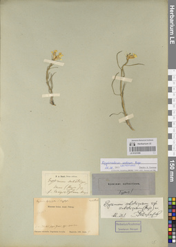
LE 01202433
Eleocharis argyrolepidoides Zinserl. det. Egorova, Tatiana Vladimirovna
Collectors: Andreev, V. N. Collection date: 21.08.1947. Administrative regions: MD - Raionul Causeni. Groups of specimens: Образцы сектора Восточной Европы; Соглашение Минобрнауки №075-15-2021-1056; Флора МолдавииOriginal label text:Близ села Конанка Бендерского уезда, пойма Днестра. Леонтьевское озеро [видимо, уже исчезло]. В воде.
Coordinates (geographic position): 46° 41′ 36.27″ N, 29° 36′ 21.07″ E ±2000 mRecord creation: 2023-07-26, Artyom Borodushkin, PhotoScan D2.Citation: Specimen LE 01202433 // Virtual herbarium of Komarov Botanical Institute RAS — http://re.herbariumle.ru/01202433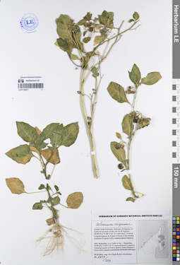
LE 01194871
Solanum nigrum L. det. Byalt, Vyacheslav Vyacheslavovich
Collectors: Byalt, Vyacheslav Vyacheslavovich; Korshunov, Mikhail Vladimirovich Field collecting number: 1627/259. Collection date: 24.11.2019. Administrative regions: AE - United Arab Emirates. Place of collection: Фуджейра, Аль Тайба в окрестности г. Фуджейра: сорное в поливных кругах в северной части фермы шейха Хамада II.Groups of specimens: Образцы общего сектора; Соглашение Минобрнауки №075-15-2021-1056; Бялт В.В.: Флора ФуджейрыOriginal label text: United Arab Emirates. Emirate of Fujaira, Al Taiba in environs of the city of Al Fujeira, 25°09'29.6"N 56°17'31"E: weed in irrigated places in N part of farm of the Sheikh Khamad II [point 342]. – ОАЭ, Фуджейра, Аль Тайба в окр. г. Фуджейра, 25°09'29.6"N 56°17'31"E: сорняк в поливных кругах в N части фермы шейха Хамада II [точка 342], 24 XI 2019, fl., fr., V.V. Byalt & M.V. Korshunov 1627/259
LE 01221058
Groups of specimens: Образцы сектора Кавказа; Типовые образцы сектора Кавказа; Соглашение Минобрнауки №075-15-2021-1056Record creation: 2023-07-28, Elena Portenier, PhotoScan D2.Citation: Specimen LE 01221058 // Virtual herbarium of Komarov Botanical Institute RAS — http://re.herbariumle.ru/01221058
LE 01137669
Carex pilosa Scop. det. Bakej, S. K. at 28.04.2014
Collectors: Bakej, S. K. Field collecting number: 18. Collection date: 28.04.2014. Administrative regions: BY - Grodno Oblast - Novogrudskiy Rayon. Groups of specimens: Образцы сектора Восточной Европы; Соглашение Минобрнауки №075-15-2021-1056; Гербарий Университета города Гродно им. Я. Купалы (GRSU)Original label text:Осока волосистая
Locus status Республика Беларусь, Гродненская область, Новогрудский район, окрестности деревни Городиловка
35UMV2
Locus vitae (phytocoenosis) Грабняк мшистый
Coordinates (geographic position): 53° 36′ 26.39″ N, 25° 52′ 7.05″ E ±500 mRecord creation: 2023-07-27, Artyom Borodushkin, PhotoScan D2.Citation: Specimen LE 01137669 // Virtual herbarium of Komarov Botanical Institute RAS — http://re.herbariumle.ru/01137669Locus status Республика Беларусь, Гродненская область, Новогрудский район, окрестности деревни Городиловка
35UMV2
Locus vitae (phytocoenosis) Грабняк мшистый
LE 01202073
Cyperus fuscus L. det. Gejdeman, Tatyana Sergeevna
Collectors: Kirtoka, V. A. Collection date: 22.08.1975. Administrative regions: MD - Criuleni. Groups of specimens: Образцы сектора Восточной Европы; Соглашение Минобрнауки №075-15-2021-1056; Флора МолдавииOriginal label text:Криулянский район, село Охринча. Заболоченное место старого русла Реута.
Coordinates (geographic position): 47° 13′ 45.53″ N, 29° 3′ 34.19″ E ±1500 mRecord creation: 2023-07-26, Artyom Borodushkin, PhotoScan D2.Citation: Specimen LE 01202073 // Virtual herbarium of Komarov Botanical Institute RAS — http://re.herbariumle.ru/01202073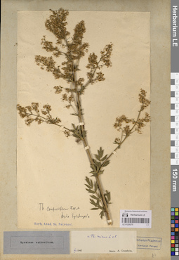
LE 01220275
Groups of specimens: Образцы сектора Кавказа; Типовые образцы сектора Кавказа; Соглашение Минобрнауки №075-15-2021-1056Record creation: 2023-07-26, Elena Portenier, PhotoScan D2.Citation: Specimen LE 01220275 // Virtual herbarium of Komarov Botanical Institute RAS — http://re.herbariumle.ru/01220275
LE 01221057
Groups of specimens: Образцы сектора Кавказа; Типовые образцы сектора Кавказа; Соглашение Минобрнауки №075-15-2021-1056Record creation: 2023-07-28, Elena Portenier, PhotoScan D2.Citation: Specimen LE 01221057 // Virtual herbarium of Komarov Botanical Institute RAS — http://re.herbariumle.ru/01221057
LE 01194869
Solanum nigrum L. det. Byalt, Vyacheslav Vyacheslavovich
Collectors: Byalt, Vyacheslav Vyacheslavovich; Korshunov, Mikhail Vladimirovich Field collecting number: 1491. Collection date: 23.11.2019. Administrative regions: AE - United Arab Emirates. Place of collection: Фуджейра, горы Хаджар. Старая дорога Масафи-Дибба, сады в северо-западной окрестности пос. Аль Хала, сорное в частном саду Абдулы.Groups of specimens: Образцы общего сектора; Соглашение Минобрнауки №075-15-2021-1056; Бялт В.В.: Флора ФуджейрыOriginal label text: United Arab Emirates. Mts. Hajar. Old road Masafi-Dibba, gardens in NW environs of vil. Al Khala, 25°29'02.84"N 56°11'22"E, ca. 180 m alt.: weed in the private garden of Abdulah. – ОАЭ, Фуджейра, горы Хаджар. Старая дорога Масафи-Дибба, сады в сев.-зап. окр. пос. Аль Хала, 25 ° 29'02.84 "N 56 ° 11'22" E, ок. 180 м н. ур. м.: сорняк в частном саду Абдулы, 23 XI 2019, fl., fr., V.V. Byalt, M.V. Korshunov 1491

LE 01194870
Solanum nigrum L. det. Byalt, Vyacheslav Vyacheslavovich
Collectors: Byalt, Vyacheslav Vyacheslavovich; Korshunov, Mikhail Vladimirovich Field collecting number: 1875/531. Collection date: 29.11.2019. Administrative regions: AE - United Arab Emirates. Place of collection: Фуджейра, дорога Аль Даид-Мазафи, окрестности пос. Мазафи [точка 358]: сорное в питомнике Салмана.Groups of specimens: Образцы общего сектора; Соглашение Минобрнауки №075-15-2021-1056; Бялт В.В.: Флора ФуджейрыOriginal label text: United Arab Emirates. Emirate of Fujaira, Al Dhaid-Masafi Road, environs of Masafi, 25°17'47.19"N 56°07'28.25"E [point 358]: weed in Salman Nursery. – ОАЭ, Фуджейра, дорога Аль Даид-Мазафи, окр. Мазафи, 25°17'47.19"N 56°07'28.25"E [точка 358]: сорняк в питомнике Салмана, 29 XI 2019, fl., fr., V.V. Byalt & M.V. Korshunov 1875/531
LE 01137668
Cyperus fuscus L. det. Bakej, S. K. at 06.09.2014
Collectors: Bakej, S. K. Field collecting number: 156. Collection date: 06.09.2014. Administrative regions: BY - Grodno Oblast - Horad Hrodna. Groups of specimens: Образцы сектора Восточной Европы; Соглашение Минобрнауки №075-15-2021-1056; Гербарий Университета города Гродно им. Я. Купалы (GRSU)Original label text:Сыть бурая
Locus status Pecпублика Беларусь, окрестности города Гродно, лесопарк Пышки 34UFE3
Locus vitae (phytocoenosis) Правый берег реки Неман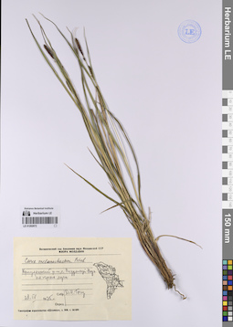
LE 01202072
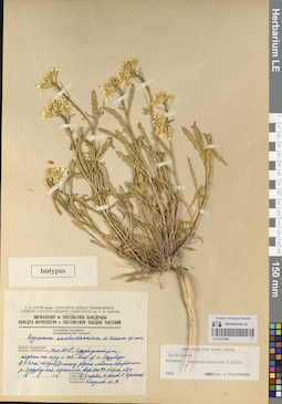
Carex melanostachya M. Bieb. ex Willd. det. Togu, D. I. at 28.04.1975
Collectors: Togu, D. I. Collection date: 28.04.1975. Administrative regions: MD - Municipiul Chisinau. Groups of specimens: Образцы сектора Восточной Европы; Соглашение Минобрнауки №075-15-2021-1056; Флора МолдавииOriginal label text:Криулянский район, село Вадул-луй-Воуэ, по краю луга.
Coordinates (geographic position): 47° 5′ 30″ N, 29° 4′ 32″ E ±1500 mRecord creation: 2023-07-26, Artyom Borodushkin, PhotoScan D2.Citation: Specimen LE 01202072 // Virtual herbarium of Komarov Botanical Institute RAS — http://re.herbariumle.ru/01202072
LE 01220274
Groups of specimens: Образцы сектора Кавказа; Типовые образцы сектора Кавказа; Соглашение Минобрнауки №075-15-2021-1056Record creation: 2023-07-26, Elena Portenier, PhotoScan D2.Citation: Specimen LE 01220274 // Virtual herbarium of Komarov Botanical Institute RAS — http://re.herbariumle.ru/01220274
LE 01221056
Groups of specimens: Образцы сектора Кавказа; Типовые образцы сектора Кавказа; Соглашение Минобрнауки №075-15-2021-1056Record creation: 2023-07-28, Elena Portenier, PhotoScan D2.Citation: Specimen LE 01221056 // Virtual herbarium of Komarov Botanical Institute RAS — http://re.herbariumle.ru/01221056
LE 01137667
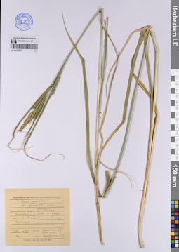
Eleocharis palustris (L.) Roem. & Schult. det. Bakej, S. K. at 26.06.2014
Collectors: Bakej, S. K. Field collecting number: 106. Collection date: 26.06.2014. Administrative regions: BY - Grodno Oblast - Novogrudskiy Rayon. Groups of specimens: Образцы сектора Восточной Европы; Соглашение Минобрнауки №075-15-2021-1056; Гербарий Университета города Гродно им. Я. Купалы (GRSU)Original label text:Болотница болотная
Coordinates (geographic position): 53° 34′ 46.98″ N, 25° 55′ 9.25″ E ±1500 mRecord creation: 2023-07-27, Artyom Borodushkin, PhotoScan D2.Citation: Specimen LE 01137667 // Virtual herbarium of Komarov Botanical Institute RAS — http://re.herbariumle.ru/01137667Locus status Республика Беларусь. Гродненская область Новогрудский район, окрестности деревни Рутка-2
35UMV2
Locus vitae (phytocoenosis) рекультивированный песчаный карьер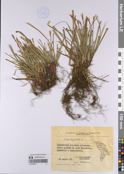
LE 01202071
Carex digitata L. det. Gejdeman, Tatyana Sergeevna
Collectors: Chernyh, R. V.; Vitko, Ksenia Romanovna Collection date: 28.03.1977. Administrative regions: MD - Raionul Straseni. Groups of specimens: Образцы сектора Восточной Европы; Соглашение Минобрнауки №075-15-2021-1056; Флора МолдавииOriginal label text:Страшенский район. Близ села Рокшаны. Сухая дубрава из дуба скального, пушистого и черешчатого.
Coordinates (geographic position): 47° 9′ 0.59″ N, 28° 40′ 46.55″ E ±2000 mRecord creation: 2023-07-26, Artyom Borodushkin, PhotoScan D2.Citation: Specimen LE 01202071 // Virtual herbarium of Komarov Botanical Institute RAS — http://re.herbariumle.ru/01202071