View
Add
Copy
Edit
Delete
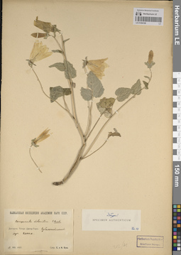
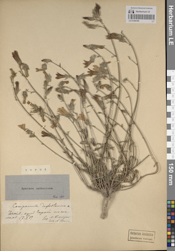
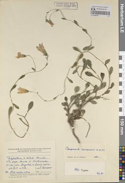
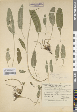
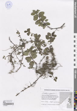
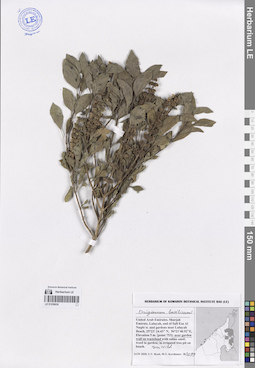
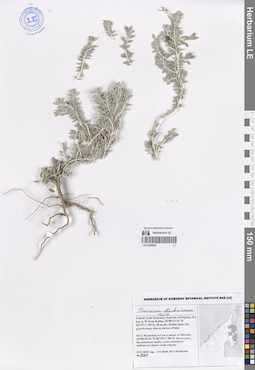
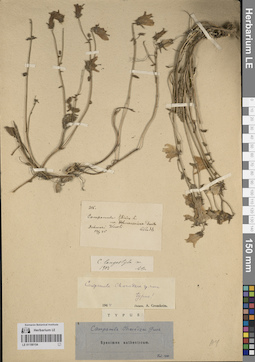
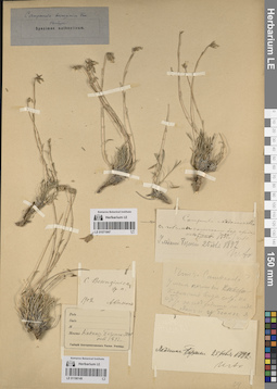
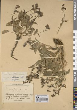
LE 01204168
Groups of specimens: Образцы сектора Кавказа; Типовые образцы сектора Кавказа; Соглашение Минобрнауки №075-15-2021-1056Record creation: 2023-11-22, Elena Portenier, PhotoScan D2.Citation: Specimen LE 01204168 // Virtual herbarium of Komarov Botanical Institute RAS — http://re.herbariumle.ru/01204168
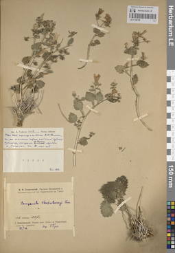
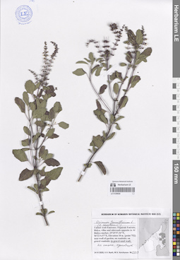
LE 01259639
Lavandula subnuda Benth. det. Byalt, Vyacheslav Vyacheslavovich
Collectors: Byalt, Vyacheslav Vyacheslavovich; Korshunov, Mikhail Vladimirovich Field collecting number: 1715. Collection date: 23.11.2019. Administrative regions: AE - United Arab Emirates. Place of collection: Фуджейра, горы Хаджар. Граница эмиратов Фуджейра и Рас-эль-Хайма, старая дорога Масафи-Дибба, вади: боковой склон в каменистом сухом водотоке.Groups of specimens: Образцы общего сектора; Соглашение Минобрнауки №075-15-2021-1056; Бялт В.В.: Флора ФуджейрыOriginal label text: United Arab Emirates. Mts. Hajar. Border of emirate of Fujaira and Ras al Khaima, old road Masafi-Dibba, 25°21'17.57"N 56°10'47.12"E, ca. 515 m alt.: Wadi side slope, in a stony dry stream.– ОАЭ, Фуджейра, горы Хаджар. Граница эмиратов Фуджейра и Рас-эль-Хайма, старая дорога Масафи-Дибба, 25 ° 21'17.57 "N 56 ° 10'47.12" E, ок. 515 м. Вади: на боковом склоне в каменистом сухом водотоке, 23 XI 2019, fl., fr., V.V. Byalt, M.V. Korshunov 1715
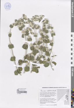
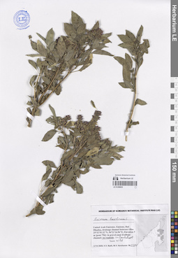
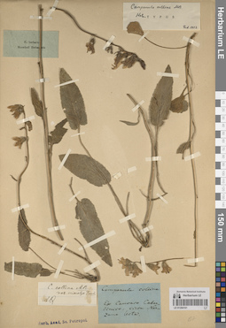
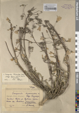
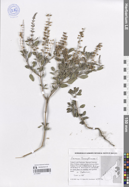
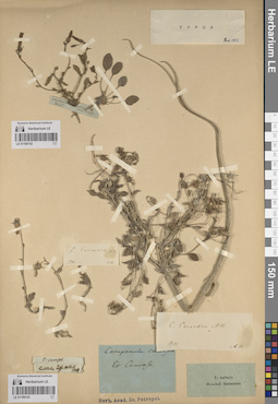
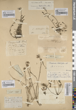
LE 01204167
Groups of specimens: Образцы сектора Кавказа; Типовые образцы сектора Кавказа; Соглашение Минобрнауки №075-15-2021-1056Record creation: 2023-11-22, Elena Portenier, PhotoScan D2.Citation: Specimen LE 01204167 // Virtual herbarium of Komarov Botanical Institute RAS — http://re.herbariumle.ru/01204167
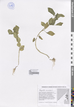
LE 01259638
Salvia macilenta Boiss. det. Byalt, Vyacheslav Vyacheslavovich
Collectors: Byalt, Vyacheslav Vyacheslavovich; Korshunov, Mikhail Vladimirovich Field collecting number: 1697. Collection date: 23.11.2019. Administrative regions: AE - United Arab Emirates. Place of collection: Фуджейра, горы Хаджар. Граница эмиратов Фуджейра и Рас-эль-Хайма, старая дорога Масафи-Дибба, вади: боковой склон в каменистом сухом водотоке.Groups of specimens: Образцы общего сектора; Соглашение Минобрнауки №075-15-2021-1056; Бялт В.В.: Флора ФуджейрыOriginal label text: United Arab Emirates. Mts. Hajar. Border of emirate of Fujaira and Ras al Khaima, old road Masafi-Dibba, 25°21'17.57"N 56°10'47.12"E, ca. 515 m alt.: Wadi side slope, in a stony dry stream.– ОАЭ, Фуджейра, горы Хаджар. Граница эмиратов Фуджейра и Рас-эль-Хайма, старая дорога Масафи-Дибба, 25 ° 21'17.57 "N 56 ° 10'47.12" E, ок. 515 м. Вади: на боковом склоне в каменистом сухом водотоке, 23 XI 2019, fl., fr., V.V. Byalt, M.V. Korshunov 1697
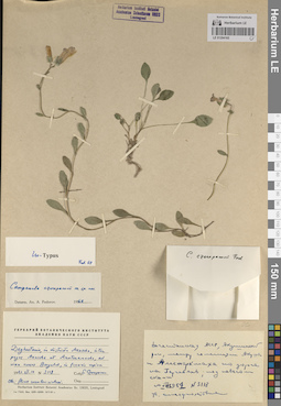
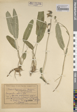
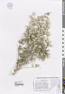
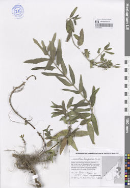
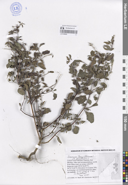
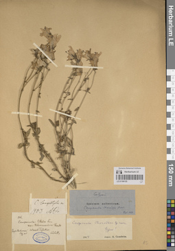
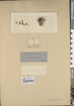
LE 01204166
Groups of specimens: Образцы сектора Кавказа; Типовые образцы сектора Кавказа; Соглашение Минобрнауки №075-15-2021-1056Record creation: 2023-11-22, Elena Portenier, PhotoScan D2.Citation: Specimen LE 01204166 // Virtual herbarium of Komarov Botanical Institute RAS — http://re.herbariumle.ru/01204166
LE 01259637
Leucas inflata Benth. det. Byalt, Vyacheslav Vyacheslavovich
Collectors: Byalt, Vyacheslav Vyacheslavovich; Korshunov, Mikhail Vladimirovich Field collecting number: 1532. Collection date: 23.11.2019. Administrative regions: AE - United Arab Emirates. Place of collection: Фуджейра, горы Хаджар. Граница эмиратов Фуджейра и Рас-эль-Хайма, старая дорога Масафи-Дибба, вади: дно и боковые склоны, каменистый сухой водоток.Groups of specimens: Образцы общего сектора; Соглашение Минобрнауки №075-15-2021-1056; Бялт В.В.: Флора ФуджейрыOriginal label text: United Arab Emirates. Mts. Hajar. Border of emirate of Fujaira and Ras al Khaima, old road Masafi-Dibba, 25°21'17.57"N 56°10'47.12"E, ca. 515 m alt.: Wadi bottom and side slopes, in a stony dry stream.– ОАЭ, Фуджейра, горы Хаджар. Граница эмиратов Фуджейра и Рас-эль-Хайма, старая дорога Масафи-Дибба, 25 ° 21'17.57 "N 56 ° 10'47.12" E, ок. 515 м. Вади: на дне и боковых склонах, в каменистом сухом водотоке, 23 XI 2019, fl., V.V. Byalt, M.V. Korshunov 1532
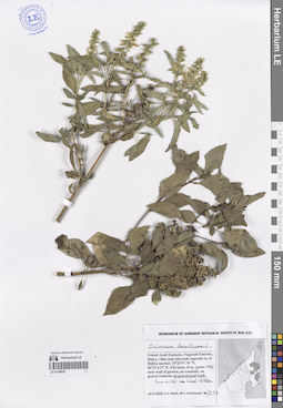
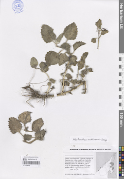
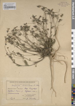
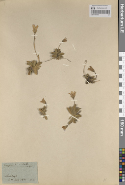
LE 01204165
Groups of specimens: Образцы сектора Кавказа; Типовые образцы сектора Кавказа; Соглашение Минобрнауки №075-15-2021-1056Record creation: 2023-11-22, Elena Portenier, PhotoScan D2.Citation: Specimen LE 01204165 // Virtual herbarium of Komarov Botanical Institute RAS — http://re.herbariumle.ru/01204165
LE 01259636
Ocimum basilicum L. det. Byalt, Vyacheslav Vyacheslavovich
Collectors: Byalt, Vyacheslav Vyacheslavovich; Korshunov, Mikhail Vladimirovich Field collecting number: 2137. Collection date: 14.04.2020. Administrative regions: AE - United Arab Emirates. Place of collection: Fujairah Emirate, Bidya, villas and sideroads opposite to Al Bidiya market [point 752]: run wild on wadi bottom in gravel-sand wadi.Groups of specimens: Образцы общего сектора; Соглашение Минобрнауки №075-15-2021-1056; Бялт В.В.: Флора ФуджейрыOriginal label text: United Arab Emirates, Fujairah Emirate, Bidya, villas and sideroads opposite to Al Bidiya market. 25°25'57.34"N, 56°21'6.57"E, elevation 10 m. [point 752]: run wild on wadi bottom in gravel-sand wadi, 14 IV 2020, V.V. Byalt, M.V. Korshunov 2137
LE 01204164
Groups of specimens: Образцы сектора Кавказа; Типовые образцы сектора Кавказа; Соглашение Минобрнауки №075-15-2021-1056Record creation: 2023-11-22, Elena Portenier, PhotoScan D2.Citation: Specimen LE 01204164 // Virtual herbarium of Komarov Botanical Institute RAS — http://re.herbariumle.ru/01204164
LE 01259635
Ocimum basilicum L. det. Byalt, Vyacheslav Vyacheslavovich
Collectors: Byalt, Vyacheslav Vyacheslavovich; Korshunov, Mikhail Vladimirovich Field collecting number: 2190. Collection date: 17.04.2020. Administrative regions: AE - United Arab Emirates. Place of collection: Fujairah Emirate, Rul Dhadna, drainage channel between villas [pont 756]: run wild on roadside in backstreet.Groups of specimens: Образцы общего сектора; Соглашение Минобрнауки №075-15-2021-1056; Бялт В.В.: Флора ФуджейрыOriginal label text: United Arab Emirates. Fujairah Emirate, Rul Dhadna, drainage channel between villas. 25°32'55.32"N, 56°21'16.96"E, elevation 5 m [pont 756]: run wild on roadside in backstreet, 17 IV 2020, V.V. Byalt, M.V. Korshunov 2190
LE 01204163
Groups of specimens: Образцы сектора Кавказа; Типовые образцы сектора Кавказа; Соглашение Минобрнауки №075-15-2021-1056Record creation: 2023-11-22, Elena Portenier, PhotoScan D2.Citation: Specimen LE 01204163 // Virtual herbarium of Komarov Botanical Institute RAS — http://re.herbariumle.ru/01204163
LE 01259634
Plectranthus amboinicus (Lour.) Spreng. det. Byalt, Vyacheslav Vyacheslavovich
Collectors: Korshunov, Mikhail Vladimirovich Field collecting number: s.n. Collection date: 18.04.2020. Administrative regions: AE - United Arab Emirates. Place of collection: Fujairah Emirate, Fujairah city, villas south from Umbrella beach, gardens and villas near Al Sharqi Medical Centre [point 757]: run wild near garden wall.Groups of specimens: Образцы общего сектора; Соглашение Минобрнауки №075-15-2021-1056; Бялт В.В.: Флора ФуджейрыOriginal label text: United Arab Emirates, Fujairah Emirate, Fujairah city, villas south from Umbrella beach, gardens and villas near Al Sharqi Medical Centre, 25° 8'30.90"N, 56°21'17.35"E, elevation 4 m [point 757]: run wild near garden wall, 18 IV 2020, M.V. Korshunov s.n
LE 01204162
Groups of specimens: Образцы сектора Кавказа; Типовые образцы сектора Кавказа; Соглашение Минобрнауки №075-15-2021-1056Record creation: 2023-11-22, Elena Portenier, PhotoScan D2.Citation: Specimen LE 01204162 // Virtual herbarium of Komarov Botanical Institute RAS — http://re.herbariumle.ru/01204162
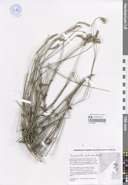
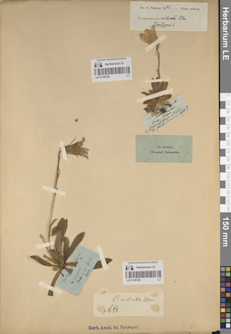
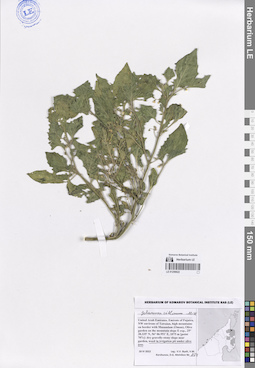
LE 01204161
Groups of specimens: Образцы сектора Кавказа; Типовые образцы сектора Кавказа; Соглашение Минобрнауки №075-15-2021-1056Record creation: 2023-11-22, Elena Portenier, PhotoScan D2.Citation: Specimen LE 01204161 // Virtual herbarium of Komarov Botanical Institute RAS — http://re.herbariumle.ru/01204161
LE 01259633
Leucas inflata Benth. det. Byalt, Vyacheslav Vyacheslavovich
Collectors: Byalt, Vyacheslav Vyacheslavovich; Korshunov, Mikhail Vladimirovich Field collecting number: 412. Collection date: 13.03.2020. Administrative regions: AE - United Arab Emirates. Place of collection: Fujairah Emirate, Al Tawyeen (Taween) area, small village 0.8 km West-North-West to mountain peak [point 707]: on gravel-stony sides near old bagara.Groups of specimens: Образцы общего сектора; Соглашение Минобрнауки №075-15-2021-1056; Бялт В.В.: Флора ФуджейрыOriginal label text: United Arab Emirates, Fujairah Emirate, Al Tawyeen (Taween) area, small village 0.8 km West-North-West to mountain peak. 25°38'59.41"N, 56° 7'17.88"E, elevation 1360 m. [point 707]: on gravel-stony sides near old bagara, 13 III 2020, V.V. Byalt, M.V. Korshunov 412
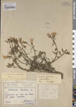
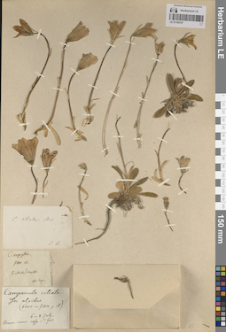
LE 01190162
Groups of specimens: Образцы сектора Кавказа; Типовые образцы сектора Кавказа; Соглашение Минобрнауки №075-15-2021-1056Record creation: 2023-11-22, Elena Portenier, PhotoScan D2.Citation: Specimen LE 01190162 // Virtual herbarium of Komarov Botanical Institute RAS — http://re.herbariumle.ru/01190162
LE 01259632
Mentha × piperita L. det. Byalt, Vyacheslav Vyacheslavovich
Collectors: Byalt, Vyacheslav Vyacheslavovich; Korshunov, Mikhail Vladimirovich Field collecting number: 1756. Collection date: 03.04.2020. Administrative regions: AE - United Arab Emirates. Place of collection: Fujairah Emirate, 2.2 km North from Al Manama by E18 road , water valves near road [point 731]: Water spillage, около бочки с водой, протечка.Groups of specimens: Образцы общего сектора; Соглашение Минобрнауки №075-15-2021-1056; Бялт В.В.: Флора ФуджейрыOriginal label text: United Arab Emirates, Fujairah Emirate, 2.2 km North from Al Manama by E18 road , water valves near road.
25°21'1.38"N, 56° 1'24.38"E, elevation 222 m. [point 731]: Water spillage, около бочки с водой, протечка, 3 IV 2020, V.V. Byalt, M.V. Korshunov 1756
LE 01190161
Groups of specimens: Образцы сектора Кавказа; Типовые образцы сектора Кавказа; Соглашение Минобрнауки №075-15-2021-1056Record creation: 2023-11-22, Elena Portenier, PhotoScan D2.Citation: Specimen LE 01190161 // Virtual herbarium of Komarov Botanical Institute RAS — http://re.herbariumle.ru/01190161
LE 01259631
Mentha longifolia (L.) L. det. Byalt, Vyacheslav Vyacheslavovich
Collectors: Byalt, Vyacheslav Vyacheslavovich; Korshunov, Mikhail Vladimirovich Field collecting number: 1757. Collection date: 03.04.2020. Administrative regions: AE - United Arab Emirates. Place of collection: Fujairah Emirate, 2.2 km North from Al Manama by E18 road, water valves near road [point 731]: water spillage, около бочки с водой, на мокром песке на протечке.Groups of specimens: Образцы общего сектора; Соглашение Минобрнауки №075-15-2021-1056; Бялт В.В.: Флора ФуджейрыOriginal label text: United Arab Emirates, Fujairah Emirate, 2.2 km North from Al Manama by E18 road , water valves near road.
25°21'1.38"N, 56° 1'24.38"E, elevation 222 m. [point 731]: Water spillage, около бочки с водой, на мокром песке на протечке, 3 IV 2020, V.V. Byalt, M.V. Korshunov 1757
LE 01190160
Groups of specimens: Образцы сектора Кавказа; Типовые образцы сектора Кавказа; Соглашение Минобрнауки №075-15-2021-1056Record creation: 2023-11-22, Elena Portenier, PhotoScan D2.Citation: Specimen LE 01190160 // Virtual herbarium of Komarov Botanical Institute RAS — http://re.herbariumle.ru/01190160
LE 01259630
Ocimum basilicum L. det. Byalt, Vyacheslav Vyacheslavovich
Collectors: Byalt, Vyacheslav Vyacheslavovich; Korshunov, Mikhail Vladimirovich Field collecting number: 2099. Collection date: 14.04.2020. Administrative regions: AE - United Arab Emirates. Place of collection: Sharjah Emirate, Luluyah, end of Safi Esa Al Naqbi st. and gardens near Luluyah Beach [point 753]: run wild near garden wall on wasteland.Groups of specimens: Образцы общего сектора; Соглашение Минобрнауки №075-15-2021-1056; Бялт В.В.: Флора ФуджейрыOriginal label text: United Arab Emirates, Sharjah Emirate, Luluyah, end of Safi Esa Al Naqbi st. and gardens near Luluyah Beach. 25°23'24.43"N, 56°21'40.92"E, elevation 5 m. [point 753]: run wild near garden wall on wasteland, 14 IV 2020, V.V. Byalt, M.V. Korshunov 2099

LE 01190158
Groups of specimens: Образцы сектора Кавказа; Типовые образцы сектора Кавказа; Соглашение Минобрнауки №075-15-2021-1056Record creation: 2023-11-22, Elena Portenier, PhotoScan D2.Citation: Specimen LE 01190158 // Virtual herbarium of Komarov Botanical Institute RAS — http://re.herbariumle.ru/01190158
LE 01190159
Groups of specimens: Образцы сектора Кавказа; Типовые образцы сектора Кавказа; Соглашение Минобрнауки №075-15-2021-1056Record creation: 2023-11-22, Elena Portenier, PhotoScan D2.Citation: Specimen LE 01190159 // Virtual herbarium of Komarov Botanical Institute RAS — http://re.herbariumle.ru/01190159
LE 01259629
Ocimum tenuiflorum L. det. Byalt, Vyacheslav Vyacheslavovich
Collectors: Byalt, Vyacheslav Vyacheslavovich; Korshunov, Mikhail Vladimirovich Field collecting number: 2221. Collection date: 17.04.2020. Administrative regions: AE - United Arab Emirates. Place of collection: Fujairah Emirate, Rul Dhadna, villas and accommodations north from Mina road, on corner with E99 Rugaylat road [pont 755]: run wild on roadside near wall of villa in backstreet.Groups of specimens: Образцы общего сектора; Соглашение Минобрнауки №075-15-2021-1056; Бялт В.В.: Флора ФуджейрыOriginal label text: United Arab Emirates. Fujairah Emirate, Rul Dhadna, villas and accommodations north from Mina road, on corner with E99 Rugaylat road. 25°31'16.29"N, 56°21'19.69"E, elevation 12 m [pont 755]: run wild on roadside near wall of villa in backstreet, 17 IV 2020, V.V. Byalt, M.V. Korshunov 2221
LE 01190157
Groups of specimens: Образцы сектора Кавказа; Типовые образцы сектора Кавказа; Соглашение Минобрнауки №075-15-2021-1056Record creation: 2023-11-22, Elena Portenier, PhotoScan D2.Citation: Specimen LE 01190157 // Virtual herbarium of Komarov Botanical Institute RAS — http://re.herbariumle.ru/01190157
LE 01259628
Teucrium stocksianum Boiss. det. Byalt, Vyacheslav Vyacheslavovich
Collectors: Byalt, Vyacheslav Vyacheslavovich; Korshunov, Mikhail Vladimirovich Field collecting number: 1441. Collection date: 22.11.2019. Administrative regions: AE - United Arab Emirates. Place of collection: Фуджейра, 0,3 км западнее г. Кальба, Кальбинская дамба: сухие каменисто-щебнистые берега озера (пруда).Groups of specimens: Образцы общего сектора; Соглашение Минобрнауки №075-15-2021-1056; Бялт В.В.: Флора ФуджейрыOriginal label text: United Arab Emirates. Emirate of Fujaira, 0.3 km to W from Kalba, 25°00'33.51"N 56°19'17.58"E, 48 m alt., Kalba dam: dry gravel-stony shores shores of lake.– ОАЭ, Фуджейра, 0,3 км к западу от Кальбы, 25°00'33.51"N 56°19'17.58"E, 48 м н.ур.м., Кальбинская дамба: сухие каменисто-щебнистые берега озера (пруда), 22 XI 2019, veg., V.V. Byalt, M.V. Korshunov 1441
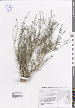
LE 01190156
Groups of specimens: Образцы сектора Кавказа; Типовые образцы сектора Кавказа; Соглашение Минобрнауки №075-15-2021-1056Record creation: 2023-11-22, Elena Portenier, PhotoScan D2.Citation: Specimen LE 01190156 // Virtual herbarium of Komarov Botanical Institute RAS — http://re.herbariumle.ru/01190156
LE 01259627
Ocimum tenuiflorum L. det. Byalt, Vyacheslav Vyacheslavovich
Collectors: Byalt, Vyacheslav Vyacheslavovich; Korshunov, Mikhail Vladimirovich Field collecting number: 1423a. Collection date: 22.03.2020. Administrative regions: AE - United Arab Emirates. Place of collection: Sharjah Emirate, Khor-Fakkan, shady garden between Khor-Fakkan Port and Bidiya, run wild on waste place on roadside.Groups of specimens: Образцы общего сектора; Соглашение Минобрнауки №075-15-2021-1056; Бялт В.В.: Флора ФуджейрыOriginal label text: United Arab Emirates, Sharjah Emirate, Khor-Fakkan, shady garden between Khor-Fakkan Port and Bidiya. 25°20'40.63"N, 56°21'34.91"E, elevation 6 m: run wild on waste place on roadside, 22 III 2020, V.V. Byalt, M.V. Korshunov 1423a
LE 01190155
Groups of specimens: Образцы сектора Кавказа; Типовые образцы сектора Кавказа; Соглашение Минобрнауки №075-15-2021-1056Record creation: 2023-11-22, Elena Portenier, PhotoScan D2.Citation: Specimen LE 01190155 // Virtual herbarium of Komarov Botanical Institute RAS — http://re.herbariumle.ru/01190155
LE 01190154
Groups of specimens: Образцы сектора Кавказа; Типовые образцы сектора Кавказа; Соглашение Минобрнауки №075-15-2021-1056Record creation: 2023-11-22, Elena Portenier, PhotoScan D2.Citation: Specimen LE 01190154 // Virtual herbarium of Komarov Botanical Institute RAS — http://re.herbariumle.ru/01190154
LE 01259626
Ocimum tenuiflorum L. det. Byalt, Vyacheslav Vyacheslavovich
Additional identifications: Ocimum sanctum L. det. Byalt, Vyacheslav Vyacheslavovich Collectors: Byalt, Vyacheslav Vyacheslavovich; Korshunov, Mikhail Vladimirovich Field collecting number: 2139. Collection date: 14.04.2020. Administrative regions: AE - United Arab Emirates. Place of collection: Fujairah Emirate, Bidya, villas and sideroads opposite to Al Bidiya market [point 752]: in gravel-sand wadi, на откосе, одичавшее.Groups of specimens: Образцы общего сектора; Соглашение Минобрнауки №075-15-2021-1056; Бялт В.В.: Флора ФуджейрыOriginal label text: United Arab Emirates, Fujairah Emirate, Bidya, villas and sideroads opposite to Al Bidiya market. 25°25'57.34"N, 56°21'6.57"E, elevation 10 m. [point 752]: in gravel-sand wadi, на откосе, одичавшее, 14 IV 2020, V.V. Byalt, M.V. Korshunov

LE 01190152
Groups of specimens: Образцы сектора Кавказа; Типовые образцы сектора Кавказа; Соглашение Минобрнауки №075-15-2021-1056Record creation: 2023-11-22, Elena Portenier, PhotoScan D2.Citation: Specimen LE 01190152 // Virtual herbarium of Komarov Botanical Institute RAS — http://re.herbariumle.ru/01190152
LE 01190153
Groups of specimens: Образцы сектора Кавказа; Типовые образцы сектора Кавказа; Соглашение Минобрнауки №075-15-2021-1056Record creation: 2023-11-22, Elena Portenier, PhotoScan D2.Citation: Specimen LE 01190153 // Virtual herbarium of Komarov Botanical Institute RAS — http://re.herbariumle.ru/01190153
LE 01259625
Physalis minima L. det. Byalt, Vyacheslav Vyacheslavovich
Collectors: Byalt, Vyacheslav Vyacheslavovich; Korshunov, Mikhail Vladimirovich Field collecting number: 2864. Collection date: 12.05.2020. Administrative regions: AE - United Arab Emirates. Place of collection: Fujairah Emirate, Al Bidiya, Abu Khalid agricultural nursery. 0.3 km to South from Eid Prayer Ground Bidyah [point 780]: weed on irrigation in plantation.Groups of specimens: Образцы общего сектора; Соглашение Минобрнауки №075-15-2021-1056; Бялт В.В.: Флора ФуджейрыOriginal label text: United Arab Emirates, Fujairah Emirate, Al Bidiya, Abu Khalid agricultural nursery. 0.3 km to South from Eid Prayer Ground Bidyah, 25°25'15.85"N, 56°20'27.64"E, elevation 18 m. [point 780]: weed on irrigation in plantation, 12 V 2020, V.V. Byalt, M.V. Korshunov 2864
LE 01190151
Groups of specimens: Образцы сектора Кавказа; Типовые образцы сектора Кавказа; Соглашение Минобрнауки №075-15-2021-1056Record creation: 2023-11-22, Elena Portenier, PhotoScan D2.Citation: Specimen LE 01190151 // Virtual herbarium of Komarov Botanical Institute RAS — http://re.herbariumle.ru/01190151
LE 01259624
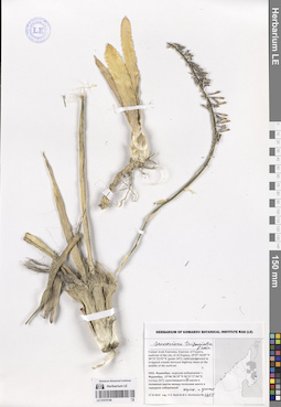
Chenopodium murale L. det. Byalt, Vyacheslav Vyacheslavovich
Collectors: Byalt, Vyacheslav Vyacheslavovich; Korshunov, Mikhail Vladimirovich Field collecting number: 211. Collection date: 11.03.2020. Administrative regions: AE - United Arab Emirates. Place of collection: Fujairah Emirate, Al Hayl Fort (Al Hayl Castle) [point 704]: in wadi bottom under garden.Groups of specimens: Образцы общего сектора; Соглашение Минобрнауки №075-15-2021-1056; Бялт В.В.: Флора ФуджейрыOriginal label text: UAE, Fujairah Emirate, Al Hayl Fort (Al Hayl Castle). 25° 5'4.59"N, 56°13'36.84"E, elevation 240–310 m [point 704]: in wadi bottom under garden, 11 III 2020, fl., V.V. Byalt, M.V. Korshunov 211
LE 01190150
Groups of specimens: Образцы сектора Кавказа; Типовые образцы сектора Кавказа; Соглашение Минобрнауки №075-15-2021-1056Record creation: 2023-11-22, Elena Portenier, PhotoScan D2.Citation: Specimen LE 01190150 // Virtual herbarium of Komarov Botanical Institute RAS — http://re.herbariumle.ru/01190150
LE 01259623
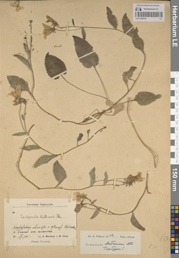
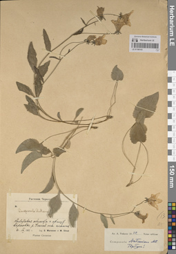
Heliotropium bacciferum ssp. tuberculosum (Boiss.) Riedl det. Byalt, Vyacheslav Vyacheslavovich
Collectors: Byalt, Vyacheslav Vyacheslavovich Field collecting number: 613/283. Collection date: 14.12.2017. Administrative regions: AE - United Arab Emirates. Place of collection: Фуджейра, пос. Аль Бидия, окрестности г. Фуджейра, реликтовый лес около дворца шейха, редкий лес и кустарники.Groups of specimens: Образцы общего сектора; Соглашение Минобрнауки №075-15-2021-1056; Бялт В.В.: Флора ФуджейрыOriginal label text: United Arab Emirates. Emirate of Fujaira, environs of Al Fujeira, relict forest near Sheikh palace, 25° 8' 24.34" N, 56°18'39.14"E: woodland and bushes.– ОАЭ, Фуджейра, посёлок Аль Бидия, окр. г. Фуджейра, реликтовый лес около дворца шейха, 25° 8' 24.34" N, 56°18'39.14"E: редкий лес и кустарники, 14 XII 2017, fr., veg., V.V. Byalt 613/283
LE 01190149
Groups of specimens: Образцы сектора Кавказа; Типовые образцы сектора Кавказа; Соглашение Минобрнауки №075-15-2021-1056Record creation: 2023-11-22, Elena Portenier, PhotoScan D2.Citation: Specimen LE 01190149 // Virtual herbarium of Komarov Botanical Institute RAS — http://re.herbariumle.ru/01190149
LE 01259622
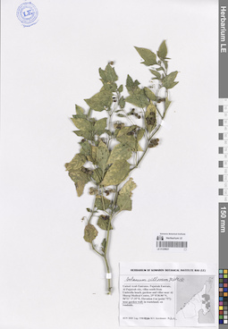
Solanum villosum Mill. det. Byalt, Vyacheslav Vyacheslavovich
Collectors: Byalt, Vyacheslav Vyacheslavovich; Korshunov, Vladimir Mikhailovich; Melnikov, Denis Germanovich Field collecting number: 154. Collection date: 18.04.2022. Administrative regions: AE - United Arab Emirates. Place of collection: Emirate of Fujaira, NW environs of Tawaian, high mountains on border with Musandam (Oman), Olive garden on the mountain slope E exp. [point 707c]: weed in irrigation pit under olive tree.Groups of specimens: Образцы общего сектора; Соглашение Минобрнауки №075-15-2021-1056; Бялт В.В.: Флора ФуджейрыOriginal label text: United Arab Emirates. Emirate of Fujaira, NW environs of Tawaian, high mountains on border with Musandam (Oman), Olive garden on the mountain slope E exp., 25° 38.335' N, 56° 06.951' E, 1075 m [point 707c]: weed in irrigation pit under olive tree, 18 IV 2022, fl., fr., V.V. Byalt, V.M. Korshunov, D.G. Melnikov 154
LE 01190146
Groups of specimens: Образцы сектора Кавказа; Типовые образцы сектора Кавказа; Соглашение Минобрнауки №075-15-2021-1056Record creation: 2023-11-22, Elena Portenier, PhotoScan D2.Citation: Specimen LE 01190146 // Virtual herbarium of Komarov Botanical Institute RAS — http://re.herbariumle.ru/01190146

LE 01190147
Groups of specimens: Образцы сектора Кавказа; Типовые образцы сектора Кавказа; Соглашение Минобрнауки №075-15-2021-1056Record creation: 2023-11-22, Elena Portenier, PhotoScan D2.Citation: Specimen LE 01190147 // Virtual herbarium of Komarov Botanical Institute RAS — http://re.herbariumle.ru/01190147

LE 01190148
Groups of specimens: Образцы сектора Кавказа; Типовые образцы сектора Кавказа; Соглашение Минобрнауки №075-15-2021-1056Record creation: 2023-11-22, Elena Portenier, PhotoScan D2.Citation: Specimen LE 01190148 // Virtual herbarium of Komarov Botanical Institute RAS — http://re.herbariumle.ru/01190148
LE 01190145
Groups of specimens: Образцы сектора Кавказа; Типовые образцы сектора Кавказа; Соглашение Минобрнауки №075-15-2021-1056Record creation: 2023-11-22, Elena Portenier, PhotoScan D2.Citation: Specimen LE 01190145 // Virtual herbarium of Komarov Botanical Institute RAS — http://re.herbariumle.ru/01190145
LE 01259621
Solanum villosum Mill. det. Byalt, Vyacheslav Vyacheslavovich
Collectors: Korshunov, Mikhail Vladimirovich Field collecting number: s.n. Collection date: 18.04.2020. Administrative regions: AE - United Arab Emirates. Place of collection: Fujairah Emirate, Fujairah, villas south from Umbrella beach, gardens and villas near Al Sharqi Medical Centre [point 757]: near garden wall.Groups of specimens: Образцы общего сектора; Соглашение Минобрнауки №075-15-2021-1056; Бялт В.В.: Флора ФуджейрыOriginal label text: UAE, Fujairah Emirate, Fujairah, villas south from Umbrella beach, gardens and villas near Al Sharqi Medical Centre, 25° 8'30.90"N, 56°21'17.35"E, Elevation 4 m [point 757]: near garden wall, 18 IV 2020, fl., fr., M.V. Korshunov s.n.
LE 01190144
Groups of specimens: Образцы сектора Кавказа; Типовые образцы сектора Кавказа; Соглашение Минобрнауки №075-15-2021-1056Record creation: 2023-11-22, Elena Portenier, PhotoScan D2.Citation: Specimen LE 01190144 // Virtual herbarium of Komarov Botanical Institute RAS — http://re.herbariumle.ru/01190144

LE 01070751
Amaranthus spinosus L. det. Byalt, Vyacheslav Vyacheslavovich
Collectors: Byalt, Vyacheslav Vyacheslavovich; Korshunov, Mikhail Vladimirovich Field collecting number: 1929. Collection date: 30.11.2019. Administrative regions: AE - United Arab Emirates. Place of collection: Фуджейра. Эмират Фуджайра. г. Аль-Фуджайра, восточная приморская часть, сорное на свалке на пустыре.Groups of specimens: Образцы общего сектора; Соглашение Минобрнауки №075-15-2021-1056; Бялт В.В.: Флора ФуджейрыOriginal label text: United Arab Emirates. Emirate of Fujarah. Al Fujairah, E seafront part, 25°07'55.41"N 56°21'08.54"E, 4 m alt.: weed a landfill in a wasteland. – ОАЭ, Фуджейра. Эмират Фуджара. Аль-Фуджайра, вост. приморская часть, 25°07'55.41"N 56°21'08.54"E, 4 м над ур. м.: сорное на свалке на пустыре, 30 XI 2019, fl., fr., V.V. Byalt, M.V. Korshunov 1929
LE 01190143
Groups of specimens: Образцы сектора Кавказа; Типовые образцы сектора Кавказа; Соглашение Минобрнауки №075-15-2021-1056Record creation: 2023-11-22, Elena Portenier, PhotoScan D2.Citation: Specimen LE 01190143 // Virtual herbarium of Komarov Botanical Institute RAS — http://re.herbariumle.ru/01190143
LE 01070746
Sansevieria trifasciata Prain det. Byalt, Vyacheslav Vyacheslavovich
Collectors: Byalt, Vyacheslav Vyacheslavovich; Korshunov, Mikhail Vladimirovich Field collecting number: 1955. Collection date: 27.11.2019. Administrative regions: AE - United Arab Emirates. Place of collection: Фуджейра, морская набережная г. Фуджейра [точка 347]: сорное (одичавшее) в поливных кругах между полосами шоссе в середине набережной.Groups of specimens: Образцы общего сектора; Соглашение Минобрнауки №075-15-2021-1056; Бялт В.В.: Флора ФуджейрыOriginal label text: United Arab Emirates. Emirate of Fujaira, seafront of the city of Al Fujeira, 25°07'18.09"N 56°21'22.92"E [point 347]: weed in irrigated rounds between highway lanes at the middle of the seefront. – ОАЭ, Фуджейра, морская набережная г. Фуджейра, 25°06'38.35"N 56°21'27.04"E [точка 347]: сорняк (одичавшее) в поливных кругах между полосами шоссе в середине набережной, 27 XI 2019, veg., V.V. Byalt & M.V. Korshunov 1955
LE 01190142
Groups of specimens: Образцы сектора Кавказа; Типовые образцы сектора Кавказа; Соглашение Минобрнауки №075-15-2021-1056Record creation: 2023-11-22, Elena Portenier, PhotoScan D2.Citation: Specimen LE 01190142 // Virtual herbarium of Komarov Botanical Institute RAS — http://re.herbariumle.ru/01190142